RAILFAN GUIDES of the U.S.
Todd's Railfan Guide to
Vancouver
WA
Part of the Portland OR
Railfan Guide
In General
Getting Here
Map
Pictures
RAILFAN GUIDES HOME
RAILROAD SIGNALS HOME
The Portland Railfan Guide is divided up into the following
sections:
HOME ..... the Portland Railroading Home Page
MAP 1
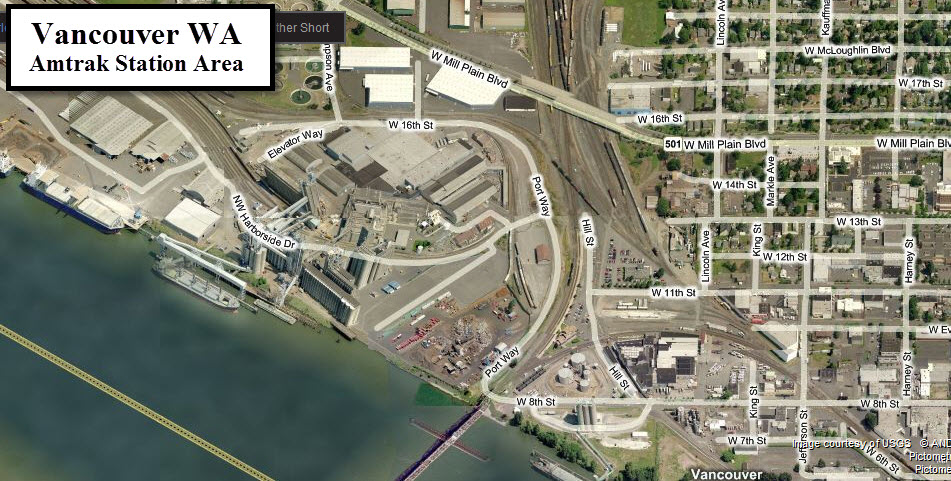
..... the Amtrak Station Area
MAP 2
..... The Union Pacific and the east side of the Willamette
MAP 3
..... the BNSF and the west side of the Willamette
MAP 4
..... South of Downtown Portland, the Milwaukie area
Map 8 - Vancouver WA
I also have the following transit maps available for the
Portland area:
HOME
..... the Portland Transit Homepage
MAP 1
..... Portland Light Rail Overview
MAP 2
..... the Portland Streetcar
MAP 3
..... WES - the Westside Express Service Commuter Train
MAP 4
..... the Downtown Area
MAP 5
..... the Westside Light Rail Guide
MAP
6
..... the Eastside Light Rail Guide
MAP 7
..... the Yellow Line
MAP 8
..... the Red Line
MAP 9
..... the Blue Line/east
MAP 10
... the Green Line
MAP 11
... the Yellow & Green Lines Downtown
MAP 12
... Downtown to Gateway/east
MAP 13
... the Blue & Red Lines/west
MAP 14
... the Blue Line/west - Beaverton to Hillsboro
Please note, some of the above transit pages are
maps only, not guides
- as such, there are no pictures or
information contained within.
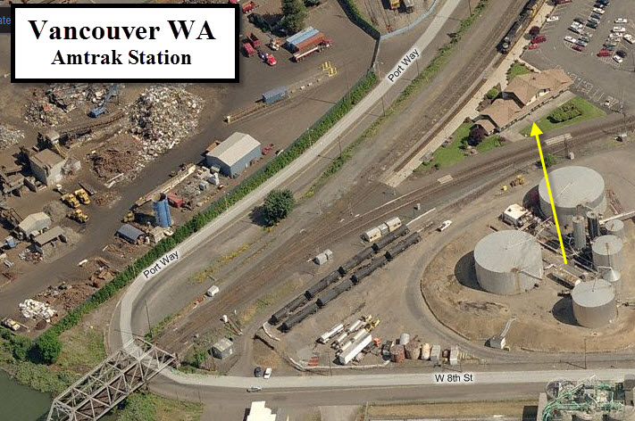
One of the nice features of taking pictures at the station, is that you can get these great shots of trains coming across the bridge from Portland, and you are looking straight down the track since the station sits in the middle of a split in the tracks.... perfectly positioned!
Aerial shots were taken from www.bing.com/maps. The snap-shots from Bing are made with Snagit, a Techsmith product... a great tool if you have never used it!
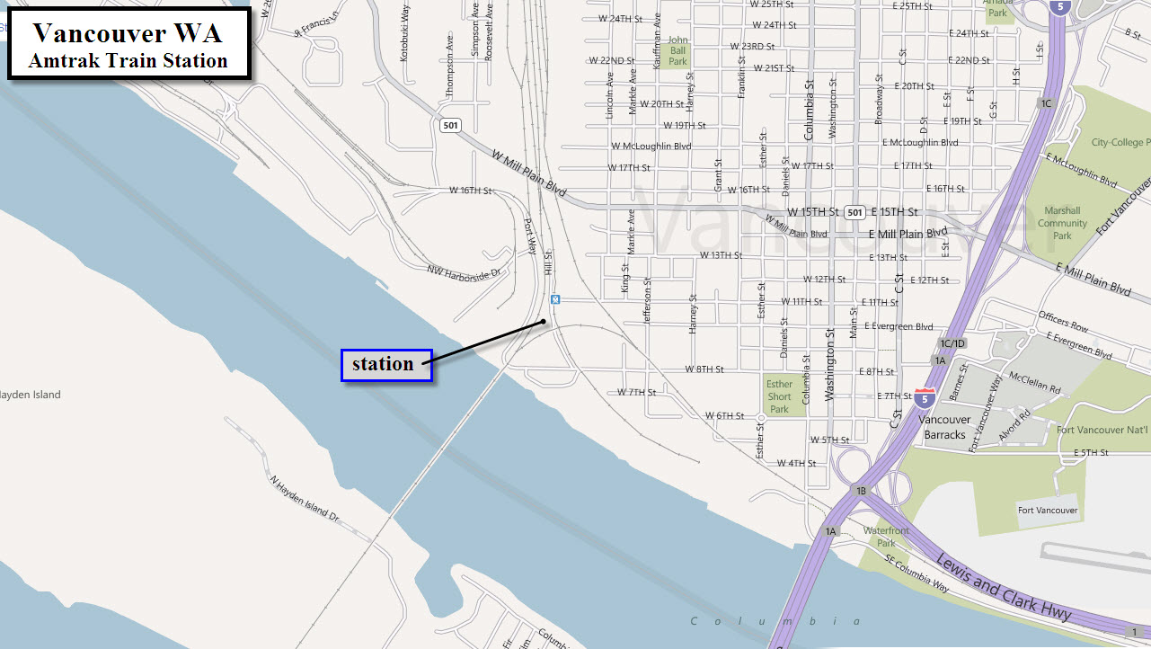
From downtown Portland, take I-5 north, getting off at the first exit (actually the second exit so you wind up going over I-5) once you've crossed the river, exit 1B. This will put you on C St. Travel north on C St till you come to 11th St. Take a left and it will take you to the Amtrak Station.
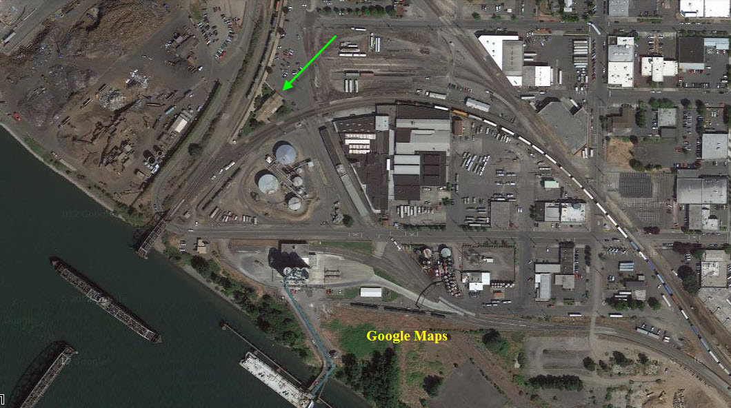
The green arrow points to the station. From up
here, you can see how the track crossing the river lines up with the station.
1 the Amtrak Station
In reading the various railfan nets floating around the internet, the Vancouver Amtrak station appears to be the number one spot for watching trains in the Portland area.
Going east from Vancouver along the Columbia, you have railroad crossings at Wishram and Kennewick/Pasco... there are two fairly good size yards along the way, one in Pasco, and one in Wishram. The Wishram yard was the main classification yard for the SP&S. The track out of Pasco heads on up to Spokane.
Heading north from the station and wye takes the BNSF up to Tacoma and Seattle. I-5 follows the tracks pretty well up to a couple of miles north of Castle Rock, and then rejoins it at Chehalis - only for a short while tho, cause I-5 takes off NW from the tracks at Centralia... Amtrak stops in Centralia. Chehalis is also home to the Chehalis Centralia Railroad and Museum. Along the way, there are a couple of yards on the south side of Longview/Kelso.
New 10/23/2011
last Modified:
02 Sep 2013