What's Here:
TriMet's MAX Light Rail - Orange Line
Data:
GPS Coordinates: as needed
Phone A/C: 503
ZIP: n/a
Access by train/transit:
Amtrak (in downtown Portland)
Portland Streetcar (in downtown Portland, SW Moody, and SE Water)
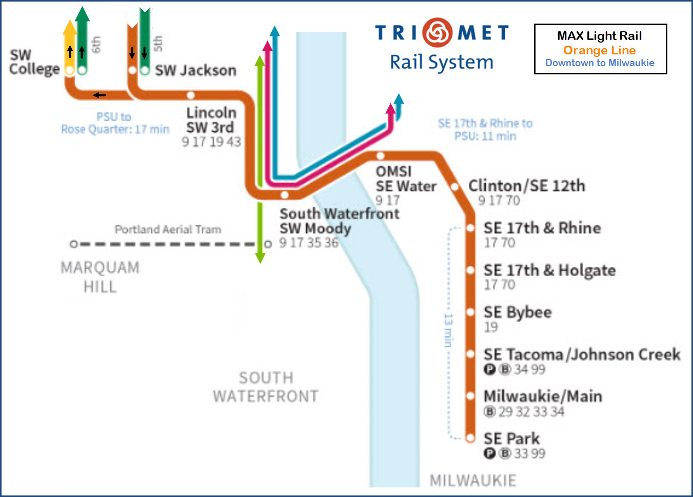
MAX Red, Blue, Yellow & Green Lines (in downtown Portland)
The Scoop:
The Orange Line, as far as a ride goes for railfans, is probably one of the
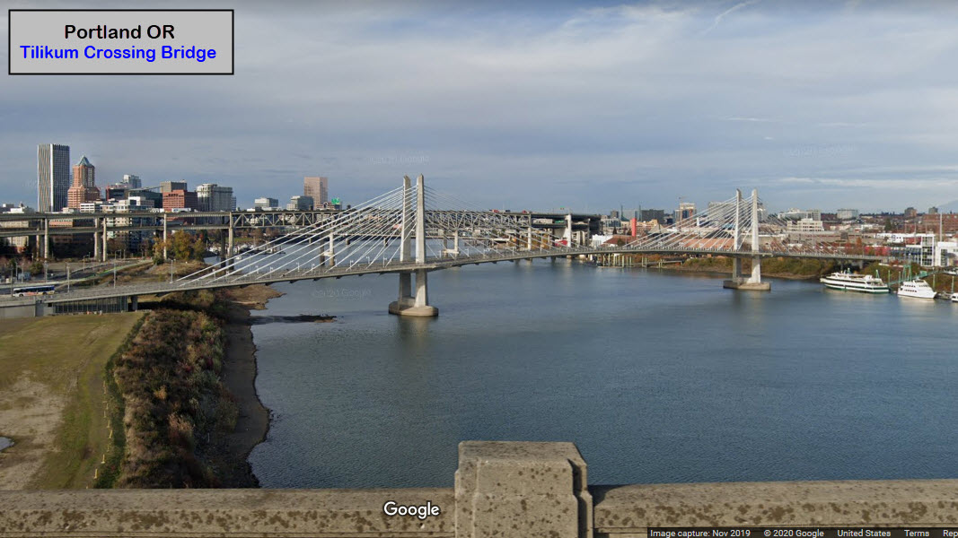
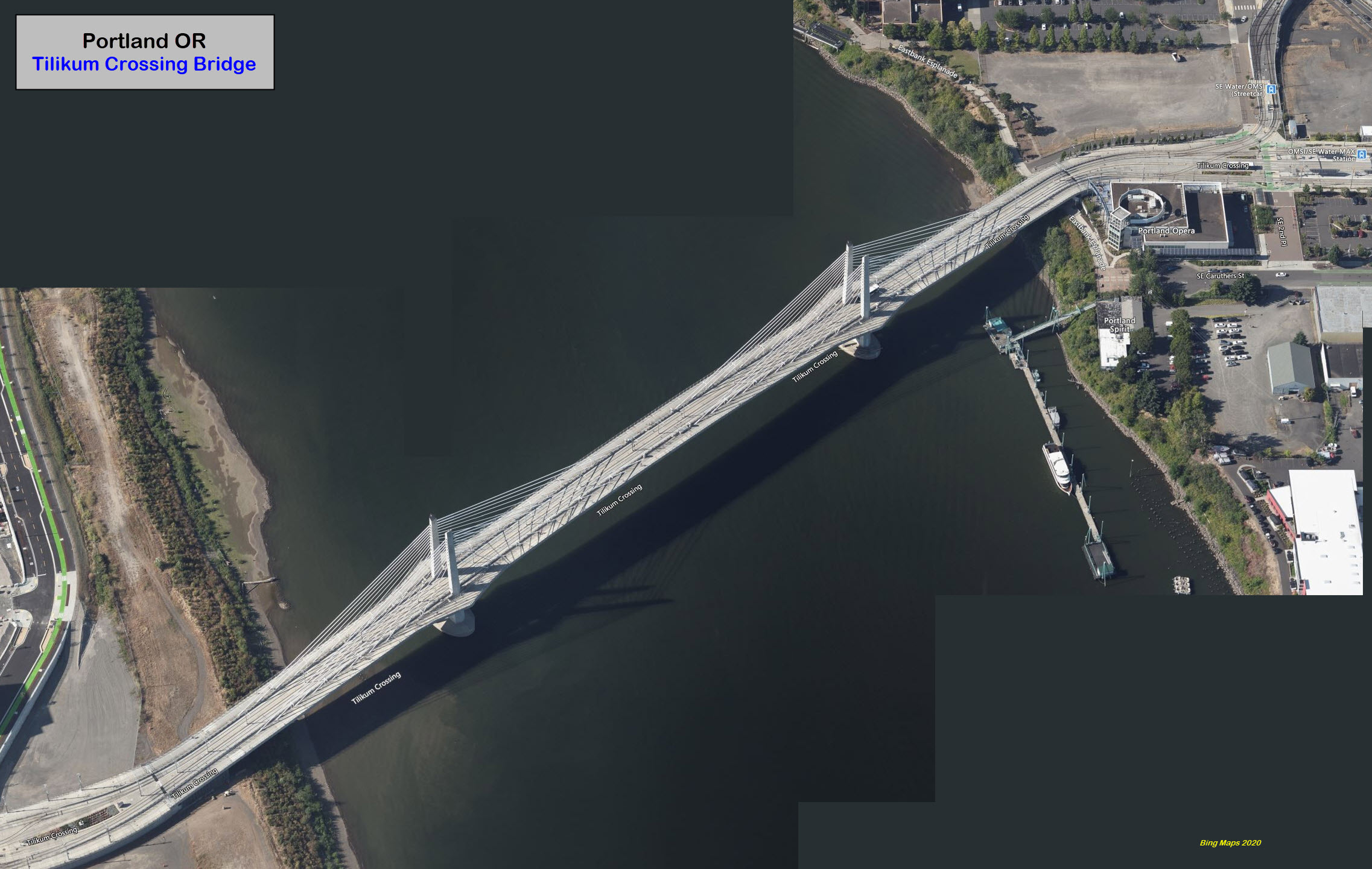
more "fun" and interesting lines in the Portland area, with the Tilikum Crossing
Bridge, sharing some of the route with the Portland Streetcar, passing the
Oregon Rail Heritage Center, passing the Milwaukie UP Yard, and going over
several other bridges/causeways. If you're short on time, and want to
take a ride on just one line, my vote would be for the Orange Line.
The Orange Line is the last of the MAX Light Rail lines to open, having opened
on September 12, 2015.
Exit 18 off I-405/I-5 just after crossing the Willamette gets you off at 4th Ave.
The Ross Island bridge, on the east side drops you off onto McLoughlin
Blvd, which the Orange Line follows for a good bit of it's way south.
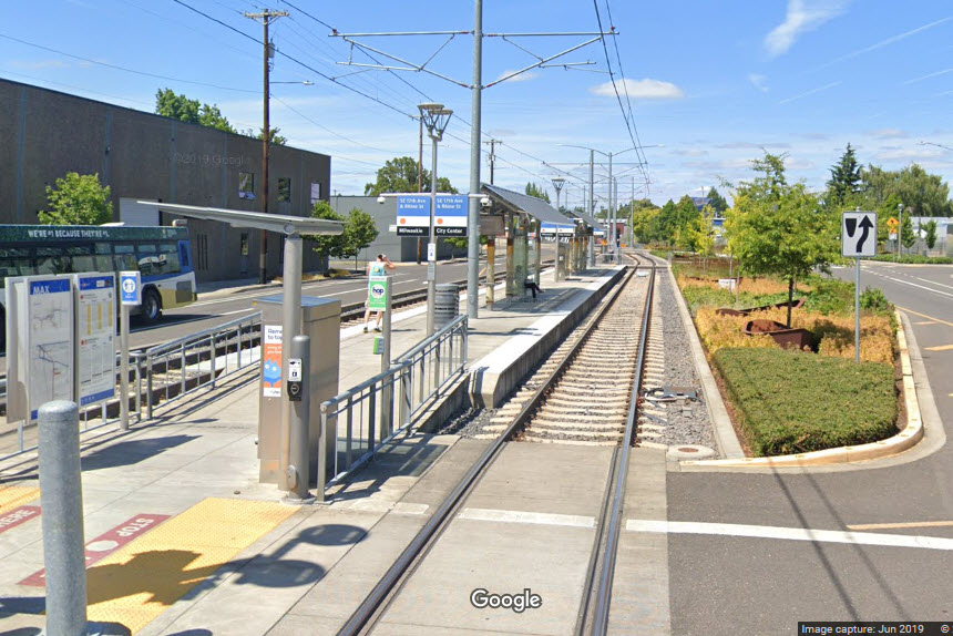
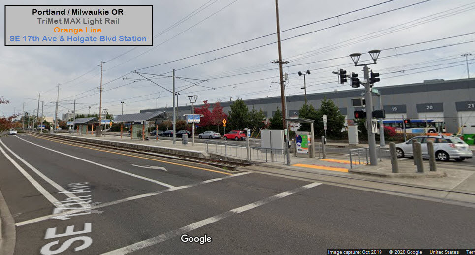
In the Milwaukie area, the light rail R-O-W runs alongside the Union Pacific, so
you will have to catch the light rail trains at crossings, like SE Harrison or
Monroe St.
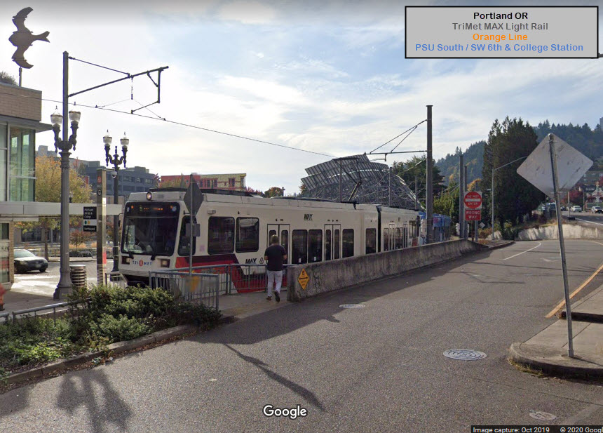
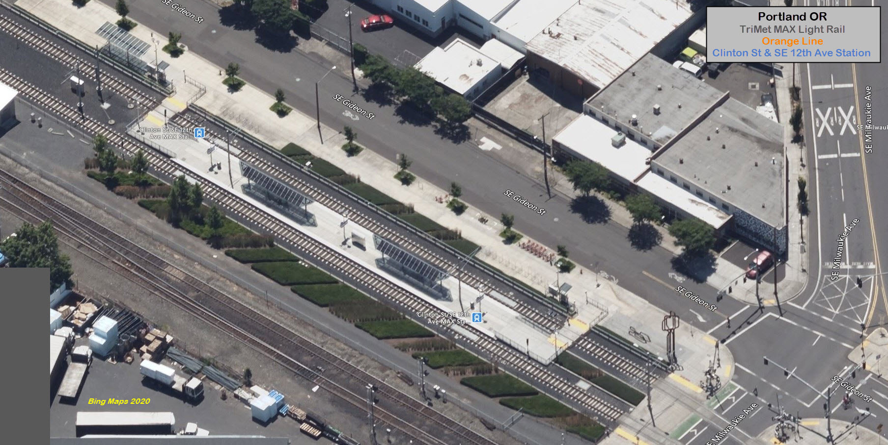
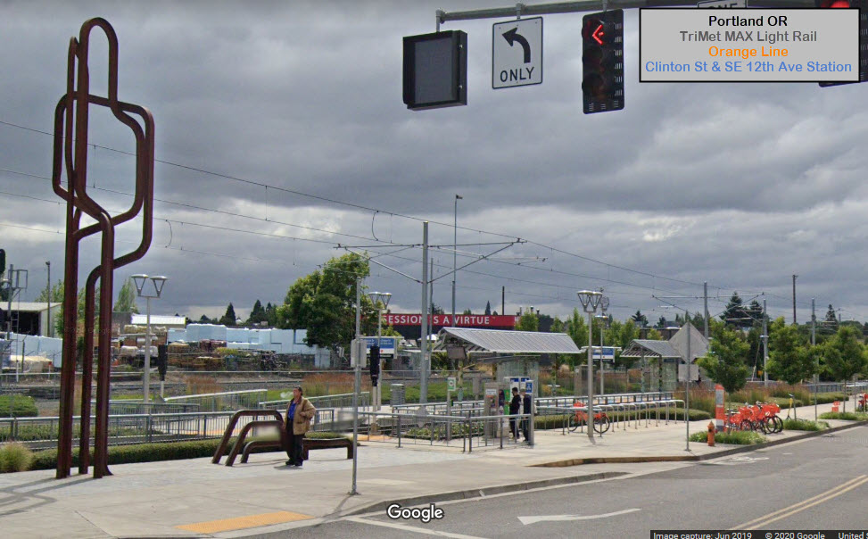
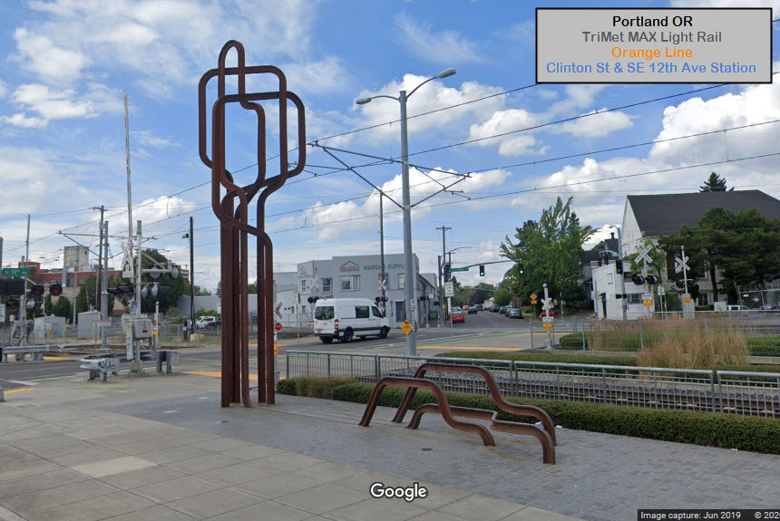
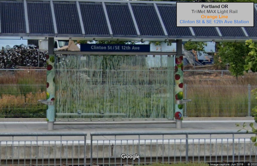
GPS Coordinates: 45.509500, -122.683706
https://en.wikipedia.org/wiki/PSU_South_stations
This is a "NB" station only, as the street is one-way. For
inbound trains (into the city), this is the last Orange Line stop.
Green and Yellow Line trains start here.
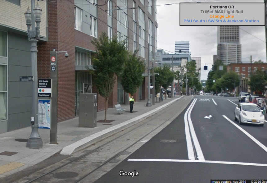
GPS Coordinates: 45.509127, -122.682902
https://en.wikipedia.org/wiki/PSU_South_stations
This is a "SB" station only, as the street is one-way. This
is the last stop on the line for Green Line trains. Yellow Line trains
already "stopped" back in the downtown area at NW Glisan - where the Orange Line
begins.
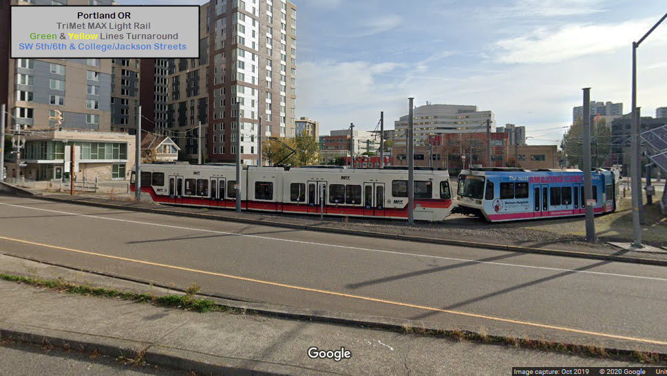
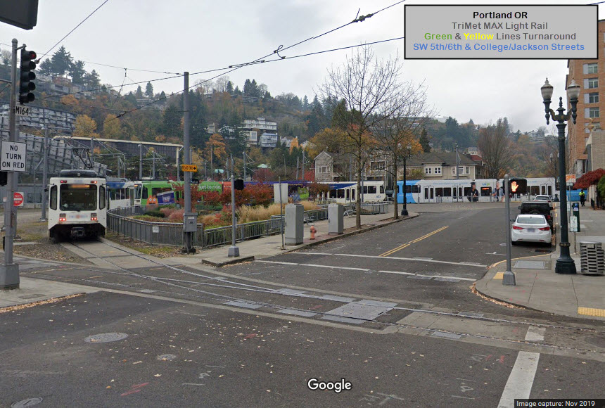
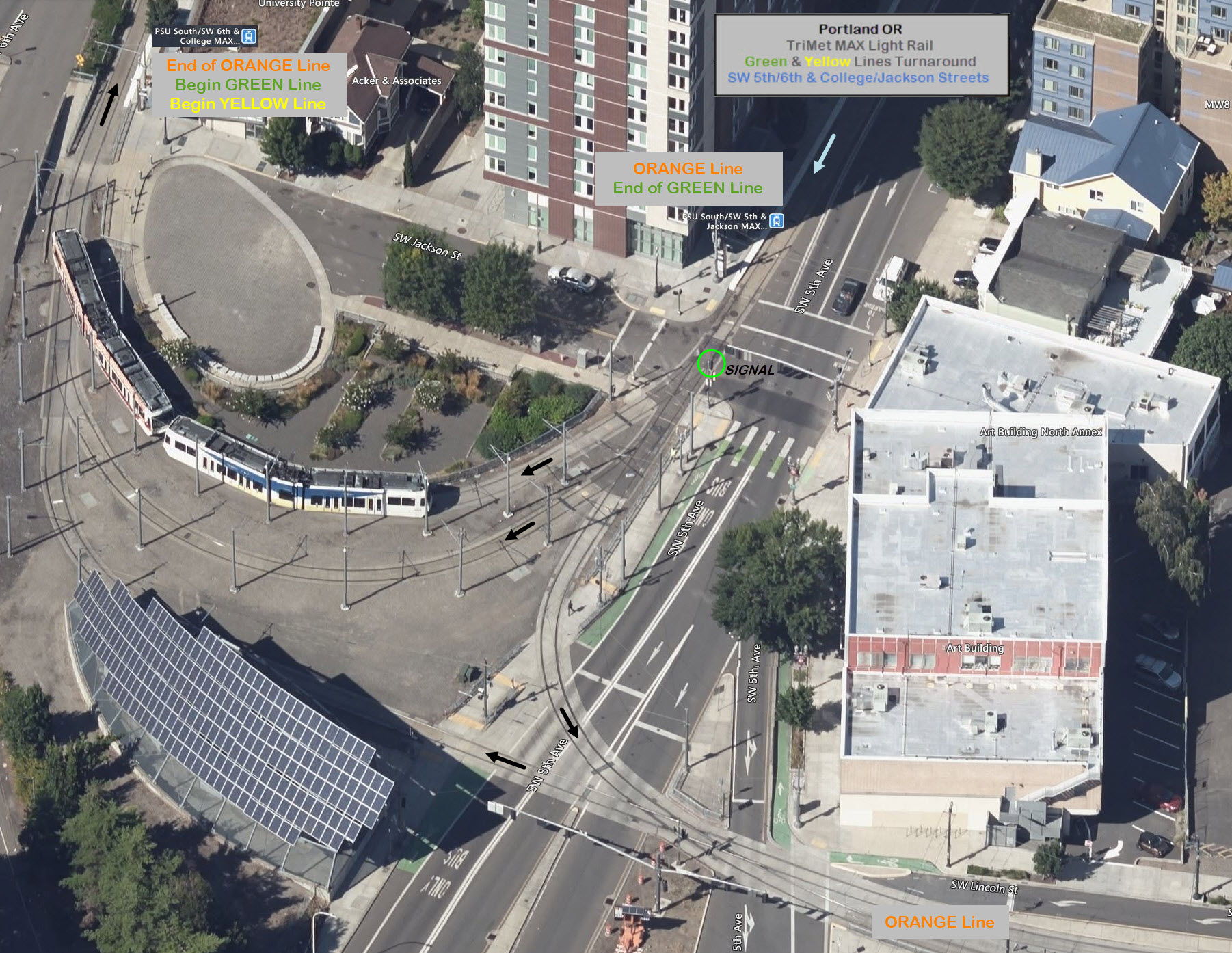
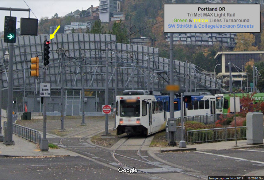
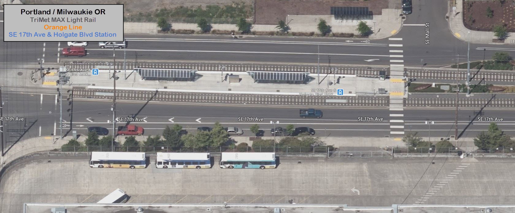
An interesting spot on the MAX system.... At the 5th Ave station, the Orange
Line ends, and the Green and Yellow Lines begin. At the SB 6th Ave
station, the Green Line ends, and the Orange Line runs thru, as the line began
further north at Glisan.
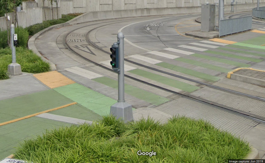
The light rail bar signal shown in the streetview below is circled in the aerial
view above. It displays a clear for one of the two turnaround tracks, or
for a straight move onto the continuation of the Orange Line.
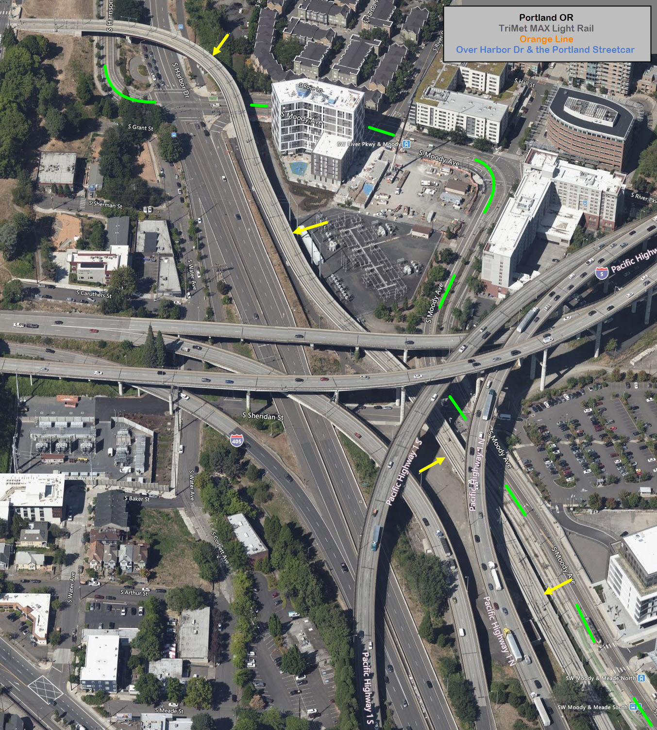
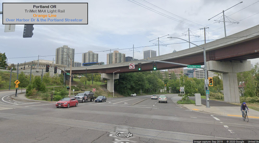
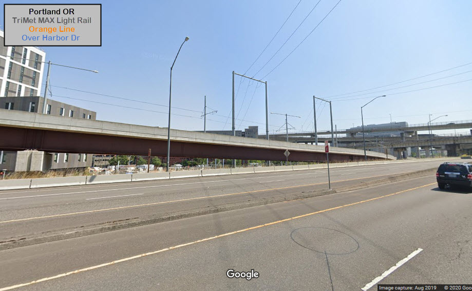
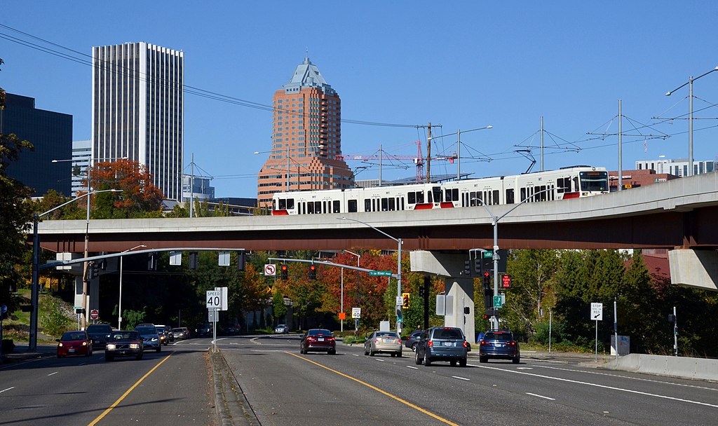
This is the start of a causeway that goes under I-5, and over: the Portland
Streetcar on Harrison St, Harbor Dr, a substation (not a TriMet one), some misc
open space, and South Sheridan St. It is also used by busses.
Yellow arrows point at the causeway, and The Portland Streetcar follows the
route with the green lines.
Steve Morgan, 2019
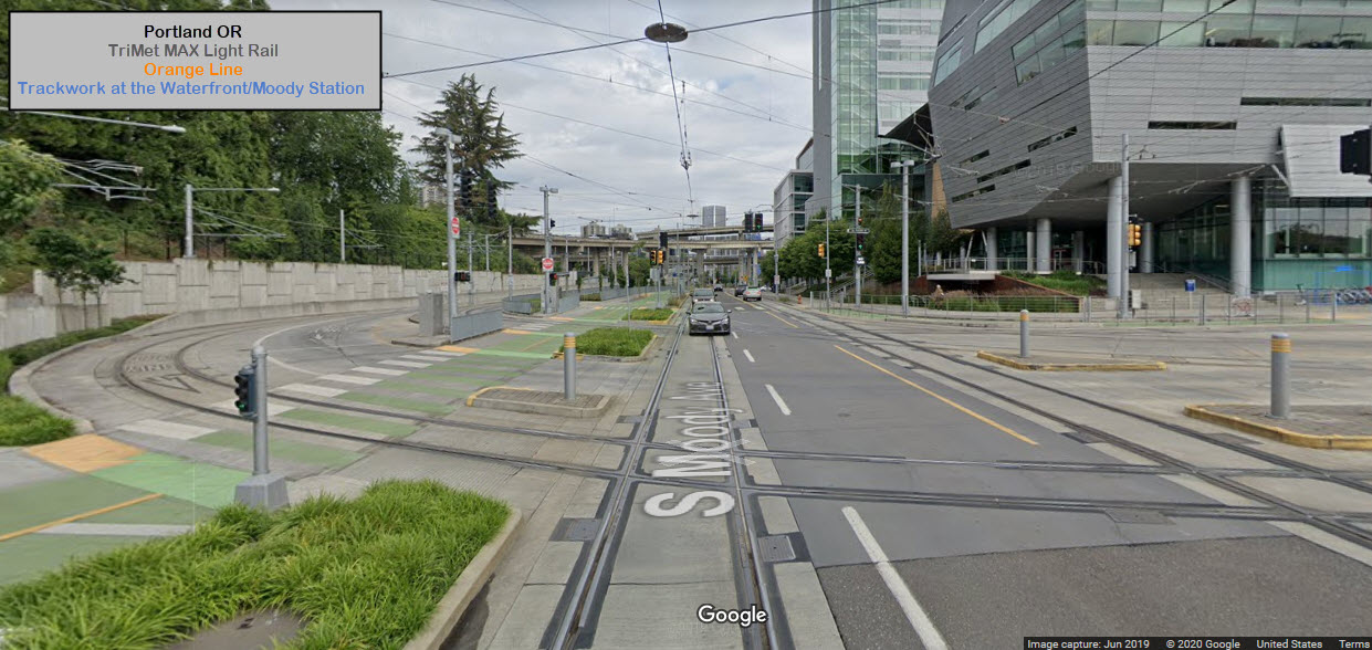
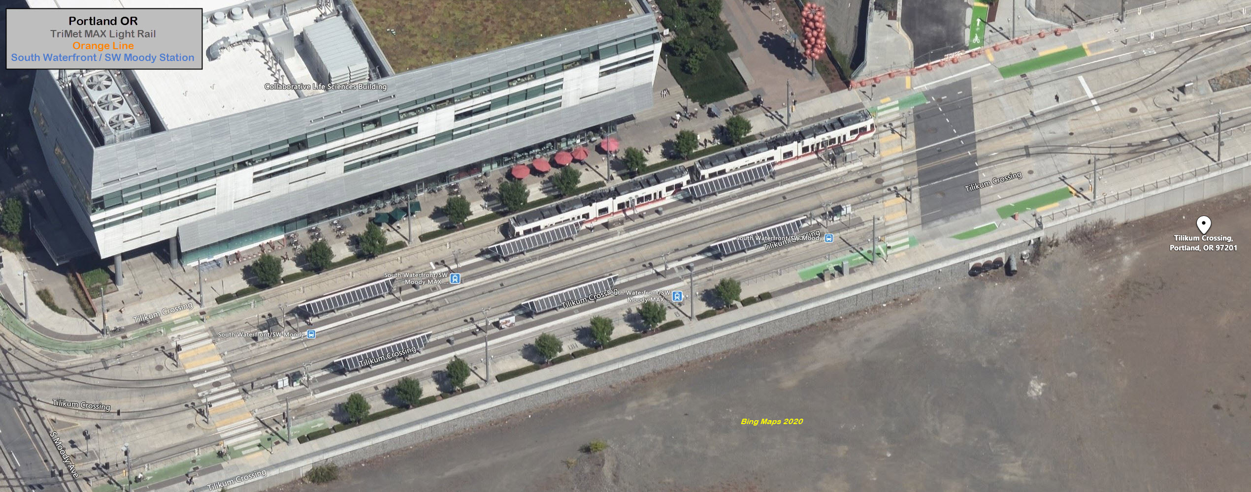
Trackwork at the Waterfront/Moody Station
Here, the two lines of the Orange Line cross the two tracks of the Portland
Streetcar. Additionally, there is an interchange between the two streetcar
lines that cross the river, and the Streetcar Green Line that continues south on
Moody Avenue. There is however, no interchange between the two systems
at this interlocking, it happens on the "far" side of the Waterfront/Moody
station where the two systems go into one track for each direction, in order to
cross the Tilikum Crossing Bridge.
This is Toronto and Philadelphia level trackwork! :-)
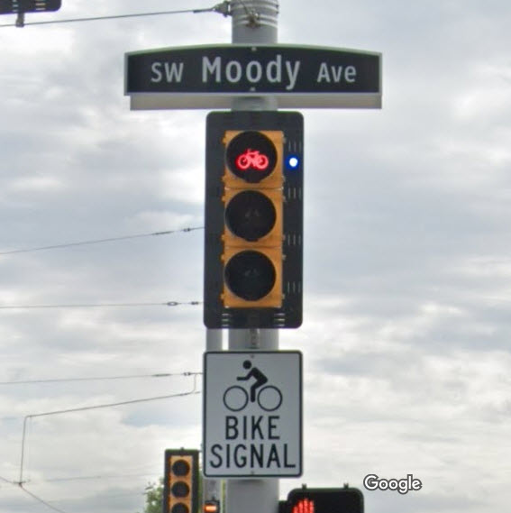
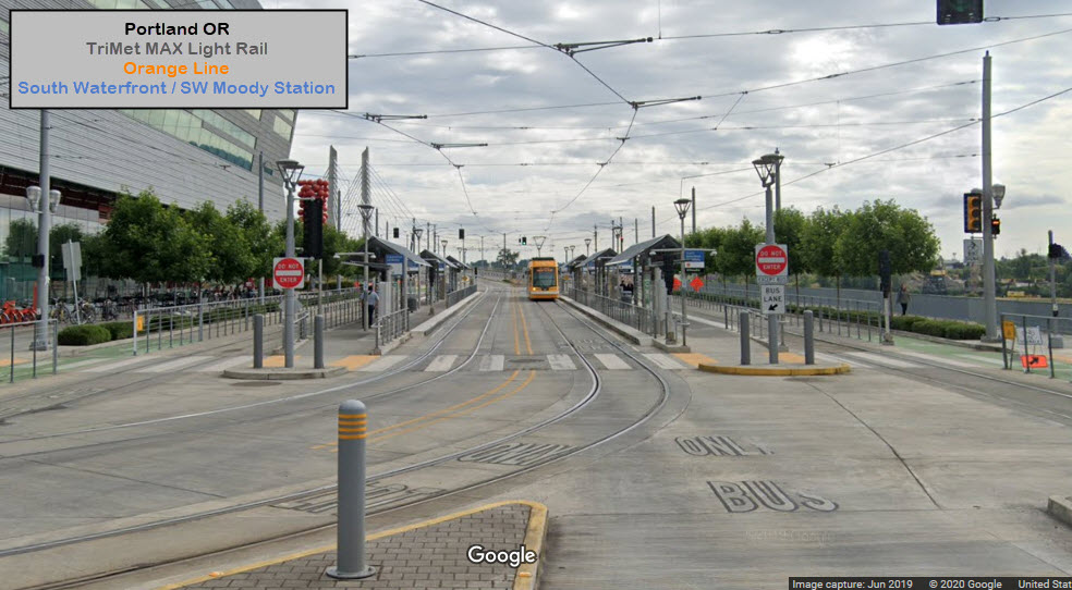
Traffic Lights for the bike lanes.... go figure.... and in case you didn't
catch on, the green lanes are for bicycles....
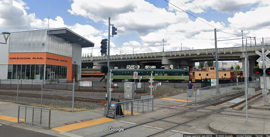
This museum is quickly becoming one of the best in the country, mostly through
the efforts of one guy - Doyle McCormack.
This location is a new location,
having moved most of what they could from the UP yard in Milwaukie. The
latest "catch" is a 100 foot long turntable.
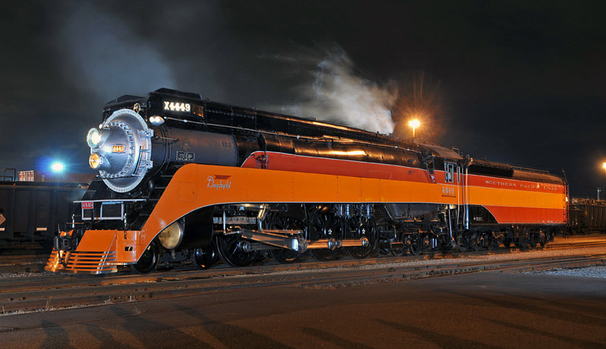
Steam engines of the museum are the infamous Southern Pacific #4999, Spokane, Portland
& Seattle 700, and Oregon Railway & Navigation #197.
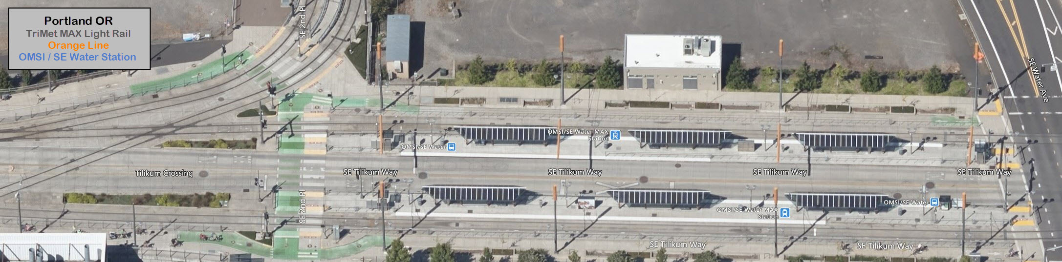
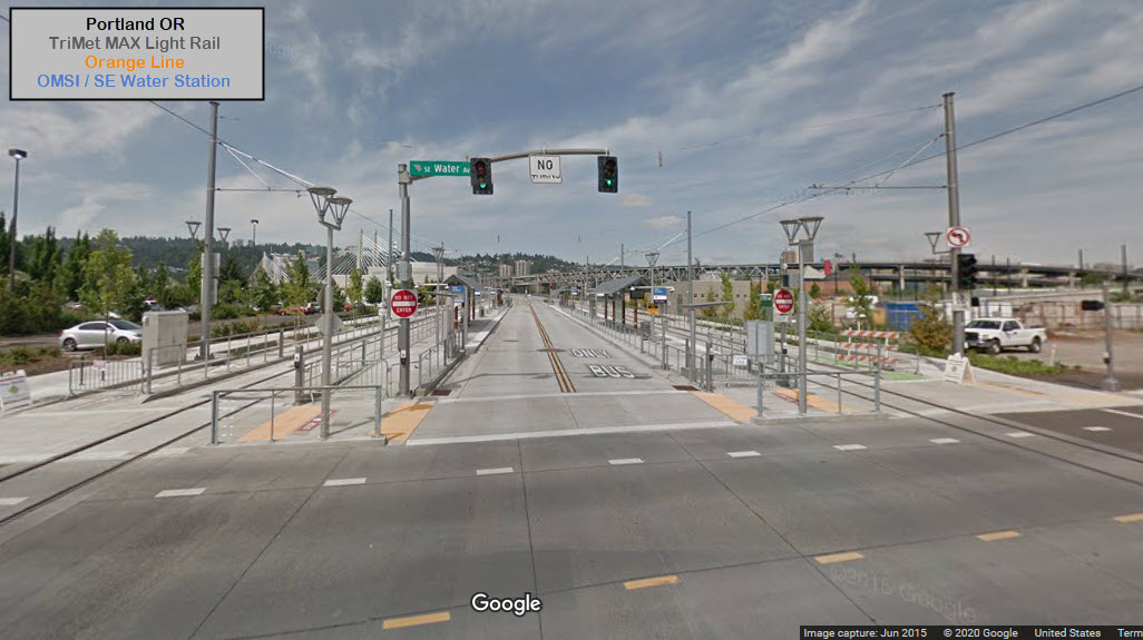
The OMSI / SE Water Station is located across the street from the museum, making it
extremely easy to get to. The Portland Streetcar SE Water/OMSI station
is located just on the other side of the light rail station.
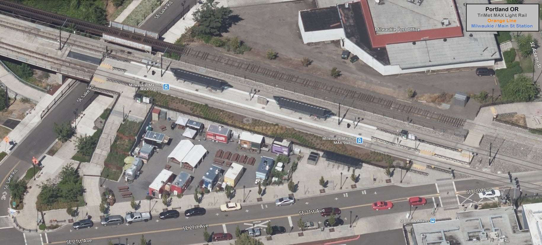
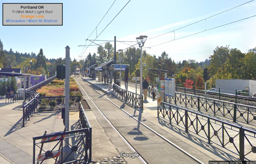
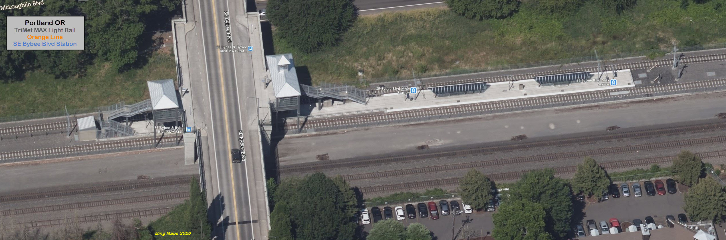
GPS Coordinates: 45.474806, -122.640030
https://en.wikipedia.org/wiki/Southeast_Bybee_Boulevard_station
This station is just south of UP's Milwaukie Yard, where the roundhouse used to
be that stored SP #4999 and SPS #700.
Styling is reminiscent of a 100 year old NYC Subway station.
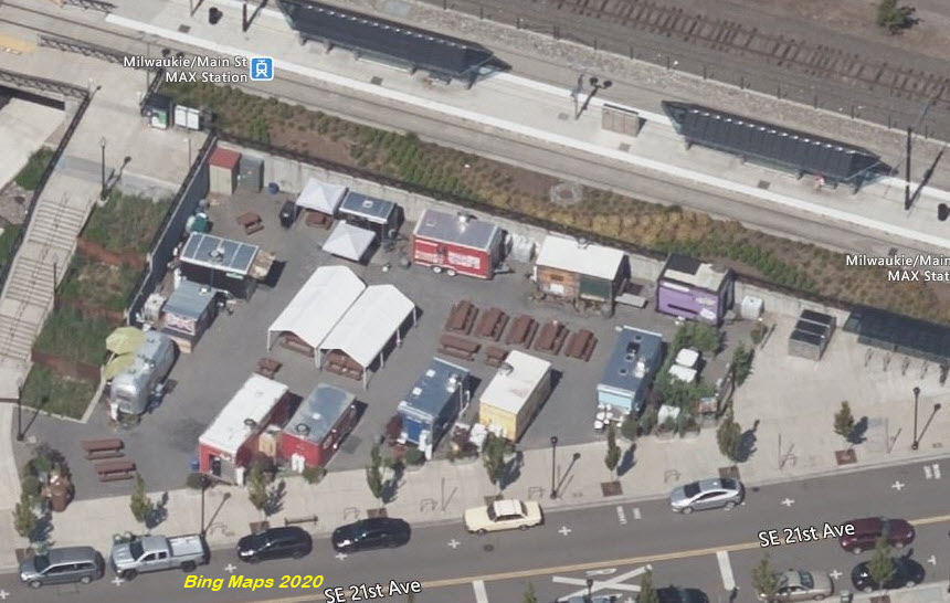
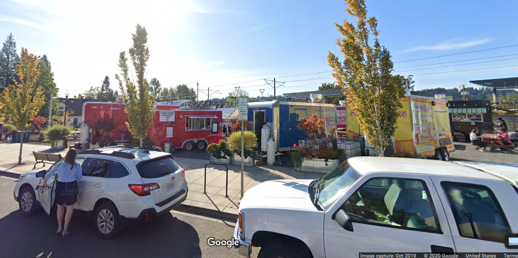
I don't know if it is here all year round, but I noticed an interesting feature:
the lot next to the station has about a dozen or so food vendors operating out of trailers
with a seating area!
I hope with the covid thing going around, that they are still in business....
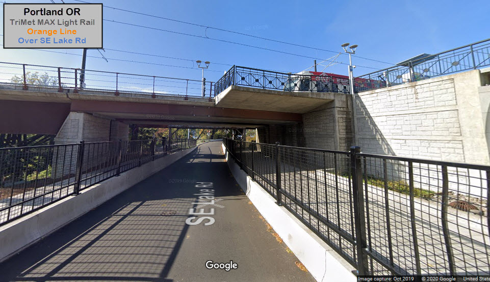
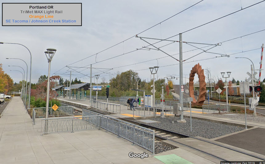
Over SE Lake Rd
GPS Coordinates: 45.440906, -122.640162
This is the beginning (or end) of a massive bridge structure that crosses two
roads and Kellogg Creek. The end of the Milwaukie station platform can
be seen in the picture.
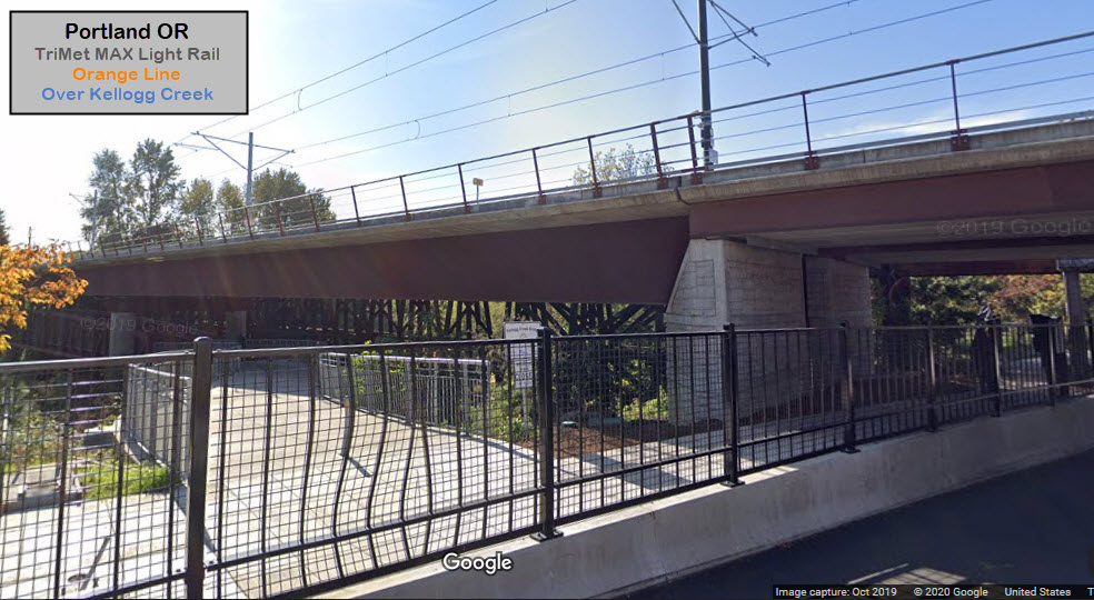
Over Kellogg Creek
GPS Coordinates: 45.440235, -122.640489
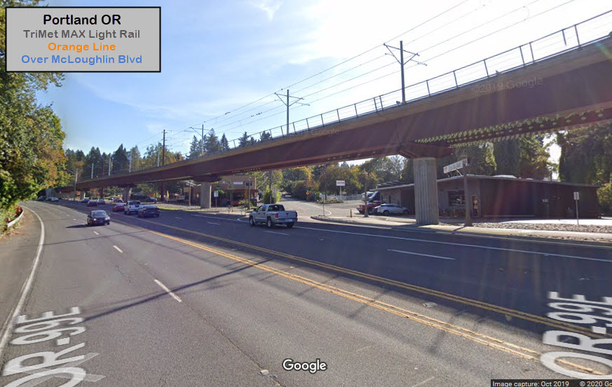
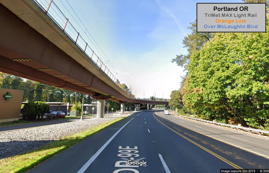
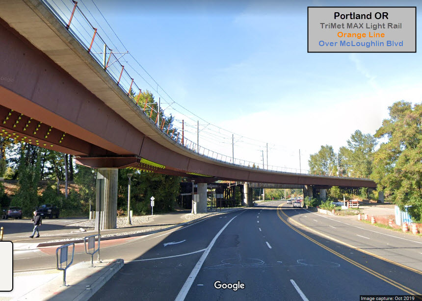
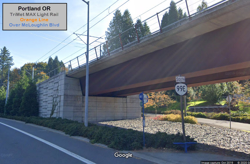
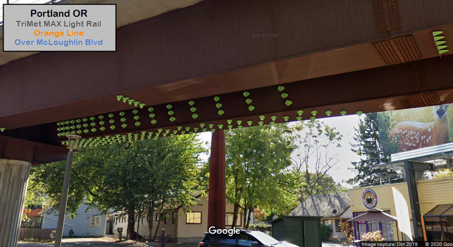
Over McLoughlin Blvd
GPS Coordinates: 45.439098, -122.641096
Anyone know what the "green things" are that are on the underside of the bridge?
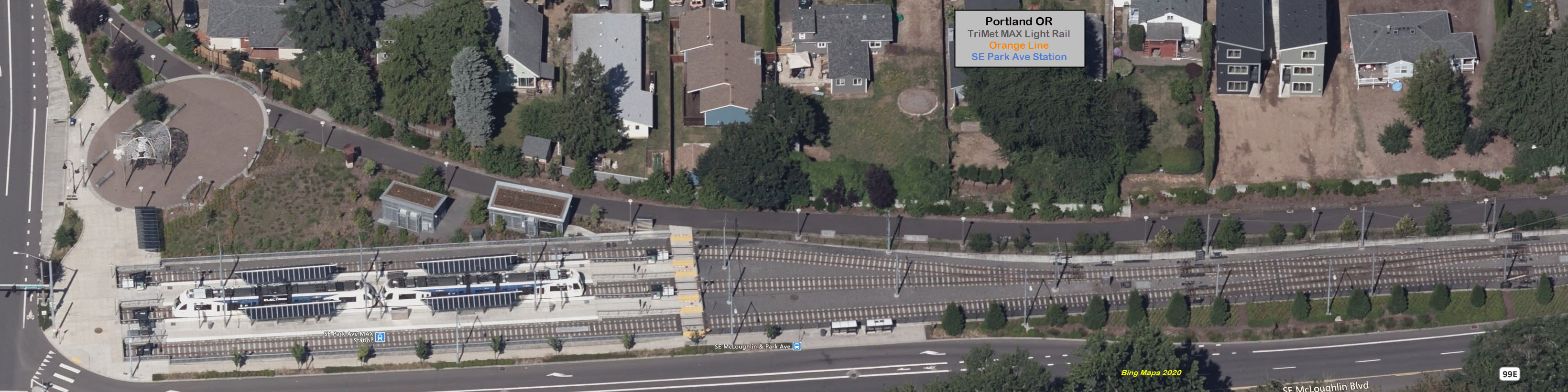
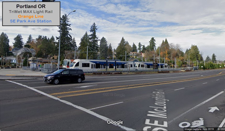
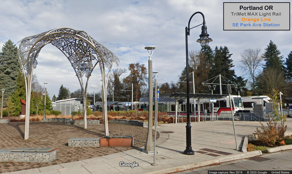
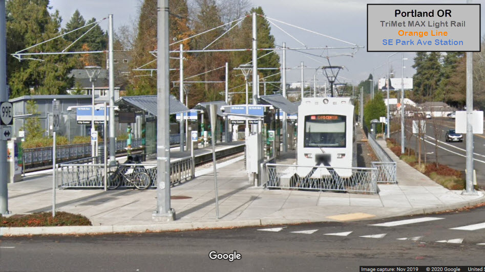
GPS Coordinates: 45.430702, -122.635129 https://en.wikipedia.org/wiki/Southeast_Park_Avenue_station
Park St is the current end of the Orange Line.
Just before getting into the station, there is a double crossover before going
into three tracks.
Disclaimers:
I love trains, and I love signals. I am not an expert. My webpages reflect what I find on the topic of the page. This is something I have fun with while
trying to help others.
Please Note: Since the main focus of my two websites is railroad signals, the railfan guides are oriented towards the signal fan being able to locate them.
For those of you into the modeling aspect of our hobby, my
indexa page has a list of almost everything railroad oriented
I can think of to provide you with at least a few pictures to help you detail your pike.
If this is a railfan page, every effort has been made to make sure that the information contained on this map and in this railfan guide is correct. Once in a while,
an error may creep in :-)
My philosophy: Pictures and maps are worth a thousand words, especially for railfanning. Text descriptions only get you so far, especially if you get lost or
disoriented. Take along good maps.... a GPS is OK to get somewhere, but maps are still better if you get lost! I belong to AAA, which allows you to get
local maps for free when you visit the local branches. ADC puts out a nice series of county maps for the Washington DC area, but their state maps do not have the
railroads on them. If you can find em, I like the National Geographic map book of the U.S..... good, clear, and concise graphics, and they do a really good job
of showing you where tourist type attractions are, although they too lack the railroads. Other notes about specific areas will show up on that page if known.
Aerial shots were taken from either Google or Bing Maps as noted. Screen captures are made
with Snagit, a Techsmith product... a great tool if you have never used it!
By the way, floobydust is a term I picked up 30-40 years ago from a National Semiconductor data book, and means miscellaneous
and/or other stuff.
Pictures and additional information is always needed if anyone feels inclined to take 'em, send 'em, and share 'em, or if you have something to add or correct.... credit
is always given! Please be NICE!!! Contact info is here
Beware: If used as a source, ANYTHING from Wikipedia must be treated as being possibly inaccurate, wrong, or not true.

 Steve Morgan, 2019
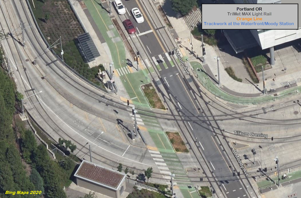
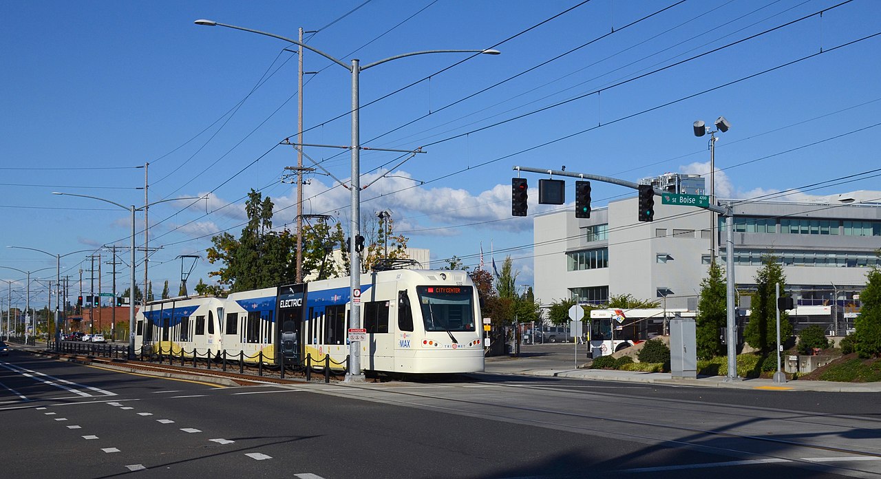 Steve Morgan, 2019, passing TriMet's HQ
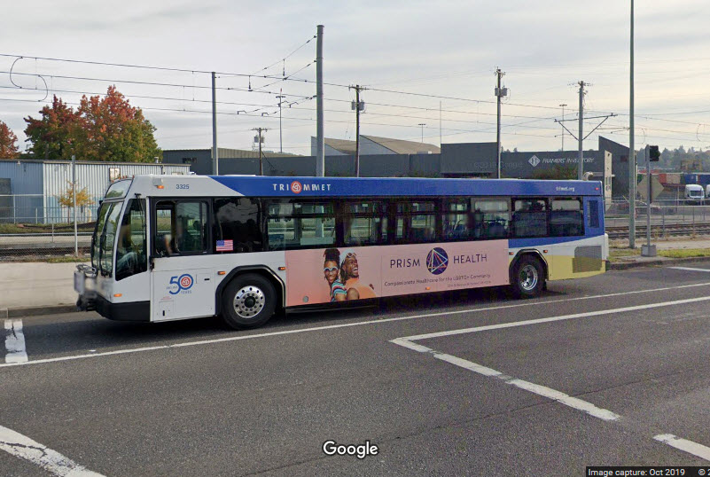
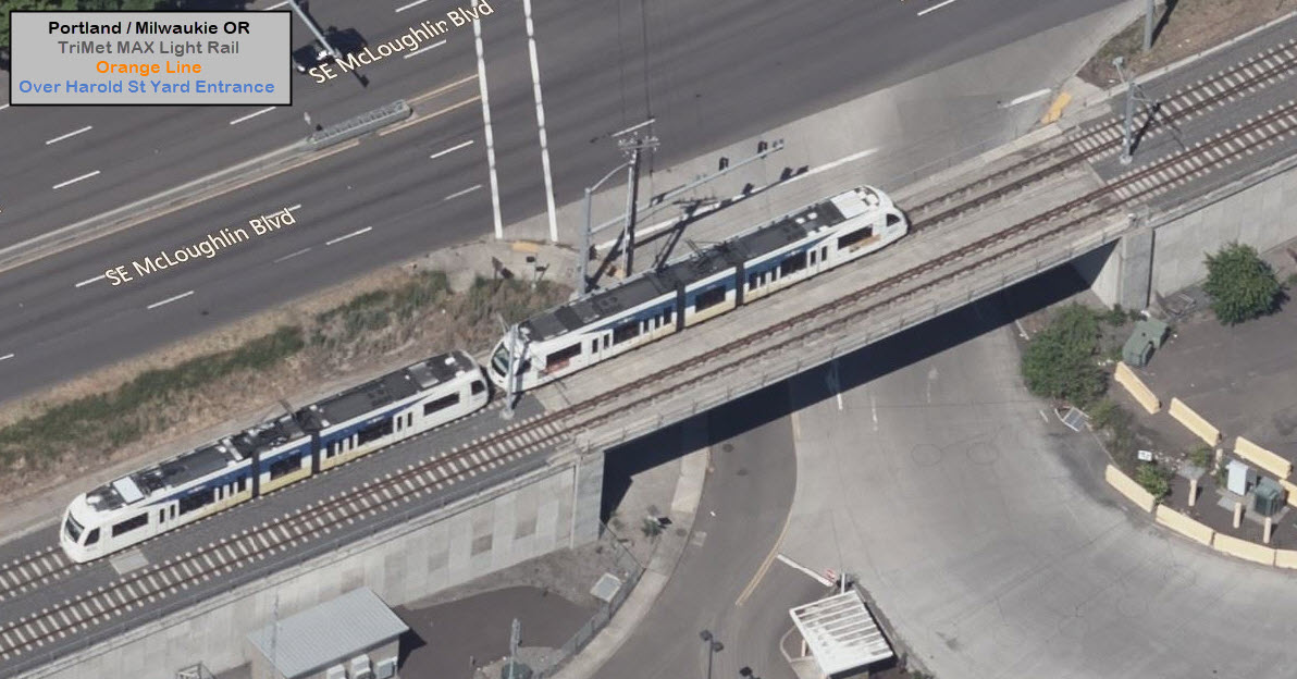
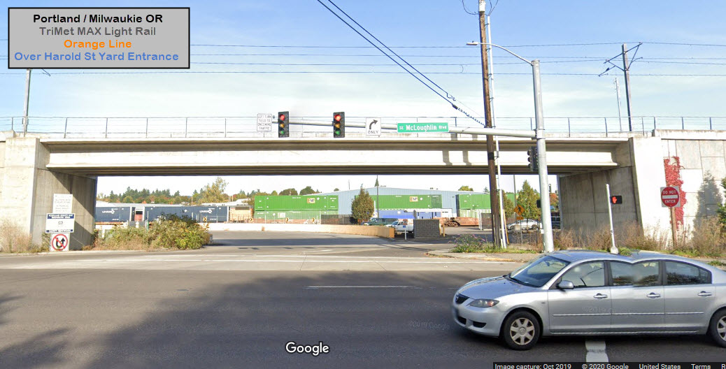
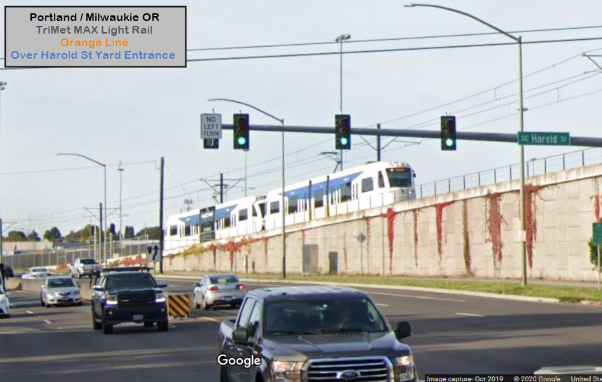
 from McLoughlin Blvd