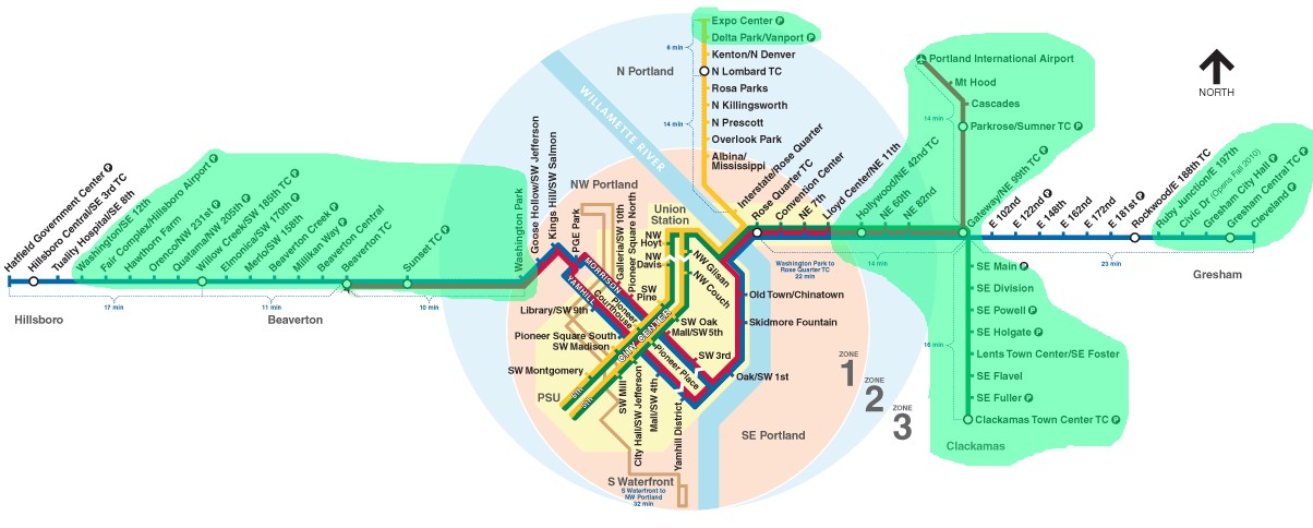
Access by train/transit:
Amtrak at Union Station
TriMet MAX Light Rail
Portland Streetcar downtown
Commuter Rail in Beaverton
The Scoop:
The MAX Light Rail system in Portland is a 94 station system running on
approximately 60 miles (96km) of track on five lines.
Service frequency runs from 30 minutes off peak, to about every 3 minutes during the rush hour.
According to Wikipedia, the system is the forth busiest after Los Angeles, Boston, and San Francisco.
The first leg of the system opened on September 5, 1986, after four years of construction.
Service was between 11th Avenue in downtown Portland and Cleveland Avenue in Gresham.
This core system was the start of the Blue Line, altho the Blue Line
name was not adopted until 2001.
The Blue Line was expanded west in 1998 to downtown Hillsboro, after a massive tunneling project.
As a result of this tunnel, the MAX system has the deepest station in the United States at
260 feet (79m). Construction costs were about double the projected costs due to soft dirt
and sandstone which made the use of the TBM (tunnel boring machine) ineffective.
The Red Line was the next section to be built, and opened in 2001.
The Red Line went from Beaverton on the west end, thru downtown on the same route as the Blue
Line, and then northeast to the Portland Airport (PDX).
Following the Red Line, was the Yellow Line from PSU downtown, north
to the Expo Center in 2004, taking the turn north at the double track wye, just
on the east side of the Willamette River.
The Green Line opened in two phases in August and November of 2009, going
from PSU to Clackamas Town Center, and sharing the Gateway/NE 99th TC as the
last station on the Blue Line as the Red Line does.
The Orange Line was the last to open in 2015, and goes from NE Glisan south to
Milwaukie, crossing over the Willamette River on the new Tilikum Crossing
bridge, along with the Portland Streetcar.
Acknowledgements:
Rick Holm
Greg Martin
Steve Morgan
Denver Todd
Wikipedia
From Wikipedia: As of 2020, TriMet operates five models of light rail vehicles that are designated
as "Type 1" through "Type 5", of which two are successive upgrades of the same model. The agency
has 145 cars that vary in length, from 88 feet (26.8 m) to 95 feet (29.0 m), and are all used
interchangeably by every service on the network. With Portland's relatively small 200-foot
(61 m) downtown blocks, services operate with only one or two cars to prevent stationary
trains from blocking intersections. Type 2 and 3 low-floor vehicles may run singularly or
coupled to another Type 1, 2, or 3 vehicle. Type 1 high-floor vehicles are also capable
of running singularly, but doing so would constrain accessibility due to a lack of wheelchair
access. Thus, a high-floor car must be coupled with a low-floor car. Type 4 and 5 cars can
only be coupled to one another.
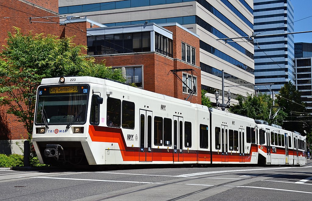
Twenty-six Type 1 high-floor vehicles were produced for the Banfield light rail project by a
joint venture between Bombardier and La Brugeoise et Nivelles beginning in 1983. TriMet
announced it would purchase seven additional vehicles that August, but a budget shortfall
forced the agency to withdraw this proposal the following November. The cars are similar
in design to Bombardier vehicles that had been used in Rio de Janeiro. Bombardier built
the frames in Quebec but its factory in Barre, Vermont manufactured the majority of each
car, the first of which arrived in Portland in 1984. Each 45-short-ton (41 t) car is
single-articulated and contains six axles. The high floors connect with the low platforms
through interior steps, which necessitated platform wheelchair lifts until the arrival
of low-floor cars. A car sits 76 people and has an overall capacity of 166.
A type 1 (high floor) and a type 2 (low floor) in downtown Portland.
Steve Morgan
In 1992, TriMet officials conducted an accessibility study and determined that low-floor
cars were the most cost-effective alternative to providing universal access. MAX then
became the first light rail system in North America to acquire low-floor train sets when
TriMet procured 39 model SD660 cars from Siemens in 1993. These Type 2 cars were equipped
with doorway wheelchair ramps. They entered service during the partial opening of the
Westside MAX in 1997. By 2000, TriMet had ordered 17 more Type 2 cars including six for
the Airport MAX project.
The system's 27 Type 3 vehicles, which the agency purchased as part of the Interstate
MAX project and first brought into use in 2003, are the same model as the Type 2
vehicles but with technical upgrades and a new livery. They are Siemens
model number SD660, and have 60Hz AC motors instead of DC motors.
Steve Morgan, 2015
Twenty-two Siemens S70 low-floor cars, which were designated Type 4, were
purchased in conjunction with the I-205 MAX and Portland Transit Mall projects,
and were first used in 2009. Type 4 cars have a more streamlined design and more
seating, and are lighter and more energy-efficient than the previous models. The
Type 4 cars were the first in the MAX network to use LED-type destination signs.
Type 4, 2009, Steve Morgan
The second series of S70 cars, TriMet's Type 5 vehicles, were procured for the
Portland–Milwaukie light rail project. TriMet placed an order for the Type 5 cars
with Siemens in 2012 and delivery commenced in 2014. These vehicles include some
improvements over the Type 4 cars, including less-cramped interior seating, and
improvements to the air-conditioning system and wheelchair ramps.
In July 2019, TriMet placed an order for 26 Siemens S700 light rail vehicles that
are intended to replace the system's Type 1 vehicles. The first car is expected
to be delivered in 2021.
The TriMet light rail system is powered by a conventional 750-volt DC overhead system. In central
city areas, a single contact wire is used to minimize the amount of overhead wiring. All other
locations use a dual-wire catenary, having a contact wire supported by a messenger wire,
allowing higher speeds and requiring fewer poles.
Substations
Substations convert high voltage power from the public supply to the 750-volt DC power used
by trains. MAX substations are spaced at roughly one mile intervals. The power system can
bridge any one substation so trains can continue to run when a substation or its supply
is down. On the MAX Orange Line, one substation was replaced with an energy storage unit
that captures and stores electrical energy generated by trains during braking, and feeds
it back into the system when the trains accelerate.
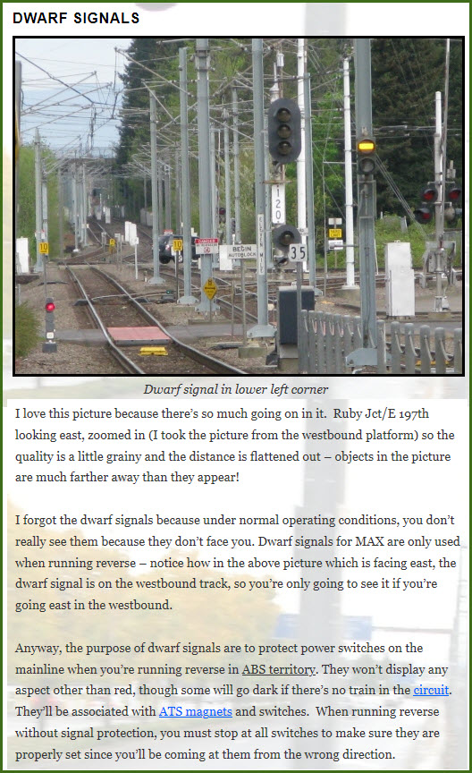
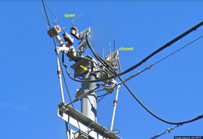
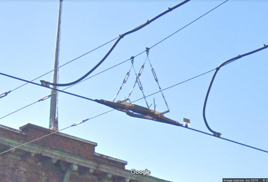
Here are a few pictures of a section break at 3rd and Glisan, on the
Green/Yellow line in downtown, with close-ups of the feeder on the pole, and the
insulated-joint (IJ) on the catenary, which separates two power districts.
Power on either side of the IJ would come from two separate substations, but in
the event of a failure of one of them, the equipment at the top of the poles,
which are basically high power switches, can be used to connect one power
district to another. You can see the power feed coming out of the pole
at the arrow. The substation here must be inside one of the buildings.
Above, you can see how one of the switches is open, and, viewing from the other side, we can see how the switch is closed...
Minimizing visual impact
(From TriMet Brochure) In Downtown Portland, ornamental poles support the overhead wiring
and street lighting. In some locations, buildings and bridge structures are used to
avoid the need for poles. A handful of buildings on 5th and 6th avenues in downtown
Portland were utilized in this manner. Extensive tree planting and tall buildings
often mask the silhouette of the wires. On Interstate MAX, light poles in the street
median support the overhead
Gated crossings
(From TriMet Brochure) The MAX system includes 48 at-grade crossings which are
equipped with gates, lights and bells. Crossings adjacent to stations use wayside
signals and ATS to hold the train at the platform until the minimum crossing
warning is completed. Where signal-controlled intersections are close to gated
crossings, interconnect systems provide traffic time to clear out. Gates, lights
and bells are used in conjunction with ABS where line of sight operations are
impractical due to LRT speeds and/or track alignment.
Traffic signals and MAX interlockings
(From TriMet Brochure) Where the track configuration, street geometry and MAX
operations dictate, street interlocking protection facilitates train moves by
means of powered switches. Traffic signal preempt and route signaling are merged
into a single signal head to simplify the information given to the operator.
Traffic interface
(From TriMet Brochure) TriMet and the local traffic signal jurisdictions use various
interconnect methods to accomplish two major goals: first, to provide safe operations
for both MAX and vehicle traffic, and second, to minimize delays to both MAX and
vehicle traffic. Traffic interface has to be site specific, use proven equipment,
and be simple to program and maintain.
Preempt strategies: Preemption varies by degree. For the most part, MAX
operates between station platforms without stopping for intermediate
intersections. East Burnside Street sections of Interstate MAX, and
Portland to Milwaukie In these segments, the trains operate at track
speeds of up to 35 mph within the median of city streets.
Trains preempt the intersections using conventional traffic signal equipment.
Trains are detected by inductive loops or by train-to-wayside communications
loops, and the intersection controller starts a pre-timed routine that will
bring up the preempt while the train is still a safe stopping distance from
the intersection.Wayside preempt indicators display four traffic signals to
the LRT operator: yellow horizontal, flashing yellow horizontal, white vertical
and flashing white vertical. Colored signal indications such as Ts or Xs can
be misinterpreted by vision-challenged motorists. To avoid confusion to motorists,
TriMet has adopted the bar signal system used in Europe for buses and rail transit.
A “Decision Point” marker is installed on the track to help the operator decide
what speed to use. In the event a preempt does not occur, the train can stop at
the normal service braking rate. A second detector communicates with the traffic
signal controller as soon as the train has cleared the intersection, allowing
normal operation to resume.
Hillsboro: Hillsboro uses a similar concept except
that the narrow roadway prevented installation of left turn pockets at
intersections. Left turns are permitted across the tracks by running the
trains through the intersections on an “all-red” phase. Left turns are
then permitted simply by not being prohibited. Train speeds do not exceed
25 mph in this segment.
Downtown Portland: The city center’s 200-foot blocks
and alternating one-way streets allow a
traffic progression at approximately 15 mph in all four directions. MAX
runs on the Morrison/Yamhill streets and the 5th/6th avenues couplets
within this progression. TriMet operates at 3-minute headways in the
streets with negligible impact on cross traffic.
On 5th and 6th avenues, buses and light rail trains share dedicated transit
lanes on the right. Trains travel in the center or right lane, stopping at
curbside platforms on the right approximately every 5 blocks. Buses also
travel in the center or right lane except to pull over at their stops. Motor
vehicles and bikes only travel in the left hand lane. Separate signals are
used for trains, buses, and cars and bikes. When trains have a signal to
proceed through an intersection, buses, cars and bikes traveling in the same
direction have red lights until the train has cleared the intersection.
Right turns across the transit lanes are prohibited except at three
signalized intersections. On Yamhill and Morrison streets, parallel
traffic can turn across the tracks on a green signal. A train-actuated
white bar signal allows the train to enter the intersection ahead of
any turning traffic. The few seconds required for this advance white
bar is gained by shortening the two succeeding green phases.
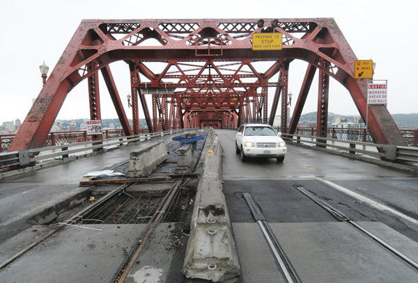
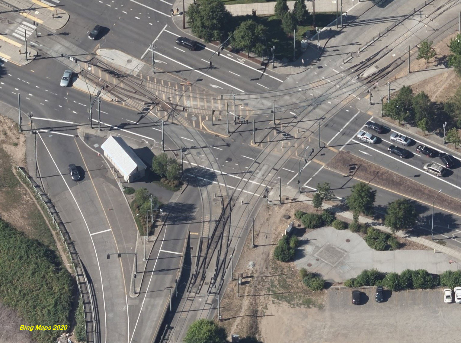
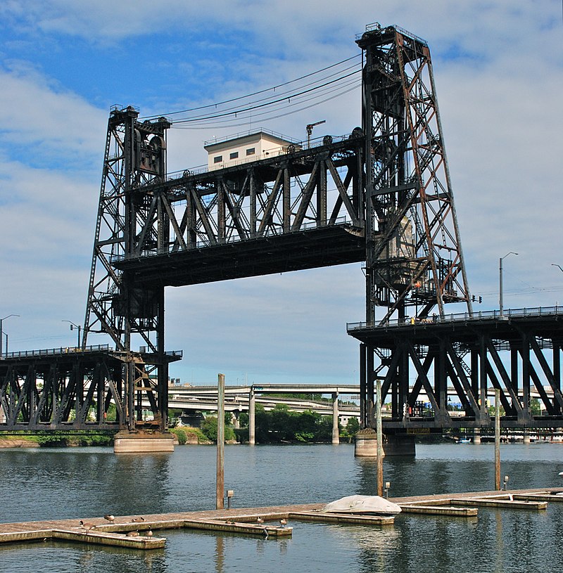
This is the middle bridge of the three used by rail transit in Portland,
and is only used by the MAX Light Rail.
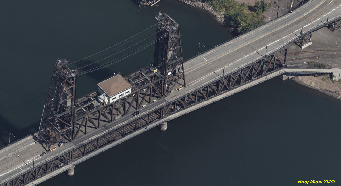
The wye mentioned above is a stones throw from the unique Steel Bridge, that carries the
light rail and cars on the upper deck, and UP trains on the lower deck of this
vertical lift bridge.
Steve Morgan
Steve Morgan, 2009
Steverelei, 2003
The Tilikum Crossing Bridge
GPS Coordinates: 45.504901, -122.667071 (center)
This is the southern most of the three bridges used by rail transit in Portland,
and is used by both the Portland Streetcar and MAX Light Rail. It is a "fancy"
cable-stayed bridge which opened in 2015. It carries no vehicular traffic, and is only
open to pedestrians, cyclists & mass transit.
Here is the bridge shown with a MAX Light Rail car and a Portland Streetcar crossing it.
Steve Morgan, 2016
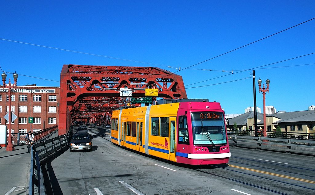
The Broadway Bridge
GPS Coordinates: 45.531845, -122.674125 (center)
This is the northern most of the three bridges used by rail transit in Portland,
and is used by the Portland Streetcar.
The Broadway Bridge was built in 1911-12, with a new approach added in 1927 and an
old approach replaced by the City of Portland in 1999-2002. It carries four lanes
of automobile traffic and one streetcar line, and is also a popular river crossing
for people on bicycles. It was originally painted black, but was repainted to
“Golden Gate Red” in 1963. Vertical clearance of the closed bascule span is adequate
for the majority of river traffic, with openings necessary about 25 times per month,
primarily to accommodate grain terminal ships. The full structure totals 1,613
feet in length and consists of a 278-foot double-leaf Rall bascule main channel
draw span, three Pennsylvania-Petit Through truss spans of 270 feet, 286 feet
and 297 feet on the western approach, and one Pennsylvania-Petit Through truss
of 297 feet and one Warren Through truss of 185 feet on the eastern approach.
In the first picture, the guided missile destroyer USS Pinckney is passing under
the bridge, headed towards Portland and the Steel Bridge. Picture taken by
Navy Petty Officer 2nd Class Marc Cuenca.
Steve Morgan
Over I-84 & I-205
GPS Coordinates: 45.532082, -122.565359 (center)
A long overpass that goes over Interstate 84, Interstate 205, and the Red Line to the PDX Airport.
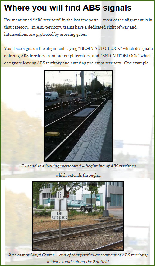
From Wikipedia: Approximately 70 percent of the MAX system uses automatic block signaling (ABS).
This allows for faster operating speeds - up to 55 miles per hour (89 km/h), and short headways.
In particular, between Lloyd Center/Northeast 11th Avenue station and Gateway Transit Center
along the Banfield Freeway -- where Blue, Green, and Red lines interline -- ABS allows for
an operating headway of two minutes. In these sections, automatic train stops (ATS) enforce
speed limits and automatically apply the brakes should a train operator fail to do so. The
remaining 30 percent of the system, which runs in city street medians, relies on traffic
signals and line-of-sight operation. Speeds do not exceed 35 mph (56 km/h) in these sections.
From TriMet Brochure... Signals and train control: Approximately 30 percent of the
TriMet light rail transit (LRT) line operates in the median of city streets. In these
sections, train operation is based on traffic signals and line of sight. Train operators
observe traffic signals and are prepared to stop short of any obstruction. Speeds do
not exceed 35 mph in these sections and are generally restricted to 15–30 mph.
Also from the TriMet Brochure... Block signal system and ATS: Where operating
speeds do not allow line-of-sight operation, TriMet uses three-aspect, Automatic Block
System (ABS) wayside signals. In these sections, Automatic Train Stops (ATS) apply
train braking automatically should the train operator fail to obey a red (stop)
signal. In some sensitive areas, ATS also provides for speed enforcement.
Approximately 70 percent of the MAX alignment uses ABS signaling. Interlockings
provide for both interline routes and turn-backs, with power switches where the
MAX Red Line, Yellow Line, Green Line and Orange Line intersect the Blue Line.
The end of each line has turn-backs with power switches. Reverse running is
provided in the Washington Park tunnel and in single-track sections of the MAX
Red Line. The ABS system provides a design headway of two minutes forty-five
seconds for a scheduled headway of three minutes. One section of track, between
Gateway and Lloyd Center, is built to accommodate 2-minute scheduled headways.
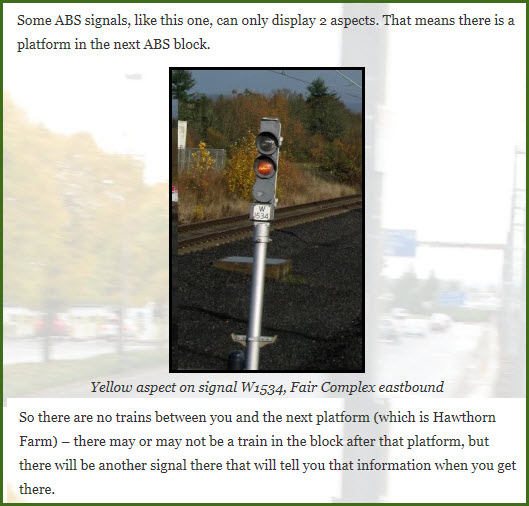
I have to say, the MaxFacts pages on the light rail signals is one of the most
complete treatments I have seen of any railroad or transit fan websites. All of the
screen grabs below come from those pages.
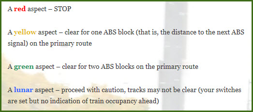
One thing to note, the signal colors are arranged in vehicular fashion, what I
call "reverse format", where the red is at the top of the signal instead of the
bottom. Baltimore signals are the same way, and when I worked there, the
reasoning I heard is that it made it easier on the operators since they were bus
drivers, to keep it the same as what they were used to. Minneapolis had
standard railroad type signals (with red on the bottom), and then at some point,
maybe around 2008, went to the reverse format too.
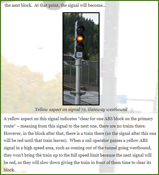
Interesting that for the yellow aspect, it does not tell the operator to slow
down and prepare to stop at the next signal, just in case the train in front of
him has not moved. Maybe it is an oversight since this is not the official
operators guide???
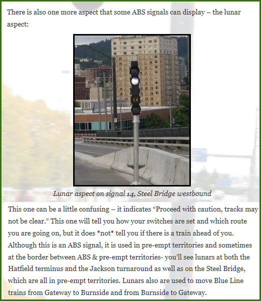
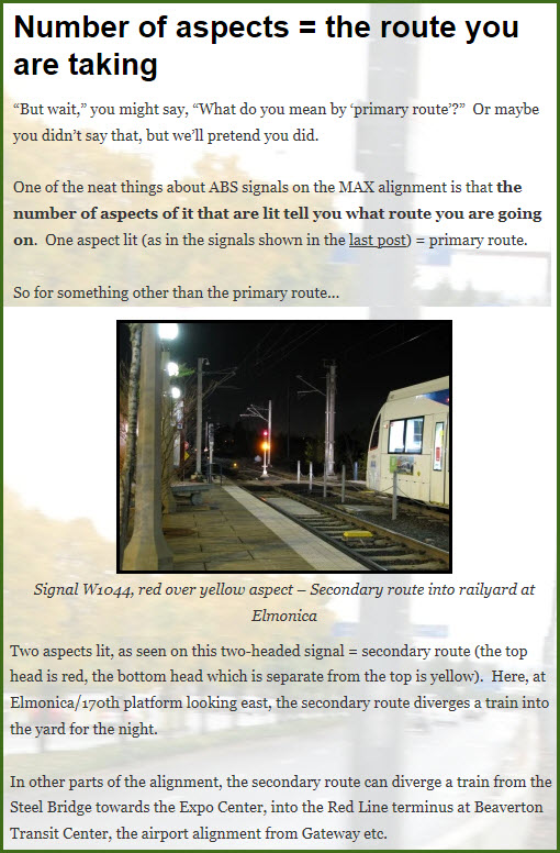
Looks like the signal has been replaced since the page was originally done in
2010. At the bottom of the bridge, you can see a switch, necessitating a lunar signal.
The single lunar signal indicates the train will be going on to the primary route.
The diverging route could be either a red/lunar, or a red/yellow according to the other screen grabs below...
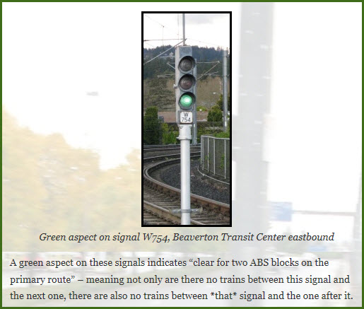
The areas shaded in green are ABS territories.
Disclaimers:
I love trains, and I love signals. I am not an expert. My webpages reflect what I find on the topic of the page. This is something I have fun with while
trying to help others.
Please Note: Since the main focus of my two websites is railroad signals, the railfan guides are oriented towards the signal fan being able to locate them.
For those of you into the modeling aspect of our hobby, my
indexa page has a list of almost everything railroad oriented
I can think of to provide you with at least a few pictures to help you detail your pike.
If this is a railfan page, every effort has been made to make sure that the information contained on this map and in this railfan guide is correct. Once in a while,
an error may creep in :-)
My philosophy: Pictures and maps are worth a thousand words, especially for railfanning. Text descriptions only get you so far, especially if you get lost or
disoriented. Take along good maps.... a GPS is OK to get somewhere, but maps are still better if you get lost! I belong to AAA, which allows you to get
local maps for free when you visit the local branches. ADC puts out a nice series of county maps for the Washington DC area, but their state maps do not have the
railroads on them. If you can find em, I like the National Geographic map book of the U.S..... good, clear, and concise graphics, and they do a really good job
of showing you where tourist type attractions are, although they too lack the railroads. Other notes about specific areas will show up on that page if known.
Aerial shots were taken from either Google or Bing Maps as noted. Screen captures are made
with Snagit, a Techsmith product... a great tool if you have never used it!
By the way, floobydust is a term I picked up 30-40 years ago from a National Semiconductor data book, and means miscellaneous
and/or other stuff.
Pictures and additional information is always needed if anyone feels inclined to take 'em, send 'em, and share 'em, or if you have something to add or correct.... credit
is always given! Please be NICE!!! Contact info is here
Beware: If used as a source, ANYTHING from Wikipedia must be treated as being possibly being inaccurate, wrong, or not true.

 Steve Morgan
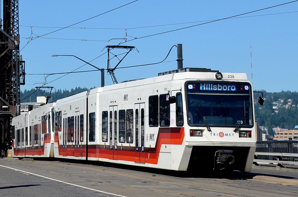 Steve Morgan, 2015
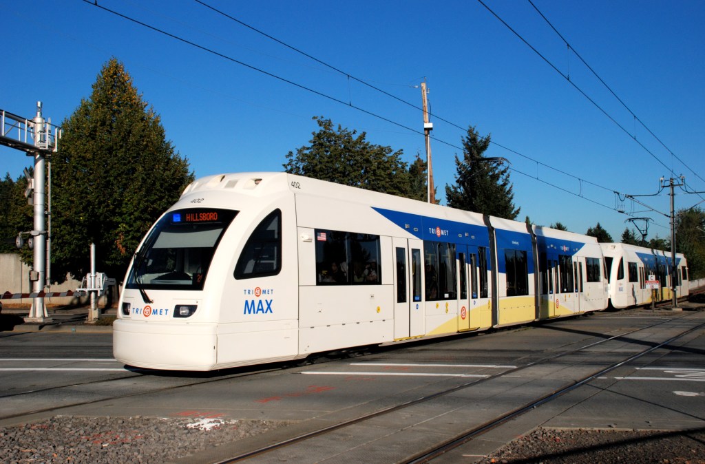 Type 4, 2009, Steve Morgan
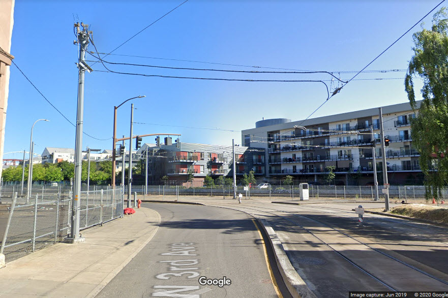


 Steve Morgan
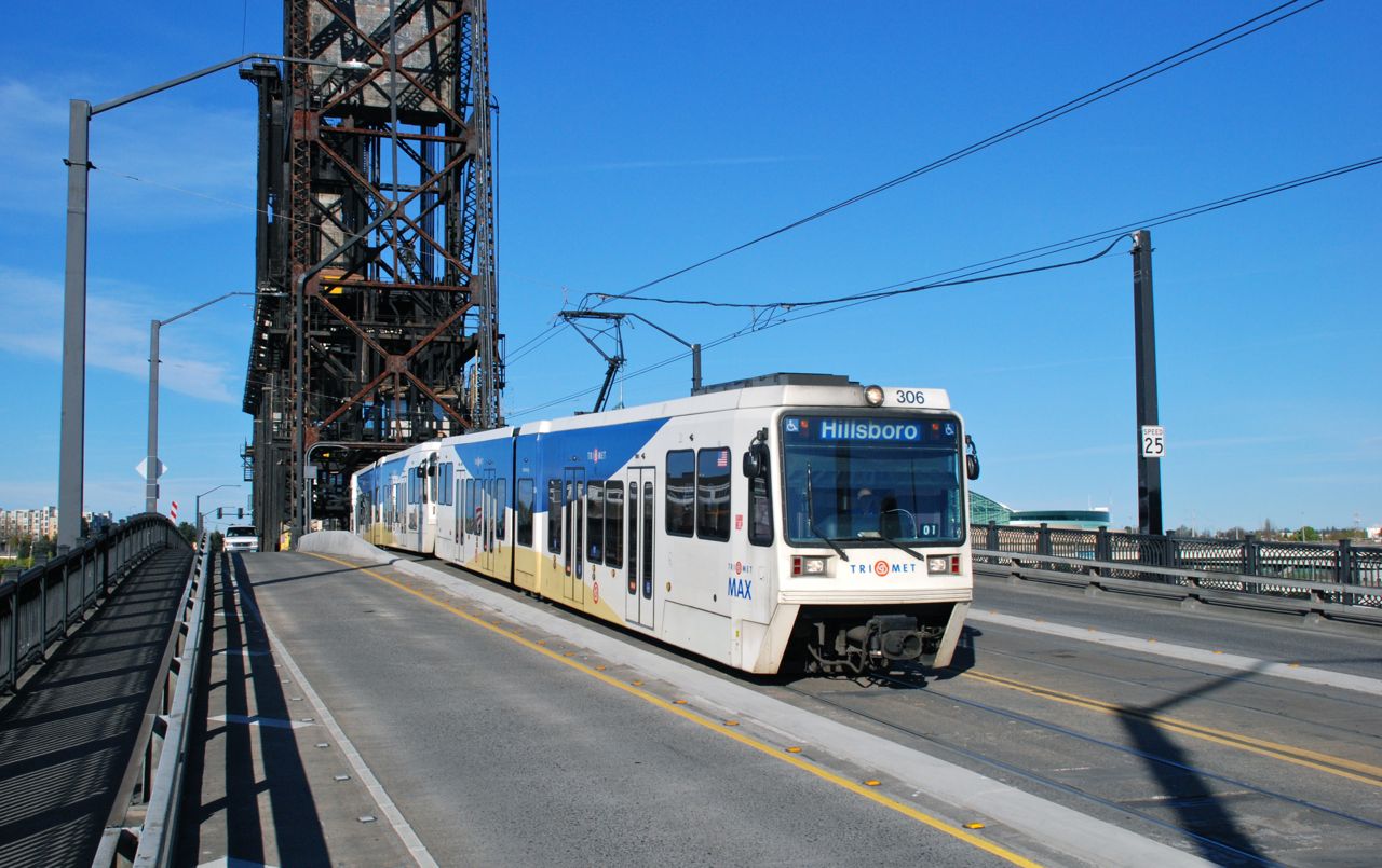 Steve Morgan, 2009
 Steverelei, 2003
 Steve Morgan, 2016
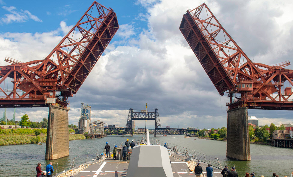
 Steve Morgan