RAILFAN GUIDES of the U.S.
Todd's Railfan Guide to
PORTLAND OR
In General
Transit
Amtrak
Non-Train Things to See
Getting Here
Surrounding Towns
Maps
USGS Map
RAILFAN GUIDES HOME
RAILROAD SIGNALS HOME
The Portland Railfan Guide is divided up into the following
sections:
Portland
Home Page - You're on this page
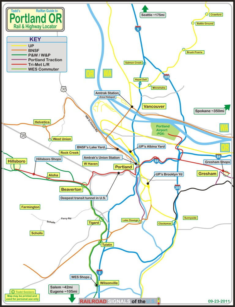
Map 1 - Amtrak
Station Area
Map 2 - UP and
the east side of the Willamette
Map 3 - BNSF
and the west side of the Willamette
Map 4 - South
of Downtown, Milwaukie
Map 8 - the
Vancouver Amtrak Station
Portland is a great railfan town, but if you have never been there before, the first thing you may notice is all the bridges that cross the Willamette River... and if you come in at dusk or later, the town is alive with color on the downtown buildings.
For railroads, you have Amtrak, the Union Pacific, BNSF, the Willamette and Pacific, and the Portland and Western.
I'm sure everyone knows of the ex Espee steamer #4449, right? Featured in the movie "Tough Guys" (1986), it's home base has been Portland since Doyle McCormick had anything to do with it (he was also it's engineer in the movie). It had been stored in an old roundhouse down in Milwaukie, or Brooklyn... in the Brooklyn Roundhouse, but since UP wants to enlarge the yard, they are breaking ground for a new home.
Another less well known railroad name, Gunderson, has it's home adjacent to the BNSF yard.
For more info on the P&W,
click here .
New maps not of my own doing and aerials are from
www.bing.com/maps and captured using
SnagIt.
Tri-Met Light Rail, Portland Streetcar, and Tri-Met WES Commuter Service
Portland has done an excellent job of providing transit service to the area. Overall, during the years 1998 to 2002, when the company I worked for was headquartered in Beaverton and I used to get there on a regular basis, the overwhelming majority of Portland seemed to be happy with the light rail service. Only a few dissenters along the route were not happy with the light rail running behind their homes, some even putting up banners saying how they were held captive in their own homes (I live next to the Baltimore Light Rail tracks, and don't feel that way).
The original section of the system, the Eastside MAX Blue line, opened on September 5th, 1986. It has 30 stations, is 15 miles in length, runs from City Center to Gresham, and cost $214M. Construction was 3/82-9/86.
The Westside MAX Blue line opened September 12th, 1998. It has 32 stations, runs 18 miles from Hillsboro to City Center, and cost $963M. Construction ran from 7/93 to 9/98.
The Airport MAX Red line opened on September 10th, 2001, has 4 stations, and is 5.5 miles long, but covers some 30 miles from PDX airport to the Beaverton Transit Center. It cost $125M, and construction was from 5/99 to 9/01.
The Interstate MAX Yellow line opened in May 1st, 2004. It has 10 (22) stations, runs 5.8 miles, and goes from the Expo Center to PSU. Construction was from 11/00 to 5/04, and cost $350M.
The MAX Green line opened in 2009, has 28 stops, and runs 14.1 miles between Clackamas and PSU. No details from the Tri-Met webpage were available for the Green line.
If you add up all of the above numbers, you will notice that it adds up to more than the number of stations the MAX has, 85.... That's because 38 stations are served by two lines, and 8 by three lines. There is a total of about 52 miles on all of the lines.
Interestingly, the system uses two different voltages. The standard 750VDC is used west of NE 9th Ave and Holladay, and 825VDC on the rest of the system... I have not come across an explanation for this since 750VDC is pretty much the standard now (600VDC WAS the standard in the old streetcar days).
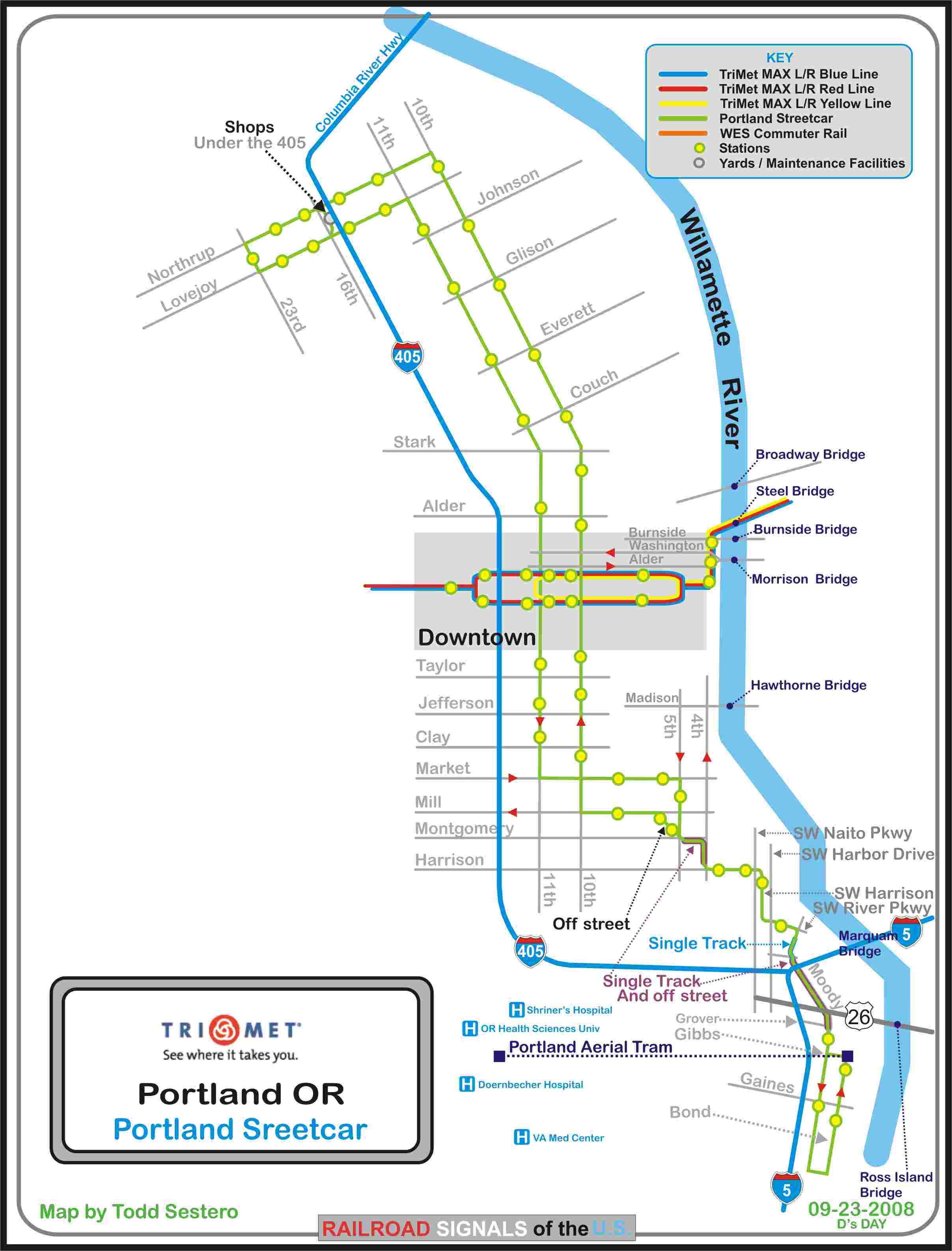
Following in Tri-Met's success with it's MAX light rail system, the Portland Streetcar opened for service in 2001. The system is owned by the city of Portland and operated by the Portland Streetcar Inc. Maintenance on the streetcars is carried out by Tri-Met personnel in the Streetcar's own shops under I-5. Being a streetcar system, the system qualifies as being the first system in the United States to order new cars since the end of WWII. The system is almost 4 miles long, but an extension is expected to open next year in 2012.
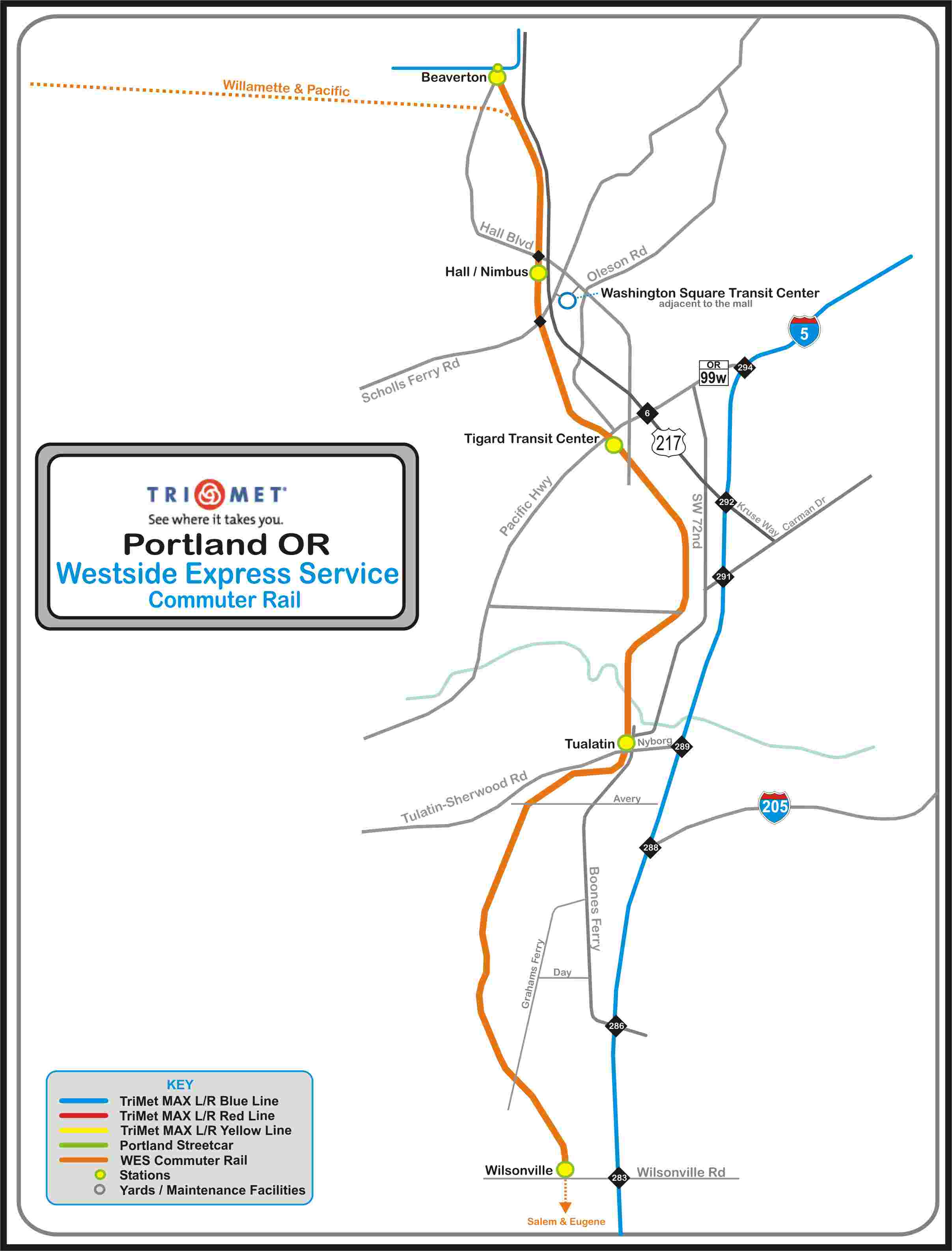
Then, in 2010, Tri-Met opened the Westside Express Service to provide commuter train service between Beaverton and Wilsonville, some 16 miles to the south. There are three intermediate stops. There is a rail-to-rail connection at Beaverton with the MAX. The trains run only during rush hours, roughly 05:20 to 09:00, and 15:30 to 19:00, no weekend service.
A lot of the above info came from: http://trimet.org/about/history/maxoverview.htm
The individual transit maps are as follows:
Portland Transit Home
MAP 2
..... the Portland Streetcar
MAP 3
..... WES - the Westside Express Service Commuter Train
MAP 4
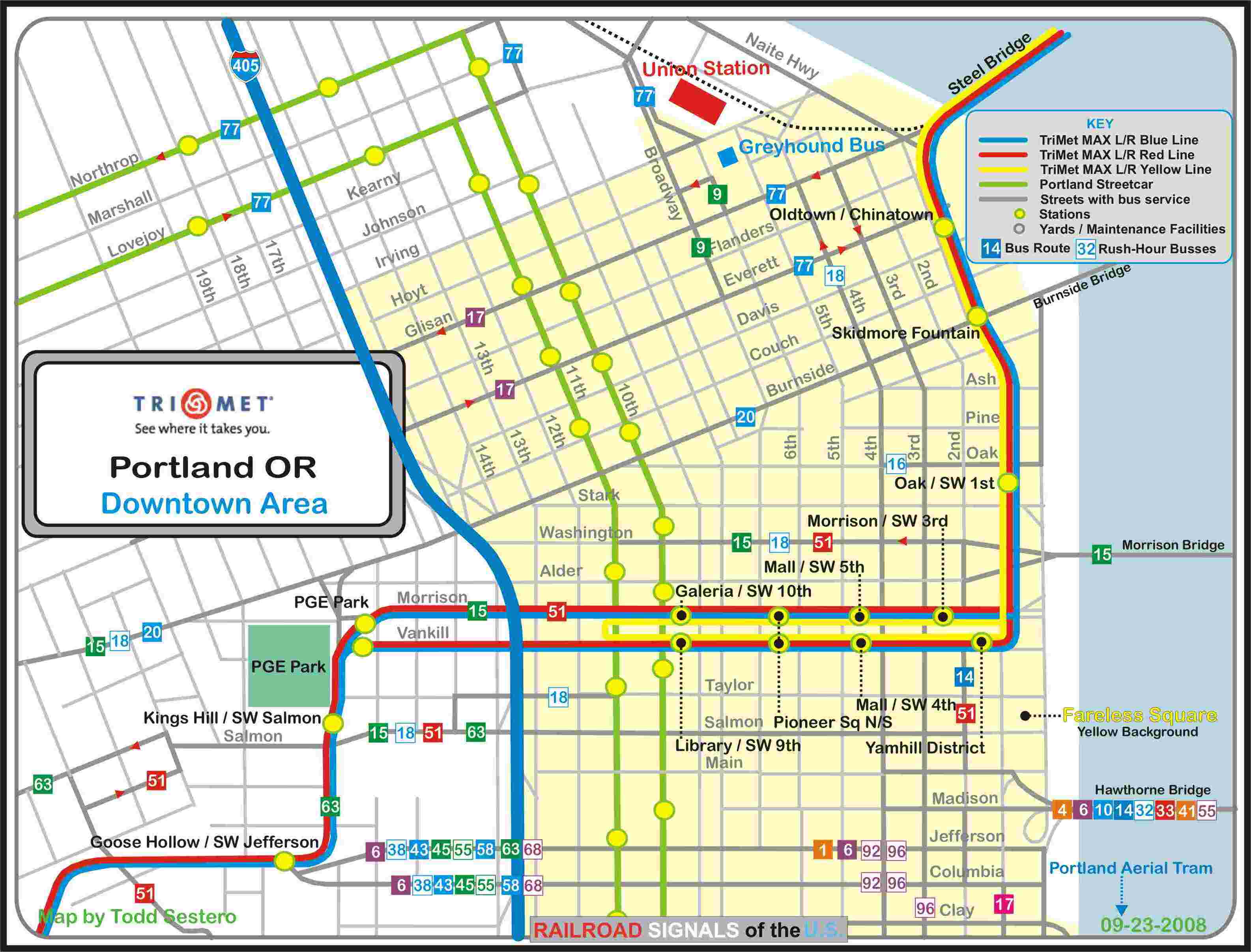
..... the Downtown Area
MAP 5
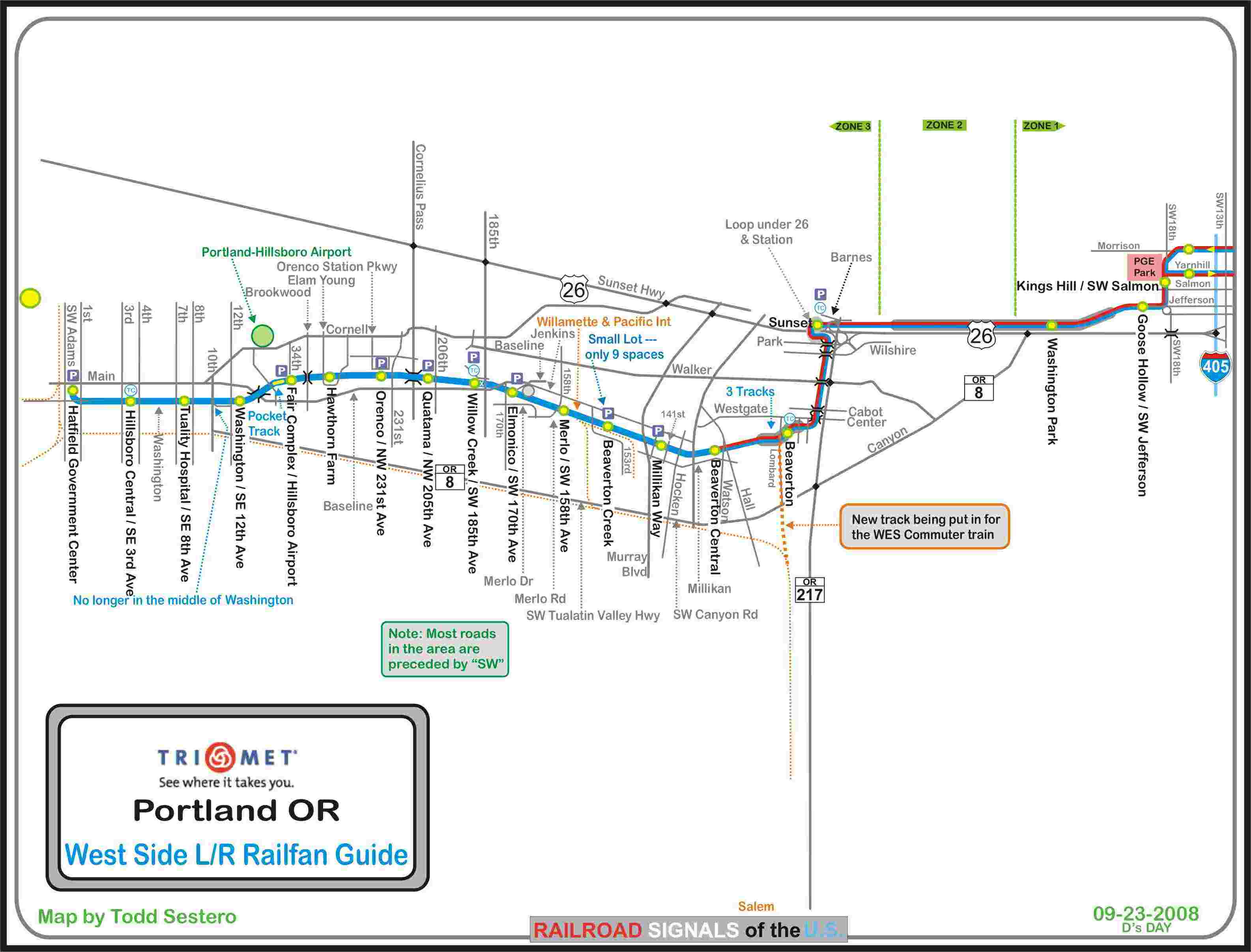
..... the Westside Light Rail Guide
MAP 6
..... the Eastside Light Rail Guide
Please note, these are only maps, and not guides, so there are no pictures or
information contained within.
All of the maps are available here as a PDF
Amtrak has three trains servicing
Union Station:
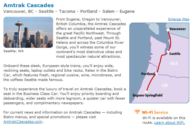
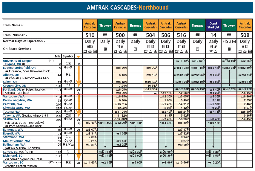
The Amtrak Cascades, covering Vancouver BC to Eugene OR
(about 90 miles south of Portland).
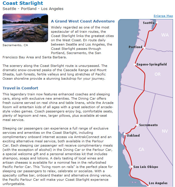
The Coast Starlight, going from Seattle WA to Los
Angeles CA.
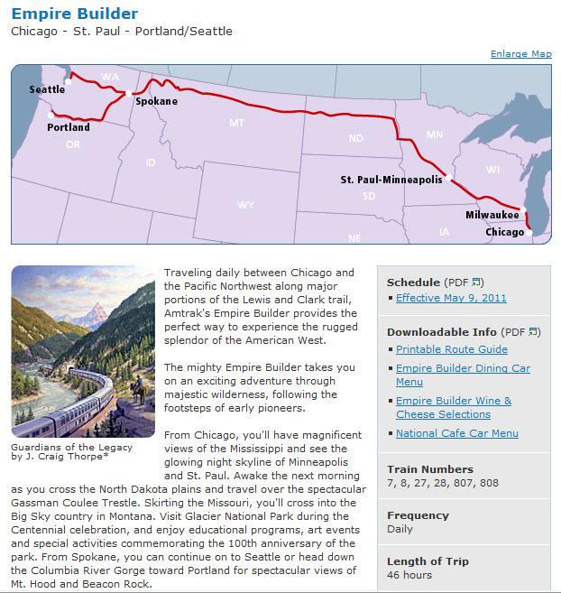
The Empire Builder, going from Portland to Chicago via
Spokane WA (one of two routes, the other going to Seattle WA)
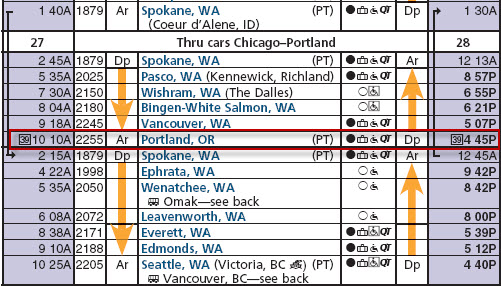
The Portland section of the Empire Builder:
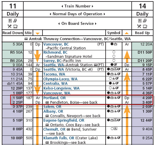
The Coast Starlight:
The Amtrak Cascades:

Portland Trivia and Non Train Things to See
The most common nickname for Portland is The City of Roses, and it became the official nickname in 2003.
TV people you may know that hail from Portland are Matt Groening (the Simpsons), Sam Elliot, and Sally Struthers. Musically, the Kingsmen and Paul Revere and the Raiders are from Portland. Quite a few TV shows and movies have been filmed in Portland, whole or in part.
OMSI, the Oregon Museum of Science and Industry has an OMNIMAX theater and the USS Blueback, a submarine used in the filming of The Hunt For Red October.
The Portland Rose Festival takes place in June.
Powell's City of Books claims to be the largest independent book store in the U.S. and the largest bookstore west of the Mississippi.
The major malls in the area are: Bridgeport Village, Clackamas Town Center, Pioneer Place, Lloyd Center, Washington Square, and Vancouver Mall.
If you are into beer, Portland is famous for it's microbreweries, and boosts the largest number of them in the U.S., over 40!... CNBC named Portland the best town in the states for happy hour.
Portland, despite it being 80 miles upriver from the coast, is the largest shipper of wheat in the United States, and the second largest wheat port in the world.
Portland has it's very own cable cars, the Portland Aerial Tram, which takes off from the South Waterfront, and climbs the hill to the Oregon Health & Science University on Marquam Hill overlooking the city (it can be found on my Portland Streetcar map).
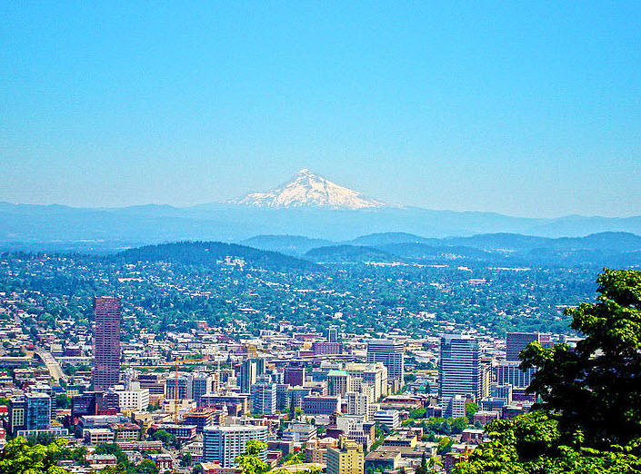
Mt Hood can be seen from the surrounding hills, and it is about 40 miles to the east.
Mt. Saint Helens is about 65 miles to the north east.
Getting Here Being at the junction of I-5, running north and south, and I-84, heading east
out of town, Portland is an easy town to access from the interstates.
Vancouver
Vancouver is on the other side of the Willamette River from Portland, and seems to be a favorite spot for railfans who want to just sit and watch the trains come by. From the station platform, you can look straight down the bridge coming over from Portland, and offers the opportunities for some nice shots.
Salem
Salem is less than an hours drive south of Portland straight down I-5. It is the capitol of Oregon, and has one of the newer state capitol buildings being completed in 1938. The preceding capitol building (the second) was destroyed by fire in 1935. The town also has a more modern train station, which Amtrak stops at on it's way south. It is the states third largest city after Portland and Eugene. Salem is home to four correctional facilities, including the states only maximum security prison (lucky them :-). The film One Flew Over the Cuckoo's Nest was filmed at the Oregon State Hospital. The Salem area has quite a few wineries and vineyards, and the oldest one in Oregon is here, Honeywood Winery.
BNSF has a small yard in town, and the Willamette & Pacific's shops are also here.
Eugene
Eugene is about two hours south of Portland, and is the state's second largest
city. Eugene, back in the Southern Pacific days was home to the infamous
tunnel motor geeps, as part of the helper facility there. The Central
Oregon and Pacific RR now maintains engines in part of the Espee yard.
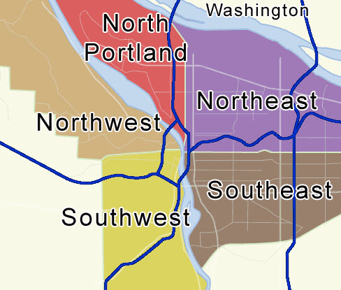
The "quadrants" of Portland, from Wikipedia.
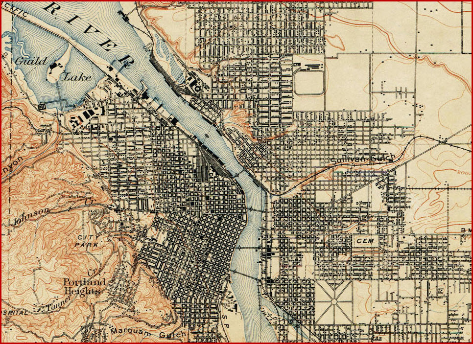
Courtesy of the University of Texas Library, click here for their index page. 1896 Portland quadrangle.
Disclaimers:
I love trains, and I love signals. I am not an expert. My webpages reflect what I find on the topic of the page. This is something I have fun with while trying to help others. My webpages are an attempt at putting everything I can find of the subject in one convenient place. There are plenty of other good websites to help me in this effort, and they are listed in the links section on my indexa page, or as needed on individual pages. Please do not write to me about something that may be incorrect, and then hound the heck out of me if I do not respond to you in the manner you would like. I operate on the "Golden Rule Principle", and if you are not familiar with it, please acquaint yourself with how to treat people by reading Mathew 7:12 (among others, the principle exists in almost every religion). If you contact me (like some do, hi Paul) and try to make it a "non-fun" thing and start with the name calling, your name will go into my spambox list! :-)
Please Note: Since the main focus of my two websites is railroad signals, the railfan guides are oriented towards the signal fan being able to locate them. For those of you into the modeling aspect of our hobby, my indexa page has a list of almost everything railroad oriented I can think of to provide you with at least a few pictures to help you detail your pike.
If this is a railfan page, every effort has been made to make sure that the information contained on this map and in this railfan guide is correct. Once in a while, an error may creep in, especially if restaurants or gas stations open, close, or change names. Most of my maps are a result of personal observation after visiting these locations. I have always felt that a picture is worth a thousand words", and I feel annotated maps such as the ones I work up do the same justice for the railfan over a simple text description of the area. Since the main focus of my website is railroad signals, the railfan guides are oriented towards the signal fan being able to locate them. Since most of us railheads don't have just trains as a hobby, I have also tried to point out where other interesting sites of the area are.... things like fire stations, neat bridges, or other significant historical or geographical feature. While some may feel they shouldn't be included, these other things tend to make MY trips a lot more interesting.... stuff like where the C&O Canal has a bridge going over a river (the Monocacy Aqueduct) between Point of Rocks and Gaithersburg MD, it's way cool to realize this bridge to support a water "road" over a river was built in the 1830's!!!
My philosophy: Pictures and maps are worth a
thousand words, especially for railfanning. Text descriptions only
get you so far, especially if you get lost or disoriented. Take
along good maps.... a GPS is OK to get somewhere, but maps are still
better if you get lost! I belong to AAA, which allows you to get
local maps for free when you visit the local branches. ADC puts
out a nice series of county maps for the Washington DC area, but their
state maps do not have the railroads on them. If you can find em,
I like the National Geographic map book of the U.S..... good, clear, and
concise graphics, and they do a really good job of showing you where
tourist type attractions are, although they too lack the railroads.
Other notes about specific areas will show up on that page if known.
Pictures and additional information is always needed if anyone feels
inclined to take 'em, send 'em, and share 'em, or if you have
something to add or correct.... credit is always given! BE NICE!!! Contact info
is here
Beware: If used as a source, ANYTHING from Wikipedia must be treated as being possibly being inaccurate, wrong, or not true.
RAILFAN GUIDES HOME
RAILROAD SIGNALS HOME
New 10/15/2011
last Modified:
03 Jul 2014