What's Here:
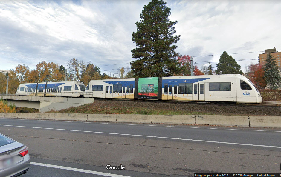
TriMet MAX Light Rail
The Steel Bridge
Double Track Wye
Amtrak - across the river
Portland Streetcar - across the river
Data:
GPS Coordinates: as needed
Phone A/C: 503
ZIP: n/a
Access by train/transit:
Light Rail
Amtrak
Portland Streetcar
The Scoop:
This section of the Portland Transit guide covers the MAX Light Rail system from
the Willamette River and the Steel Bridge, to the Gateway Center, where the
Blue, Red, and Green lines go their separate ways - the Red line goes north
to the Airport, the Green line goes south to Clackamas, and the Blue line runs
east into Gresham.
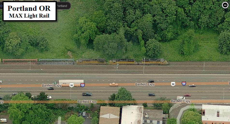
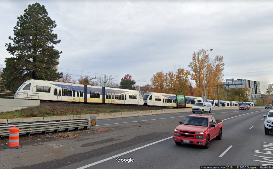
From 16th Ave east, the line parallels I-84 and the Union Pacific, and if
you are at the Hollywood station, and lucky, you could catch a passing freight.
I know it is covered elsewhere in the transit and the train sections of my
guides, but we will start at the river with the Steel Bridge.
Acknowledgements:
Denver Todd
Pi.1415926535
Google Maps
Bing Maps
To get out of the downtown Portland area heading east, the
four light rail lines cross the Willamette using the Steel Bridge. The two
tracks cross the bridge in the middle, and share the space with vehicular
traffic.... quite a unique arrangement.
Light Rail Wye/Junction
This wye is a double track junction between all of the
lines and allows the yellow line to head north. Although it is technically
a wye, it is not used as such as in conventional railroading, it just allows
trains to go from any branch to any other.
Rose Quarter Station
GPS Coordinates: 45.530161, -122.665406
The light rail portion of the transit center is located under I-5, making really good pictures darn near impossible.
photo: Pi.1415926535
Convention Center Station
GPS Coordinates: 45.530089, -122.662128
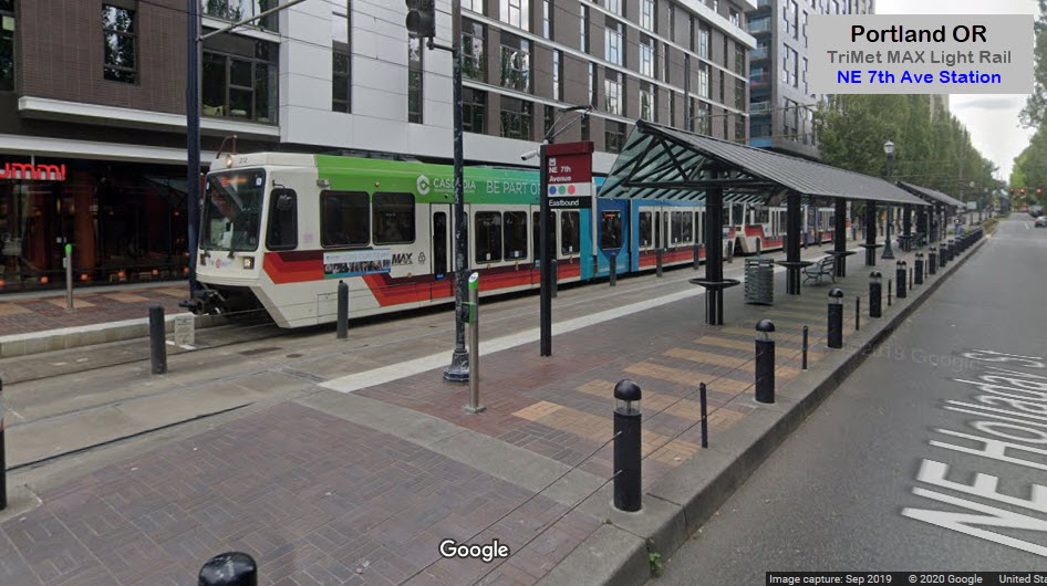
NE 7th Ave Station
GPS Coordinates: 45.530075, -122.654215
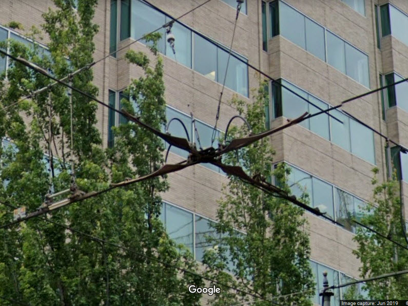
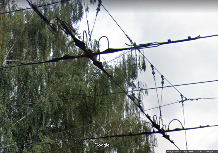
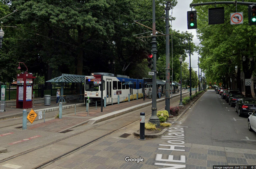
Here at Holladay and 7th, we have several other items of interest....
Bar signal for the Portland Streetcar
MAX train coming sign
A couple pictures of the trolley wire junction between the light rail and
Portland Streetcar lines at 7th and Holladay.
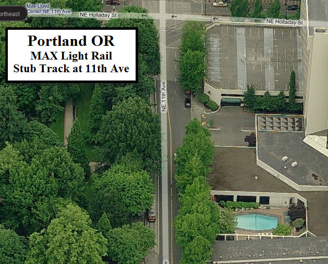
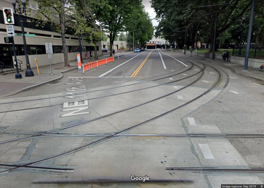
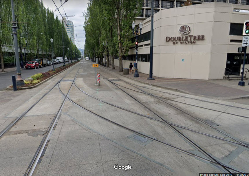
11th Ave Stub Track
This stub track is used as a turnaround for trains coming
out of the downtown area, and as such, can only be accessed by cars going
eastbound. The Bing Maps picture below is upside down, and gives the best
view from Bing. It shows a historic trolley sitting on the stub.
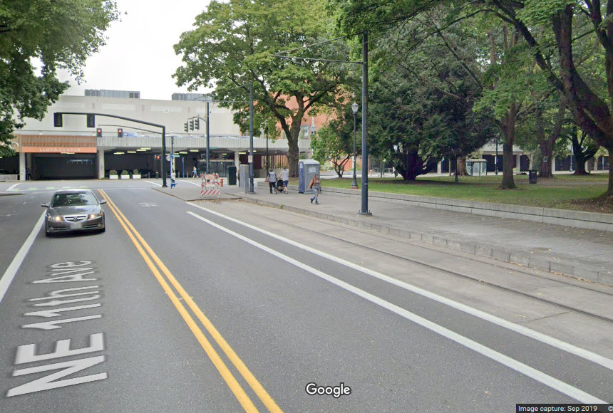
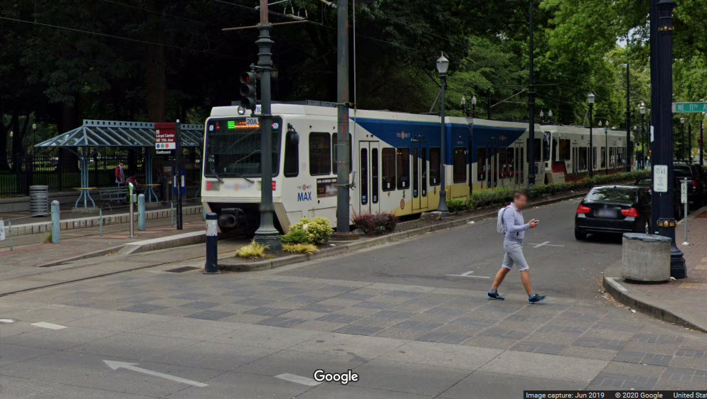
Lloyd Center/NE 11th Ave Station
GPS Coordinates: 45.530075, -122.654215
The Double Tree hotel is across 11th Ave from the station, making it convenient if you don't have a car!
End of Street Running on Holladay St
GPS Coordinates: 45.530097, -122.652455
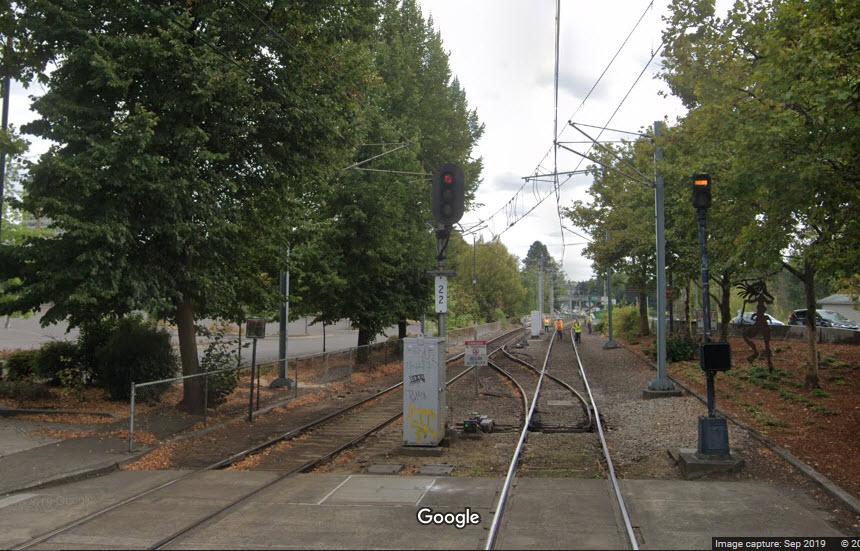
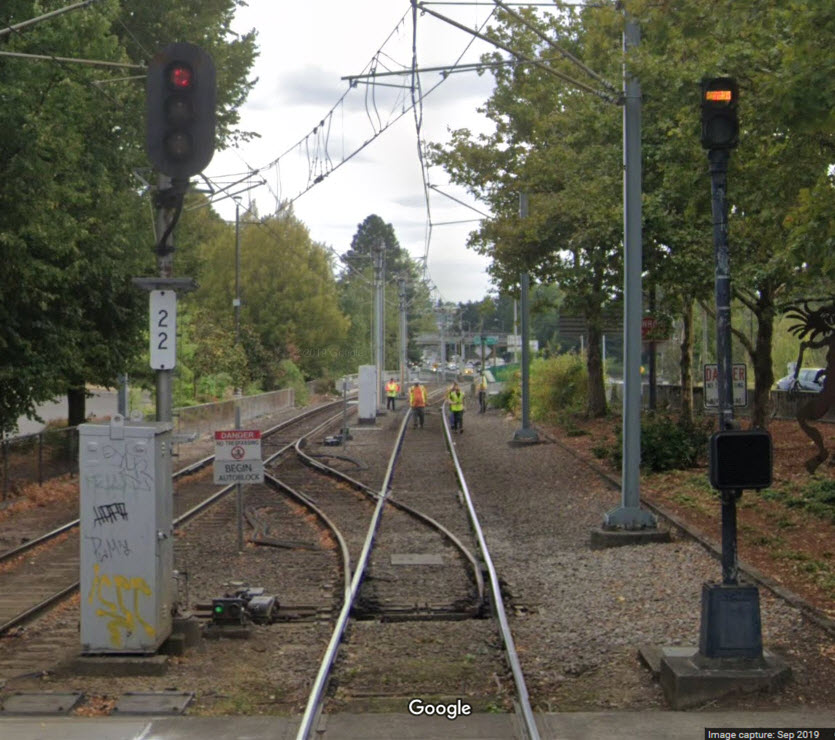
Holladay street is one way going east here. Just after this, going
eastward, the tracks cross 16th St and the UP. There is also a single
crossover here.
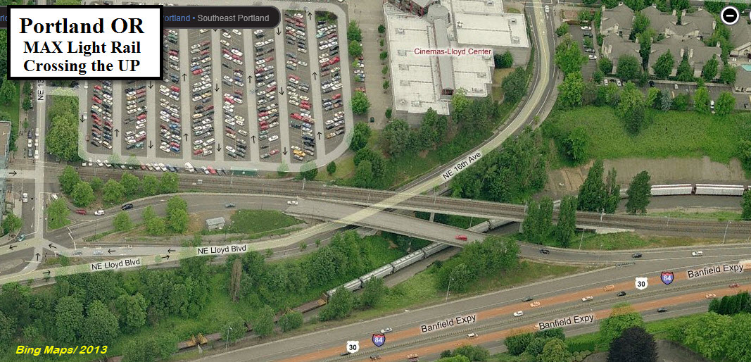
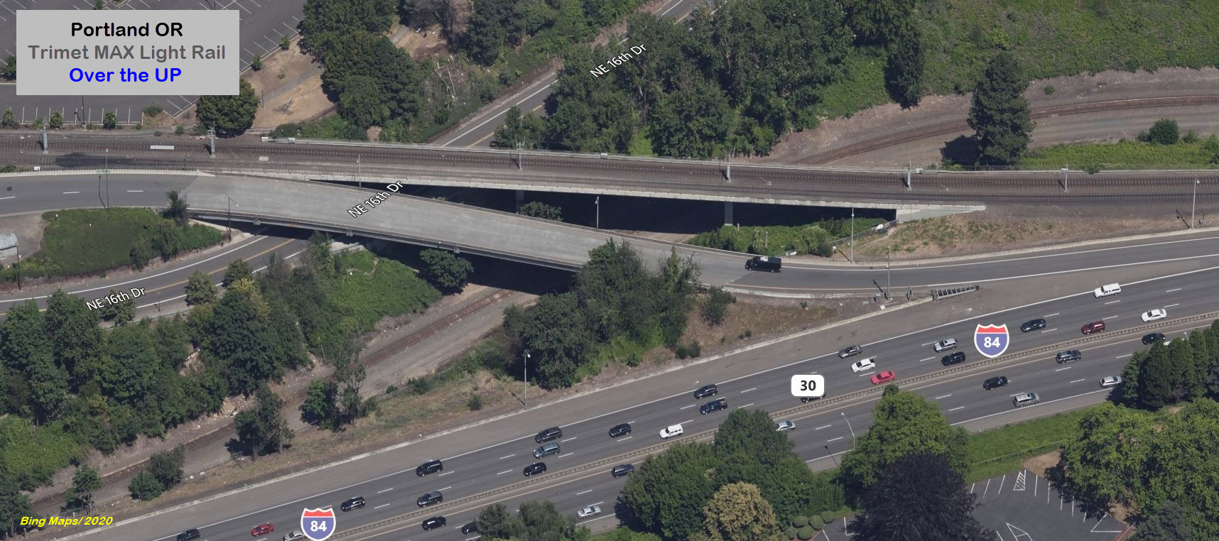
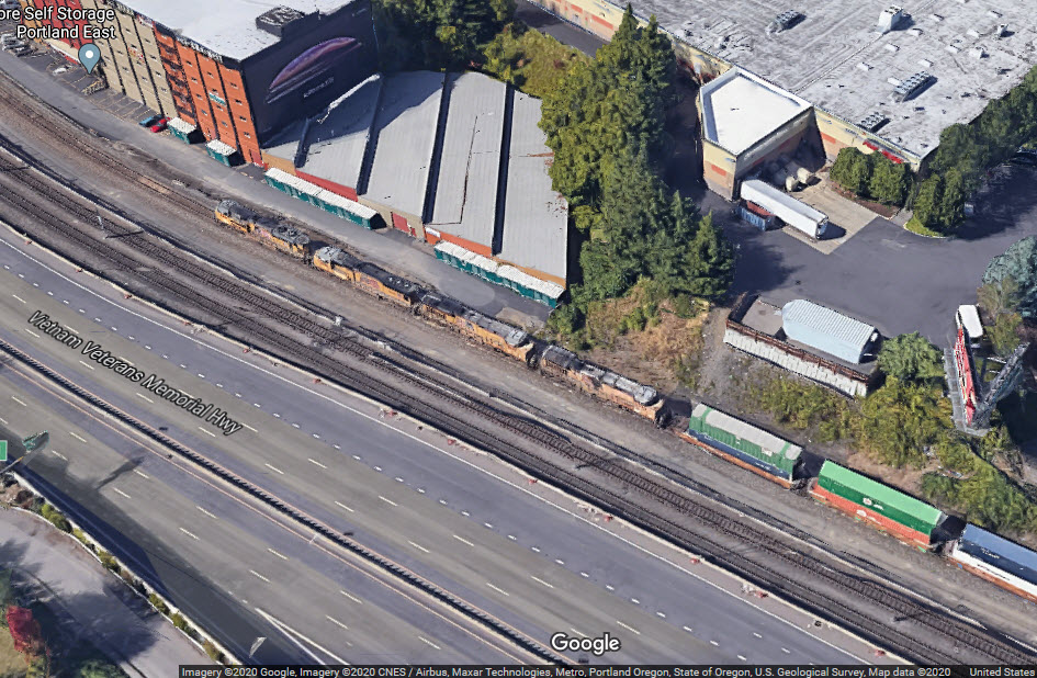
Crossing the Union Pacific
Just east of NE 13th Ave, the ROW crosses the UP tracks and then runs between I-84 and the UP.
Luck
If you take a ride on the MAX, you may be lucky enough to pass a UP freight running alongside you.
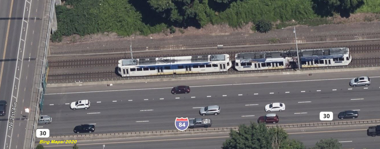
Once in a while we are luck when the Bing airplanes catch something in action, here, a train just went under NE 21st Ave....
Here at the exit ramp from WB I-84 going onto Lloyd Blvd (exit 1), Google catches three trains in different views.
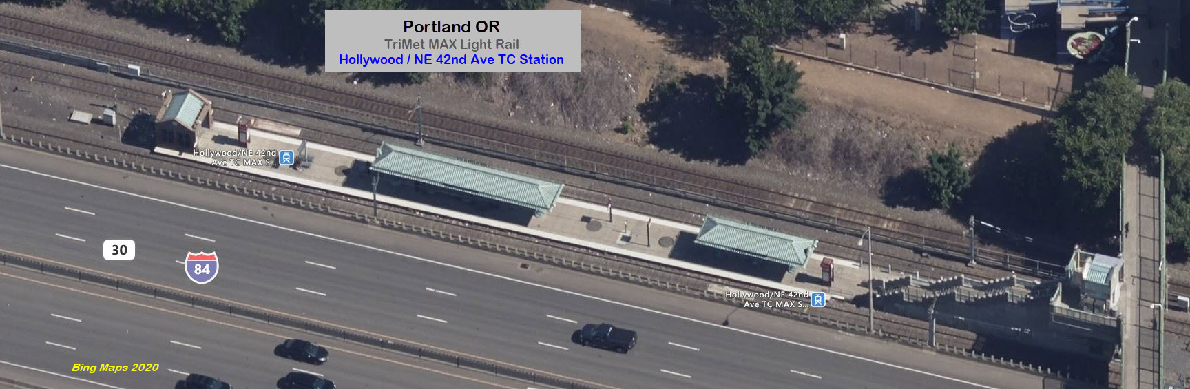
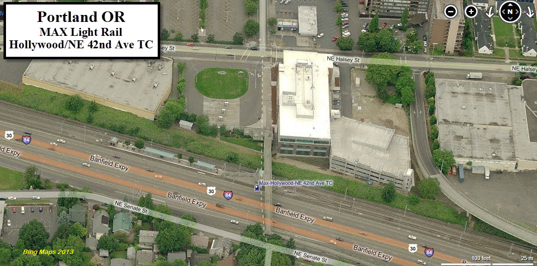
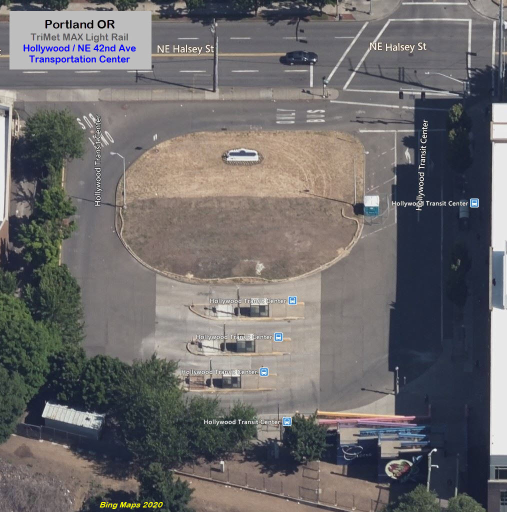
Hollywood / NE 42nd Ave TC Station and Pocket Track
GPS Coordinates: 45.532871, -122.621070
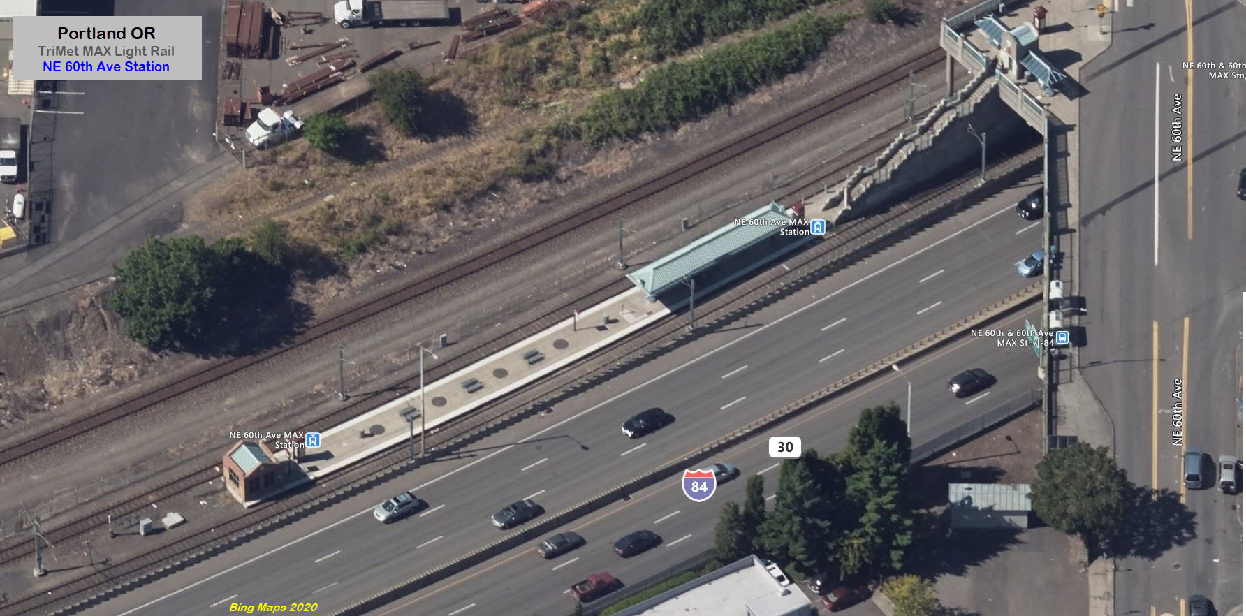
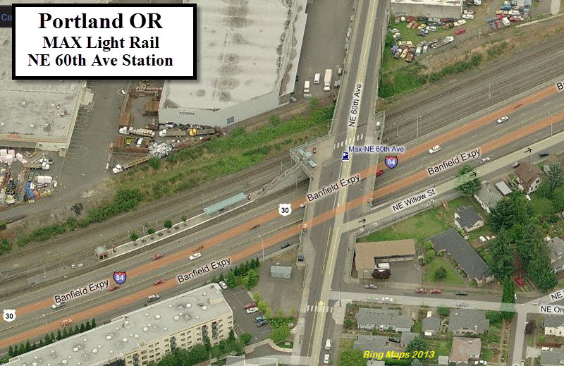
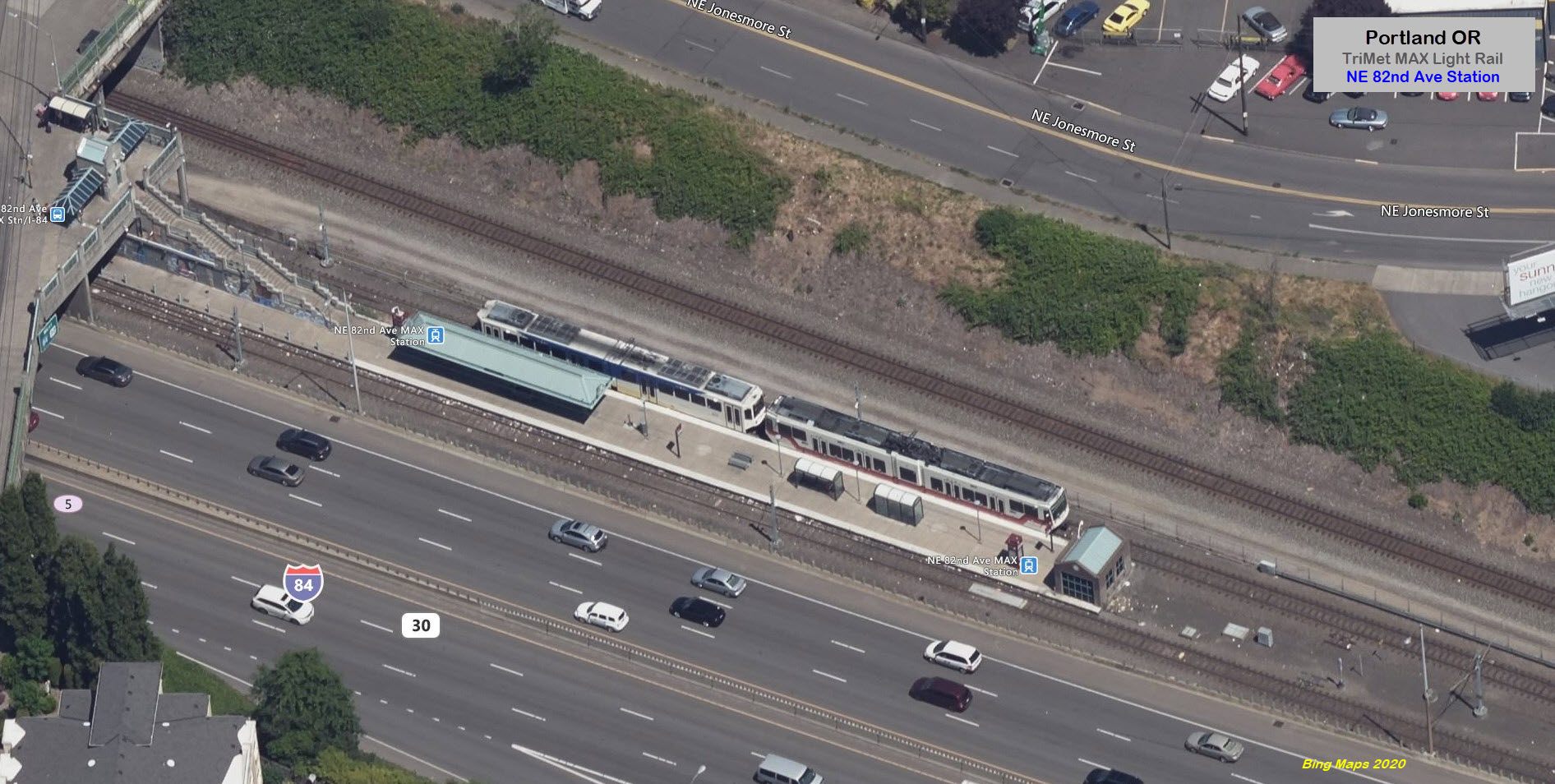
This station is typical of the three MAX stations along
I-84 (42nd, 60th, and 82nd). In addition, there is a transit center to the
north, and a pocket track to the east of the station.
NE 60th Ave Station
GPS Coordinates: 45.528697, -122.602869
NE 82nd Ave Station
GPs Coordinates: 45.533415, -122.578231
A Days Inn by Wyndham is nearby, a Comfort Inn is across the interstate, and
there are numerous places to eat in the vicinity.
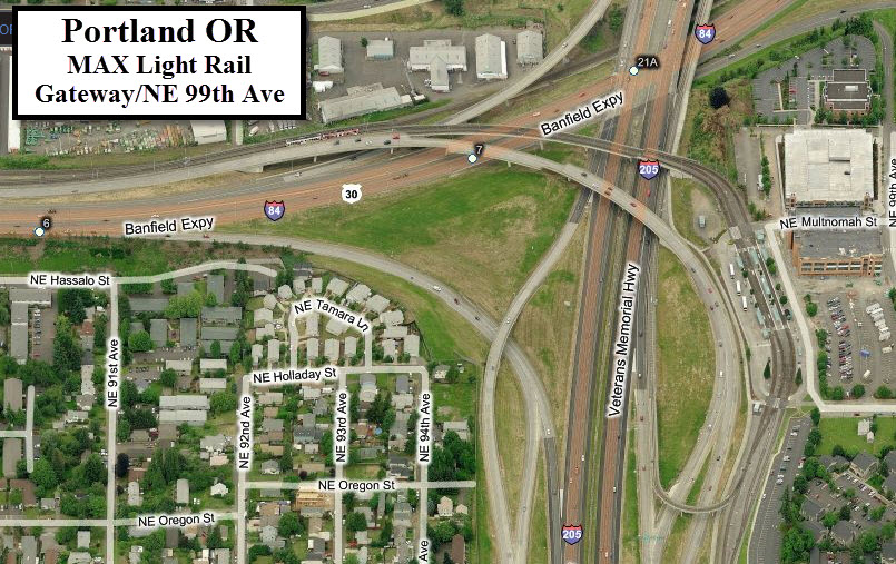
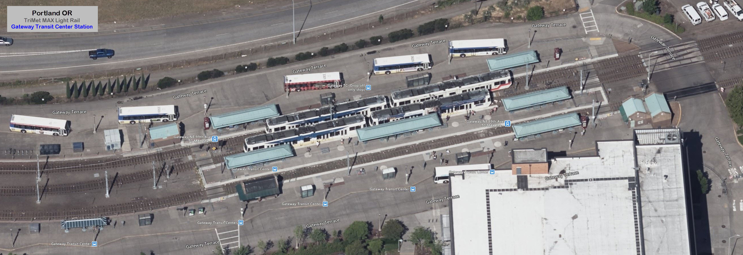
Gateway / NE 99th Ave Station
GPS Coordinates: 45.530592, -122.563583
Gateway station marks another division point in the system.
The Blue and Green line continue south from here, but the Red line loops around,
deals with a pretty good grade to loop back under itself and head north along
I-205 on it's way to the Portland Airport.
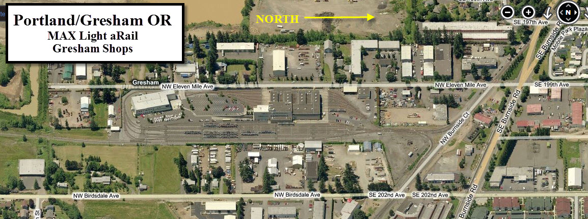
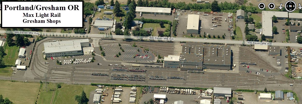
Gresham Shops
Three stops from the end, you will find the Gresham Shops
off 202nd Ave. Using my contacts from working at the light rail system in
Baltimore, I was able to tour the facility in 1998 when in town for a job
interview... one of these days, I will have to scan the slides from that trip.
Disclaimers:
I love trains, and I love signals. I am not an expert. My webpages reflect what I find on the topic of the page. This is something I have fun with while
trying to help others.
Please Note: Since the main focus of my two websites is railroad signals, the railfan guides are oriented towards the signal fan being able to locate them.
For those of you into the modeling aspect of our hobby, my
indexa page has a list of almost everything railroad oriented
I can think of to provide you with at least a few pictures to help you detail your pike.
If this is a railfan page, every effort has been made to make sure that the information contained on this map and in this railfan guide is correct. Once in a while,
an error may creep in :-)
My philosophy: Pictures and maps are worth a thousand words, especially for railfanning. Text descriptions only get you so far, especially if you get lost or
disoriented. Take along good maps.... a GPS is OK to get somewhere, but maps are still better if you get lost! I belong to AAA, which allows you to get
local maps for free when you visit the local branches. ADC puts out a nice series of county maps for the Washington DC area, but their state maps do not have the
railroads on them. If you can find em, I like the National Geographic map book of the U.S..... good, clear, and concise graphics, and they do a really good job
of showing you where tourist type attractions are, although they too lack the railroads. Other notes about specific areas will show up on that page if known.
Aerial shots were taken from either Google or Bing Maps as noted. Screen captures are made
with Snagit, a Techsmith product... a great tool if you have never used it!
By the way, floobydust is a term I picked up 30-40 years ago from a National Semiconductor data book, and means miscellaneous
and/or other stuff.
Pictures and additional information is always needed if anyone feels inclined to take 'em, send 'em, and share 'em, or if you have something to add or correct.... credit
is always given! Please be NICE!!! Contact info is here
Beware: If used as a source, ANYTHING from Wikipedia must be treated as being possibly inaccurate, wrong, or not true.
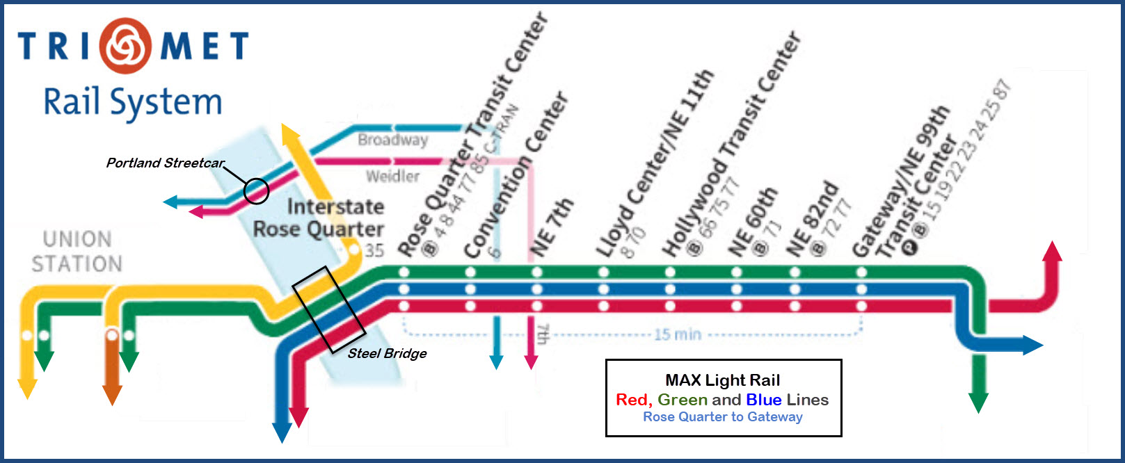
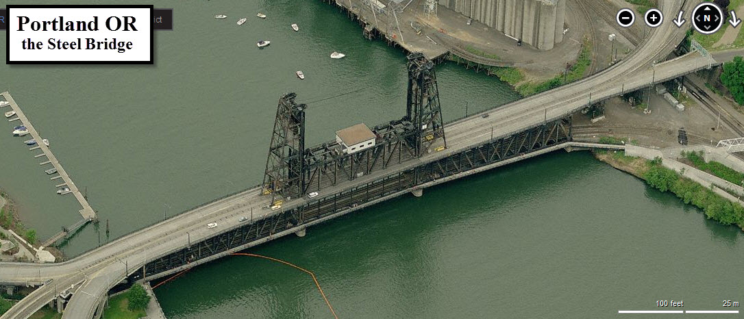
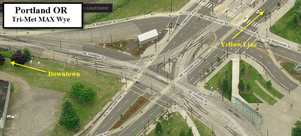
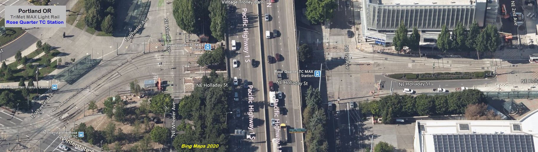
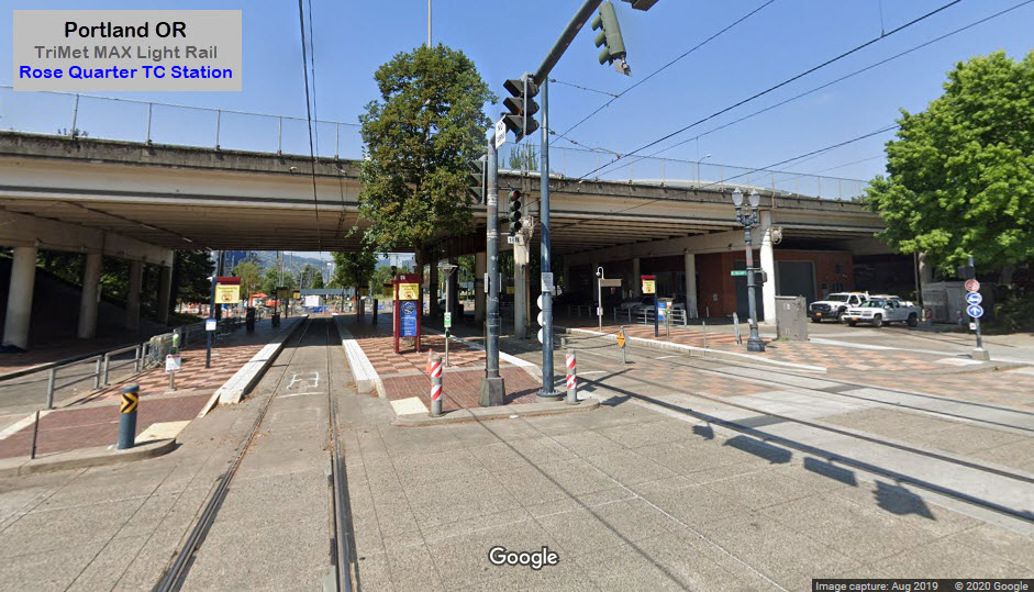
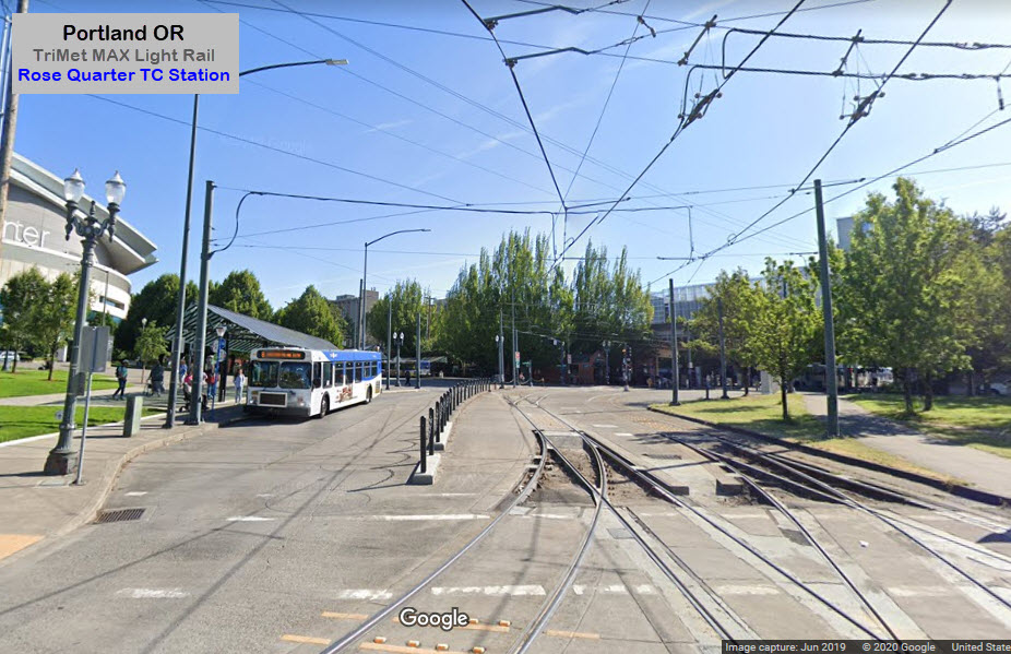
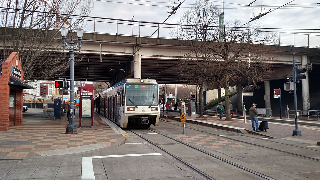 photo: Pi.1415926535
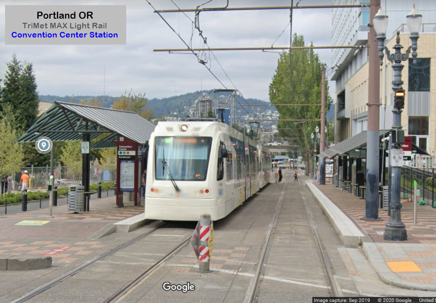
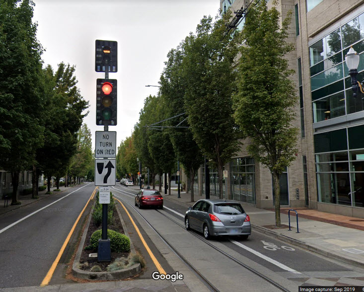 Bar signal for the Portland Streetcar
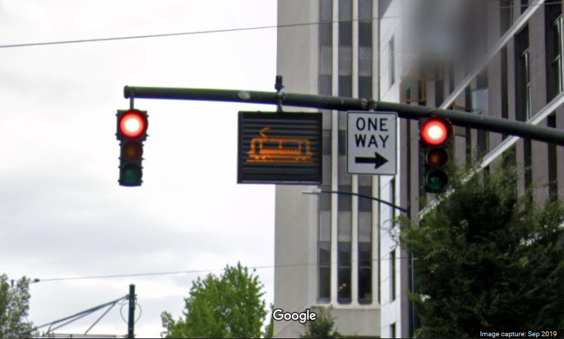 MAX train coming sign