Location / Name:
Hunt Valley, Baltimore County MD
Cockeysville, Baltimore County MD
What's Here:
Former R-O-W of the Baltimore & Susquehanna RR (the 2nd railroad in Baltimore), and later the Northern Central, Pennsy, PC, Conrail, and NS
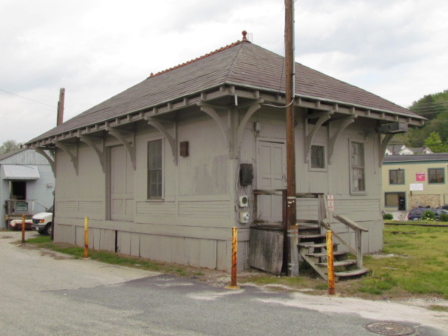
Former PRR freight shed (Cockeysville)
5 Light Rail stations
B&S marble stringers (ties)
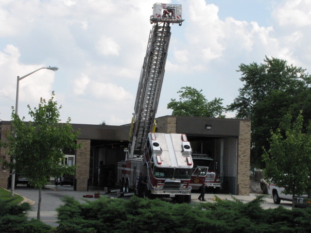
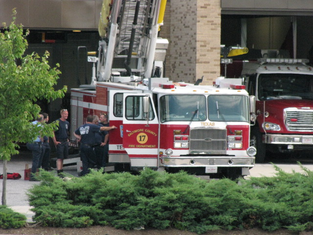
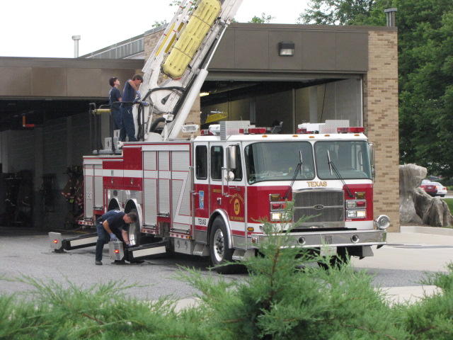
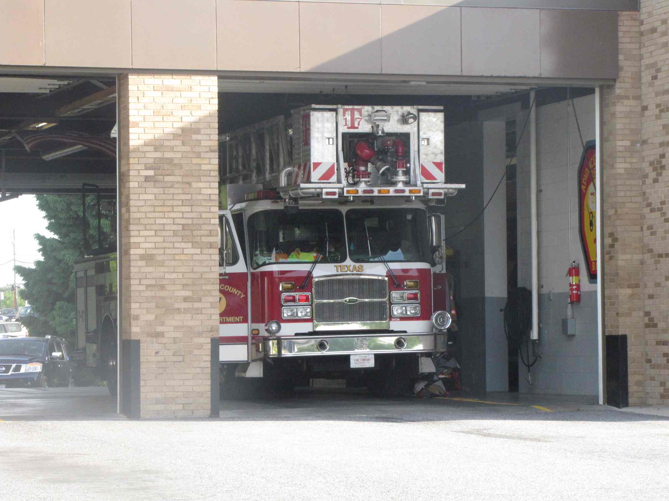
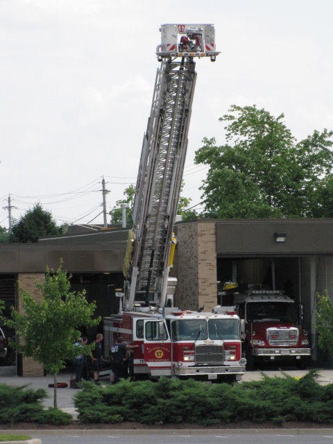
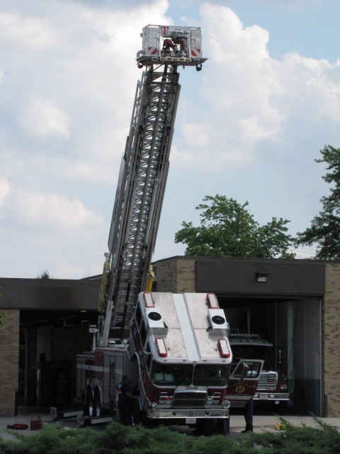
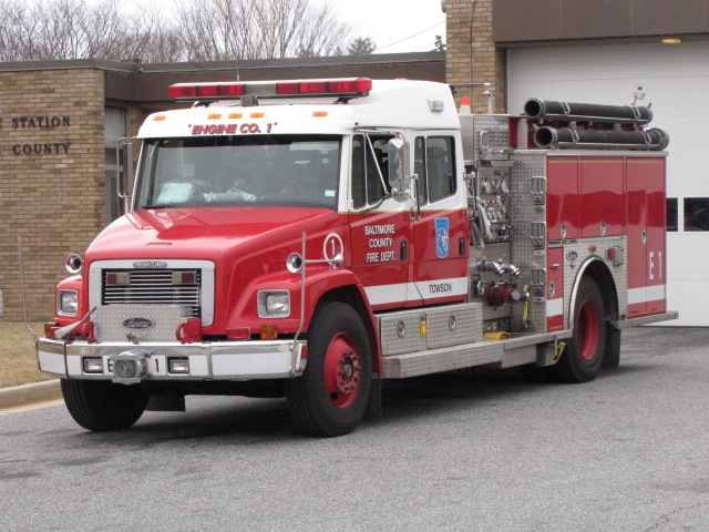
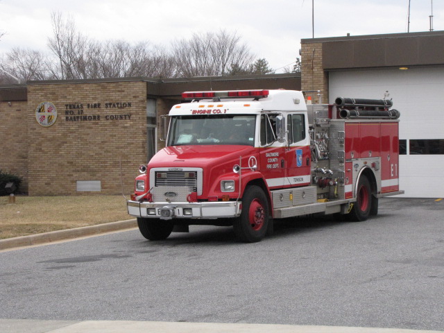
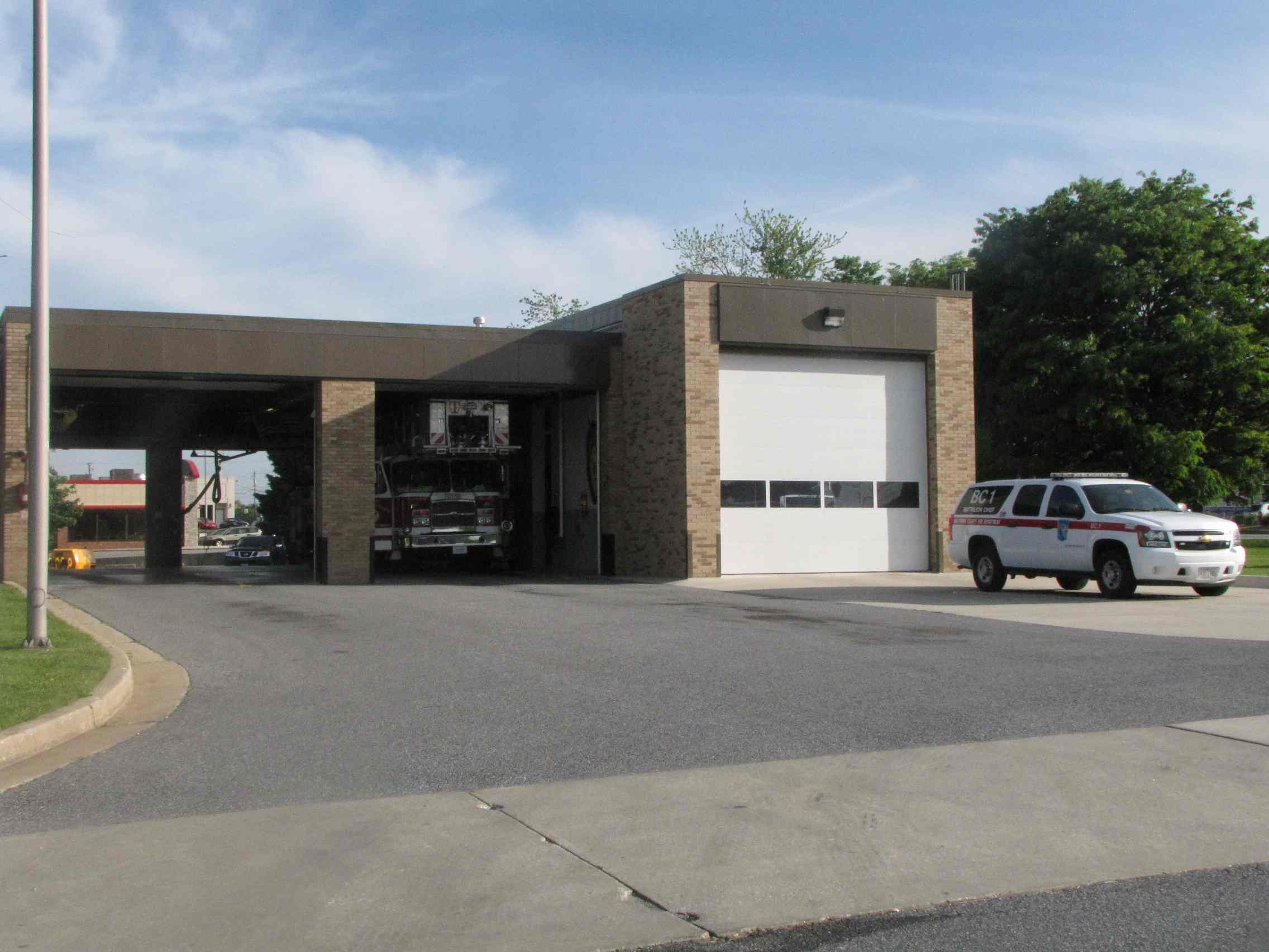
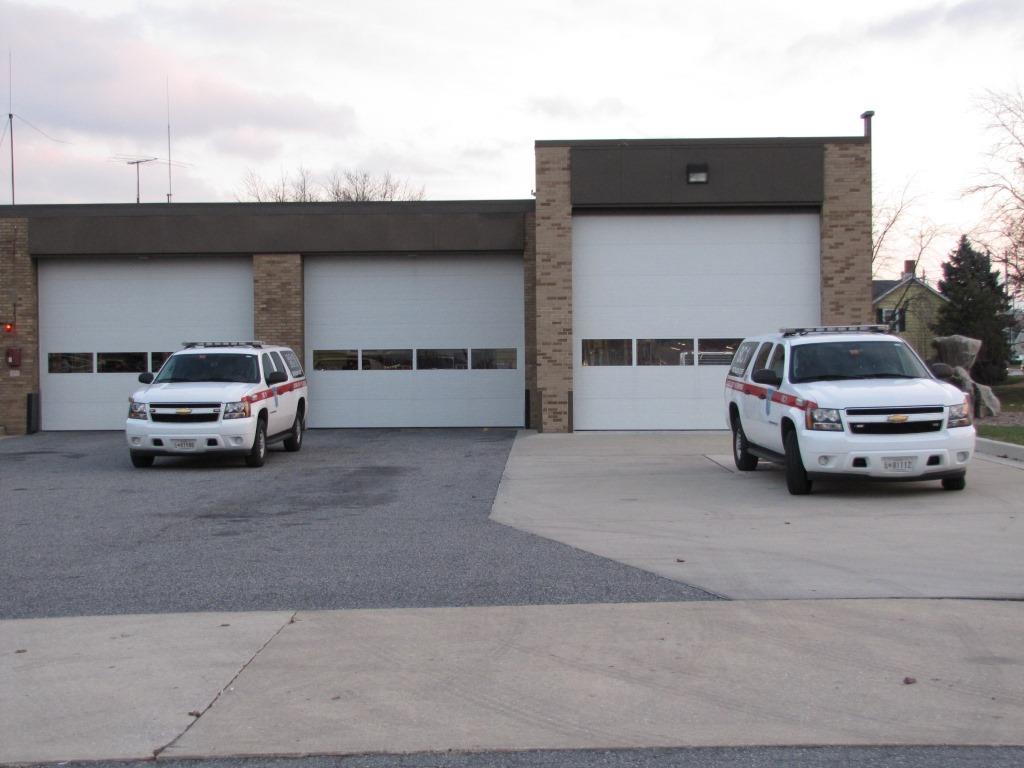
Fire stations:
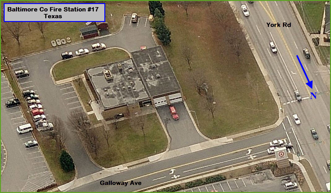
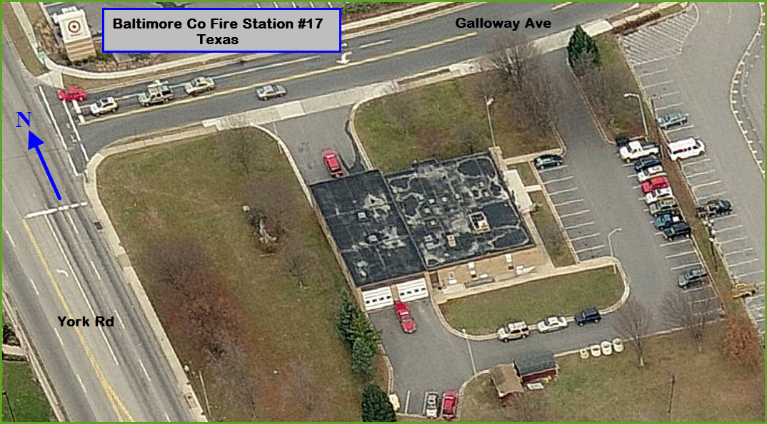
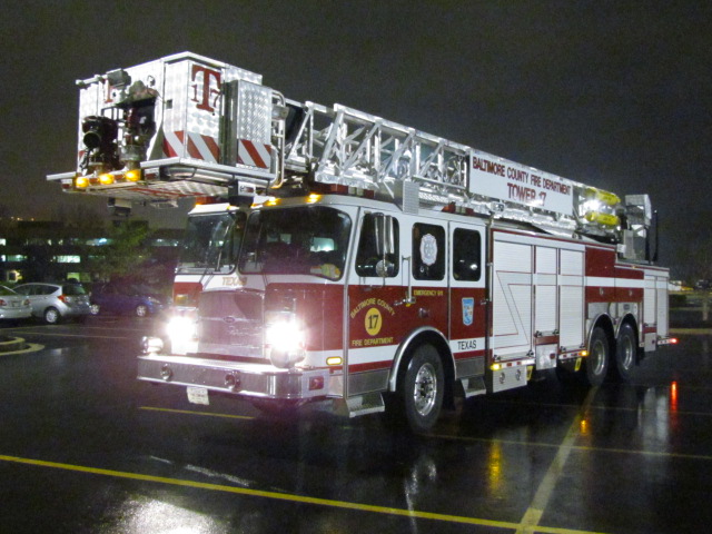
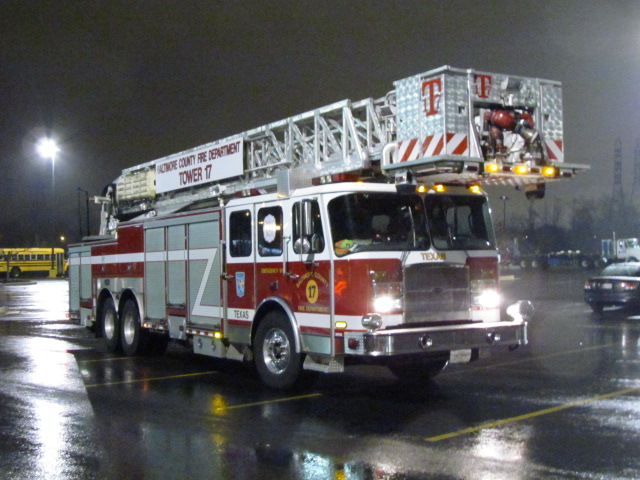
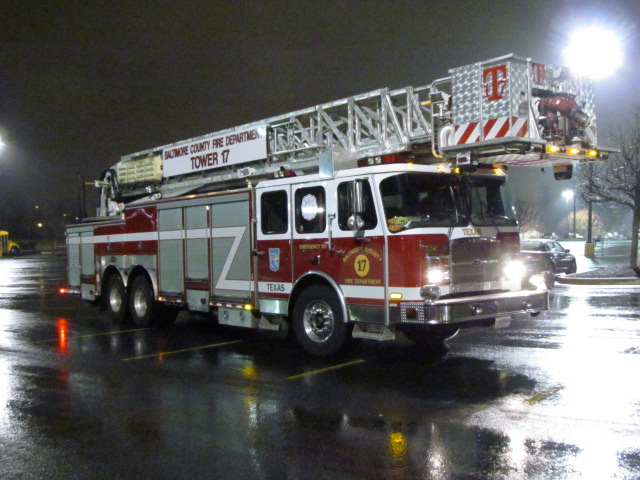
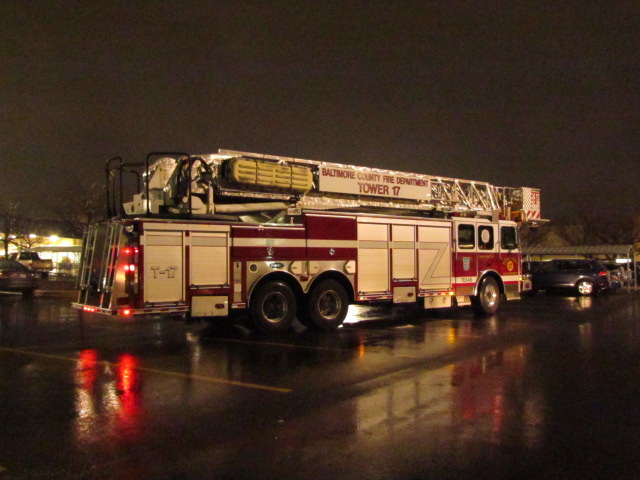
-- BaltCo station #17
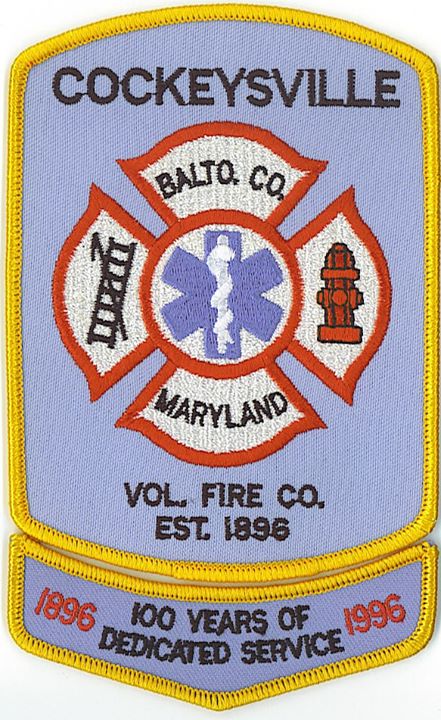
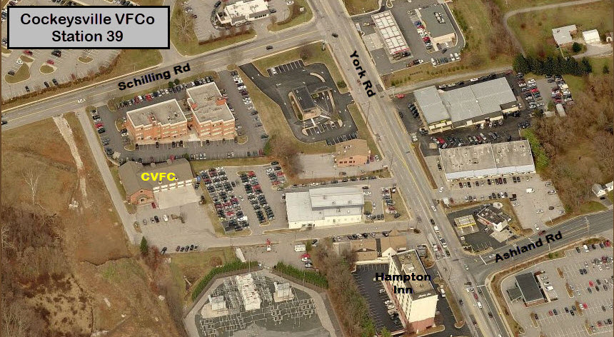
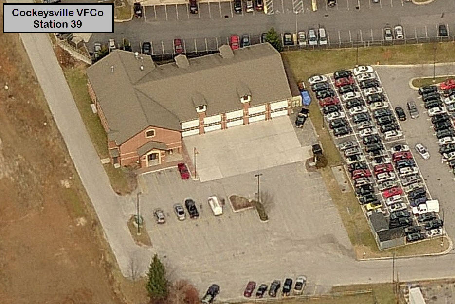
-- Cockeysville Volunteers station #39
Police station:
-- Precinct 7 - Cockeysville
Plenty of food, shopping, movie theaters, and gas - Hunt Valley Towne Center, Walmart, and the usual other suspects
Data:
GPS Coordinates: as needed
ZIP/Cockeysville: 21030
ZIP/Hunt Valley: 21031
Access by train/transit:
No Amtrak or MARC service
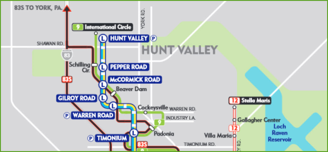
Light Rail Stops:
-- Warren Road
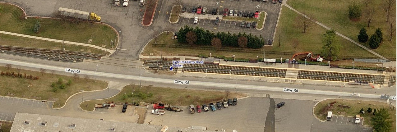
-- Gilroy Rd
-- McCormick Rd
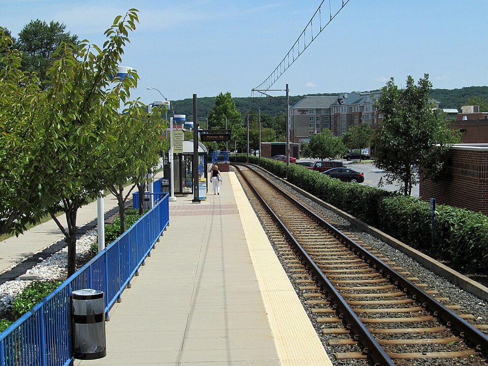
-- Pepper Rd
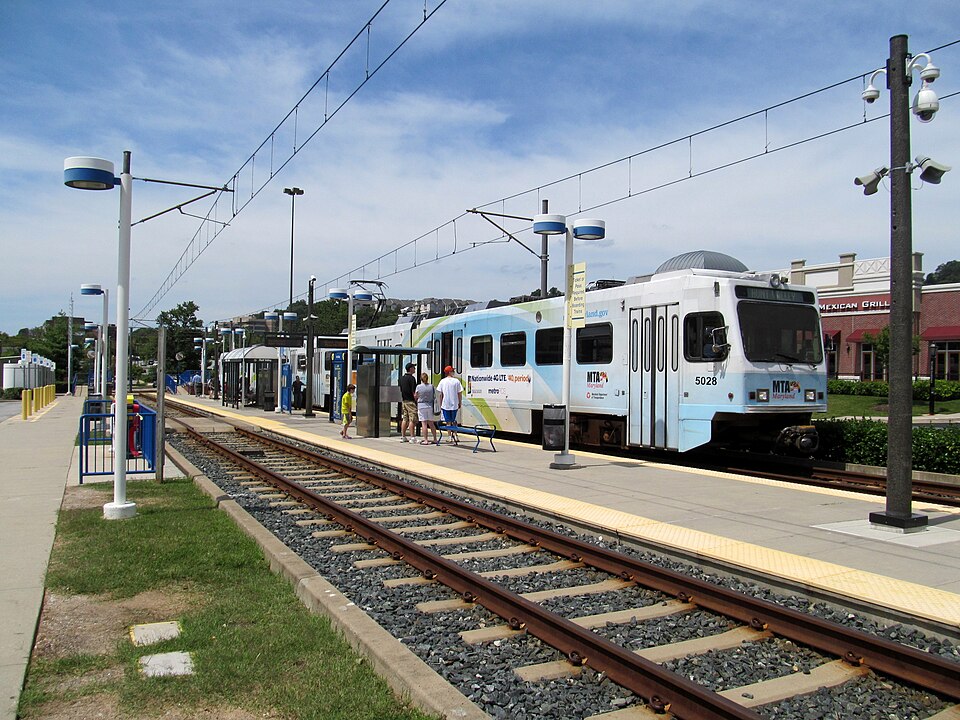
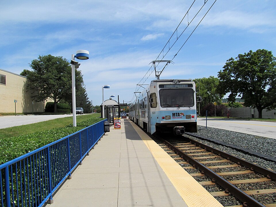
-- Hunt Valley
Bus/Local: #9 Route
Bus/Commuter: Rabbitt Bus #83S to York
The map below shows the north suburban side of
Baltimore... Towson, Lutherville, Timonium, Cockeysville, and Hunt Valley.
My Map #1 page is very busy, and needs to be re-done. The Cockeysville page is part of my effort
to make my old MAP 1 page less cluttered.
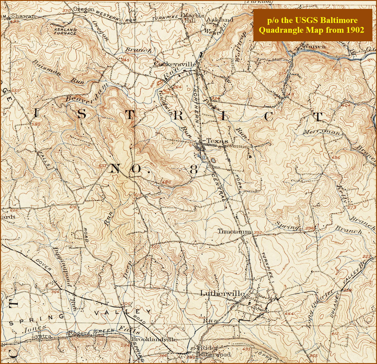
Cockeysville is about 18 miles north of Baltimore. It sits on what
used to be the main rail line heading north out of Baltimore, and it sits on a
major road that used to carry all of the traffic to York PA before I-83 was
built: York Rd. Cockeysville was one of the major centers on the
Northern Central, as it had a station, a freight shed, a siding with a wye, and
several sidings in the Cockeysville Rd area.
Parkton is the
only other station that provided more facilities than Cockeysville on the line.
The second railroad of
Baltimore, the Baltimore and Susquehanna, came through here in 1831-32 heading to York and
Harrisburg. A fairly complete history is on the
Ruxton and Riderwood
and Parkton
pages. The railroad was re-organized as the Northern Central Rwy
(NCR) after a really bad accident in Ruxton/Riderwood killed 35 people, and the B&S
was prompted to reorganize in order to stave off bankruptcy. The B&S also built the
Green Spring Branch, which the
Western Maryland used in the beginning before they had their own route out of the city.
They built this route as an alternate way out of Baltimore when the state of
Pennsylvania denied the Northern Central access to entering York County.
The right-of-way was double tracked and signaled by WW1. Local passenger service
known as the Parkton Local, which was started in 1861, was discontinued in 1959. Soon after, the line
reverted to a single track with passing sidings.
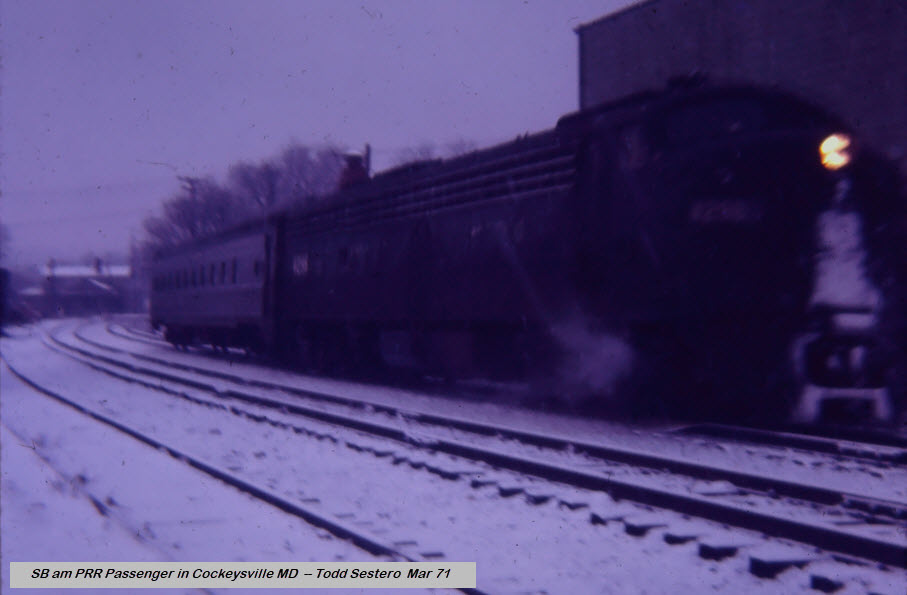
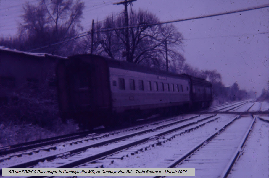
The last passenger train came thru in 1971 with the start of Amtrak.
The train had been an E-8 with a lone passenger car, at least since before I
moved into Ruxton in 1966.
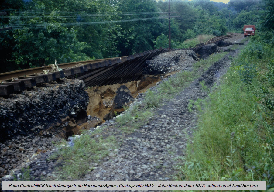
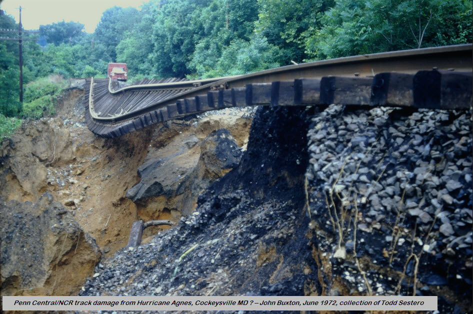
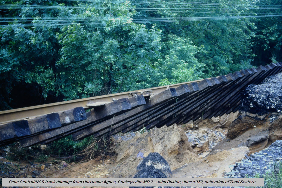
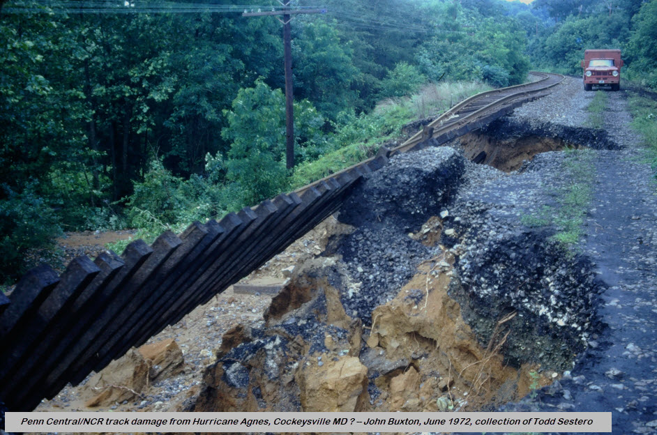
The last freight train came thru prior to Wednesday, June 21, 1972, when Hurricane Agnes
hit and did its damage to the line. The bankrupt Penn Central could not afford
to rebuild the line, and it was easier for them to have freights go up
to Perryville and use the Port Road to get to Harrisburg
The NCR had steep grades and lots of curves which prevented the Pennsy for
using the route as a way to head north to York. Most of the
freights using the NCR in the latter years were SB only because of the grades,
once the Port Road was completed (1877 according to Google AI).
The northern part of the light rail system runs right up the middle of the map, which
is the original right-of-way of the Northern Central.
The original section of the Baltimore Light Rail System, which opened in 1990,
only went as far north as Timonium.
The extension to Hunt Valley opened in September of 1997. I had the
'honor' (if you want to call it) of being the emergency ET onboard for the
inaugural run.
Any part of it that wasn't, was double tracked in a 2005 project. Because of the construction. the old
B&S marble ties (stringers) were
visible along the R-O-W for a few months.
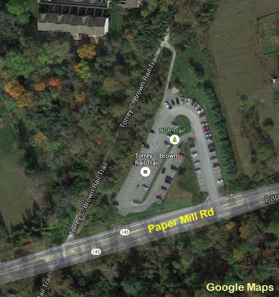
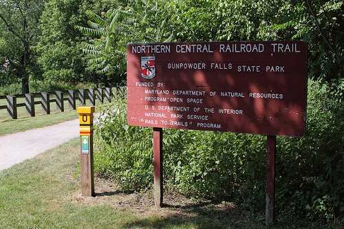
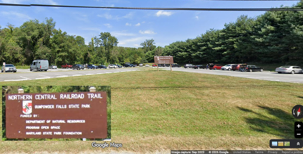
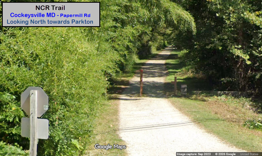
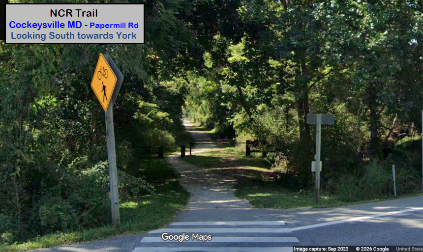
Above Cockeysville, the right-of-way (R-O-W) is now the NCR Trail, which is very popular with
walkers, runners, and bikers. The trail HQ is in Monkton.
The R-O-W splits off at Warren Rd, and other than the stub that is still there,
not much remains visible. NS trains stopped running when the light rail
closed the track for the double tracking project at the beginning of 2005.
They applied for abandonment shortly thereafter.
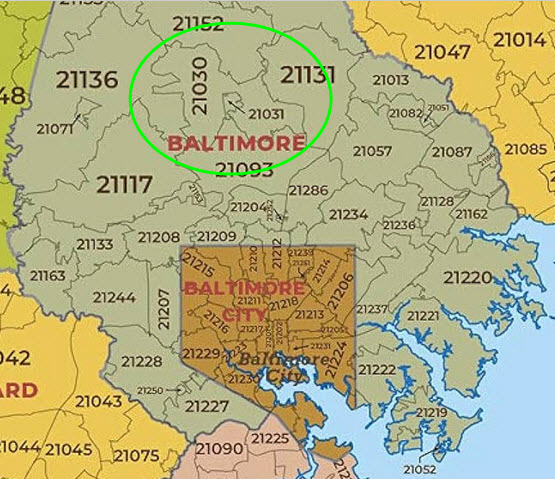
21030 or 21031? Most people will interchangeably use Cockeysville and Hunt Valley. To a
small degree, they are correct, but beware, there IS a HUGE difference.
Before there was a Hunt Valley, the whole area used to be considered
Cockeysville. With the advent of commercial development in the numerous
industrial parks of Cockeysville, in the area around and below Shawan Road, the
post office decided they needed a way to differentiate between the areas, so
they created the 21031 ZIP code for Hunt Valley. In the map below, you can
see that the 21031 Hunt Valley area is a small segment in the much larger 21030
"Cockeysville" area.
It's kind of funny how, with the advent of light rail service, that the main line and siding functions of the track in
Cockeysville reversed roles. What is now the light rail's main line at
Warren Road, used to be an industrial siding, servicing business' in
Cockeysville and the Hunt Valley Industrial Park. What used to be the
Pennsy main line, became the siding.
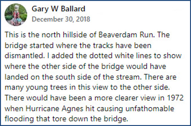
The NCR became a local branch/line after Hurricane Agnes ripped thru in June of 1972.
It washed out virtually every bridge and and a good portion of track
north of Cockeysville where it followed the river. For the benefits
the -broke- Penn Central derived from having the Northern Central as a SB
route from Harrisburg to Baltimore, they could not afford to rebuild the
line and traffic reverted to the Port Road (comes off the NEC at
Perryville MD), the same route the NB
trains used because it was a gentler grade going NB. If you recount
the stories of Parkton MD back in the steam era, Parkton was a resting place
for helper engines to get over the hills between there and the flatter
country of southern York County PA.
The track went up to the freight shed for many years after the MTA took over the NCR, and you
could often see a speeder sitting outside of the shed. Later on, they
positioned the speeder on a section of track just north of Warren Road, and
the track between Warren Road and Cockeysville Road became overgrown.
I do not know when the NW leg of the wye was removed.
Prior to the end of freight service (2005), you could find a Norfolk Southern or
Conrail engine, and maybe a few cars sitting north of Warren Road every so often, because they
couldn't make it back to the interchange track back at the light rail shops
before the start of service. When I used to work for Light Rail, and
we would go out at night to do "brake rate tests", we would often have to
sit tight at say, Timonium Station, for the freight train to pass us.
Wish I had taken my camera along, dammit.
Several old NC/PRR depots are still around in addition to the Cockeysville Freight Shed: Riderwood,
Lutherville, Greenspring, Stevenson, and Monkton. Three of them are used
as homes, and anyone wishing to take pictures of them should respect the privacy
of the homeowners! Monkton serves as the HQ for the Trail. Please
check those pages to view information on them.
Acknowledgements:
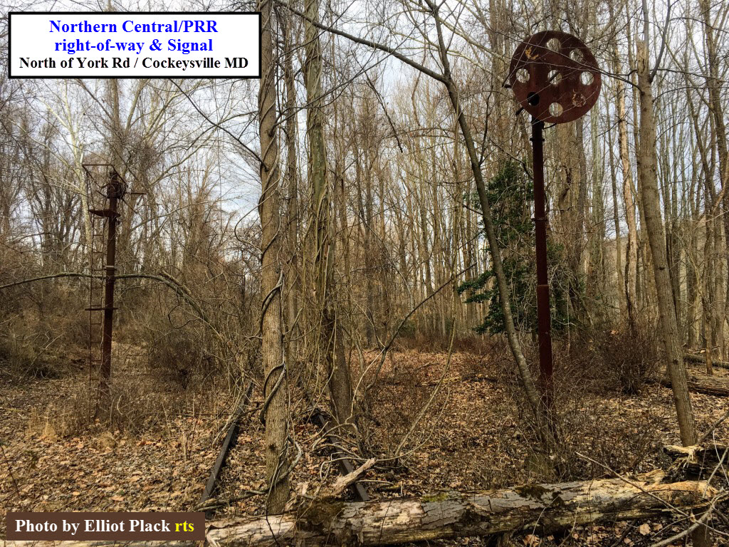
Elliott Plack - Pictures of still standing PRR PL signal and bridge
John S - additional info regarding hurricane Agnes
Gary W. Ballard - additional signal pictures Steve's Tour of the NCR, part 9
Google Images
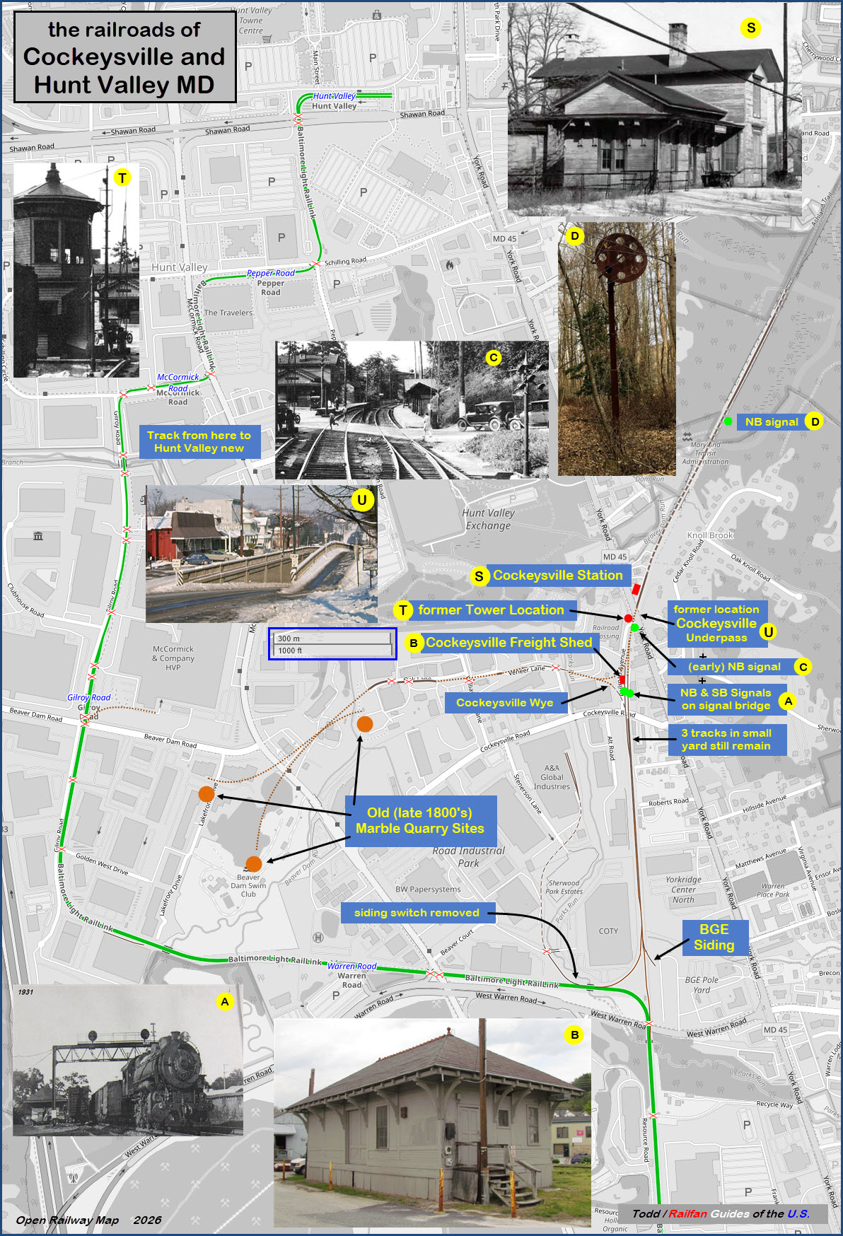
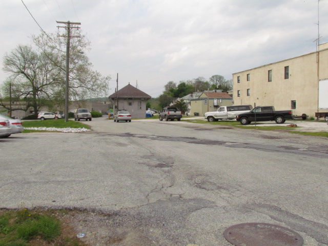
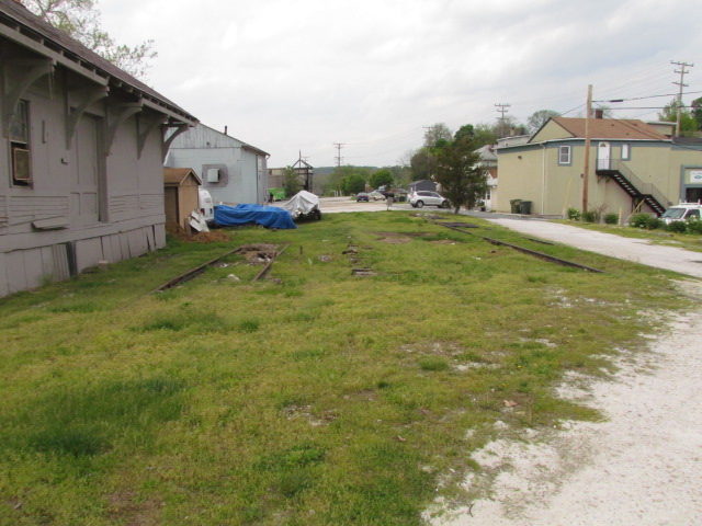
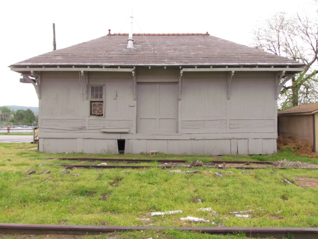
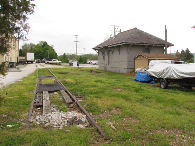
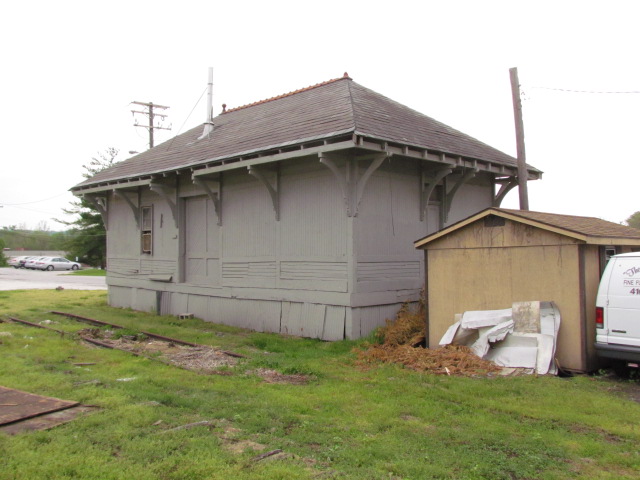
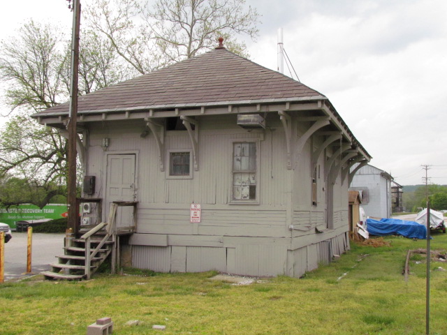
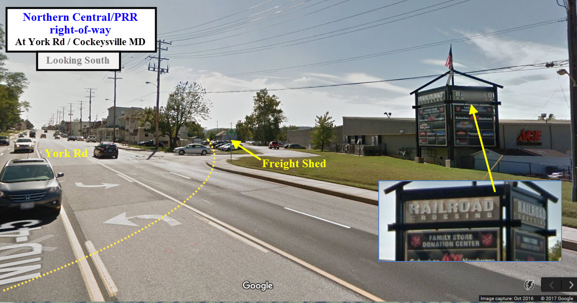
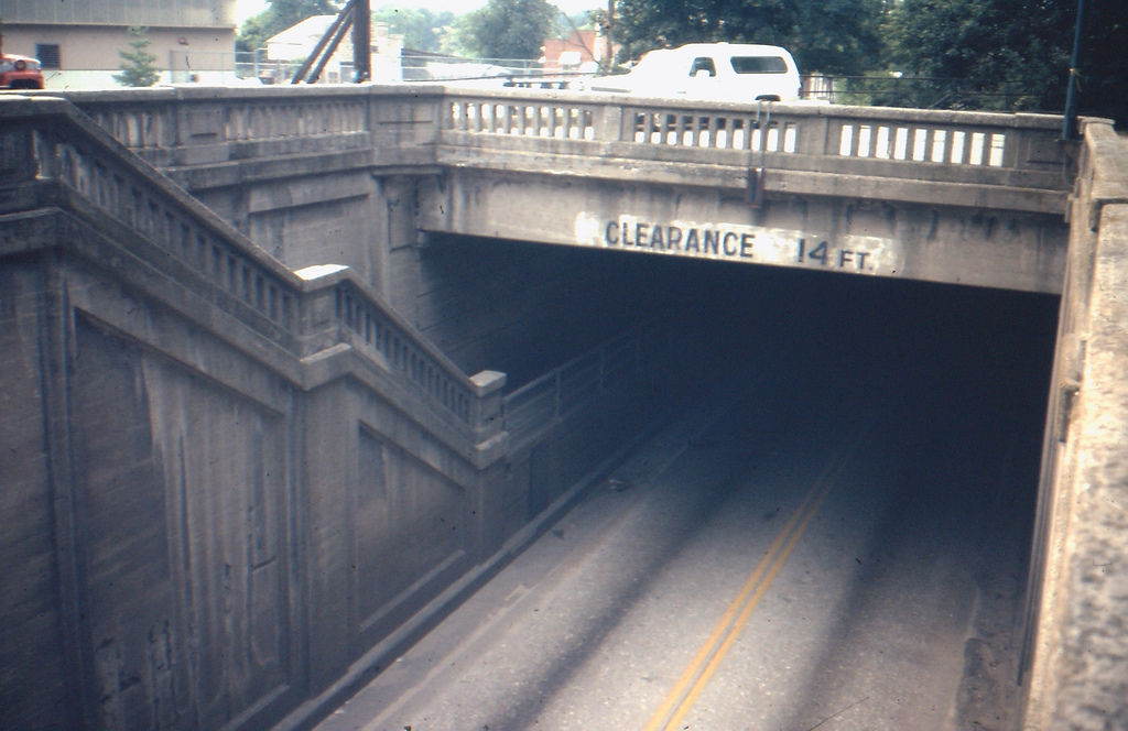
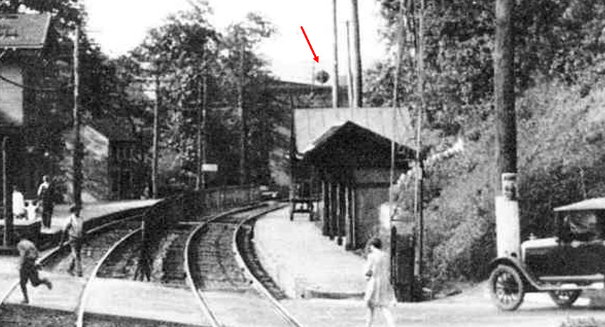
The most visible Pennsy railroad feature, or fixture, still
around these days. Many references I see on the internet are calling this
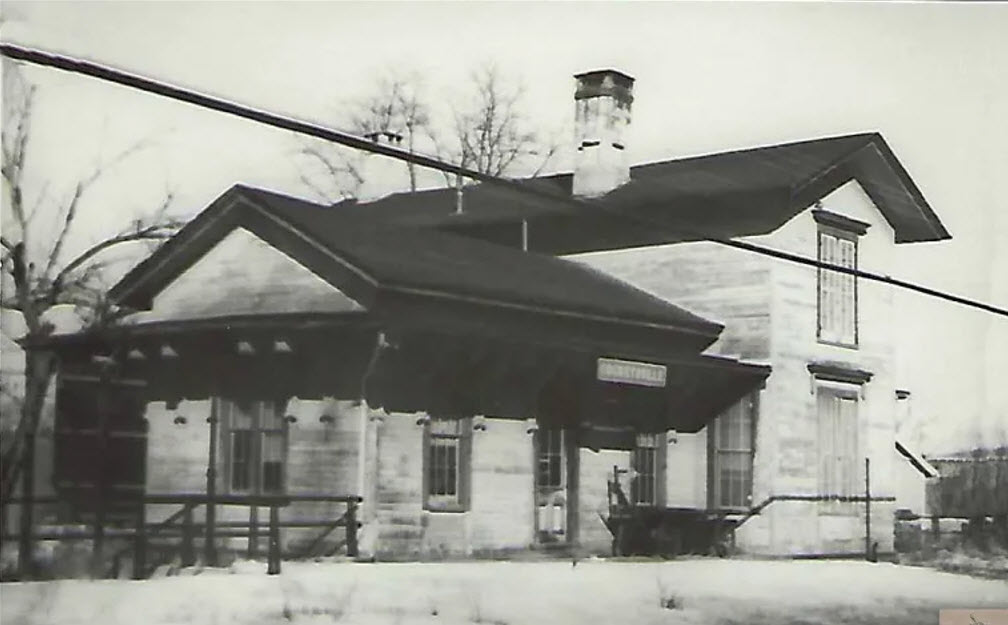
the Cockeysville station, which is
incorrect. The actual railroad station used to sit on "the other" side of
York Rd. These pictures are from May 2014, and as of 2026, it is still
around, altho in poor condition. The MTA is the current owner of the
building. Up until 2005 or so, the tracks from the light rail line
actually used to still connect to the track outside the shed, and the MTA kept a
speeder in a small shed they built over the tracks.
For some reason, I don't remember the station being torn down in 1972.
Darn. I was up here ALL the time, as one of my best friends lived only a
few blocks away. I would also come up here hoping to get a glance of the local
working the industrial park, or one of the thru SB Truc-Trains - the route between here and New Freedom PA was
uphill AND twisty-turny, so the Pennsy in later years, once they had the Port
Road open, really only used the NCR for southbound freights.
It was well shaded by trees, and even on a hot summer day, was a great place
for train watching (not that there was a whole to watch :-). Another thing that
made it nice to hang around, was the fact that the railroad had a radio repeater
at the south end of the station platform, and the radio techs would usually leave the
speaker on, so you would know when there was something around. This was in
the days before scanners were common, if you can believe that!
The brick paved platform, on the right side of the tracks as you looked from York Road,
was around until the mid 80's.
found on the kilduffs page
found on the kilduffs page
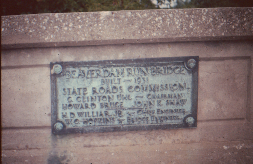
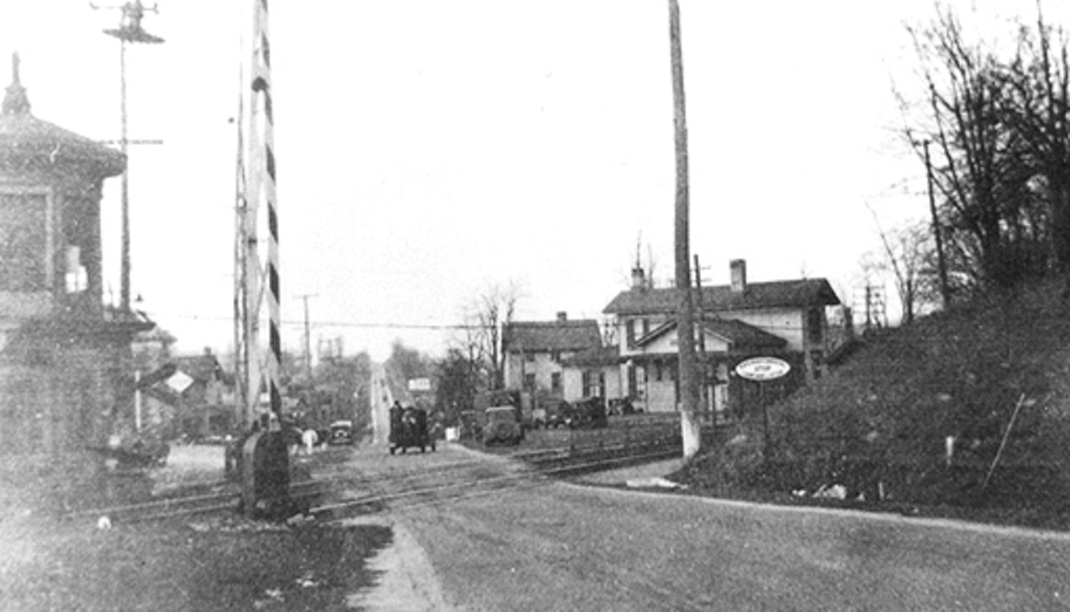
From a reprint of a 1969 reprint of the 1877 map.
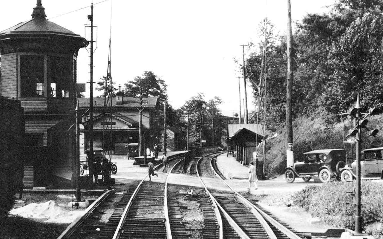
The above picture -may- have been during 1931 when they were building the
underpass, judging from the rebar sticking up and the depot on timbers like it's
getting ready to be moved.
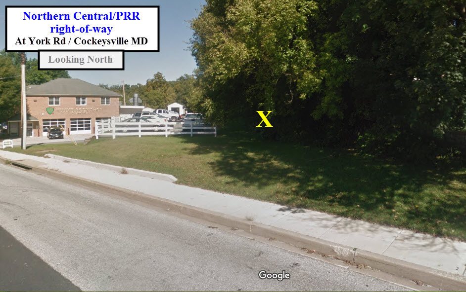
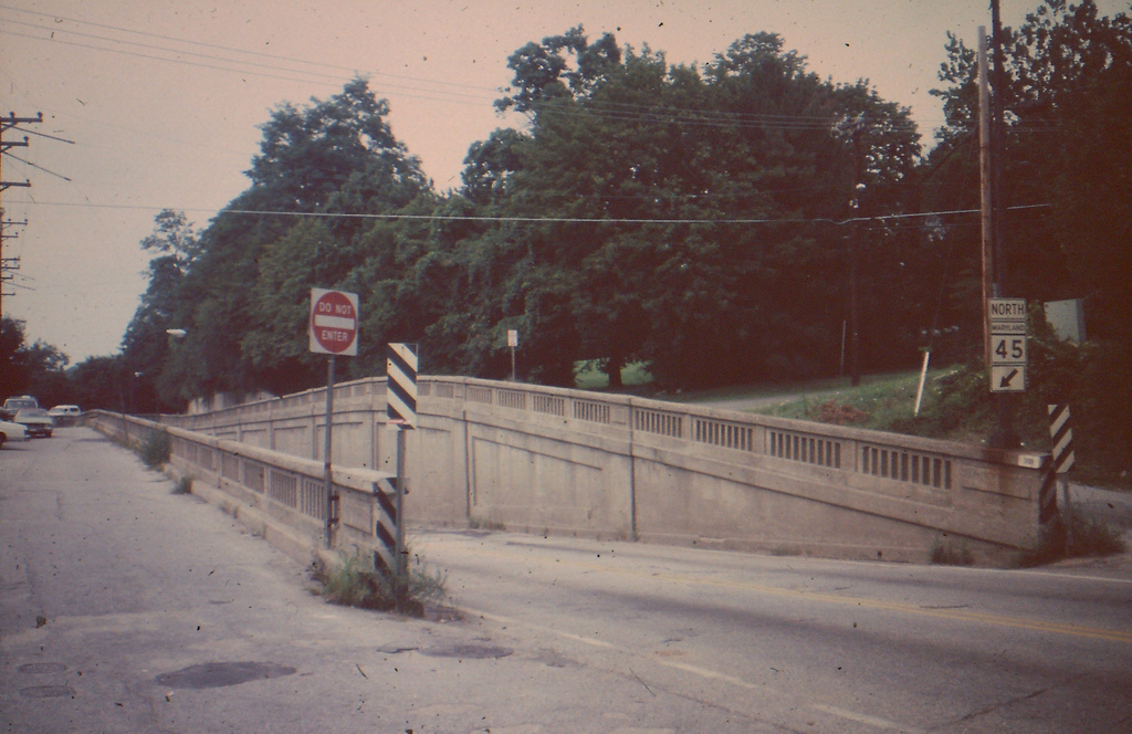
X marks the spot where the tracks used to be......
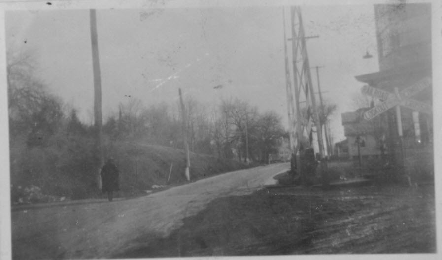
How did the chicken get to the other side of the railroad tracks?
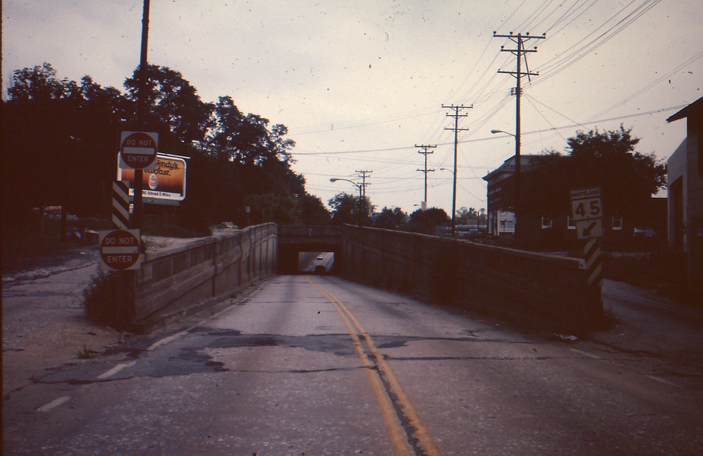
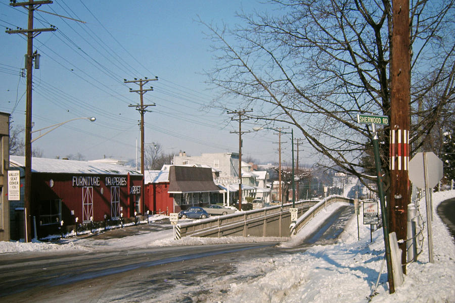
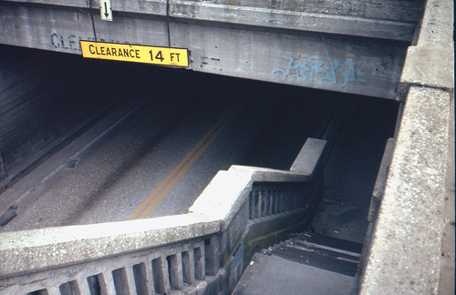
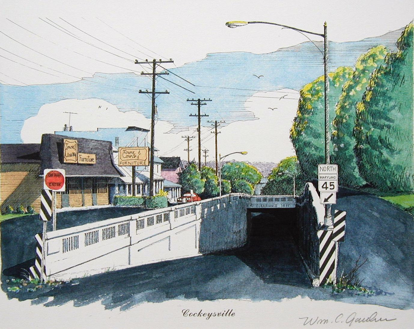
Simple. When there was still a right-of-way, York Road went under the
tracks in an underpass built in 1931. Being only a two-lane affair, it was a choke point
in York Road, and filled up with water every time we had a severe storm.
It also included a walkway for pedestrian traffic. I'm sure Baltimore County
and every driver around here praised the day it went
away! Most of the underpass is still there, they just filled it in with
dirt, and then paved over it. And, below, is a picture from sometime
around 1925 before the underpass was put in.
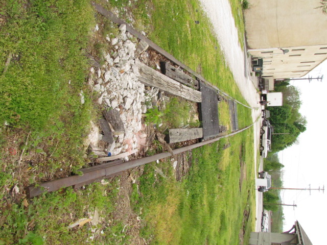
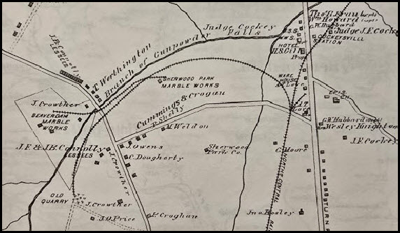
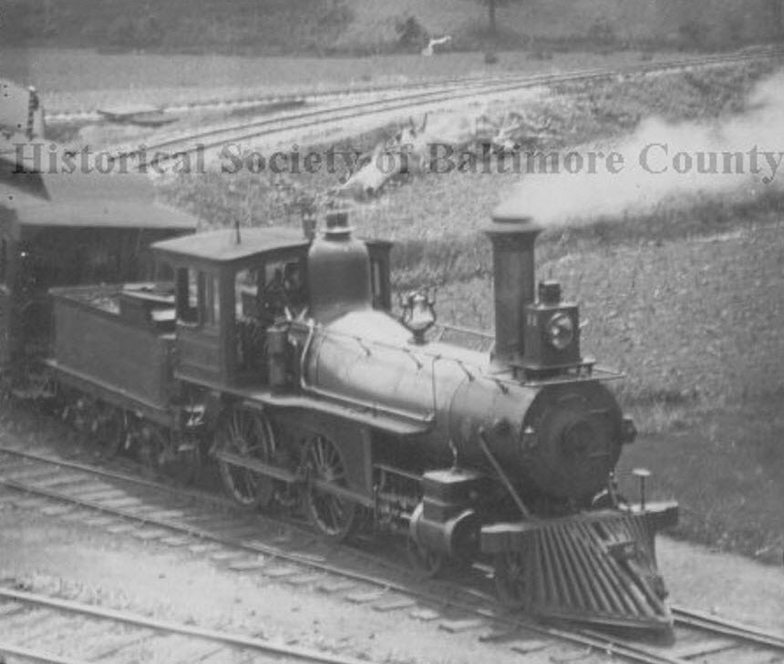
In what is probably the south leg of a wye that used to be here in the late
1800's, this short siding was where few of the last remaining customers for
Conrail used to be located in the 1970's. If we look at the 1877 map, we can see
that the siding serviced three marble quarries. And, later on, it looks
like the NCR made the siding junction into a wye, looking at the picture from
the HSBC with the 4-4-0 in it (looks like the train, a passenger train, is
backing into the siding so it can make a return trip back into Baltimore - pure
speculation on my part tho).
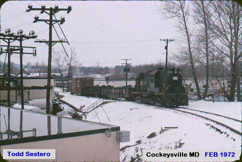
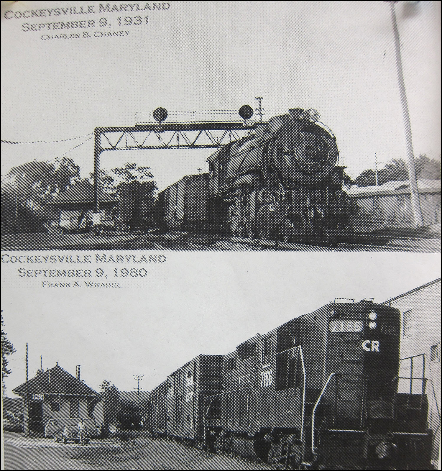
Taken in the early 70's a few months apart are the two
following pictures of the local working in Cockeysville, next to the Freight
Shed. The siding is still partially there. Would love to have gotten
the "no left turn" signal! Adjacent to where the shed stands,
come the two following pictures of a local working one of the Cockeysville
sidings. The engine, an Alco RS-11, or Dl-701, is one of
my favorites of the era. In NYC, they took over the duties in 1969 on the New
Haven when Penn Central took over, and stopped using the electric E-33's going
over Hell Gate bridge in Queens NY. The square picture is of the RS-11's
making their way north thru Queens next to where my grandparents lived in
Jackson Heights.
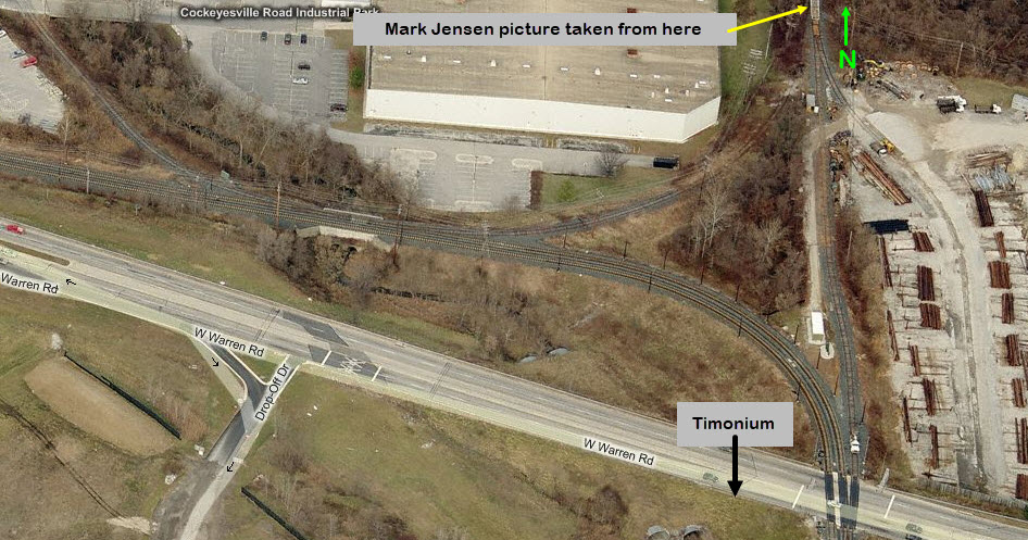
Below is a shot of the NCR looking south, from just north of Warren Rd. The
BG&E siding goes off to the left, and the one leg of the wye goes off to the
right, which takes you up into the Cockeysville Industrial Park area.
From the late 1980's?
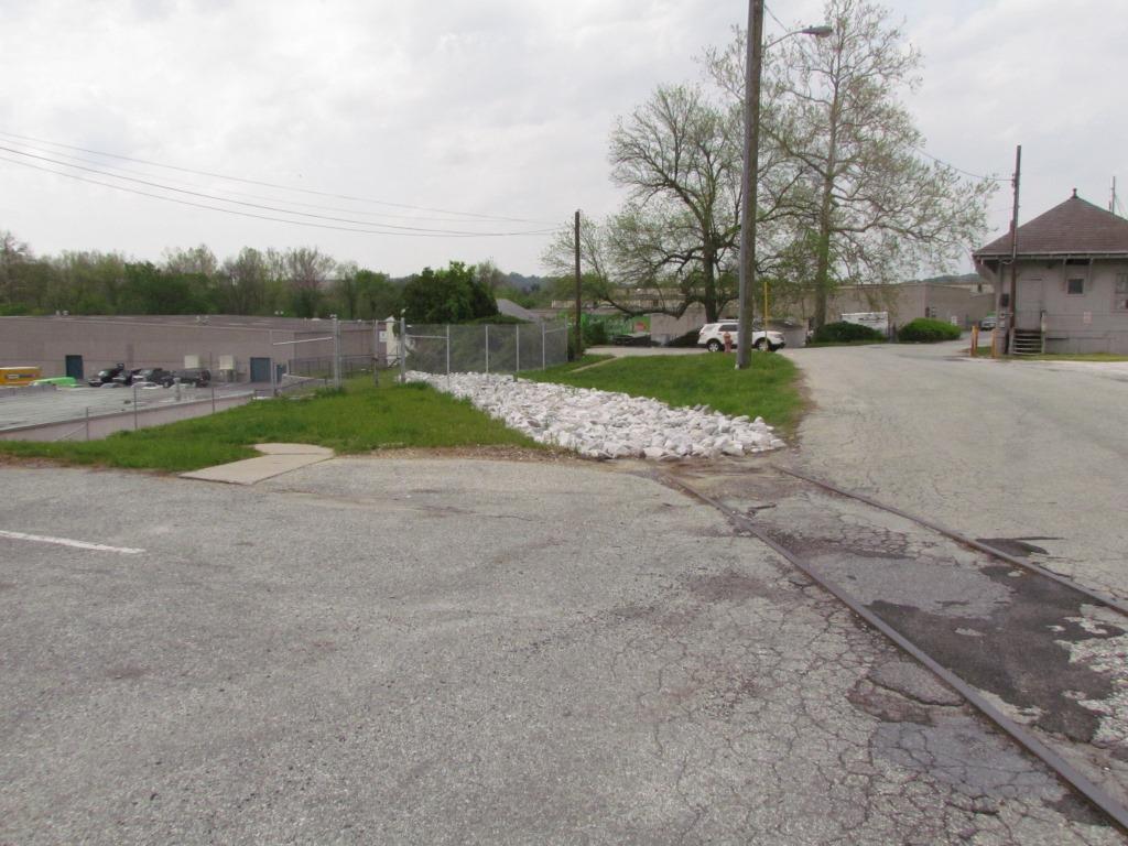
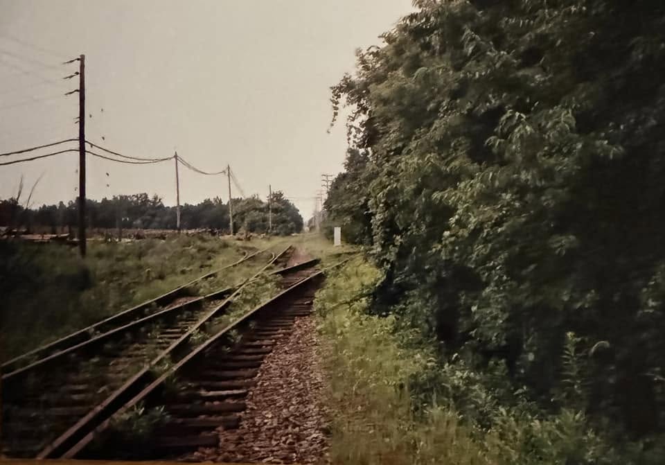
From Cockeysville Road, you don't see much, even in winter. It is hard
to believe that there used to be three tracks running thru here, which you can
see in the insert from another photo I came across in my collection. If
you venture into the thicket, the tracks are still there! But I didn't see
any evidence of the signals seen in the insert. I have more pictures,
I just gotta yank them off my phone. Again, wish I had the foresight
to take pictures of everything around here back in the early 70's.
Neither John nor I can remember where exactly along the Northern Central he took
these pictures. Since there is water to the left, it could be almost anywhere,
but since he probably didn't venture far off York Rd, it's probably Cockeysville or very near.
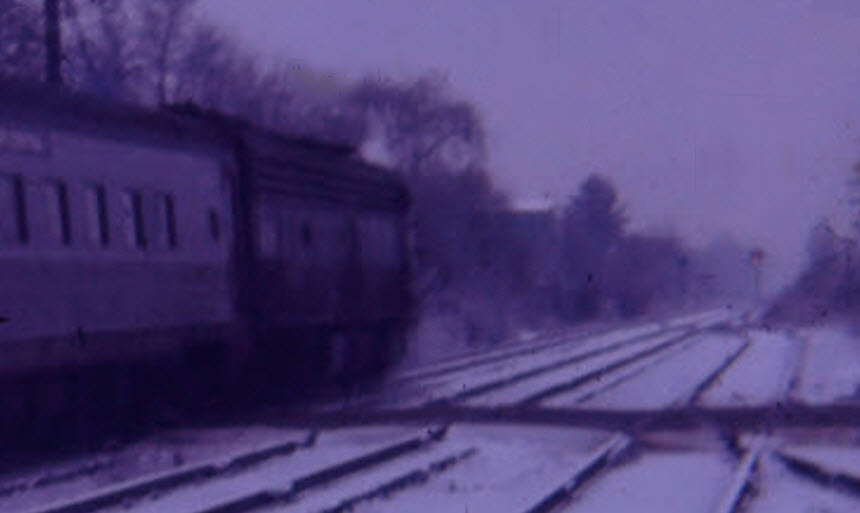
Passing by the Cockeysville freight shed was this Baltimore bound Capitol
Connector, which got into Baltimore around 9am. Don't remember why I was
in Cockeysville that early on such a dreary day..... shoulda come back up here on
a beautiful sunny day, huh? :-( Picture comes from a Kodak Instamatic
square slide, sorry. This was three months before Agnes came thru and
destroyed the line. The track on the far side of Cockeysville Road is
still there, albeit VERY grown over!
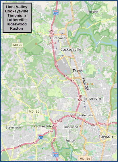
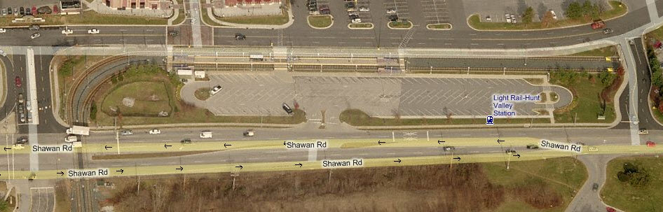
The Baltimore Light Rail system starts/ends on
the northern part of the map in Hunt Valley, at the mall. Too bad for
riders, but by the time the current owner of the Mall told the MTA that they
would love to have the Light Rail come into the Mall, the MTA already had
started on building the station as it is now.
This map covers the system from the northern
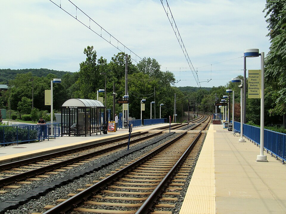
end down to the Twin Tunnels in Riderwood. The longest stretch of track
without a stop starts on this map at Lutherville, and goes about 4 miles to the
Falls Road station, and also takes in the best scenery of the entire system at
Lake Roland.
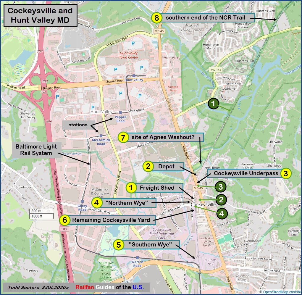
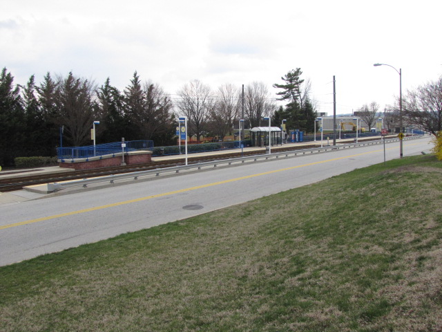
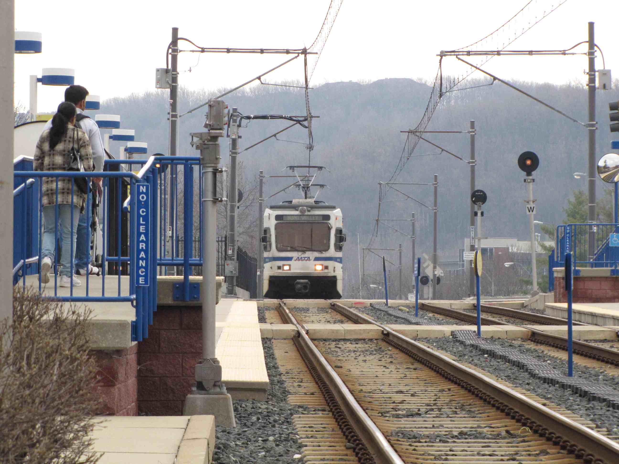
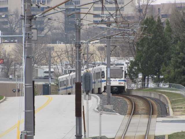
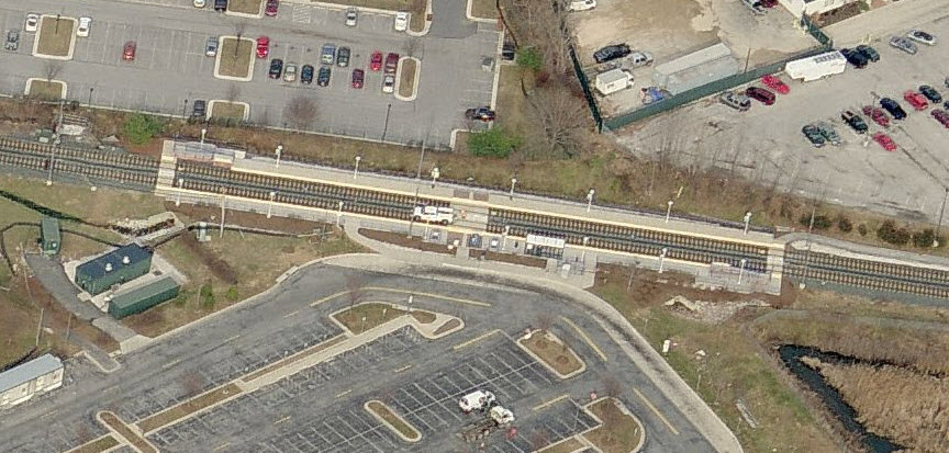
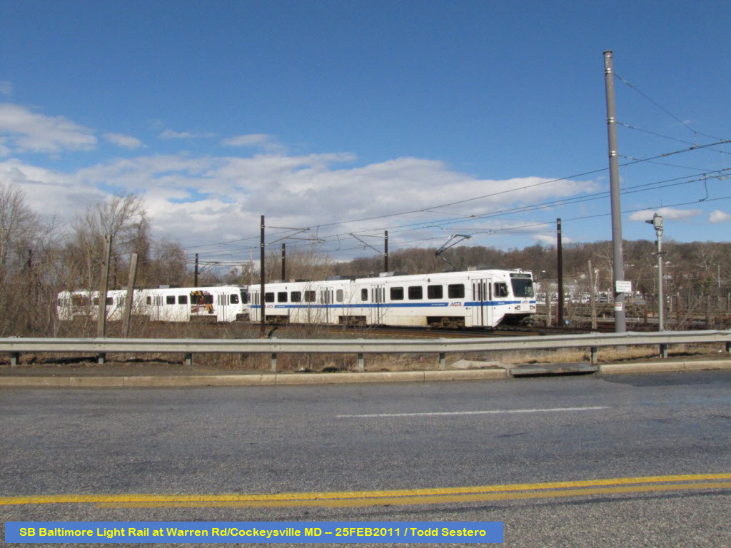
At Gilroy, the line goes into a single track
for its trip through most of the industrial park. It goes back into two tracks
for the Hunt Valley station before crossing Shawan Road.
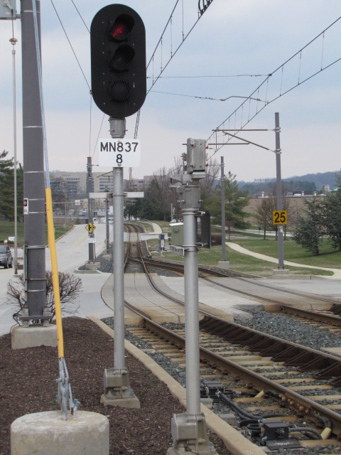
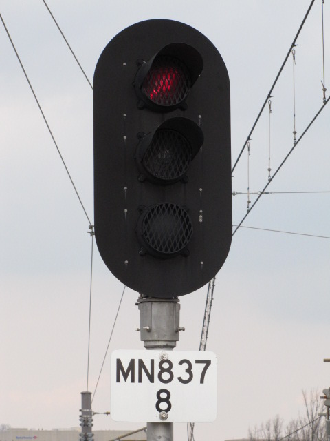
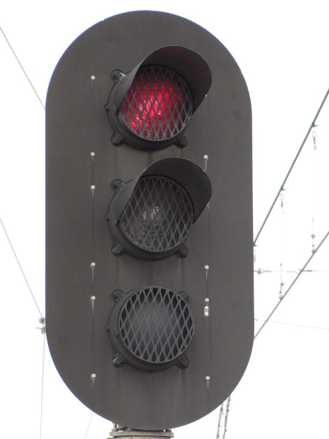
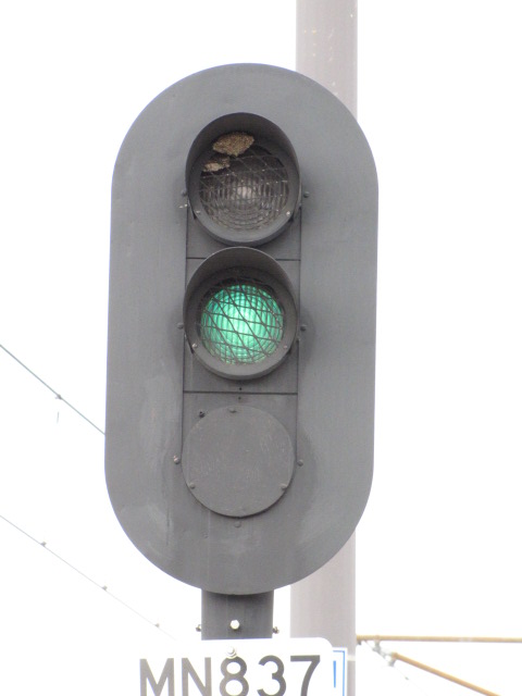
The NB signal for trains heading to Hunt
Valley is fairly unique in that it only displays two aspects as seen below.
Signals like this also show up at the Timonium turn around.
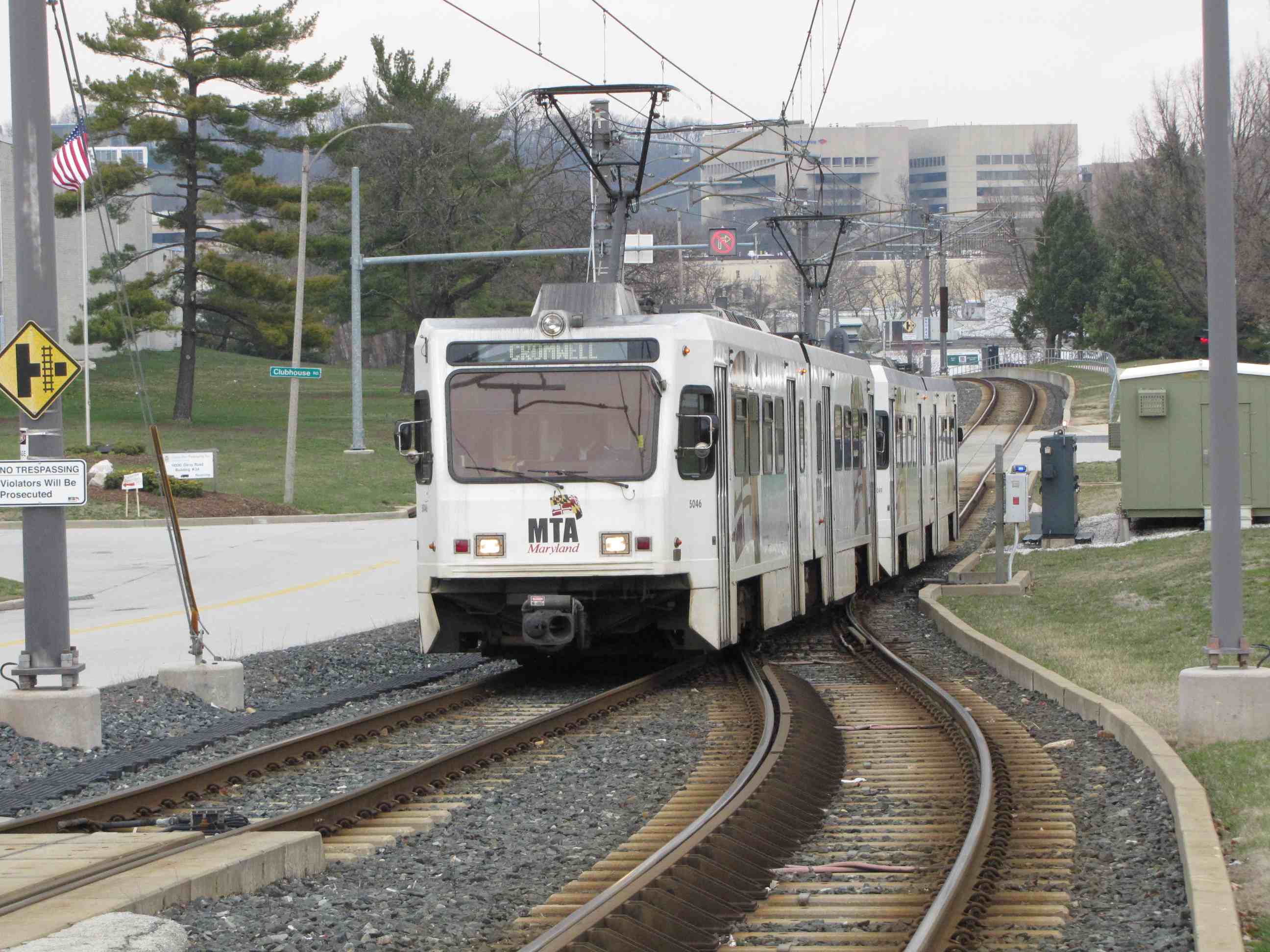
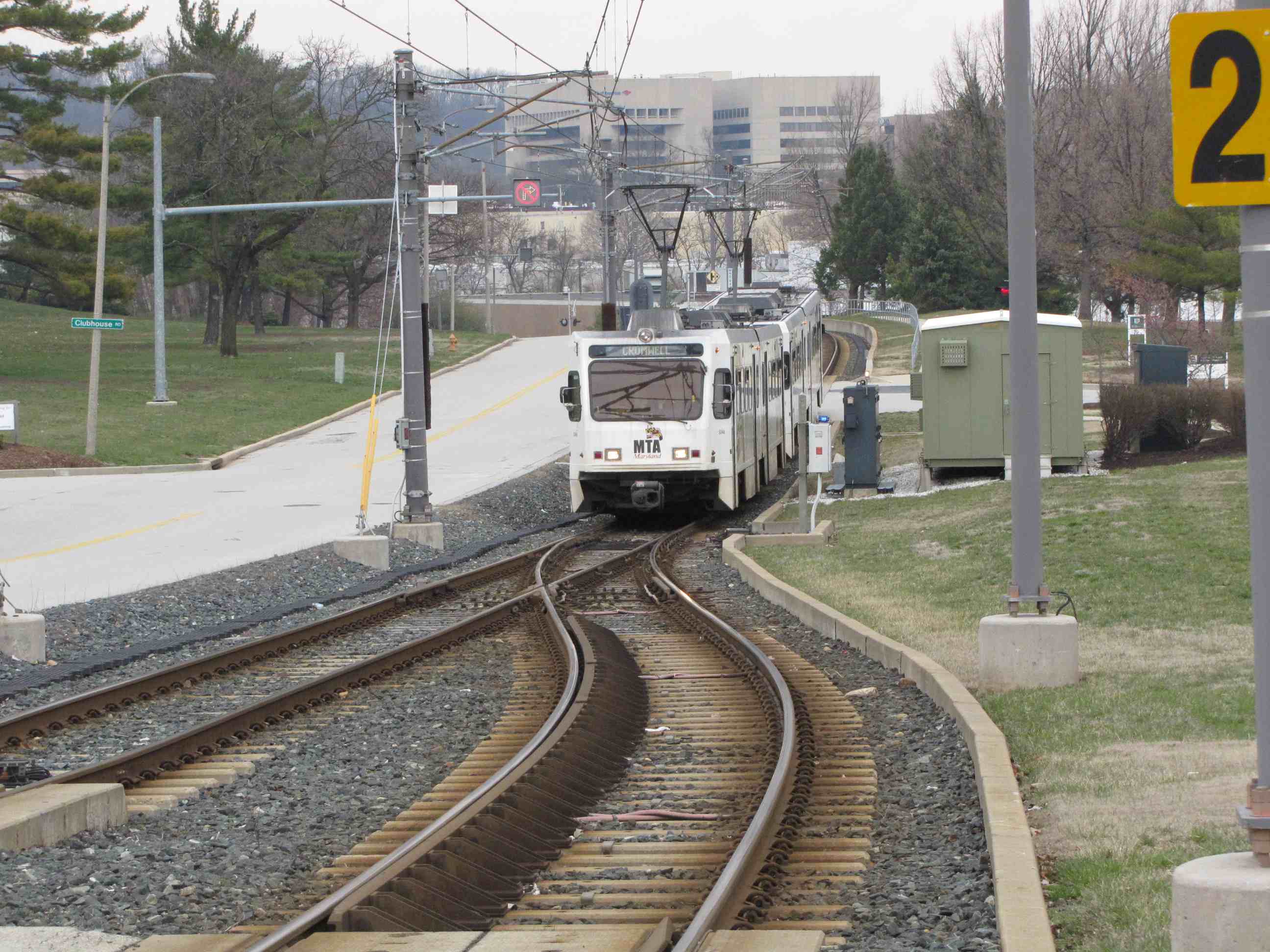
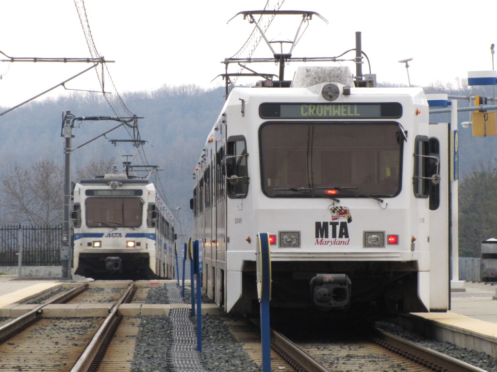
You can almost always count on a meet here,
because trains going to HV have to wait for the SB train to clear the single track.
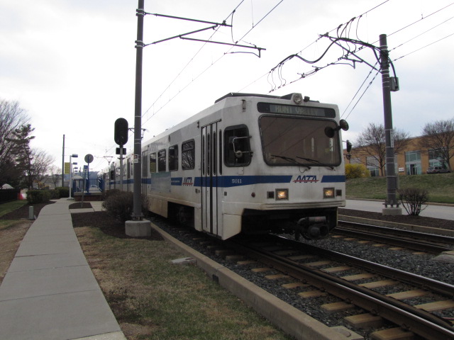
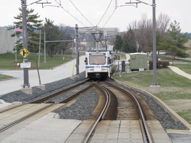
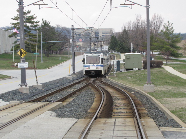
A SB train coming into Gilroy
A NB train coming into Gilroy and then heading to HV
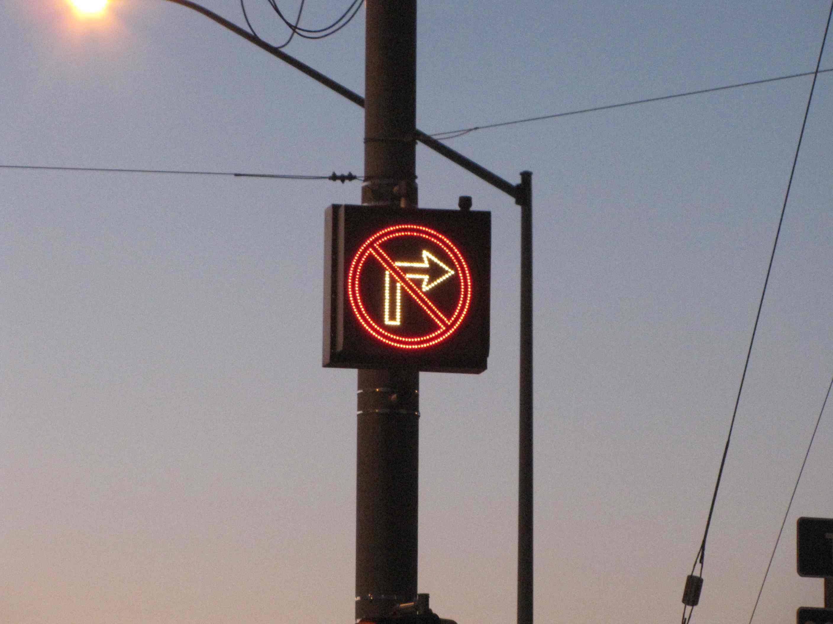
No right turn signs on WB Warren Rd when taking a right onto Beaver Dam Road.
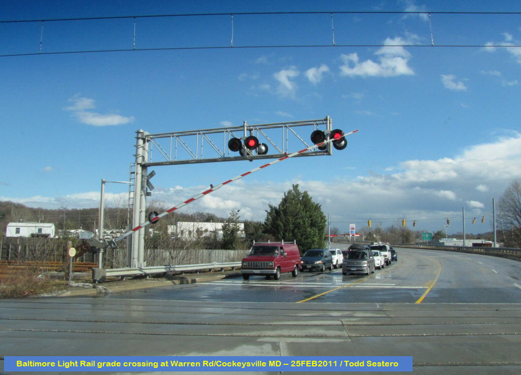
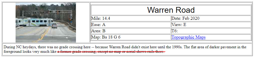
Warren Rd Grade Crossing
Warren Road - one of the worst constructed stretches of road in Baltimore
County. Between York Road and Beaver Dam Road, the construction company
that had the contract to do this "new" section of Warren Rd, messed this up
horribly, and we are still paying for it today (and I'm writing this in June of
2026). Warren Rd Originally stopped at York Rd, until the state put in the
Warren Rd exit off of I-83. They messed up, because the road was put in
over really soft and marshy like ground. They didn't do a proper job of
stabilizing the road base, and ever since it's finish, the road has been slowly sinking.
If you look along the side of the road, in places, you see the original concrete
curbing dipping below the road/ground surface, indicating the constant sub-base
sinking. I think the state has re-paved the road at least three times in
order to keep the roadway surface somewhat level, however, the road is still
like riding over a bunch of rolling hills. :-) So the assumption that
there was another grade crossing here is in error.
If you want to learn more about Pennsy PL Signals, click here
Pennsy PL Signals
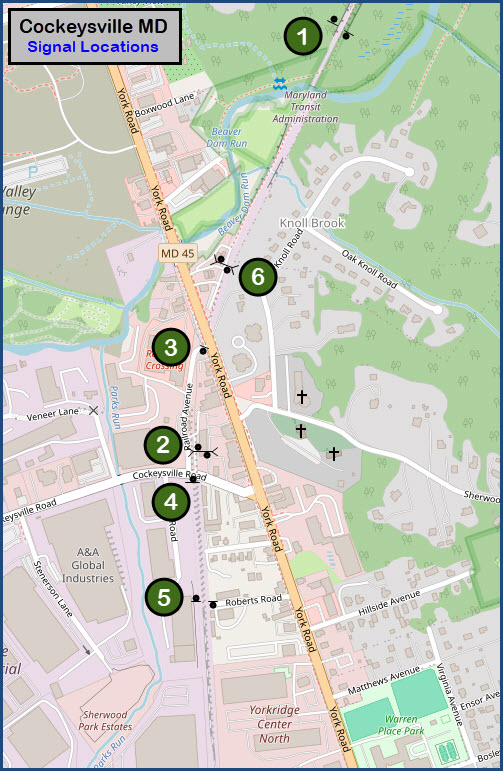
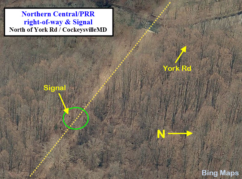
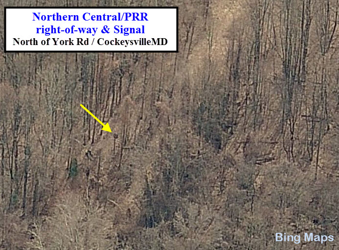
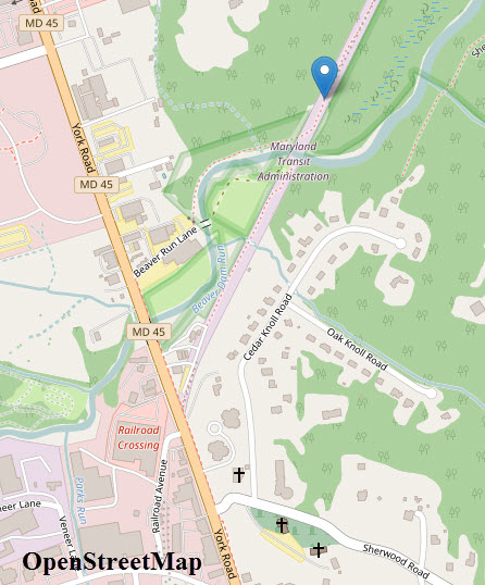
GPS: 39.489855, -76.641851 (close enough, but may not be exact)
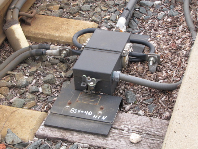
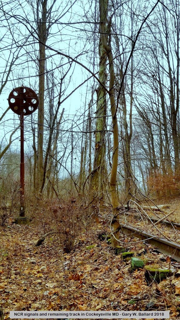
One of the few signals I saw on the line - it's maybe
half a mile down the track from where the former Cockeysville station stood.
During the days when the station was around, the Pennsy and the
Penn Central also had a radio repeater station located here. I have a
picture of it, but it is a tiny little dot in the distance - a really stupid
photo because it was taken with a lowly Kodak Instamatic camera. I'm surprised it got any picture
of it at all considering it was totally dark! :-) The signal
location is about 2500ft from York Rd, and if you want to visit it, the best
bet is to drive in on Beaver Run Lane and follow the stream around to the
right of way, and then go left, or north from where the bridge would have
been. I wonder if I can get my trailer in there? :-) :-) I'm
surprised that you can see the signal head in the Bing birds-eye view!
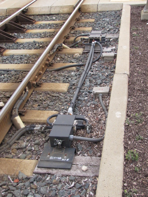
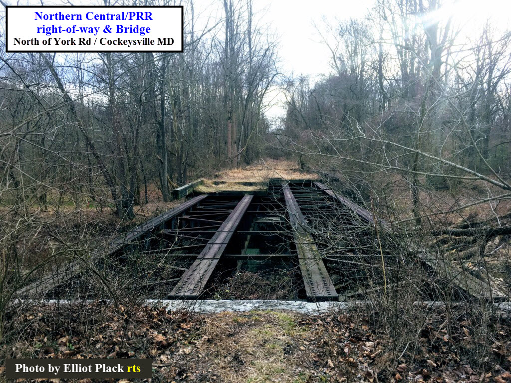
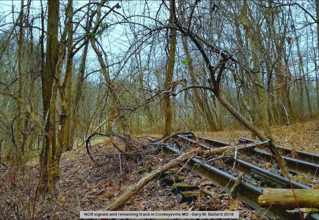
The picture at the bottom is what remains of one of the bridges along this
section of the track. The two photos are courtesy Elliot Plack.
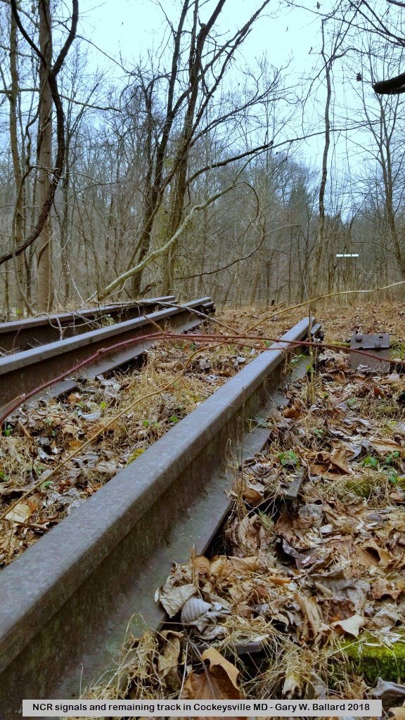
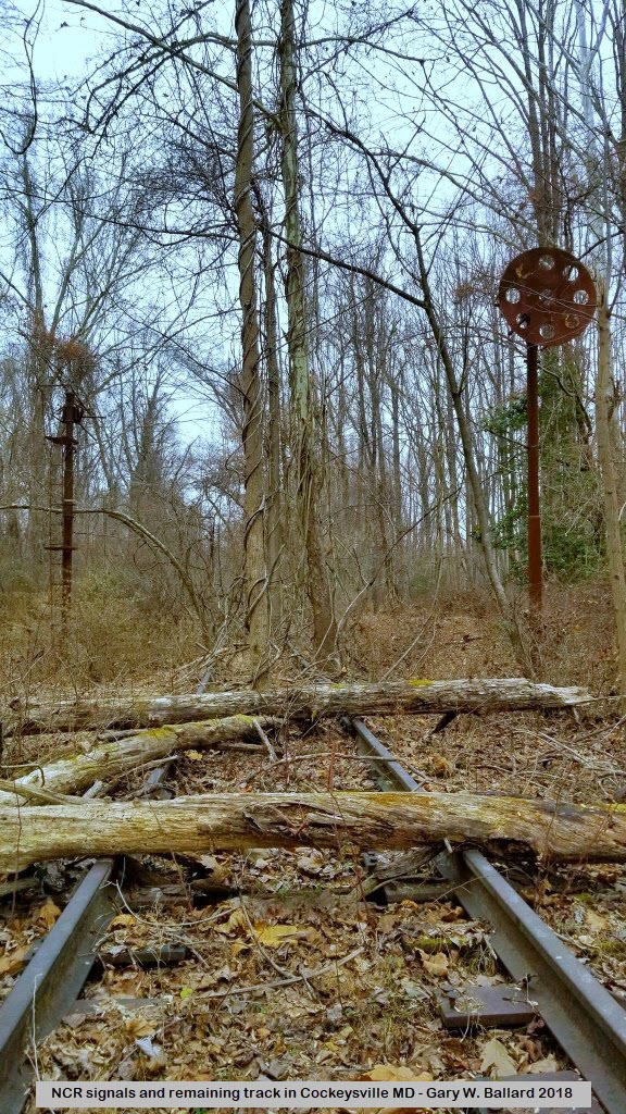
2026 Update.
Found these four photos after doing a search for any and all things related to
trains in Cockeysville, these showed up in a 2018 post by Gary Ballard.
Pennsy PL Signal Bridge
GPS: 39.482510, -76.645411
Looks like we use to have a signal bridge adjacent to the freight shed (the shed
is still there), with a pair of signals, one for each direction, north and
south. I have no idea when the signal bridge was taken down,
but I would take an educated guess that it was shortly after the Pennsy
stopped running passenger service in 1959. Below is the best picture
of it I have found (so far) on the internet.
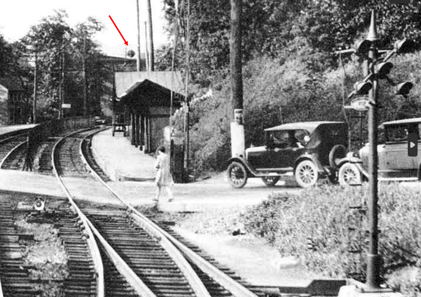
Pennsy PL Signal at York Road
This picture is a portion of another photo appearing above in the section
for "before the underpass". You can just barely make out the signal in the
other photos too, but it is hard. Not sure if this signal was for the
station or not, because, even in 1920, it is not a standard PL (position light)
signal. I also just noticed, that above the platform roof for the NB
track, there appears to be another signal bridge for trains approaching the
station (red arrow).
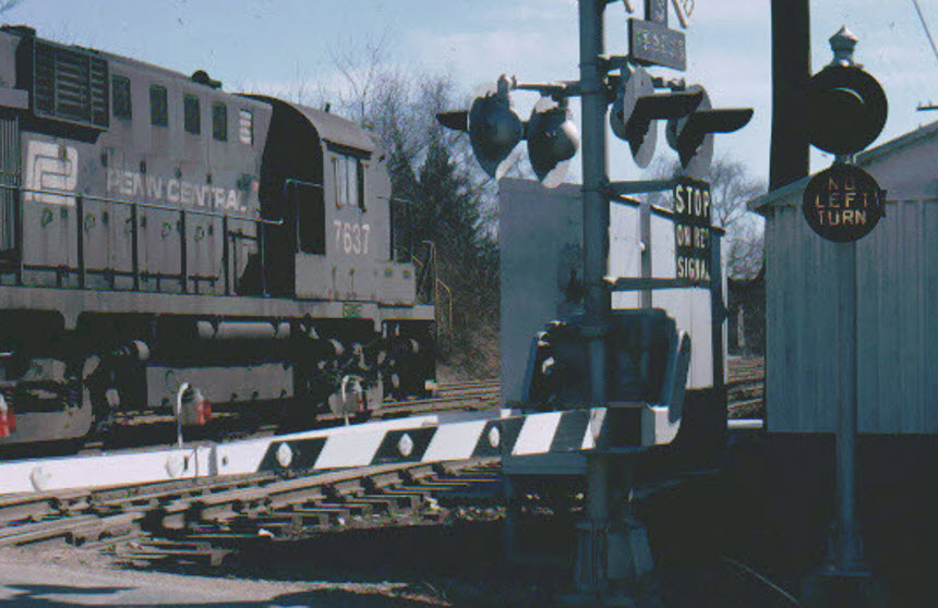
Other Signals Seen in the Various Photos
A NO LEFT TURN signal, activated when the
crossing gates came down so cars trying to make a left onto Cockeysville Rd won't be tempted.
These were rare in the Baltimore area, wonder whose house this sits at now? :-)
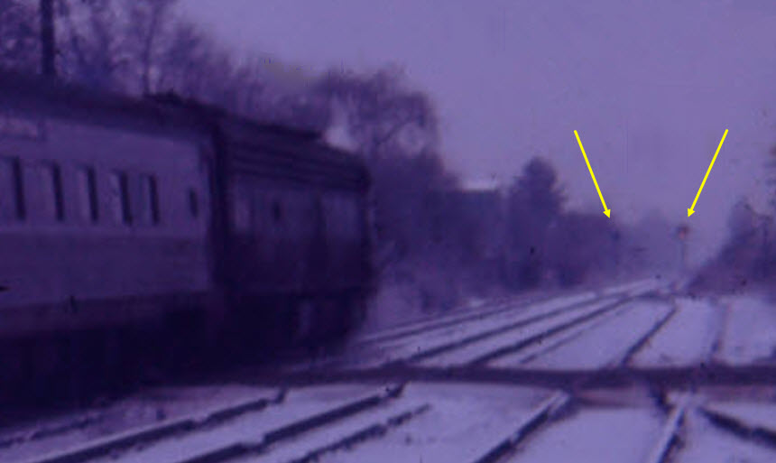
As we have already seen in this portion of a photo from above, it appears
that in 1971 there were two signals located just south of Cockeysville Road.
We can just see a little bit of light coming from the one signal.
As seen above, it looks like a signal on a standard Pennsy signal bridge.

 found on the kilduffs page
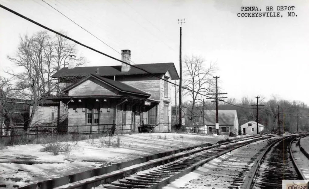 found on the kilduffs page
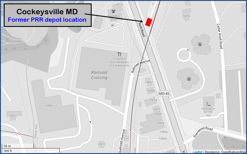
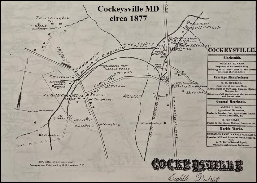 From a reprint of a 1969 reprint of the 1877 map.
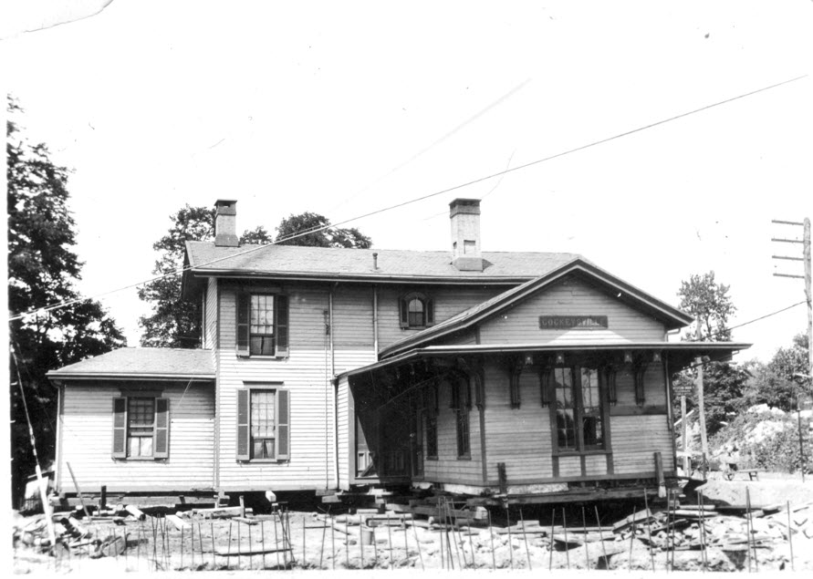


 Mark Jensen/FB
 2014, photo by Pi.1415926535 via Wikipedia
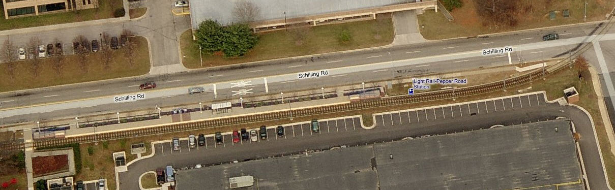
 2014, photo by Pi.1415926535 via Wikipedia
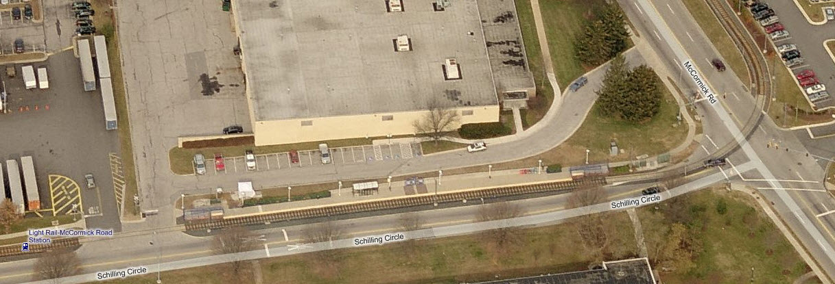
 2014, photo by Pi.1415926535 via Wikipedia
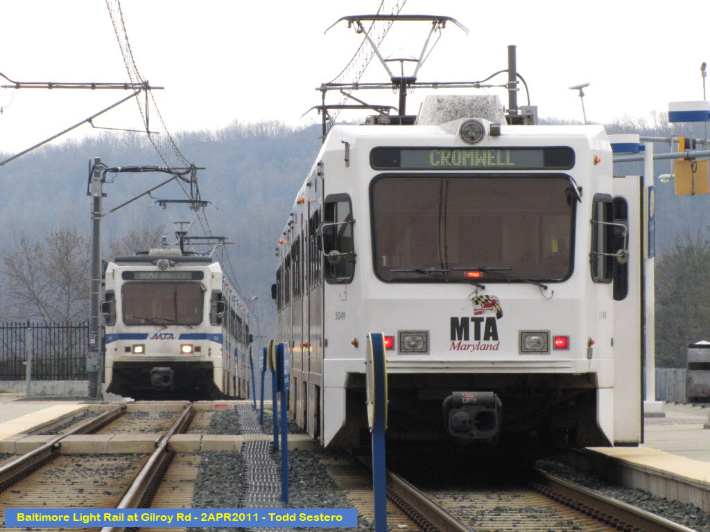


 2014, photo by Pi.1415926535 via Wikipedia


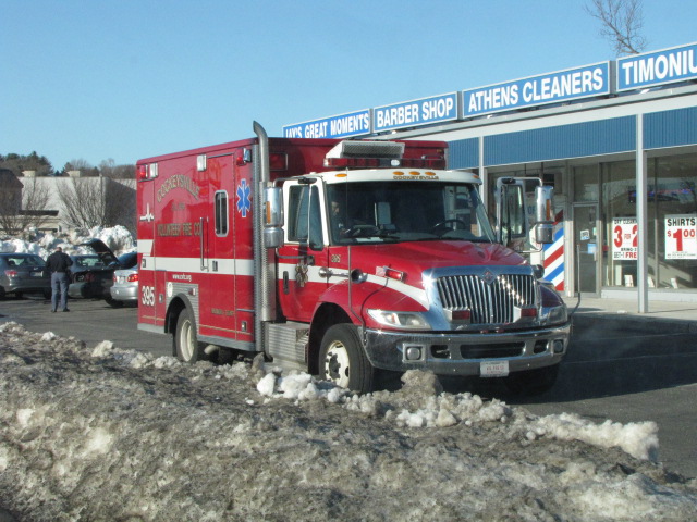 Medic 395 in Timonium.
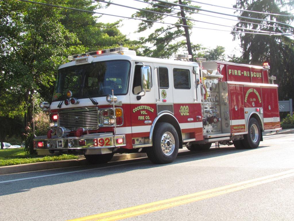 Engine 392 caught near the station.