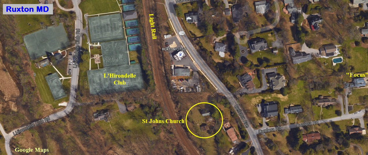
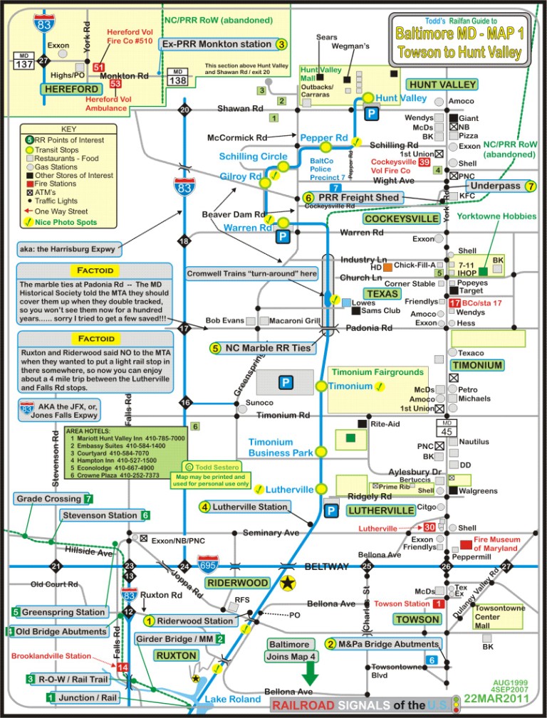
Location / Name:
Ruxton & Riderwood MD, Baltimore County
What's Here:
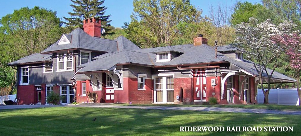
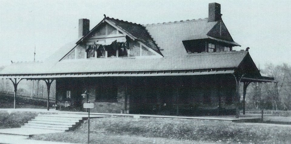
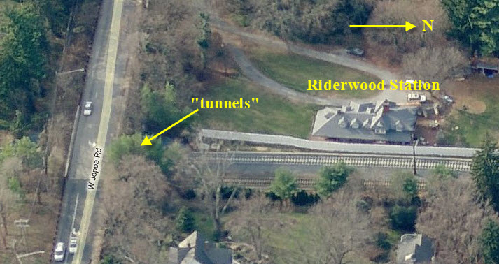
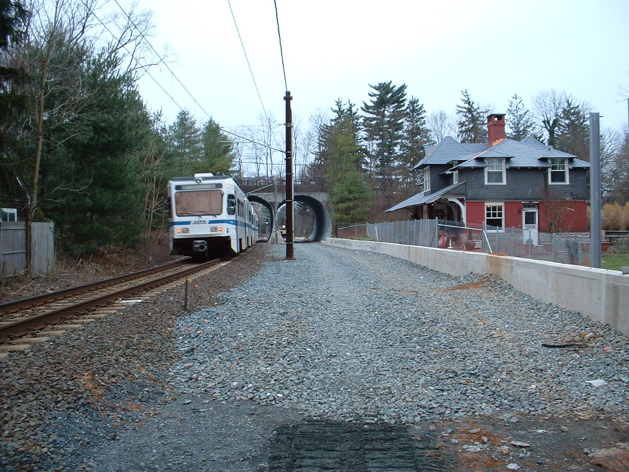
Riderwood Station (former Pennsy)
Twin Light Rail Tunnels
Site of former PRR Ruxton station
Data:
GPS Coordinates: as needed
Phone A/C: 410
ZIP: 21204
Access by train/transit:
None
The Scoop:
Ruxton and Riderwood are two historic communities in the north central part
of Baltimore County, just north of the city-county line. When there was
precious little out in the suburbs of Baltimore back in the 1800's, these two
areas sprang up as bedroom communities for the rich. Ruxton was the
original "rich" area of Baltimore County, and still retains a lot of that former
affluence.
Although this part of Baltimore happens to be blessed with quite a variety of
railroad "things", there is nothing here of
any real interest to the "hardcore" railfan looking for mainline action - you
will have to go downtown, or to the east or west of Baltimore for that. The second railroad of
Baltimore, the Baltimore & Susquehanna, later the Northern
Central, came through here in 1832 heading to York and
Harrisburg. They also built the Green Spring Branch, which the Western
Maryland used in the beginning before they had their own route out of the city.
The northern part of the light rail system runs right up the middle of the
map, which was the original right-of-way of the B&S/Northern
Central. The original section opened in 1990 and went to
Timonium. The extension went to Hunt Valley in 1996.
Any part of it that wasn't, was double tracked in 2005, and the old marble ties (stringers) were
visible along the R-O-W for a short while. Above Cockeysville, the R-O-W is now
the NC hikey-bikey Trail, which is very popular with those types (sorry, nothing
personal, as I take walks and hikes around the lake quite often). The R-O-W
splits off at Warren Rd, and other than the stub that is still there, not much
remains visible. NS trains stopped running when the light rail closed the
track for the double tracking project at the beginning of 2005. They
applied for abandonment shortly thereafter.
Both Ruxton and Riderwood were stations along the
Parkton Local route, which ran
from about 1862 till 1959. The Parkton page gives you a history, with
pictures of the stations along the route (if I have them), but for details, it
will bring you back to this page!
Several old NC/PRR depots are still with us to
check out. Riderwood is the only one in the neighborhood
(about a quarter of a mile down the tracks from me),
with the Ruxton station having been torn down in the early
1960's. Lutherville, Greenspring, Stevenson, and Monkton
are all fairly close - Three of them are used
as homes, and anyone wishing to take pictures of them should respect the privacy
of the homeowners! Monkton serves as the HQ for the Trail.
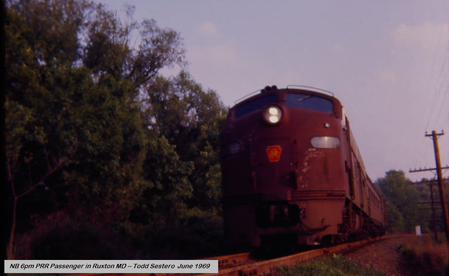
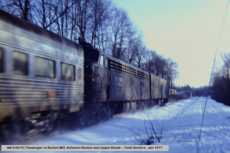
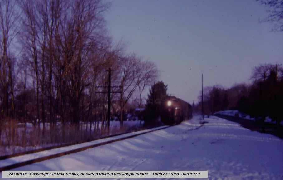
For those of you who remember, and for those of you who do not, the Pennsy ran a
single car passenger train from Baltimore to Harrisburg via the Northern Central
and York PA up until the start of Amtrak - May 1st, 1971. The train had a
single E8 pulling a single car. It left Baltimore at 6:00pm, and returned
the following morning around 9:00am. I have a picture of the NB train on
the last day somewhere in Ruxton, if I can find it. My buddy John Buxton
thinks a SB train ran ON Amtrak day, but we are looking into that. Since
the NCR train was a connection for the Capitol Limited that came from Chicago,
we're not sure if the train leaving on April 30th, was still going to use this
connection on May 1st? Anyone know for sure? Otherwise, they would
have had to take the train all the way into Philadelphia, and then get on a DC
bound train there, adding at least an hour to the trip.
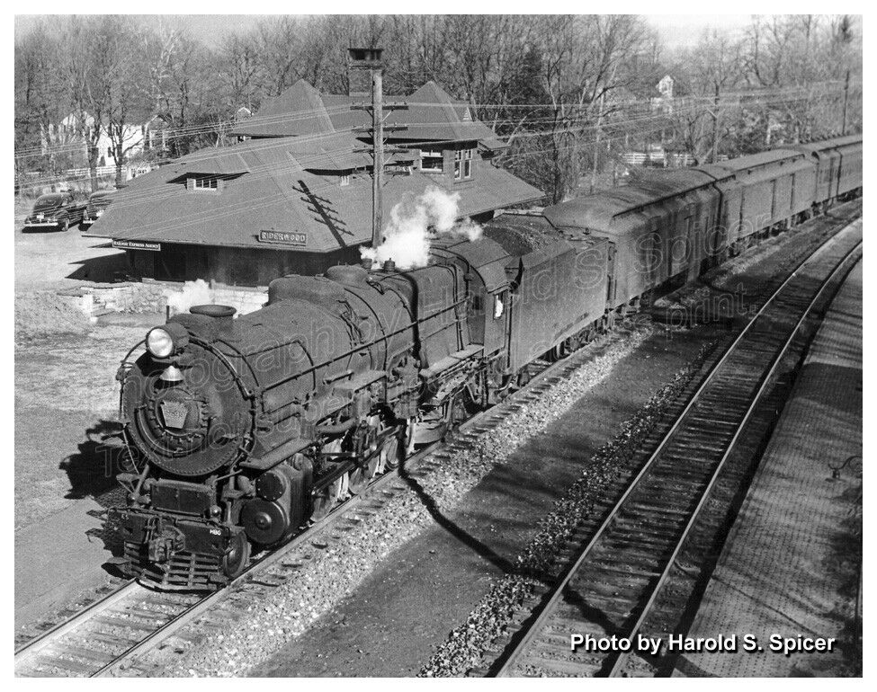
With the May 2021 update of this page, I would like to thank Bill
Spicer for allowing me to use his father's pictures of the Riderwood depot, and
the shot of a SB steamer going under Joppa Road.... WAY before Joppa Road was
rebuilt and they put in the twin "tunnels". If you are looking for copies
of the pictures Harold S. Spicer took, visit Bill's EBay store at:
https://www.ebay.com/usr/spicerpro?ul_noapp=true . Here is a small
sampling of the pictures he is offering:
Towson is to the east, Brooklandville is to the west, Lutherville,
Timonium, Texas, Cockeysville, Hunt Valley, and Monkton
are to the north, and Mt Washington and Lake Roland are
to the south.
Neither Ruxton nor Riderwood have a fire or police station located
within. The closest fire stations are Lutherville
Volunteer Fire Company (station 33), Towson (station 1), and Brooklandville (station
14). The closest police station, precinct 6, is in Towson.
FYI - I currently live in Riderwood, and grew up in Ruxton on L'Hirondelle Club Rd, and
yes, there is actually a tennis club on L'Hirondelle Club Rd, wanna guess
the name of it? :-)
Acknowledgements:
Bill Kalkman
Bill Spicer
Terry Jo Miller
S. W. Wiley Jr.
the Baltimore Sunpapers newspaper
Google Maps
Bing Maps (sometimes)
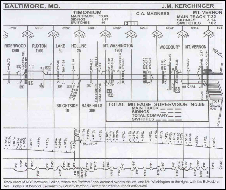
Track chart provided by Frank Wrabel, from the PRRT&HS Keystone Newsletter from Spring 2025.
Bridge 9.73 is over Roland Run, bridge 7.15 is over Lake Roland at the narrows.
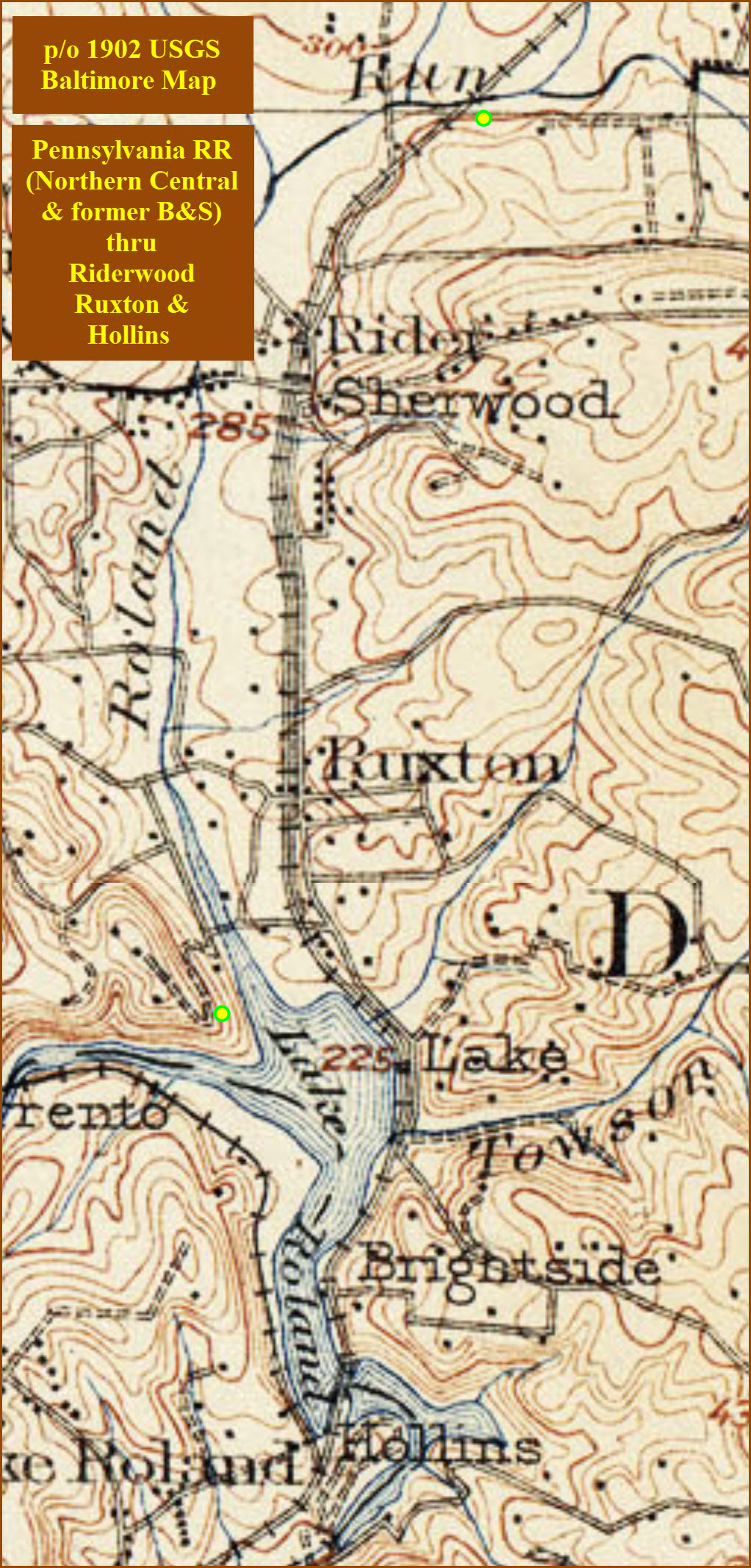
The map below is a blow-up of a 1902 topo map of Baltimore to show the
Riderwood-Ruxton-to-Hollins area of the Pennsy RR.
This station is privately owned.
The Riderwood Station is of a Frank Furness design.
The station was sold to the station operator around 1964 after the Pennsy stopped running the Parkton Local in 1959.
The station sold in 2002 for around $175,000, after been having put on the
Baltimore County Historic List, preventing is destruction.
Only date I have seen so far for the construction of this station is 1905, from the Wiki page on Ruxton and Riderwood.
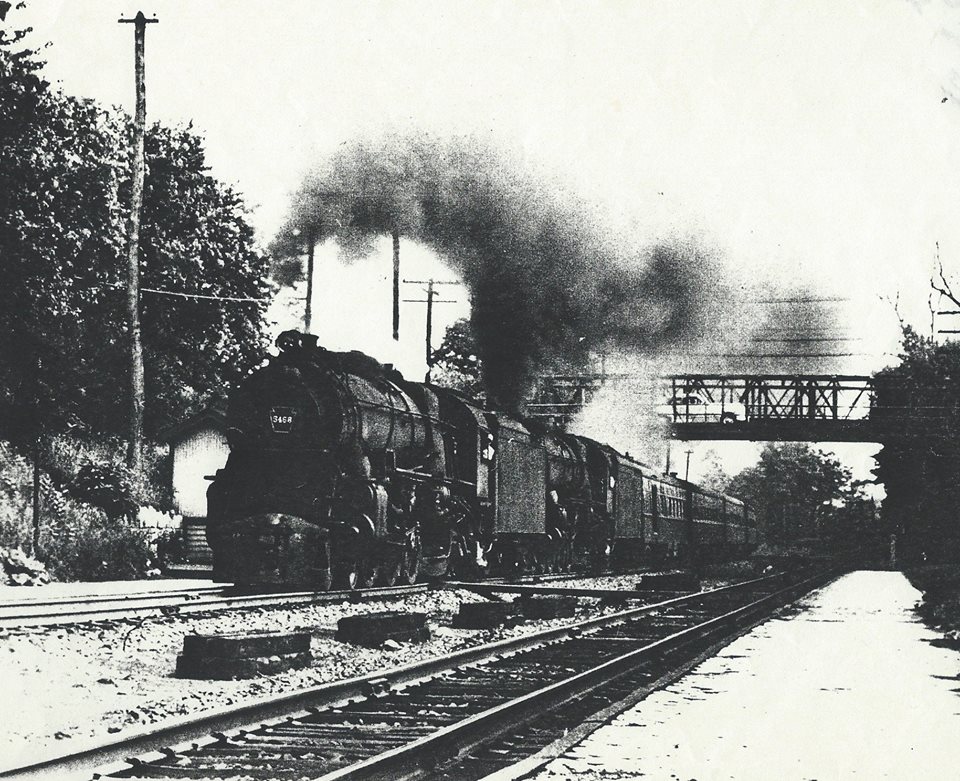
SB under Joppa Road.
photo from Kildruffs page
Please note: This depot should never be referred to as a Penn Central depot, because they had nothing to do with it.
But it does help to date when the photo was taken.
about 1917, photo by CWE Treadwell, via Wikipedia
In looking at the Harold Spice picture above, you can see the two tracks
disappearing off to the upper right next to each other, but as the tracks
progress southward past the station, the space in between widens, indicating
(probably) where the third track started at the north end. In the
second Harold Spice photo, you can see that the third track is gone (as with
the Ruxton pictures below), so it must have been removed early in the
1900's. This is an educated guess from the photographic evidence I've
been able to uncover.
In the track chart provided by Frank Wrabel, we can see that there were two
siding at Riderwood, one off of each track. One probably served the
station, and the other one may have been for unloading supplies headed to
Stebbins, a local hardware store.
Not that I am looking for fame and fortune, but I do believe that people who
do things -for free- and on their own time, they should be recognized for
doing so. This is one case where the Ruxton-Riderwood Improvement
Association dropped the ball, when they issued a note to their members about
getting the Riderwood Station on Baltimore County's Historic Register. Here's why:
In 2002, the woman who owned the station (the surviving widow of the
station operator), decided to sell it. I got a call while in Minneapolis
on business from a fellow named Mr. Coale of the Ruxton-Riderwood Improvement
Association asking me for help (don't know why he called me, or how he knew I
had an interest in trains, because it was before I started my website).
So I went to a monthly council meeting and petitioned
Baltimore County to put it on their historical list. The following month at the second
hearing, "things" were not looking good, because the council was turning down
similar requests. But after an additional short speech, I succeeded in getting
it onto the list! Yea! The woman and her real estate agent got
really pissed at me because the best offer they had gotten was from a real
estate developer who wanted to tear it down and put up 4 or 5 houses on the acre
and a half it sits on. Score one for "us". The house sold for $175K
back in 2002, and recently sold for around $650K before the real estate bust.
It looks like a second fireplace was added sometime after the station was
originally built.
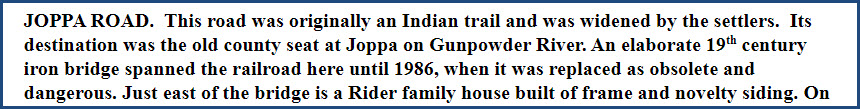
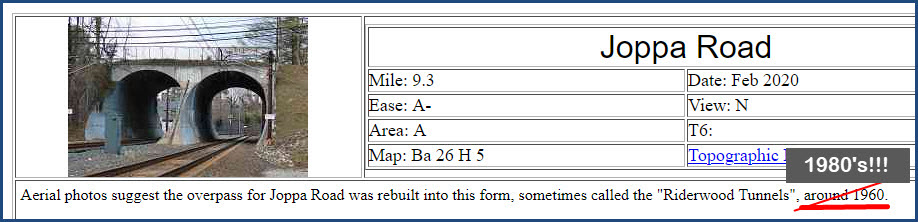
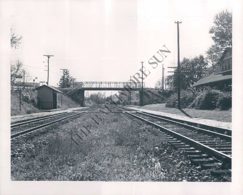
When I started driving in 1969, Joppa Road went over the tracks in a pretty
'rickety' ole bridge. I didn't really pay much attention at the time as to
when they replaced the bridge with the "tunnels", but according to the
history of the Light Rail route by John McGrain, the bridge was replaced by
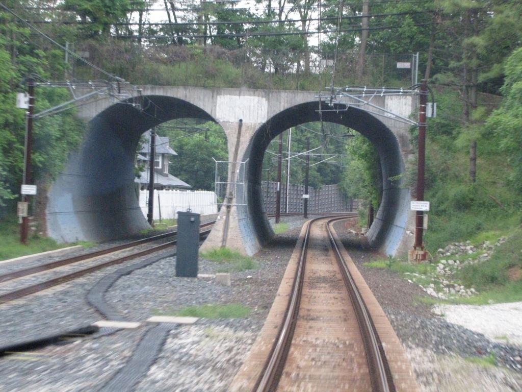
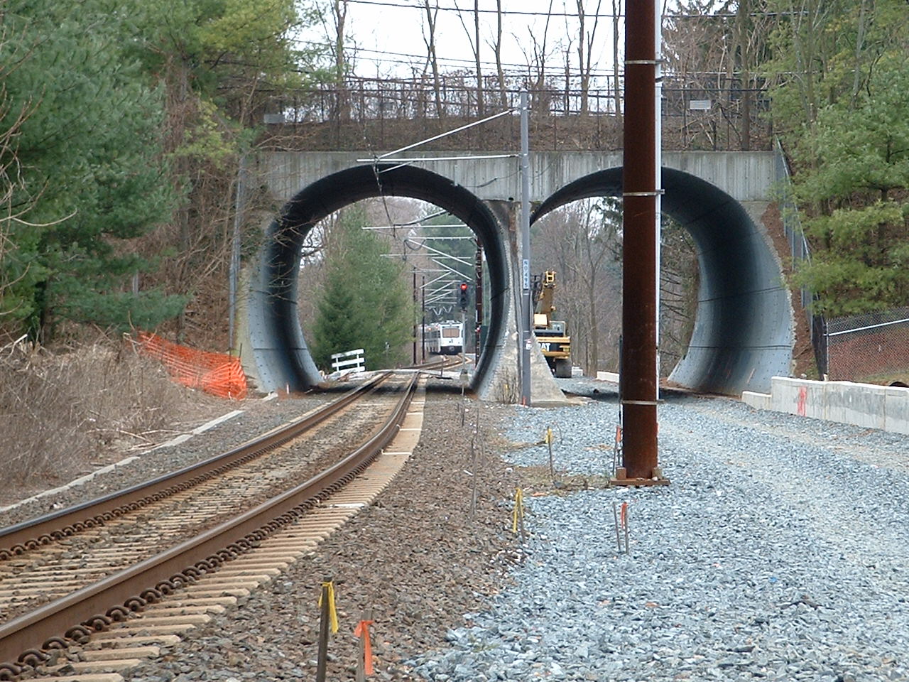
the "tunnels" in 1986.
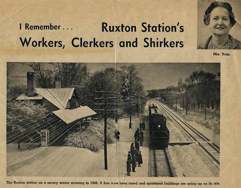
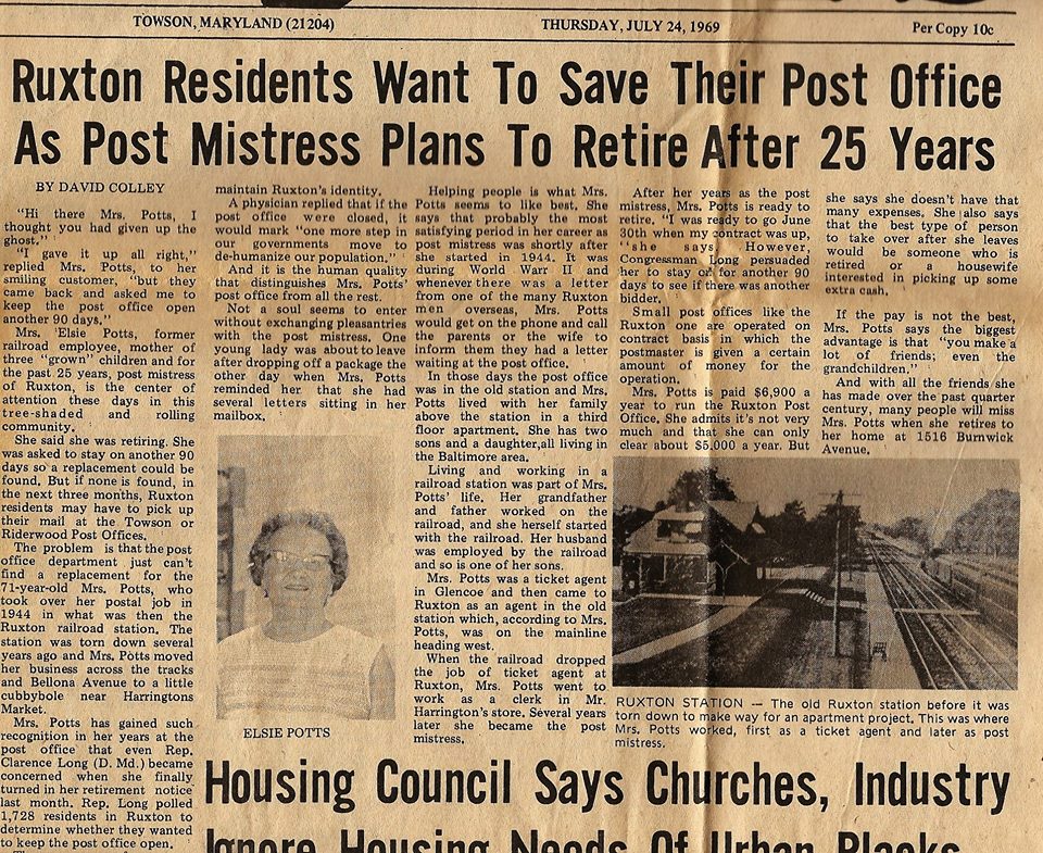
The Ruxton station was torn down in the early 60's after
passenger service ended in 1959, and an apartment building was put up in its place.
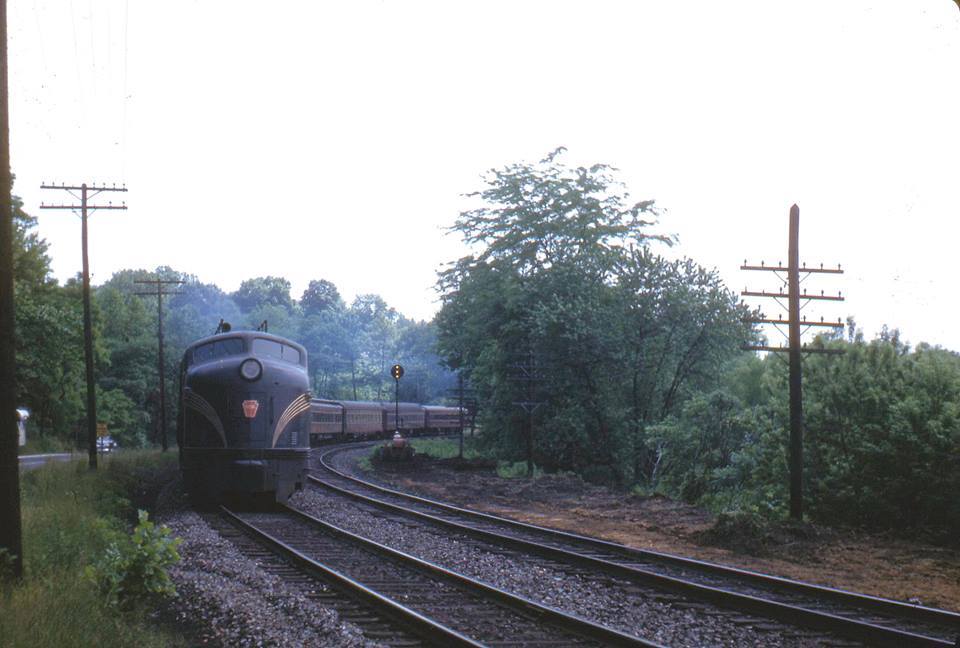
The train in the left picture below is using a diesel - you can also see a phone booth on
the corner of the depot, which is not in the steam picture. Maybe one day
I will find a better picture of the station, showing how they squeezed three
tracks in here - the picture appeared in the
Sunpapers back in the late 60's.&
1892, S. W. Wiley Jr
from Terry Jo Miller collection
from Terry Jo Miller collection
HSBC
~1955?, Warren E. Olt
Northbound Capitol Connector along Bellona Ave, getting ready to pass thru Ruxton.
Living next to the light rail can have its
advantages. During the blizzard of 1996, traffic went no-where for two
days, so I called up Light Rail Control and had them stop behind my house at
this milepost to pick me up for work. Did this for two days. If you
read the Baltimore Light Rail section, you may remember I worked as an ET for
them between 95 and 98. Some of the operators will still blow the
horn when they pass by and see me in the yard.
The railing in the photo above is on bridge 9.73 (on the Pennsy track chart) going over Roland Run.
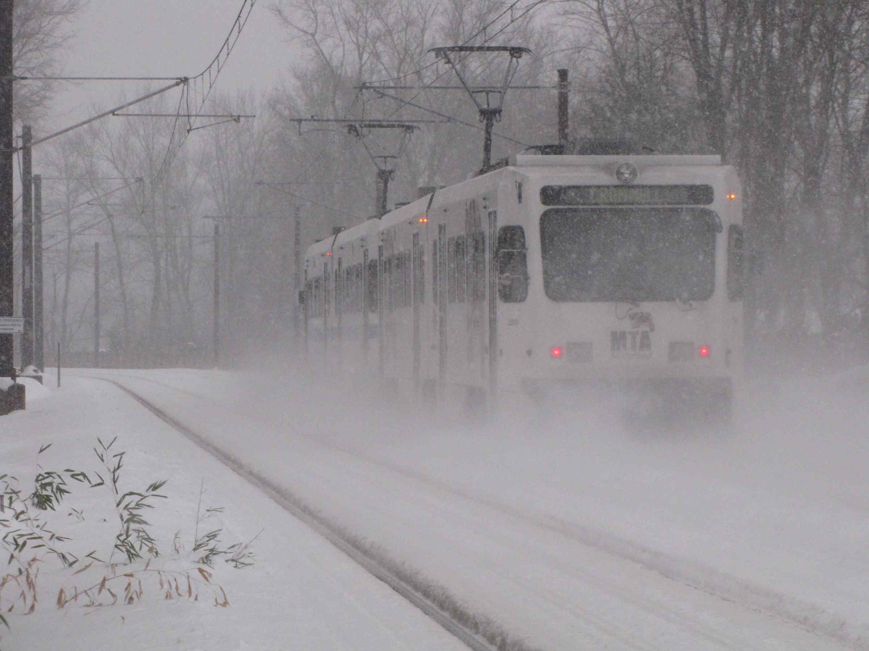
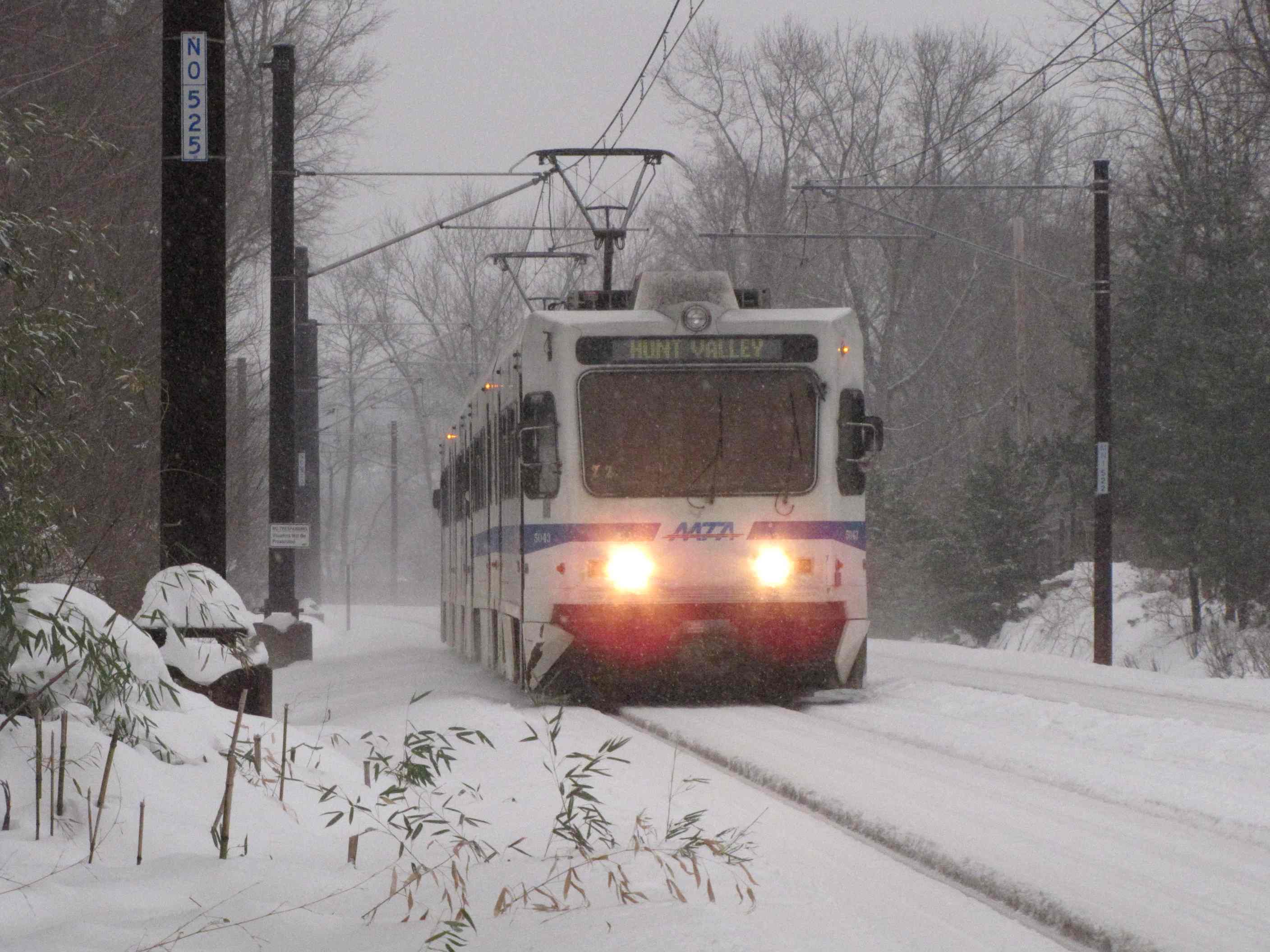
A few winter shots from behind my house.
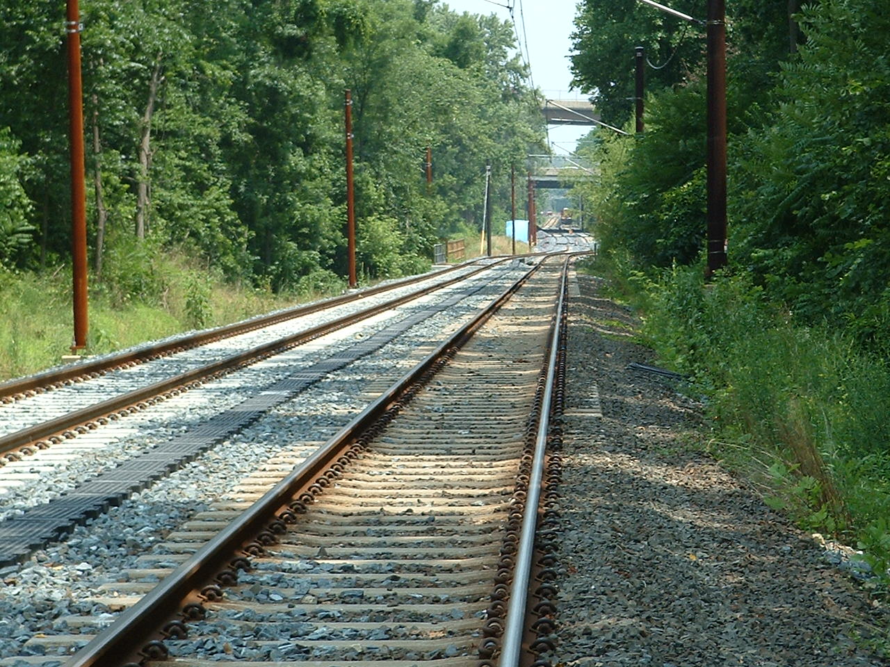
Looking north towards Lutherville. The jog in the track was/is for noise
reduction for Thorton residents! :-)??? I'm sure it does a LOT of good!
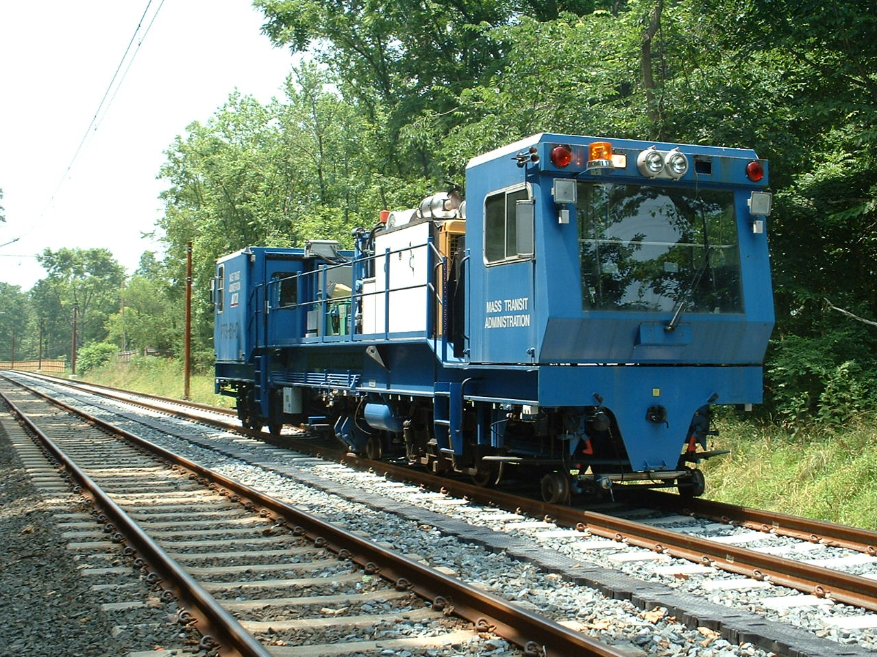
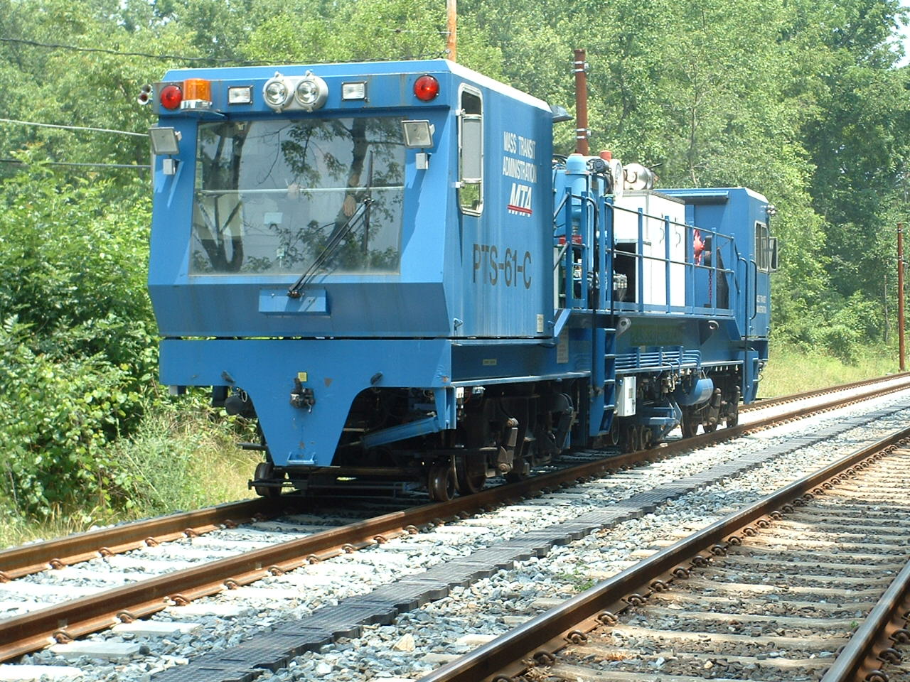
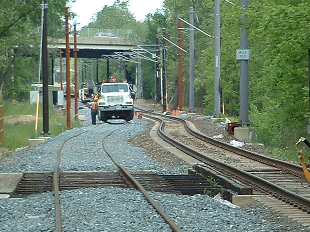
Double tracking the north end of the light rail
system started on January 1st, 2005, and took about a year. During the
construction time, the MTA used busses. I bet a lot of the suburbanites
drove their own car during that time! :-)
Double tracking reduced the number of signals in the Ruxton-Riderwood area.
There was a NB signal next to the Riderwood post-office (bottom two
pictures in the tunnel pics section below), and a SB signal just south of the
tunnels that were removed (the signal you can see when looking thru the
tunnels, with only one track before the double tracking project). In
addition, there were three signals used in the interlocking
along Bellona Ave adjacent to Grauls that were removed because they were no
longer needed. Signals are no longer used as intermediate signals,
especially since they have ATC installed on the cars.
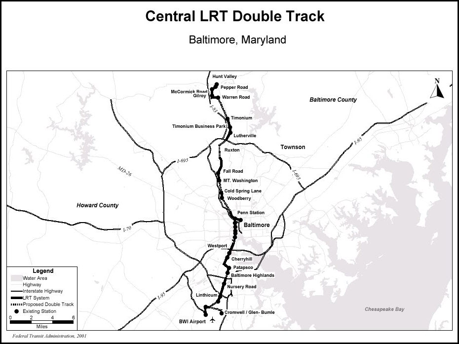
As you can see from
the map below, the north end had way more single track than the south end.
One reason for this may have been the fact that when the MTA took on the task of
building the first section of light rail, which was the north section, they paid
for it completely without federal funds for a couple of reasons. One, it
was quicker, and secondly, they didn't have to go through the environmental
approval process required to get the federal money. So they took shortcuts
where they could, and one was to have a lot of single track. One of my
biggest beefs in the way they did things was to put TWO sets of poles on the
line, instead of one down the middle. Why would anyone who was thinking of
saving money double the installation costs? In addition, it saves in space
needed to lay down the R-O-W, and anyone who has been behind the Riderwood post
office knows what I mean, because they use hangers that span both tracks because
it is so narrow there!
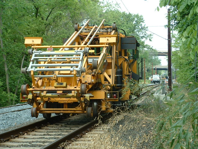
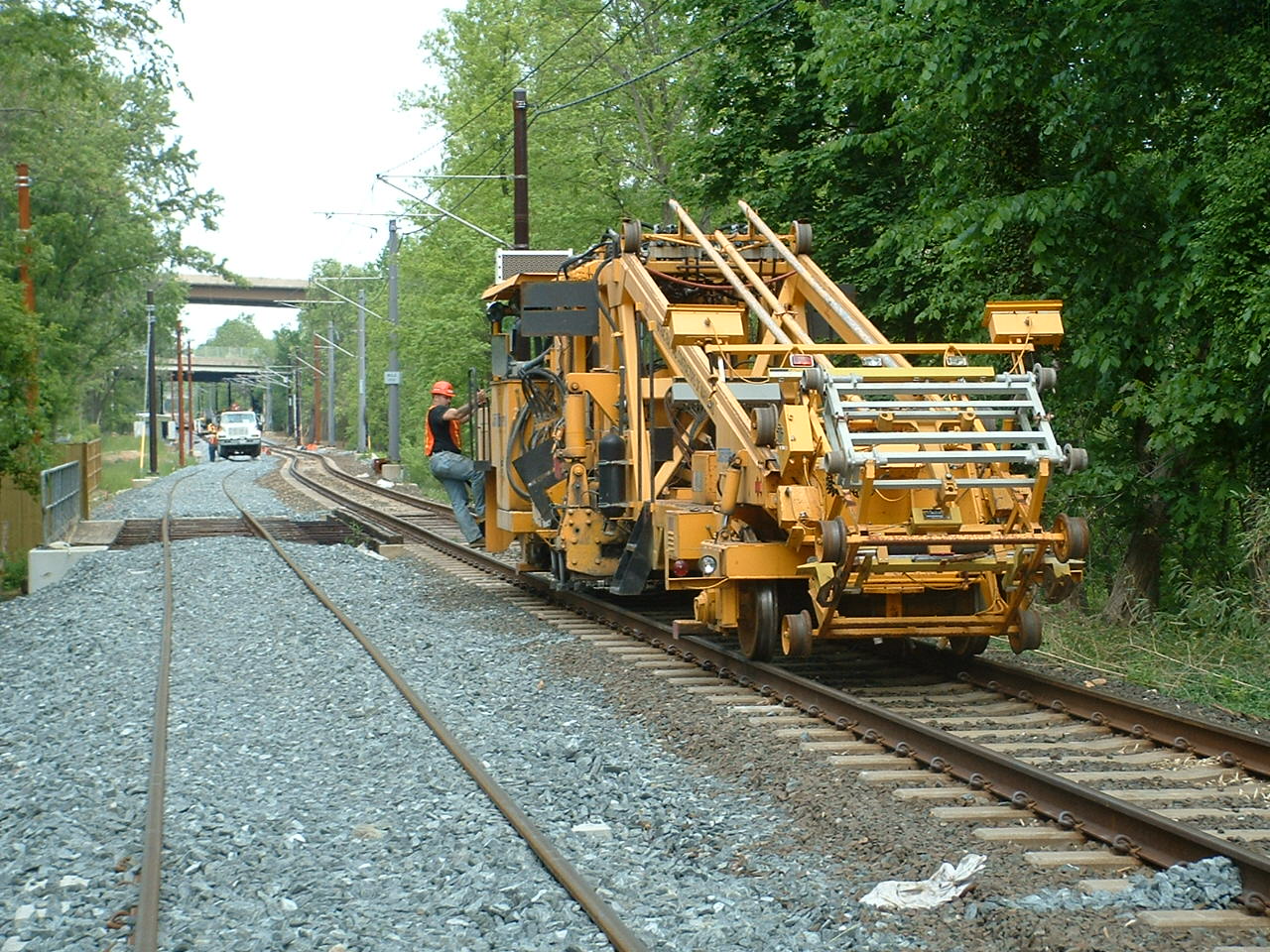
Installing the catenary support brackets.
Installing the catenary.
Fine tuning the catenary.
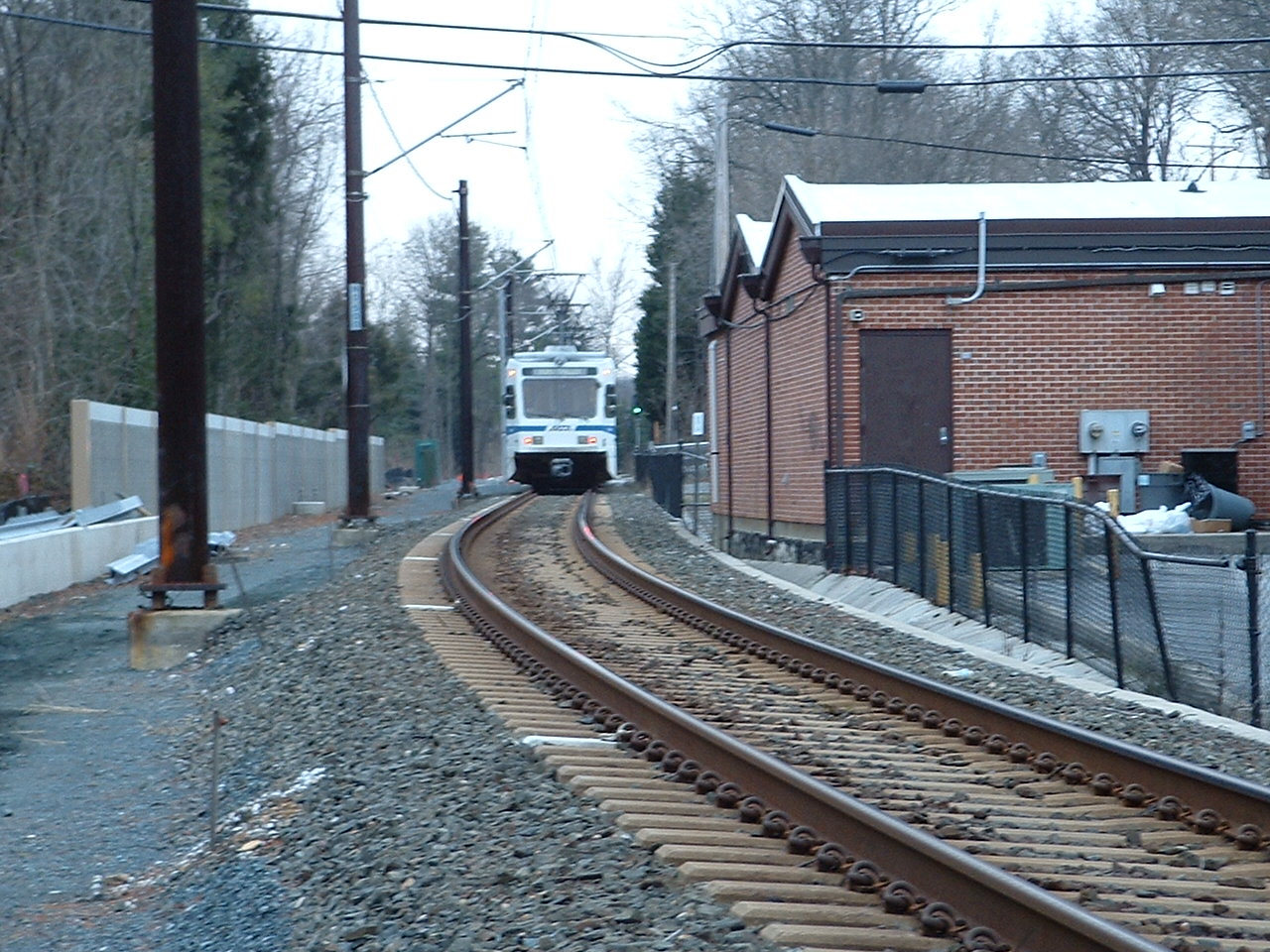
the Riderwood Tunnels
Shooting thru the cab of a northbound train, just before going thru the tunnel. You
can just barely see the Riderwood station thru the left portal.
Looking southbound thru the tunnels, on 12/31/2004, the day before they shut down service on the "north
end" to start the double tracking project. The signal is no longer there.
With my back to the tunnels.
With my back to the tunnels.
A long time ago, this is what trains looked like when they were going under
Joppa Road before the Tunnels were built.
~1955?, Warren E. Olt
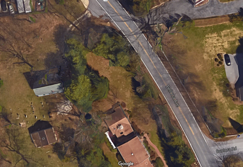
A northbound passenger where Bellona breaks off from the tracks and goes up the hill to Charles Street.
I have the wiring diagrams for that signal - somewhere.
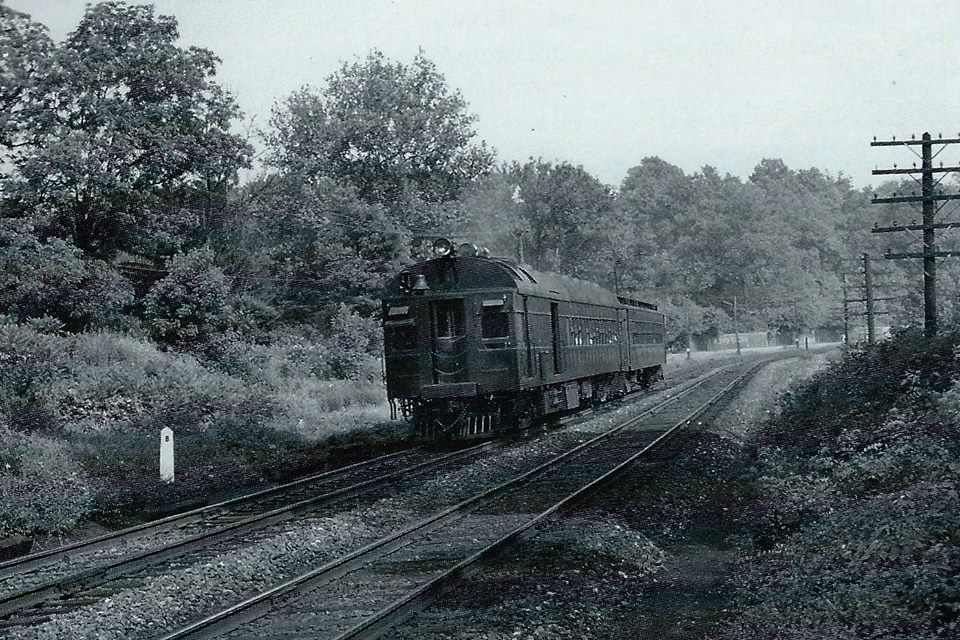
A northbound Parkton Local having just passed Lake Roland and the Lake Station, which was on Bellona Ave.
Ruxton Road is behind us, and that is Bellona Ave off to the left of the tracks.
What follows are a bunch of pictures I took as a kid, most where shot with a
Kodak Instamatic (the square slides), so quality isn't all that good. Darn.
Seems to be a popular spot for photos! :-)
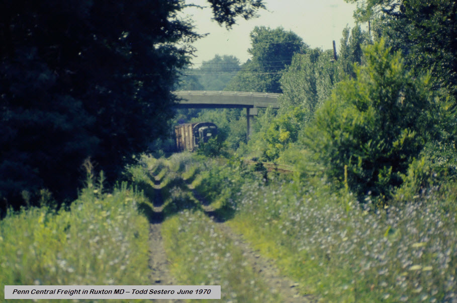
Just north of Ruxton Rd
Again, just north of Ruxton Rd. Nice long string of cars, maybe, what, 15 cars or so?
Yeah, I know it's not a great picture, but..... Shoulda made a u-turn and
gotten it on Bellona where the track and road paralleled each other.
This shot doesn't show much except for the plethora of greenery that developed once the Pennsy stopped doing much ROW maintenance "up here".
As seen above, this train often used two engines, not sure why, cause I'm sure an RS unit had the power.
In later years, after Agnes, and they took up most of the track in Cockeysville and north,
so there was no way to do a go around, and an engine was needed on both ends.
This might have been a returning freight since there is no headlight.
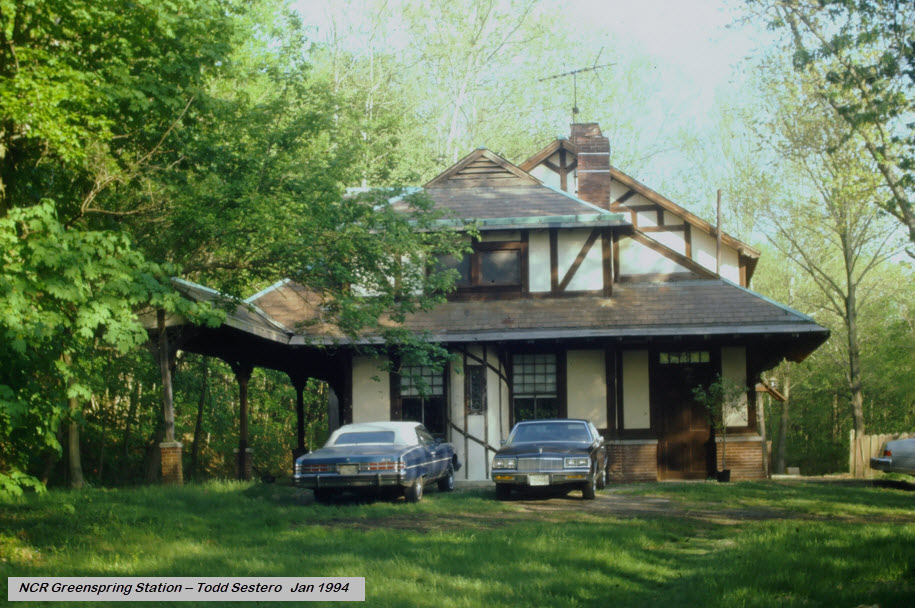
Take Ruxton Rd to it's other end at Falls Rd, make a right onto Falls Rd, and in about a mile,
you come to the Greenspring station on your left.
Small excerpt from Alex Brougham's BULL SHEET, June 1994:
The Baltimore & Susquehanna RR (1828-1854):
With this issue of the Bull Sheet, I take an opportunity to devote its
feature material space to a central theme. The Baltimore & Susquehanna (a
predecessor of the Northern Central) holds a very special place to me. I
grew up along the line. By devoting it to the B&S, a two-fold purpose is
served: First, this month marks the 35th anniversary of the last trip of the
famed Parkton Local, a train I rode many times in its final two years of
service. Second, on Saturday, June 4, the first mile and one-half segment of
the York County Rail/Trail along the former B&S right-of-way in Pennsylvania
will be dedicated.
The Baltimore & Susquehanna Railroad was chartered in 1828 and begun the
following year to connect Baltimore with the Susquehanna River near York,
Pennsylvania. It achieved that goal in 1840. It later completed construction
to the area of Harrisburg, with work to build further, but in 1854 the
company went bankrupt. It was then reorganized under the name of the
Northern Central Railway, a line that eventually reached Lake Ontario at
Sodus Point, New York. In 1914, the NCR became a part of the mighty
Pennsylvania Railroad through a lease arrangement.
The dedication of the Baltimore & Susquehanna to this issue of the Bull
Sheet is due to that line's geographical territory approximating the issue's
interest scope. The ultimate Northern Central's territory was much larger,
and the Pennsylvania's was larger yet. So while the names Northern Central
and Pennsylvania do figure extensively in the articles that follow, it is
actually the territory of the predecessor B&S that more directly intrigued
my fancy as a kid growing up in Monkton.
Special thanks go to Robert L. Williams and Martin K. Van Horn for their
assistance with material they provided for this issue.
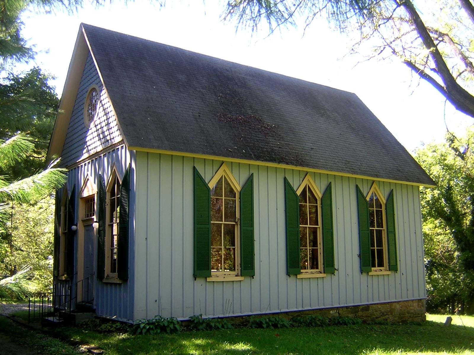
From Wikipedia: St. John's Church is a historic A.U.M.P. Church located in
Ruxton, Baltimore County, Maryland. It was built in 1886 as a successor to
the original log cabin church built on the site in 1833, and is a frame
Carpenter Gothic-style gable-roofed structure with board-and-batten siding,
stylized lancet windows and decorative detailing. Also on the property is
a 1 1/2 story stuccoed stone house, believed to date from about 1835, which was used as a
parsonage and has suffered significant fire damage, and a simple frame
rectangular social hall built about 1890. The Black congregation that
constructed this church was formed in the 1830s and they acquired this site in
1833. According to its National Register listing, "St. John's Church is
particularly important as an exceptional example of Black church building in the
late 19th century." Supposedly, the church is the oldest Black
church in Maryland.
Disclaimers:
New format 10/26/23: Please check out my disclaimer page for my standard
dribble and contact info here
 SB under Joppa Road.
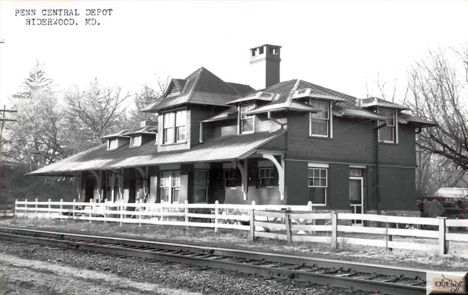 photo from Kildruffs page
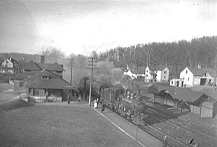 about 1917, photo by CWE Treadwell, via Wikipedia
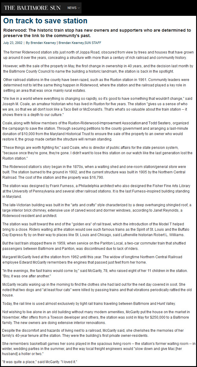
 1892, S. W. Wiley Jr
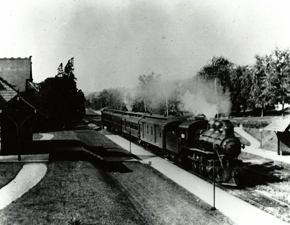 from Terry Jo Miller collection
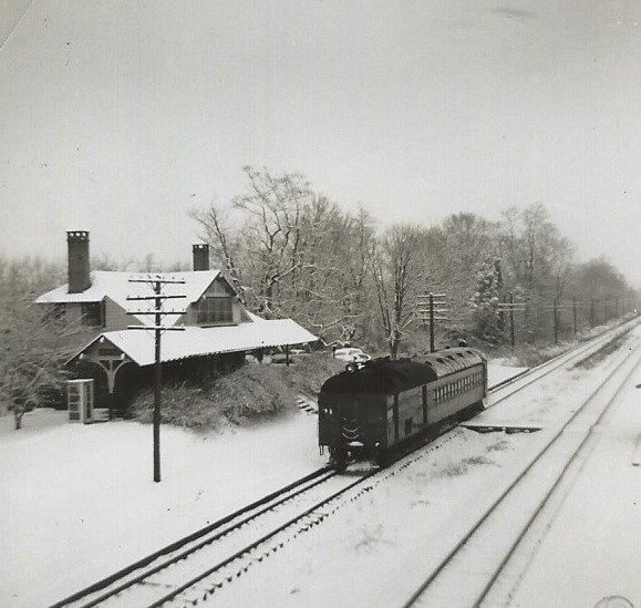 from Terry Jo Miller collection
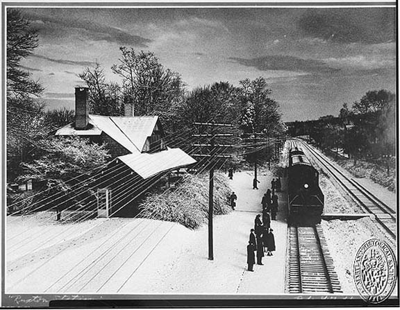 HSBC
HSBC ~1955?, Warren E. Olt
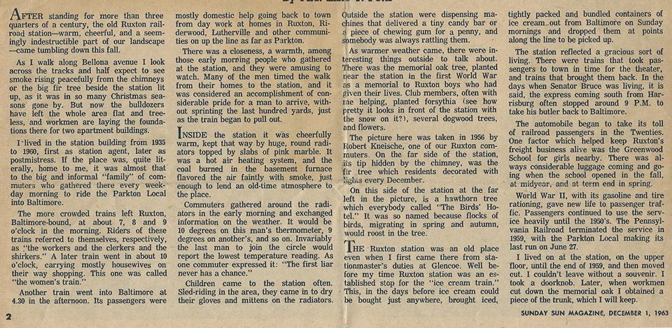
 A few winter shots from behind my house.
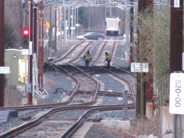
 Installing the catenary support brackets.
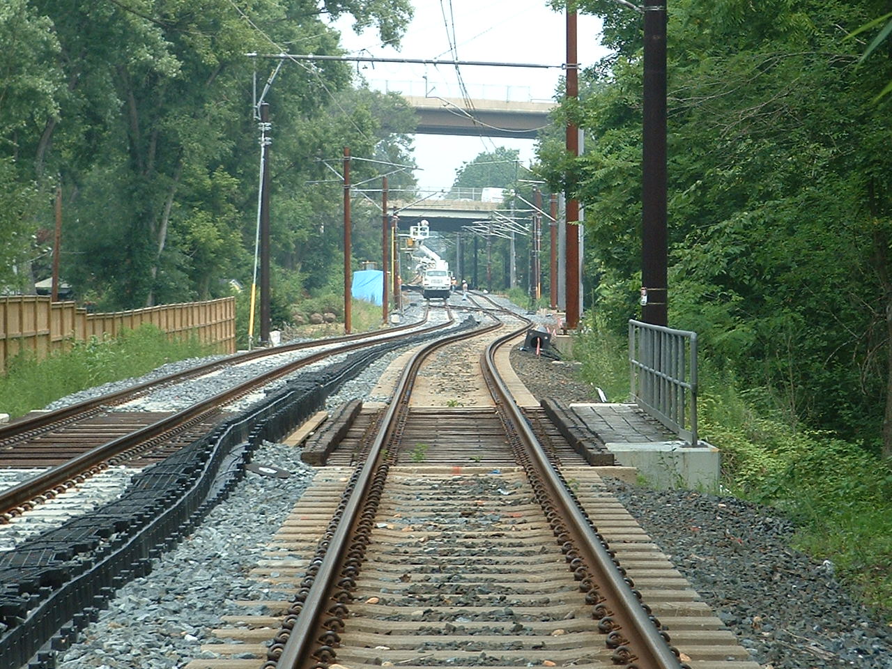 Installing the catenary.
 Fine tuning the catenary.
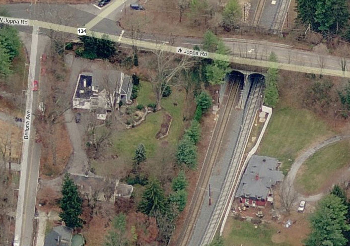
 With my back to the tunnels.
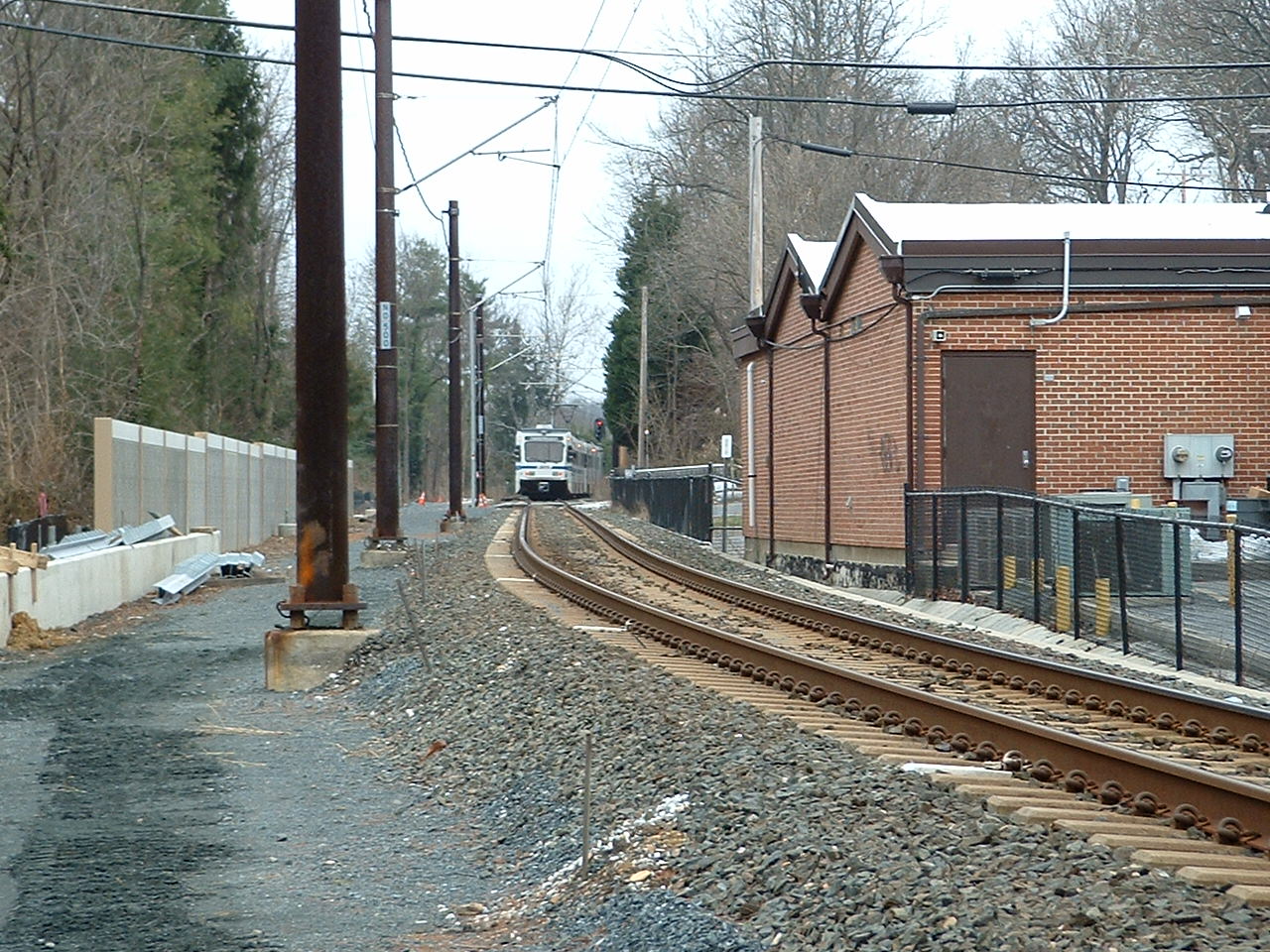 With my back to the tunnels.
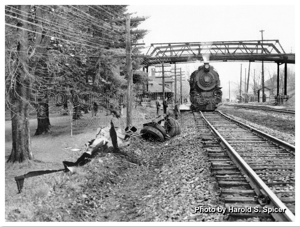 courtesy Bill Spicer.
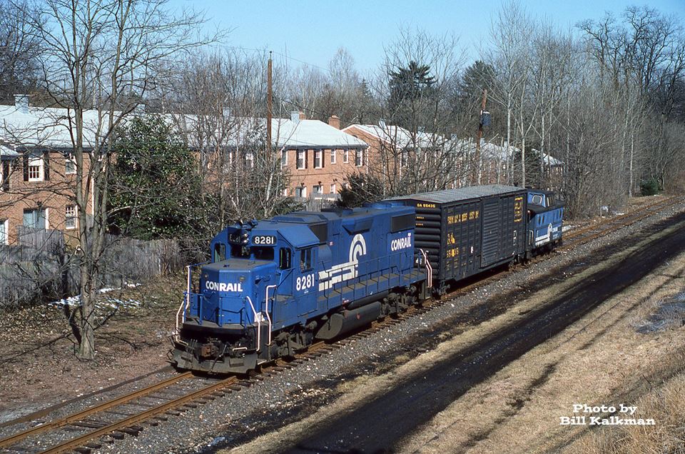 SB Conrail at Ruxton Rd, Mar 1st, 1986
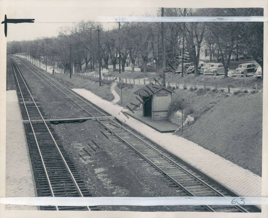 Late 40's???
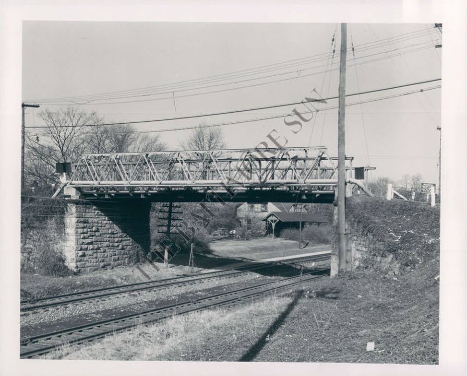
 ~1955?, Warren E. Olt
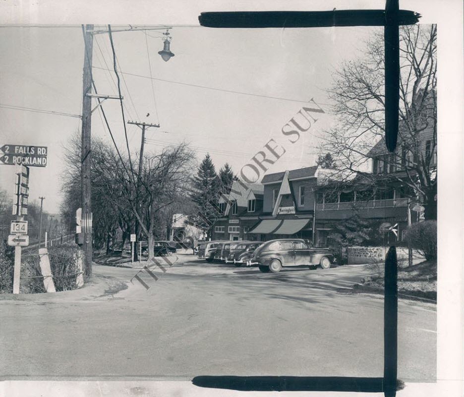
 Seems to be a popular spot for photos! :-)
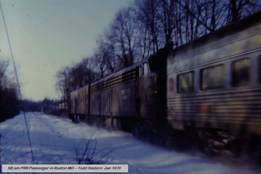 Just north of Ruxton Rd
 1969
1969