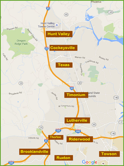
The only thing of real train type interest
in Timonium is the light rail passing thru, and for half of you, it's probably not a
great enough reason to stop in Timonium. There are two stations in
Timonium: Timonium Fairgrounds and
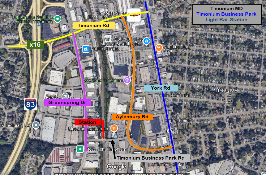
Timonium Business Park. The
Fairgrounds station has plenty of parking off of Greenspring Drive. The
Business Park station DOES NOT have it's own parking - you can try parking in
the Bluestone restaurant parking lot, or at the Baltimore Coffee store and
take a chance they don't have you towed, but if you're just parking to get some
quick pictures, it shouldn't be a problem.
The only other item of significance are
the Baltimore & Susquehanna marble ties, but they were only uncovered
briefly during the 2005 double-tracking, so there is nothing to see any more.
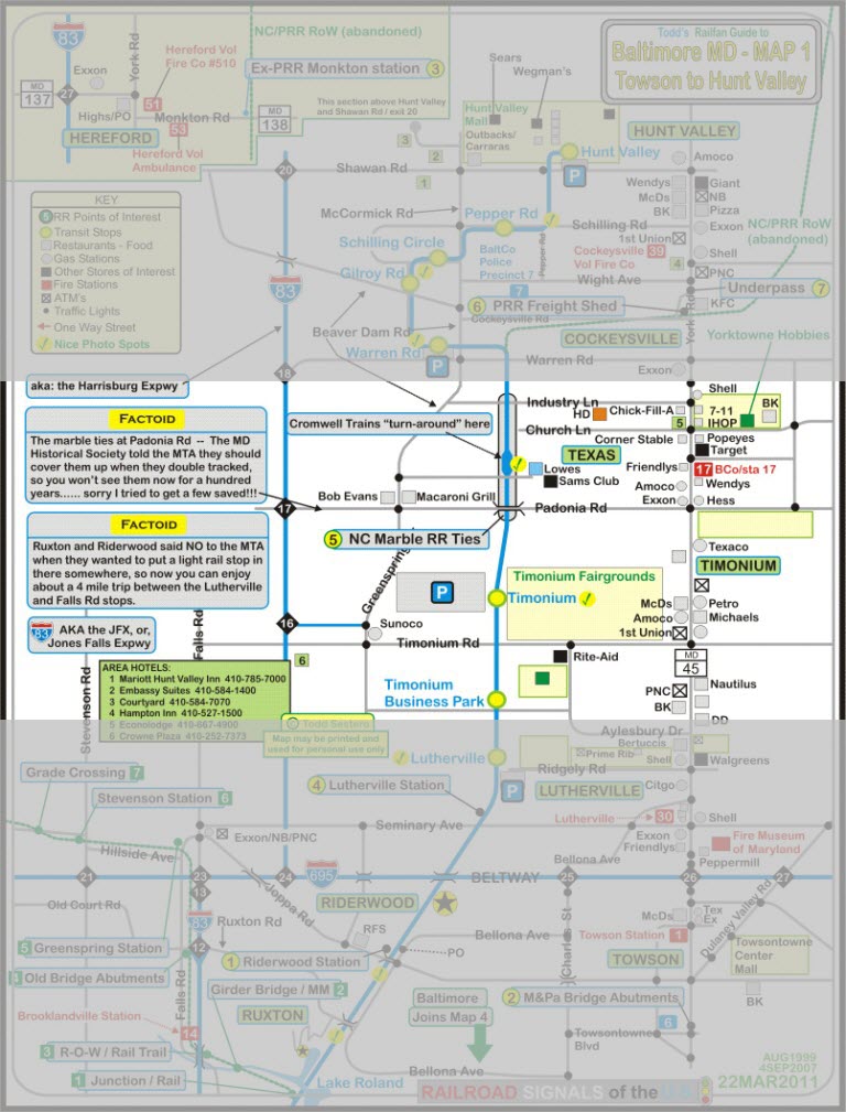
The second railroad of Baltimore, the Baltimore and Susquehanna,
came through here in 1831-32 heading to York and Harrisburg.
The railroad was re-organized as the Northern Central Rwy
after a really bad accident in Ruxton/Riderwood killed 35 people, and the B&S
was prompted to reorganize in order to stave off bankruptcy. The B&S also built the
Green Spring Branch, which the Western
Maryland used in the beginning before they had their own route out of the city.
They built this route as an alternate way out of Baltimore when the state of
Pennsylvania denied the Northern Central access to entering York County.
The R-O-W was double tracked and signaled by WW1. Local passenger service,
known as the Parkton Local, was discontinued in 1959. Soon after, the line
reverted to a single track with passing sidings.
There are no fire or police stations in Timonium. The closest fire station
is #17 in neighboring Texas to the north, and Lutherville Volunteer Fire
Company, station 30, to the south. The Towson, and maybe the Cockeysville
precinct handle trouble in Timonium.
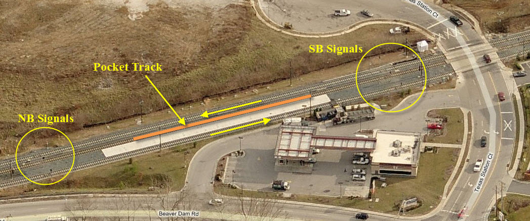
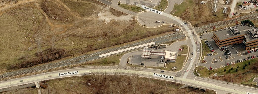
Just north of Padonia Road, across from the
Lowe's, the Glen Burnie/Cromwell trains "turn around". During the
double-tracking project, the MTA put in this really nice pocket track station
like arrangement (like Camden Station), and the turn-arounds wait in the pocket
track.
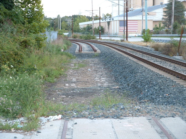
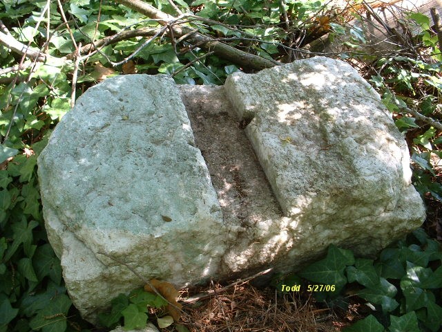
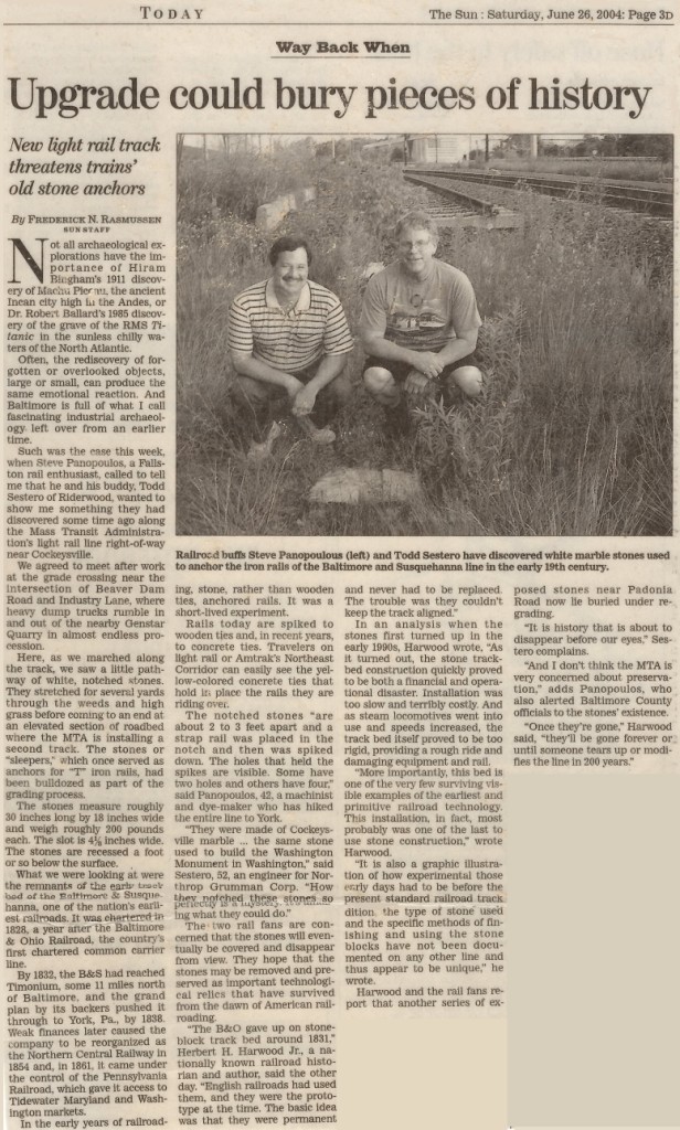
These fine examples of marble railroad ties, or sleepers, date back to when
the Baltimore & Susquehanna, precursor to the Northern Central,
was heading north out of Baltimore in the 1834 time frame.
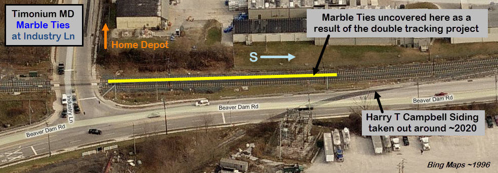
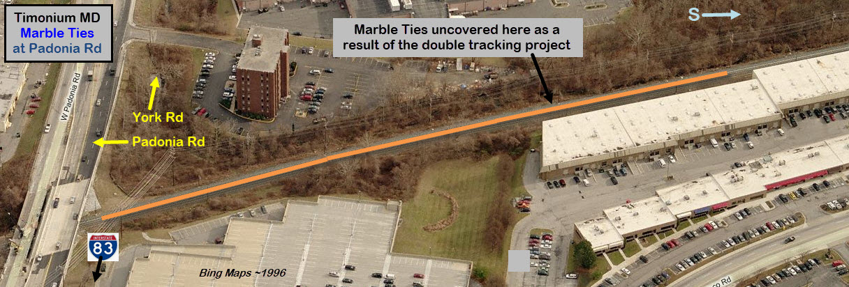
When the MTA Light Rail was double tracking the northern section in 2005, they
"uncovered" many of the ones still left in the old right-of-way. There
were two sections that we saw, one was under Padonia Road going several hundred
feet to the south, the other section was at Industry Lane. I tried like a
bandit to get some of them saved, but neither the MTA
nor the Maryland Historical Trust wanted to do so,
stating that they should be preserved for the
future when "we" will know more about discovering their secrets. The
letter I received also asked me if I knew anything about extracting historical
artifacts out of the ground without damaging them, but a couple of days after I
received that letter, contractors doing the R-O-W work came along and scraped the
top of several dozen of them while clearing the way for the new track - so much
for the state being competent guardians of our past (I saw this happen, so it is not
hearsay or someone else's story!).
So, they all got buried and none of us will ever see them again in our lifetime :-(
The two aerial shots below show where the stones were uncovered and could easily be seen during 2005.
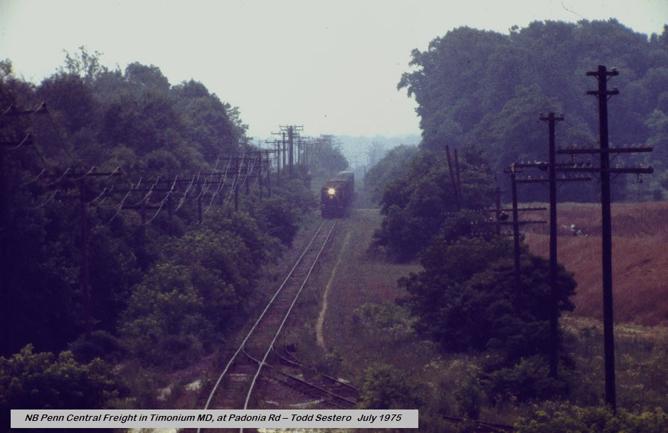
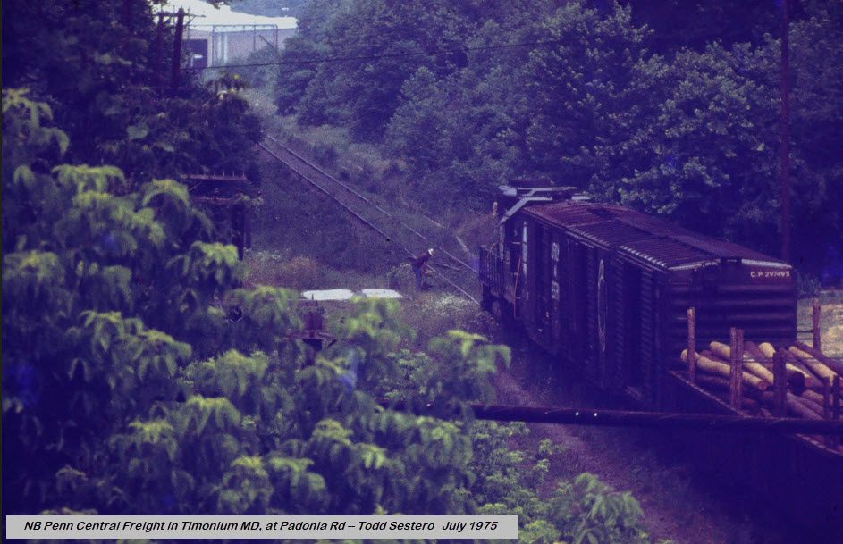
Here are a couple of pictures of a Penn Central freight heading up to
Cockeysville in mid 1975. I forgot about the siding - don't remember who
it went to, and I never saw anything on it since I started driving in 1969.
Closer to the Padonia Road overpass is where the B&S sleepers were uncovered
during the double tracking in 2005. Wish I had taken a picture of it at
the switch! -- Well, actually I did. Somehow I'm missing three slides in
the sequence from here.... Now I gotta go n look thru 100 slide boxes since they
aren't in the two boxes of PRR & PC stuff. Dang. In case I
gave you some slides way back when, I'm looking for slides number 201-7/8/9.
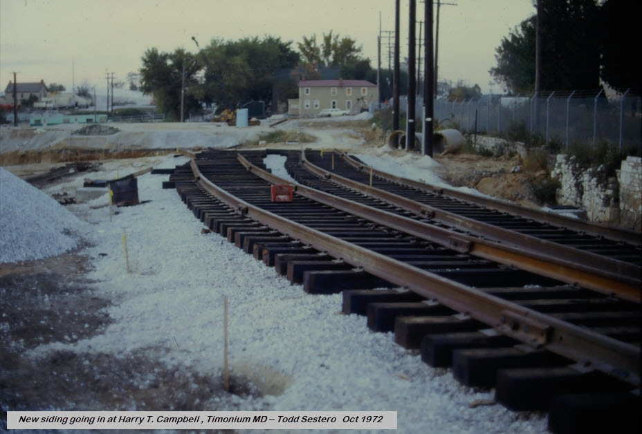
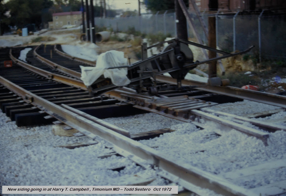
The quarry siding that the MTA took out in the Texas/Timonium area back in 2018
or so, had been installed in 1972!
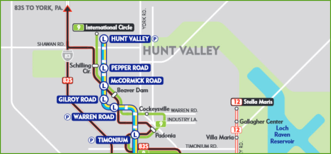
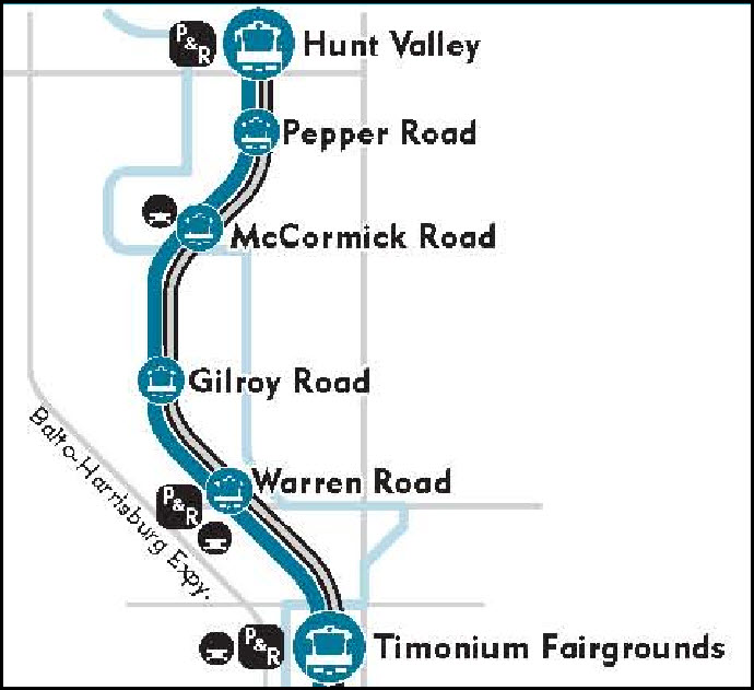
The Baltimore Light Rail system starts/ends on
the northern part of the map in Hunt Valley, at the mall. Too bad for
riders, but by the time the current owner of the Mall told the MTA that they
would love to have the Light Rail come into the Mall, the MTA already had
started on building the station as it is now.
As mentioned at the top of the page, there are two stops in Timonium, the
Fairgrounds, next to the State Fairgrounds, and
the Timonium Business Park.
In addition, there is a pocket track adjacent to Lowe's where
trains not going to Hunt Valley "turn around", or, as Google Maps
now has it labeled: the Texas Crossover.
I've never heard anyone say what the pocket track is referred to as, so you can
pick one:, the Texas Crossover, the Lowe's Pocket Track, or the Timonium
Turn-Around :-) Texas is a small spot on the map between Timonium and
Cockeysville, and BaltCo Fire station #17 is called -Texas-.
North to south, you got Warren Rd grade crossing, Timonium turn around
(the Lowe's pocket track),
Fairgrounds station, and Business Park station. Next station south is
Lutherville, next one north is Warren Rd.
the Texas Crossover, or the Timonium Turn Around
GPS Coordinates: 39.45857, -76.64101
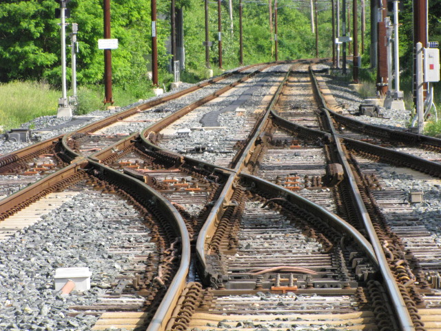
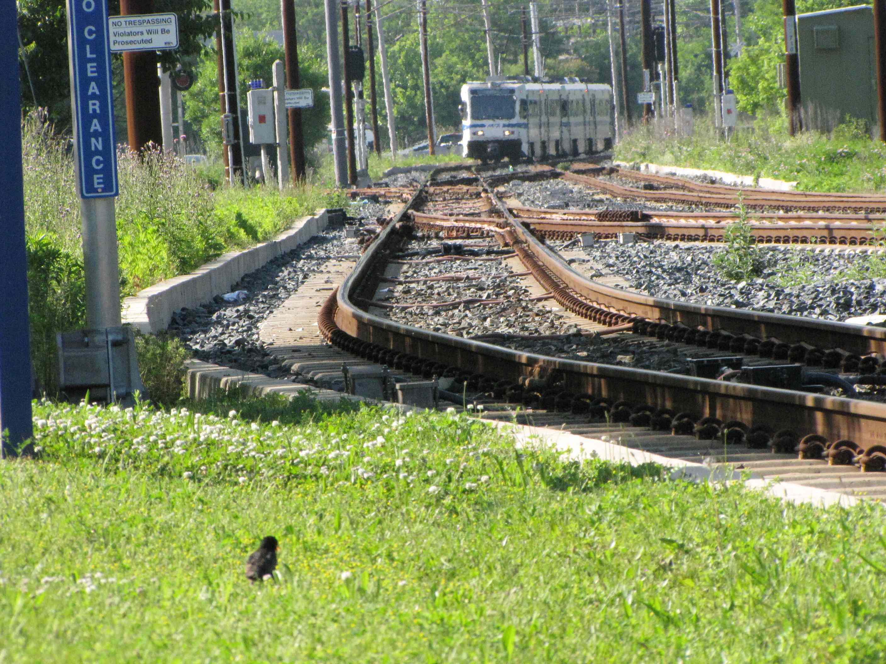
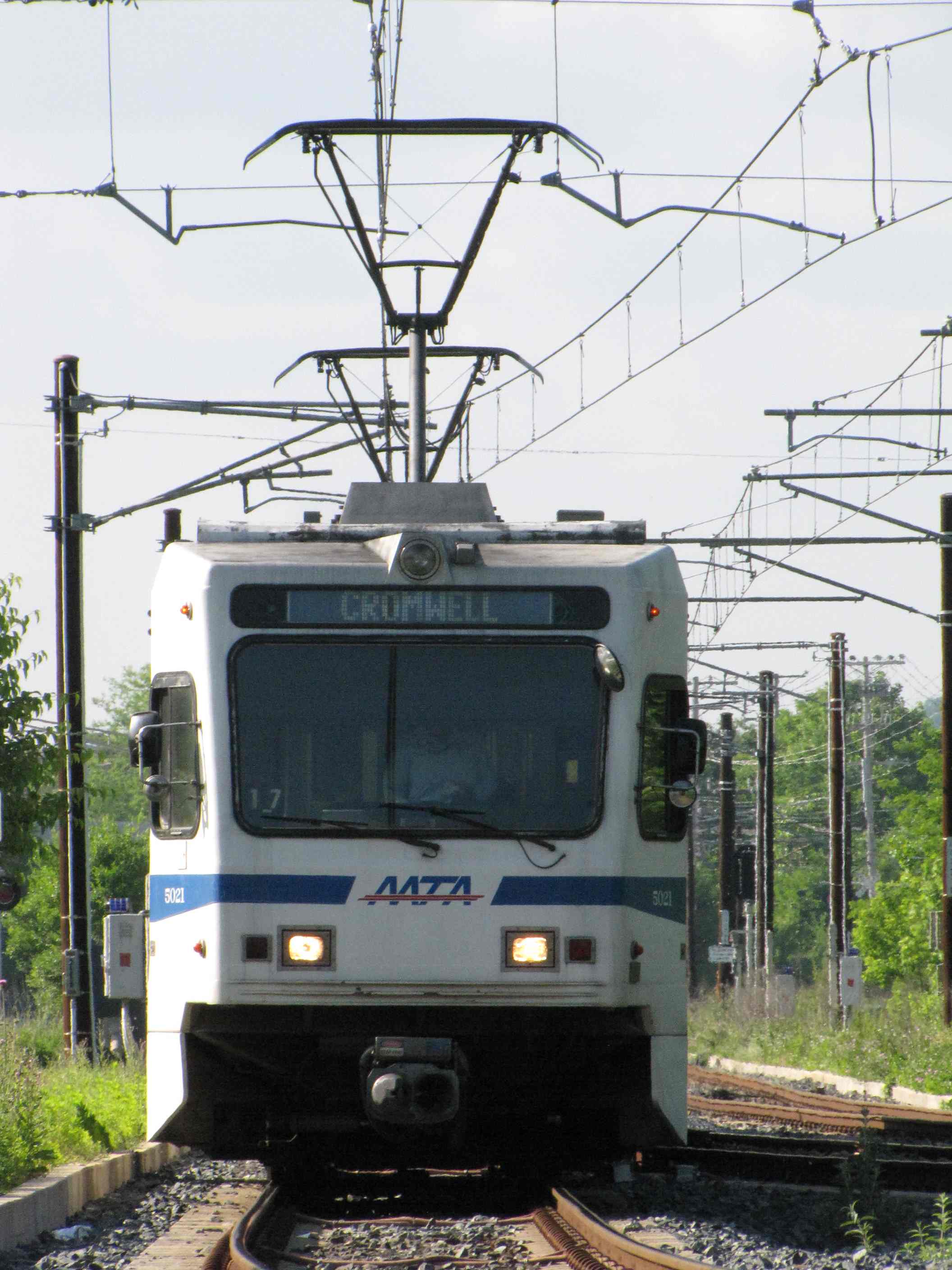
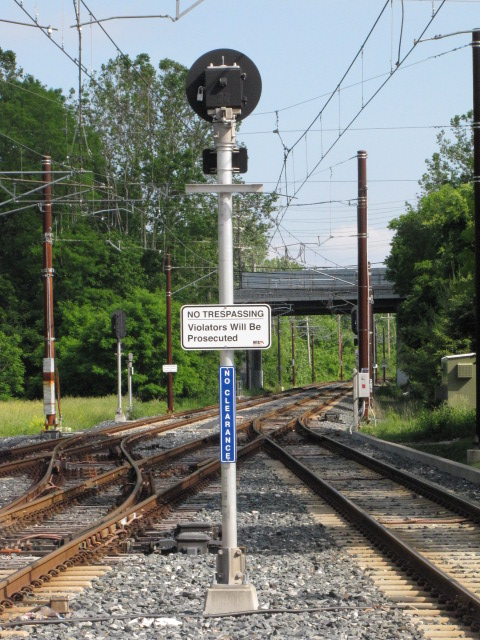
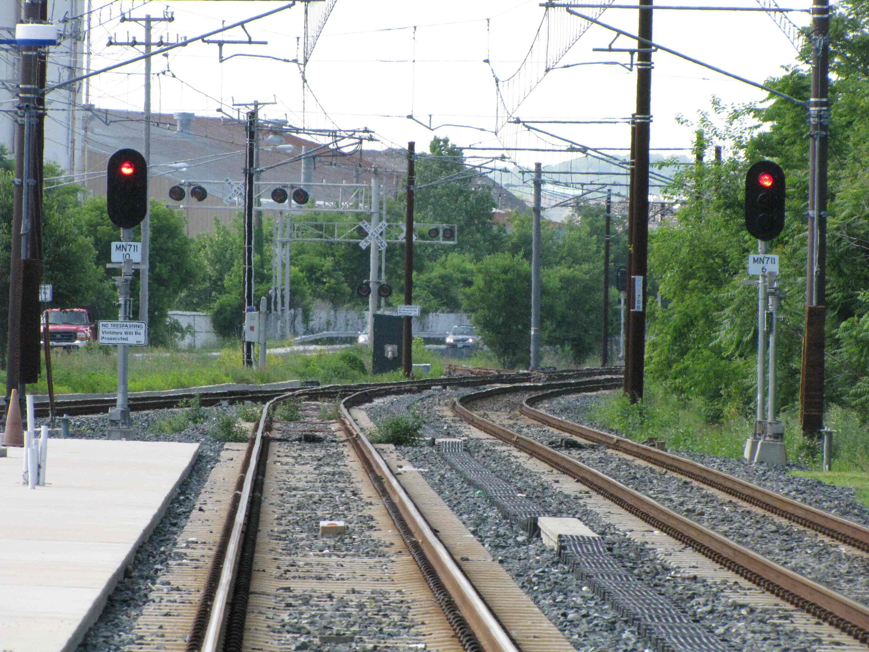
My guess as to why they use the middle track as the turn-around track, is
because there is only one crossover on the northbound side to go anywhere.
"They" unfortunately didn't place the switch for the third outside track after
that crossover, it is "before" it. The picture below illustrates this.
The
switches are aligned for a crossover move for the next NB train to move
into the pocket track. If this crossover had been placed further away, on
the other side of the distant switch, then they could have used the outside
track as the turn-around track, and let the SB trains run straight through.....
just a thought..... less wear and tear over time.
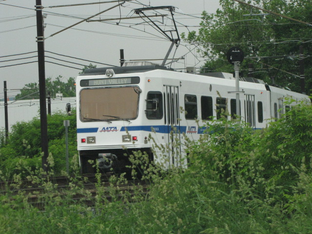
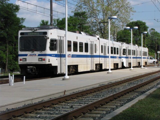
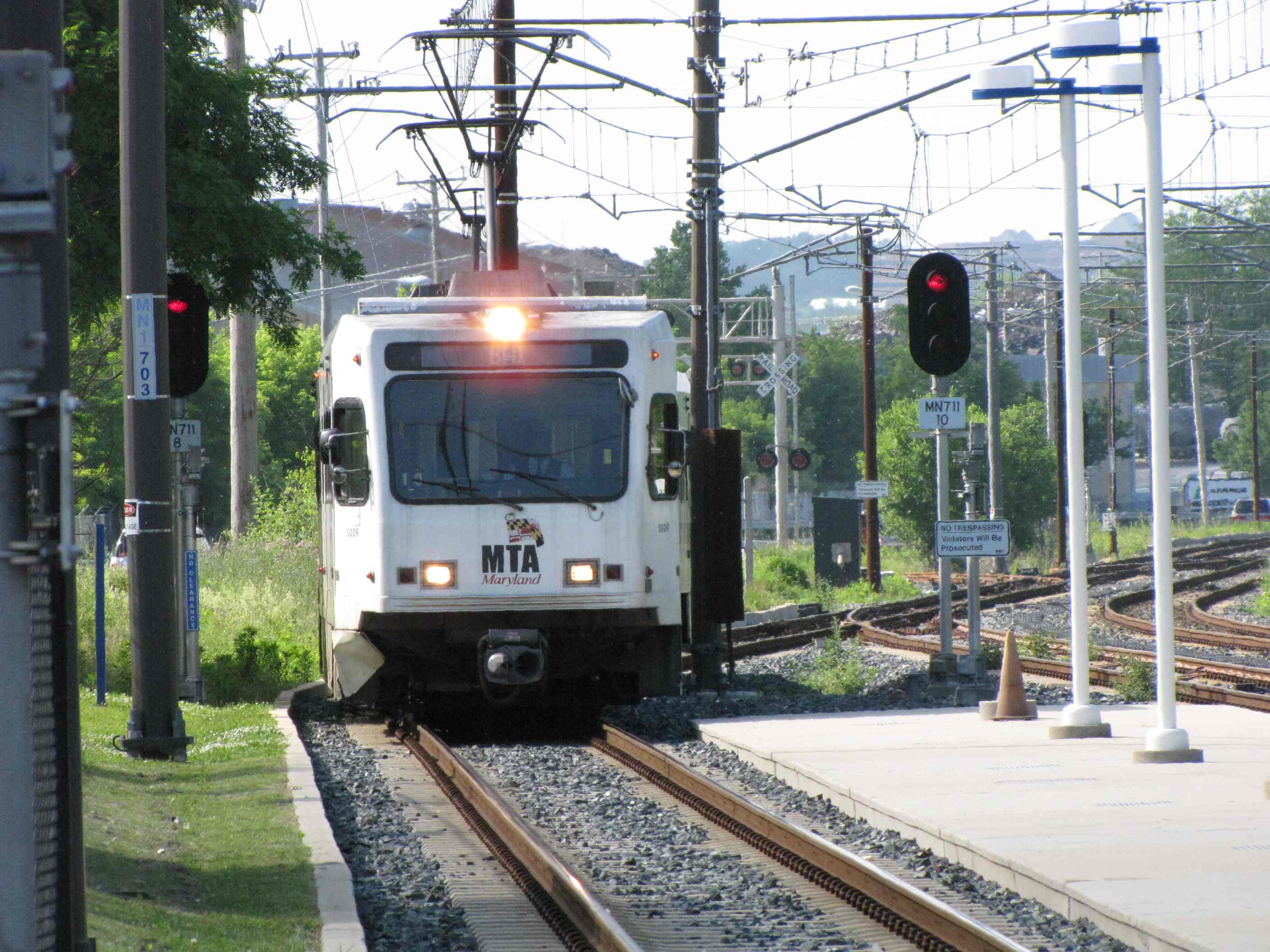
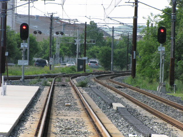
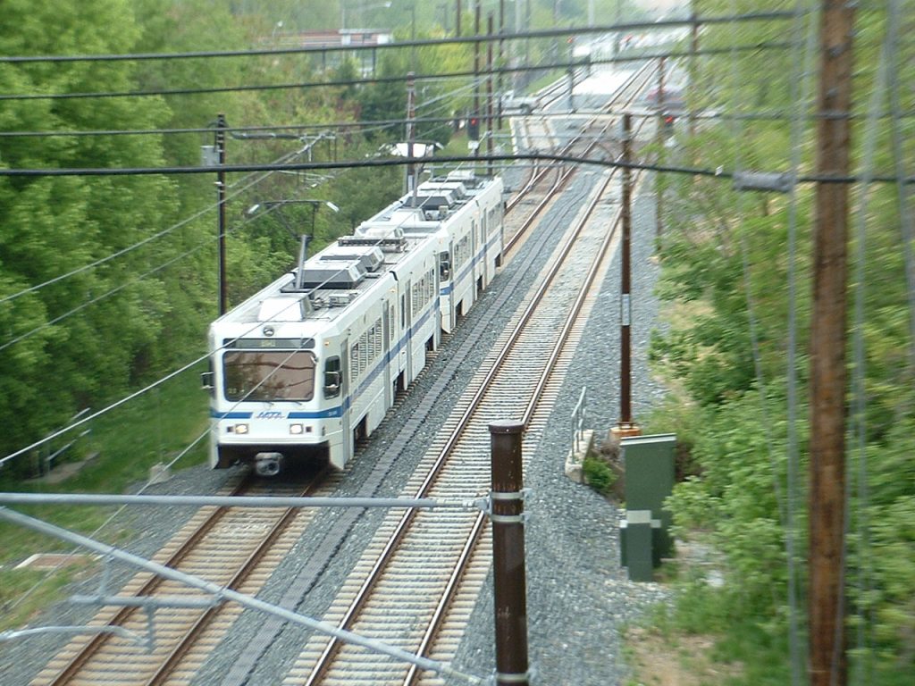
NB trains passing the pocket track.
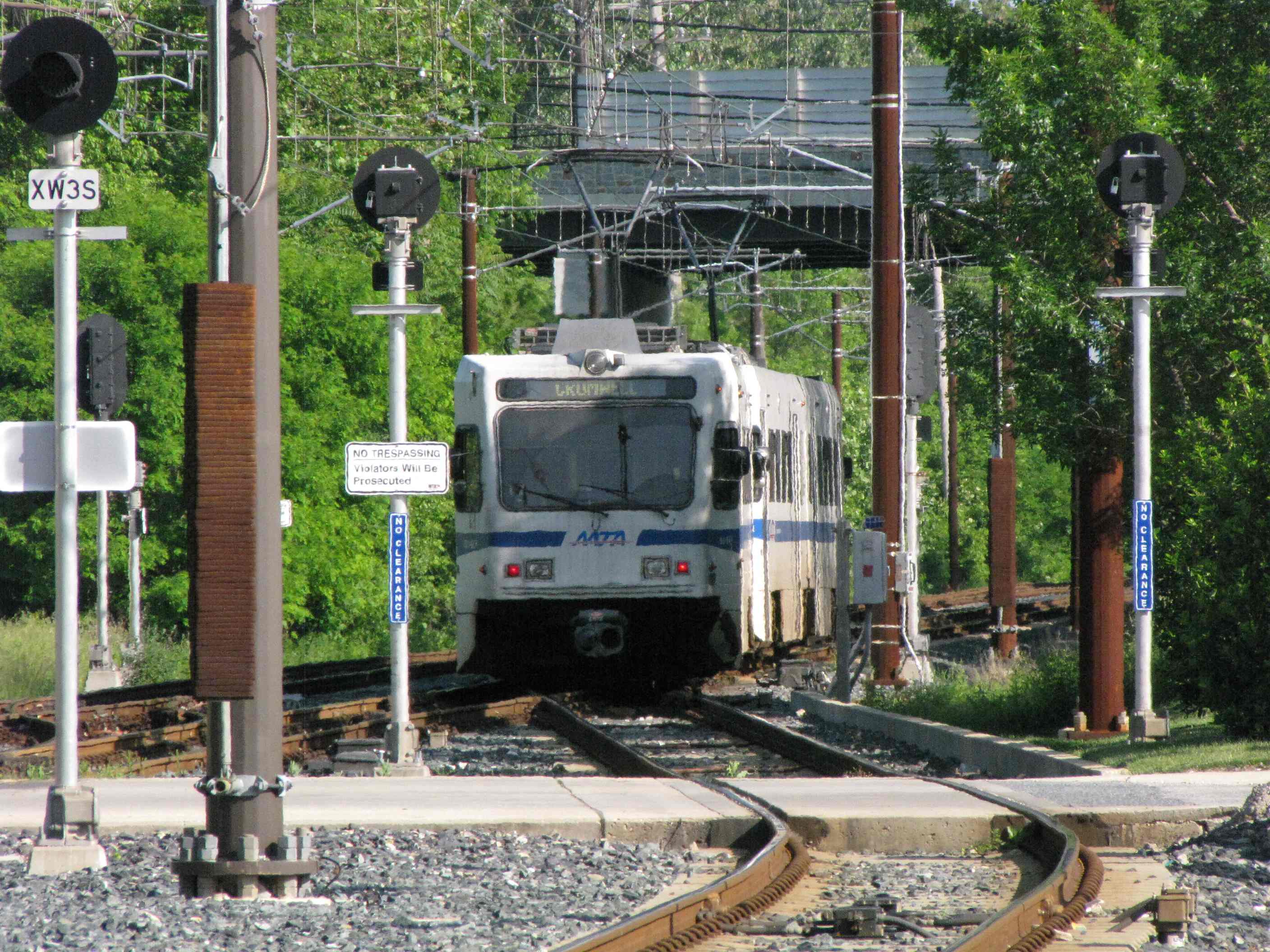
NB going into the pocket track.
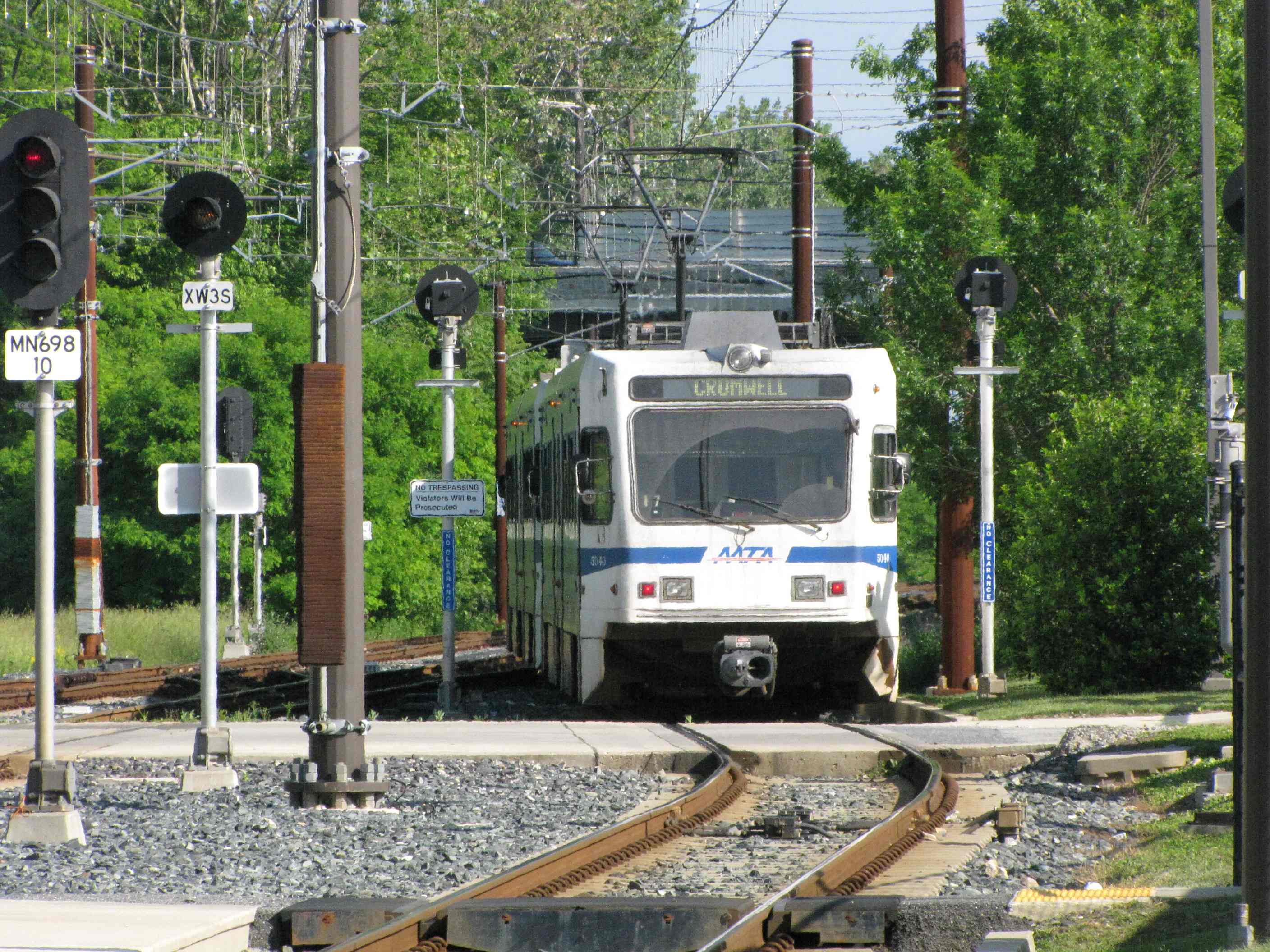
In the pocket track.
SB trains passing the pocket track.
Picture from the adjacent medical building and my doctors office, they think I'm nuts when I show up for an exam with my camera :-)
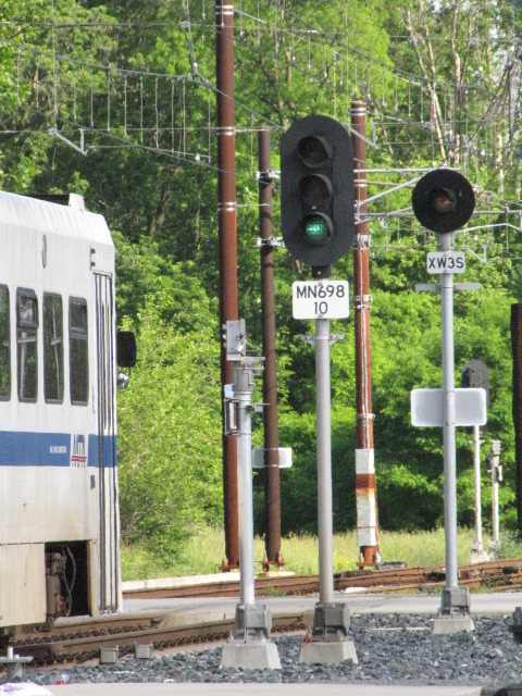
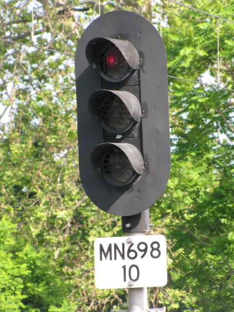
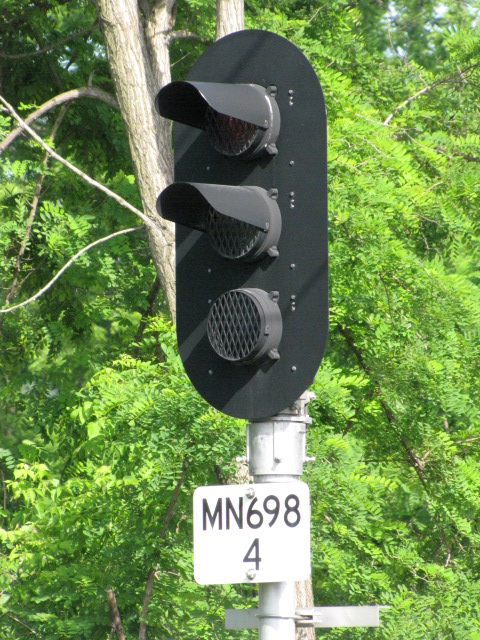
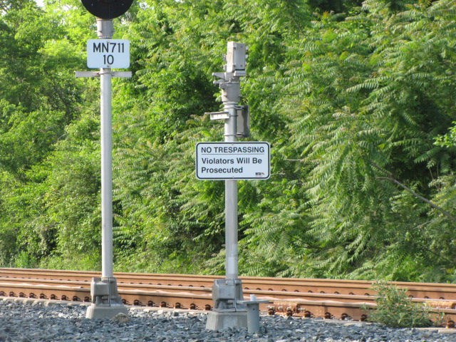
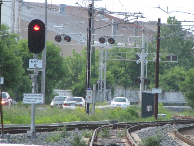
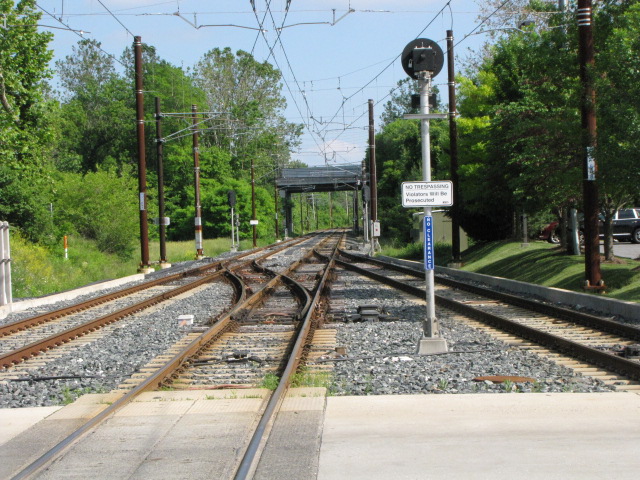
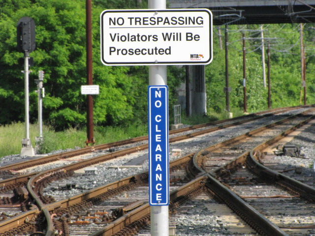
Signals and signs.
More signals and signs.
Ductwork used for running the cables in, instead of running them overhead and/or on poles.
Padonia Road Overpass
GPS Coordinates: 39.45556, -76.63889
One of the very few places where the road goes over the ex-Pennsy right-of-way,
which was built way before anyone even thought of having a light rail system.
Too bad there aren't more of them! :-)
Looking south/1996.
Looking north/1996.
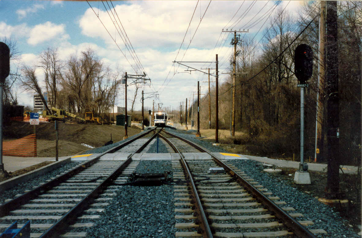
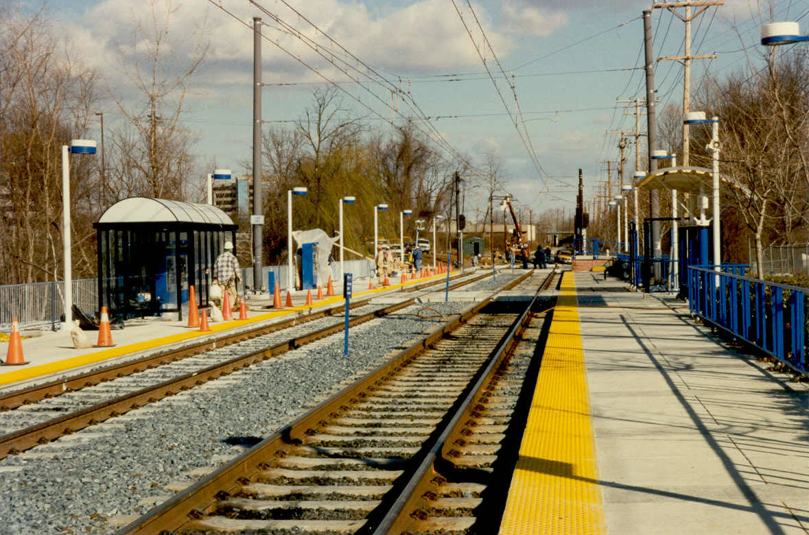
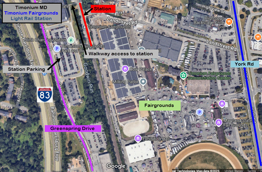
Timonium Fairgrounds Station
GPS Coordinates: 39.44862, -76.63498
Timonium used to the be the last stop before the Hunt Valley extension was finished in 1997.
The three pictures below are from (about) 1995 when they were started working on the extension track.
The first two are looking north towards Cockeysville, the last one is looking south.
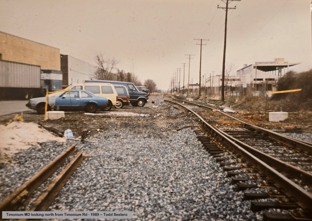
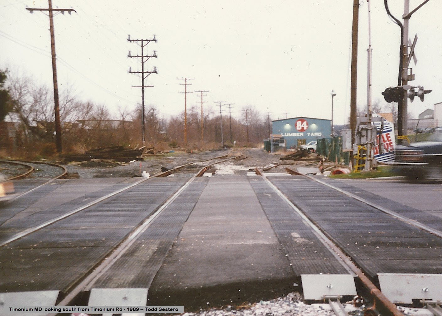
the Timonium Road Grade Crossing
GPS Coordinates: 39.43956, -76.63007
Timonium Road when they were originally building the light rail system in 1989.
Years earlier, when they put a new grade crossing in, they at least planned for the future,
but as things goes, when the line was double tracked later on, they
wound up tearing out the 1989 version and rebuilding it - so why bother? The siding
going off to the left went into what used to be Saco Lumberyard, now 84 Lumber,
which is now in Cockeysville off Cockeysville Road, next to the tracks, but no longer has a siding going to it.
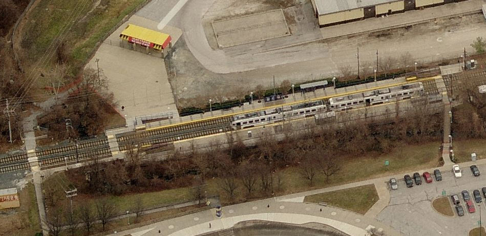
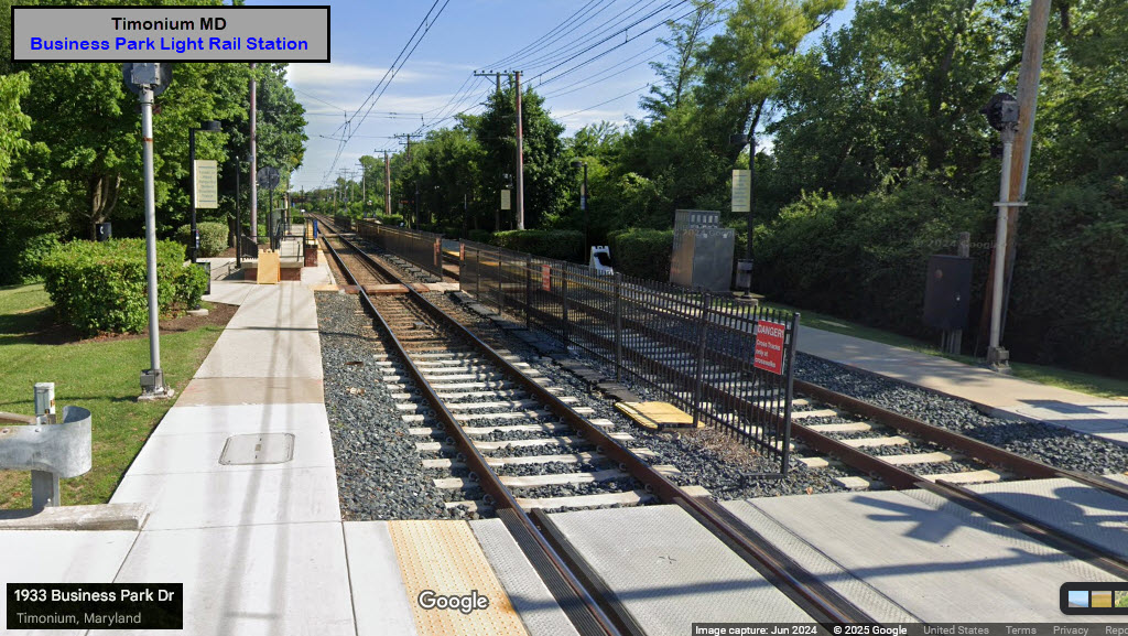
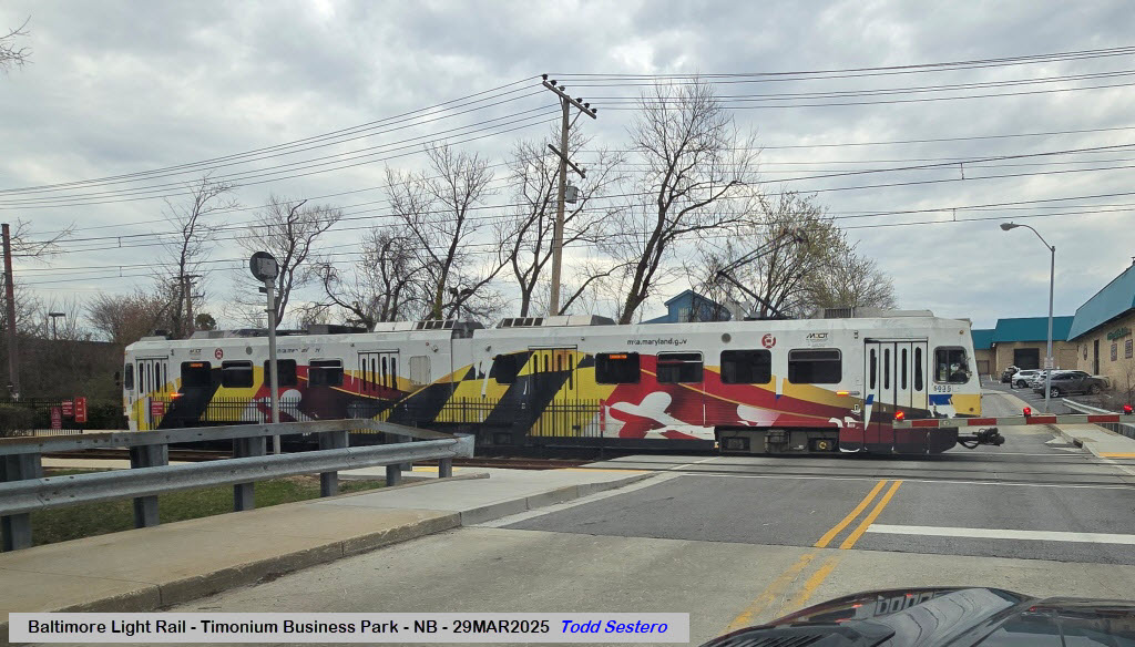
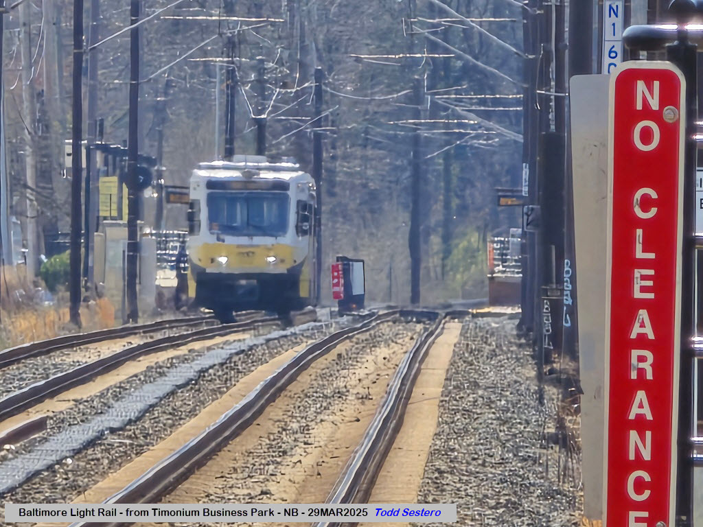
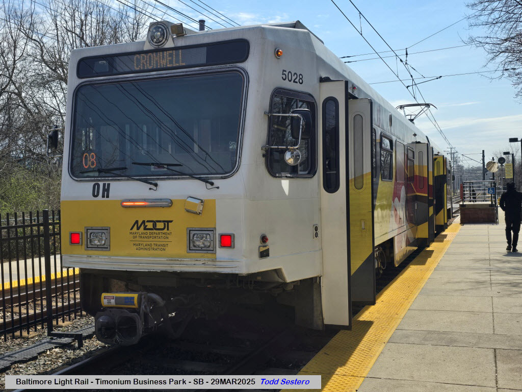
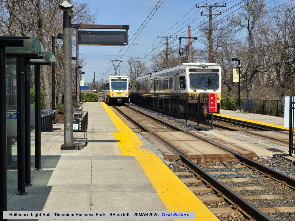
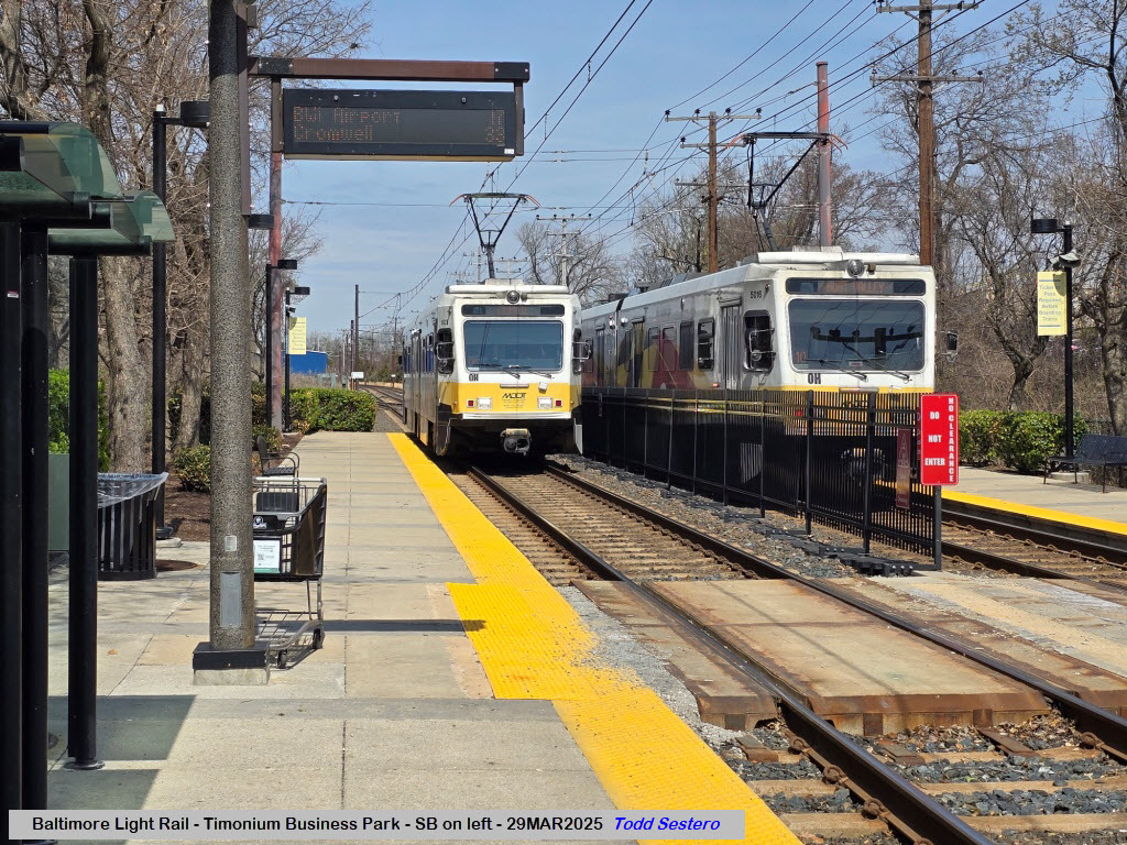
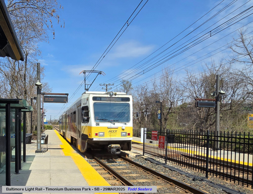
Timonium Business Park Station
GPS Coordinates: 39.43378, -76.62818
Disclaimers:
New format 10/26/23: Please check out my disclaimer page for my standard
dribble and contact info here

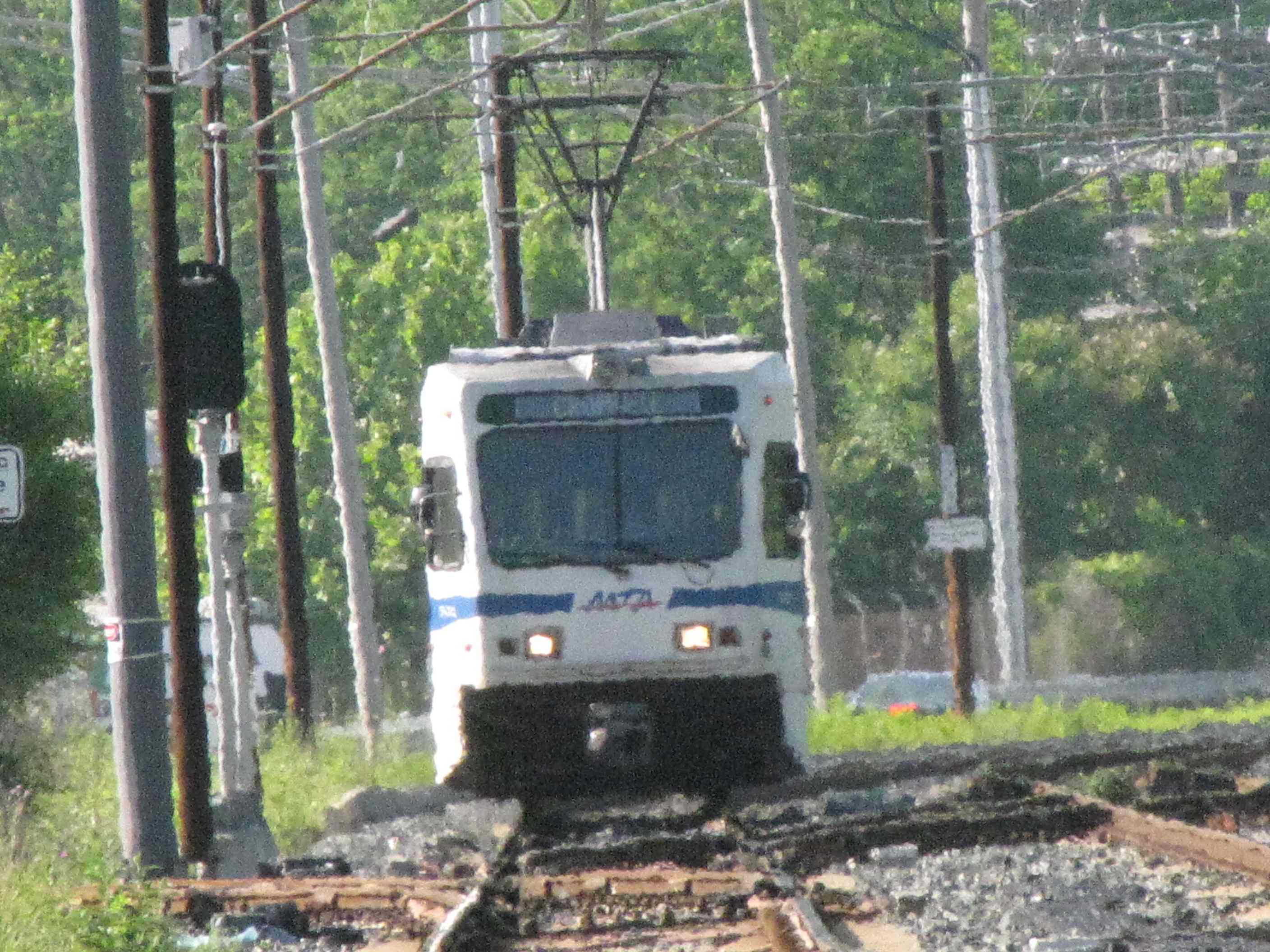
 NB trains passing the pocket track.
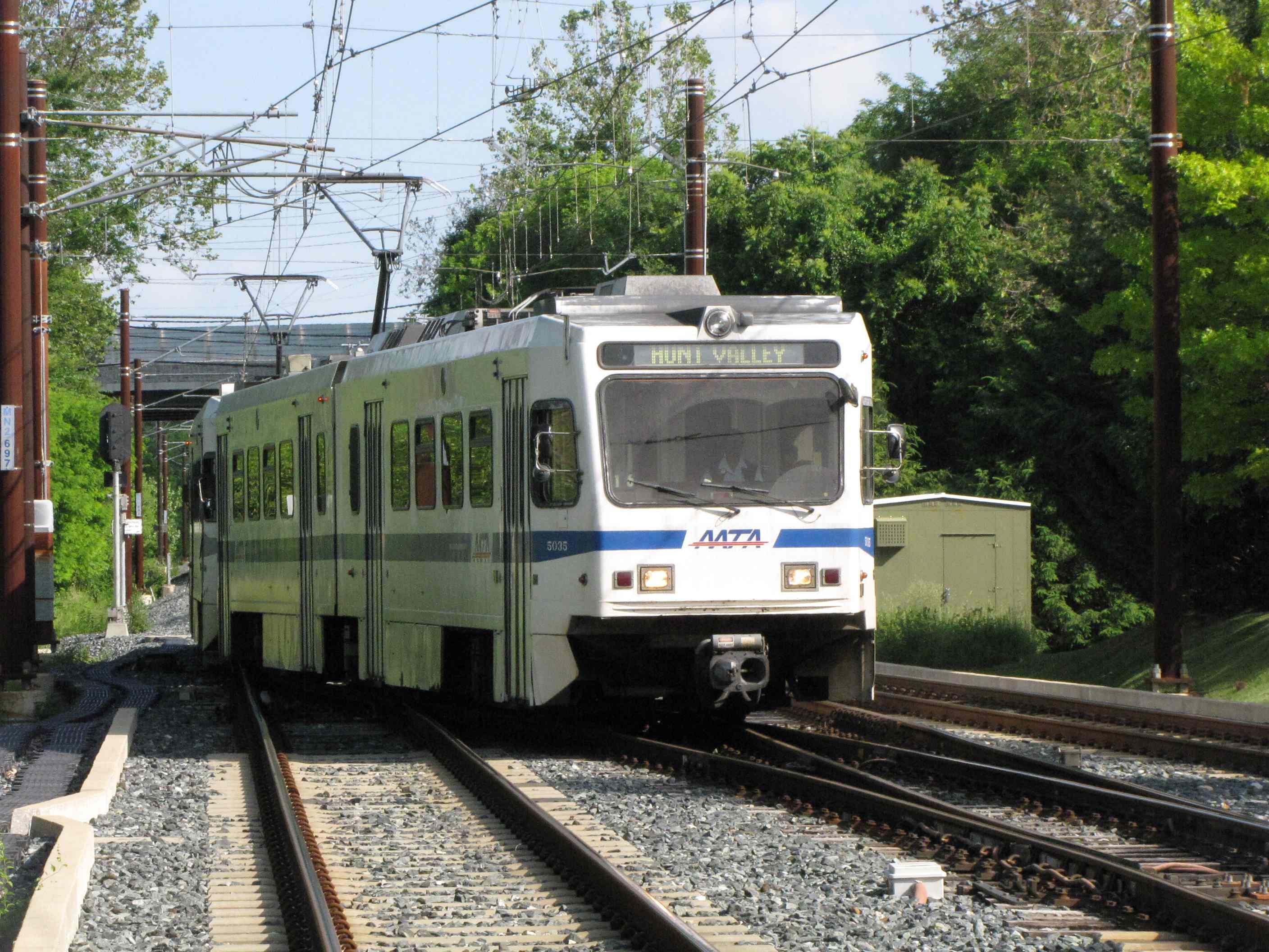

 NB going into the pocket track.
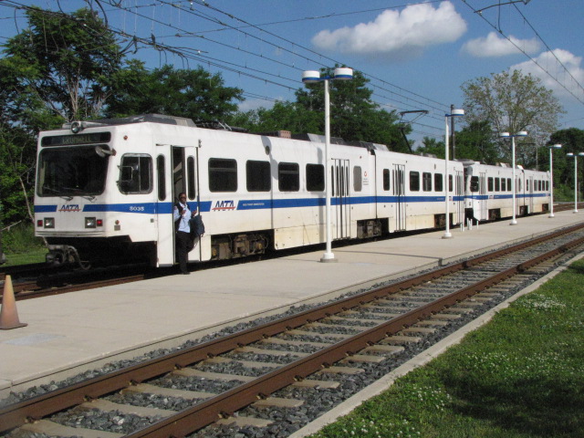

 In the pocket track.
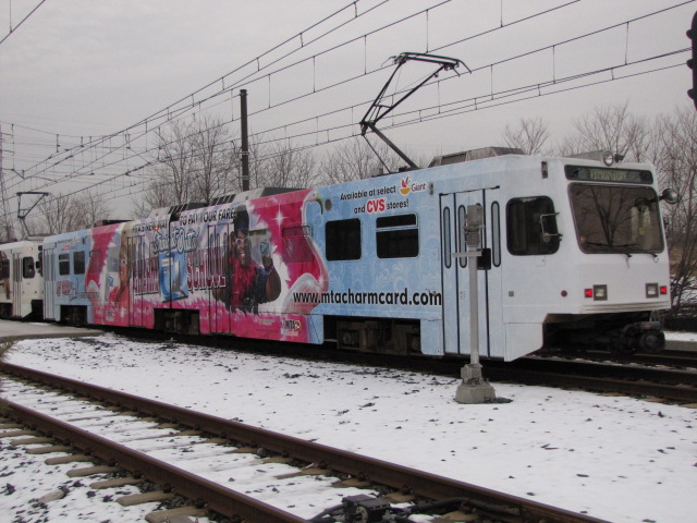

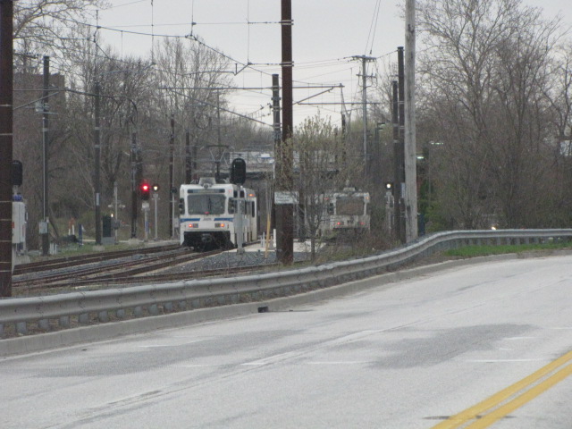 SB trains passing the pocket track.
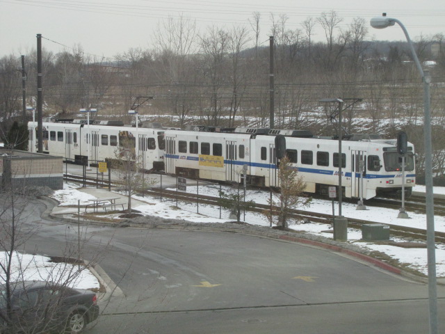


 Signals and signs.
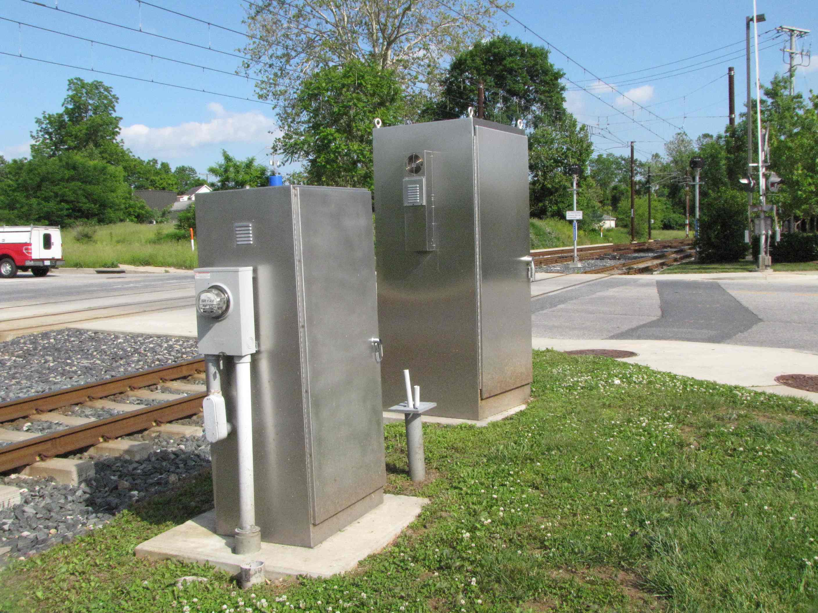

 More signals and signs.
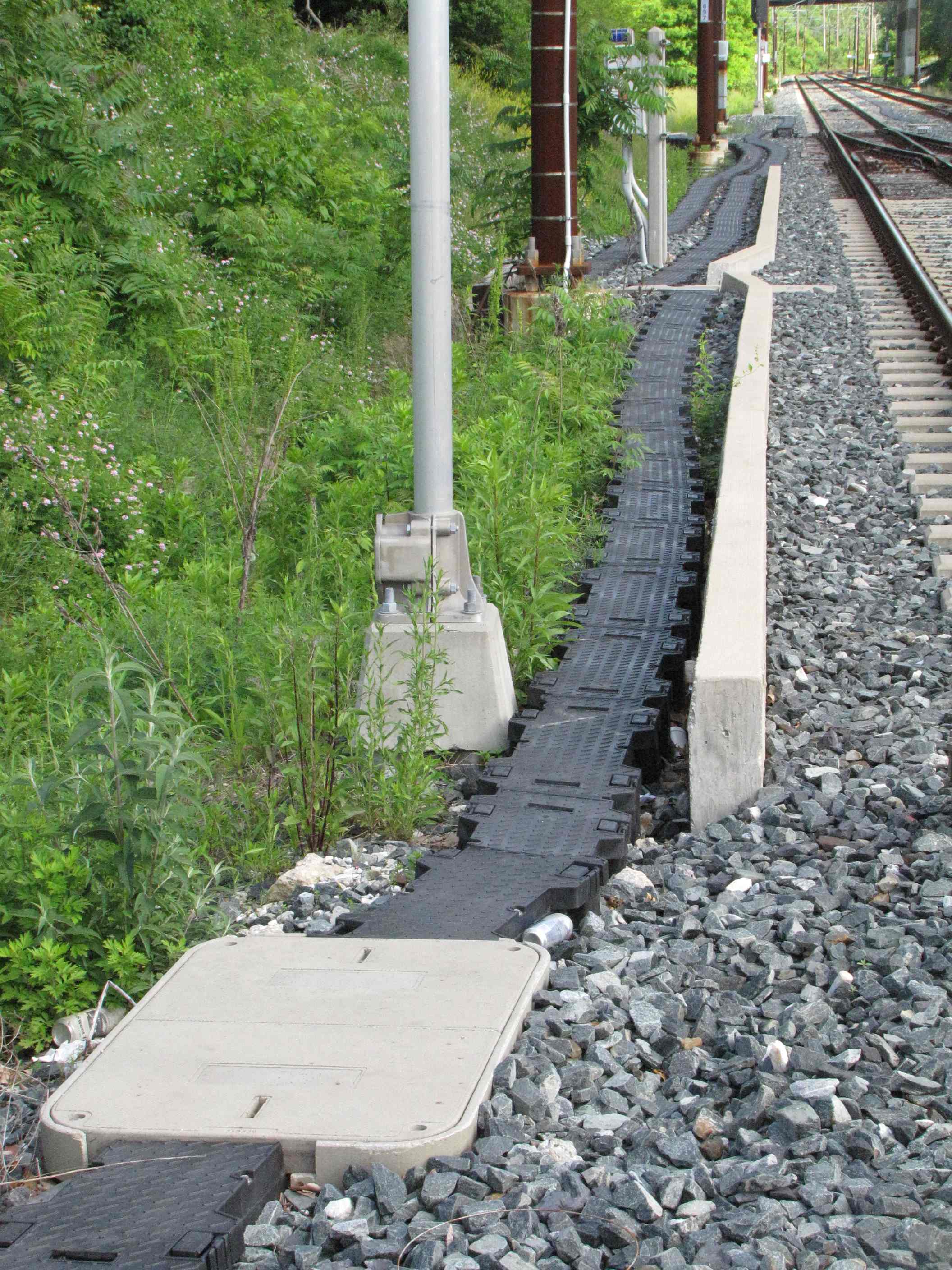
 Ductwork used for running the cables in, instead of running them overhead and/or on poles.
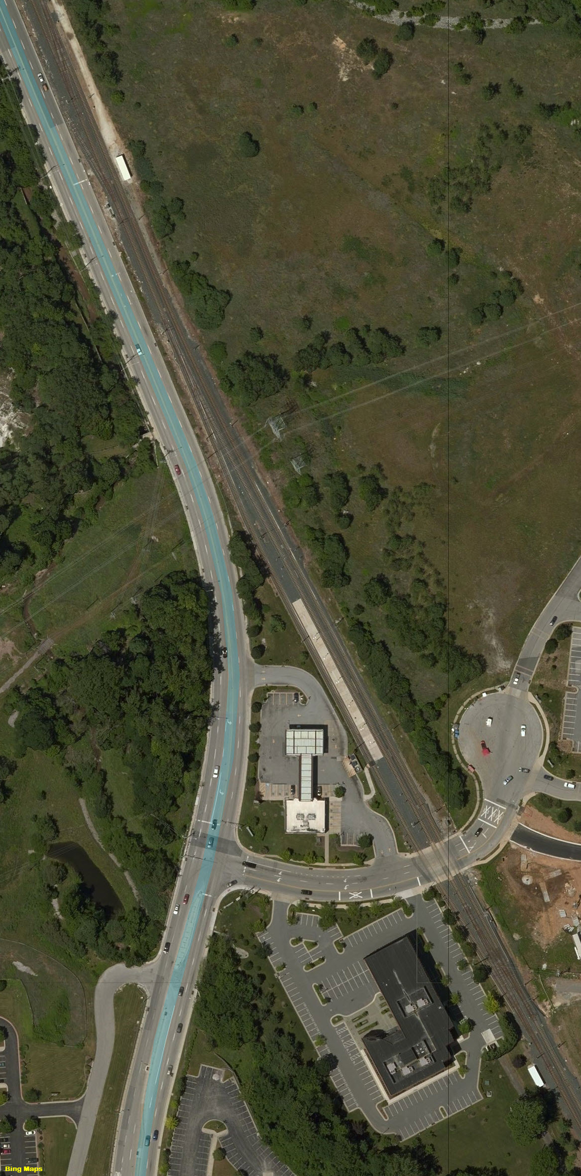
 Looking south/1996.
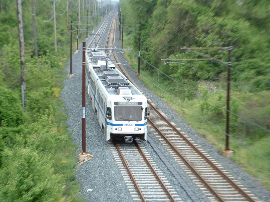 Looking north/1996.