RAILFAN GUIDES of the U.S.
Todd's Transit Guide to
PORTLAND OR
Light Rail on the
east side of Portland
PORTLAND RAILFAN GUIDE HOME
RAILFAN GUIDES HOME
RAILROAD SIGNALS HOME
The Portland Railfan Guide is divided up into the following
sections:
Portland Home Page
Map 1 - the
Amtrak Station Area
Map 2 - UP and
the east side of the Willamette
Map 3 - BNSF
and the west side of the Willamette
Map 4 - South
of Downtown, Milwaukie
Map 8 - the
Vancouver Amtrak Station
I also have the following transit maps available for the
Portland area:
Portland Transit Home
MAP 2
..... the Portland Streetcar
MAP 3
..... WES - the Westside Express Service Commuter Train
MAP 4
..... the Downtown Area
MAP 5
..... the Westside Light Rail Guide
MAP 6
..... the Eastside Light Rail Guide
- You're on this page
MAP 7
..... the Yellow Line
MAP 8
..... the Red Line
MAP 9
..... the Blue Line/east
MAP 10
... the Green Line
MAP 11
... the Yellow & Green Lines Downtown
MAP 12
... Downtown to Gateway/east
MAP 13
... the Blue & Red Lines/west
MAP 14
... the Blue Line/west - Beaverton to Hillsboro
Please note, these are only maps, and not guides, so there are no pictures or
information contained within.
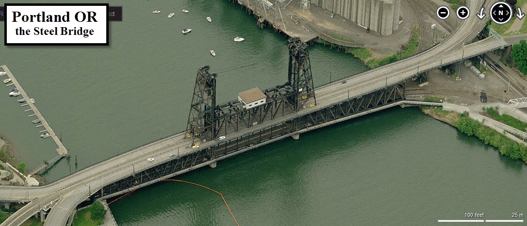
the Steel Bridge
To get out of the downtown Portland area heading east, the four light rail lines cross the Willamette using the Steel Bridge. The two tracks cross the bridge in the middle, and share the space with vehicular traffic.... quite a unique arrangement.
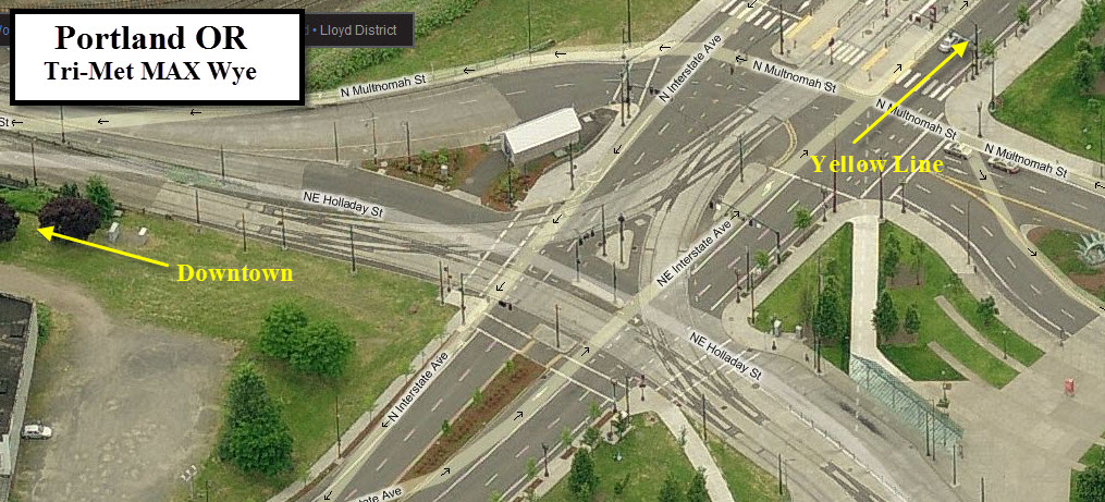
Light Rail Wye/Junction
This wye is a double track junction between all of the lines and allows the yellow line to head north. Although it is technically a wye, it is not used as such as in conventional railroading, it just allows trains to go from any branch to any other.
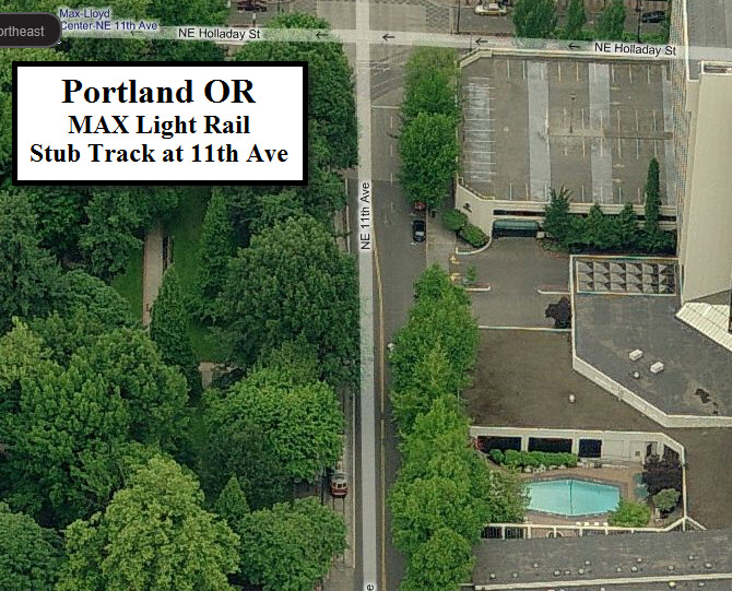
11th Ave Stub Track
This stub track is used as a turnaround for trains coming out of the downtown area, and as such, can only be accessed by cars going eastbound. The Bing Maps picture below is upside down, and gives the best view from Bing. It shows a historic trolley sitting on the stub.
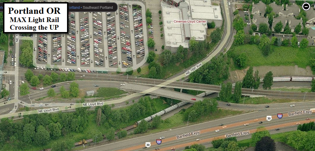
Crossing the Union Pacific
Just east of NE 13th Ave, the ROW crosses the UP tracks to run along I-84.
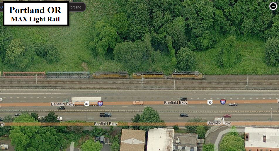
Luck
If you take a ride on the MAX, you may be lucky enough to pass a UP freight running alongside you.
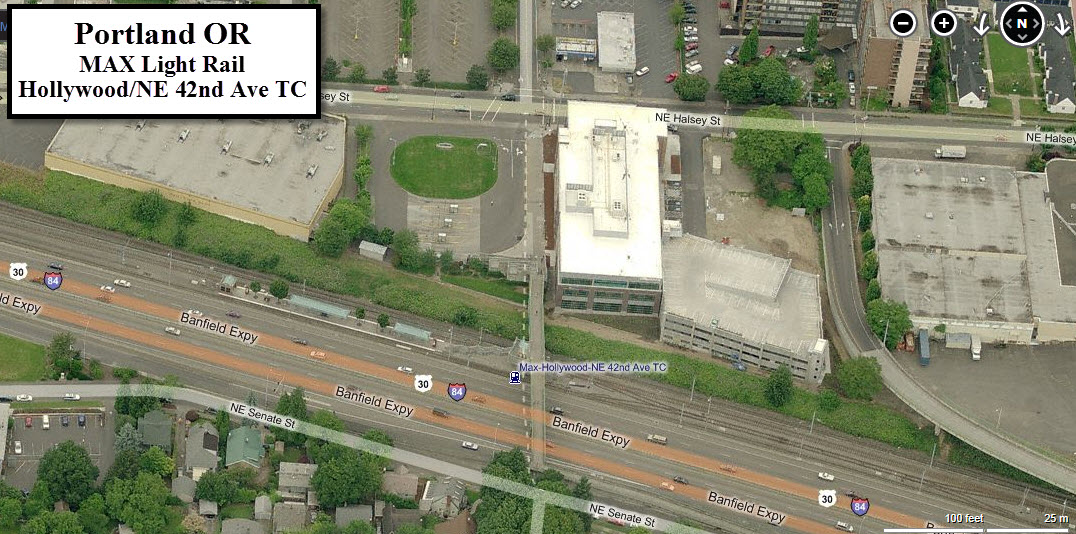
Hollywood / NE 42nd Ave TC and Pocket Track
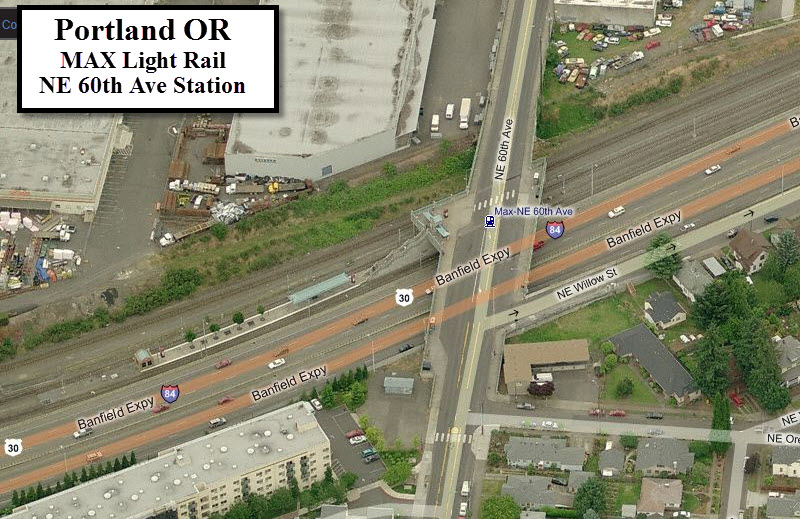
This station is typical of the three MAX stations along I-84 (42nd, 60th, and 82nd). In addition, there is a transit center to the north, and a pocket track to the east of the station.
NE 60th Ave
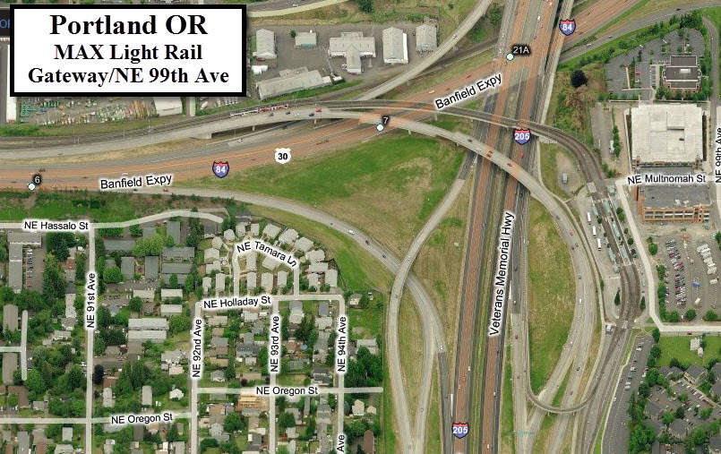
Gateway / NE 99th Ave
Gateway station marks another division point in the system. The Blue and Green line continue south from here, but the Red line loops around, deals with a pretty good grade to loop back under itself and head north along I-205 on it's way to the Portland Airport.
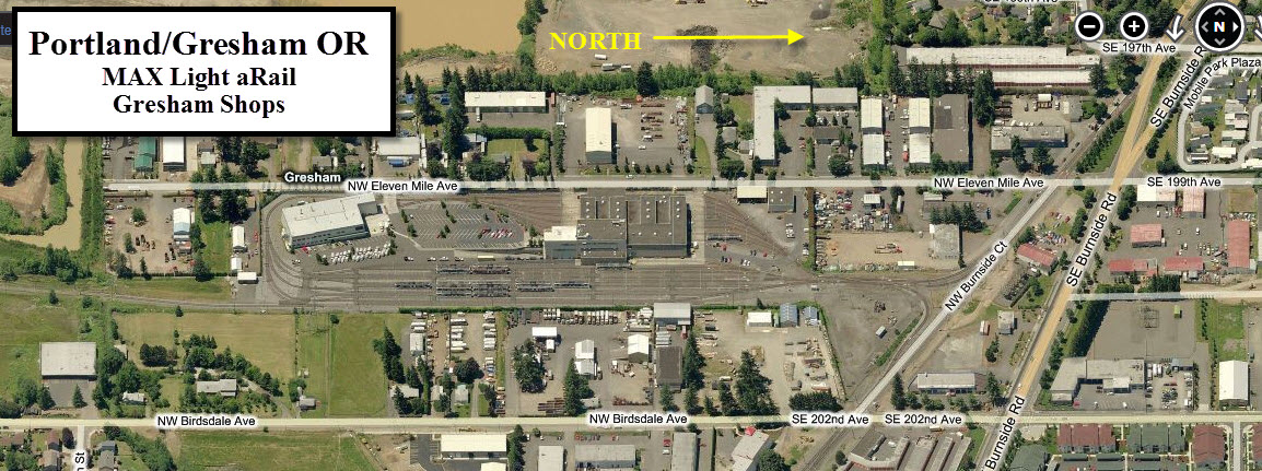
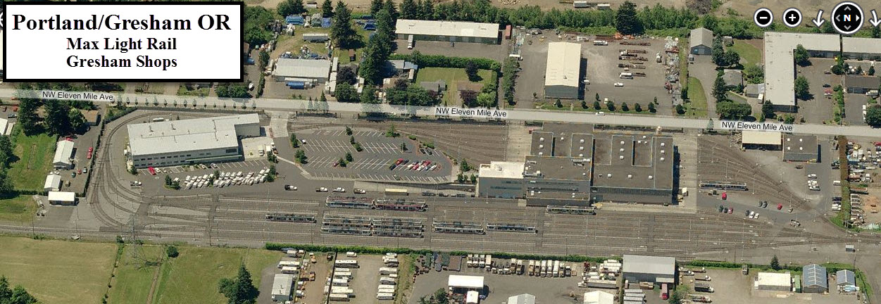
Gresham Shops
Three stops from the end, you will find the Gresham Shops off 202nd Ave. Using my contacts from working at the light rail system in Baltimore, I was able to tour the facility in 1998 when in town for a job interview... one of these days, I will have to scan the slides from that trip.
New 10/27/2011
last Modified:
10 Mar 2012