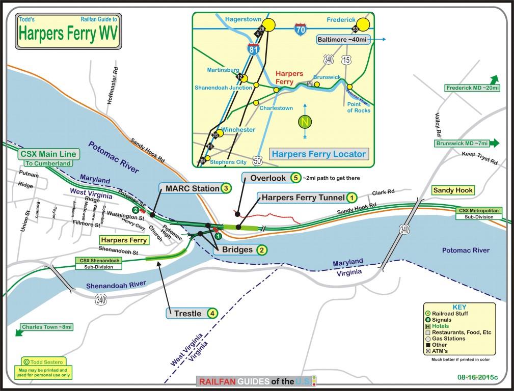
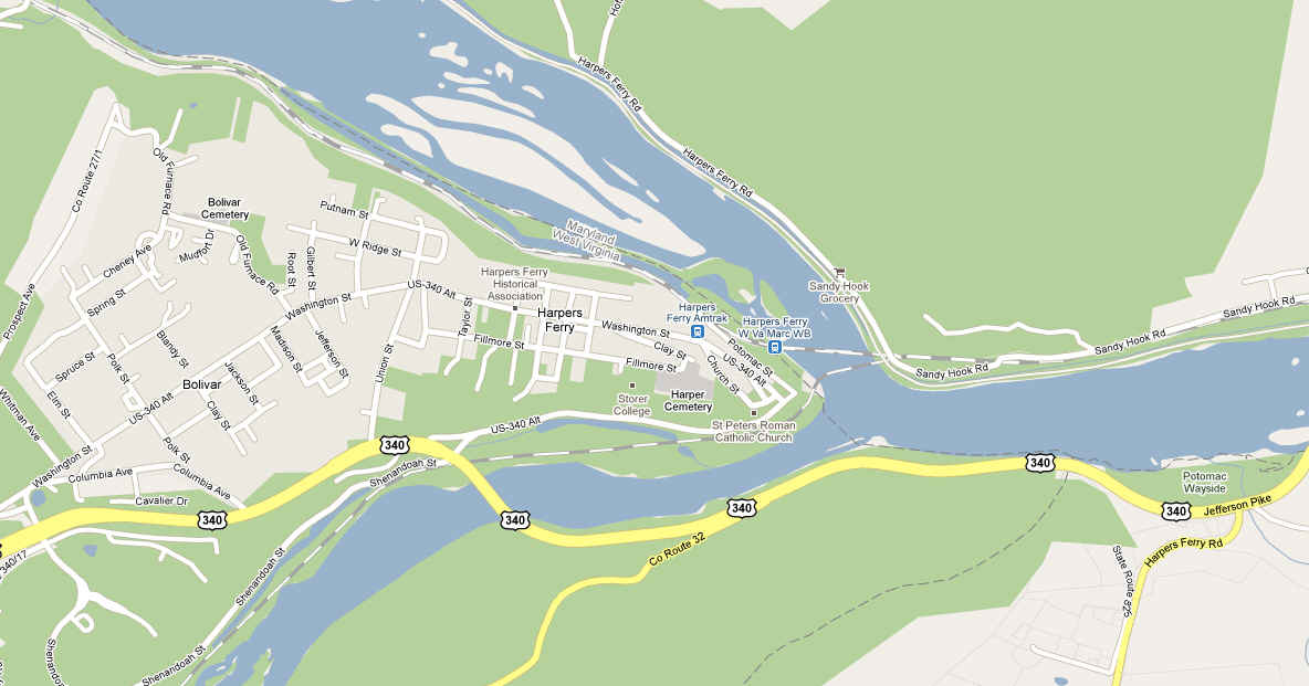
Location / Name:
Harpers Ferry WV, Jefferson County
What's Here:
Amtrak / MARC Station
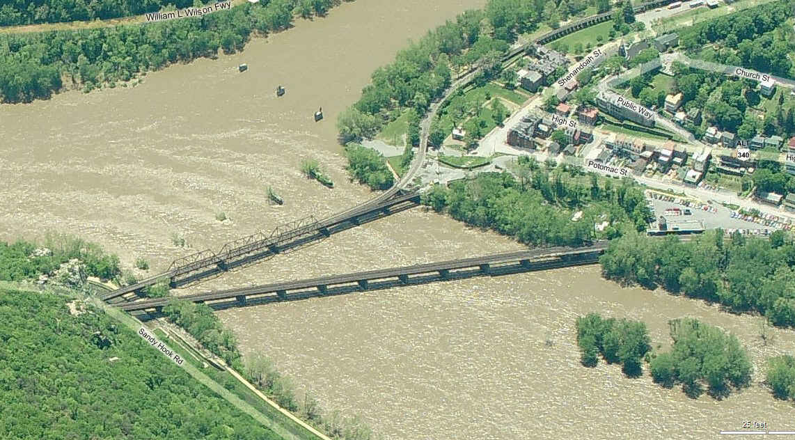
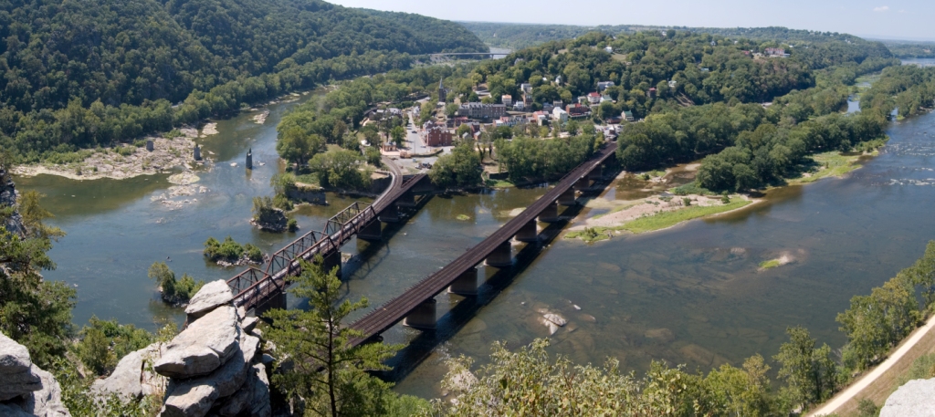
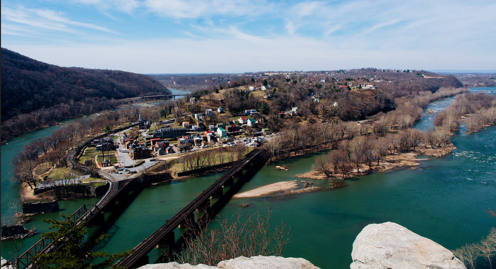
Three bridges
Tunnel (on the Maryland side of the river)
Data:
GPS Coordinates: as needed
Phone A/C: 304
ZIP: 25425
Access by train/transit:
Amtrak and MARC
The Scoop:
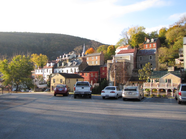
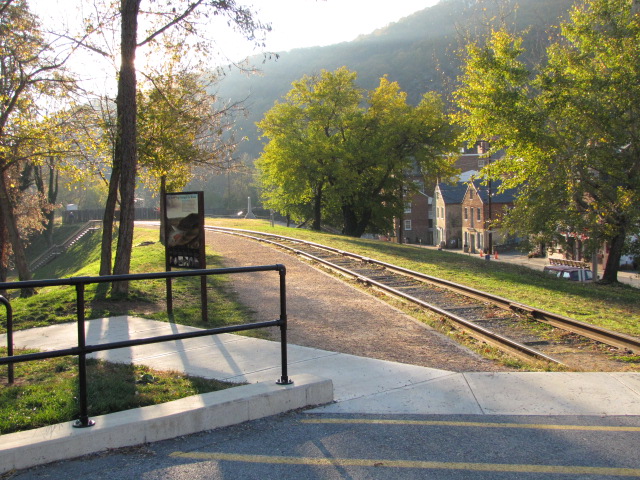
Harpers Ferry is an interesting spot on the old B&O mainline heading west from the
Baltimore and Washington DC lines that come together in Brunswick, and offers the railfan
many interesting photo ops with the combination of tunnel and bridges.
If you're into hiking, you can also get some real nice views from the Maryland side, way above
Harpers Ferry - it's about a two-mile hike one way.
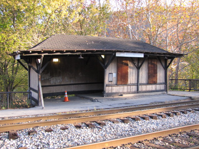
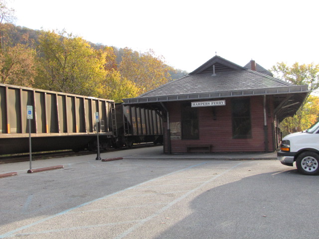
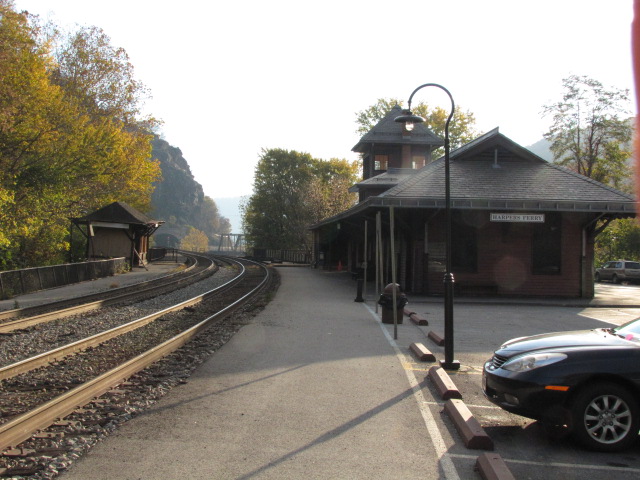
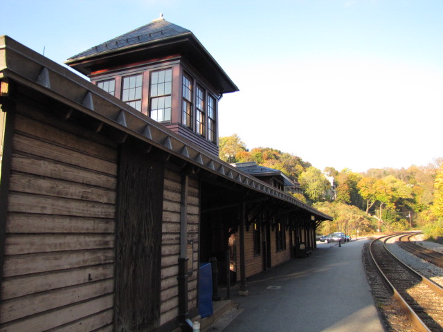
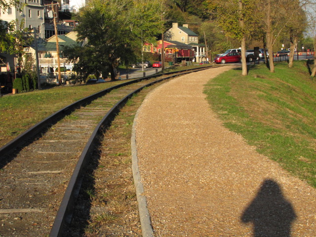
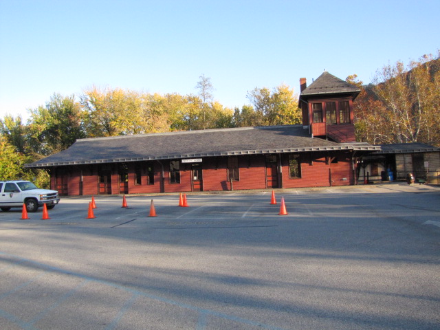
The MARC station is a good spot for pictures, as is a little east
of there to catch trains on the bridge leading into the tunnel.
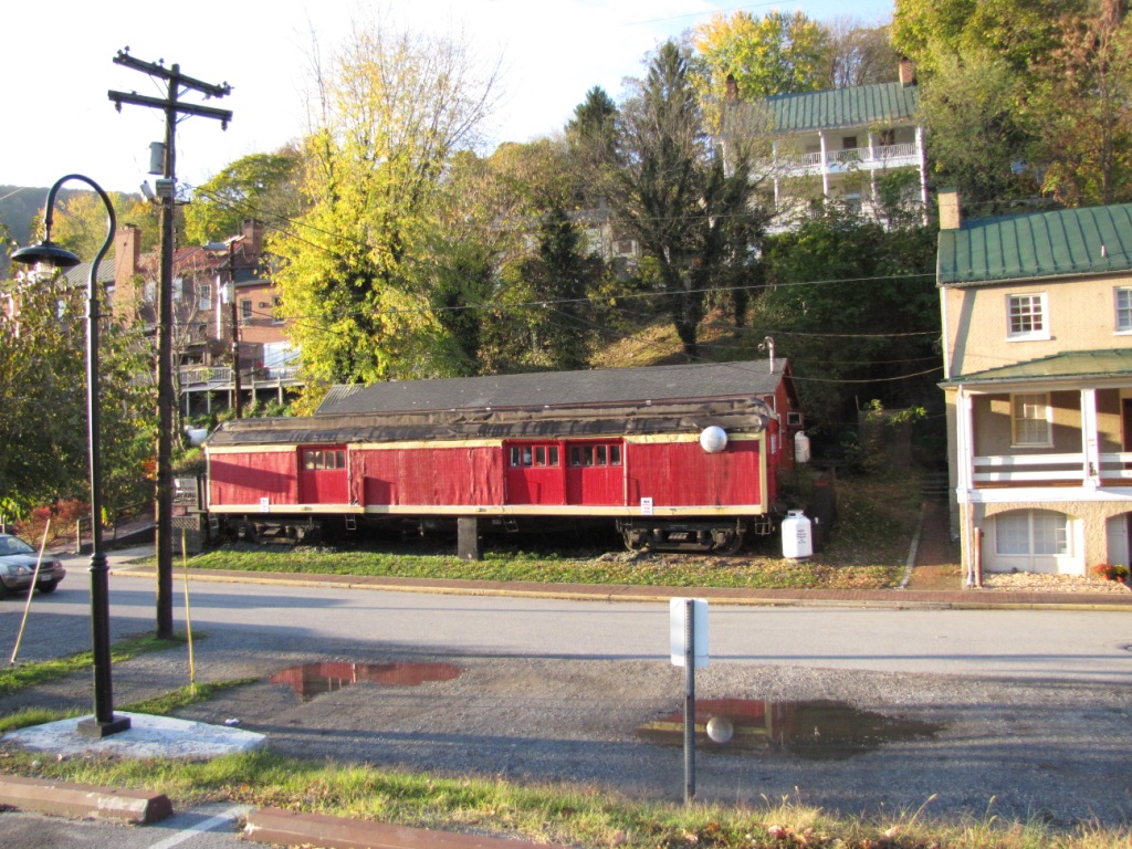
While you're there, don't forget to check out the Toy Train Museum, the town,
and some of the Civil War history.
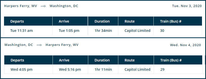
Amtrak's Capitol Limited stops in town around 11:30am on it's way into
Washington DC. The WB Capitol Limited arrives in Harpers Ferry around
5:15pm. I believe the service is every other day, but since Amtrak is not
posting the regular schedules (that I can find in Oct 2020), I'm guessing.
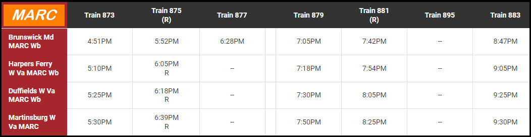
MARC Service has more trains in the evening coming out of Washington DC, then it
has in the morning inbound to DC.
Acknowledgements:
Bruce Stambaugh
Tim Eaton
Denver Todd
Google Maps
Bing Maps - please note, as of 2019 or so, Bing does NOT have Birds Eye views
available for this area anymore! :-( Shame on You BING
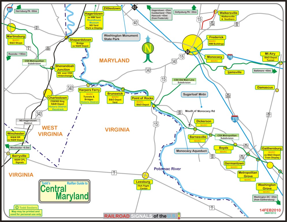
If you are coming from the west or east via interstate 70, take US340 south from Frederick MD, which
is exit 53. From Frederick, Harpers Ferry is about 14 miles south on US340.
Coming up from the south west, as in
I81, I usually take exit 307 at Stevensville (you could also go up to exit 317
at Winchester, and take VA7 east to get to US340, but I found it usually takes a
little longer than getting off at exit 307). My daughter used to go to
school at Virginia Tech, and getting off here made the trip to Baltimore much
quicker than going across 66 through DC, or up to Hagerstown to catch 70.
At this exit are a bunch of good places to get gas and catch something to eat.
Anyways, head east on VA277, which is Fairfax Pike. In about 4 miles, you
will hit the traffic light junction of 277, US340, and US522 (take a left and
you'll wind up at the East Broad Top! :-). Go straight through the
intersection, and you are now on US340. Stay on this as you pass through
the small towns of Boyce, Berryville, Rippon, and then bypass Charlestown.
You may also be able to catch some Norfolk Southern action as you toot along,
but in the 20 some years I've been using this route, I've never caught anything.
In Berryville, there is a nice set of N&W CPL signals if you hang a right on
Main St and go to the crossing. About ten years ago, they built a bypass
around Charlestown, which makes the trip go a little quicker, but the downtown
area has some nice shops in it if you have your wife or girlfriend with you.
Just follow the signs for 340, and you can't go wrong. Where 340 and WV9
meet up with the 340 heading to Harpers Ferry, there is a standard cloverleaf
interchange, just watch the signs. From there it's about 5 miles to
Harpers Ferry.
From DC, you have a couple of
choices. You can head west from the DC Beltway on either VA7 or VA267, the
Dulles Airport Access Road, which is a toll road, and head to Leesburg where you
can pick up US15 heading to Point of Rocks. Just on the other side of the
river and Point of Rocks, hang a left onto MD464, Point of Rocks Rd, and take
that the seven miles into Brunswick, and then another 7 miles or so to Harpers
Ferry after 464 meets up with US340.
If you're coming from the north side
of DC, I would just head up I270 to Frederick, and then catch US340 south...
while it may be a little longer, you don't have the stop signs, traffic lights,
and slow moving idiots that plague the back roads.
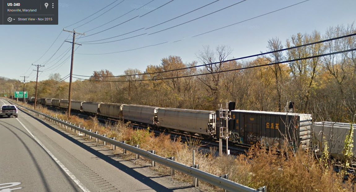
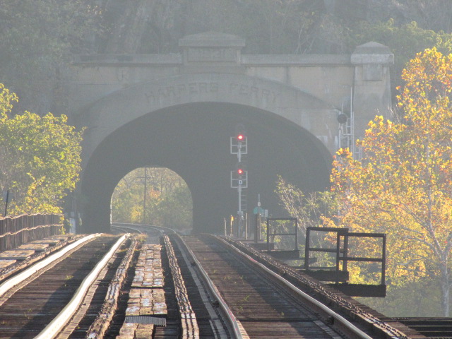
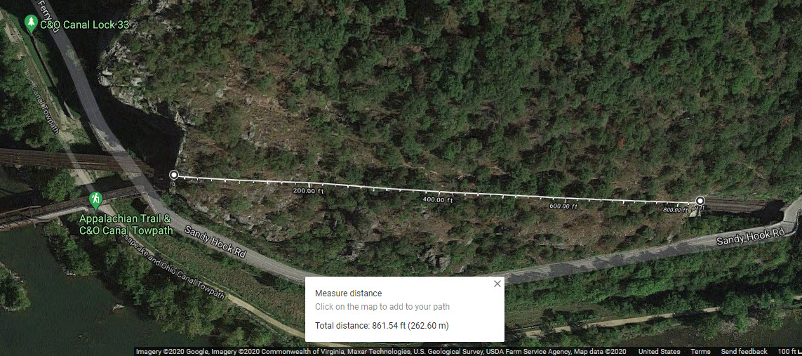
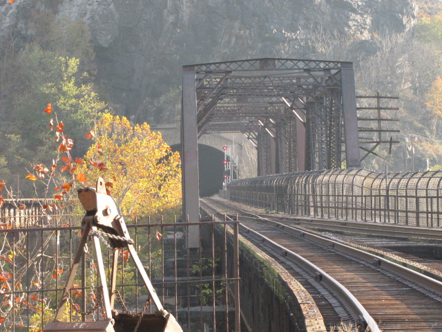
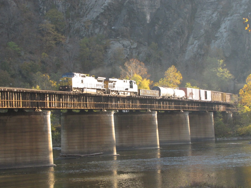
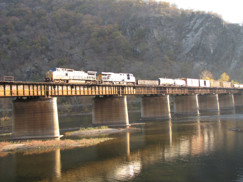
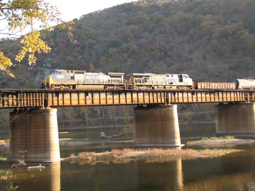
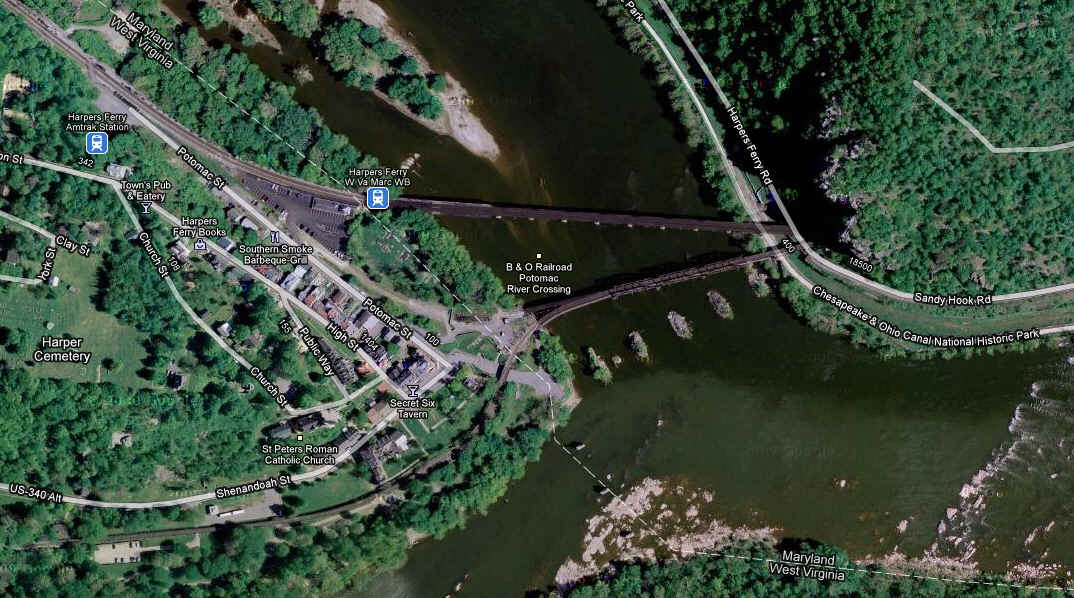
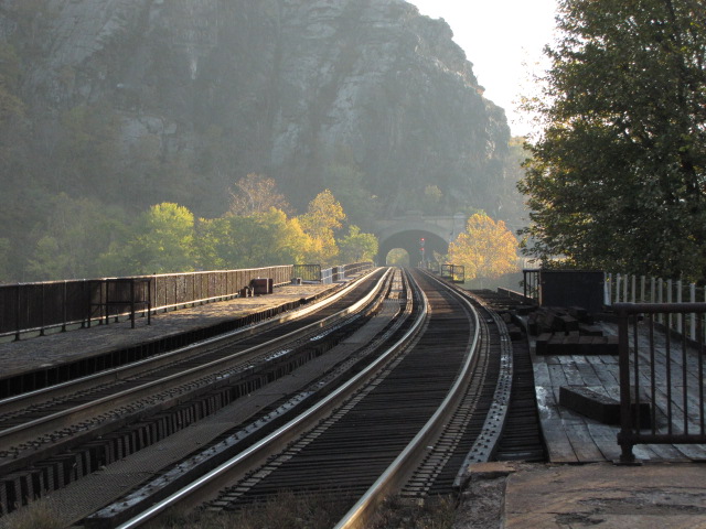
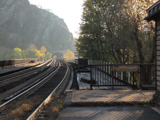
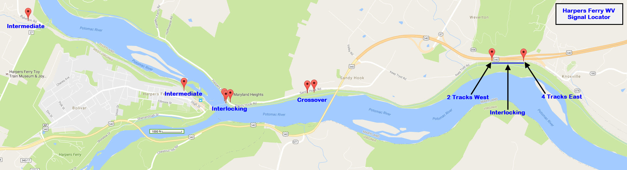
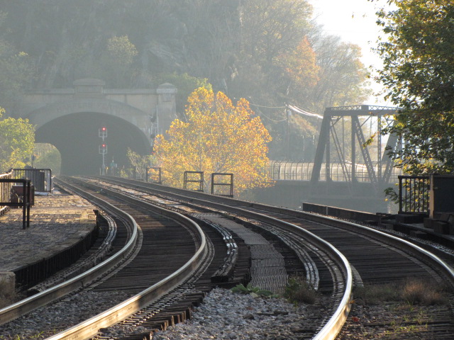
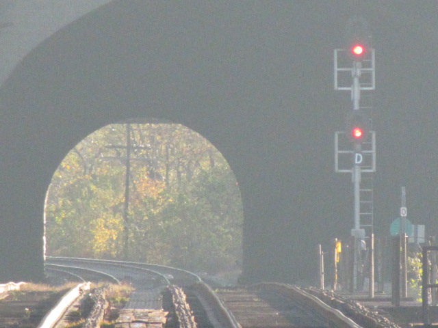
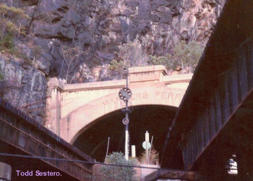
Harpers Ferry Tunnel, built in 1931 on the Maryland side of the Potomac River, is a very busy tunnel
where trains cross from the tunnel over the river to Harpers Ferry in West Virginia. According to a website
describing proposed changes to this tunnel, the tunnel was originally built in 1893 and
modified in 1931. Proposed changes are to modify the tunnel to accommodate 'double stack' freight cars needing a
21 foot clearance. The tunnel runs through a geographic feature called Maryland Heights, which was one of the
locations that the Confederate Army placed batteries to surround and eventually capture Harpers Ferry.
The tunnel is about 861 feet long.
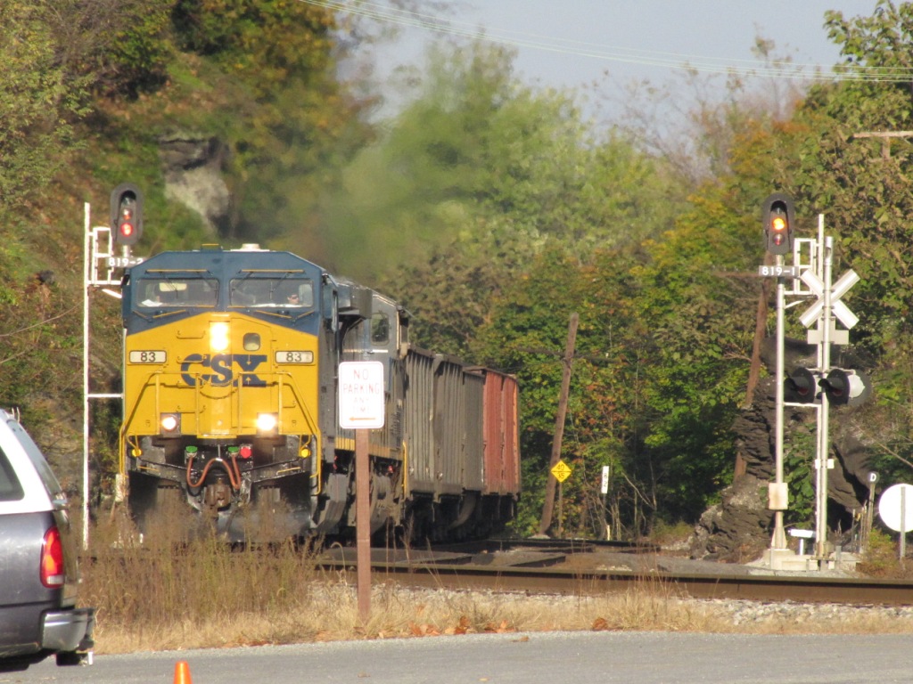
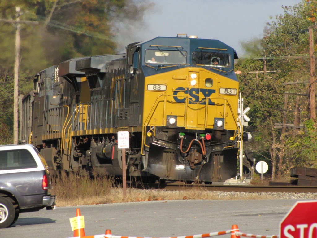
An early morning WB, lighting is harsh, especially with the lingering haze :-)
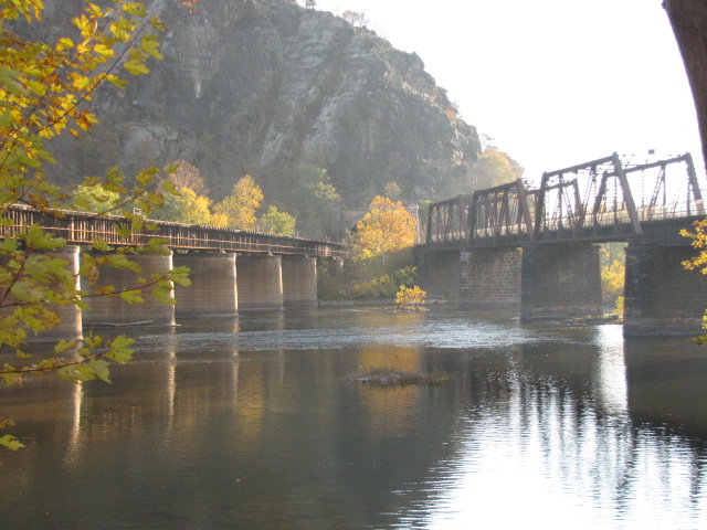
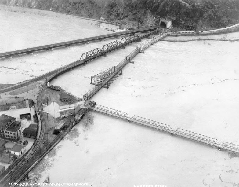
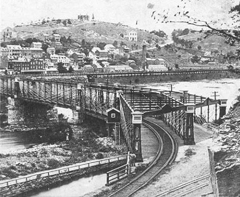
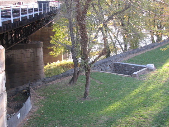
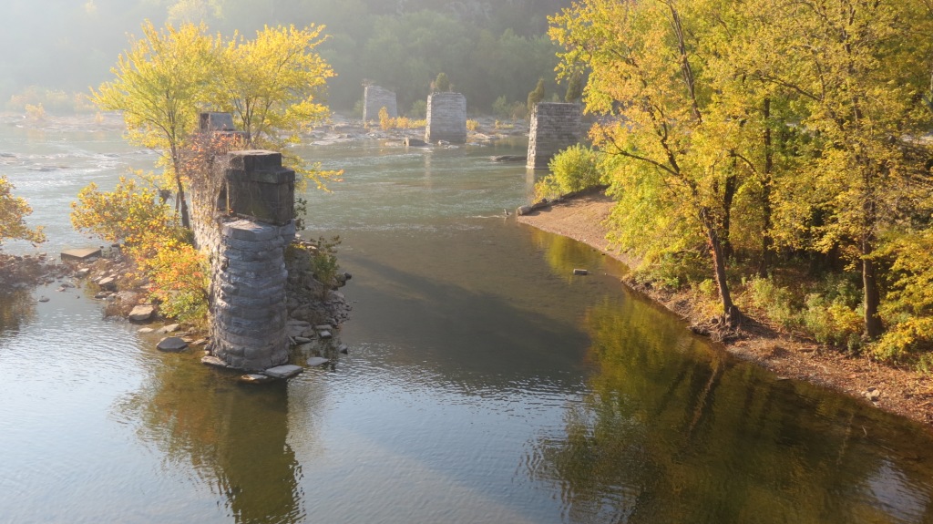
A couple of vintage photographs showing the original Potomac River bridge - one of
them is an aerial from when Harpers Ferry had a flood in 1938. The
aerial photo also shows three sections of the older Bollman Truss bridge having
been replaced - don't know if it was because of a re-alignment after the tunnel
was dug, or if it was because of a washout from a previous flood.
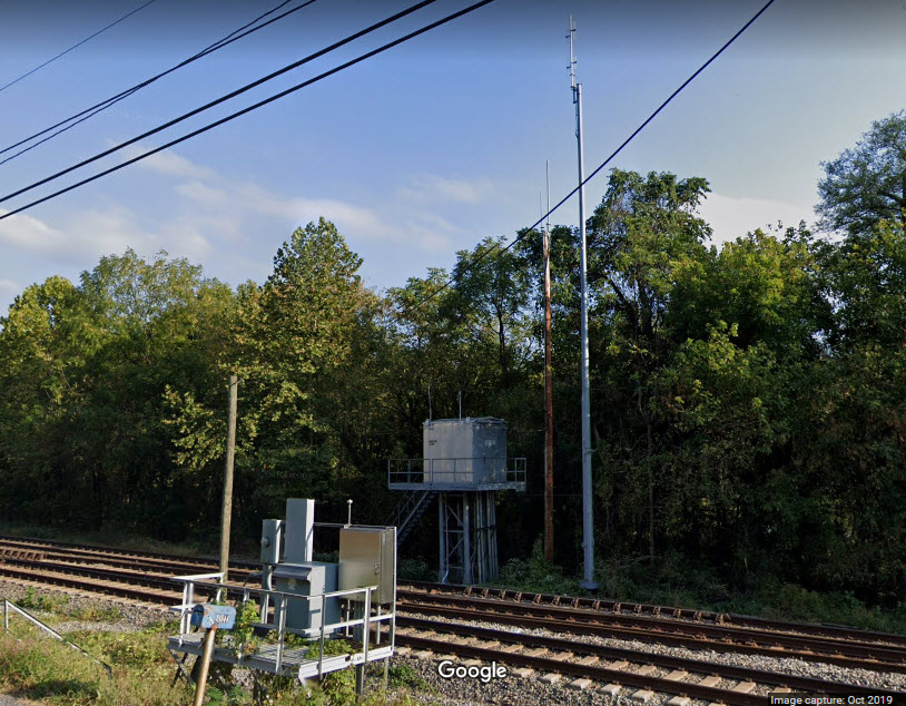
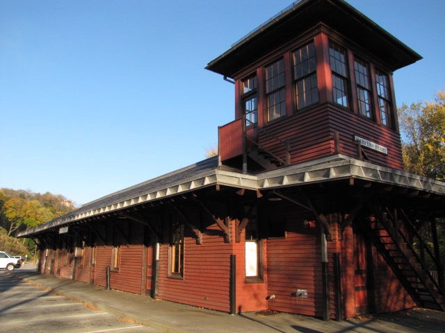
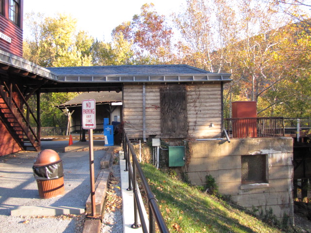
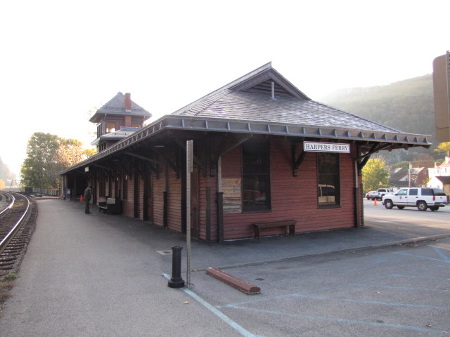
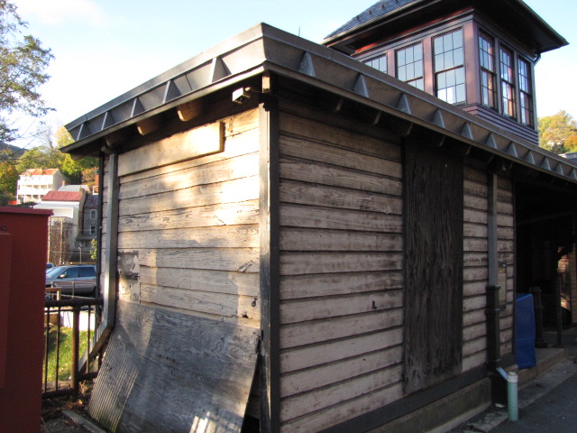
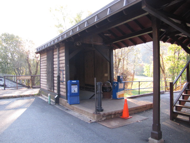
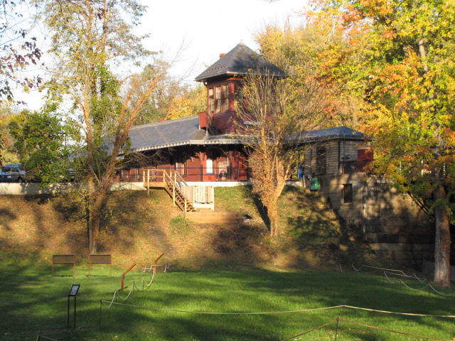
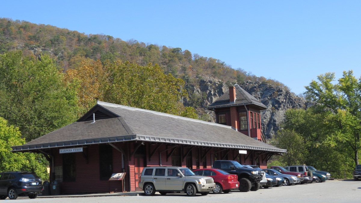
the Harpers Ferry MARC Station
GPS Coordinates: 39.324484, -77.731072
Even pictures from the parking lot of the station don't turn out tooooo bad.....
Bruce Stambaugh
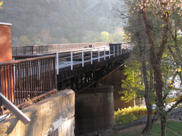
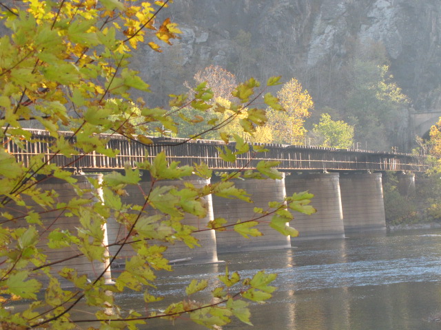
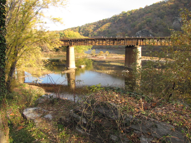
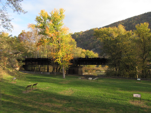
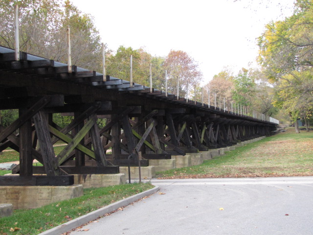
Shenandoah Sub-Division Trestle
Overlook
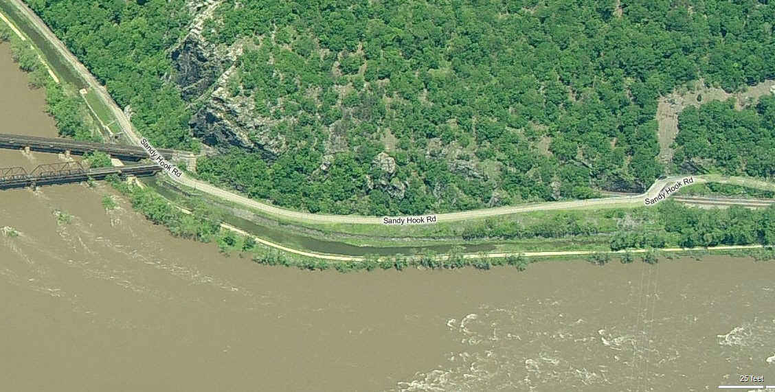
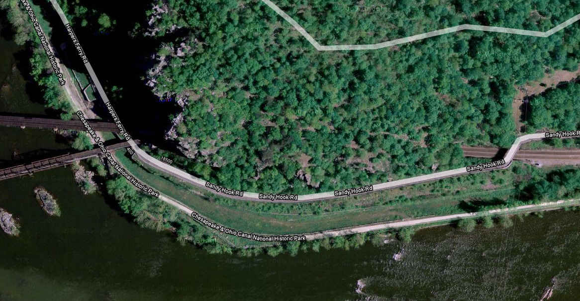
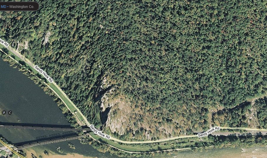
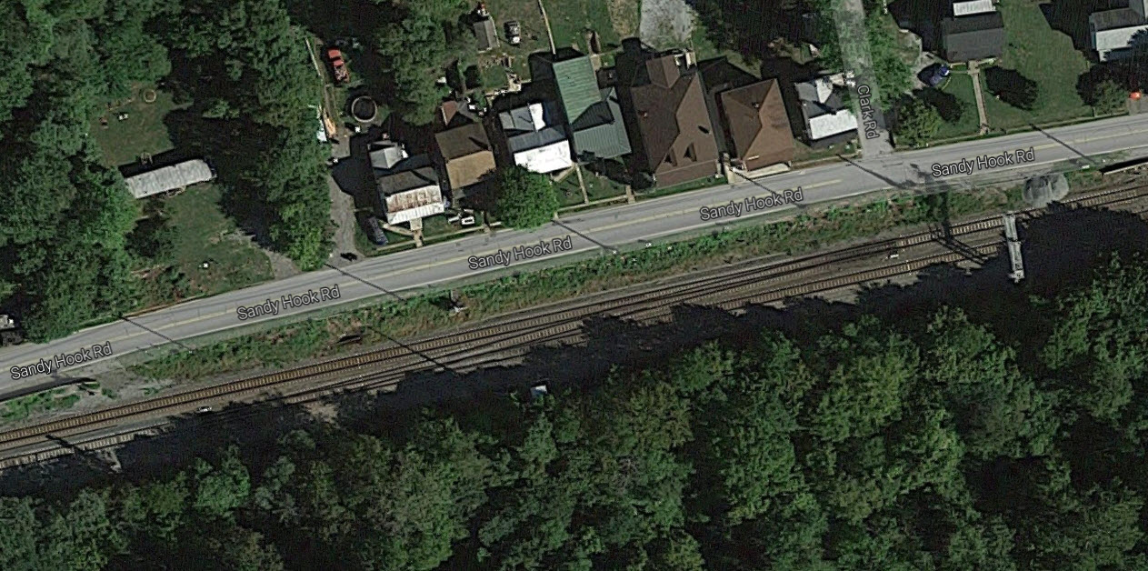
Somewhere up here is a path leading to an overlook of Harpers Ferry. You're on your own,
as I have no clue where to find the beginning of the path, but it's suppose to be off of Sandy Hook Road.
Nice shot of the old bridge piers - Bruce Stambaugh
Bruce Stambaugh
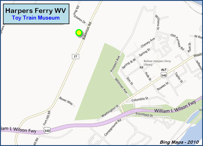
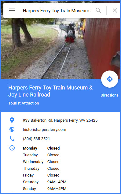
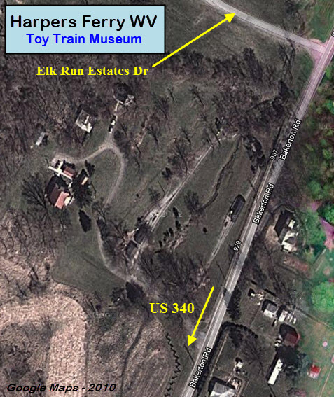
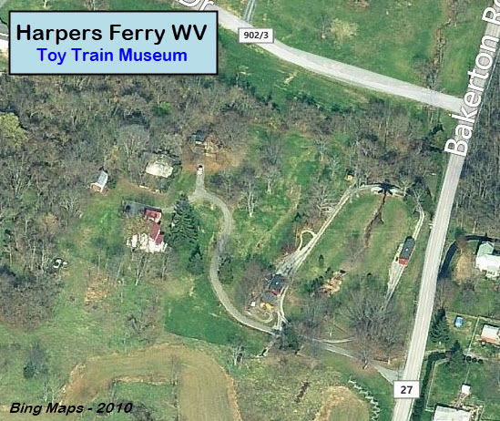
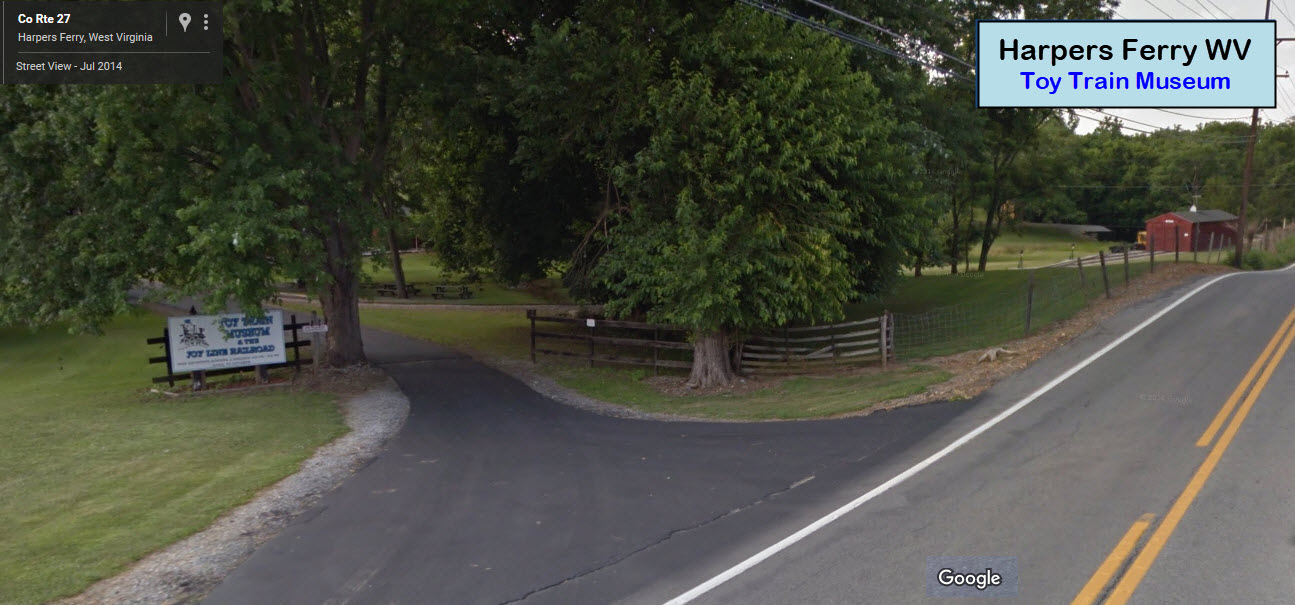
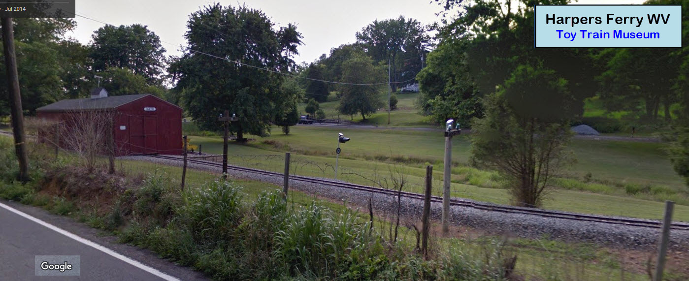
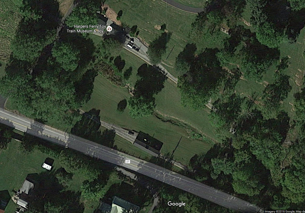
Harpers Ferry Toy Train Museum & Joy Line Miniature RR
Thanks to Tim Eaton for finding this museum. We'll have to check it
out on our next visit to Harpers Ferry. Is has a huge collection of
Lionel Standard gauge and O gauge equipment, as well as a 75 foot long
operating layout. Outside it has a "Live Steam" railroad that can be ridden.
I love trains, and I love signals. I am not an expert. My webpages reflect what I find on the topic of the page. This is something I have fun with while
trying to help others.
Please Note: Since the main focus of my two websites is railroad signals, the railfan guides are oriented towards the signal fan being able to locate them.
For those of you into the modeling aspect of our hobby, my
indexa page has a list of almost everything railroad oriented
I can think of to provide you with at least a few pictures to help you detail your pike.
If this is a railfan page, every effort has been made to make sure that the information contained on this map and in this railfan guide is correct. Once in a while,
an error may creep in :-)
My philosophy: Pictures and maps are worth a thousand words, especially for railfanning. Text descriptions only get you so far, especially if you get lost or
disoriented. Take along good maps.... a GPS is OK to get somewhere, but maps are still better if you get lost! I belong to AAA, which allows you to get
local maps for free when you visit the local branches. ADC puts out a nice series of county maps for the Washington DC area, but their state maps do not have the
railroads on them. If you can find em, I like the National Geographic map book of the U.S..... good, clear, and concise graphics, and they do a really good job
of showing you where tourist type attractions are, although they too lack the railroads. Other notes about specific areas will show up on that page if known.
Aerial shots were taken from either Google or Bing Maps as noted. Screen captures are made
with Snagit, a Techsmith product... a great tool if you have never used it!
By the way, floobydust is a term I picked up 30-40 years ago from a National Semiconductor data book, and means miscellaneous
and/or other stuff.
Pictures and additional information is always needed if anyone feels inclined to take 'em, send 'em, and share 'em, or if you have something to add or correct.... credit
is always given! Please be NICE!!! Contact info is here
Beware: If used as a source, ANYTHING from Wikipedia must be treated as being possibly inaccurate, wrong, or not true.


 Bruce Stambaugh
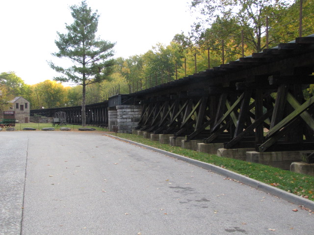
 Bruce Stambaugh
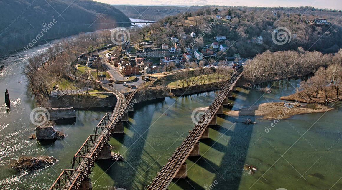


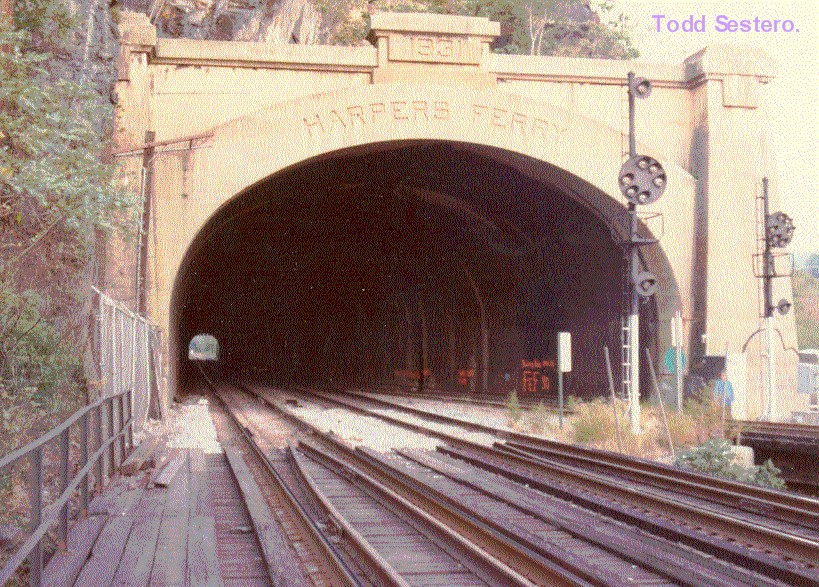
 These pictures are from way back in the early 70's, scanned from prints
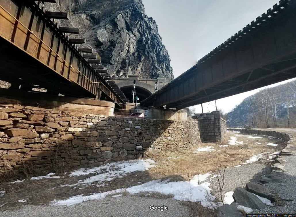
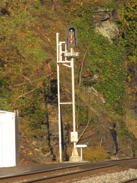
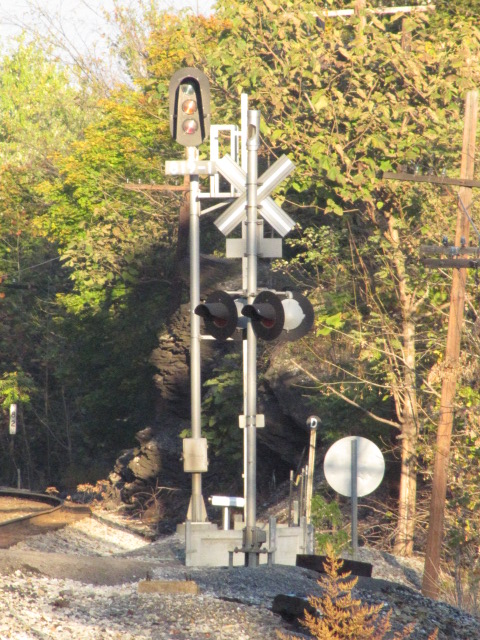
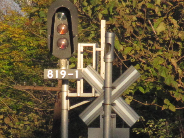


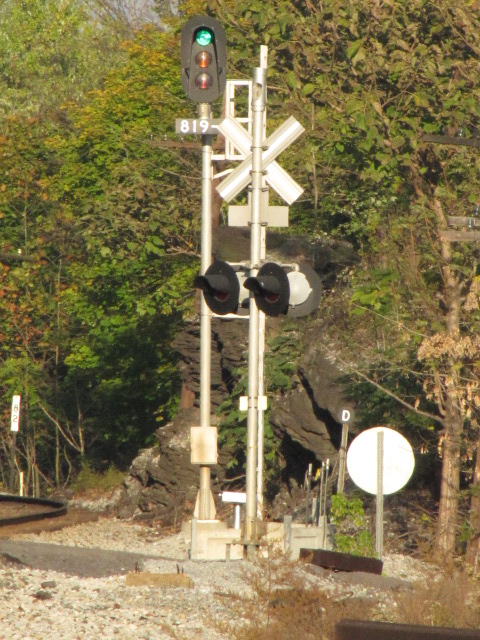
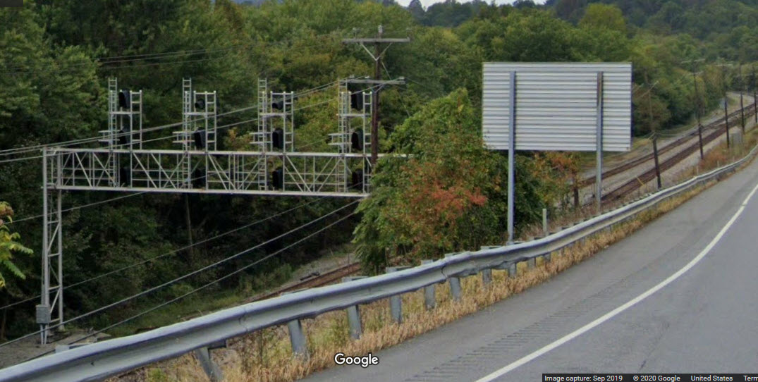
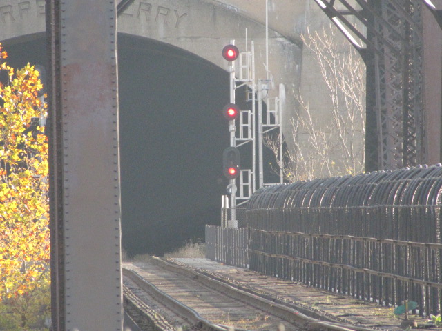
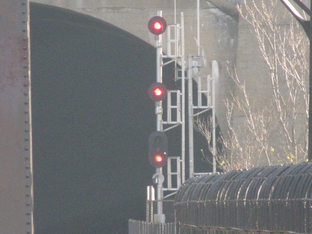
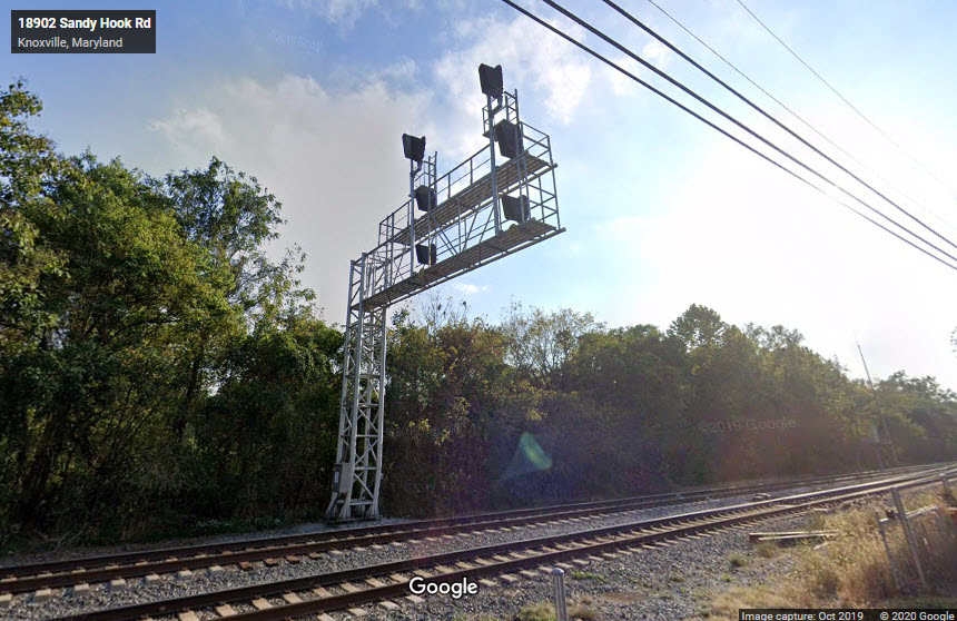 WB Signals
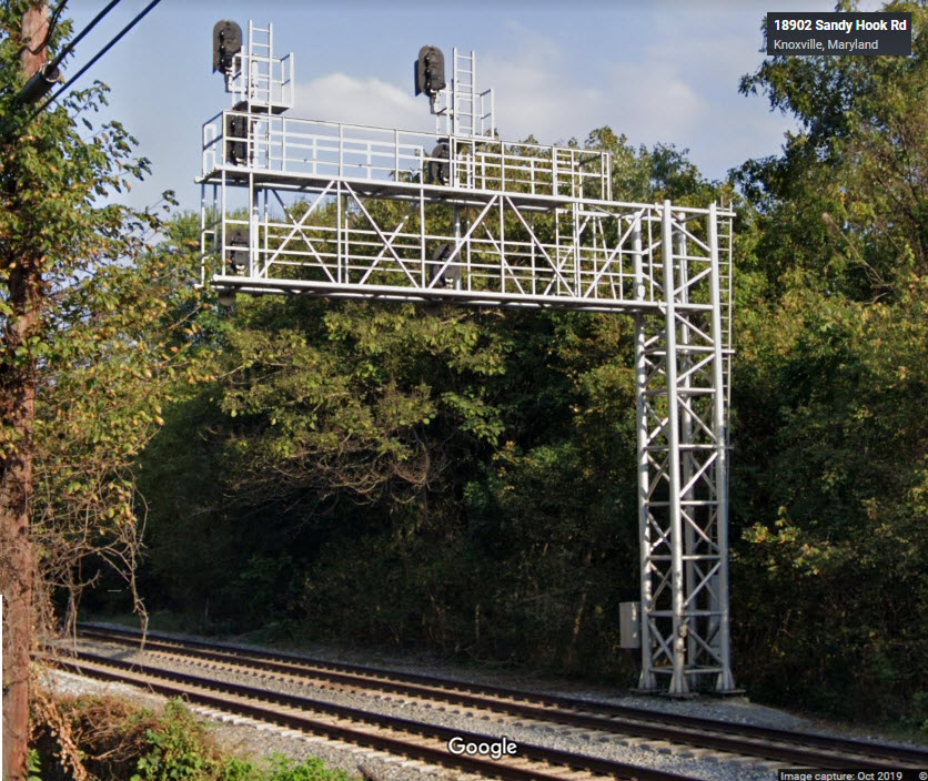 WB Signals
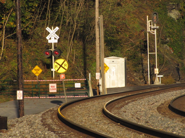
 EB Signals