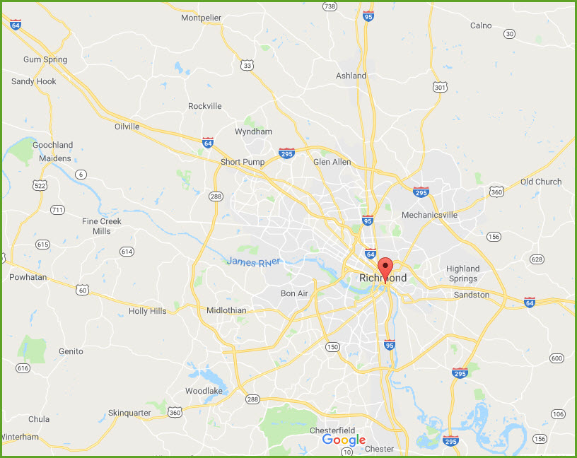
Location / Name:
Richmond VA
Note: Richmond has not been part of surrounding Henrico County since 1842
What's Here:
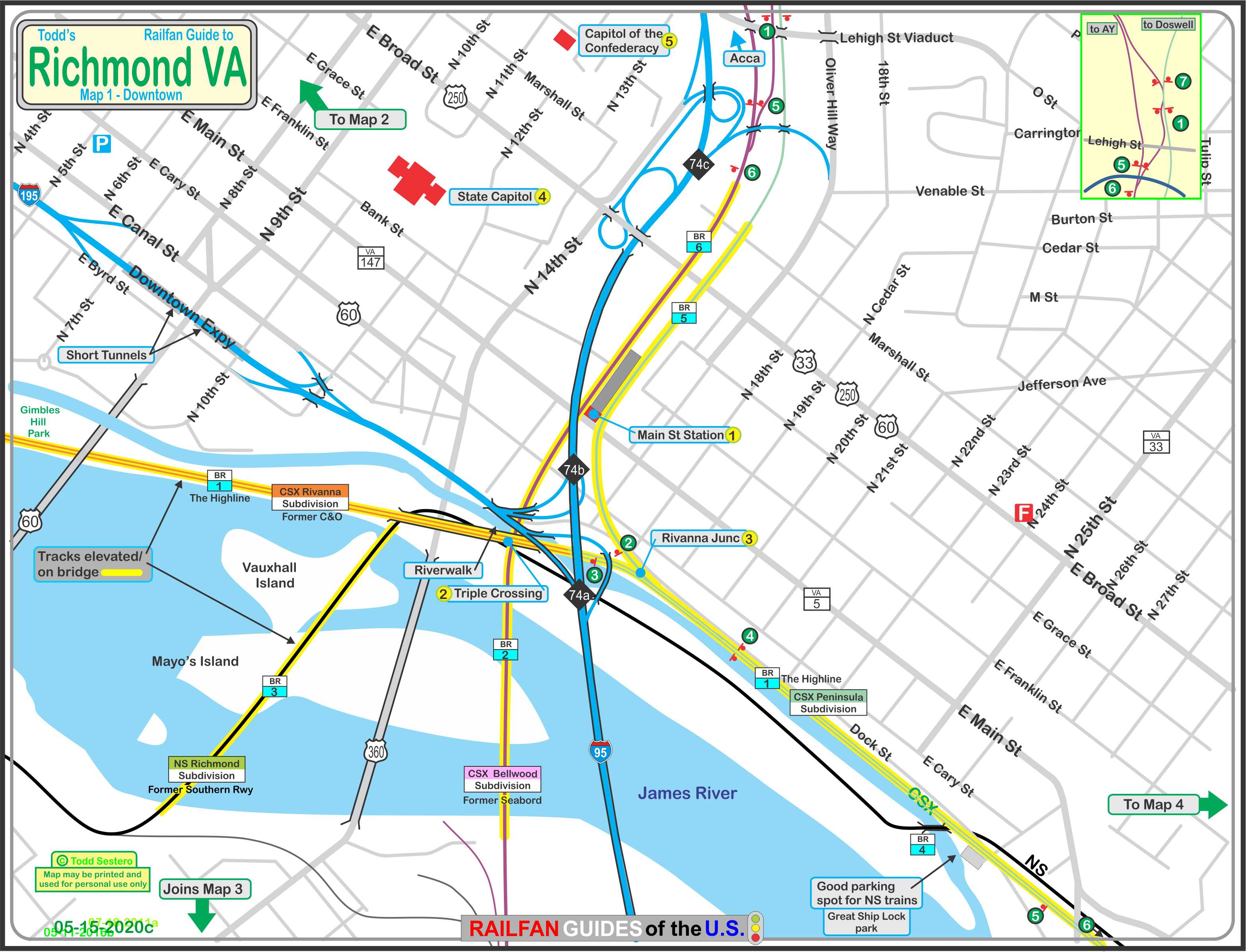
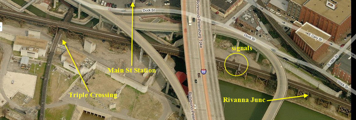
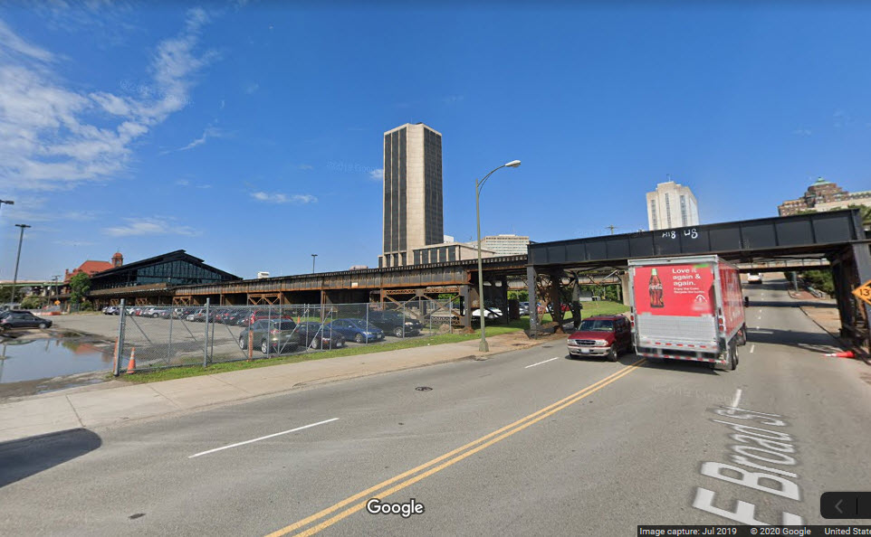
Richmond's Main Street Station
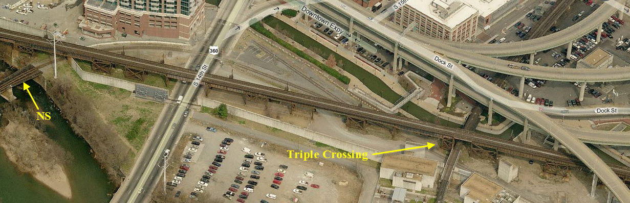
the Triple Crossing
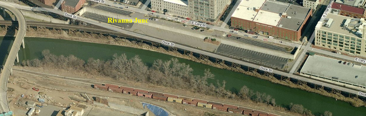
Rivanna Junction
Elevated CSX E/W Line
N/S CSX Line
E/W NS Line
Data:
GPS Coordinates: as needed
Phone A/C: 804
ZIP: 23223
Access by train/transit:
Amtrak
The Scoop:
Downtown Richmond is full of "so much" railroad stuff and other items of
interest, that anyone coming here should plan on spending at least a whole day
here, especially if you are trying to catch trains in the right spot.
Patience is a virtue, because trains do not run as frequently as many other
places.
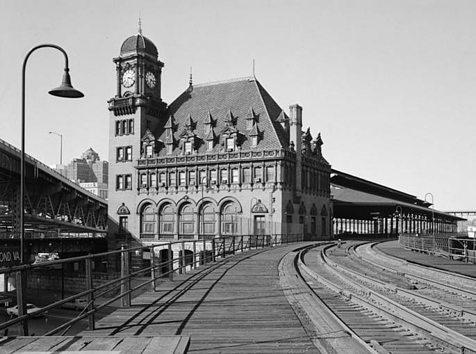
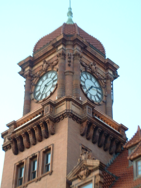
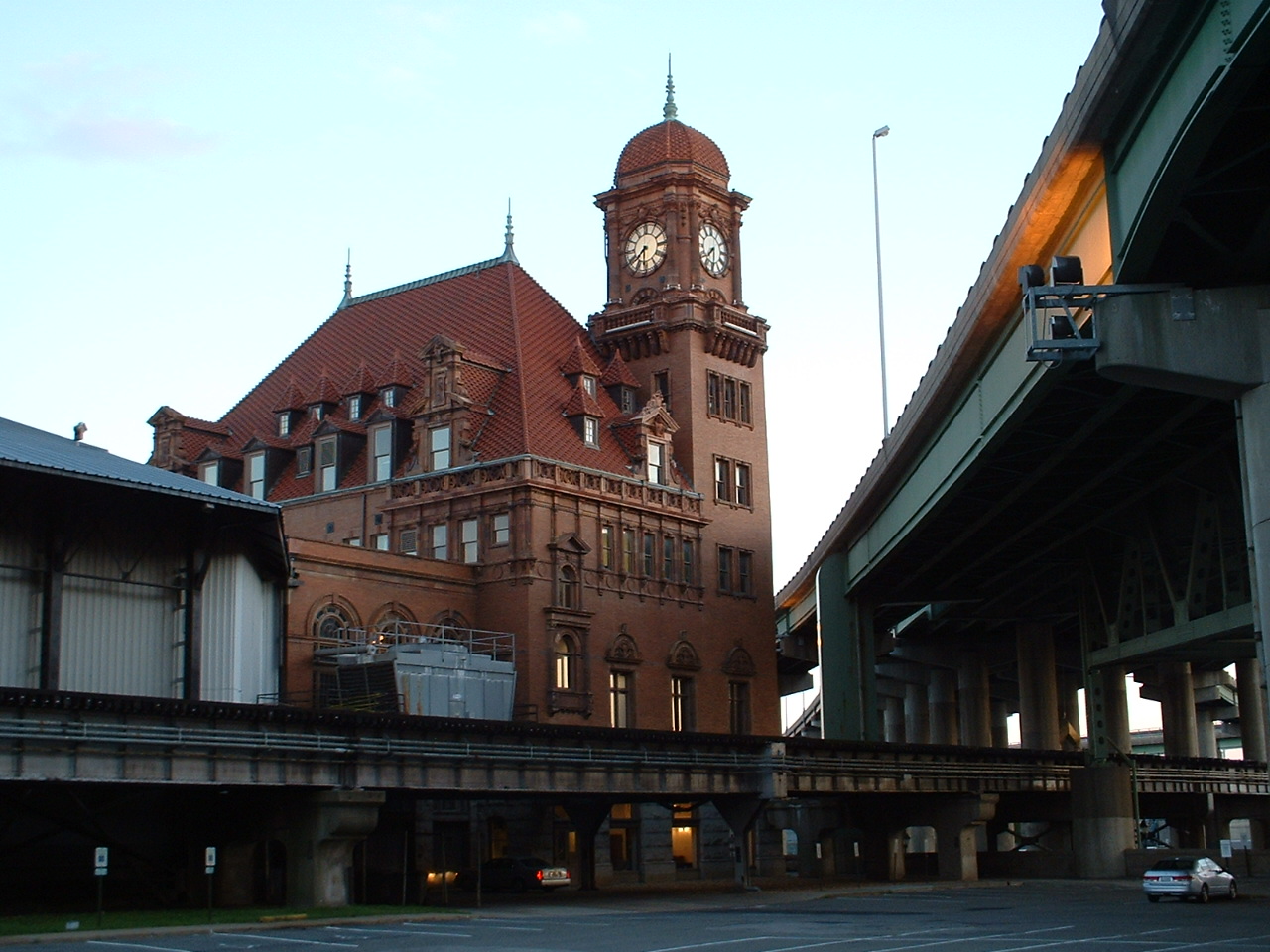
You have the beautiful Victorian styled Main Street Station, which is at the
center of a downtown revival, and if you are into other things, you could spend
a whole day investigating them - restaurants, shops, etc.
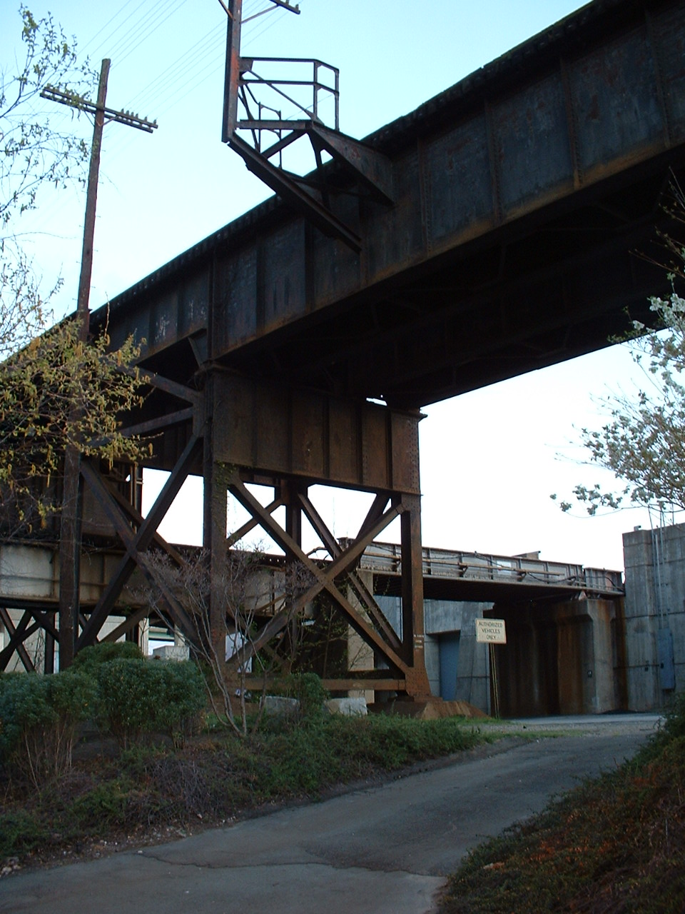
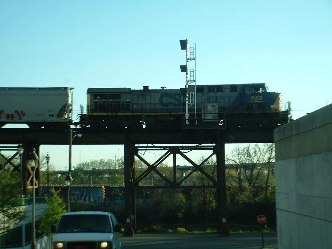
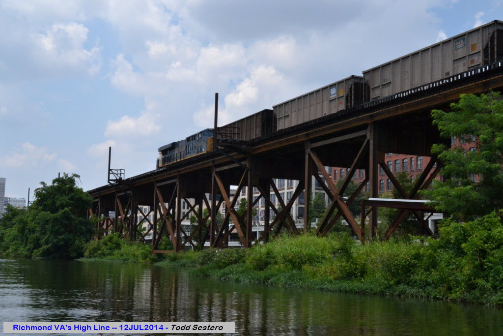
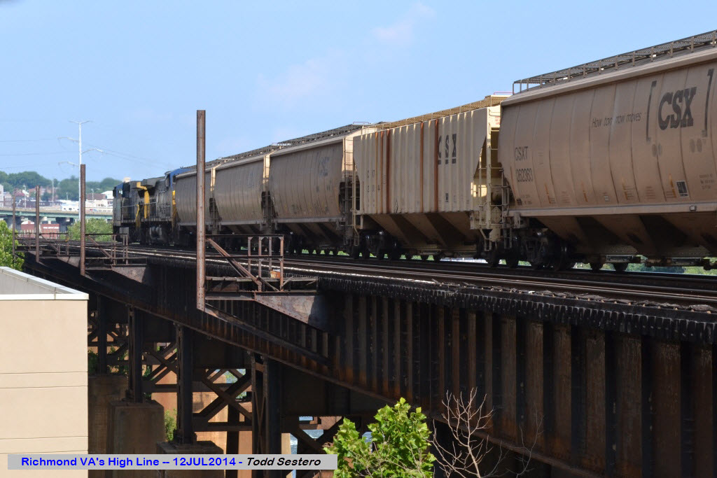
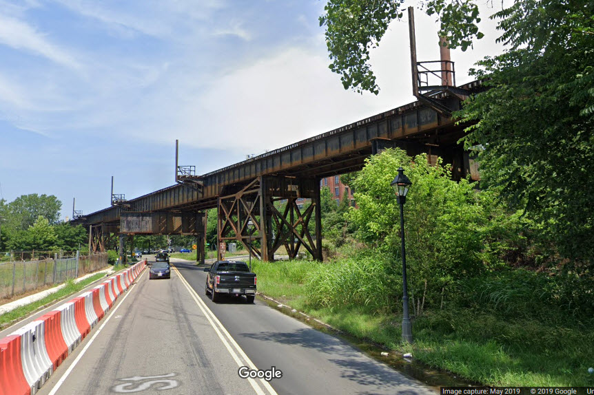
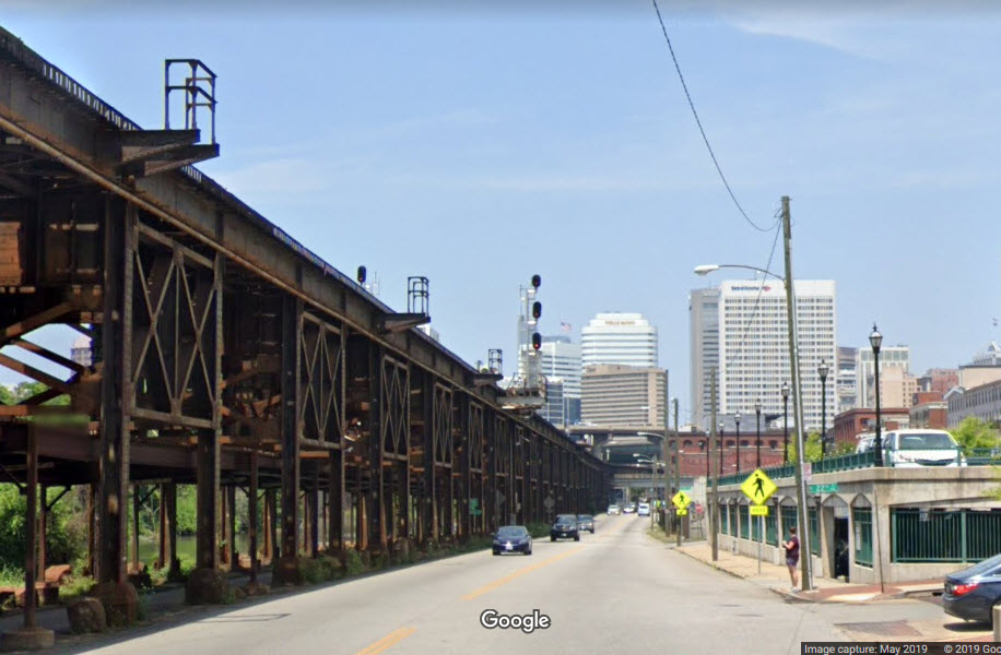
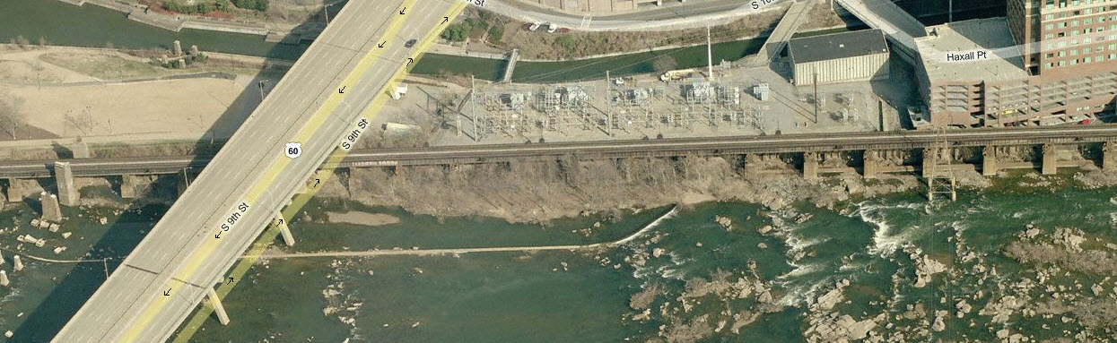
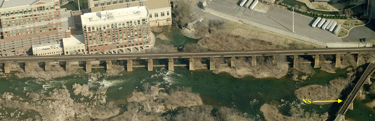
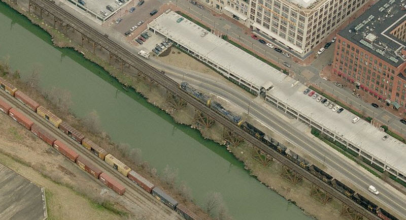
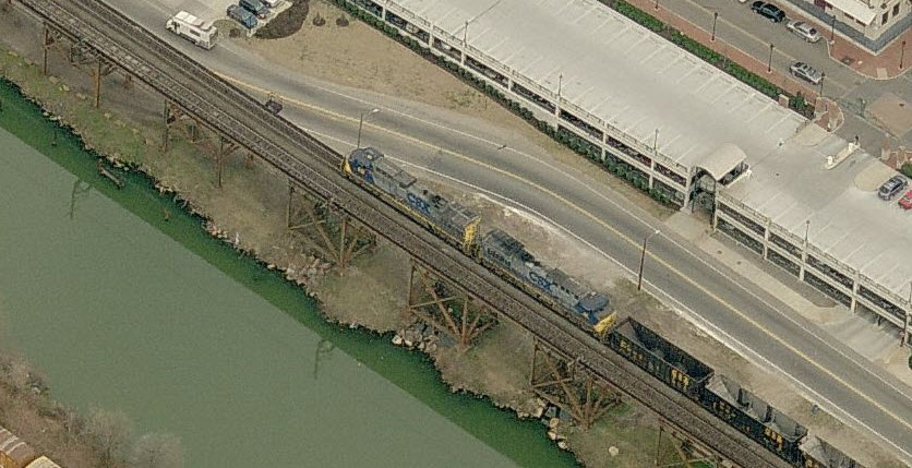
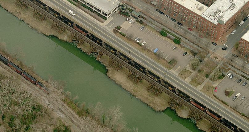
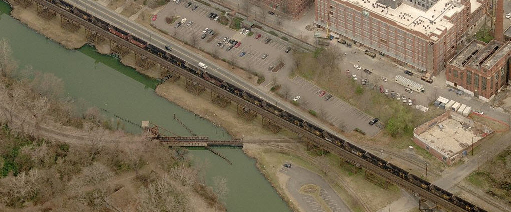
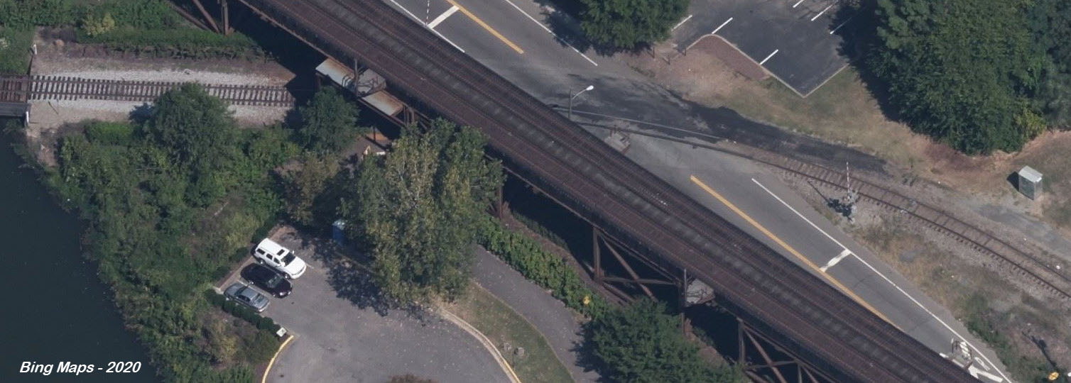
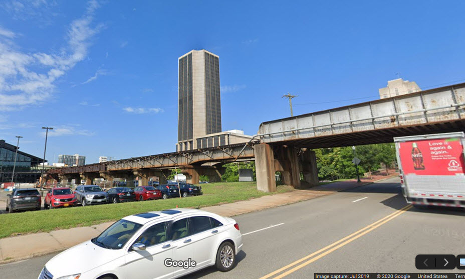
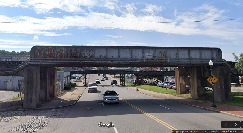
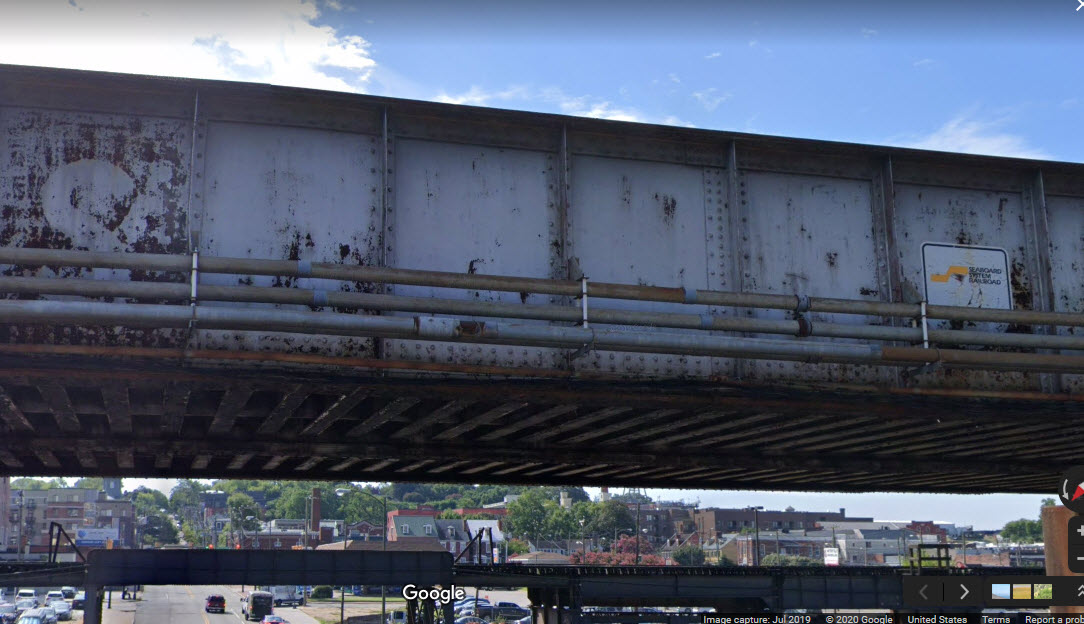
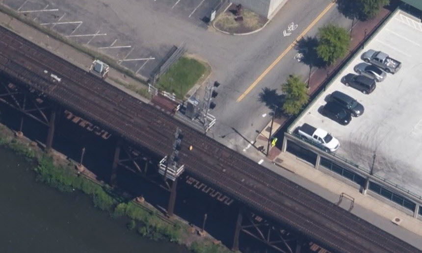
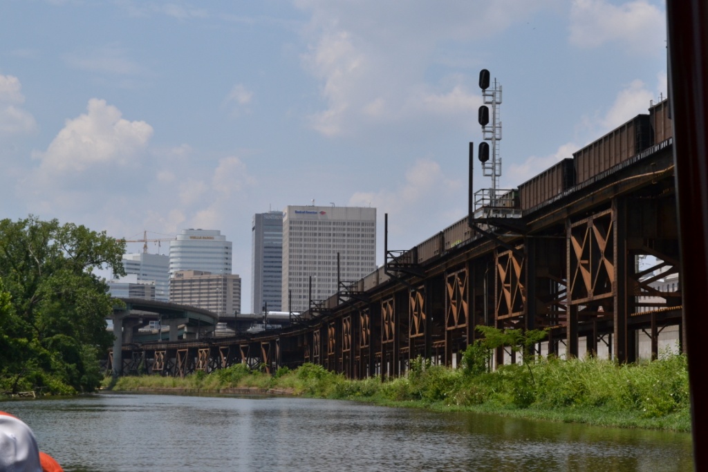
CSX comes thru on it's unique former C&O high line trestle which is over a mile long,
along the waterfront, and offers so many photo opportunities it's not funny.
Between the lighting and the angles, photo ops are endless! Dock
Street, east of I-95, provides ample locations for shots of trains on the
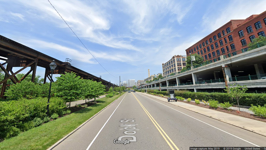
bridge, unless you're directly under it. West of I-95, East Byrd
Street provides some good photo locations, a parking garage which gets you
"up close and personal", Brown's Island, and the T. Tyler
Potterfield Memorial Bridge - it allows you to get out over the river
and shoot the High-line from a different view than any of the other
locations! And if you are
hungry, don't forget to grab something at the rooftop dining at the Bottoms Up
Pizza pub, nestled right in the middle of Rivanna Junction!! Good food at
decent prices and trains - what can be better?
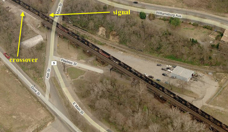
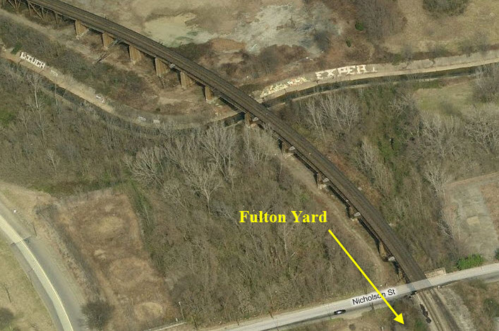
Slightly east of the high line is former C&O Fulton yard, but access is not very good
except at the north end.
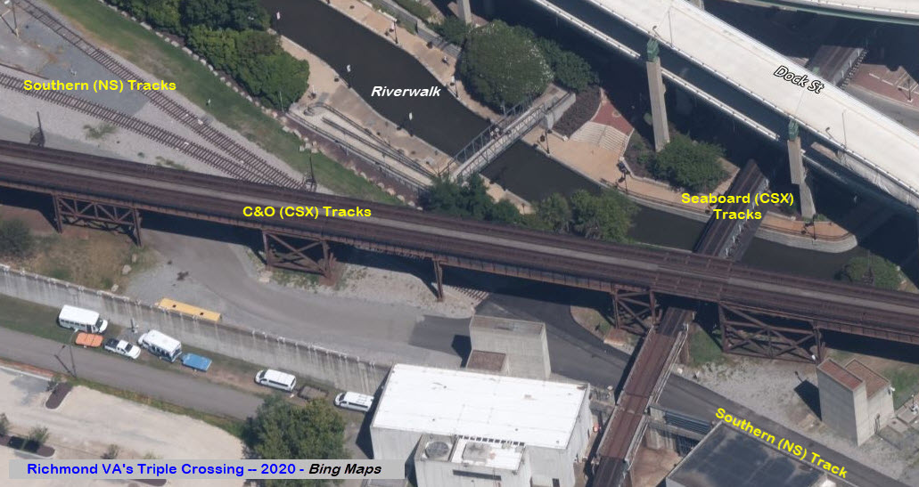
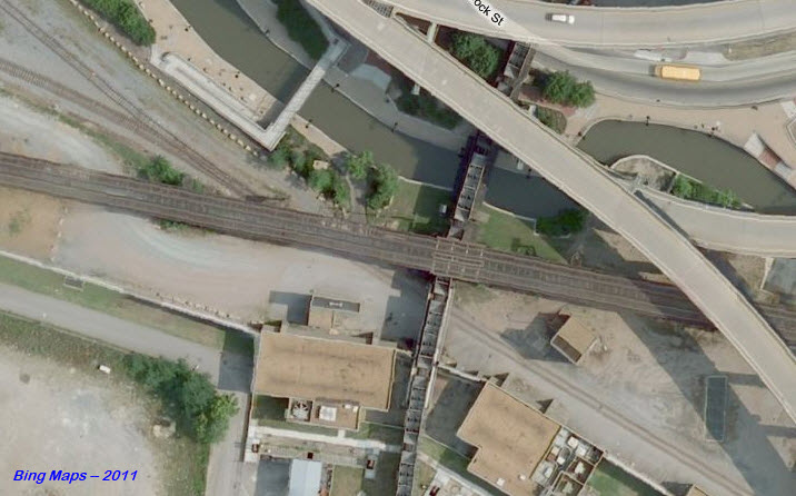
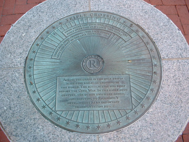
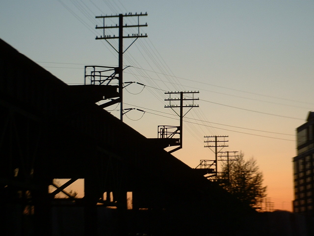
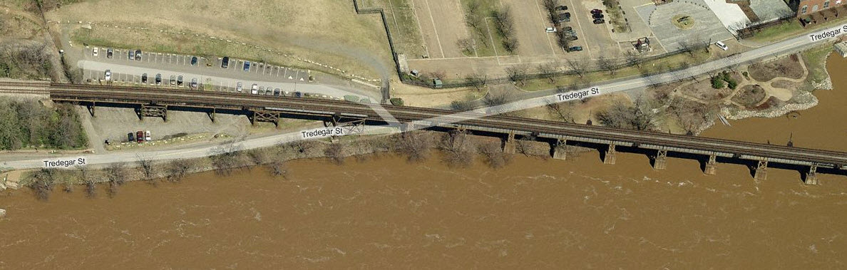
Last but not least is the Triple Crossing, the only one of it's kind in (at
least) the United States. It's gotten a little harder to take good
pictures because of the river wall they erected, but nevertheless, it is a prime
photo location.
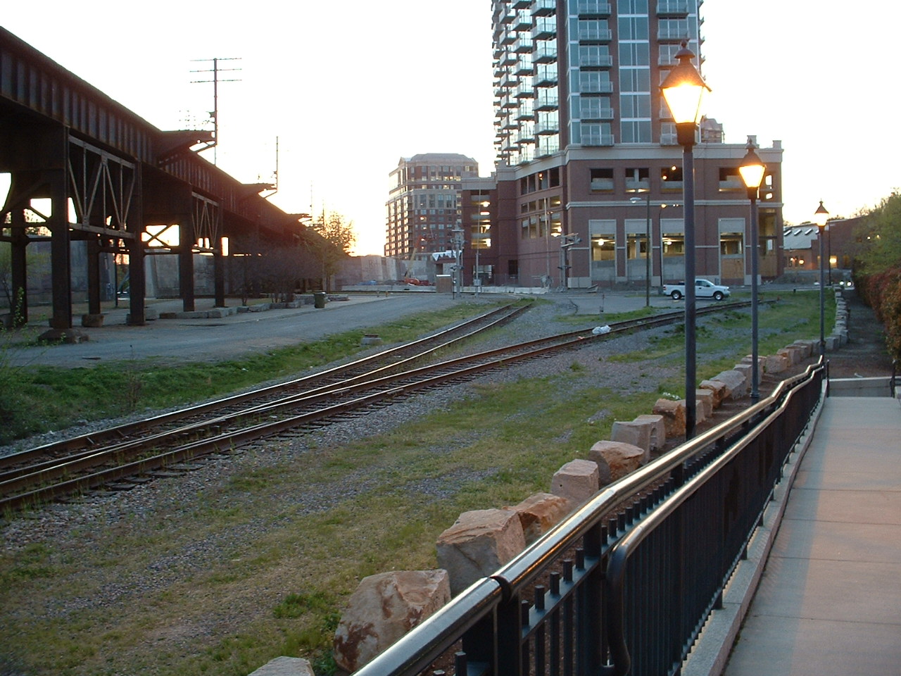
It is very surprising, that even in 2020, more development has not taken
place on the north side of the Main Street Station! There is still
plenty of "old" embedded track in the streets that cover the area where,
back in the 40's, there was a considerable amount of yards and activity.
Good photo spots abound in the downtown area. On the north side of
the Main St Station, you can catch CSX trains from/to Acca Yard/AY
Interlocking and Doswell VA. CSX trains on the high line can be harder
to get good pictures of, but the parking structure on the west side of I-95
is one good spot, a drone would give you good shots too, if you have access
to one. The Triple Crossing area is difficult to shoot well, you will
have to wander around and see what grabs your fancy. If you have
access to one of the high rise buildings, that would be a bonus! :-)
Richmond has also done an excellent job in revitalizing the Riverwalk area, with
beautiful walkways, boat rides, markers, lighting, it's great to see what can be
done with a downtown area!
When you arrive to the downtown area, you will
be greeted by one of the prettiest Victorian style depots around, America's only
"three level" crossing, and a viaduct that offers the railfan an almost
unlimited variety of photo ops.
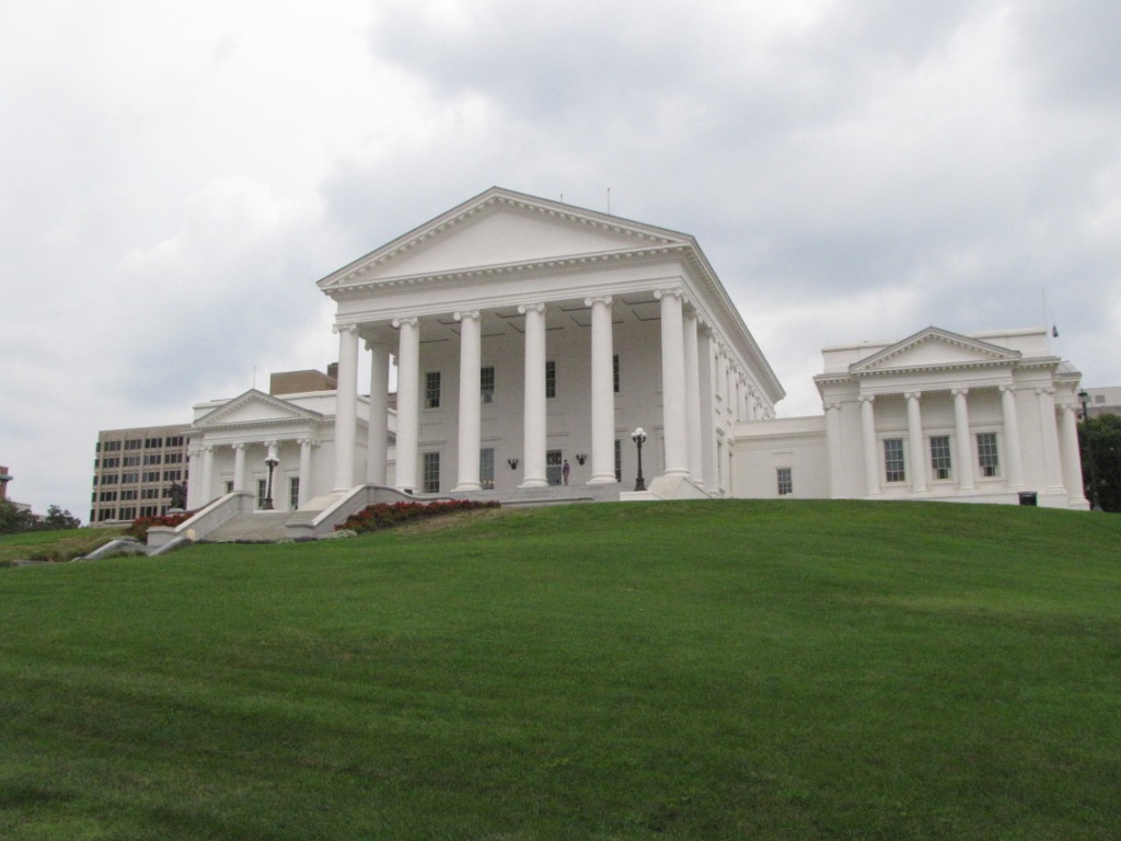
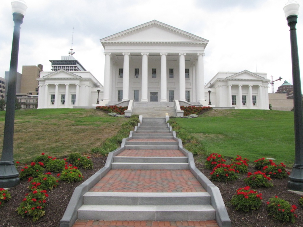
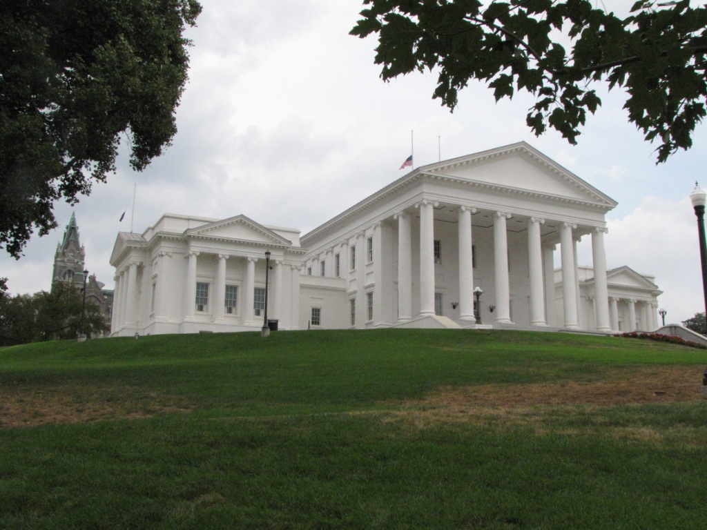
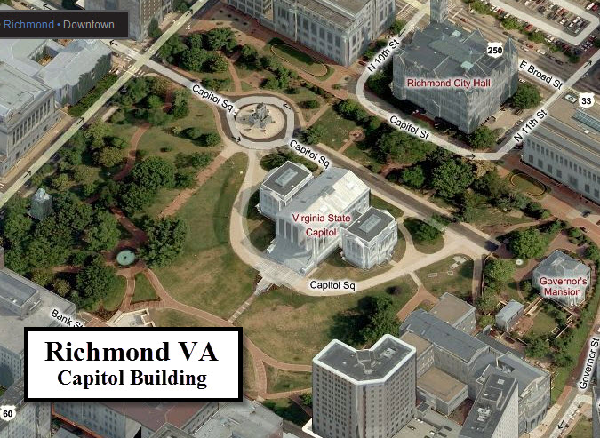
While you're in the downtown area, you should
at least drive by the capitol building and take a gander, and then check out the
Confederate Capitol building a few blocks away.
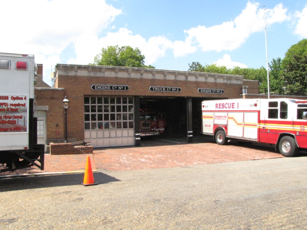
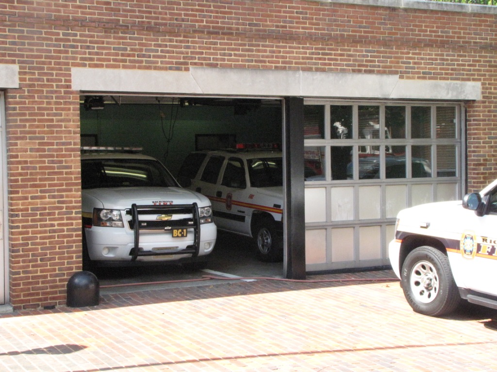
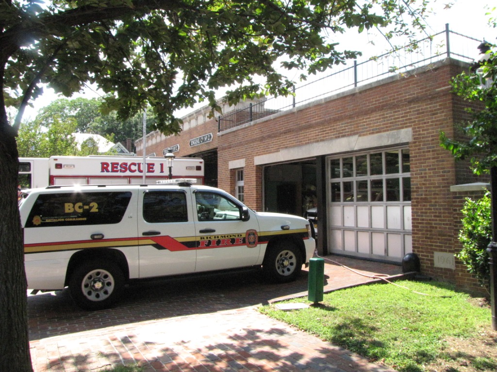
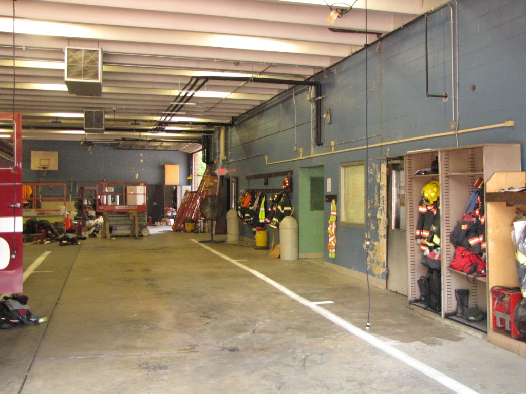
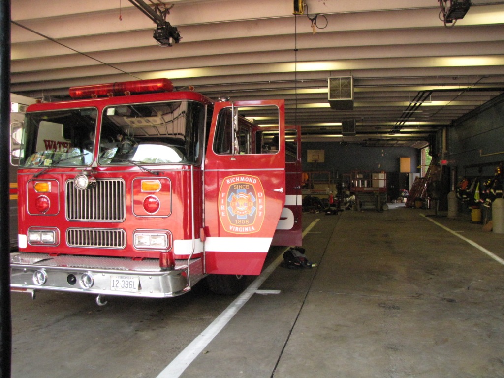
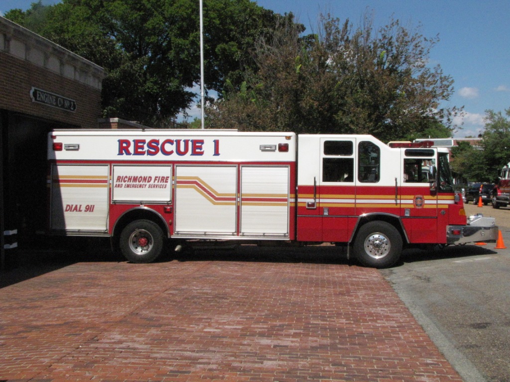
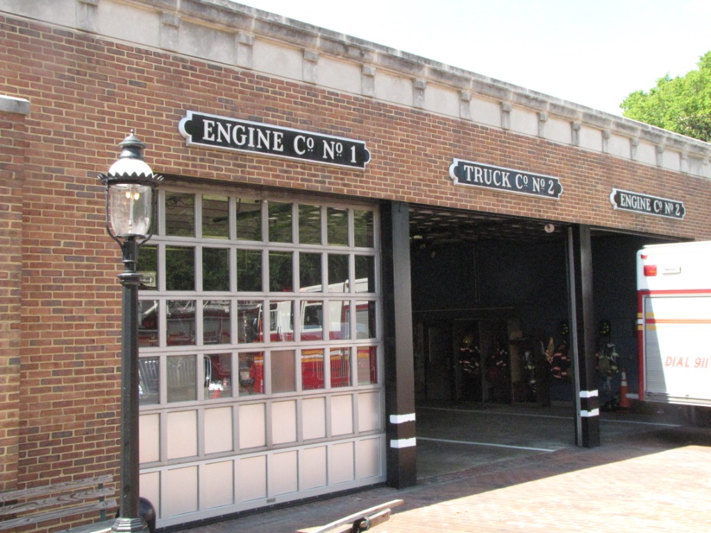
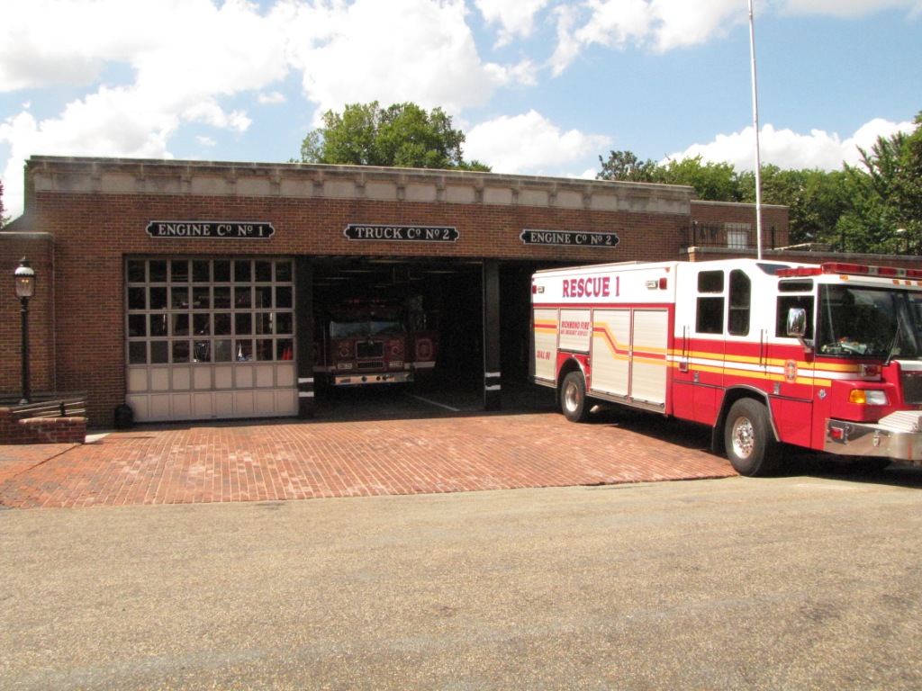
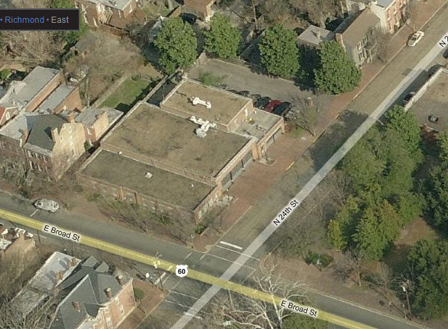
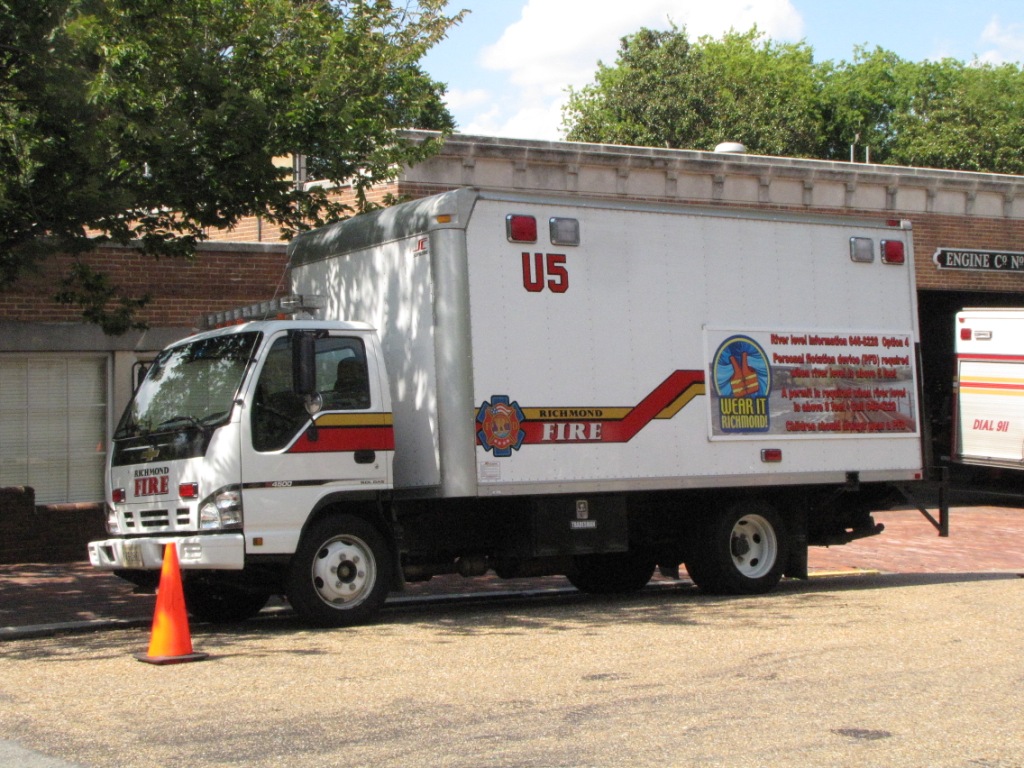
One fire station and a police station are in the area too.
From the north or south, exit 74c looks like your best bet.
Coming in from the west or east on I-64, take
95 south to exit 74, or if you're coming in from the east around the Sandston
and airport area, you can take the leisurely route in via US60/Williamsburg Rd
which will take you by the old C&O Fulton yard.
Of note, the interchange between I-95 and the
Downtown expressway rivals something in New York City because of where it had to
be squeezed in along the shores of the James River and the downtown build-up.
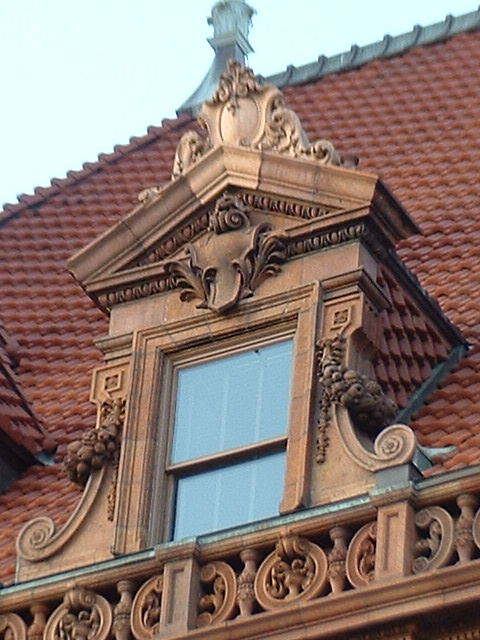
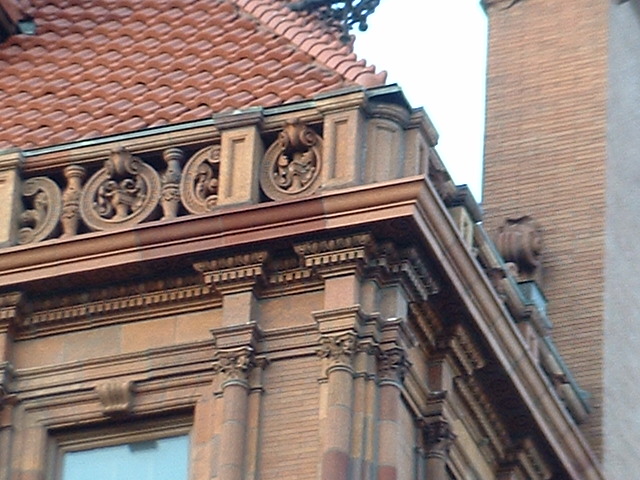
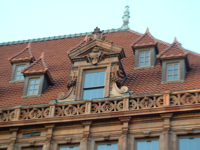
Richmond's Main Street Station was built in
1901 by the Chesapeake & Ohio Railway and the Seaboard Air Line Railroad.
The SAL offering new service to Richmond, and the C&O was consolidating the
operations of two older stations (from railroads they had snapped up) into this
station. The Seaboard moved it's passenger operations to the Broad Street
Station in the 50's, while the C&O continued to use this facility until Amtrak
took over passenger service in 1971. After Hurricane Agnes came through in
1972, Amtrak moved it's operations to the Staples Mills station in 1975. The
station suffered two fires in 1976 and 1983. It was subsequently renovated.
Rear view of the train shed
Shots from the highways over the station.
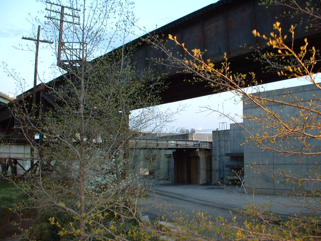
At the Triple Crossing
A long, long time favorite spot of American railfans for
pictures is this unique spot. If you look around the internet, you will
see the many variations of trains passing through here, and the numerous times
the three former railroads made the effort to get three trains in position for a
promo shot (meanwhile tying up the railroads :-)
Since they put in the flood walls and gates, and Riverwalk,
it has become challenging to get good pictures of trains on the ground level.
Although not as "close" as the three tracks are here, the next closest
triple crossing in the United States is at
Santa Fe
Junction in Kansas.
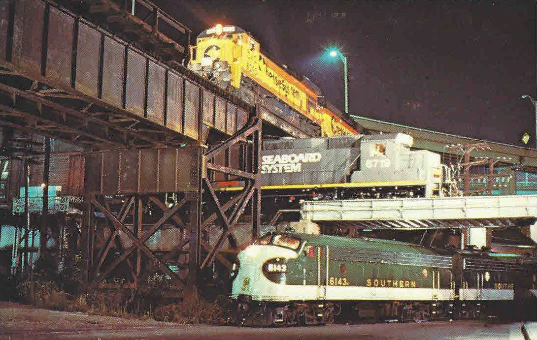
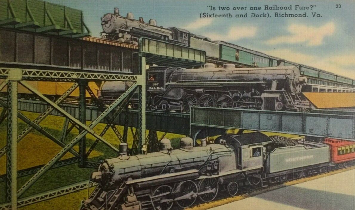
Postcard, from around 1983
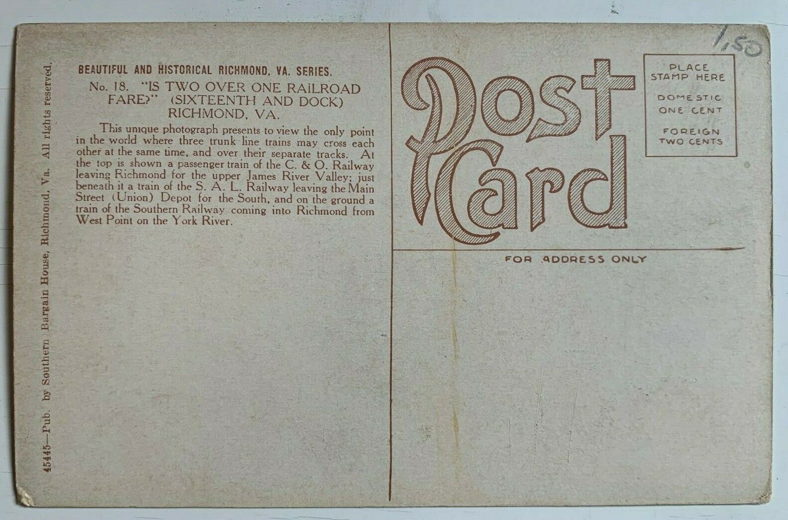
Postcard, from around 1920
Postcard, from 1911
Postcard, from around 1944
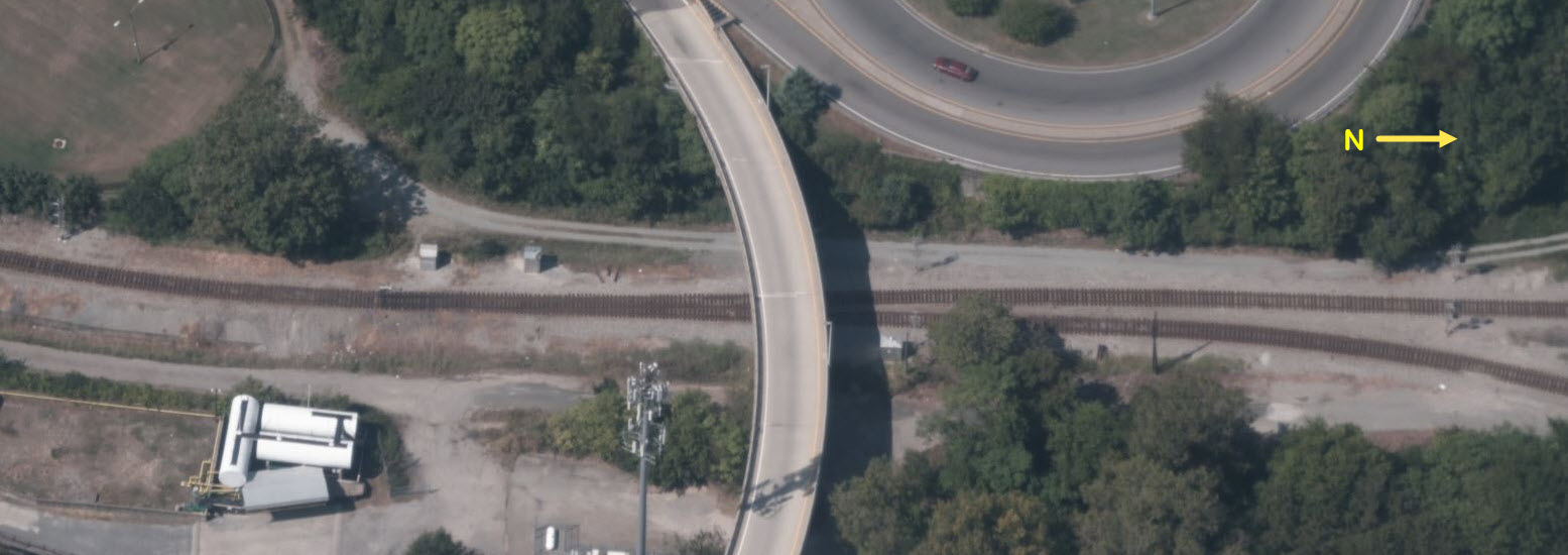
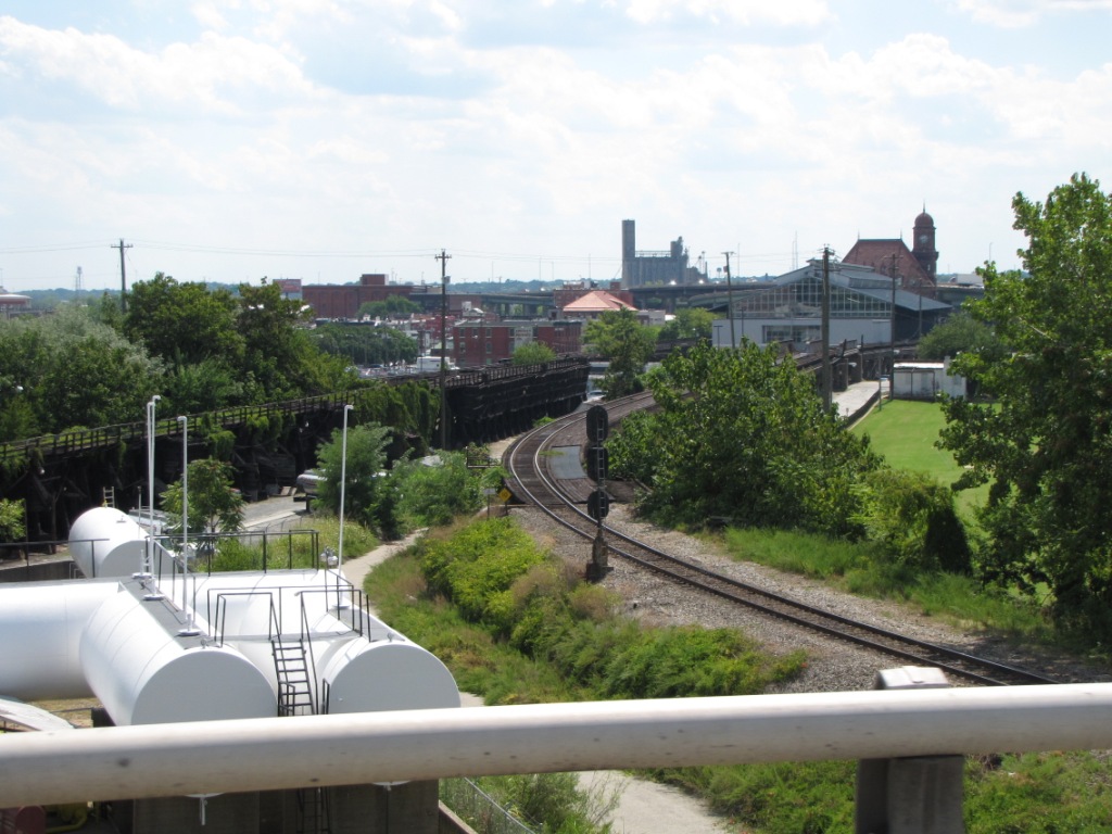
Rivanna Junction
It's difficult to get really decent pictures of trains at
the junction because of where the junction is located - UP!
Sunset time from the north side is definitely NOT a good time to shoot here.
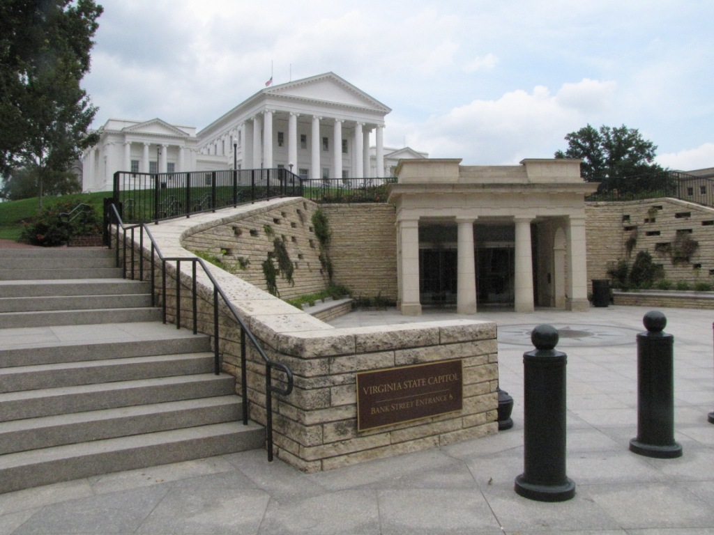
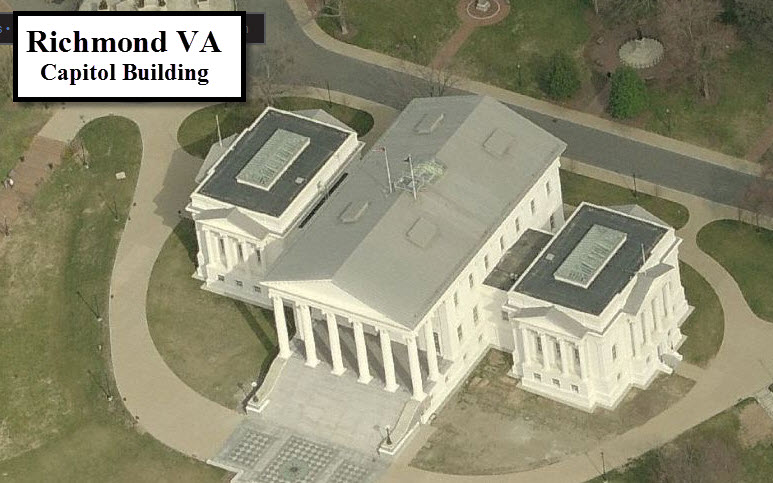
The Virginia State Capitol Building
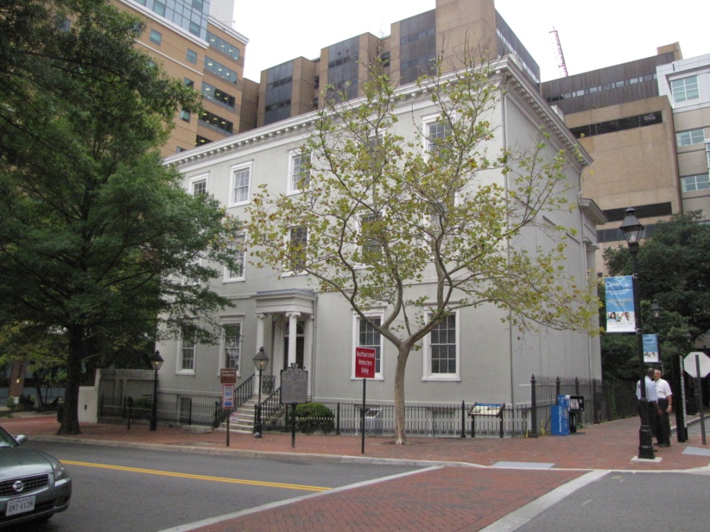
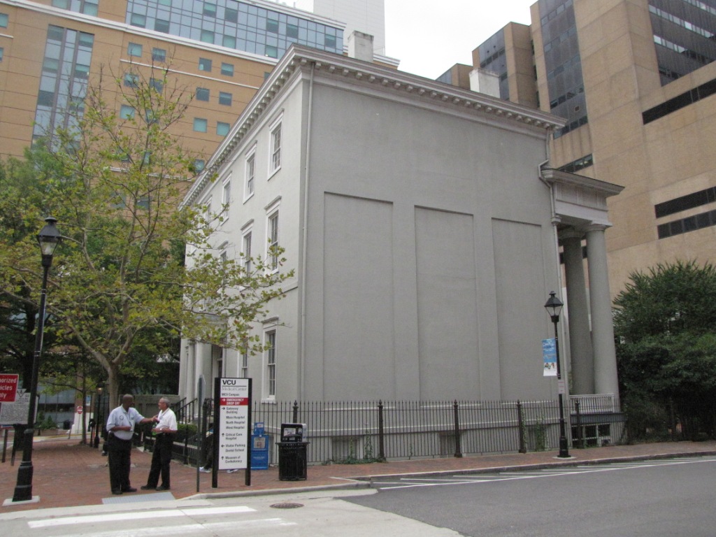
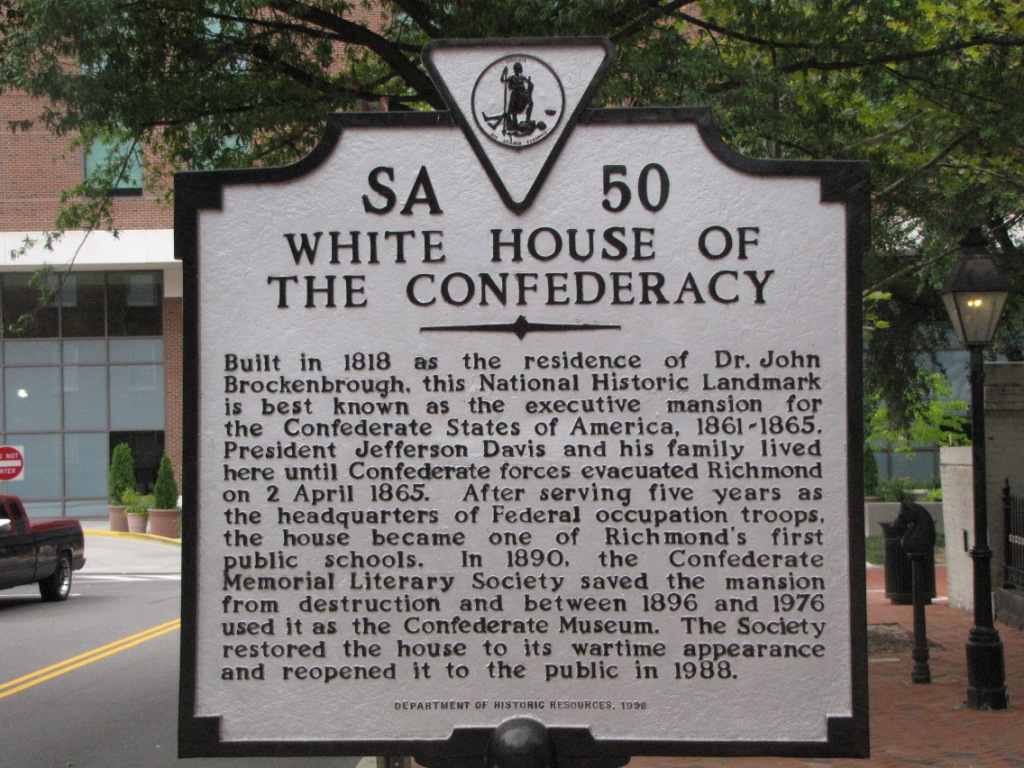
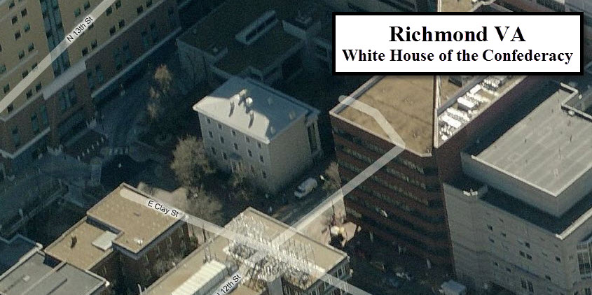
The White House of the Confederacy Capitol Building
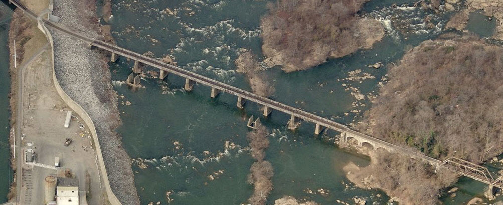
Nestled away amongst the high rise buildings of modern Richmond, is another great historical treasure of Richmond!
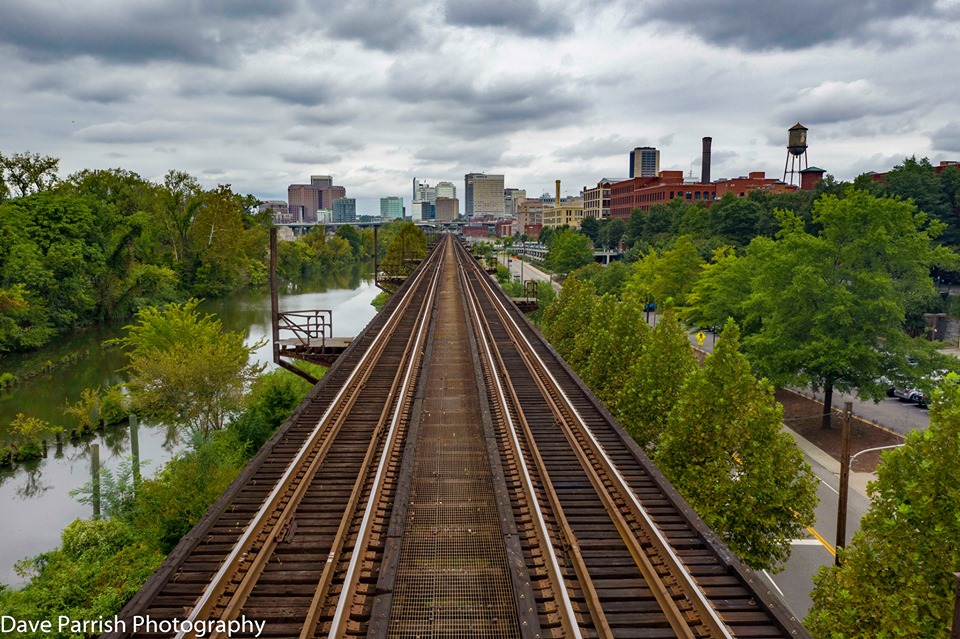
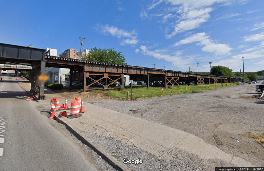
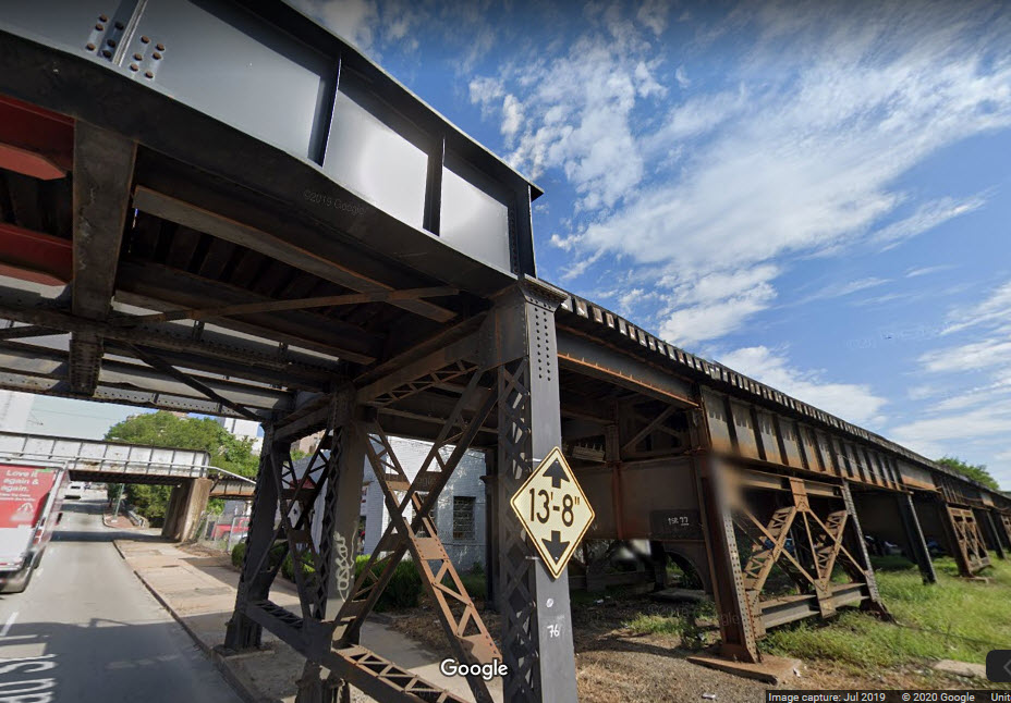
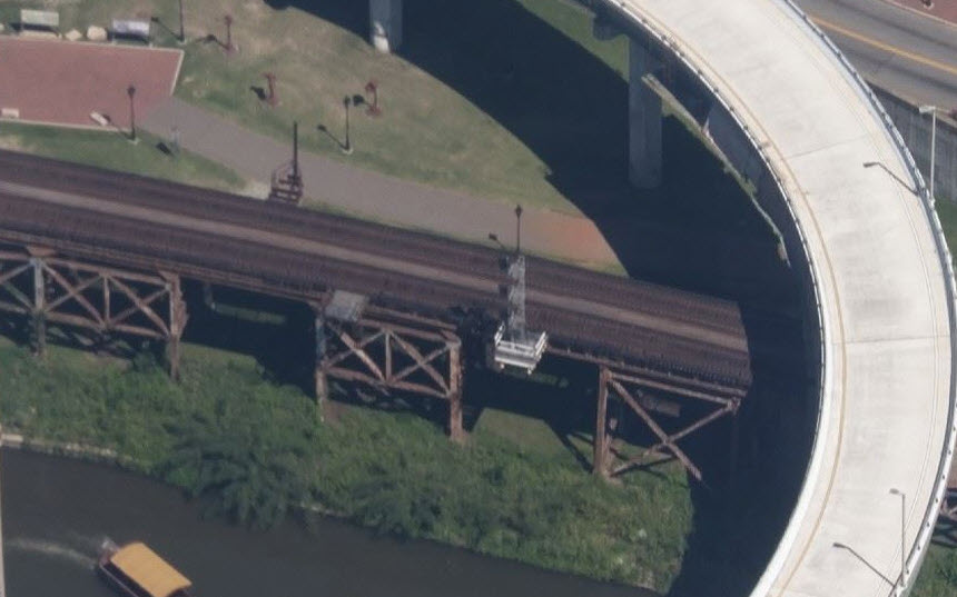
One of the coolest features of Richmond isn't an attraction per se, but a
1.77 mile long steel viaduct that hugs the north side of the James River.
The viaduct provides some really nice photo opportunities as it winds its way
through downtown Richmond. I wonder what the price tag on replacing this
thing would be today? I'm guessing the viaduct is about 35 feet high for
most of it's length along the river.
The first photo we have for the viaduct is one taken by Dave Parrish, using a
drone, giving us an engineers view of what it looks like traveling west on the
viaduct.
If you take the harbor cruise, you may be able to catch a freight passing by as I did...
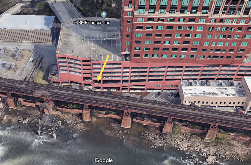
A little bit to the west side of I-95 is a parking garage where you can get
good pictures from....
Where the above two pictures were taken from, an easy walk from the Riverwalk area.
Next up is where dock St goes under the viaduct towards the eastern end of it.
We can see the Norfolk Southern crossing in the distance.
A little further west after Dock Street crosses under the viaduct, and we're at
the NS grade crossing.
Interesting shot with the parking structure on one side, and the viaduct on the other.
Here we are, up tight against the river with signals for Rivanna Junction in the
distance. We're at 22nd St, and the edge of the historic district.
A few more pictures from Bing Maps a la 2011.....
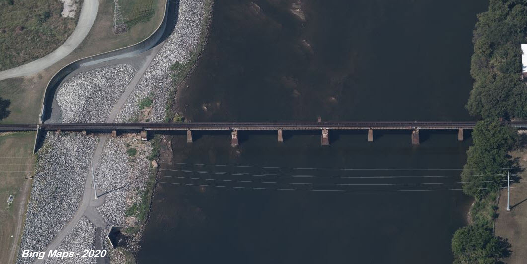
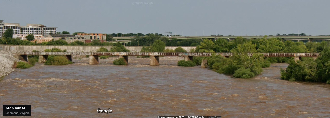
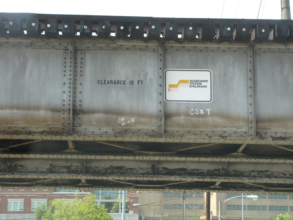
CSX crossing the James River - SCL Style
This was part of the Seaboard System, now
known as the "S" line, and runs up along the Main Street Station.
Once it hits the shore on the north side of the river, it goes into the Triple
Crossing, and is the middle of the three lines.
The southern part:
The northern part, the triple crossing is at the right:
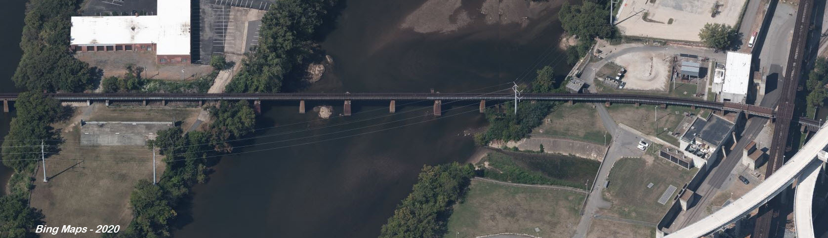
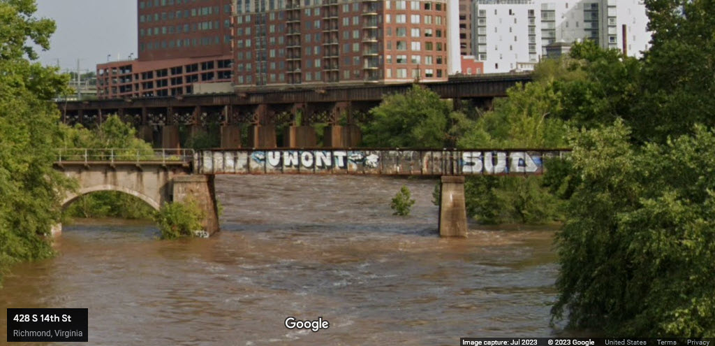
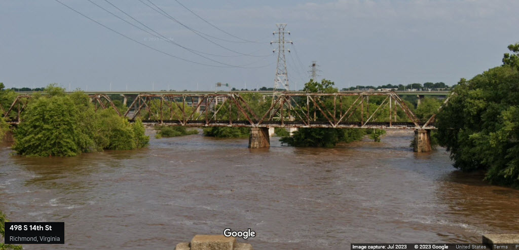
NS crossing the James River
If you can convince the construction company at the halfway point you're not
there to steal anything, they might let you wander back to the bridge for
some nice shots.... maybe.....
The 3 Streetviews below are what you can see of the NS bridge from 14th St, north to south:
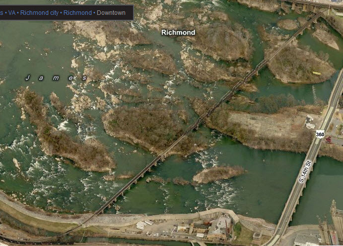
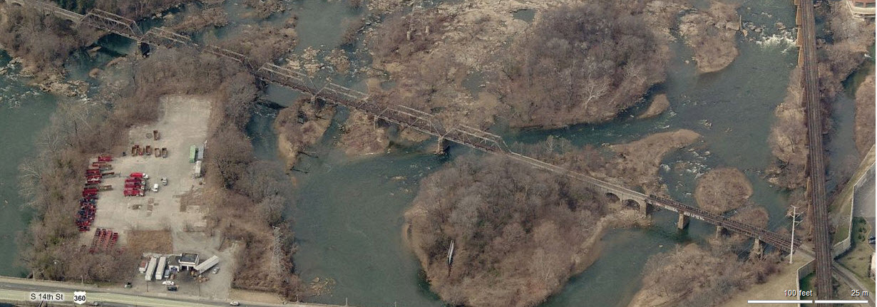
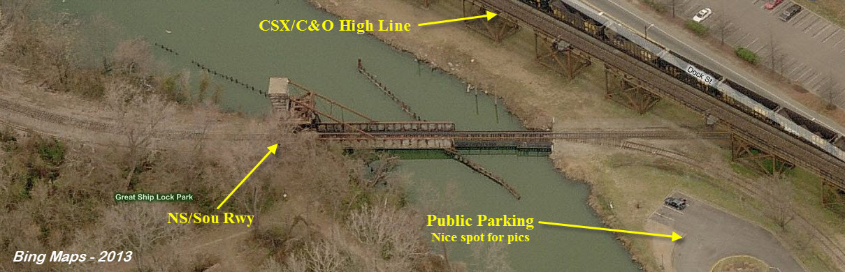
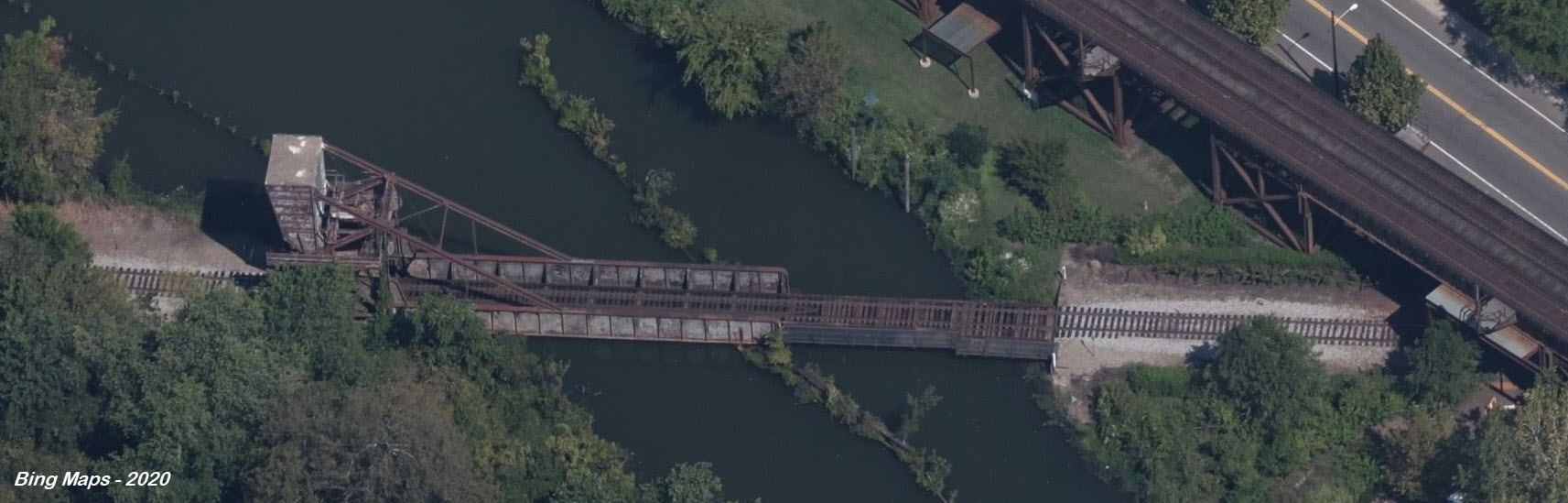
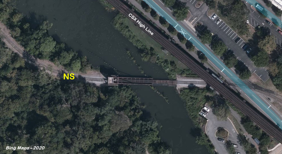
NS crossing the James River - Part 2 - From the Peninsula to the North Shore
The second part of getting from "here to there" is a small bascule bridge coming off the end of a peninsula which
is easy to get to off Dock St. Notice, since I first did this page in
2013, Richmond (or the railroad) removed a small siding on the north side of
the bridge.
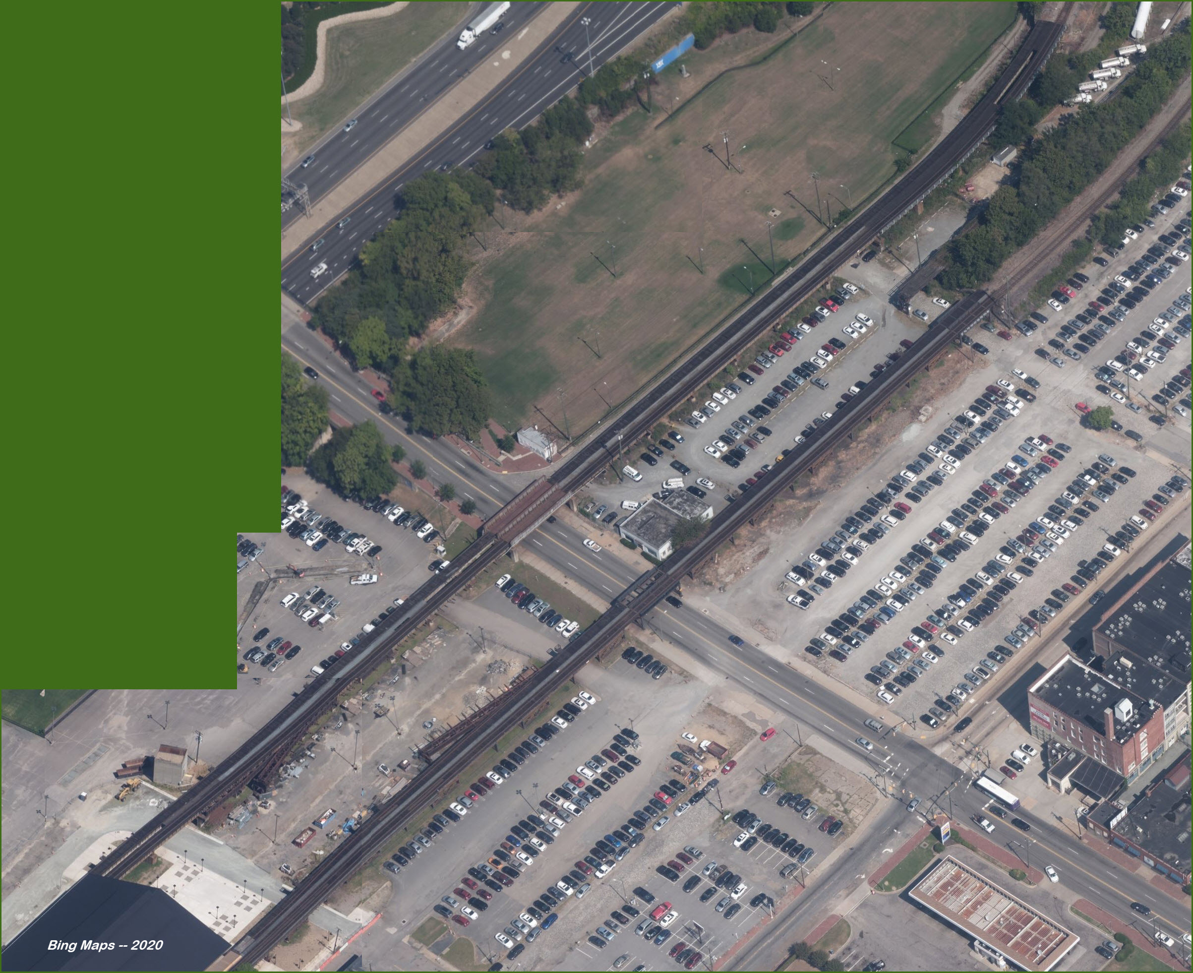
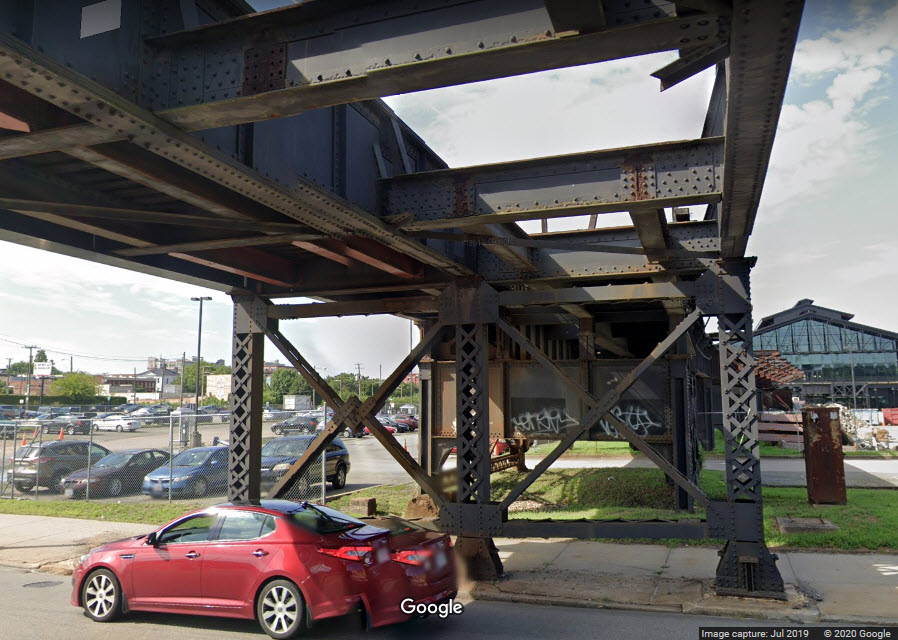
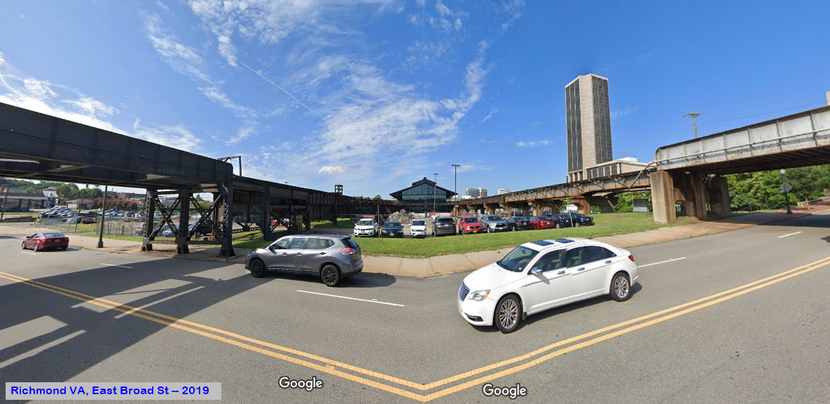
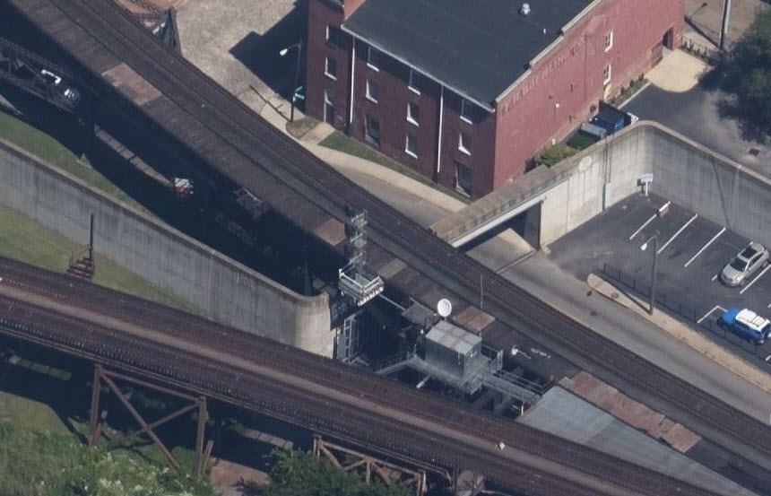
Main Street Station East Side Viaduct - the Old C&O
A composite picture of the two aerial structures bordering the Main Street
Station, from many of Bing's "Birds Eye" views....
Can you imagine what it would have been like railfanning here in the 40's,
with two tracks on both lines, leads into the train sheds, and steam!
The Google street view pictures below are from East Broad Street - which is
the same Broad Street the Broad St Station is on in West Richmond.
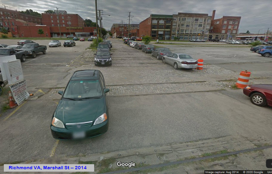
Alongside the trainshed
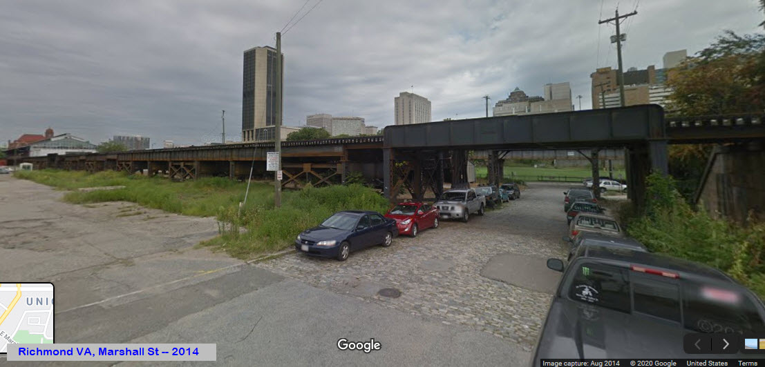
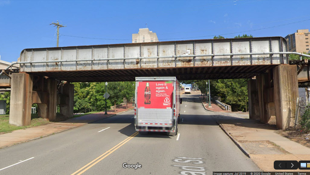
And here is the last "bridge" over Marshall St, before the C&O tracks went onto a fill.
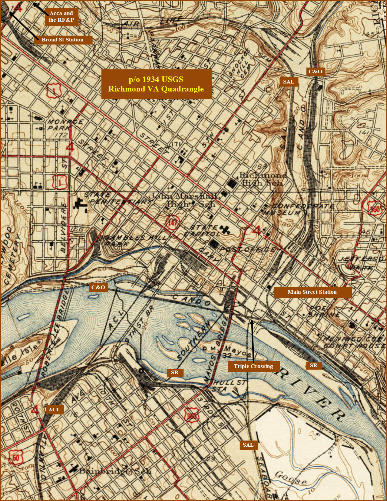
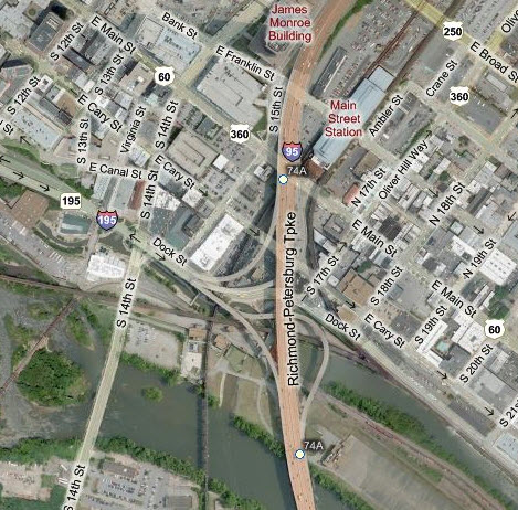
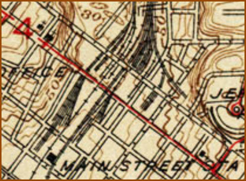
The complexity of the track around the Main Street Station can be seen from
this USGS map partial. Given that Marshall St is (still) crossed by
many tracks, they were either added after 1934, or the USGS map is wrong... take your pick :-)
Main Street Station West Side Viaduct - the Old Seaboard
Traces of the Seaboard System can still be seen, even in 2019...
Bridge on the north side of the station, but in looking at current photos of the bridge, don't know where it was when I took it.
Since I first did this guide in 2011, CSX has re-signaled most of Richmond, Acca and AY received most of the work....
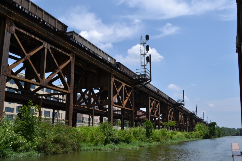
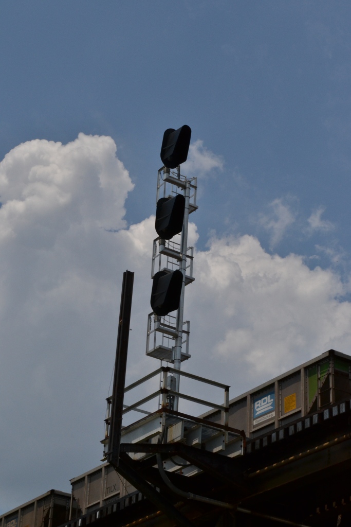
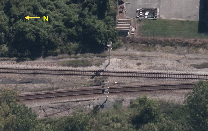
South C&O Interlocking Colorlight Signals
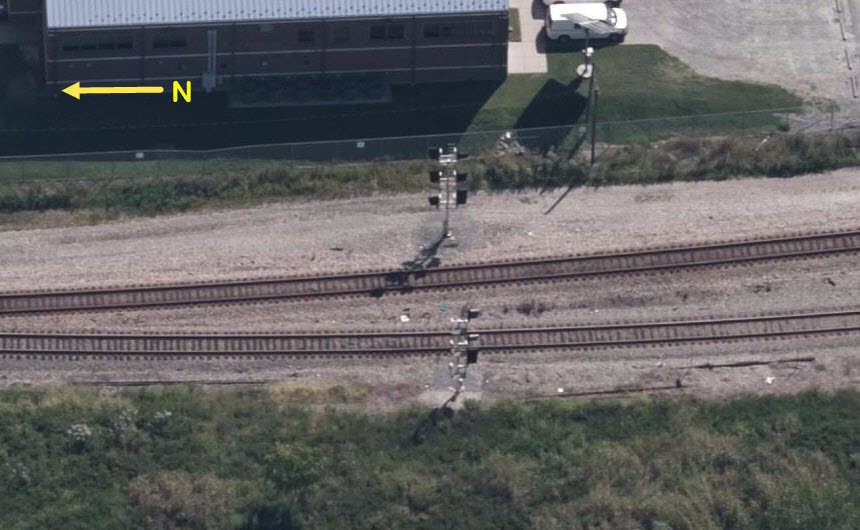
Rivanna Junction - SB "C&O" Colorlight Signals
Rivanna Junction - EB "C&O" Colorlight Signals
Rivanna Junction - WB "C&O" Colorlight Signals
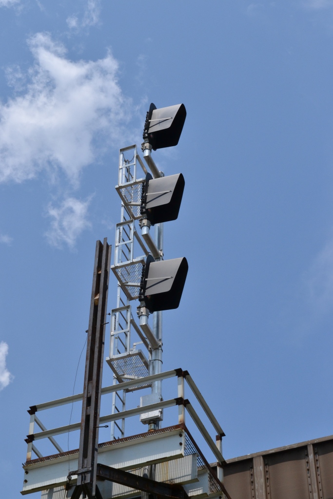
All of the signals in the Richmond area have been updated to the standard "Darth
Vader" style colorlight signals shown here. The close-ups of the one along
the river were taken from a boat on one of those harbor tours.
If you notice elsewhere on this page, the I-beams sticking up in the air
were supports for the telephone poles, which can be seen in some of the
earlier shots.
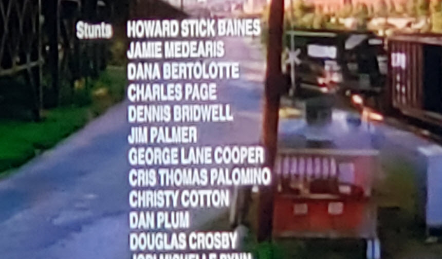
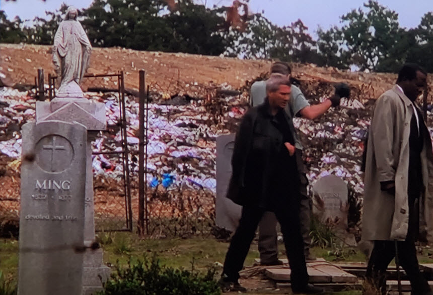
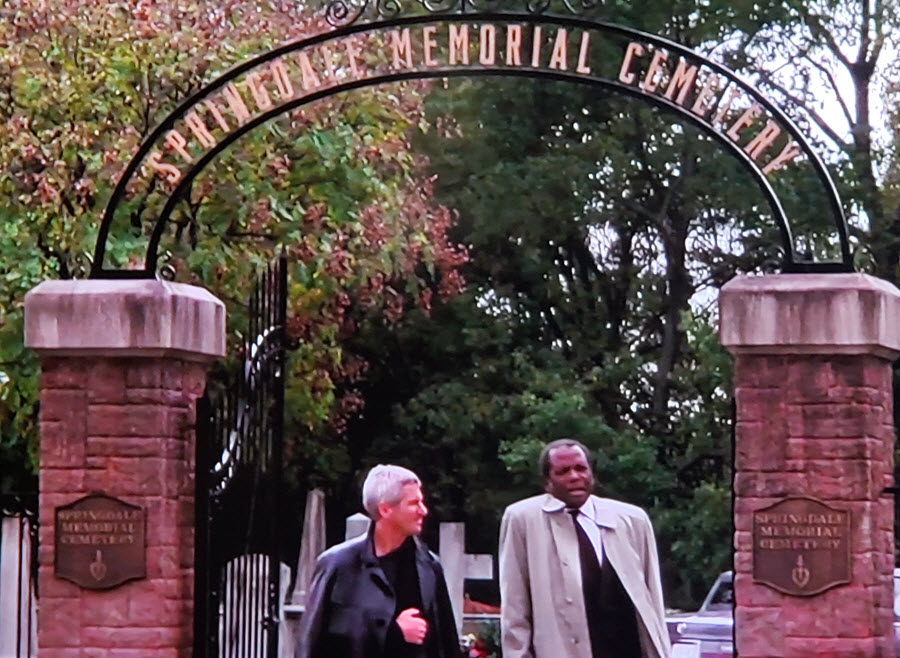
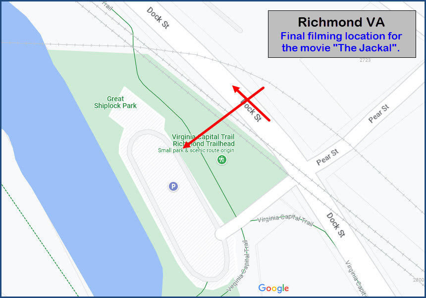
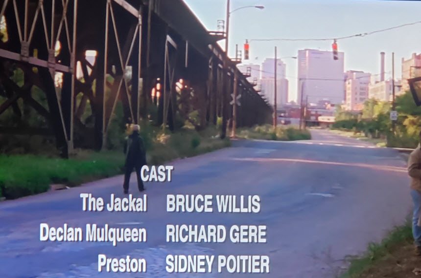
Back in 1997, The Jackal features a final scene in a cemetery,
and then a picture of Richard Gere walking off into the distance alongside
an elevated structure, and then as the credits are rolling, a Norfolk
Southern freight appears from the right, and then crosses the street, with
Richard Gere having just crossed the grade crossing before the train goes
across! Having been by here many times, I knew this could be only one place - Dock
Street in Richmond. And if you watch the credits to the end, it confirms this.
The movie features Bruce Willis as the Jackal, Richard Gere, and Sidney
Poitier. The cemetery is not real, as it is (at least, now) a parking lot for a park,
so they did quite a lot of staging for that ONE final scene. However,
in the background, there is a bulldozer smashing down trash, so was there
really a landfill there????? And, BTW, if you look for a Springdale
Memorial Cemetery in Richmond, you won't find one..... Notice they
removed the traffic light signals for the NS crossing.
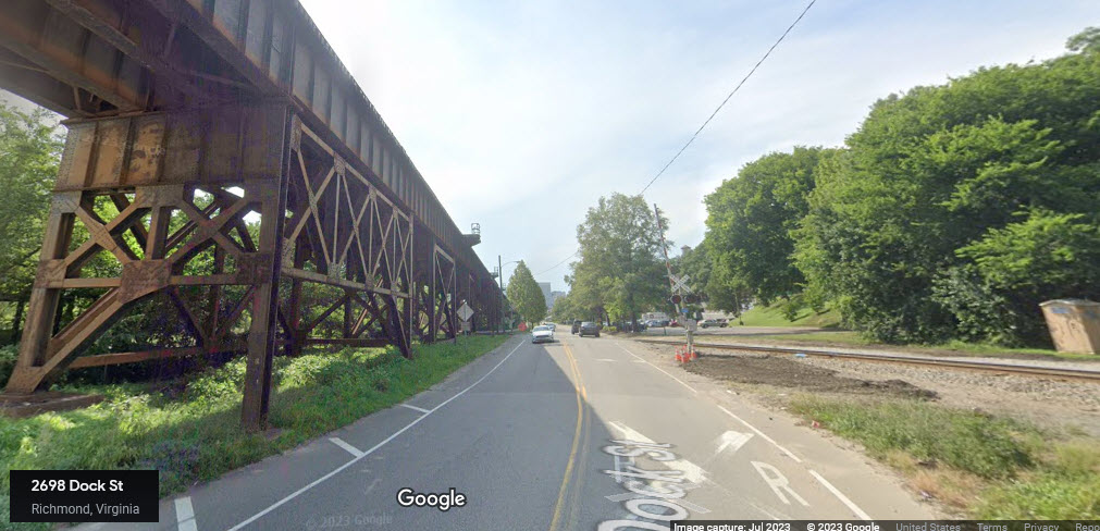
view down Dock St in 2023
In addition, a few minutes before in Washington DC, there is a scene where
Richard Gere is chasing Bruce Willis into the tube for the DC Metro.
Only problem is, it was NOT shot in DC, it was shot in Montreal, as their
rubber tyred metro system was completed in 1967. The scene down in the
Metro Center station IS NOT shot in DC either, as the real station has the
high concrete ceilings. You'll find additional pictures from the movie
here
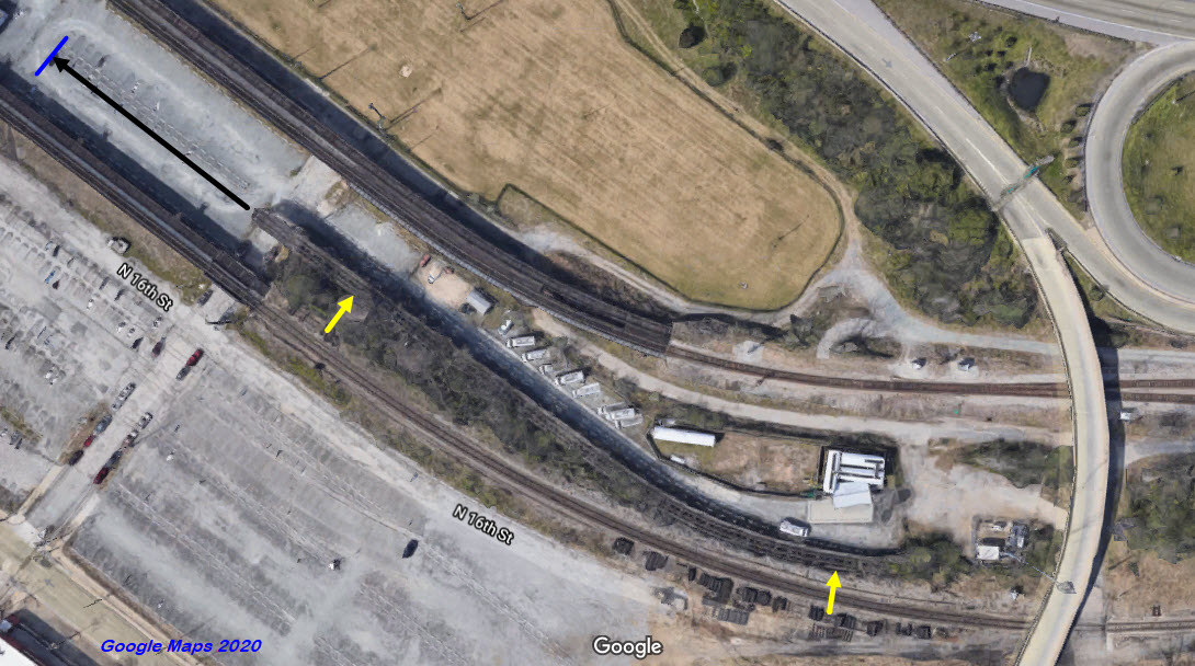
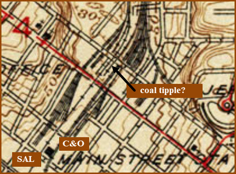
Coal Tipple?
Nestled between the C&O and Seaboard tracks, but coming off the C&O, looks like the leftovers of a coal tipple,
which, in looking at the USGS map, went to about where the blue line is in the aerial photo.
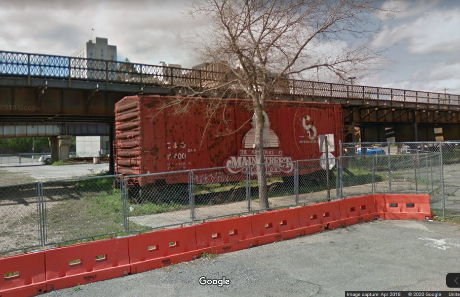
C&O Boxcar
On the north side of the Main Street Station, under the C&O tracks, stands a C&O boxcar.
Courtesy of the University of Texas Library, click here for their index page.
As I mentioned above, with the RF&P (Richmond, Fredericksburg & Potomac),
SAL (Seaboard Air Line), ACL (Atlantic Coast Line), C&O (Chesapeake & Ohio),
and the Southern Railway all coming into Richmond in the 30's and 40's, it
must have been a dream world for a railfan! :-)


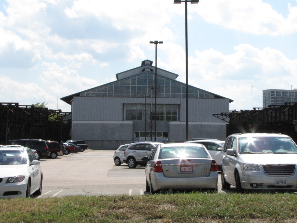 Rear view of the train shed
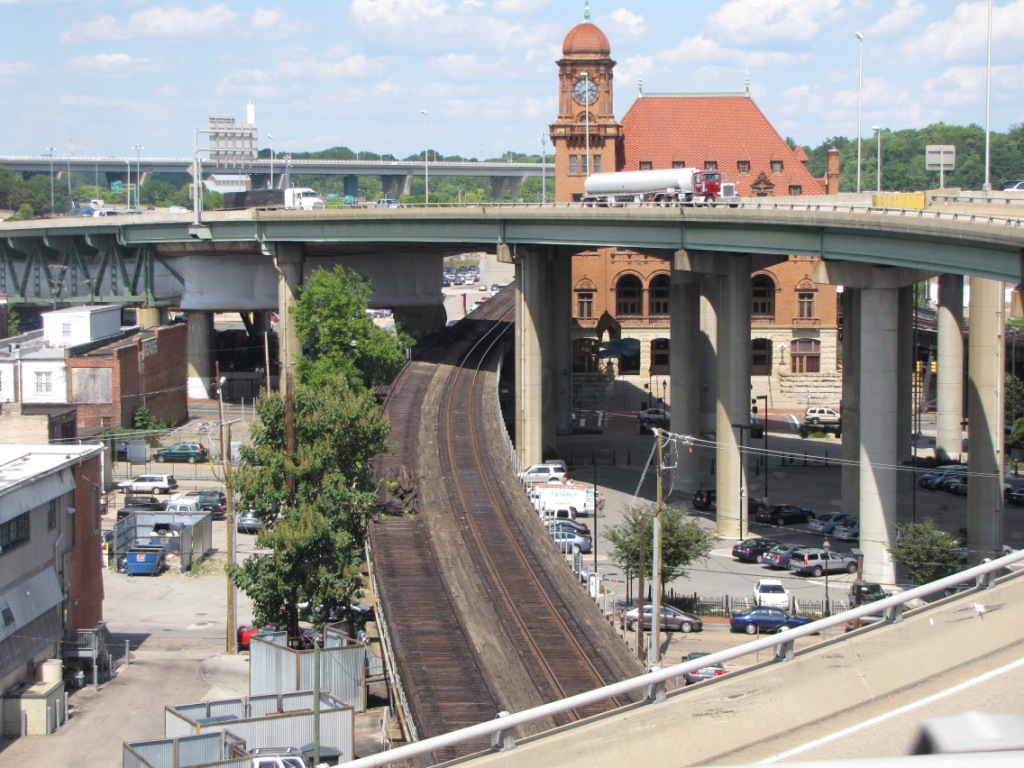 Shots from the highways over the station.
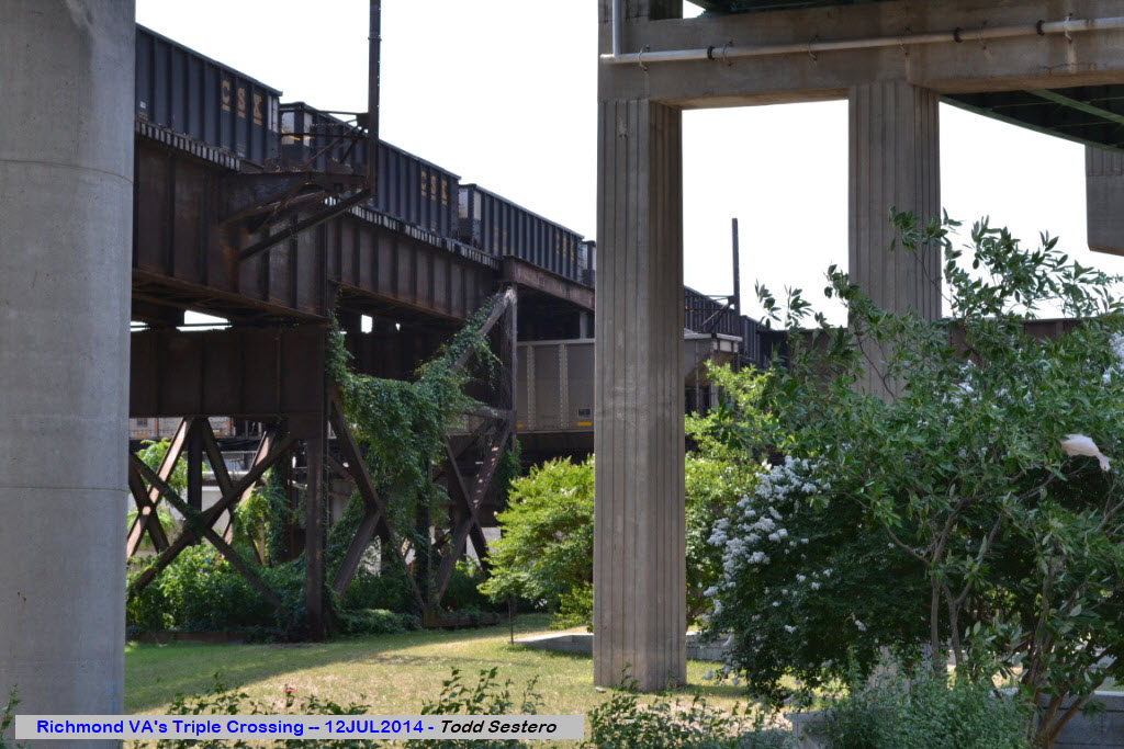
 Postcard, from around 1983
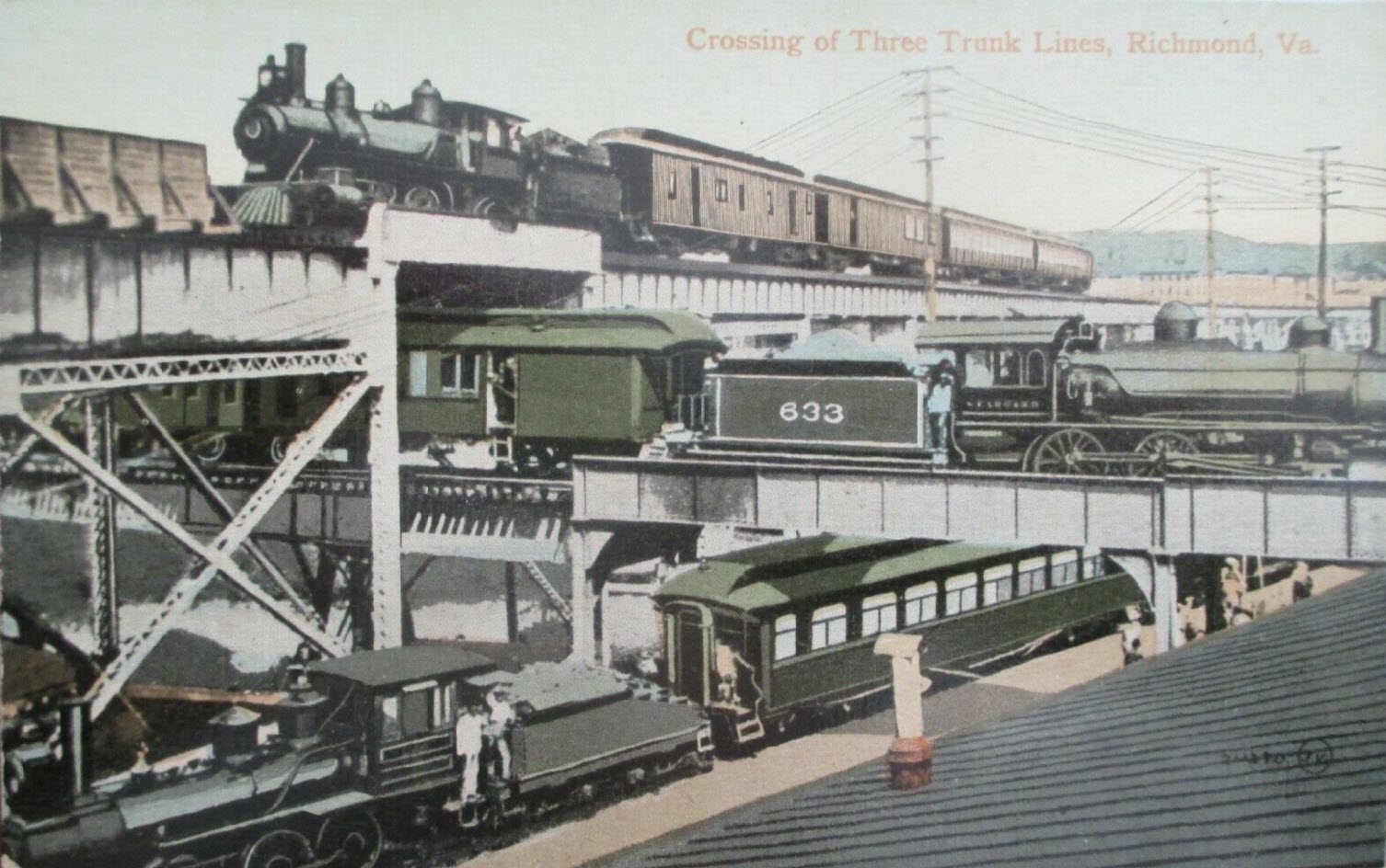 Postcard, from around 1920
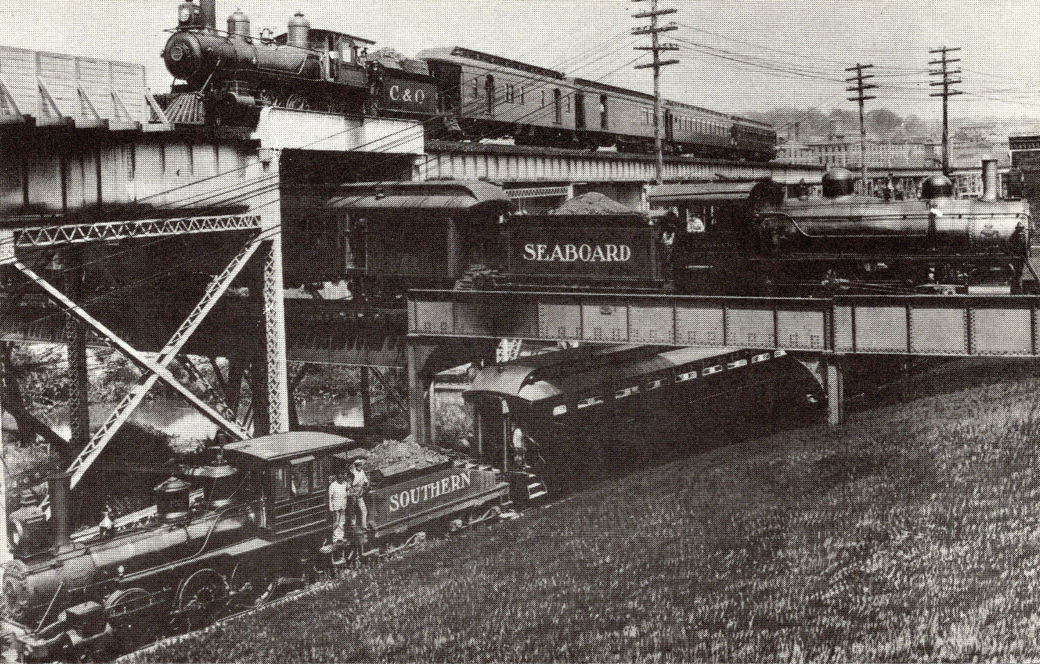
 Postcard, from 1911
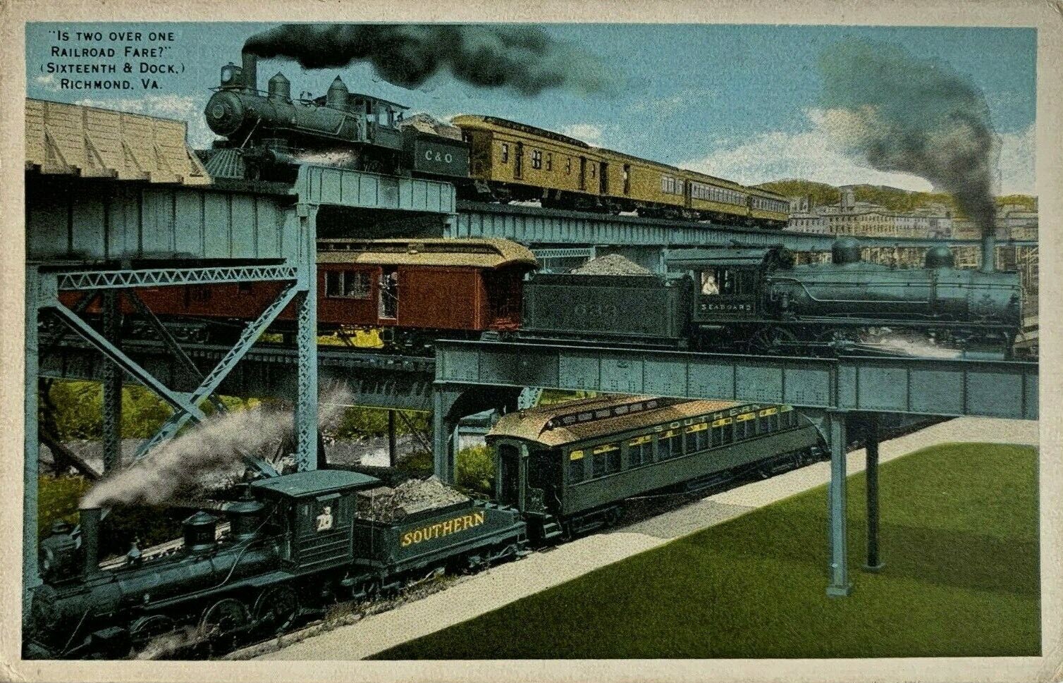
 Postcard, from around 1944
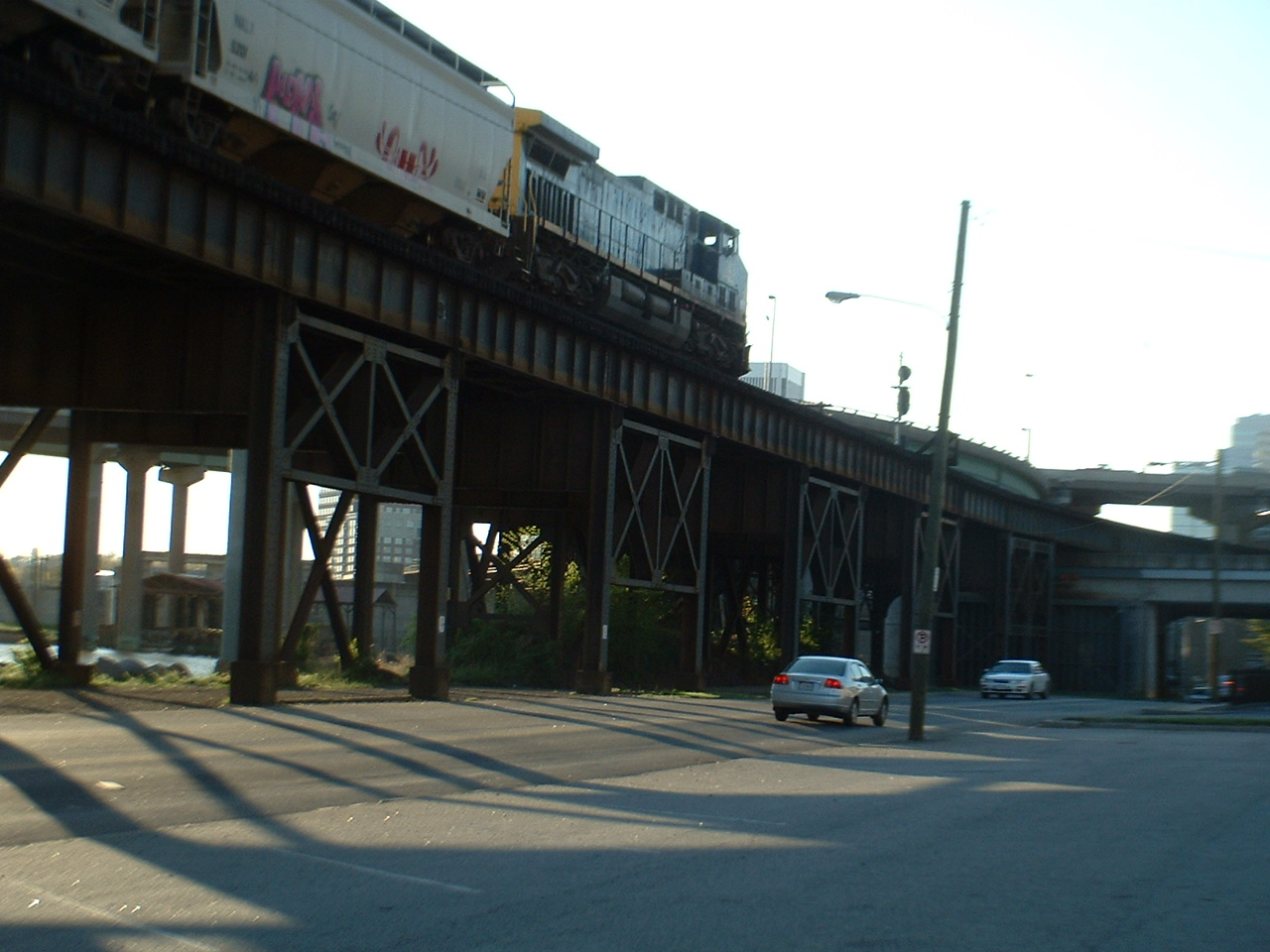


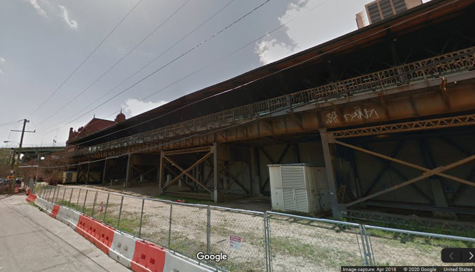 Alongside the trainshed
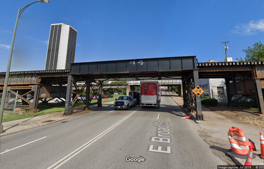
 New signal location
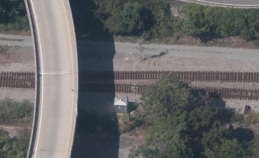 Old signal location
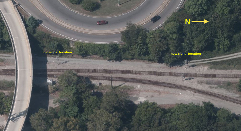
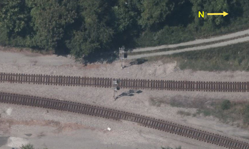
 Both signals 5 and 6
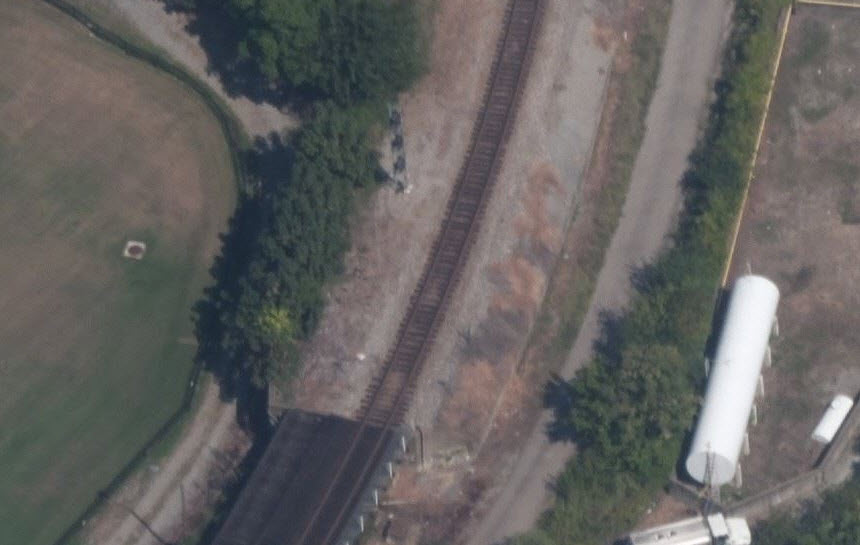
 2014, before signal replacement
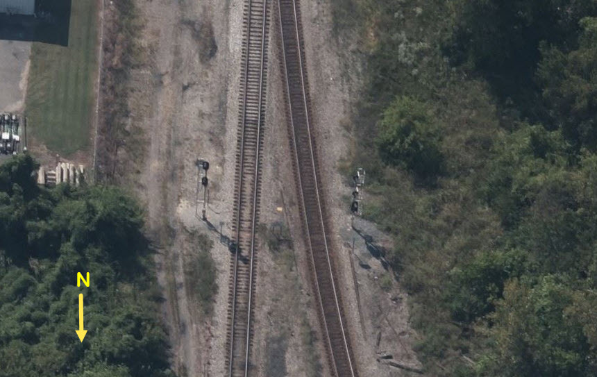


 view down Dock St in 2023