In General
Getting Here
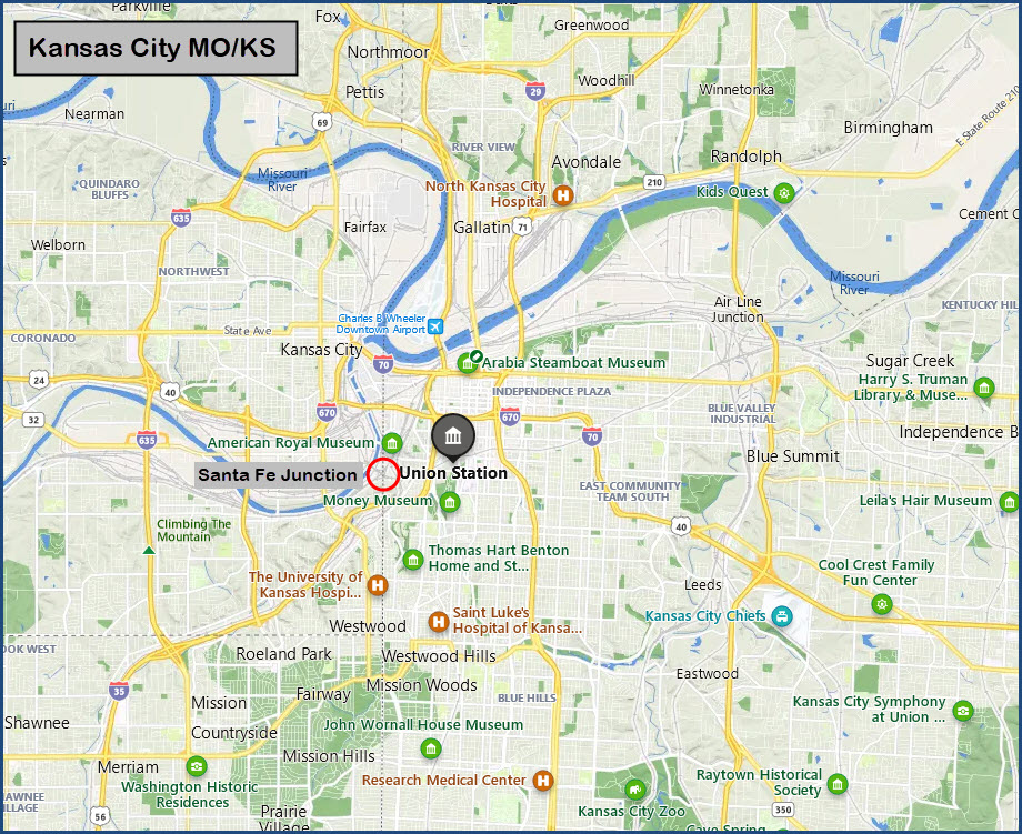
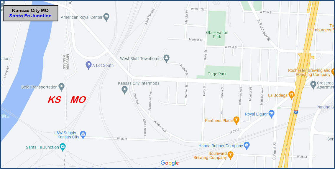
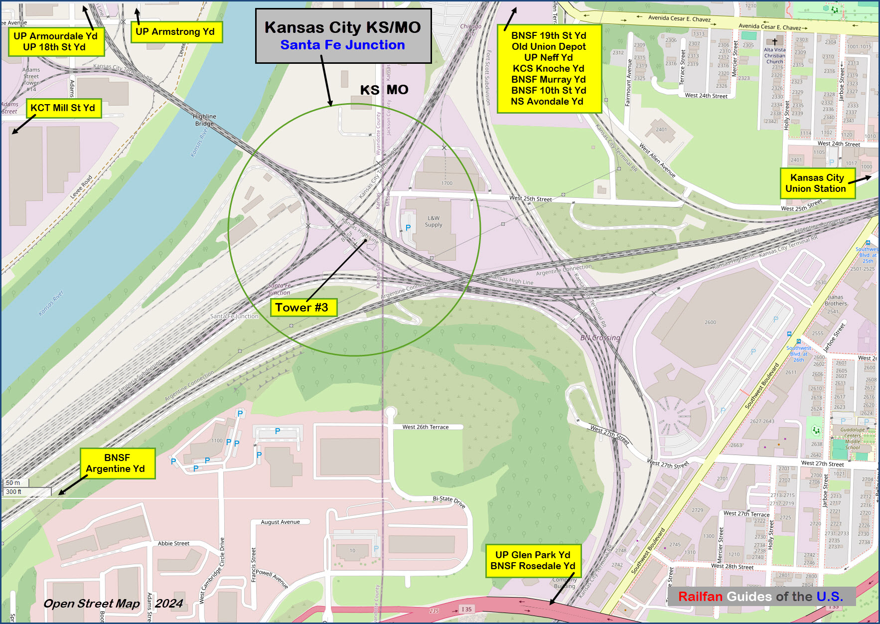
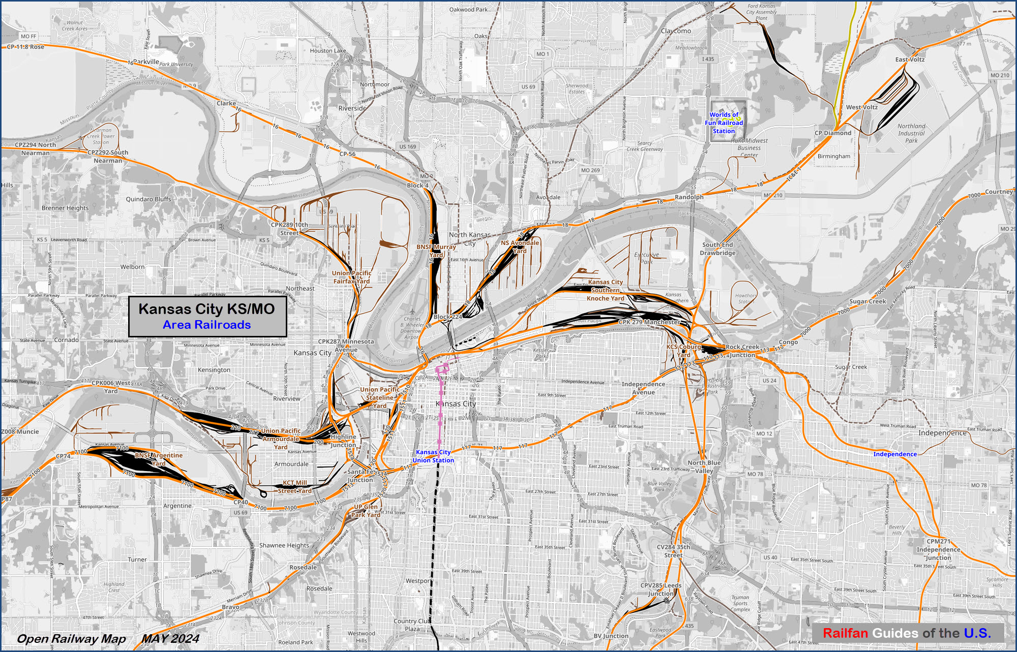
Map
Sights
Pictures
Bridges
Signals
Floobydust
USGS Maps
RAILROAD SIGNALS HOME
Location / Name:
Kansas City KS, Wyandotte County (just barely :-)
What's Here:
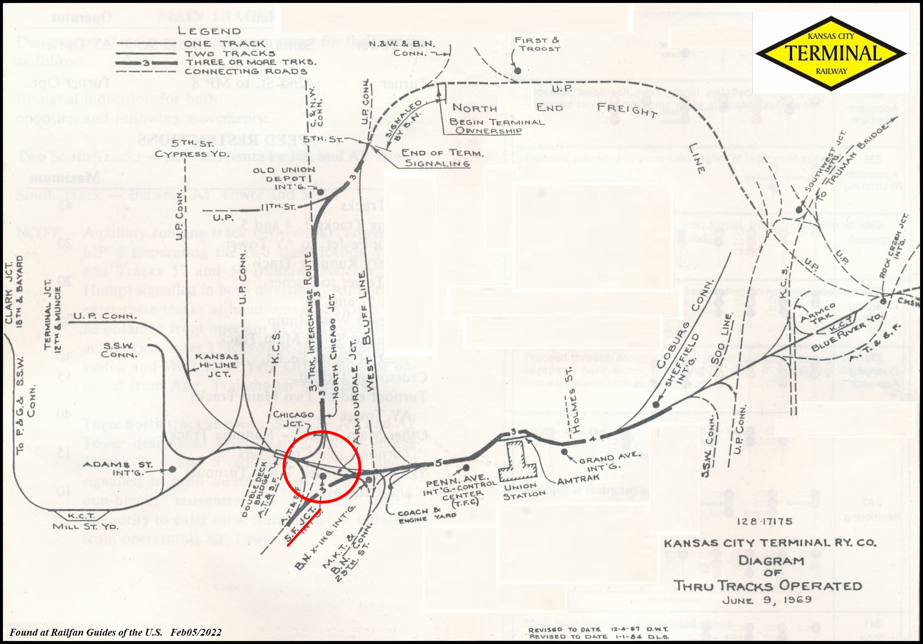
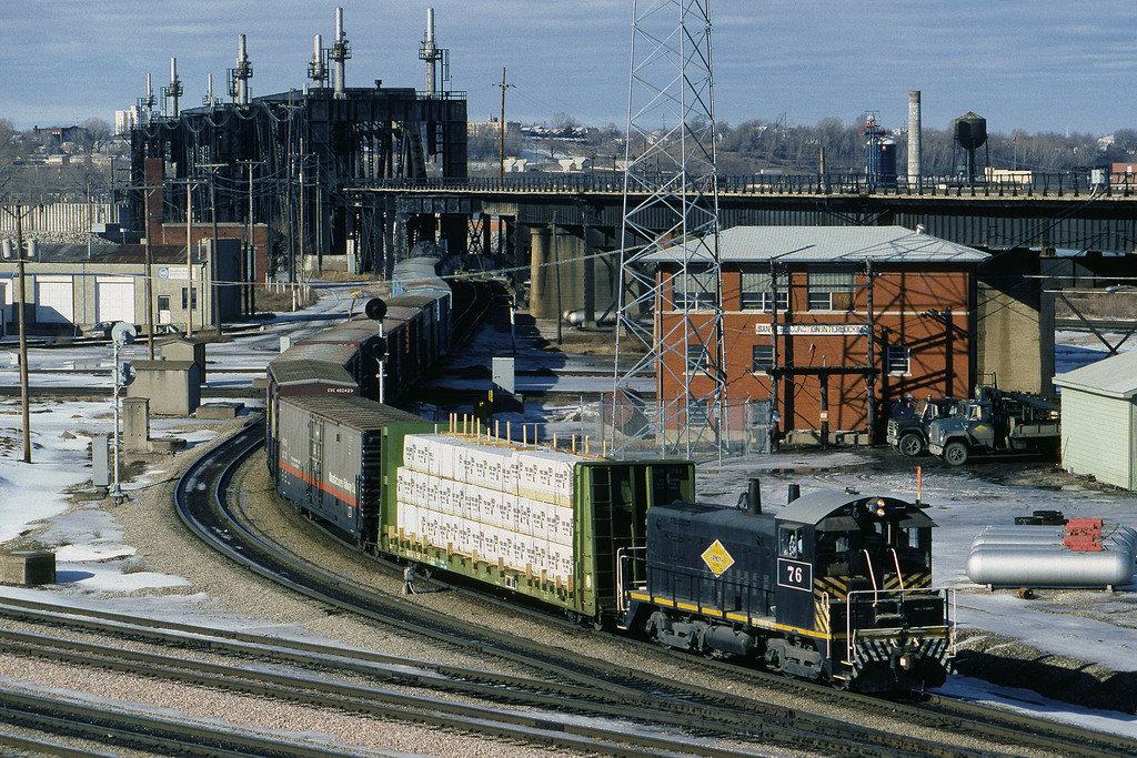
Santa Fe Junction of the Kansas City Terminal Rwy
Double decked railroad bridge
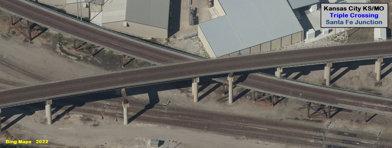
"Triple" Crossing
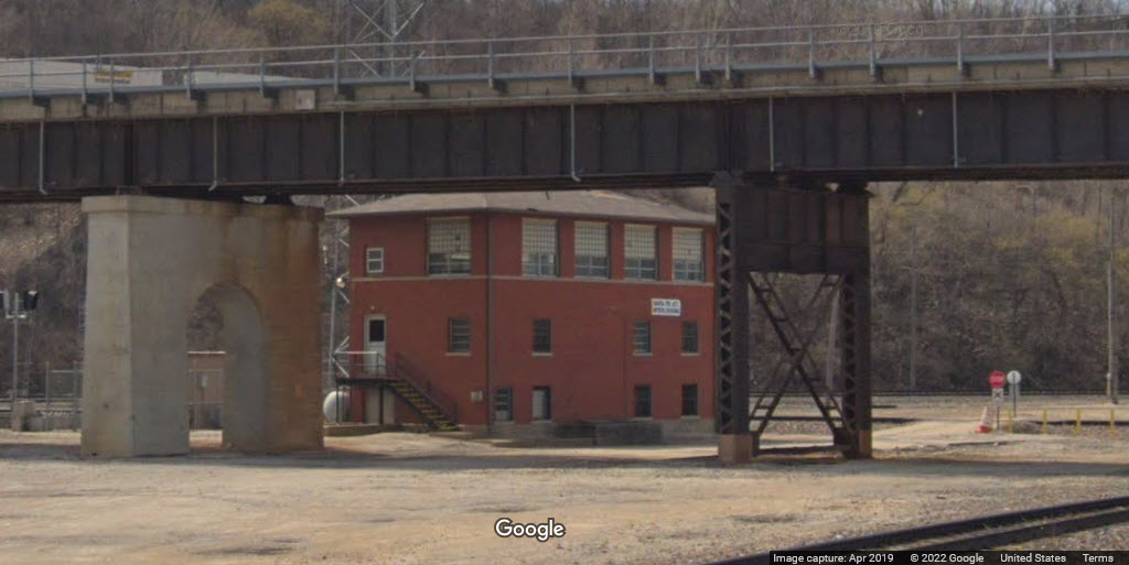
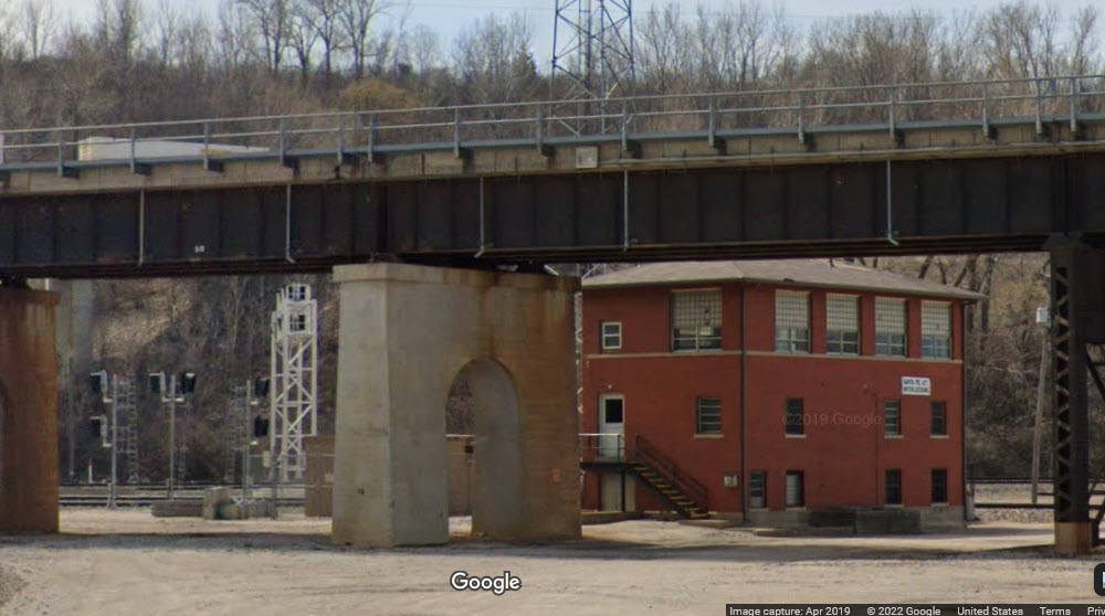
Tower #3
Data:
GPS Coordinates: as needed
Phone A/C: 913 in KS / 816 in MO
ZIP: 66103 in KS / 64108 in MO
Access by train/transit:
None
The Scoop:
Santa Fe Junction is just "a hair" into Kansas where 25th St meets State Line Rd, and is probably one of the busiest junctions in America, with 100-150 movements a day thru here.
Virtually every yard in the Kansas City area can be gotten to by passing thru Santa Fe Junction.
Accidents/derailments at Santa Fe Junction:
https://www.youtube.com/watch?v=vFLJvpwm52Q Feb 2, 2022, UP on the bottom track of the "Triple Crossing"
https://www.youtube.com/watch?v=R9VIWVlCIlg&t=44s Feb 2/3, 2022, Clean-up of the above derailment
https://www.youtube.com/watch?v=4oyMx-ta_sY&t=33s Sep 15, 2020, UP on the approach to the bridge
Acknowledgements:
Denver Todd
Maersk.146
Tyler Silvest via Wikimedia Commons
Tom Gatermann
Doc Grommesh
Bridge Hunter dot com
Google Maps
Bing Maps
Open Street/Railway Maps
Websites and other additional information sources of interest for the area:
https://bridgehunter.com/ks/wyandotte/highline/
http://landmarkhunter.com/quad/23051
https://www.youtube.com/watch?v=WT8uJAZbcaI Drone video of Amtrak turn around by Doc Grommesh
https://www.deviantart.com/dragonwolface/art/Santa-Fe-Junction-153674213
It looks like the easiest way to get here is exit 1D (20th St) from SB I-35, or exit 1C from NB 35, which will dump you off on West Pennway St (a block south of 20th St).
At the end of the SB ramp, take a right onto 20th St and go 1-1/2 blocks to Summit St and take a left to go south. >>> Go south 3 blocks, and take a right onto Southwest Blvd. Go 3 short blocks to West 25th St on your right, and take it. In a quarter of a mile, 25th St will take a left, and go under a track (with West Allan St continuing straight). You will cross a pair of tracks, and where 25th St takes a hard right and turns into State Line Rd, it puts you in the middle of Santa Fe Junction.
From the NB exit, take a left at the end of the ramp onto Pennway St, and go 1-1/2 blocks to Summit St and take a left, follow the instructions above from the >>>, but you only need to go 2 blocks before taking a right onto Southwest Blvd.
GPS Coordinates: 39.08246, -94.60750
 Maersk.146
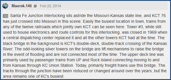
GPS Coordinates: 39.08176, -94.60540
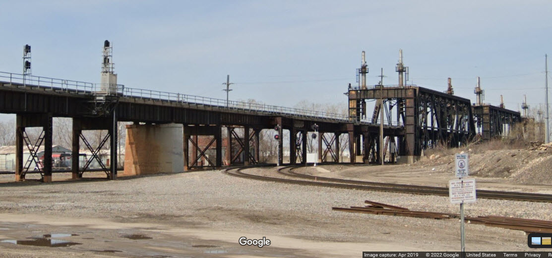
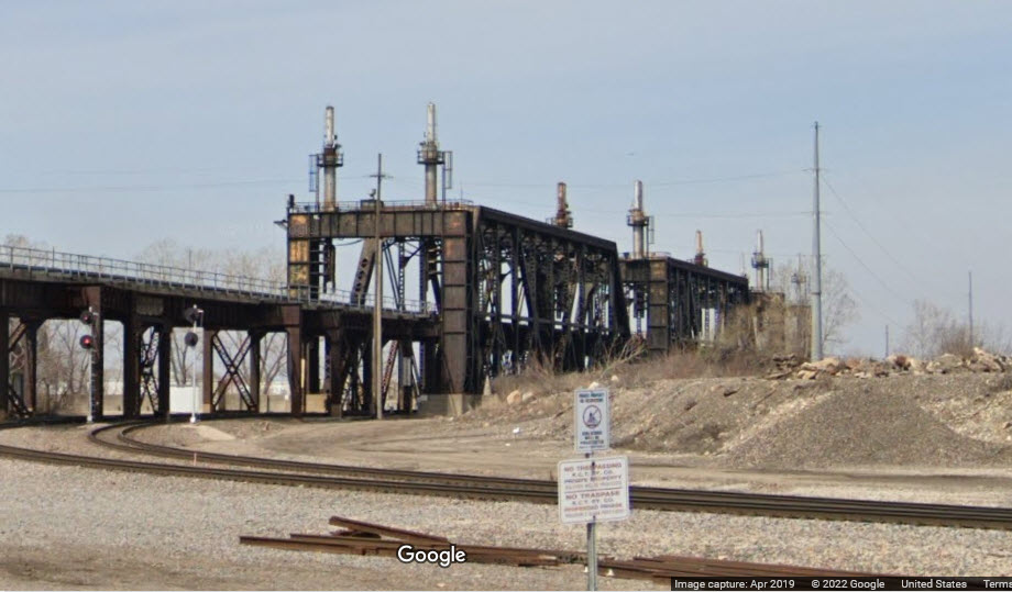
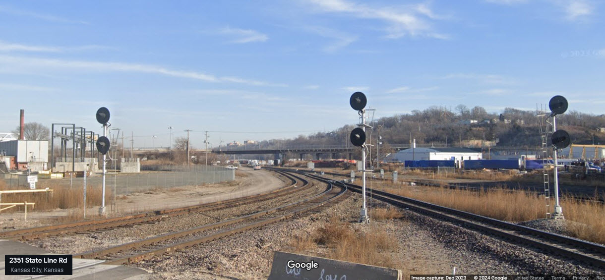
I guess we can consider this a triple-crossing. However, unlike the triple-crossing in Richmond VA where the three cross each other at exactly the same point, they are slightly off here.
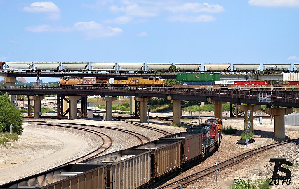 7/2018 Tyler Silvest
 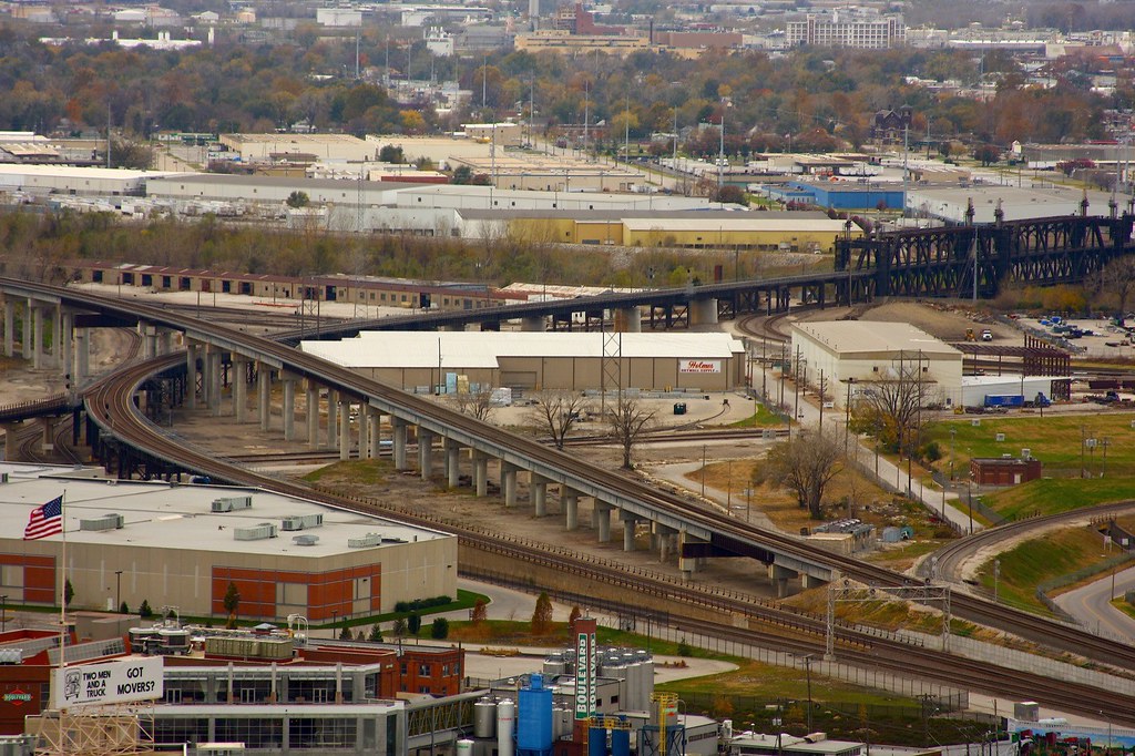 11/2008 Spacecamp
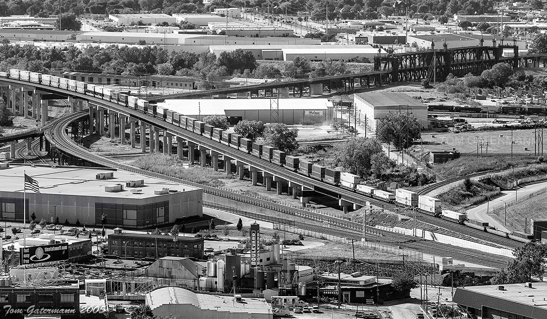 Tom Gatermann
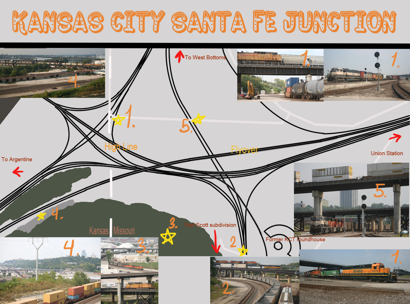 DragonWolfeACe
Standing on a corner in Winslow Arizona, no, that's something else, can't remember what...
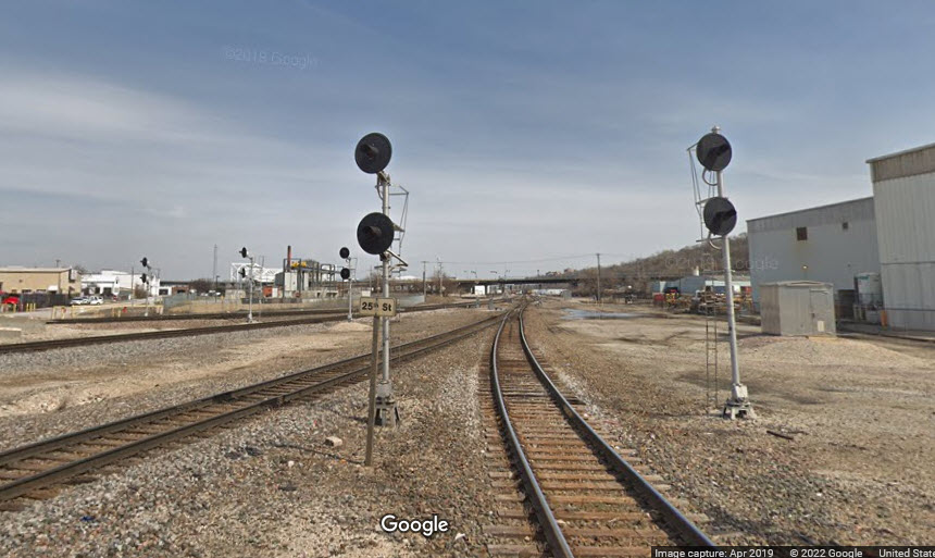
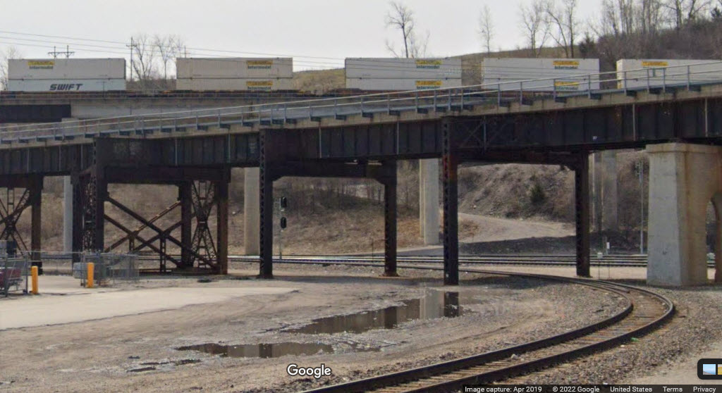
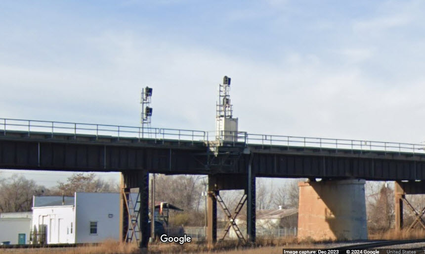
Anyways, this is what you can see from the corner of State Line Rd and 25th St.
Get your searchlight signal pictures while you can..... :-)
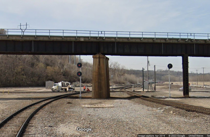
GPS Coordinates: 39.08436, -94.61079
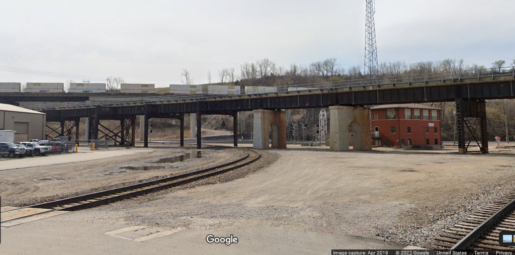
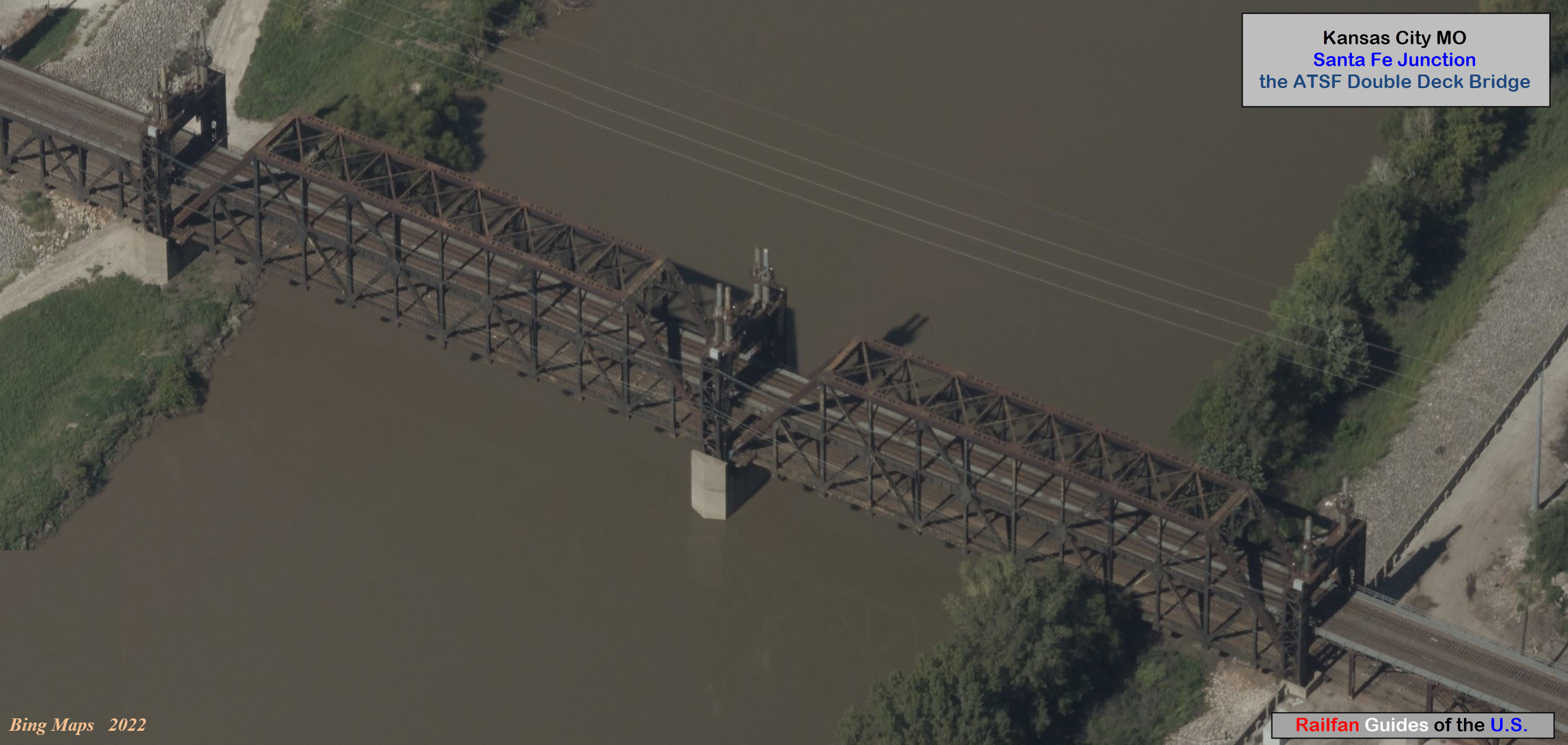
The bridge is a two-level truss bridge, and the network of approaches over the Kansas River on the KCT Rwy in Kansas City.....
-- More specifically, it's a Baltimore Through Truss, with flood jacks.
The bridge is also known as the KCT/Kansas River Bridge and the KCT/Armstrong Yard Highline Viaduct
It is a vertical lift bridge that only lifts for floods.
The bridge goes from Kansas City, Wyandotte County KS to Kansas City, Jackson County MO.
It was built 1917 and rehabilitated in 2005.
Total length of the bridge is 5,210.6 ft. (1.0 mi.)
Length of largest span is 300ft.
Obviously, with as much track, and as many railroads as there are in the Kansas City area, there are going to be signals ALL OVER the place. I'm only going to touch on what can be seen from State Line Road.
Signals that can be seen from State Line Rd

Nothing for now......
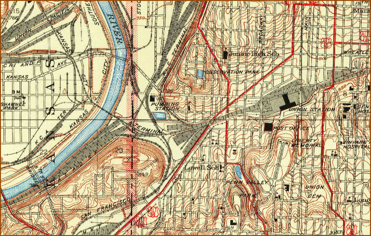
Courtesy the US Geological Society
Disclaimers:
New format 10/26/23: Please check out my disclaimer page for my standard dribble and contact info here
RAILFAN GUIDES HOME
RAILROAD SIGNALS HOME
NEW 2/6/2022, FEB07/2024, MAY12/13/14/2024
Last Modified 14-May-2024