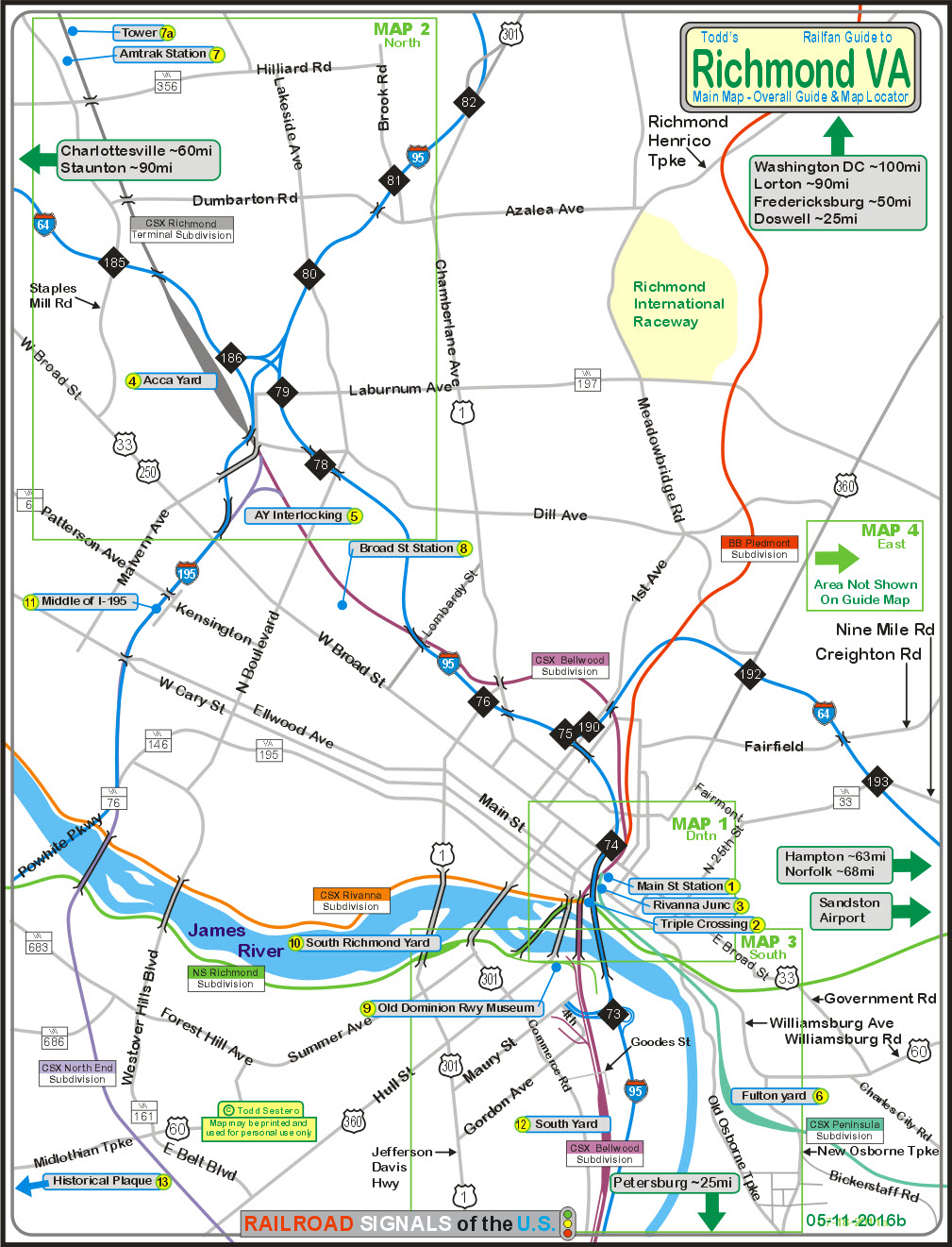
What's Here:
the Triple Crossing!
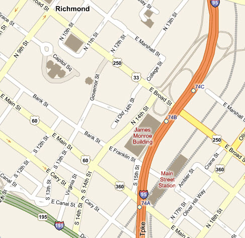
Main Street station
Rivanna Junction (it's elevated :-)
Amtrak Staples Mill Road station
Amtrak Downtown Richmond station
Broad Street station
Old Dominion Railway Museum
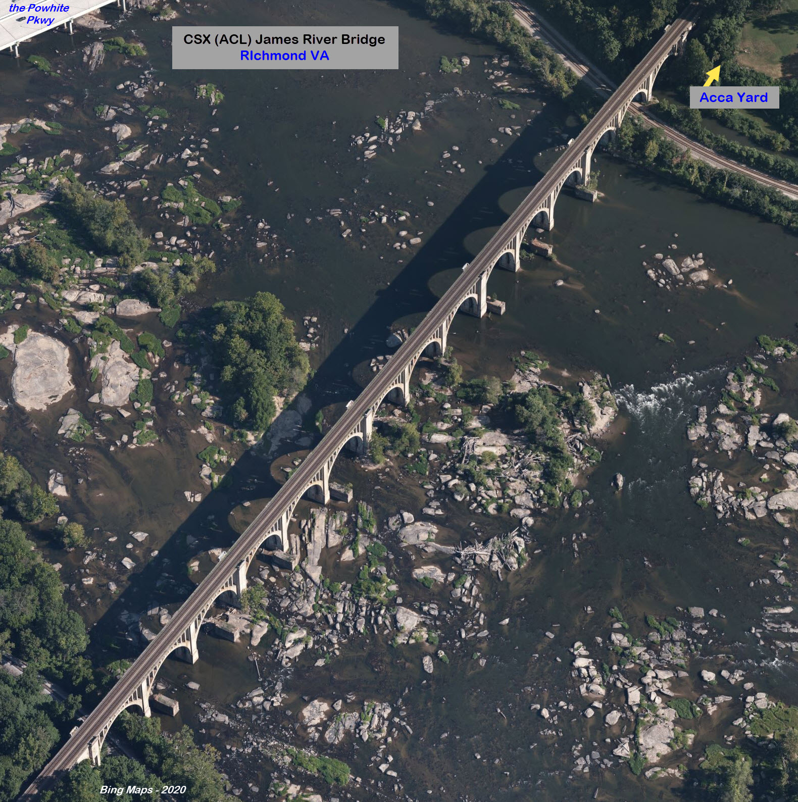
CSX Acca Yard (former RF&P)
CSX Fulton Yard (former C&O)
CSX South Yard (former ACL)
NS South Richmond Yard (former Southern Rwy)
AY Interlocking (CSX, former RF&P)
Plenty of Elevated trackage
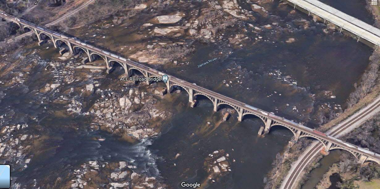
The James River Bridge
Mainline Running in the Middle of a Highway
GN Tower (former RF&P)
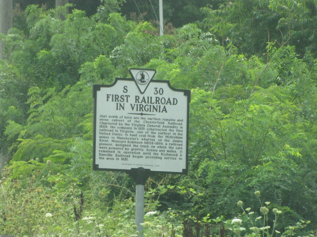
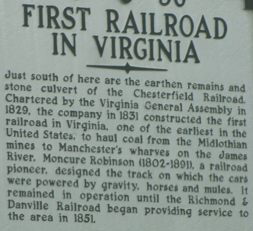
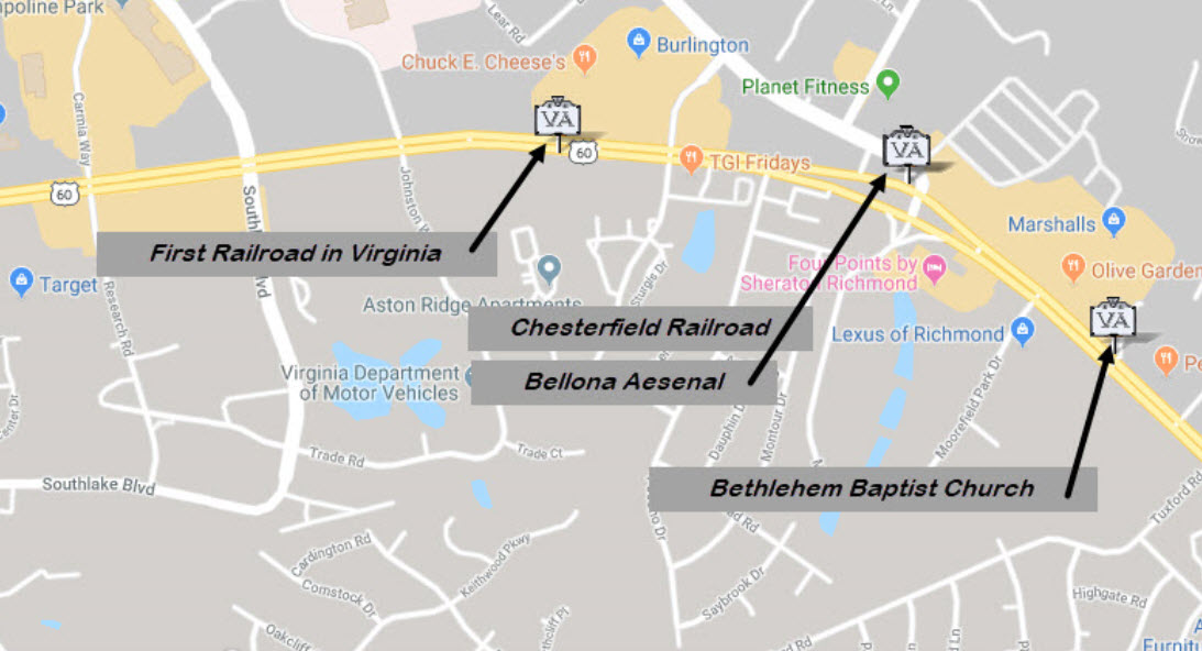
Historical Plaque for the First Railroad in Virginia (in Midlothian VA)
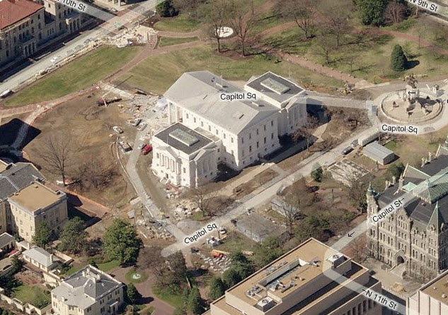
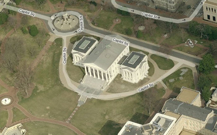
The Virginia State Capitol
The Capitol of the Confederacy
And much, much more!....
Data:
GPS Coordinates: as needed
Phone A/C: 804
ZIP: 23218 (at the capitol building)
Access by train/transit:
Amtrak - Staples Mill Rd station
Amtrak - Richmond station
The Scoop:
Richmond Virginia offers the railfan a variety of great photo opportunities,
altho the majority of the action is CSX.
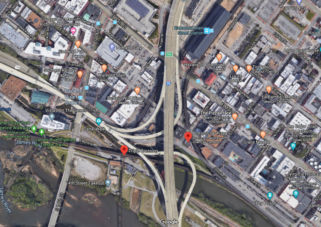
I guess the first thing I should mention is the Triple Crossing, the only
place in the United States where three railroad lines cross each other.
It should be almost as well known to us railfans as Horseshoe Curve or
Tehachapi Loop! At least it is here on the east coast.
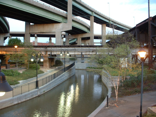
One of the other things Richmond is well known for is the ginormous elevated
structure put in by the C&O to get thru downtown Richmond, along with the
elevated Rivanna Junction. The elevated structure is approximately two
and a half miles long. A restaurant is located right in the middle of
the junction, with rooftop seating to enjoy the action during the warm
months.
The largest yard in Richmond is Acca Yard, a former RF&P yard in northwest
Richmond. It has recently been updated to accommodate three thru
tracks on the west side of the yard, along with an overhaul of AY
Interlocking, the southern approach to the Staple Mills Road Amtrak station,
and a massive update to the entire signaling system from AY up to the Amtrak
station.
On the east side of town is CSX's Fulton Yard, a former C&O yard.
Trains from and to Newport News VA come thru here, about 65 miles to the east.
On the south side of the James River, there are two smaller yards: NS's
South Richmond Yard, and CSX's South Richmond Yard. A local NS freight
runs out of the South Richmond Yard in the morning running west thru
Midlothian.
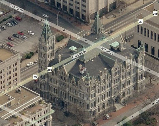
There are three depots in the Richmond area. The most impressive of which
is the Main Street station in downtown Richmond.
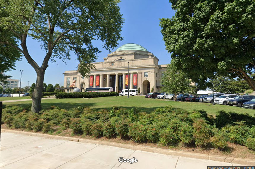
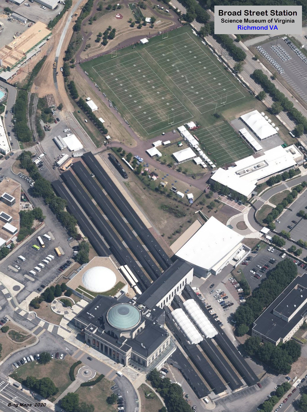
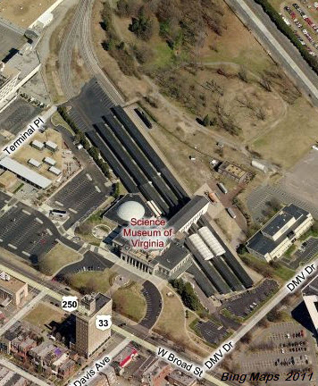
Another impressive structure is the Broad Street station, in west Richmond.
It is a former RF&P depot, and now houses the Science Museum of Virginia.
The station also served the SAL, ACL, and the N&W.
Last but not least in South Richmond, is a former Southern Railway depot in which the
Richmond Railroad Museum and the Old Dominion Chapter of the National Railway
Historical Society (NRHS) is located.
There are three James River crossings, the most famous of which is the James
River bridge on the former ACL ("A") line heading south from AY
Interlocking. It's difficult to get really good pictures, but the
effort in doing so is well worth the effort. There are several smaller
James River crossings in the downtown area for both CSX and the NS.
There are four depots/stations around, numerous bridges because of the James River, three yards, the Old Dominion
Railway Museum, several nice junctions, and the ~2.5 mile long "bridge" on the
ex C&O that follows along the James River in the downtown area.
And don't forget, while you're here, that Richmond is the state capitol AND was
the capitol of the South during the Civil War!
If you're into food, Arby's has a series of "Goochy" restaurants
in the Richmond/Petersburg area, offering
more than just their roast beef sandwiches, and the largest Arby's in the
U.S. is located just south of here in Petersburg VA.
SPECIAL REQUEST:
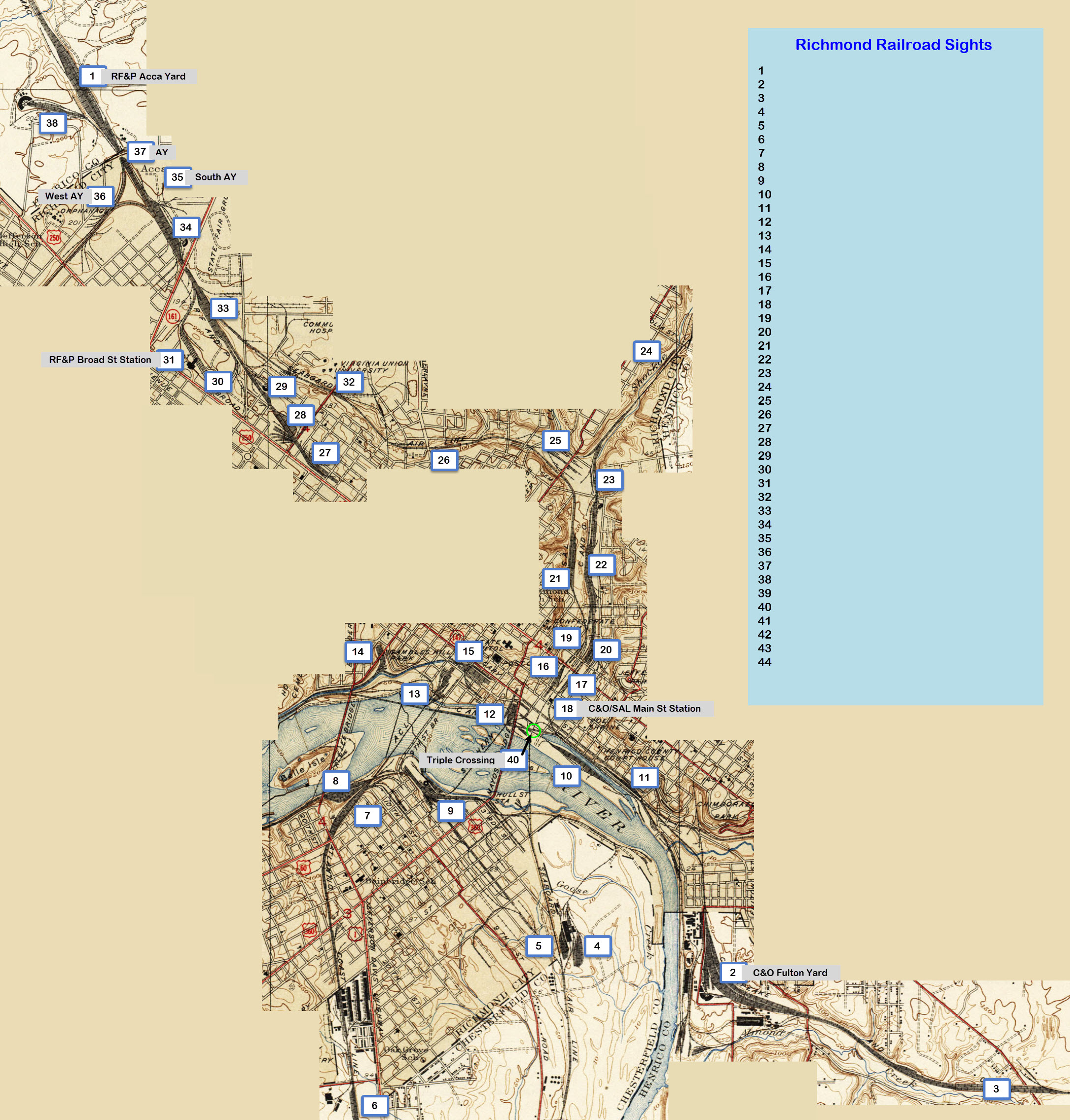
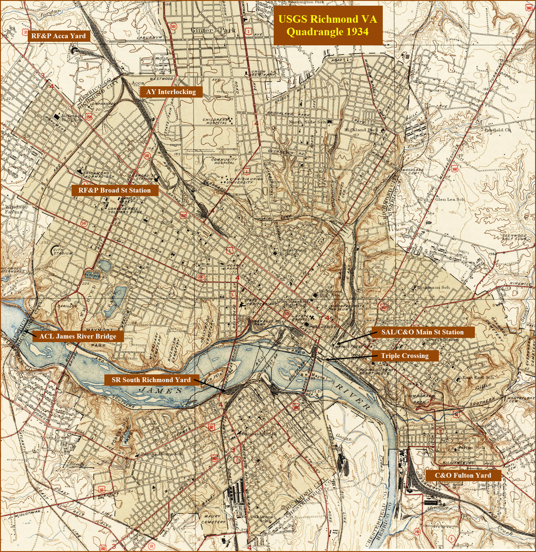
If we look at an "old" map of Richmond, we will find there is a whole lot
more railroad stuff around than there is today. Not surprising, it is
that way in most towns and cities. Using the 1934 USGS map as a basis,
I have numbered (mostly) the yards that used to exist. I'm trying to
find out what the names of these yards were. I'm also looking for the
name(s) of the interchange(s) between the "C&O" and "Seaboard" on the north
side of the Main St Station - they did not exist in 1934 - maybe we can also
find out about when they were installed. Some of the places I stuck a
number next to may not even have a name, or might be called the same thing
as one that is adjoining. Who can help???
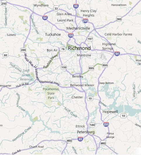
Richmond is conveniently located at the
junction of I-95 and I-64, and US60 which parallels I-64 to the south (kinda-sorta).
I-95 to the north takes you to DC, Baltimore,
Philadelphia, New York City and beyond. To the south it takes you to I-85,
Petersburg, NC, SC, etc. Be careful around the Main St Station, as the
highway twists and turns.
To the east I-64 takes you to Norfolk, to the
west, it runs into I-81 at Staunton (pronounced as if there is no "U" in it).
I-295 bypasses the downtown area of Richmond
and Petersburg, but if you take it, there is no way to get off at I-85. I
have never used it to go around Richmond, as I try to time my trips during
non-rush hours. Taking I-295 will add quite a few extra miles if you
travelling N-S. On the northside, I-295 gives you a shortcut to I-64 on
the west side without having to go downtown.
The junction between I-95, I-64, and I-195 is complicated, so pay attention
to the signs, and you will be OK.... routes are well marked.
Forming a loop on the west/south side is 288,
which starts at I-64 and goes around the SW side of Richmond to join up with
I-95 halfway between Richmond and Petersburg. It's a long road, and
travelling it seems to take forever :-)
An inner loop of sorts on the south side is
formed by 895 (the Pocahontas Pkwy) east of I-95 and goes over to I-295, and 150
(the Chippenham Pkwy) on the west, which takes you over to the Powhite.
The Powhite Parkway goes from I-195 in
downtown to the SW side at 288, near Midlothian. It is a toll road, and
there are numerous toll plazas that nickel and dime you to death... The total
toll is around a little over a dollar for the full length.
US60 used to be the main E-W highway, but now,
in the metro area, it's severely developed and "red light city".... so
travelling it is slow. The upside is that just about any and every service
can be found along it. If you're into them, a Northern Tools is just east
of the Powhite interchange. By taking US60 west, you will eventually come
to Dillwyn (about 45 miles from 288), headquarters for the Buckingham Branch RR.
US360 running NE out of town runs in US17,
which for most of us, doesn't really do anything for us.
I-95 down to I-85 will take you to central and
western North Carolina, western South Carolina, and on to Atlanta if you so
choose, or, bring you in from those places.
Since Richmond is on the two major interstates, it is easy to get to. Most people by now have GPS, so
directions shouldn't be needed. If you know where Washington DC is, it's about 90 miles south!
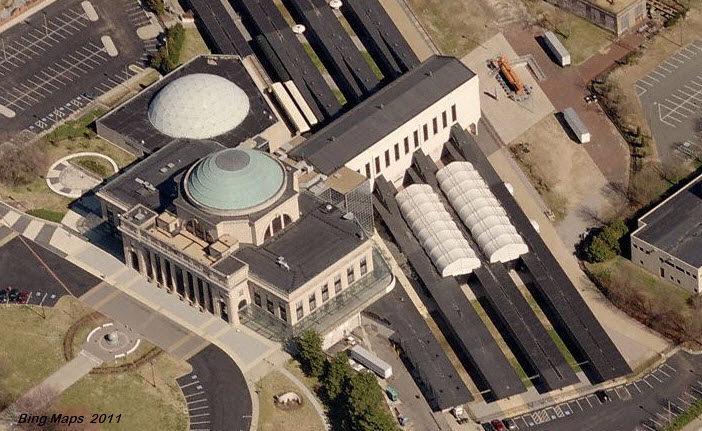
This station was built by the RF&P as their southern terminus in 1917. The station also served the
SAL, ACL, and the N&W. Service ended here in 1975, and the facility was sold to the Science Museum of Virginia.
Looks like they have been working on the remaining track in the rear of the station.
The interchange with CSX is on the Bellwood Sub, just south of the SOUTH AY interlocking.
Historical Plaque S-30
GPS Coordinates: 37.506846, -77.589601
This plaque is a dedication to the first
railroad in Virginia, and is located in Midlothian on Midlo (Midlothian)
Turnpike just west of Sturbridge Rd. For some reason, they located it at a place where you can't
easily pull off to read what it says :-(
Located across from the Pocono Crossing shopping center with a Chucky Cheese in it.
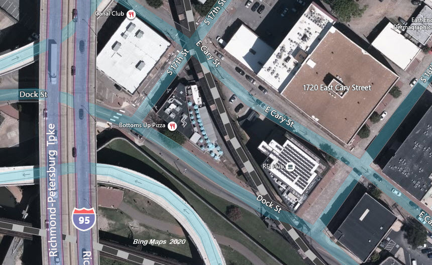
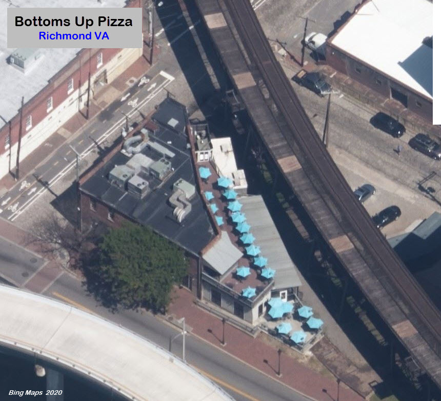
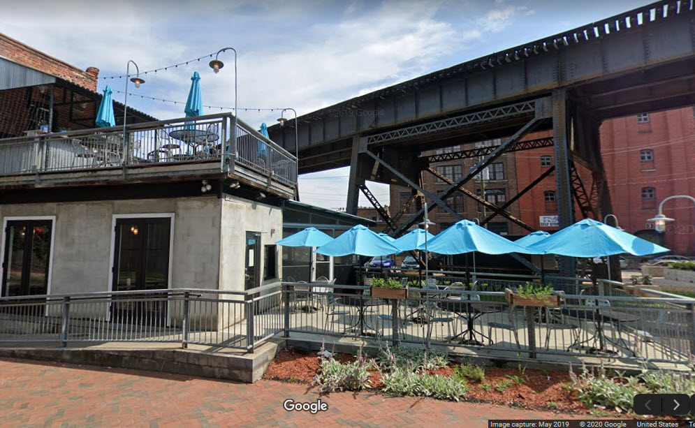
Bottoms Up Pizza
GPS Coordinates: 37.506846, -77.589601
I don't normally push a specific restaurant, but I will make an exception for
this one, on the basis that it puts right in the middle of the elevated CSX
line and Rivanna Junction in downtown Richmond. They have great pub
type food, and during the summer, it makes a great place to watch trains
from!!!
After leaving ACCA Yard, and going through AY
interlocking to head south, CSX crosses the James River on this great looking
ACL Bridge with the CSX on the southern shore and the NS on the northern shore following the river underneath it.
Note: I used to have the other bridges of Richmond on this page, but have moved them to the Richmond 1 page:
-- CSX's High Line
-- NS crossing the James River
-- NS crossing the James River - Part 2 - From the Peninsula to the North Shore
-- CSX crossing the James River - SCL Style
Courtesy of the University of Texas Library, click
here for their index page.
Disclaimers:
I love trains, and I love signals. I am not an expert. My webpages reflect what I find on the topic of the page. This is something I have fun with while
trying to help others.
Please Note: Since the main focus of my two websites is railroad signals, the railfan guides are oriented towards the signal fan being able to locate them.
For those of you into the modeling aspect of our hobby, my
indexa page has a list of almost everything railroad oriented
I can think of to provide you with at least a few pictures to help you detail your pike.
If this is a railfan page, every effort has been made to make sure that the information contained on this map and in this railfan guide is correct. Once in a while,
an error may creep in :-)
My philosophy: Pictures and maps are worth a thousand words, especially for railfanning. Text descriptions only get you so far, especially if you get lost or
disoriented. Take along good maps.... a GPS is OK to get somewhere, but maps are still better if you get lost! I belong to AAA, which allows you to get
local maps for free when you visit the local branches. ADC puts out a nice series of county maps for the Washington DC area, but their state maps do not have the
railroads on them. If you can find em, I like the National Geographic map book of the U.S..... good, clear, and concise graphics, and they do a really good job
of showing you where tourist type attractions are, although they too lack the railroads. Other notes about specific areas will show up on that page if known.
Aerial shots were taken from either Google or Bing Maps as noted. Screen captures are made
with Snagit, a Techsmith product... a great tool if you have never used it!
By the way, floobydust is a term I picked up 30-40 years ago from a National Semiconductor data book, and means miscellaneous
and/or other stuff.
Pictures and additional information is always needed if anyone feels inclined to take 'em, send 'em, and share 'em, or if you have something to add or correct.... credit
is always given! Please be NICE!!! Contact info is here
Beware: If used as a source, ANYTHING from Wikipedia must be treated as being possibly being inaccurate, wrong, or not true.