
In General
Getting Here
Map
Station by Station
Pictures
Bridges
Signals
Floobydust
USGS Maps
RAILROAD SIGNALS HOME
Location / Name:
Ft Worth TX to DFW Airport
What's Here:
One of the newest (as of 2020) commuter rail operations in the U.S.
Data:
GPS Coordinates: as needed
Phone A/C: 817
ZIP: 7616x
Access by train/transit:
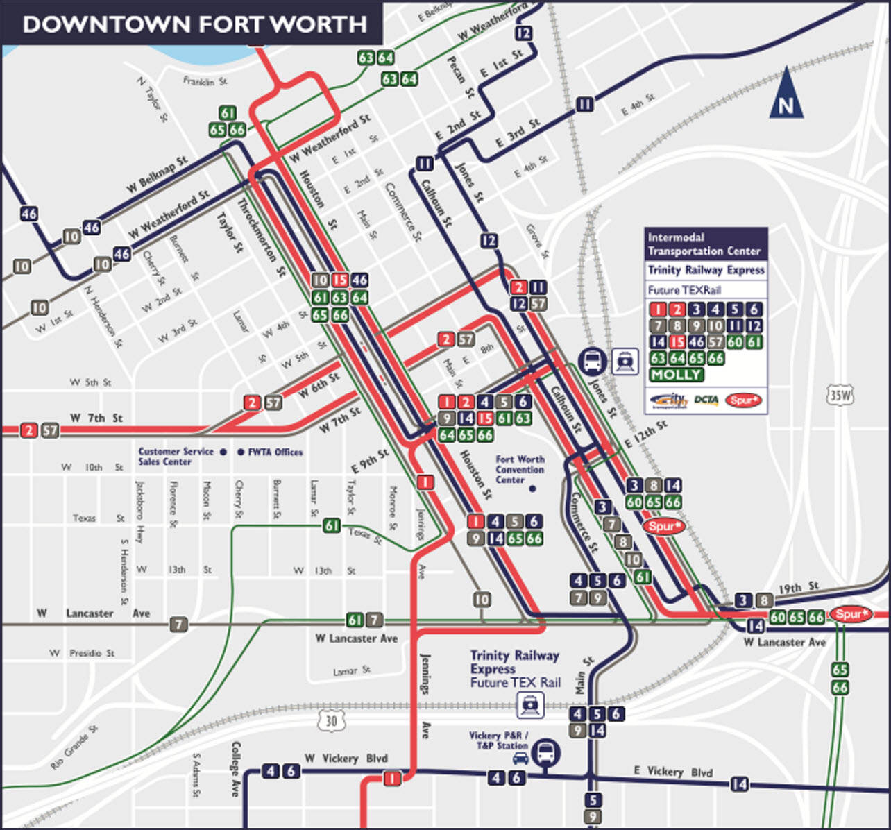
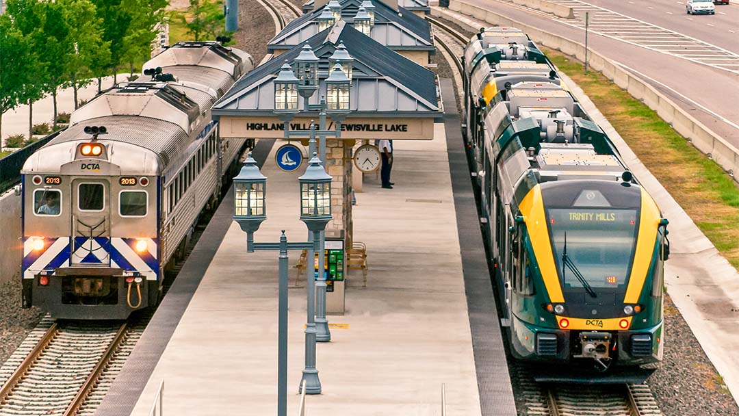
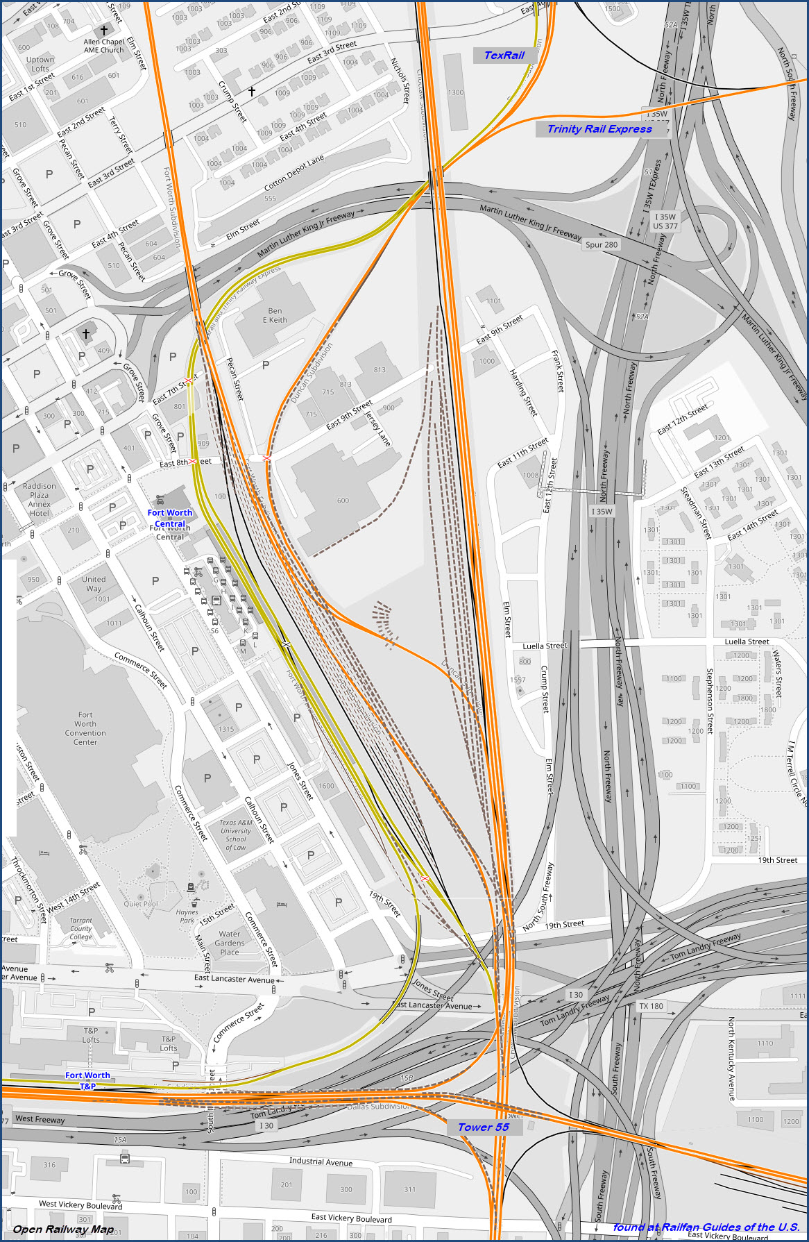
Trinity Rail Express at T&P and Central Stations in Ft Worth
DART Light Rail at DFW Airport
The Scoop:
TexRail is a commuter rail type operation traveling between downtown Ft Worth TX and DFW Airport, terminal B, which is across the International Parkway from the DART Light Rail station. It is operated by Trinity Metro (formerly Fort Worth Transportation Authority). Service started on January 10, 2019, with a preview of the upcoming service on December 31, 2018.
Because this guide got so large with the addition of all of the signal and bridge locations along the line (30 for the signals), I put them on their own pages.
Construction on the line officially started on August 24, 2016, with a groundbreaking held at Grapevine's historic depot, the site of Grapevine-Main Street station. On January 4, 2019, less than 12 hours before service was scheduled to commence, the opening was suspended due to signal issues identified during an inspection by FRA officials along the southern end of the line in Downtown Fort Worth. The new opening date was on January 10, 2019.
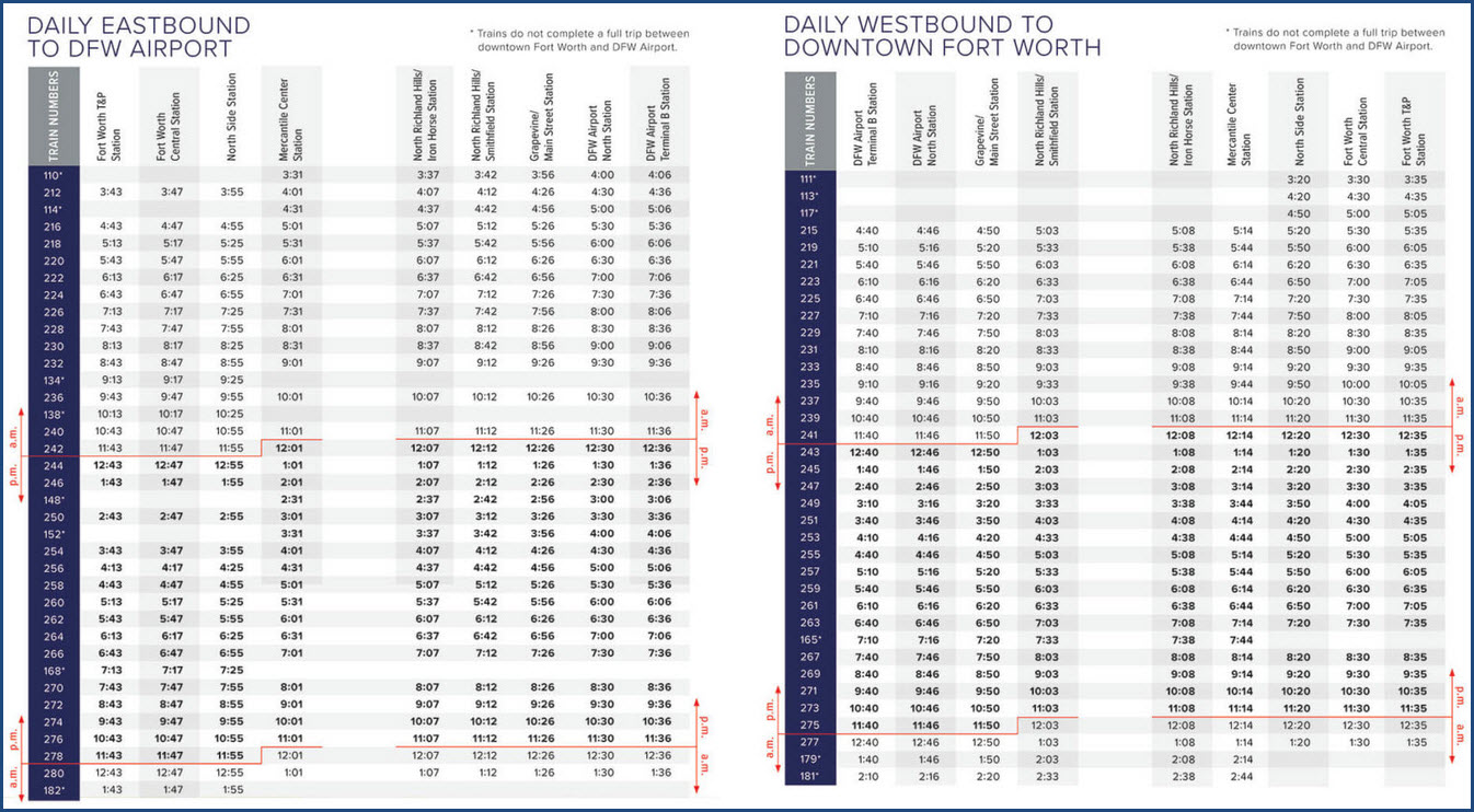
Operations: Estimated travel time from T&P Station to DFW Airport is estimated to be approximately 52 minutes. There are 48 trips per day with predominantly 1-hour headways; all but the earliest westbound and latest eastbound trains runs the full length of the route. The line is predominantly single tracked, with passing sidings installed to allow for 30-minute headways.
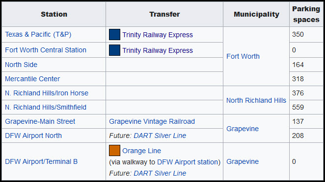
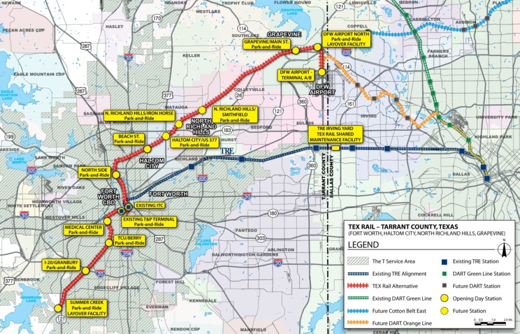
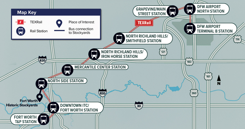
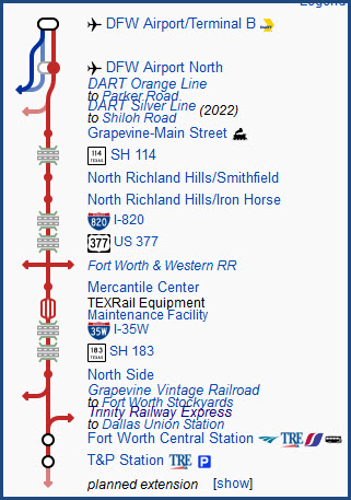
As of 2020, the line has 9 stations:
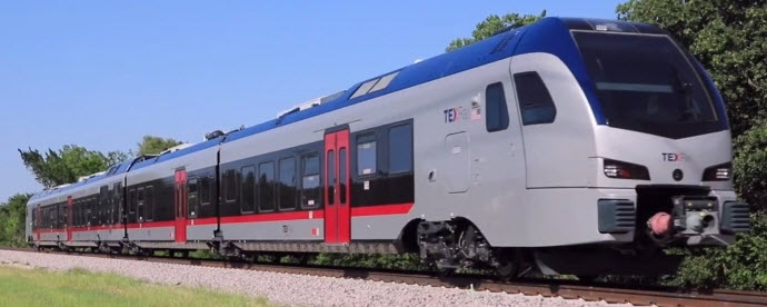
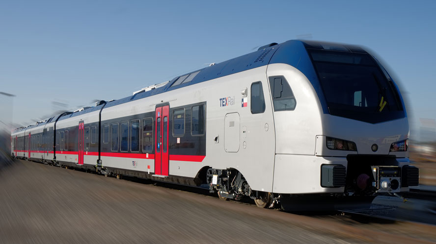
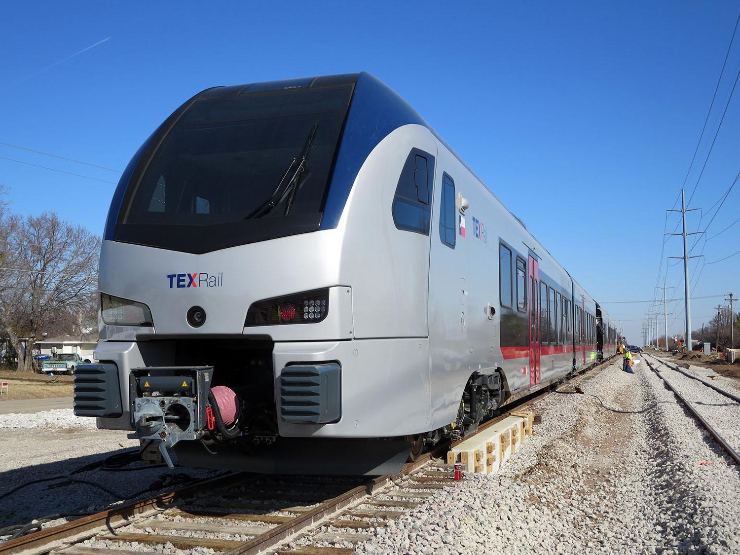
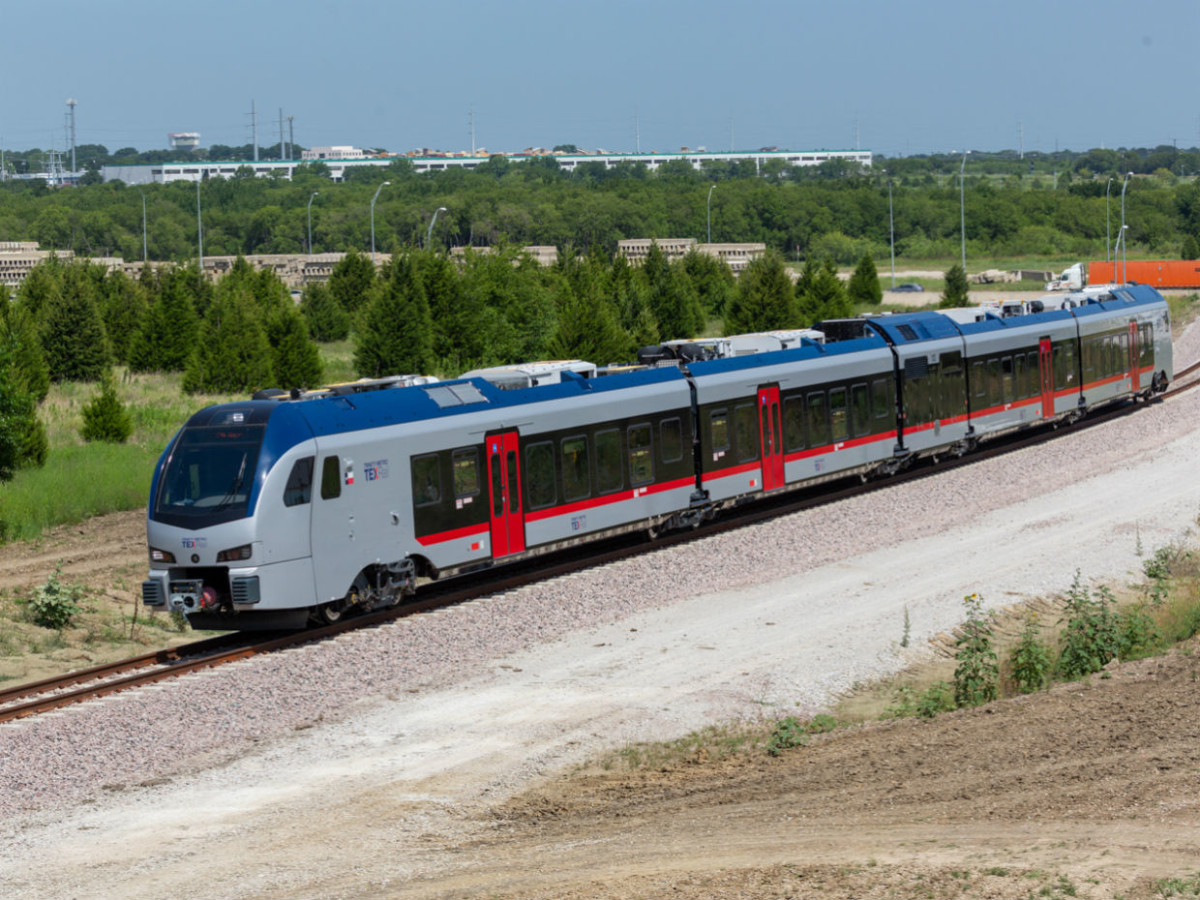
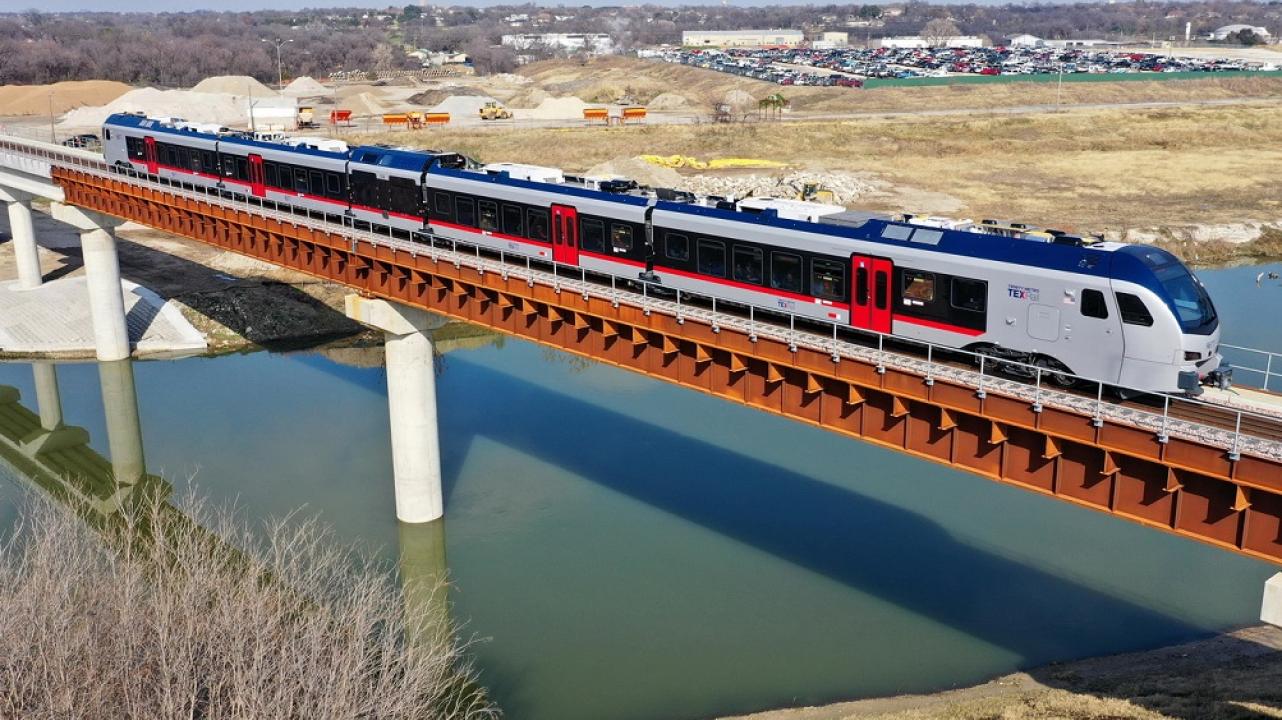
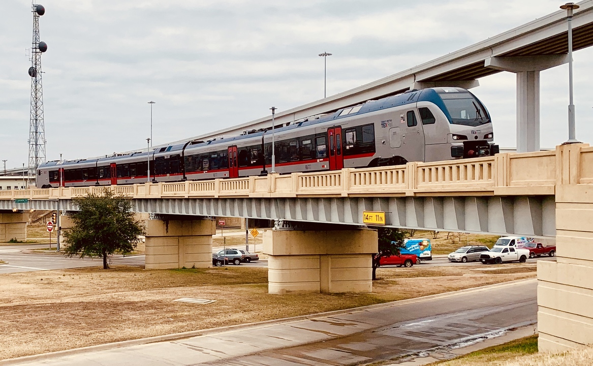
Rolling stock: TEXRail service uses eight (8) Stadler FLIRT self-propelled diesel multiple units (DMU) capable of seating 229 passengers and carrying up to 488 passengers. In TEXRail application, the diesel power module contains two 520-kilowatt (697 hp) (1400 hp Total) Deutz AG TCD 16.0 V8 engines that comply with US EPA Tier 4 emission standard, able to achieve a top speed of 81 mph (130 km/h). These units at 266 feet (81 m) long weigh in at 352,000 pounds (160 t) empty (443,000 pounds (201 t) full load).
Editor: For comparison purposes, the Baltimore LRV's, which are 95 feet long, weigh 54 tons empty, so foot for foot, the new TexRail cars weigh slightly less!
The contract to purchase eight trainsets, valued at about $100 million, was awarded to Stadler in June 2015. The first set was delivered in October 2017, and four more sets had arrived by November 2018. Equipment testing and crew training started in March 2018.
Each rail vehicle is configured with an operator cab at either end for bidirectional movement. At the center of the train is the power pack with two diesel engines, with a passageway to allow access to other parts of the train, and allows it to be much quieter than traditional commuter rail. TEXRail vehicle amenities include USB ports equipped at every seat, work tables, lap trays, a quiet car, ADA compliant level boarding, overhead luggage racks, bike racks, and a restroom near the center of each train. If you notice, they are using the pretty much "standard" coupler for transit equipment made by Dellnor - the Baltimore LRV's use the same coupler, and they were designed 30+ years ago.
Most of the above information comes from the Wikipedia page. A "good number" of the aerial photos below were screen grabbed from both Google and Bing Maps in June of 2020, and as of then, most of the aerial photography was done BEFORE the start of construction, with a few hitting the area while construction was going on, like the overpass construction over Old Denton Road. We'll revisit soon to see if they have had any new flyovers for updated aerial shots.
Chasing the line:
As far as picture taking goes, good places abound, especially along Ira E. Woods Ave from Grapevine down to Brumlow Blvd. The two run right next to each other for almost three miles, for dang near perfect pictures. South of that, Woods turns into Colleyville Blvd, and veers away from the tracks.
The Cotton Belt Trail follows the tracks from William D. Tate Rd in Grapevine south to Browning Dr, a distance of a little over 11 miles! Many good spots along here, there are many small bridges. A parking lot for the Dick Faram Park adjacent to the trail on Amundson Dr near Donna Rd, makes for a convenient spot to park for pictures - one of many!!!
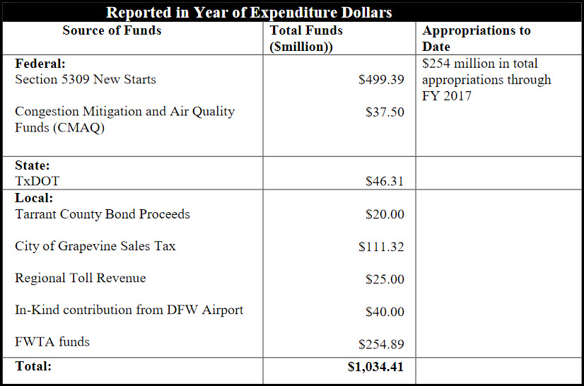
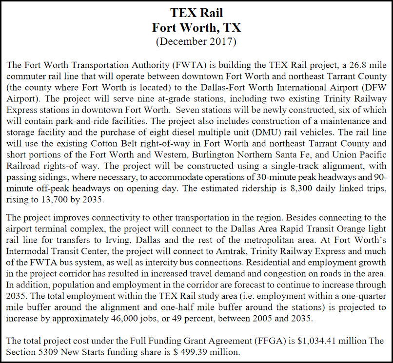
In 2017, when the following PDF was published, it was estimated to cost slightly over one billion dollars to "build" the TEX Rail system. I wonder what the final cost actually was?
Please see my signal and bridge section, because they contain the bulk of the detail for specific places (even tho they are tedious to wade thru :-). This page is lengthy, because I have covered every bridge & overpass, and every signal location (I can find via Google) on the line.
The STATION BY STATION section will not only highlight the stations of the line, but also the maintenance facility, and anything else of significance.
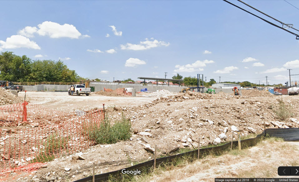
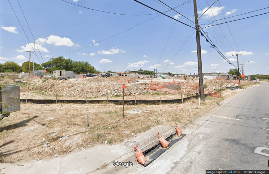
As of the original date of this page, June 2020, I have not visited the line, and am going strictly by what I can find on Google Maps and Bing Maps. Neither of them have updated imagery showing the completed line yet, especially towards the western end of the line in Ft Worth. If anyone has pictures they would like to contribute, I hope you will. Because of that, I pretty much stopped following the signals west of the North Side station.
Acknowledgements:
Bob Vogel
Whomever is behind the gramho site
Denver Todd
Google Maps
Bing Maps
Websites and other additional information sources of interest for the area:
http://www.walshgroup.com/news/2019/texrailcommuterlineopensinnorthtexas.html
https://en.wikipedia.org/wiki/TEXRail
https://www.star-telegram.com/news/traffic/your-commute/article179104096.html
https://www.hsrail.org/texrail-will-prove-commuter-trains-should-lose-some-weight
http://www.walshgroup.com/news/2019/texrailcommuterlineopensinnorthtexas.html
http://www.carrtracks.com/Tower_55.htm
https://ridetrinitymetro.org/about-texrail/
https://gramho.com/explore-hashtag/ridetrinitymetro
This is one of the few times I will say, "use GPS", because there are too many places for you to be in order to railfan the entire system.
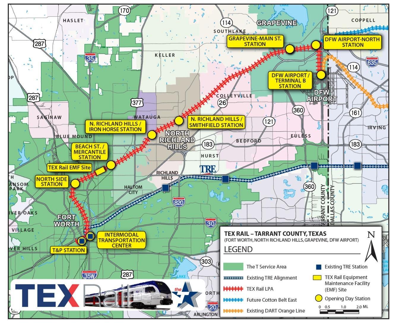
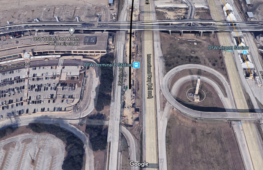
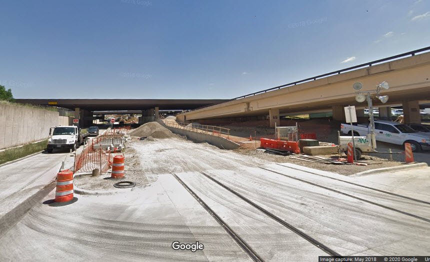
DFW Terminal B Station
GPS Coordinates: 32.906355, -97.041180
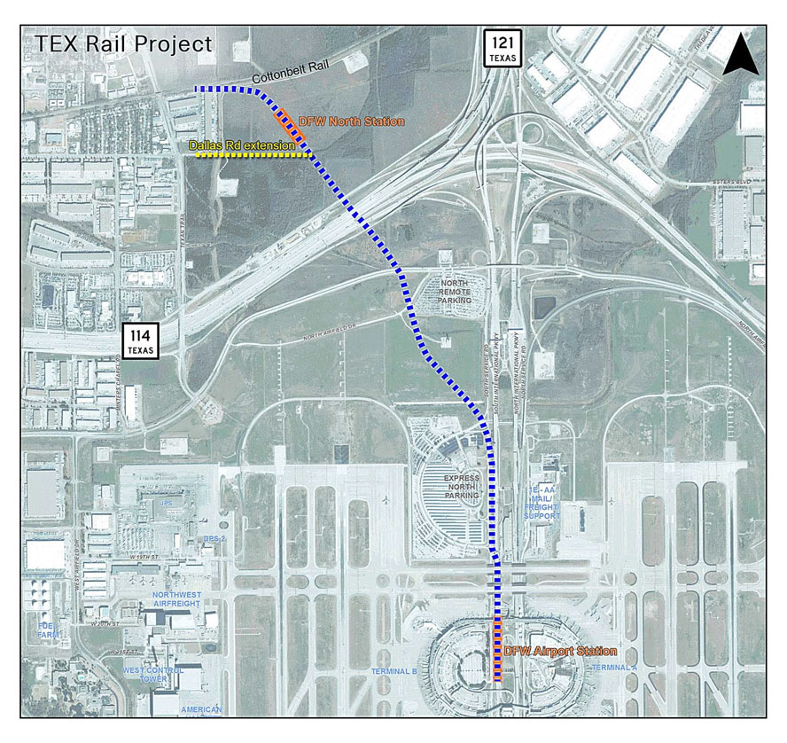
Before the TexRail project got started, a map of the proposed route into DFW Airport.
 during
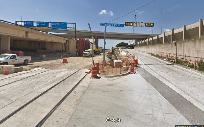 during
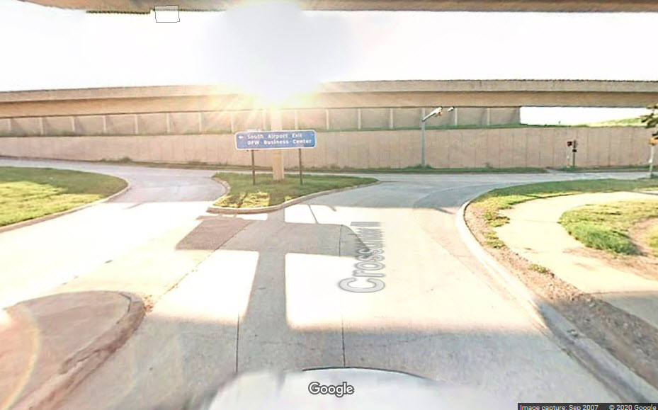 before
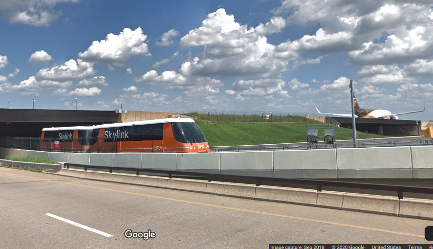 Planes and Skylink
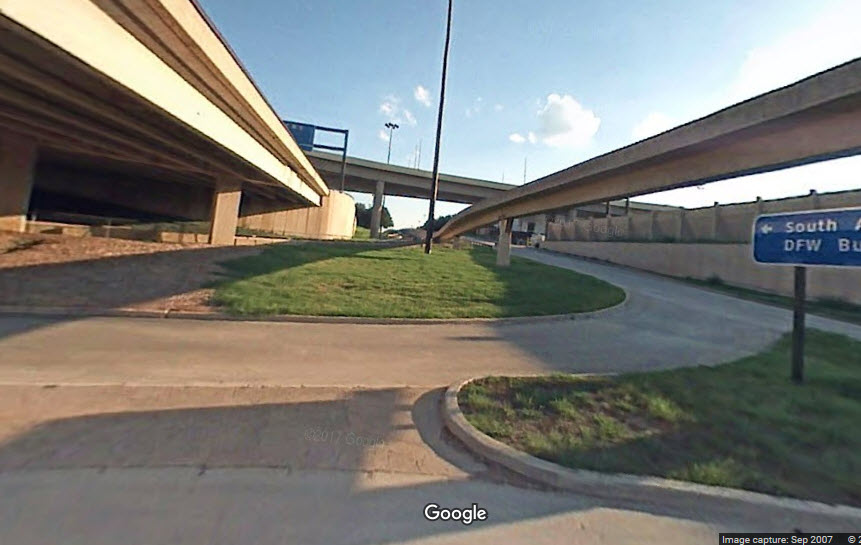 before
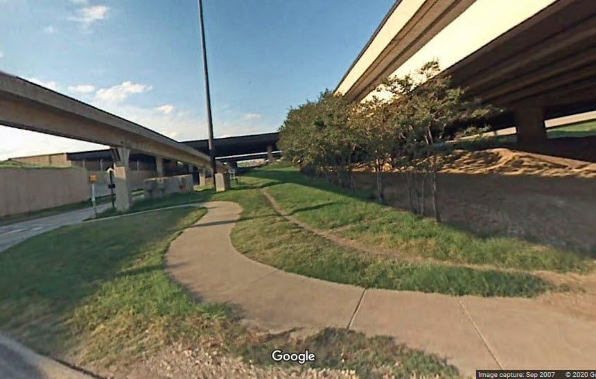 before
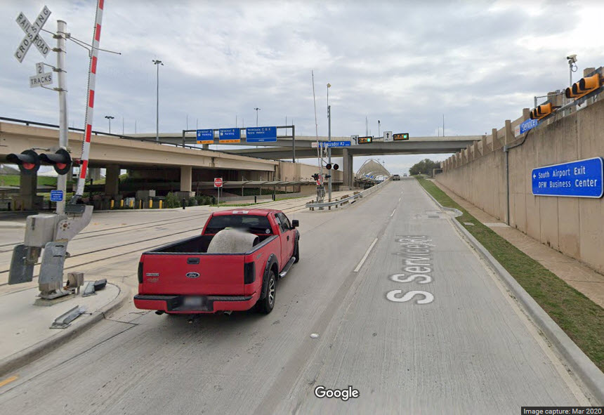 after
afterDFW Airport North Station
GPS Coordinates: 32.933810, -97.054289

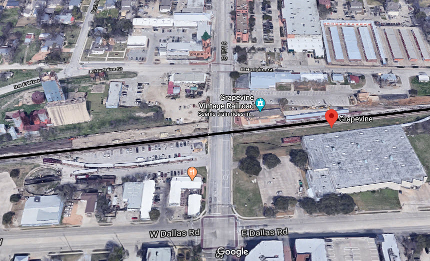
Grapvine / Main St Station
GPS Coordinates: 32.933655, -97.077388

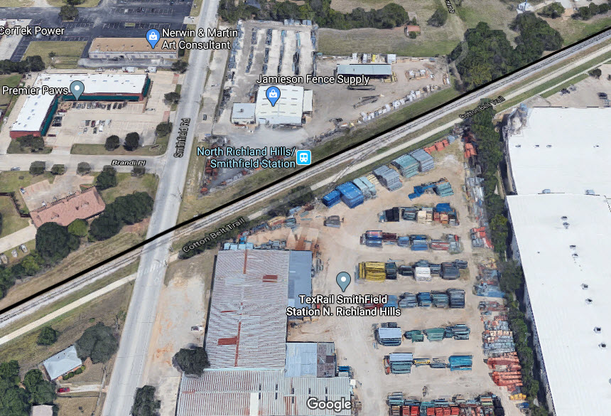
North Richland Hills / Smithfield Station
GPS Coordinates: 32.865010, -97.211447
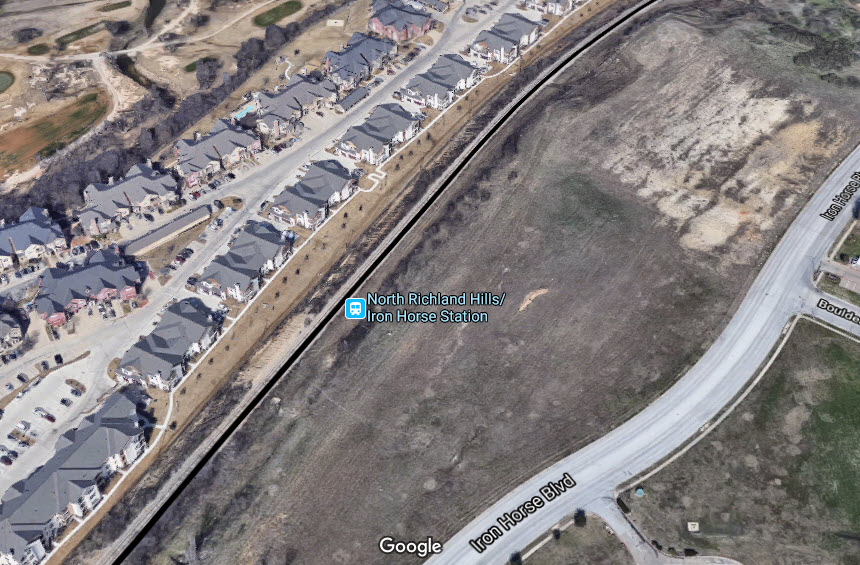
North Richland Hills / Iron Horse Station
GPS Coordinates: 32.844761, -97.249580
North Richland Hills, TX 76180
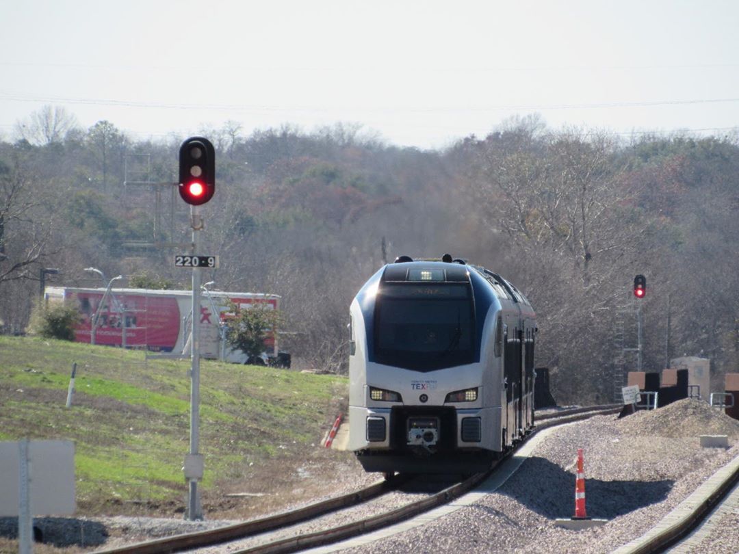
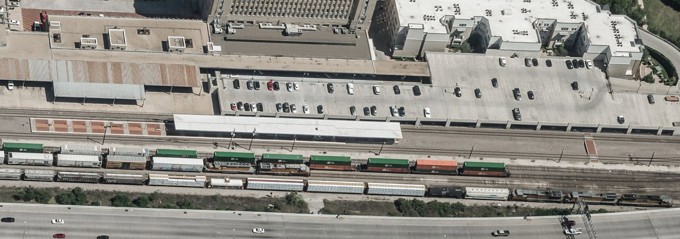
An approaching train has just crossed I-820 and is passing the signals on it's way into the Iron Horse station.
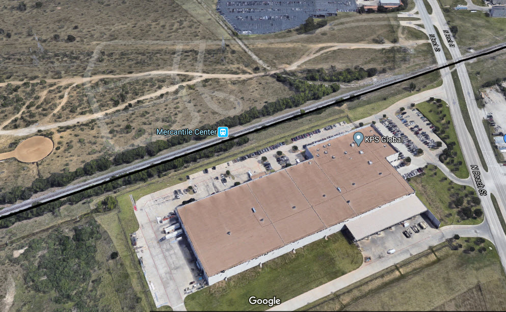
Beach St / Mercantile Station
4233 N Beach St, Fort Worth, TX 76137
GPS Coordinates: 32.819427, -97.293365
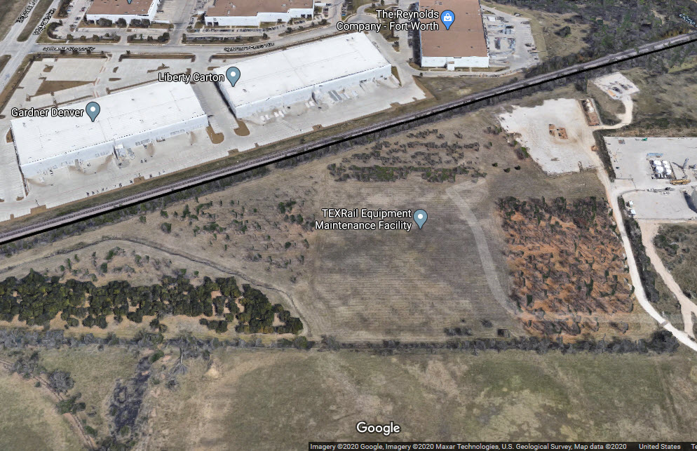
TexRail Maintenance Facility
3801 Texrail Avenue, Fort Worth, TX 76137
GPS Coordinates: 32.813886, -97.304810
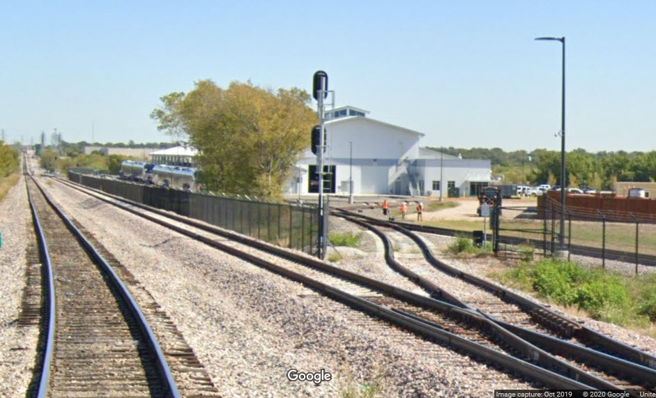
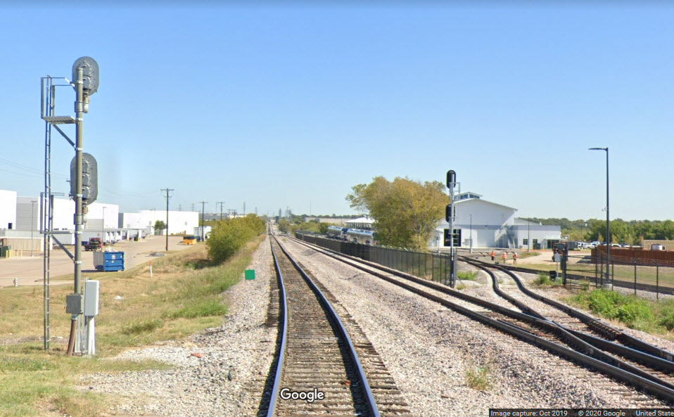
 looking west from Sylvania Rd
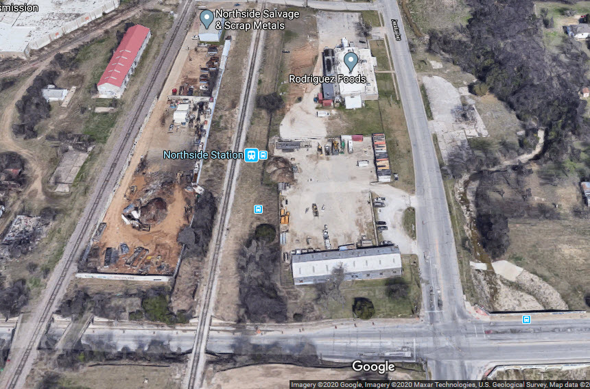
Northside Station
2829 Decatur Ave, Fort Worth, TX 76106
GPS Coordinates: 32.796069, -97.338057
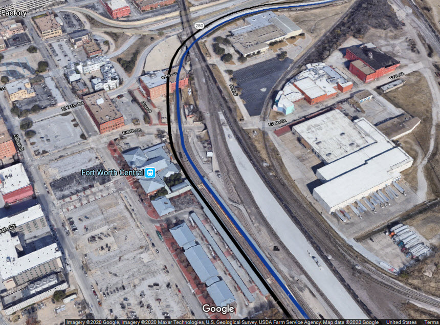
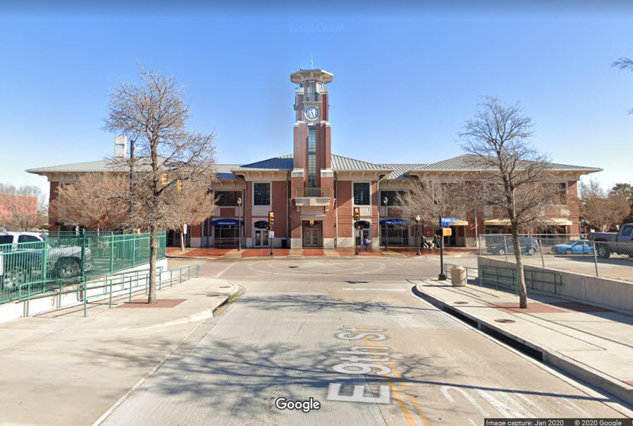
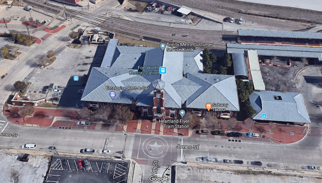
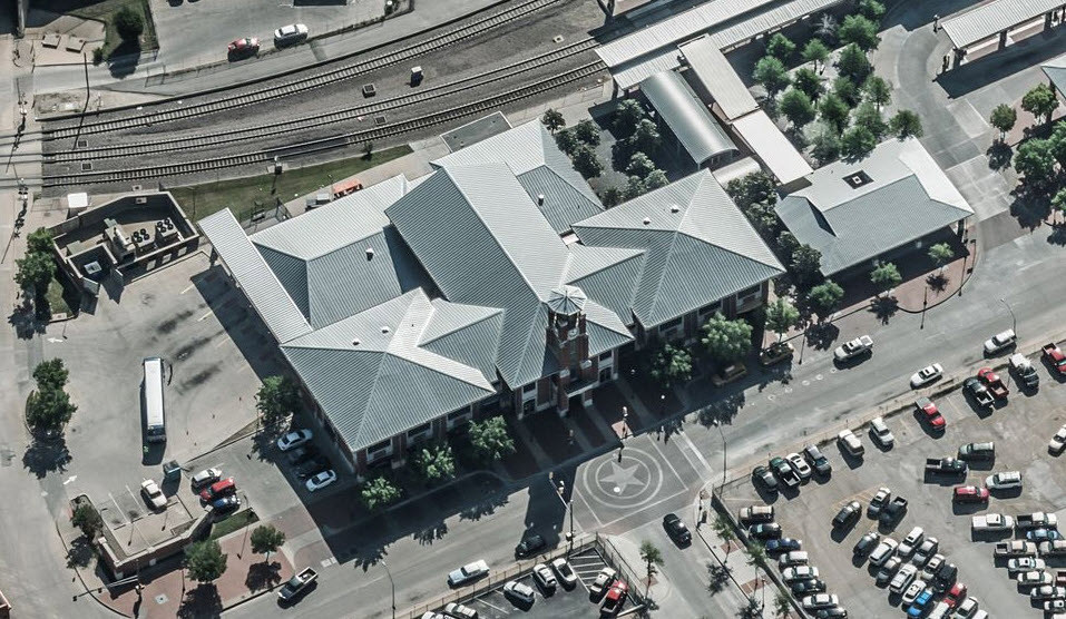
Intermodal Transportation / Ft Worth Central Station
1001 Jones St, Fort Worth, TX 76102
GPS Coordinates: 32.752722, -97.326423

T&P Station
221 W Lancaster Ave, Fort Worth, TX 76102
GPS Coordinates: 32.745307, -97.327897
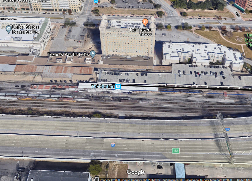


Tower 55
The infamous Tower 55 in downtown Ft Worth is just a short hop from the T&P Station. The area sure has changed since I first visited the tower in 1985!
Because Tower 55 is at the crossroads of Ft Worth railroading, being there or nearby is one of the best places to be in Texas.


Disclaimers:
I love trains, and I love signals. I am not an expert. My webpages reflect what I find on the topic of the page. This is something I have fun with while trying to help others.
Please Note: Since the main focus of my two websites is railroad signals, the railfan guides are oriented towards the signal fan being able to locate them. For those of you into the modeling aspect of our hobby, my indexa page has a list of almost everything railroad oriented I can think of to provide you with at least a few pictures to help you detail your pike.
If this is a railfan page, every effort has been made to make sure that the information contained on this map and in this railfan guide is correct. Once in a while, an error may creep in :-)
My philosophy: Pictures and maps are worth a thousand words, especially for railfanning. Text descriptions only get you so far, especially if you get lost or disoriented. Take along good maps.... a GPS is OK to get somewhere, but maps are still better if you get lost! I belong to AAA, which allows you to get local maps for free when you visit the local branches. ADC puts out a nice series of county maps for the Washington DC area, but their state maps do not have the railroads on them. If you can find em, I like the National Geographic map book of the U.S..... good, clear, and concise graphics, and they do a really good job of showing you where tourist type attractions are, although they too lack the railroads. Other notes about specific areas will show up on that page if known.
Aerial shots were taken from either Google or Bing Maps as noted. Screen captures are made with Snagit, a Techsmith product... a great tool if you have never used it!
By the way, floobydust is a term I picked up 30-40 years ago from a National Semiconductor data book, and means miscellaneous and/or other stuff.
Pictures and additional information is always needed if anyone feels inclined to take 'em, send 'em, and share 'em, or if you have something to add or correct.... credit is always given! Please be NICE!!! Contact info is here
Beware: If used as a source, ANYTHING from Wikipedia must be treated as being possibly being inaccurate, wrong, or not true.
RAILFAN GUIDES HOME
RAILROAD SIGNALS HOME
NEW JUN22/2020
Last Modified
29-Jun-2020