In General
Timeline
Map
Supplemental Maps
Station Locations
RAILFAN GUIDES HOME
RAILROAD SIGNALS HOME
Location / Name:
Philadelphia PA: Bucks, Chester, Delaware, Montgomery and Philadelphia Counties
What's Here:
Railroad Stations of 1934
Access by train/transit:
Well, at the time, any of them :-)
The Scoop:
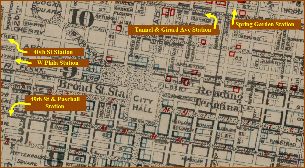
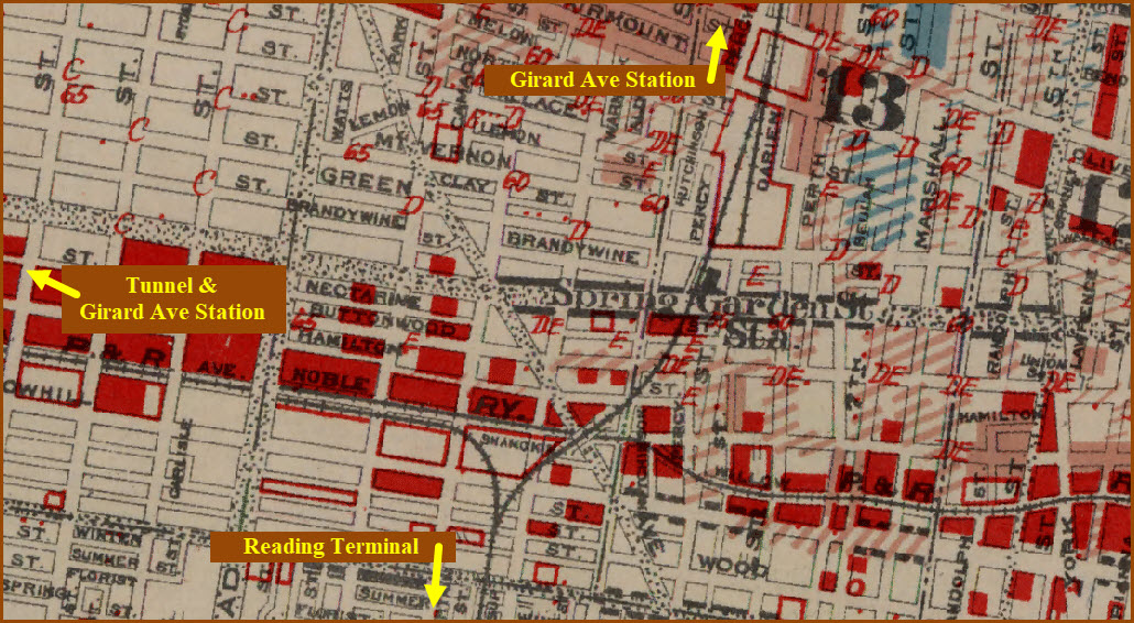
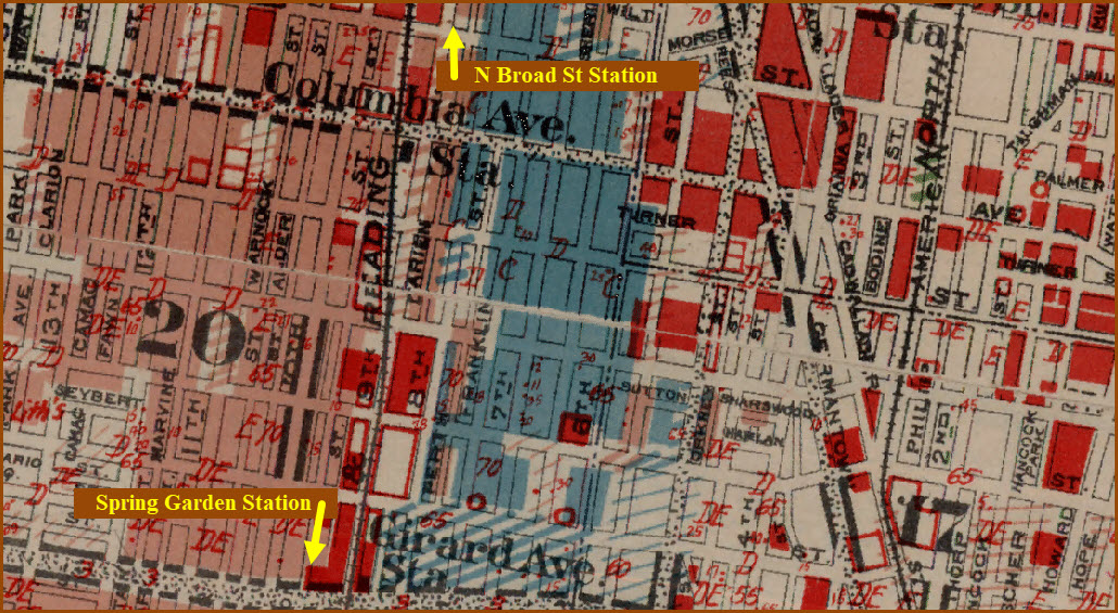
These three pages cover the railroad / train stations that were around in the early 1900's. What started this whole venture was the 1934 appraisal map. These maps come from an excellent historical reference page of maps of the greater Philadelphia area from back in the late 1800's and early 1900's, all overlaid on Google's map from today. You can click on as many maps as you want, but only the latest map will be shown on top, earlier maps will be "underneath". The 1934 station locations will be augmented with screen shots from two other maps: a 1910 Philadelphia Atlas, and a 1903 Philadelphia Street map. This is because there seem to be a fair number of stations that disappeared just in these 24 years!
Because there are so many stations to cover, I divided the coverage into several pages, this page covers stations Northeast of the current 30th Street Station, the other two cover Northwest and South Philadelphia.
Railroad Abbreviations:
B&O -- Baltimore & Ohio RR
CNJ -- Central RR of New Jersey
H&B -- Holmesburg & Bustleton RR (later became part of the PRR)
LV -- Lehigh Valley RR
LVR -- Lebanon Valley Railroad
NYC -- New York Central RR
NYSL -- New York Short Line RR
PB&W -- Philadelphia, Baltimore & Washington RR (became the PRR)
PG&N -- Philadelphia, Germantown & Norristown RR
PKR -- Port Kennedy Railroad
PN&NY -- Philadelphia, Newtown & New York RR
P&R -- Philadelphia & Reading Rwy, which later became the Reading
P&T -- Philadelphia & Trenton RR
PW&B -- Philadelphia, Washington & Baltimore RR
PRR -- Pennsylvania RR
PVR -- Pickering Valley Railroad
R&C -- The Reading and Columbia Railroad
RDG -- Reading RR
WC&P -- West Chester and Philadelphia Railroad, 1848-1881, became the West Chester branch of the PRR, now the Media-Elwyn line
Acknowledgements:
Greater Philadelphia Geo History
Wikipedia
Hidden City, various pages
Websites and other additional information sources of interest for the area:
http://www.philageohistory.org/tiles/viewer/
https://hiddencityphila.org/2019/08/in-northeast-philadelphia-a-rich-history-of-train-tracks-and-acquisitions/
https://hiddencityphila.org/2013/03/who-moved-the-newkirk-viaduct-monument/
https://en.wikipedia.org/wiki/Philadelphia,_Wilmington_and_Baltimore_Railroad
https://en.wikipedia.org/wiki/Newkirk_Viaduct_Monument
https://en.wikipedia.org/wiki/History_of_rail_transport_in_Philadelphia
https://en.wikipedia.org/wiki/Baltimore_and_Philadelphia_Railroad
https://en.wikipedia.org/wiki/Junction_Railroad_(Philadelphia)
https://en.wikipedia.org/wiki/West_Chester_and_Philadelphia_Railroad

Station Locations
22nd St NW05
40th St NW26
49th St S01
52nd St NW24
60th St S03
84th St S06
Allens Lane NW18
Arrott NE14
Asbestos NW16
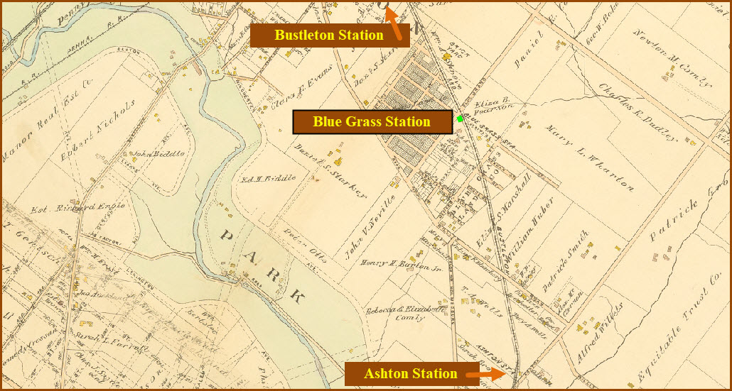
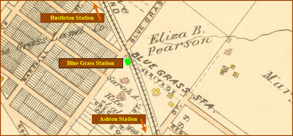
Ashton NE20
Bala NW22
Belmont NW25
Bell Road S05
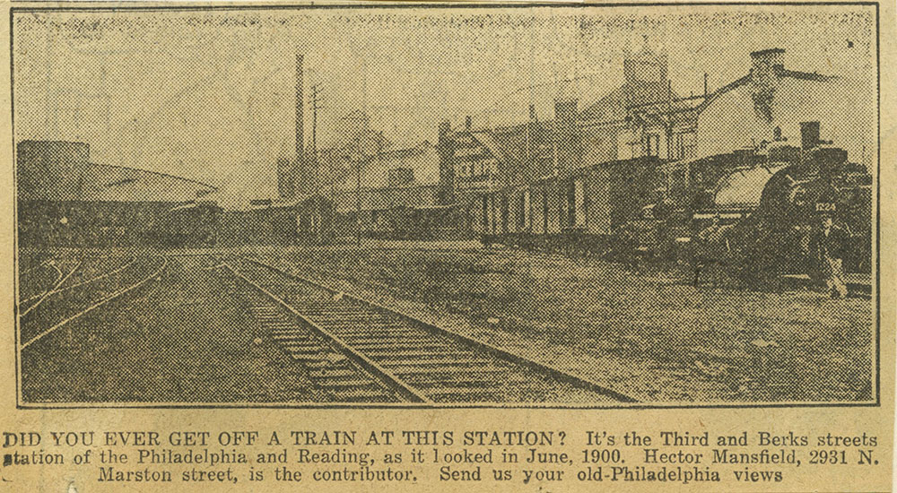
Berks St NE04
Blue Grass NE24
B&O Station (downtown) NW27
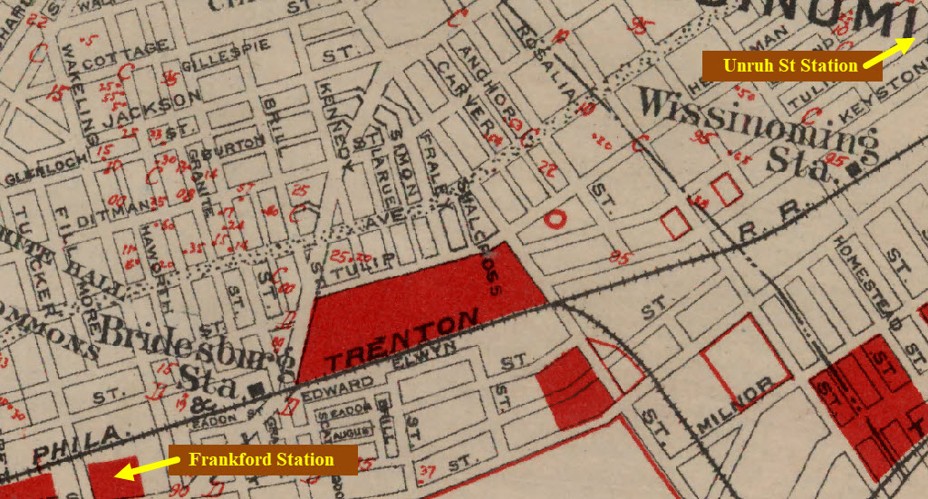
Bridesburg NE17
Broad Street NE01
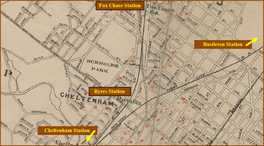
Bustleton Stations NE23
Carpenter NW18
Cedar Grove NE13
Cheltenham NE21
Chestnut Hill Stations NW14
Cinnaminson NW01
Columbia Ave NE03
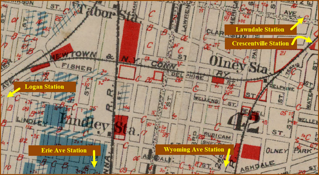
Crescentville NE13
Cynwyd NW22
(Darby) B&O S04
E. Falls NW04
East Lane NW16
Elkins Park NE12
Elmwood S07
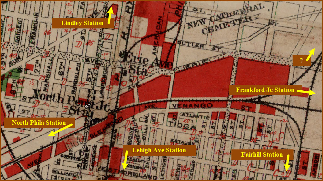
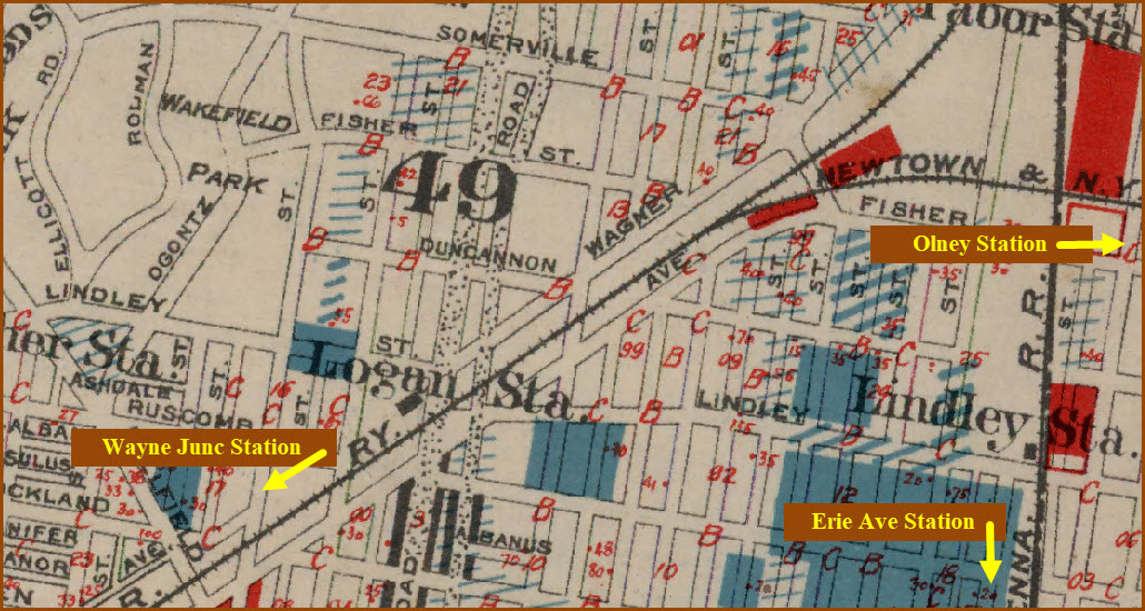
Erie Ave NE06
Fairhill NE05
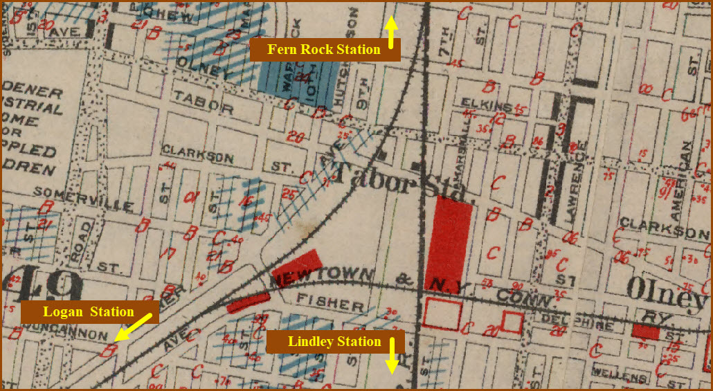
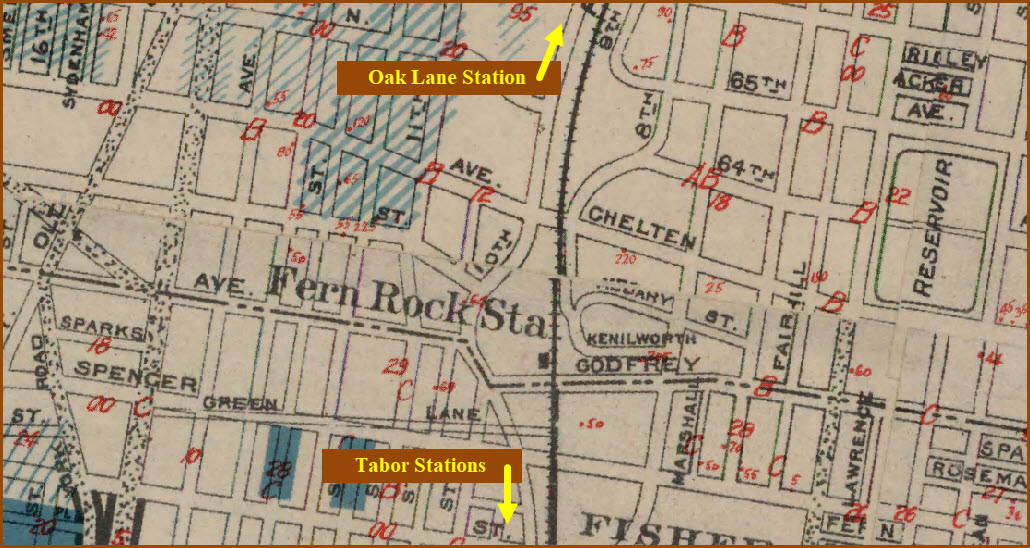
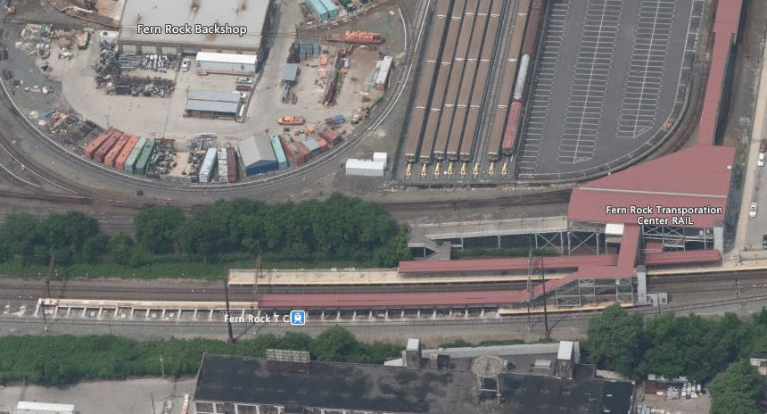
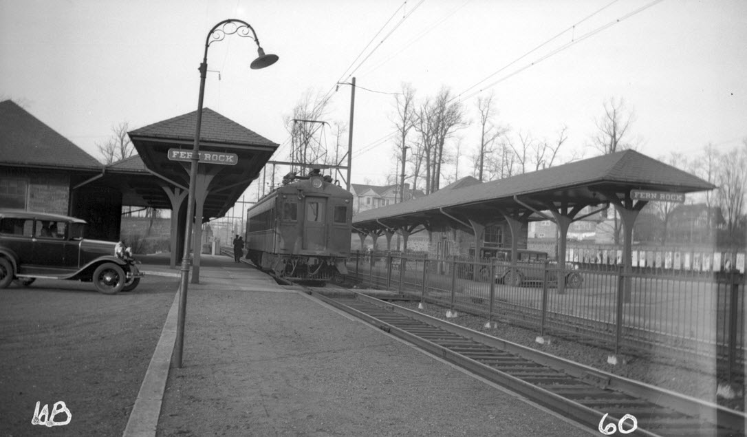
Fern Rock NE10
Fernwood S02
Fisher NW08
Fox Chase NE22
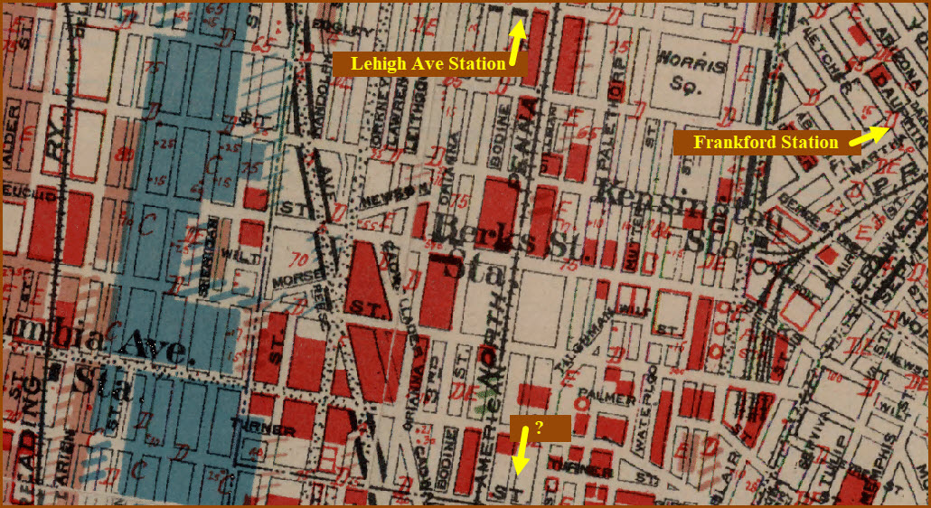
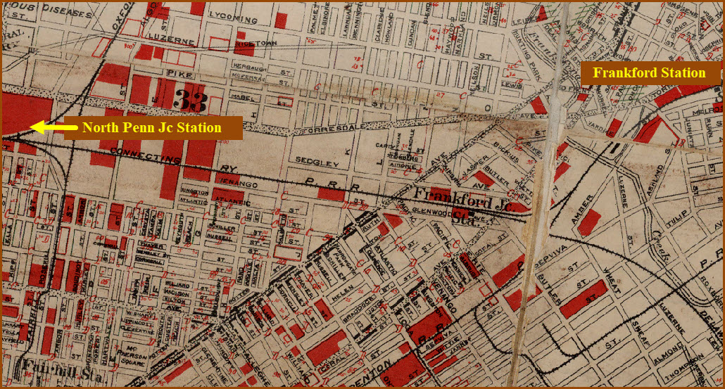
Frankford Stations NE15
Frankford Junction NE16
Girard Ave NE03
Germantown (P&R) NW09
Germantown (PRR) NW20
Germantown Road NW12
Girard Ave (P&R) NE03
Girard Ave (PRR) NW26
Gravers NW14
Highland NW15
Hillcrest NW17
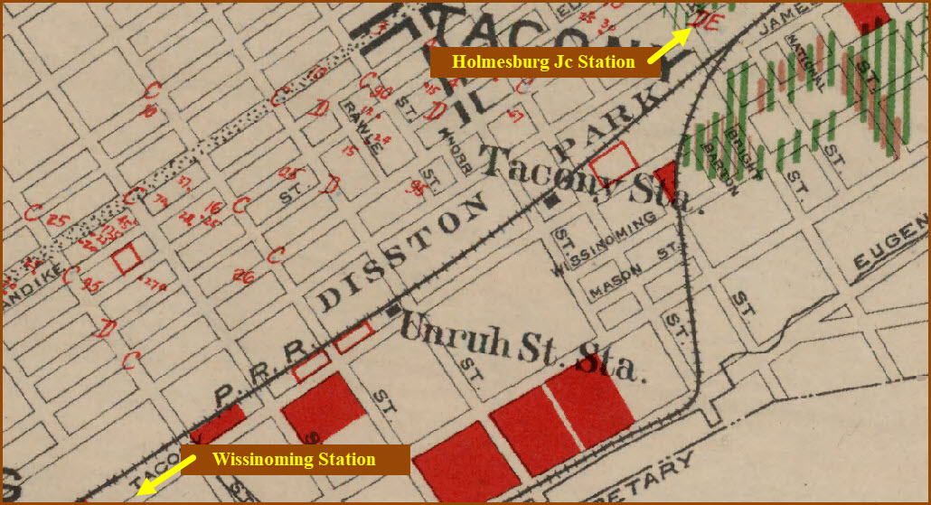
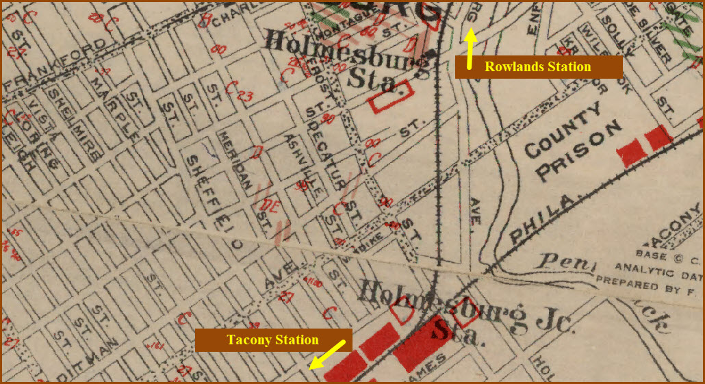
Holmesburg NE19
Holmesburg Junction NE19
Kensington NE04
Lawndale NE21
Lehigh Ave NE05
Lindley NE07
Logan NE08
Manayunk NW02
Merion NW23
Mermaid NW13
Mt Airy NW12
N. Broad Street NW21
N. Manayunk NW01
Nicetown NW06
North Penn Jc NE06
N. Philadelphia NW21
Oak Lane NE11
Olney NE07
Overbrook NW23
Paschall S04
Pencoyd NW03
Reading Terminal NE01
Rowlands NE20
Ryers NE22
Queen Lane NW20
Sedgwick NW11
Spring Garden NE02
Stenton NW11
St Martins NW15
Summerdale NE14
Tabor Stations NE09
Tacony NE18
Tioga NW06
Tulpehocken NW19
Unruh NE18
Upsal NW19
W. Falls NW04
W. Manayunk NW02
Washington Lane NW10
Wayne Junction NW07
Westmoreland NW05
West Phila NW27
Wingohocking NW09
Wissahickon NW03
Wissinoming NE17
Wister NW09
Wyndmoor NW13
Wynnefield NW24
https://en.wikipedia.org/wiki/Spring_Garden_Street_station
 Russ Nelson, 2009, via Wikipedia
http://philaphilia.blogspot.com/2012/09/lost-mystery-building-of-week-september.html Info on Girard Ave (Please note: bad language warning!!!)
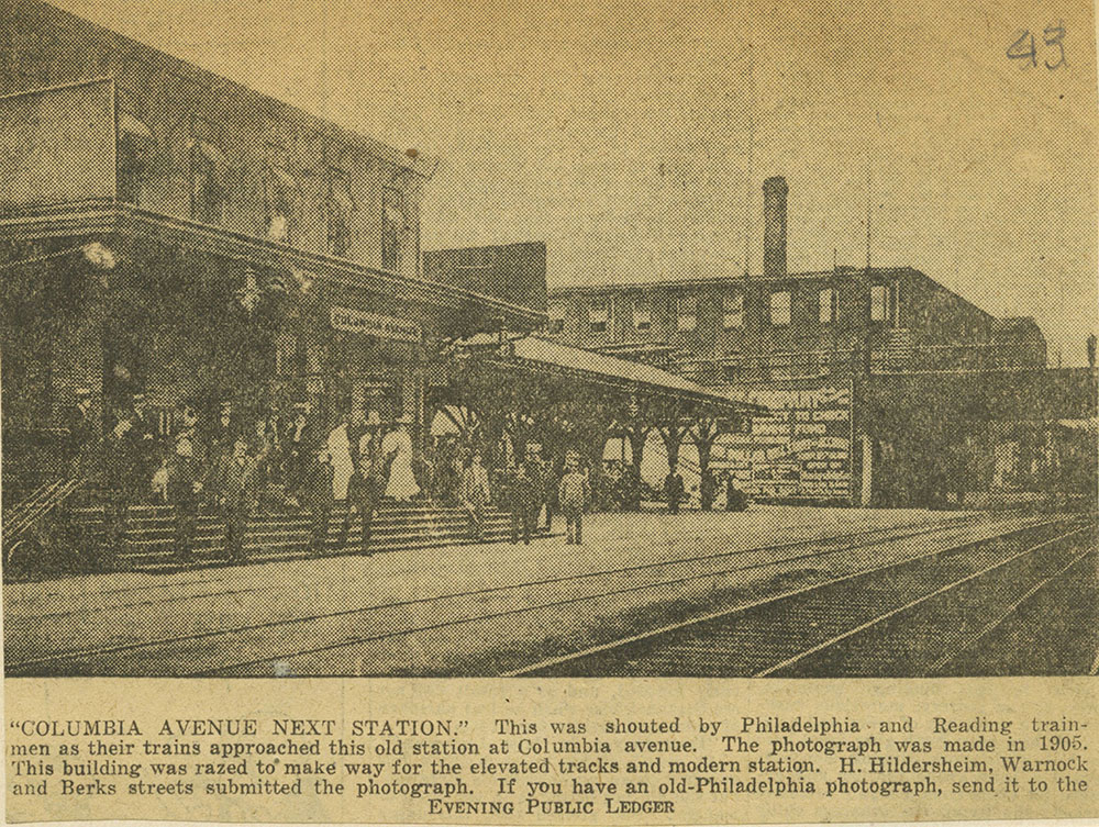 Columbia Ave 1905
 Girard, 1906, notice the Banjo signals!
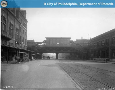 Girard 1906
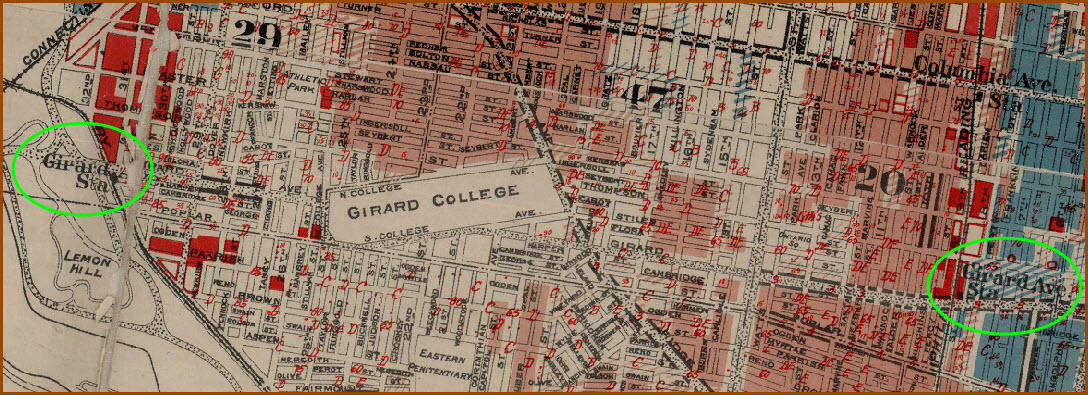
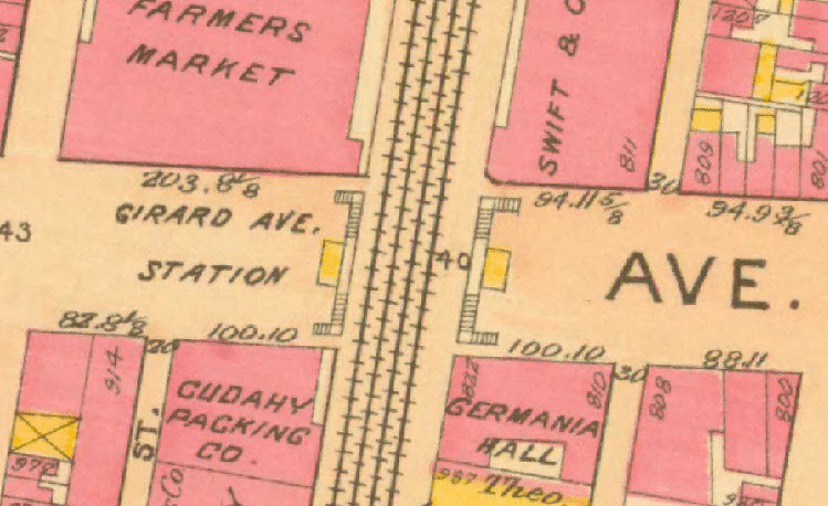 1910
1910Note: Back then, there were two GIRARD AVE stations.
Neither of the Girard Ave railroad stations are still with us.
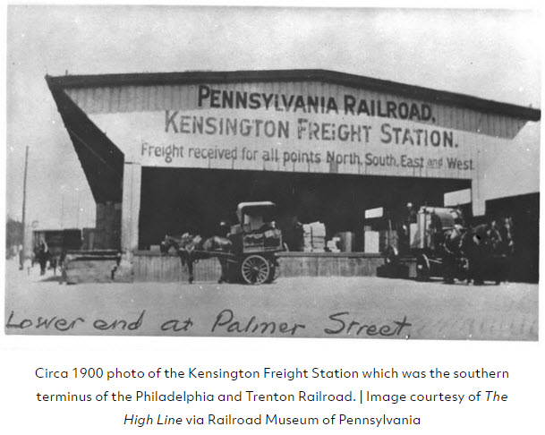
Kensington was the southern terminus of the Philadelphia & Trenton.
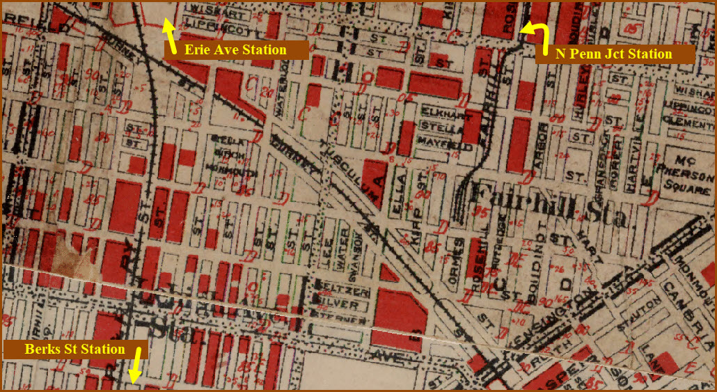
Close-up of the Fairhill station, nothing is left to indicate anything was ever there, except for maybe the "grassy knolls". Looks like we also lost part of Orems St.
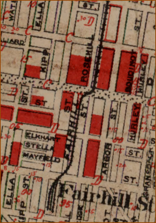
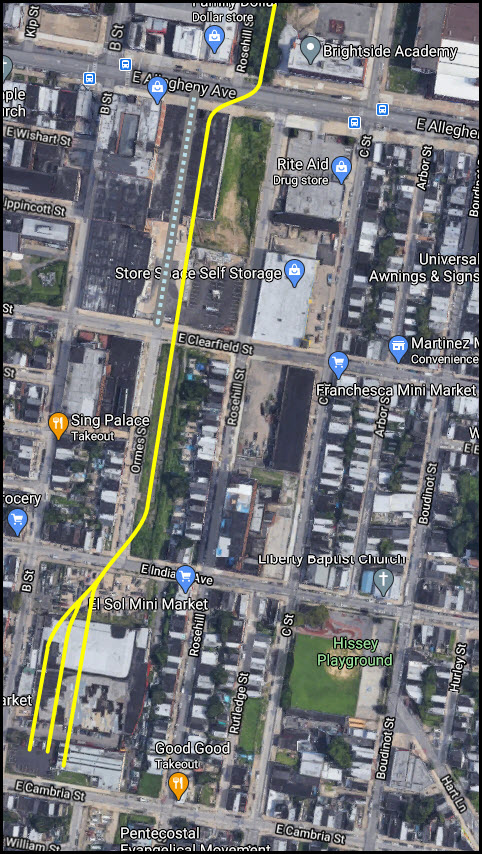
Wonder why they didn't move "it" one block north and split the cost of building a station?
https://www.west2k.com/pastations/philadelphia.shtml
 ~1930?, from west2k
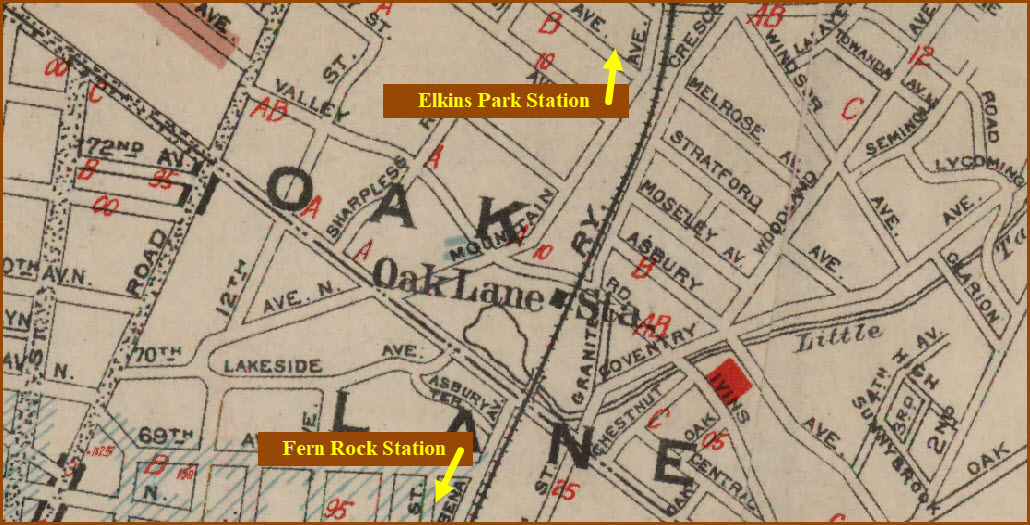


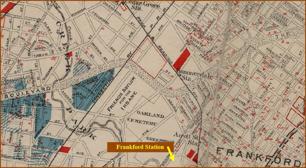
The P&R Frankford station was at the end of the Frankford Branch.


https://hiddencityphila.org/2019/08/in-northeast-philadelphia-a-rich-history-of-train-tracks-and-acquisitions/

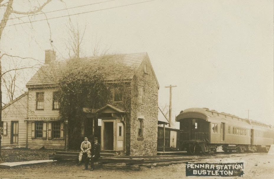 Bustleton 1910
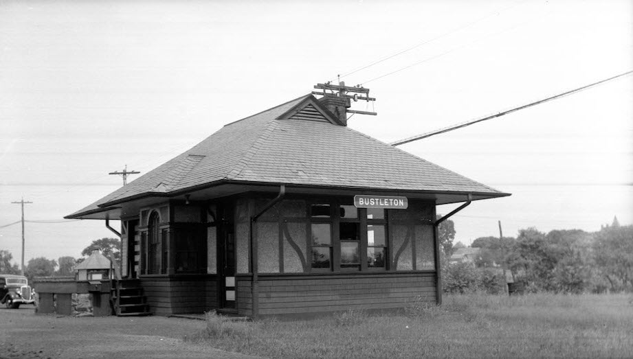 Bustleton 1940
From Hidden City and High Line via Railroad Museum of Pennsylvania
Disclaimers:
I love trains, and I love signals. I am not an expert. My webpages reflect what I find on the topic of the page. This is something I have fun with while trying to help others.
Please Note: Since the main focus of my two websites is railroad signals, the railfan guides are oriented towards the signal fan being able to locate them. For those of you into the modeling aspect of our hobby, my indexa page has a list of almost everything railroad oriented I can think of to provide you with at least a few pictures to help you detail your pike.
If this is a railfan page, every effort has been made to make sure that the information contained on this map and in this railfan guide is correct. Once in a while, an error may creep in :-)
My philosophy: Pictures and maps are worth a thousand words, especially for railfanning. Text descriptions only get you so far, especially if you get lost or disoriented. Take along good maps.... a GPS is OK to get somewhere, but maps are still better if you get lost! I belong to AAA, which allows you to get local maps for free when you visit the local branches. ADC puts out a nice series of county maps for the Washington DC area, but their state maps do not have the railroads on them. If you can find em, I like the National Geographic map book of the U.S..... good, clear, and concise graphics, and they do a really good job of showing you where tourist type attractions are, although they too lack the railroads. Other notes about specific areas will show up on that page if known.
Aerial shots were taken from either Google or Bing Maps as noted. Screen captures are made with Snagit, a Techsmith product... a great tool if you have never used it!
By the way, floobydust is a term I picked up 30-40 years ago from a National Semiconductor data book, and means miscellaneous and/or other stuff.
Pictures and additional information is always needed if anyone feels inclined to take 'em, send 'em, and share 'em, or if you have something to add or correct.... credit is always given! Please be NICE!!! Contact info is here
Beware: If used as a source, ANYTHING from Wikipedia must be treated as being possibly inaccurate, wrong, or not true.
SEPTA HOMEPAGE
RAILFAN GUIDES HOME
RAILROAD SIGNALS HOME
NEW 12/07/2020
Last Modified
18-Dec-2020