Location / Name:
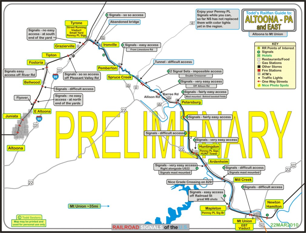
East of Altoona PA, to Huntingdon
What's Here:
Norfolk Southern's Middle Division, their main between the east coast and Chicago, and a former Pennsylvania RR Line
Data:
GPS Coordinates: as needed
Phone A/C: n/a
ZIP: n/a
Access by train/transit:
Amtrak Pennsylvanian
The Scoop:
These guides covers
the Altoona and Horseshoe Curve areas. This one specifically - is a signal guide from the Altoona Yard eastward, to Huntingdon PA, a trip of about 45 miles by track
and back roads, with a short stopover in Tyrone because of the many interesting railroad related items in town. To cover all of the areas highlighted on this
page, you can easily expect to spend a day. If the signals have already been switched over to standard color light signals, as they have at ANTIS, then you may
not even care to check out the signals. Unfortunately, for the signal fan, with the disappearance of B&O CPL's, Pennsy PL's, semaphores, and searchlight
signals, there is getting to be precious few signals "out there" to photograph that are unique, Darn-it!
STAY TUNED..... MORE TO COME....
Acknowledgements:
Jersey Mike
Craig Sanders
Denver Todd
Access via the Pennsylvania Turnpike, and then I-88 at exit 146 is the quickest way if you are coming in from the south, east or west, unless you're "above"
Altoona and Tyrone. At exit 146, you have a whole host of restaurants (6 or 7 including a McDs, Denny's, Bedford Diner, and Hoss's) and hotels (looks to be about
7 of em) to choose from if you need a place to stay or something to eat. Altoona is about 33-34 miles north of the PA Turnpike.
Above Altoona, in the area of State College and I-80, take exit 161 to jump on I-99 and head south, Tyrone is about 38 miles from I-80, and Altoona is about 53 or so.
From the East Broad Top and Mt Union area, its west on US22 thru Huntingdon and then 453 at Alfarata thru Tyrone, unless you want to take a "shortcut" into
Altoona via the back roads. Taking US22 south at Alfarata will bring you just south of Altoona near Holidaysburg, and then continues on to the Portage RR and Cresson.
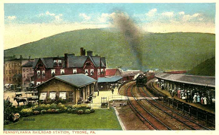
The Tyrone Amtrak station is now a FLAG STOP, meaning, there are not enough passengers for the train to stop here all the time. The original depot, built in
1880, is being used by the Tyrone Area Historical Society. Amtrak built a small bus type shelter around 2000 for the station, and there are no facilities here.
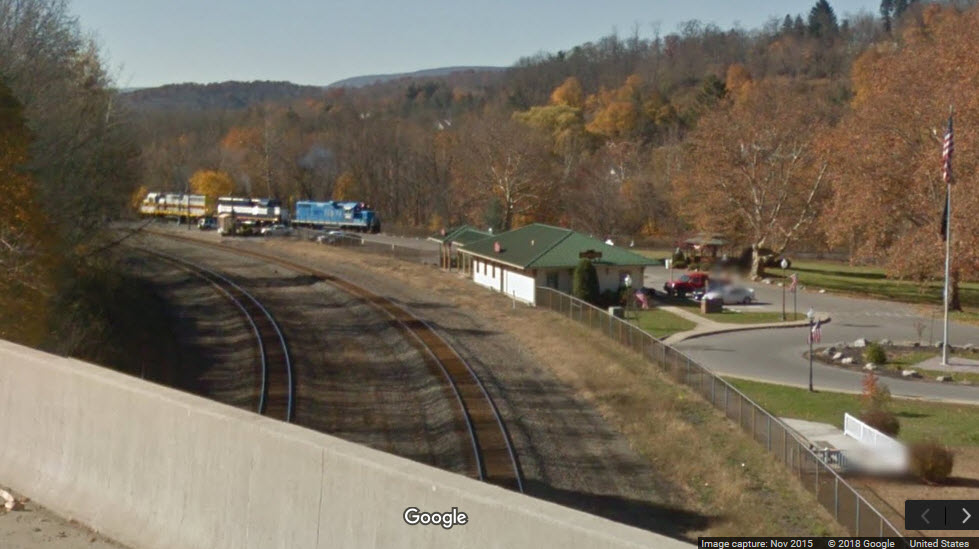
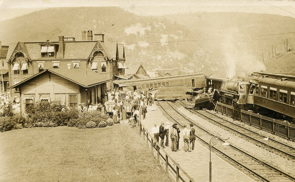
There used to be three tracks thru here as you can see in the postcard from the steam era, now there are only two.
The Historical Society supervises and maintains historical information and artifacts. Anyone interested in viewing information or becoming involved in the history of the
community is welcome. The Society meets the third Monday in the months of January, March, May, July, September, and the second Monday in November at the township hall.
From the Great American Stations webpage: Tyrone remained a small industrial village until new transportation modes and routes offered better connections to the rest
of the state. As early as 1786, regularly scheduled stage trips began between Philadelphia and Pittsburgh, but the grueling journey took three weeks, as poor roads
made night travel nearly impossible. Looking for a better link across the state, the Pennsylvania legislature was dismayed by the opening of the National Road in
Maryland and the Erie Canal in New York during the 1820s—transportation routes that threatened to siphon off trade from Pennsylvania and its major port at Philadelphia.
The state quickly devised its own transportation scheme: the Main Line of Public Works. At a cost of more than $10 million, it included a series of roads, railroads,
and canals built from 1826-1835. Upon completion, travel time was cut to only four days. The Juniata River provided a natural pathway through the mountains that was
soon lined with the Pennsylvania Main Line Canal; the Juniata Division started at the Susquehanna River in the east and ended at Hollidaysburg in the west where freight
was then transported by railroad over the Allegheny Mountains.
With a taste of what improved transportation infrastructure could provide in terms of speed and lower shipping rates, the communities along the waterway soon advocated
for improvements to the main line. Many looked to the promise of the new railroads. In 1846, the Commonwealth of Pennsylvania chartered the Pennsylvania Railroad (PRR)
to construct a rail line between Harrisburg and Pittsburgh in order to bypass the slower canals and roadways. Land holders in the vicinity of Tyrone Forge knew that
rail access would allow for the easier transport of the area’s mineral goods, which included lead, coal, and iron ore, as well as limestone. Realizing the profit
that could be made in shipping, the PRR chose to construct the rail line along the Little Juniata rather than follow the canal path further to the south as was
common along most of the route.
Four years later, the first train passed by Tyrone Forge; recognizing the potential for growth, Lyon, Shorb, and Company laid out a settlement a mile to the
west in 1851. The plateau upon which it was platted was not only flat but also substantially raised above the river to protect against flooding. Within a year,
a handful of buildings was constructed and referred to as both Eagleville and Shorbsville until Tyrone City was settled upon. The name referenced a county in
Ireland and was later shortened to “Tyrone.” The exact reason for the Irish reference is not entirely clear, but it may have been influenced by a group of Irish
settlers in the nearby Sinking Valley as well as an additional community of Irish immigrants who worked in the iron industry.
Between Huntingdon and Tyrone, the tracks crossed the Little Juniata 15 times, requiring more bridges in that 20 mile stretch than in the previous 200 miles from
Philadelphia to Huntingdon. By 1854, the all-rail route linking Philadelphia and Pittsburgh was fully opened, and the entire trip could be accomplished in an
amazing 15 hours at a cost of $8. Tyrone was suddenly connected to Philadelphia, one of the nation’s primary Atlantic ports, and Pittsburgh, considered the gateway
to the expansive and growing Ohio River Valley. Residents had to use the passenger depot at the old forges until one was built closer to town in 1853. Once the new
station was built, the lower end of Pennsylvania Avenue was lined with hotels and other businesses catering to rail travelers. One of the most famous hostelries was
the Ward House, part of which still stands across from the current station site.
In railroad miles, Tyrone was about halfway between Harrisburg and Pittsburgh, and it soon became an important shipping center. The value of the coal fields and
stands of lumber to the north of town had been one of the prime motivations behind the construction of the PRR main line along the Little Juniata, and within a
decade, two branch lines were constructed from Tyrone to better access these natural resources; a third was laid in the early 1880s. The increased activity through
the town prompted the PRR to name it the division headquarters in 1863, and five years later work was begun on expanded rail facilities including a roundhouse,
repair shops, weighing platform, and a rail yard for the processing of coal and lumber.
Rather than erect these buildings close to the station, they were placed to the north of the town center in an area that became known as East Tyrone. The railroad
also sponsored the construction of adjacent housing, most of which was intended for PRR employees working at the nearby shops. The neighborhood was absorbed into
Tyrone in 1893. The railroad facilities spurred other industrial developments such as a brick factory and the Tyrone Paper Mills. The paper manufacturer received
its vital loads of timber over the rails and produced a high quality product for use in mechanized printing as well as for general writing purposes. It had the
honor of providing National Geographic Magazine with the paper used for its colorful yellow-bound covers. Other industries included shoes, artistic prints, and
finished wood products. Gardner’s Candies has been in business since 1897. In addition to a small storefront, founder James Gardner sold his sweet treats from a
horse drawn wagon that became a fixture at carnivals and other events. Today customers can tour the company factory to better understand how chocolates are made.
To accommodate the office functions associated with the maintenance of the PRR main and branch lines, a new and larger station was constructed near the original
depot at Tyrone in 1888. It was a 2½ story brick structure marked by numerous gables decorated with fancy wood fretwork typical of the then-popular Queen Anne
style of architecture. The right-of-way eventually contained four tracks, and they were divided into two pairs by a center platform with a long canopy that
protected passengers from inclement weather as they waited for the train to arrive. A nearby building housed the Adams Express Company, a service that shipped
parcels and packages along the rail lines. After World War I, a memorial was erected across from the depot to honor all those who had died in the conflict;
the statue of a “doughboy” was later moved to Soldiers’ Park on the other side of the river.
By the end of the 19th century, Tyrone was the busiest stop on the PRR between Philadelphia and Pittsburgh. Functioning as the primarily departure point for
students and visitors to nearby Pennsylvania State University, the depot bustled at holiday time and during school breaks. The PRR provided Tyrone with a
solid economic base. In the late 1890s, the Tyrone Division of the railroad employed about 450 city residents, or about 1 in 13 Tyroners. Others labored in
local manufacturing concerns that were able to ship their goods across the country due to the town’s excellent rail connections. Those links were soon augmented
by a network of state highways that intersected at Tyrone, earning it the nickname “Hub of the Highways.”
The shot below is taken from the I-99/US220 overpass.
Accident, unknown date
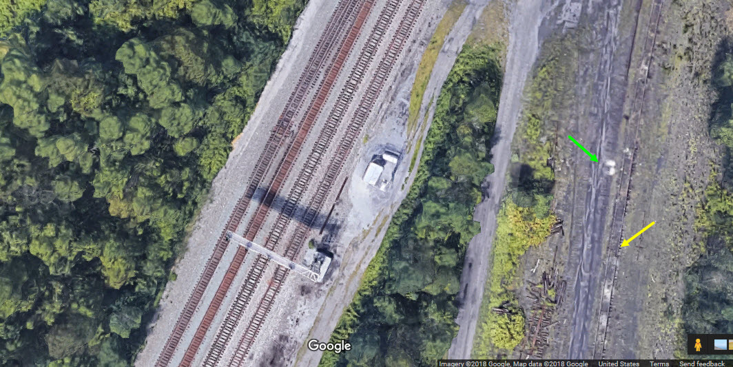
Tyrone PA - Wye
From this aerial shot, we can plainly see where the wye used to be here in Tyrone.
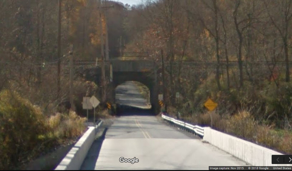
Being that the right of way follows the river for a great deal of it's trek thru the Pennsylvania countryside, it's not
surprising at the number of bridges and tunnels you may encounter.
South Tyrone PA - Short Bridge over Kerbaugh Rd
South Tyrone PA - Short Bridge over Bells Gap Run
Tyrone PA - Bridge over W 10th St
Looking in the other direction, we can see that the tracks run between the two sides of the street once coming off the small viaduct, looking like almost street running.
Tyrone PA - Bridge over 9th St
There are TWO bridges going over 9th St, because they are two sides of the wye that used to be here in Tyrone. One is still currently used by the
Nittany & Bald Eagle RR for servicing Tyrone, the other one is unused and in a terrible state of disrepair, and the city wants to tear it down.
The 9th Street Bridge has been a part of Tyrone’s History since the late 19th century! Holding a tremendous amount of significance to both the residents and to
the region as a whole, The Tyrone Area Historical Society has taken on the task of raising the necessary funds to restore this Tyrone Landmark!
At present, Blair County owns The 9th Street Bridge and has condemned it with no interest in its restoration. Borough of Tyrone officials, including the
majority of the current Borough of Tyrone Council, has agreed to bless our fund raising efforts and will even take ownership and/or stewardship of The 9th
Street Bridge upon the completion of our fundraiser! Blair County officials have agreed to hold off the demolition of The 9th Street Bridge in favor of this
potential, even to the point of giving the bridge over to the Borough of Tyrone once it’s completed.
photo by Craig Sanders
photo by Craig Sanders
photo by Craig Sanders
Tyrone PA - Bridge over Quarry Rd and the Little Juniata River
GPS Coordinates: 40.661229, -78.216675
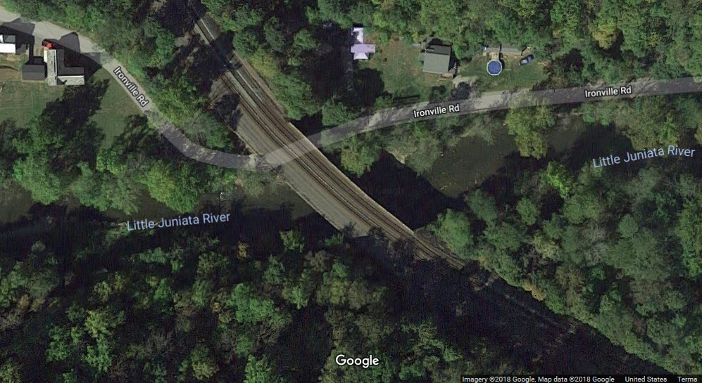
Tyrone PA - Bridge over Ironville Rd and the Little Juniata River
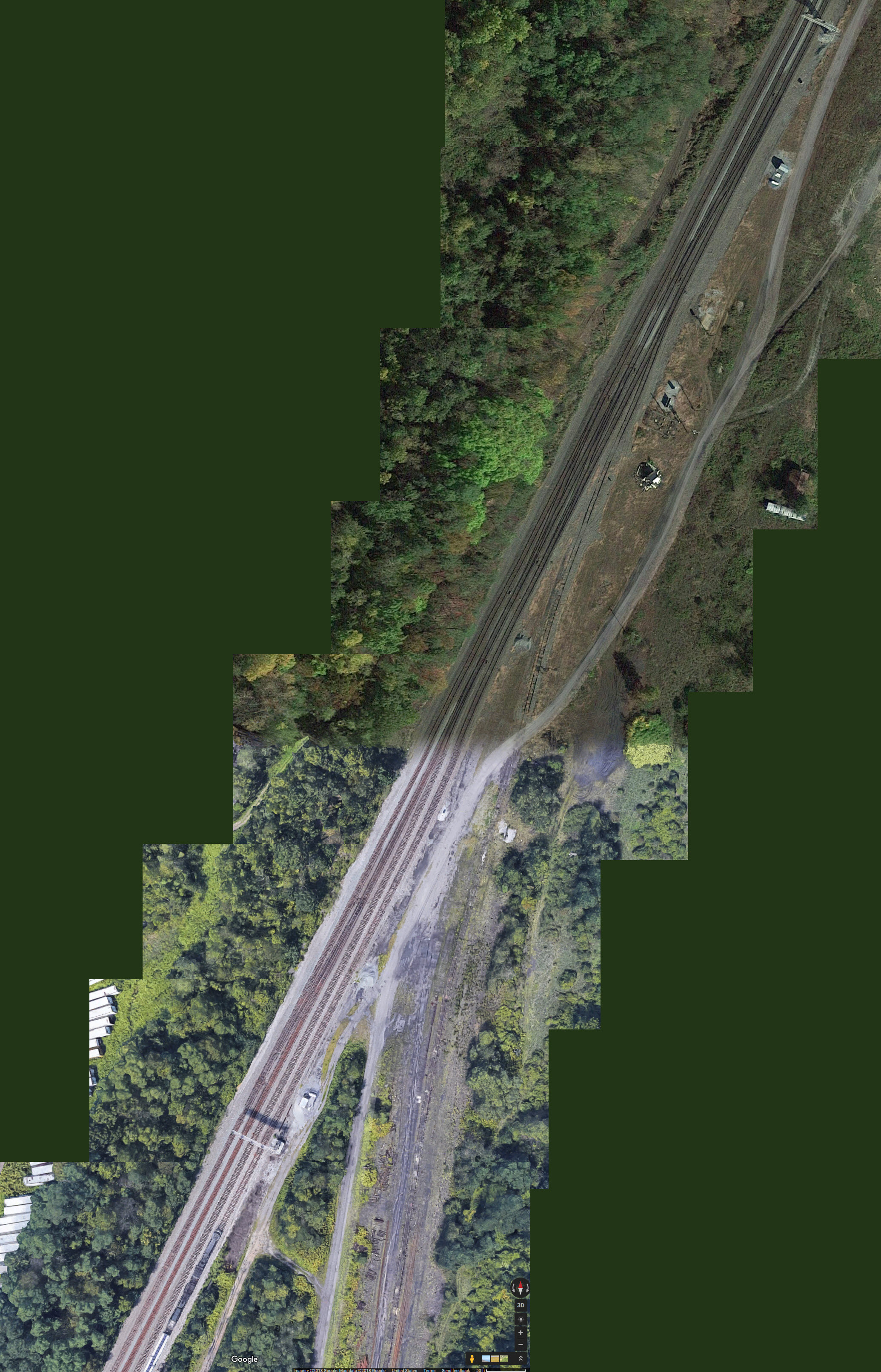
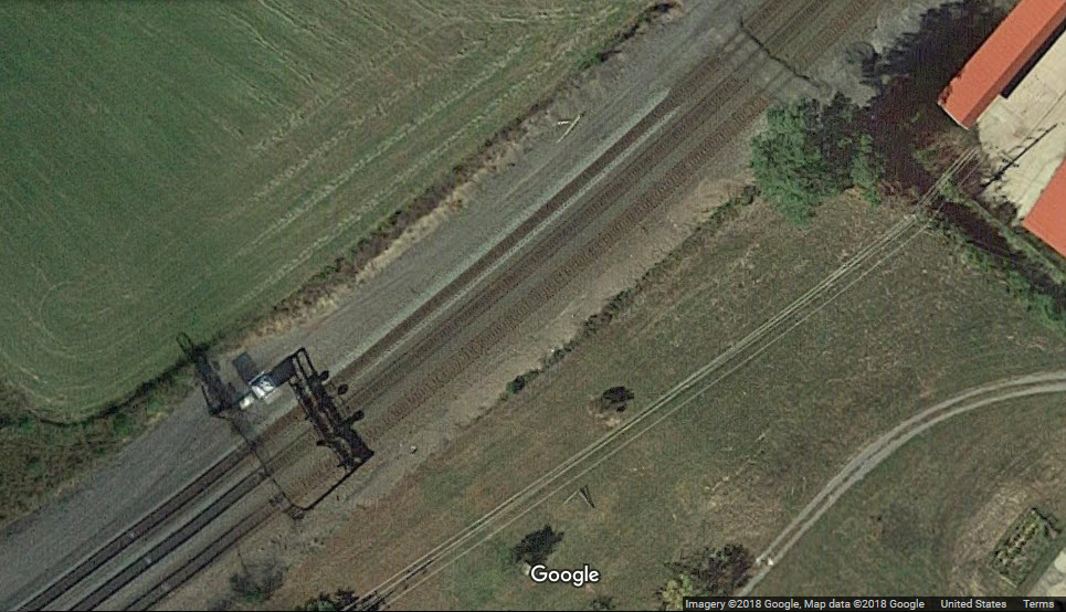
This set of signals is at the very north end of the Altoona Yard Complexes. Four tracks from the yard go down into three for the line up to southern Tyrone,
and there are multiple crossovers. There is also a lead for what used to be the eastern part of the Altoona yard. As of June 2018, both sets of
signals here have had the Pennsy PL signals replaced. Also, both sets of signals are placed on cantilever bridges, the southern set spans three tracks
to give all four tracks a signal.
Southern set
Northern set
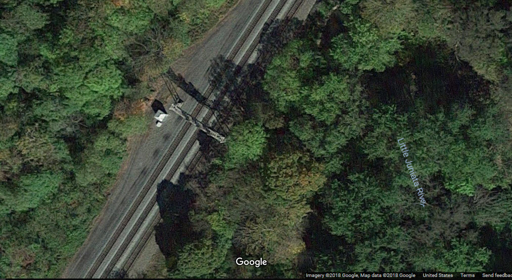
Signals near Bells Ln
GPS Coordinates: 40.588961, -78.343650
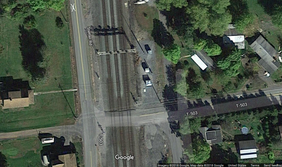
Signals by Stetter Rd and T-503
GPS Coordinates: 40.618674, -78.321952
A set of EB (NB) and WB (SB) signals.
Adjacent to Pacanokski Rd
GPS Coordinates: 40.640507, -78.282721
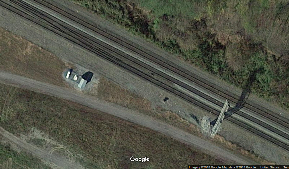
XXX Interlocking
GPS Coordinates: 40.655563, -78.257725
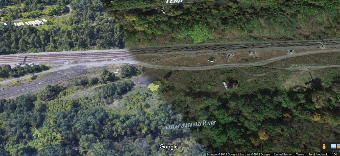
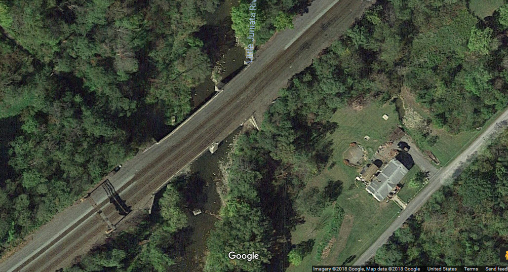
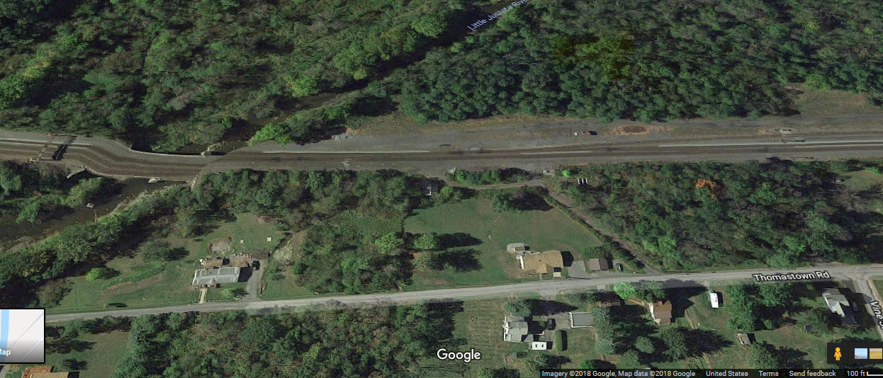
Signal Bridge where the tracks cross the Little Juniata, and we go from three to two tracks for an interlocking, a crossover, and then we balloon back into several
tracks for a small yard. Three mast mounted PL signals are for WB (SB mapwise) traffic. We got 2 tracks on the mainline, and 3 in the yard. The 3
in the yard mix down to one, and "wye" off into Tyrone.

 Accident, unknown date
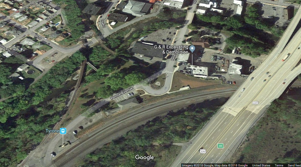
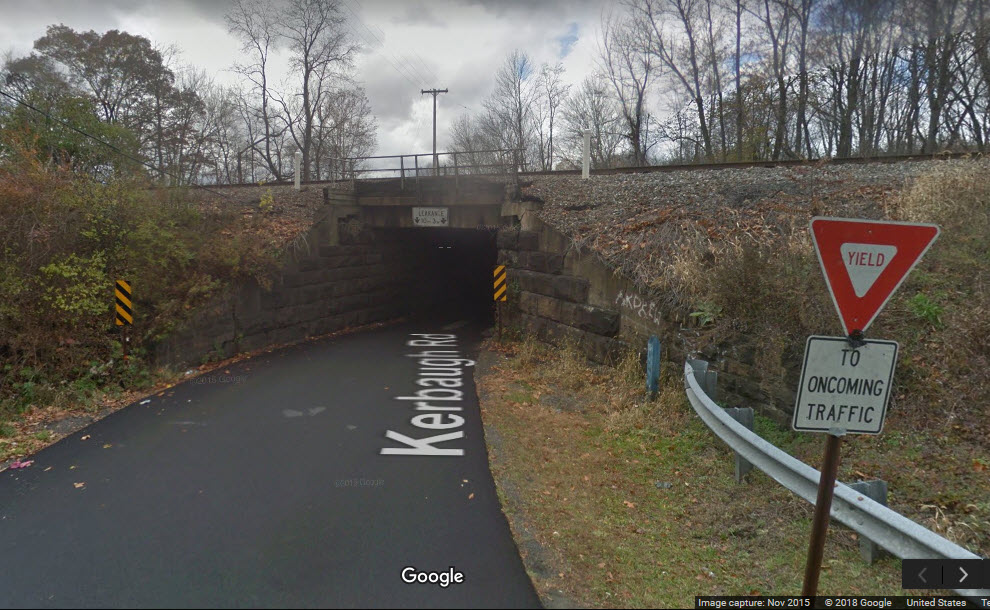
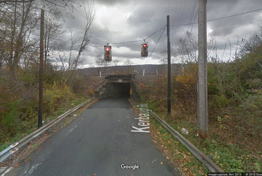
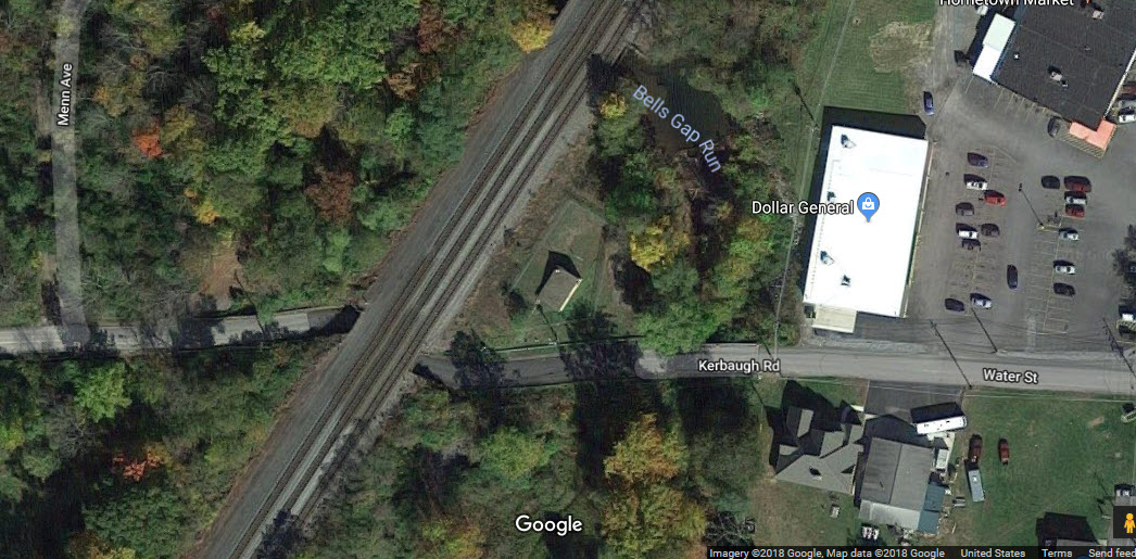
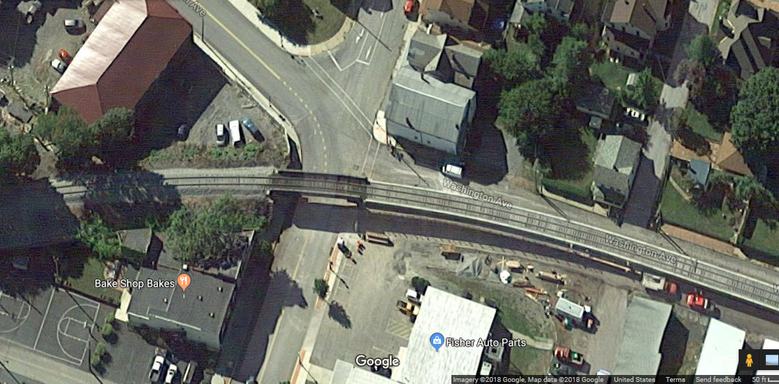
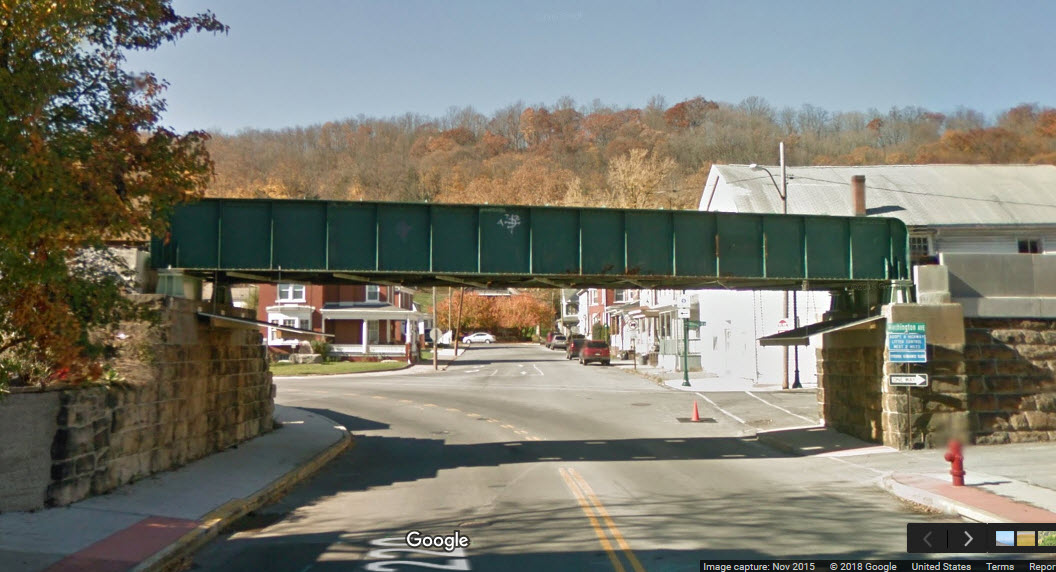
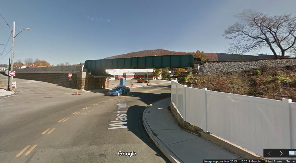
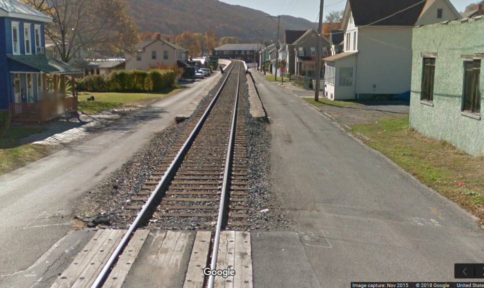
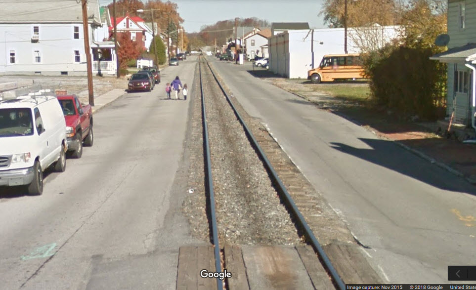
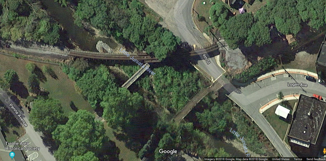
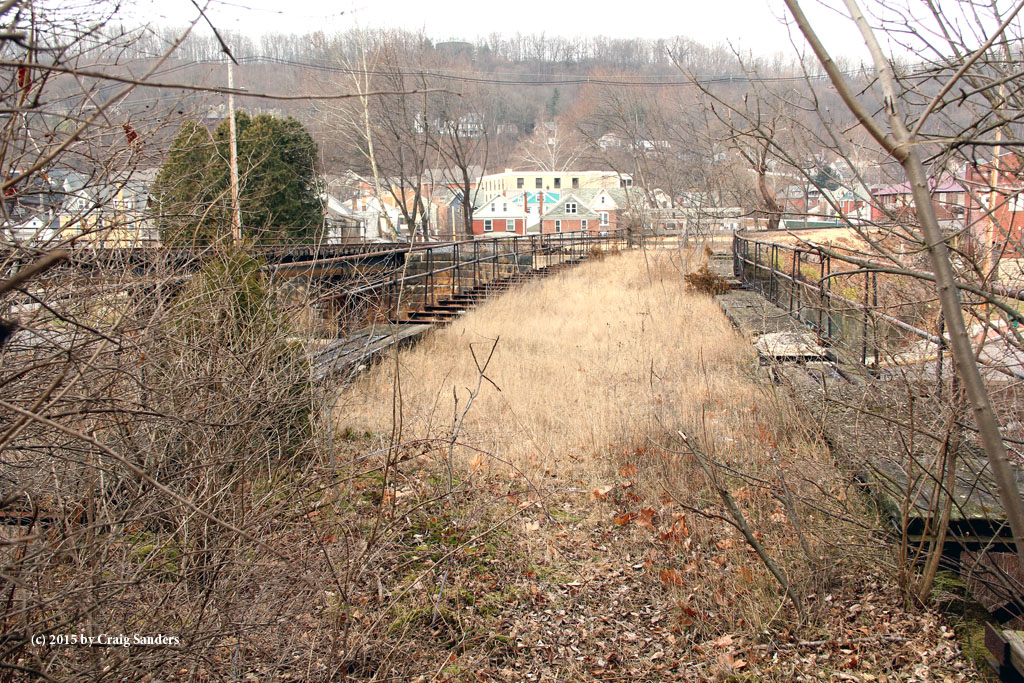 photo by Craig Sanders
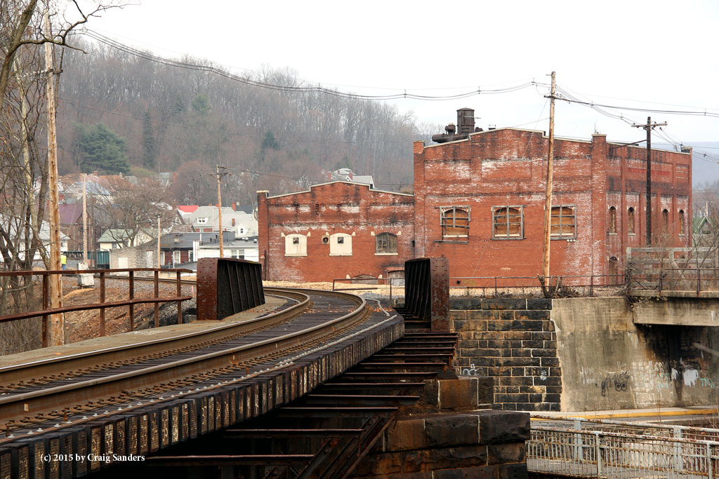 photo by Craig Sanders
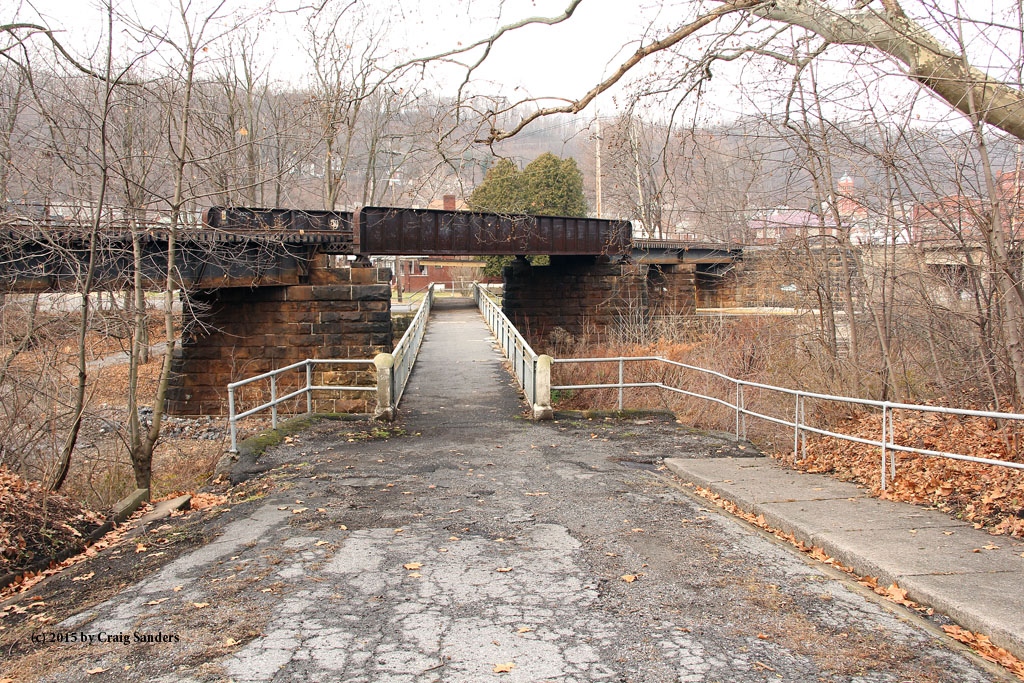 photo by Craig Sanders
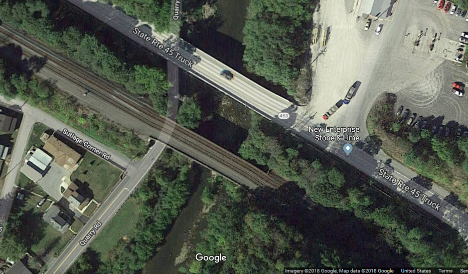
 Southern set
 Northern set