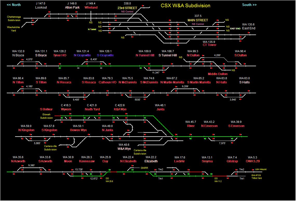
Map
Sights
Other Stuff To See
Signals
Floobydust
RAILFAN GUIDES HOME
RAILROAD SIGNALS HOME
I choose this map first, because it is the part of Atlanta I am most familiar with.
The area contains the main CSX route in and out of Atlanta, the Georgia Northeastern RR, and many other things to see and do. Plan on a day to cover the area fully, especially if you are going to visit Kennesaw.
A page with pictures of many of the surviving Georgia Depots is at: http://www.flickr.com/groups/georgiaonmymind/discuss/72157603756483685/
As always, if anyone has additional info, my contact info is here
MAP 1 - the Atlanta Homepage
MAP 2 - Downtown Atlanta
MAP 3
- NS's Inman yard and CSX's Tilford & Howell Yards - NW of downtown Atlanta
MAP 4 - south of Atlanta
MAP 5 - east of Atlanta
MAP 6 - west of Atlanta
MAP 7 - the Duluth and Norcross area, with the
Southeast Railroad Museum
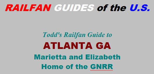
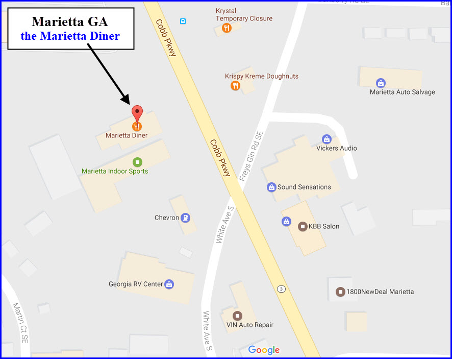
MAP 8 - the Marietta and Elizabeth area - home of the Georgia Northeastern RR
MAP 9 - Guide
to the Georgia Northeastern RR
MAP 10 - the
Kennesaw area & the Southern Museum of Civil War and Locomotive History
the MARTA Metro System
Note: the aerial photos come from www.bing.com/maps... a great resource if you haven't used it for railfanning!!!

Please note, most small side streets not shown for clarity.
For a PDF of this map,
click here
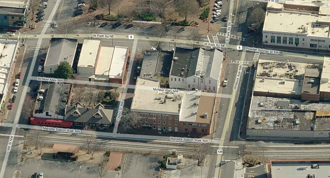
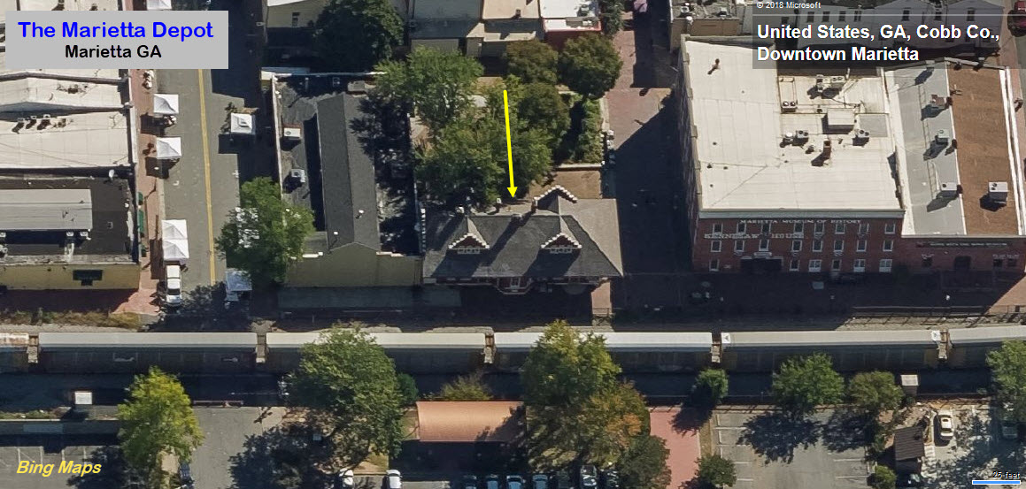
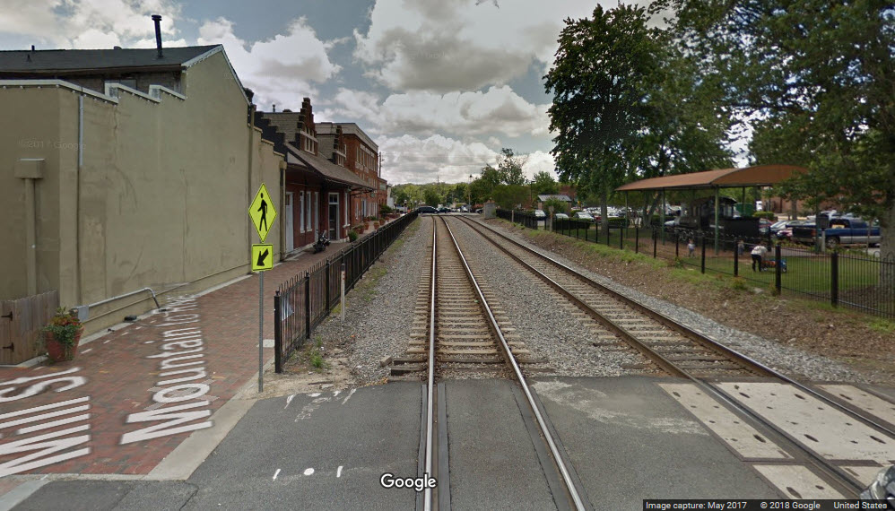
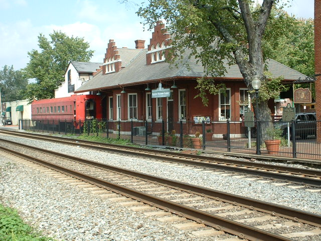
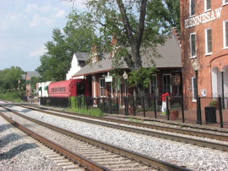
![]() The
Marietta Depot
The
Marietta Depot
GPS Coordinates: 33.952961, -84.550911
Located just off the square, is this an 1898
depot, rebuilt on the original site after Sherman and his men came through on
their way into Atlanta, and burned Marietta to the ground. The track was
originally the Western and Atlantic Railroad. The W&A was acquired by the
Nashville, Chattanooga & St. Louis Railroad in 1890. The Louisville & Nashville
Railroad absorbed the NC&StL in 1957. In 1983, the L&N became part of the
Seaboard system, and in 1987, part of CSX. More
info at:
http://www.waymarking.com/waymarks/WMM89_Marietta_GA_Train_Depot_Welcome_Center
Notice in the more recent aerial shot from Bing and Google Streetview, that they have removed the old passenger car sitting next to the depot.
![]() The
Georgia Northeastern RR
The
Georgia Northeastern RR
GPS Coordinates: 33.975956, -84.557144
This is northern Georgia's gem! If you're in the Atlanta area, you HAVE TO make a trek to Elizabeth and visit. Besides offering the railfan with older generation diesels, they are friendly to boot, and are willing to talk to railfans (as long as you are respectful and ASK first!). I was lucky that my daughter lived only minutes away. Places for good pictures exist all over the place, but go out and check the line to find your favorites.
The GNRR line started out life in 1874 as the
Marietta & North Georgia RR. Tracks to Murphy NC were completed in 1887.
The line eventually wound up as part of the L&N, the Seaboard in 1983, and then
CSX in 1987. CSX sold off the tracks, of which part of it is now operated
by the GNRR.
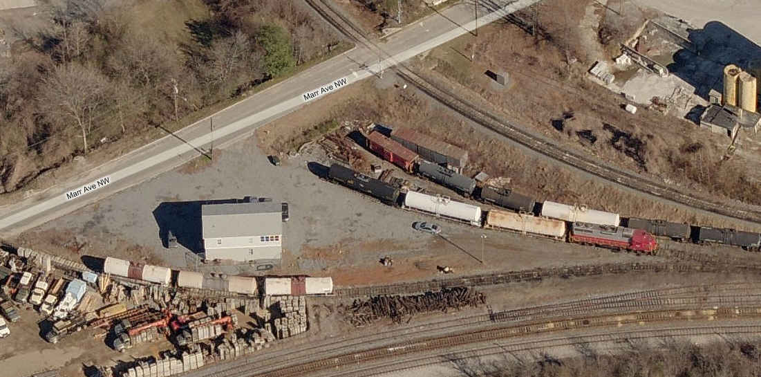
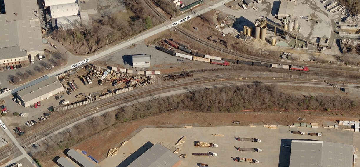
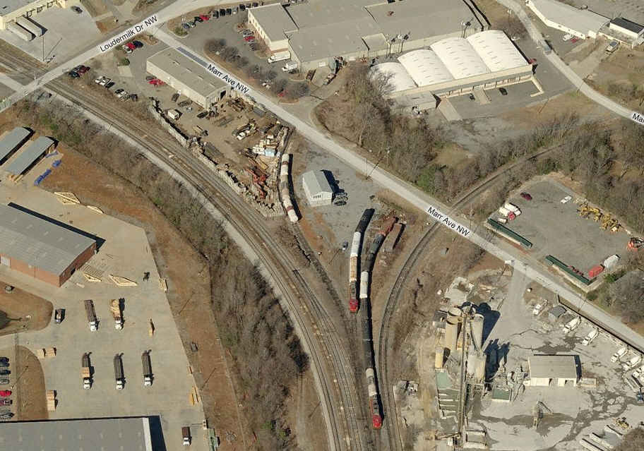
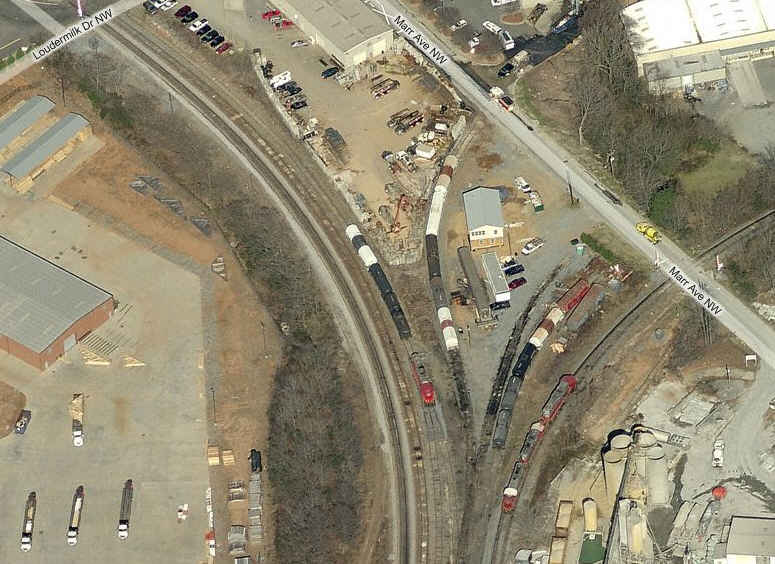
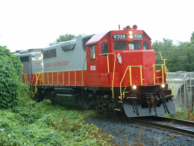 #9708 heads a NB freight out of the yards in 2004 at the Marr
St crossing.
#9708 heads a NB freight out of the yards in 2004 at the Marr
St crossing.

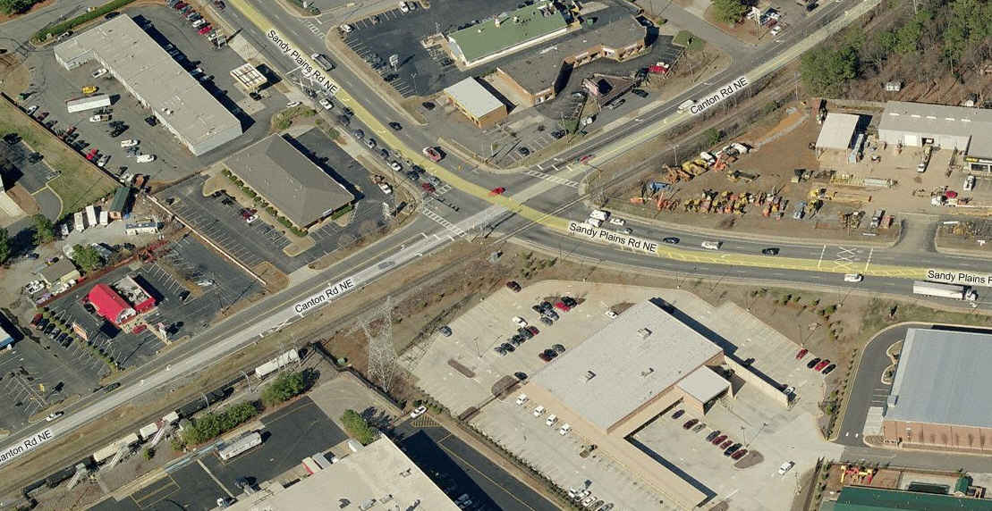 A "big" grade crossing at Sandy Plains Road and Canton.
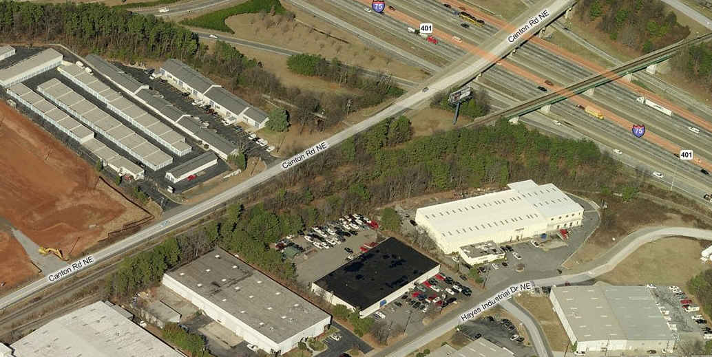
 Canton Road, On the east side of 75 is a siding, which might
make for an interesting shot with a SB passing it.
Canton Road, On the east side of 75 is a siding, which might
make for an interesting shot with a SB passing it.
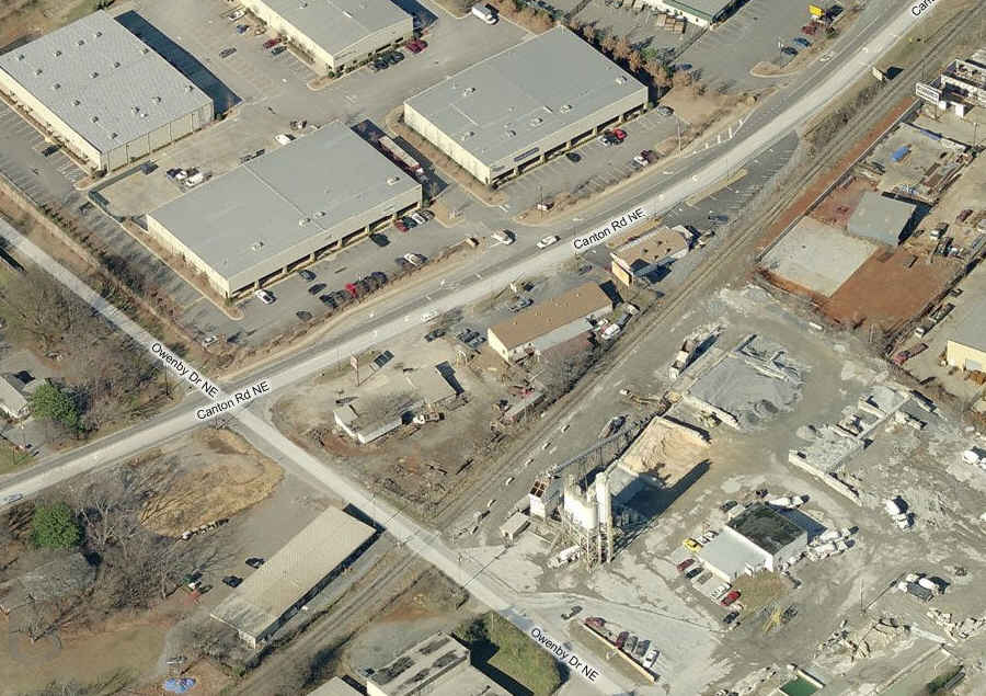 Off Canton Road, at Owenby, east side of 75, is a nice grade
crossing full of industrial type backdrops.
Off Canton Road, at Owenby, east side of 75, is a nice grade
crossing full of industrial type backdrops.
 Here you can catch a SB freight as it crosses I-75.
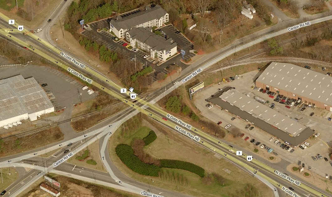 Getting a little closer to the yard, the GNRR crosses Canton
Road, and then goes over Cobb Parkway.
Getting a little closer to the yard, the GNRR crosses Canton
Road, and then goes over Cobb Parkway.
 We are at the Church St crossing, and the eatery with the red
roof, has it's own grade crossing gates to keep you out of trouble leaving the
parking lot so you can't go running across the tracks when a train is coming,
worth the stop just to check it out, and get a great sandwich!
We are at the Church St crossing, and the eatery with the red
roof, has it's own grade crossing gates to keep you out of trouble leaving the
parking lot so you can't go running across the tracks when a train is coming,
worth the stop just to check it out, and get a great sandwich!
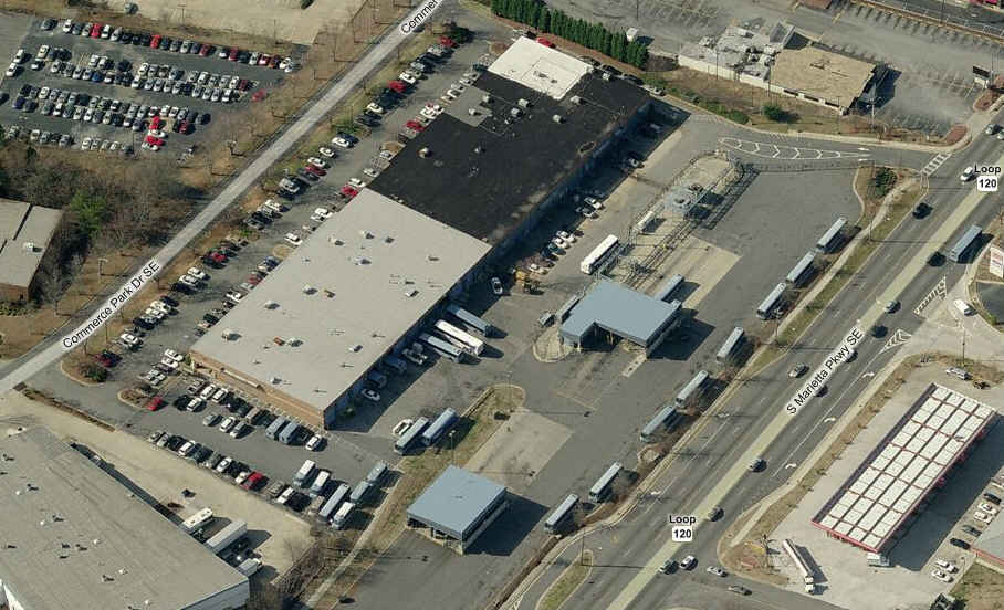
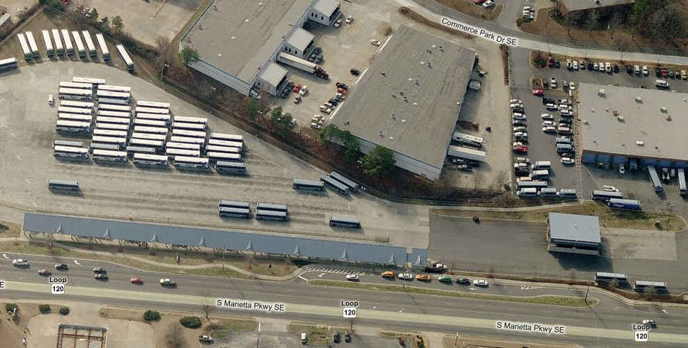
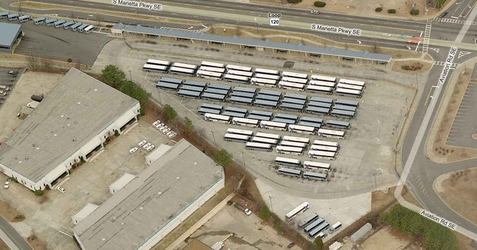
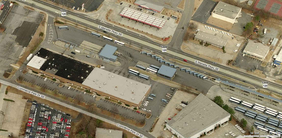
![]() The
Cobb County Transit Transportation Center and Bus Yard
The
Cobb County Transit Transportation Center and Bus Yard
GPS Coordinates: 33.941883, -84.532112
One of the most easily accessible bus yards I've been to, on Marietta Parkway to/from downtown Marietta and I75.
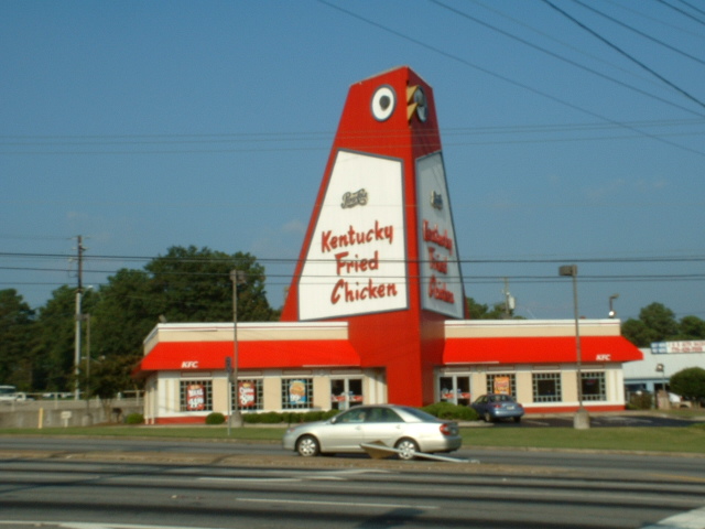
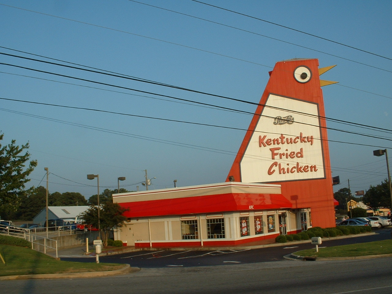
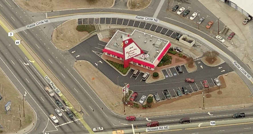
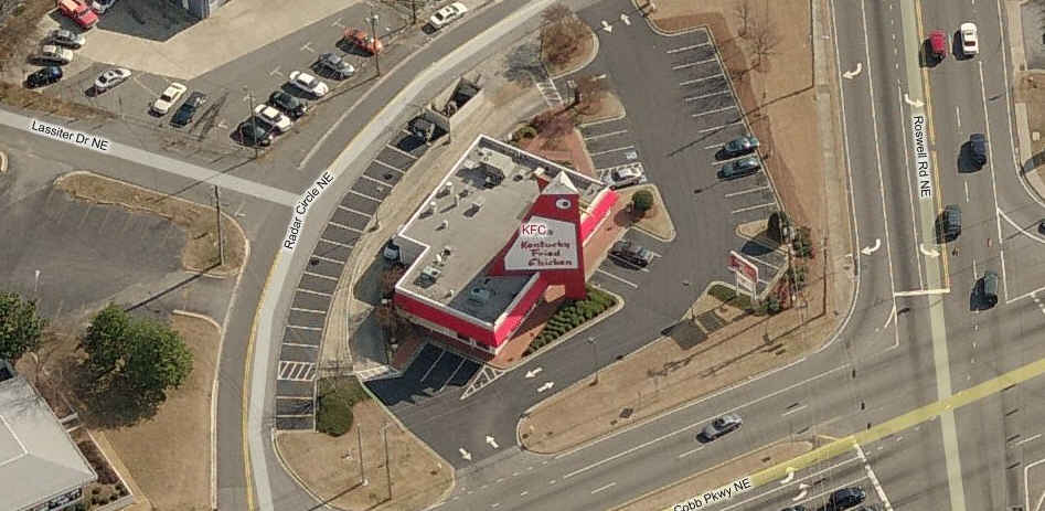
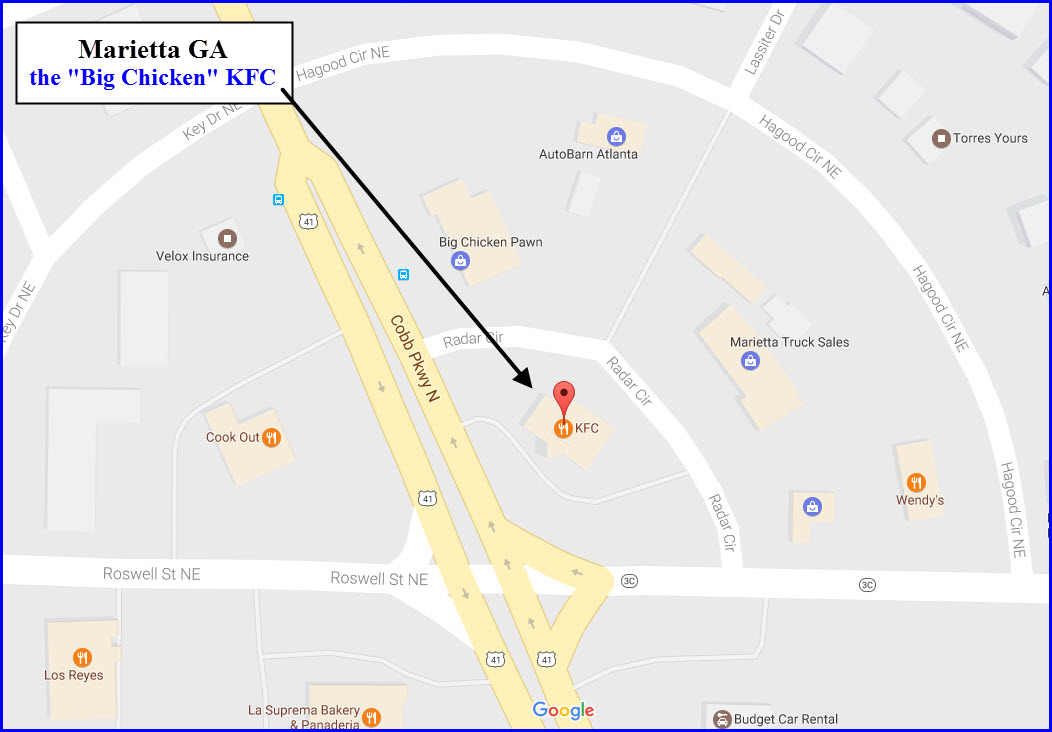
![]() The
Big Chicken
The
Big Chicken
GPS Coordinates: 33.951447, -84.520370
You can't honestly tell me you have never
heard of the "Big Chicken"? That's OK, I never did either until
my daughter moved to Marietta! :-) :-) The original diner on this spot was built in
1956. When he sold it to his brother, and his brother made it part of the
KFC family in 1963, he had this terrific landmark made by a local metal
manufacturer. It is 56 feet tall. We nearly lost it in 1993, when a
small tornado came along, and they were going to tear it down, but because of
public outcry, they rebuilt it using most of the original parts, including the
beak and eyes (which are animated). Most locals will use it as a landmark
to tell you how to get somewhere, or to meet at. For more info, check out
(a Google search will turn up much, much more):
http://en.wikipedia.org/wiki/Big_Chicken
http://roadsidegeorgia.com/site/bigchicken.html
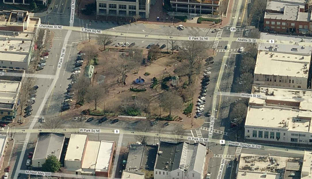
![]() The
Marietta Square
The
Marietta Square
The Antebellum Marietta Square is a nice, peaceful place to rest and grab something to eat. If you are travelling with your wife or girlfriend, you can leave her in good hands with the many antique stores on the square, then join her with something tasty for lunch! You may want to join her tho while going thru the antique store on the the south side of Whitlock, on the SE corner of the square, for I have been thru there many a time with my daughter, and found interesting railroad what-nots to buy... the same goes for one on the corner of Whitlock and W Park Square NE, besides clocks and watches, they might have something of interest for "us".
The visitors center in the depot offers a Marietta Heritage Passport, which gives you 3 admissions for the price of 2.
More info at (altho there is precious little
anywhere on the site about the depot):
http://www.mariettasquare.com/
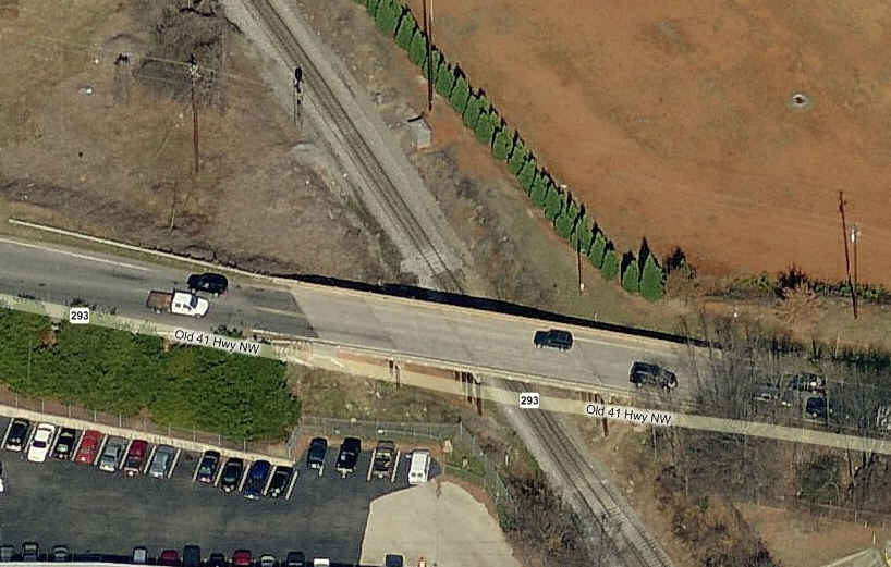
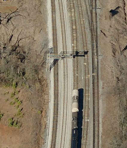
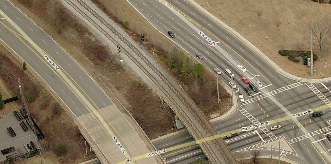
![]() Just north of the old Hwy 41 overpass.
Just north of the old Hwy 41 overpass.
This signal is the south approach to the Elizabeth Yard, controlled from the N. Elizabeth (WA 22.4) control point. There are matching north approach signals
on the other size of the Elizabeth switch (one for the CSX main, the other for the Elizabeth Yard itself).
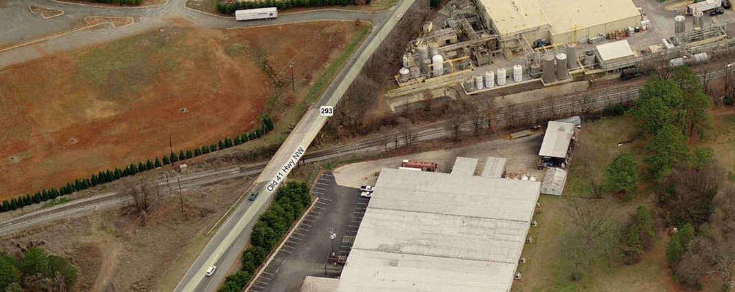
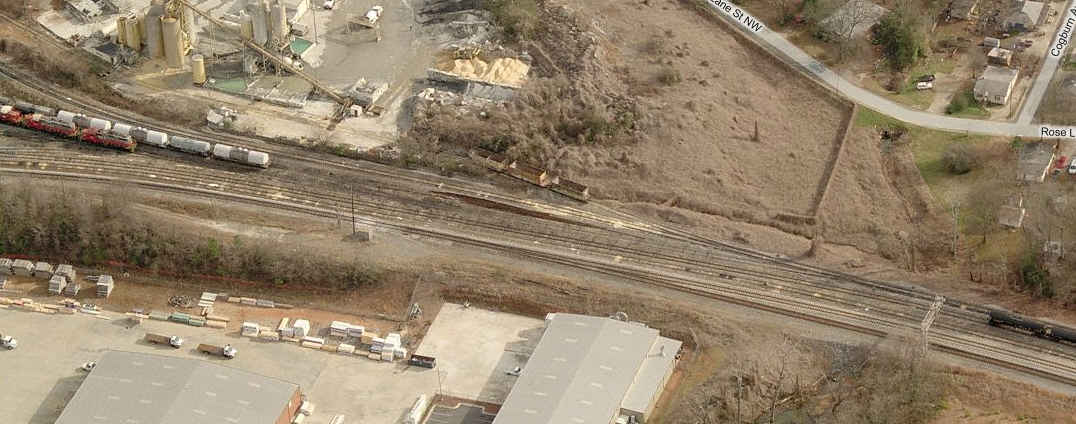
![]() In the middle of the Elizabeth Yard
In the middle of the Elizabeth Yard
This signal is the south approach to the Elizabeth control point (WA 22.2), where the CSX mainline splits into two (Trk1 and Trk2). Signal 1c (below) is the companion northbound signals for the
two mainline tracks - no easy access - part of 2 to 1 interlocking.
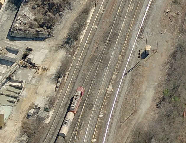
![]() Also in the middle of the Elizabeth Yard
Also in the middle of the Elizabeth Yard
No easy access - part of the above 2 to 1 interlocking.
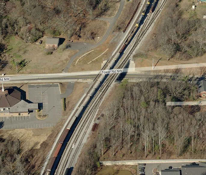
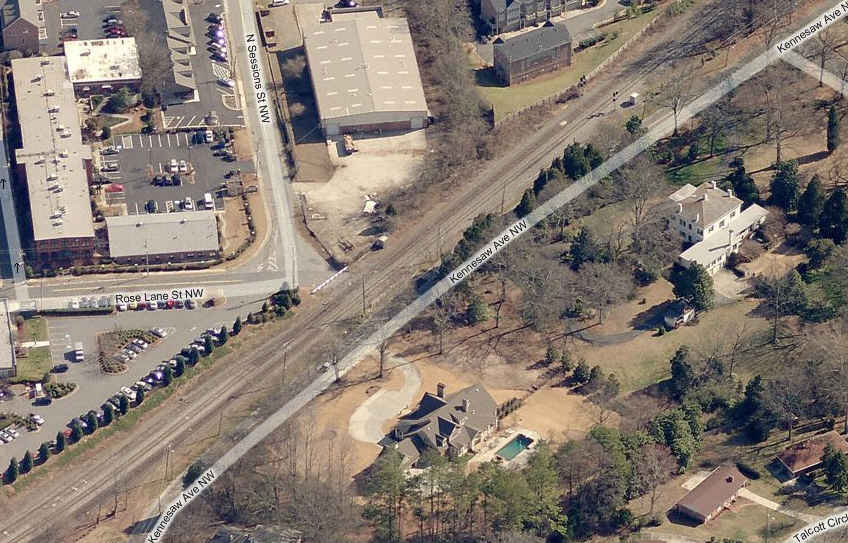
![]() Along Kennesaw Ave NW - north of downtown Marietta
Along Kennesaw Ave NW - north of downtown Marietta
Signal 2 is an approach signal into the Marietta block area; this actually is an approach signal to the interlocking at Lockheed on the other side of town. Note in the aerial picture, you can see the
closed Roselane Rd crossing (excellent spot for photos), and the very very end of the L&N Hook 'n' Eye mainline, which is the switch just north of Roselane Rd. That marks the very
southernmost point of the GNRR trackage. South of the Elizabeth Yard is the Tower Road underpass, and good pictures can be had here of passing CSX freights.
![]() Just north of S Cobb Street SE - south side of downtown Marietta
Just north of S Cobb Street SE - south side of downtown Marietta
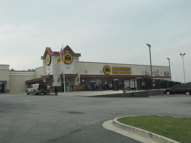
The is also a huge antique mall next door to the Northern Tools store.
If you're into Pawn Shops, the area is littered with them all over the place, but there are 4 or 5 of them on Cobb Parkway around the food places on the right side of the map... years ago, when the digital camera mania was setting in, I picked up the last film type Canon Rebel for 50 bucks!
Also, not too far away from downtown Marietta, is the 2888 acre Kennesaw Mountain National Battlefield Park. Located at 900 Kennesaw Mountain Drive, this is where Confederate forces held up the Sherman's Union advancement into Atlanta in June of 1864.
The Marietta Fire Museum is at 112 Haynes St. 770-794-5491 http://www.mariettaga.gov/departments/emergency/fire/museum.aspx
Into model railroad layouts, check out this website (keep your sound level down!): http://www.northgeorgiarailroad.com/
And also of model trains, there is usually a model train show at the Cobb County Civic Center in the March timeframe.
A nice Marietta reference is at:
http://en.wikipedia.org/wiki/Marietta,_Georgia Disclaimers: I love trains, and I love signals. I am not an
expert. I do these pages because I love spending my time doing them -
although I do a reasonable amount of research to make sure the information
presented is accurate! :-) :-) Please Note: Since the main focus of my two websites is railroad signals, the railfan guides
are oriented towards the signal fan being able to locate them. For those
of you into the modeling aspect of our hobby, my
indexa page has a list of
almost everything railroad oriented I can think of to provide you with at least a few pictures to
help you detail your pike. If this is a railfan page, every effort has
been made to make sure that the information contained on this map and in this
railfan guide is correct. Once in a while, an error may creep in,
oooooooops, oh well! :-)
My philosophy: Pictures and maps are worth a
thousand words, especially for railfanning. Text descriptions only
get you so far, especially if you get lost or disoriented. Take
along good maps.... a GPS is OK to get somewhere, but maps are still
better if you get lost! I belong to AAA, which allows you to get
local maps for free when you visit the local branches. ADC puts
out a nice series of county maps for the Washington DC area, but their
state maps do not have the railroads on them. If you can find em,
I like the National Geographic map book of the U.S..... good, clear, and
concise graphics, and they do a really good job of showing you where
tourist type attractions are, although they too lack the railroads.
Other notes about specific areas will show up on that page if known. Beware: If used as a source, ANYTHING from Wikipedia must be treated as
being possibly being inaccurate, wrong, or not true.
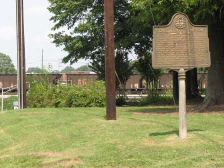
There is also a Confederate Cemetery, off Powder Mills Rd, south of where it ends at South Marietta Pkwy.
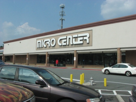
A Micro-Center store is on Powers Ferry Rd, just north of Terrell Mill Rd. Take the Delk Rd exit off of 75, head east, then a right onto Powers Ferry Rd. The Home Depot worldwide HQ is also
located on Powers Ferry Rd, near where it crosses the Perimeter.
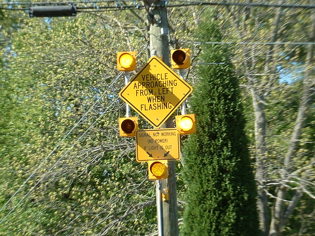
Look for this sign heading west out of Marietta on Whitlock... pretty unusual.
BTW, floobydust is
a term I picked up 30-40 years ago from a National Semiconductor data
book, and means miscellaneous and/or other stuff.
Pictures and additional information is always needed if anyone feels
inclined to take 'em, send 'em, and share 'em, or if you have
something to add or correct.... credit is always given! BE NICE!!! Contact info
is here
NEW 5-30-2010
Last
Modified 05-Aug-2018