Stations without an aerial picture do not have any discernable features
from the air (mostly because they are underground).
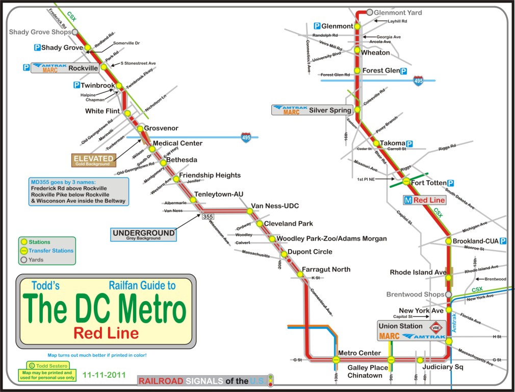
The Red Line features three yards, two of which have maintenance facilities:
One at both ends (Shady Grove and Glenmont), and one roughly in the middle
(Brentwood) just north of Union Station and New York Avenue.
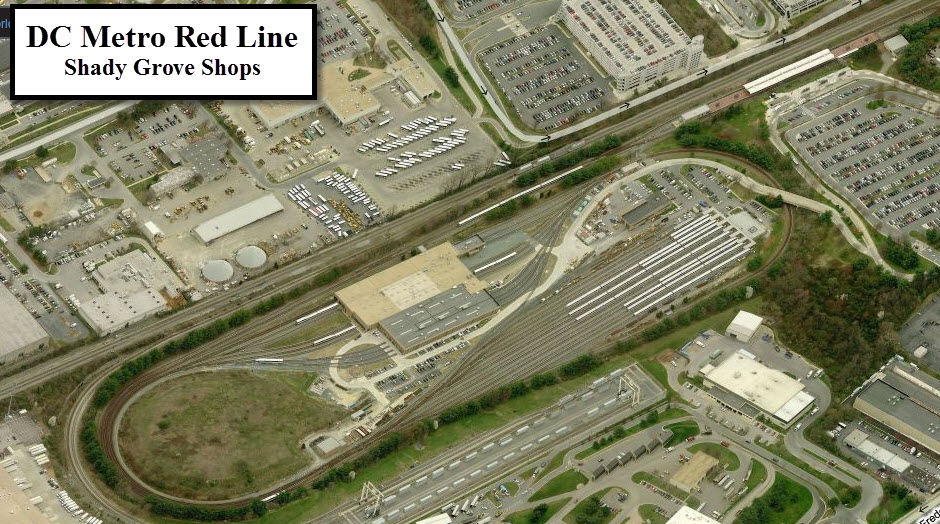
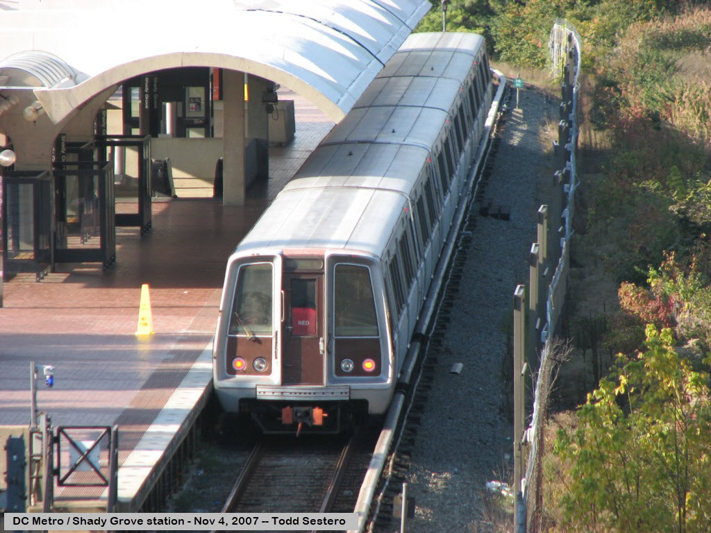
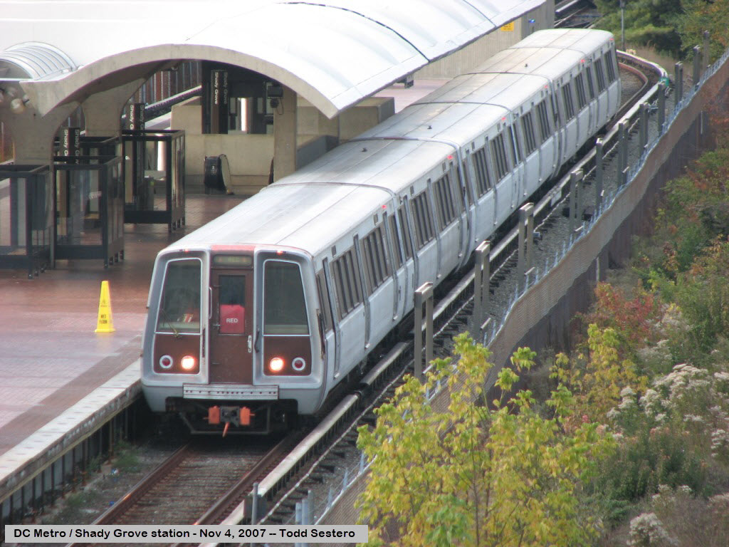
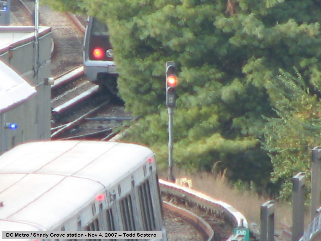
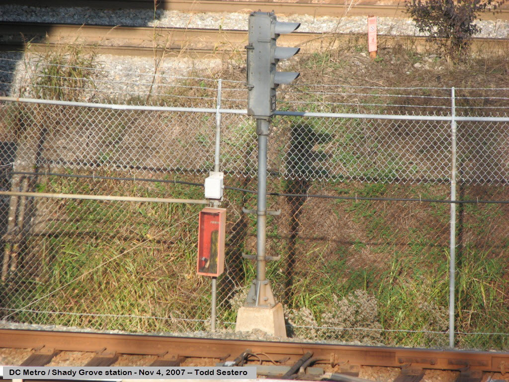
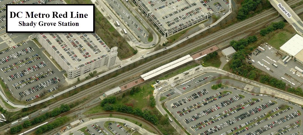
the Shady Grove Shops
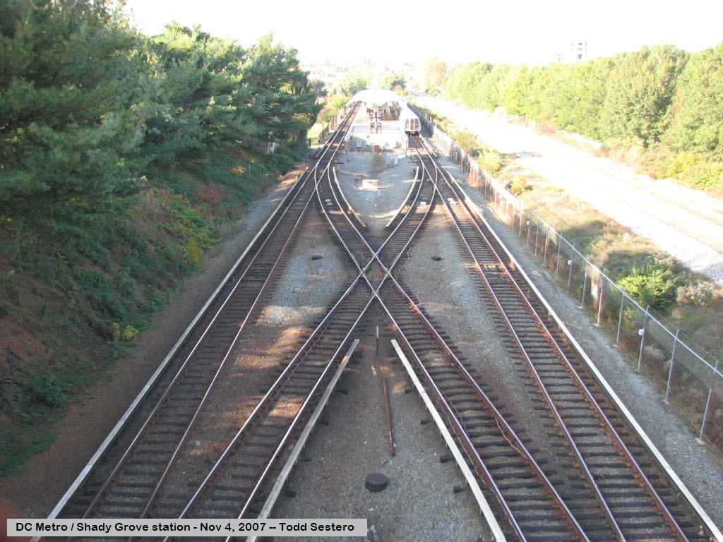
Shady Grove
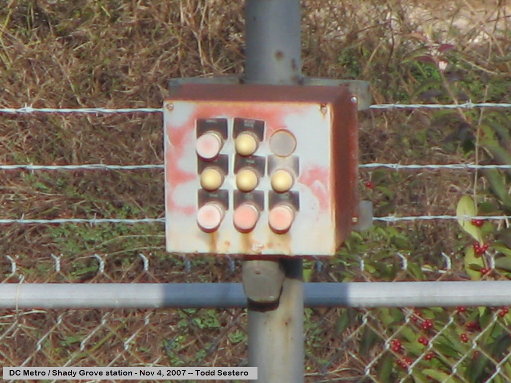
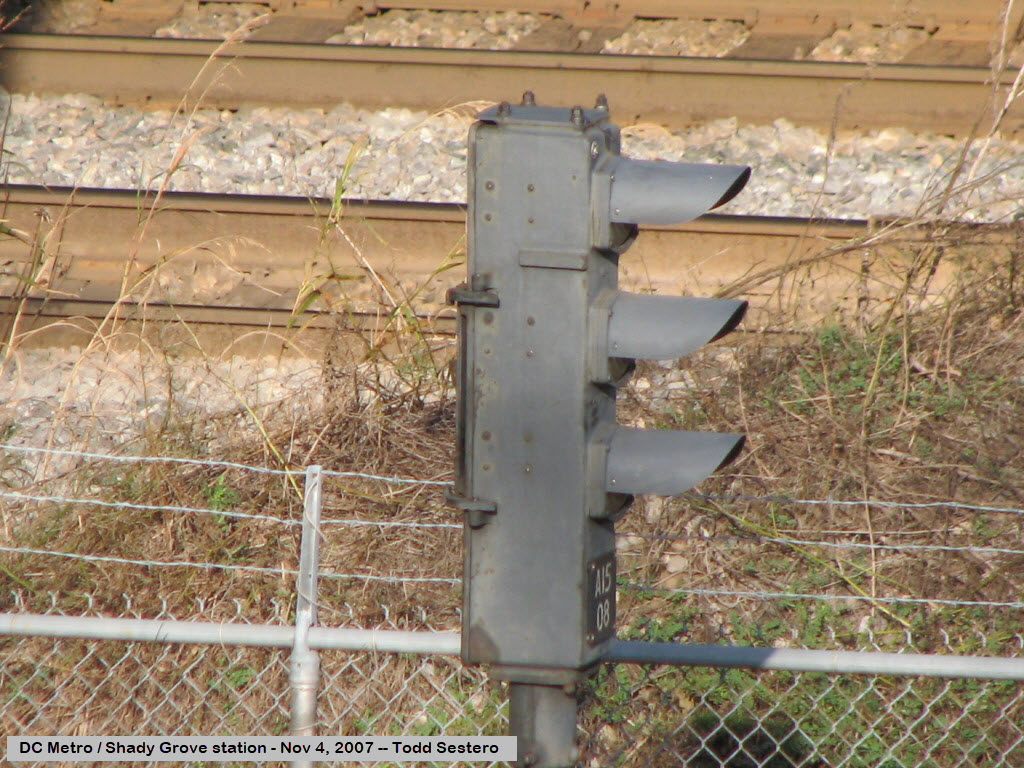
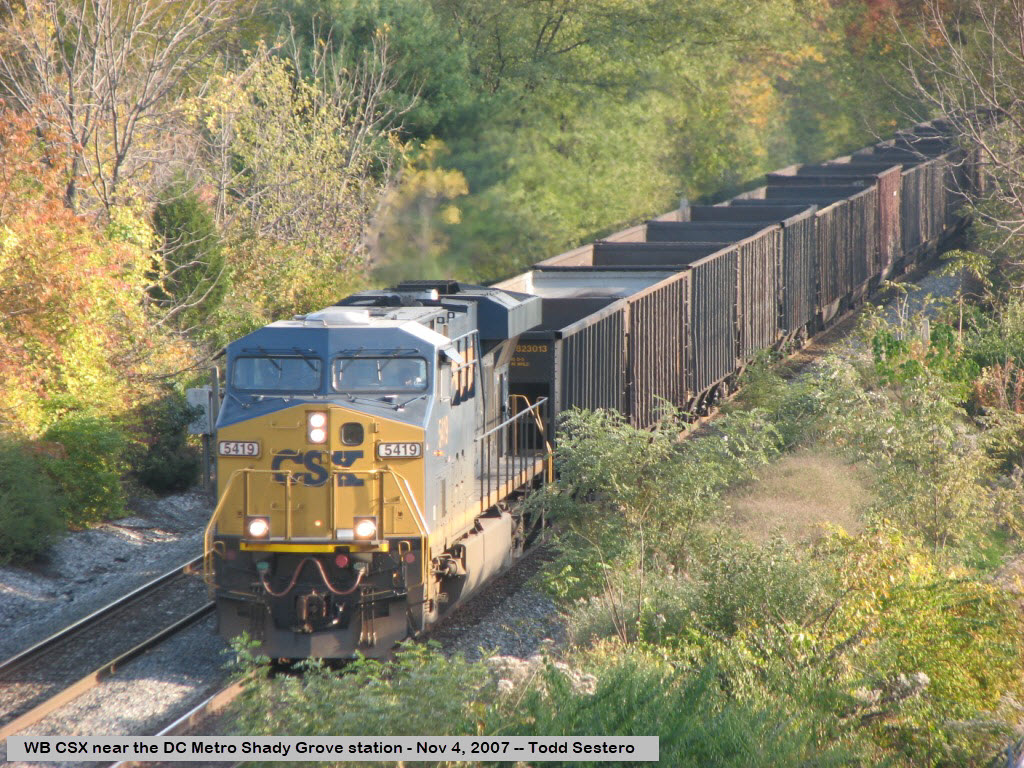
Pictures from the Shady Grove station at the end of the Red
Line on train show day at Gaithersburg, 11-04-2007. CSX runs right next to
the Metro, this one is on it's way west to Hagerstown and Cumberland.
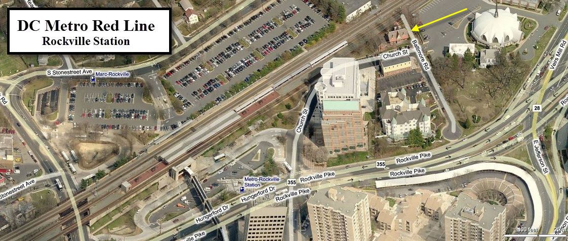
Rockville
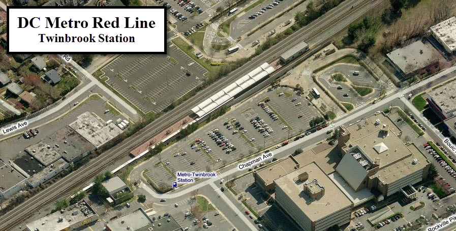
Twinbrook
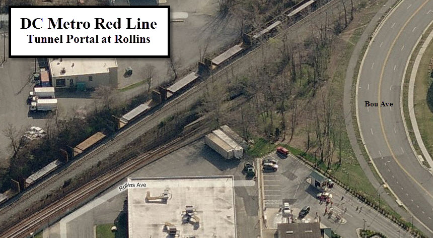
Going Under
The Metro goes underground at the end of Rollins Ave and Bou Ave,
off the intersection of Bou with Chapman Ave.
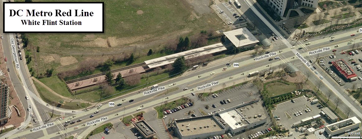
White Flint
The Red Line is exposed just enough to show off the White Flint station!
White Flint Mall is about a quarter of a mile south of the station.
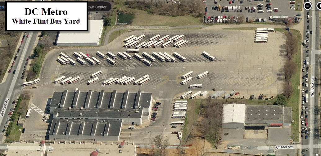
White Flint Bus Yard
A block or two up Marinelli from the White Flint station is one of DC Metro's many bus yards.
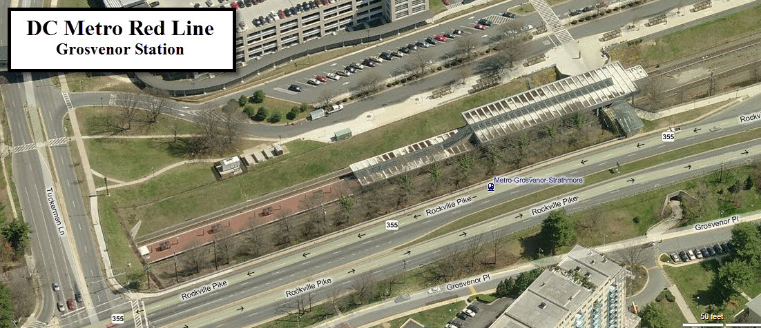
Grosvenor
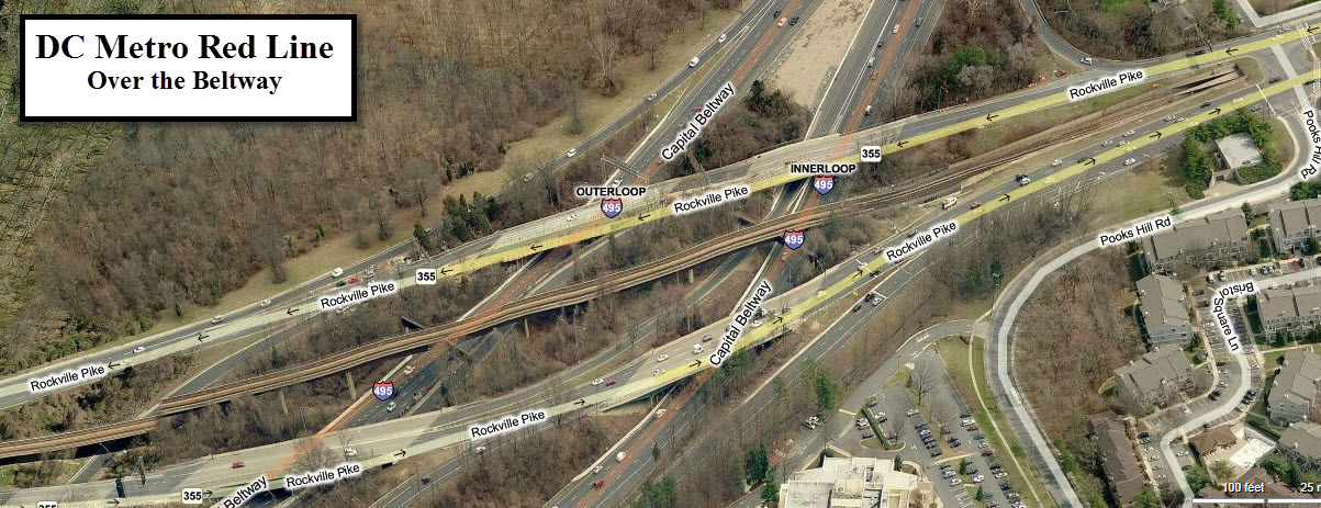
Over the Beltway and back Underground
On the "inside" of the Beltway, Rockville Pike, MD355,
becomes Wisconsin Ave, and the Red Line follows it underground. Among
other "things", Bethesda is home to the Discovery Network.
The following stations denoted with "--" are underground:
-- Medical Center
The station is between Wilson Dr and South Drive/S Wood Rd.
On the east side of Wisconsin Ave, you have the National Naval Medical
Center.... on the west side, the National Institute of Health.
-- Bethesda
The station is between Montgomery Ave/Lane and East-West Hwy/Old Georgetown Rd.
Among other "things", Bethesda is home to the Discovery Network. Check out
the aerial views on www.bing.com/maps, as
they have some interesting looking buildings!
-- Friendship Heights
The station is between Jennifer St NW and Western Ave on Wisconsin Ave.
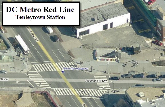
-- Tenleytown AU
The station is at Albemarle St. From here, the tracks leave
Wisconsin Ave and heads over to Connecticut Ave.
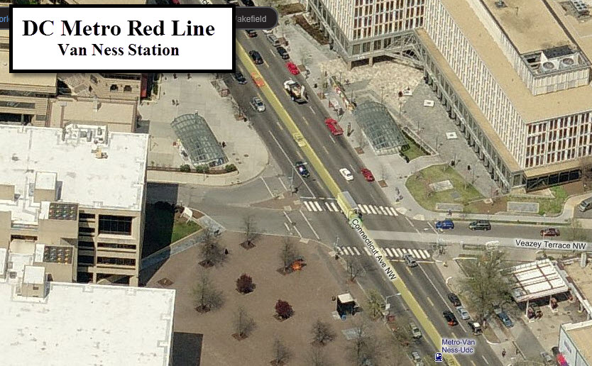
-- Van Ness UDC
The station is on the north side of the intersection with Veazey Terrace NW.
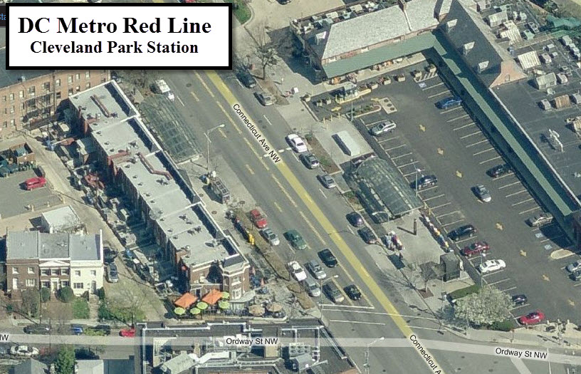
-- Cleveland Park
The station is on Connecticut Ave between Ordway St NW and Porter St NW.
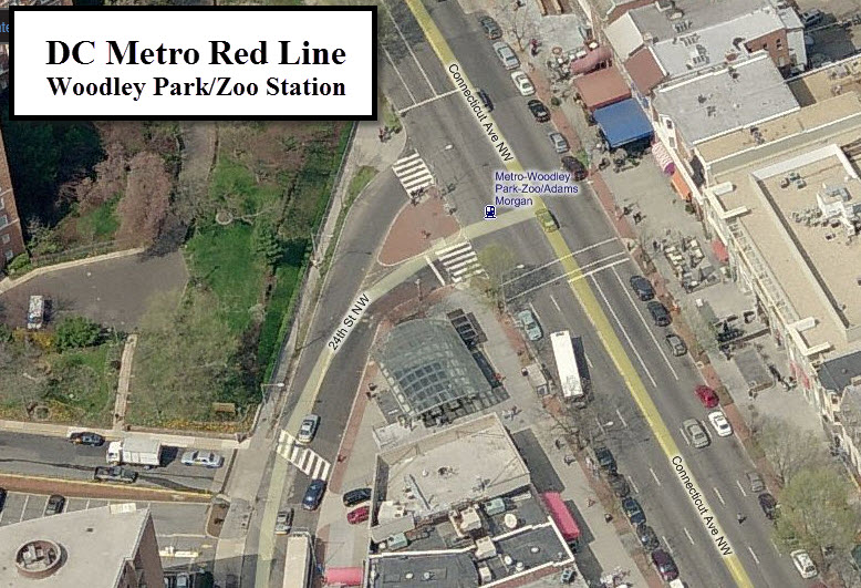
-- Woodley Park/Zoo-Adams Morgan
The station is on Connecticut Ave between Woodley Rd NW and Calvert St NW.
The National Zoo is NE of the station.
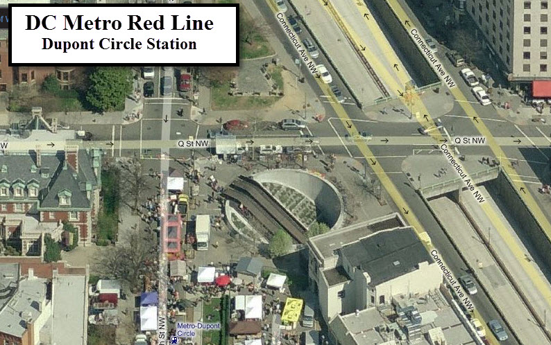
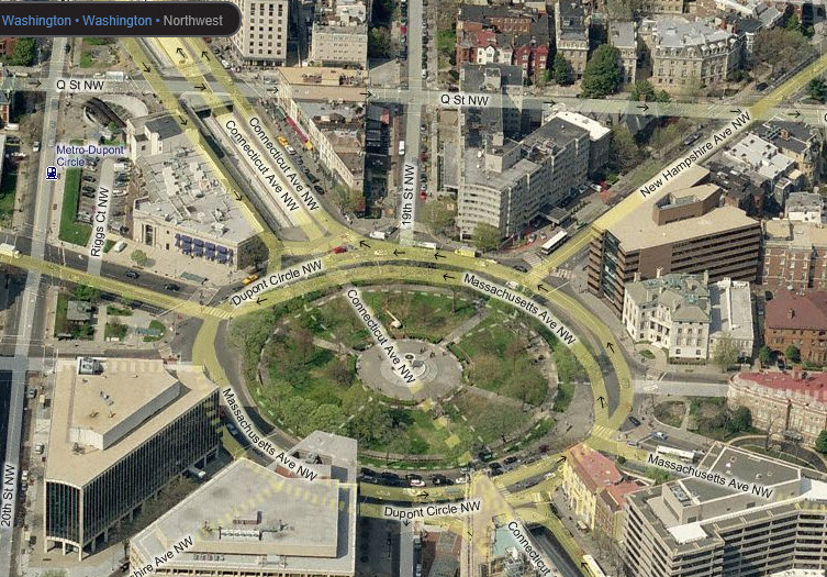
-- Dupont Circle
The station is between Q Street NW and Massachusetts Ave NW.
Dupont Circle is pretty cool in that Connecticut Ave station goes underneath the circle.
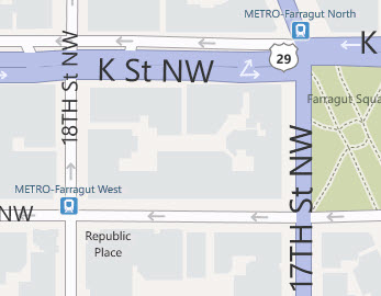
-- Farragut North
The station is on the north side of the
intersection with Connecticut and K Street NW, and is the last (or first
depending on the direction you're travelling) on Connecticut Ave.
The Red Line crosses the Blue/Orange Line one block south
of here at I Street NW, but does not connect to the two lines until Metro
Center. Farragut West on the Bl/Or Line is a block away.
From here, the line cuts across the north side of Lafayette
Park to wind up going east/west on F street NW
-- Metro Center
The station is at the intersection of F St NW and 13th St NW.
Metro Center is a transfer point between the Red Line and the Blue/Orange Lines.
-- Gallery Place/Chinatown
The station is a transfer point to the Green and Yellow Lines,
and the entrance is up on H St by 7th St NW because it is shared
with the other two lines.
-- Judiciary Square
The station is between 4th and 5th Streets NW on F St NW.
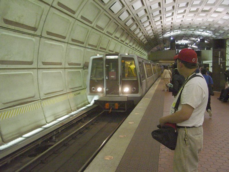
-- Union Station
The station is under the west side of Union
Station, and is where the tracks once again come above ground north of here.
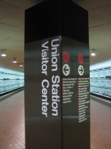
Interesting note: the station used to be called the
Union Station Visitor Center, but was renamed
to its current named when the National Visitors Center
failed. They haven't changed all of the references to the old name.
Union Station is the busiest station in the Metro system.
These two pictures of Union Station come from Wikipedia's page for the station.
New York Ave
The station is located just south of New York Ave at Florida Ave.
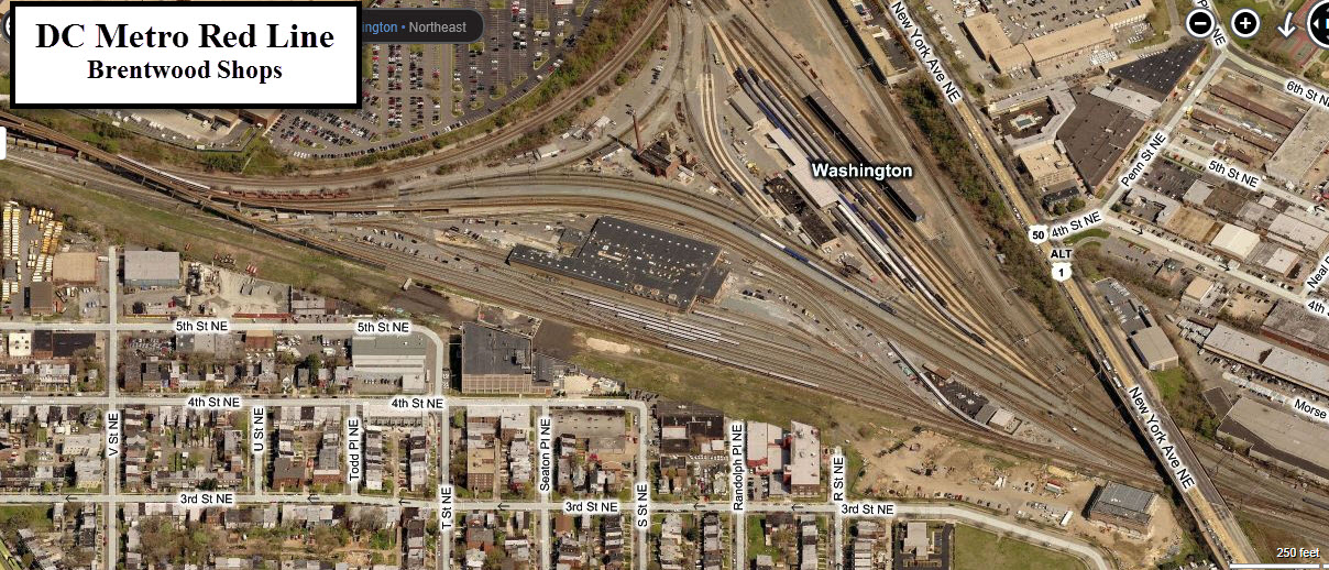
Brentwood Shops
The shops service the Red and Green Lines, and is located
on part of what used to be the Washington Terminal's coach yard.
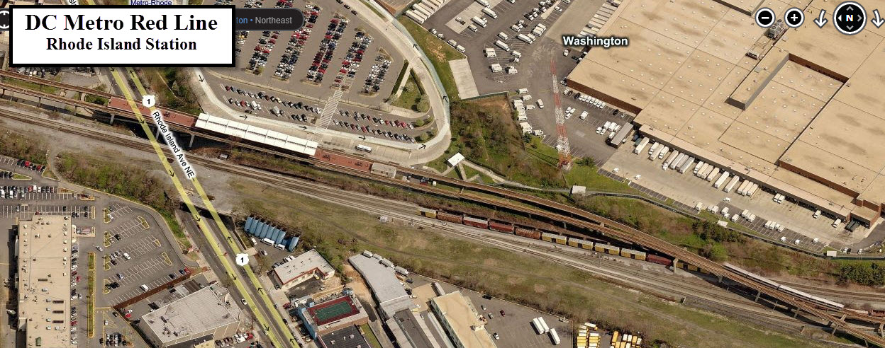
Rhode Island
The station on the south side of Rhode Island Ave NE.
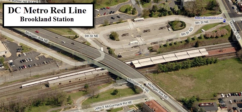
Brookland CUA
The station is underneath Michigan Ave NE and Monroe St NE.
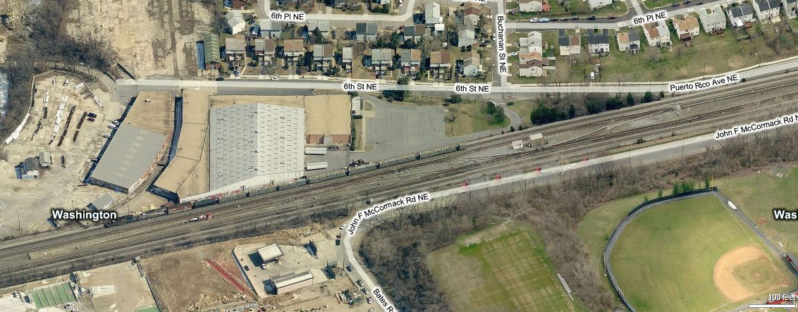
Crossovers
Between Brookland and Ft Totten is an elaborate set
of crossovers so that trains can interchange between the Red Line and the Green
Line - the tunnel portal to the Green Line can be seen to the left of the
picture. This is done so the Green Line trains can use the Brentwood shops.
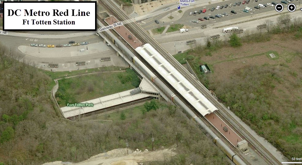
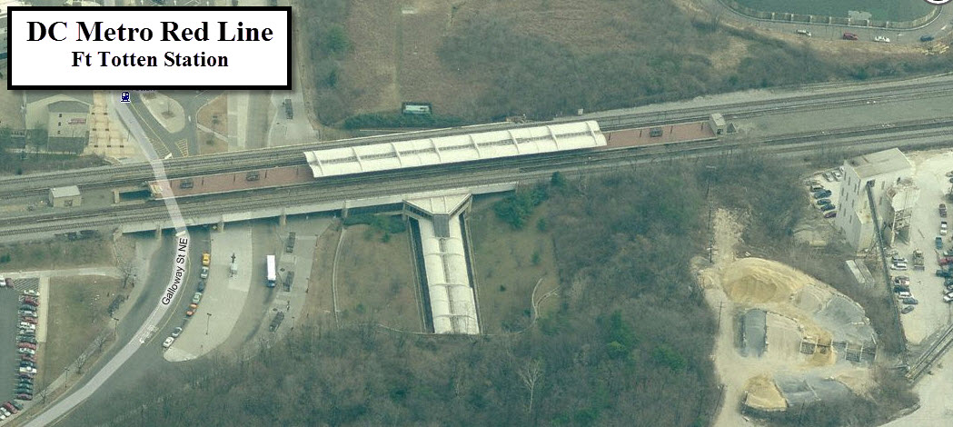
Fort Totten
The station is on the south side of Galloway St NE,
and is a transfer point to the Green Line.
Notice that the Green Line is exposed for the length of the station.
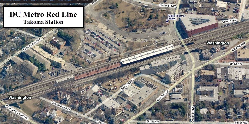
Takoma
The station is between Cedar St NW and Piney Branch Rd NW.
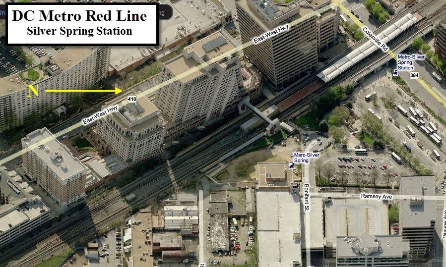
Silver Spring
The station is above Colesville Road, RT 29. The MARC Silver Spring station is also here.
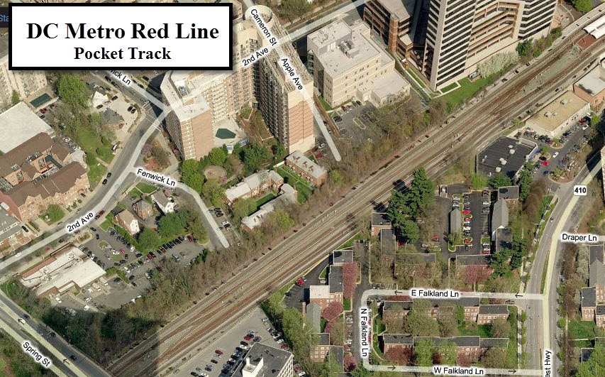
Pocket Track
Just north of the Silver Spring station is this pocket track.
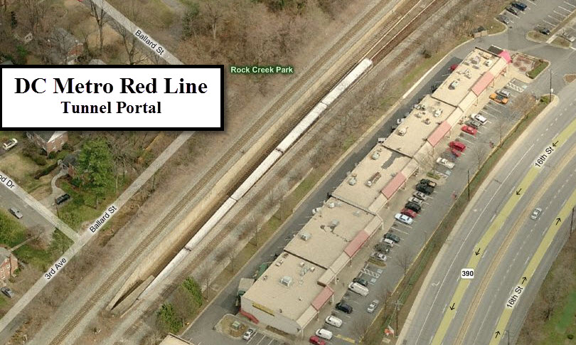
Tunnel Portal
The Red Line once again goes underground at this point, to
travel the remainder of the way north to the end underground. It aligns itself
with Georgia Ave once it leaves the CSX Brunswick Line.
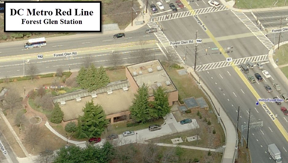
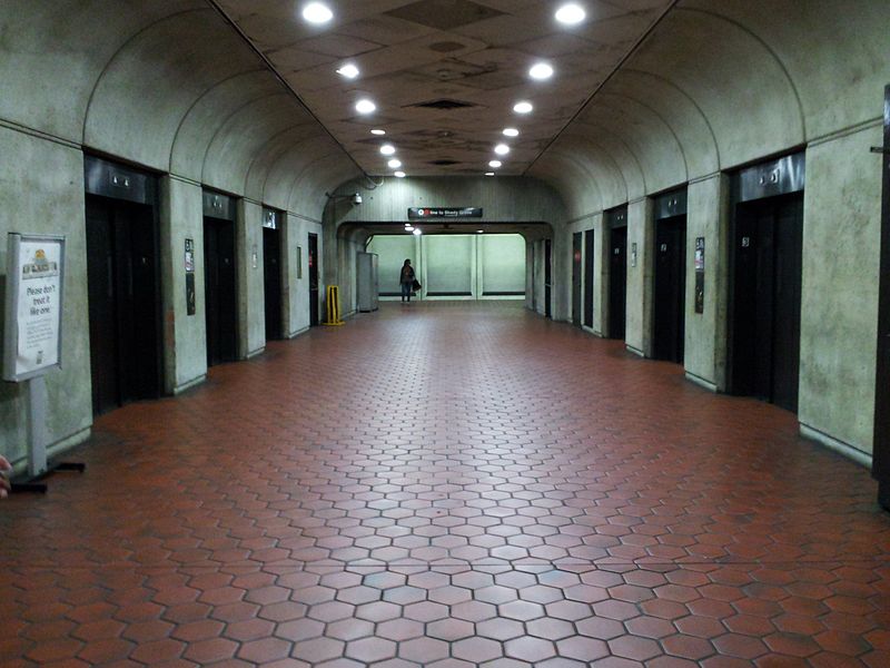
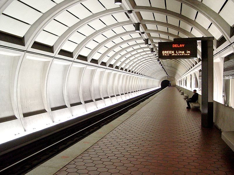
-- Forest Glen
The station is on the SW corner of Georgia Ave (MD 97) and Forest
Glen Rd (MD 192), and is the first station on the west side of the system that is
on the outside of the Beltway. Forest Glen is the deepest of the underground stations at
196 feet. It also has no escalator service due to it's depth, instead, it
is serviced by six elevators, with an stairway for emergency back-up.
Wheaton and Forest Glen also share a distinction from the
other underground stations of the Metro system, in that each track has it's own
tunnel and platform. This is similar to many of London Underground's Tube
stations design. The design was cost driven.
These two pictures for the Forest Glen station came from Wikipedia's page for the station.
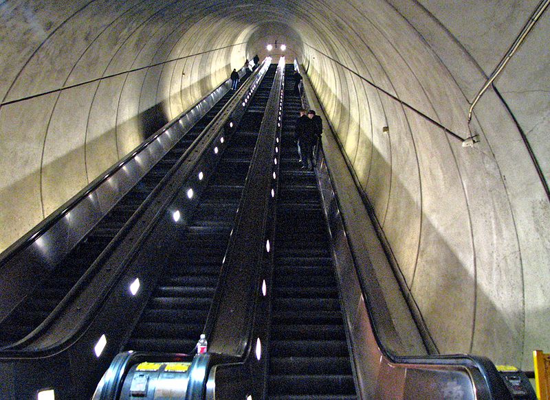
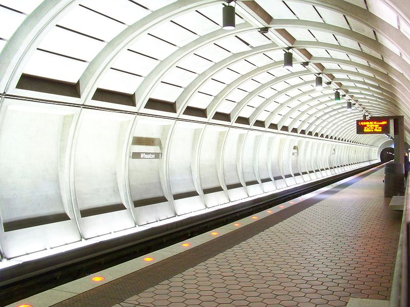
-- Wheaton
The station is in the triangle of Georgia Ave, Veirs Mill Rd, and Reedie Dr.
Wheaton has the honor of having the longest single span
escalators in the Western Hemisphere, according to Wikipedia. It has a
length of 230 feet, with a rise of 115 feet, and travels at 90 feet per minute.
Wheaton is the second deepest station on the whole Metro system.
Wheaton and Forest Glen also share a distinction between
the other underground stations of the Metro system, in that each track has it's
own tunnel and platform.
Wheaton served as the northern terminus of the system for nearly 8
years until Glenmont was opened in July of 1998. The station
opened on September 22nd, 1990.
These two pictures for the Wheaton station came from Wikipedia's page for the station.
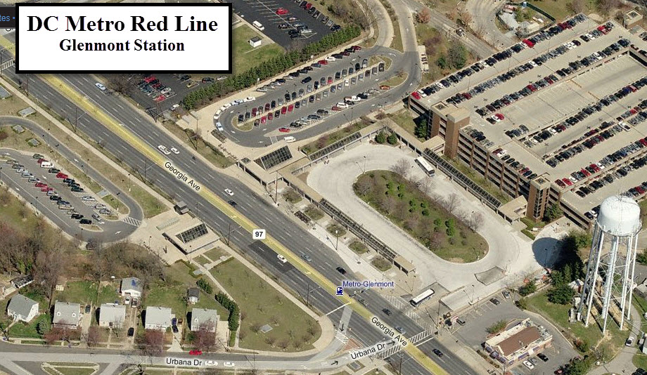
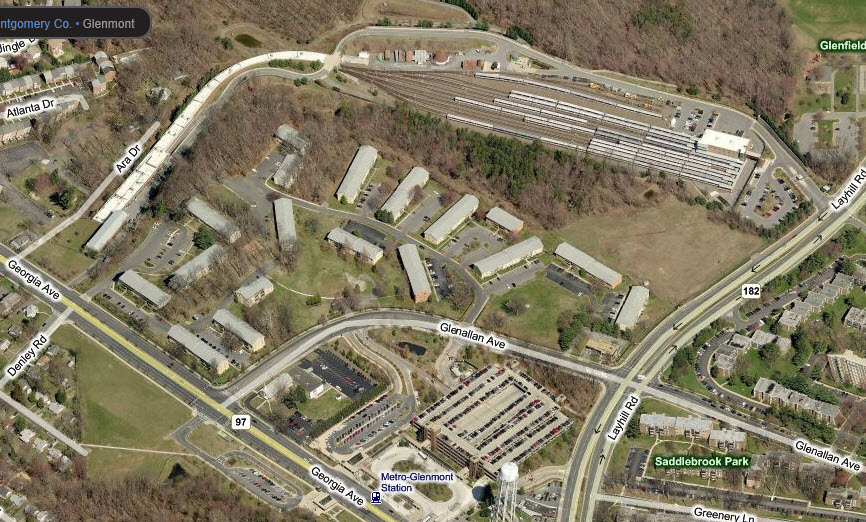
-- Glenmont
This is the end station for the line on the "east"
end, and is located along Georgia Ave adjacent to Urbana Drive.
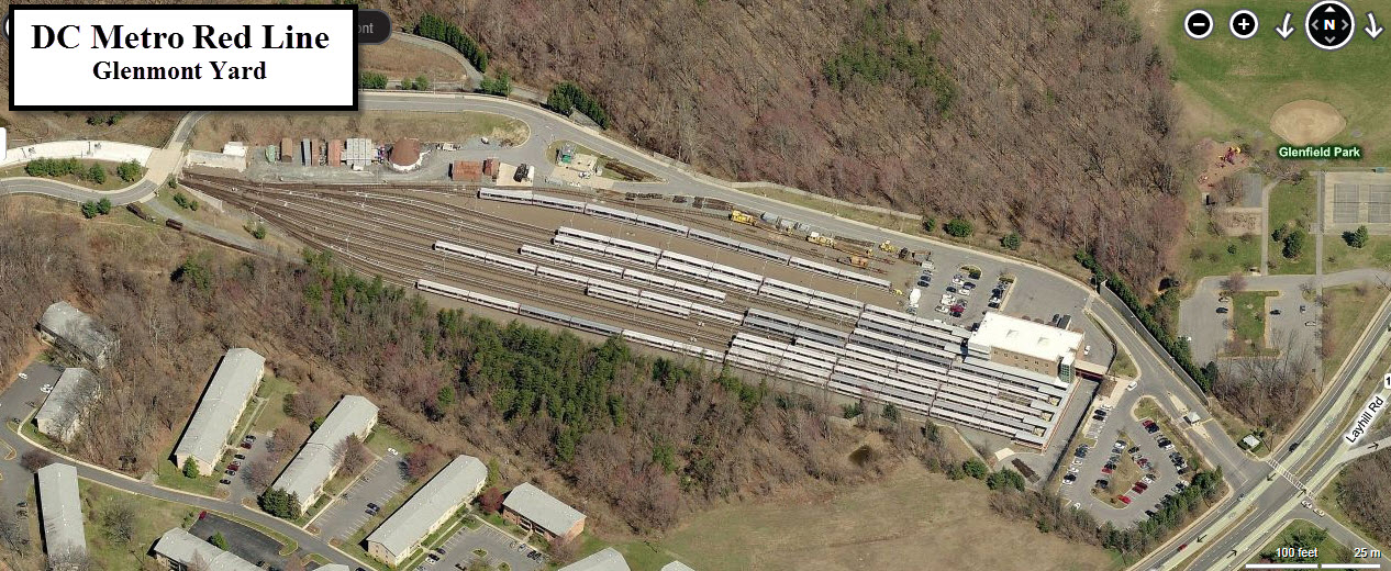
the Glenmont Yard
Phew!
Disclaimers:
New format 10/26/23: Please check out my disclaimer page for my standard
dribble and contact info here


 These two pictures of Union Station come from Wikipedia's page for the station.
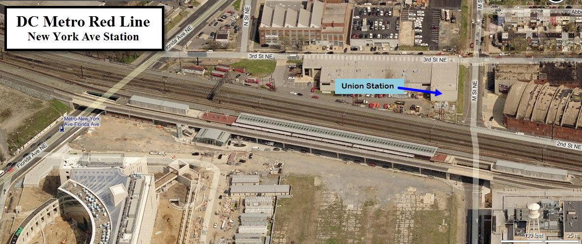
 These two pictures for the Forest Glen station came from Wikipedia's page for the station.
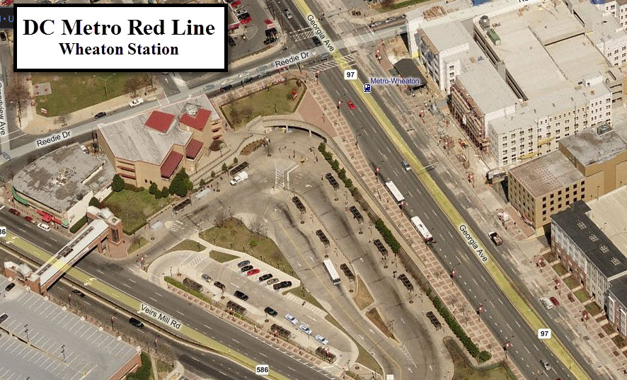
 These two pictures for the Wheaton station came from Wikipedia's page for the station.