This page covers the DC Metro's Green Line from end to end, starting at the
north end station, Greenbelt.
Stations without an aerial picture do not have any discernable features from the air.
Unfortunately for us (and me) it seems like BING has ended supplying "Birds
Eye Views" for most locations, if not all. They were ALWAYS better
than Google's aerial views, especially since Google has gone to their crappy 3D
image format. Bing's Birds Eye View were sharp with lot's of
good detail, even close-in, for most places - you can't get that from Google's
aerial shots -today-. Ever tried to stitch together a series of screenshots (like
I often do for my railfan guides) using Google's aerial pictures-it's frickin
awful - HORRIBLE!.... Using Bing's Birds Eye Views made the task easy-peasy! I
know, would I like some cheese to go with that whine? :-) :-)
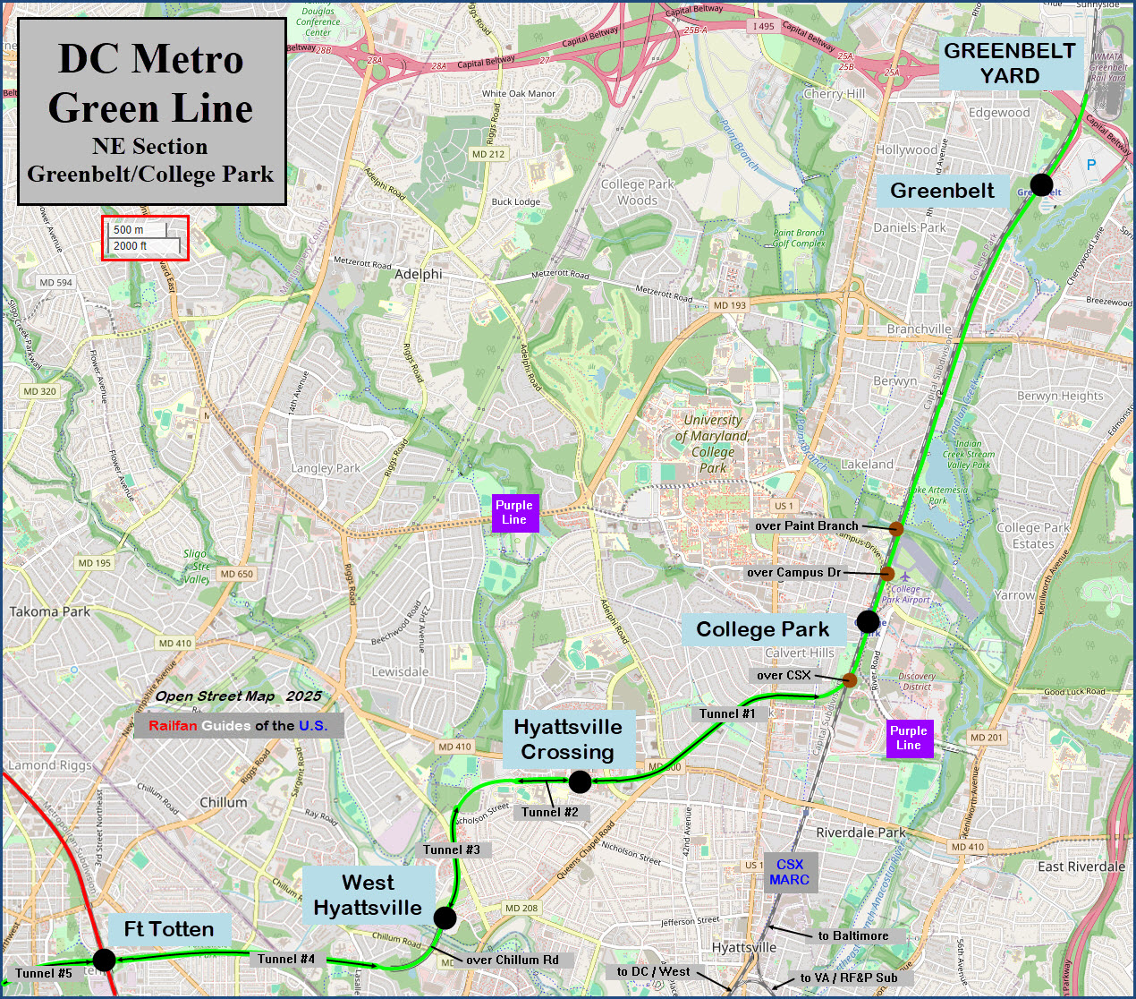
I've taken the liberty of numbering the Green Line tunnels, starting at the north
end, with the first one being between College Park and Hyattsville Crossing.
Note: Stations denoted with "--" are underground
Acknowledgements:
Pi.1415926535
Rainclaw7
Open Street Map
Google Maps
Bing Maps
WMATA
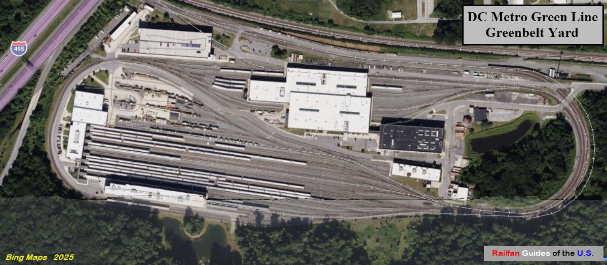
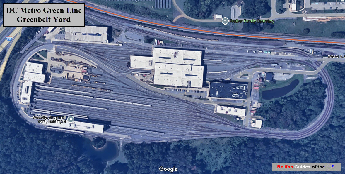
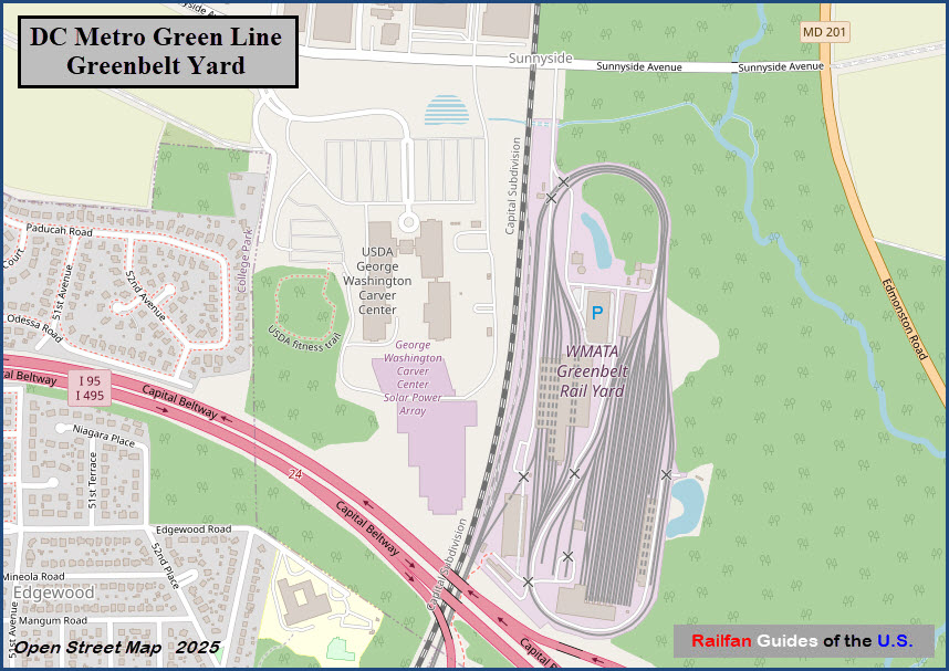
GPS Coordinates: 39.01121, -76.91108 https://en.wikipedia.org/wiki/Greenbelt_station
Station is at ground level.
Greenbelt serves the Green Line, and is the northern terminus for the line.
Beginning Dec2025, the Yellow Line will also service this line on an alternating Basis (every other train).
Transfer to MARC, which runs on the adjacent CSX tracks.
Station opened 11DEC1993, coinciding with the opening of three other
stations in northern Prince George's County, and the completion of 7.96
miles of Green Line rail north of Fort Totten in Washington, D.C.
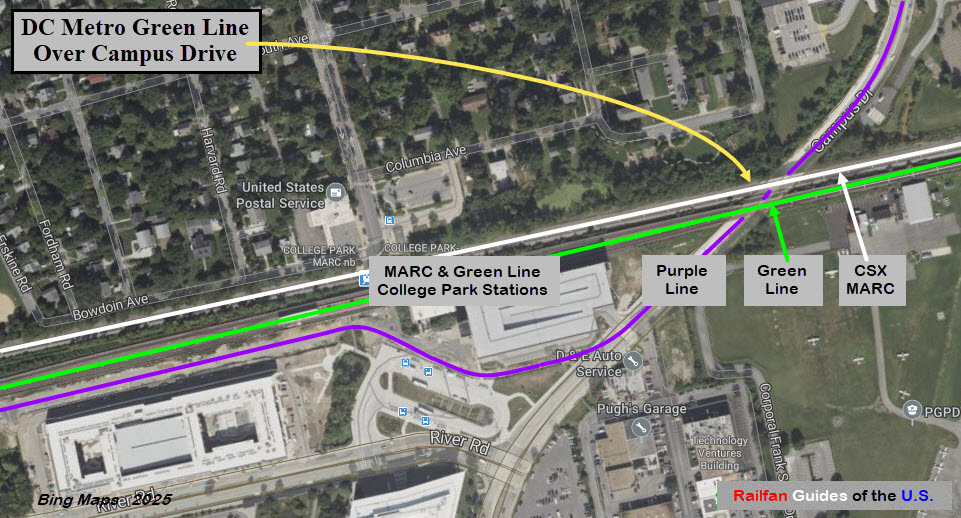
GPS Coordinates: 38.98165, -76.92707
https://en.wikipedia.org/wiki/College_Park%E2%80%93University_of_Maryland_station
Station is at ground level.
Serves the Green Line; starting DEC2025, will also serve the Yellow Line.
Transfer to MARC, which runs on the adjacent CSX tracks.
Transfer to the Purple Line (once running).
The College Park Airport is nearby.
Station opened 11DEC1993.
GPS Coordinates: 38.96527, -76.95601 https://en.wikipedia.org/wiki/Hyattsville_Crossing_station
Station is above ground in an open cut.
The station has a unique layout in that it is an open-cut side platformed station with a parking garage directly over the tracks.
Station opened as Prince George's Plaza,
referencing the nearby Prince George's Plaza, now known as The Mall at Prince Georges.
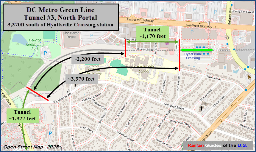
South from here, the line goes into another "short" tunnel, at approximately 1,162 feet.
Serves the Green Line, but has a complicated relationship with the Yellow Line, see the Wiki page.
Starting DEC2025, will also serve the Yellow Line, again.
Station opened 11DEC1993.
GPS Coordinates: 38.95503, -76.96964
https://en.wikipedia.org/wiki/West_Hyattsville_station
Station is elevated.
Serves the Green Line, but has a complicated relationship with the Yellow
Line, see the Wiki page.
The station was originally known as "Chillum" but was changed to "West Hyattsville" in 1979, well before services began.
Station opened on 11DEC1993.
GPS Coordinates: 38.95177, 77.00217
550 Galloway St NE, Washington DC 20011 https://en.wikipedia.org/wiki/Fort_Totten_station
Serves the Green/Yellow and Red Lines.
Green and Yellow lines run east/west, and are below the north/south Red Line.
Station opened February 6, 1978.
GPS Coordinates: 38.90487, -77.02203 https://en.wikipedia.org/wiki/Mount_Vernon_Square_station
Station is underground.
Mount Vernon Square serves the Green and Yellow Lines, but is the northern terminus for the Yellow Line.
Station opened May 11, 1991.
GPS Coordinates: 38.89839, -77.02185 (roughly)
https://en.wikipedia.org/wiki/Gallery_Place_station
The station is a transfer point to the Red Line, and the entrance is up on H St by 7th St NW.
Gallery Place is one of four major transfer points of the whole DC Metro system.
The Red Line is on the upper level, and the Green & Yellow Lines are on the
lower level.
GPS Coordinates: 38.885008, -77.01556
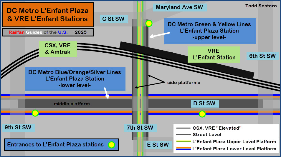
600 Maryland Ave SW, Washington DC 20024
https://en.wikipedia.org/wiki/L%27Enfant_Plaza_station
Station is underground. Area OK for railfans.
Station serves the Green and Yellow Lines. Transfer to the Blue, Orange, and Silver lines.
Block away from the VRE/Amtrak L'Enfant Station and CSX freight line going to Virginia.
The FAA, FCC, Federal Transit Administration, and NTSB HQ's are nearby.
McDonalds and Holiday Inn nearby.
From Wikipedia: L'Enfant Plaza station is an Intermodal transit station complex located at
L'Enfant Plaza in the Southwest Federal Center neighborhood of Washington D.C. It consists
of an underground Washington Metro rapid transit station and an elevated Virginia Railway
Express (VRE) commuter rail station.
The Metro station, which opened on July 1, 1977, is one of four major interchange stations
on the Metro system. It is the only station to serve five of the six Metro lines: the Green
and Yellow lines with two side platforms on the upper level, and the Blue, Orange, and
Silver lines with one island platform on the lower level. It was the seventh-busiest Metro
stop in 2023, with an average of 7,506 daily passenger entries.
The VRE station, which has a single side platform serving the northernmost of the three tracks
of the RF&P Subdivision, is served by the Manassas Line and Fredericksburg Line. end wiki
GPS Coordinates:
https://en.wikipedia.org/wiki/Waterfront_station_(Washington_Metro)
Station is underground.
Serves the Green Line only.
Station opened 28DEC1991, and coincided with the completion of approximately
2.88 miles (4.63 km) of rail southeast of the L'Enfant Plaza station and
the opening of the Anacostia and Navy Yard/Ballpark stations.
GPS Coordinates: 38.86210, -76.99520
1101 Howard Rd SE, Washington DC 20020 https://en.wikipedia.org/wiki/Anacostia_station
Station is underground.
Serves the Green Line only.
Station opened 13JAN2001.
Its opening coincided with the completion of approximately 6.5 miles (10.5 km)
of rail southeast of Anacostia, as well as the opening of Branch Avenue,
Suitland, Naylor Road, Southern Avenue.
GPS Coordinates: 38.84065, -76.97560
1411 Southern Ave SE, Hillcrest Heights, MD 20748 https://en.wikipedia.org/wiki/Southern_Avenue_station
Station is at ground level.
The station is in Maryland by approx 165 feet.
Serves the Green Line only.
Station opened 13JAN2001.
GPS Coordinates: 38.85107, -76.95679
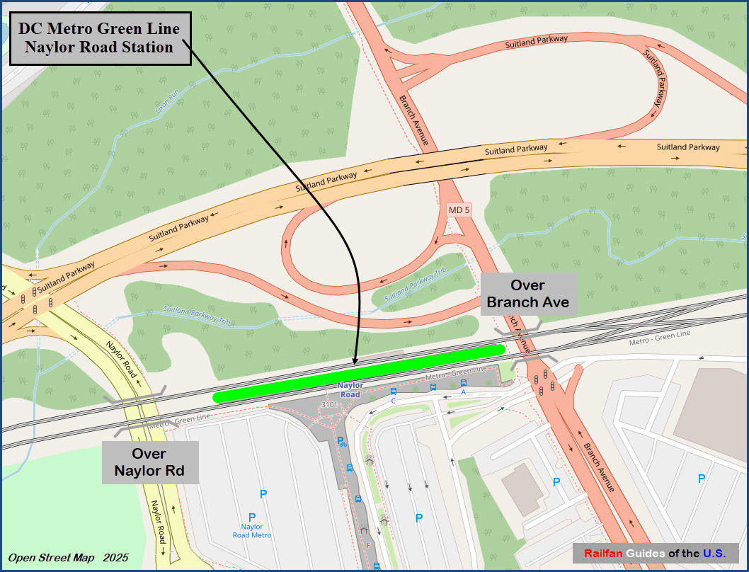
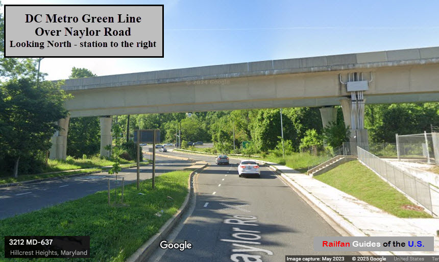
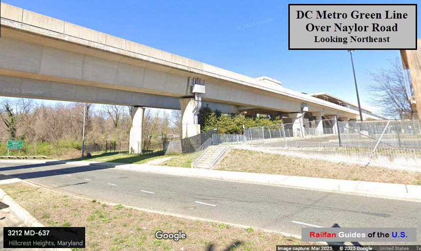
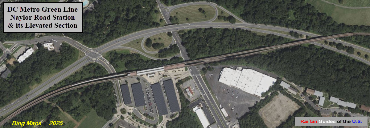
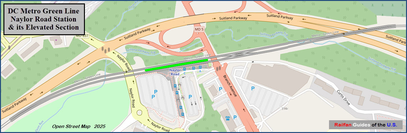
3101 Branch Ave, Temple Hills MD 20748 https://en.wikipedia.org/wiki/Naylor_Road_station
Station is elevated.
Serves the Green Line only.
Station opened 13JAN2001.
GPS Coordinates: 38.84419, -76.93237
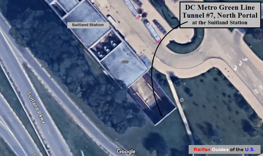
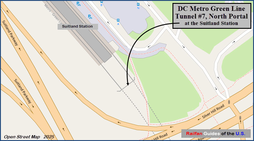
4500 Silver Hill Rd, Suitland-Silver Hill MD 20746 https://en.wikipedia.org/wiki/Suitland_station
Station is at ground level.
Serves the Green Line only.
Station opened 13JAN2001.
GPS Coordinates: 38.82669, -76.91185
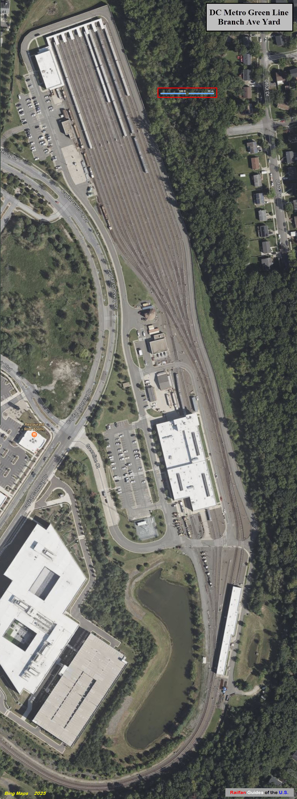
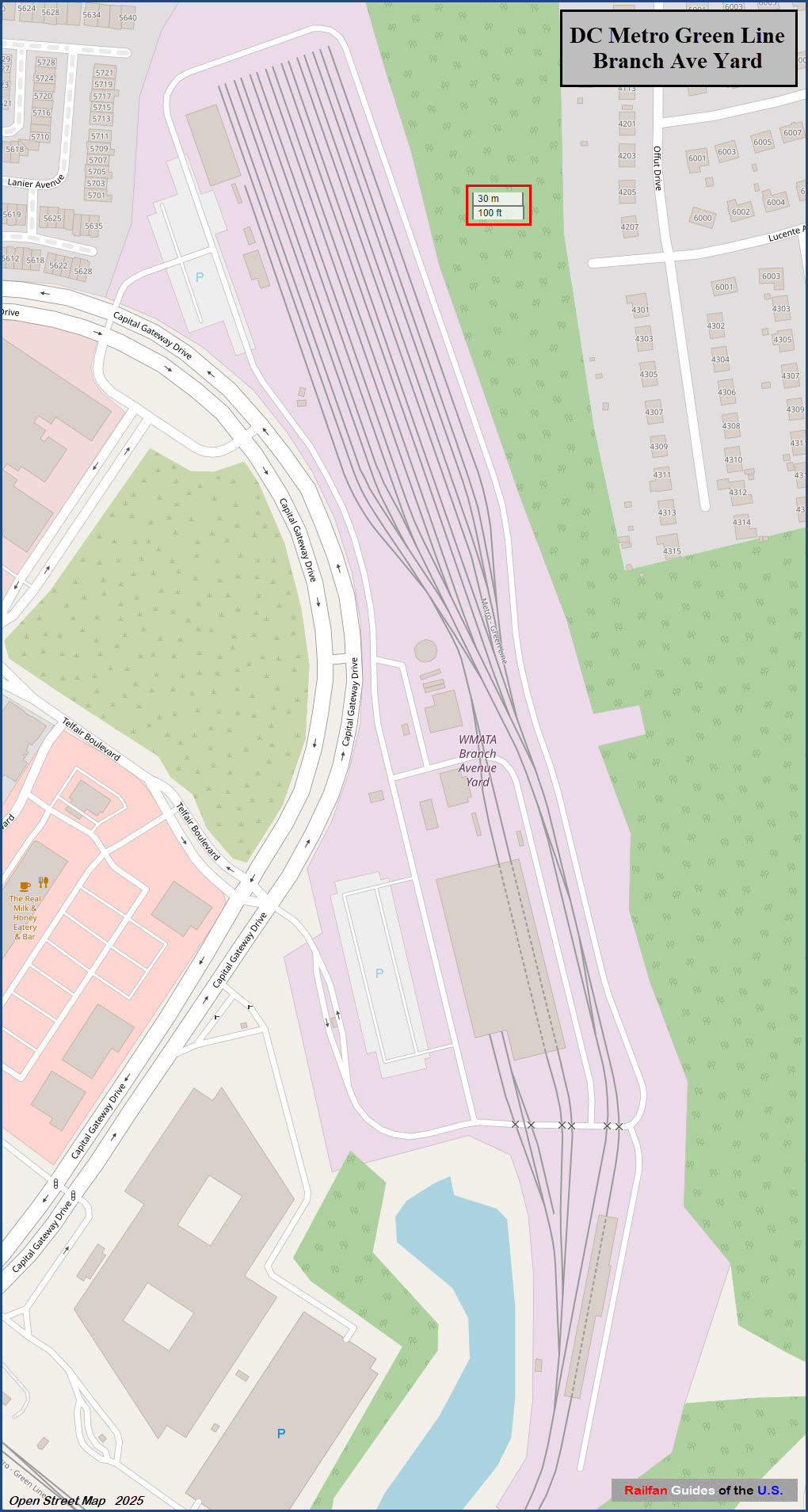
4704 Old Soper Rd, Suitland-Silver Hill MD 20746 https://en.wikipedia.org/wiki/Branch_Avenue_station
Station is at ground level.
Serves the Green Line only.
Station opened 13JAN2001.
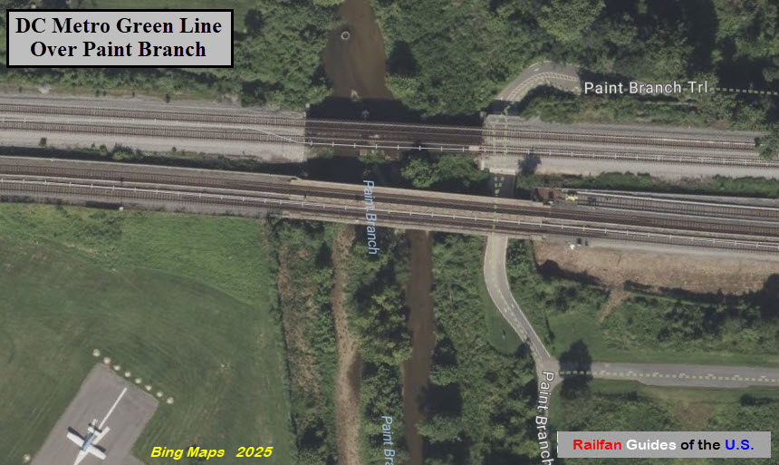
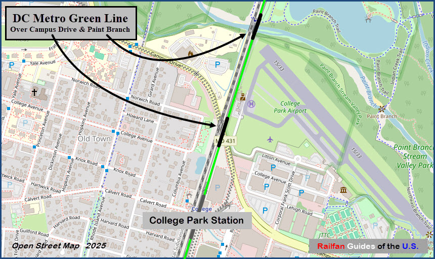
GPS Coordinates: 38.98413, -76.92599
Approx 1,900 feet north of the College Park station, the Green Line goes over a small creek.
On a nice cool day, this would be a nice spot to catch CSX freights, MARC commuter trains, and
the Green Line trains.
Depending on how accurate Google Maps distance measuring algorithm is, the
bridge looks to be about 210 feet long.
The College Park station is to the left.
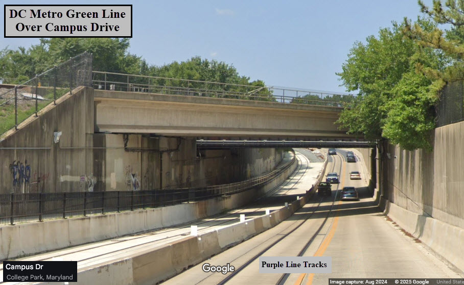
GPS Coordinates: 38.98093, -76.92744
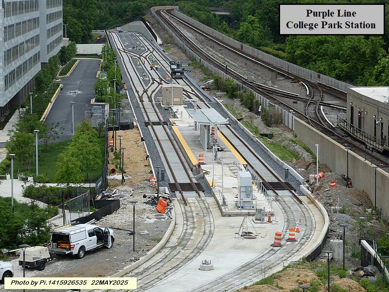
In this Google Streetview from 2024, the Purple Line still needs a lot of work done.
The College Park station is to the left.
GPS Coordinates: 38.97151, -76.93343
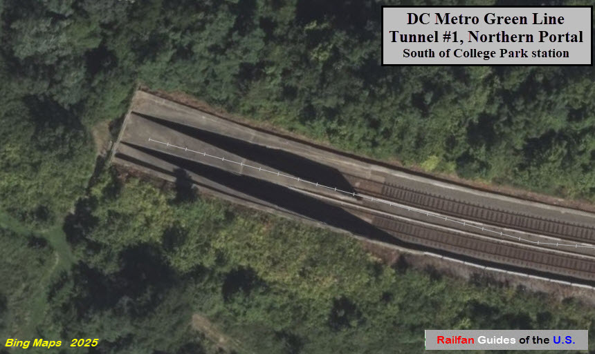
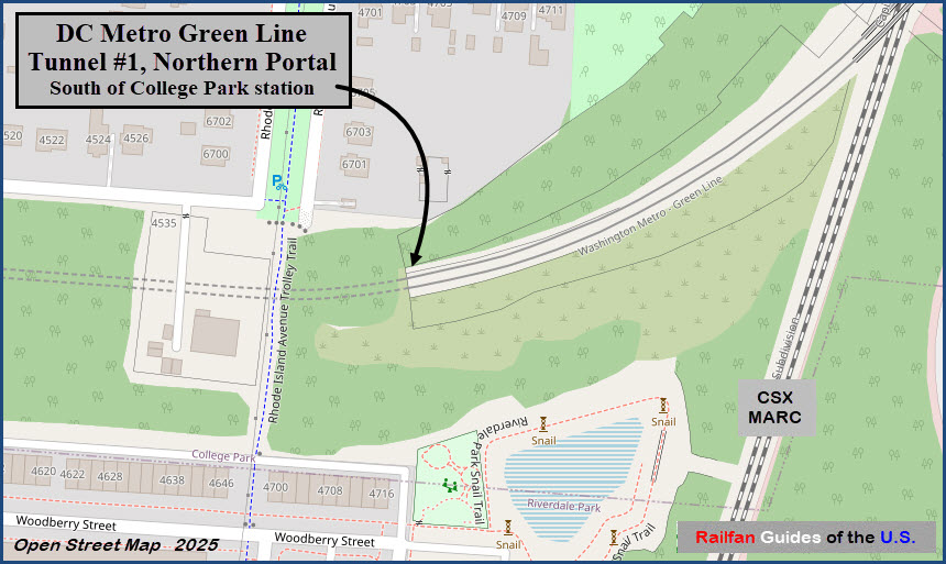
This is the entrance to an approximately 1.32 mile long tunnel that ends at the
Hyattsville Crossing station.
This portal is approximately 2,630 feet (1/2 mile) south of the College Park station.
Tunnel #1 - Southern Portal
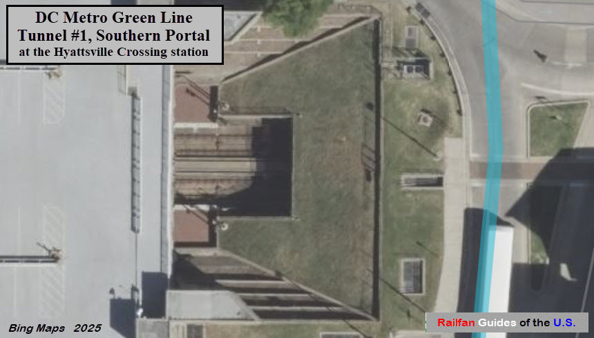
GPS Coordinates: 38.97151, -76.93343
Southern portal of the tunnel that ends here at the
Hyattsville Crossing station.
GPS Coordinates: 38.96319, -76.96845
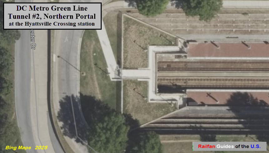
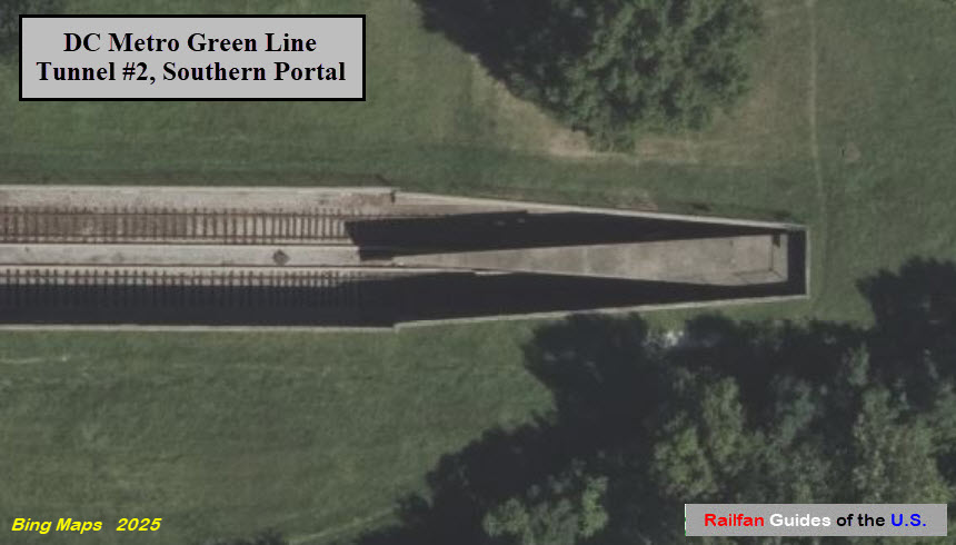
Northern entrance to an approximately 1,927 foot long tunnel that ends near the
West Hyattsville station.
Portal is about 2,200 feet from the next tunnel going north (away from DC).
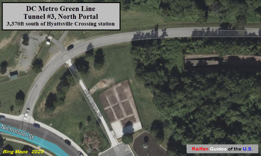
Tunnel #3, Southern Portal
GPS Coordinates: 38.95804, -76.96840
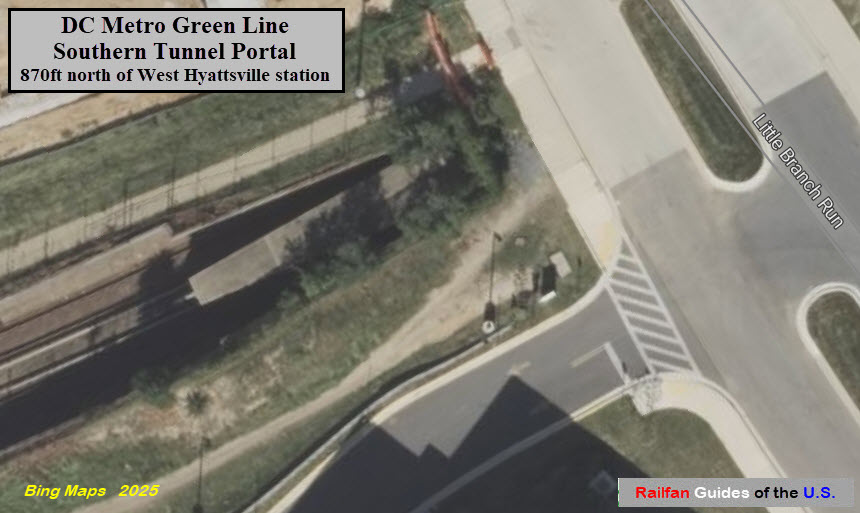
Southern entrance to an approximately 1,927 foot long tunnel that ends near
the Hyattsville Crossing station.
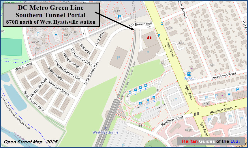
About 870 feet from the platform at West Hyattsville station.
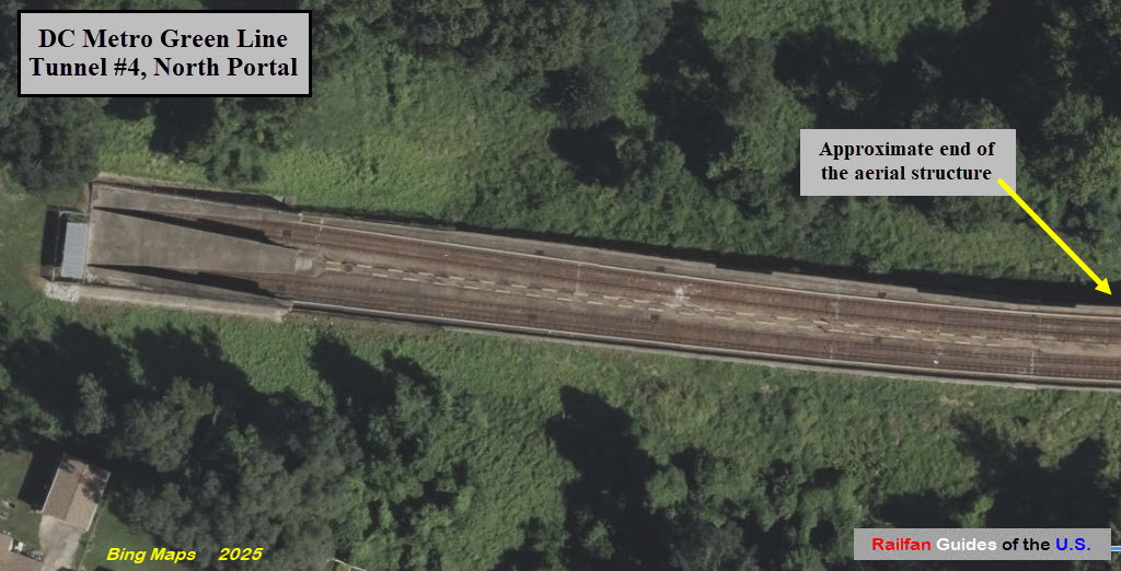
GPS Coordinates: 38.95173, -77.00319
Northern entrance to the Green Line's main underground portion.
This underground stretch is about 10.7 miles.
The Yellow Line shares the tunnel with the Green Line from Mt Vernon Square
to I-395 where it splits off and goes west, a distance of 1.6 miles.
Eventually, the Yellow line will be going to Ft Totten, and then every other train will go all the way to the end at Greenbelt.
The Green Line does not come out of the hole again until the Southern Avenue Station in Maryland (in MD by 156 feet :-)
GPS Coordinates: 38.95183, -77.00194
The end of, (or the beginning of) a 10.7 mile long tunnel that wanders around the main part of DC and RFK Stadium.
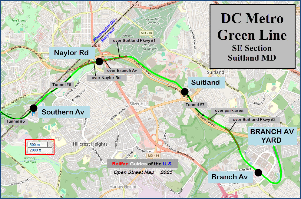
GPS Coordinates: 38.85089, -76.95826
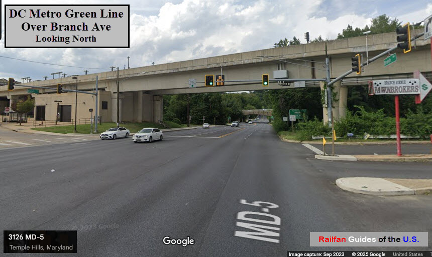
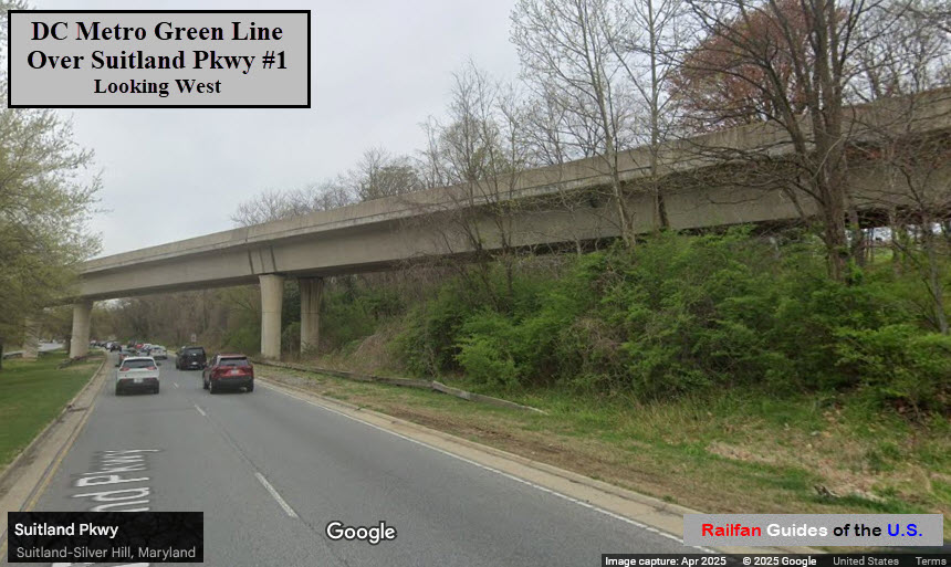
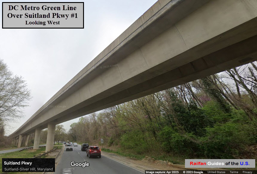
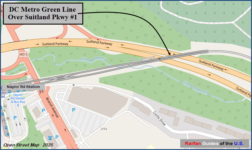
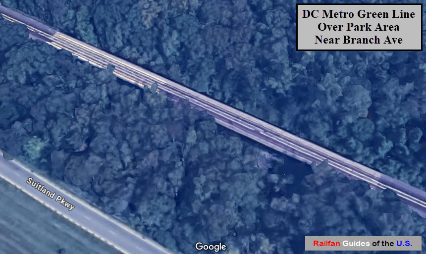
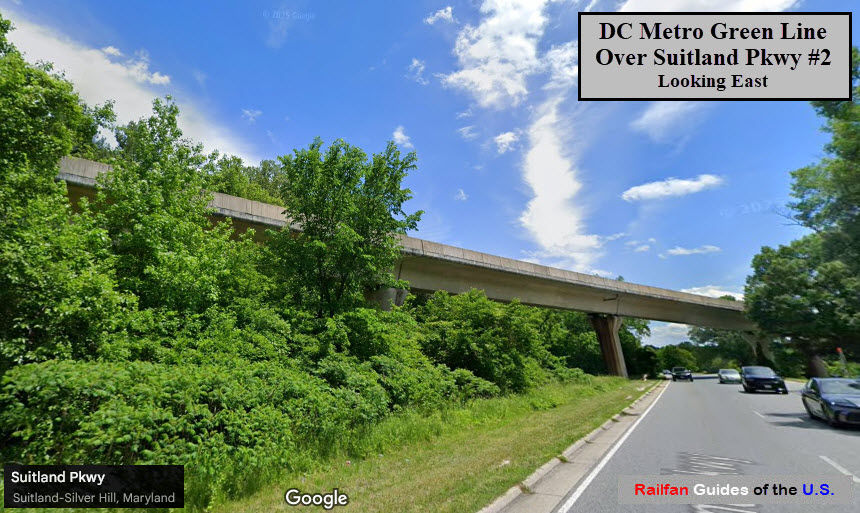
Part of a 4,270 foot long elevated section that also goes over Branch Ave
and Suitland Pkwy and hosts the Naylor Road Station.
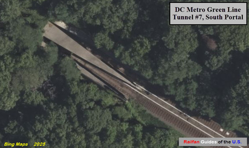
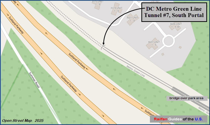
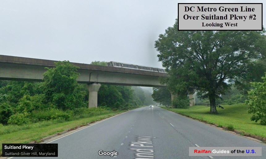
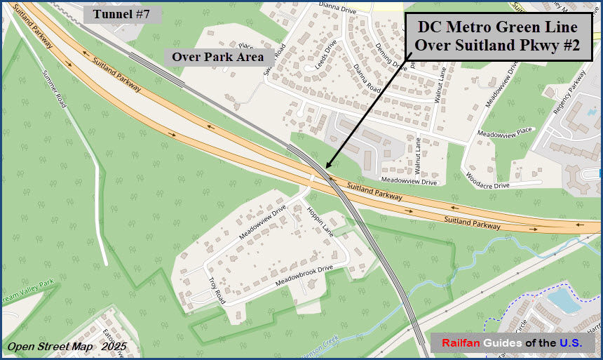
GPS Coordinates: 38.83815, -76.92514
VERY hard spot to get pictures of trains crossing this short, 542 foot long
bridge in the middle of a well forested park.
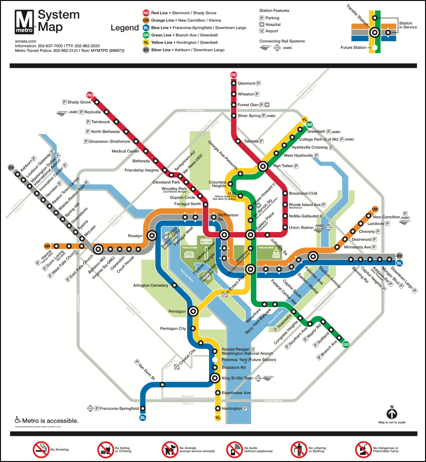
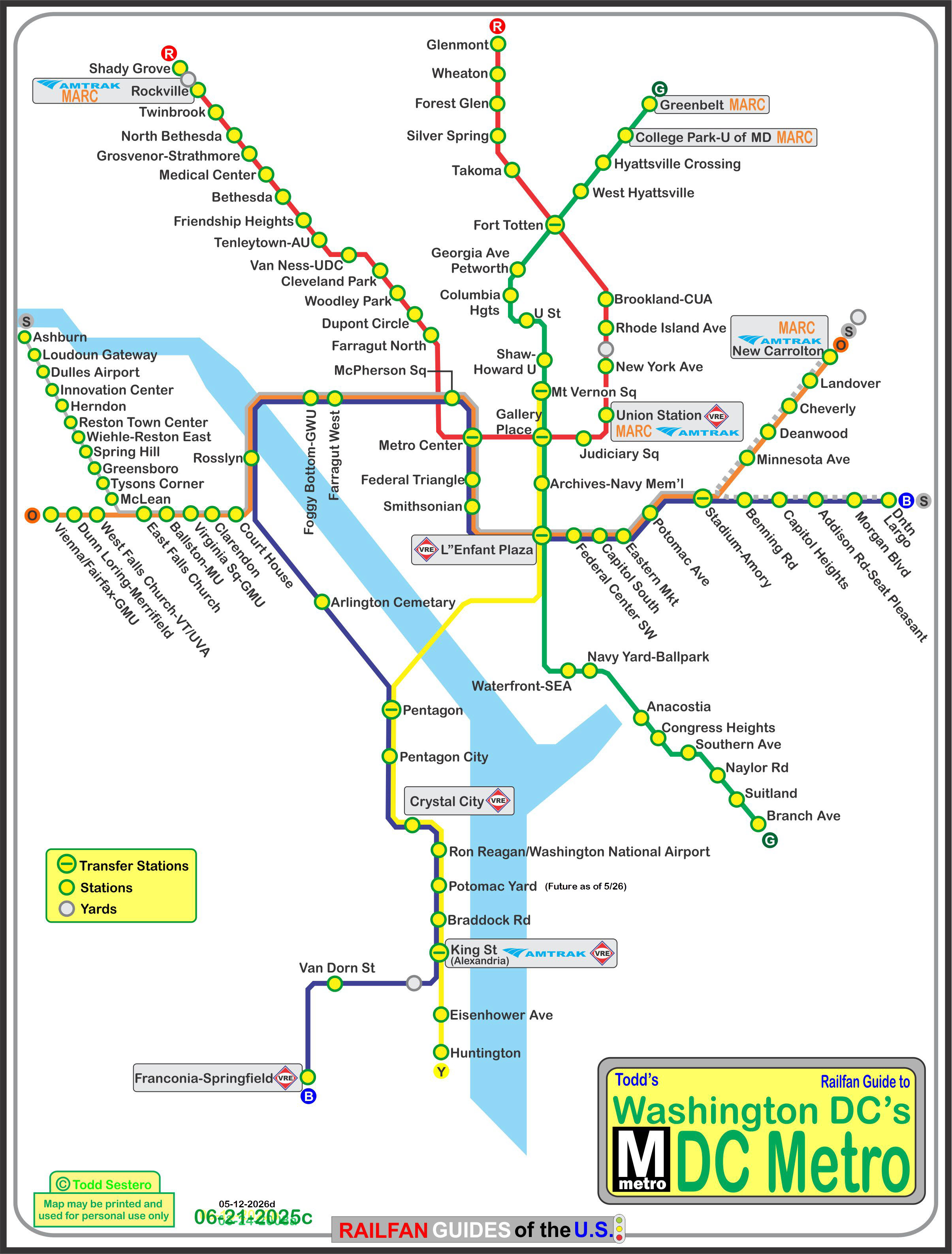
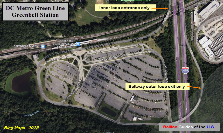
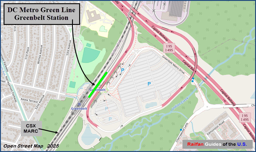
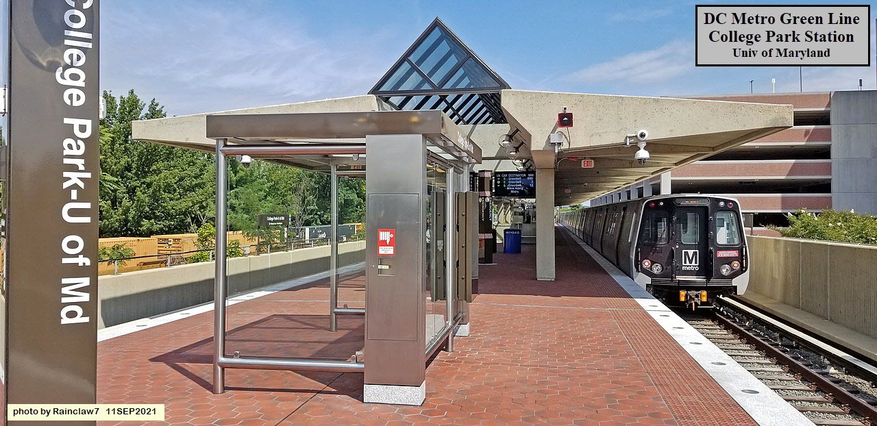
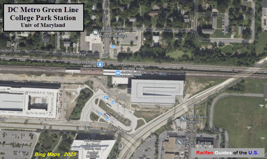
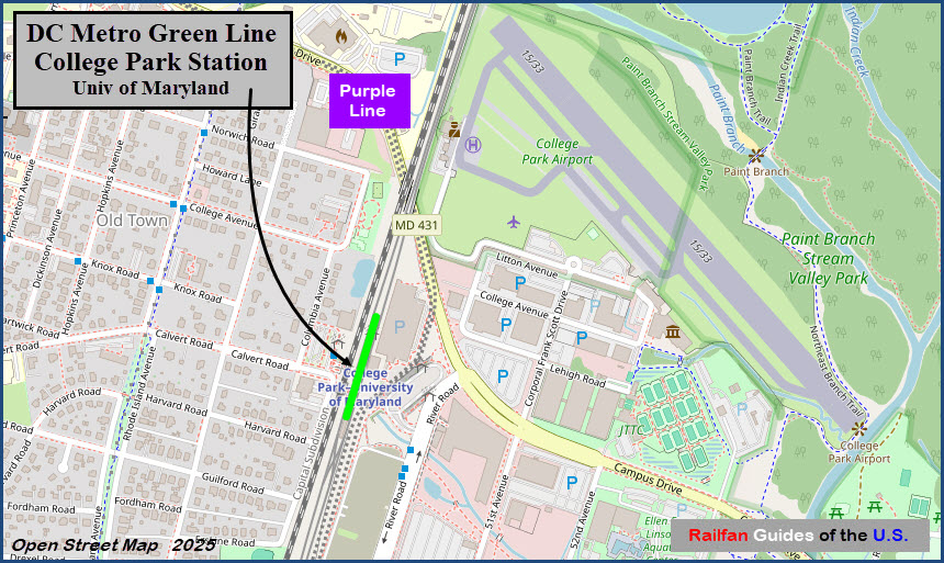
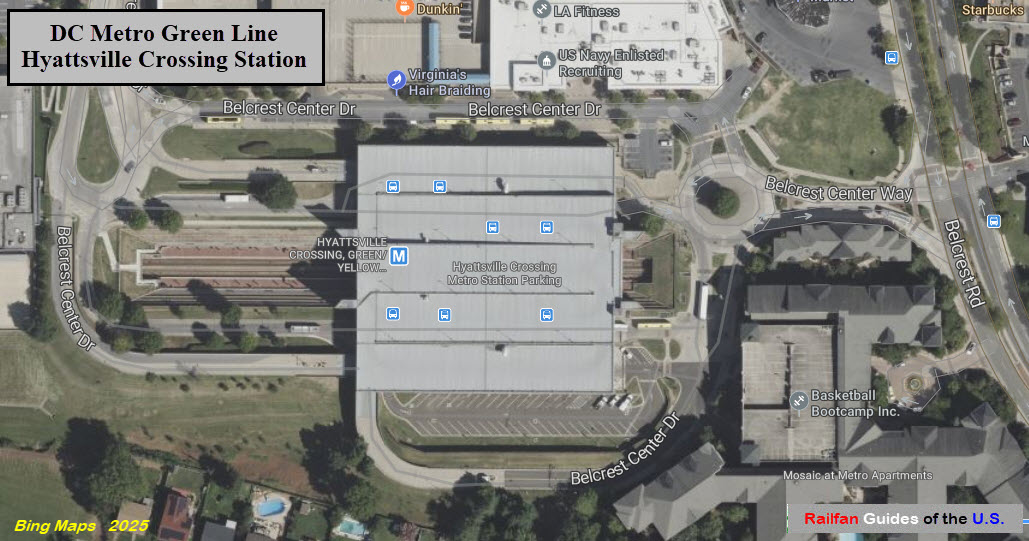
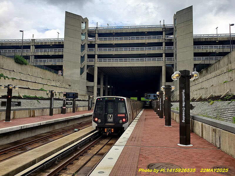
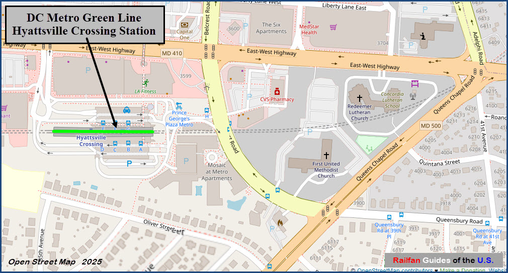
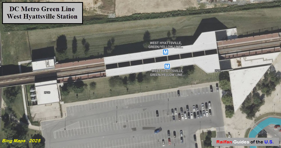
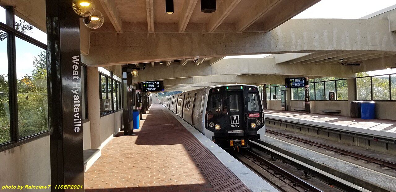
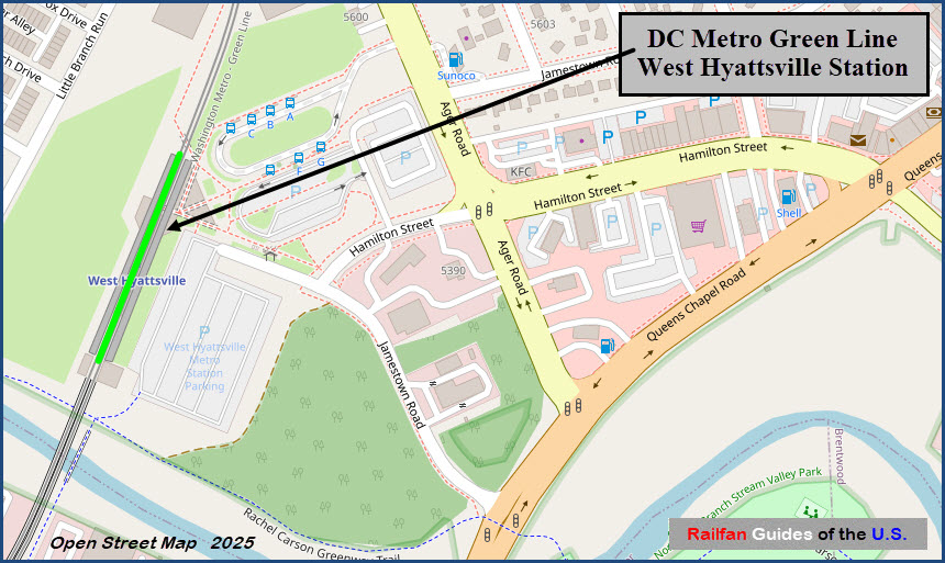
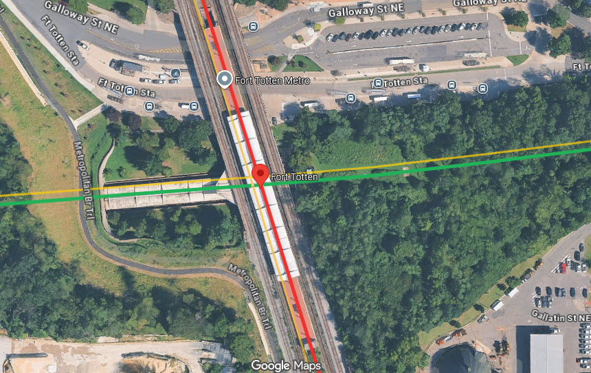
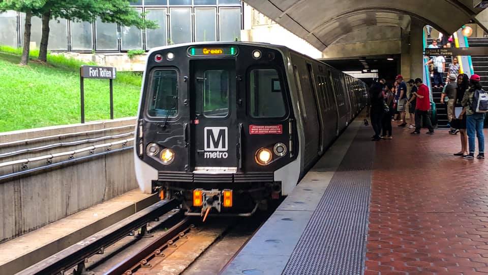 photo by Swagging via Wikipedia
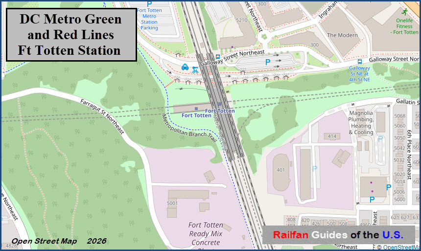
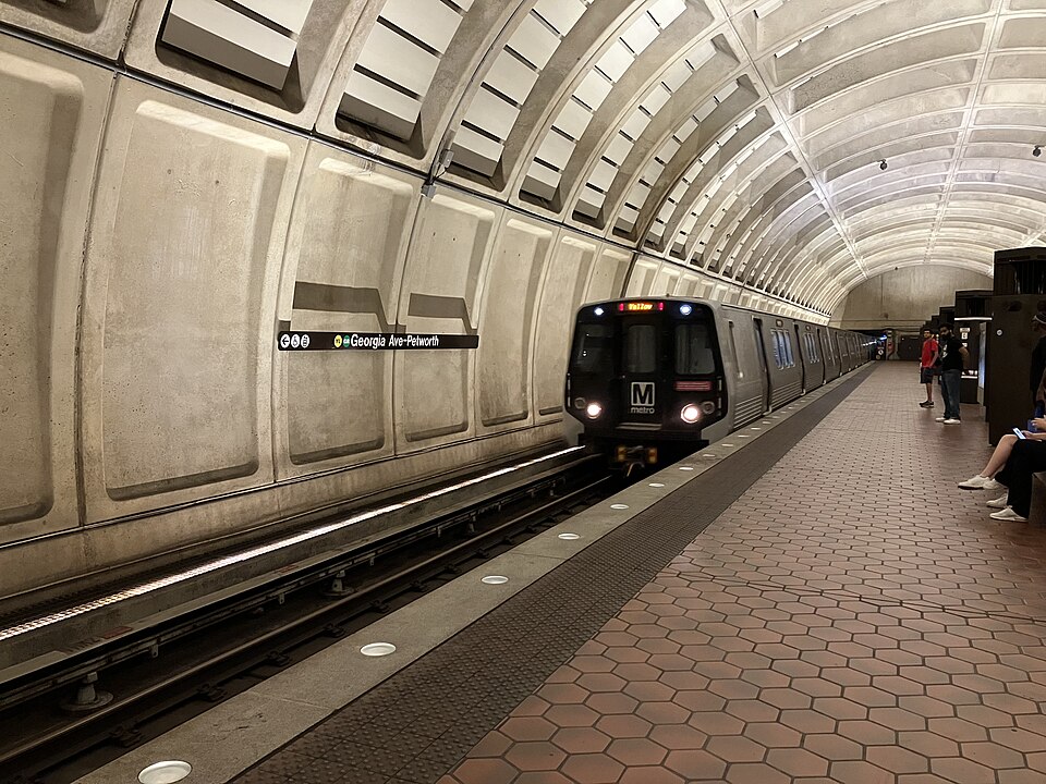 photo by Aidanlang, via Wikipedia, 9/2022