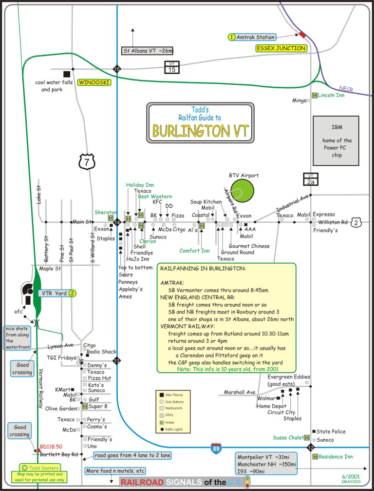
What's Here:
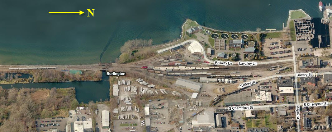
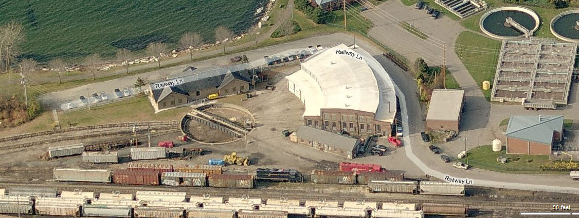
Vermont Rwy Yards and Office
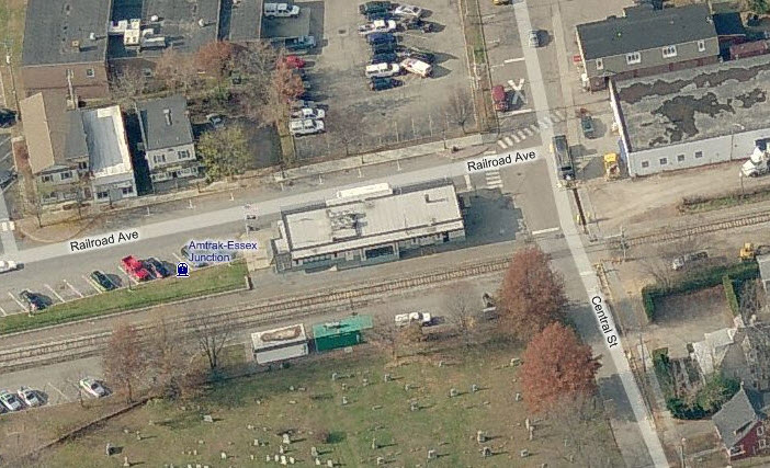
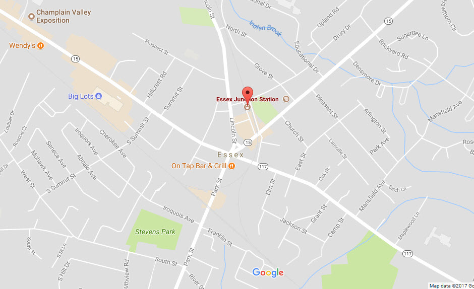
Amtrak Station in neighboring Essex Junction
the New England Central RR comes thru on it's way to St Albans
Really nice lakefront town
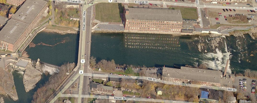
Winnoski Falls
Most populous city in VT
Very Beautiful in the fall
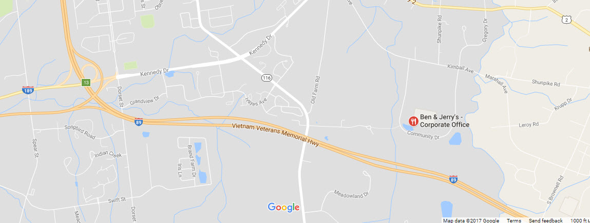
Ben and Jerry's Ice Cream HQ is just south of Burlington
Data:
GPS Coordinates: as needed
Phone A/C: 802
ZIP: 05401
Access by train/transit:
Amtrak has 4 trains a day, see below
The Scoop:
Many years ago, I worked up a whole bunch of
maps, and then thought I lost them when one of my computers crashed. Lo
and behold, I found a 100meg ZIP floppy with the maps on there, and will
slowly be updating them. This is the first one.
Years ago, back in the 2001 timeframe, I was lucky to be in town on
business when they had the Champagne Flyer
commuter train running, I have to dig up the pictures.
For being "way out yonder", Burlington still
has a strong railroad presence, with the Vermont Railway having it's northern
terminus here, the New England Central RR comes rambling through on it's way to
St. Albans to the north, and Amtrak stops in Essex Junction.
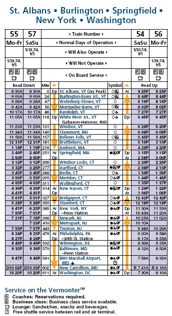
Amtrak has two daily trains each way.
The schedule is below. The Vermonter actually terminates in Washington DC,
and travel time is estimated at 13:45 between there and St Albans.
According to an article in the
Burlington Free Press, Amtrak rates the state of Vermont as the last in the
category of worst rail service.
Burlington is a neat town to visit, and if
you're driving up from "the south", you'll pass by the
Ben and Jerry's Ice
Cream HQ along the way.
From Wikipedia: Burlington is home to the University of Vermont (UVM) and
Champlain College, a small private college. Vermont's largest hospital, the UVM Medical
Center, is within the city limits. The city of Burlington also has Vermont's largest
airport (the Burlington International Airport) in neighboring South Burlington.
In 2015, Burlington became the first city in the U.S. to run entirely on renewable energy. (end Wiki)
Burlington is 45 miles (72 km) south of the Canadian border and is 94 miles (151 km) south of Montreal.
General Railfanning
The Vermont Railway has a freight that heads
south to Rutland around 8:30am. Depending on the amount of traffic they
have, they switch stuff in yard about half the day. Nice shots can be had
from the rocks along the waterfront.... they are just south of the main office
building.
The folks over at the VTR are pretty decent,
and if you exercise good judgment, and don't go wandering the yard, they will
leave you alone if shooting from their parking lot. The tracks leading
into town from the south are pretty easy to line up some good shots in both
directions at Lyman and Bartlett Bay roads.
Waterfront Park off Lake St offers good photo
ops for interchange trains north of the VTR yard.
The NECR has a daily train each way. As
mentioned above, the New England Central offers the railfan numerous photo ops
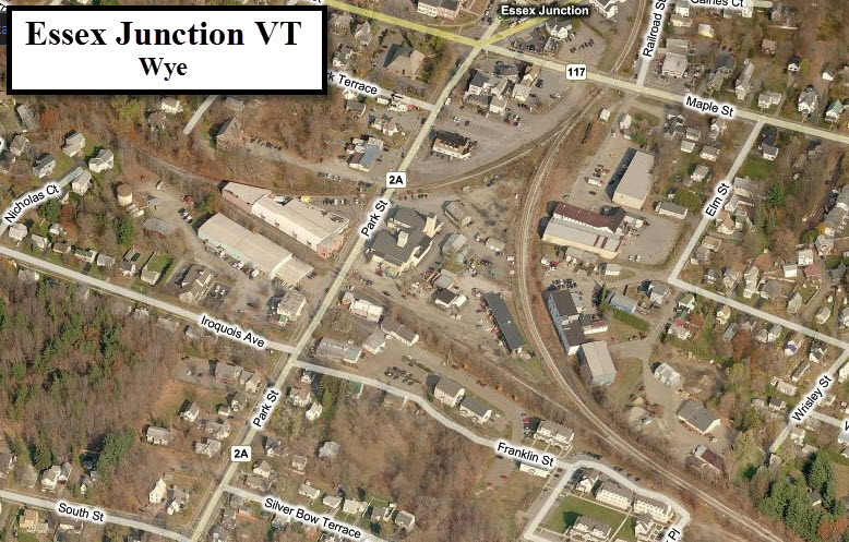
up and down the I-89 corridor. The wye in Essex Junction is also a good
and interesting spot for pictures.
If you are game for some "hi-speed" chasing,
following the NECR up or down the interstate will reward you with many excellent
locations at any of the exits along I-89. The scenery south of Montpelier
is especially nice south of Barre where it passes by a lake during the fall -
the colors are nothing short of magnificent! There is also a passing
siding south of Montpelier, and if they are still doing the same thing as when I
was there in 2001, the NB and SB freights pass here in quite a dance since
the siding only has an entrance at one end and the train has to back out in
order to continue south.
Other stuff:
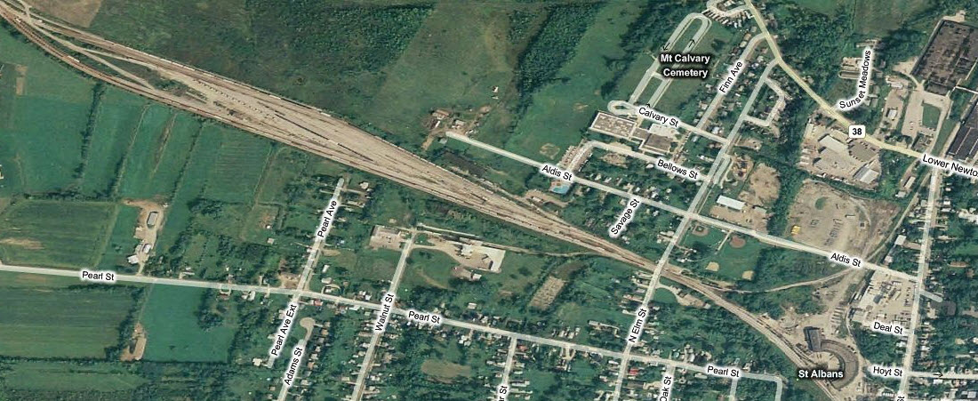
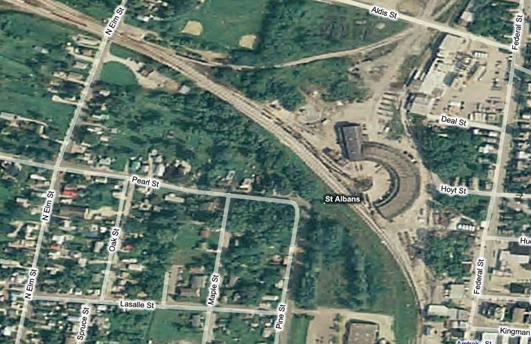
St Albans is a short hop north of Burlington,but not too much is usually
going on unless a freight is getting ready to leave or one has just arrived.
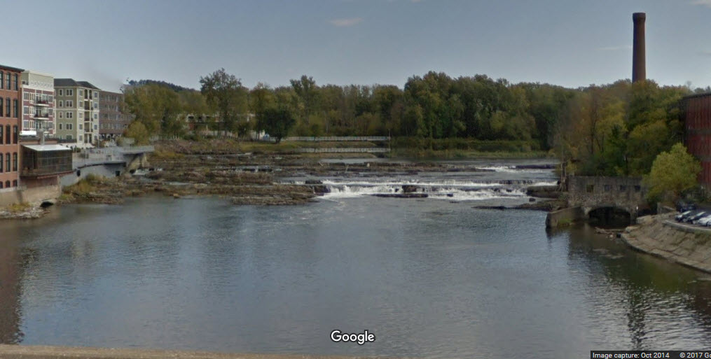
Winooski has a neat waterfalls which offers a change of pace while your taking a break to eat.
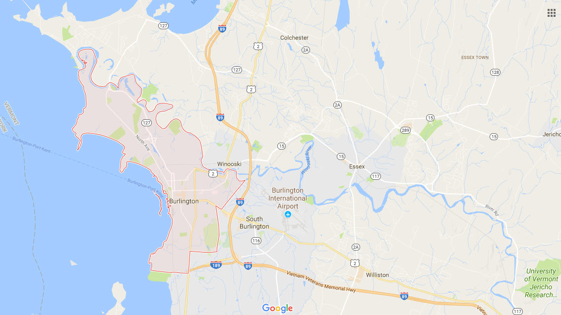
Burlington is simple. I-89 is the main road to get you in and out of Burlington.
side of town is VT 2a, Running up on the east which goes from
exit 12 on up through Essex Junction, home to
IBM, where they developed and produce the Power PC chip.
Williston Rd is the main E/W road, and is AKA
US 2. The airport is off Williston, as well as many of the areas hotels.
Williston turns into Main St on the west side of I-89, and the University of
Vermont is located between the interstate and downtown.
Maple St is two blocks south of Main St, and
is used to gain access to the VTR yard.
On the northside, 89 takes you through St
Albans and on up to the Canadian border where highway 133 picks up. St
Albans is about 25 miles from Burlington, the border is about another 15, and
from there, it's about 50 miles to Montreal - a very cool railroading town!
I-89 to the south takes you to a junction with
N-S I-91 at Hartford VT... I-91 rides the line between NH and VT. Beyond
the junction with 91 is Manchester NH, which is serviced by Southwest Airlines.
Travelling into Burlington by plane involves transferring at least once at
something like LaGuardia, so you might as well spend the layover time driving
from Manchester and get in some additional railfanning.
If you are coming from northern New York, the
only real option is to take the ferry across Lake Champlain at Port Kent NY.
Port Kent is about 5 miles off I-87. You can go around the lake on the
north end, but it's about a 90 mile hike.
There are four ferries a day each way Monday
thru Wednesday, six each way the rest of the week. The trip takes about an
hour. The fee is $17.50 for a one way, $32.75 for a round trip if you have
a car. It's 5 bucks and $9.30 if you don't. More info
here.
The Vermont Rail System is an affiliation of six shortlines:
-- Vermont Railway (VTR)
-- Green Mountain Railroad (GMRC)
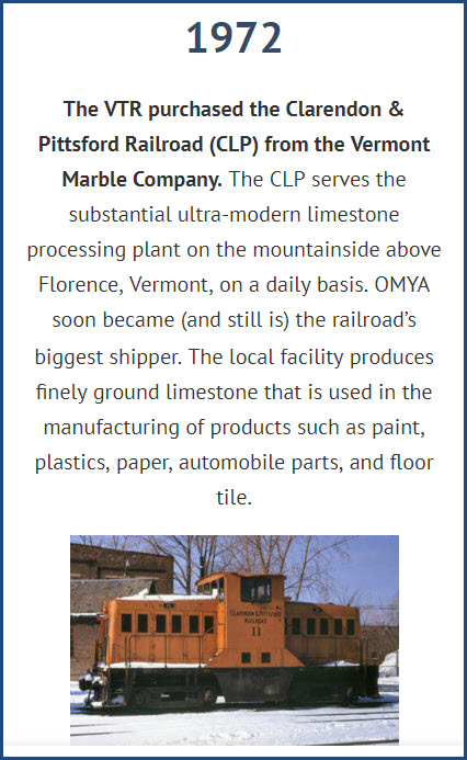
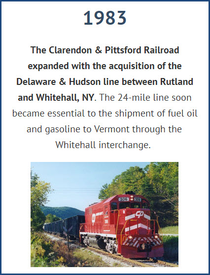
-- Clarendon and Pittsford Railroad (CLP)
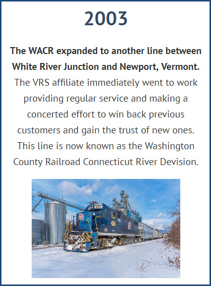
-- Washington County Railroad (WACR)
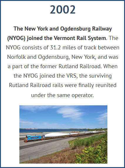
-- New York and Ogdensburg Railway (NYOG)
-- New England Southern Railroad (NEGS)
Individually, each shortline
provides personalized, efficient, and reliable rail freight service
to a wide variety of on-line customers. Joined in common ownership the
railroads form a strategic alliance that allows for better utilization
of manpower and equipment, resulting in an increased level of service
to customers.
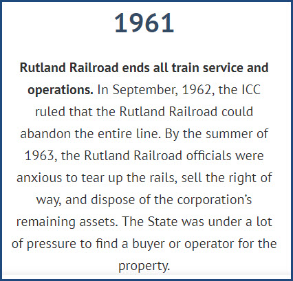
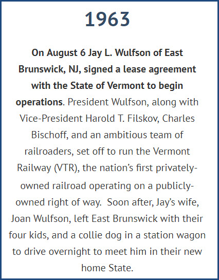
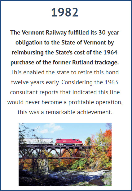
From their website: Acquired August 6th, 1963. Route: Burlington VT to
Bennington VT and Hoosick Junction NY. The Vermont Railway (VTR) was
the nation�s first privately-owned railroad operating on a publicly-owned
right of way. With daily freight trains operating between Burlington and
Rutland, and service three days a week between Rutland and North Bennington,
the VTR was able to restore freight traffic along Vermont�s Western
Corridor with a strong commitment to customer service.
Amtrak has two daily trains each way as shown in the schedule. It travels
the same track as the NECR, and stops in Montpelier and terminates in St Albans.
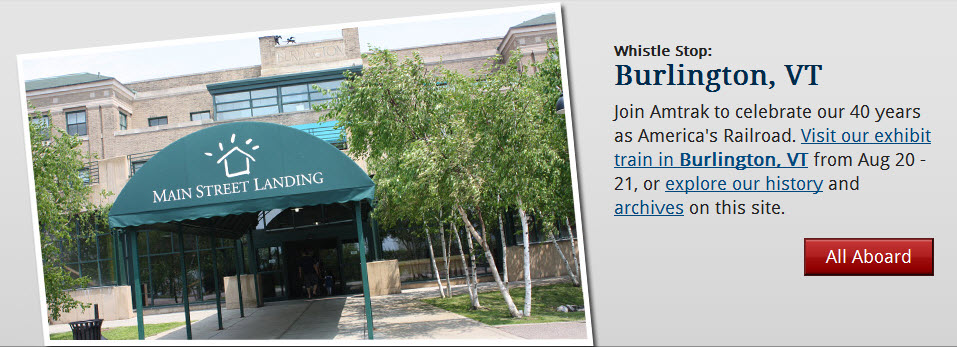
Amtrak's 40th Birthday Train
Was In Town The Weekend of August 20th and 21st, 2011
A brief history of the railroad from their website....
Winooski and the Water Falls
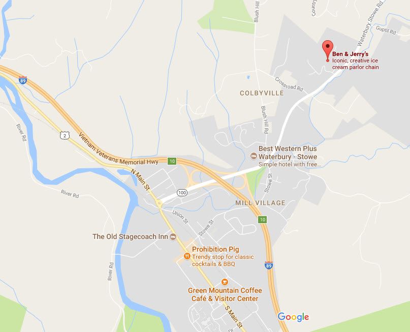
Ben and Jerry's Ice Cream
Who hasn't heard of Ben and Jerry's Ice Cream? It's like the Big Chicken in
Marietta GA .....
I believe the location off exit 10 is supposed to be "where it all happened"
and is the original location..... maybe not, at least that is what I heard :-)
Disclaimers:
I love trains, and I love signals. I am not an expert. My webpages reflect what I find on the topic of the page. This is something I have fun with while
trying to help others.
Please Note: Since the main focus of my two websites is railroad signals, the railfan guides are oriented towards the signal fan being able to locate them.
For those of you into the modeling aspect of our hobby, my
indexa page has a list of almost everything railroad oriented
I can think of to provide you with at least a few pictures to help you detail your pike.
If this is a railfan page, every effort has been made to make sure that the information contained on this map and in this railfan guide is correct. Once in a while,
an error may creep in :-)
My philosophy: Pictures and maps are worth a thousand words, especially for railfanning. Text descriptions only get you so far, especially if you get lost or
disoriented. Take along good maps.... a GPS is OK to get somewhere, but maps are still better if you get lost! I belong to AAA, which allows you to get
local maps for free when you visit the local branches. ADC puts out a nice series of county maps for the Washington DC area, but their state maps do not have the
railroads on them. If you can find em, I like the National Geographic map book of the U.S..... good, clear, and concise graphics, and they do a really good job
of showing you where tourist type attractions are, although they too lack the railroads. Other notes about specific areas will show up on that page if known.
Aerial shots were taken from either Google or Bing Maps as noted. Screen captures are made
with Snagit, a Techsmith product... a great tool if you have never used it!
By the way, floobydust is a term I picked up 30-40 years ago from a National Semiconductor data book, and means miscellaneous
and/or other stuff.
Pictures and additional information is always needed if anyone feels inclined to take 'em, send 'em, and share 'em, or if you have something to add or correct.... credit
is always given! Please be NICE!!! Contact info is here
Beware: If used as a source, ANYTHING from Wikipedia must be treated as being possibly inaccurate, wrong, or not true.