
In General
Getting Here
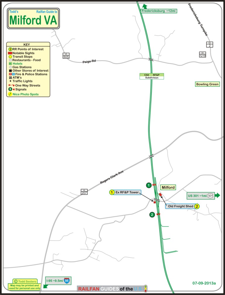
Map
Sights
Pictures
Signals
Floobydust
RAILROAD SIGNALS HOME
Location / Name:
Milford VA, Caroline County
What's Here:
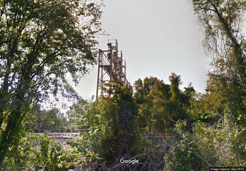
Former RF&P "MD" Tower
Single Crossover
NB Signal
Data:
GPS Coordinates: 38.019257, -77.374073 (tower)
Phone A/C: 804
ZIP: 22514
Access by train/transit:
None
The Scoop:
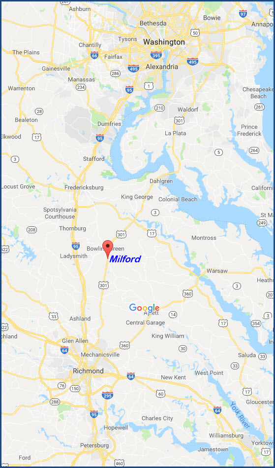
Milford Virginia is a place you're not likely to stop at for any particular reason. It is off of VA207, which extends the US301 route from Baltimore to Richmond, bypassing DC. Many years ago, it use3d to be faster to take US301 to get around DC, but with the growth in the past 20 years, it takes about 4 hours to get from Baltimore to Richmond via 301. US301 splits away from VA207 a mile or so north of here in Bowling Green.
The VA207 bridge over the CSX is a pretty good spot to take pictures from, however, you are smack dab in the middle of two signal bridges, so you can't see either of them.
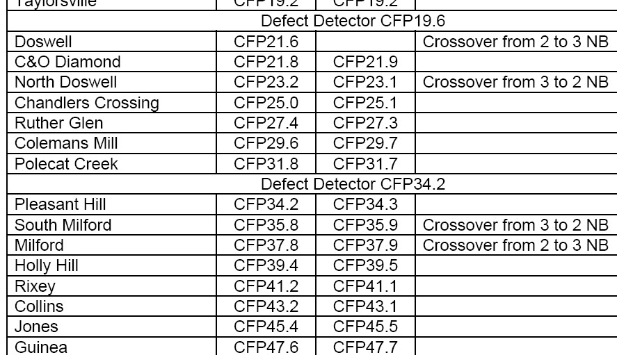
The above is from http://www.railsinvirginia.com/guides/rf&p_subdivision.pdf
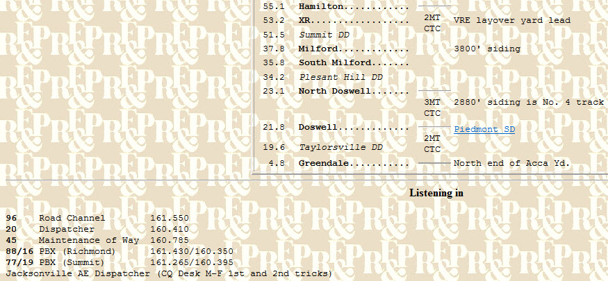
The above is from http://www.trainweb.org/varail/csxrfp.html, click on the link for much more info!
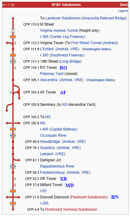
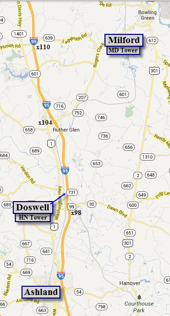
Acknowledgements:
Denver Todd
Websites and other additional information sources of interest for the area:
Here are some other sources of info I have come across for further reading:
http://www.railwaymailservicelibrary.org/aftower/aftower.htm excellent vintage photos of AF Tower & Interlocking
http://www.dcnrhs.org/learn/railfan-hotspots DC Railfan spots
http://www.botecomm.com/bote/rail/railfan_natcap.html More DC railfanning
http://railfanlocations.tripod.com/arlington-va.html NOVA Railfanning
http://www.frograil.com/tours/csx/WashingtonRichmond.php Text only guide DC-Richmond
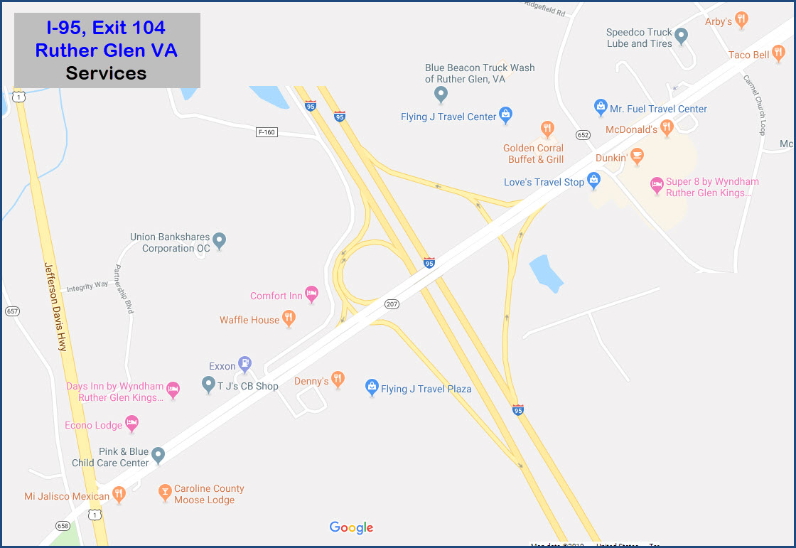
From the I-95 corridor, either NB or SB, jump off at exit 104, and head north. Exit 104 also has some of the cheapest gas around in case you are in need.
From Fredericksburg, you can also come down VA2 into Bowling Green, and then hop onto VA207.
From Maryland, the alternate way to come down is via I-97 to US301.....
Unless otherwise noted, pictures taken by myself on Sunday June 23rd, 2013
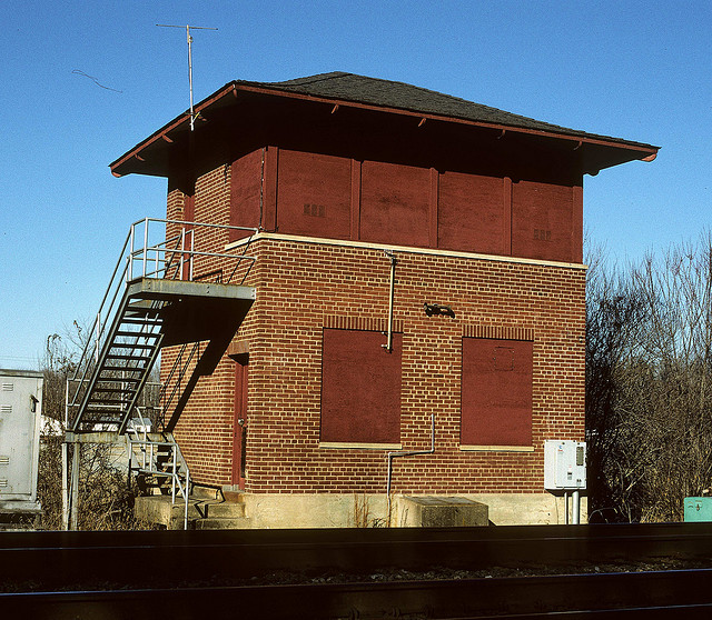 Picture taken in 2002 by P3SUBHUNTER
The building on the left fer sure was a railroad building. Can't say for sure about the other one... maybe?
From VA207 overpass
Looking down on the south side of the VA207 overpass, you will see this dwarf colorlight signal. It controls movements from the sidings shown in the middle picture, onto the siding beyond the crossover seen in the right picture. Pictures from the VA207 overpass
NB around 3:50pm
SB around 4:00pm
SB Amtrak came thru around 4:15pm
Milepost south of VA207
Looking south from the VA207 overpass
Looking north from the VA207 overpass
Sidings off Industrial Drive / VA640.... a few are actually still used!
The private grade crossing where the Amtrak pictures were taken from
CAUTION: If you are taking pictures from either of the two bridges, you need to be careful of an over active FBI guy that lives in Milford (he has Rescue Squad license plates on his white Honda SUV). He may stop and ask you if you need any help, to which I replied Nope, I'm good, thank you for asking tho. We got into a dialog after he took down my license plate number, where he got indignant because I was somehow supposed to know that that was HIS way of asking what are you doing? Silly me, like I'm supposed to be a mind reader. While I was taking pictures from the 207 overpass, a local cop or sheriff in an unmarked Tahoe kind of vehicle stopped and asked what I was doing, and I told him straight-up. If our federal gendarme had asked the same question... well, he knows he would have gotten a straight answer too, and then he wants to be POed at me! The FBI guy assured me he knew about railfans, and told me that he has never seen any here, so I guess that makes it the wrong thing to do in Milford cause no-one has ever done it there before.... Personally, I don't think he knows two hoots about us. I wonder how they treat the active Muslim terrorist training camp guys located not too far from Doswell (the place they buried the Boston Bomber cause no-one else wanted him?)? Oh well, so much for my soap box....
Disclaimers:
I love trains, and I love signals. I am not an expert. My webpages reflect what I find on the topic of the page. This is something I have fun with while trying to help others.
Please Note: Since the main focus of my two websites is railroad signals, the railfan guides are oriented towards the signal fan being able to locate them. For those of you into the modeling aspect of our hobby, my indexa page has a list of almost everything railroad oriented I can think of to provide you with at least a few pictures to help you detail your pike.
If this is a railfan page, every effort has been made to make sure that the information contained on this map and in this railfan guide is correct. Once in a while, an error may creep in :-)
My philosophy: Pictures and maps are worth a thousand words, especially for railfanning. Text descriptions only get you so far, especially if you get lost or disoriented. Take along good maps.... a GPS is OK to get somewhere, but maps are still better if you get lost! I belong to AAA, which allows you to get local maps for free when you visit the local branches. ADC puts out a nice series of county maps for the Washington DC area, but their state maps do not have the railroads on them. If you can find em, I like the National Geographic map book of the U.S..... good, clear, and concise graphics, and they do a really good job of showing you where tourist type attractions are, although they too lack the railroads. Other notes about specific areas will show up on that page if known.
Aerial shots were taken from either Google or Bing Maps as noted. Screen captures are made with Snagit, a Techsmith product... a great tool if you have never used it!
By the way, floobydust is a term I picked up 30-40 years ago from a National Semiconductor data book, and means miscellaneous and/or other stuff.
Pictures and additional information is always needed if anyone feels inclined to take 'em, send 'em, and share 'em, or if you have something to add or correct.... credit is always given! Please be NICE!!! Contact info is here
Beware: If used as a source, ANYTHING from Wikipedia must be treated as being possibly being inaccurate, wrong, or not true.
RAILFAN GUIDES HOME
RAILROAD SIGNALS HOME
NEW
JUN30/2013, MAY13/2014, JUN11/2019, APR23/2020
Last Modified
24-Apr-2020