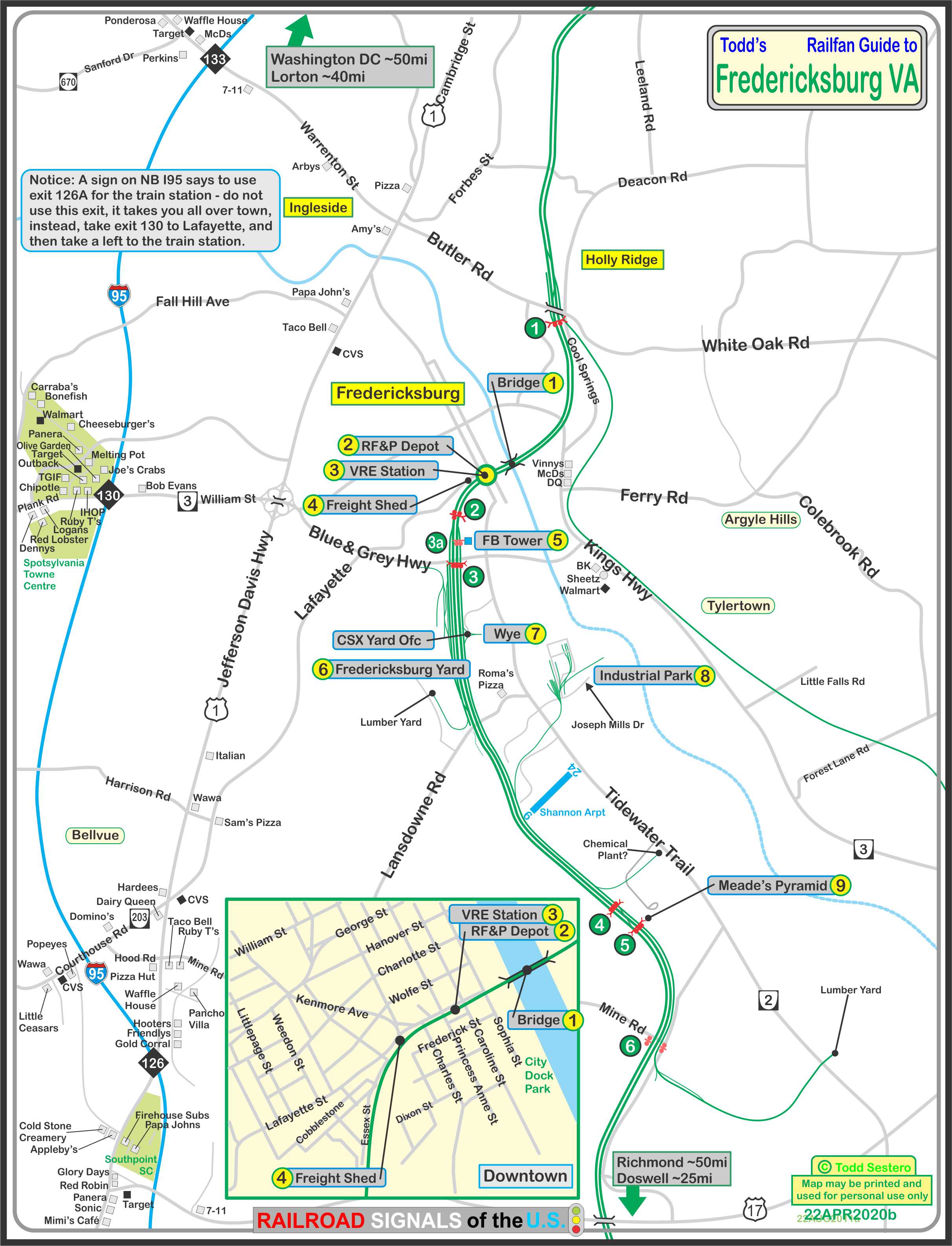
Location / Name:
Fredericksburg VA, No County - Fredericksburg has been independent since
1879, but is surrounded by Spotsylvania County
What's Here:
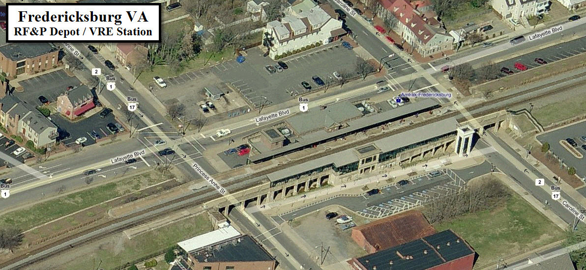
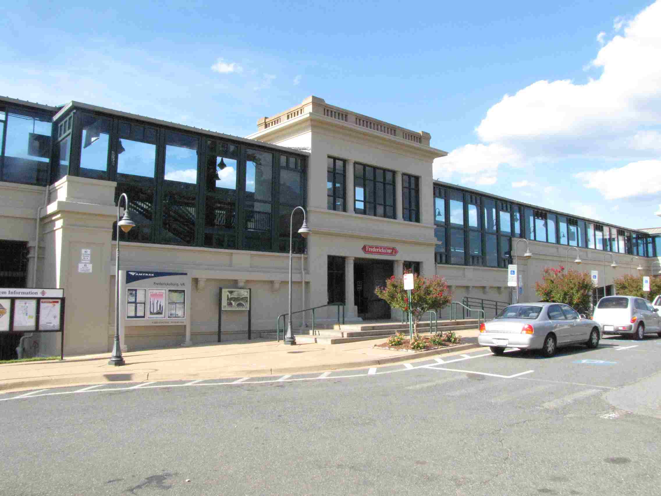
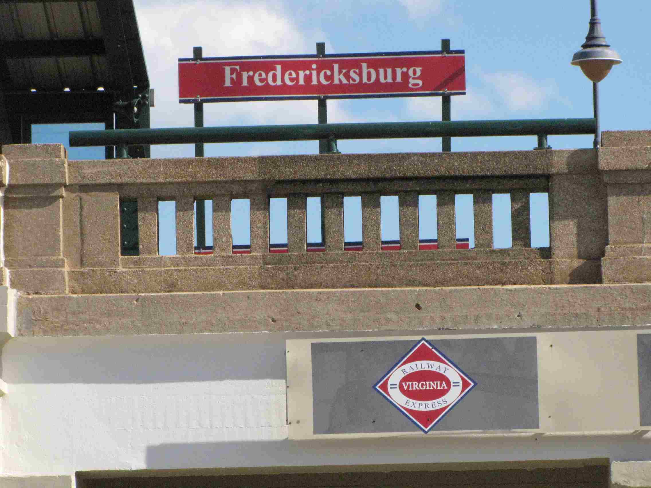
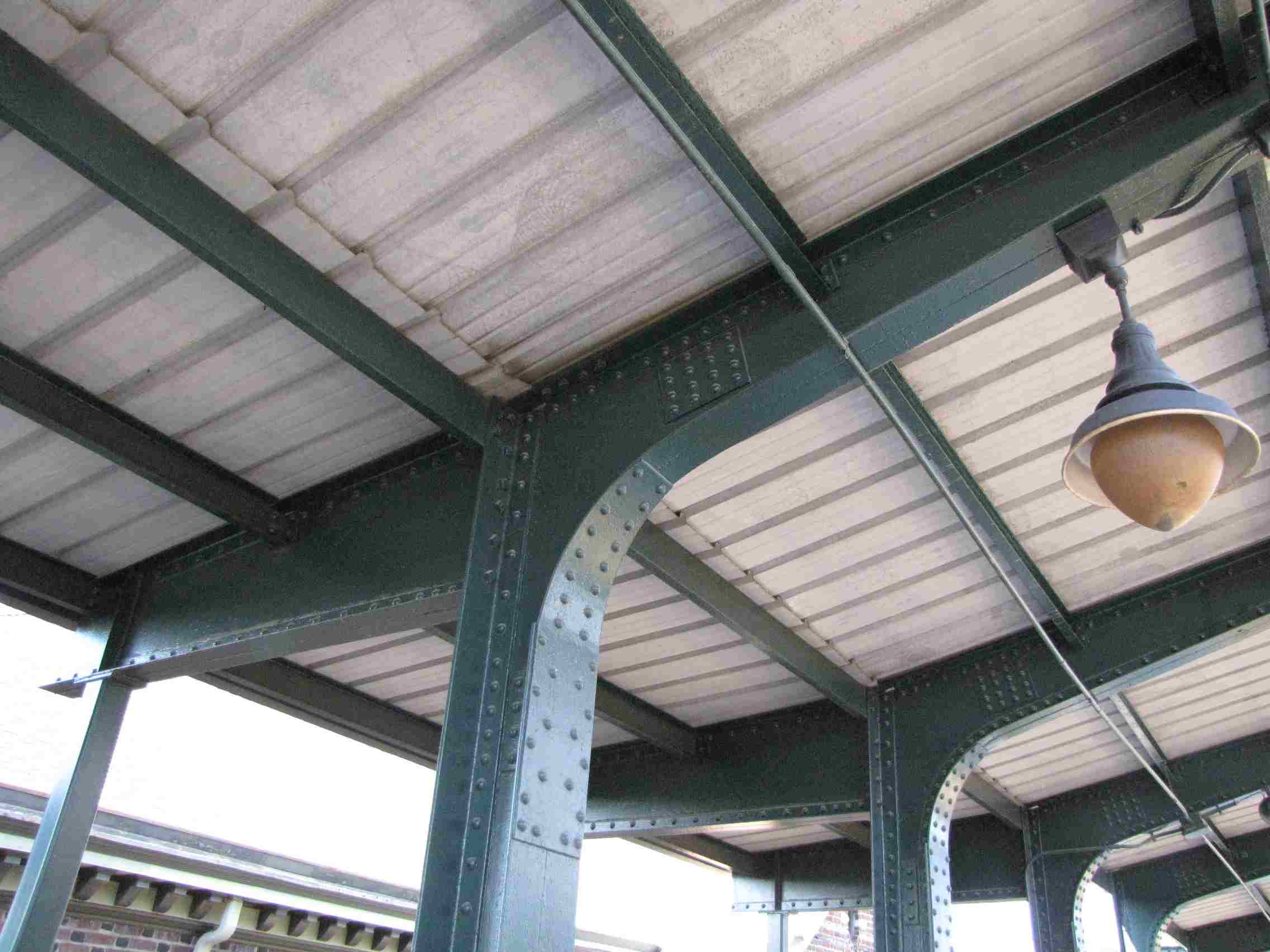
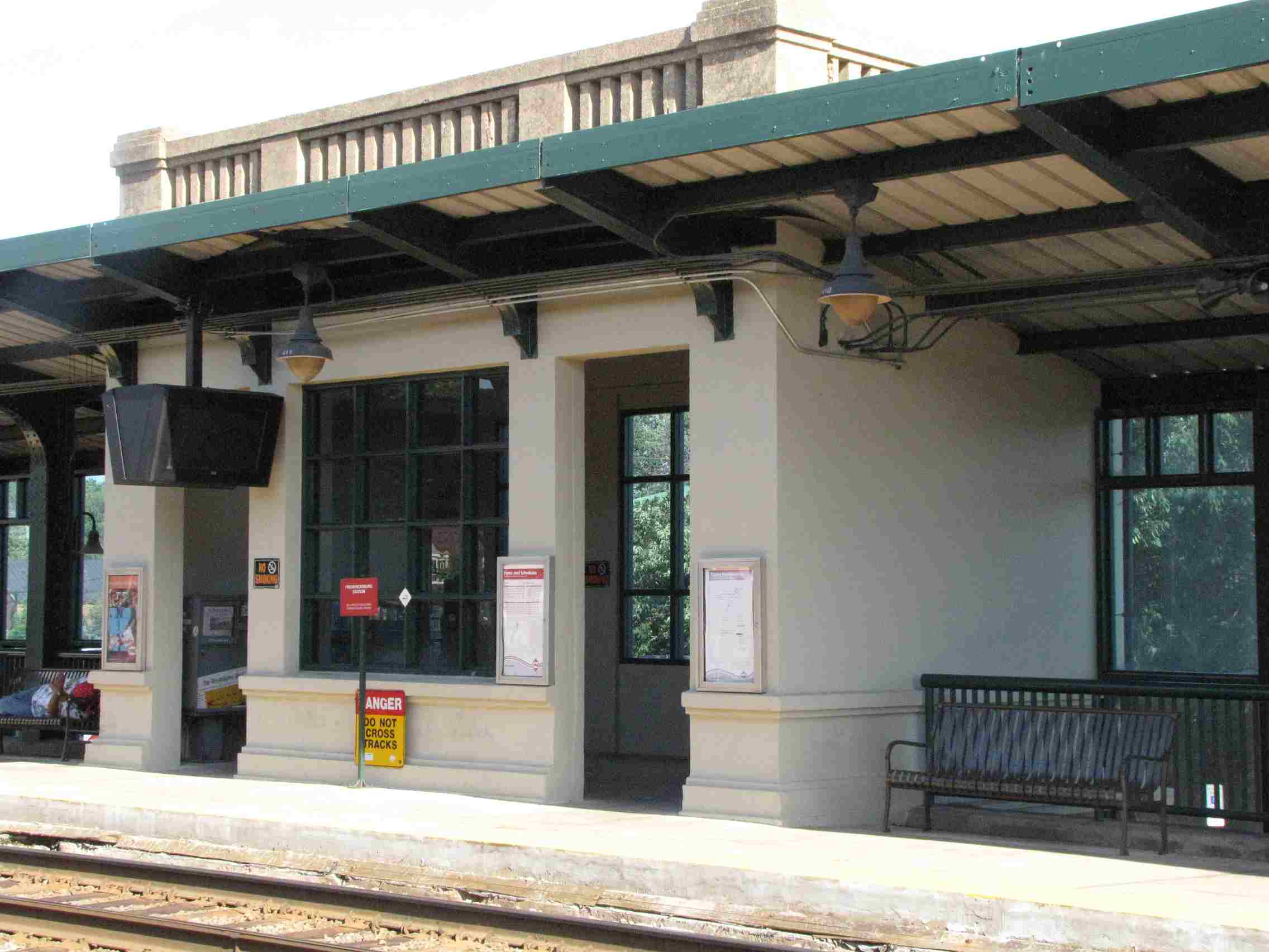
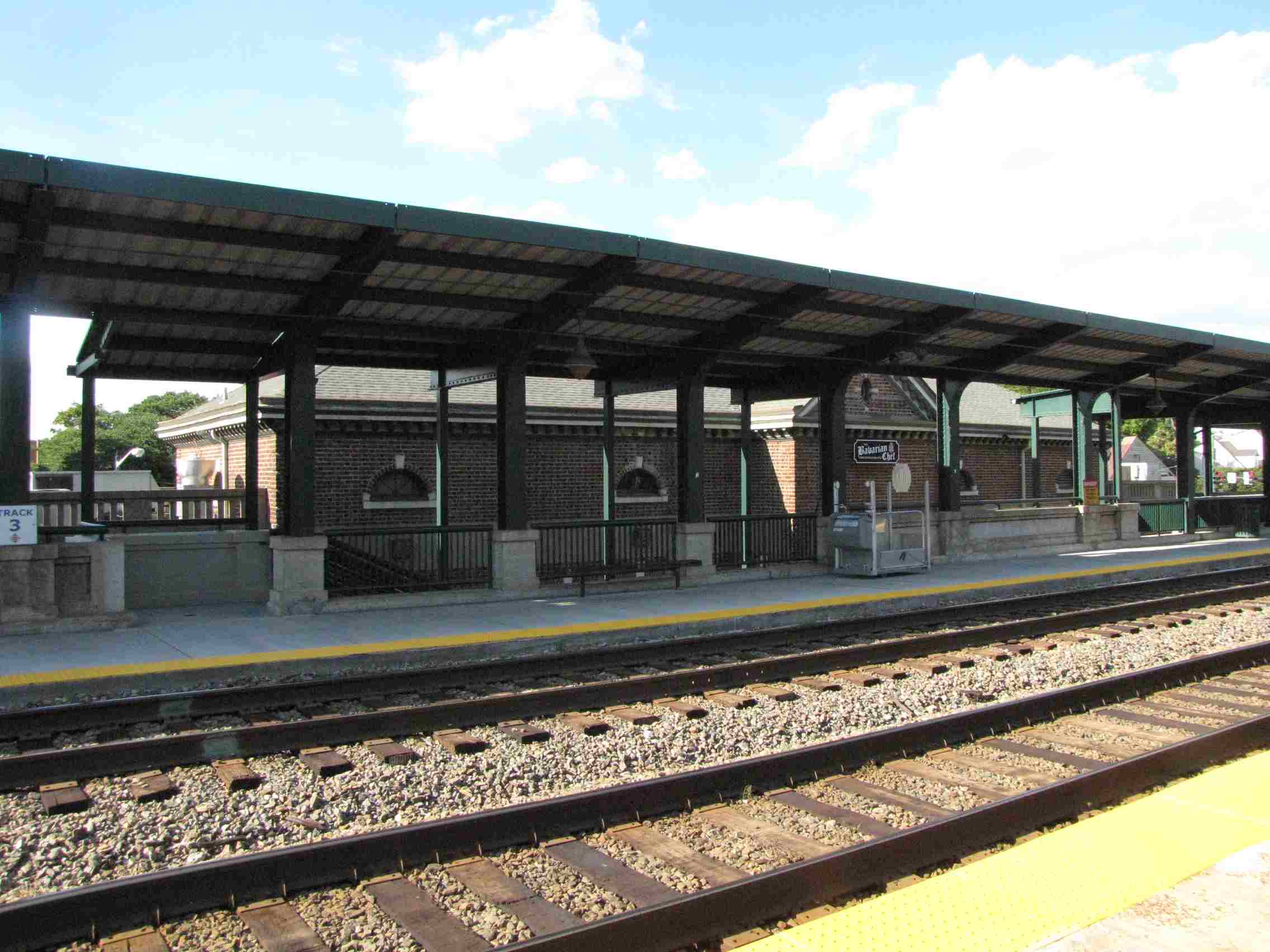
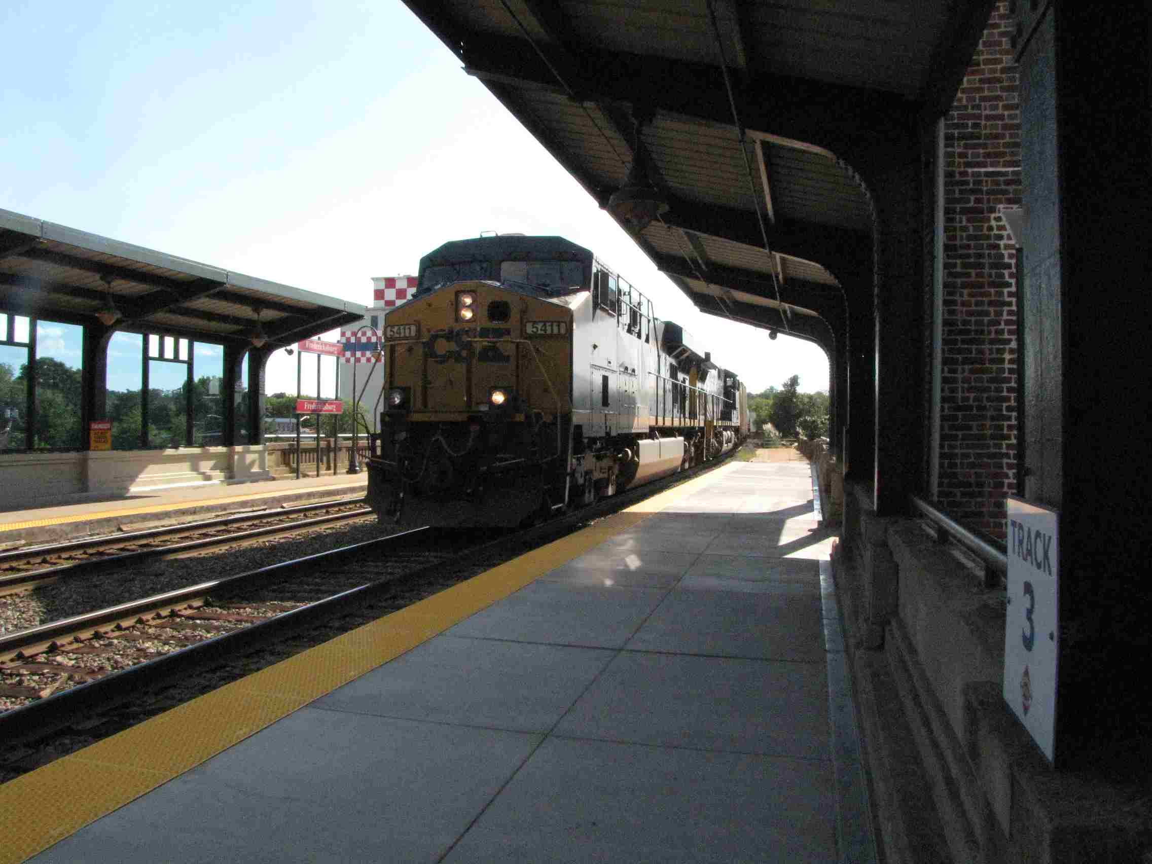
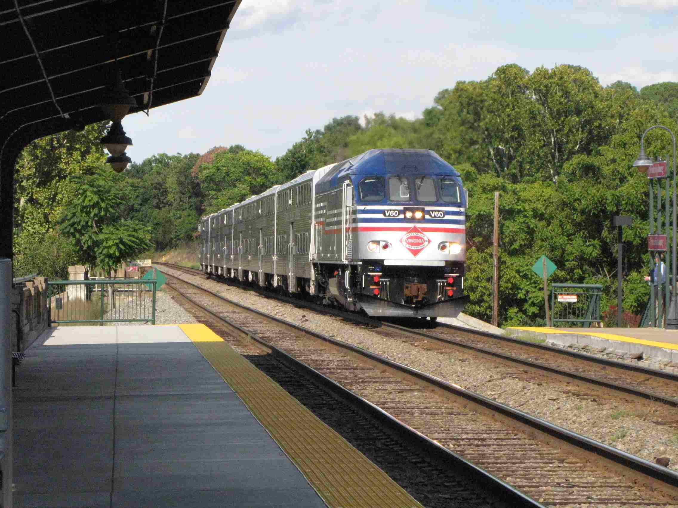
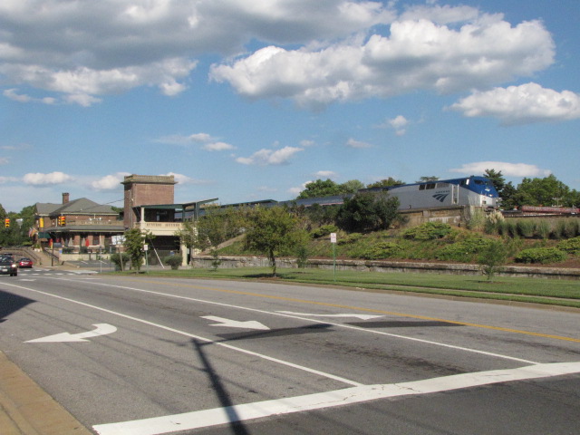
Fredericksburg VRE Station
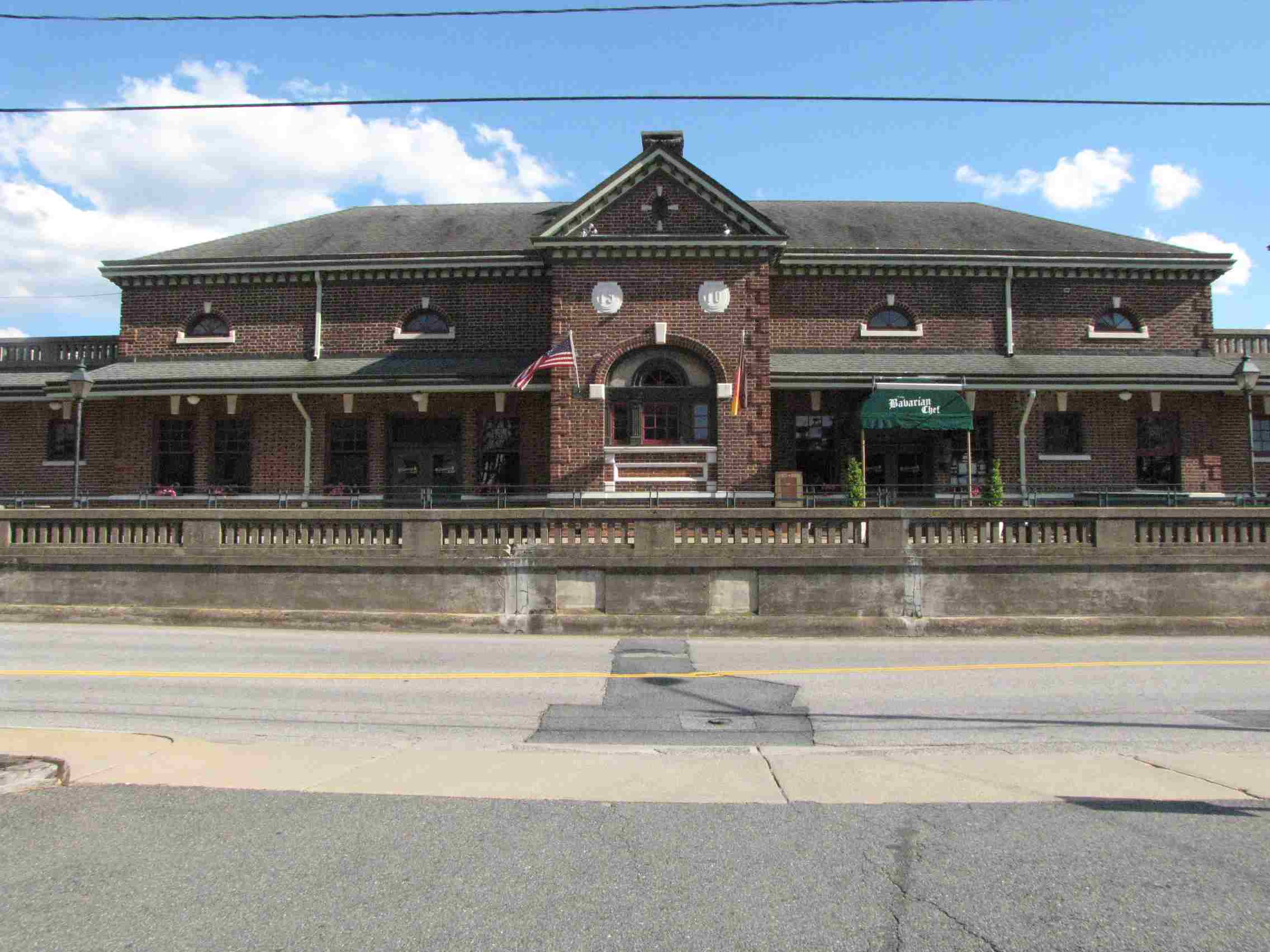
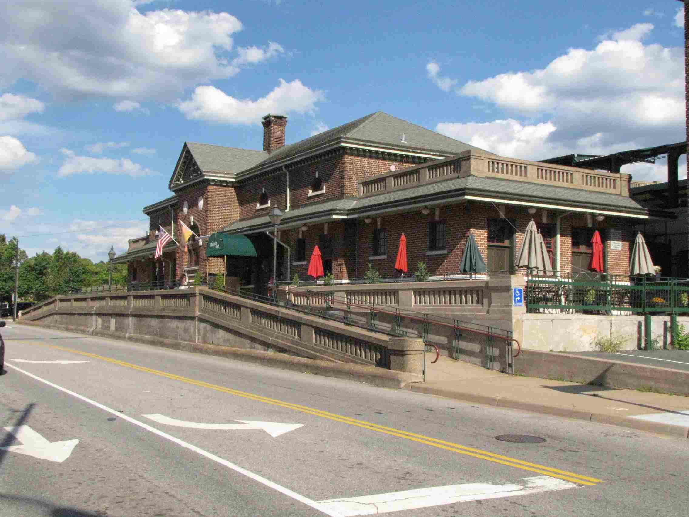
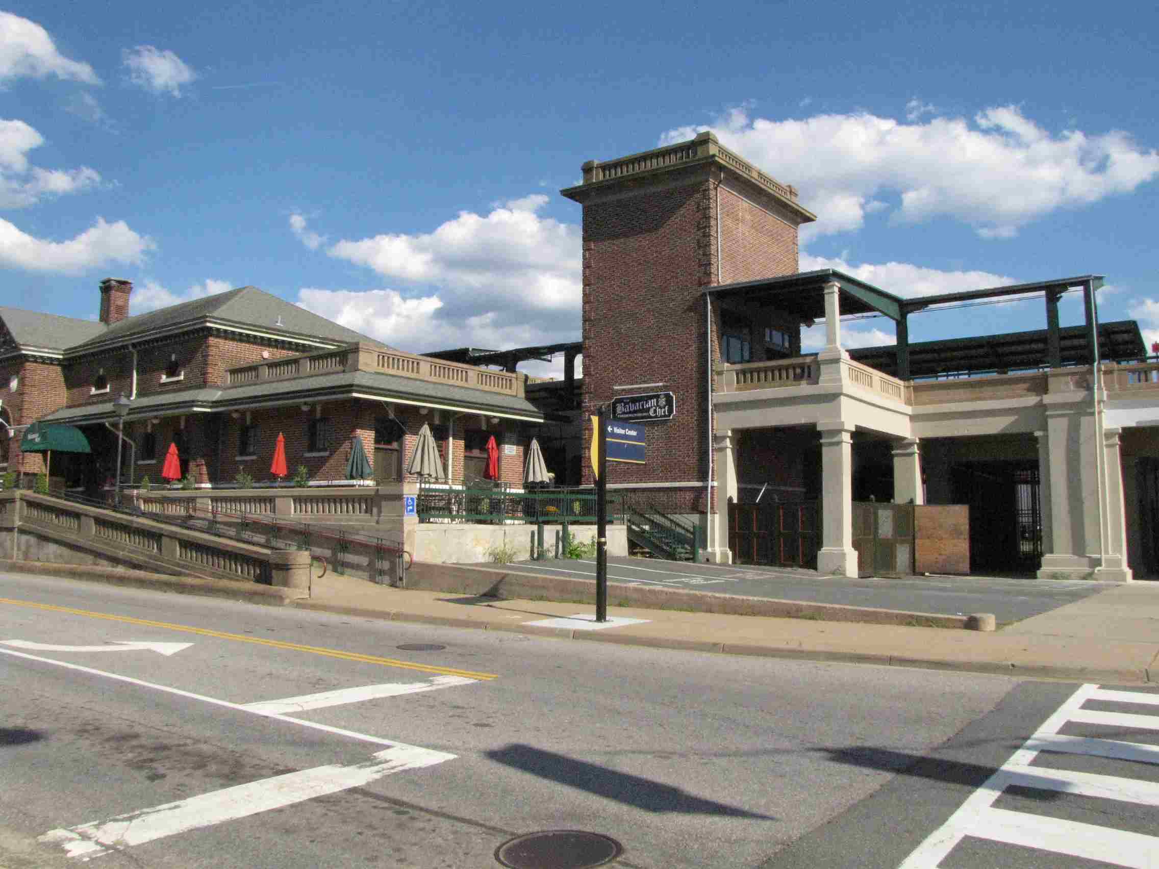
Former RF&P Depot
Former RF&P Freight Shed
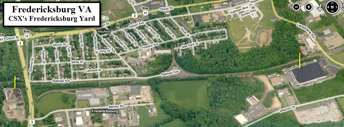
VRE End of Line Yard
Rappahannock Railroad Museum
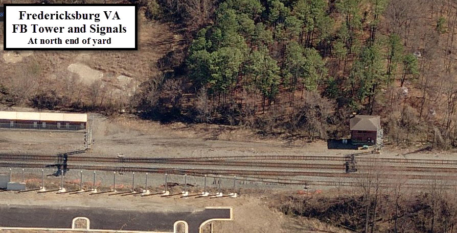
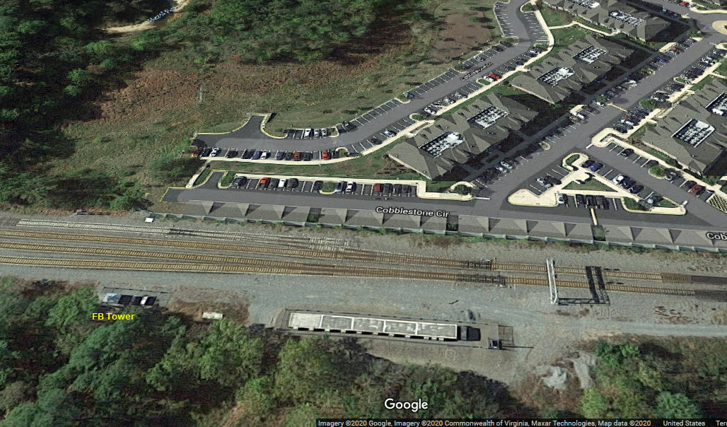
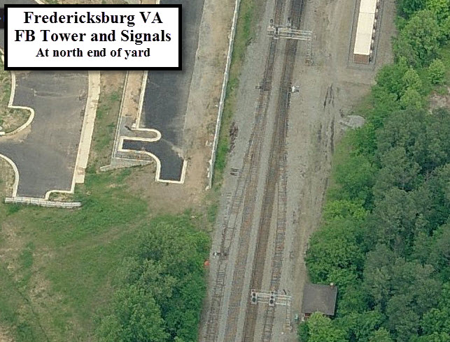
FB Tower
Data:
GPS Coordinates: as needed
Phone A/C: 540
ZIP: 22401
Access by train/transit:
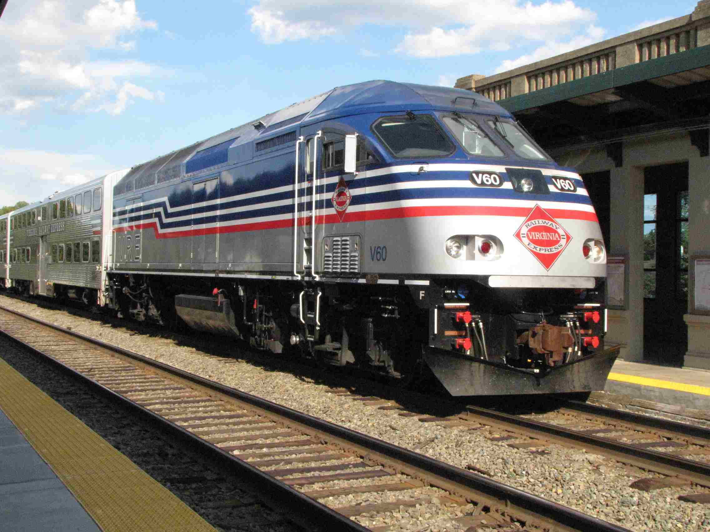
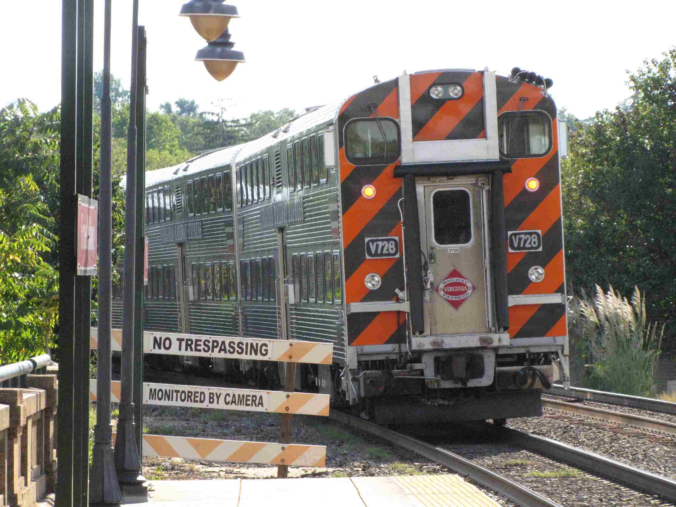
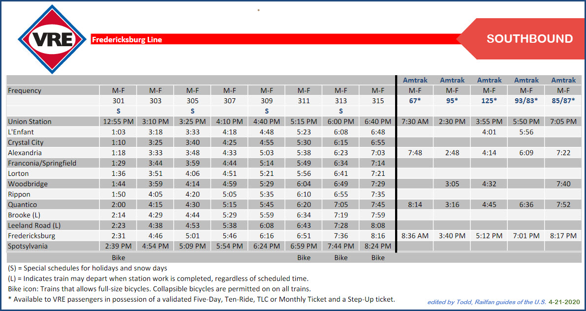
VRE Fredericksburg Line Commuter Trains
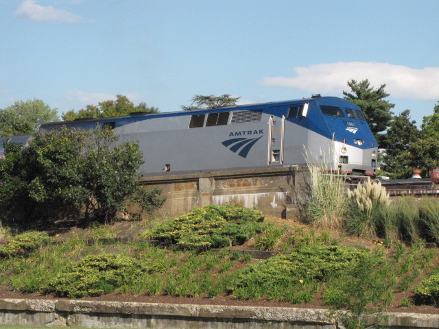
Amtrak
The Scoop:
This page covers a location that is about halfway between Richmond VA and Washington
DC on CSX, what used to be the old RF&P.
In addition to being on CSX's main
N-S route on the east coast, Fredericksburg is also home to a station that
services both Amtrak and VRE, which is the southern most the VRE goes. The
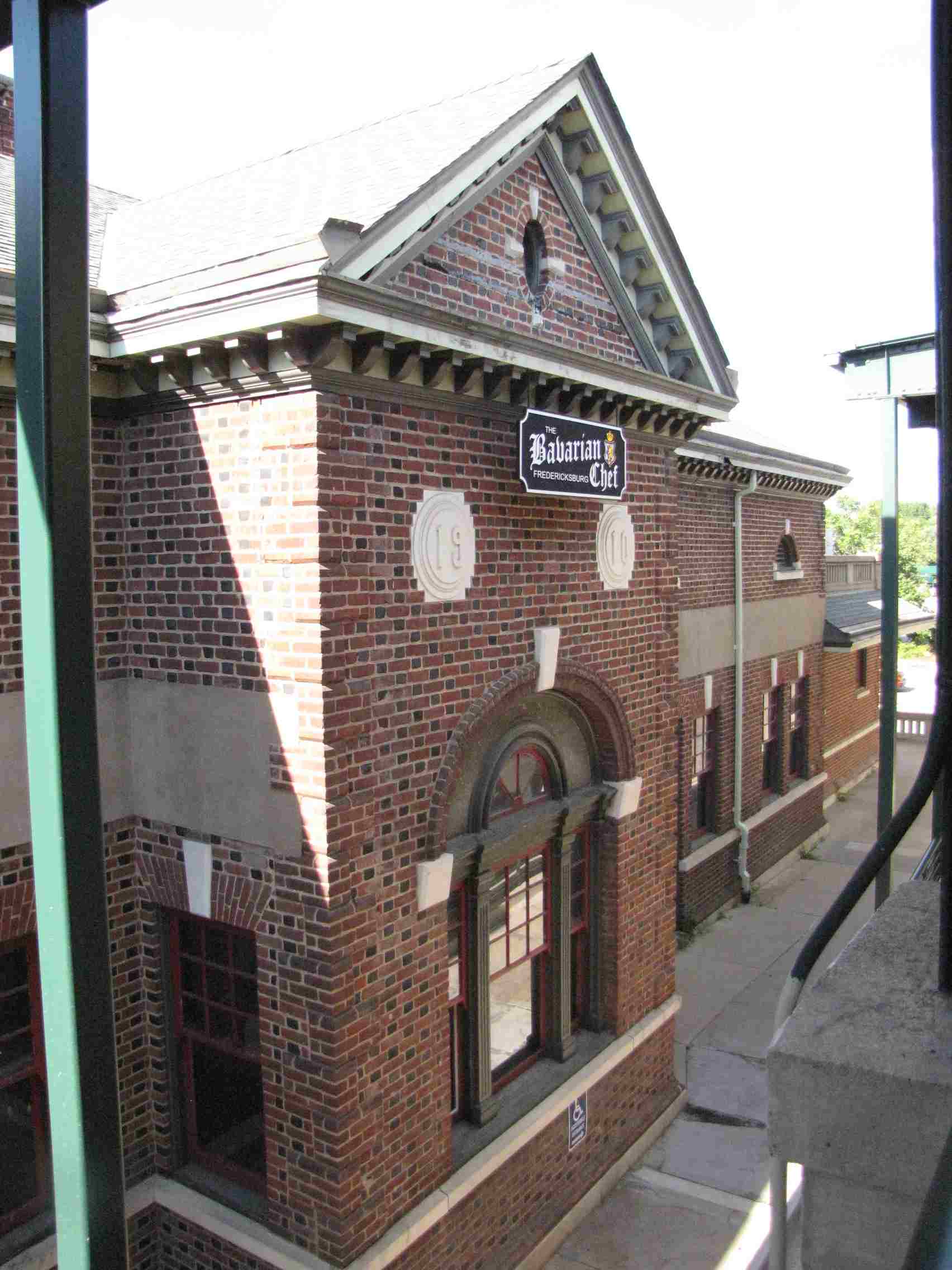
adjoining RF&P depot now houses a restaurant.
Several other noteworthy attractions for the railfan are here in Fredericksburg.
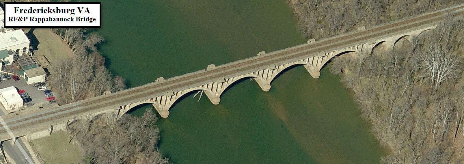
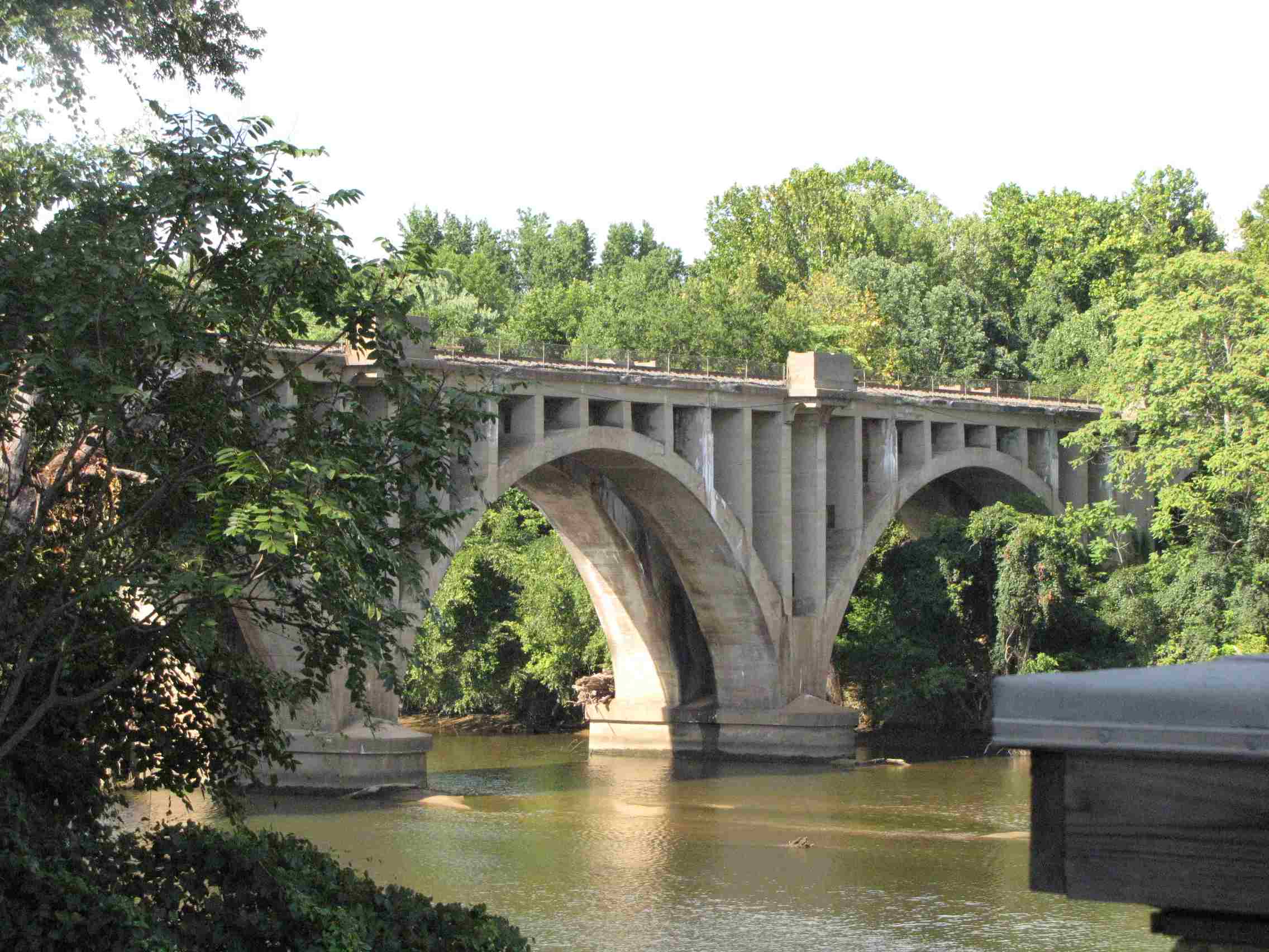
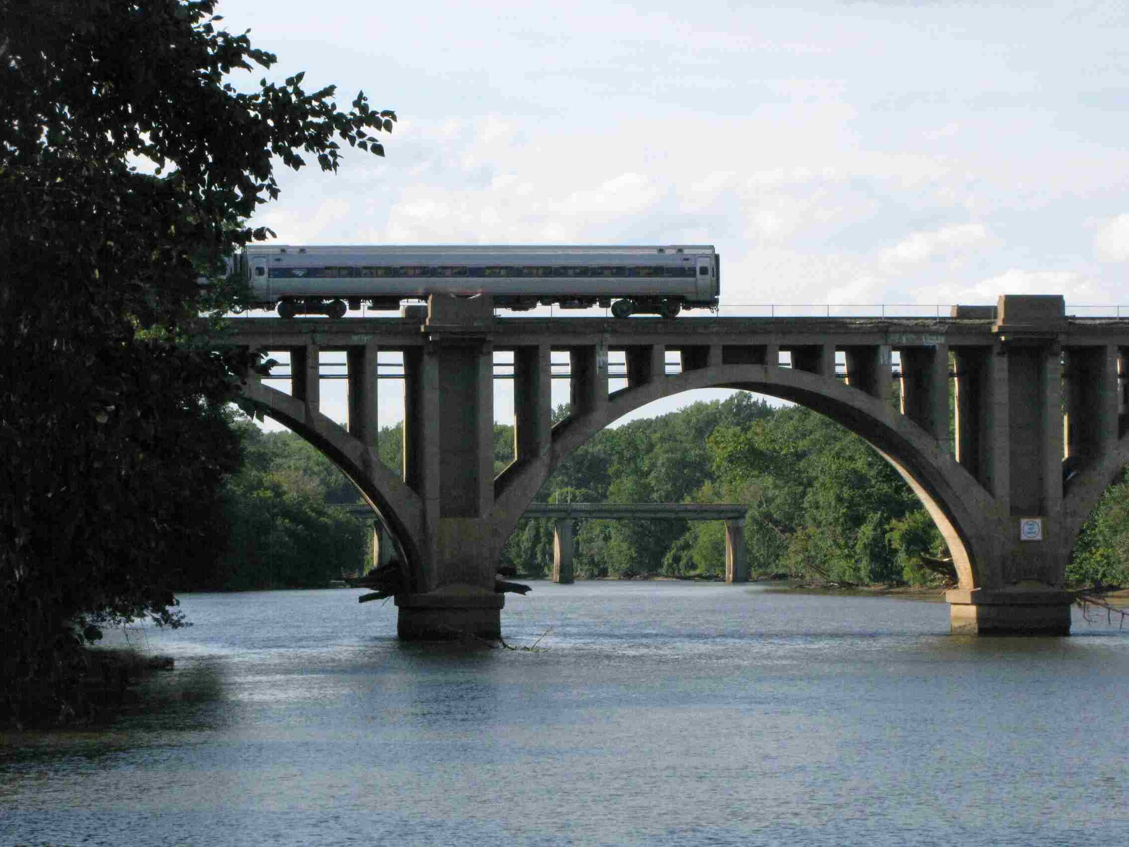
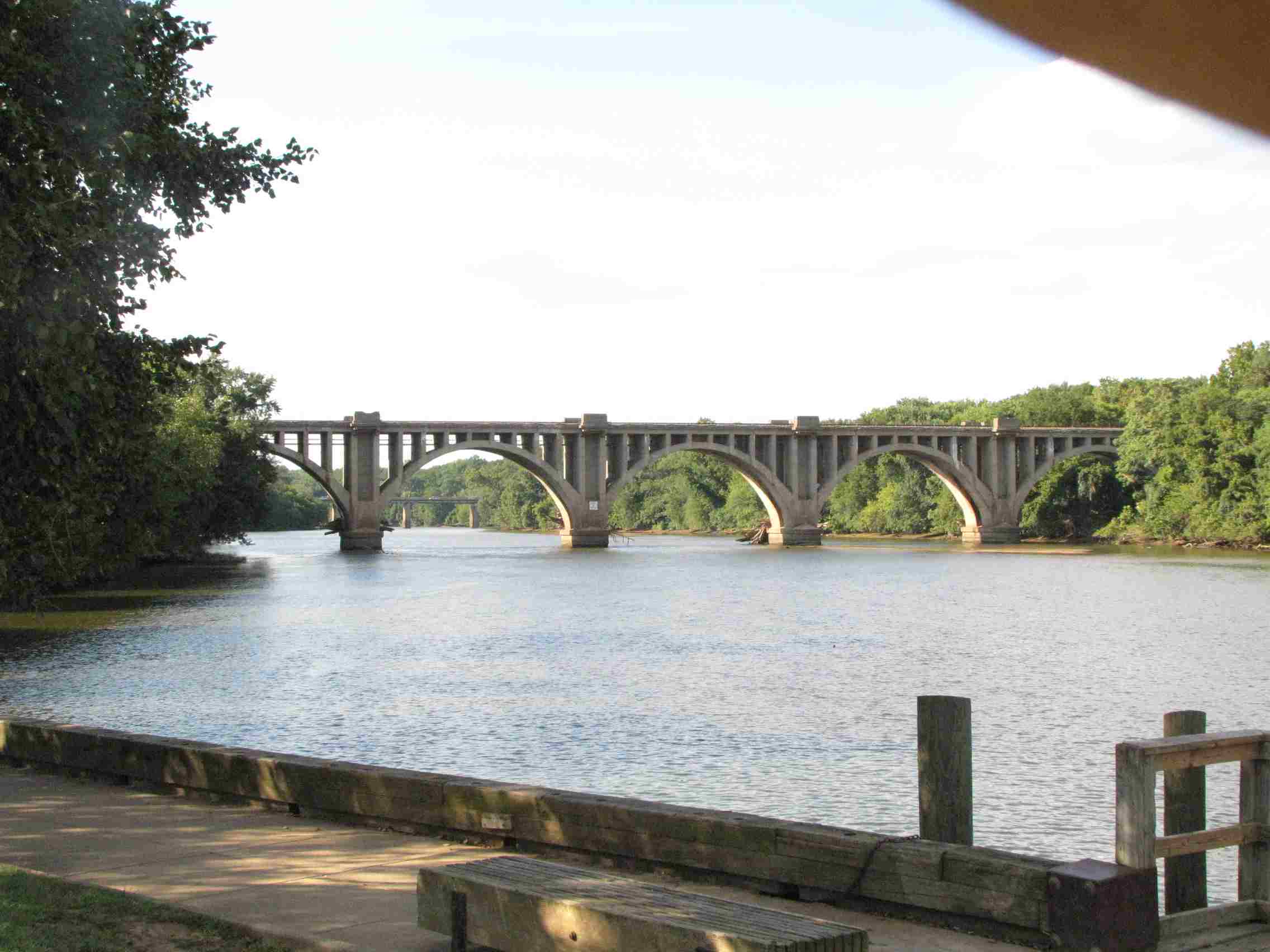
The biggest one is probably the Rappahannock River crossing on a 10 arch bridge, 5
of which remind you of the spans of the Tunkhannock Viaduct in Nicholson PA.
Trains are frequent enough that you shouldn't have to wait too long before something
comes over the bridge.
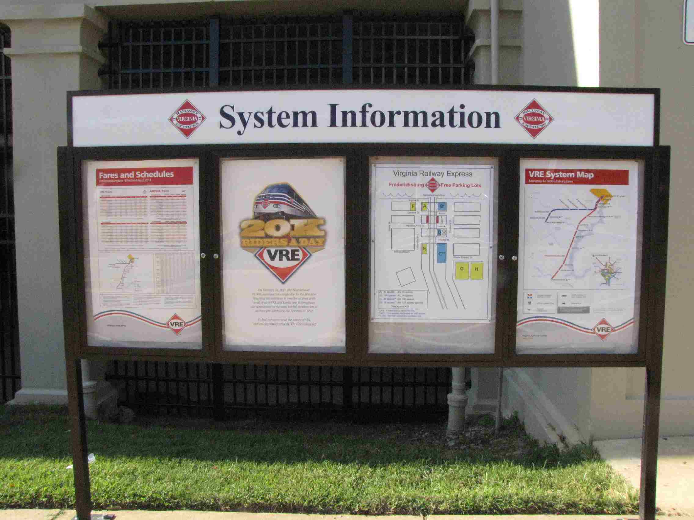
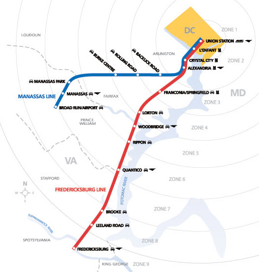
Fredericksburg is the southern
terminus for the Virginia Rail Express (VRE)
line named after the town. A link to their Fredericksburg page is
here. There is
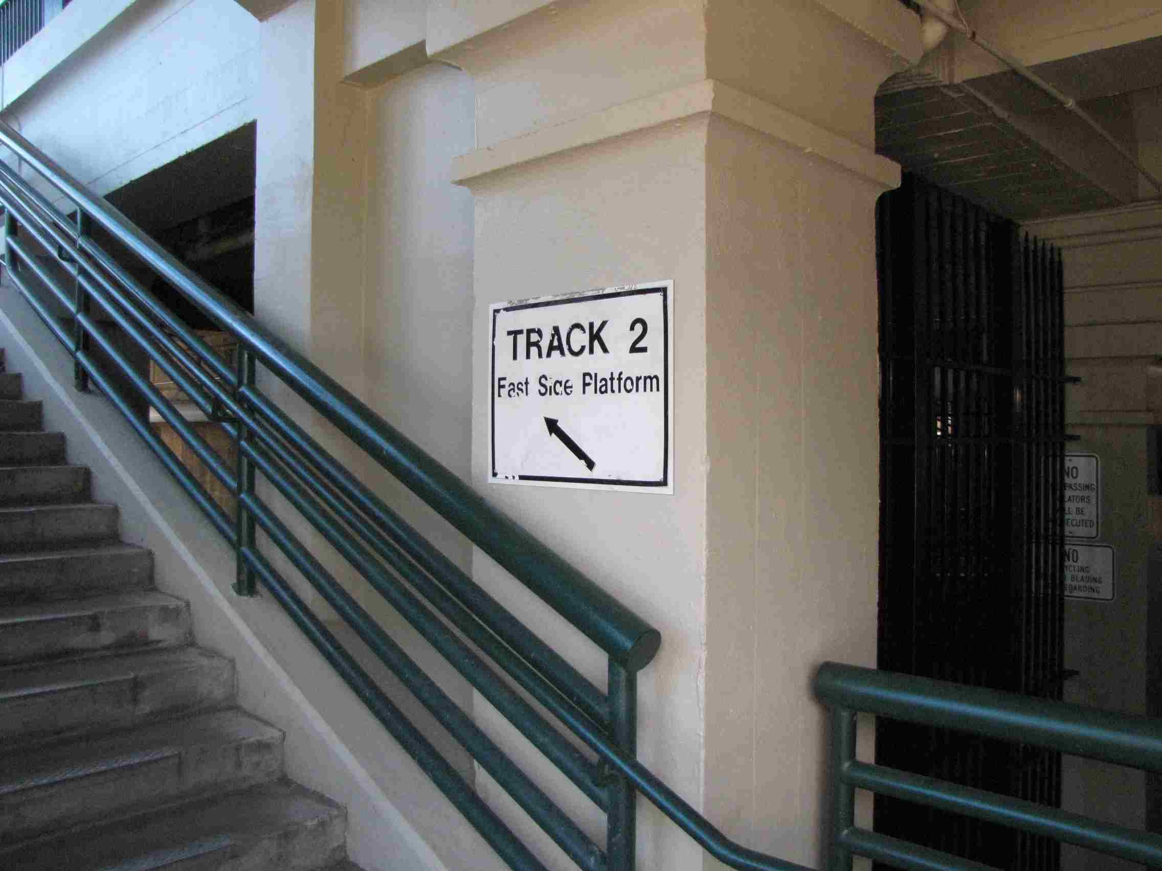
one TVM located on the track 2 platform, and it only accepts debit or credit
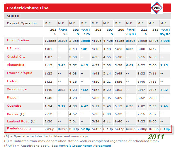
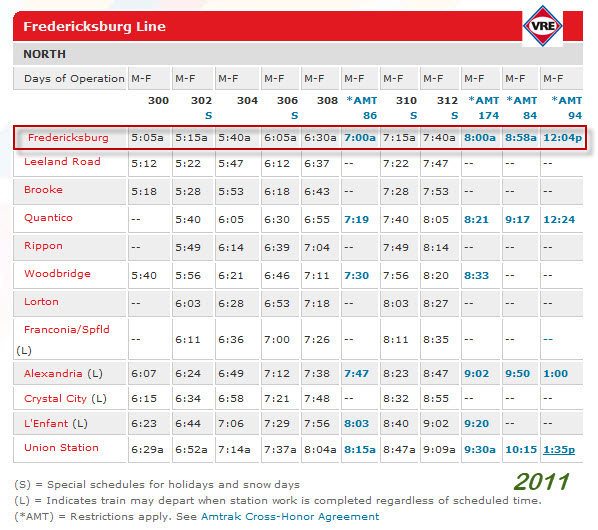
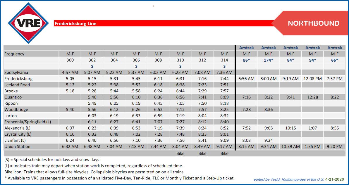
cards. Schedules and map appear below. Eight (8) Amtrak Monday thru
Friday trains stop here too, and the VRE has a reciprocal agreement with them
so you can use a VRE ticket.
And don't forget the SB
Autotrain (#53) comes rambling through just
before 16:30. If the NB #52 is on time, it should be coming through just
before 08:00 with an arrival time in Lorton of 08:30.
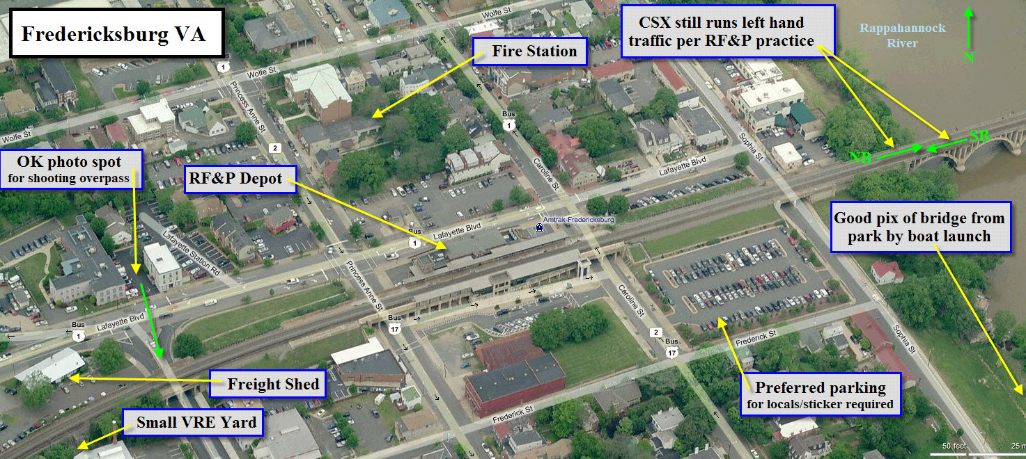
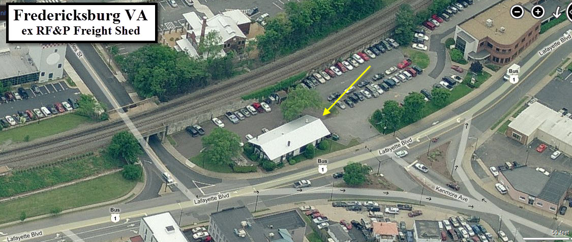
South of the station is a small yard, FB Yard, where the VRE trains lay overnight and CSX cuts off local cars.
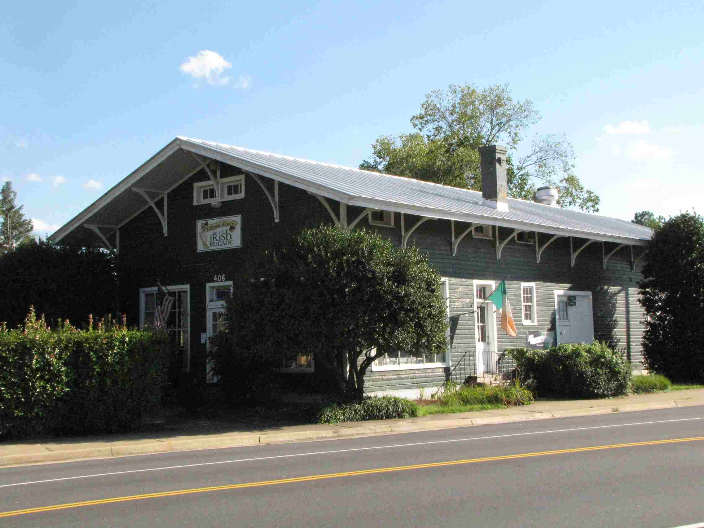
Next to the station where the traffic light for Kenmore and Lafayette is, sits
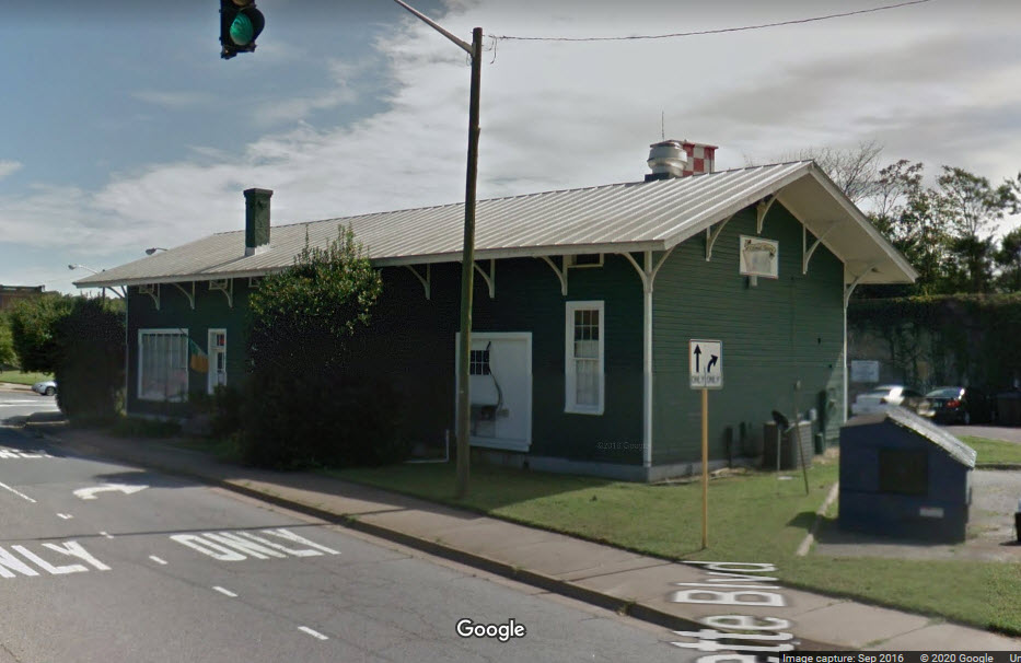
an old RF&P freight shed that now sees life as a pub.
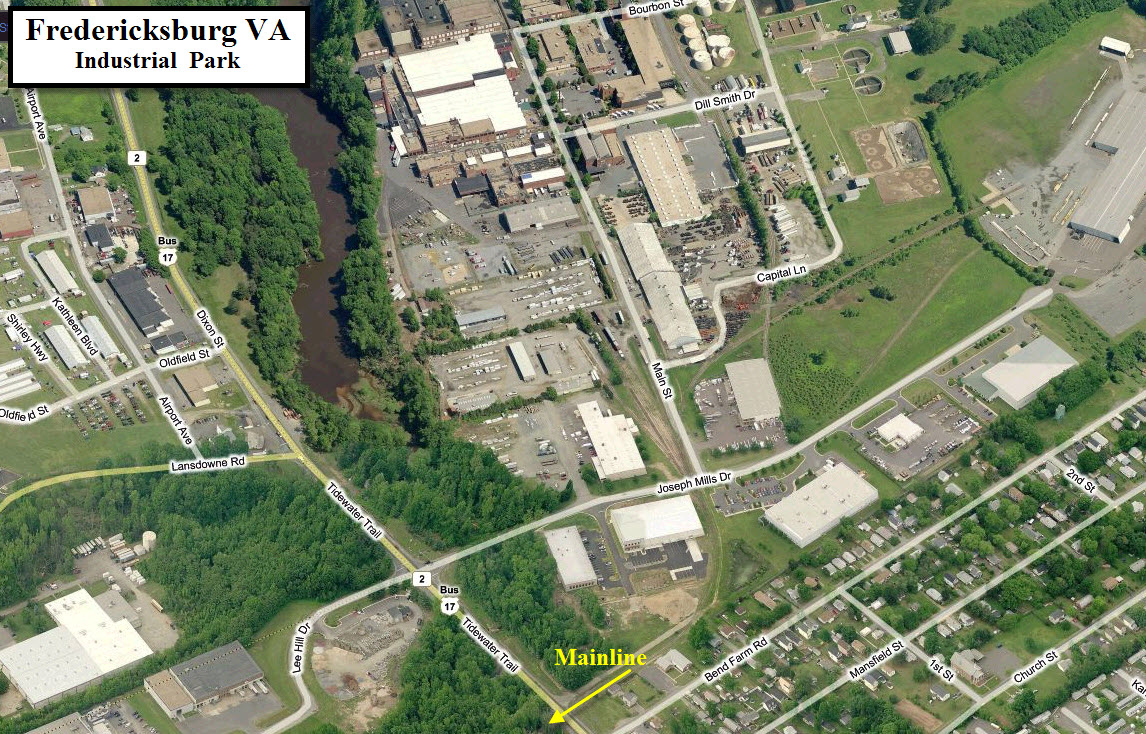
I don't normally make a big deal out
of industrial parks, but these days when most industrial park members have gone
to using truck service, it appears that there are still plenty of railroad
customers in this one. If you can catch a local working the yard, it
should make for some interesting shots. The the track layout is
interesting and worthy of being modeled.
The industrial park is also home to the Rappahannock Railroad Museum. They
have a number of old freight cars, cabooses, a PRR baggage car, and provide
rides on old work cars.
If you make it here, you may also
want to plan on driving the 25 miles or so down to Doswell (and Ashland a few
miles further south where they run up the middle of two streets so it looks
almost like street running) and make a day out of these two or three places.
A description of things (sidings, signals, speeds, etc) on the RF&P is
here, although I notice he has in there that a deck girder bridge cross the
Rappahannock and the viaduct continues to the station.... both of these are
wrong, as the viaduct crosses the river, and the railroad was built up to go
thru the majority of town to be at the same level as the river crossing.
Another accounting of a rail trip of the line is
here.
As you can see from my map below, most of the food service is located at
I-95 exits 126 and 130, with a huge mall area at exit 130.
From Google: Fredericksburg is a city on the Rappahannock River in
Virginia, south of Washington, D.C. Known for its colonial and Civil
War history, it’s home to the 4 battlefields of the Fredericksburg
and Spotsylvania National Military Park: Fredericksburg, Chancellorsville,
Wilderness and Spotsylvania Court House. The park’s Fredericksburg
National Cemetery is the final resting place of thousands of Union soldiers.
Fredericksburg, being right off of I-95, is easy to get to. It is about halfway between Richmond VA and
Washington DC. If you are coming up from the south, take exit 130 instead
of paying attention to the sign on I-95 that tells you to take exit 126 -
there's too many traffic lights and turns between you and the station going via
exit 126. Coming from the north, I usually take exit 133 - taking
Warrenton to Route 1/the Jefferson Davis Hwy, and then taking a left onto
Princess Anne St, which takes you right to the station.
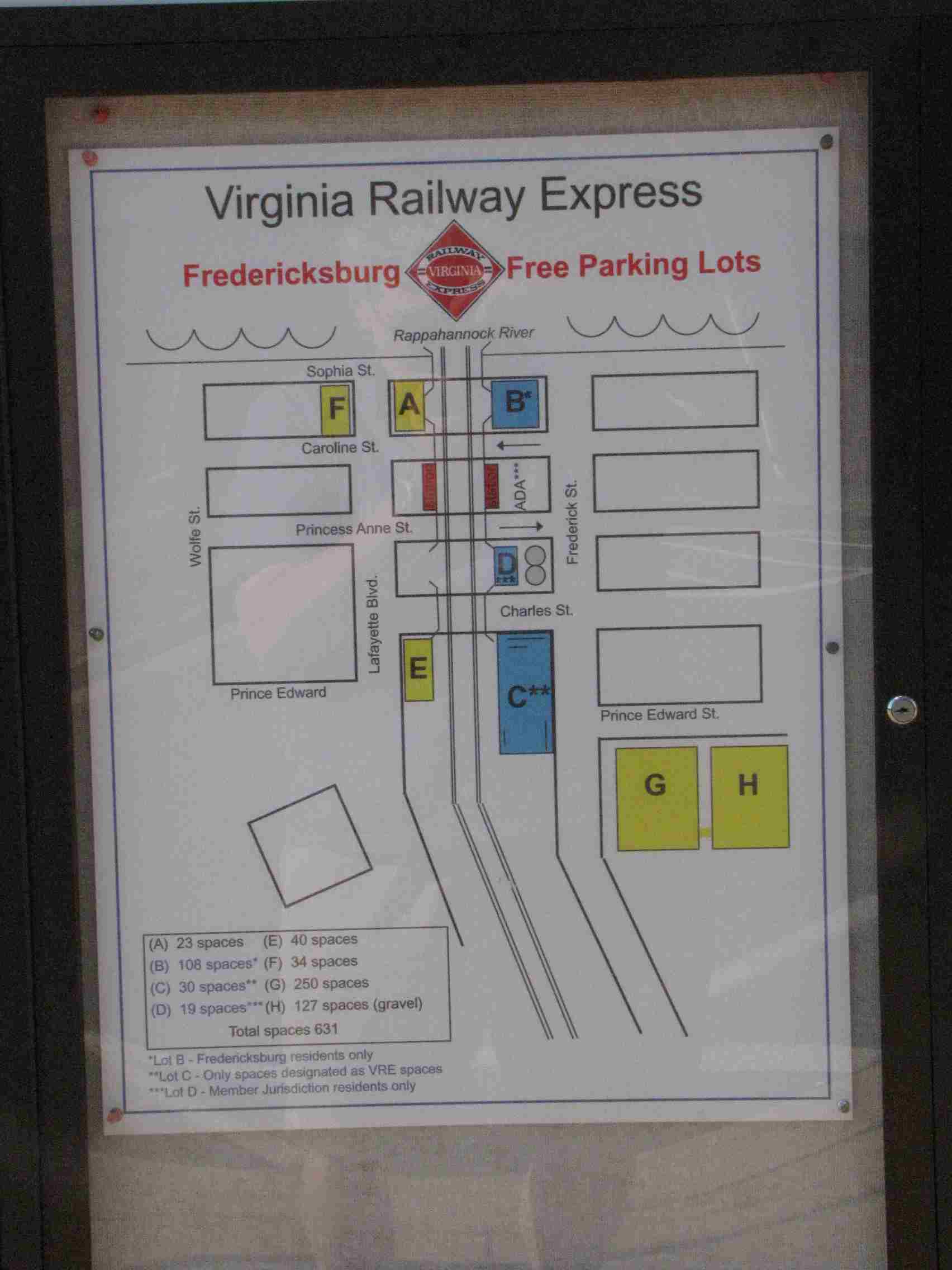
Parking can be a little tough
sometimes, since the main and satellite parking lots are reserved for locals
with a window sticker. The lot directly in front of the station is for
taxi's and drop-off's. You should be able to, however, be able to find
street parking within a short walking distance, especially down towards the city
dock off Sophia St.
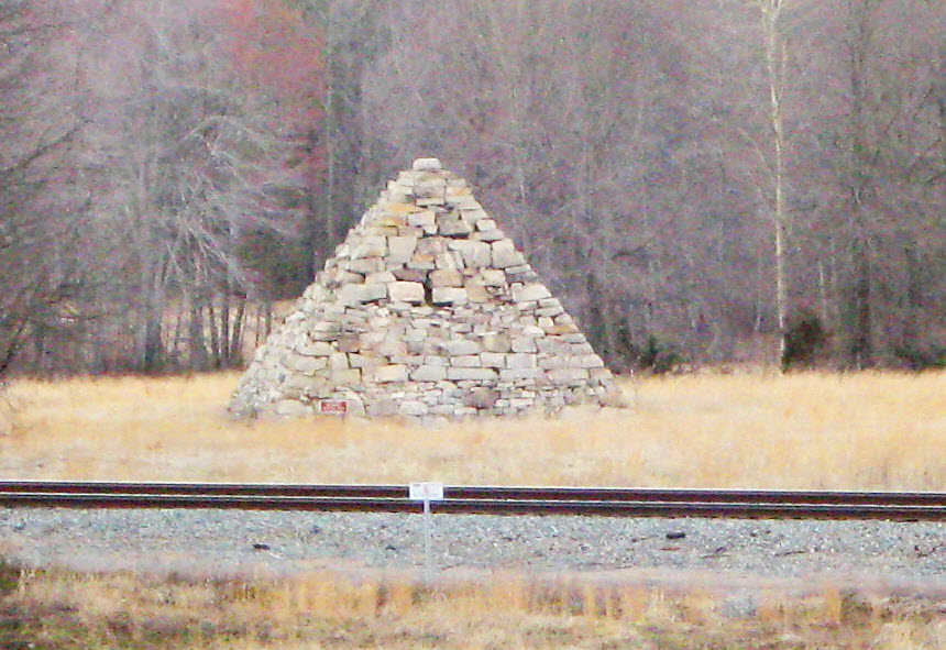
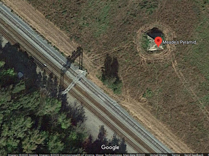
Usually thought of as a Union monument, the large pyramid shown below was in
fact erected by the Confederate Memorial Literary Society. In 1897, the society
contacted Virginia railroad executives asking them to erect markers at historically
significant sites along their lines. The president of the Richmond, Fredericksburg,
and Potomac Railroad embraced the proposal, but rather than simply erecting a sign,
he constructed a stone pyramid modeled after the memorial to the unknown Confederate
dead buried in Richmond's Hollywood Cemetery."
The pyramid is made of rough hewn Virginia granite and is 30 feet square and 23
feet high. A trail leads from the marker back towards the pyramid but the Park
Service does not classify it as accessible as a visitor would have to trespass
across a dangerous set of railroad tracks to reach the pyramid itself (not if
the parking lot/loop seen in the aerial shot is for the monument).
I get conflicting reports about the accessibility to the monument, but that
parking lot off Lee Road looks like a good place to start, and then if it
pans out, is also a good place to shoot trains from at the signal bridge.
SB Interlocking signals for going from 2 tracks to 4.
CSX moved the switches a few feet to the north, moved the signal bridge a
few hundred feet north removing the NB signal from it, and took out the
signal bridge adjacent to the tower (my location 3a) - moving it to the
south side of the Blue & Grey Highway (location 3).
in 2020
in 2011
South FB Interlocking
Google view from 2012, before signals
"old" South FB Interlocking
Location 3a is the bottom of the two signal bridges in this aerial shot from Bing (sorry to repeat myself).
The signal has been moved to the south side of Blue & Grey Hwy, shown above
at location 3.
in 2011
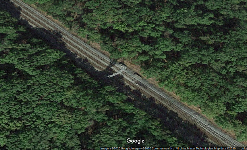
North Crossover Interlocking
South Crossover Interlocking
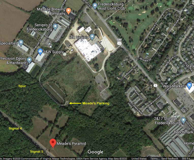
This signal is adjacent to Meade's Pyramid, and there is a parking lot nearby.
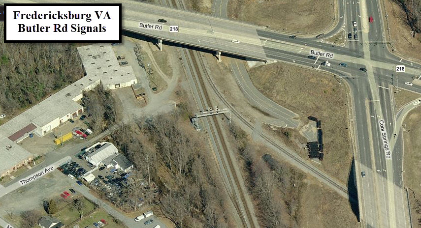
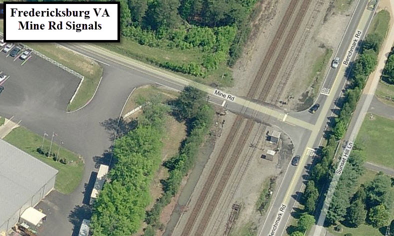
Mine Road Signals
These signals are now gone, they were RF&P signals.
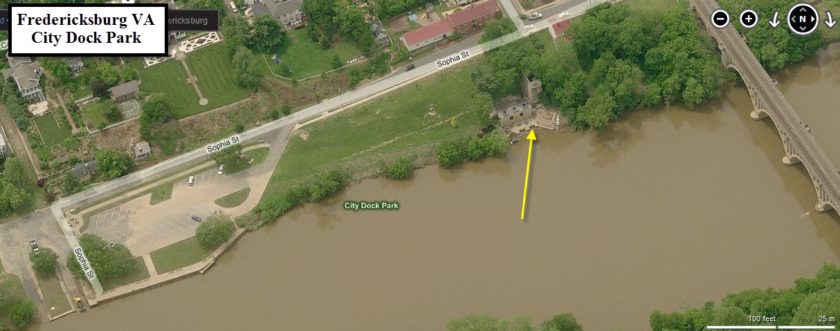
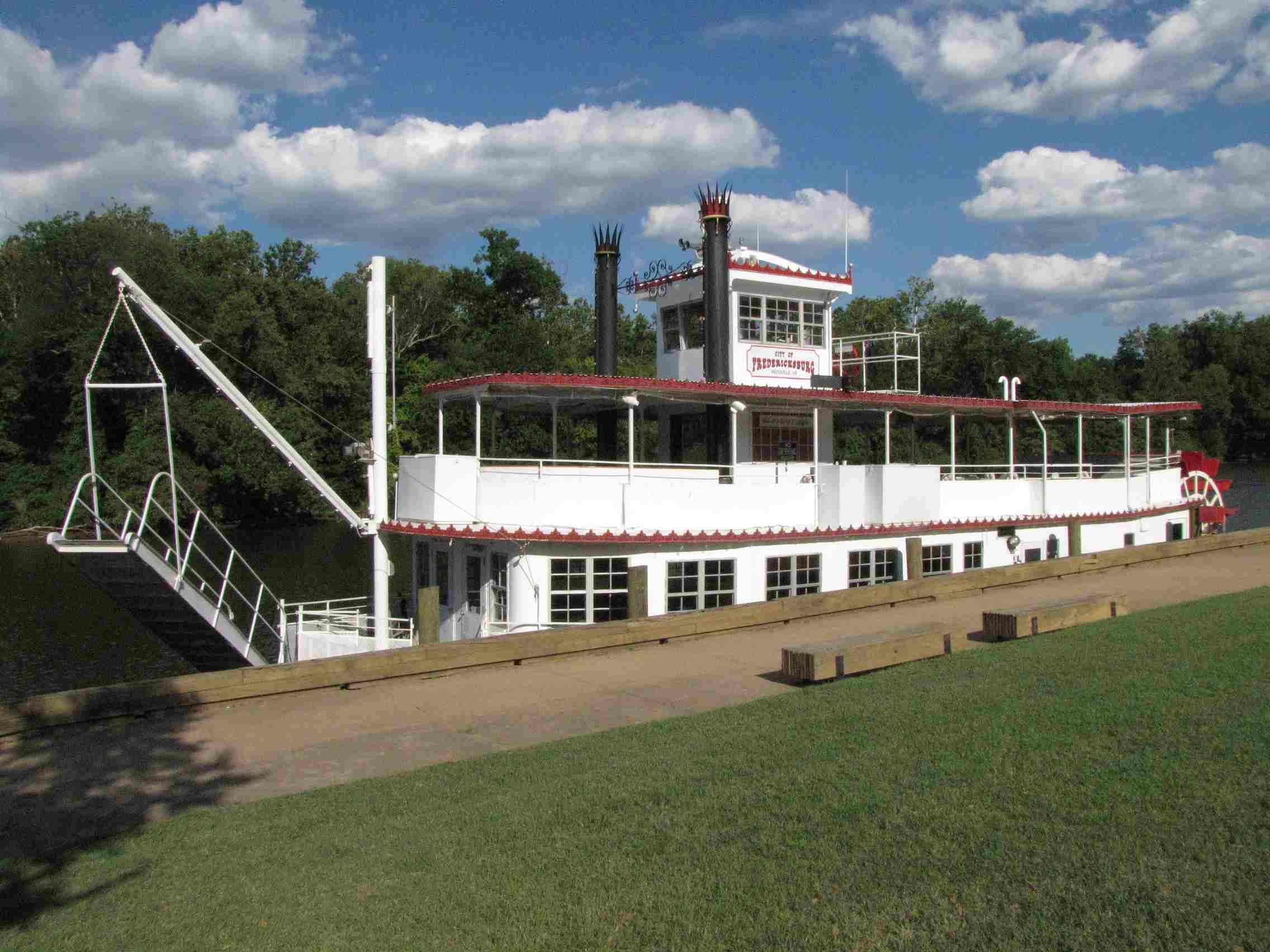
The City Dock Park affords a great
view of the bridge over the Rappahannock River. Because of it's
orientation, mid afternoon shots are probably best here, especially during the
non-summer months since the sun will be lower in the sky.
The arrow points to a most interesting building, but I don't know anything
about it -- it kinda looks like it is a private home now, judging from
the things seen around it... dunno, but it's worth checking out.
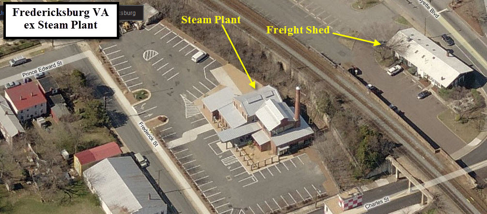
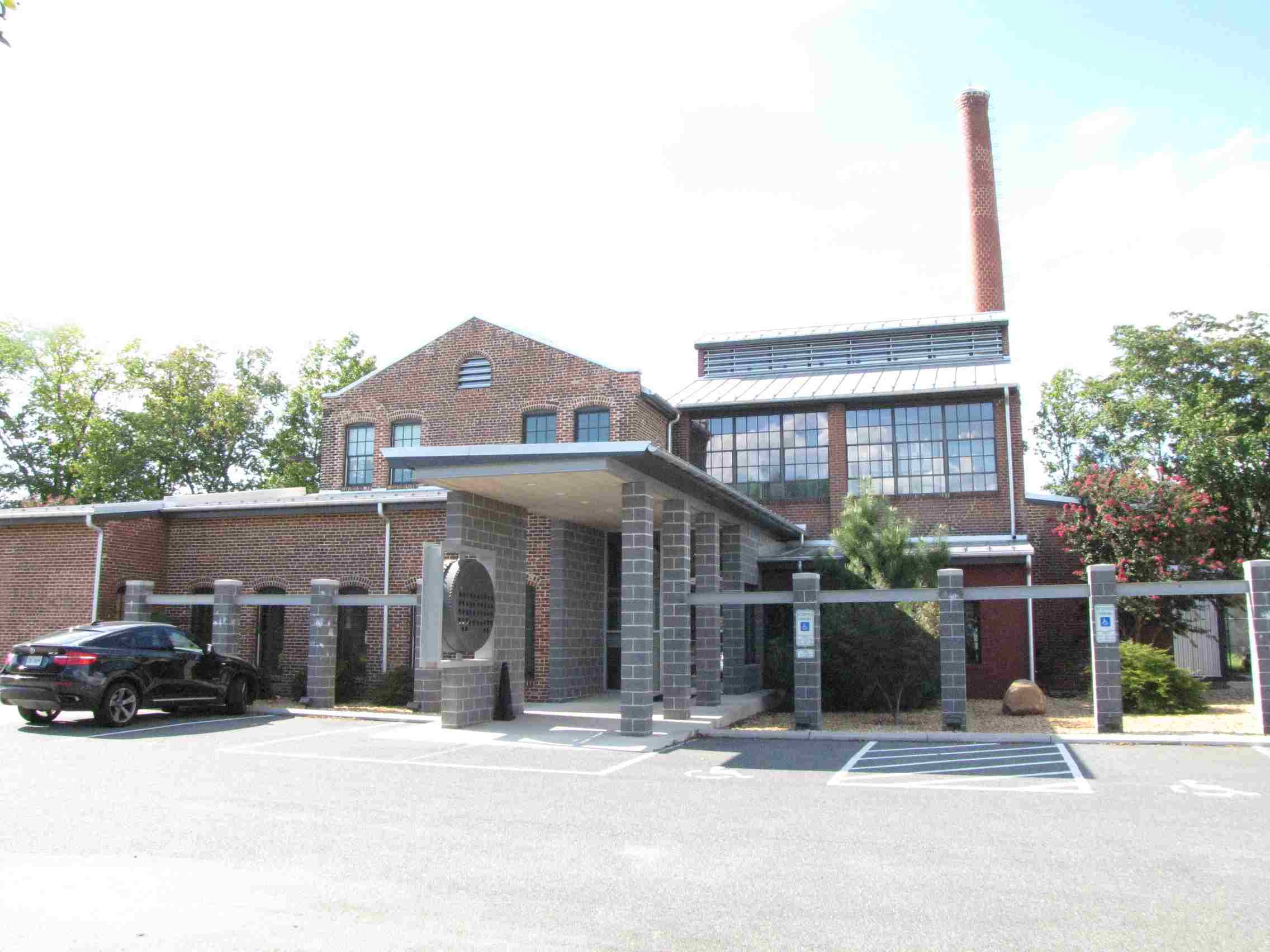
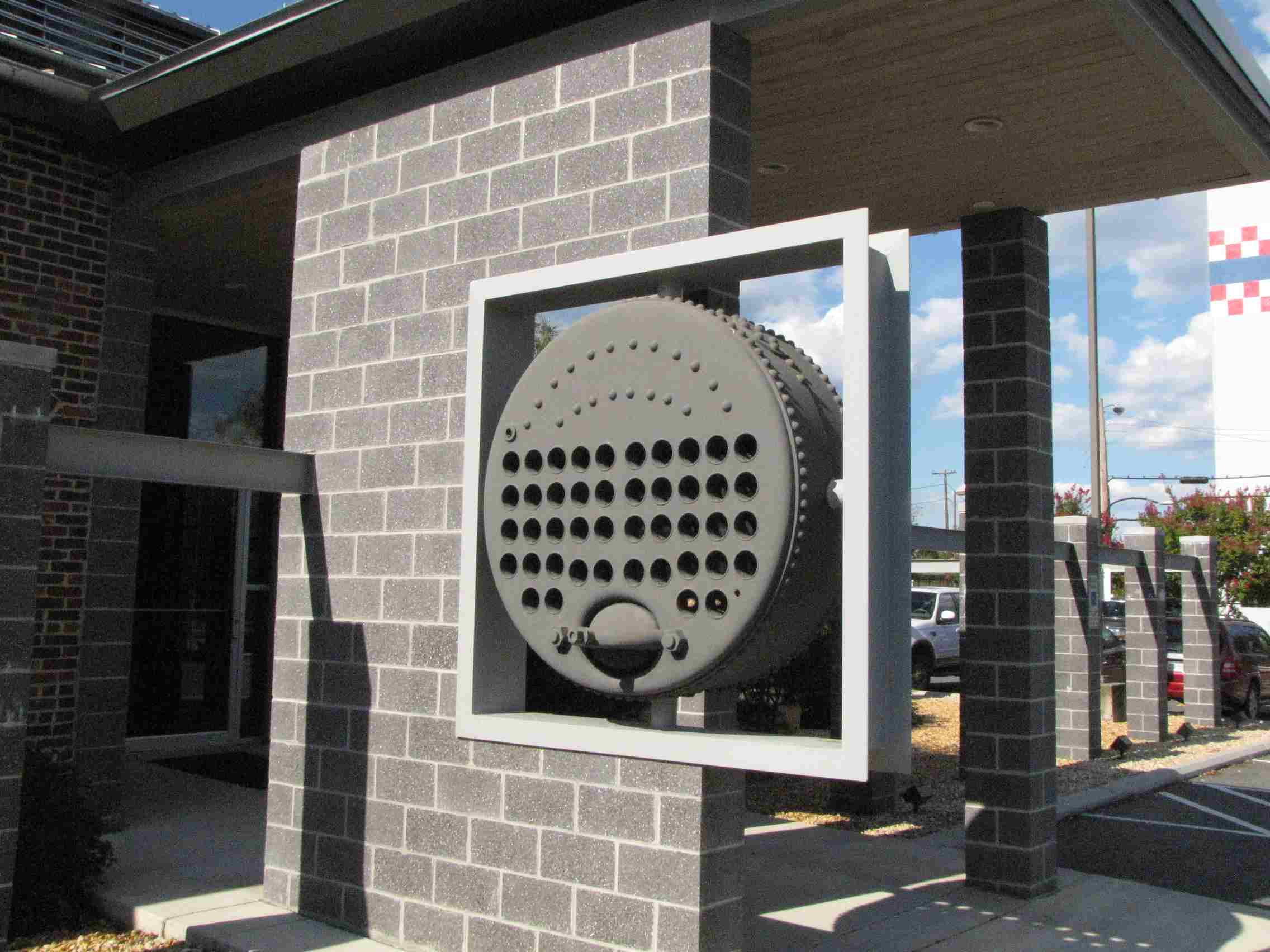
Old Steam Plant
This building used to be a steam
plant, and is now occupied by a construction and architectural firm. Part
of the boiler has been saved and worked into the building.
Disclaimers:
I love trains, and I love signals. I am not an expert. My webpages reflect what I find on the topic of the page. This is something I have fun with while
trying to help others.
Please Note: Since the main focus of my two websites is railroad signals, the railfan guides are oriented towards the signal fan being able to locate them.
For those of you into the modeling aspect of our hobby, my
indexa page has a list of almost everything railroad oriented
I can think of to provide you with at least a few pictures to help you detail your pike.
If this is a railfan page, every effort has been made to make sure that the information contained on this map and in this railfan guide is correct. Once in a while,
an error may creep in :-)
My philosophy: Pictures and maps are worth a thousand words, especially for railfanning. Text descriptions only get you so far, especially if you get lost or
disoriented. Take along good maps.... a GPS is OK to get somewhere, but maps are still better if you get lost! I belong to AAA, which allows you to get
local maps for free when you visit the local branches. ADC puts out a nice series of county maps for the Washington DC area, but their state maps do not have the
railroads on them. If you can find em, I like the National Geographic map book of the U.S..... good, clear, and concise graphics, and they do a really good job
of showing you where tourist type attractions are, although they too lack the railroads. Other notes about specific areas will show up on that page if known.
Aerial shots were taken from either Google or Bing Maps as noted. Screen captures are made
with Snagit, a Techsmith product... a great tool if you have never used it!
By the way, floobydust is a term I picked up 30-40 years ago from a National Semiconductor data book, and means miscellaneous
and/or other stuff.
Pictures and additional information is always needed if anyone feels inclined to take 'em, send 'em, and share 'em, or if you have something to add or correct.... credit
is always given! Please be NICE!!! Contact info is here
Beware: If used as a source, ANYTHING from Wikipedia must be treated as being possibly being inaccurate, wrong, or not true.

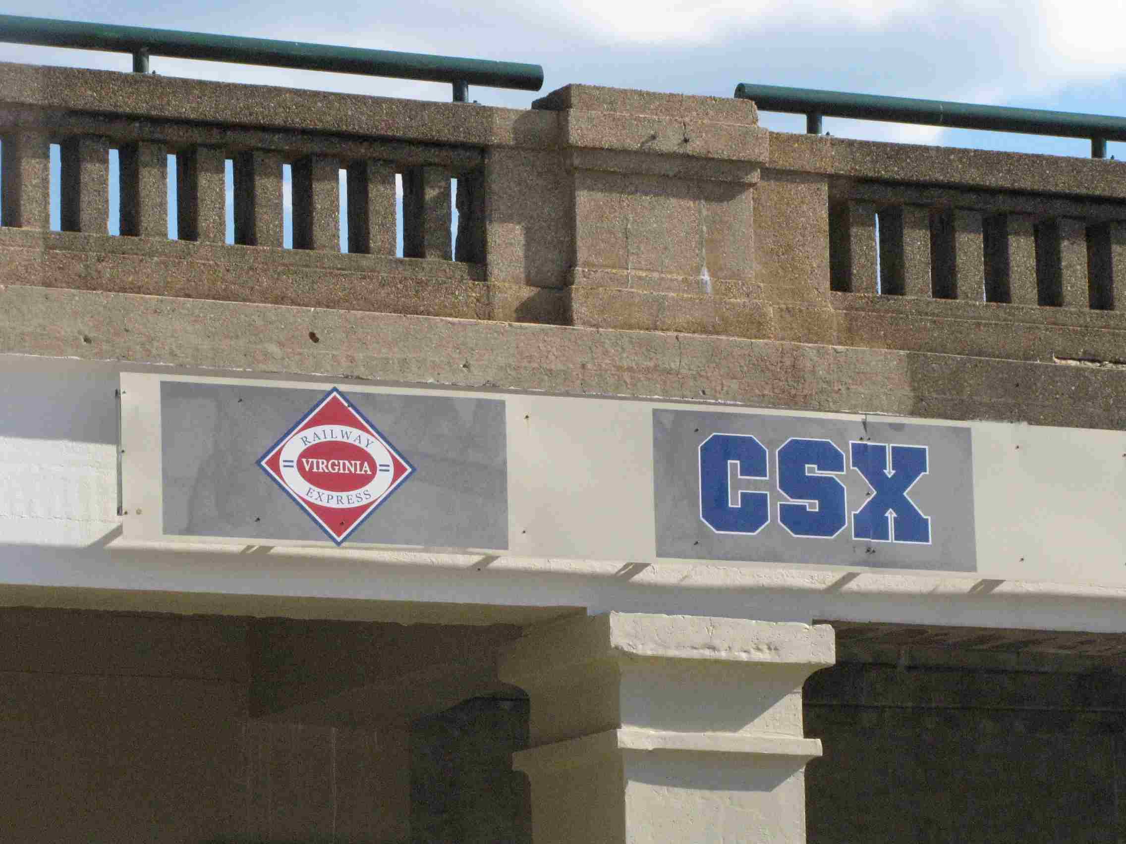
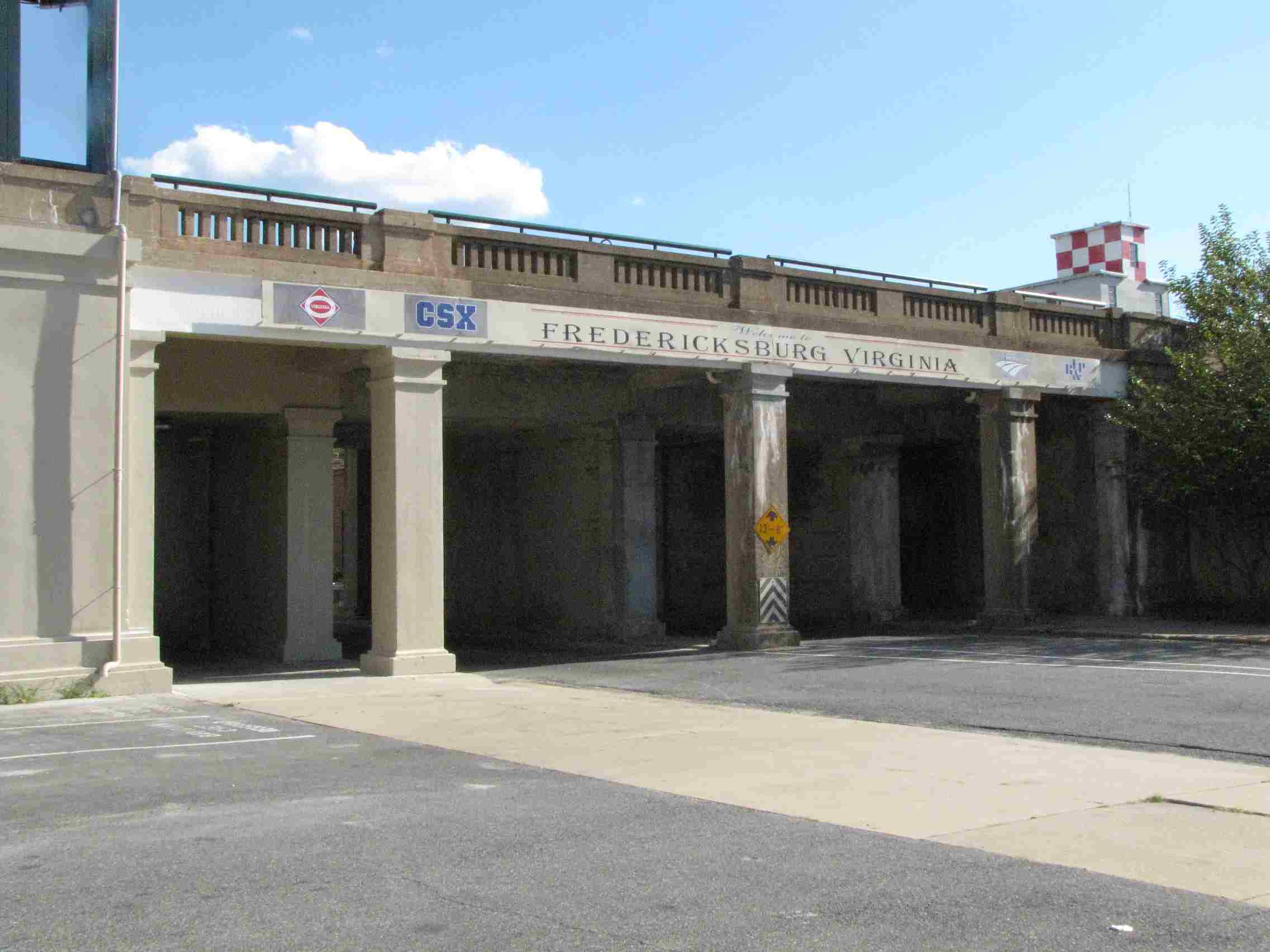
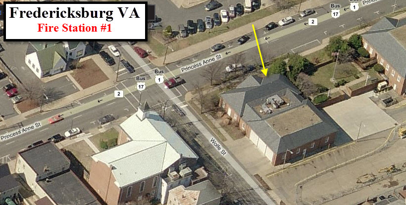
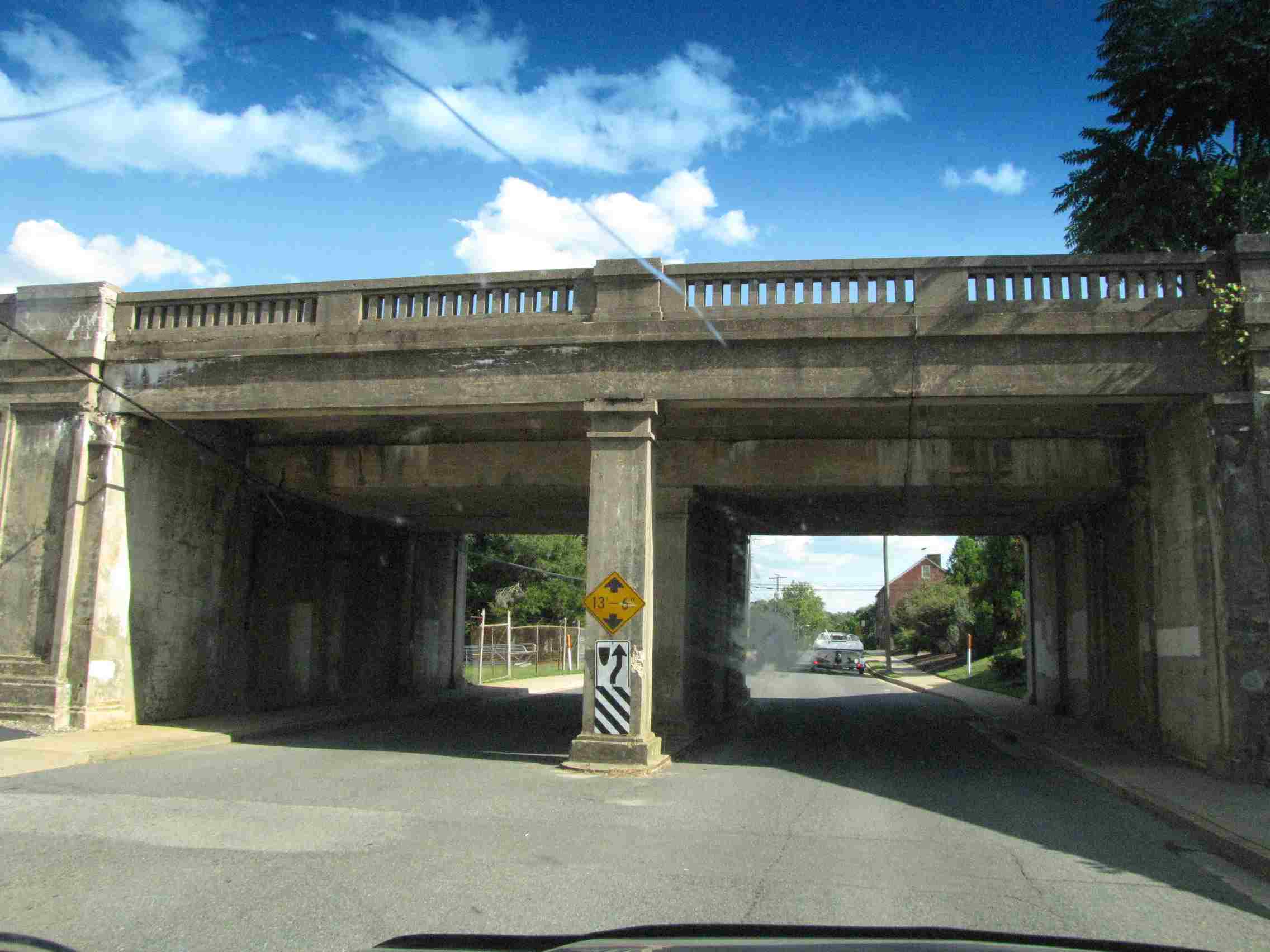
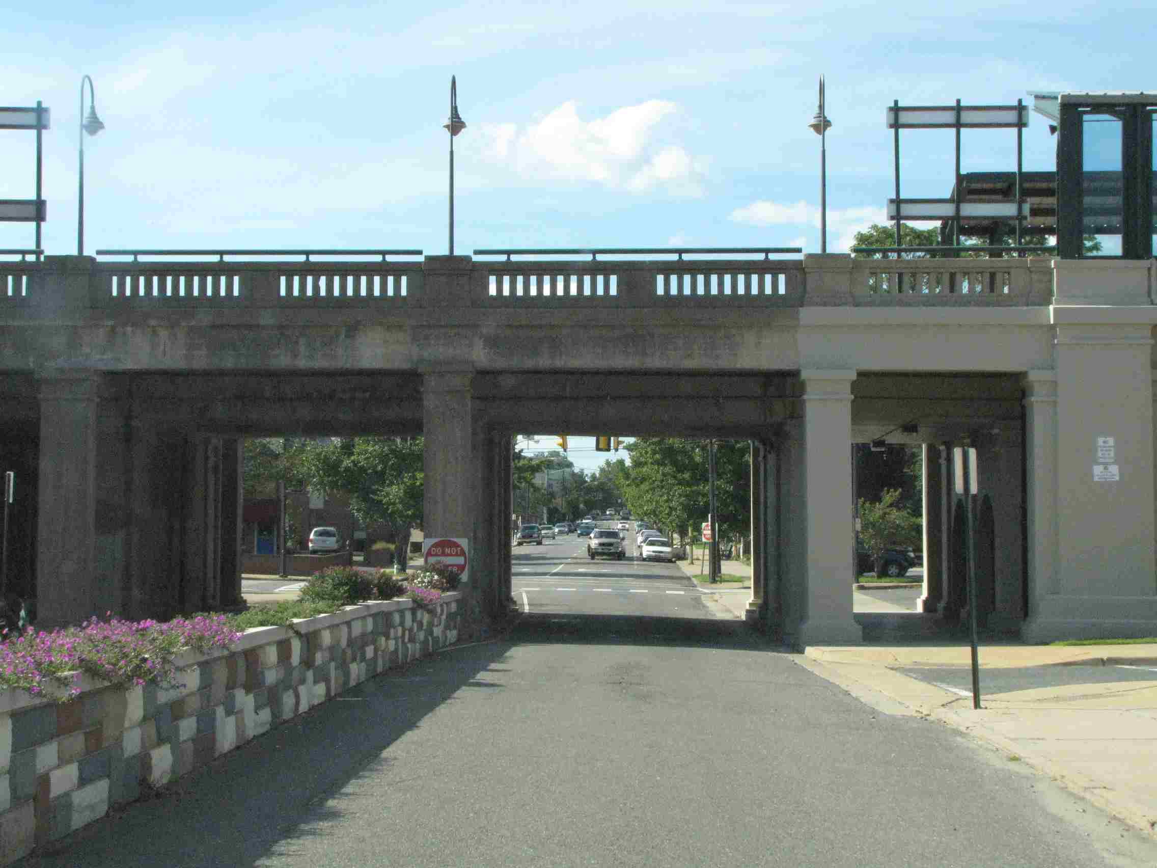
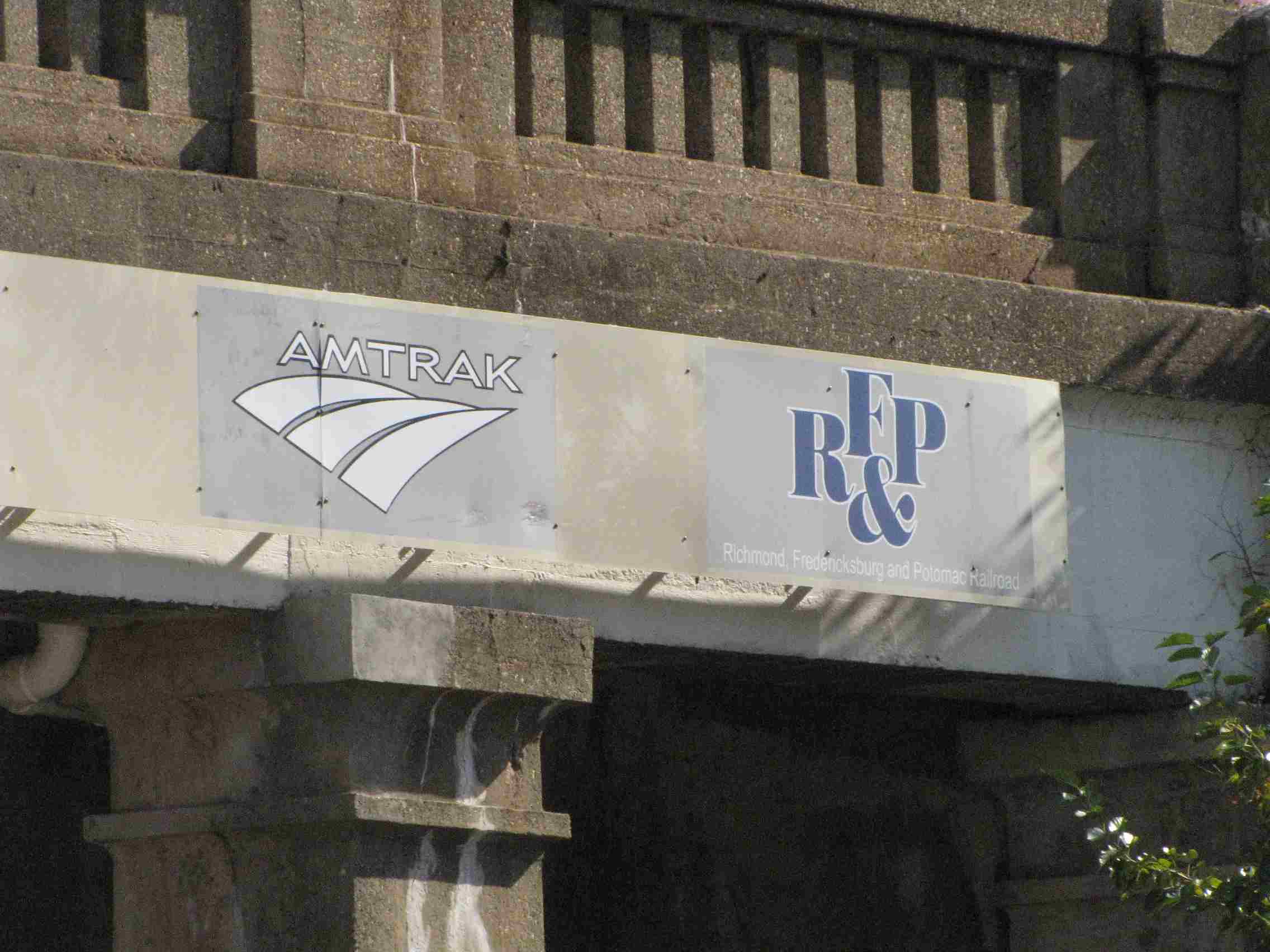 Over Princess Anne St
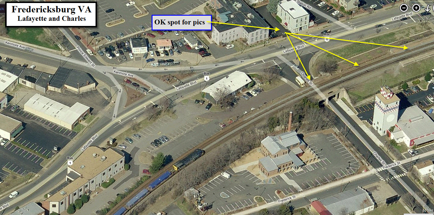


 in 2020
 in 2011
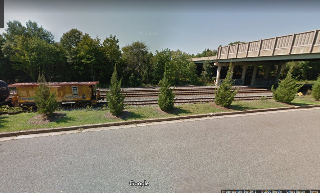 Google view from 2012, before signals
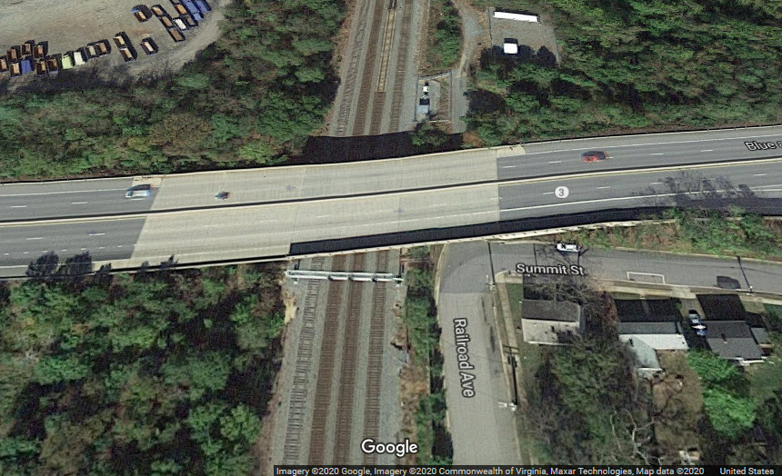

 in 2011
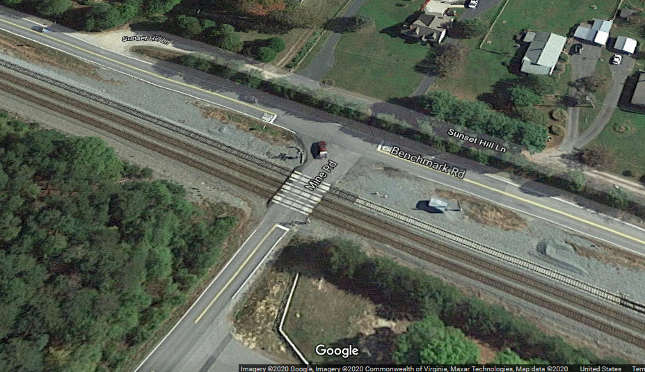 2020
2020 2020
2020