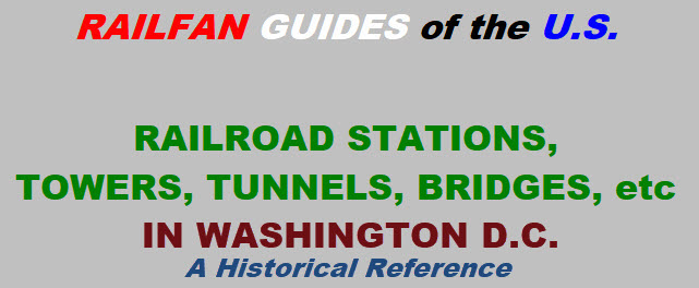
Stations
Towers
Tunnels
Bridges
Stations
Towers
Tunnels
Bridges
TOWERS TUNNELS
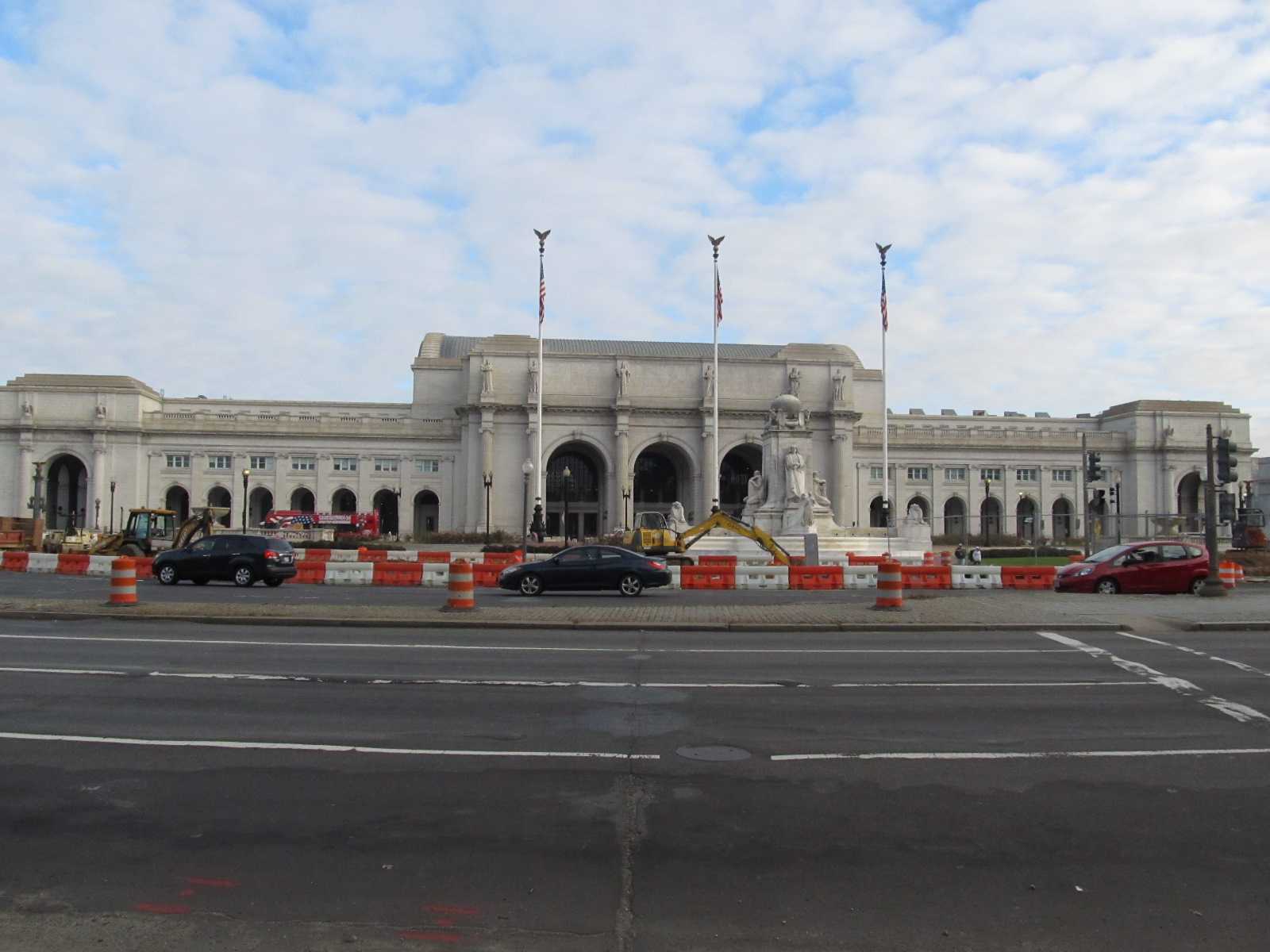
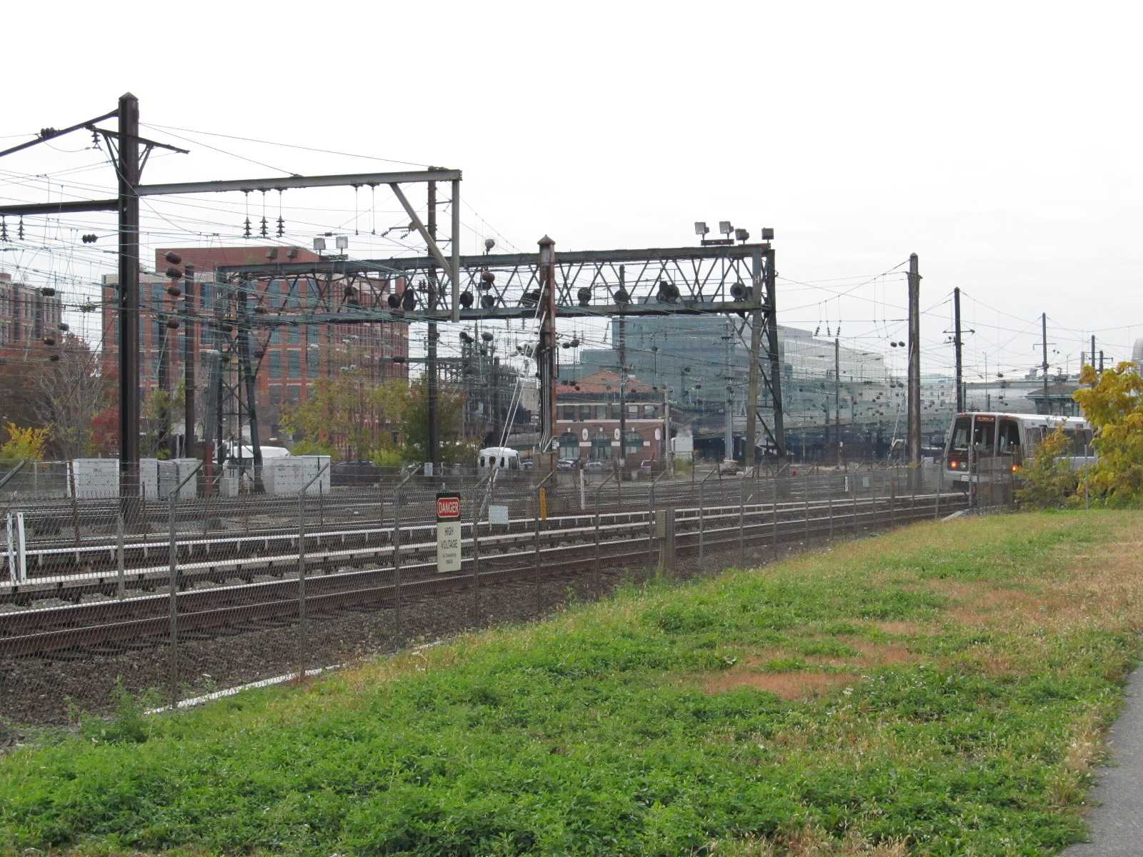
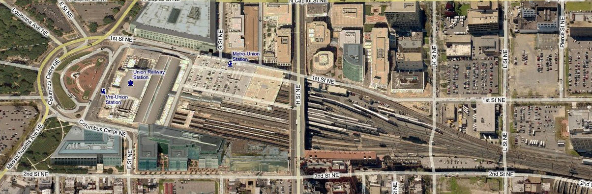
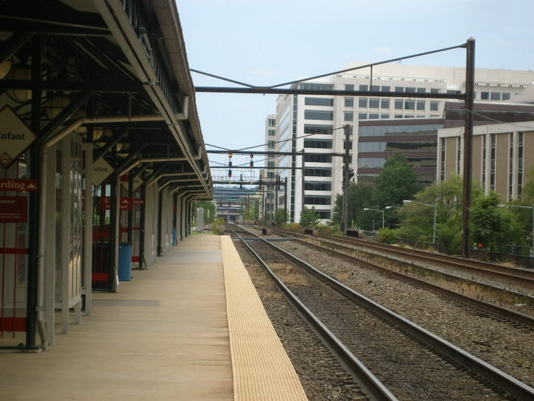
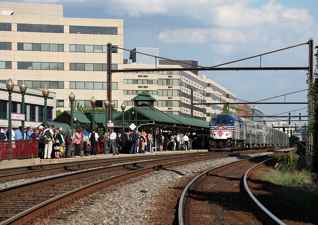
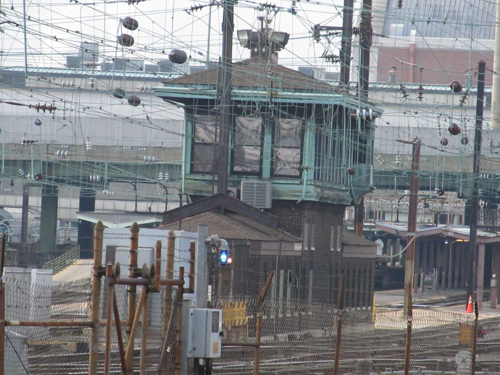
WASHINGTON DC - K St Tower
GPS Coordinates: 38.874312, -77.038830 (Center of the bridge)
This tower is located in the Union Station yard.
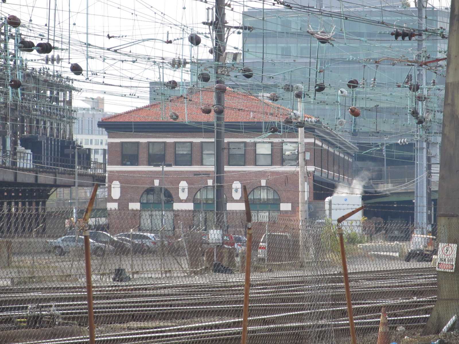
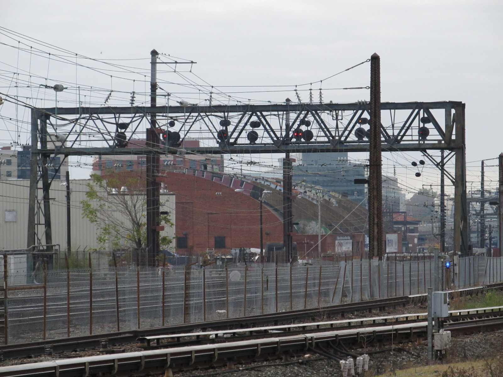
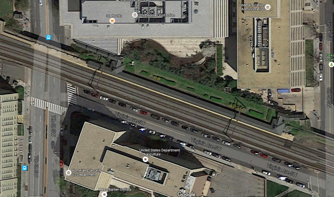
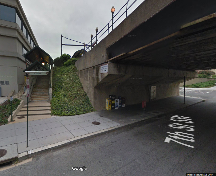
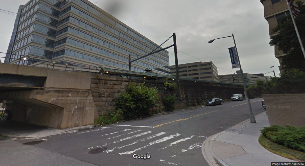
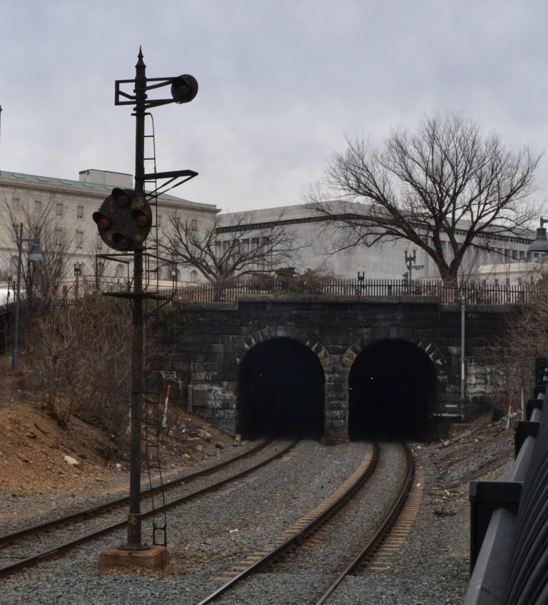
WASHINGTON DC - the First Street Tunnel
GPS Coordinates: 38.884831, -77.007562 (southern portal)
This tunnel runs up under First Street SE to reach Union Station. The
southern portal is the only one accessible without asking for permission from
the Amtrak Gods. If you go to take pictures at the southern portal, you
will be greeted by a high fence surrounding every piece of track leading to the
tunnel, and security cameras out the wazoo. Myself and a friend of mine
were there for a little over an hour and were never bothered by anyone -
civilians, local police, or Amtrak police. There are two B&O CPL style
signals guarding the entrance to the tunnel. In looking at the masts
closely, it appears that they may have been the original ones that previously
sported semaphores.
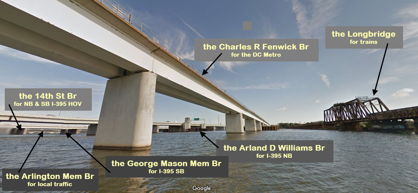
WASHINGTON DC BRIDGES - AN OVERVIEW
Washington DC, due to many factors, has an impressive number of bridges spanning
the Potomac River. The river separates Washington DC from NOVA, or
Northern Virginia. One of the earliest bridges to be built was the
Long Bridge for the railroads. The bridge that exists today is the
second iteration of the modern bridge.
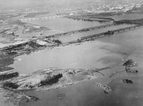
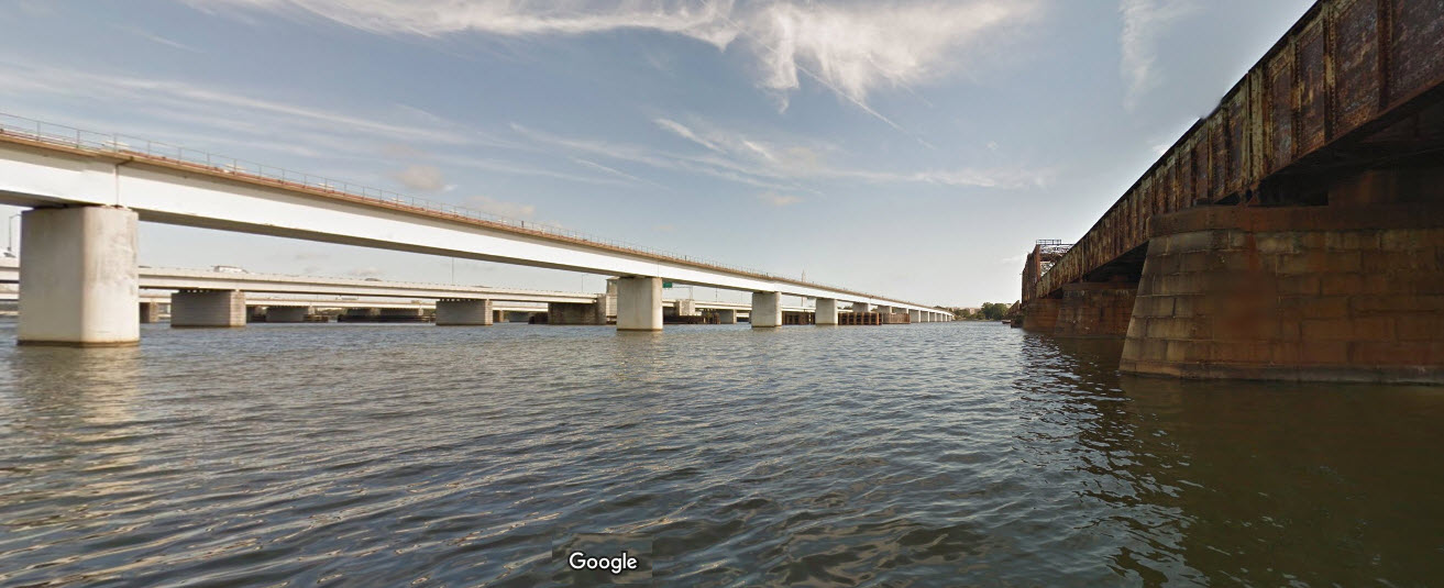
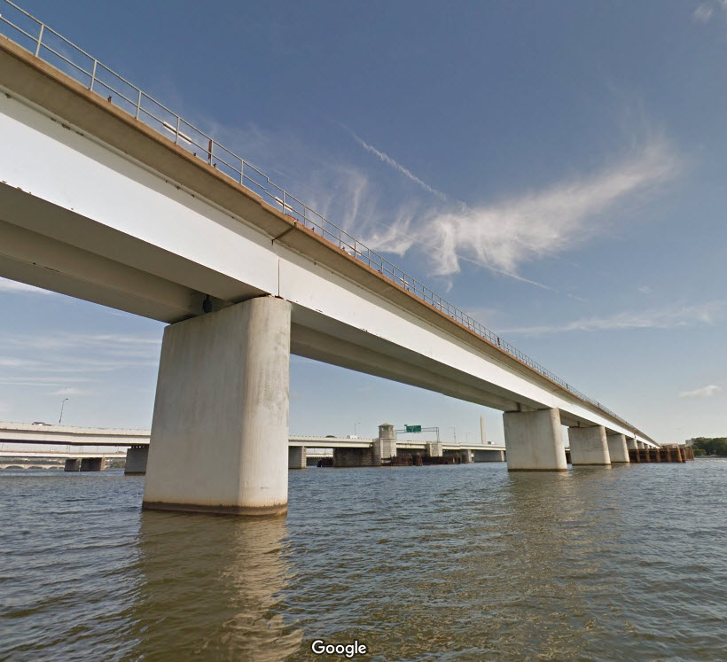
In the Google "Streetview" shot below, you can see 6 of the 9
bridges that cross the Potomac River in Washington DC. Although
you can't really see the George Mason Memorial Bridge, you can see the
supporting piers from this water view.
For further reading, here are a few links:
the Arlington Memorial Bridge: https://en.wikipedia.org/wiki/Arlington_Memorial_Bridge
The 5 bridges that make up the 14 St Bridges: https://en.wikipedia.org/wiki/14th_Street_Bridges
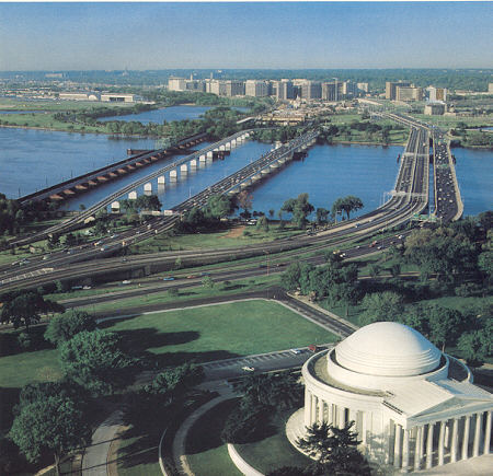
The picture below was taken from high atop the Washington Monument and shows us five of the bridges.
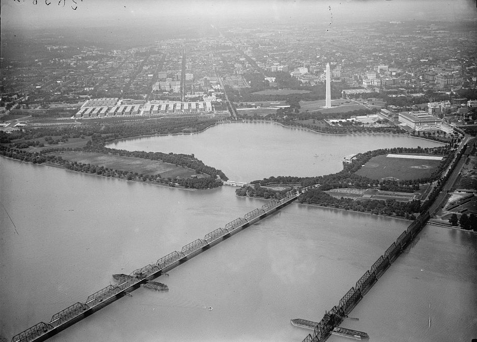
The black & white picture below is an early aerial view of the bridges in the same location as the water view above. It looks as though the Arlington
Memorial bridge is under construction, which would date the photo at around 1931, since the bridge opened for traffic in February of 1932. In this
picture, the Route 1/14th Street Bridge and the Long Bridge are of similar types, both with a swing span.
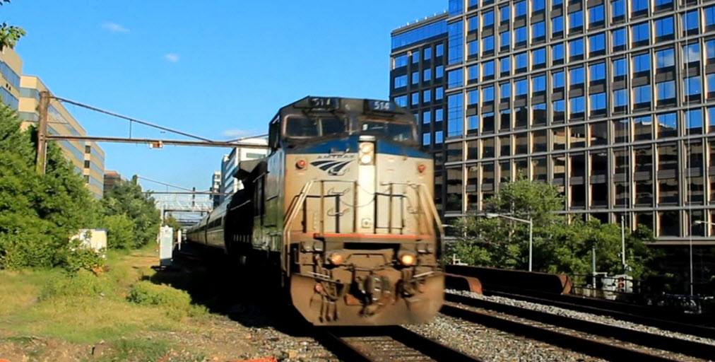
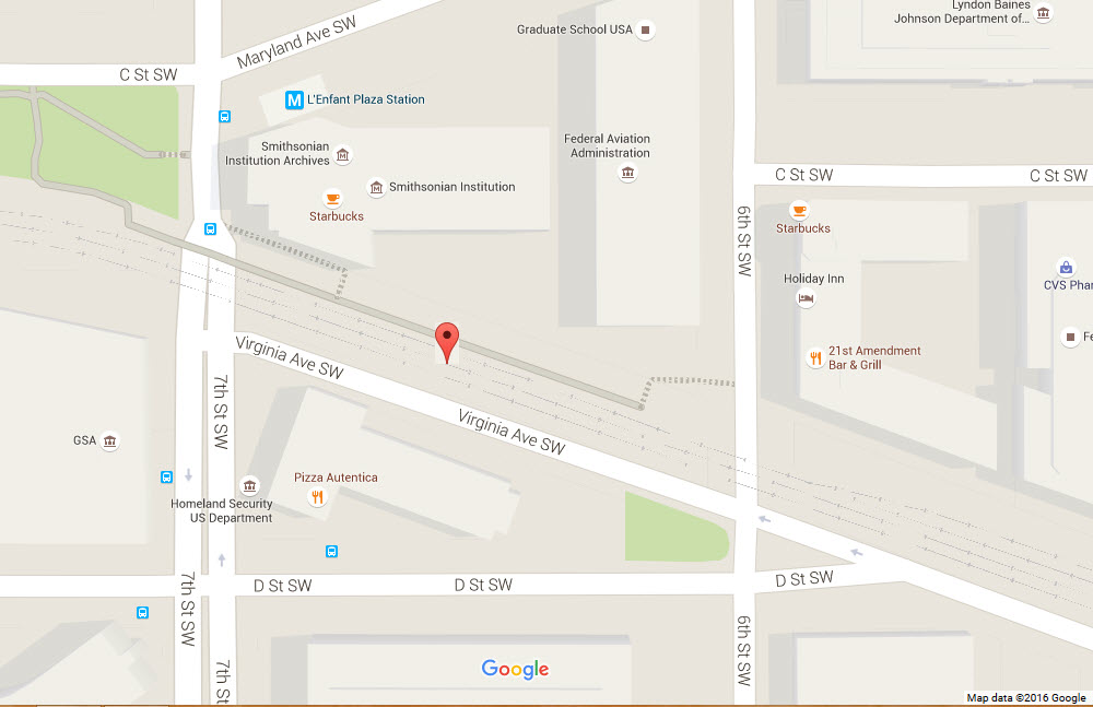
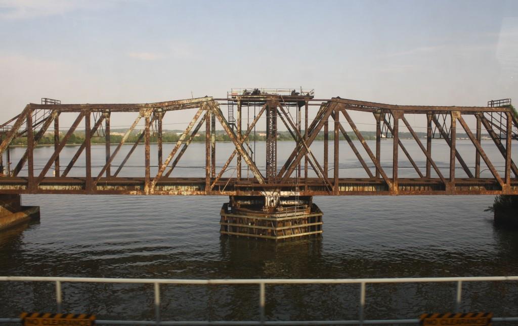
WASHINGTON DC - the Long Bridge
GPS Coordinates: 38.874312, -77.038830 (Center of the bridge)
This bridge spans the Potomac River between Washington DC and NOVA, or, Northern Virginia. It carries all east coast North-South train traffic except NS, including Amtrak, CSX, and the VRE (Virginia Rail Express) commuter trains.
There is a park at the southern end of the bridge in VA where you can get good pictures from as trains come southbound.
From Wikipedia: The 14th Street Bridges are five bridges near each other that cross the Potomac River, connecting Arlington
VA and Washington DC. A major gateway for automotive and
rail traffic, the bridge complex is named for 14th Street (U.S. 1), which feeds automotive traffic into it on the DC end.
The complex contains three four-lane automobile bridges -- one northbound, one southbound, and one bi-directional -- that carry Interstate 395 and U.S. Route 1 traffic. In addition, the complex
contains two rail bridges, one of which carries the Yellow Line of the Washington Metro; the other of which, the only mainline rail crossing of the Potomac River to Virginia, carries CSX
Transportation, Amtrak, and the VRE rail lines.
The first bridge at the site was the Long Bridge, a wooden toll bridge opened on May 20, 1809, by the Washington Bridge Company. It was the second bridge to cross the
Potomac in the District of Columbia, following a 1797 span at a narrower crossing near Little Falls, upstream of Georgetown, at the site of the present Chain Bridge.
British forces leaving the Battle of Bladensburg during the War of 1812 set fire to the north end of the Long Bridge on August 25, 1814, and American troops burned the south end. The bridge
was rebuilt by 1816.
The western portion was carried away by an ice freshet on February 23, 1831, and Congress decided to purchase the franchise of the Washington Bridge Company on July 14, 1832. A ferry carried
traffic across the river until October 30, 1835, when the bridge was reopened by President Andrew Jackson. Another freshet struck on February 10, 1840, closing the bridge until 1843.
A rail line over the Potomac had been envisioned at least since 1835, when the Washington Branch of the Baltimore and Ohio Rail Road connected the capital city to points north. In 1855, the
Alexandria and Washington Railway was chartered to connect the B&O to other railroads in Alexandria, by then part of Virginia. A city ordinance passed July 27, 1855, authorized the A&W to
build tracks from the B&O's Washington terminal to the Long Bridge. By December, tracks had been completed from the terminal south along First Street, past the United States Capitol and along
Maryland Avenue to the bridge. This line never opened due to local opposition and the inability to lay tracks on the bridge. But the A&W did complete its Virginia line, from the
bridge's southern end to downtown Alexandria, on November 25, 1856. To reach Washington and the B&O, freight and passengers had to use an omnibus connection over the bridge.
The bridge was again washed out by a flood in February 1857, but was reopened in time to allow revenue service on the A&W with connecting service over the bridge to begin on December 21, 1857.
With the outbreak of the Civil War in 1861, the bridge became militarily important. Union troops occupied the bridge on May 24, and the Orange and Alexandria Railroad soon became a major center
for the United States Military Railroad Construction Corps. Rails were placed on the bridge, and the new connection opened on February 9, 1862. Locomotives proved too heavy, so trains were pulled by
horses across the bridge.
On July 23, 1864, a new, stronger bridge was completed about 100 feet (30 m) downriver. Opened on February 21, 1865, the new bridge carried only railroad traffic, and the old one was kept for other
traffic. On November 15, 1865, with the end of the war, the U.S. Military Railroad gave the old bridge to the U.S. Department of the Interior; the new bridge became part of the
Washington, Alexandria and Georgetown Railroad, leased by the B&O.
Civil War-era poet Walt Whitman and his partner Peter Doyle often crossed the Potomac River at Long Bridge on their long hikes outside of the city.
In 1872, the Pennsylvania Railroad (PRR) obtained control of the bridge and railroad through its
Baltimore and Potomac Railroad. On July 2, the
Alexandria and Fredericksburg Railway opened, providing the first direct all-rail connection between the north and
Richmond VA. The B&O regained its link to the south on March 10, 1874, with a car float between Shepherds Point in Washington and the Washington City, Virginia Midland
and Great Southern Railway in Alexandria. (The temporary Shepherd's Landing Bridge would be built there during World War II.) By June 6, 1896, the bridge was also traversed by an
interurban streetcar line: the Washington, Alexandria, and Mount Vernon Electric Railway.
The railroad-only Long Bridge, a through-truss swing bridge, opened on August 25, 1904, about 150 feet (45 m) upriver from the old bridge. The two-track bridge contained girders recycled
from the PRR's Lower Trenton Bridge across the Delaware River. The old bridge was demolished sometime after late 1906. In 1901, trackage rights over the bridge were obtained by the Richmond,
Fredericksburg and Potomac Railroad, a bridge line owned equally by six companies including the PRR and B&O (which obtained trackage rights over the PRR to reach the bridge on July 1, 1904).
In 1991, the RF&P was merged into CSX Transportation, which acquired the bridge itself in 1998, after the Conrail breakup.
A new swing-span through-truss bridge called the Highway Bridge, 500 feet (150 m) upriver from that bridge, opened February 12, 1906, to serve streetcars and other non-railroad traffic.
On November 9, 1943, a plate girder replacement to the 1903 railroad bridge (keeping the old through-truss swing span) opened.
In coordination with the Federal Railroad Administration (FRA), the
District Department of Transportation (DDOT) is conducting a comprehensive study
for the rehabilitation or replacement of the Long Bridge. The study area
extends 2.2 miles, beginning at the RO Interlocking (MP 110.1) in Arlington and
extending northeast, along the existing rail alignment, to the CP/Virginia
Interlocking (MP 112.3) in Washington, D.C., east of L'Enfant Plaza. The
FRA is the Lead Federal Agency for the project.
Some key dates:
August 25, 1904 - The Long Bridge opens.
1935 - the PRR electrifies the bridge down to RF&P's Potomac Yard.
November 9, 1943 - the Long Bridge re-opens with new plate girder sections.
July 1, 1965 - fire breaks out in one the swing bridge pier fender skirts.
February 1, 1968 - the Penn Central takes over as the owner of the bridge.
March 4, 1969 - last time the bridge was opened to allow a barge taking down the Rochambeau Bridge to come thru.
1970's - The bridge tenders cabin is removed, having only been used by the homeless and vandals.
April 1, 1976 - Conrail assumes ownership of the bridge from the bankrupt Penn Central.
November 1981 - Conrail de-energizes the catenary.
1987 - RF&P's Potomac Yard, just south of the bridge, starts being dismantled.
June 1, 1999 - CSX receives control of the bridge after Conrail is broken up.

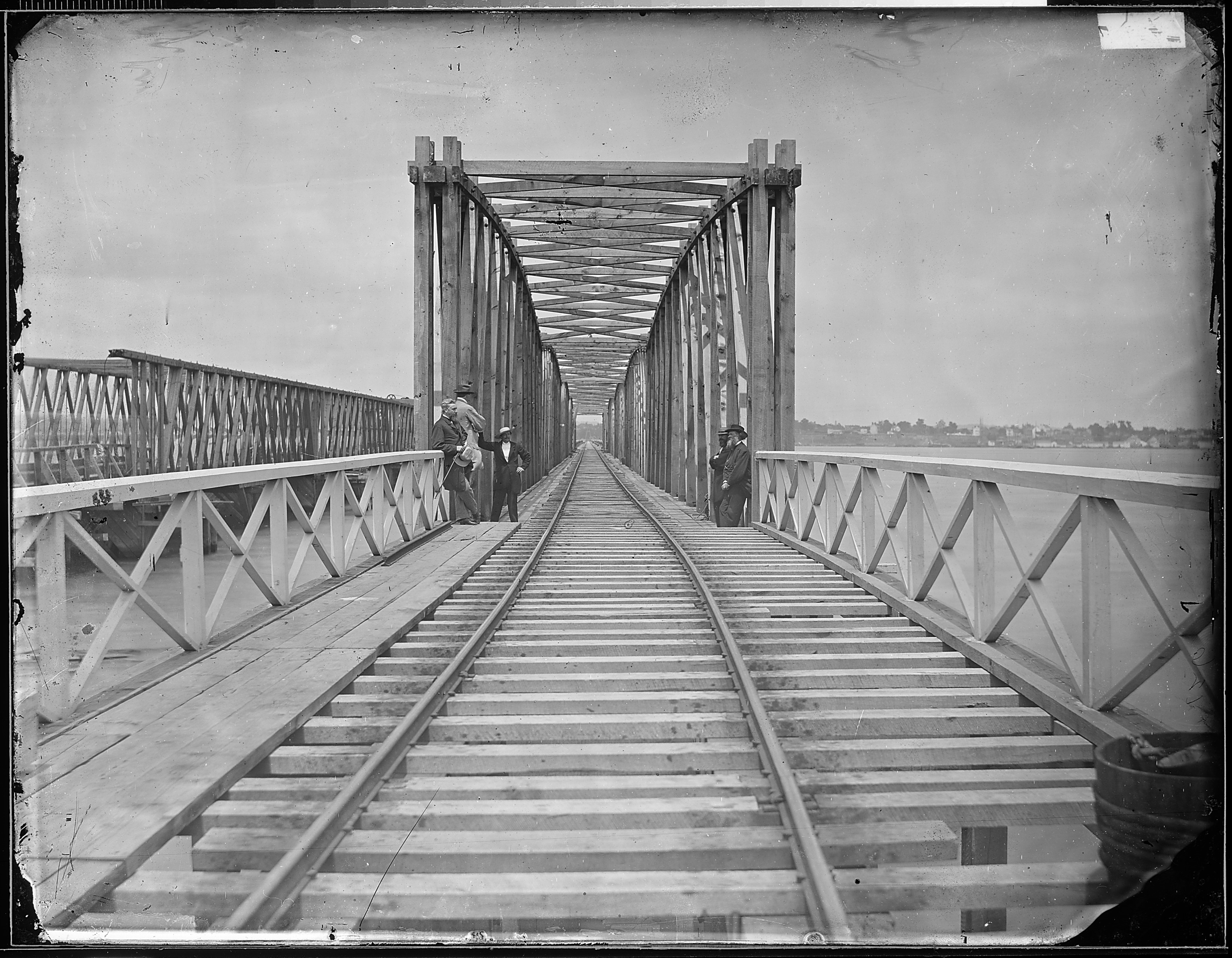
Below: the Long Bridge after completion of new bridge during the Civil War. Notice it is wide gauge.
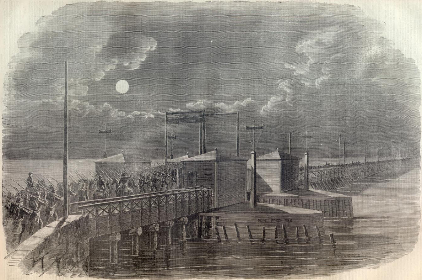
Union troops crossing the Long Bridge in 1861.
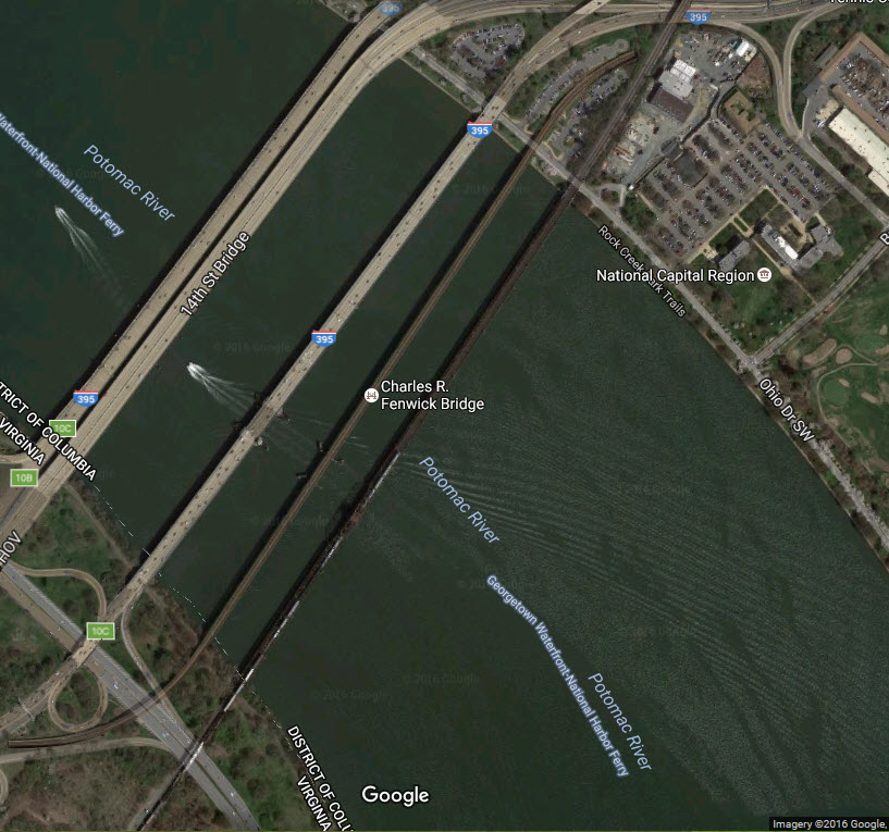
WASHINGTON DC - the Charles R. Fenwick Bridge
GPS Coordinates: 38.874862, -77.039274 (Center of the bridge)
This bridge also spans the Potomac River, and was built to handle the DC Metro trains.
It runs parallel to the Long Bridge,
and is only 150ft or so from it. Aerial shot above.
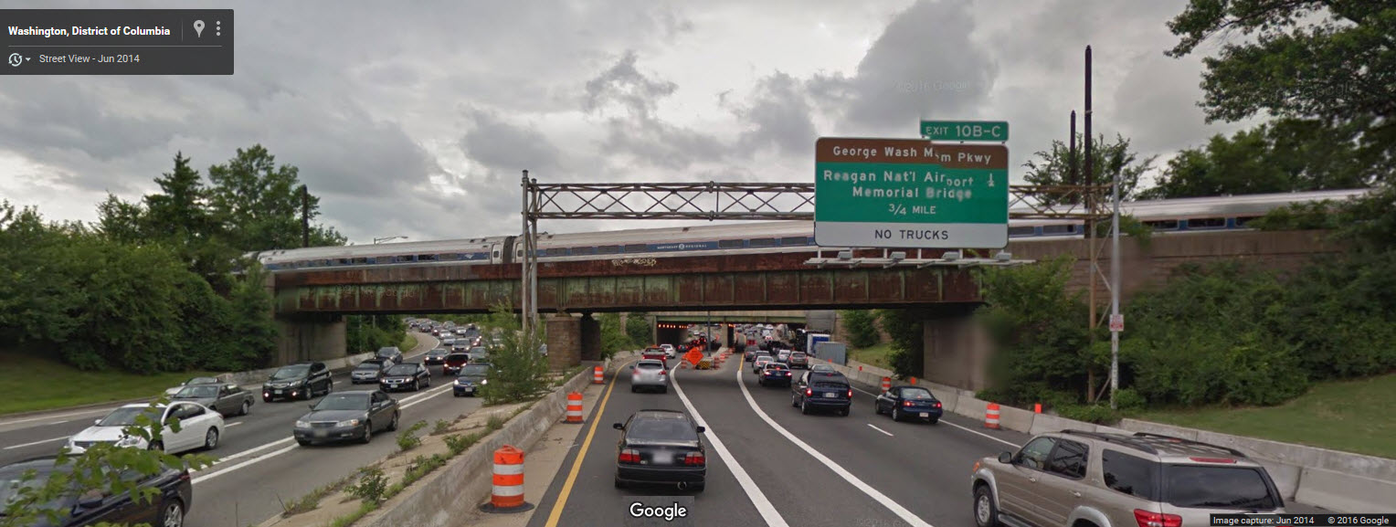
WASHINGTON DC - RR bridge over I-395
GPS Coordinates: 38.879110, -77.034881 (Center of the bridge)
This bridge is just north of the Long Bridge, and goes over I-395.
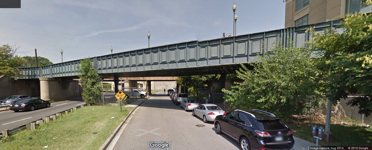
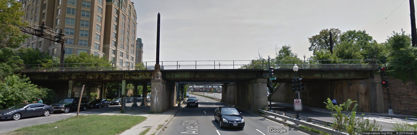
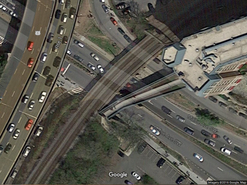
WASHINGTON DC - RR bridges over Maine Ave
GPS Coordinates: 38.883257, -77.031541 (Center of the walking bridge)
These bridges are just north of the I-395 bridge. One of them no longer used for railroad service is now being used for foot traffic.
Disclaimers:
I love trains, and I love signals. I am not an expert. My webpages reflect what I find on the topic of the page. This is something I have fun with while
trying to help others.
Please Note: Since the main focus of my two websites is railroad signals, the railfan guides are oriented towards the signal fan being able to locate them.
For those of you into the modeling aspect of our hobby, my indexa page has a list of almost everything railroad oriented
I can think of to provide you with at least a few pictures to help you detail your pike.
If this is a railfan page, every effort has been made to make sure that the information contained on this map and in this railfan guide is correct. Once in a while,
an error may creep in :-)
My philosophy: Pictures and maps are worth a thousand words, especially for railfanning. Text descriptions only get you so far, especially if you get lost or
disoriented. Take along good maps.... a GPS is OK to get somewhere, but maps are still better if you get lost! I belong to AAA, which allows you to get
local maps for free when you visit the local branches. ADC puts out a nice series of county maps for the Washington DC area, but their state maps do not have the
railroads on them. If you can find em, I like the National Geographic map book of the U.S..... good, clear, and concise graphics, and they do a really good job
of showing you where tourist type attractions are, although they too lack the railroads. Other notes about specific areas will show up on that page if known.
Aerial shots were taken from either Google or Bing Maps as noted.
Screen captures are made with Snagit,
a Techsmith product... a great tool if you have never used it!
By the way, floobydust is a term I picked
up 30-40 years ago from a National Semiconductor data book, and means
miscellaneous and/or other stuff.
Pictures and additional information is always needed if anyone feels inclined to take 'em, send 'em, and share 'em, or if you have something to add or correct.... credit
is always given! Please be NICE!!! Contact info is here
Beware: If used as a source, ANYTHING from Wikipedia must be treated as being possibly being inaccurate, wrong, or not true.
RAILFAN GUIDES HOME
RAILROAD SIGNALS HOME
New 8-17-2008, JUL29/2016, NOV22/2021
Last Changed: 22-Nov-2021