RAILFAN GUIDES of the U.S.
Todd's Railfan Guide to
BUFFALO NY
RAILFAN GUIDES HOME
RAILROAD SIGNALS HOME
Buffalo
Railfan Guide Homepage-
You're on it
Map 1 - Downtown
Map 2 - East - CSX's Frontier Yard and NS's Bison
Yard
Map 3 - Seneca
Map 4 - South
Map 5 - North
Light
Rail guide
Back in the 40's and 50's, Buffalo was a railfans dream. You could consider it the Chicago of the east coast, even though it's not on the east coast like New York and Philadelphia. Although the rail scene is nothing like it used to be, don't underestimate what Buffalo still has to offer.
The big player in town was the New York Central, which came up from New York City via Albany, and then headed west towards Chicago. Other railroads included the Erie, the Nickel Plate, the B&O, Lehigh Valley, Delaware, Lackawanna & Western, Buffalo Creek, and the Pennsylvania RR.
The NYC, LV, and Erie headed north to Niagara Falls.
On the south side of town, you had the Erie, NYC, NKP, and the LV all coming coming into town.
On the east side, the NYC came up from New York City, and just south of their trackage, the Erie, DL&W, and LV all had parallel tracks.
Today, the railroads are CSX, Norfolk Southern, Canadian Pacific, the Buffalo Southern (a 32 mile shortline heading south), Genesee & Wyoming's Buffalo & Pittsburgh, and the South Buffalo. A little to the east in Batavia, you have the short line Delaware, Lackawanna and Western, which just services Batavia.
As the story goes, an increase in taxes by the city during the mid 50's chased the railroads out, tearing up trackage all over the place, closing yards and bulldozing them under. They taxed everything the railroads had, track, right-of-way, signals, buildings, everything.....
After the split up of Conrail, CSX took over the old New York Central stuff. Norfolk Southern runs on some of the old Erie tracks and heads south towards Harrisburg PA on the Buffalo line, and Binghamton NY via the Southern Tier.
Amtrak has two stations in the area, three if you count the one in Niagara Falls. One is downtown, and the other is east in Depew. Schedules are below.
Some other sources of info you may want to check out
include:
http://www.buffaloah.com/h/rrds/tc.html
http://www.buffalosouthernrr.com/
http://wnyrails.org/railroads/bs/bs_home.htm
http://www.gwrr.com/operations/railroads/north_america/buffalo_pittsburgh_railroad
http://nyc.railfan.net/buffalo/ (a great source of USGS maps from 1950)
Getting to Buffalo is easy with access to I-90, the New York State Thruway.

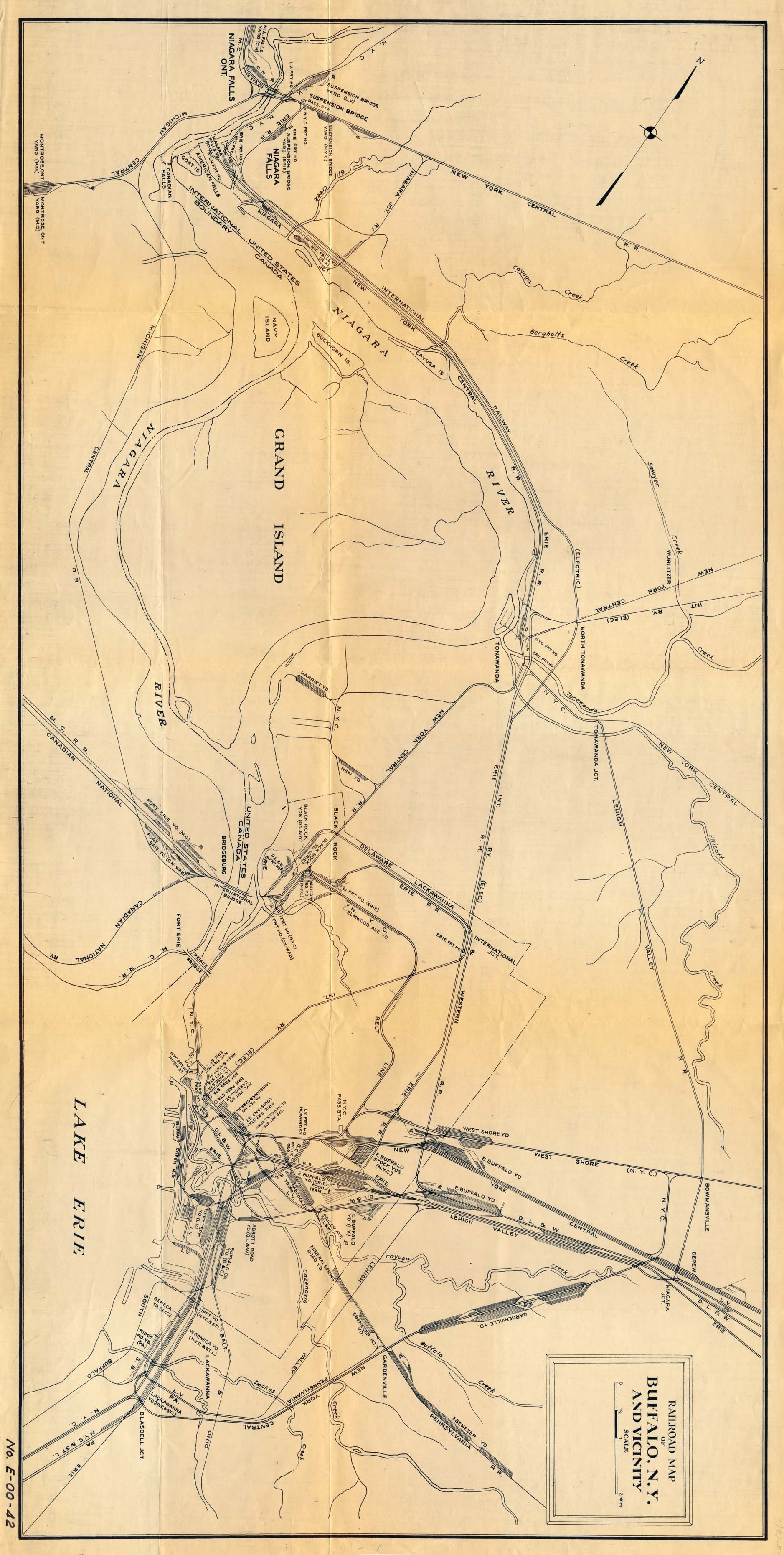
The map below, is flipped over on it's side so it is more
properly oriented to map coordinates. Not sure of the date on it, nor
the source.
I also made it a thumbnail cause it's a large file.
Amtrak Info


NEW 03/29/2012
Last Modified
10-Jan-2014