Location / Name:
Buffalo NY, Niagara County
What's Here:
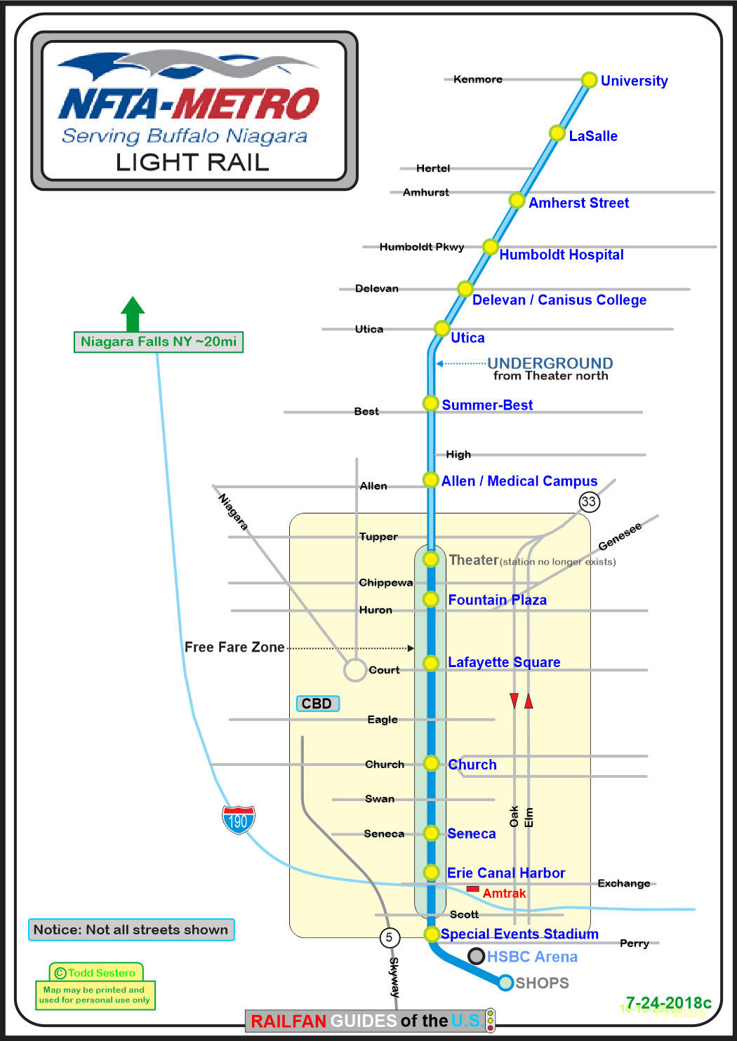
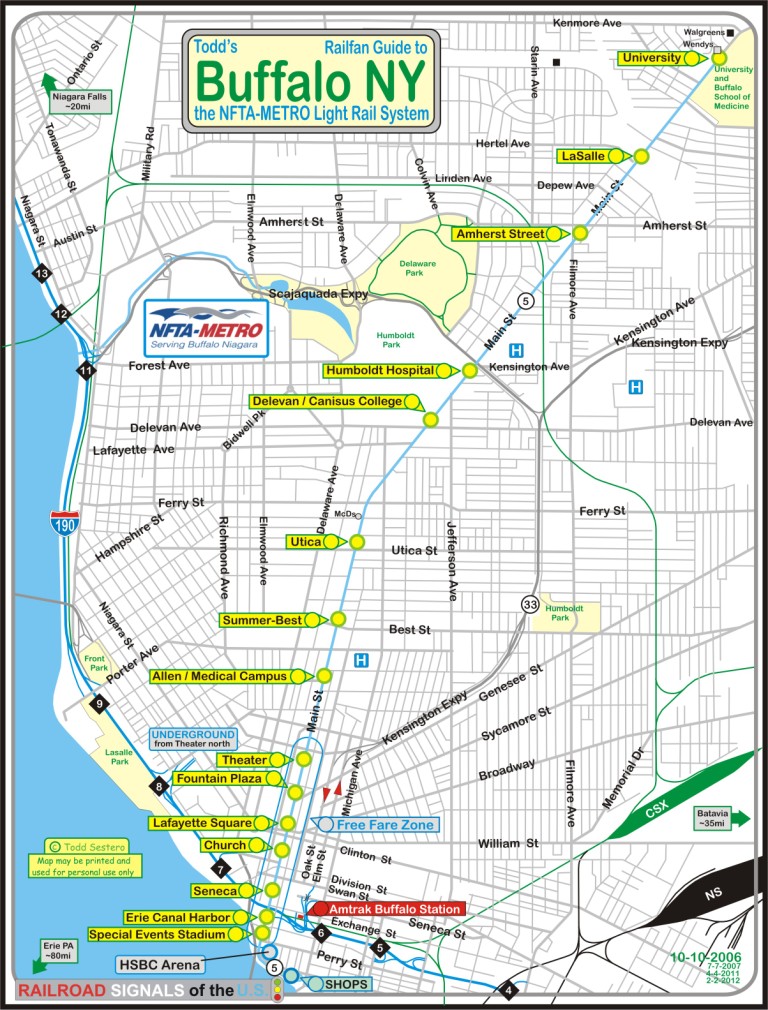
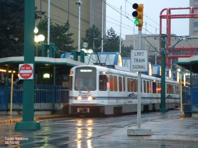
NFTA METRO (Light Rail) System
Data:
GPS Coordinates: as needed
Phone A/C: 716
ZIP: 14202
Access by train/transit:
Buffalo Amtrak Downtown Station: about 5 blocks, or 1,700 feet to the Erie Canal/Harbor Station
The Scoop:
This page covers the Light Rail system that runs in Buffalo NY.
It is operated by NFTA,
or the Niagara Frontier Transportation
Authority. Construction on the system began in
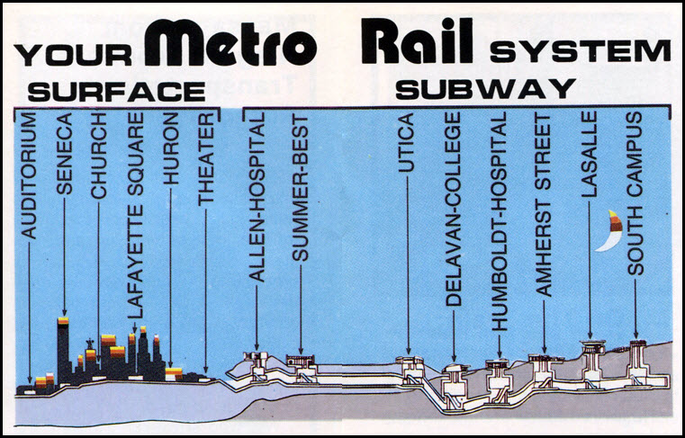
1978, and it opened in 1984. This is a short line: 6.4
miles (10.6km) long line with only 15 stations, 5.2 miles
(8.7km) of which (80%) is underground. 2.5km was done
using the cut-and-cover method, and 6.2km was done with a
boring machine. The tunnel was responsible for much
of the delay and cost overruns.
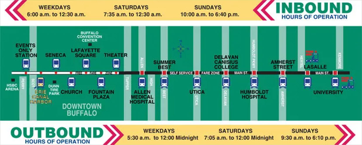
The line runs from the Keybank Center (formerly the HSBC Arena) in downtown, to the south
campus of the University at Buffalo on the north end.
At the north end of the transit mall in the CBD (Central
Business District), the line enters a tunnel, where it stays
to the end of the line. The CBD is a "fare free"
zone, not requiring any money or tickets to ride. If
visiting Buffalo, it is well worth the time to visit and
ride. Trips normally take about 22 minutes from one
end to the other.
Hours are 5:10am to 12:50am during the week, 7:05am to 12:50am
on Saturdays, and 9:30am to 7pm on Sundays. Trains are
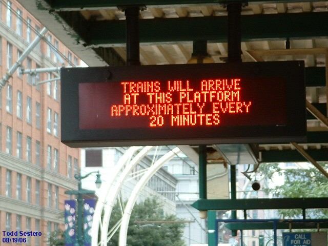
on roughly a 10 minute headway during the rush hour, and 20
minutes otherwise.
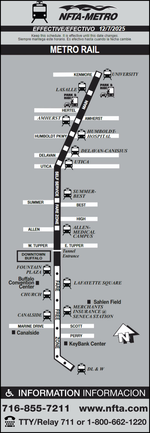
The fare to travel on the train is now $2 for a single trip, $4
for a round trip, and for $5 you get an unlimited one day pass,
which includes both subway and buses. You can purchase tickets
at any train station (cash only), and also you can purchase fare
cards with the TokenTransit app on your cell phone (credit card).
Plans are in place to end the practice of randomly checking
passengers to make sure that they have a ticket; there are entry
"turnstiles" in place at most stations, although these are not
yet in operation (as of this writing, DEC2021)(PM).
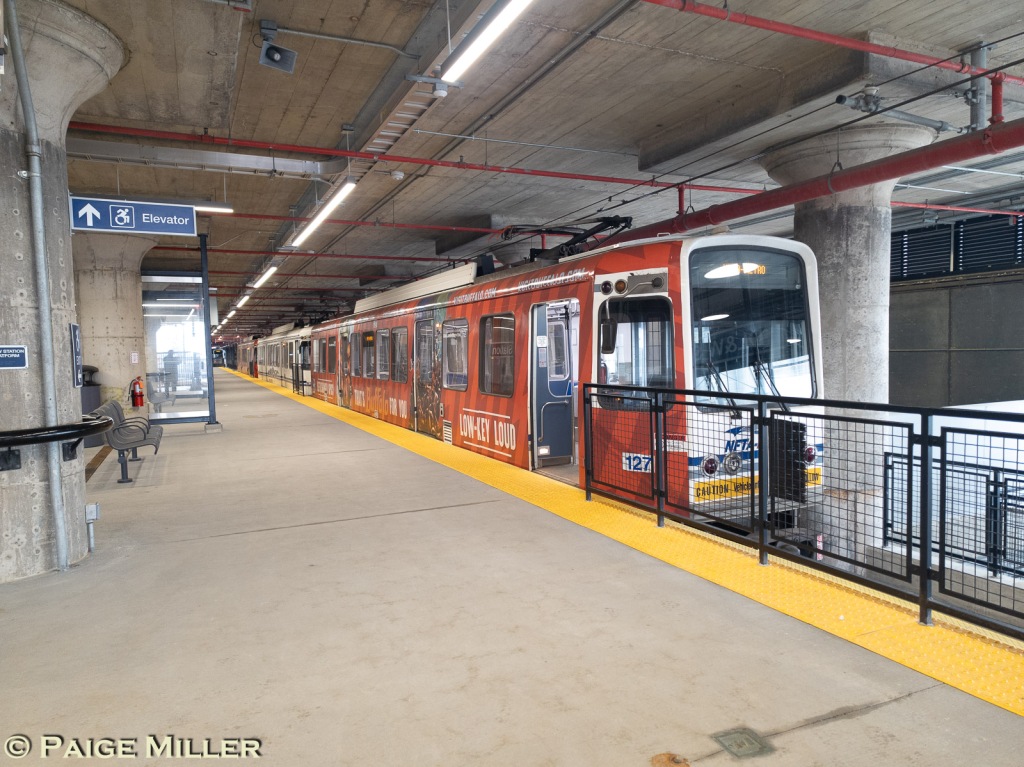
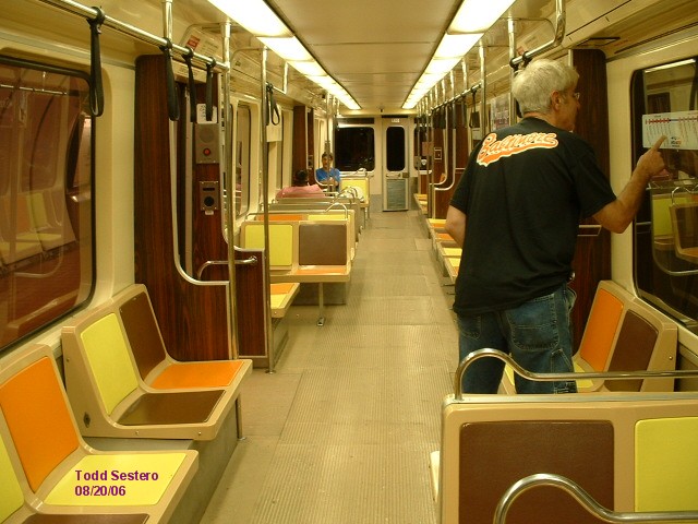
The Buffalo LRV's are the only single car LRV's besides SEPTA's
Norristown cars. There are 25 of them, numbered 101-127,
and they were built by Tokyu of Japan. They were delivered
in 1983, but during the delivery process, car #125 was damaged,
and sold to a local guy to be used as a restaurant (and supposedly
sold again). The cars are 66'-10" long (20.3m), 8'-6
1/2" wide (2.6m), and weigh 35.5 tons empty. Capacity
is 140, including 51 seated. The cars were refurbished and all of them
were back into service by July
2010. More on the refurb below.
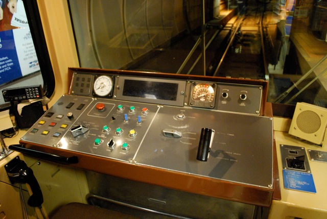
The cars also have a feature coupled with VWC which is called
automatic vehicle identification (AVI) which also transmits to
the wayside the car number, the run number (aka block number)
and the destination. The train control system uses these
to determine the schedule assigned to that particular run and
tracks the consist's movement thru the system and determines
if its running late or on time or early. On the surface,
the stations have loops which pick up the presence of a train
so it can track train movements on the surface without the use
of traditional track circuits.
Thanks to Paige Miller for the following cool tidbits of information about the
system:
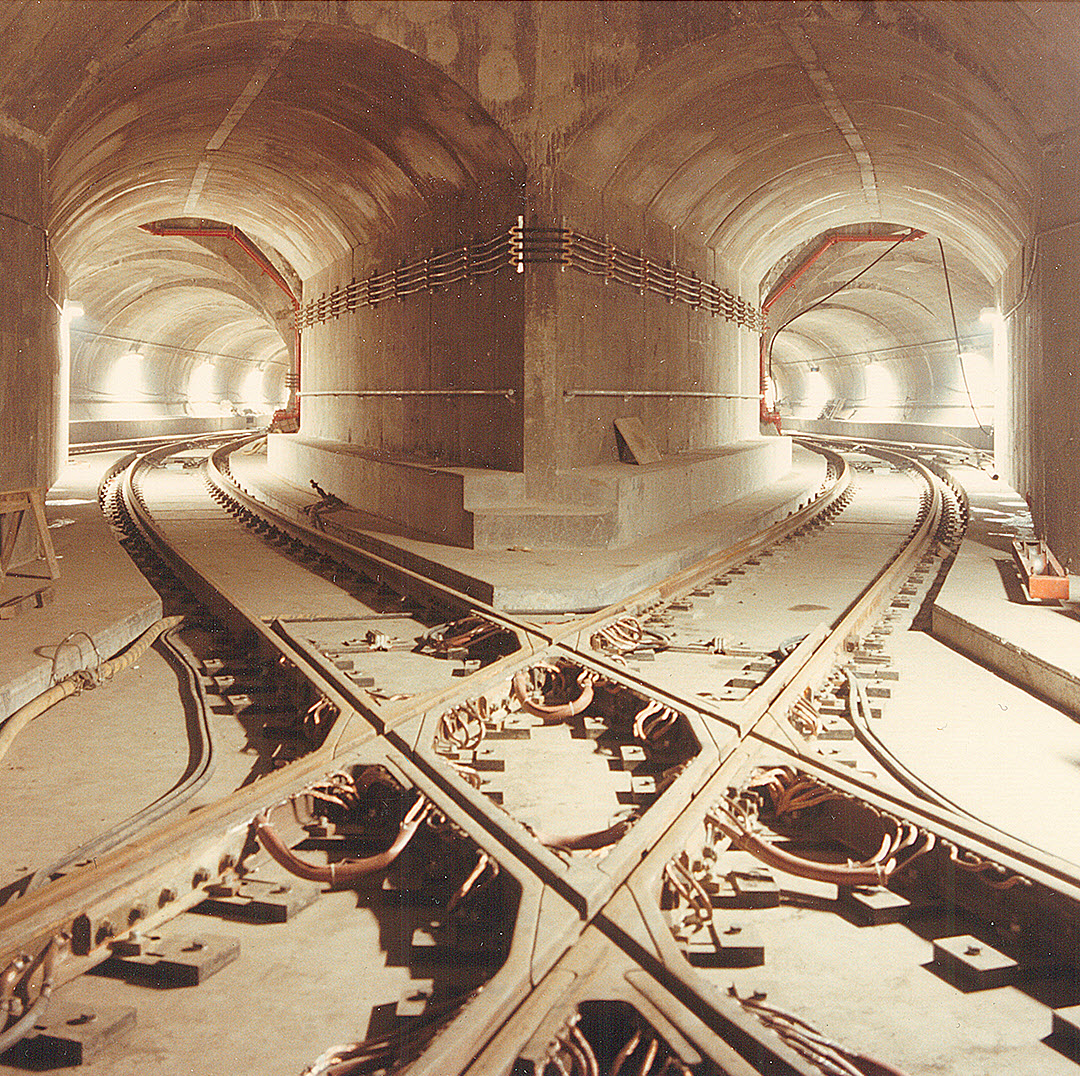
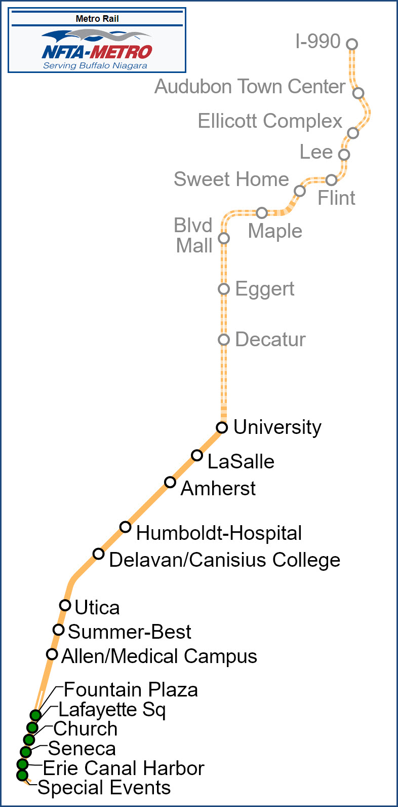
Cool trivia #1: Did you know that the Buffalo subway has two
stub tunnels that extend about 30 feet, just south of LaSalle, which were placed
there in the expectation that a line to Tonawanda would branch off from there
sometime in the future. One stub tunnel is on the inbound tracks, and one
on the outbound tracks. If you stand at the front right of the first car
of a train, and look forward out of the front of the train, you can see them.
Cool trivia #2: If you
board an outbound train and stand in the front of the first car, looking
out the right side window at the front of the train, you can get a
pretty good look at what the driver sees. Leaving Humboldt/Hospital
heading outbound, there are two sights of interest. The first is the
pocket track just north of Humboldt, the only place in the system where
there are three tracks side by side. It's pretty interesting to see it first hand. During
construction, and during times of single-tracking, the trains actually
do use this pocket track. I am told that it can also be used for
storage, as it is long enough to store a 4 car train underground in case
of blizzard or zombie apocalypse.
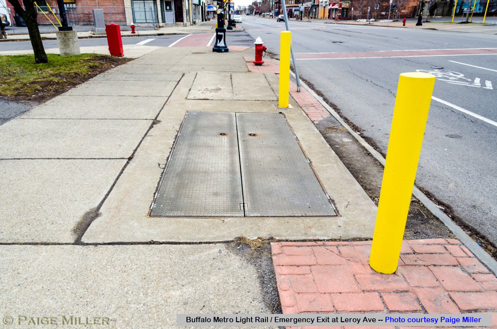
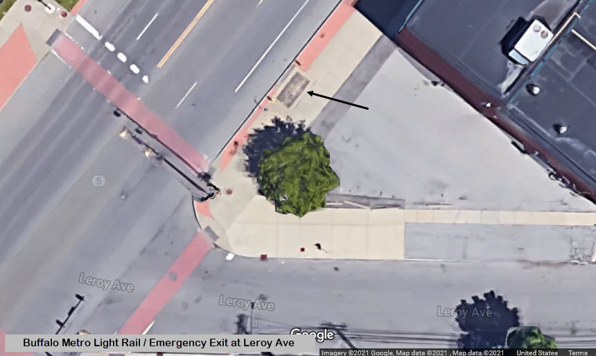
Cool trivia #3: Heading north between Humboldt and Amherst
beyond the pocket track, is a red "Exit" sign. Apparently, the designers
realized that the longest stretch of track was between Humboldt and
Amherst, and there was a need to place an emergency tunnel exit in that
stretch. Where does it go? After a lot of questions, I found out — it
leads to a trap door in the sidewalk at Leroy Avenue and Main Street. I
talked to a person who was a long-time dispatcher for the system, and he
believes that this exit has never been used in an emergency, but every 6
months an inspector has to go in there to make sure the exit is unblocked.
Cool trivia #4: There were crossovers between the two tracks
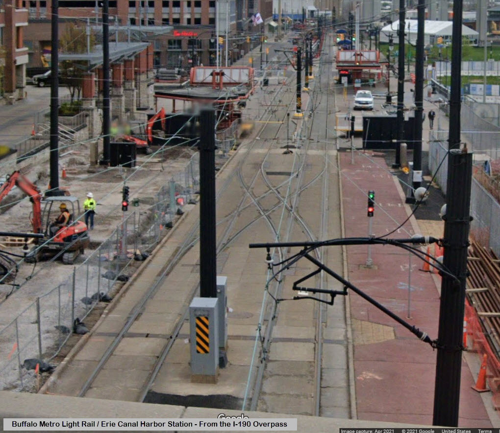
just north of the Erie Canal Harbor, but these have been removed in the
recent construction. Before they were removed, the trains could enter the
"proper" track to head outbound after arriving on the inbound track; or
be switched onto the outbound track when arriving. Now, the trains
arriving at the Erie Canal Harbor station have to continue past the
station into the maintenance yard, where the they can cross over to the
outbound track and then return to the Erie Canal Harbor station.
Cool trivia #5: The subway switches from cut-and-cover to tunnel between Utica and
Delavan. By looking out the front window, you can see this transition in
the side walls of the tunnel easily. You can also see the steepest slope
in the system right there, as the tunnel is quite a bit lower than the
cut and cover. You can see this either on an inbound train or an
outbound train.
♦ January 2026 updates from Paige Miller:
♦ The "Special Events" station is no longer in use.
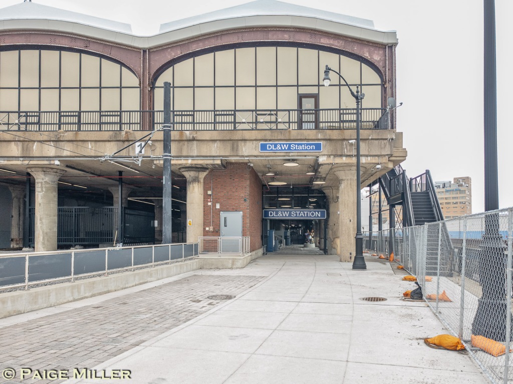
♦ The former DL&W RR freight station and car barn is now a passenger station, it is the
southernmost station of the Light Rail System. It still is the car barn.
Markets are expected to open in the upper floors of the building.
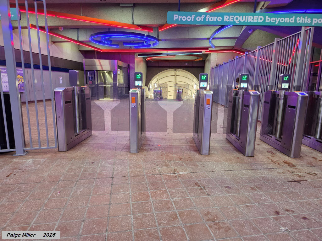
♦ There are no longer any fare inspectors checking your tickets once you
board the train; all stations (except the ones in the free fare zone) require you
to present a valid ticket or pass or prepaid card in order to enter. You also
have to present the tickets/pass/prepaid card in order to exit at each station
(except the ones in the free fare zone).
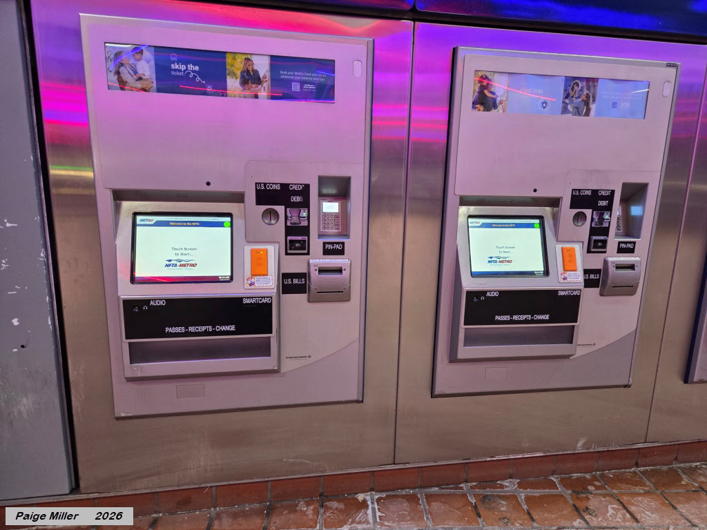
♦ Payment now is done via different ticket vending machines than the ones
shown in your article; now you can pay by credit card, cash, or you can purchase
daily, monthly or weekly passes. You can get a pre-paid pass from MetGo. You
can also pre-pay using the "Token Transit" app on your smartphone. The entrance
and exit gates will read the all valid forms of payment.
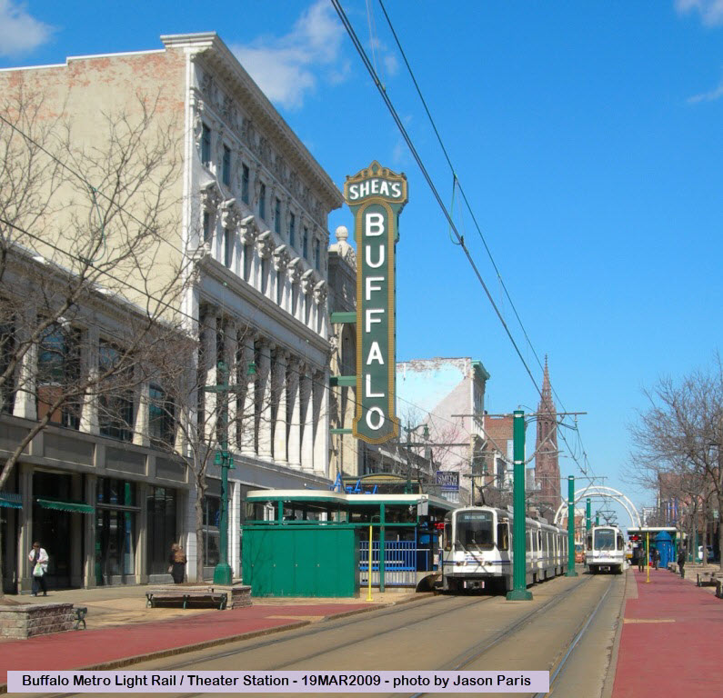
Theater station notes: The Theater station has a "colorful"
history compared to most others. For a while, it served as the northern
terminus of the system while the other stations were under construction.
Unfortunately, NFTA decided, as of February 18th, 2013, to close and demolish
the Theater station, giving in to pressure to allow cars to have better access
to the theater. Many believe that this is a step backwards and will only
serve to alienate those customers who would frequent the theater area by
Light Rail, especially the handicapped, who will now have to make their
way about two blocks from the Fountain Plaza station. The closing
of the station had actually been in the works for some time.
On the operations side of things.... They now run 3 car consists during the day,
2 at night. Two cars are used on weekends and Sunday service has been
extended from 8:00 am to 11:00 pm..
Construction on Main Street (when I did a 2012 update).... They are only at 90% design of the
first block (from Main and Chippewa to the portal and West Tupper) and they won't start
construction until fall 2013 at the earliest. As part of this, theatre station
is being removed completely. That means theatre goers who take the train to see
a show will have to get off at Fountain Plaza, then walk down a block to the theatre.
This has upset many people in the community. The theaters (particularly Shea's)
wanted the station gone so people can pull limos up under the marquee and let out
more affluent theatre patrons like the old glory days before that damn train ran in
front of the theatre! After they complete just this one block, they still haven't
even started looking at the other blocks so it won't be anytime soon that cars
will be back on the full length of the above ground section. (From Wikipedia:) On
January 23, 2015, after less than two years of construction, traffic was reintroduced
to the 600 block of Main Street, between Tupper and Chippewa Streets, in the Theater
District. On December 15, 2015, traffic was reintroduced to the 500 block of Main
Street, between Chippewa and Mohawk Streets, in the Central Business District.
There are currently no viable plans for expansion, partly due to the economic
downturn, but also the declining city population. Many downtown business's
advocate removing the light rail system from Main St and return it to it's former
"glory" in hopes of attracting more business to the downtown area, but
in a compromise, the city has been working on a project so that cars can park
along Main Street along with the light rail operations - the project is supposed
to have been completed in 2011. Originally, the Buffalo system was one of
the few unsuccessful system in terms of bringing new development along the
corridor, however, in more recent years, property values and development along the
subway corridor are increasing. FYI,
one subway website states that Buffalo's population in 1950 was around 600,000,
and from another site, here are some population stats for the decline of Buffalo:
1960 532,759 -8.2% change
1970 462,768 -13.1% change
1980 357,870 -22.7% change
1990 328,123 -8.3% change
2000 292,648 -10.8% change
2006 257,758 -11.9% change (est)
2020 update: The population in the city of Buffalo has now gone up, according to
the 2020 Census, but still quite a bit lower than previous decades. The population
in the Buffalo metro area seems to be relatively flat. (PM)
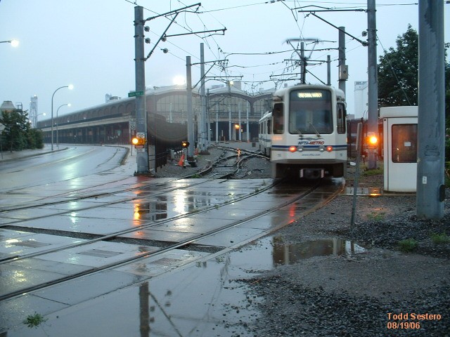
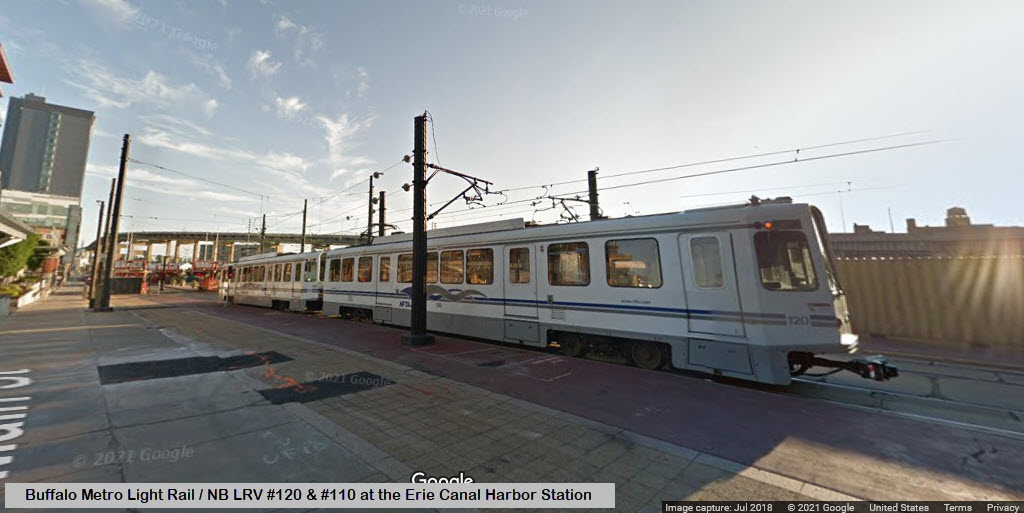
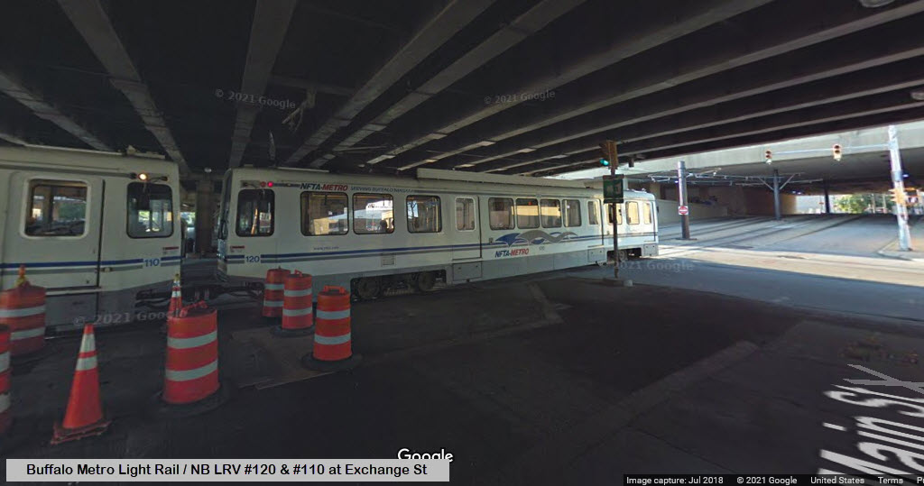
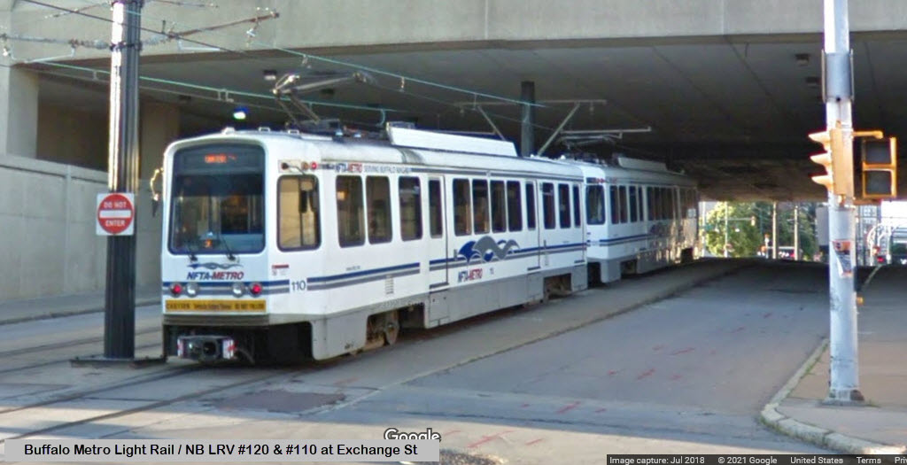
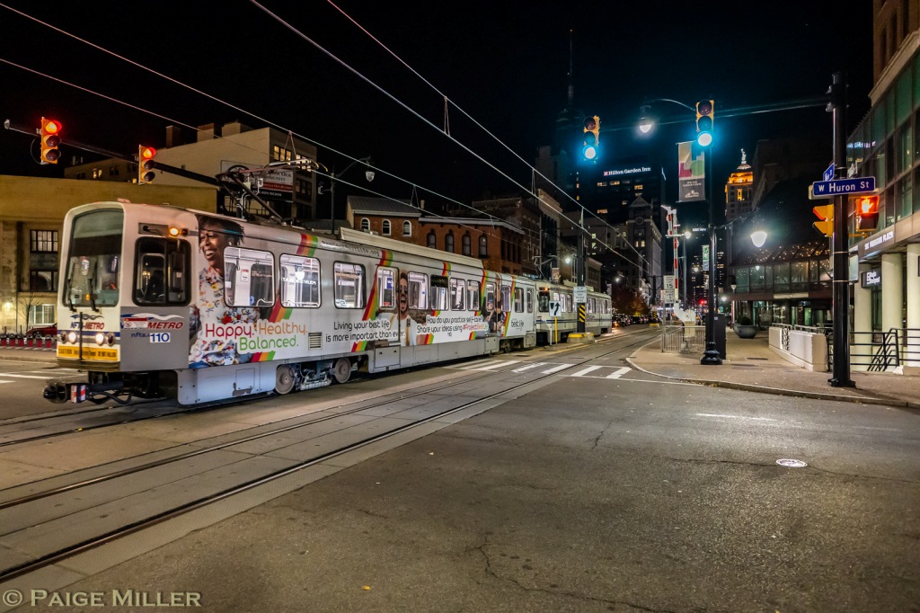
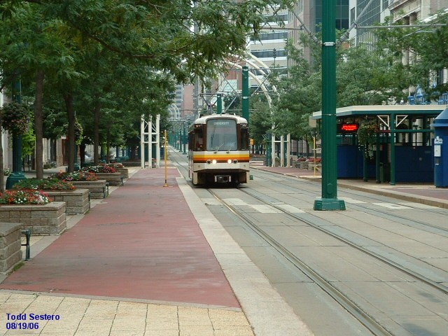
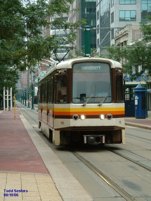
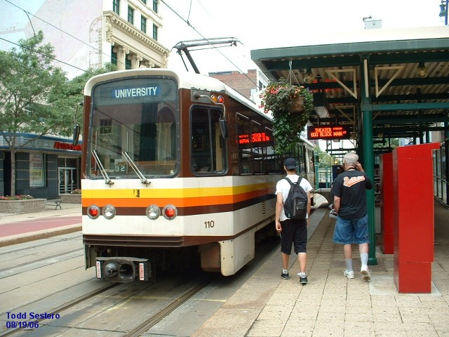
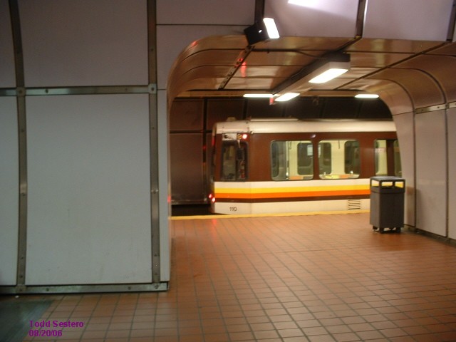
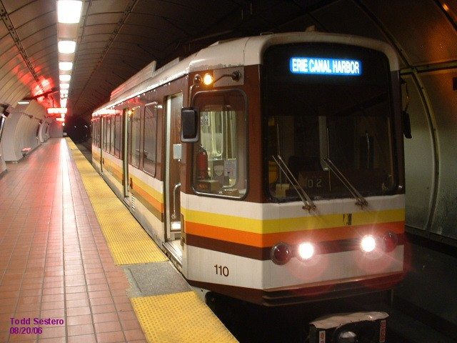
Interesting note about #110 in the photo at the top of the page. Sometime
around 2009, 110 was involved in an accident in the yard and
was sent to the rebuilder to be repaired. The train split
a switch and wound up scraping alongside a pole, badly damaging
the side. The same rebuilder is also doing an overhaul of the fleet.
On rebuilding the fleet:
NFTA sent out two cars in 2009 to be upgraded and modified. They got
back #114 and #123 at the beginning of 2011. The rebuilding effort includes:
a) The rewinding and rebuilding of the motors, but the
Westinghouse DC choppers will remain in place. NAFTA
had wanted to upgrade to AC propulsion, but can't afford it
at this time... Both motors and controls would have to be
replaced to move up to AC propulsion, along with re-wiring.
b) They have new HSCB's on the power end (which I'm
guessing are the high-speed circuit breakers used to open
the main 750VDC line coming into the car).
c) They changed over the air compressors from the old
piston type to a newer rotary type.
d) An AC inverter was added.
e) The brake system remains the same with all Knorr equipment,
but received a new drain and dryer system.
f) New LED message signs were added which will display the next
station, and it also gives an announcement over the PA system.
These are triggered by RFID tags on the ceiling of the tunnel and
outside station covers (similar technology to the EZPass transponders
we use on the highways for tolls).
g) New "intercar" barriers were installed to prevent people
from walking between cars while in the station. These are also
triggered by the RFID tags.
h) New antennas were added to the B end roof to pick-up the RFID tags.
i) They also changed the door controllers to get rid of the annoying
beep-beep-beep and changed it to a more smoothing ding-dong, ding-dong.
Acknowledgements:
Paige Miller (A special thanks goes to Paige for taking the time to send in all of the photos and information)
Denver Todd
Jason Paris
Adam Moss
Google
Google Maps
Websites and other additional information sources of interest for the area:
https://en.wikipedia.org/wiki/Buffalo_Metro_Rail
http://metro.nfta.com/
http://metro.nfta.com/Routes/
http://mapa-metro.com/en/united-states/buffalo/buffalo-metro-rail-map.htm
https://www.wkbw.com/news/nys-budget-includes-9-million-for-buffalo-light-rail
https://www.nycsubway.org/wiki/Buffalo,_New_York
https://en.wikipedia.org/wiki/Theater_station
https://transportwiki.com/the-buffalo-metro-rail/
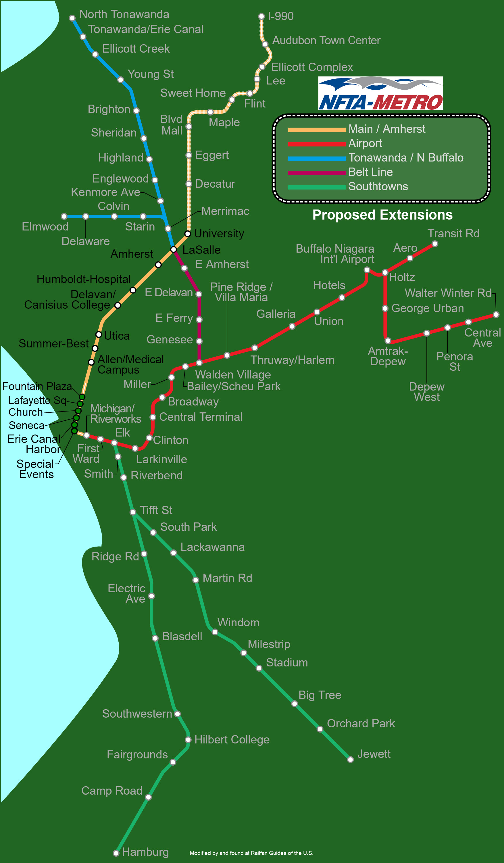
Maps
The upper map is a simplified map of the system and the environs, the lower map is a newer and more detailed version... take your pick!
The above map in PDF format here
The above map in PDF format here
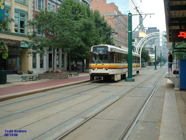
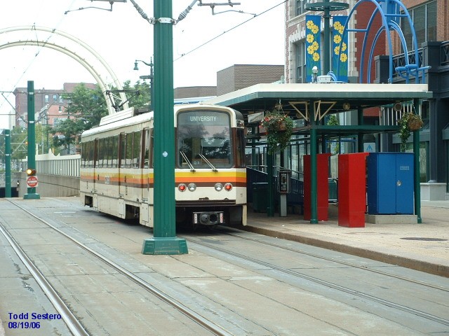
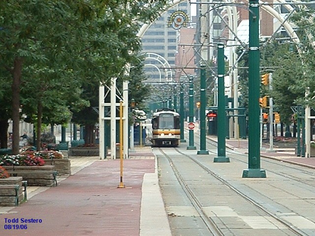
Light Rail pix from around the system
The Shops
DL&W Station
Special Events Station
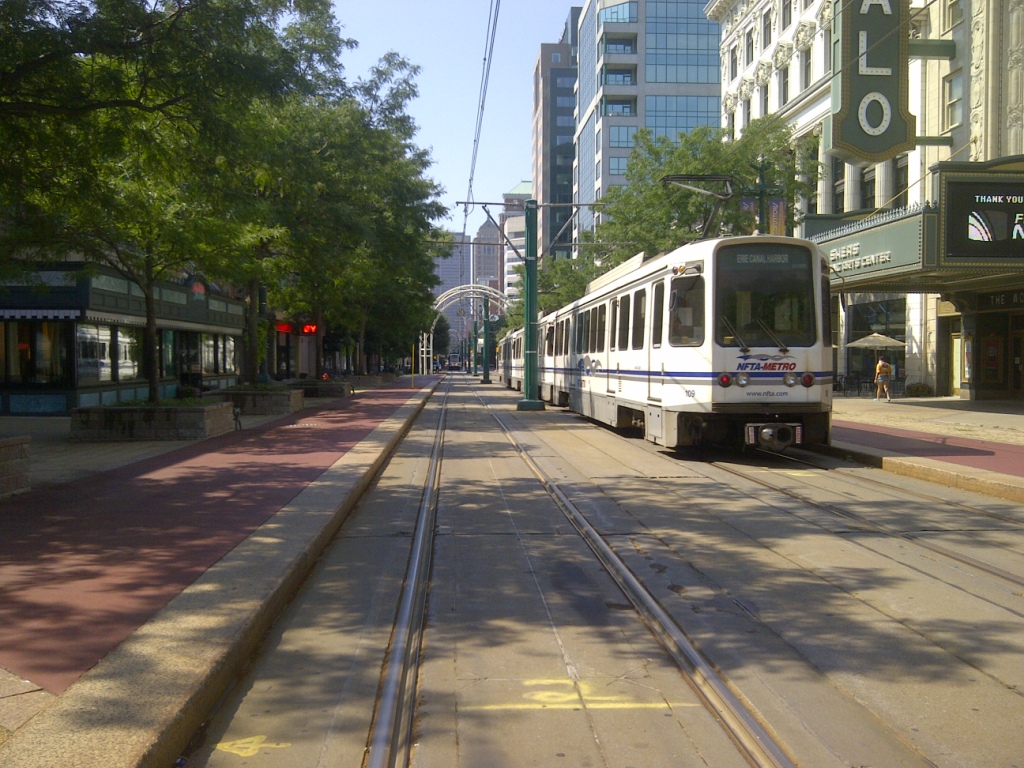
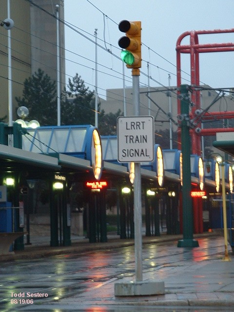
Canalside Station (Erie Canal Harbor Station)
Seneca Station
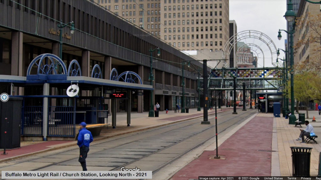
Church Station
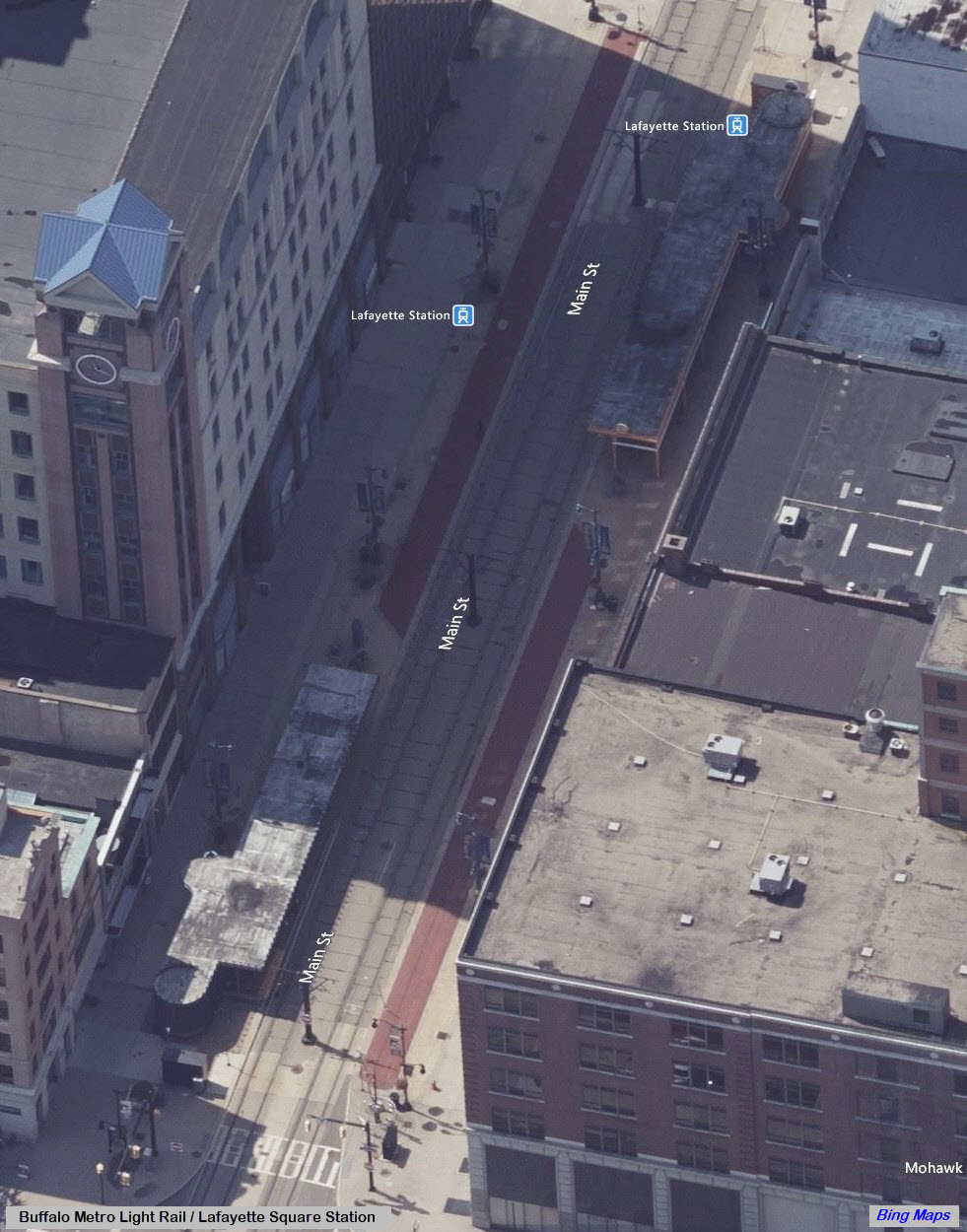
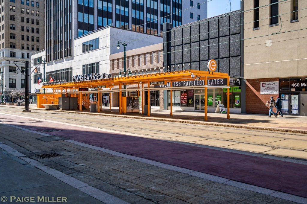
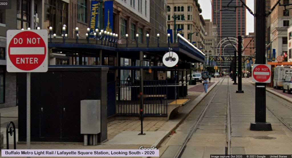
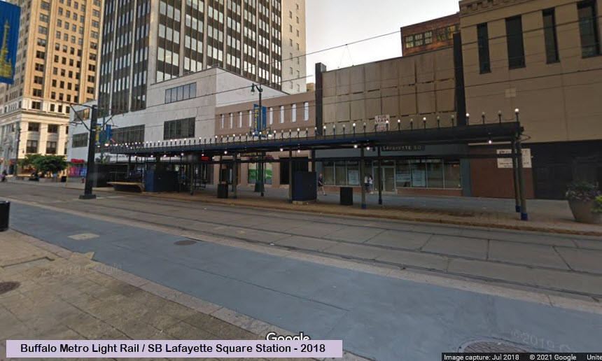
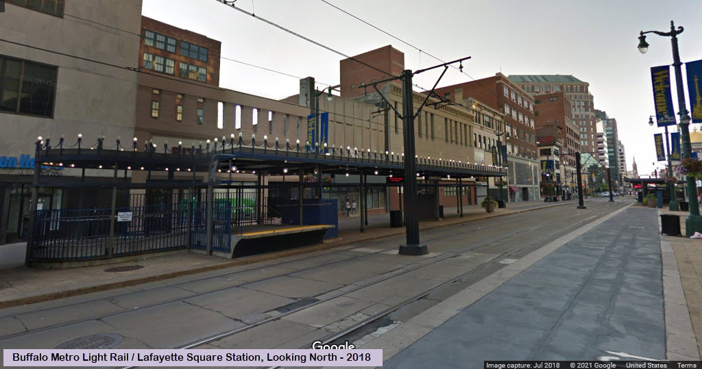
Lafayette Square (Evans Bank) Station
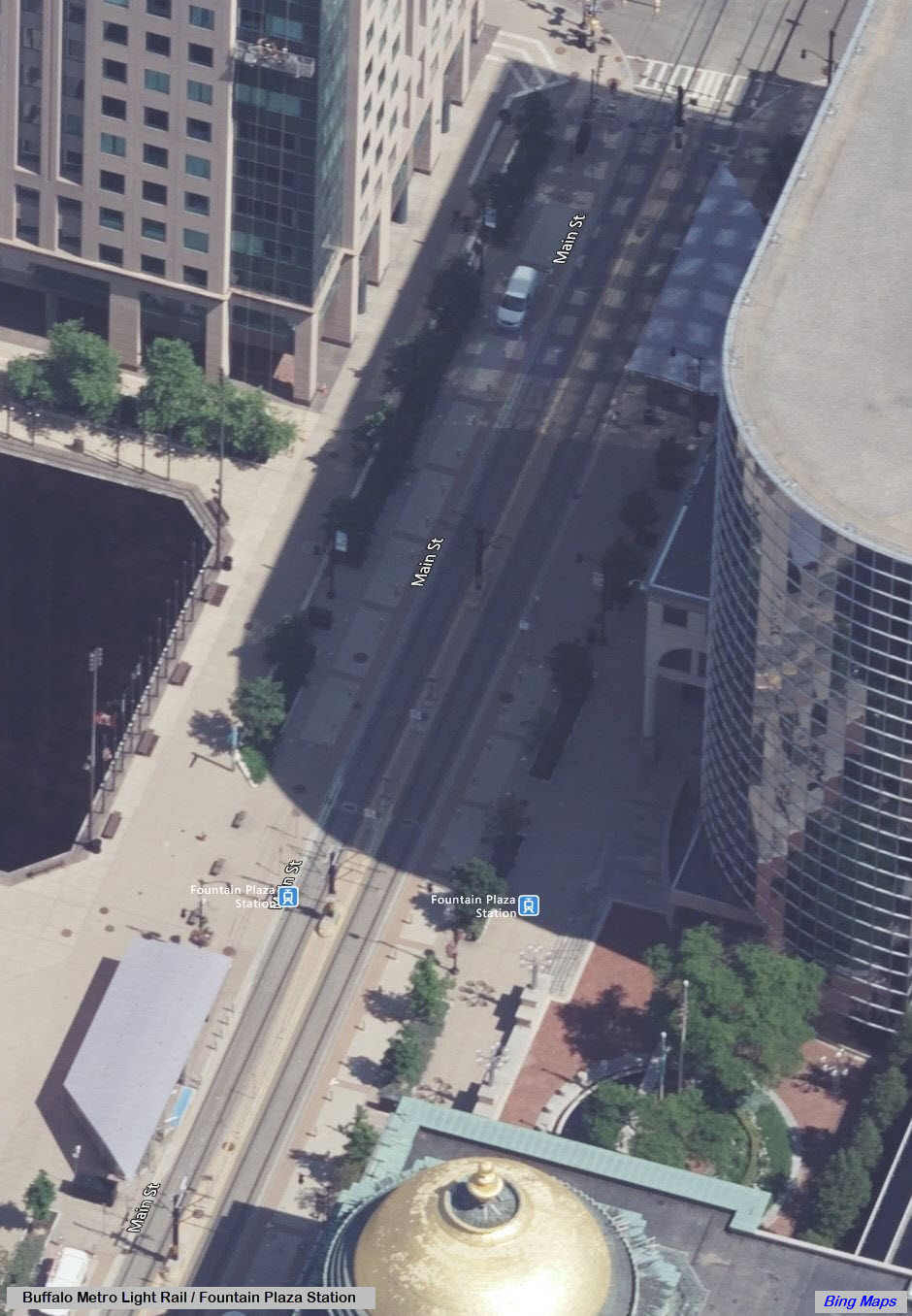
Fountain Plaza Station
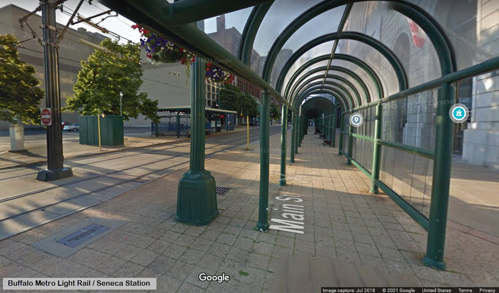
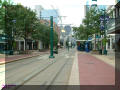
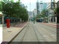
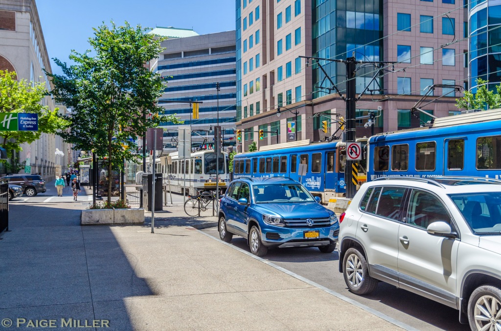
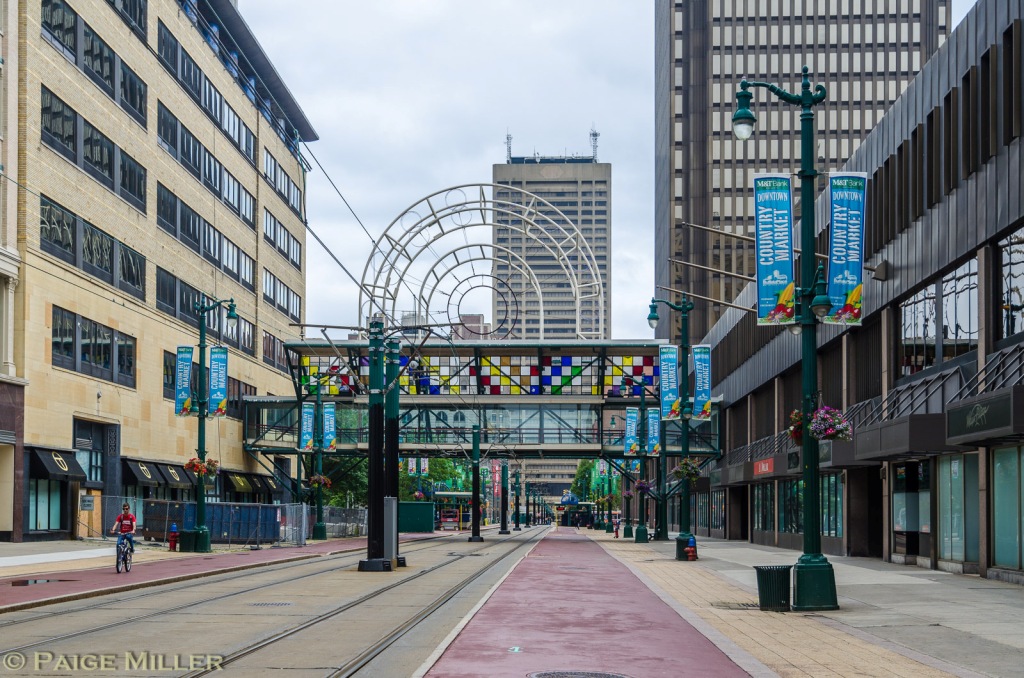
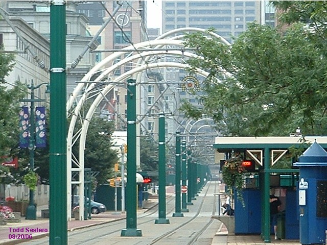
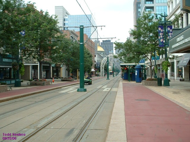
Shots down Main Street
Theater Station
Tunnel Portal / Entrance
Allen Medical Campus
Summer Best
Utica
Delevan-Canisius
Humboldt-Hospital
Amherst Station
LaSalle Station
University Station
The Shops and Carbarn
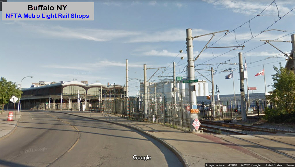
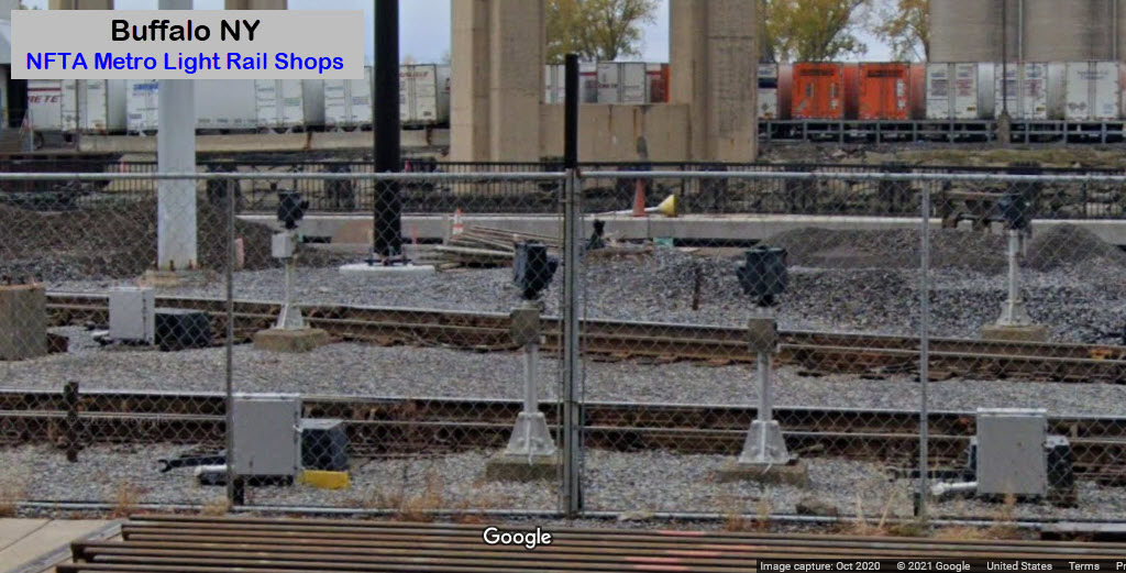
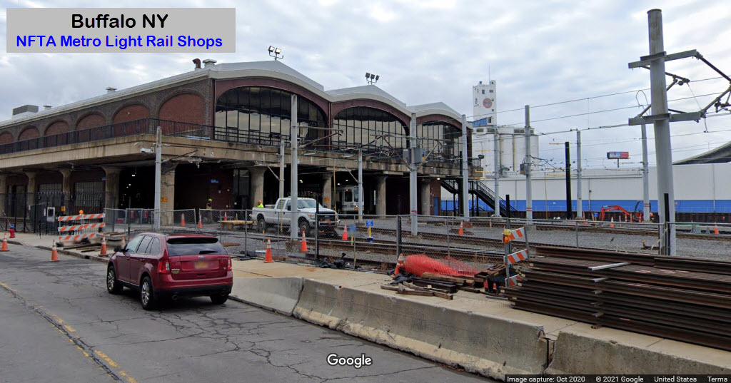
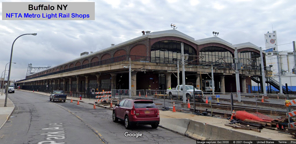
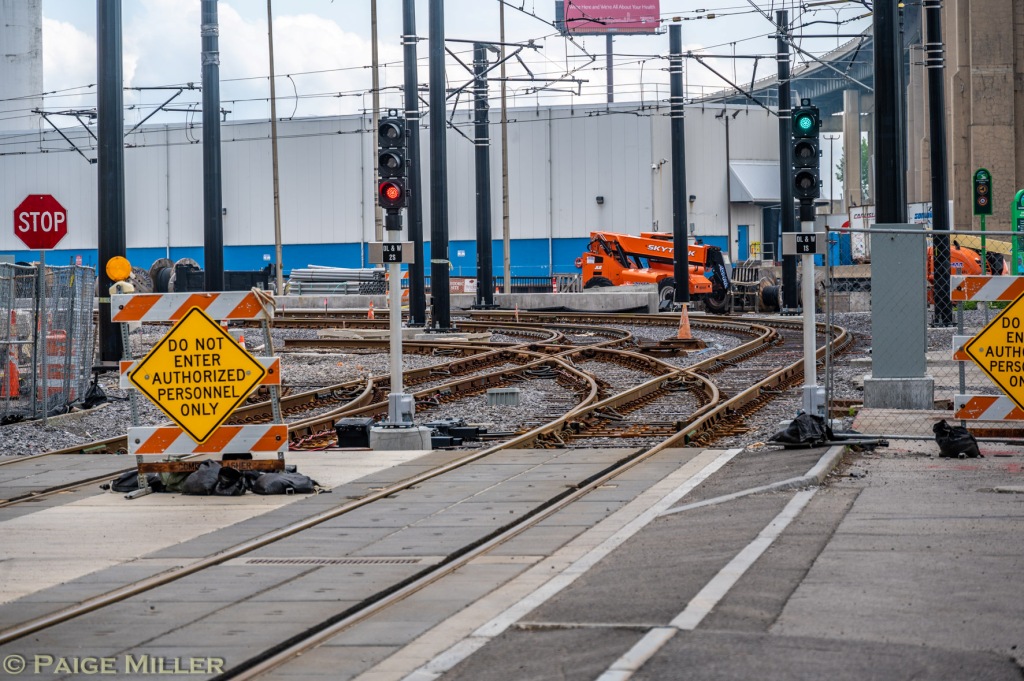
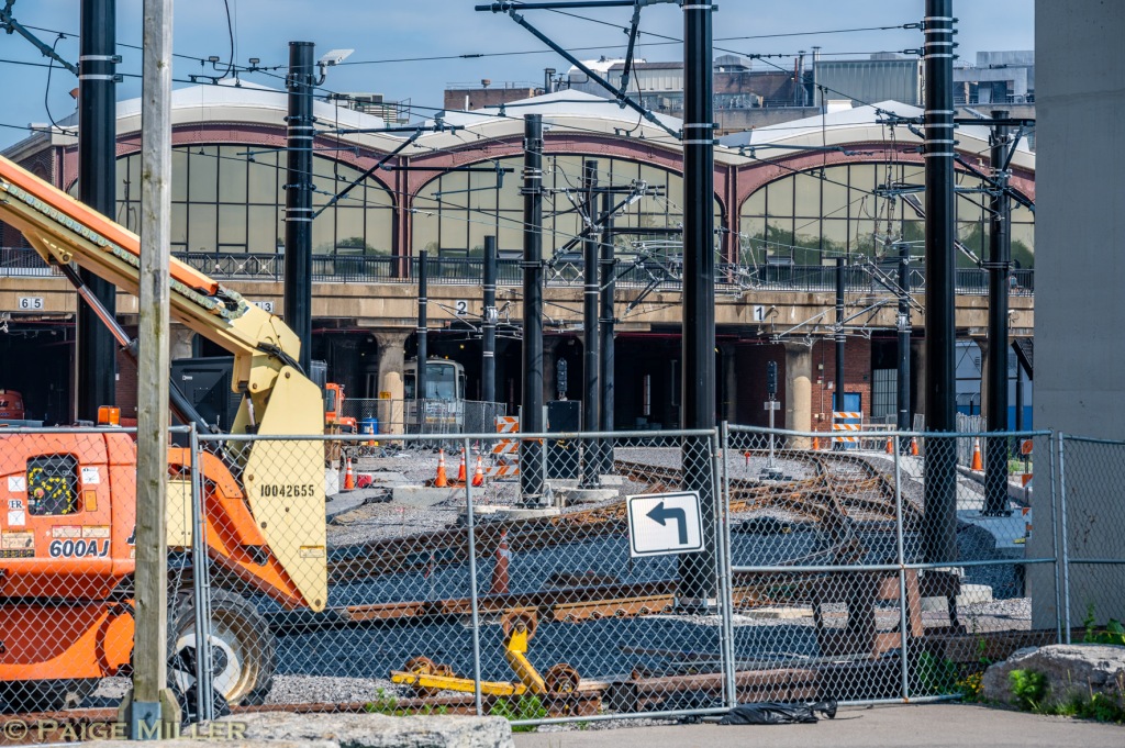
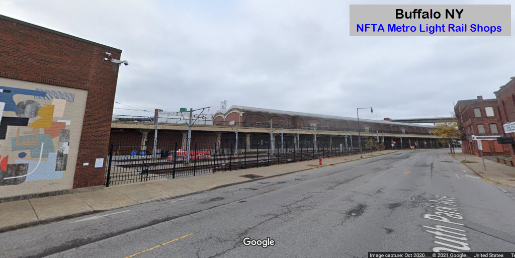
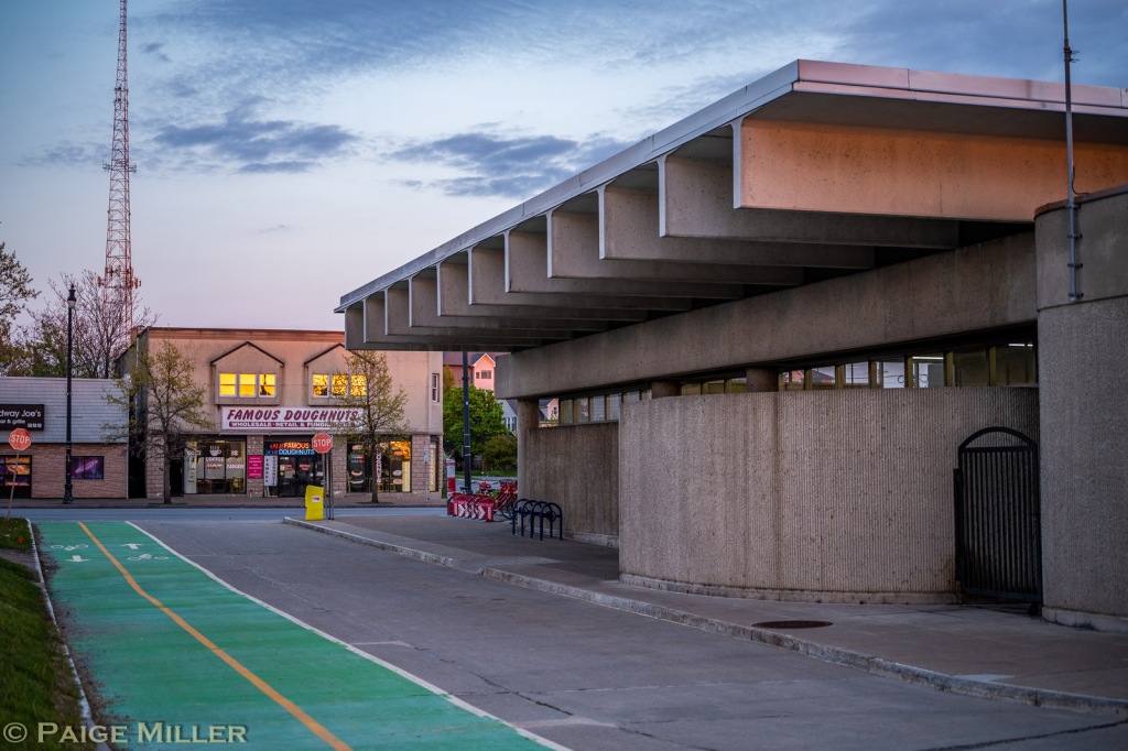
GPS Coordinates: 42.87356, -78.87605
The shops are conveniently located along South Park Avenue, coming south out of
the downtown area. Looks like a little yard work was going on in 2020 when
the Google Streetview cameras came thru.
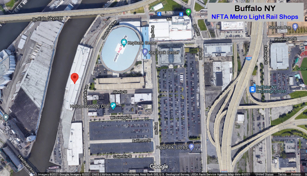
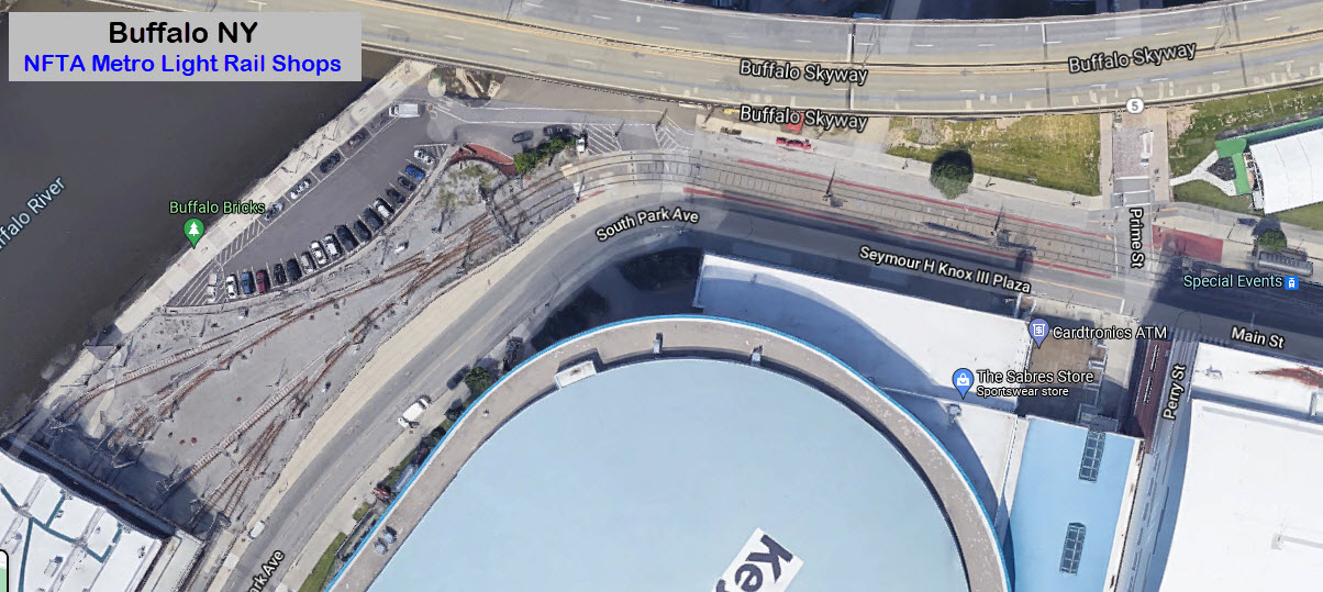
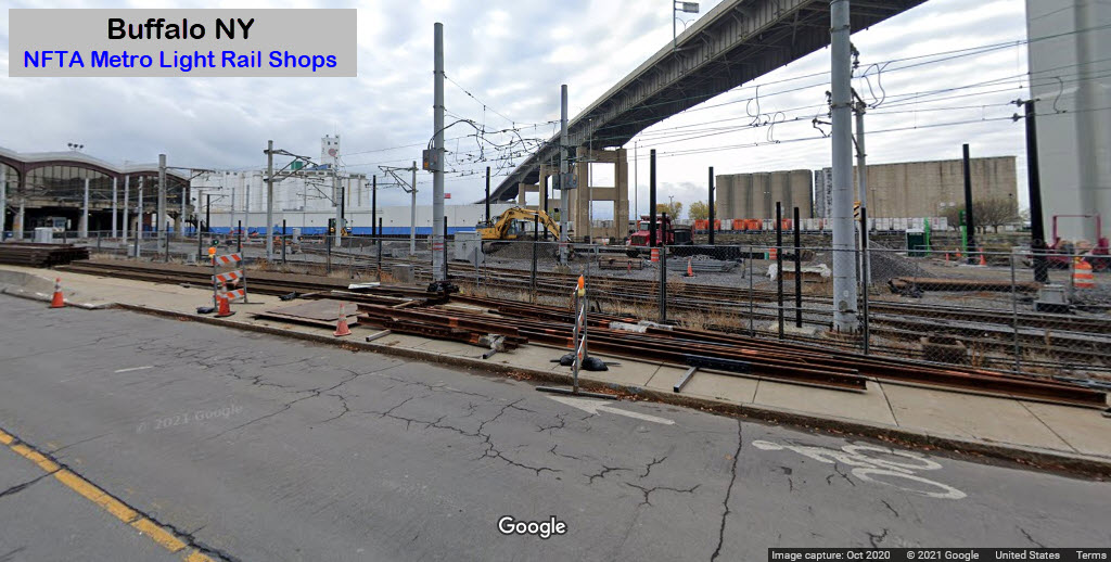
They have added a whole bunch of signals in their expanded yard....
Additional photos of the "new" entrance to the yard, courtesy Paige Miller, from May 2022:
Before pictures, before construction began on the yard work....
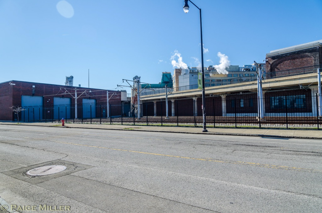
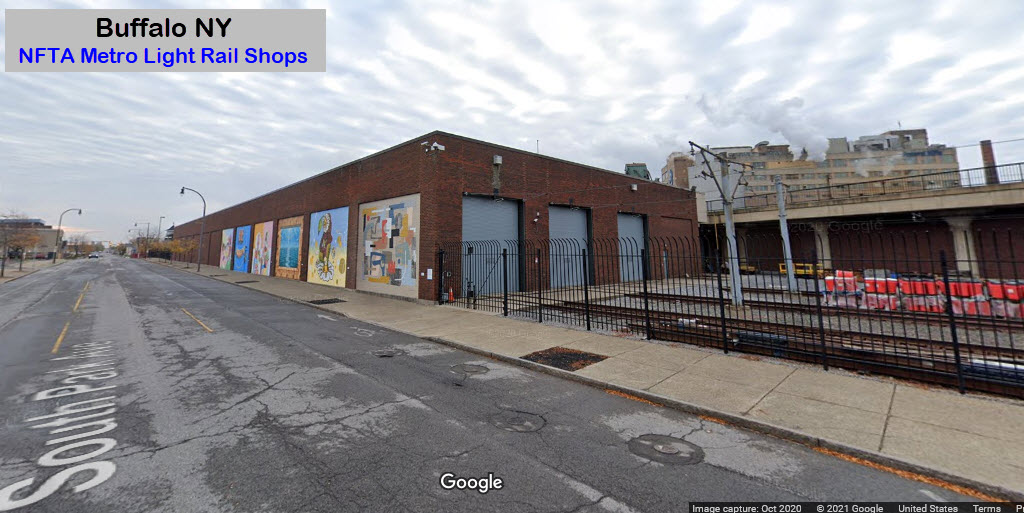
Couple of shots of the combined shops and carbarn. This is common practice in snow country.
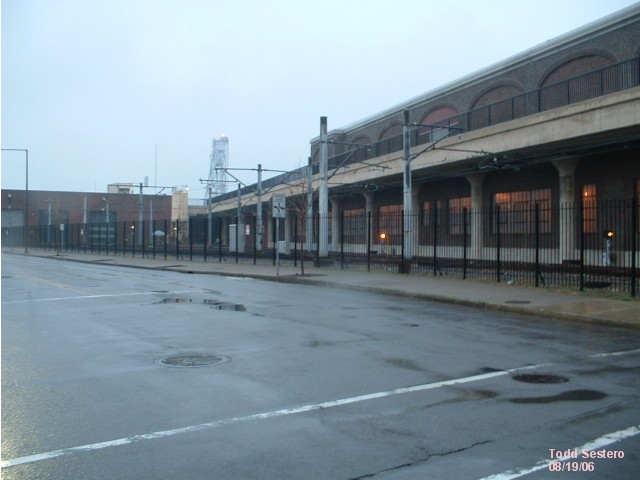

At the entrance to the yard and shops.


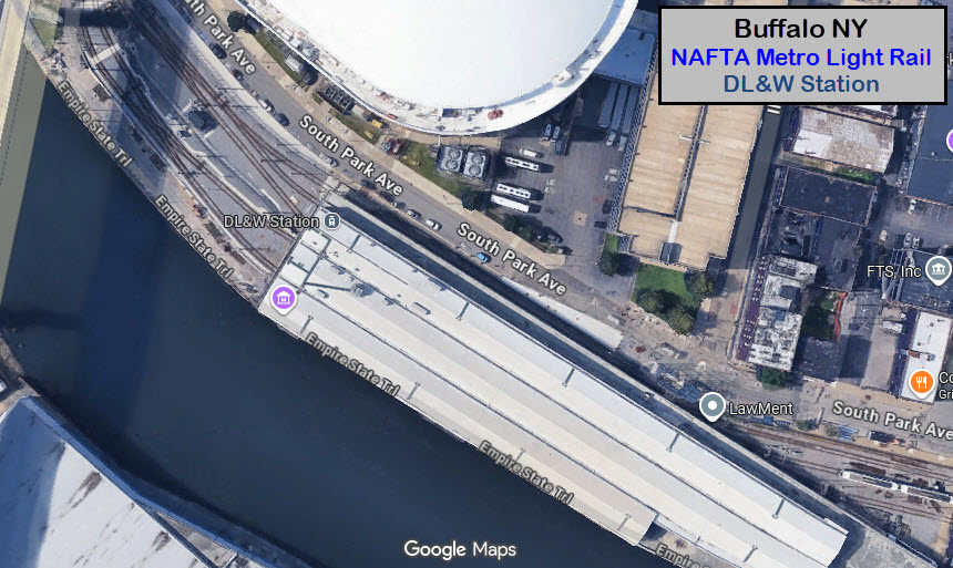
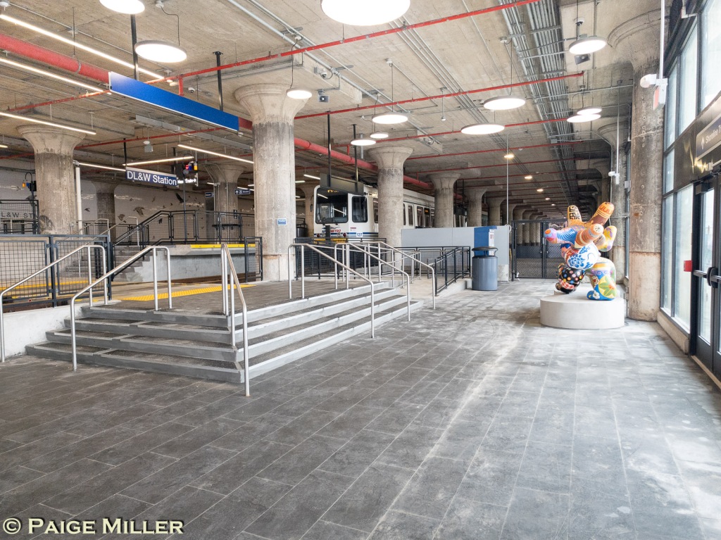
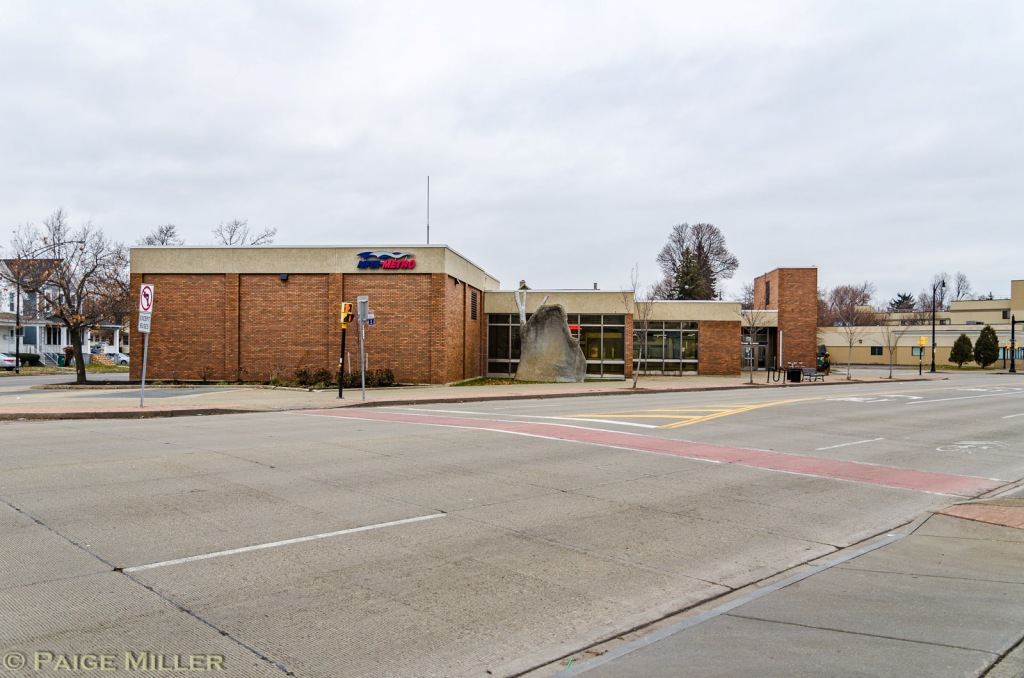
DL&W Station
GPS Coordinates: 42.87399, -78.87651
South Park Ave across from the south side of the KeyBank Center.
Service to DL&W station began on December 8, 2025. Thanks to Paige Miller for the pictures!
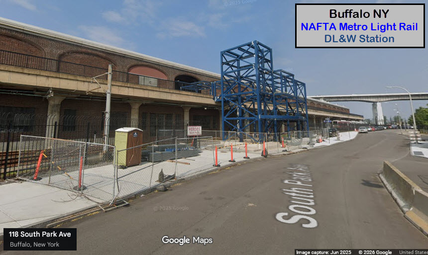 under construction/2025
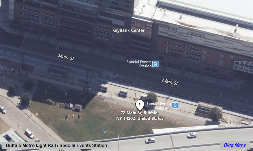
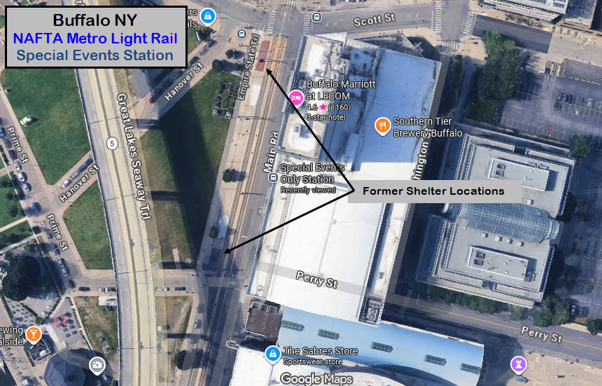
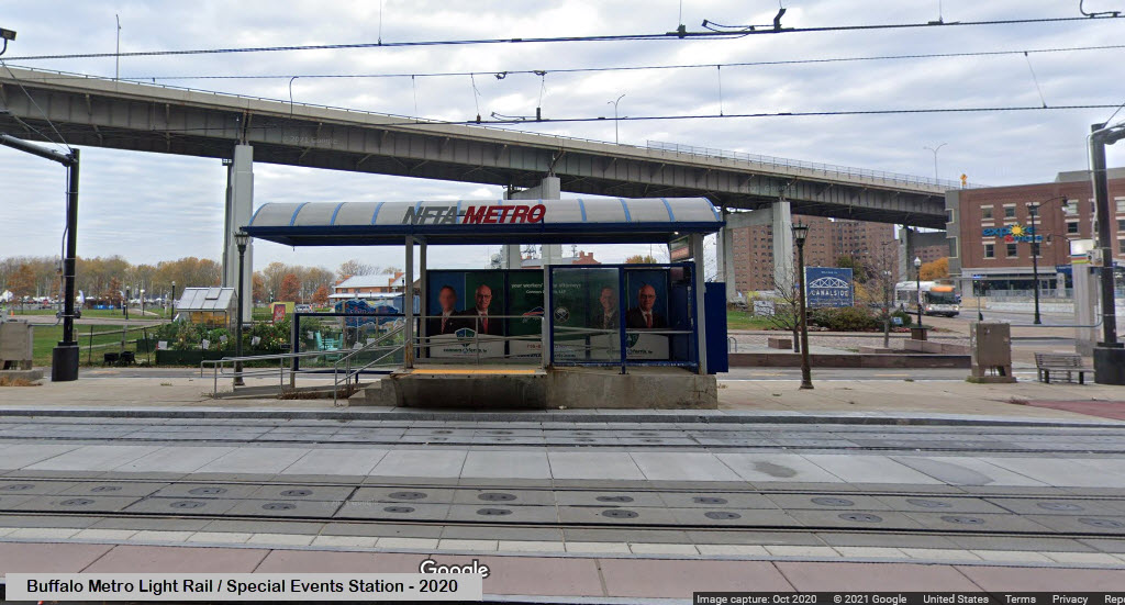
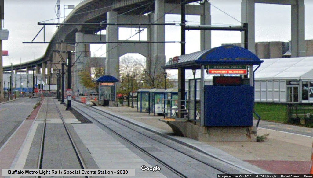
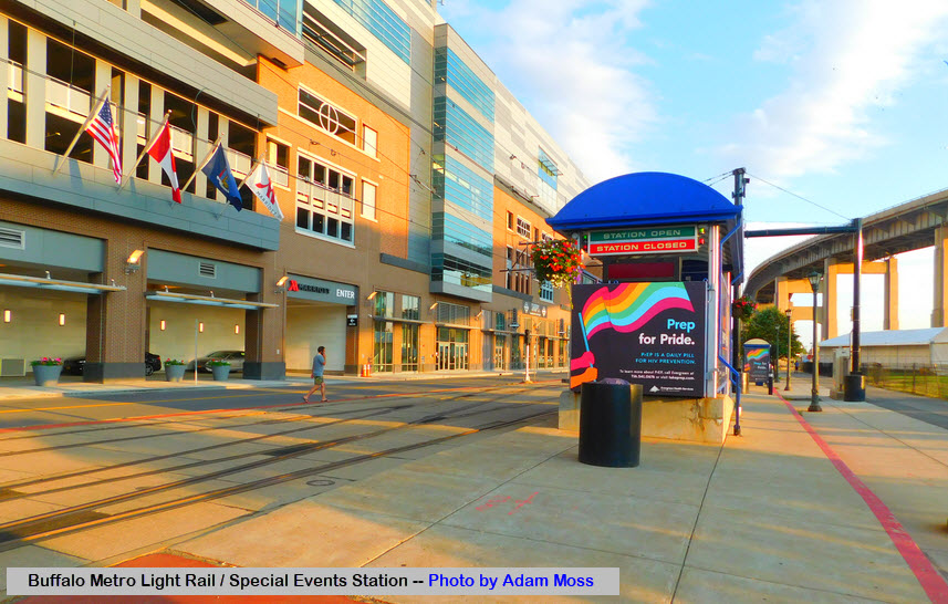
Special Events Stadium Station
GPS Coordinates: 42.87662, -78.87735
The Special Events station last saw service in 2020 at the start of the COVID-19 pandemic, and was demolished in 2024.
This station was replaced by the full-service DL&W station.
 via Wikipedia
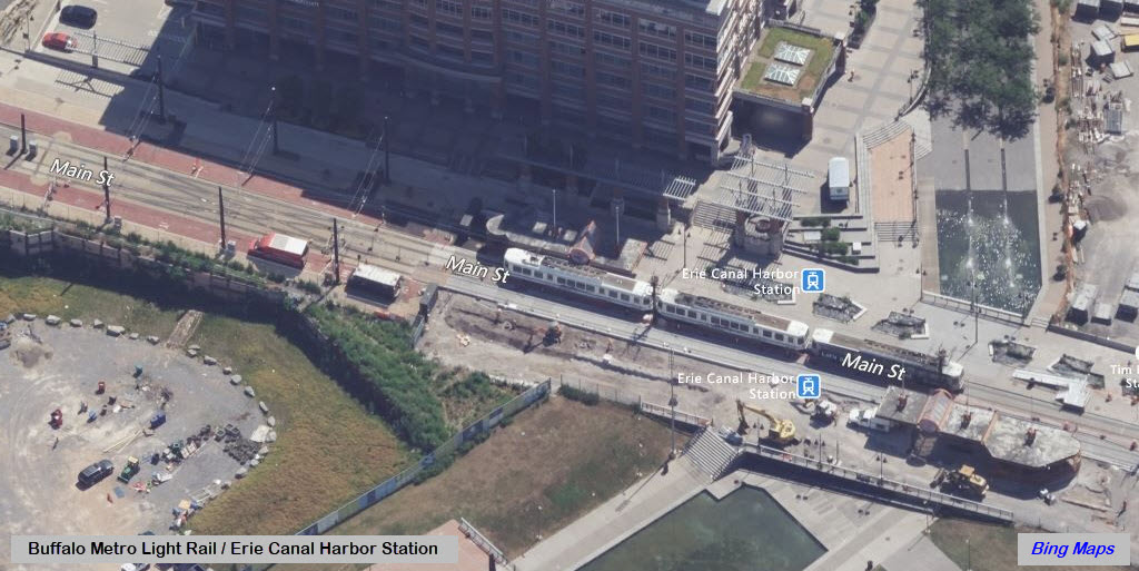
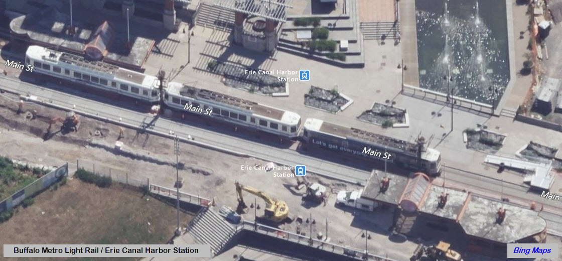
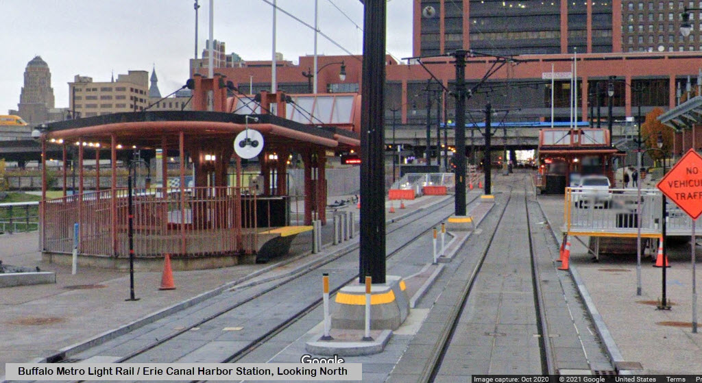
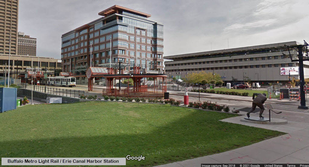
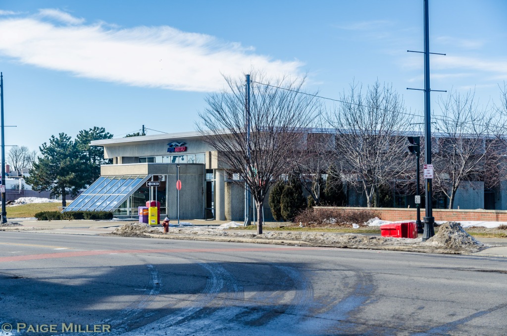
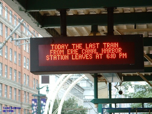
Canalside Station (formerly the Erie Canal Harbor station)
GPS Coordinates: 42.87780, -78.87696
On the north side of Main and Marine Drive & Scott
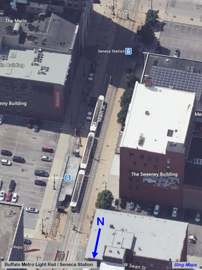
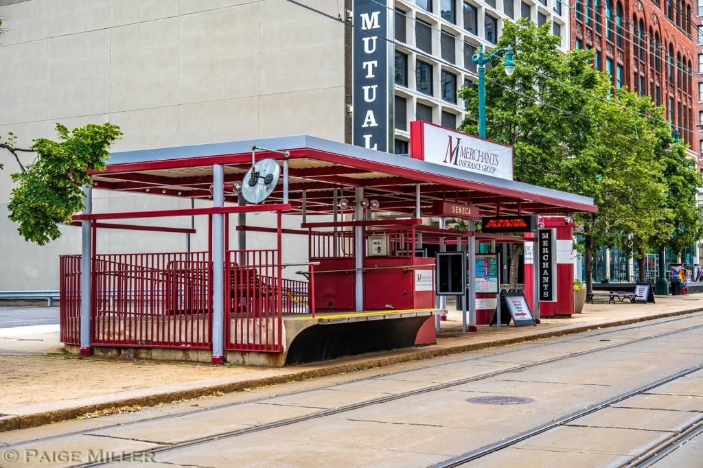
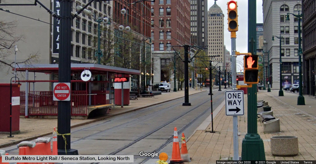
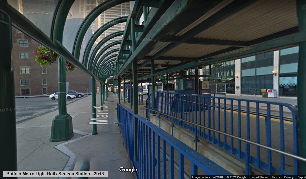
Merchant's Insurance @ Seneca Station (formerly Seneca Station)
GPS Coordinates: 42.88125, -78.87584
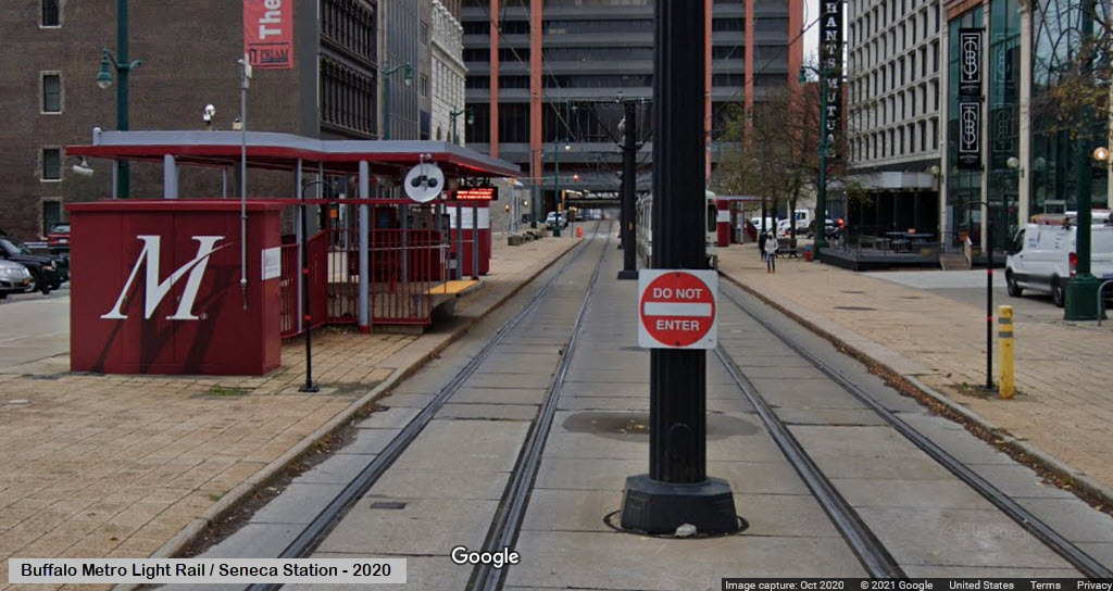
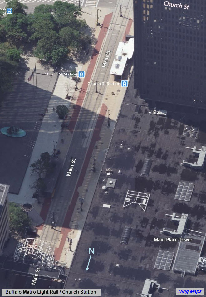
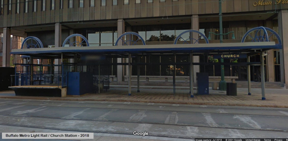
Church Station
GPS Coordinates: 42.88385, -78.87497
Lafayette Square Station (formerly the Evans Bank Station)
GPS Coordinates: 42.88469, -78.87414
Fountain Plaza Station
GPS Coordinates: 42.88951, -78.87314
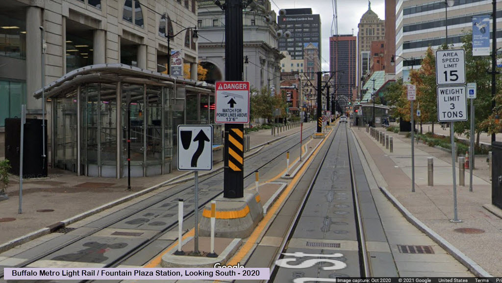
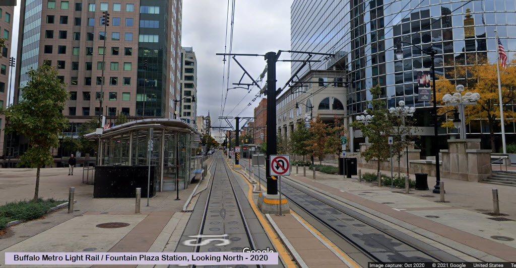
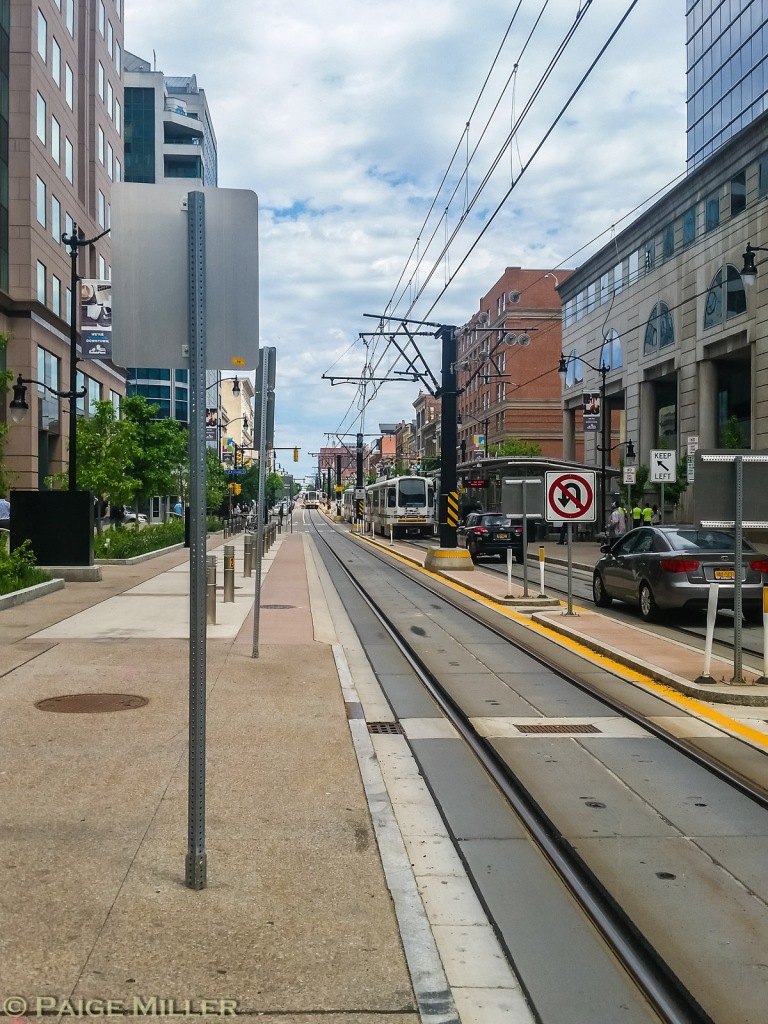 looking north, NB train on the right
Pictures down Main Street
I love these night time shots from Paige:
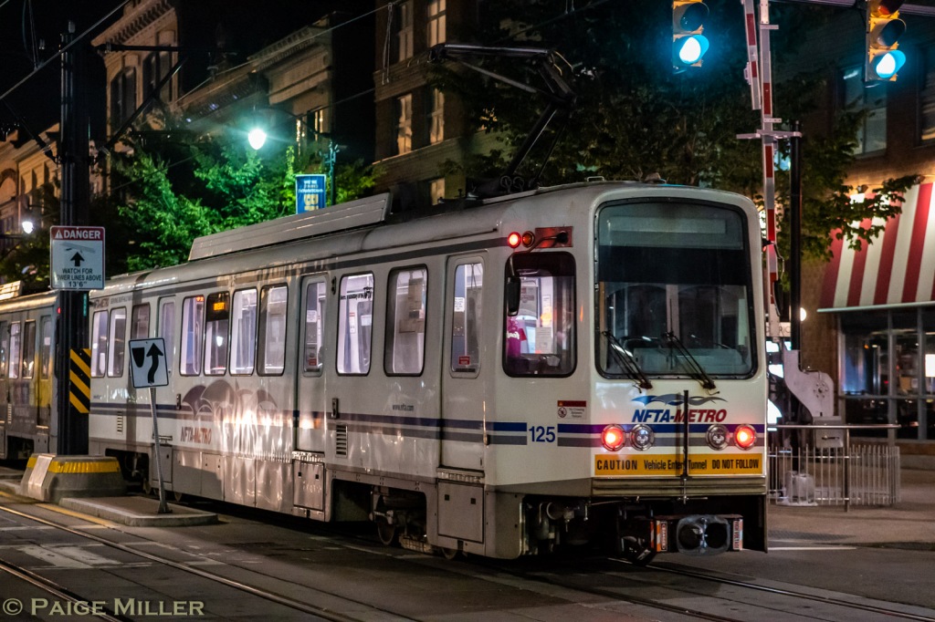
 looking south
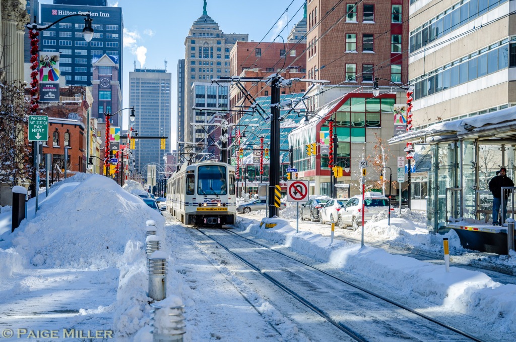
Aftermath of the 2019 blizzard, heading north at Huron Street
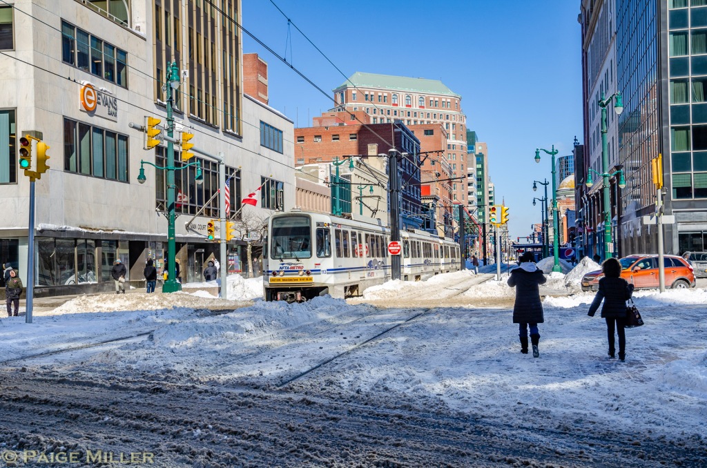
Another shot of the 2019 blizzard, SB train, looking north at Court Street
Found on the internet, photographer unknown....
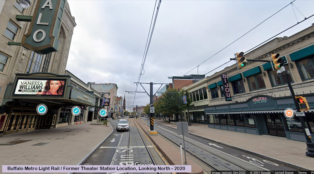
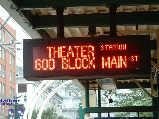
Theater Station
GPS Coordinates: 42.89193, -78.87239
https://en.wikipedia.org/wiki/Theater_station
The Theater station was permanently closed on February 18, 2013 in order
to be demolished to make way for the return of vehicular traffic to the 600 block
of Main Street. The Buffalo Theater District is now served by the Fountain Plaza
station, located 546 feet (166 m) south. Theater was the last above-ground station,
with the subway portal directly north of the station, which caused safety issues
partially leading to decision to close rather than relocate the station. (from Wikipedia)
Northbound train coming into the Theater station.


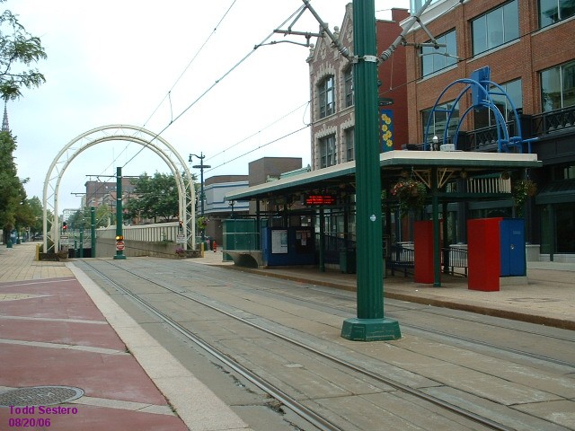
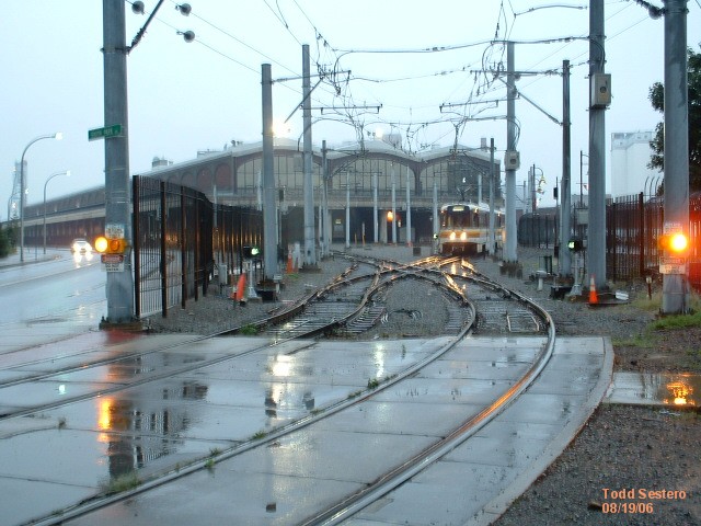
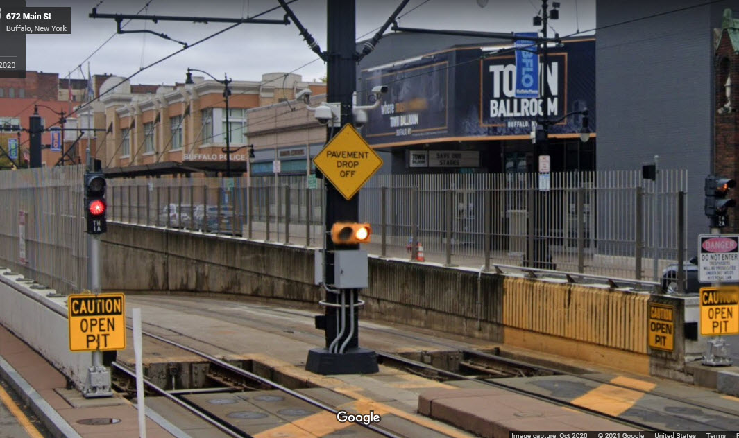
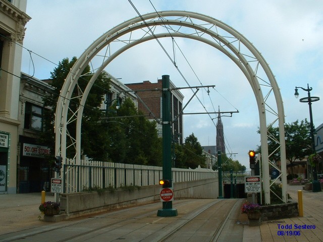
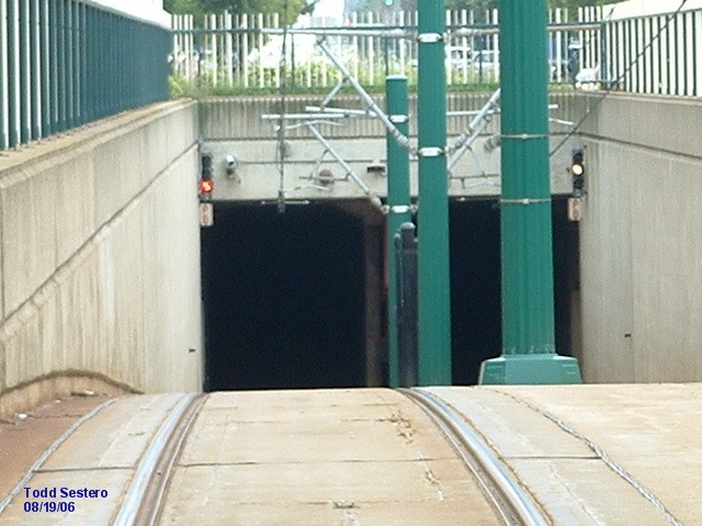
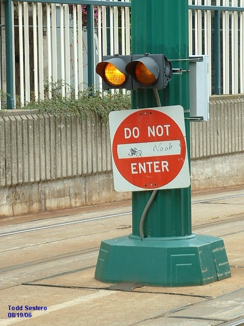
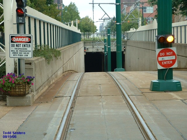
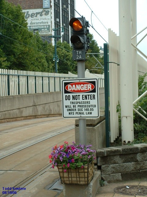
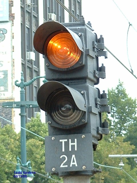
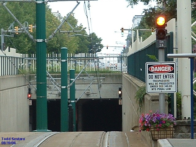
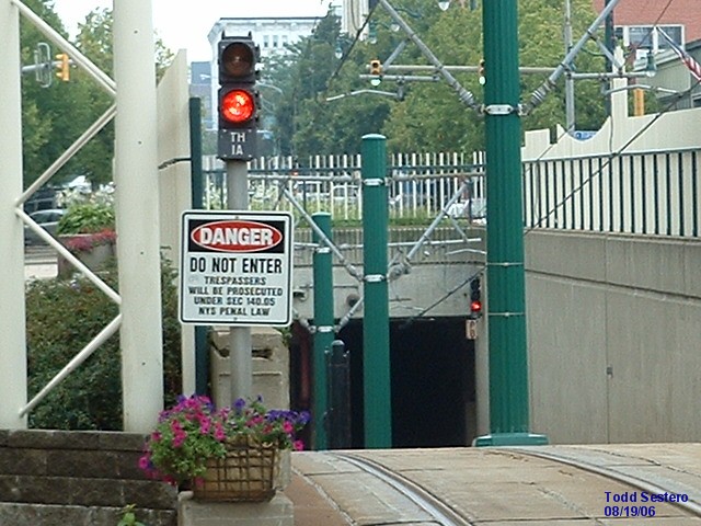
Tunnel Portal / Entrance
They've gone to great lengths to keep cars from entering the tunnel, but you
would have thought they would have made the NB side longer, since that's the
direction cars are traveling. We've lost the cool looking arch tho in the process.... darn....
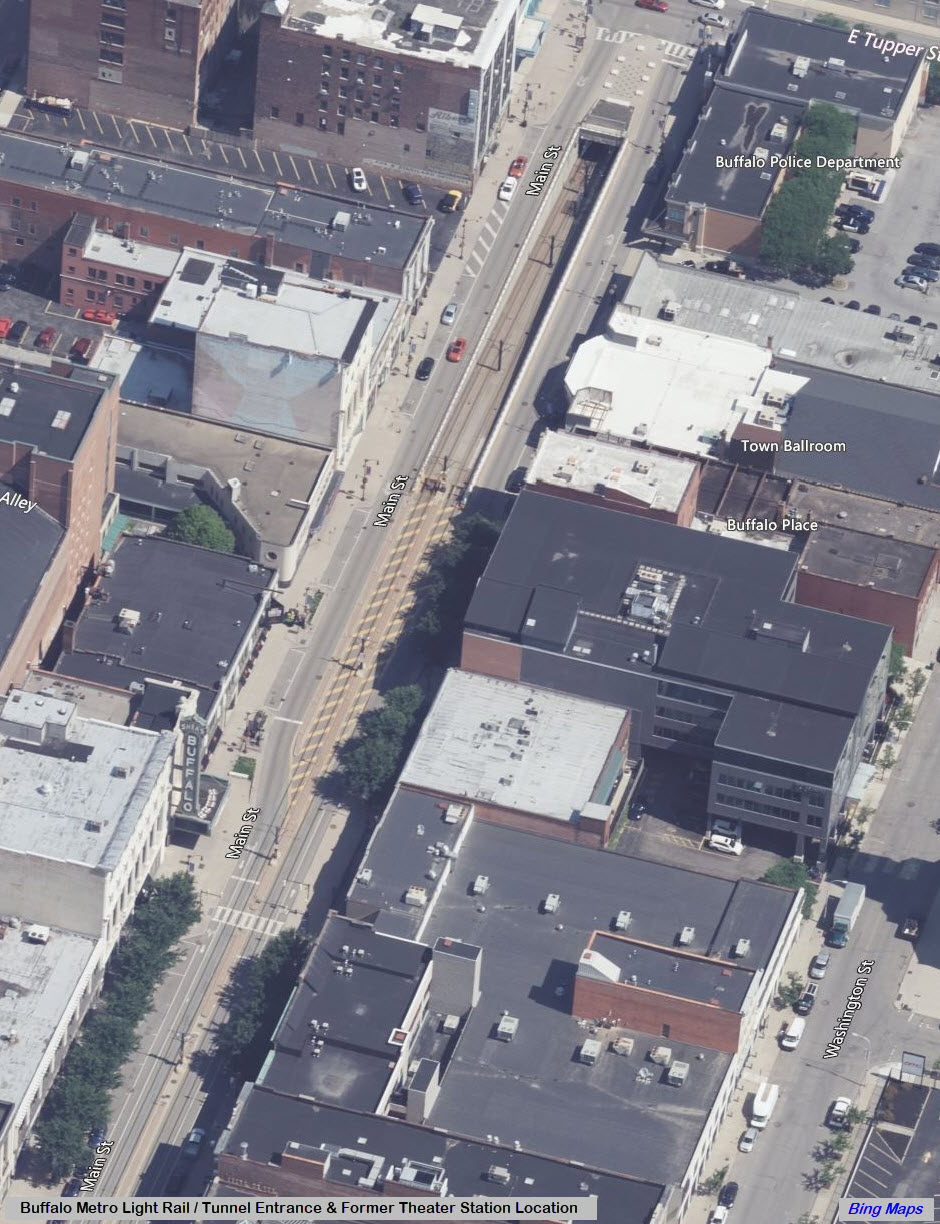
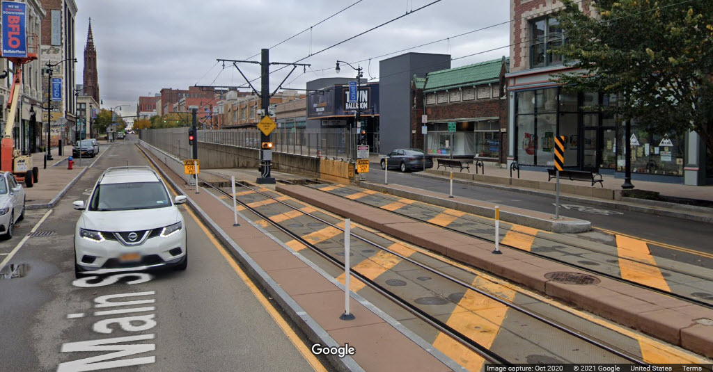
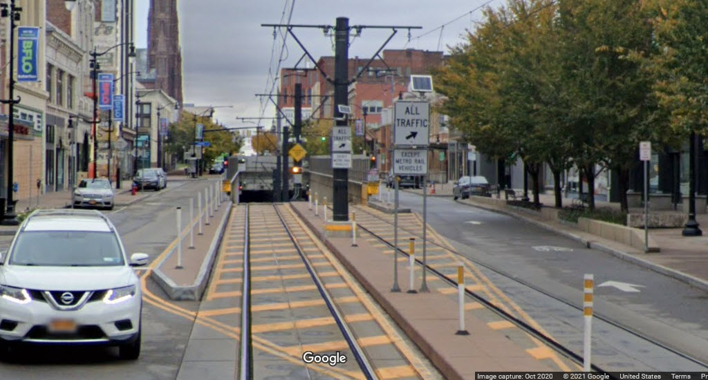
Compare the pictures above, from 2020, with those below, which are from 2006.
The alternating center warning light for pedestrians, and additional views of the tunnel entrance.
Allen/Medical Campus Station
An underground station at Main and Allen. Station opened on November 10, 1986.
Summer Best Station
An underground station at Main and Summer/Best Streets. Station opened on May 20, 1985.
Utica Station
An underground station at Main and Utica. Station opened on May 20, 1985.
Delavan/Canisius Station
An underground station at Main and Delevan. Station opened on May 20, 1985.
Humbodlt-Hospital Station
An underground station at Main and Humboldt Parkway. Station opened on May 20, 1985.
Amherst Station
https://en.wikipedia.org/wiki/Amherst_Street_station
An underground station at Main St and Amherst. Station opened on May 20, 1985.
LaSalle Station
https://en.wikipedia.org/wiki/LaSalle_station_(Buffalo_Metro_Rail)
An underground station at Station opened on November 10, 1986.
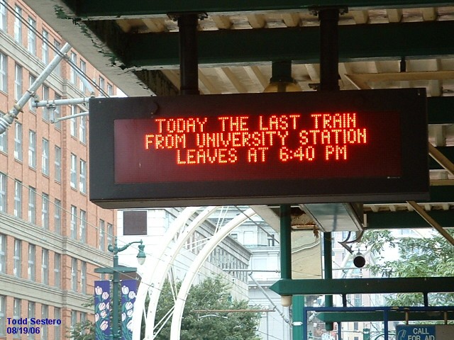
University Station
https://en.wikipedia.org/wiki/University_station_(Buffalo_Metro_Rail)
An underground station at Main and Kenmore. Station opened on November 10, 1986.

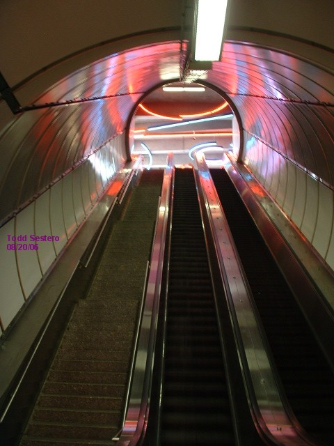 the escalator at University
I dunno who this guy is, but he shows up in my pictures no matter what town I'm riding trains in! :-)
Other Stuff
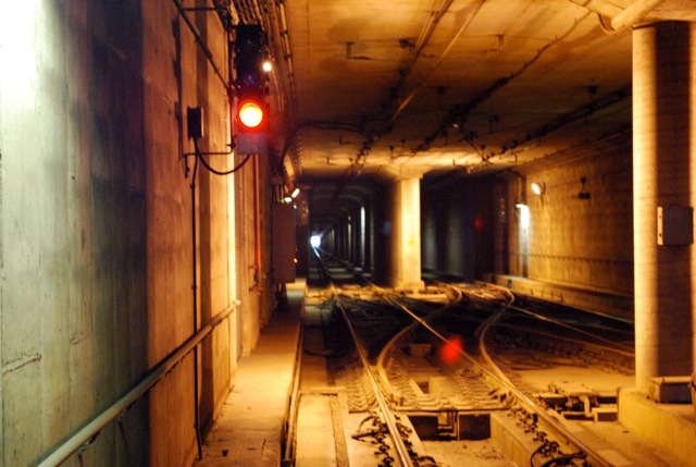
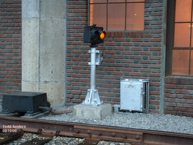
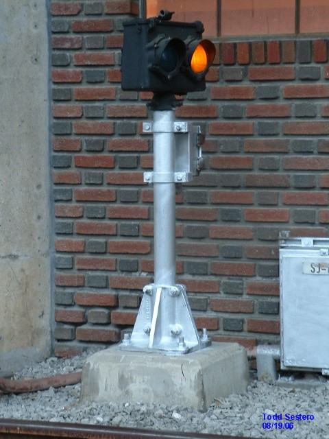
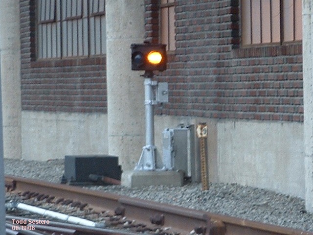
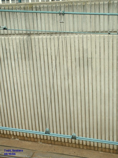
Signals and Tech
GRS was selected to supply all of Buffalo's signals, switch machines, DTS systems, etc.
They use GRS type D and J relays in their vital systems.
Track circuits used for ATC, only used in the tunnels, uses a
100Hz carrier to transmit the cab signal speed commands to the LRV's. On
the surface, trains are operated by sight.
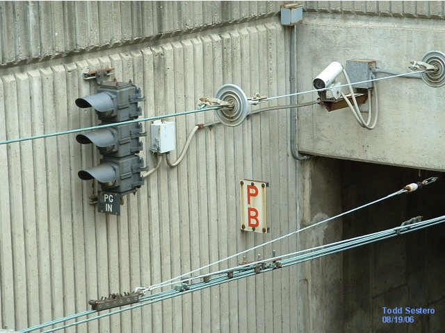
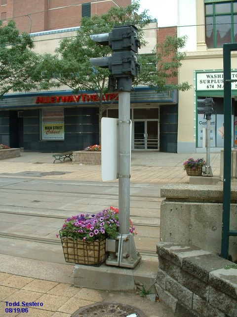
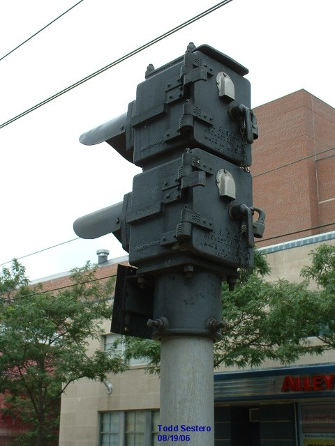
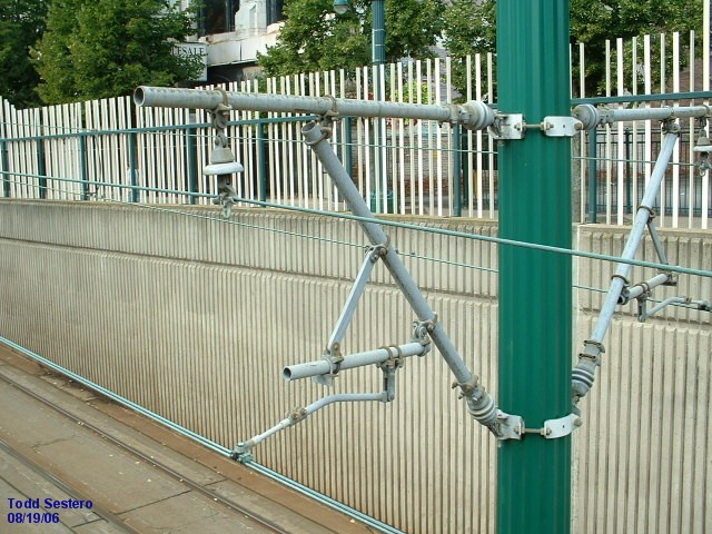
The majority of the signals are standard 3 aspect GRS heads,
notable exceptions are at the tunnel portal and the type P's at the shops.
The three aspect signals used at the surface crossovers at
Scott St (a single), and Erie Canal (a double) are used as routing indicators.
Red is displayed when no route has been called for, or the switch is out of
correspondence. Green indicates a normal route (the train goes straight
thru the crossover on the same track), and yellow indicates a reverse route (the
train crosses over to the "other" track). An interesting "quirk" provides
for flashing indications if the OCC (Operations Control Center) calls for the
routing, or the automatic control system calls for the routing. The
aspects displayed would be either a flashing green or yellow over red for this
case. The signal will flash until the operator pulls the train up to a "SWPB"
box, and uses the carborne VWC (vehicle-to-wayside control) to throw the switch
is clear. At that time, the signal will stop flashing when the route is
clear. The signal will also go solid if the controller or train control
system has called for the route, and the switch is already aligned. Also,
below the signal, is a key-by box, which
allows a supervisor or operator to manually call, or select a route and throw a
switch if there is a problem with the automatic system.
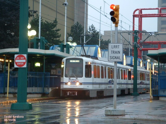
On the surface, the LRV's are given priority over vehicular
traffic at intersections. In the cab of the LRV, the VWC system has a
ready to depart button, and the operator pushes
this button when all the doors are closed and he is ready to move on. Upon
pressing this button, a command is sent to the traffic light controllers, and
once the intersection has been set up for a train move, a signal at the end of
the platform lights up informing the operator it is OK to proceed.
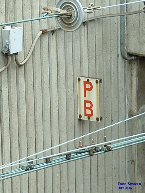
When a train transitions in and out of signaled territory,
the train operator has to either set the carborne ATP package to the
surface mode, or remove the surface mode and
enter the cab signal mode. This is
where the PB switch comes in. It reminds the operator to press the
appropriate button in the cab. 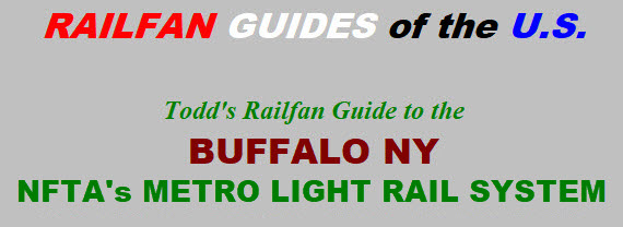

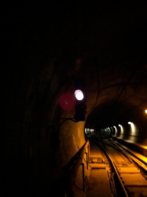
 This is looking down to the Allen crossover against traffic (red aspect).
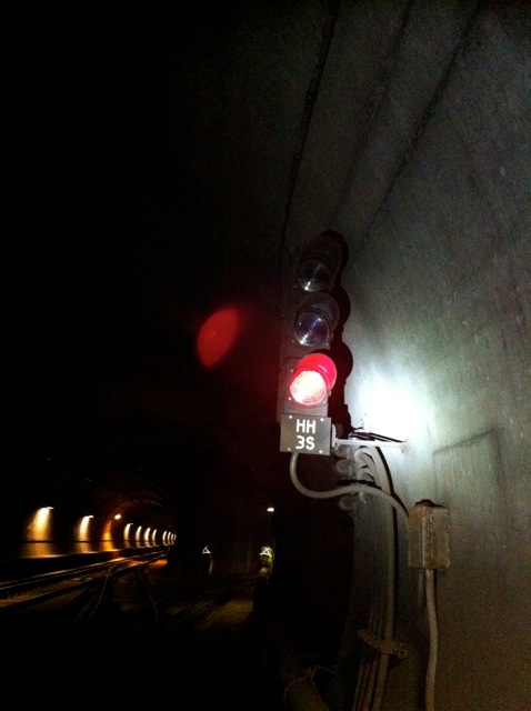 Signal head at the pocket track in the Humboldt interlocking.
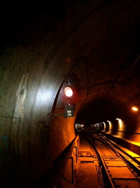
 A signal head in the Humboldt interlocking. One with, and one without a flashlight lighting up the signal.
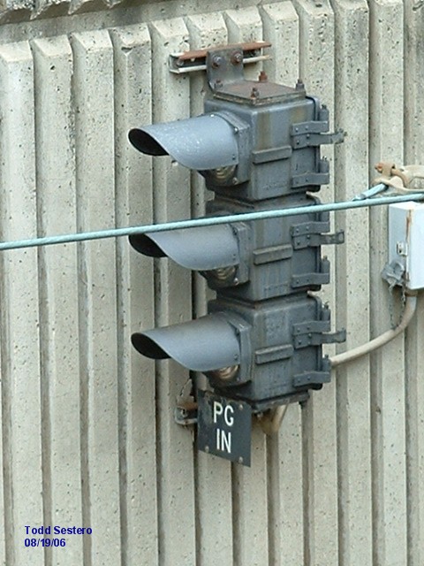


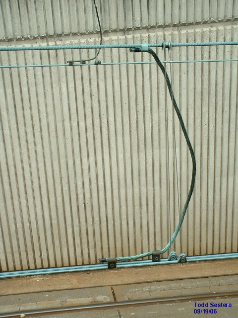
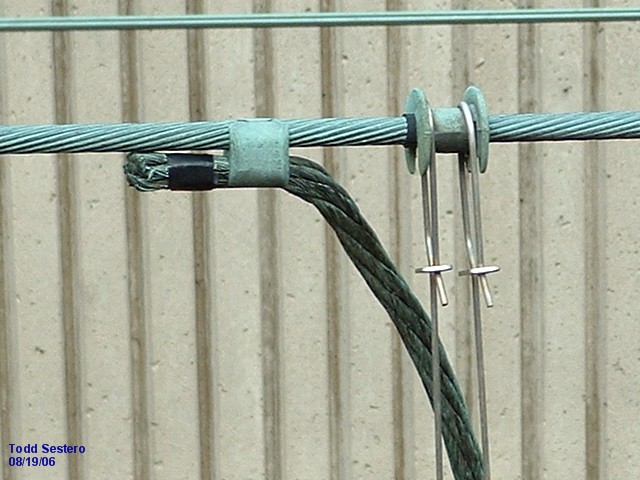


 A sectionalizing insulator in the traction power system.
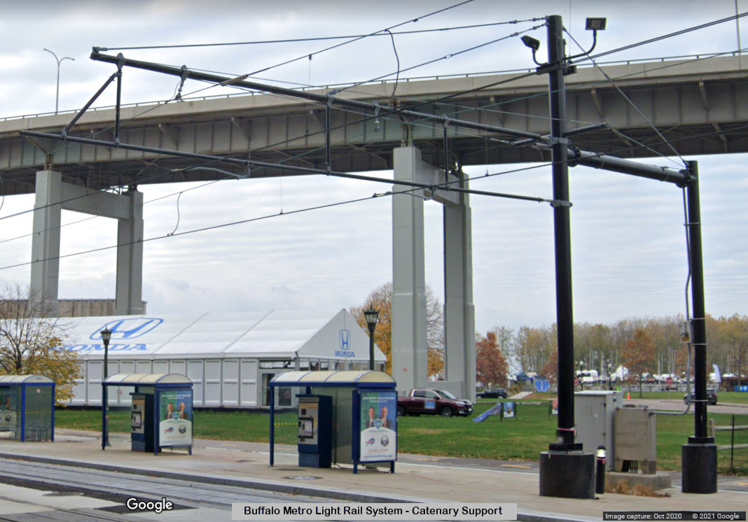
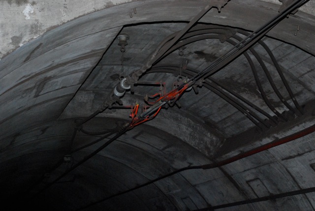
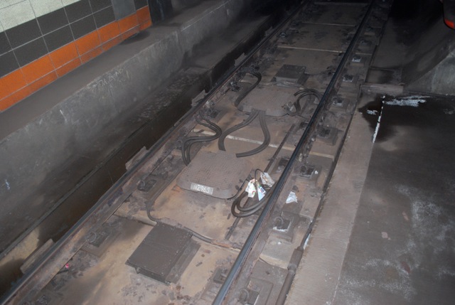 Impedance bonds used for our track circuits.
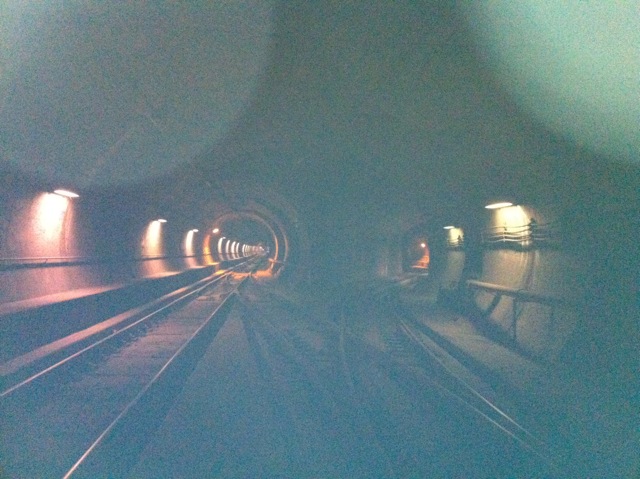
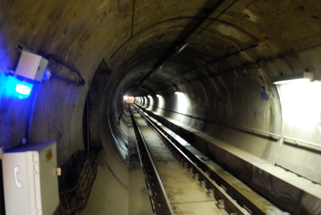 Picture of the rock tunnel.
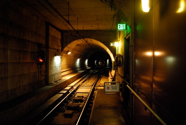 University interlocking, and the exit Paige was referring to earlier, which
leads up to Main St by Leroy Ave.
University interlocking, and the exit Paige was referring to earlier, which
leads up to Main St by Leroy Ave.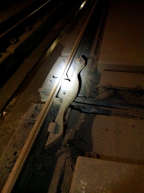
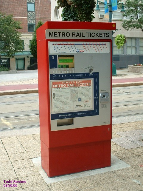

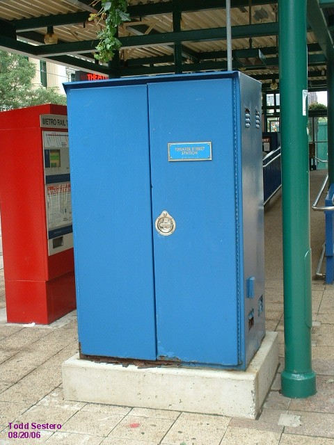 TVM's and an equipment locker.
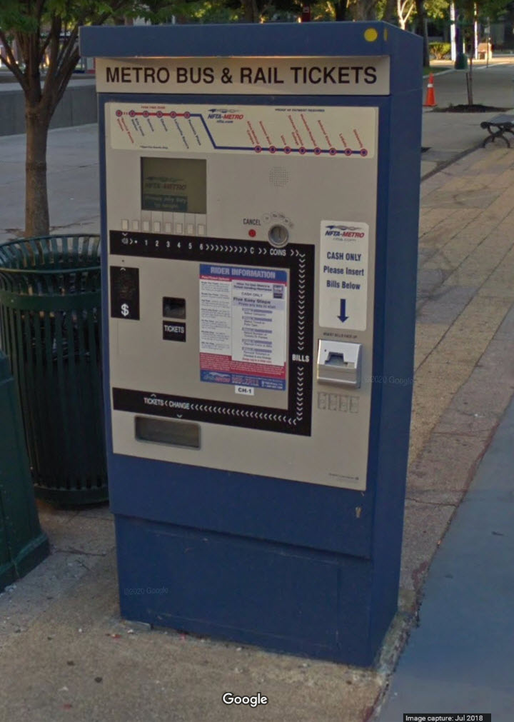

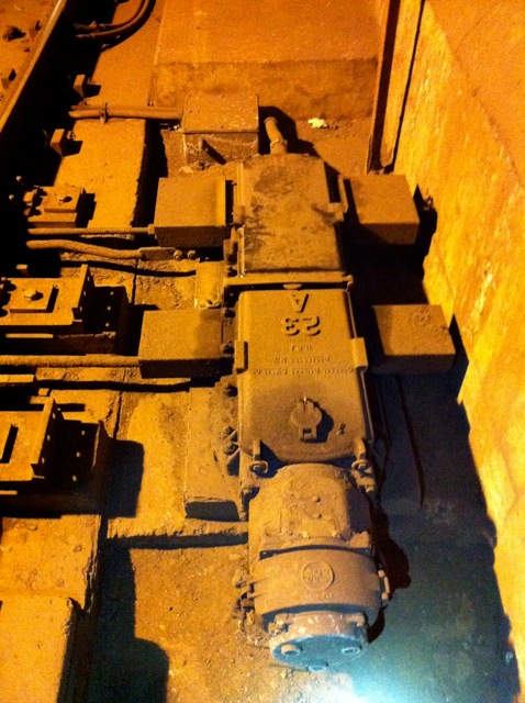 Our GRS 5E switch machine subsurface.