RAILFAN GUIDES of the U.S.
Todd's Railfan Guide to
DETROIT MI
Downtown
In General
Getting Here
Map
Sights
Bridges & Tunnels
Signals
Fire & Police
Floobydust
USGS Maps
RAILFAN GUIDES HOME
RAILROAD SIGNALS HOME
Location / Name:
Detroit MI, Wayne County
What's Here:
Amtrak Station
Former Michigan Central RR Station
Tunnel to Canada
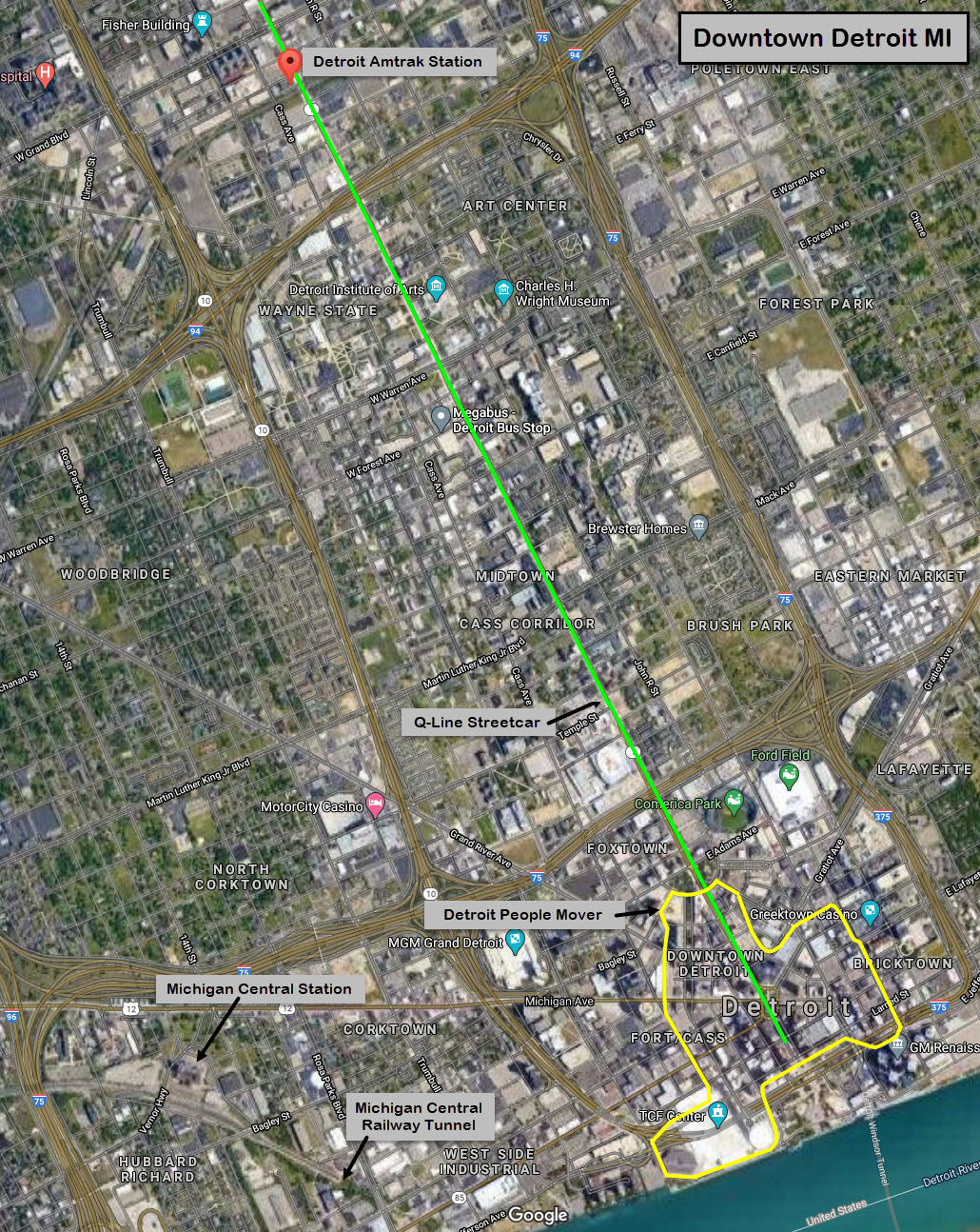
Greektown and the Detroit People Mover
The QLine Streetcar Line
Data:
GPS Coordinates: as needed
Phone A/C: 313
ZIP: 482xx
Access by train/transit:
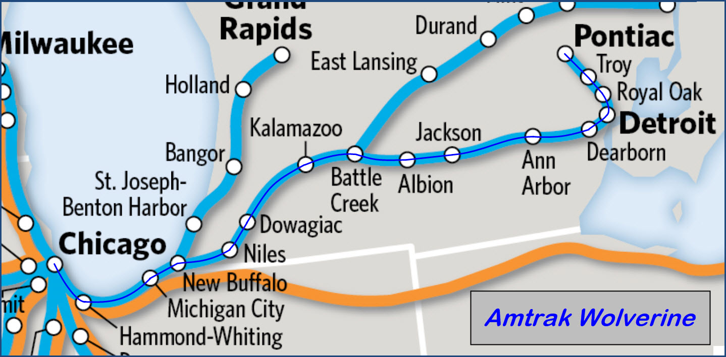
Amtrak Wolverine
the Q-Line Streetcar
the Detroit People Mover
The Scoop:
The
Acknowledgements:
Denver Todd
Websites and other additional information sources of interest for the area:
https://en.wikipedia.org/wiki/Michigan_Central_Station
https://en.wikipedia.org/wiki/Michigan_Central_Railway_Tunnel
http://www.dailydetroit.com/2016/07/09/detroit-river-tunnel-michigan-central/ has a link to a Youtube video of CP train coming out of tunnel
https://www.geocaching.com/geocache/GC731W9_railway-series-6-michigan-central-railway-tunnel?guid=0a87983c-0adc-4cfe-a509-c0063d954722
http://detroitarchitectjournal.blogspot.com/2017/07/the-first-detroit-river-tunnel.html
https://www.amtrak.com/stations/det
https://en.wikipedia.org/wiki/Detroit_station
Getting to G
Sights
the Detroit Amtrak Station
the Michigan Central RR Station
the Detroit-Windsor Tunnel
the Detroit People Mover
the QLine Streetcar
GPS Coordinates: 42.36801, -83.07234
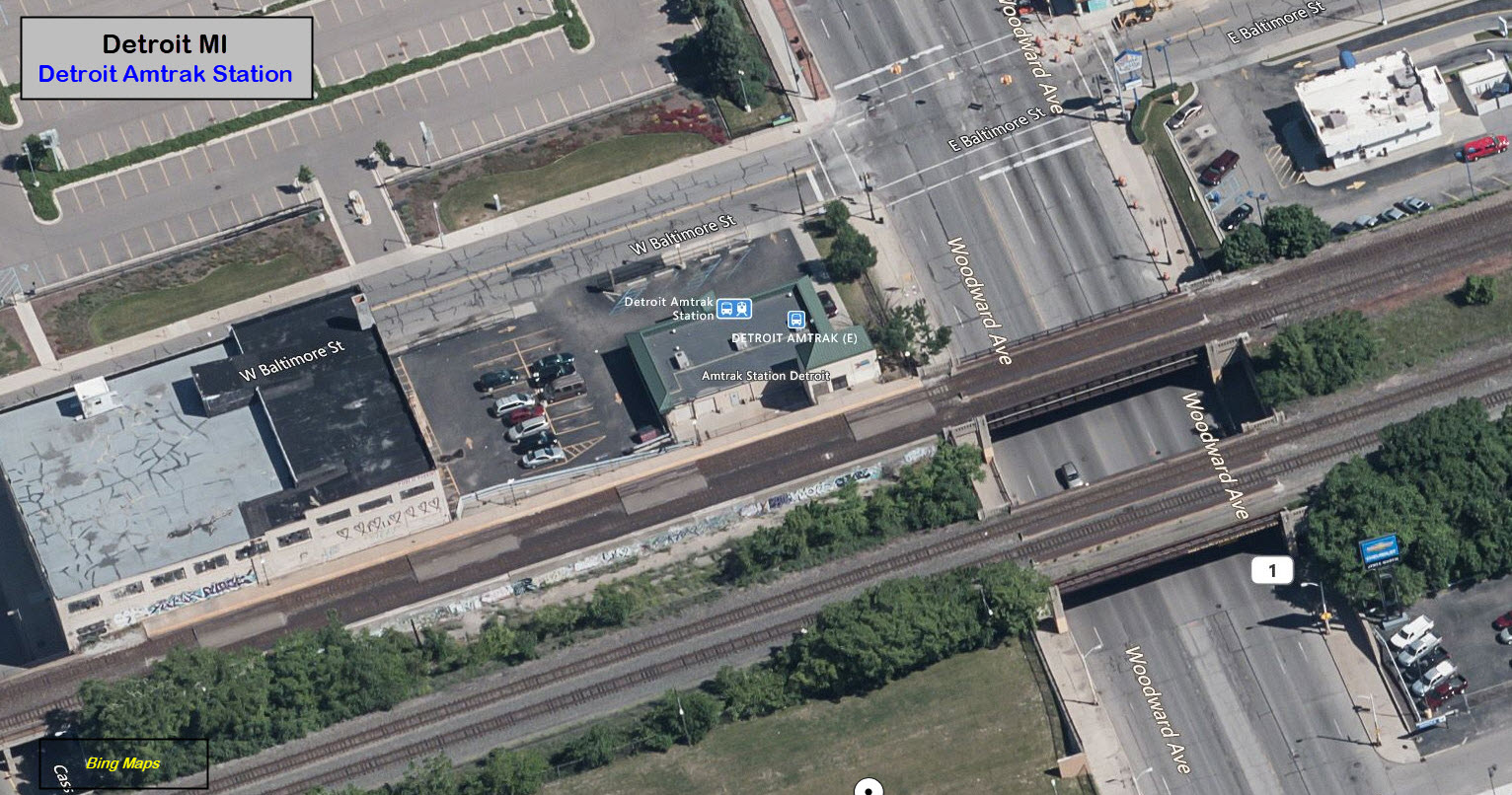
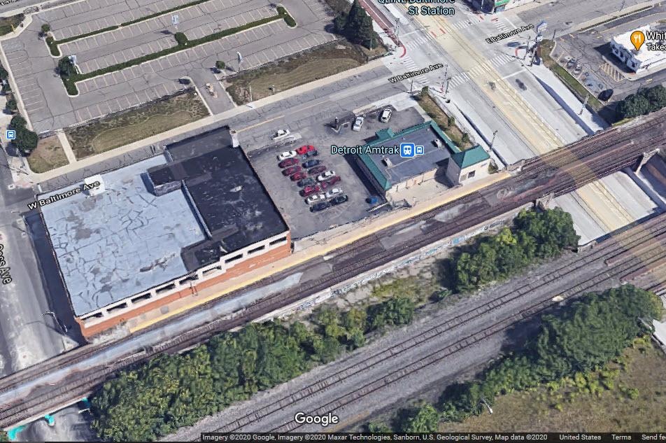
11 West Baltimore Avenue, Detroit MI 48202
The current station was built in 1994, as a replacement for the Michigan Central station, which had closed in 1988. Michigan DOT bought a 3.1 acre sight from General Motors in 1994 for $889,000 to build the station.
The Q-Line streetcar system, which opened in 2017, has a nearby stop across the street.
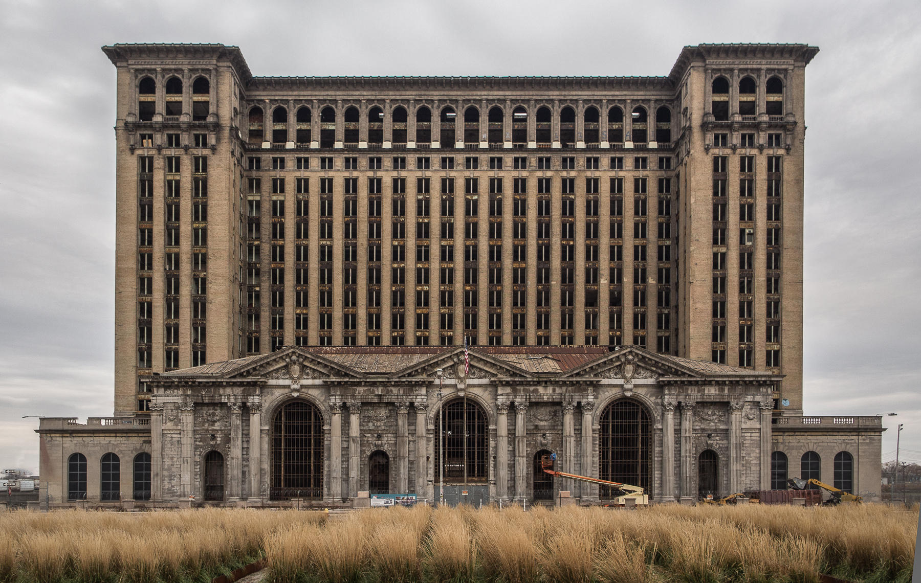
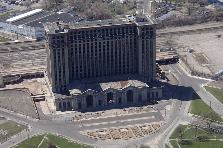
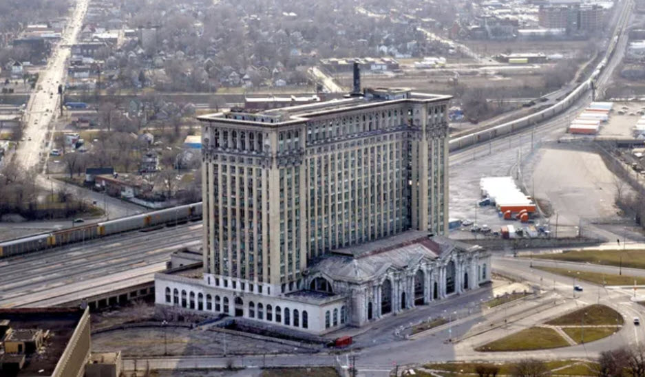
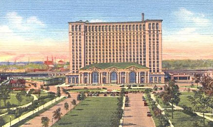
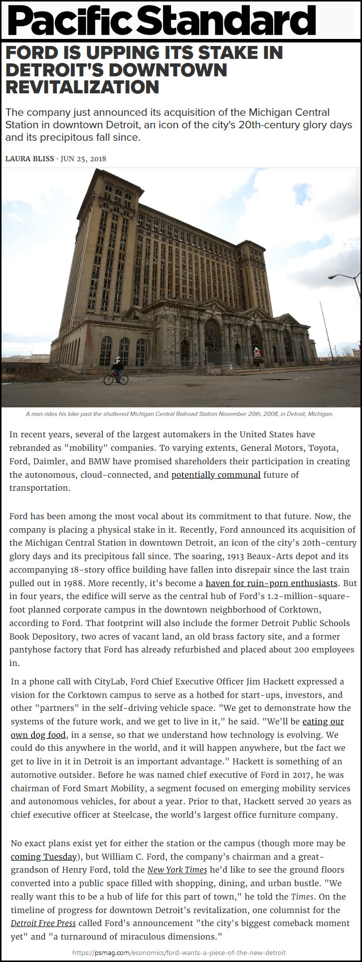
Formally dedicated on January 4, 1914, the station remained open for business until the cessation of Amtrak service on January 6, 1988. The station building consists of a train depot and an office tower with thirteen stories, two mezzanine levels, and a roof height of 230 feet (70 m).
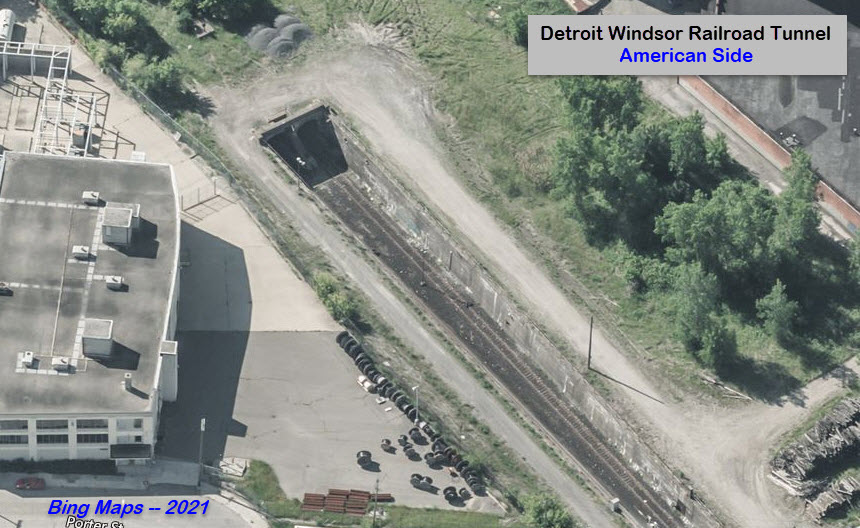
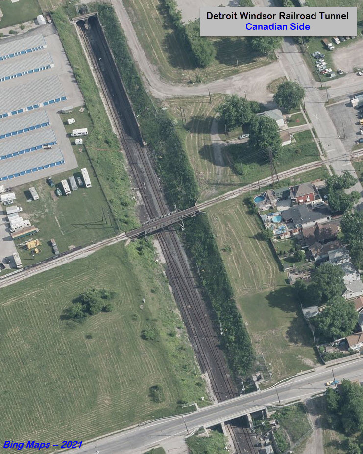
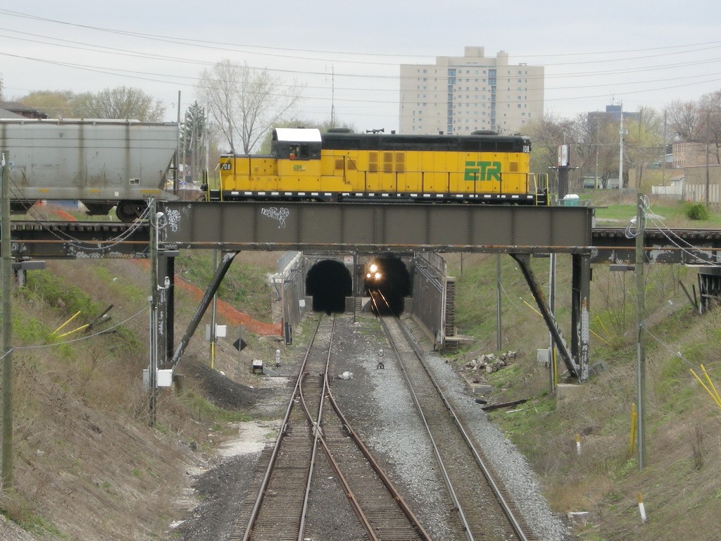
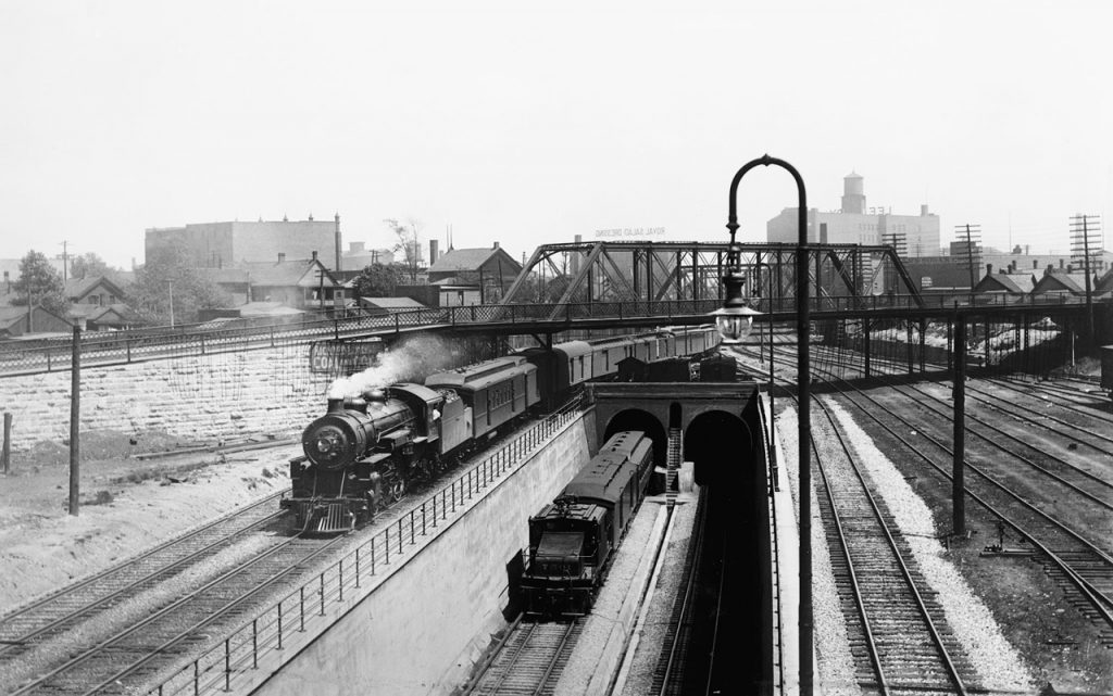
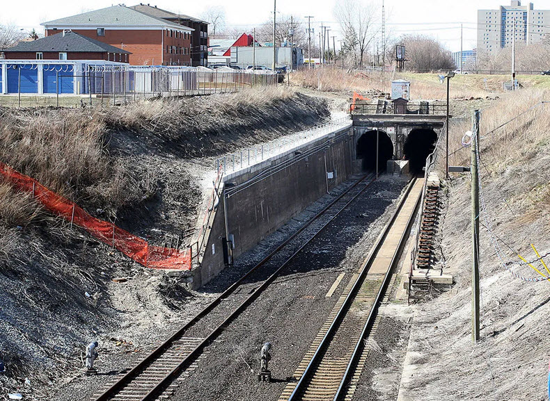
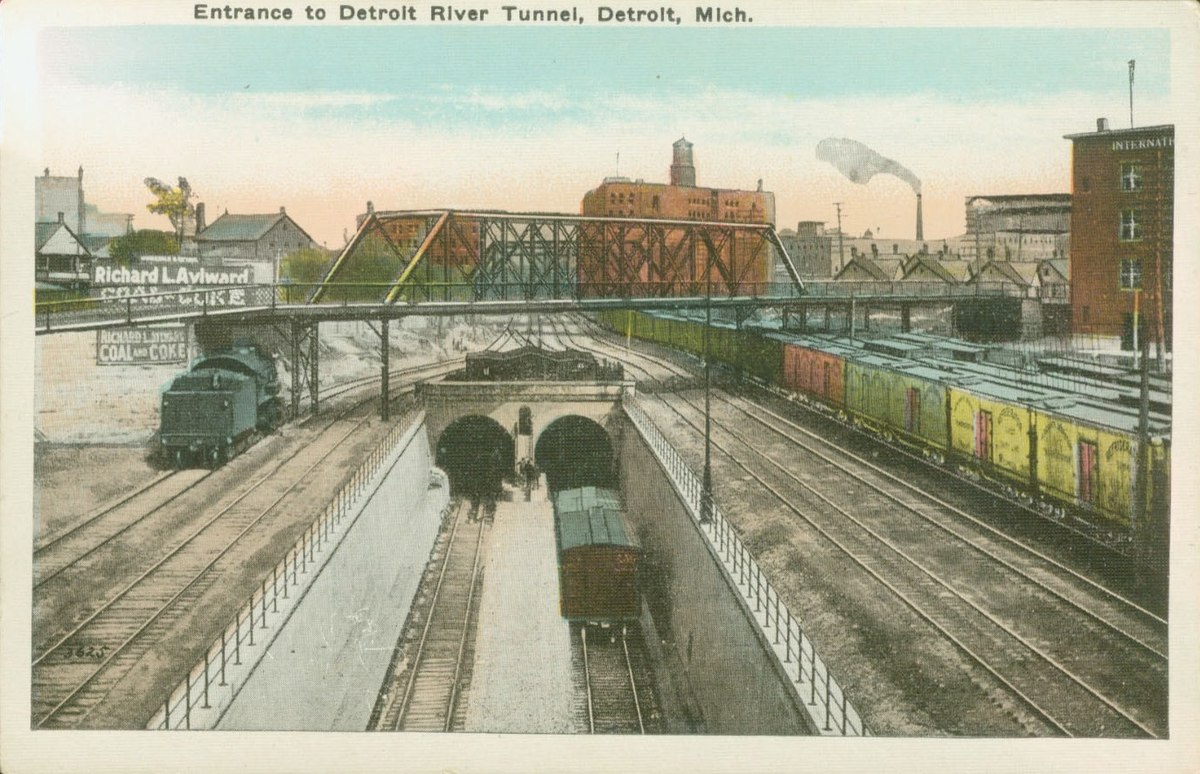
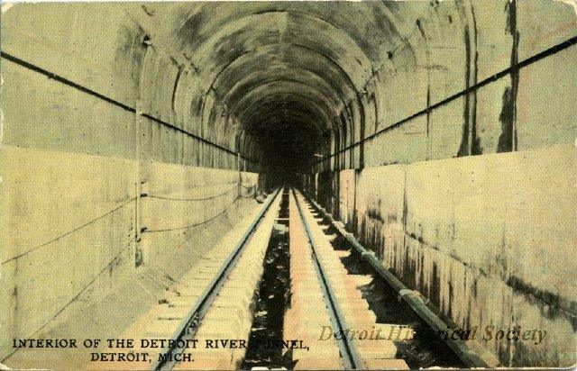
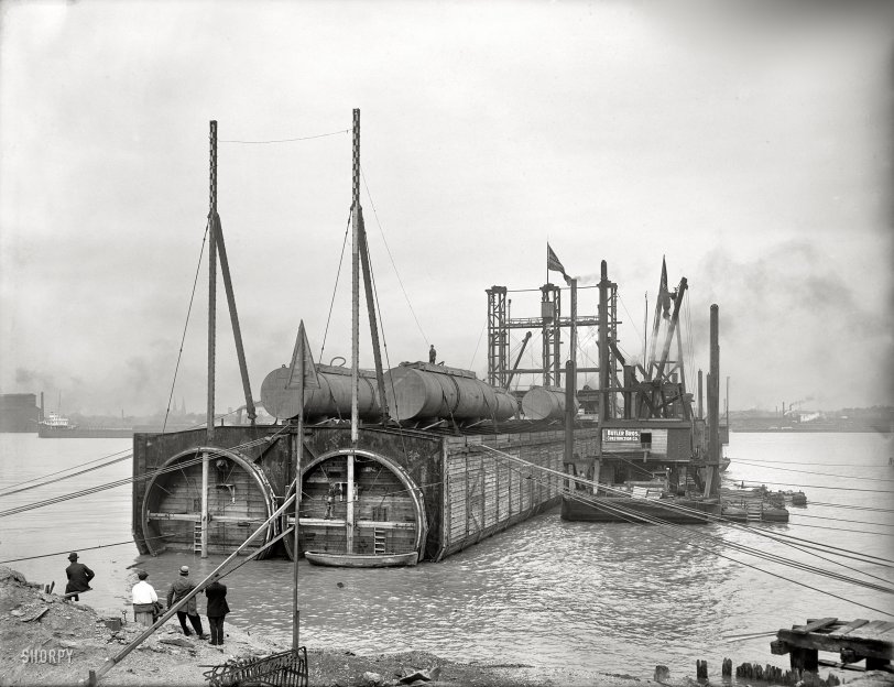
The former Michigan Central Rwy Tunnel between the U.S. and Canada opened in 1910, it is also known as the Detroit-Windsor Tunnel and the Detroit River Railroad Tunnel.
From the GeoCatching page: Construction on the Michigan Central Railway Tunnel began in October 1906, and the tunnel opened for trains on July 1910, 20 years before the Detroit-Windsor Tunnel opened. The tunnel is approximately 1.6 miles long and it cost over $8 million to build. The New York Central Railway’s engineering vice president, William J. Wilgus oversaw the construction. In 1906, the tunnel was operated by the Michigan Central Railroad. In 1968 the tunnel passed from the New York Central Railroad to Penn Central, and in 1976 to Conrail. In 1985, Conrail sold the tunnel to the Canadian National Railway and Canadian Pacific Railway, with each getting a half share. In early 2000 CN agreed to sell its stake to Borealis Transportation Infrastructure Trust (a venture of the Ontario Municipal Employees Retirement System) and use only the St. Clair Tunnel. CP and Borealis vested the tunnel into the new Detroit River Tunnel Partnership, and plans were announced to construct a new railway tunnel and convert the existing railway tunnel to a two-lane free flow truckway for transport trucks to alleviate pressure at the other nearby international border crossings (Ambassador Bridge, Detroit-Windsor Tunnel).
Pictures that have a stairway between the two portals are taken on the U.S. side - pictures with dwarf signals at the exit of the two portals and an over passing railroad line are taken on the Canadian side.
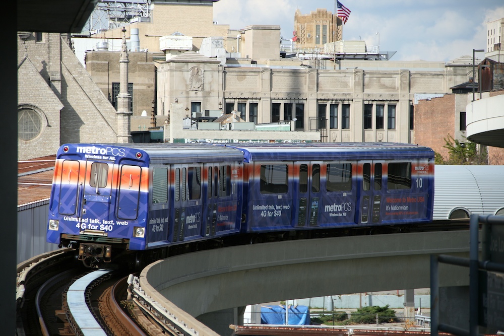
I have given the People Mover it's own page at:
https://railfanguides.us/mi/detroit/peoplemover/index.htm
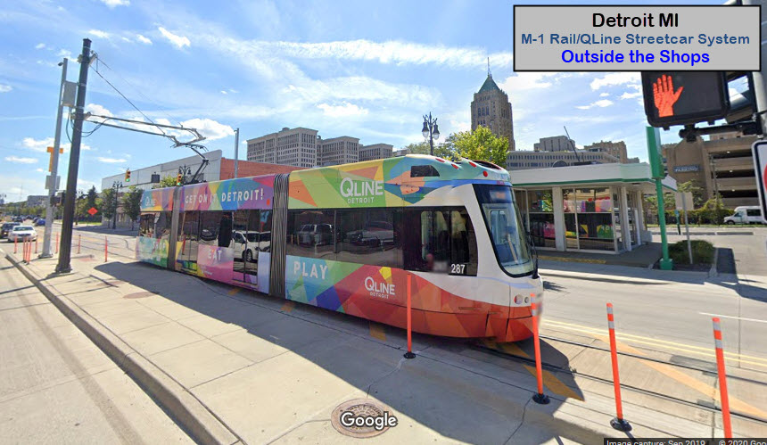
The streetcar line has it's own page at:
https://railfanguides.us/mi/detroit/QLineStreetcar/index.htm
The
The
Xxx
TheNone for now......
Courtesy of the University of Texas Library, click here for their index page.
Disclaimers:
I love trains, and I love signals. I am not an expert. My webpages reflect what I find on the topic of the page. This is something I have fun with while trying to help others.
Please Note: Since the main focus of my two websites is railroad signals, the railfan guides are oriented towards the signal fan being able to locate them. For those of you into the modeling aspect of our hobby, my indexa page has a list of almost everything railroad oriented I can think of to provide you with at least a few pictures to help you detail your pike.
If this is a railfan page, every effort has been made to make sure that the information contained on this map and in this railfan guide is correct. Once in a while, an error may creep in :-)
My philosophy: Pictures and maps are worth a thousand words, especially for railfanning. Text descriptions only get you so far, especially if you get lost or disoriented. Take along good maps.... a GPS is OK to get somewhere, but maps are still better if you get lost! I belong to AAA, which allows you to get local maps for free when you visit the local branches. ADC puts out a nice series of county maps for the Washington DC area, but their state maps do not have the railroads on them. If you can find em, I like the National Geographic map book of the U.S..... good, clear, and concise graphics, and they do a really good job of showing you where tourist type attractions are, although they too lack the railroads. Other notes about specific areas will show up on that page if known.
Aerial shots were taken from either Google or Bing Maps as noted. Screen captures are made with Snagit, a Techsmith product... a great tool if you have never used it!
By the way, floobydust is a term I picked up 30-40 years ago from a National Semiconductor data book, and means miscellaneous and/or other stuff.
Pictures and additional information is always needed if anyone feels inclined to take 'em, send 'em, and share 'em, or if you have something to add or correct.... credit is always given! Please be NICE!!! Contact info is here
Beware: If used as a source, ANYTHING from Wikipedia must be treated as being possibly inaccurate, wrong, or not true.
DETROIT HOMEPAGE
RAILFAN GUIDES HOME
RAILROAD SIGNALS HOME
NEW SEP04/2020, FEB27/2021
Last Modified
28-Feb-2021
