In General
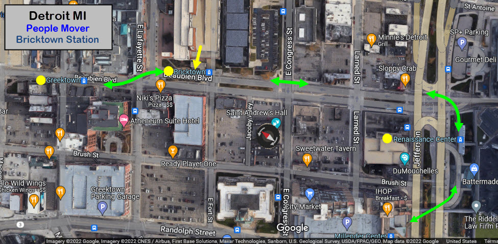
Getting Here
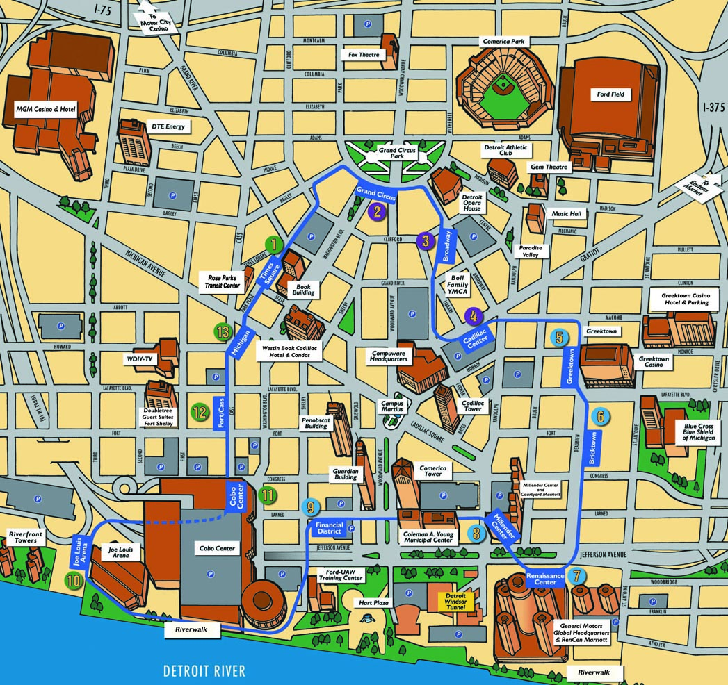
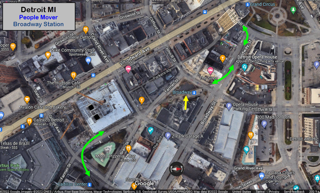
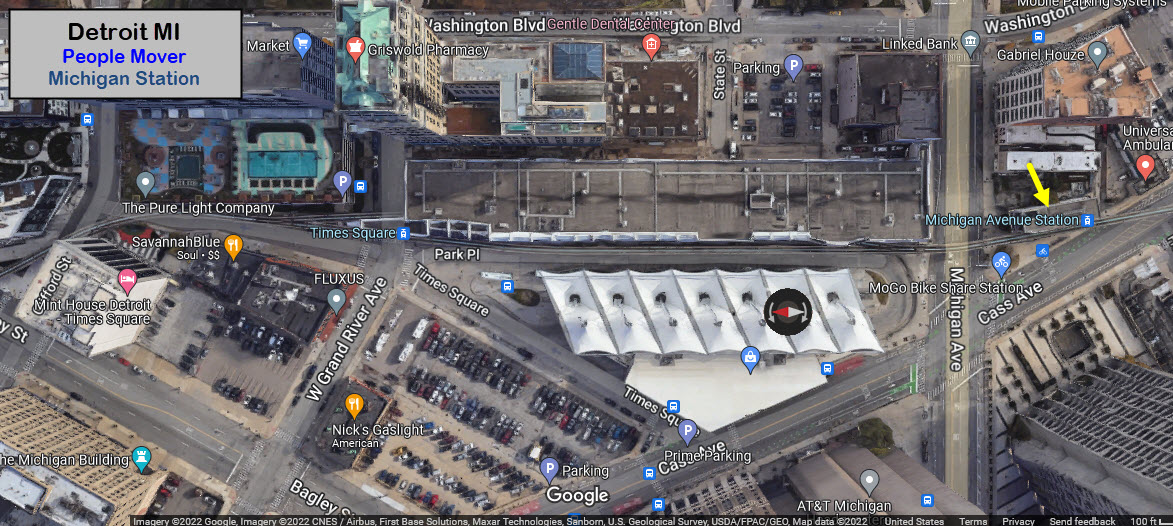
Map
Station by Station
Pictures
History & Additional Info
RAILFAN GUIDES HOME
RAILROAD SIGNALS HOME
Location / Name:
Downtown Detroit MI
What's Here:
the Detroit People Mover PRT (Personal Rapid Transit)
Data:
GPS Coordinates: 42.331604, -83.046631
ZIP: 48226
Phone A/C: 313/734
Access by train/transit:
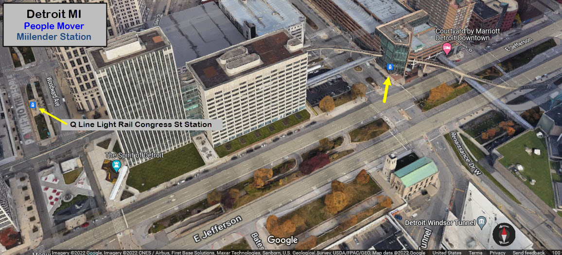
Q Line Light Rail at Grand Circus station
Amtrak via the Q Line at Baltimore St
The Scoop:
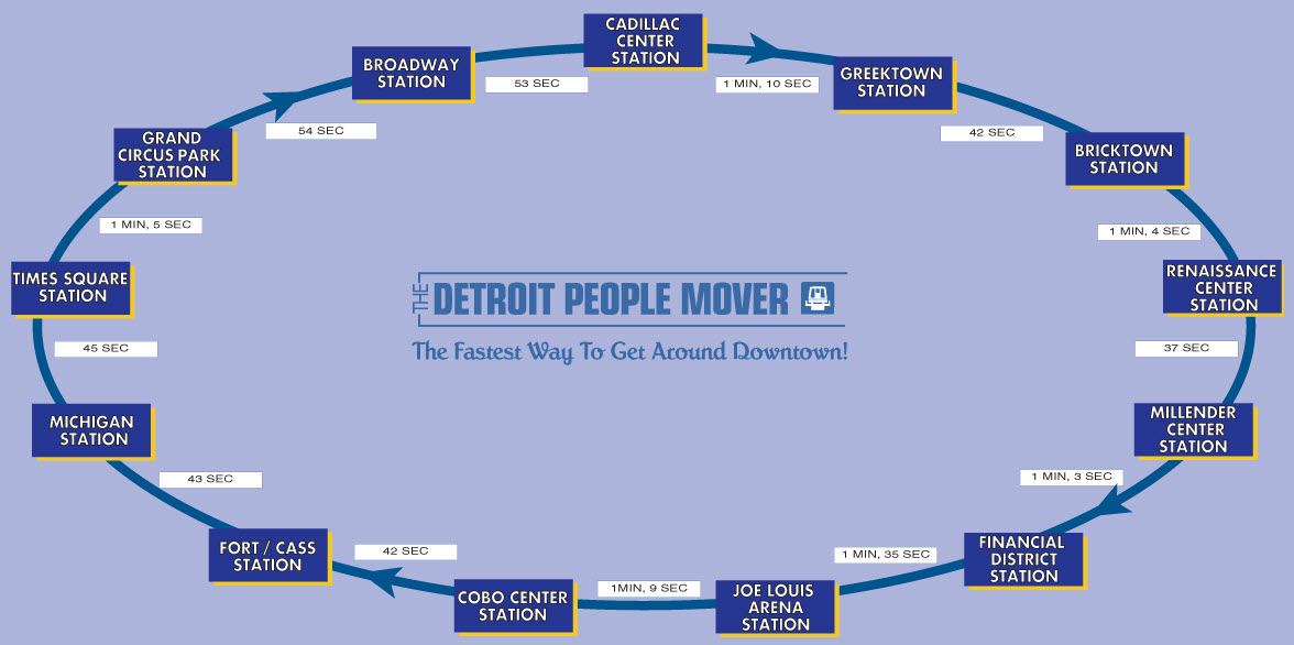
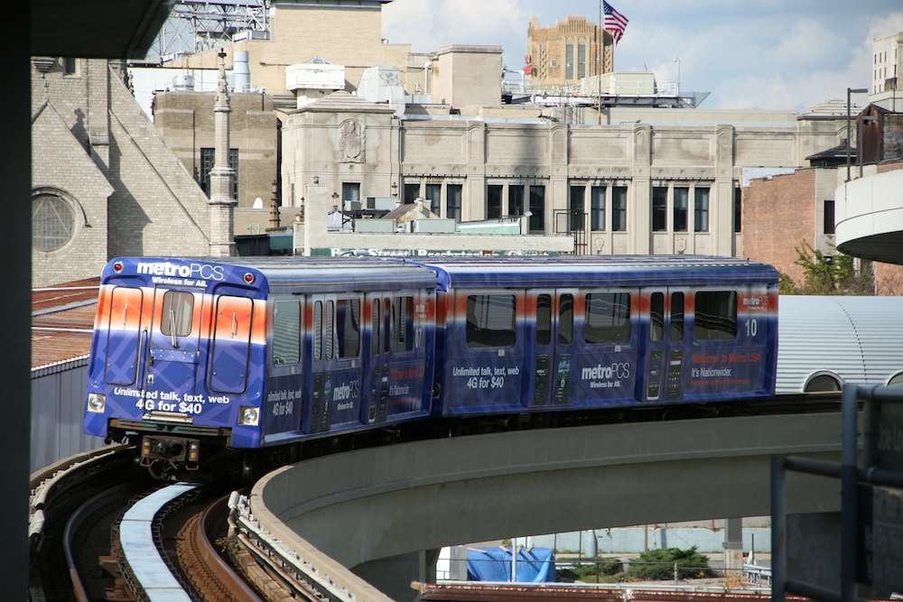
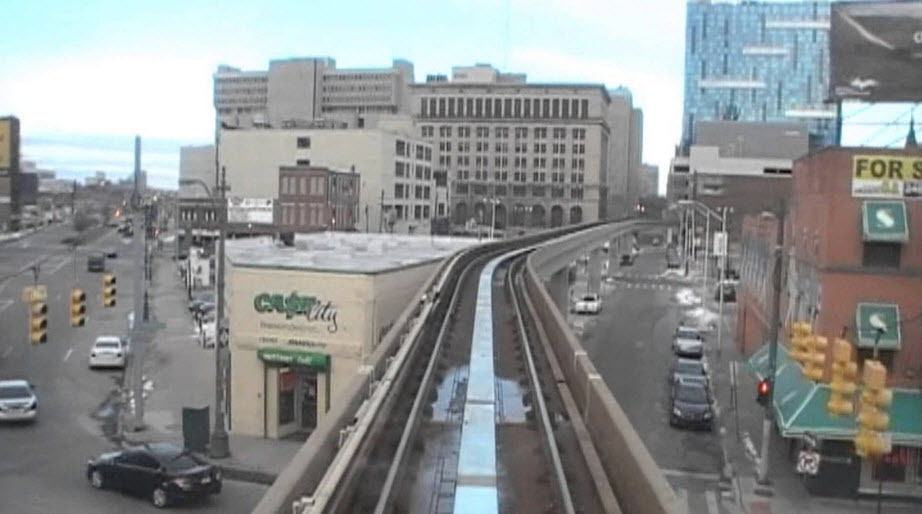
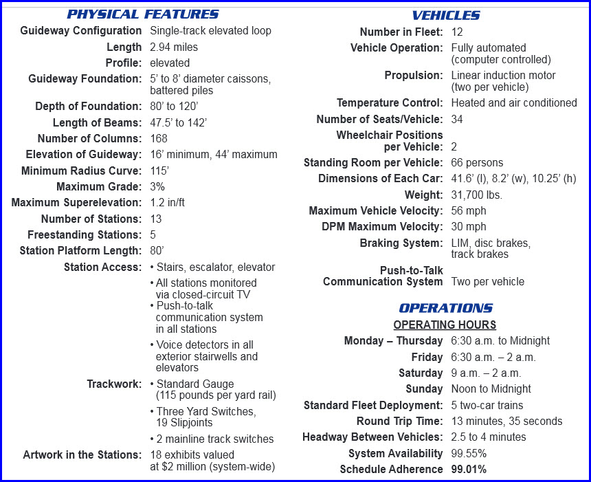
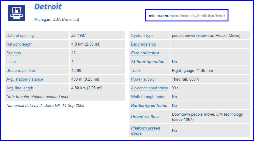
The Detroit People Mover is a 2.9-mile (4.7 km) automated people mover system. It operates on a single-track, one-way loop through the downtown area.
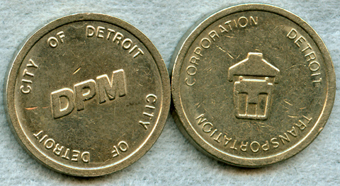
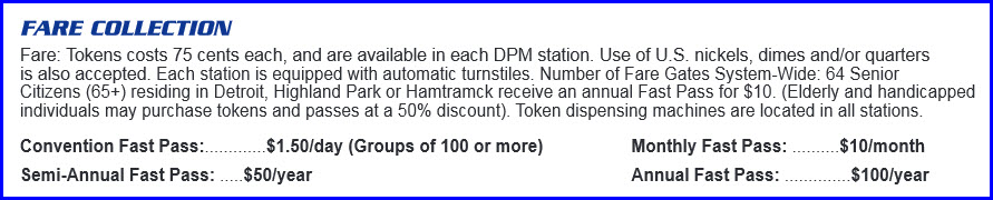
The ride cost you seventy-five cents, and tokens can be used. The tokens can be purchased at every station.
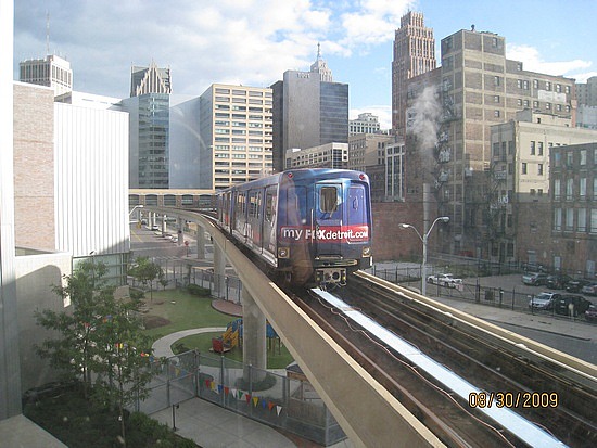
The Detroit People Mover is the major transportation railways system throughout downtown Detroit. With 13 stations and low fares of just $.50 per ride, it not only provides transportation for the residents of Detroit, but also serves as a mode of transport for tourists, downtown business workers, and sports fans.
Original plans to develop a public transportation system in Detroit started in 1966 by the Urban Mass Transportation Administration (UMTA). However, in 1975, the few attempts at producing a large-scale transportation system failed. The UMTA settled for a much smaller transportation solution and created the Downtown People Mover Program. Despite many questions regarding funding, the People Mover was completed and began operation in 1987.
The People Mover uses UTDC ICTS Mark I technology, and the cars are driverless. In 2008, the trains were switched to run clockwise, which meant they could run faster, reaching speeds of up to 56 mph. Throughout the 2.9 mile track there are 13 stations. Each station is in walking distance to popular Detroit buildings and venues. It is designed to accommodate up to 15 million passengers per year. However, as of 2008, the system had only reached 7,500 people per day, about 2.5% of its capacity of 288,000. According to the Detroit News, from 1999-2000 the city of Detroit paid approximately $3.00 for every $.50 rider fare. Essentially, the People Mover has not been the successful transportation system the UMTA envisioned.
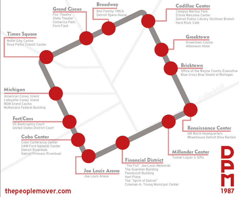
The 13 stations of the People Mover include Times Square, Grand Circus Park, Broadway, Cadillac Center, Greektown, Bricktown, Renaissance, Millender Center, Financial District, Joe Louis Arena, Cobo Center, Fort/Cass, and Michigan Avenue. Eight of the stations have been built into existing buildings, and each of the stations features its own original artwork. There are currently plans to expand the People Mover. These plans would double its size by adding more stops at places such as the Henry Ford Hospital and Wayne State University. Written by Ben Robinson
Acknowledgements:
Denver Todd
Google Maps and Images
Bing Maps
Wikipedia
Websites and other additional information sources of interest for the area:
http://mapsof.net/detroit/detroit-people-mover-timing-map
http://www.trainweb.org/usarail/detroit.htm
http://mic-ro.com/metro/metrocity.html?city=Detroit
http://www.prnewswire.com/news-releases/detroit-people-mover-rides-sponsored-by-michelin-to-ease-traffic-downtown-300182739.html
http://detroithistorical.org/learn/encyclopedia-of-detroit/detroit-people-mover
http://detroit.jalopnik.com/the-detroit-people-mover-is-dead-long-live-the-people-1153060757
http://www.thepeoplemover.com/resource/attach/26/GeneralInformationBrochureFinal.pdf
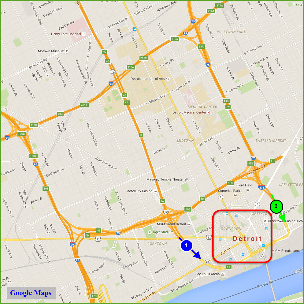
The highway system around downtown Detroit is "complicated". If you're not paying attention, you can easily wind up miles away from where you want to be with a moments worth of inattention! I know, I've done it many times. :-)
Given that, make your way to I-75, and then to either 10 or 375.
If you take 10 (blue arrow/1), you can get off at either Howard St (exit 1C) or go all the way to E Jefferson St, under the Cobo Center.
Taking I-375 (green arrow/2), you can get off at either MaComb St, Chrysler Service Drive, or where it finally dumps you off onto E Jefferson St.
You can only get off at Madison St if you are coming down I-75 from above the Fisher Freeway.
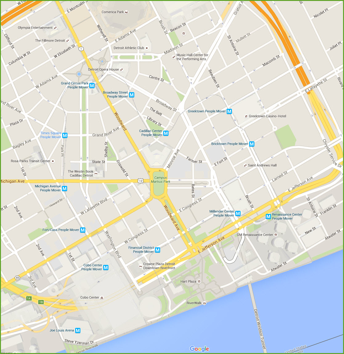
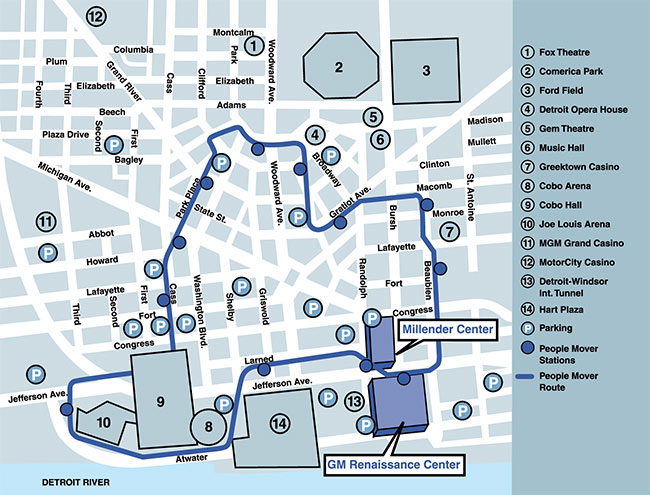
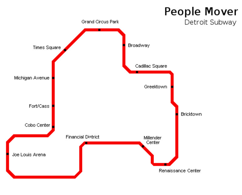
Around the System - Station by Station
Times Square
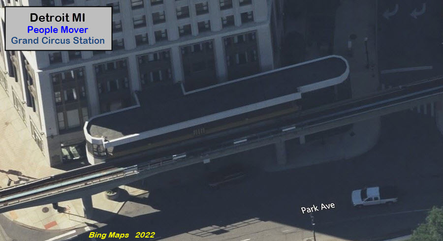
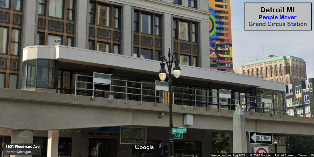
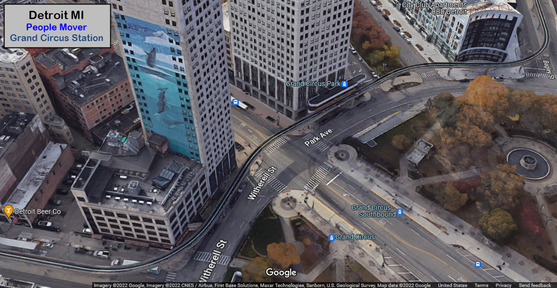
Grand Circus
Broadway
Cadillac Center
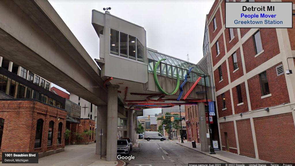
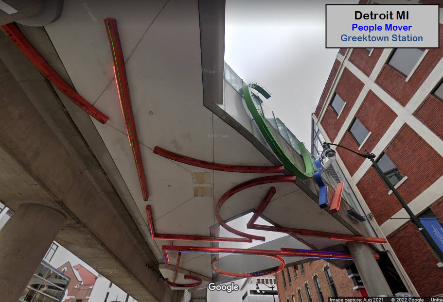
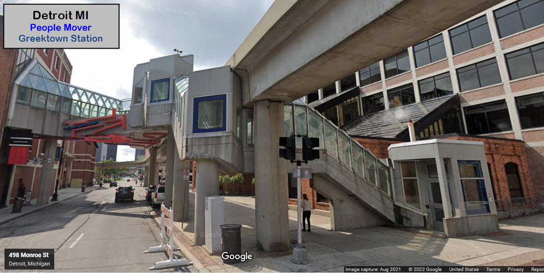
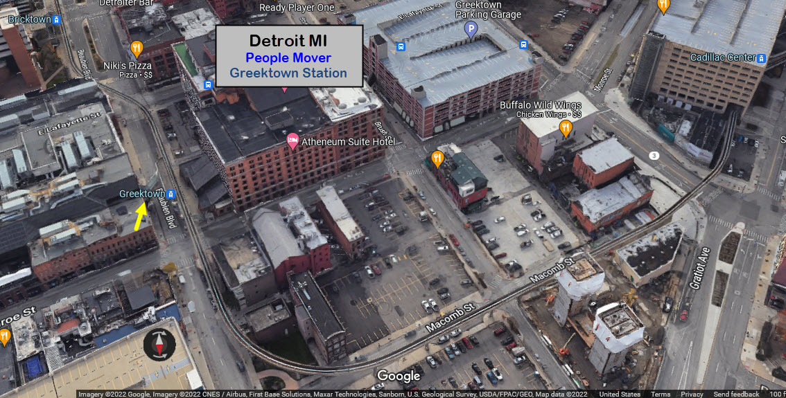
Greektown
Bricktown
Renaissance Center
Millender Center
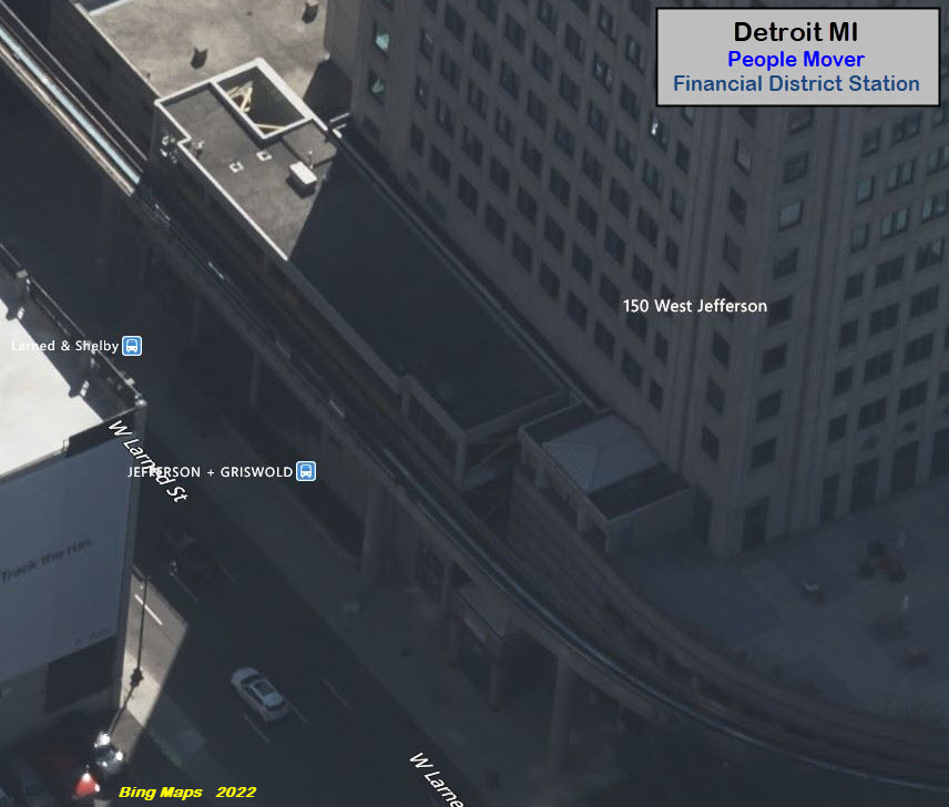
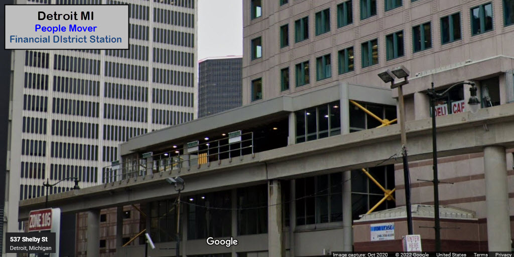
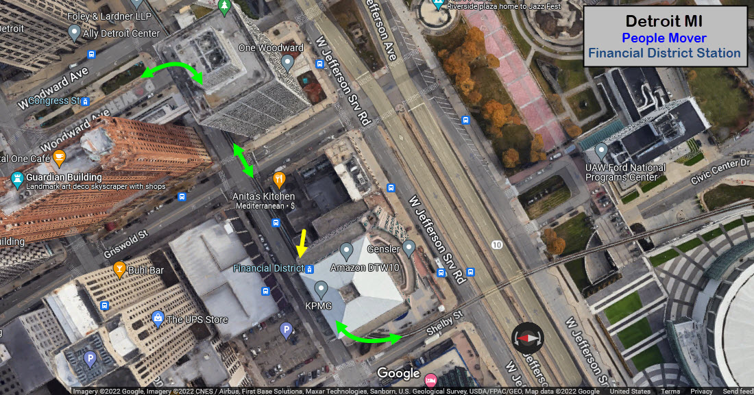
Financial District
Joe Lewis Arena
Cobo Center
Fort/Cass
Michigan
Times Square
GPS Coordinates: 42.33354, -83.05214
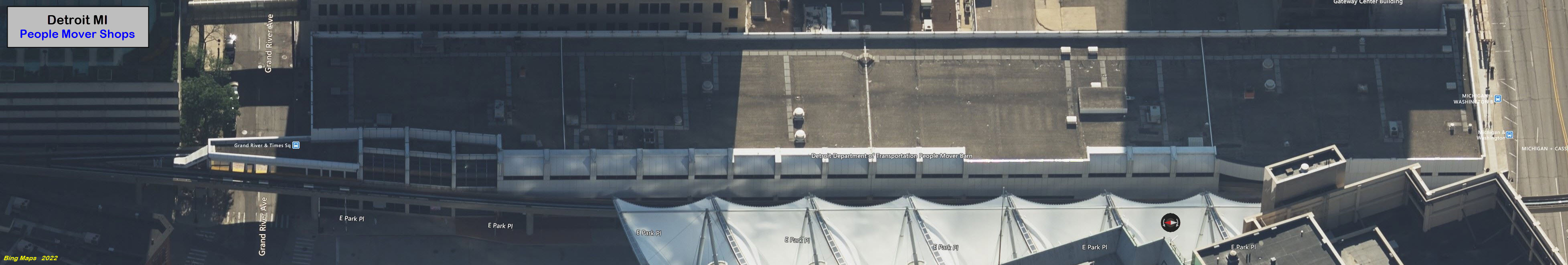
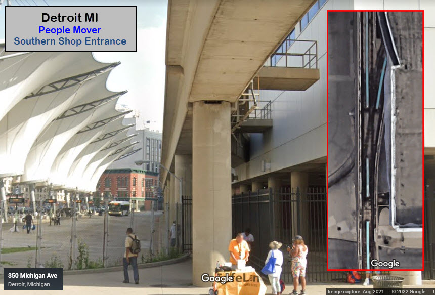
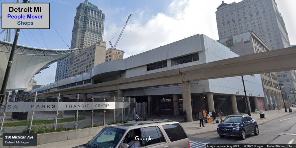
The shops are behind the station in the streetview.
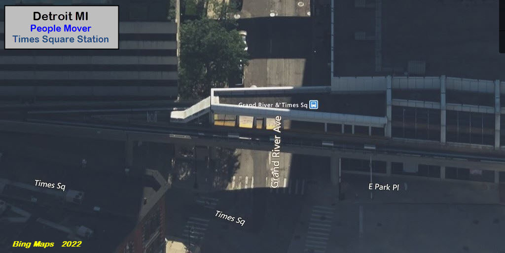
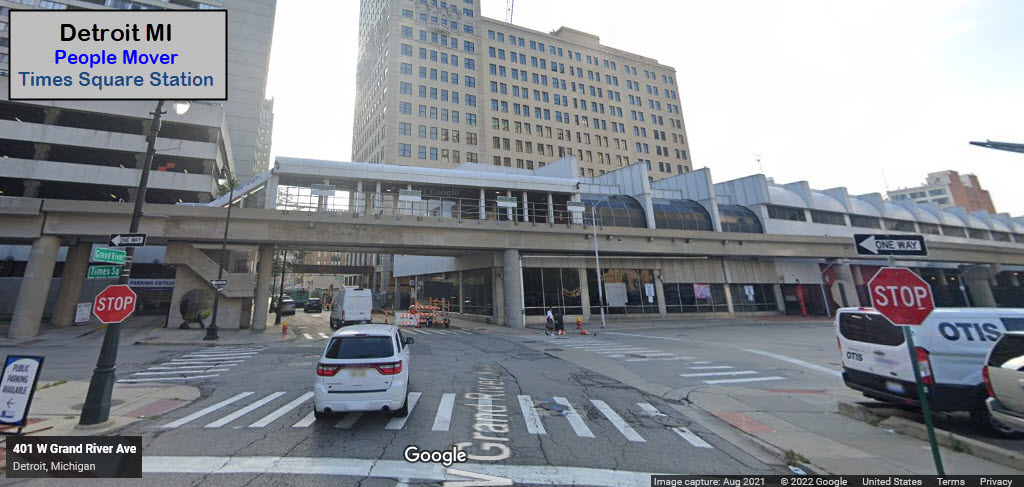
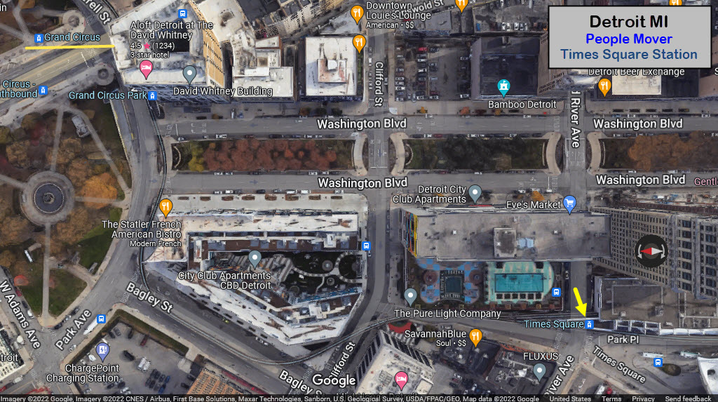
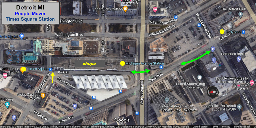
the Shops
GPS Coordinates: "Left" side same as the Times Square station.

Grand Circus
GPS Coordinates: 42.33580, -83.05054
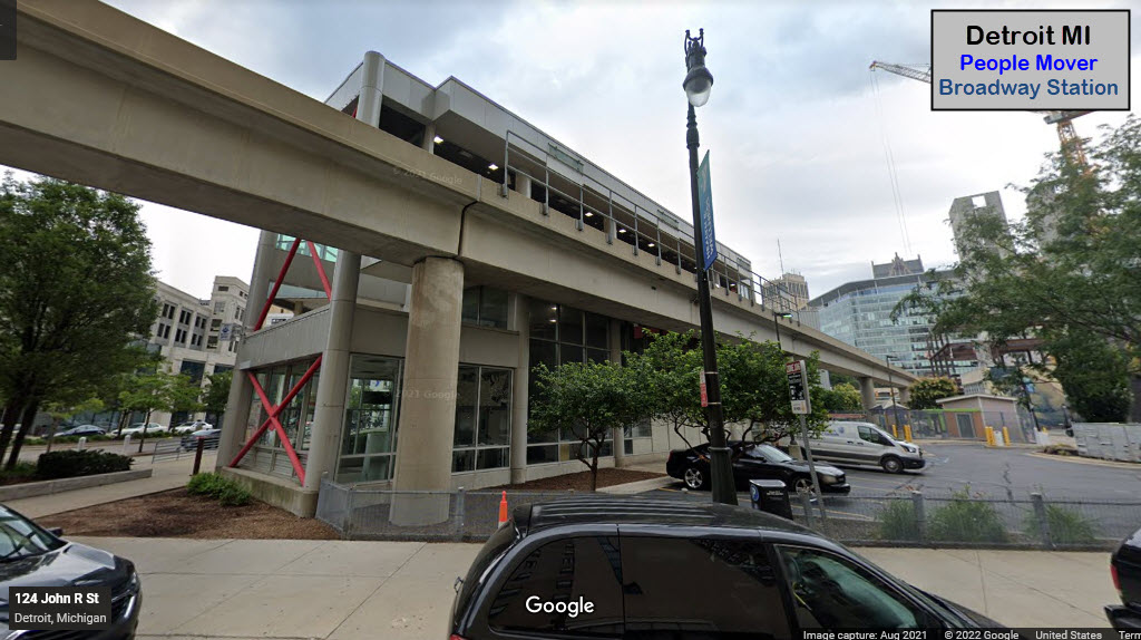
Broadway
GPS Coordinates: 42.33545, -83.04817
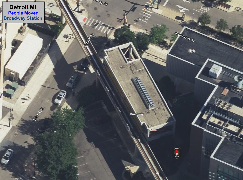
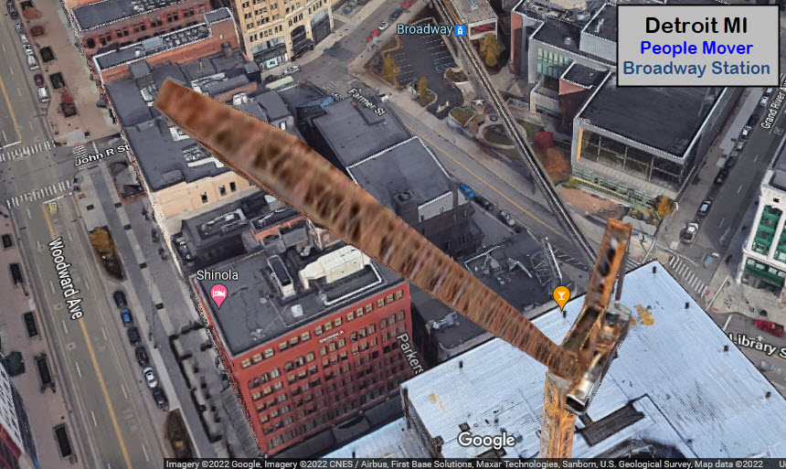
I generally don't like Google's 3D views, because they are not sharp enough for any practical use,
but sometimes, things like this crane are interesting to hover around :-)
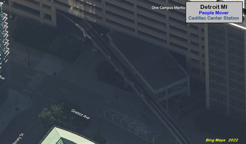
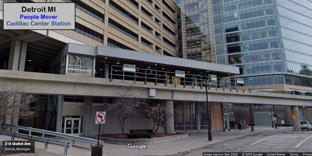
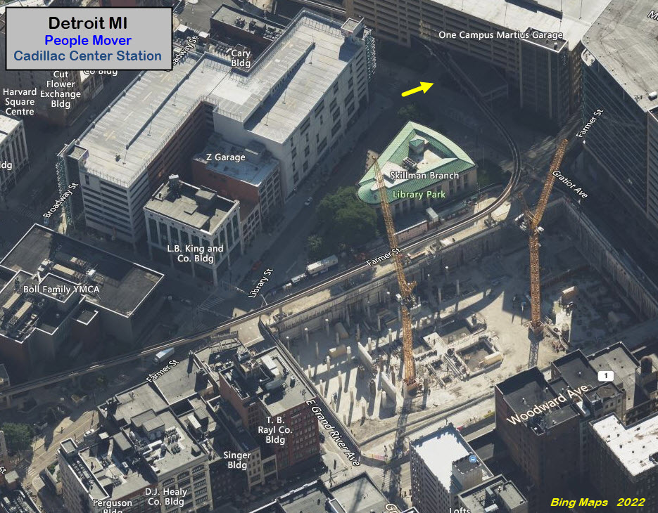
Cadillac Center
GPS Coordinates: 42.33375, -83.04614
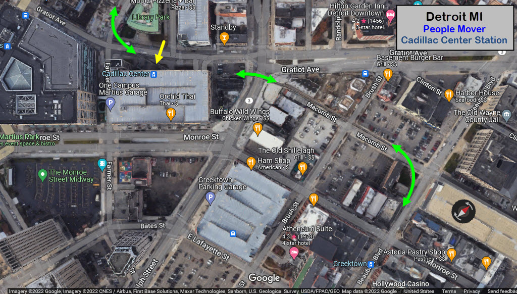
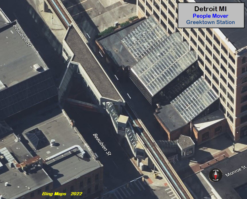
Greektown
GPS Coordinates: 42.33462, -83.04243
This is the "most artsy" station on the line!
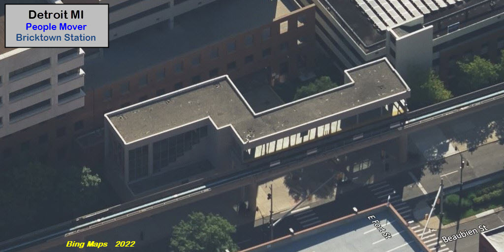
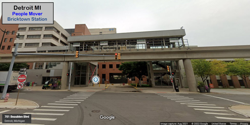
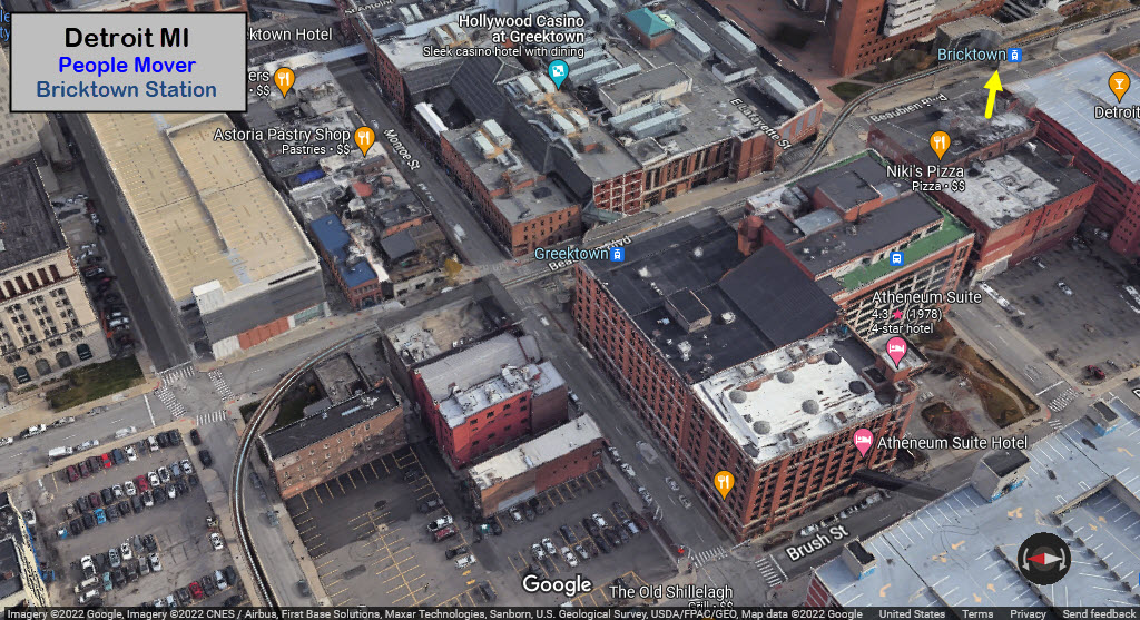
Bricktown
GPS Coordinates: 42.33343, -83.04122
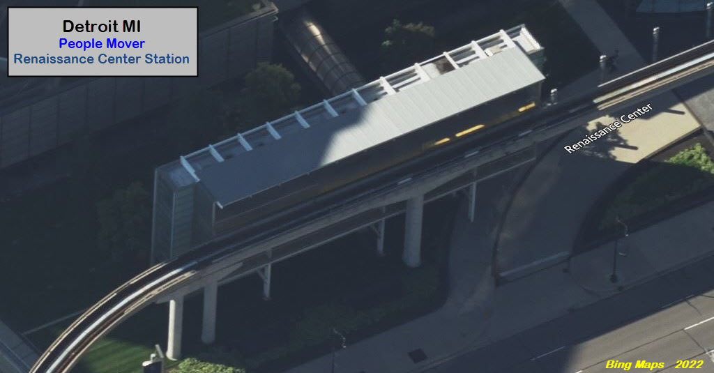
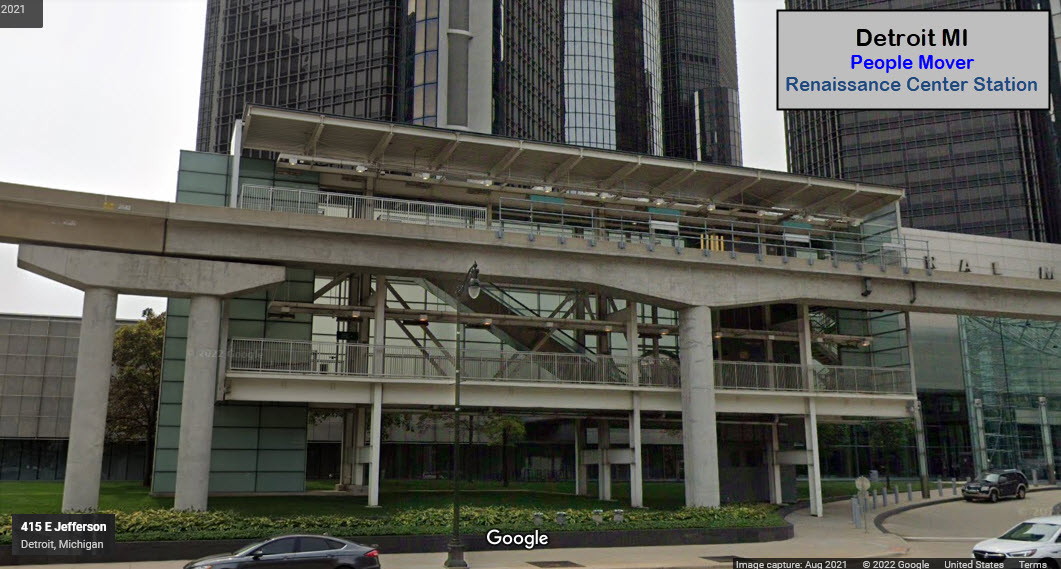
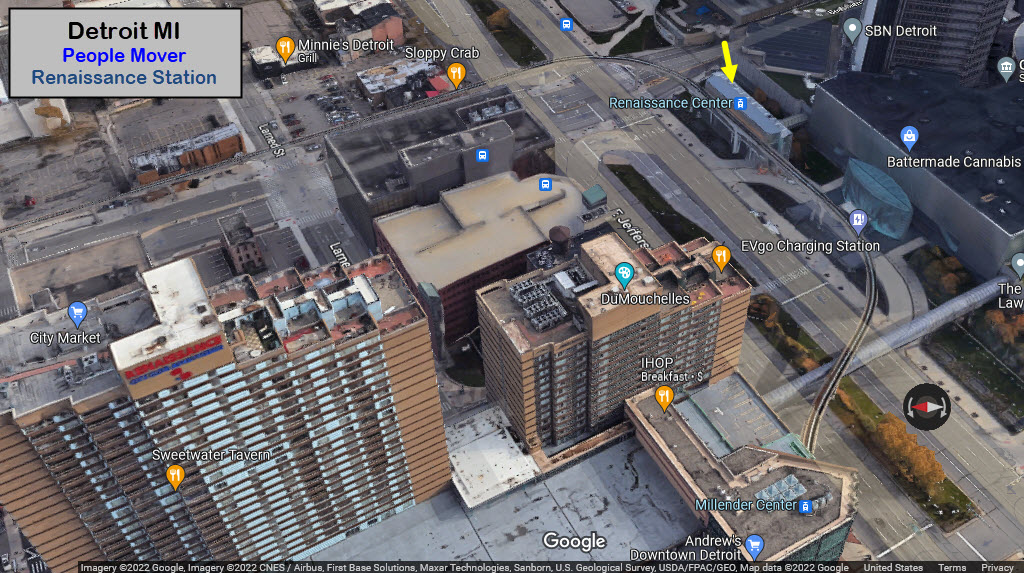
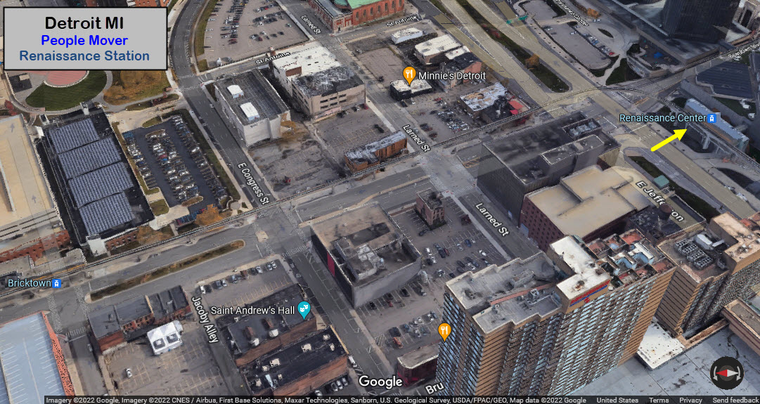
Renaissance Center
GPS Coordinates: 42.33019, -83.04000
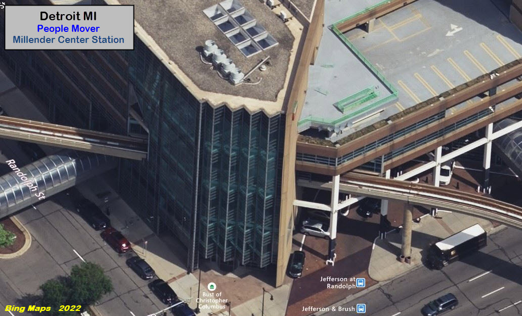
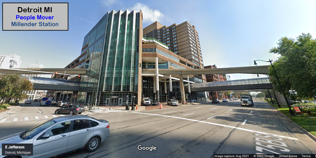
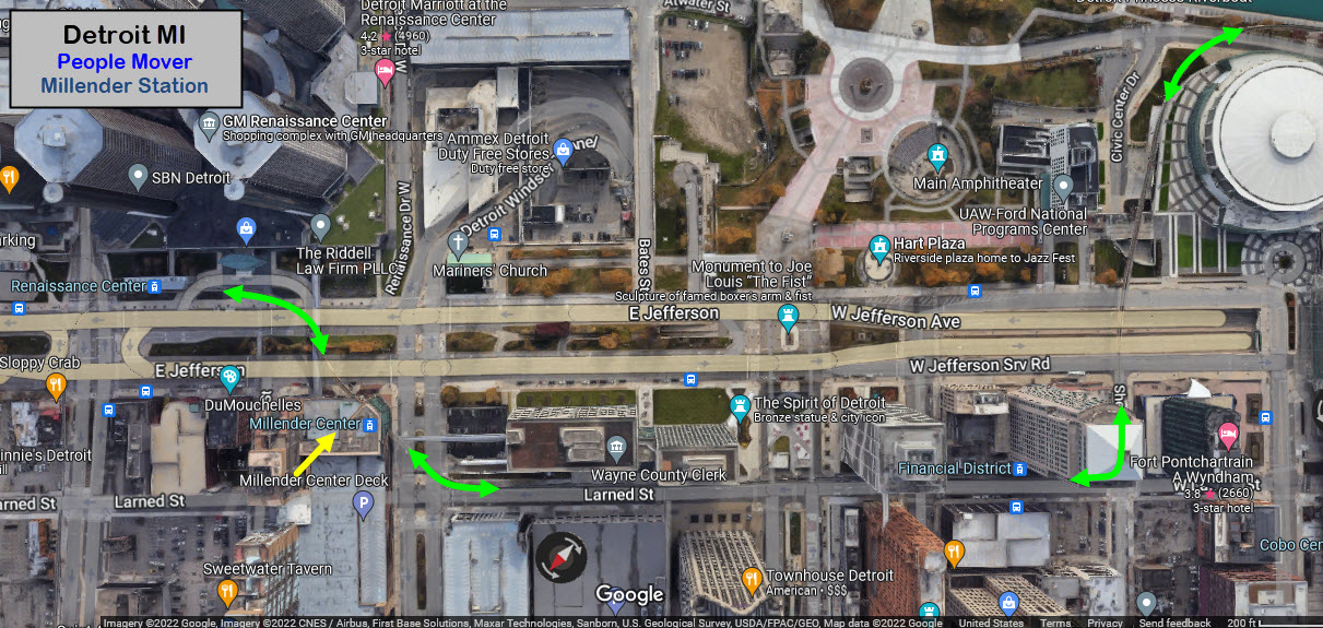
Millender Center
GPS Coordinates: 42.33023, -83.04198
Financial District
GPS Coordinates: 42.32864, -83.04671
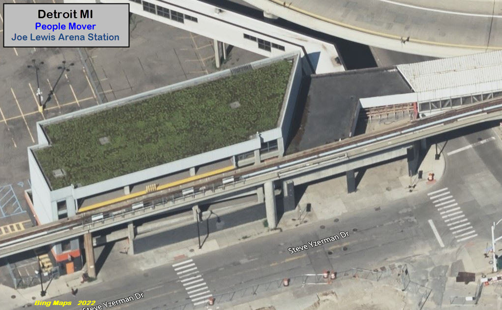
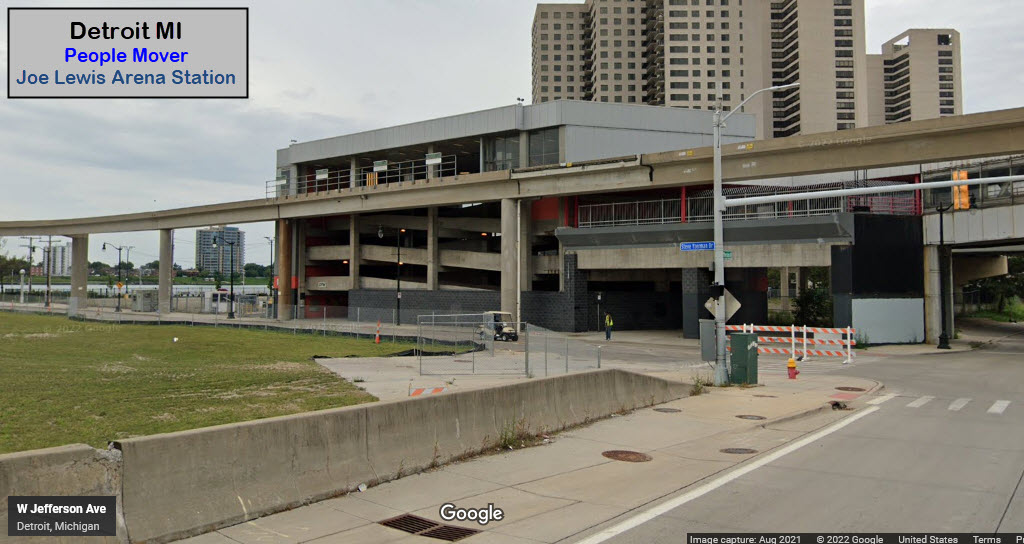
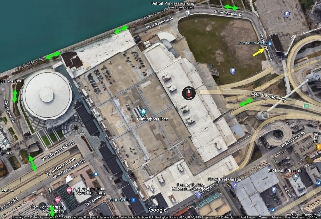
Joe Lewis Arena
GPS Coordinates: 42.32528, -83.05263
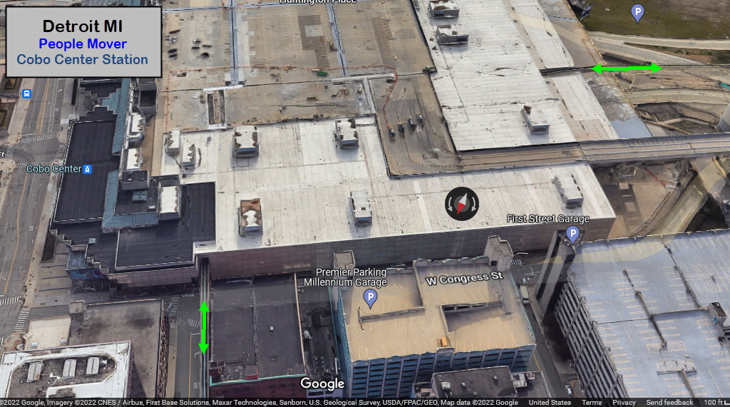
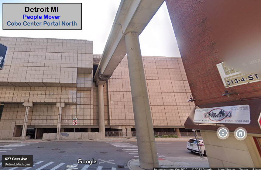
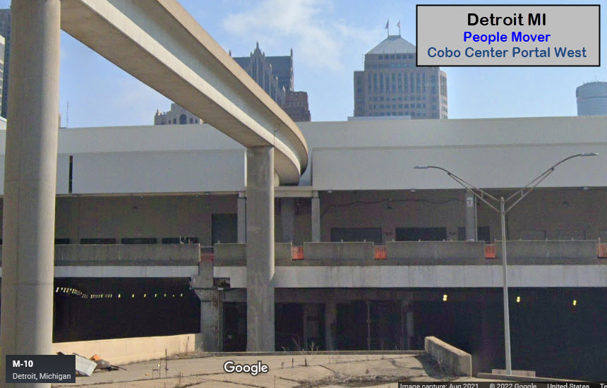
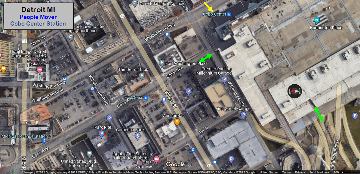
Cobo Center
GPS Coordinates: 42.32785, -83.04987 (inside the Cobo Center building)
I've ridden the line, and I'm still not sure where the station is inside the building......
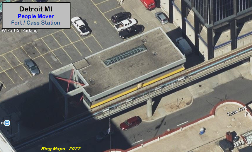
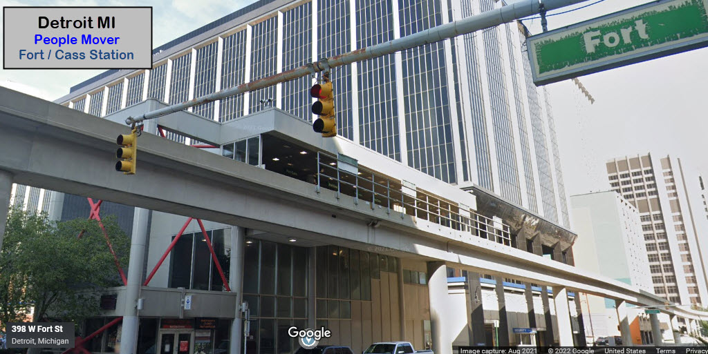
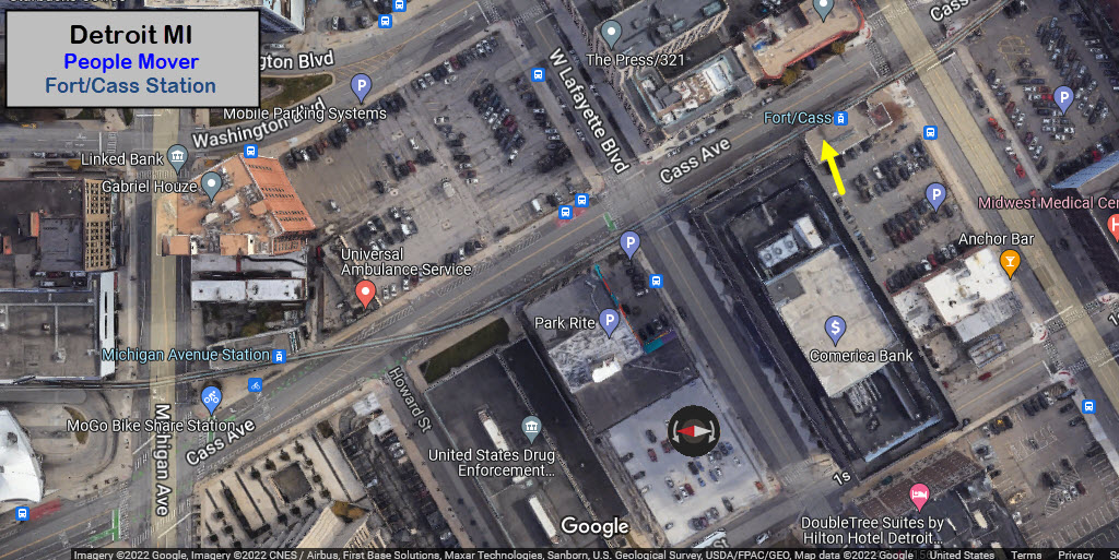
Fort / Cass
GPS Coordinates: 42.32951, -83.05113
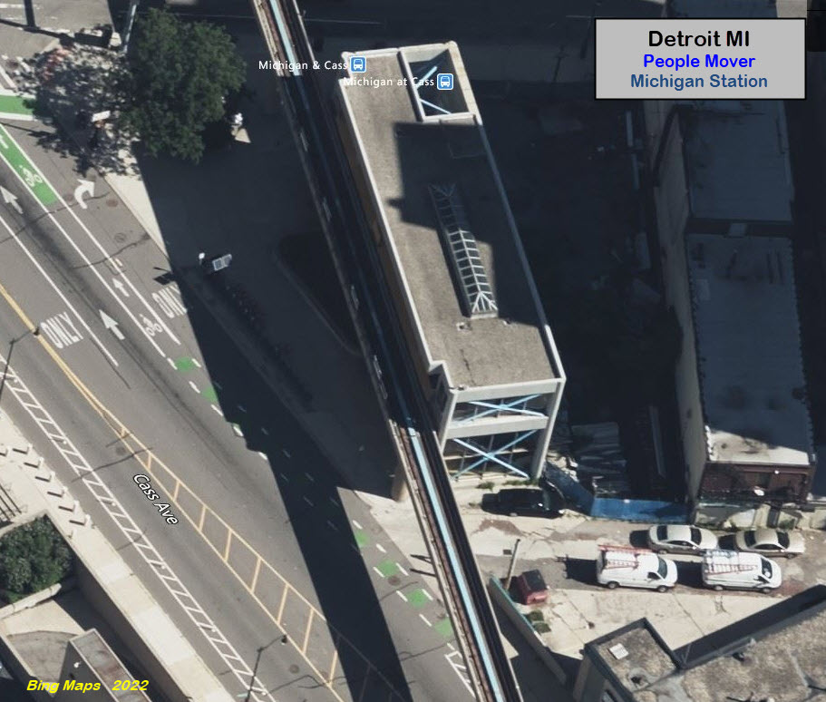
Michigan
GPS Coordinates: 42.33132, -83.05207
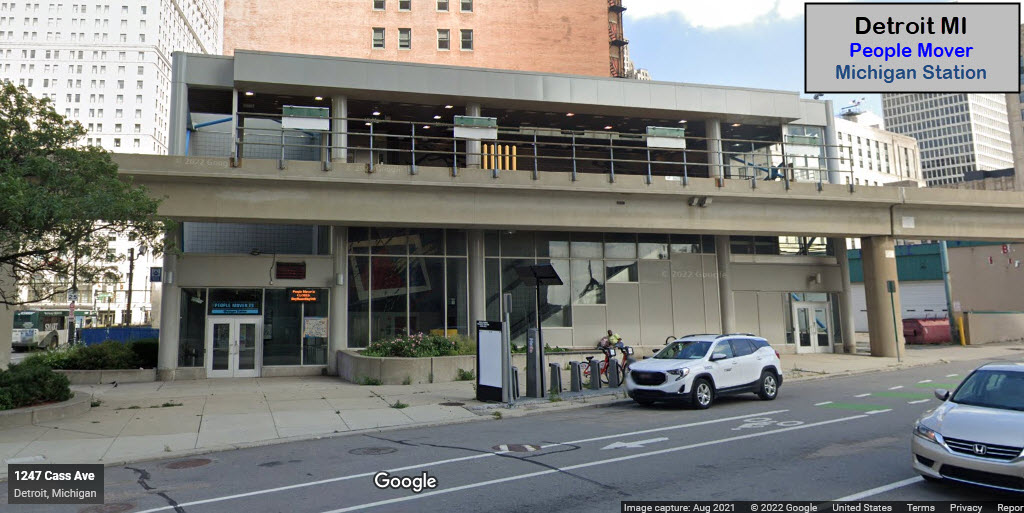
And we're back to where we started..... :-)
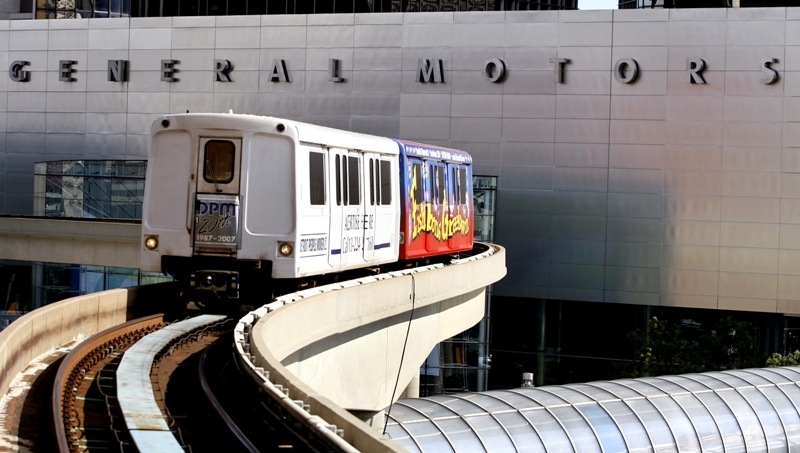
After many years of running the people mover in a plain livery, it looks like Detroit caught on to the "advertising age" and started wrapping the cars. Nice!
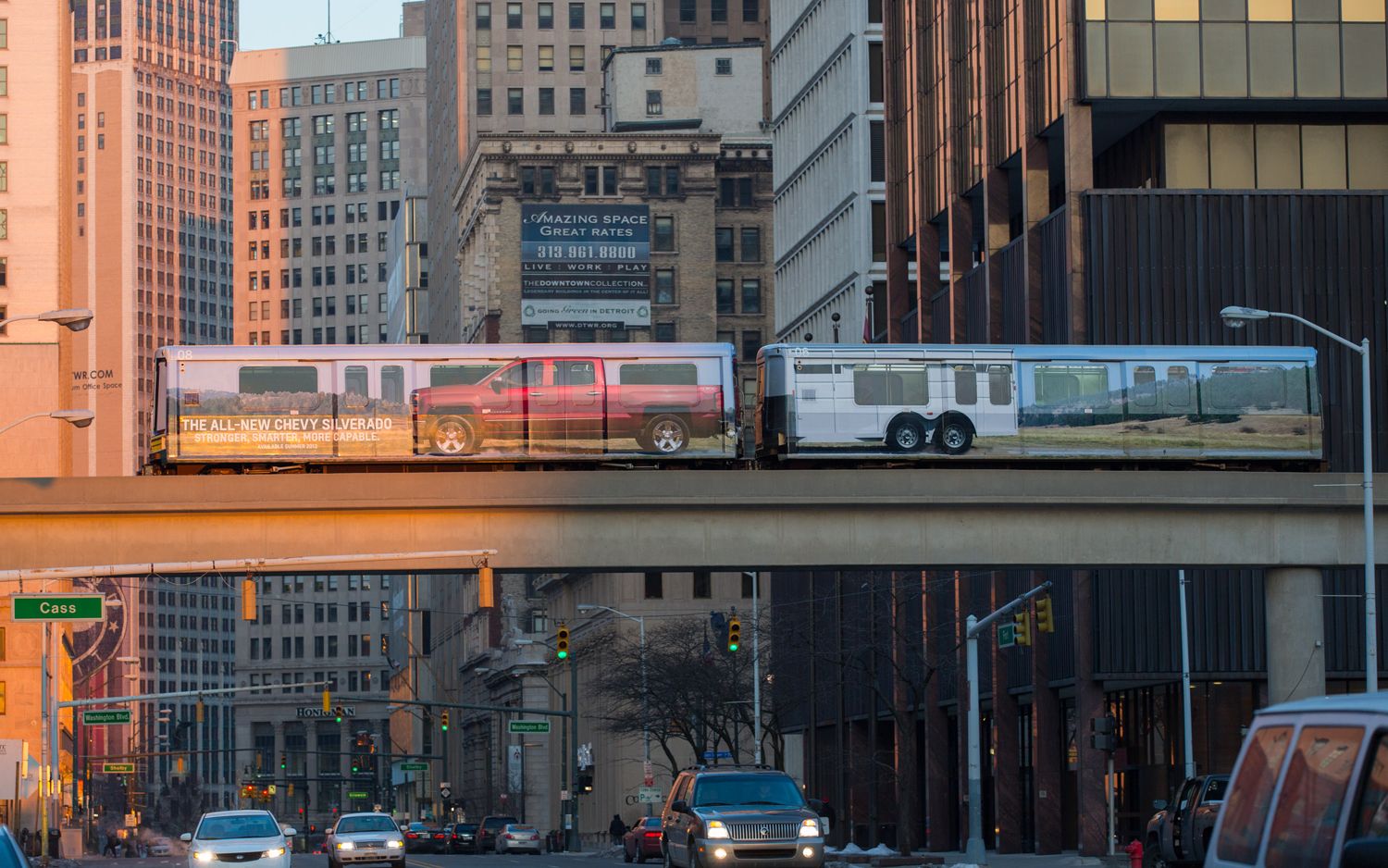 Wrapped for the Detroit Auto Show in 2014
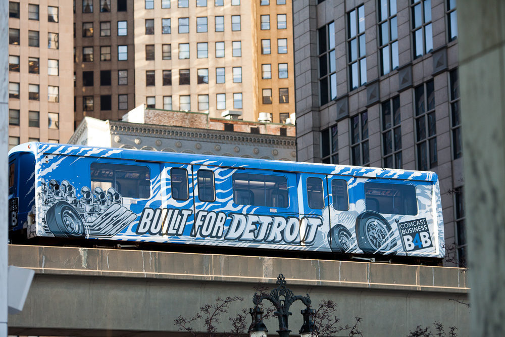
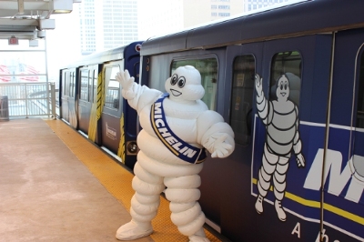 Michelin sponsored free rides on Thanksgiving Day 2015.
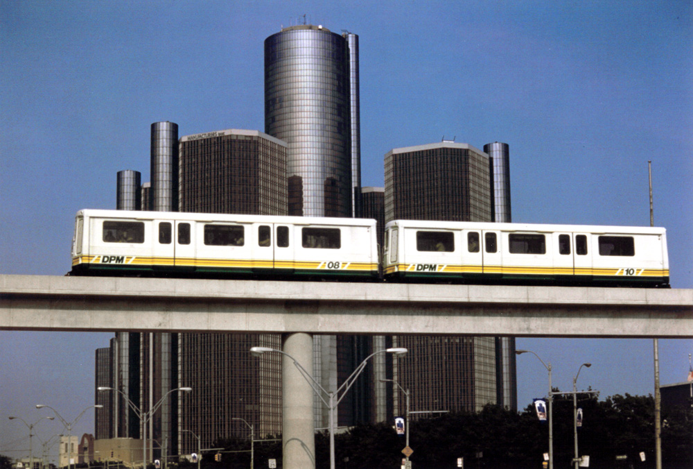
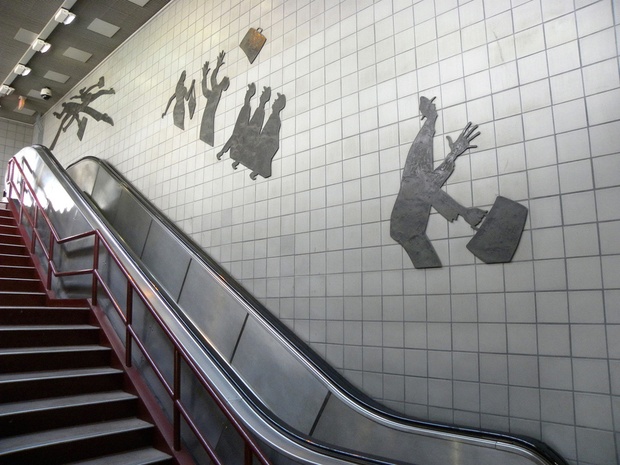 Some of the art that graces the stations.
History and Additional System Information
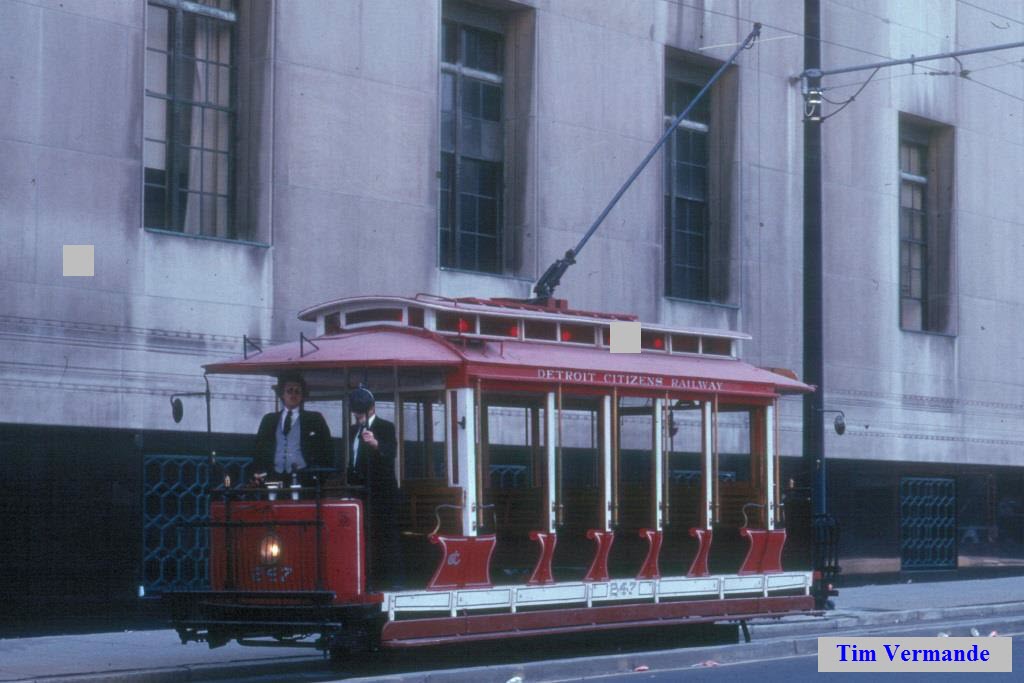
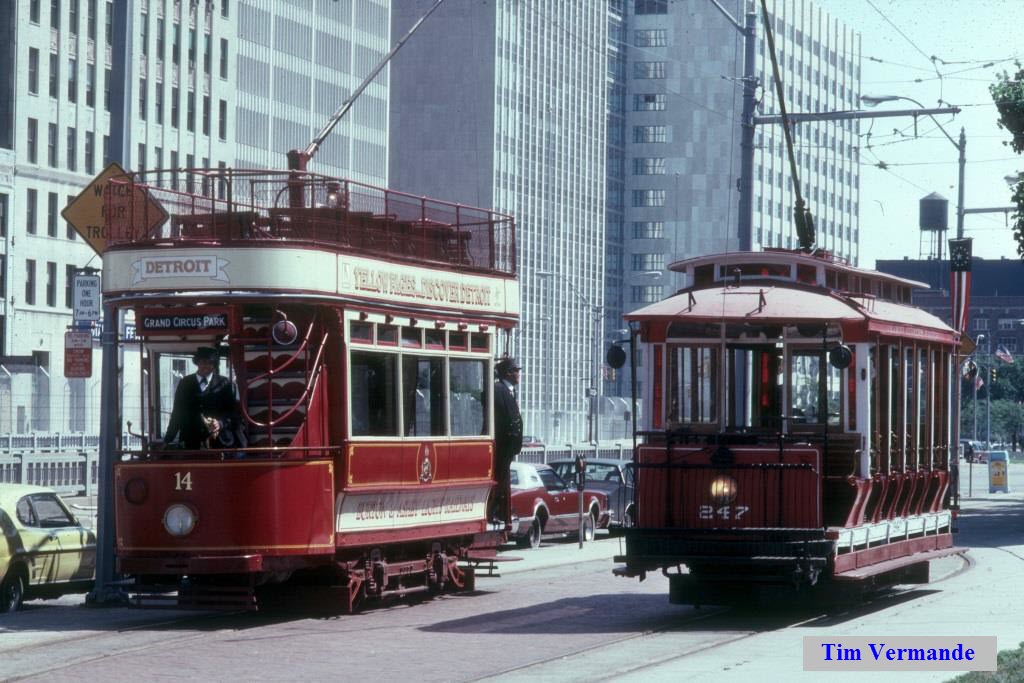
A "predecessor" to the People Mover. Photos courtesy Tim Vermande. Thanks Tim!
From Wikipedia: The Detroit People Mover has its origins in 1966, with Congressional creation of the Urban Mass Transportation Administration (UMTA) to develop new types of transit. In 1975, following the failure to produce any large-scale results and increased pressure to show results, UMTA created the Downtown People Mover Program (DPM) and sponsored a nationwide competition that offered federal funds to cover much of the cost of planning and construction of such a system. UMTA reviewed thirty-five full proposals. From these, they selected proposals from Cleveland, Houston, Los Angeles, and St. Paul. In addition, UMTA decided they would approve proposals from Baltimore, Detroit, and Miami to develop People Mover systems if they could do so with existing grant commitments. Of the seven cities with UMTA approval for their People Mover proposals, only Detroit and Miami persevered to build and operate systems.
The People Mover was intended to be the downtown distributor for a proposed city and metro-wide light rail transit system for Detroit in the early 1980s; however, funding was scaled back. President Gerald Ford had promised 600 million in federal funds. Plans included a subway line along Woodward Avenue that would turn into a street level train at McNichols and eventually go all the way to Pontiac, with additional rail lines running along Gratiot and a commuter line between Detroit and Port Huron. Inability of local leaders to come to an agreement led to the 600 million commitment being withdrawn by the Reagan Administration. Yet the People Mover still moved forward. At the time of planning, the system was projected to have a ridership of 67,700 daily. The People Mover is owned and operated by the Detroit Transportation Corporation (DTC). The DTC was incorporated in 1985 as a Michigan Public Body Corporate for the purpose of acquiring, owning, constructing, furnishing, equipping, completing, operating, improving, enlarging, and/or disposing of the Central Automated Transit Systems (CATS) in Detroit, Michigan. DTC acquired the CATS project from the Suburban Mobile Authority for Regional Transportation (SMART) formerly known as the Southeastern Michigan Transportation Authority (SEMTA), on October 4, 1985. The DTC was created by the City of Detroit, Michigan pursuant to Act 7 of Public Acts of 1967 and is a component unit of the City of Detroit and accounts its activity as per proprietary funds.
The CATS project, aka the Downtown People Mover (DPM), officially opened to the public on July 31, 1987. Prior to November 18, 1988, the People Mover System was operated and maintained by the primary contractor, Urban Transportation Development Corporation (UTDC) on a month-to-month basis. On November 18, 1988, the DTC assumed the responsibility to operate and maintain the People Mover System.
The system opened in 1987 using the same technology as Vancouver's SkyTrain and Toronto's Scarborough RT line. In the first year, an average of 11,000 riders used the People Mover each day; the one-day record was 54,648
When the People Mover opened, it ran counter-clockwise. On July 20, 2008, the system was shut down temporarily to replace track on six of the curves along the route. When it reopened in August, the system was run clockwise, as it is still run today, although it can run in either direction when necessary. The change in direction reduced the time required to complete one round-trip. The clockwise direction has one short, relatively steep uphill climb and then coasts downhill for a majority of the ride, allowing the train to use gravity to accelerate. This makes each round-trip slightly faster than running uphill most of the way in the counter-clockwise direction.
On January 22, 2015 at approximately 10:10 PM, one of the cars jumped a rail hitting the rail platform. This prompted the system to be temporarily shut down to allow an investigation to take place. After 17 hours of investigation, the system resumed service. According to a media release given by the inspectors, "A bracket beneath one of the People Mover cars dislodged, catching under the rear car of the train approaching Times Square Station. This caused the rear car to come out of alignment and leave the rail. As a result, the second car scraped the platform, dislodging the door as the train pulled into the station."
From: thepeoplemover.com
The Detroit People Mover (DPM) was built as part of an Urban Mass Transportation Administration (UMTA) – now Federal Transit Administration (FTA) demonstration project. The intent of that program was to determine how well a fully automated transit system might contribute to the revitalization of central business districts of major older cities such as Detroit, and whether such an automated technology could provide effective circulation/distribution service at a cost lower than conventional bus systems. Construction of the DPM system began in the spring of 1983 under the auspices of the Southeastern Michigan Transit Authority (SEMTA), now the Suburban Mobility Authority for Regional Transportation (SMART). On October 3, 1985, the Detroit Transportation Corporation (DTC) was established to be the agency responsible for completion of the project construction and thereafter assume full ownership responsibility for the DPM. The DPM system began operating revenue service on July 31, 1987.
The DTC is owner and operator of the DPM. The Detroit People Mover is a fully automated light rail system that operates on an elevated single-track loop in Detroit’s central business district. The system provides connections between the courts and administrative offices of several levels of government, sport arenas, exhibition Service is frequent, unencumbered by vehicle or pedestrian traffic, and conveniently available throughout the central business district. The integration of eight of the 13 People Mover stations into pre-existing structures links more than 9 million square feet that can be traversed unimpeded by outside elements. The DTC provides service to its patrons according to a seven-day schedule, which equates to 118.5 hours of operation per week for a nominal fee of 75 cents per ride. A fleet of 12 fully automated vehicles, which can be deployed in one or two car trains, provides this service. These vehicles travel in a counterclockwise direction and are propelled by two linear induction motors per car, which convey the steel-wheeled vehicles over the system’s 2.9 miles of continuously welded steel rail track. Each vehicle is heated or air conditioned as required for customer comfort. When in full loop operations, the vehicles are scheduled to provide service in 3- to 5-minute intervals. Completion of the entire route takes approximately 15 minutes or less. The DPM guideway is completely elevated and can be currently accessed at any of 13 passenger stations that are spaced at approximately quarter-mile intervals around the alignment. All stations are accessible to elderly and disabled persons, with the exception of Grand Circus Park. Passengers requiring elevator or escalator service should board and/or disembark at either Times Square or Broadway. Eight of the 13 People Mover stations (Times Square, Cobo Center, Joe Louis Arena, Financial District, Millender Center, GM Renaissance Center, Greektown, Grand Circus Park) are integrated into adjacent buildings, and the remaining five freestanding stations (Michigan, Fort/Cass, Bricktown, Cadillac Center, Broadway) are designed to facilitate direct access from future developments at the platform level if and when that is appropriate. Each of the 13 DPM stations contains major works of art that generate considerable interest, promote ridership and enhance the appearance of the system. In addition, the exhibit collectively named Art In The Stations has won numerous national as well as international awards for outstanding public art.
OPERATIONS and MAINTENANCE: DPM stations are monitored by closed-circuit TV cameras, push-to-talk voice communication equipment and voice monitoring capability. These devices are observed 24 hours per day by Central Control operators who have overall responsibility for the coordination of system operations. Their responsibilities include train control and the interface of activities between passengers, transit police officers, maintenance staff and/or outside contractors to provide safe and efficient operation of the system. Although the Automated Train Control system is capable of running a variety of vehicle fleet configurations, the control operators have override capabilities to cope with unpredictable situations which may occur during normal operation. Maintenance of the DPM system is provided by in-house staff members who are responsible for the guideway, fixed facilities, rolling stock, communications equipment, and miscellaneous test equipment to support system operations. A six-member board of directors governs the DTC.
Disclaimers:
I love trains, and I love signals. I am not an expert. My webpages reflect what I find on the topic of the page. This is something I have fun with while trying to help others.
Please Note: Since the main focus of my two websites is railroad signals, the railfan guides are oriented towards the signal fan being able to locate them. For those of you into the modeling aspect of our hobby, my indexa page has a list of almost everything railroad oriented I can think of to provide you with at least a few pictures to help you detail your pike.
If this is a railfan page, every effort has been made to make sure that the information contained on this map and in this railfan guide is correct. Once in a while, an error may creep in :-)
My philosophy: Pictures and maps are worth a thousand words, especially for railfanning. Text descriptions only get you so far, especially if you get lost or disoriented. Take along good maps.... a GPS is OK to get somewhere, but maps are still better if you get lost! I belong to AAA, which allows you to get local maps for free when you visit the local branches. ADC puts out a nice series of county maps for the Washington DC area, but their state maps do not have the railroads on them. If you can find em, I like the National Geographic map book of the U.S..... good, clear, and concise graphics, and they do a really good job of showing you where tourist type attractions are, although they too lack the railroads. Other notes about specific areas will show up on that page if known.
Aerial shots were taken from either Google or Bing Maps as noted. Screen captures are made with Snagit, a Techsmith product... a great tool if you have never used it!
By the way, floobydust is a term I picked up 30-40 years ago from a National Semiconductor data book, and means miscellaneous and/or other stuff.
Pictures and additional information is always needed if anyone feels inclined to take 'em, send 'em, and share 'em, or if you have something to add or correct.... credit is always given! Please be NICE!!! Contact info is here
Beware: If used as a source, ANYTHING from Wikipedia must be treated as being possibly inaccurate, wrong, or not true.
RAILFAN GUIDES HOME
RAILROAD SIGNALS HOME
NEW 02/25/2016, JUL22/23/24/2022
Last Modified 24-Jul-2022