
In General
Getting Here
Map
Bridges & Overpasses
Bridge Types
RAILFAN GUIDES HOME
RAILROAD SIGNALS HOME
Location / Name:
Detroit MI, Wayne County
What's Here:
Besides the numerous railroad yards, well over 40 railroad bridges and overpasses.
Data:
GPS Coordinates: as needed
Phone A/C: 313
ZIP: 48209
Access by train/transit:
Amtrak in Dearborn
Otherwise, it's almost all busses
The Scoop:
Detroit, because of the large number of railroads and roads, has an unbelievable number of bridges and overpasses used by the railroads to get over water and roads, and other railroads.... this page will cover some of them.... Prepare to bore yourself :-)
So why is this page going to bore most of you? Because many of the bridge locations have 4, 5, or 6 pictures, and there are at last count, 37 locations. I did this page mostly for myself to document the myriad of bridges and overpasses that Detroit offers bridge fans and railfans. So if you want to consider it, this is a historical page of sorts, a small glimpse into Detroit railroad bridges circa 2020/2021.
Bridge - Overpass - Viaduct.... What is the difference? The large majority of the bridges mentioned below can probably be referred to as a bridge or an overpass, and the terms are interchangeable. One fellow who helped me with another page in PA is a "bridge guy", and may disagree. Being that almost all bridges in Detroit are "older", I don't think any qualify as being called a viaduct, but some, like #8 and #9 going to Zug Island, are bridges, and not overpasses or viaducts.
A viaduct is a specific type of bridge that consists of a series of arches, piers or columns supporting a long elevated railway or road. Typically a viaduct connects two points of roughly equal elevation, allowing direct overpass across a wide valley, road, river, or other low-lying terrain features and obstacles.
See below for the different types of bridges found in railroad construction.....
Acknowledgements:
Structsource
Google Maps
Open Railway Maps
Bing Maps
Denver Todd
Websites and other additional information sources of interest for the area:
https://en.wikipedia.org/wiki/Conrail
https://en.wikipedia.org/wiki/Conrail_Shared_Assets_Operations
https://railfanguides.us/mi/detroit/map2/index.htm My page on Delray Tower
https://en.wikipedia.org/wiki/Detroit_Terminal_Railroad
http://www.structsource.com/railroadbridge/main.html
https://en.wikipedia.org/wiki/Viaduct
Please refer to my map, or use your GPS depending on where you want to go.... too many places to list.
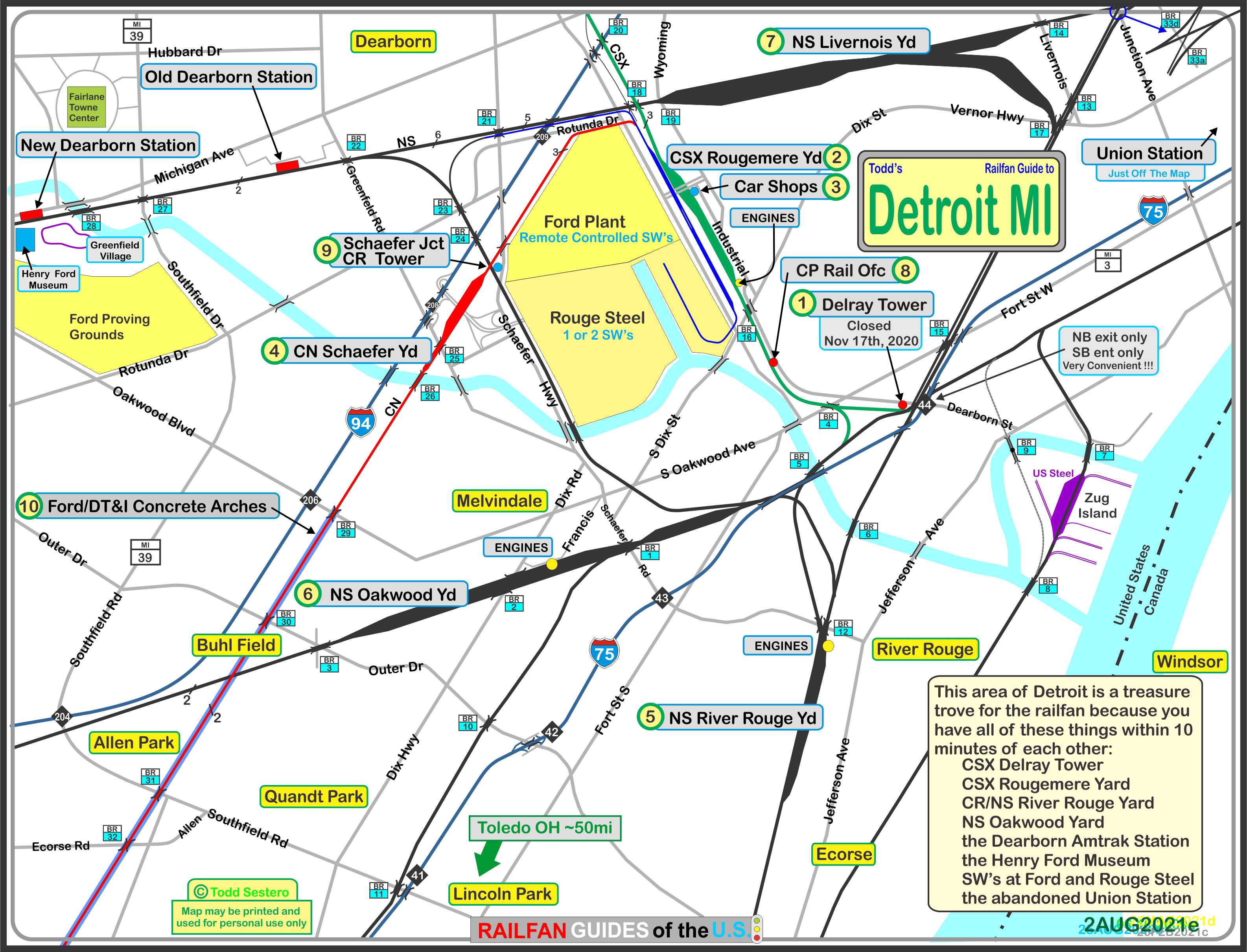
the above map in PDF format is available here
Shortcuts
1
2
3
4
5
6
7
8
9
10
11
12
13
14
15
16
17
18
19
20
21
22
23
24
25
26
27
28
29
30
31
32
33
34
35
36
37
38
39
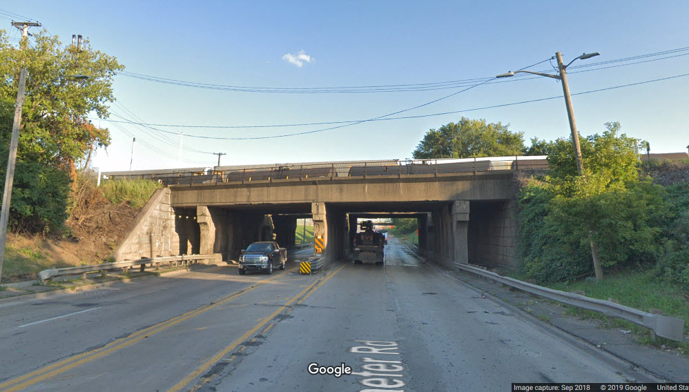
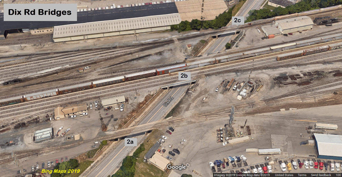
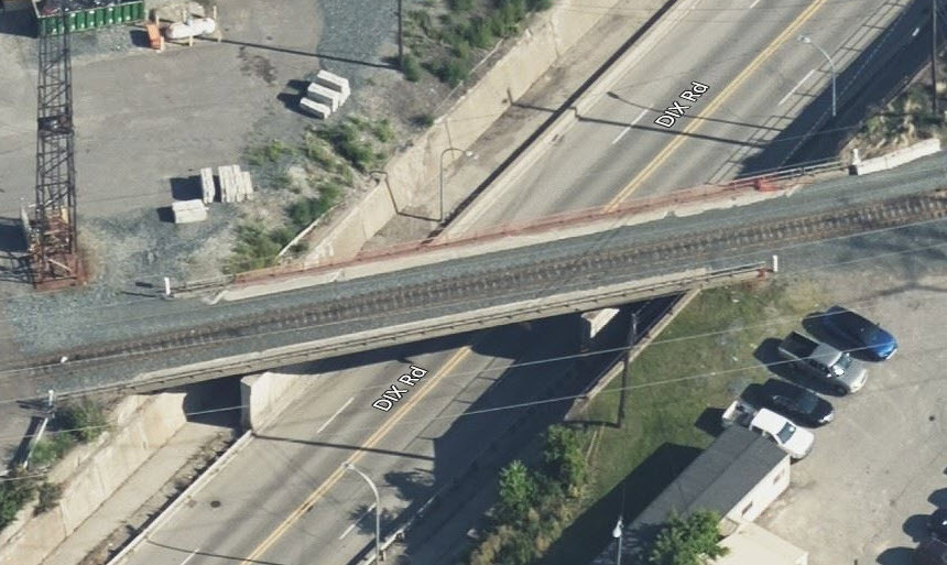
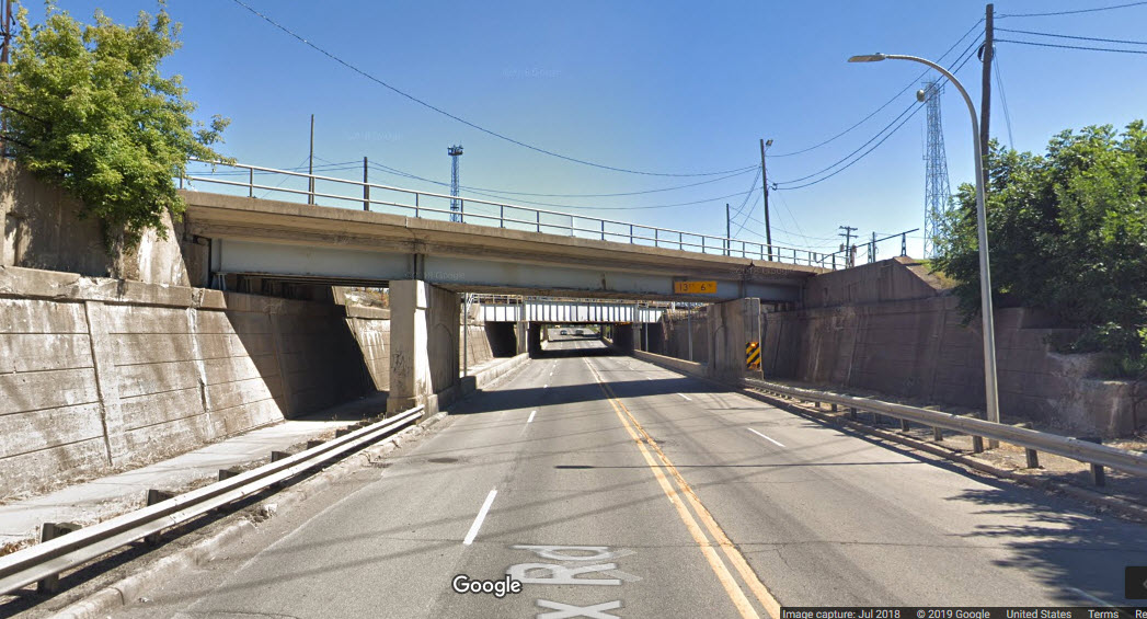
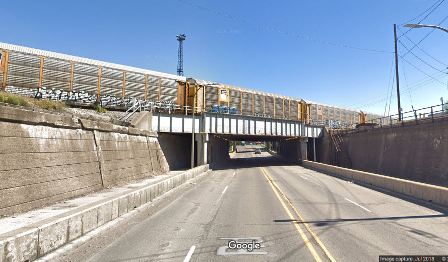
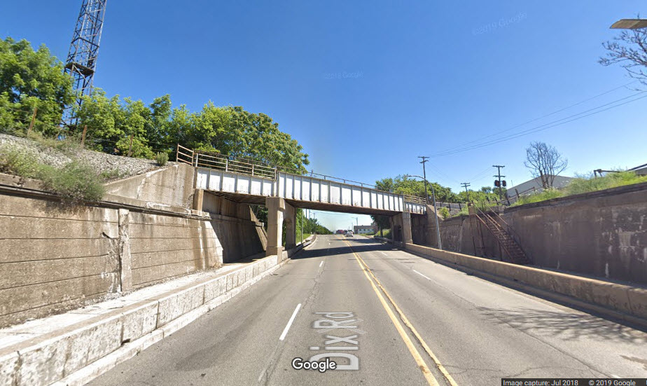
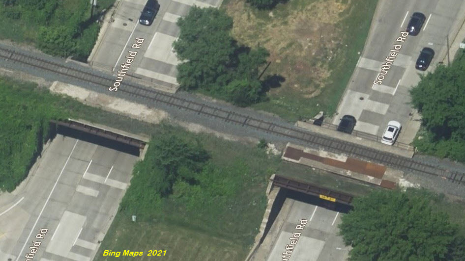
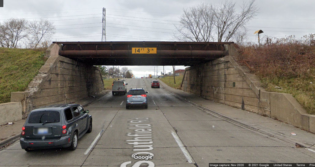
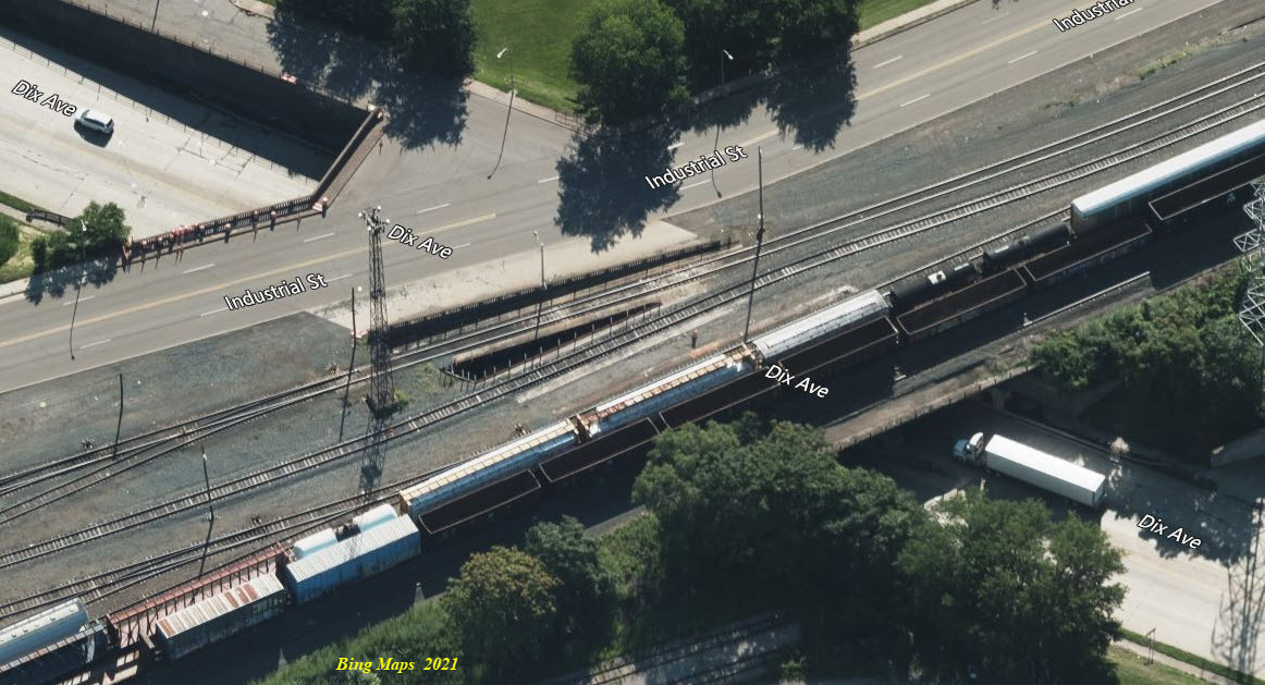
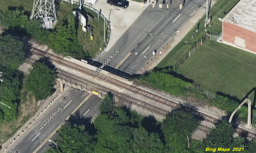
Dix Road goes under Oakwood Yard in a series of three overpasses.
 2a, looking north
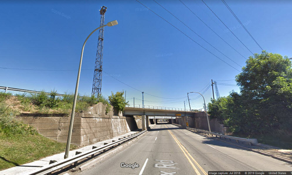 2a, looking north
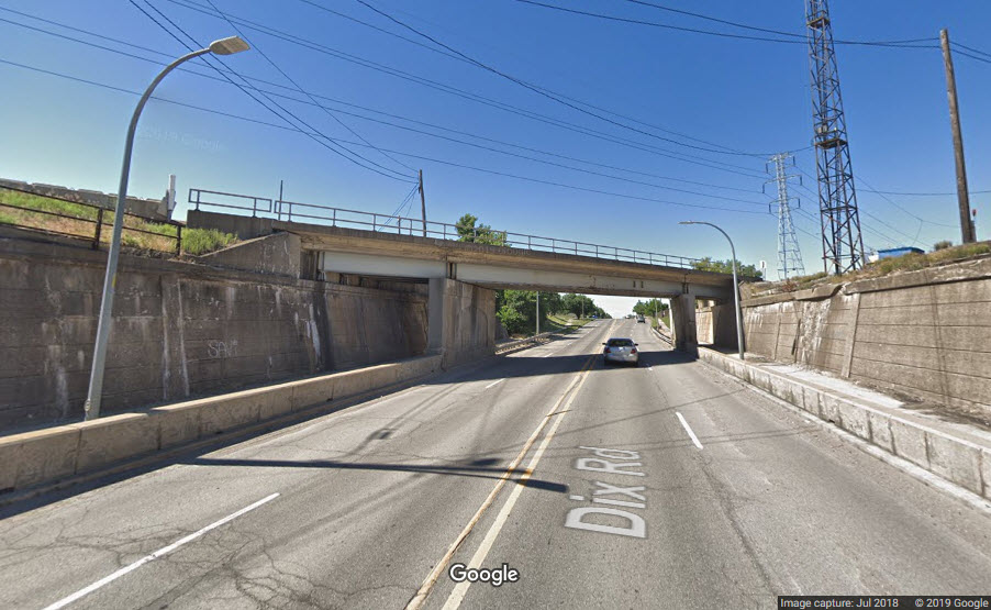 2a, looking south
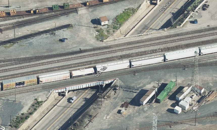
 2b, looking north
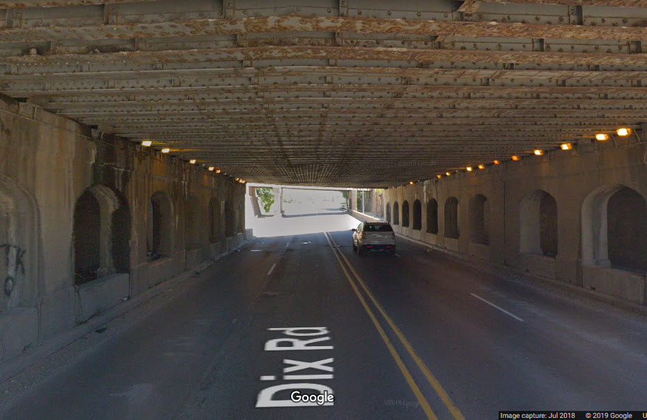 2b, looking north
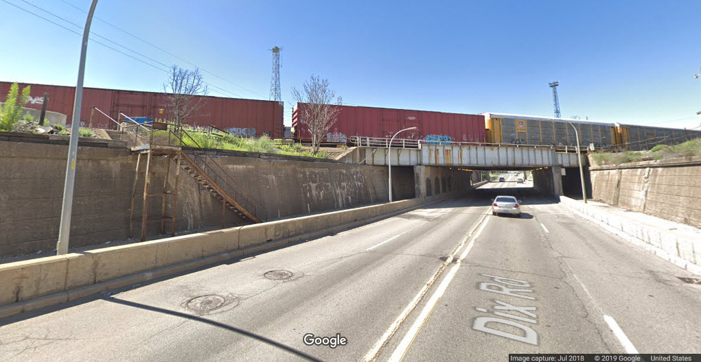 2b, looking south
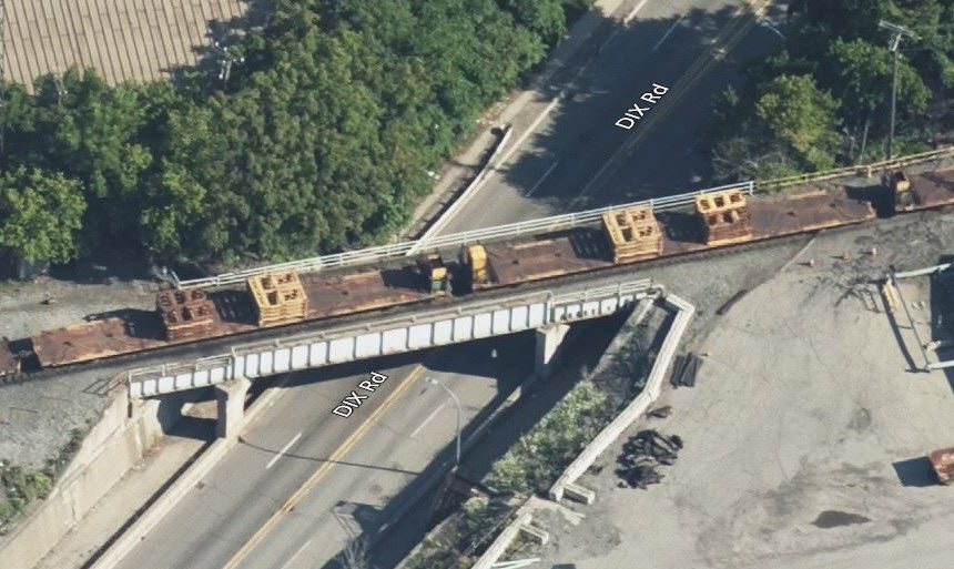
 2c, looking north
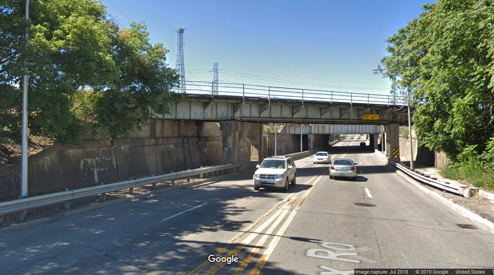 2c, looking south
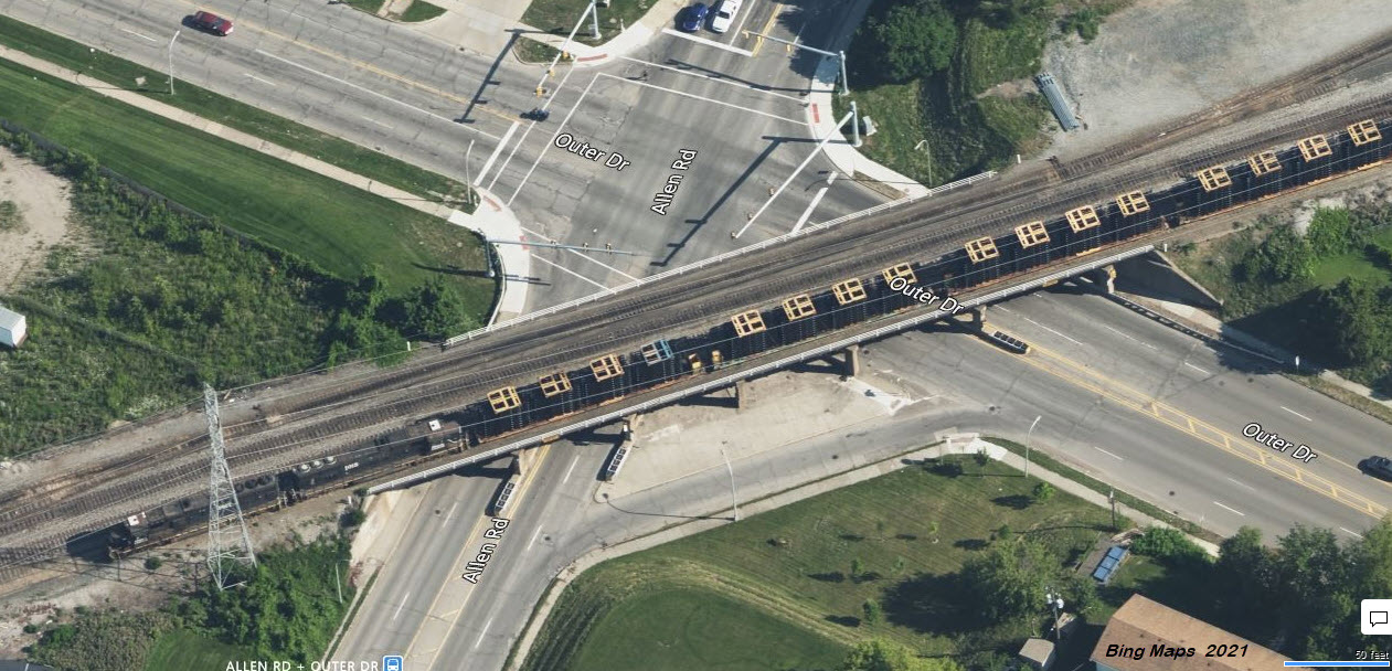
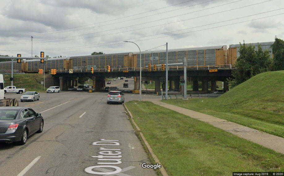
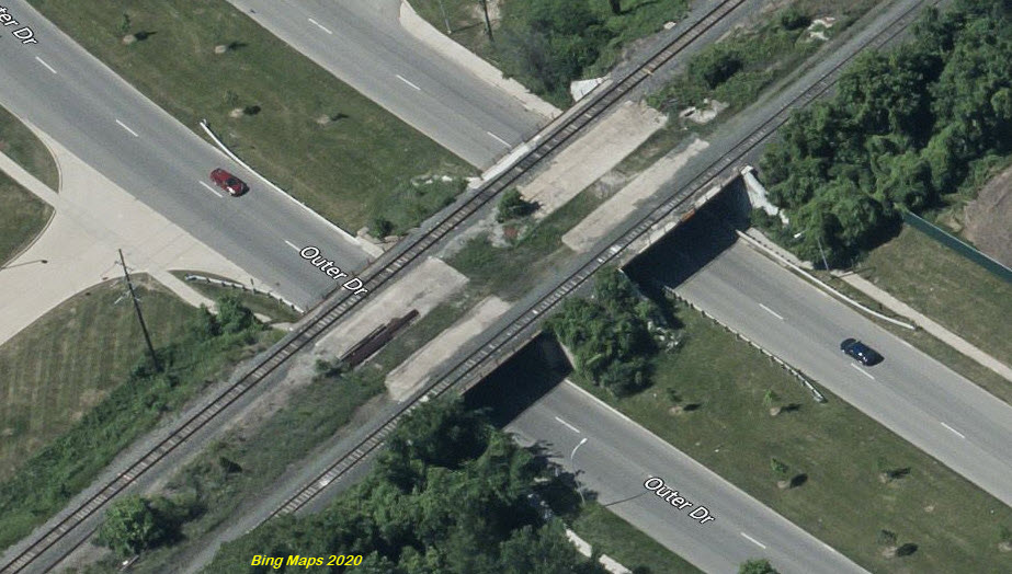
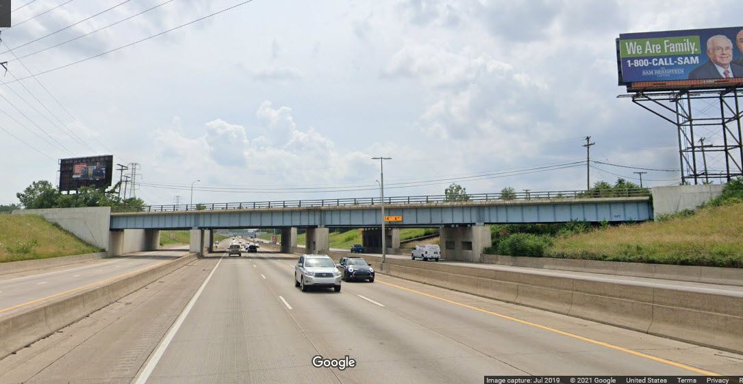
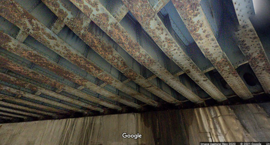
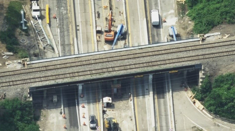
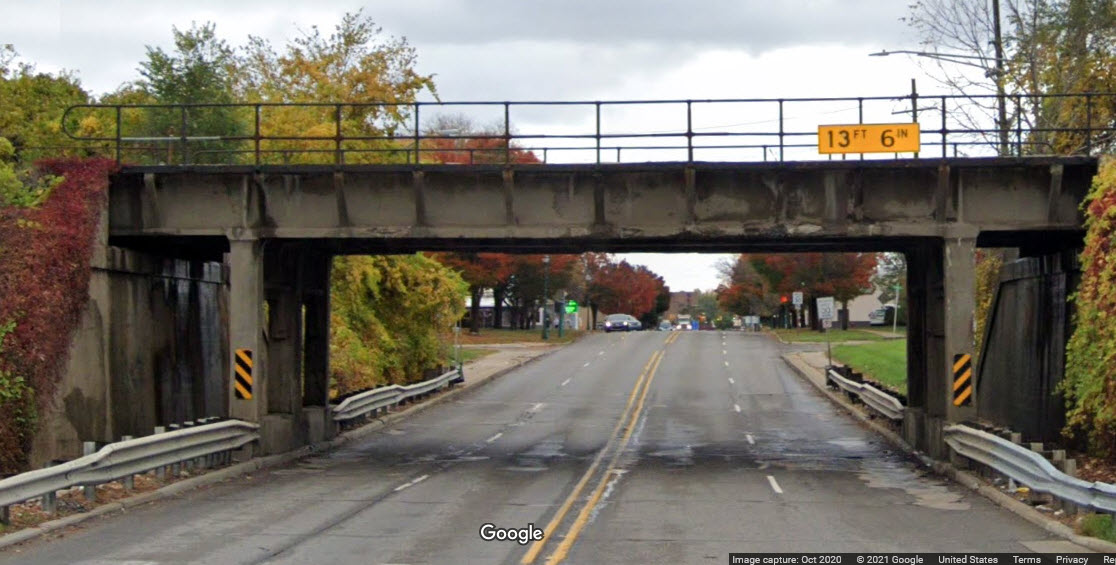
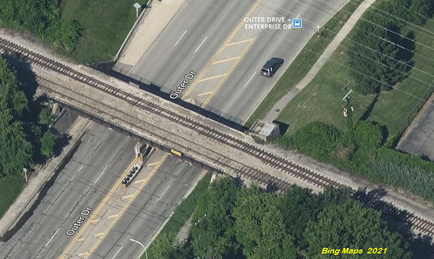
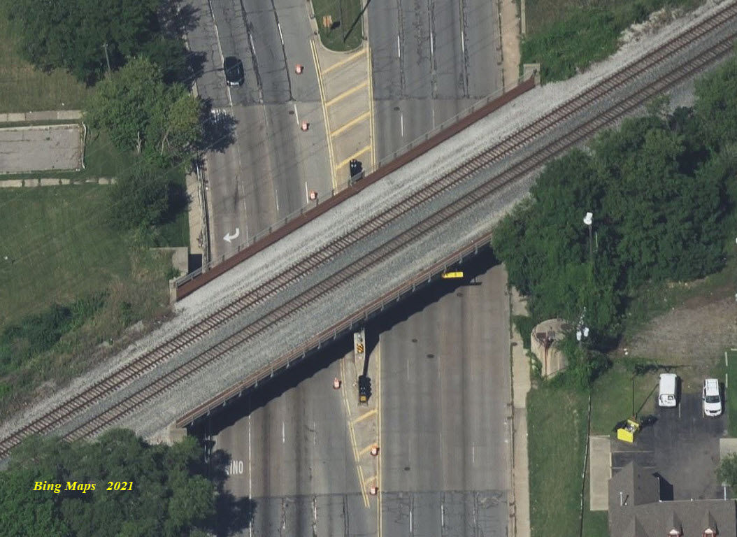
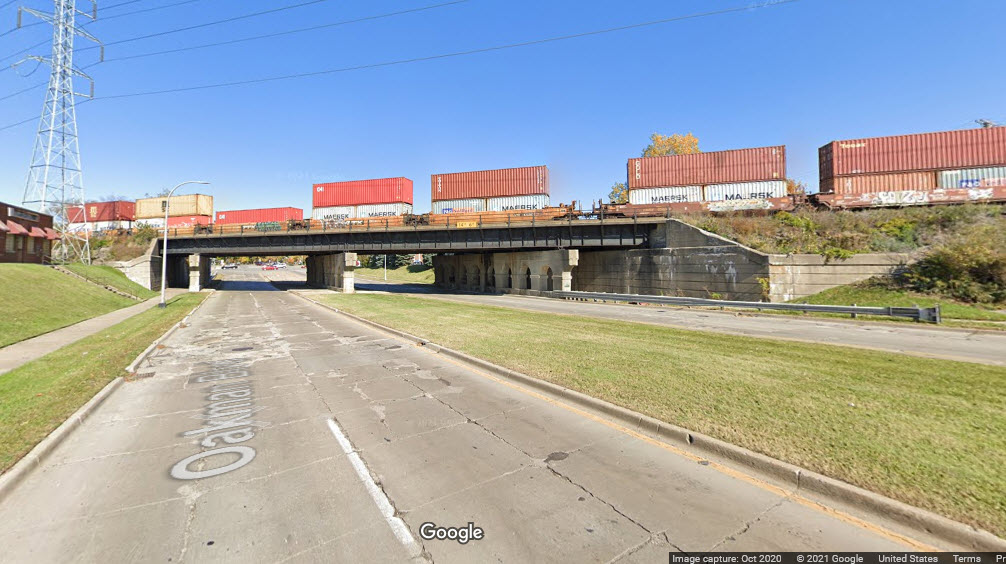
A long steel girder bridge carrying 3 tracks over 4 lanes of Allen Road, and 6 lanes of Outer Drive, concrete abutments, 6 concrete supports, and two sidewalks, phew!
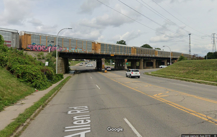
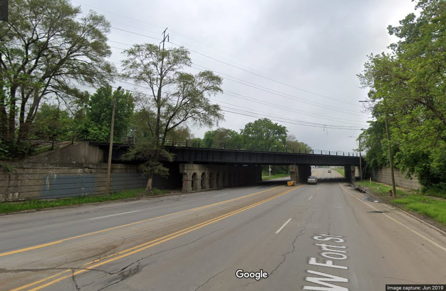
This overpass is "around the corner" from Delray Tower. Go west on Dearborn to Fort, and take a left.
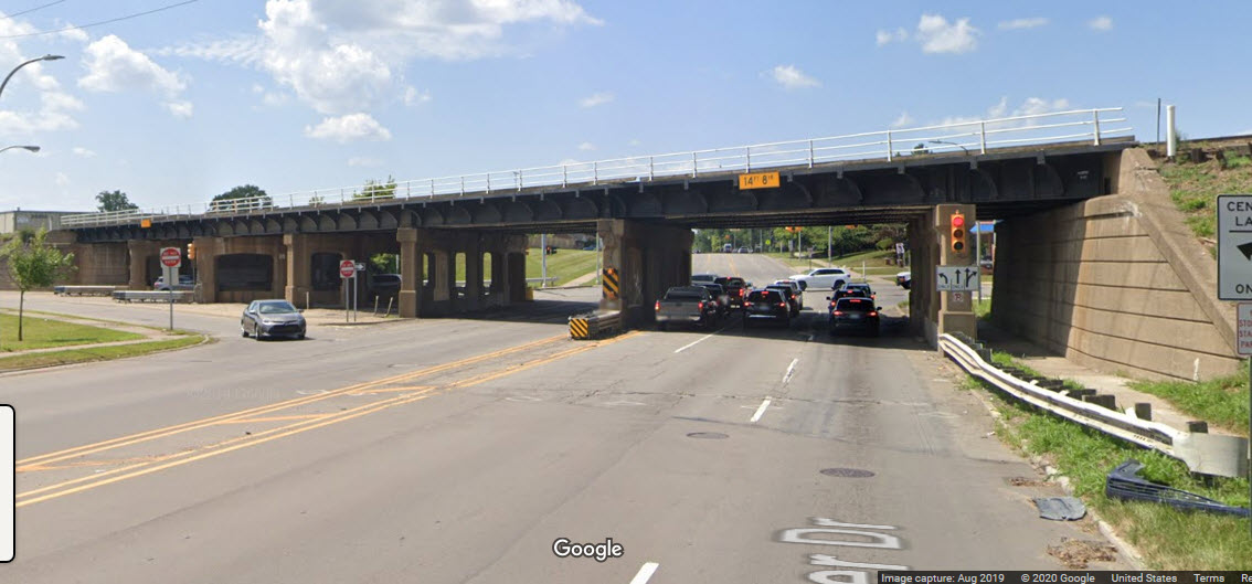
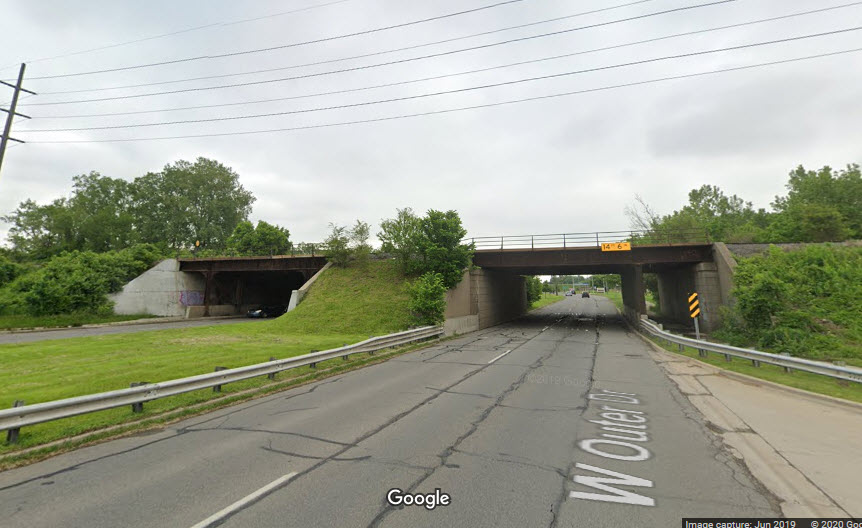
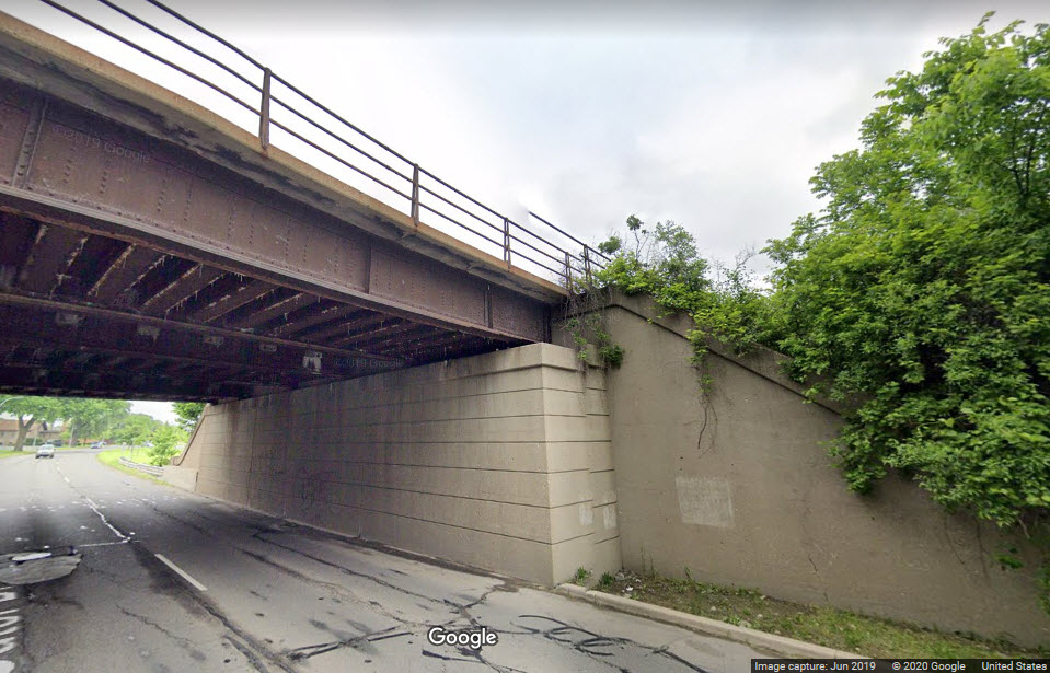
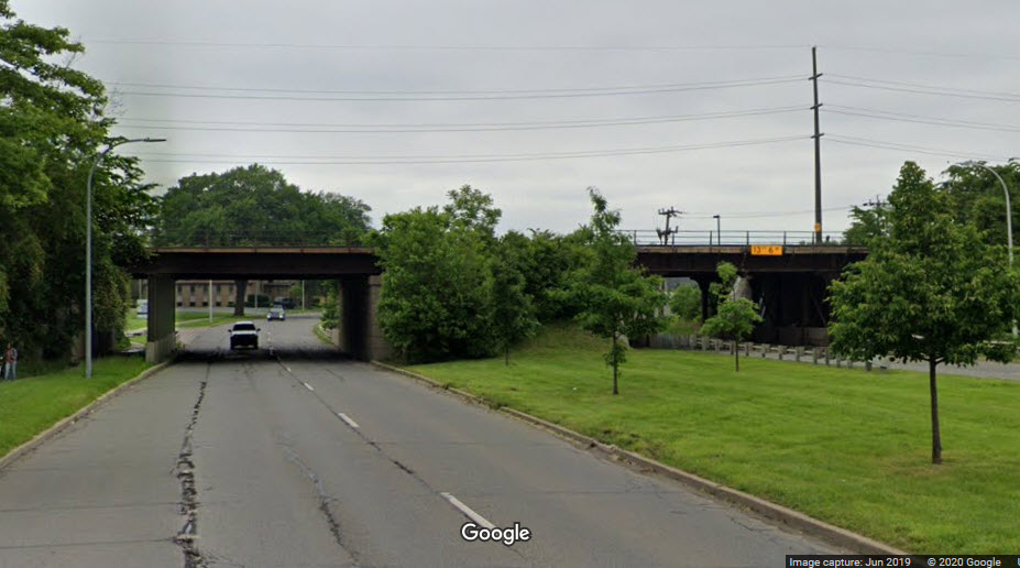
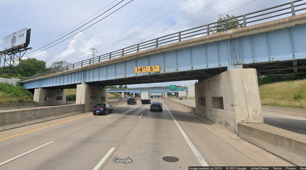
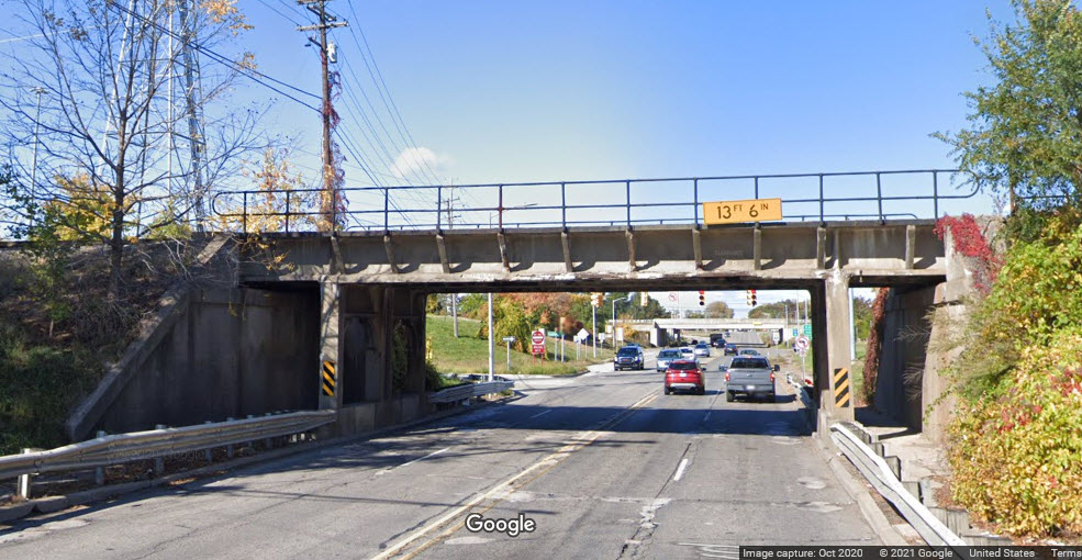
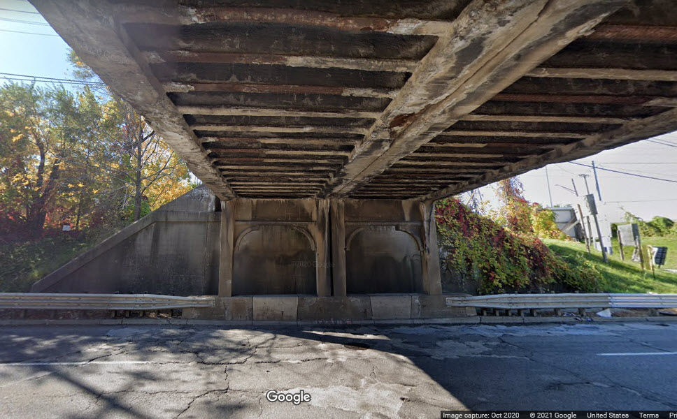
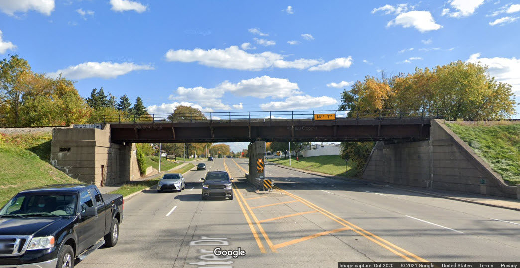
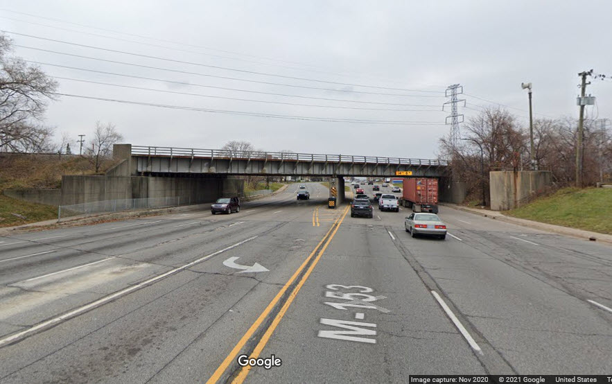
A steel girder bridge with 4 tracks but room for one more, over 4 lanes of traffic, concrete abutments, 3 concrete supports, and 2 sidewalks.
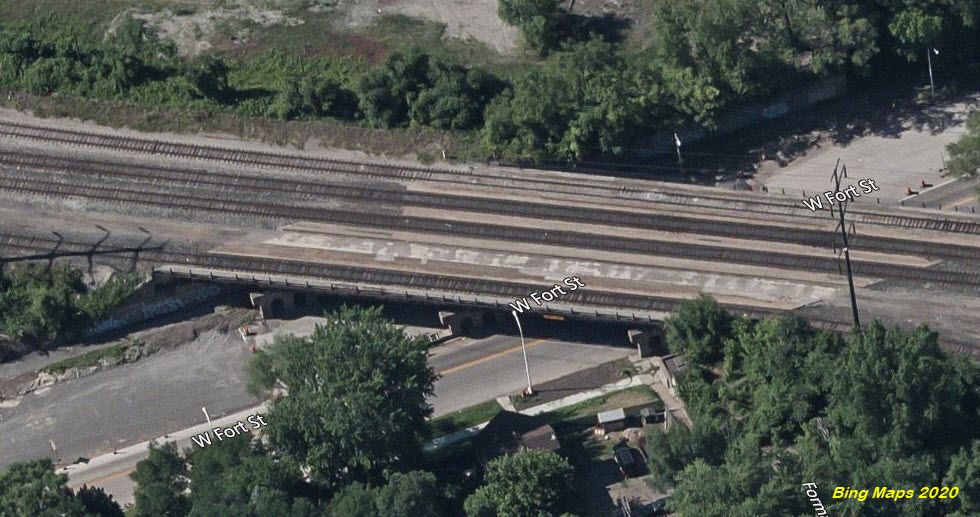
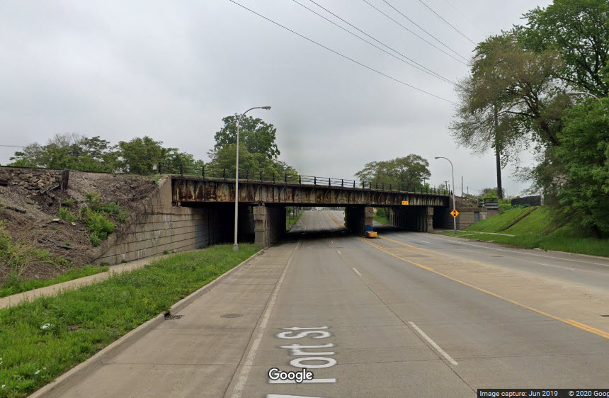
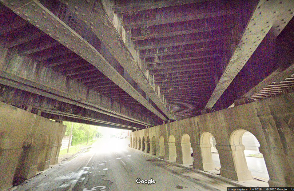
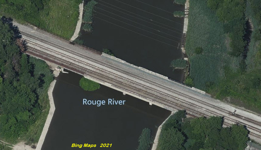
GPS Coordinates: 42.17247, -83.08392
https://historicbridges.org/bridges/browser/?bridgebrowser=michigan/rougens/
http://www.michiganrailroads.com/stations-locations/498-wayne-county-82/wayne-co-a-c/2174-bridge-rouge-detroit-mi-wabash-ns
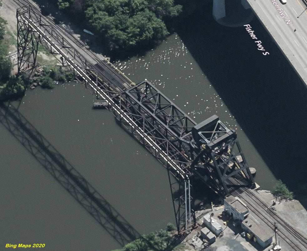
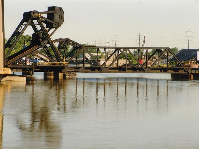
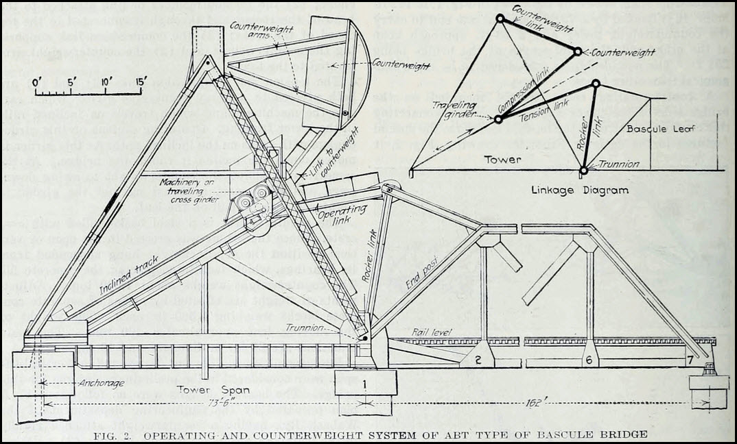
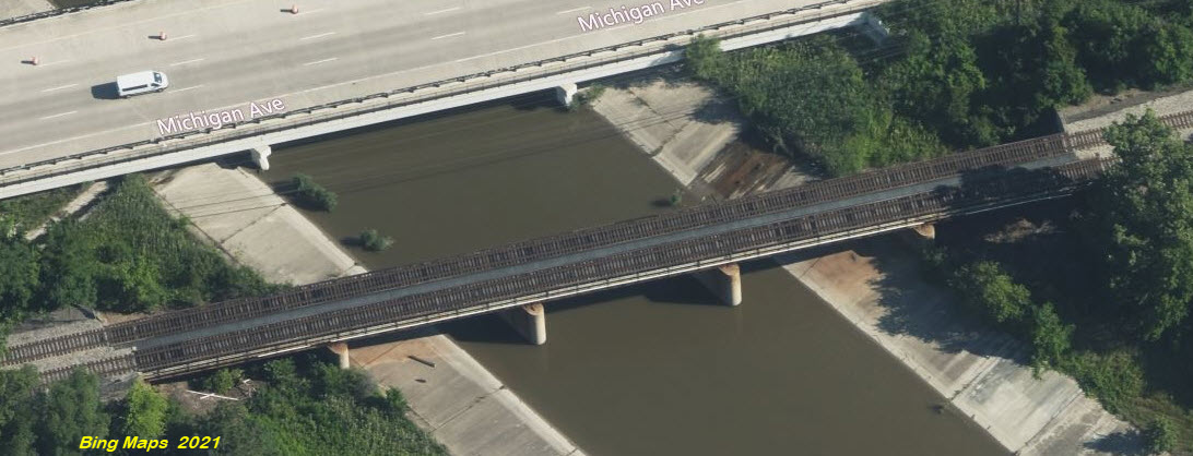
This bridge was built by the Wabash in the mid 1920's, and replaced a swing bridge when the Rouge River was widened for the Ford plant. It was also used by the Detroit & Toledo Shore Line Railroad, and later the Pennsy later in the 1920's. It is a bascule bridge that utilizes a complex counterweight that moves to adjust the weight as the bridge raises and lowers, a patented design called the Abt Bascule bridge. It is among the rarest bascule bridge types in the country. Michigan has three examples. Just about the only way to get good pictures is by boat!
Can be just seen from Dearborn St under the interstate.
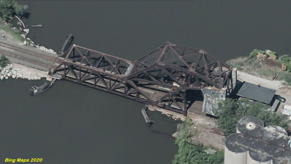
 from I-75
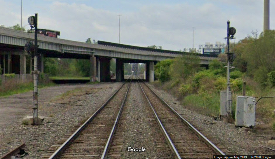 from Dearborn Ave
 Approach signals from W Pleasant St
GPS Coordinates: 42.278177, -83.115792
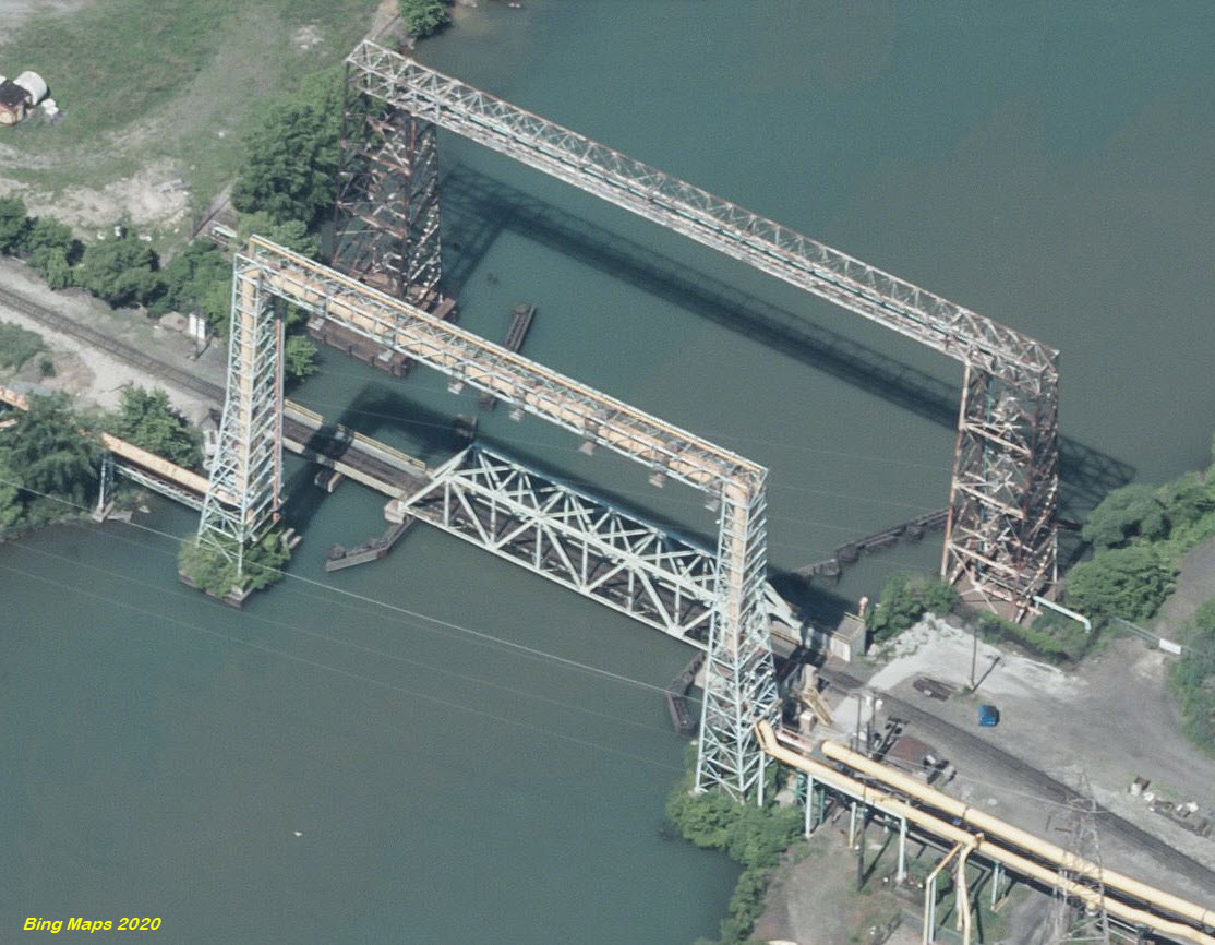
GPS Coordinates: 42.289172, -83.109280
http://www.michiganrailroads.com/stations-locations/503-wayne-county-82/wayne-co-stations-o-r/3325-rouge-river-bridge-141-detroit-mi
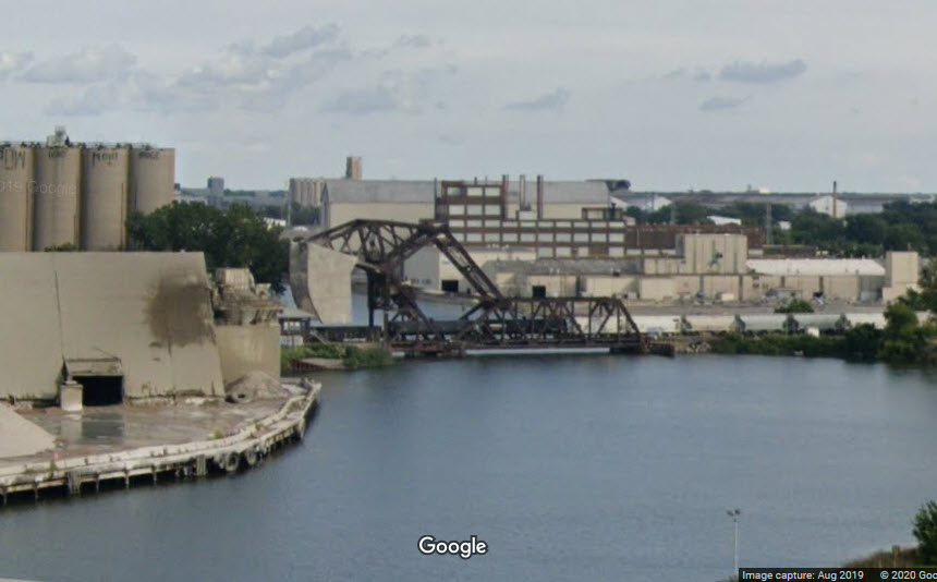
This bridge is known as Bridge 141, because of its length. It is a bascule type bridge and was built in 1914. It is 141 feet long, and is owned by the Delray Connecting Railroad, but used by the Norfolk Southern. The bridge is no longer active as far as "going up", because boating traffic needing more clearance uses the channel on the other side of the island. The Bridge is used by both rail and auto traffic. If we look at the 1904 USGS map below, we notice that the main route the river took to get around Zug Island was on this side of the island.
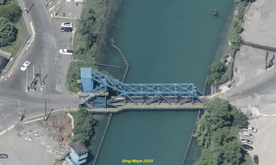
GPS Coordinates: 42.289556, -83.118078
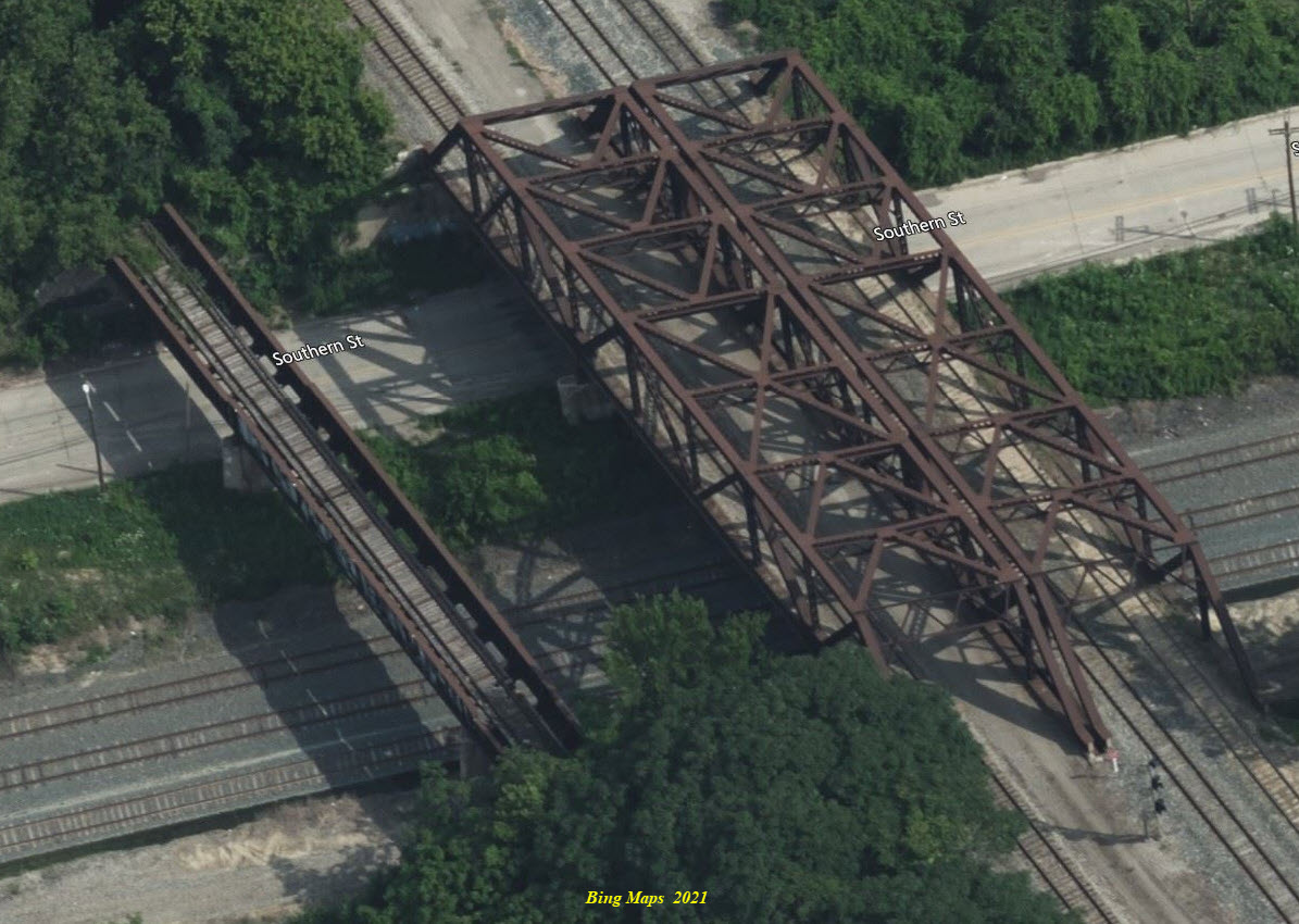
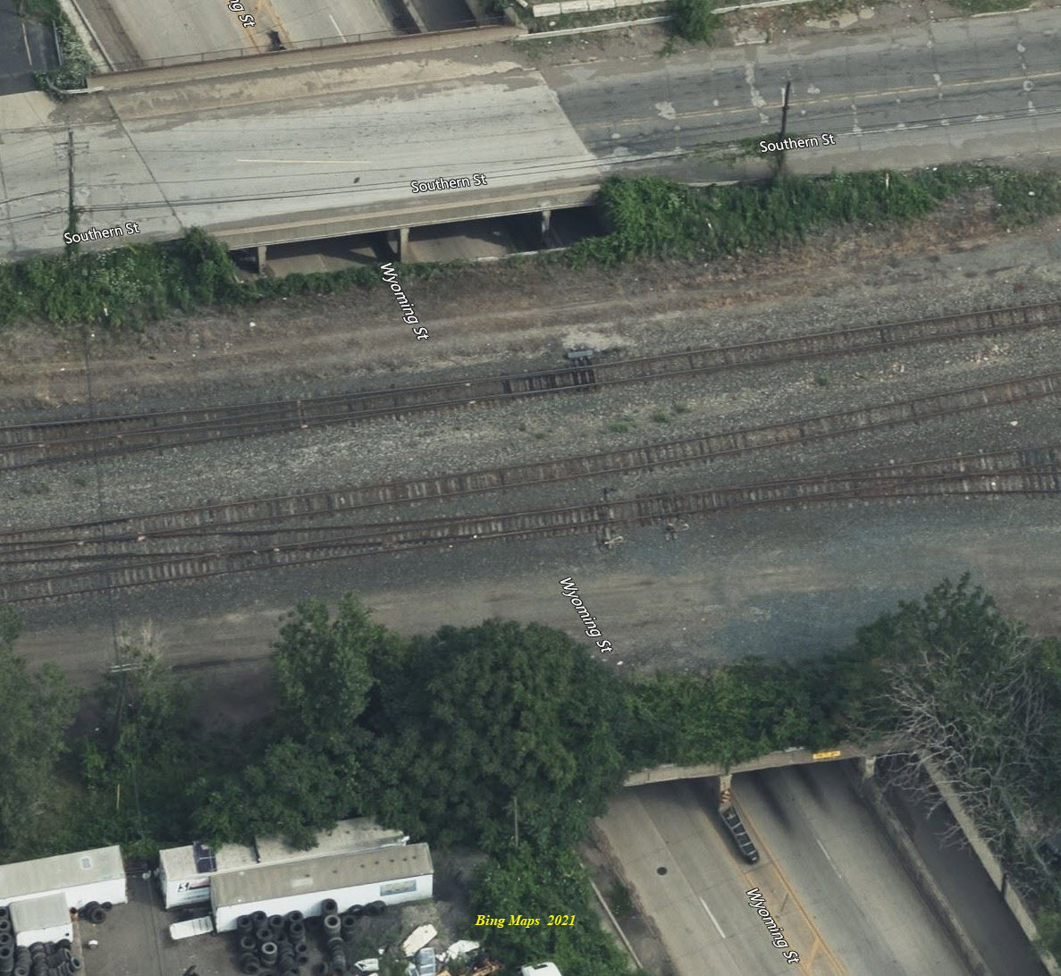
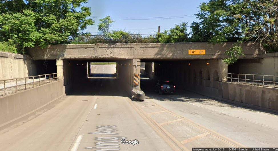
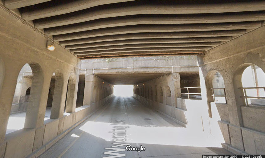
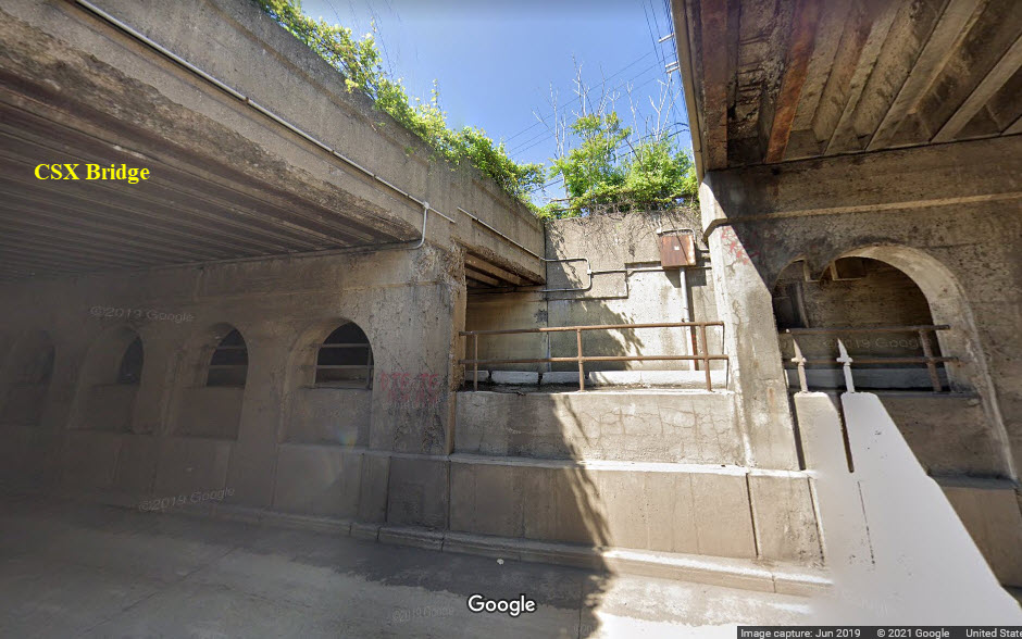
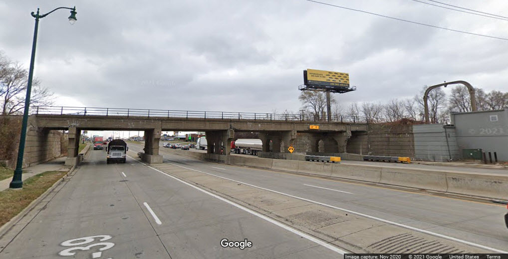
The tracks leading to the swing bridge have been taken up on both sides of the span. At least the bridge seems to still be working, as seen in the two views from Google and Bing, it is shown both open and closed. The bridge is shown on the 1904 USGS map below. It's not too far away from Delray Tower.
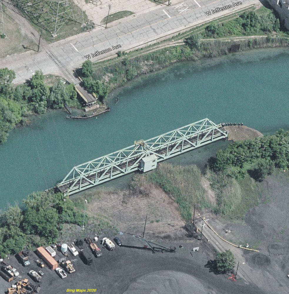
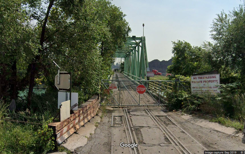
GPS Coordinates: 42.266589, -83.176207
GPS Coordinates: 42.25296, -83.18628
A pair double track girder bridges, filled in, one track removed, with each span going over a four lane road.
 NB side, looking north
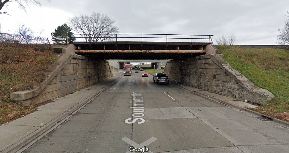 NB side, looking south
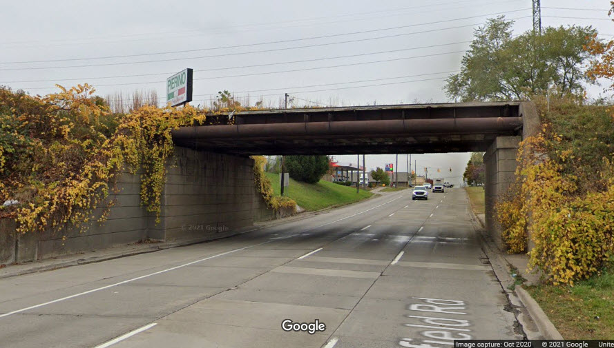 SB side, looking north
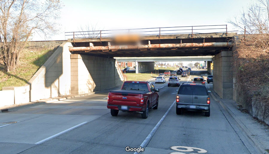 SB side, looking south
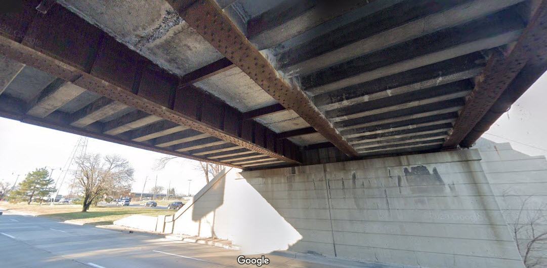 SB side underneath
GPS Coordinates: 42.27460, -83.13904
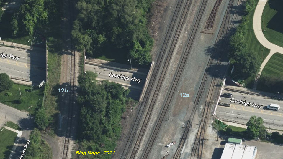
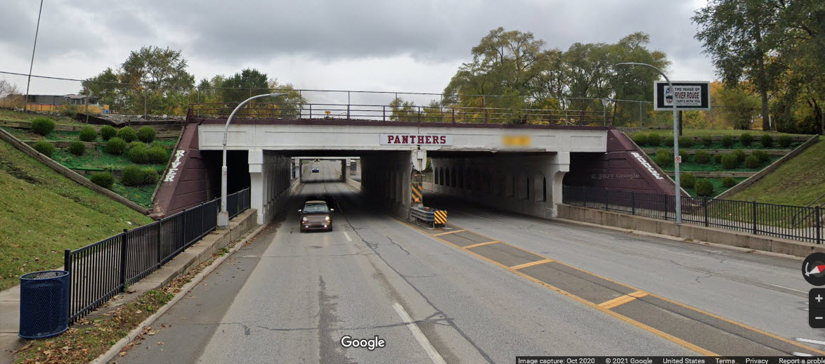
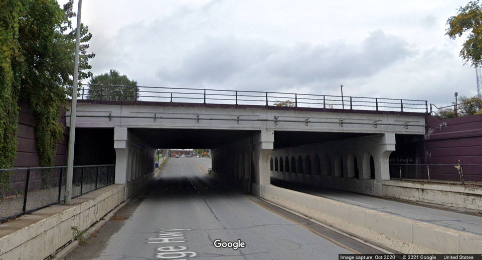
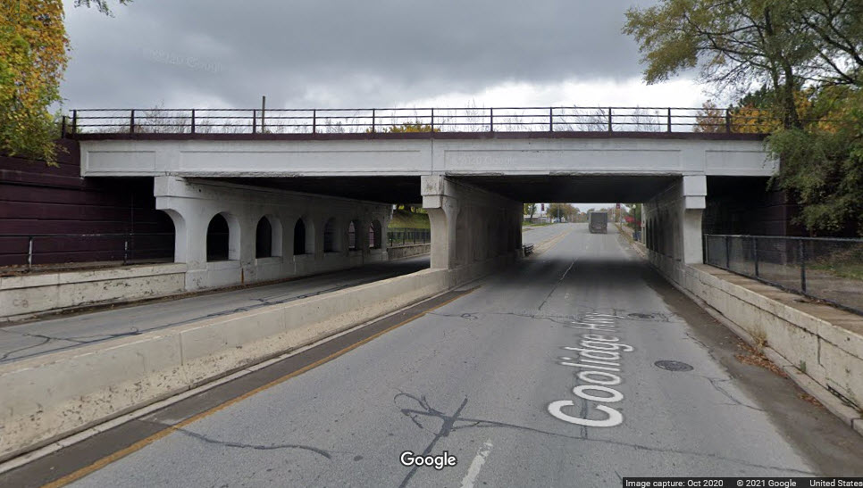
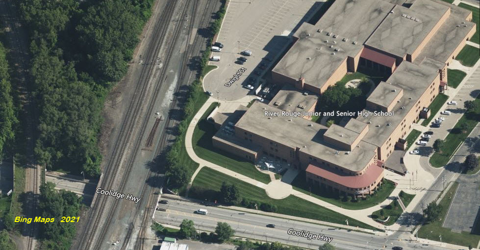
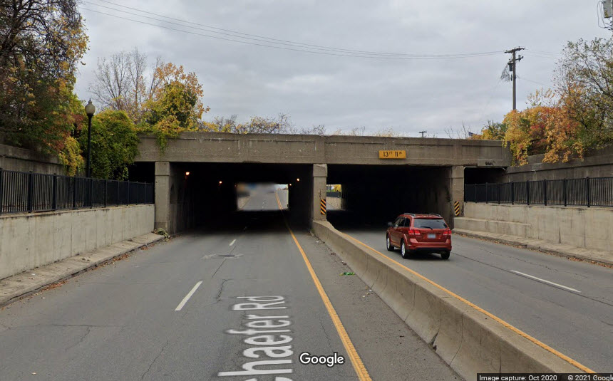
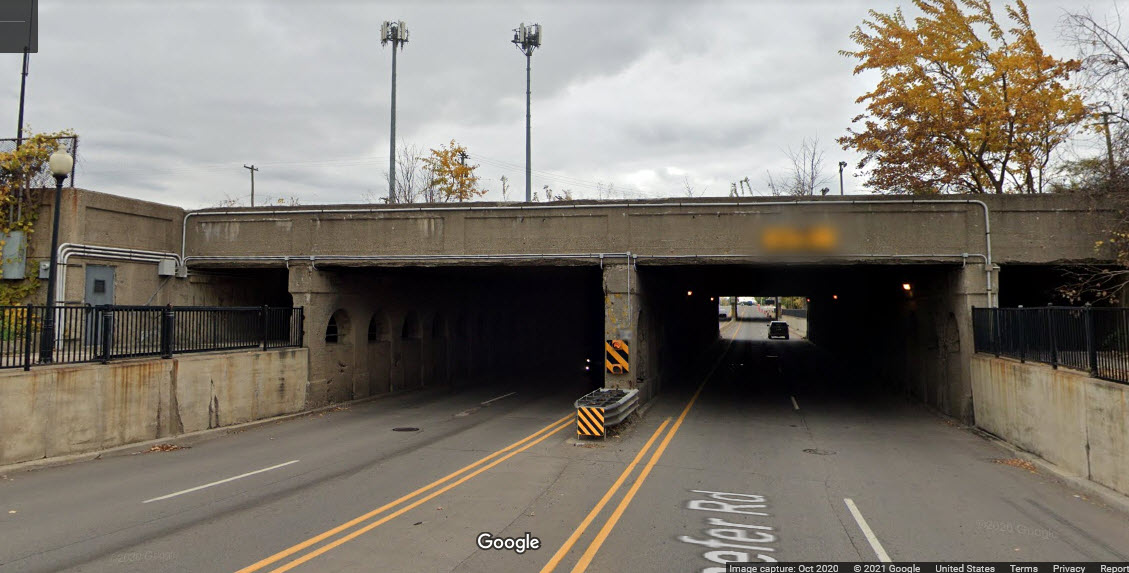
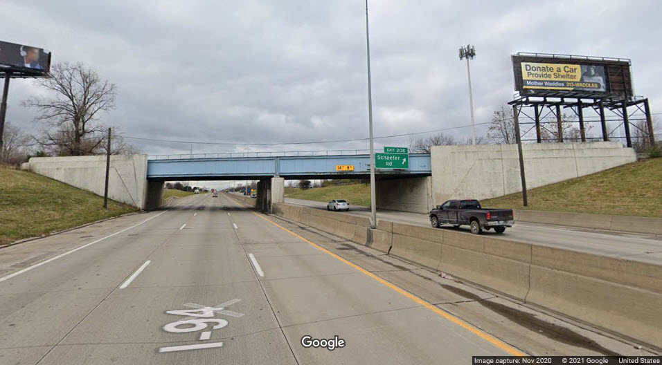
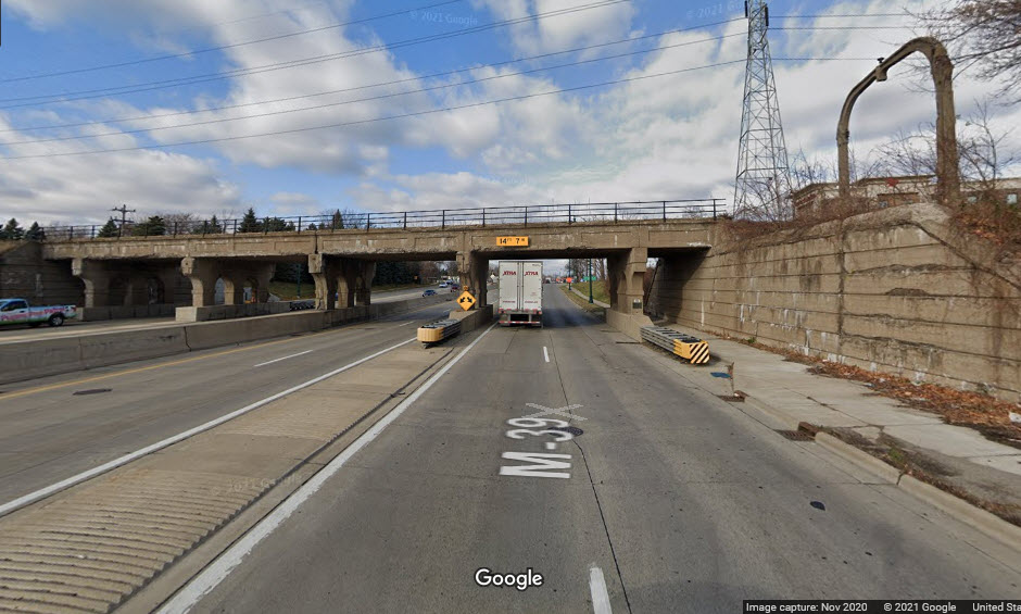
Two spans crossing a four lane Coolidge Hwy here (which turns into Schafer Hwy as you go north from here), steel girder bridges, one was for three tracks (now one), and the other could handle six, maybe seven tracks, but now has five. At the north end of NS's River Rouge yard, AND, adjacent to River Rouge High School - good thing I didn't go to school here, cause I wouldn't have gotten anything done in class if I had a class on track-side :-) :-). And gee, it's the first school I have seen in modern times to use the term "Junior High"!
GPS Coordinates: 42.31853, -83.11121
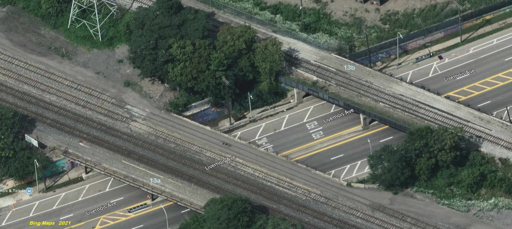
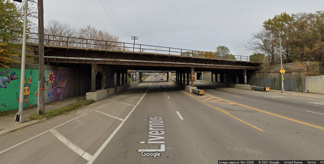
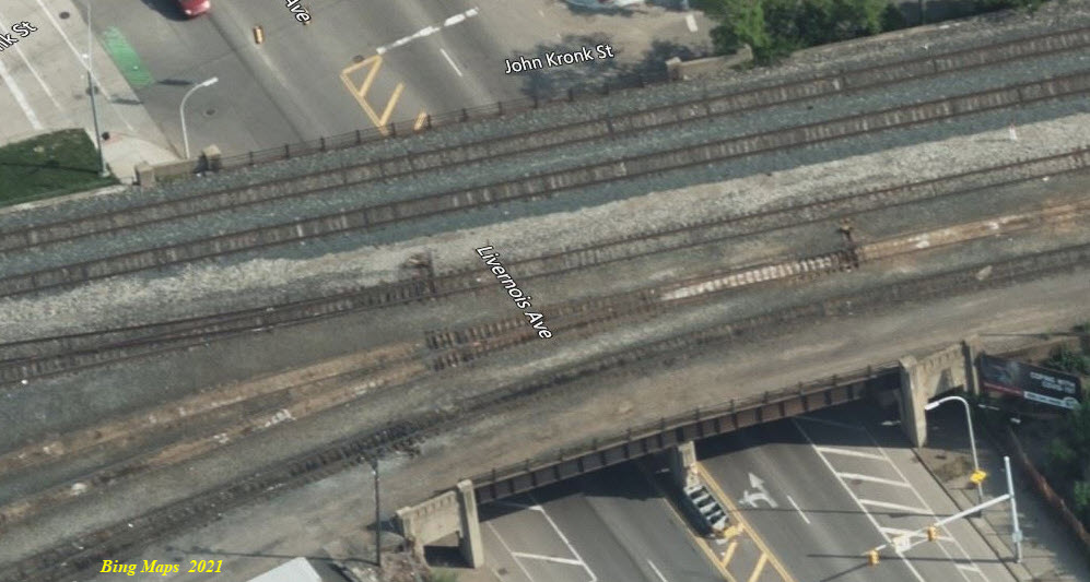
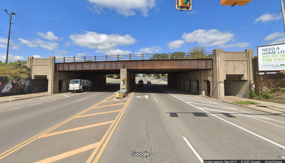
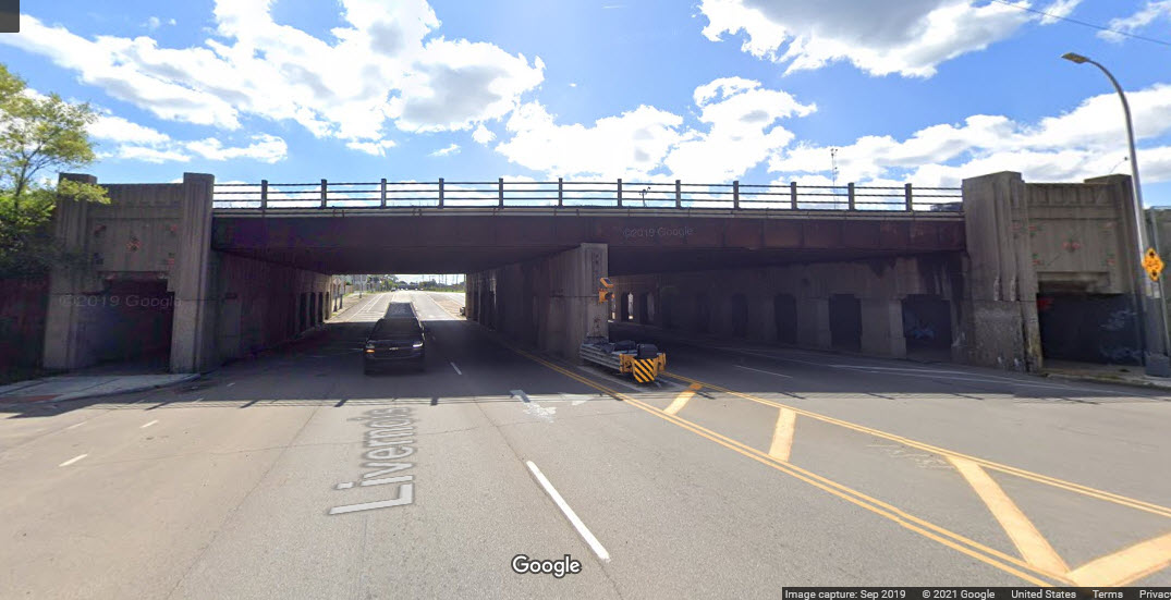
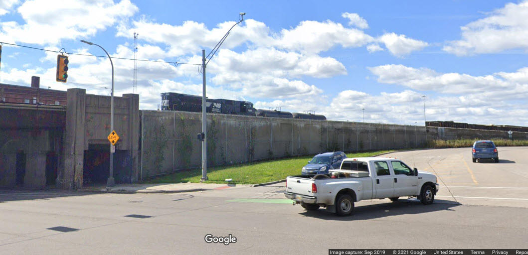
A couple of spans crossing Livernois, the southern span has room for 5 tracks, but only has four, the northern span has room for 3 tracks, but only carries one. The southern span has metal supports, while the northern bridge uses concrete abutments. Both bridges are supported in the middle, so it spans the six lanes of Livernois in two sections.
 Southern span, looking north
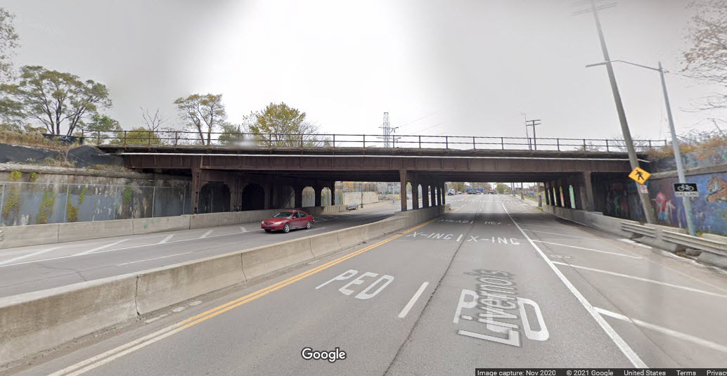 Southern span, looking south
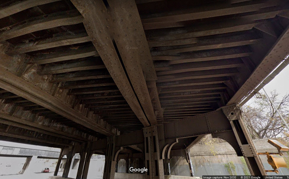 Southern span, underneath
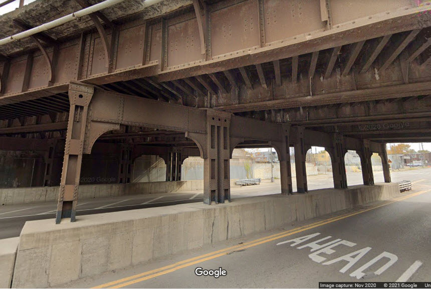 Steel Bridge Supports
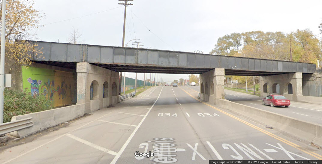 Northern span, looking north
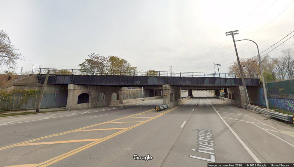 Northern span, looking south
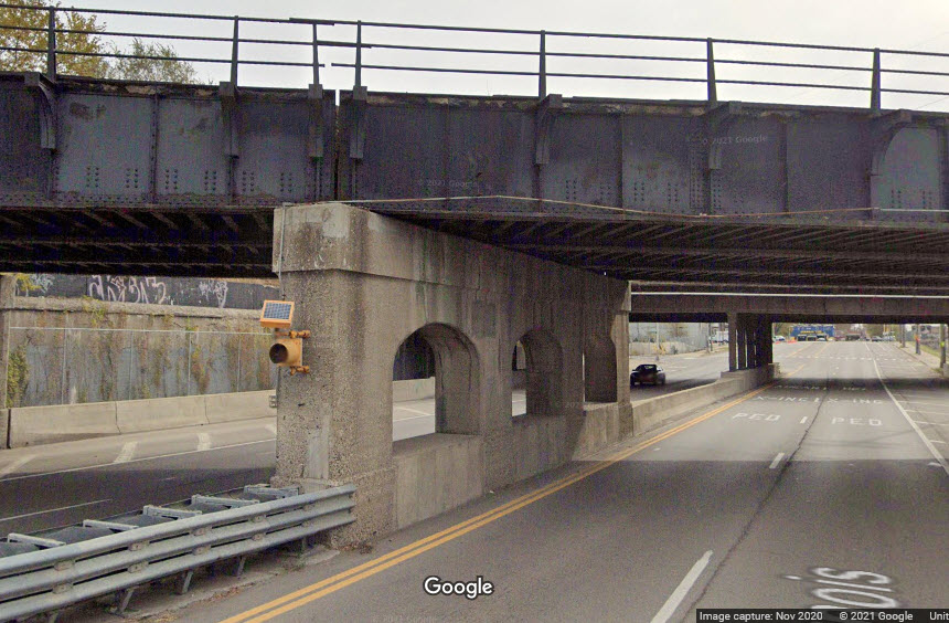 Concrete bridge supports
GPS Coordinates: 42.32410, -83.11524
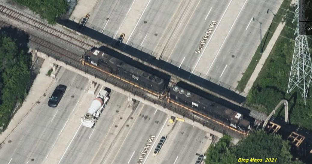
Steel girder bridge, center concrete supported, carrying five tracks over a six lane road (with a small median because of the center support). Abutments at both end are concrete, with sidewalk passthrus.
GPS Coordinates: 42.29758, -83.12598
We actually have a collection of four bridges here, I missed Lawndale when first going over the map, so instead of labeling it 39 or something like that, we just numbered them 15a thru 15d......
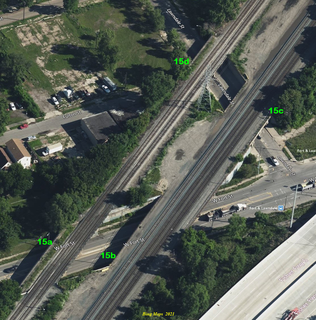
15a over Fort St
15b over Fort St
15c over Lawndale
15d over Lawndale
GPS Coordinates: 42.30043, -83.14788
The "wide" portion is actually seven steel girder bridges if you look at Google Streetview, and another girder bridge for the track going off on an angle. They have concrete abutments, and three concrete supports to allow for a sidewalk on each side, and two lanes of traffic in each direction with a center support.
GPS Coordinates: 42.31560, -83.11350
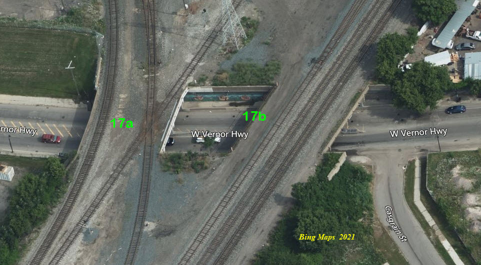
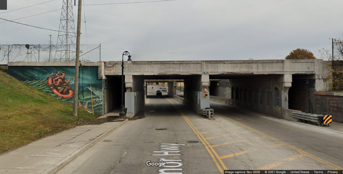 17a looking east
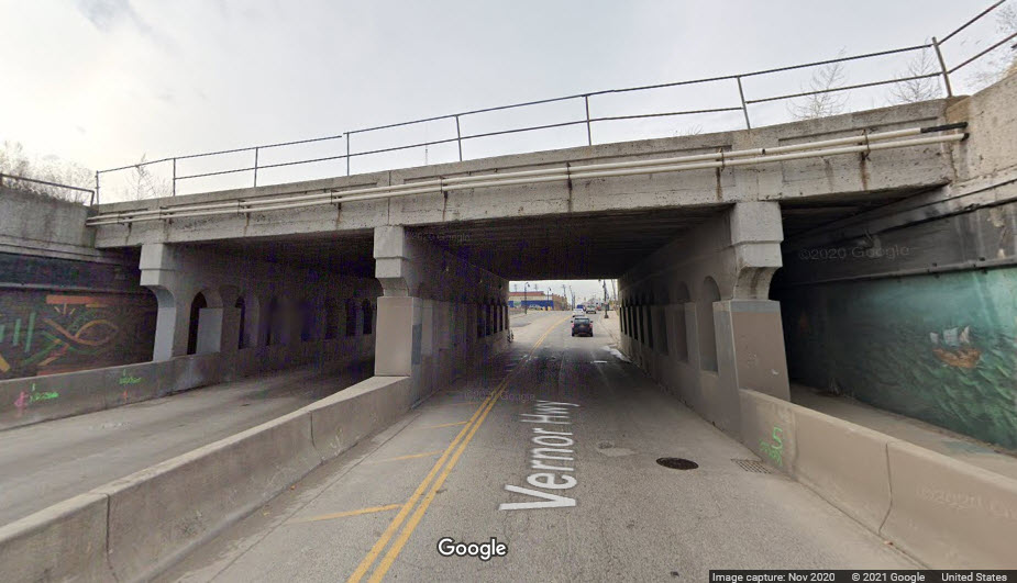 17a looking west
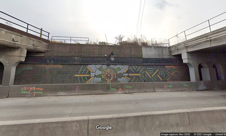 in between the two bridges
 in between the two bridges
 17b looking east
 17b looking west
GPS Coordinates: 42.31760, -83.16032
GPS Coordinates: 42.31799, -83.15762
GPS Coordinates: 42.32248, -83.16385
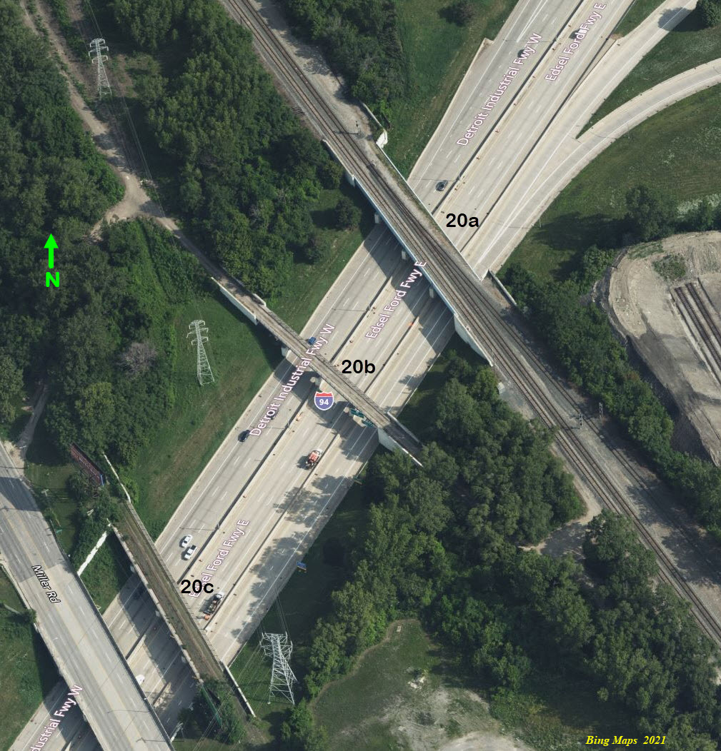
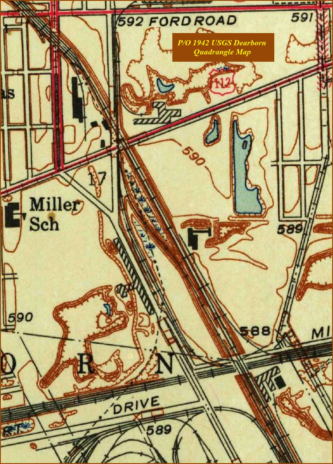
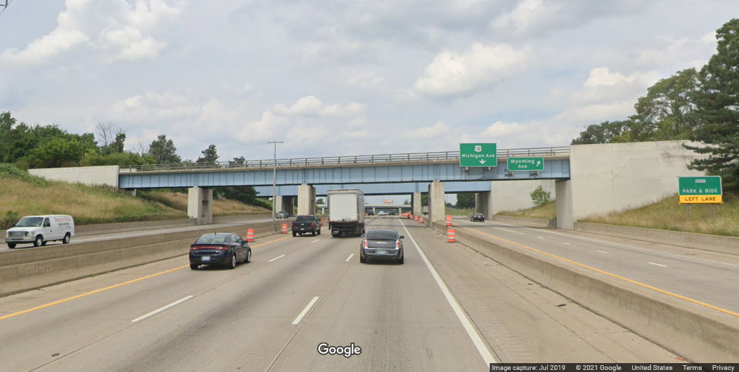
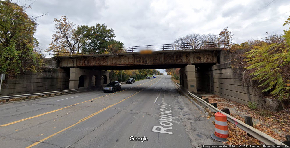
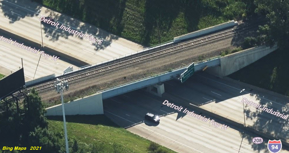
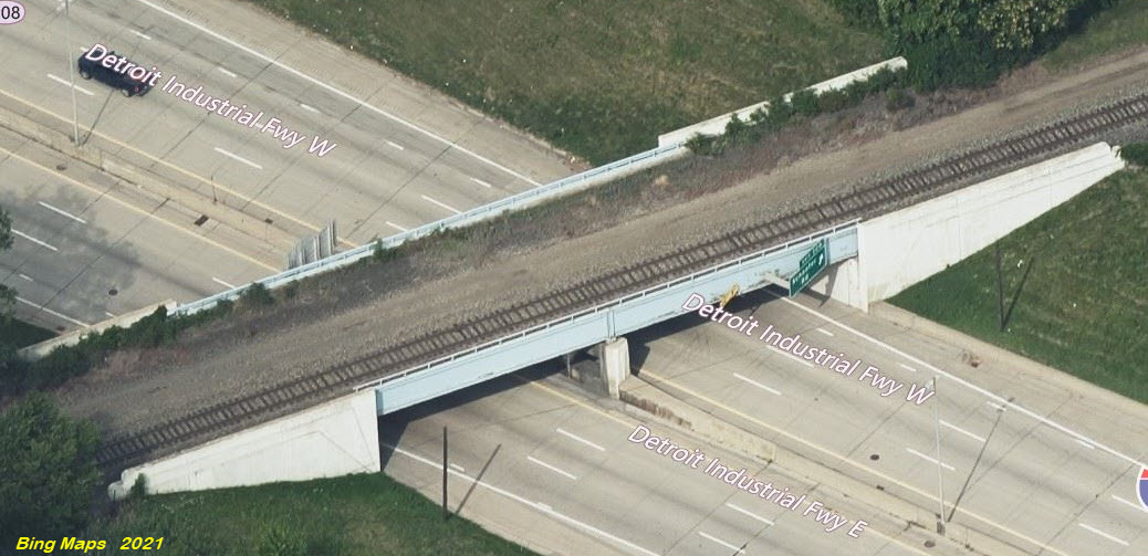
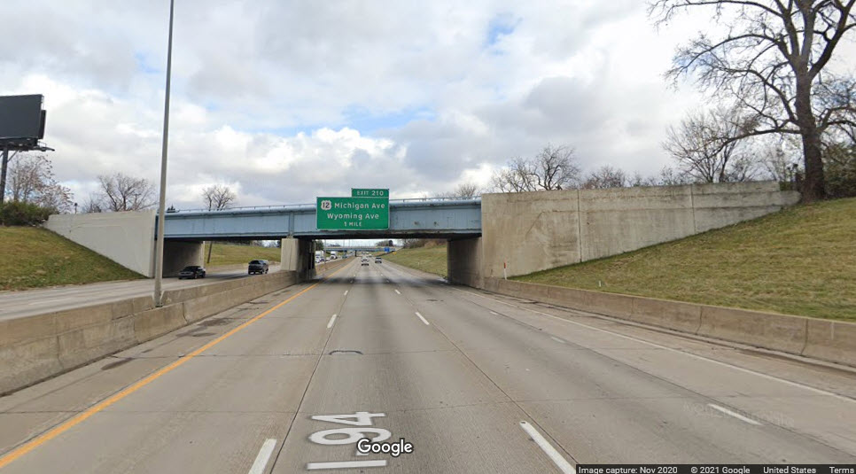
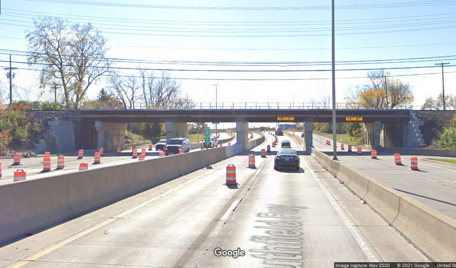
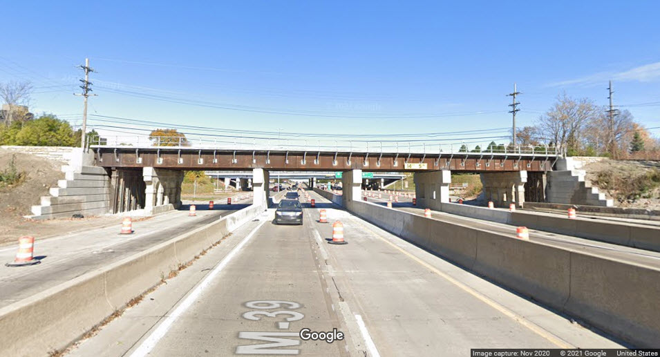
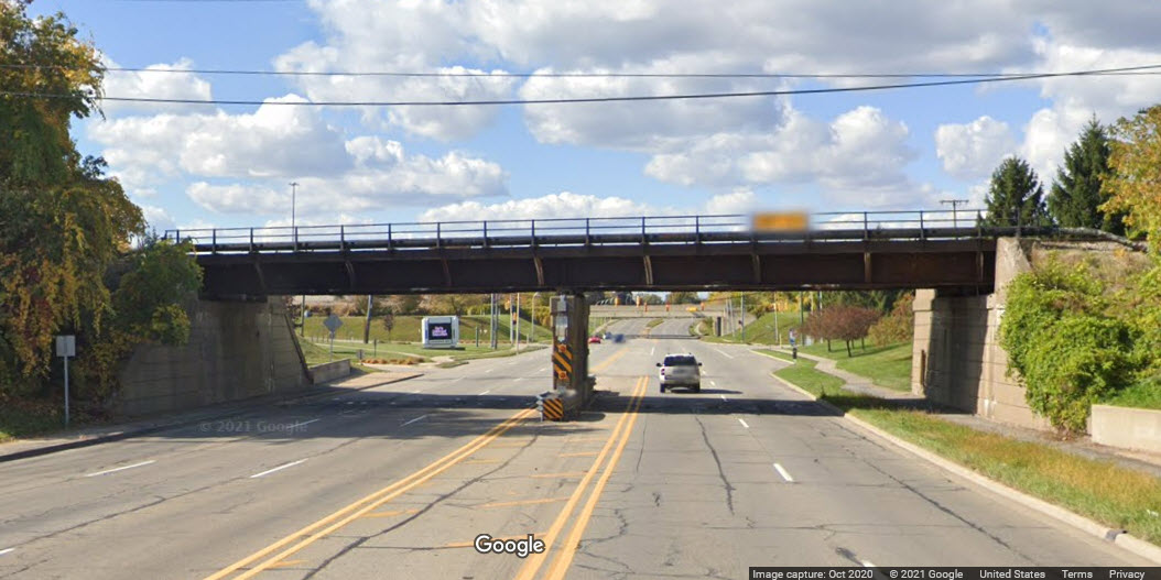
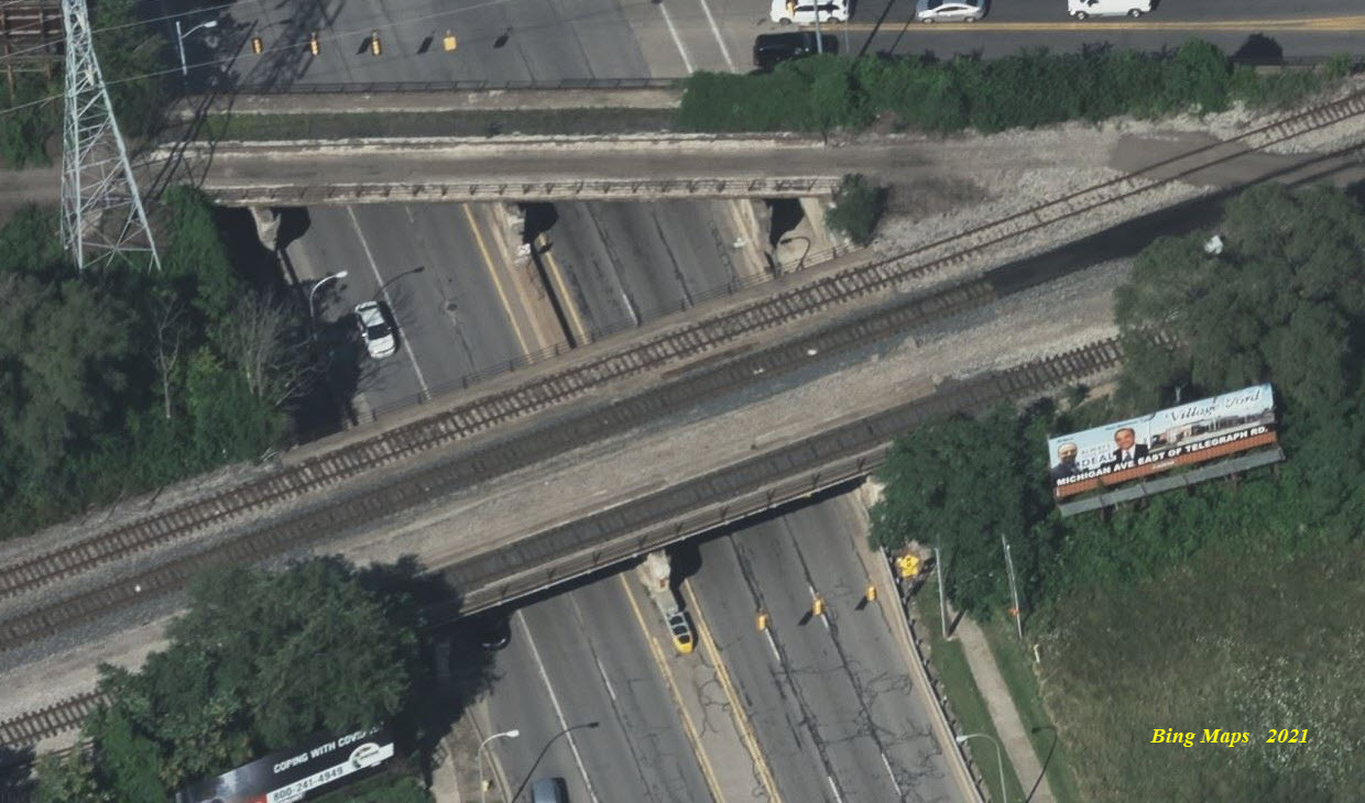
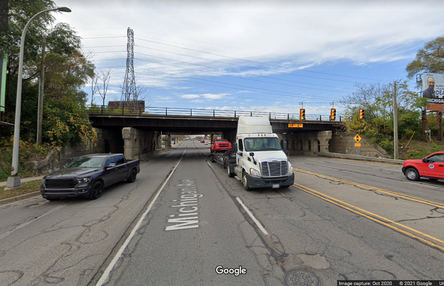
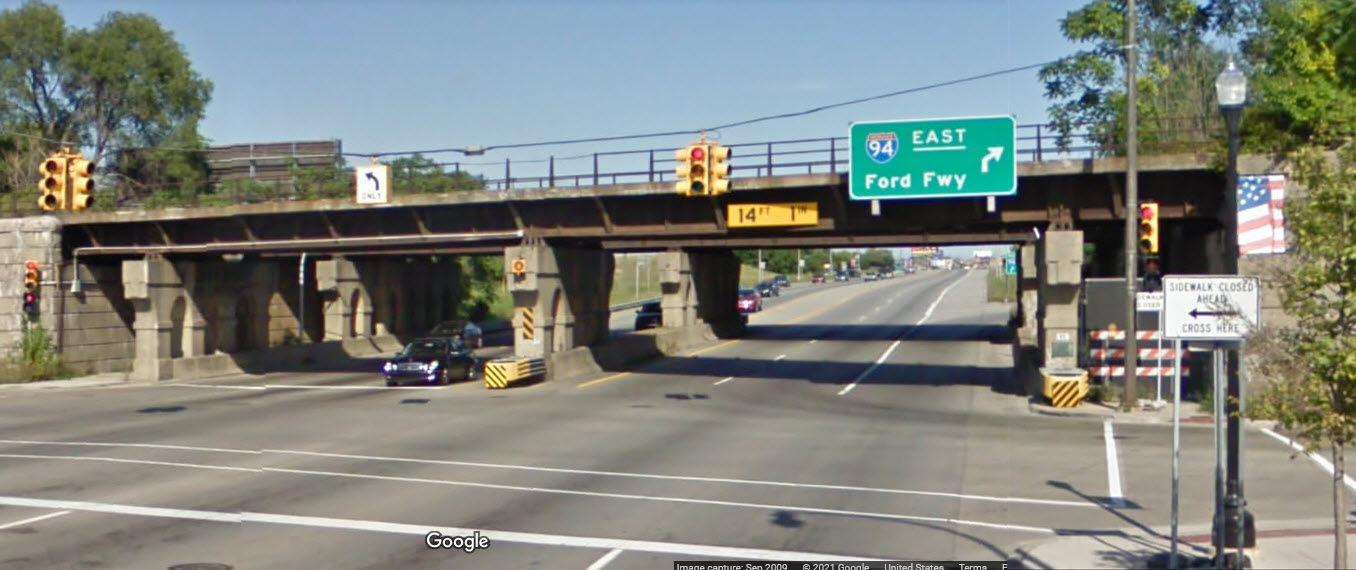
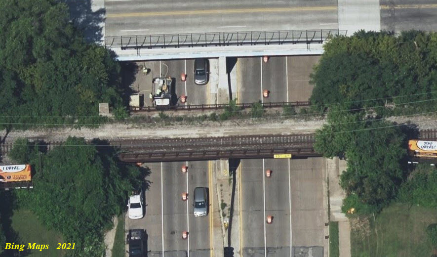
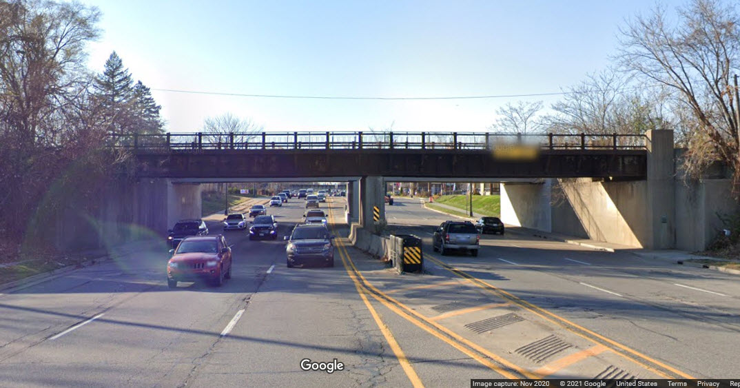
Around the area of where CSX crosses over I-94 and Michigan Avenue, there are eight bridges if we take in the two that go over Ford Road. At location 20, there are actually three bridges that cross I-94, two of which are abandoned. Maybe at some point, they may decide to remove the spans that go over the interstate, but for right now, at least they provide the function of supporting signs for the interstate. Too bad I didn't grow up in Detroit, because the railroad scene here was a lot better than what it was in Baltimore - altho, compared to other locations, Baltimore wasn't all that bad having the B&O, the B&S/NC, the WM, and the Pennsy on the NEC.
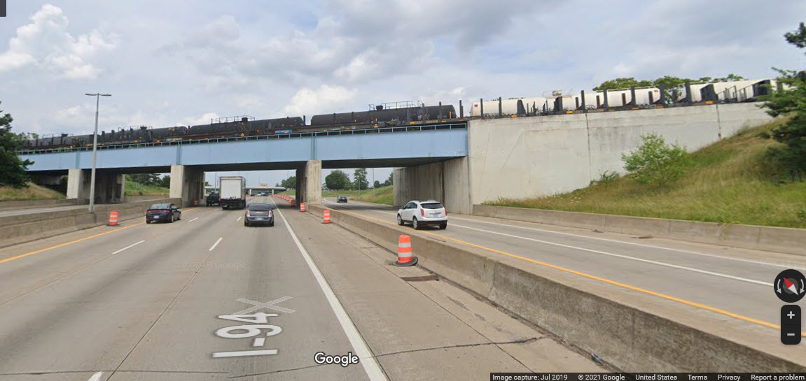 looking north
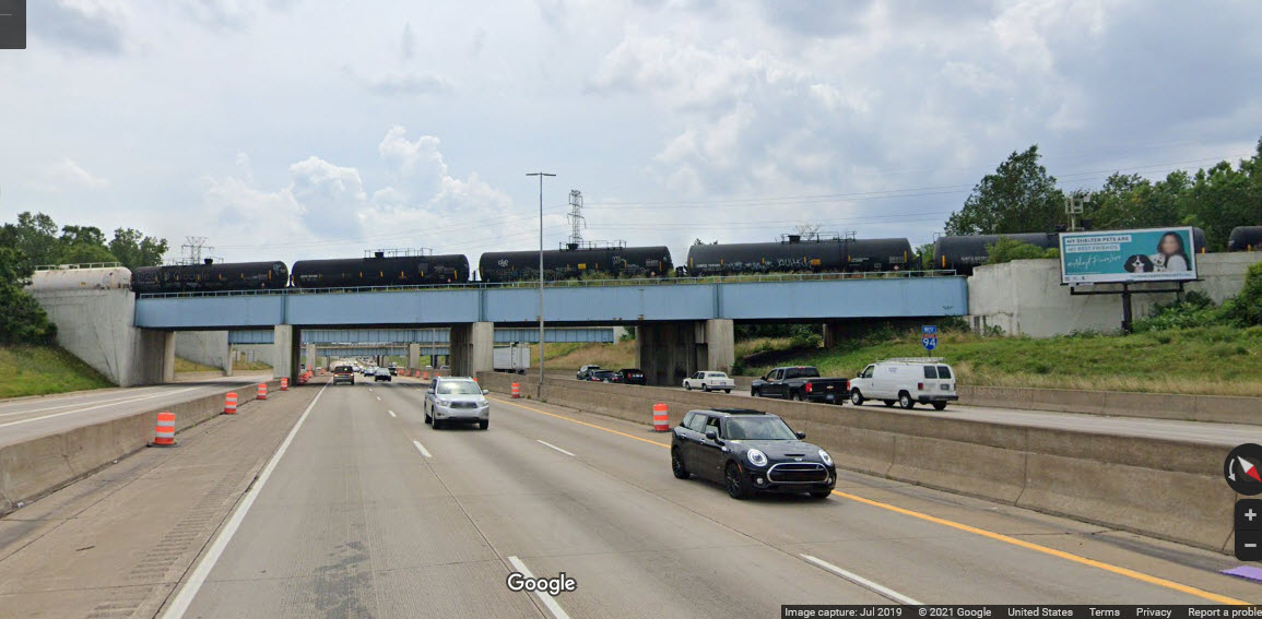 looking south
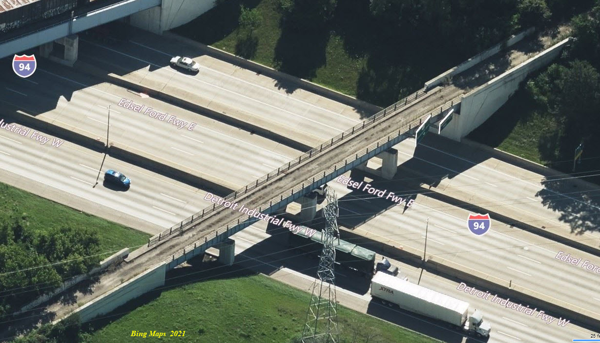
 looking north
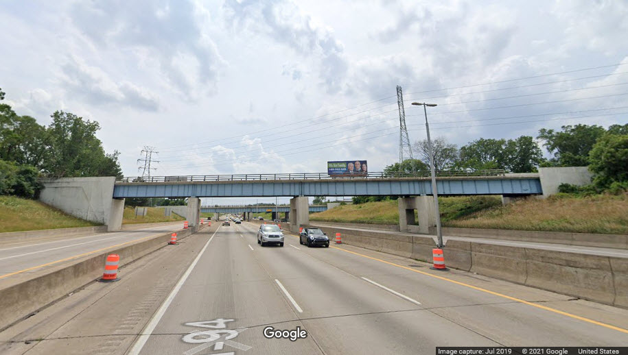 looking south
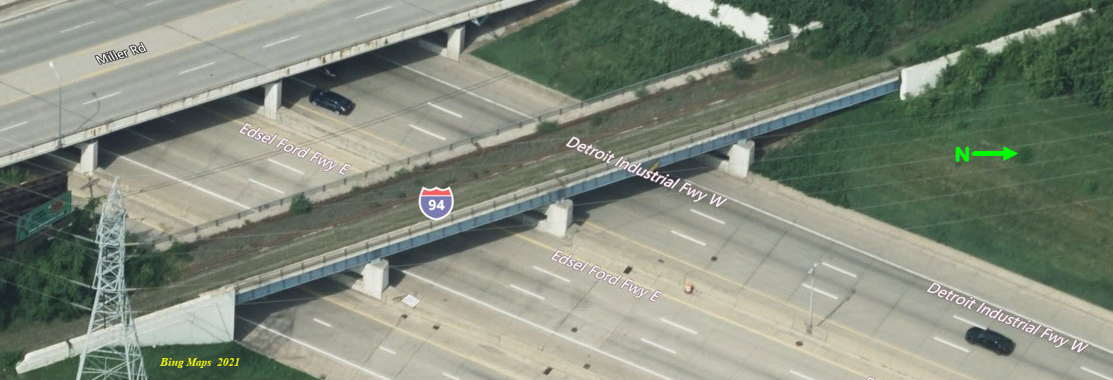
GPS Coordinates: 42.31529, -83.17566
A concrete covered girder bridge with 6 tracks, but has room for maybe 7 more, over a 4 land road.
GPS Coordinates: 42.31296, -83.19239
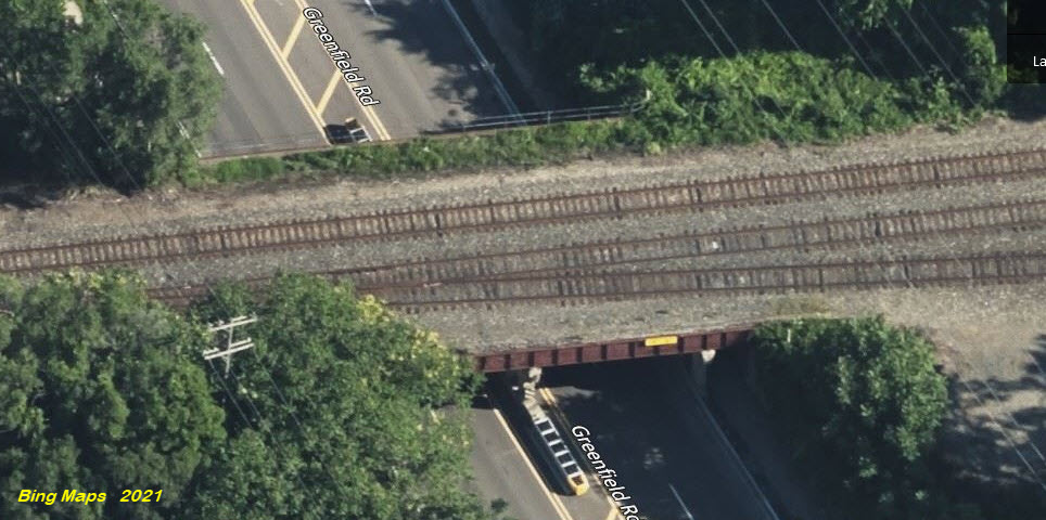
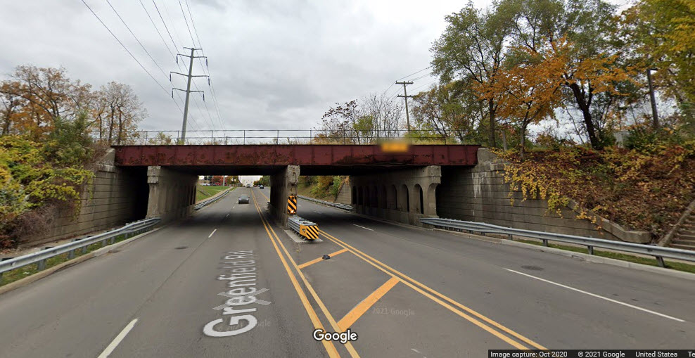
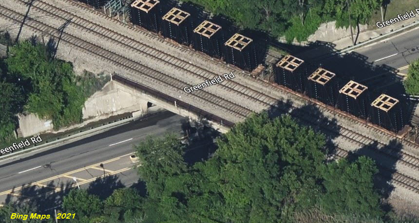
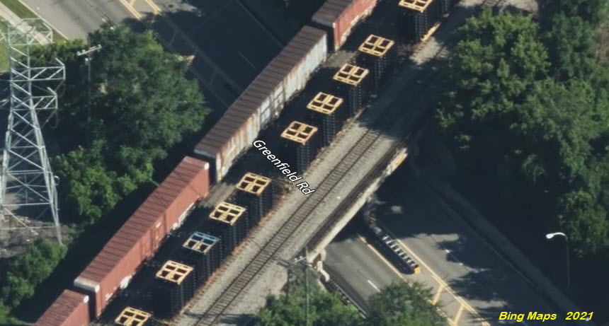
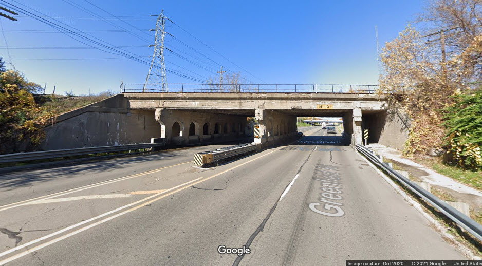
Steel girder bridge spanning 4-1/2 lanes of Greenfield Rd, carrying three tracks on top. Concrete abutments that are part of a retaining wall, with three concrete supports, and a sidewalk on each side of the street.
GPS Coordinates: 42.30885, -83.17981
Steel girder bridge with a single track, but capable of handling three. Concrete abutments with two concrete supports, going over 5 lanes and two sidewalks.
GPS Coordinates: 42.30602, -83.17777
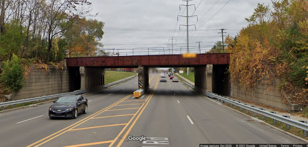
Steel girder bridge carrying a single track but built for three, it spans six lanes of the interstate with a center support. Concrete abutments and center support.
GPS Coordinates: 42.29809, -83.18172
It appears to be a concrete covered steel girder bridge handling four tracks, spanning four lanes of traffic with a center support. There are three concrete supports, concrete abutments, and a sidewalk on each side of Greenfield Rd.
GPS Coordinates: 42.29515, -83.18416
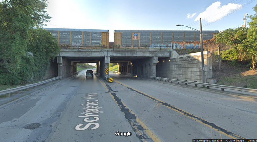
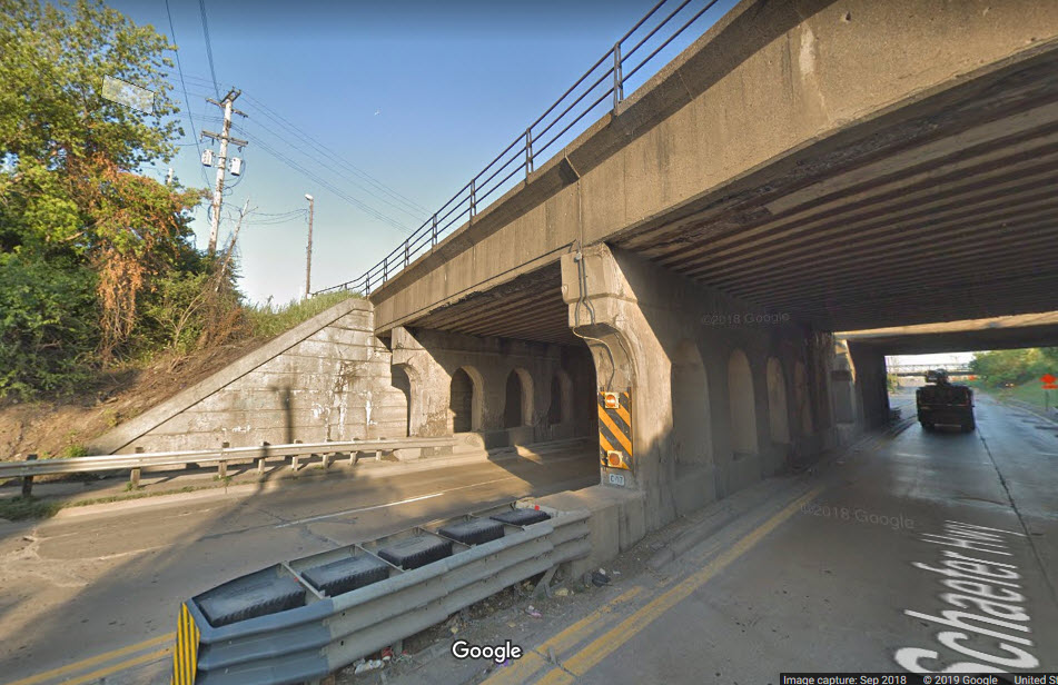
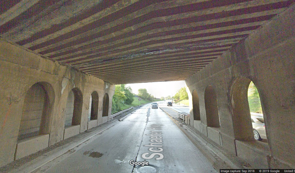
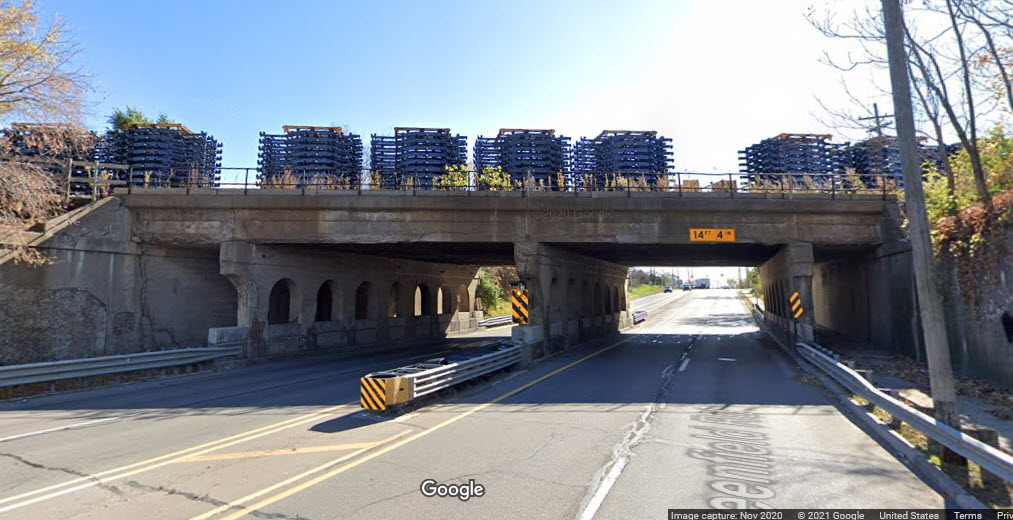
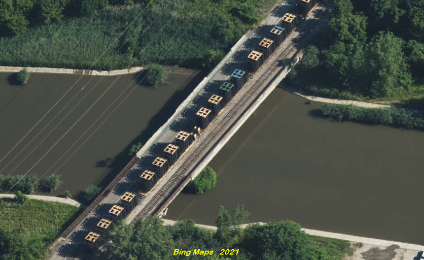
Just south of CN's Schafer Yard, it can handle four tracks, but now carries three. The odd looking loads with yellow, blue, and green tops are car chassis'.
GPS Coordinates: 42.30972, -83.21483
Steel girder bridge carrying two tracks over an eight lane road.
GPS Coordinates: 42.30872, -83.22185
GPS Coordinates: 42.28393, -83.19359
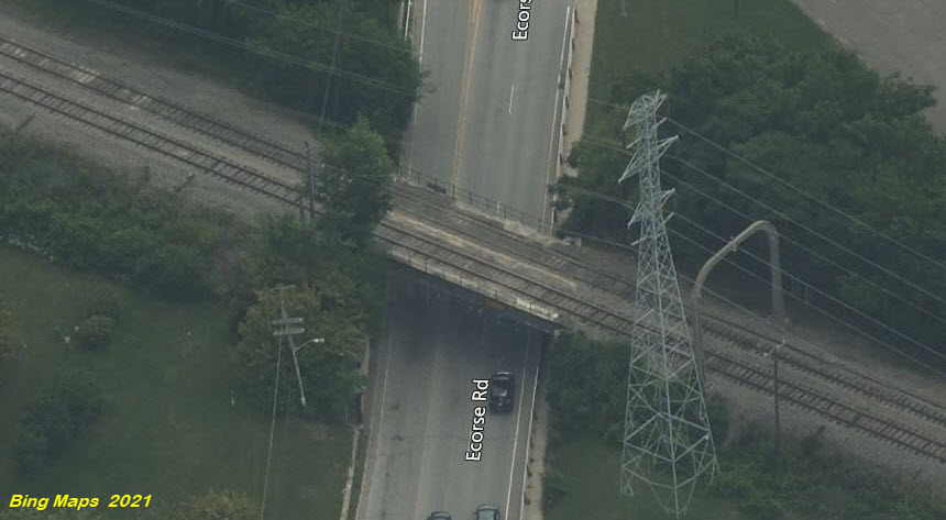
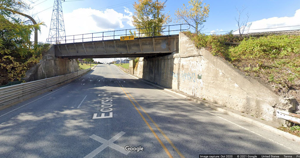
Concrete covered steel girder bridge with two tracks over two lane road.
GPS Coordinates: 42.27533, -83.20074
Steel girder bridge with two tracks over a four lane road.
GPS Coordinates: 42.26101, -83.21265
Steel girder bridge carrying two tracks over 8 road lanes.
GPS Coordinates: 42.25675, -83.21629
Steel girder bridge carrying two tracks over a two lane road.
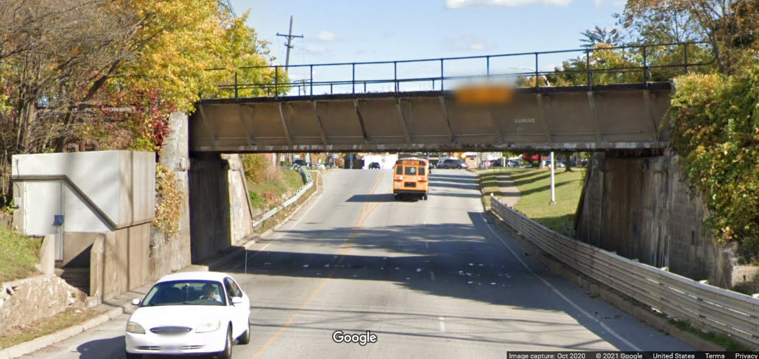
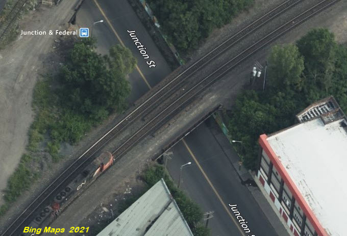
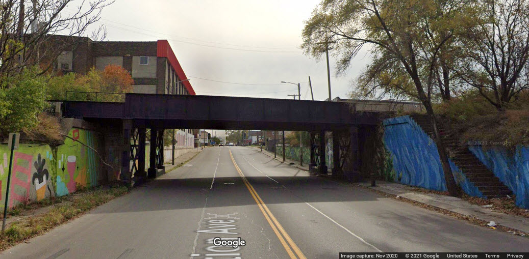
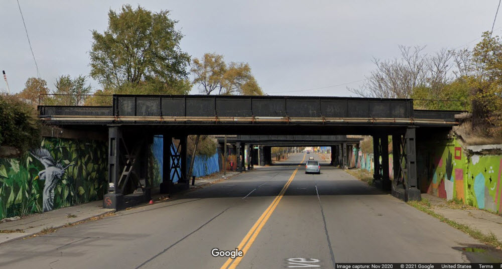
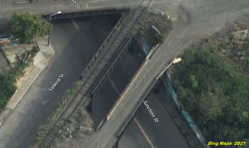
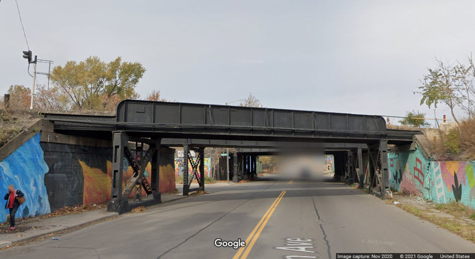
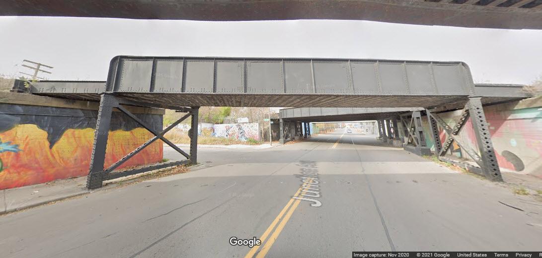
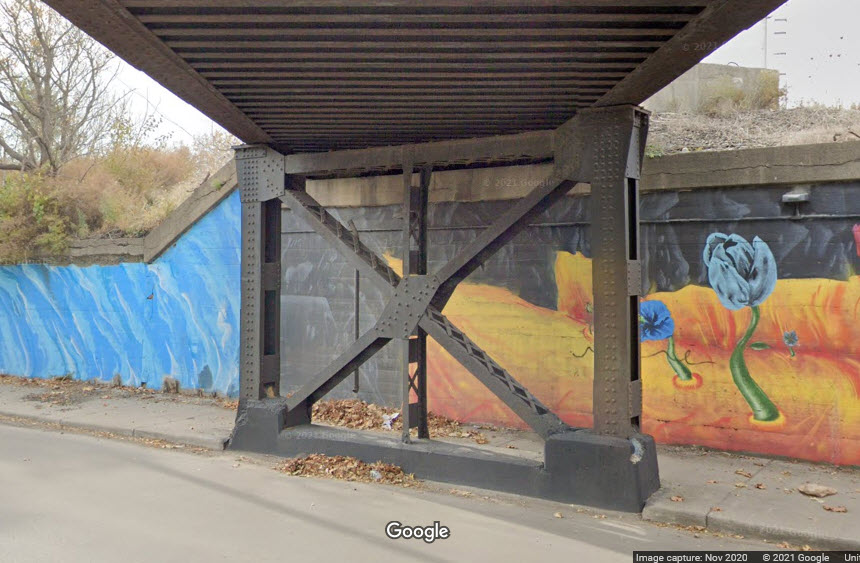
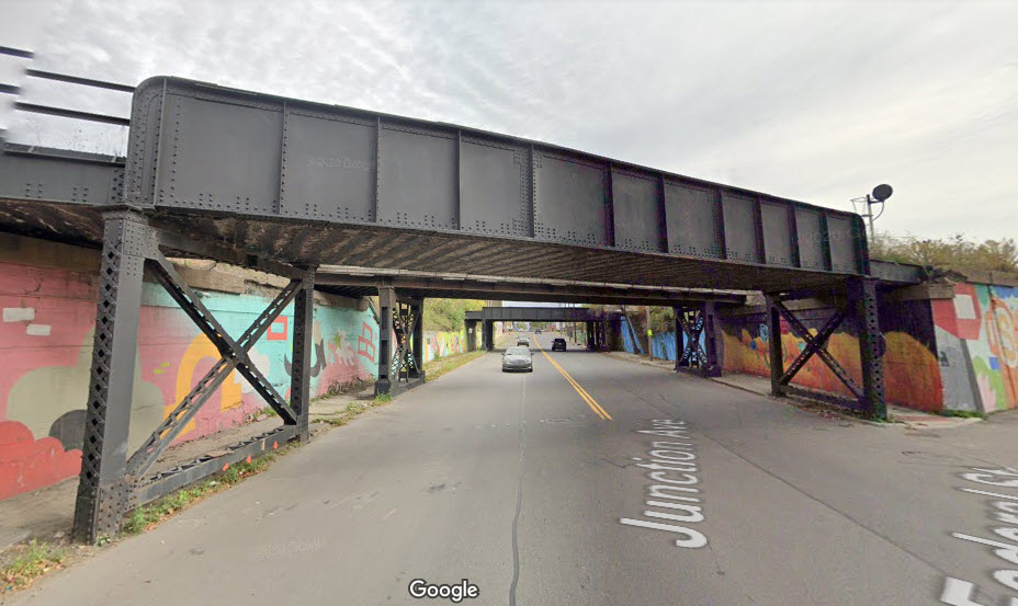
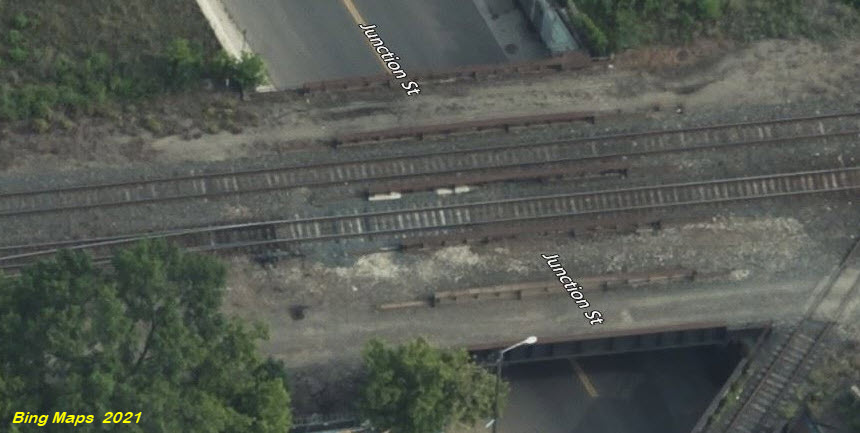
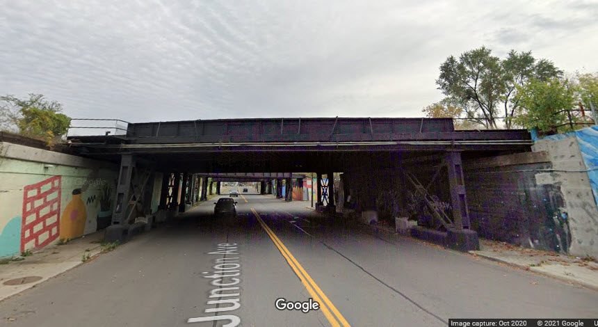
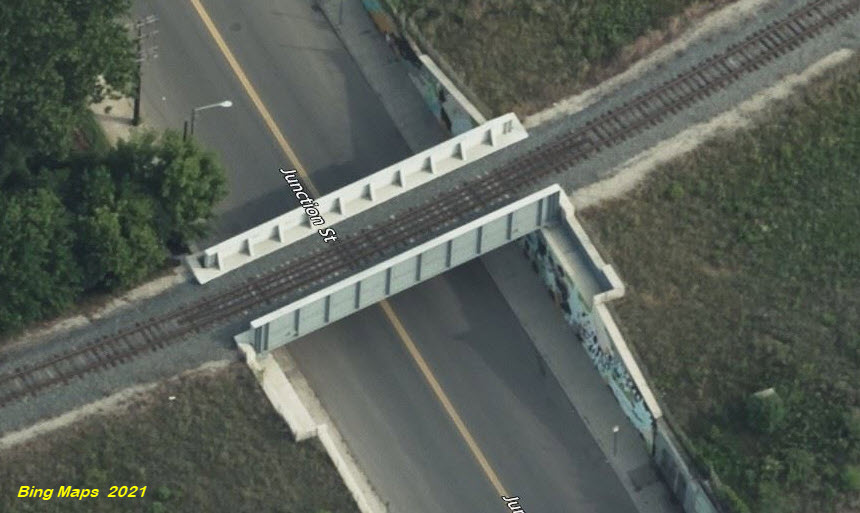
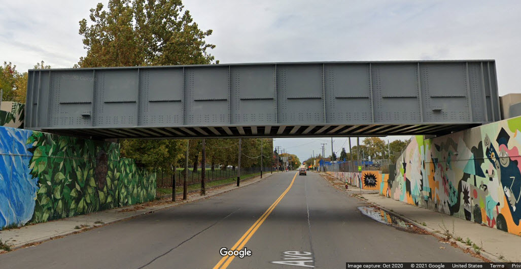
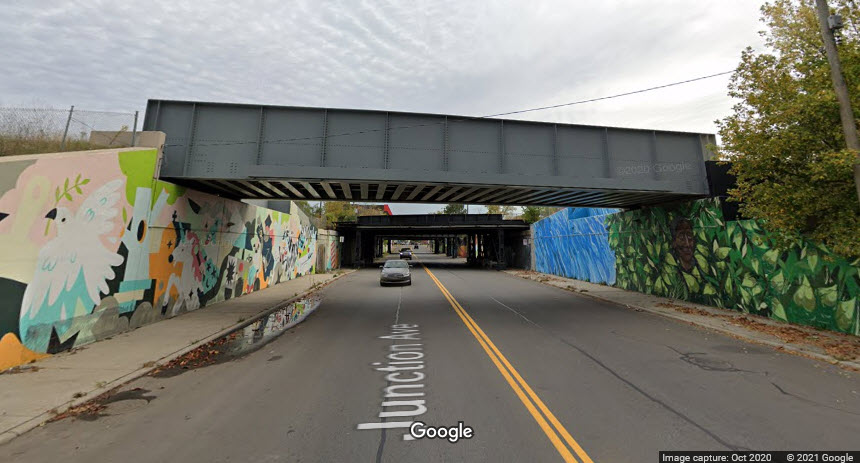
There are four bridges going over Junction Ave here, all in very close proximity, so I grouped them as 33a, 33b, 33c, and 33d.

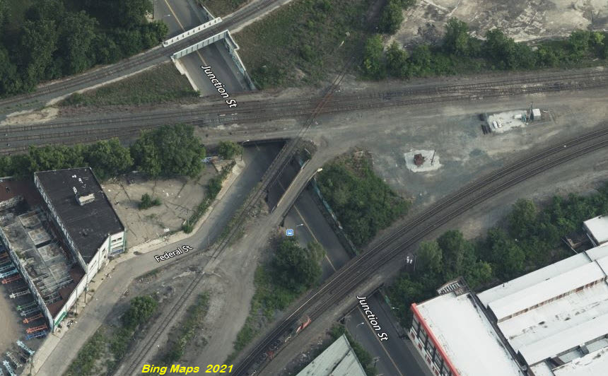
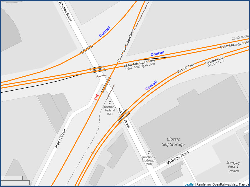
GPS Coordinates: 42.32462, -83.10673
Steel girder bridge carrying 2 tracks, used to be 3, over a two lane road.
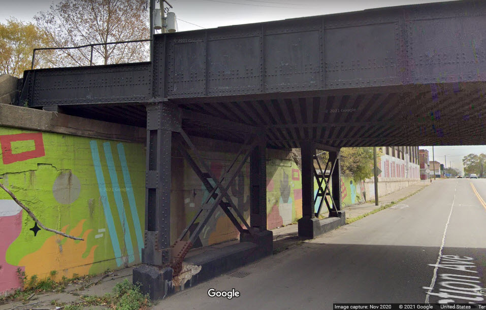
GPS Coordinates: 42.32504, -83.10705
Two single track steel girder bridges each carrying one track, one has been abandoned.
GPS Coordinates: 42.32524, -83.10720
Steel girder bridge that used to carry 5 tracks, but only 2 are left.
GPS Coordinates: 42.32555, -83.10740
Steel girder bridge carrying one track, the only one of different design of the four at this location.
Bridges 34, 35, 36:
Recent adds.....
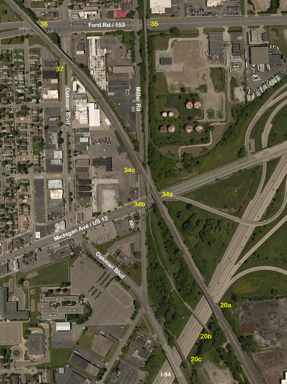
GPS Coordinates: 42.32513, -83.16570.
There are three bridges at this location, two active on the CSX line, the other is not.
Steel girder bridge, 3 tracks over a 6 lane road with 2 sidewalks, concrete abutments, and 3 concrete supports.
 looking west
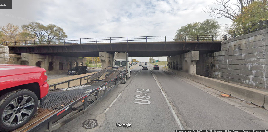 looking east
GPS Coordinates: 42.32505, -83.16604.
Steel girder bridge, single track that is no longer there, over a 6 lane road + median with 2 sidewalks, concrete abutments, and 3 concrete supports.
 looking east
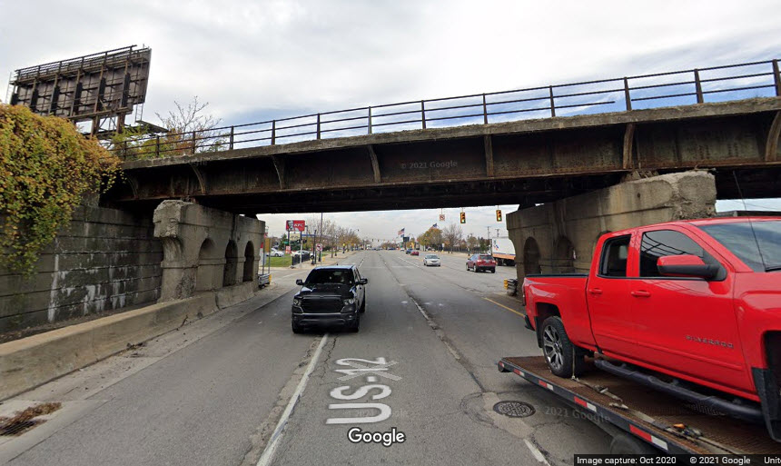 looking west
 looking west, kinda, sorry the truck is in the way...
GPS Coordinates: 42.32591, -83.16629.
Steel girder bridge, 2 tracks but can handle 3, over a 2 lane road with 1 sidewalk, concrete abutments, 3 concrete supports.
 looking north
 looking south
GPS Coordinates: 42.32965, -83.16613
Steel girder bridge 1 track with room for 2, over 6 lane road + median and 2 non-separated sidewalks, concrete abutments with one central concrete support.
 looking west
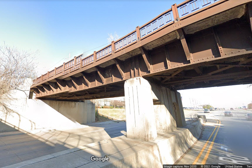 looking east
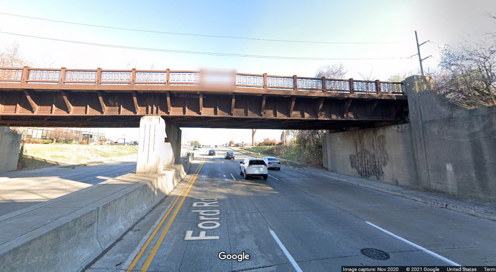 looking east
GPS Coordinates: 42.32961, -83.17009
Steel girder bridge, carries 2 tracks but can handle 4, over 8 lanes of road + median with 2 non-separated sidewalks, concrete abutments and 1 concrete support.
 looking west
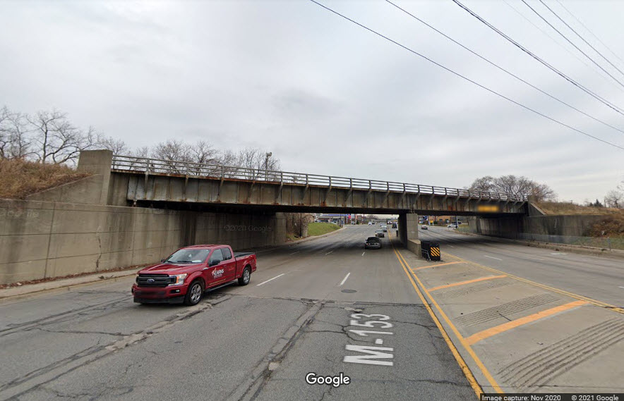
GPS Coordinates: 42.32875, -83.16896
Steel girder bridge, carries 2 tracks but can handle 4, over 4 land road with wide median and 2 separated sidewalks, concrete abutments with three concrete support.
 looking north
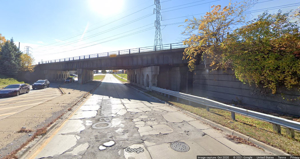 looking south
What I have on the variety of railroad bridges that exist has now been moved to this page: https://www.railroadsignals.us/railroadbridges/index.htm.
Disclaimers:
I love trains, and I love signals. I am not an expert. My webpages reflect what I find on the topic of the page. This is something I have fun with while trying to help others.
Please Note: Since the main focus of my two websites is railroad signals, the railfan guides are oriented towards the signal fan being able to locate them. For those of you into the modeling aspect of our hobby, my indexa page has a list of almost everything railroad oriented I can think of to provide you with at least a few pictures to help you detail your pike.
If this is a railfan page, every effort has been made to make sure that the information contained on this map and in this railfan guide is correct. Once in a while, an error may creep in :-)
My philosophy: Pictures and maps are worth a thousand words, especially for railfanning. Text descriptions only get you so far, especially if you get lost or disoriented. Take along good maps.... a GPS is OK to get somewhere, but maps are still better if you get lost! I belong to AAA, which allows you to get local maps for free when you visit the local branches. ADC puts out a nice series of county maps for the Washington DC area, but their state maps do not have the railroads on them. If you can find em, I like the National Geographic map book of the U.S..... good, clear, and concise graphics, and they do a really good job of showing you where tourist type attractions are, although they too lack the railroads. Other notes about specific areas will show up on that page if known.
Aerial shots were taken from either Google or Bing Maps as noted. Screen captures are made with Snagit, a Techsmith product... a great tool if you have never used it!
By the way, floobydust is a term I picked up 30-40 years ago from a National Semiconductor data book, and means miscellaneous and/or other stuff.
Pictures and additional information is always needed if anyone feels inclined to take 'em, send 'em, and share 'em, or if you have something to add or correct.... credit is always given! Please be NICE!!! Contact info is here
Beware: If used as a source, ANYTHING from Wikipedia must be treated as being possibly being inaccurate, wrong, or not true.
DETROIT RAILFAN GUIDE HOME
RAILFAN GUIDES HOME
RAILROAD SIGNALS HOME
NEW JUL31/2021, AUG04/21/22/24/26/27/28/2021, SEP05/2021
Last Modified 05-Sep-2021