In General
Getting Here
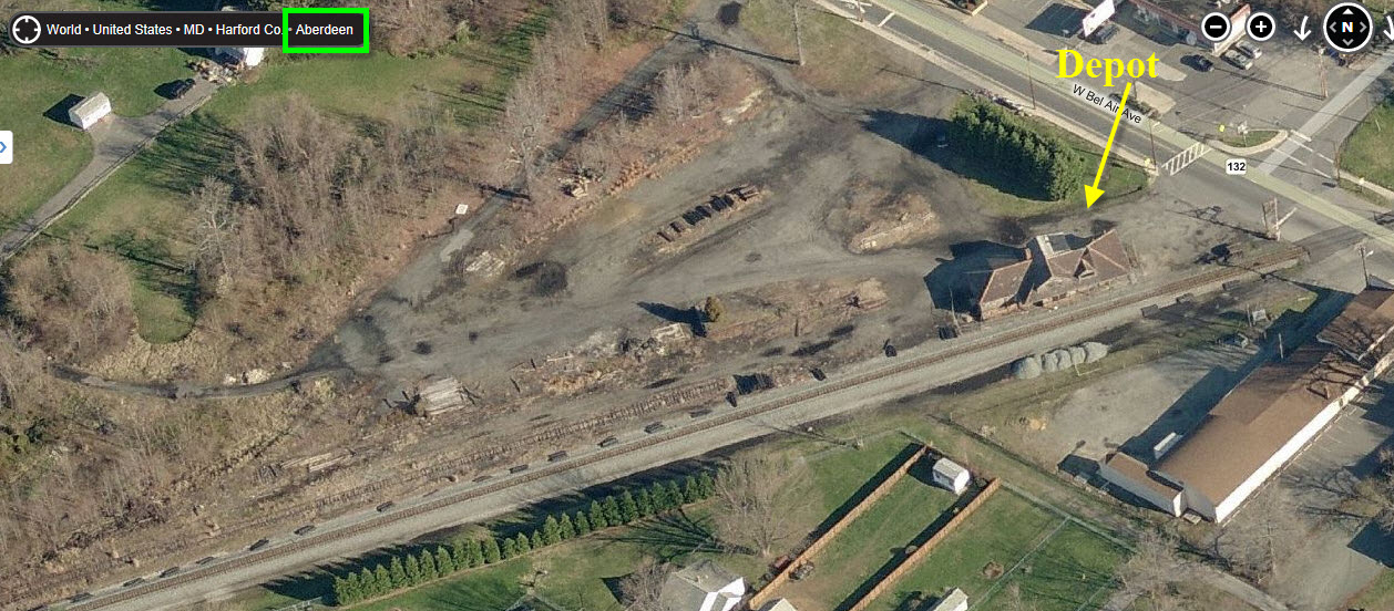
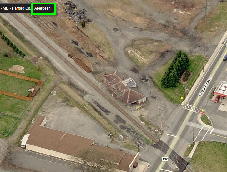
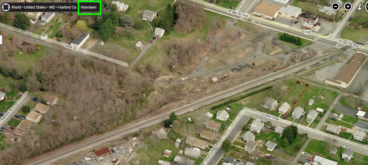
Map
Sights
Pictures
Signals
Fire & Police
Floobydust
USGS Maps
RAILFAN GUIDES HOME
RAILROAD SIGNALS HOME
Aberdeen
Havre de Grace MD
Perryville MD
These three towns are very close to each other along RT 40 East
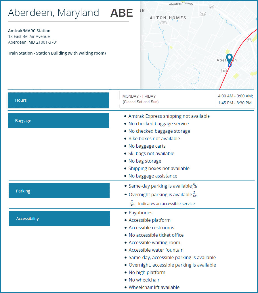
Location / Name:
Aberdeen MD, Harford County
What's Here:
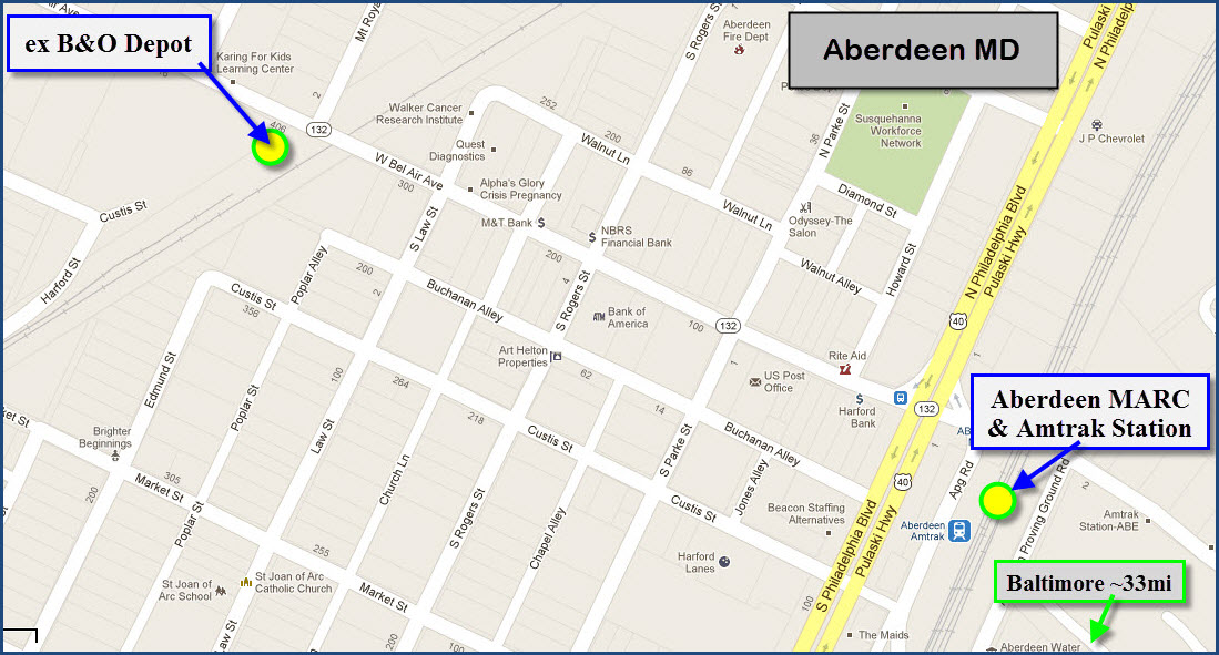
MARC / Amtrak station
Former B&O depot
Data:
GPS Coordinates: as needed
Phone A/C: 410
ZIP: 21001
Geography: pretty much flat
Access by train/transit:
Amtrak and MARC
The Scoop:
Aberdeen MD is one of the few spots in Maryland where you will find a station on both of the railroads that go through town. Both tracks offer pretty good sight lines for photographing, especially on the CSX where the tracks are straight. Over on the corridor, if you have a telephoto lens, shooting northward you can get a NB signal bridge in the shot for southbound trains.
If you're looking for a place to eat, sleep, or get gas, there are oodles of them to the east of the I-95 interchange, and more over on Rt 40.
Aberdeen is also part of a trip I took back in 2007 with Michael Watnoski tracking down the remaining CPL signals and is here.
In the "it's too bad" category -- Bing Maps no longer has birds-eye view of Aberdeen as of my checking in 12/2023 and 8/2024. :-(
Acknowledgements:
aberdeenbostation.org/
Google Maps
Wikipedia
Bing Maps
Websites and other additional information sources of interest for the area:
https://en.wikipedia.org/wiki/Aberdeen_station_(Maryland)
http://www.harfordhistory.net/aberdeen%20b&o%20station.htm
http://www.aberdeenroom.org/bao-railroad-station-restoration.html
https://www.amtrak.com/stations/abe
https://www.greatamericanstations.com/stations/aberdeen-md-abe/
https://www.mta.maryland.gov/marc-station-information
To get to Aberdeen, there are two choices - both run "north/south". These are Interstate I-95, and US Route 40, and they run parallel to each other.
Driving into Aberdeen via Pulaski Highway, aka, US Route 40, is the slightly more direct route, but is slower than I-95 if coming from afar. Doing the Rt 40 thing tho allows you to also stop at other places such as Havre de Grace and Perryville to the north, or follow the NEC and CSX to the south. Closer to Baltimore, the CSX/ex B&O mainline run pretty close to the highway.
Both NB (northbound) and SB (southbound) exits are exit 85.
If you're using I-95 SB, the blue arrows (from Wilmington DE, Philadelphia PA, and NJ), take a left at the end of the exit ramp onto MD 22. You can take a right onto Northeast Rd (green arrows), or go a little further down to Beards Hill Rd and take a right (black arrows). If you're looking for (mostly) fast food options, follow the black arrow route to the 22/Beards Mill Rd intersection, and pick a spot :-) For either the green or black arrow options, take a left onto West Bel Air Ave to head the train stations.
If you are getting off I-95 heading north (yellow arrows), the ramp takes you to both MD 22, and MD 132 (W Bel Air Ave). You can take the ramp directly onto W Bel Air Ave, which takes you to both of the stations in town. If you're looking for food, go straight (orange arrows) to MD 22 to join the blue arrows to where you'll find most of the easily accessible fast food joints. One of the food options is inside the Hilton.
There is a choice of seven hotels at this exit (as of 2024): La Quinta Inn, Hilton Garden Inn, Red Roof Inn, Days Inn, Super 8, Comfort Inn, and the Fairfield Inn.


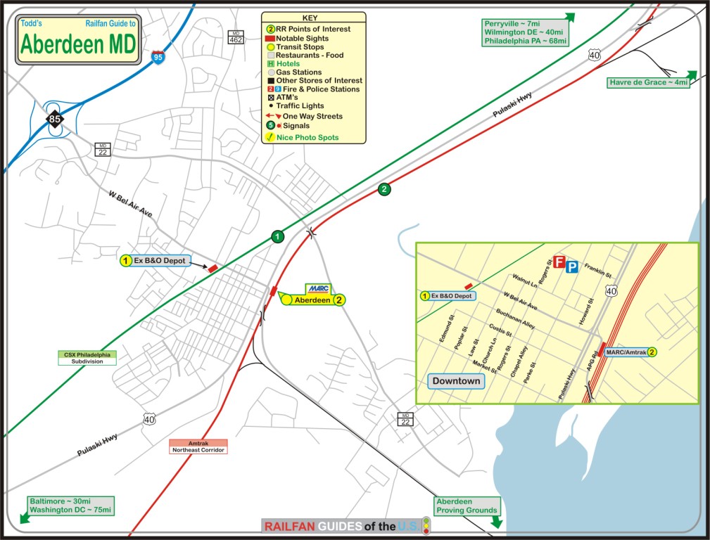
The above map is available here as
a PDF. The one below is from Google maps.
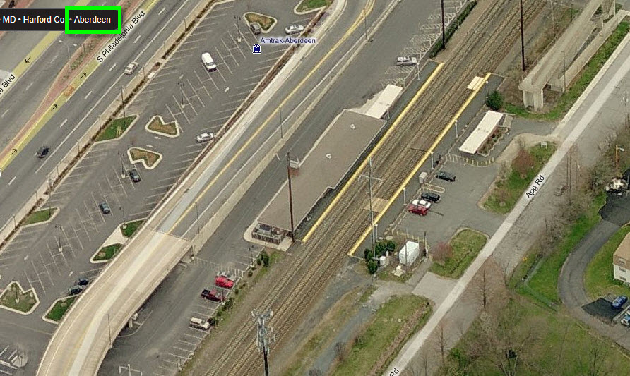
GPS Coordinates: 39.50841, -76.16321
18 East Bel Air Ave, Aberdeen MD 21001
Amtrak Station Code: ABE
The Aberdeen NEC station serves both Amtrak and MARC regional commuter trains. Aberdeen is on the northern section of MARC's Penn Line, served by seven NB and six SB trains daily. There is talk of extending MARC service to Wilmington DE.
From Wikipedia: The station is serviced by most Northeast Regional trains running between Penn Station in New York City and Union Station in Washington, D.C., but only by some trains originating or terminating at South Station in Boston. On weekends, the station is served by one Northeast Regional bound for Norfolk, Virginia and one leaving Richmond. Acela Express and all long-distance trains pass through the station without stopping.
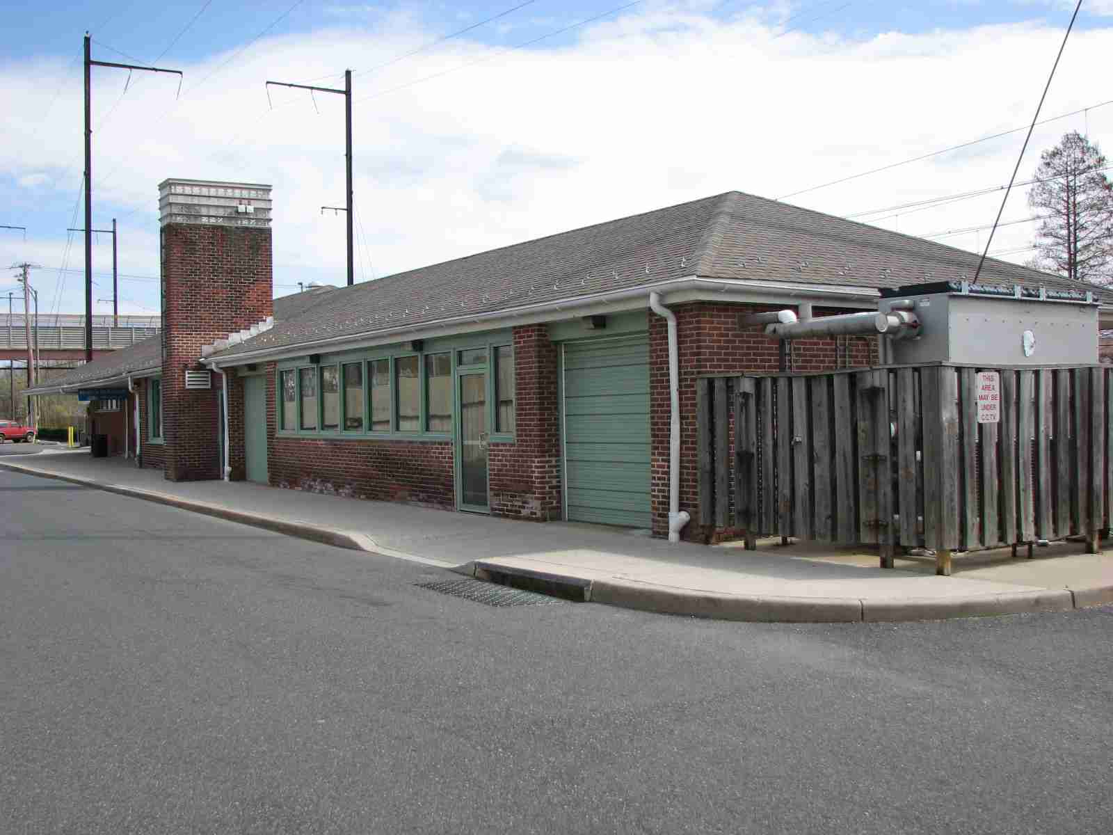
The station was originally built by the Philadelphia, Wilmington and Baltimore RR approximately in 1898, and inherited by the Philadelphia, Baltimore and Washington RR. The current station is a modern structure built in 1943 by Lester C. Tichy for the Pennsylvania Railroad, it contains a 1960s-style pedestrian tunnel, with one of the entrances located at the former north station house. It also contains a pedestrian bridge built in 1982. Aberdeen was also served by an 1886-built Baltimore and Ohio Railroad station along what is now the CSX Philadelphia Subdivision just north of this one on West Bel Air Avenue. Prior to the mid-1980s there was a grade crossing located next to the station. It was removed after Amtrak completed the Northeast Corridor Improvement Project and replaced with an overpass. end Wiki.
From Amtrak: Constructed in 1943 on the site of an earlier depot, the Aberdeen station is served by Amtrak, MARC and local buses - it's a popular stop for staff of the nearby Aberdeen Proving Grounds.

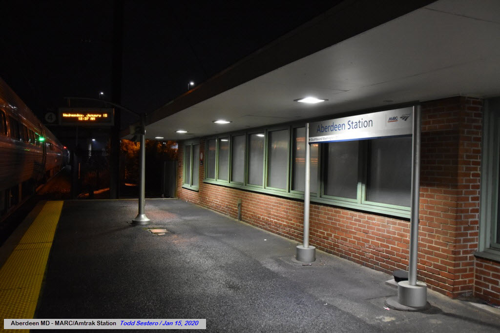
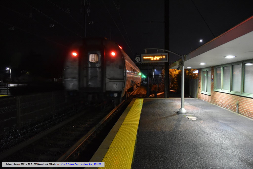
In 2020, my best friend and I took a trip to Boston for my aunt's 100th birthday. We took Amtrak out of the Aberdeen station because it was easier to deal with "things" when the train got back at 1 in the morning...... these two pictures are from when we got back.
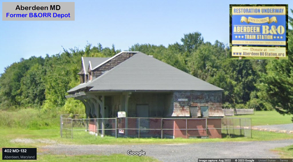
GPS Coordinates: 39.51118, -76.17013
https://aberdeenbostation.org/
https://aberdeenbostation.org/history/
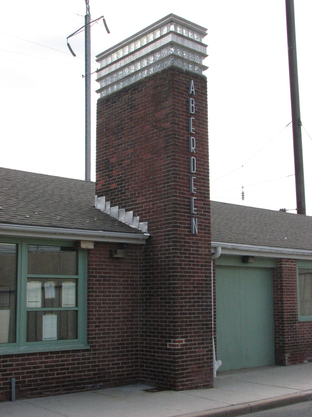
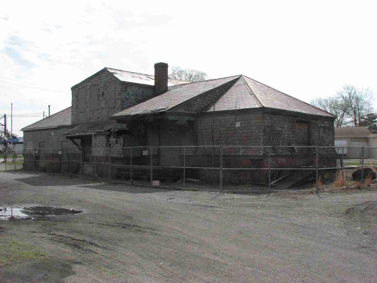
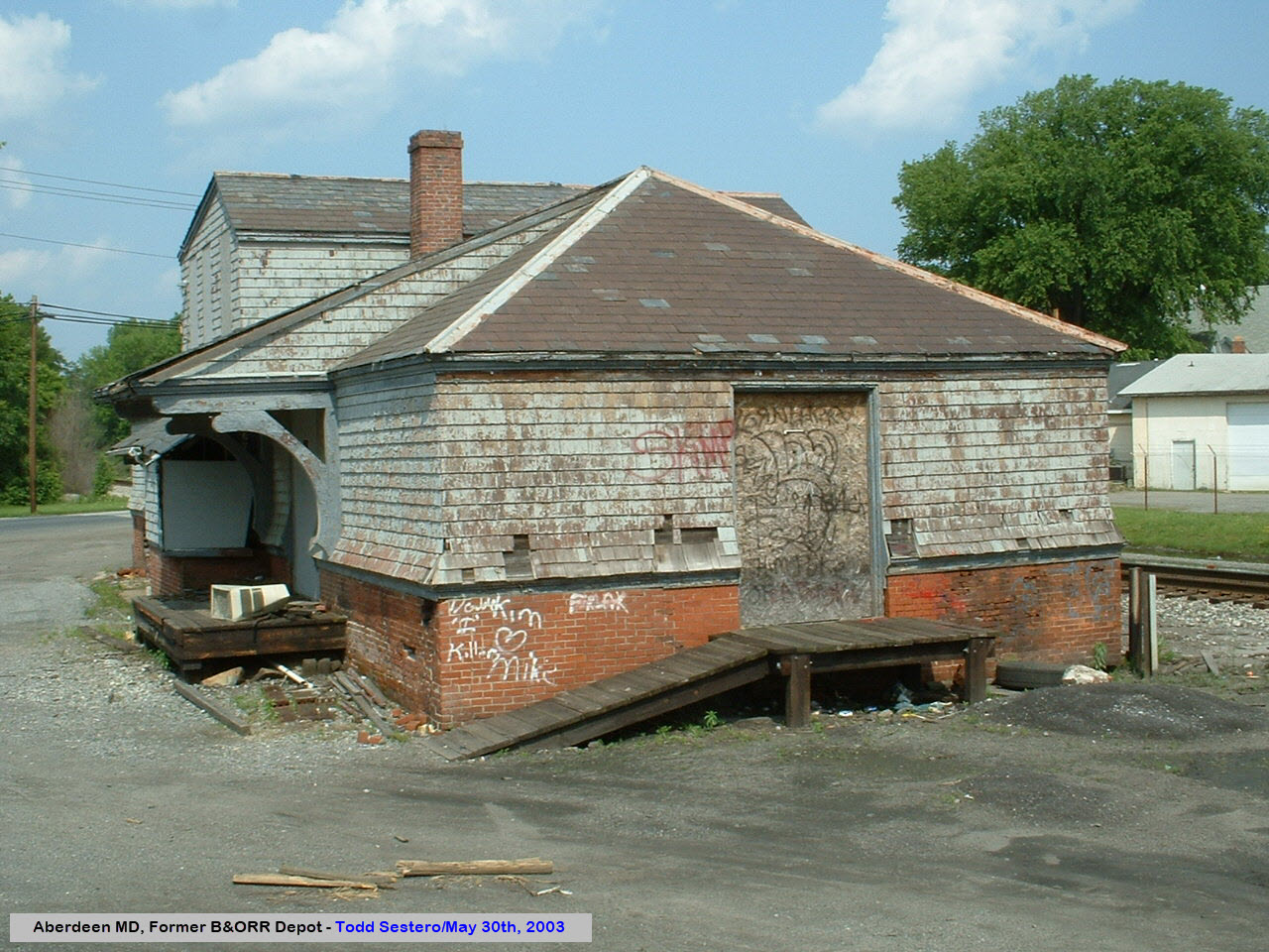
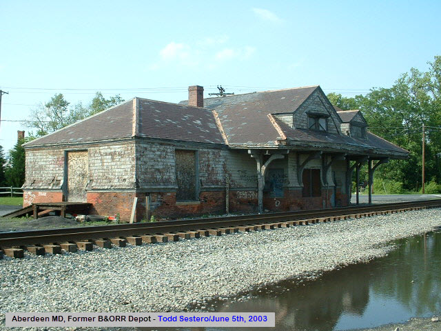
The station is a Frank Furness design - it was built in 1885, and opened in 1886. It was last used in 1958. More history at the link above.
The older aerial shots also show where the small Aberdeen yard used to be.
On August 24th, 2023, they held an open house before renovations were to begin in the fall. I missed it, darn-it :-(
The picture below is from Google Streetview, and below that, from the station's org website.
Here are pictures I took in 2009:
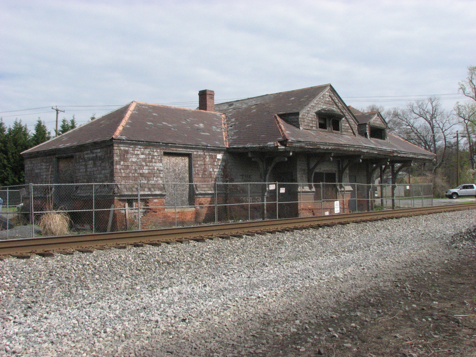
And here are a couple of pictures I took back in 2003:
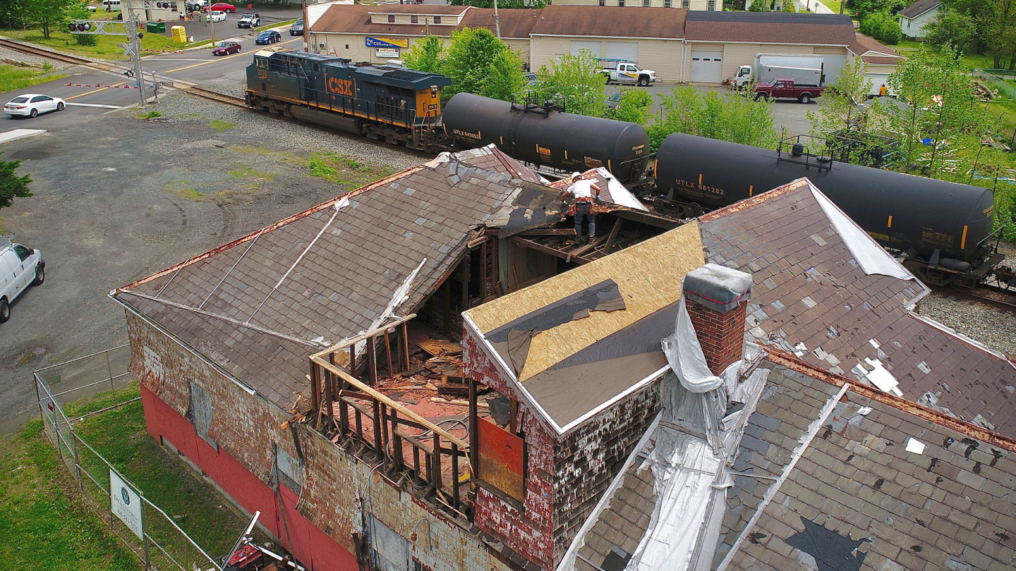
The Restoration
Not much has changed with the restoration that has been done, and I'm guessing they are going to use sheetrock on the inside instead of plaster and lathe.
There are two noticeable differences to the external restoration. One is the chimney - it has been moved, and it is markedly different. The other is the brick base of the station, it is a little taller than what it appeared to be in the older photos. One of the discussions that often surrounds -restoration work- is: how accurate should the restoration be, and should it strive to maintain to originality of the design. The new chimney violates the premise that restoration work should retain the "old look". This discussion can be found all over the railfan and preservation community. Two known incidents are streetcar/trolley restoration work we do at the Baltimore Streetcar Museum with the work being done on PCC car #7303 (which IS NOT a Baltimore car), and restoration work done by my fellow railroad signal enthusiasts where some people want to make sure that every last little nut, bolt, and screw are exactly what the manufacturer used. Going along with this is a similar disagreement on whether "signal" bulbs, and whether or not dollar replacements from Walmart can be used to light the signal. BTW, original signal bulbs cost so much not only for their reliability, but also because the filament is "pre-focused", meaning it is guaranteed to be in a specific position so signal maintainers don't always have to worry about re-focusing the signal after bulb replacement. When sitting in your backyard or basement, who cares if the thing is focused or not..... sorry for the rant :-)


They have done a nice job with the flashing, gutters, and downspouts, doing them in copper. I hope no-one decides to come and take what they can reach for scrap. I don't know if the original had rain gutters and downspouts or not. As can be seen, the original roof flashing was not copper.


They did a really nice job with the gables. The detail work must have been a pain :-)


The base/brickwork - looks to be slightly higher:


Interior shots as of August 2024:


Amtrak at the Station
GPS Coordinates: 39.51213, -76.16059
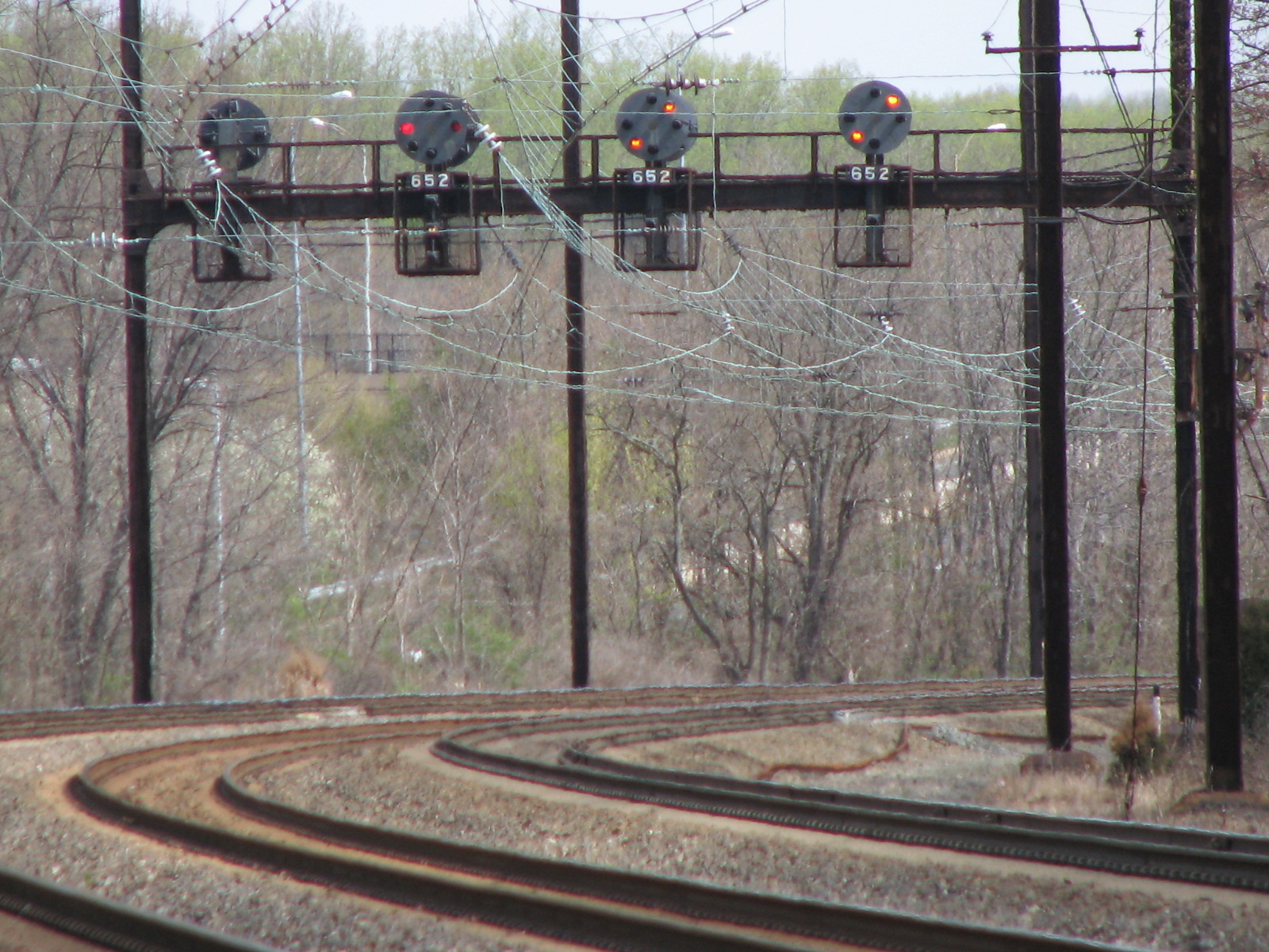
This is the first set of signals north of the Aberdeen station.
There's something about these signals, nestled amongst the curved catenary, that I never get tired of taking pictures here....
The -Stop and Proceed- on the left will never be anything but, unless track #2 is set up for reverse traffic.
Aspects that can be displayed here - the two on the right (green checkmarks) are only for track #2.


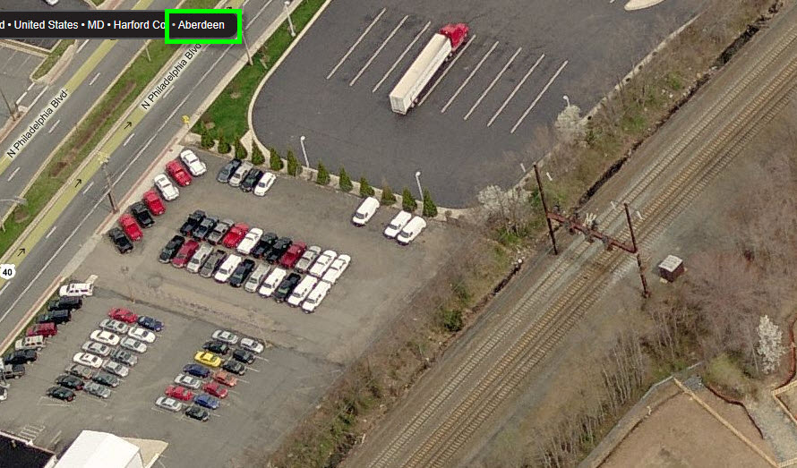
GPS Coordinates: 39.51368, -76.16437
The CPL signals here were replaced sometime around 2019, give or take.... The easiest way to get pictures of the "new" colorlight signals is to park in the lot for the restaurant on Rogers St, and walk the short distance up the track.


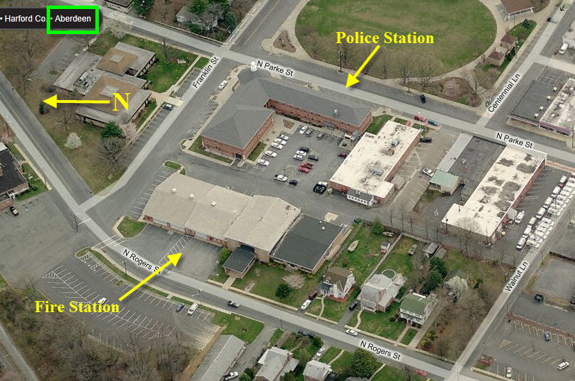
The main fire station and police headquarters are located on the same piece of property surrounded by Parke St, Franklin St, and Rogers St.
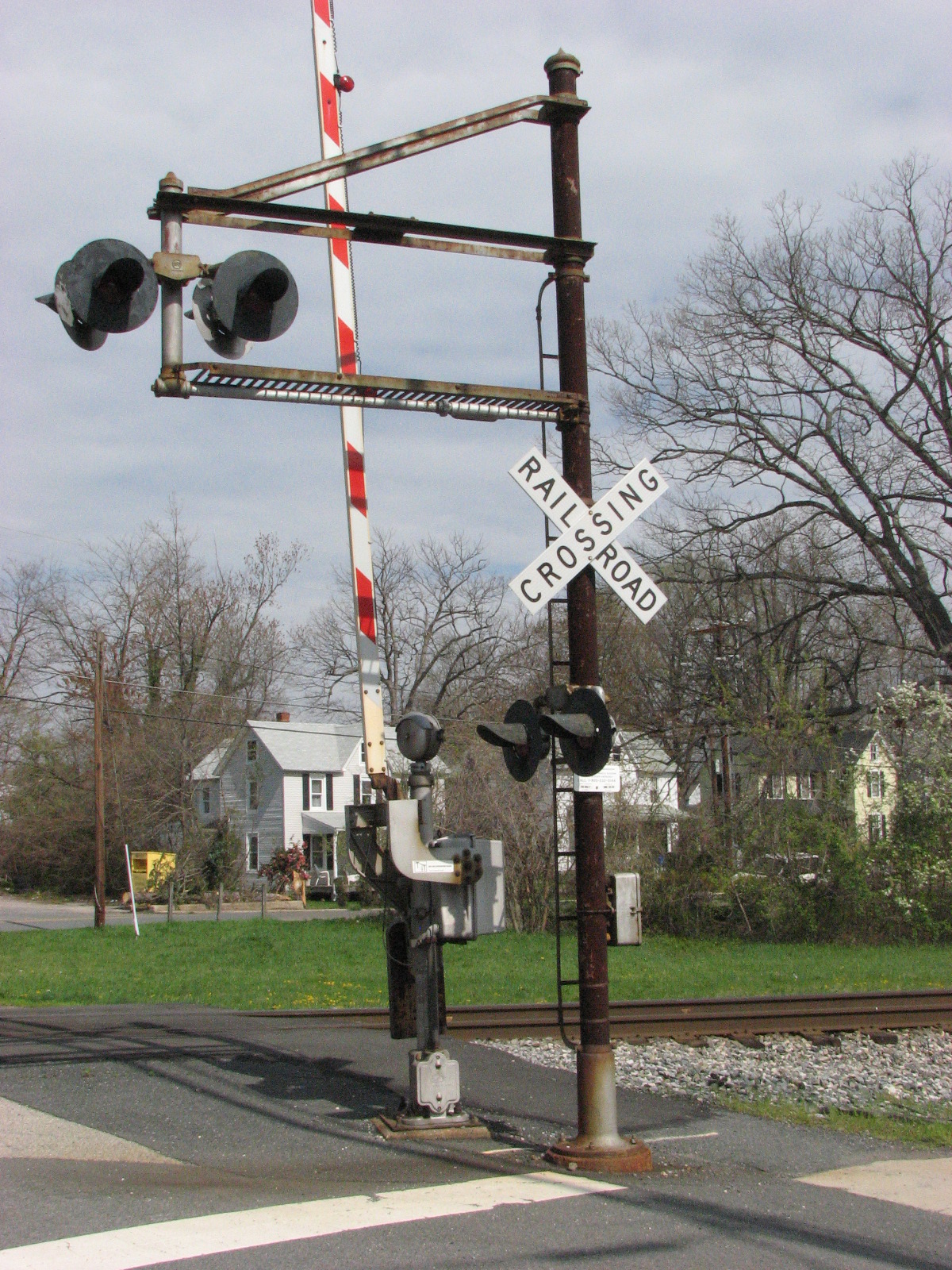
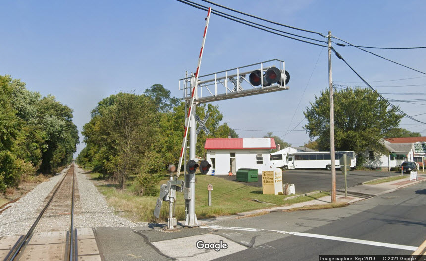
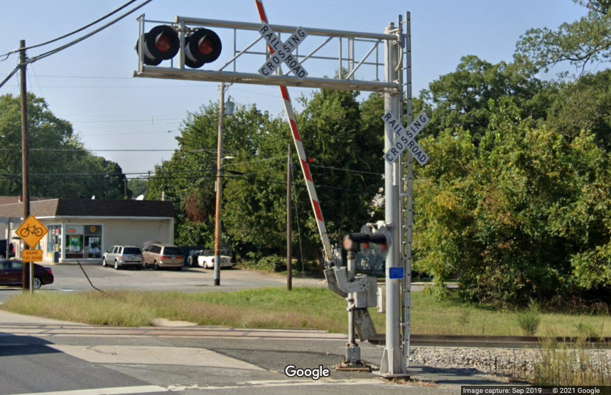
This crossing gate signal was adjacent to the B&O depot, looks like it has been replaced in the 2019 Google Streetview.
Courtesy USGS, click here for their index page.

Disclaimers:
New format 10/26/23: Please check out my disclaimer page for my standard dribble and contact info here
RAILFAN GUIDES HOME
RAILROAD SIGNALS HOME
NEW 01/01/2013, DEC29/2013, JUL27/28/2021, AUG05/2023, DEC29/2023, AUG11/12/2024
Last Modified 12-Aug-2024