
In General
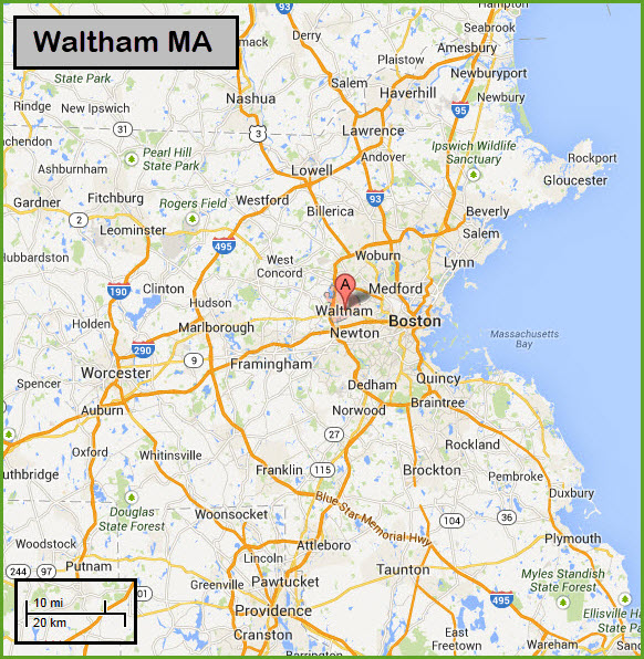
Getting Here
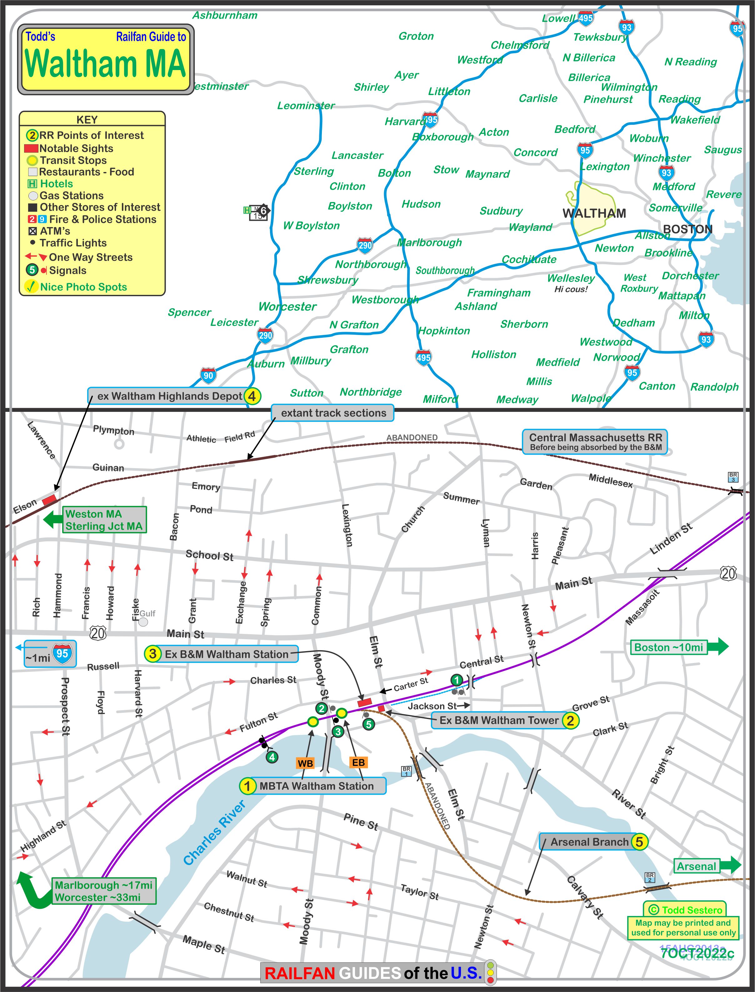
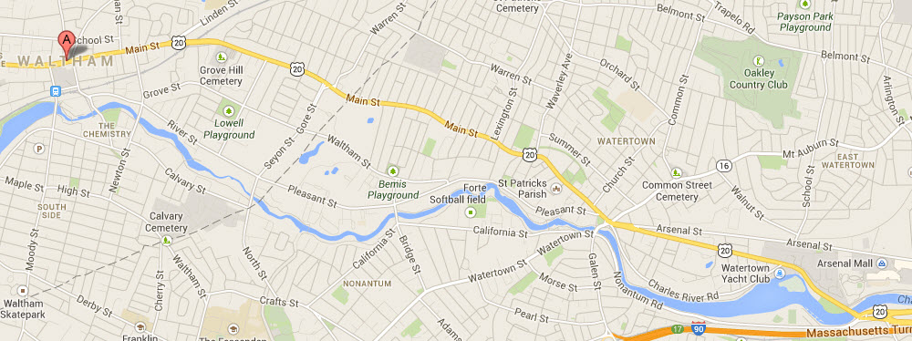
Map
Sights / Pictures
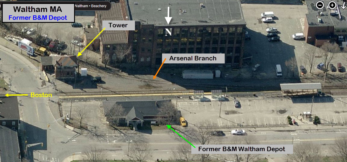
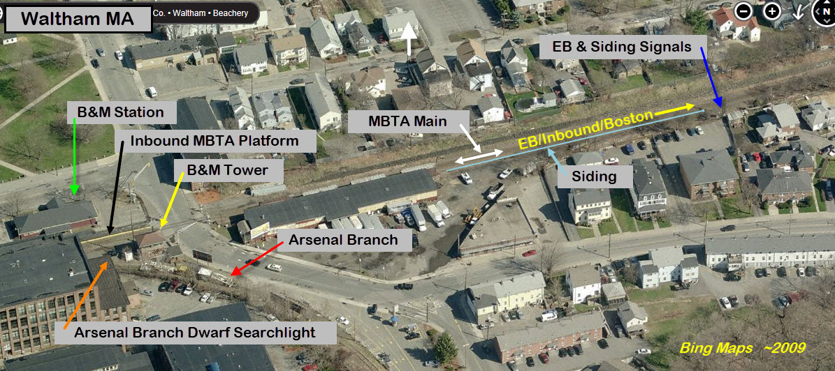
the Arsenal Branch
Bridges
Signals
Floobydust
Over at Porter Square
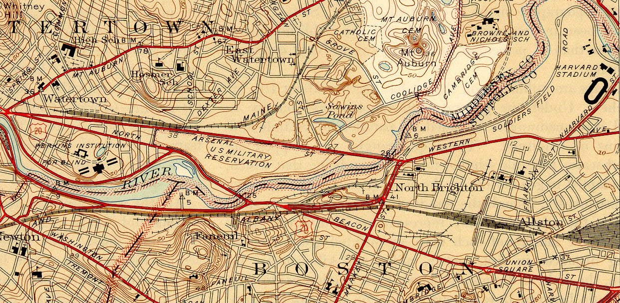
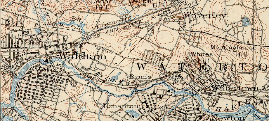
USGS Topo Maps
RAILFAN GUIDES HOME
RAILROAD SIGNALS HOME
Location / Name:
Waltham MA, Middlesex County
What's Here:
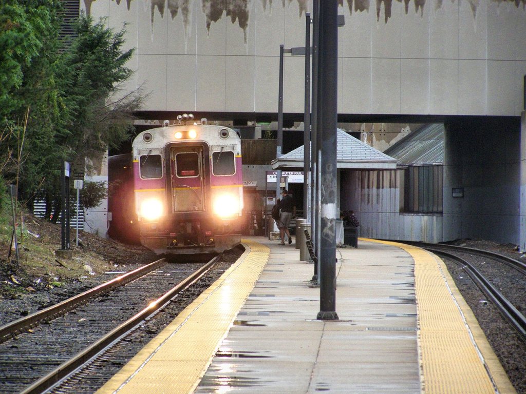
MBTA Station
Former Boston & Maine RR Tower
Former B&M Station
Former Arsenal Branch
Data:
GPS Coordinates: as needed
Phone A/C: 781
ZIP: 02451
Access by train/transit:
MBTA Commuter Rail, Fitchburg Line
The Scoop:
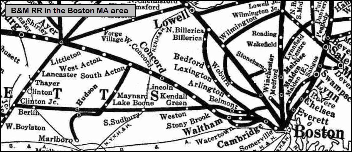
Waltham Massachusetts is a great little railfan stop for those of you who are in the area. It is the site of a former Boston & Maine RR station, now an MBTA commuter stop. The B&M had two lines going through the area, and if you look on the north side of town, you can find traces of the right-of-way. Back in the 2000 timeframe, there were still a few old crossing gates still standing, but I'm sure they are gone by now....
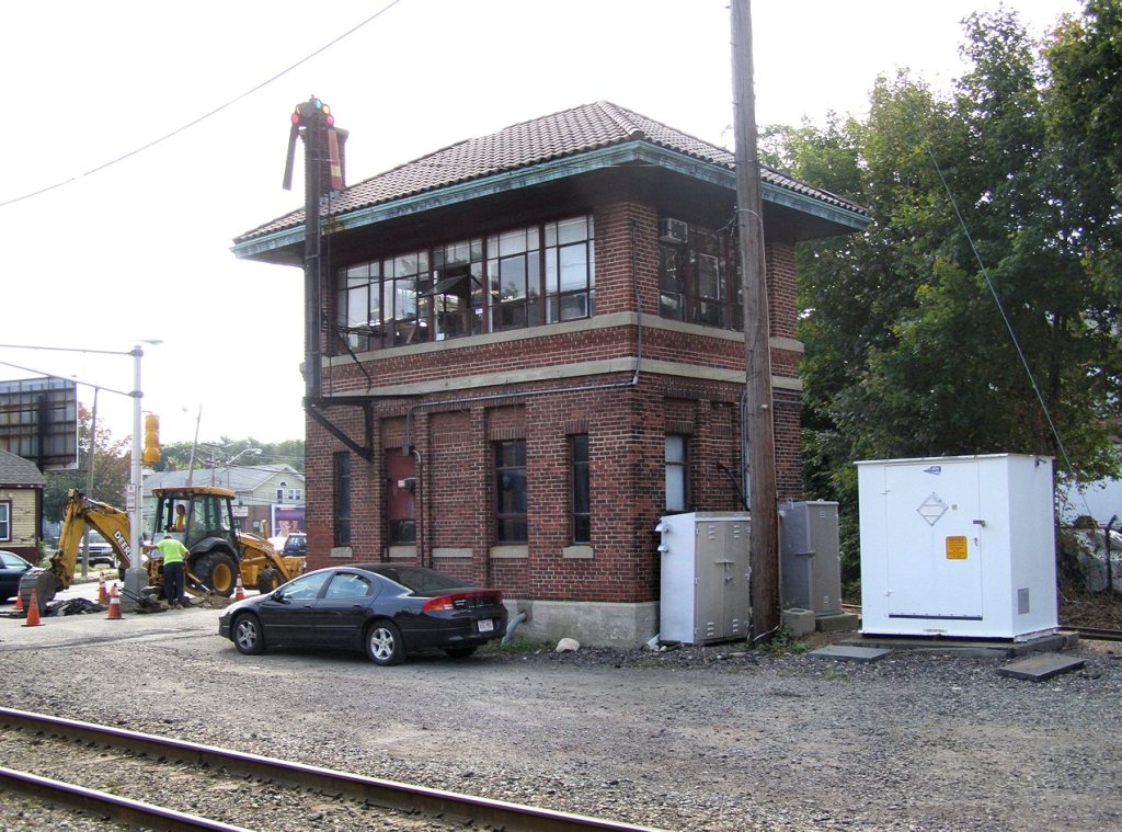
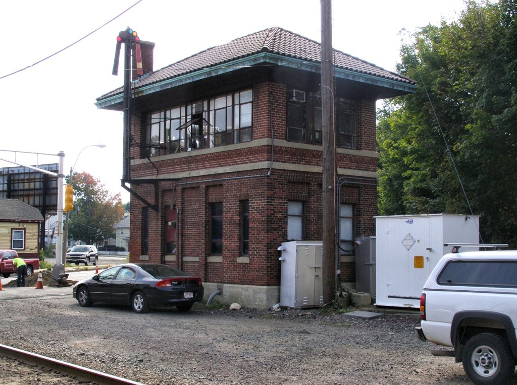
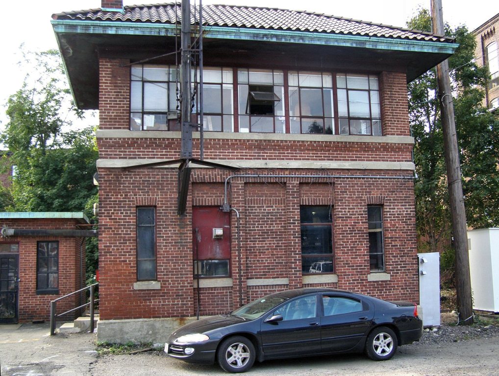
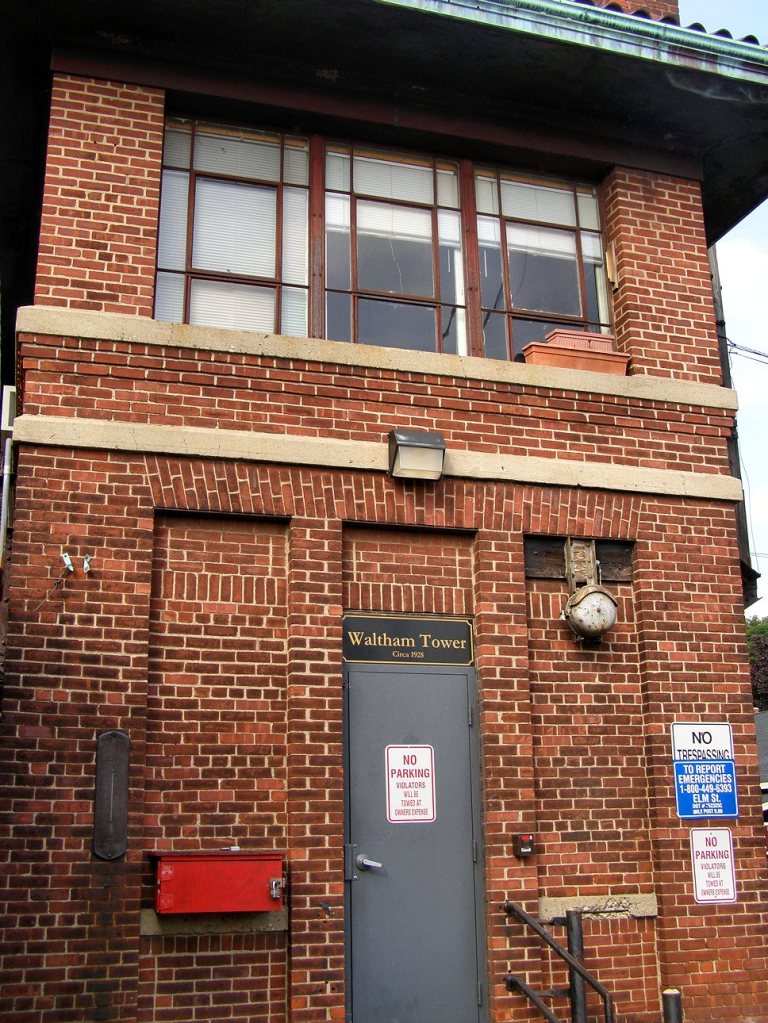
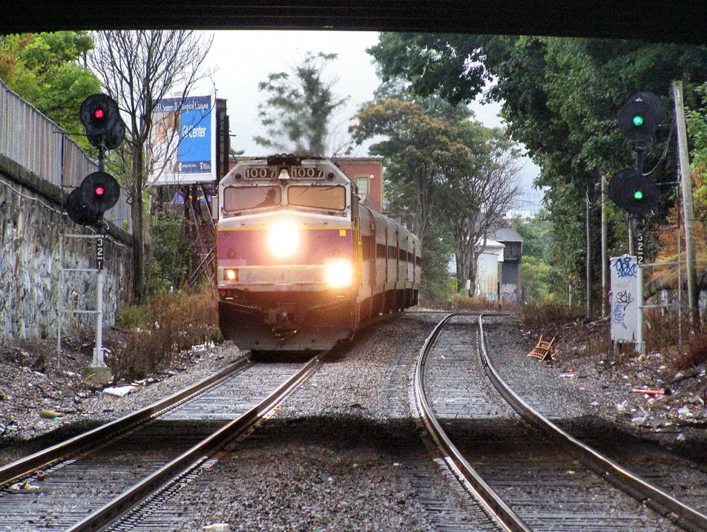
On the south side of the tracks is the former B&M Waltham Tower, complete with a semaphore type Train Order (TO) signal.
There are about 34 commuter trains through here each day.
A branch heading over to the Arsenal in Watertown was discontinued in 1960. See the maps below.
The Massachusetts Bay Transit Authority (MBTA) took on total responsibility for running commuter service in 1965 and now contracts with the MBCR (Massachusetts Bay Commuter Railroad Company) to run the day-to-day operations of the local commuter lines.
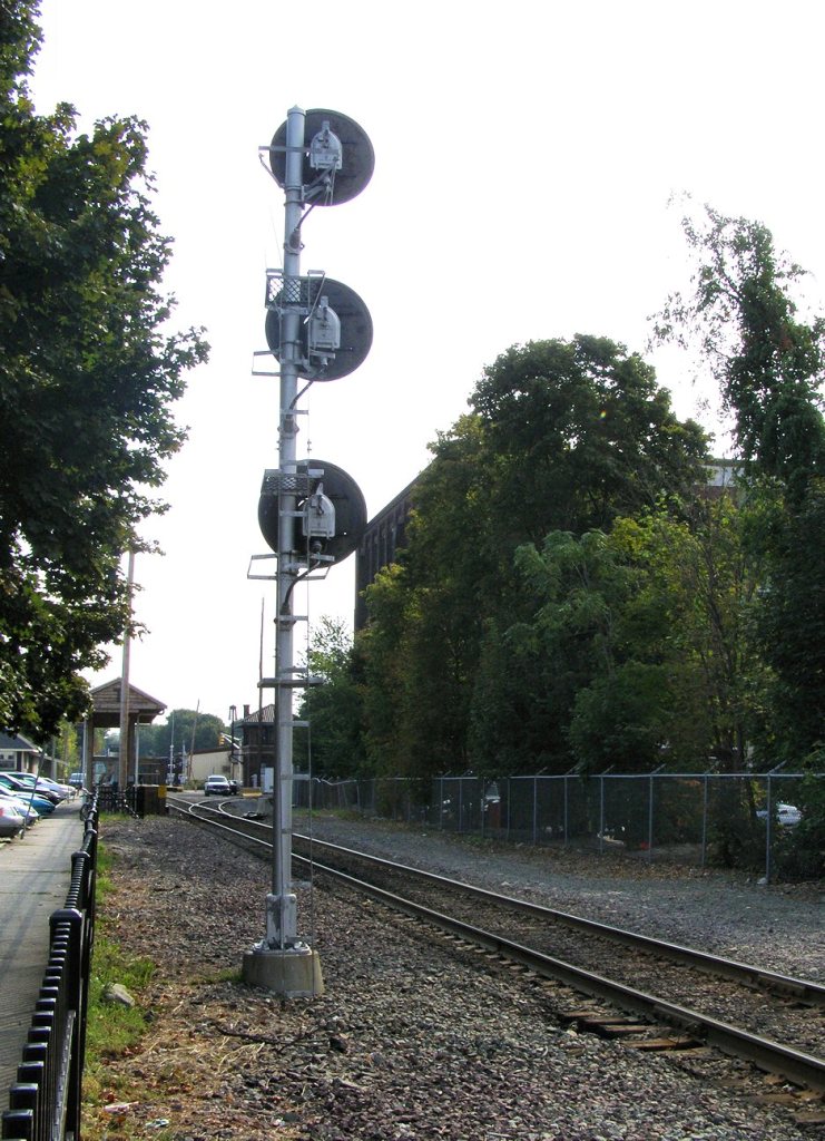
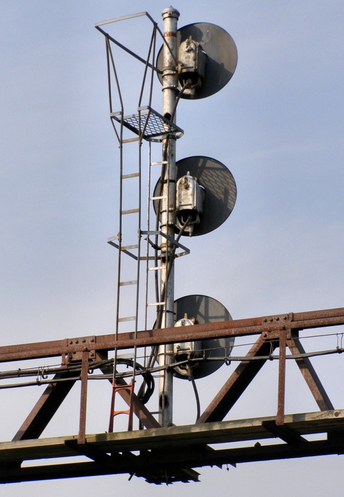
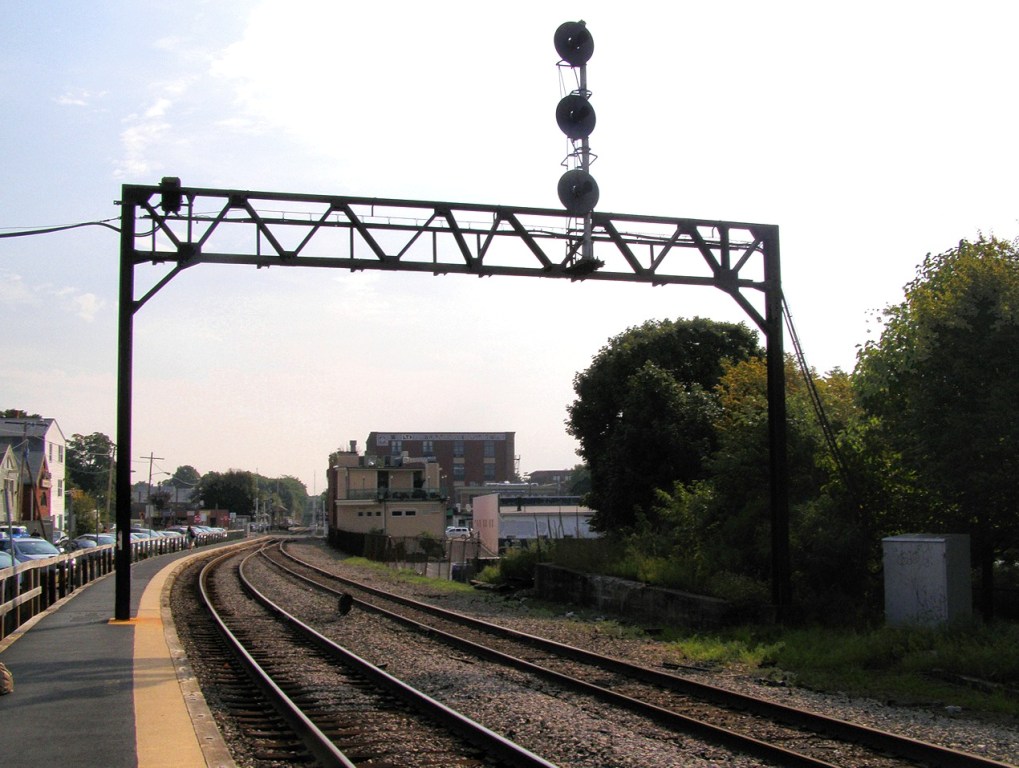
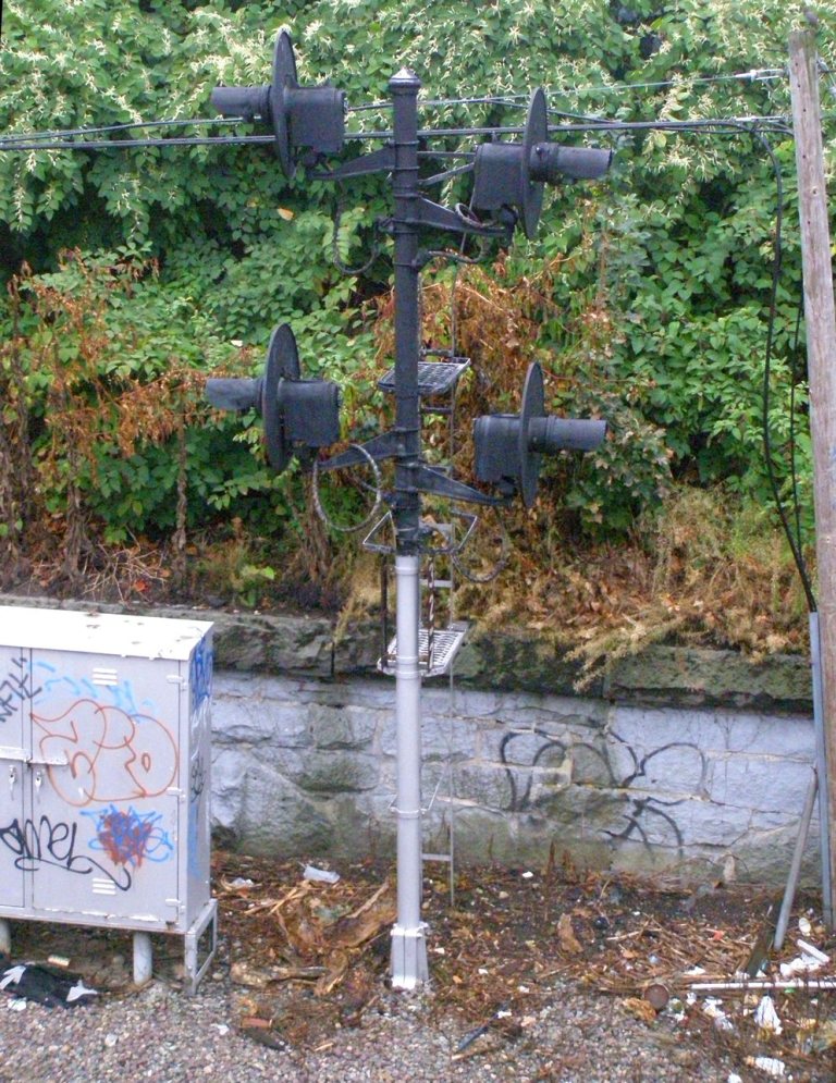
The B&M used searchlight signals almost exclusively. When I was here in the 2001 timeframe, there was a complete searchlight pole laying on the ground adjacent to the WB platform, covered with years and years worth of vine growth. The signal housings were still attached to the poles, but (I'm guessing) the mechanisms were probably removed.
All photos by Mike Brotzman, except where noted!
Acknowledgements:
Mike Brotzman
Justin Morgan
photoman82
t55z
Tom Nelligan
Denver Todd
Google Maps
Bing Maps
Open Railway Map
Wikipedia
Websites and other additional information sources of interest for the area:
https://www.waymarking.com/waymarks/WMRJHX_Waltham_BM_RR_Depot_Waltham_MA
For those of you familiar with the Baltimore and DC Beltways, Boston has a similar arrangement with I-95, I-495, and a partial with 146/I-190. Waltham is close to the I-95 "loop" which is the innermost of the three circular routes.
From the north or south, I would stay on I-95, following the signs to stay on I-95.
From the west, come in via I-90 to I-95, and then then take I-95 north.
The exit of interest is number 26. Head east from I-95 on Weston Street, about two miles to the station area. About halfway there, Weston runs into Main St, which takes you the rest of the way into town.
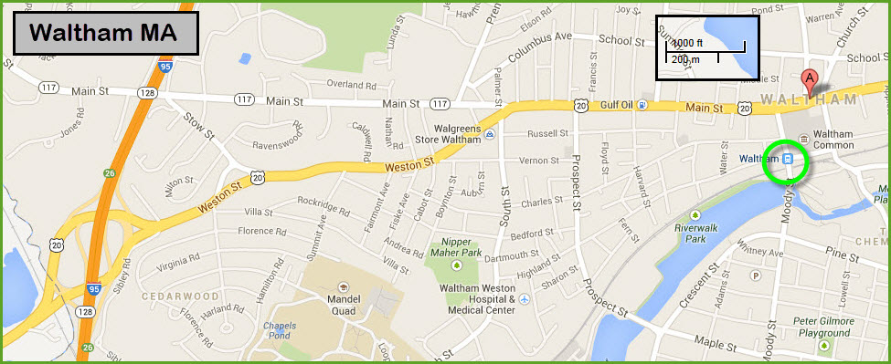
GPS Coordinates: 42.37440, -71.23497 (inbound), 42.37397, -71.23762 (outbound)
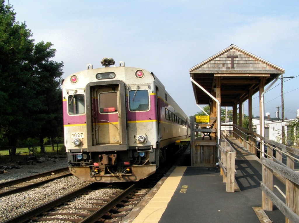
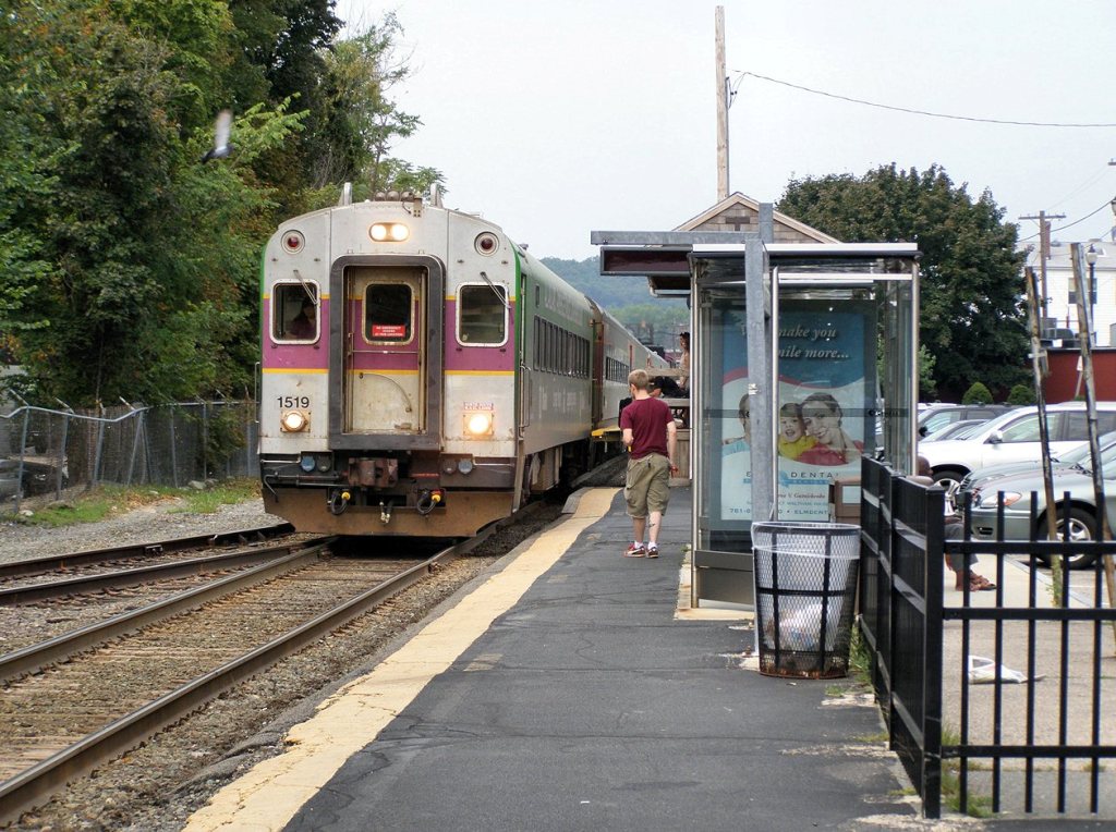
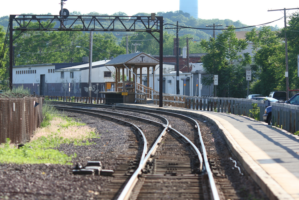 Photo by Justin Morgan.
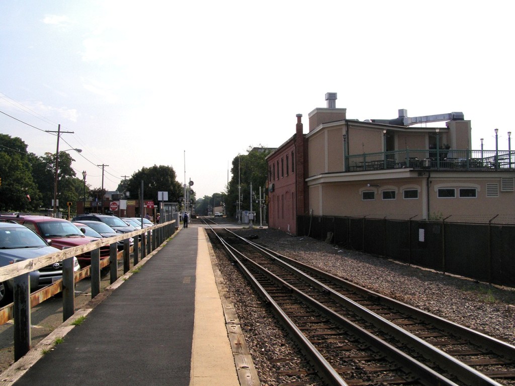
MBTA commuter rail station, outbound side. Taken from Moody St. facing west.
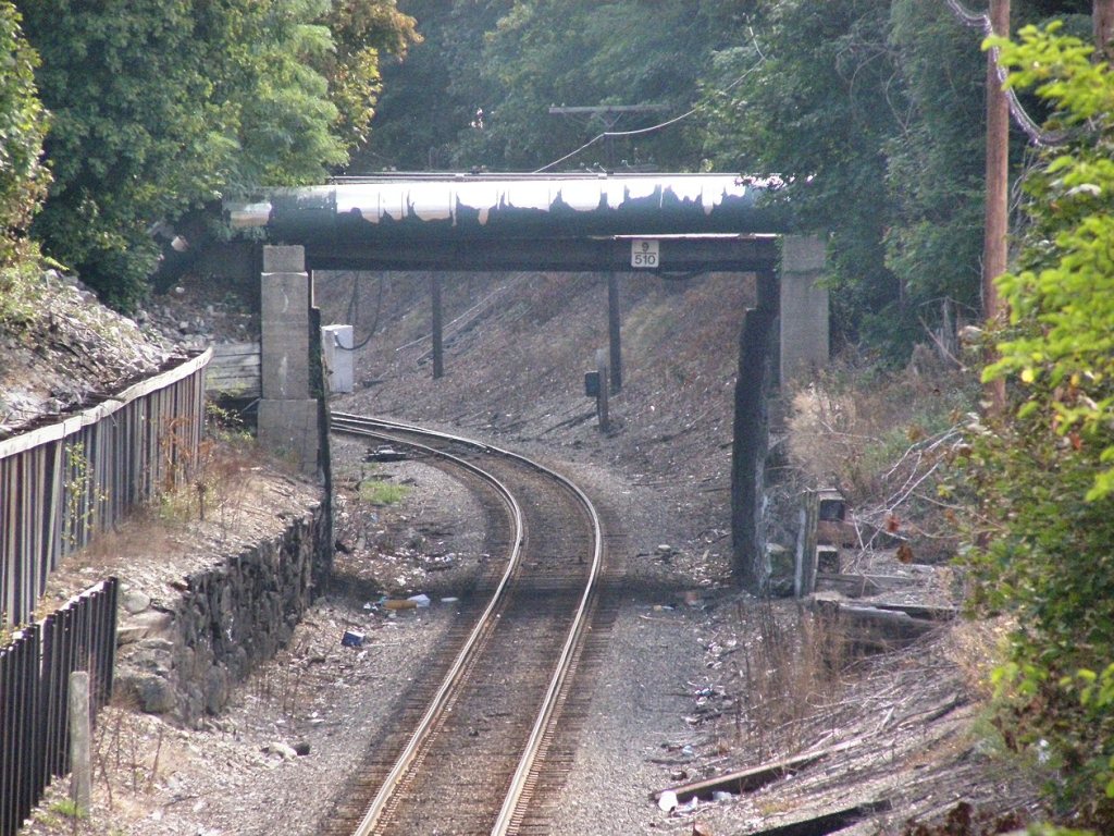
Taken from the Jackson St overpass.... Looking at recent Google Streetviews, the siding is now gone.
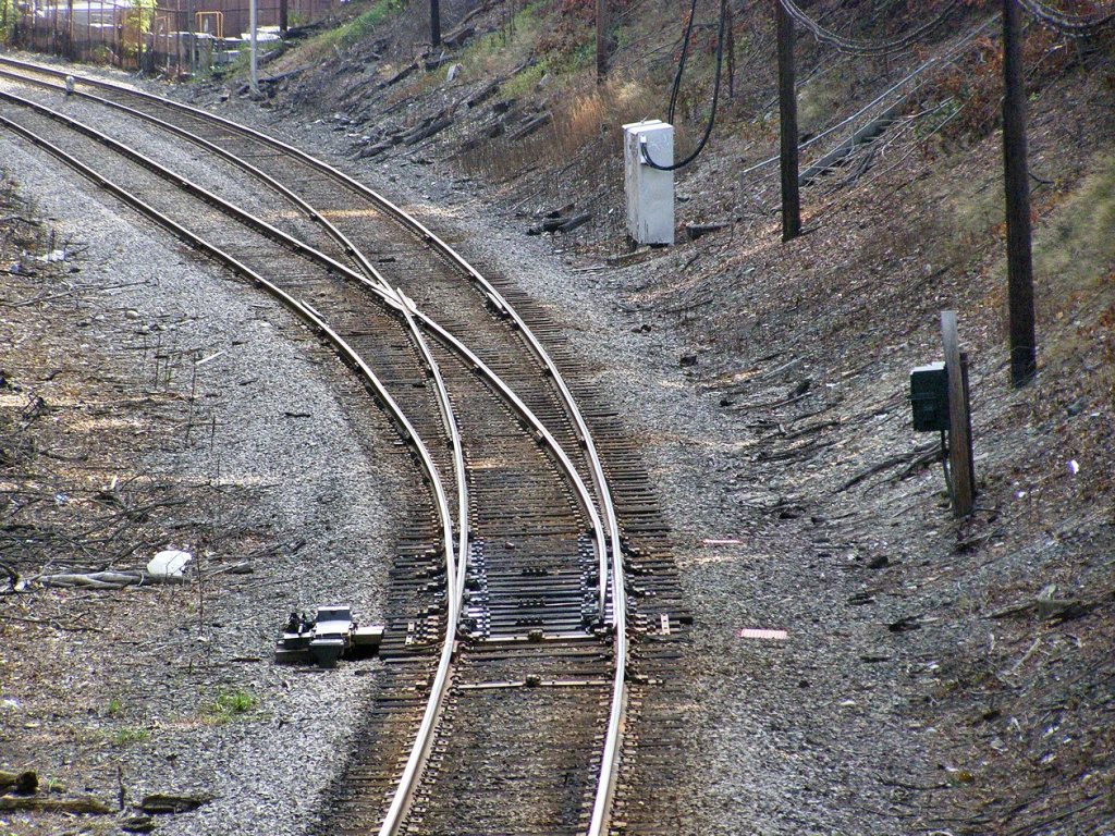
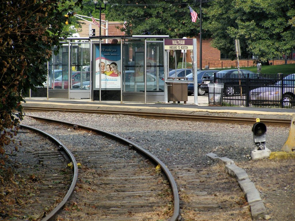
Looking east towards Boston, from roughly where the signal bridge is.
Looking west.
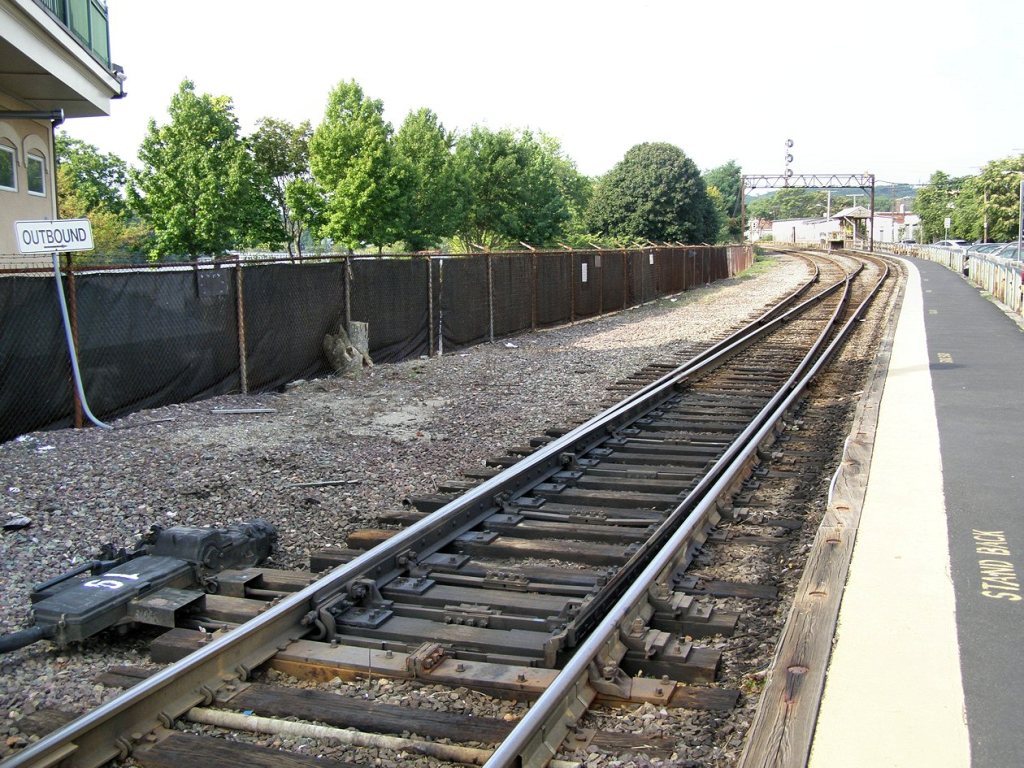
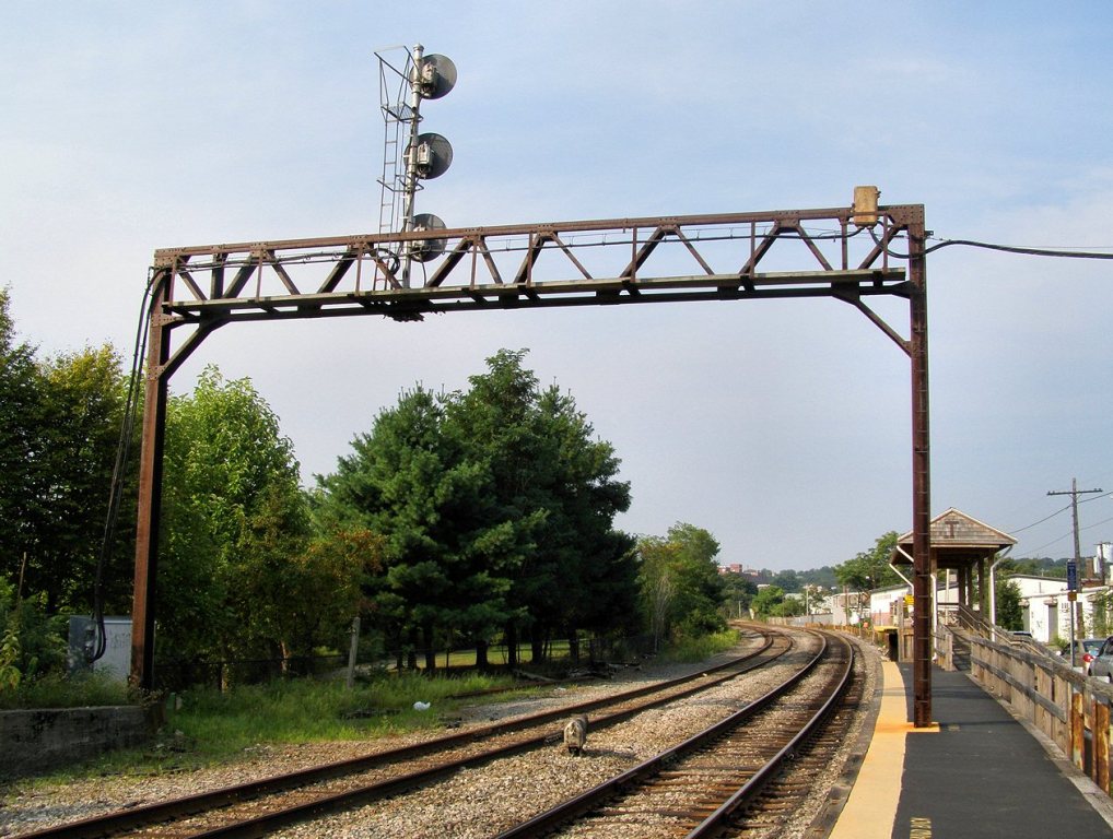
Looking west, east of the station.
Looking west, east of the station.
GPS Coordinates: 42.37435, -71.23448
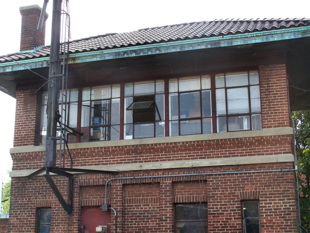
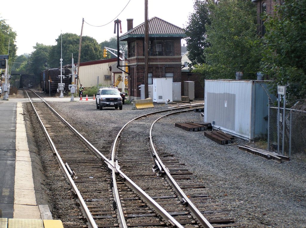
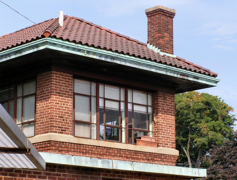
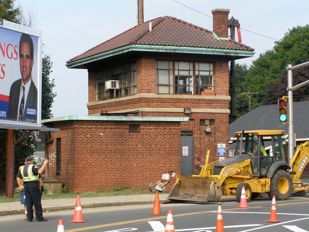
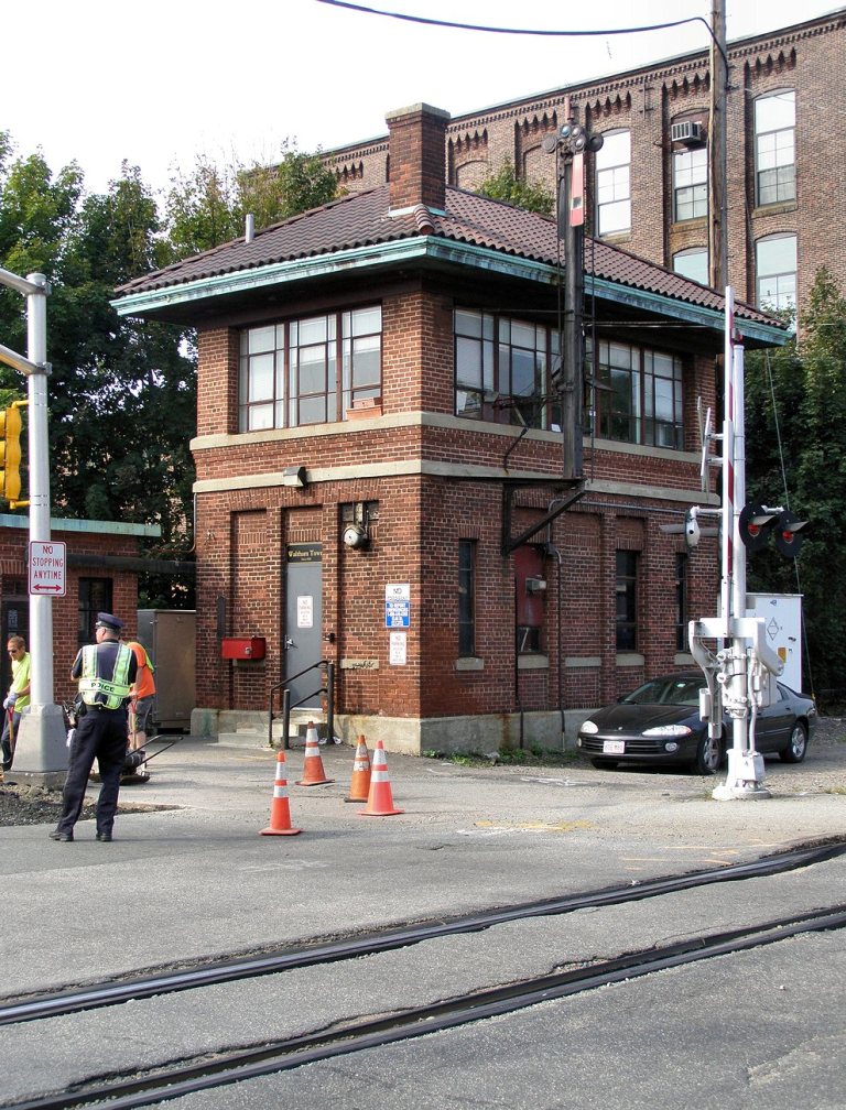
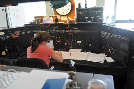
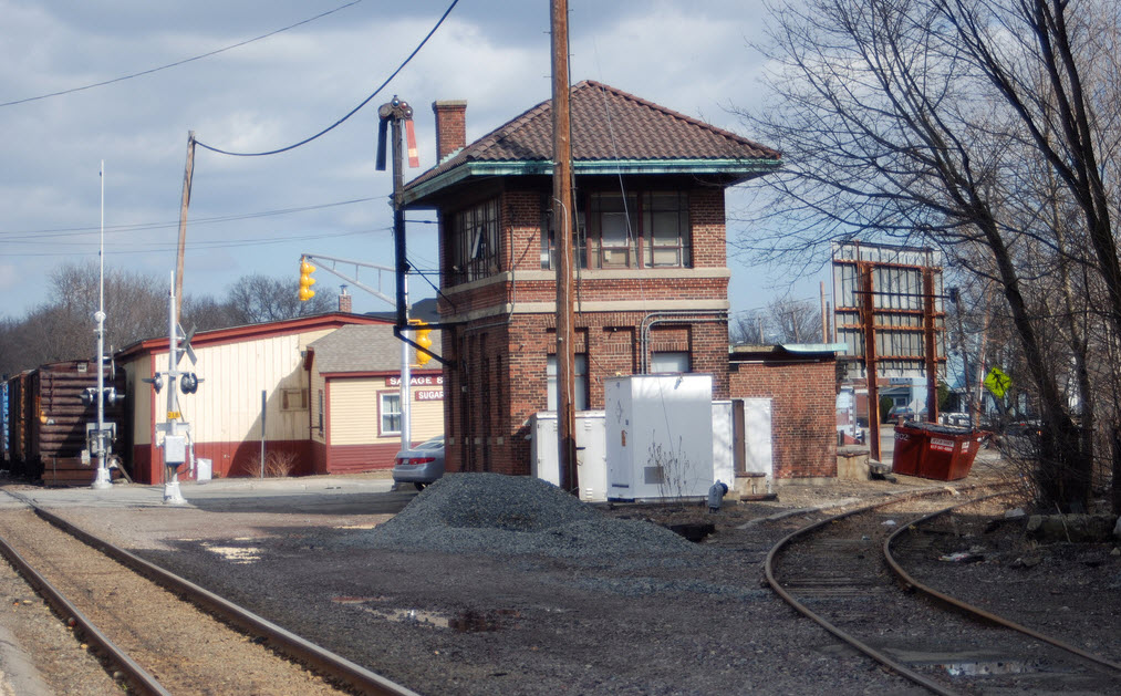
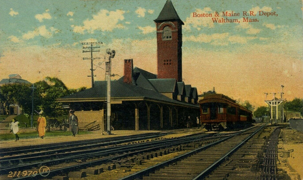
The tower was built by the Boston & Maine RR in 1928. The tower is in typical B&M style with brick facing and a tile roof. It is the last tower of this type still in operation in the state. According to one source, the tower has sisters in Ayre MA, East Deerfield MA, and Johnsonville NY. The former B&M tower in Waltham, MA still sits beside the Fitchburg Line.
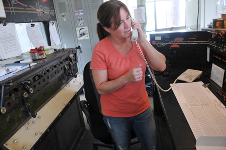
The tower controls operations on the Fitchburg Line between West Cambridge and Acton, and has been manned continuously since it's opening, currently with a staff of 5 operators. Mary Howard is the operator seen below.
More info and pictures by Mike Brotzman can be found here
Info and the pictures below come from, but the page (and site) is no longer with us: http://blogs.wickedlocal.com/brandnewwatch/2011/08/19/for- 83-years-the-waltham-tower-has-guided-train-traffic-through-the-city/
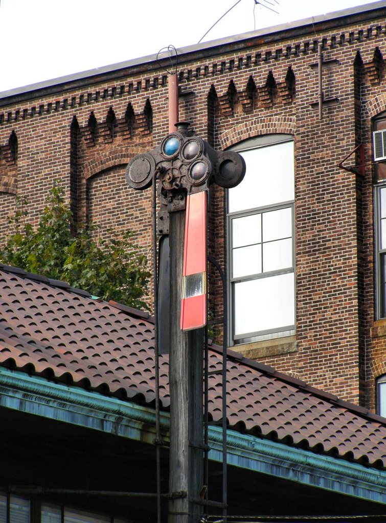 the Train Order Signal.
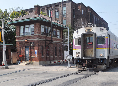
 Picture by photoman82
The picture was found here: http://www.flickr.com/photos/photoman82/3402750537/
GPS Coordinates: 42.37454, -71.23486
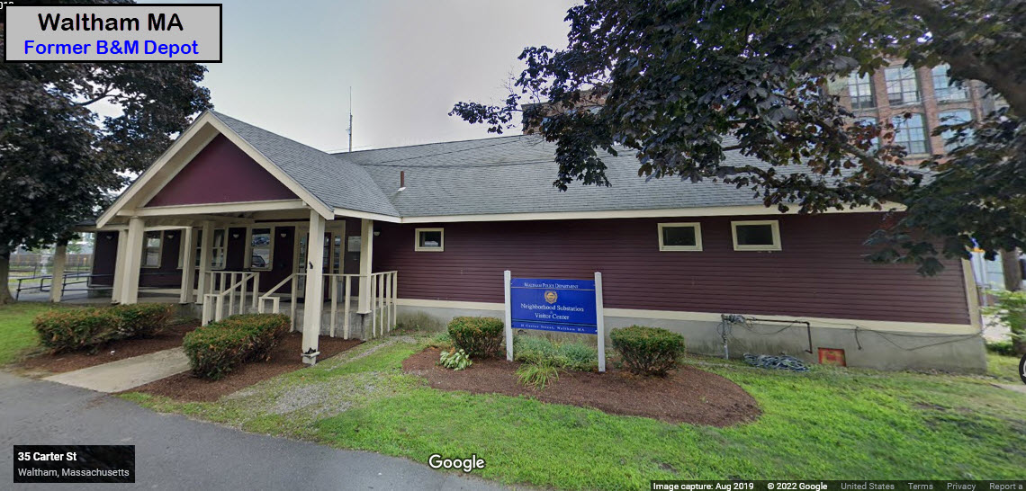
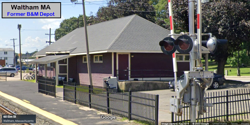
35 Carter St, Waltham MA 02453
This former B&M Depot is now used by the police and as a visitors center.
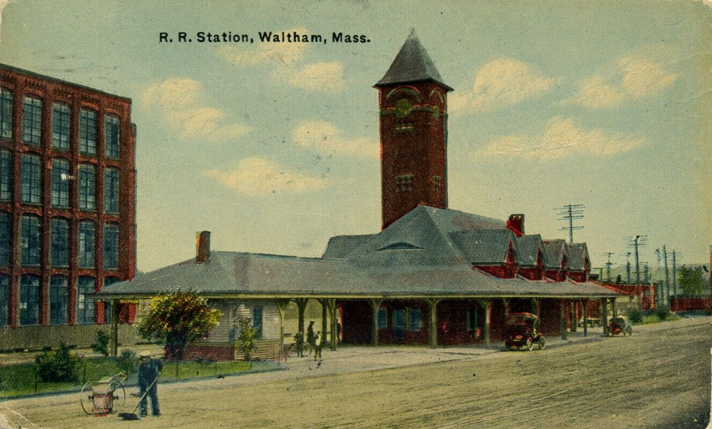
Many (many) years ago, this was the scene here in Waltham!
I'm not finding any info on the earlier depot either, as one of the sources below mentioned

GPS Coordinates: 42.37988, -71.24701
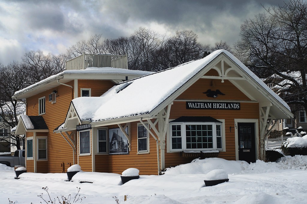
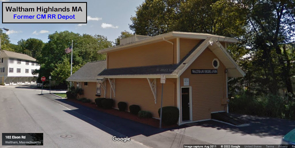
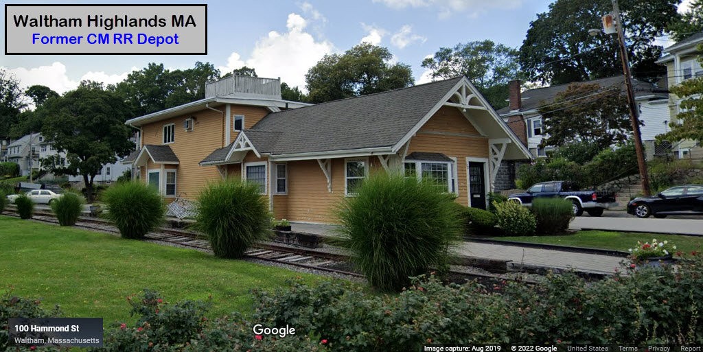
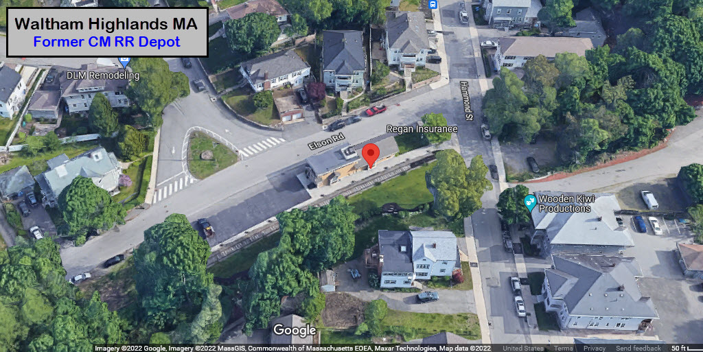
100 Hammond St, Waltham MA 02451
The building is now owned by Regan Insurance
https://www.flickr.com/photos/54690684@N07/12529788734
From t55z's Flickr Page: The Central Massachusetts Railroad built this station in 1881. This was the year that railroad began operations, and when they also built the stations in Weston and Wayland (check the Flickr page for links to pictures). The Boston & Maine Railroad operated the line for most of its history. This station had passenger service for the B&M from 1885 to 1971.
The Regan Insurance Agency occupies this building now, and has acknowledged its history with two signs saying "Waltham Highlands," and an old picture of the station on the side of the building. There are still rails alongside this building (on this side) but they're hidden under the snow here. The 2-story section in the back is a modern addition.
 2014, photo by t55z
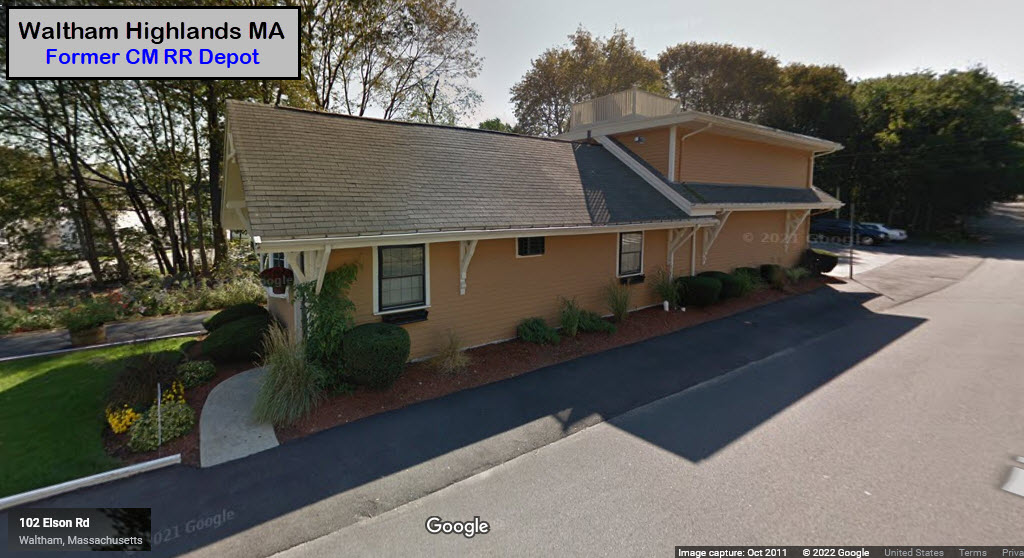
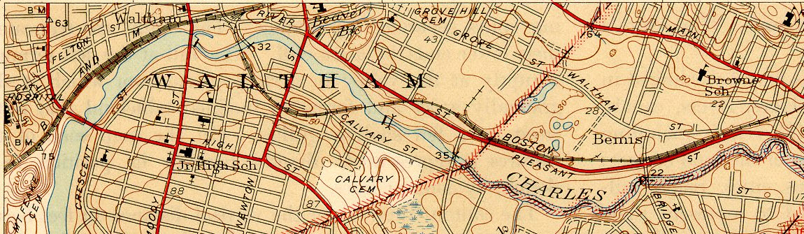
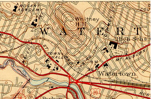
In 1946, Waltham end on top, Watertown above, and the Arsenal below.
Notice the Boston & Albany had tracks in the area too, along with a large yard on the right side of the map below.
 Today
Today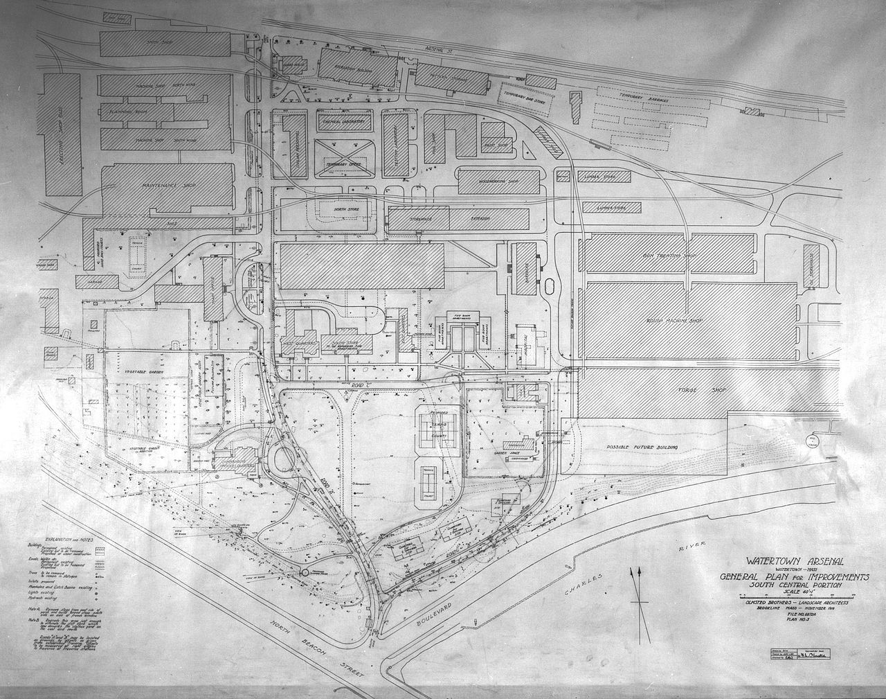
Map from Wikipedia: http://en.wikipedia.org/wiki/Watertown_Arsenal
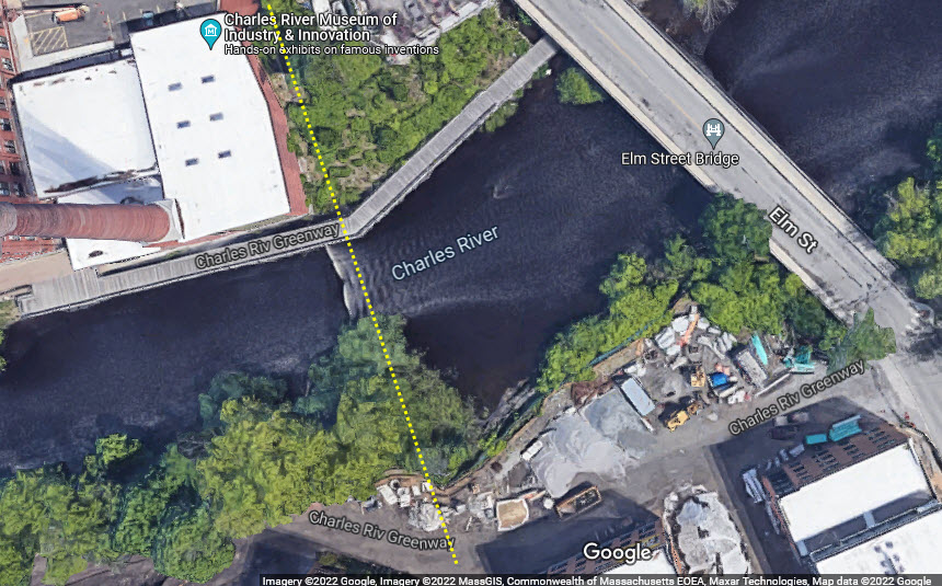
For what it's worth, here's what WAS left of the two bridges on the Arsenal Branch, they are now both gone.
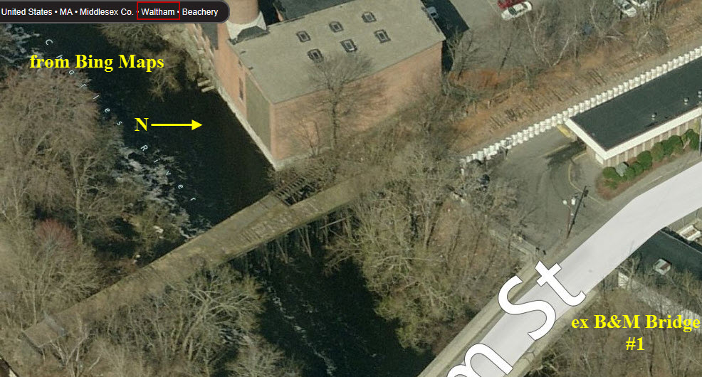
 Bridge all gone.....
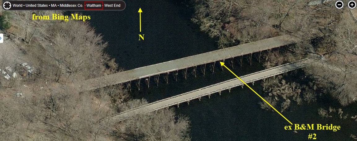
 Bridge all gone too....
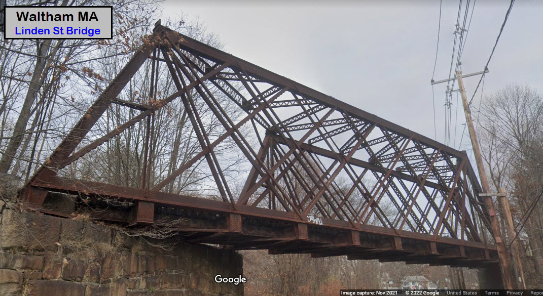
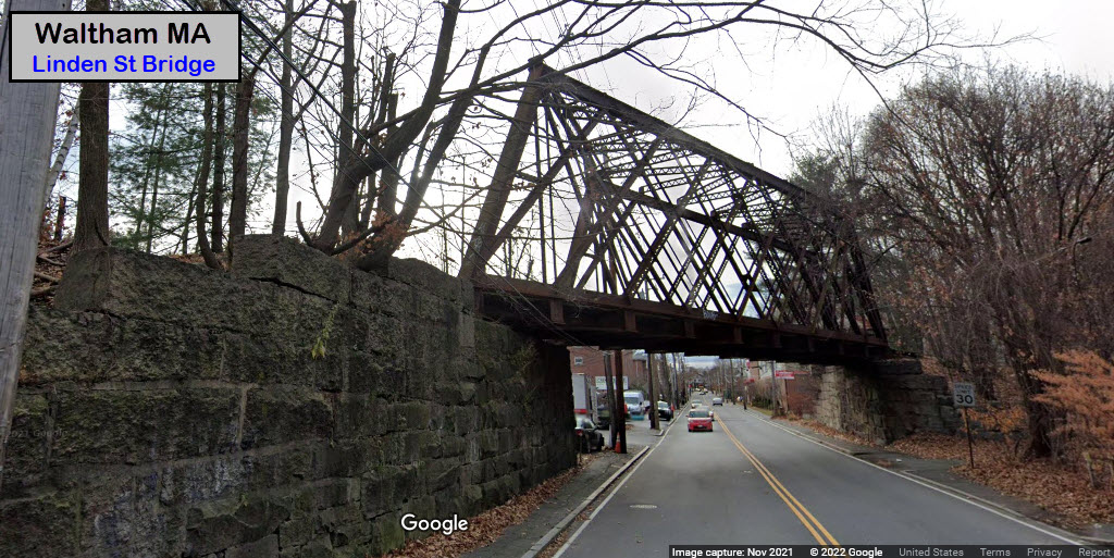
GPS Coordinates: 42.38032, -71.22035
An early skewed steel thru truss type bridge.
From the Library of Congress comes these two photographs from ~1968....
https://www.loc.gov/resource/hhh.ma1224.photos?st=gallery
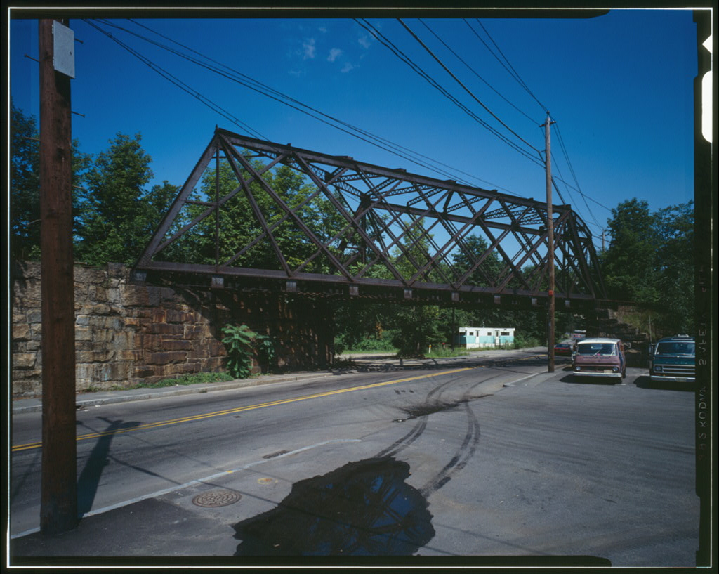
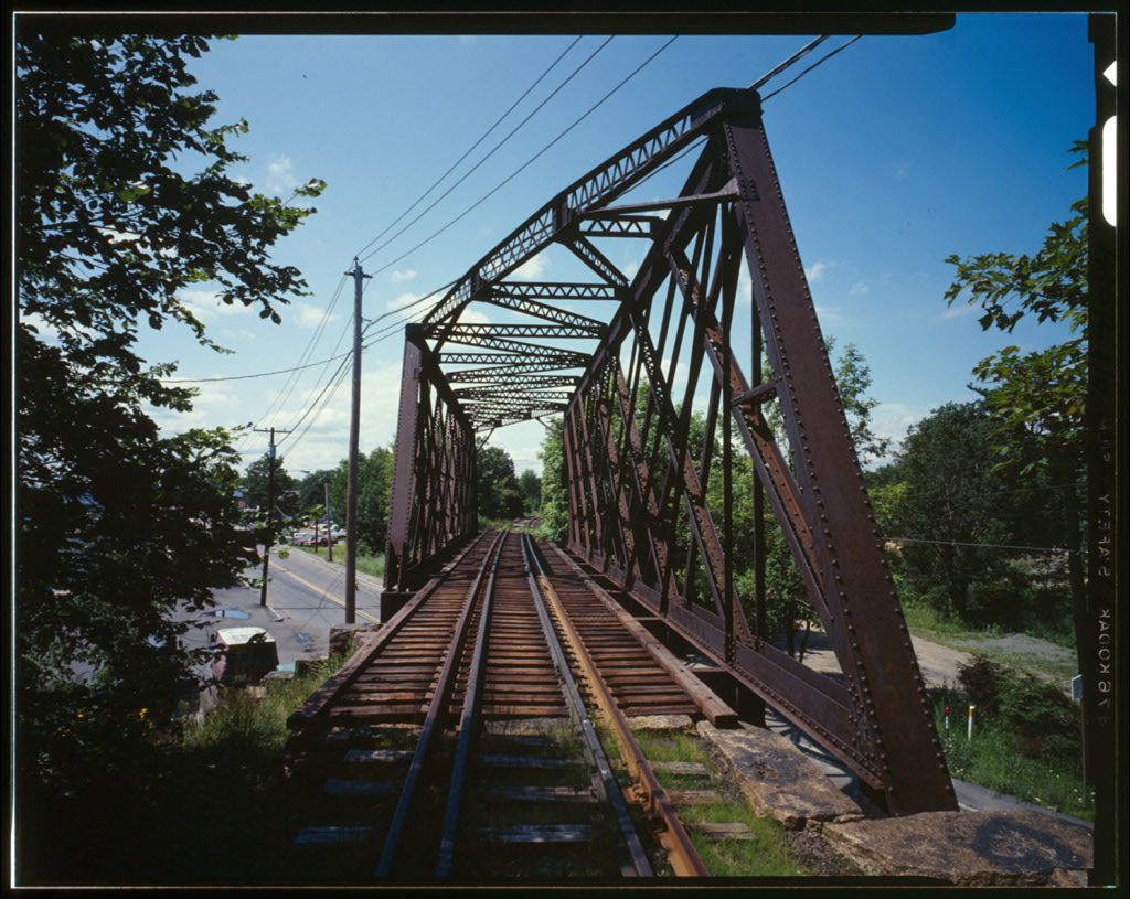
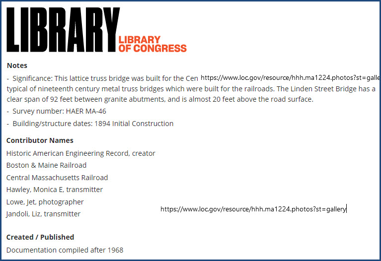
 October 1985
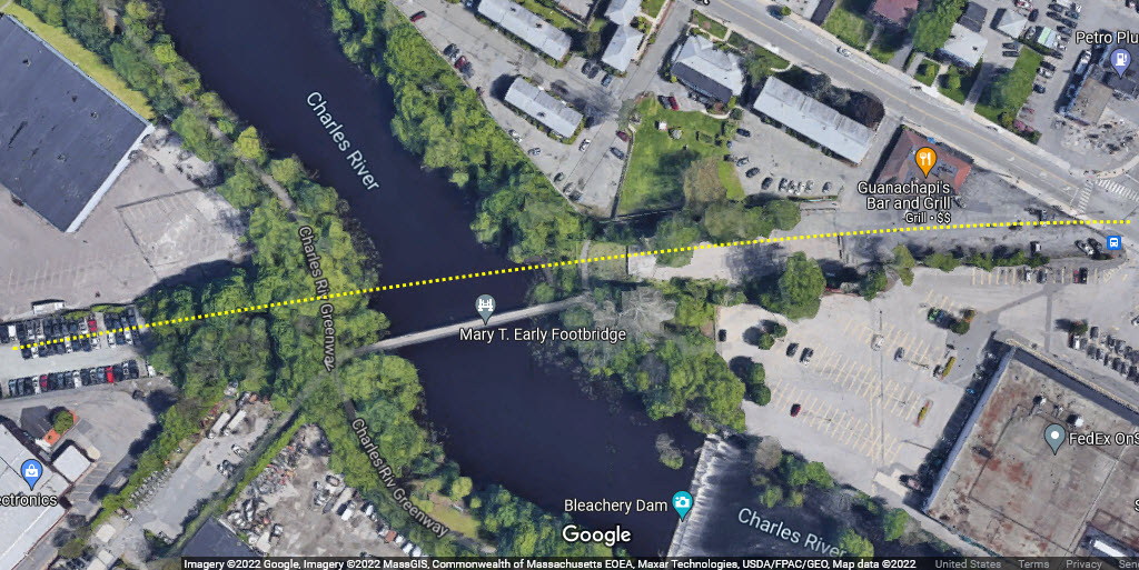
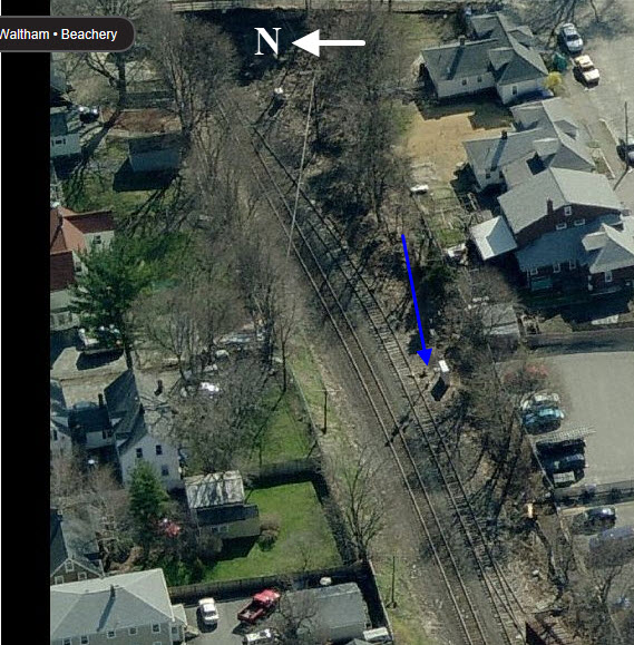
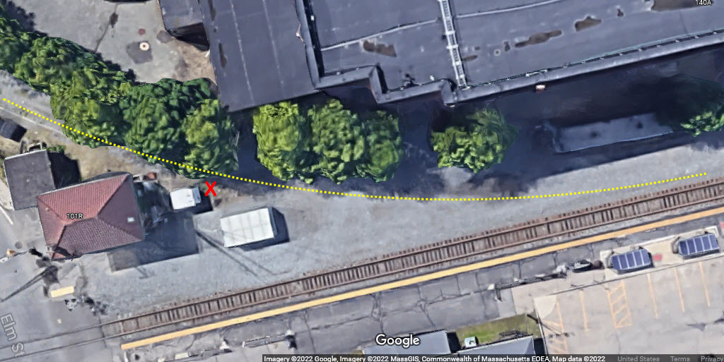
In this aerial shot from Bing, we have most of the "stuff" on the east end of the Waltham station area....
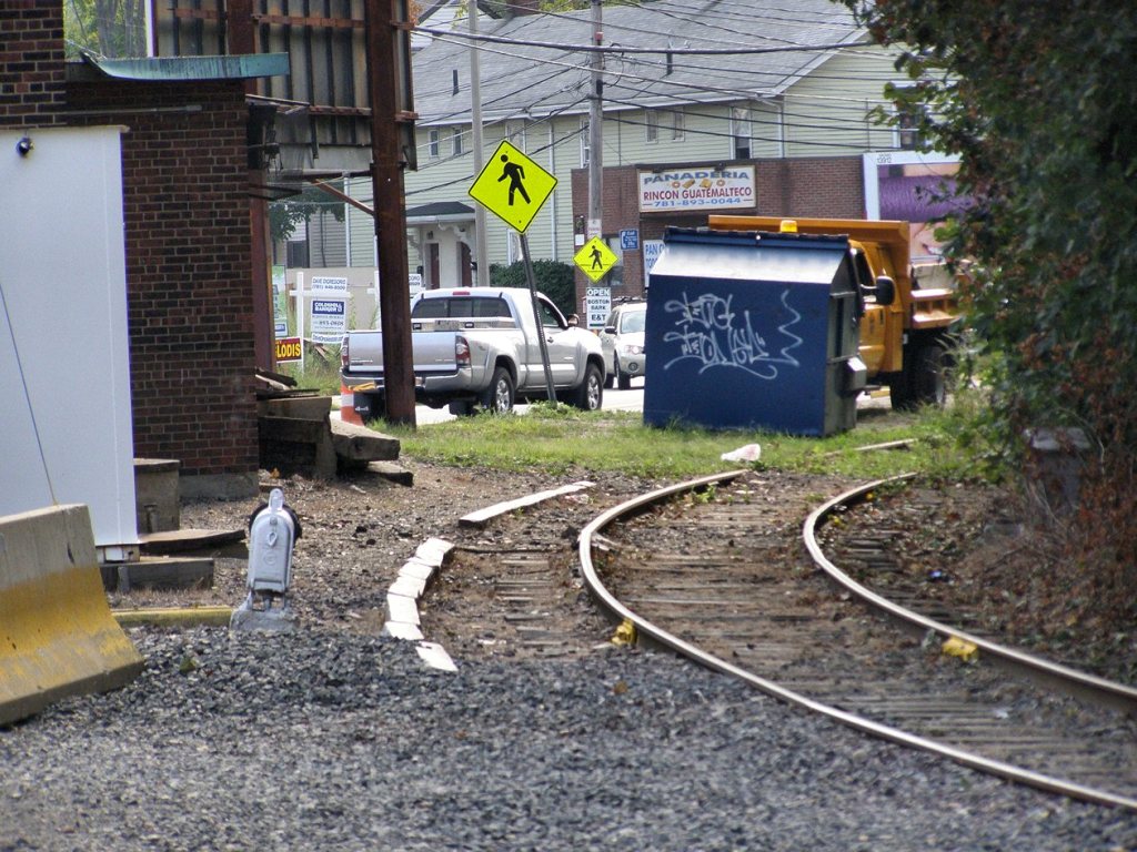
The Arsenal Branch is pretty much done for, because in Streetviews from 2020, you can barely see the rails.
GPS Coordinates: 42.37492, -71.23159
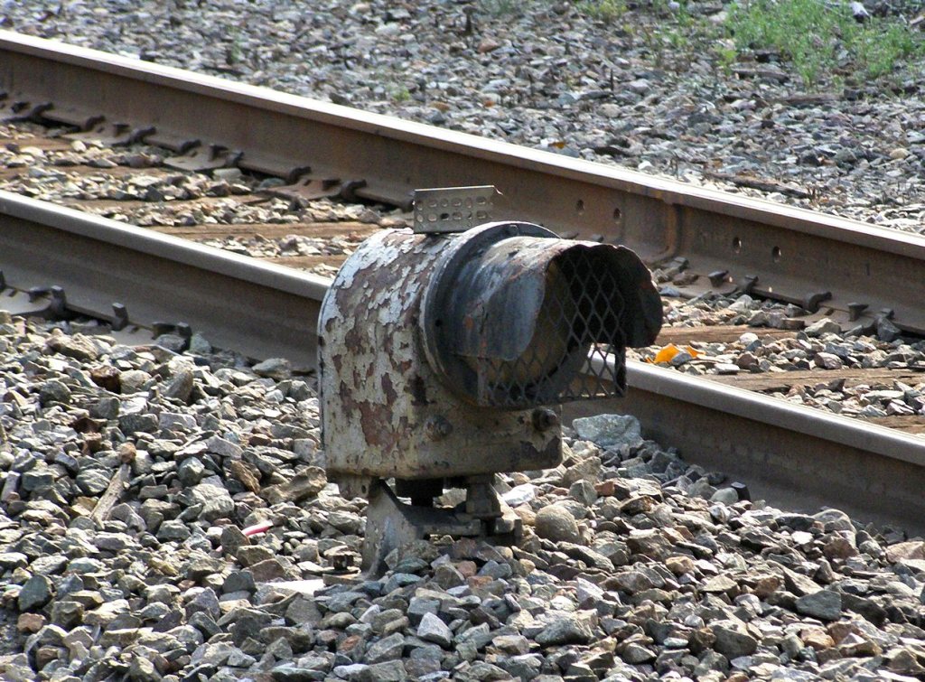
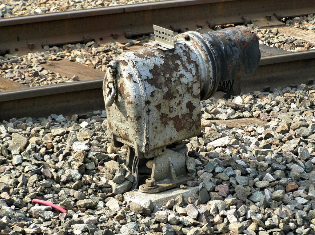
This signal used to have a deep blue doll post signal when I was here last around 2001-2002. I was here several times, and only got to see it lit twice, the other times it was out. Dave P. tells me that the doll post lamp assembly is now gone. The doll post was for a siding that stood between the signal and the track it governed. The siding has been disconnected from the mainline, and the freight cars on it can only, now, be taken out by truck....
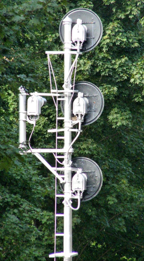
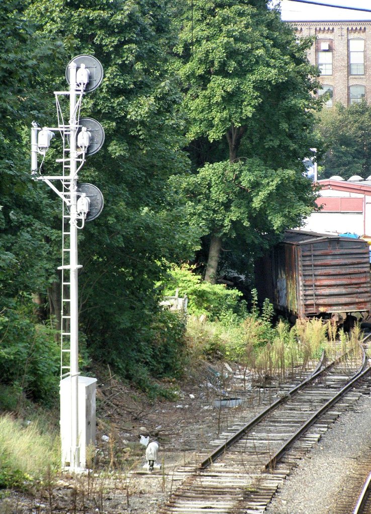
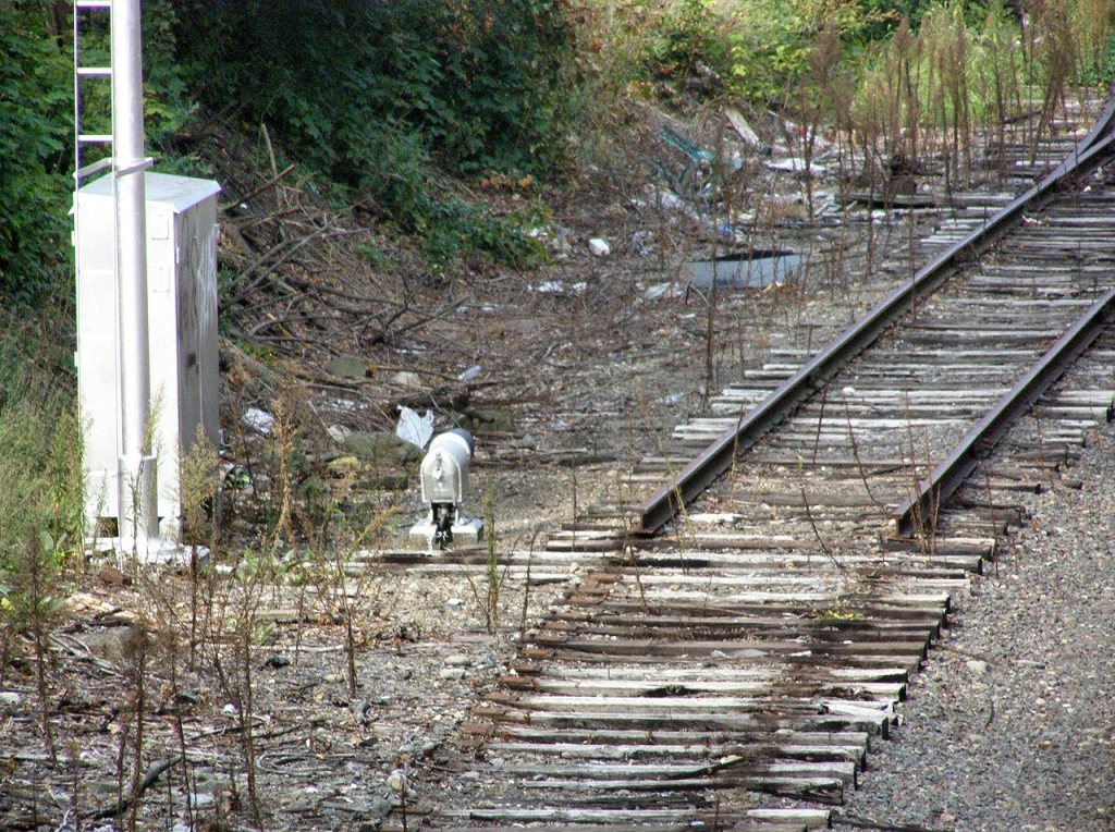
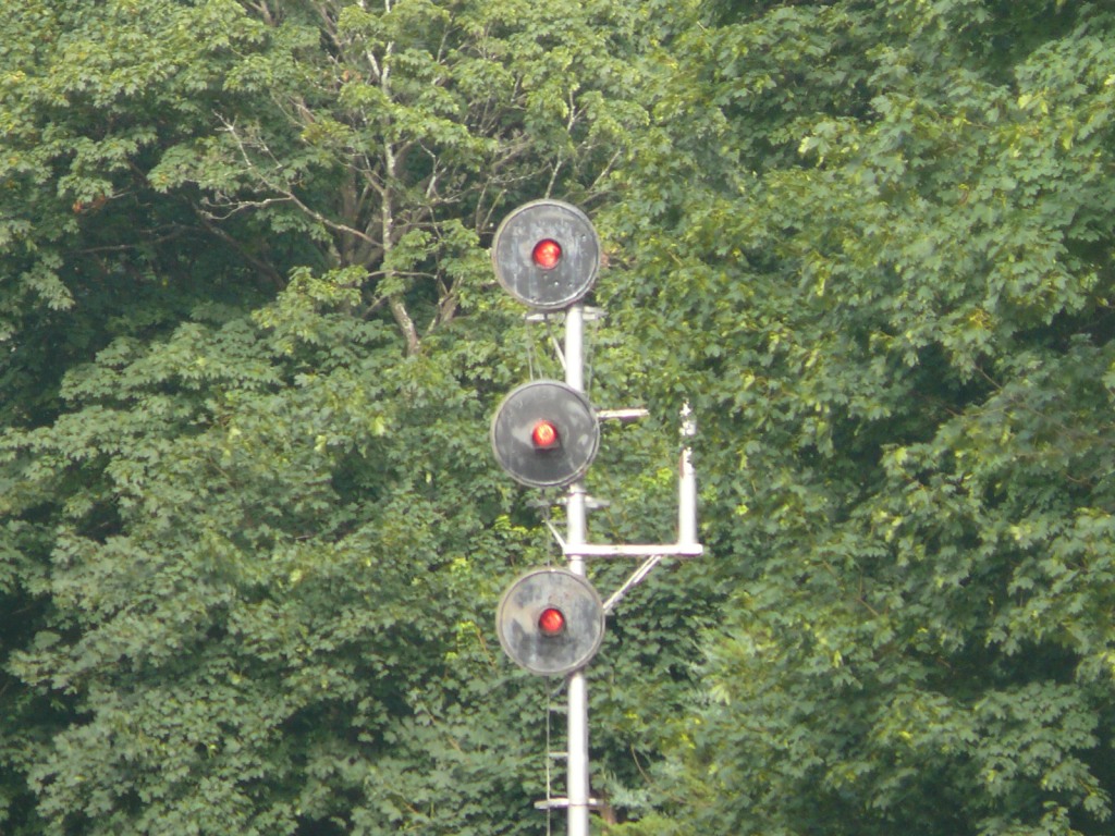 Photo by Dave P.
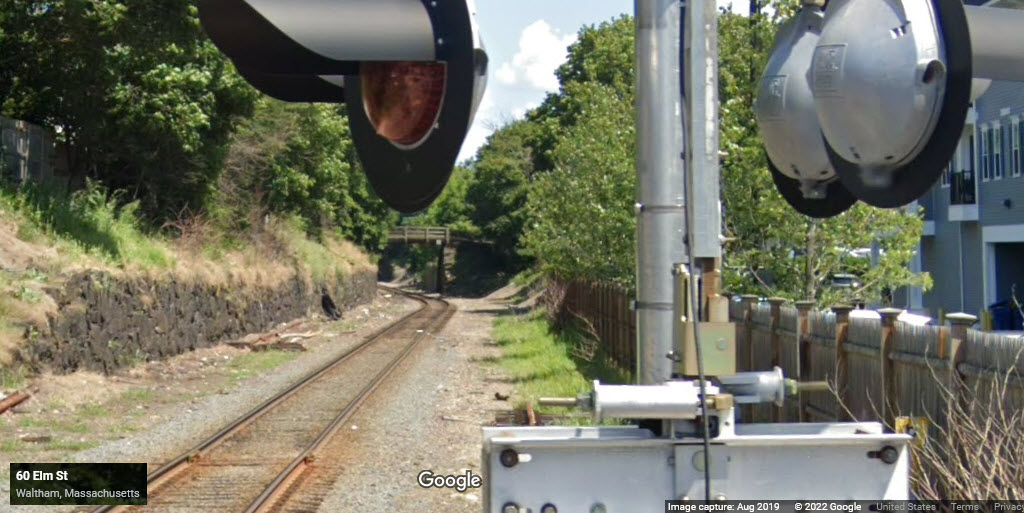
In this 2019 view from Google Streetview, we can see the siding and signals are gone....
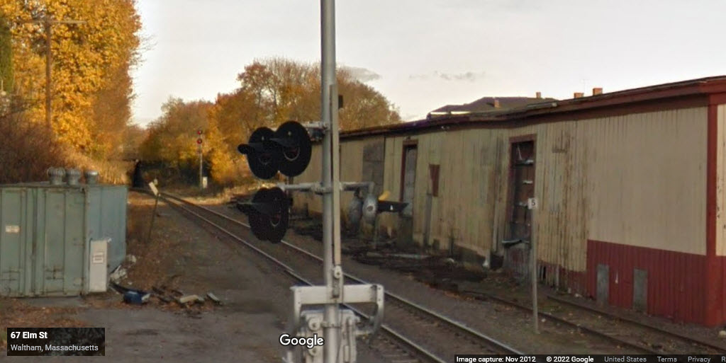
In 2012, we still have the signal, but the cars are gone, and the siding is in the process of being taken up.
Can't quite tell, but the doll arm and blue signal may be removed.
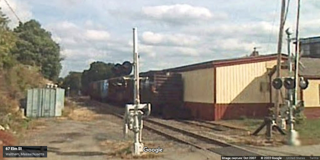
In 2007, we can see the siding, but can't really tell the signal is there due to the low resolution of the cameras at the time, darn.
GPS Coordinates: 42.37418, -71.23629
This signal is just east of Moody St. This signal controls the interlocking for the WB split into two tracks. This signal is now gone, replaced by a signal on the left side of the tracks.
GPS Coordinates: 42.37413, -71.23625
This signal is just east of Moody St. As above, this signal controls the interlocking for the WB split into two tracks. The signal is now on the left side of the tracks.
GPS Coordinates: 42.37359, -71.23878
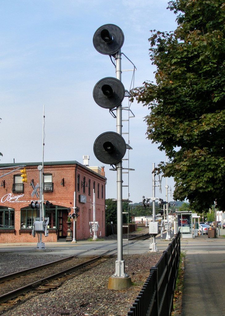
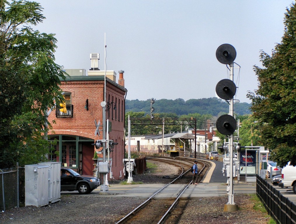
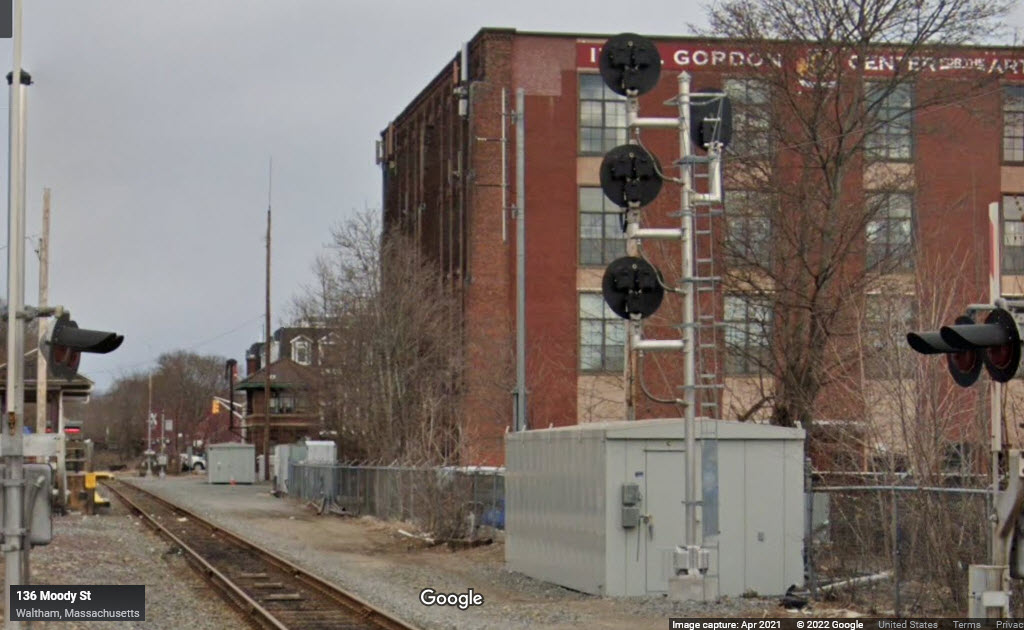
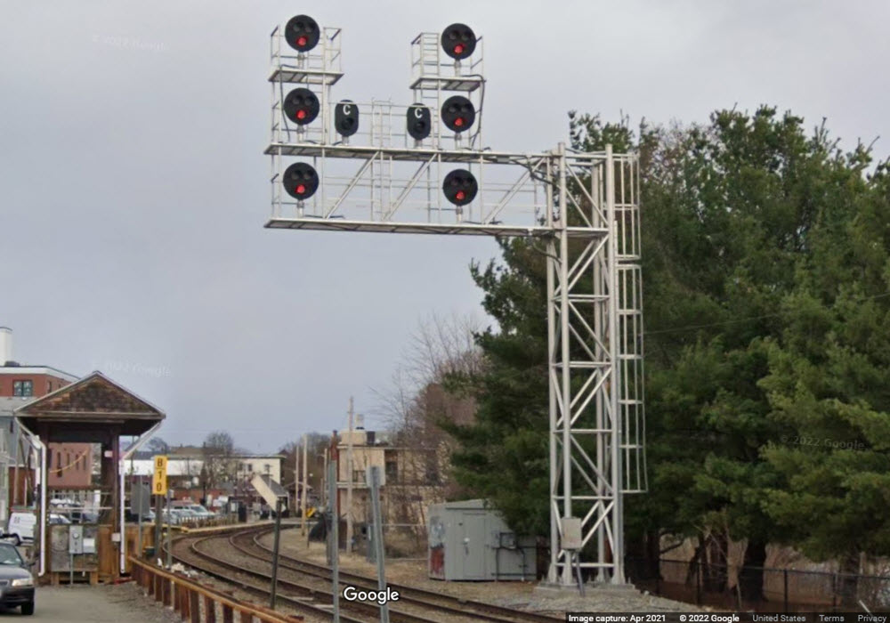
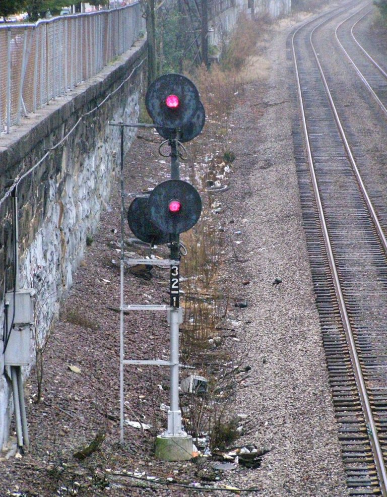
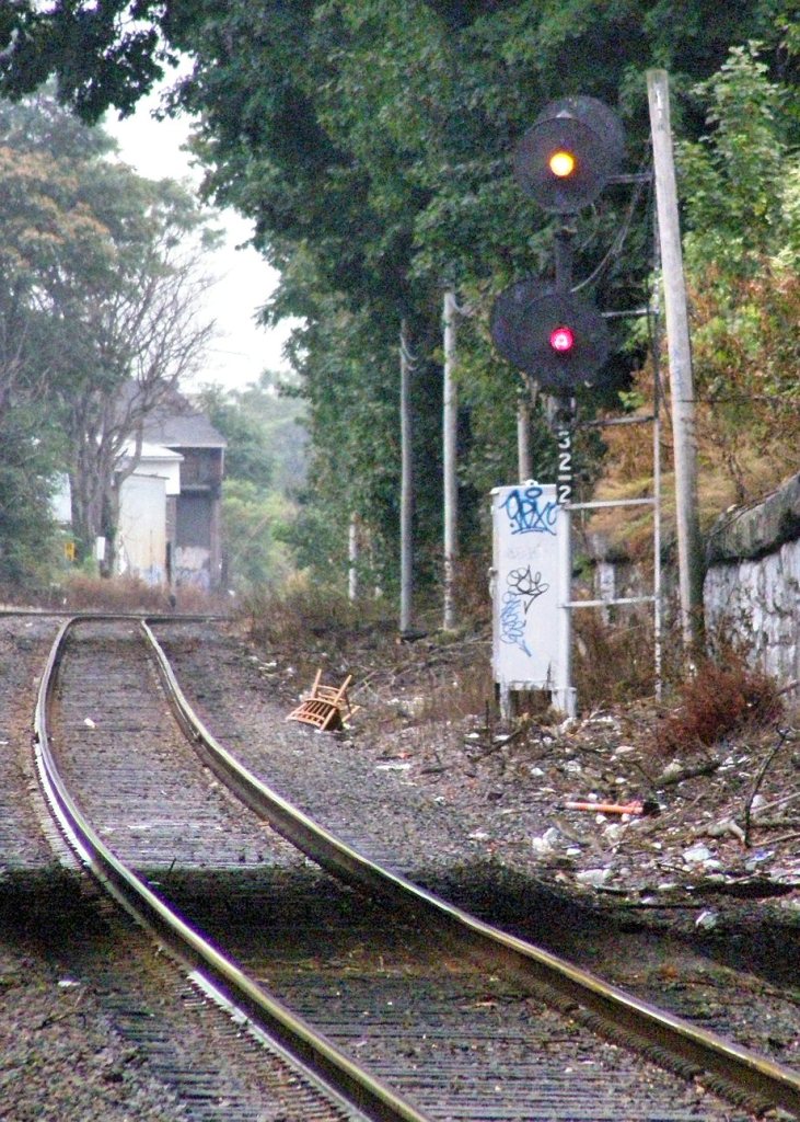
The right track (inbound to Boston) has the high signals on the signal bridge, the dwarf searchlight is for the left (outbound) track. The signals are west of Moody St.
GPS Coordinates: 42.37359, -71.23878
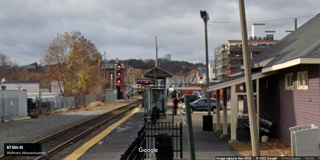
With the signal update, both signals are now high signals on a cantilever bridge. I'm making a guess, but this signal also probably controls the interlocking by the Main St overpass where we go back into two tracks.
GPS Coordinates: 42.37436, -71.23475
With the signal work that has been done in Waltham, I'm guessing this signal was removed out since the track and switch were taken up.
The Arsenal Branch track and dwarf signal locations.
Remains of an Early Grade Crossing Signal
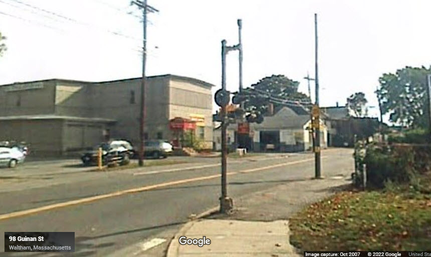
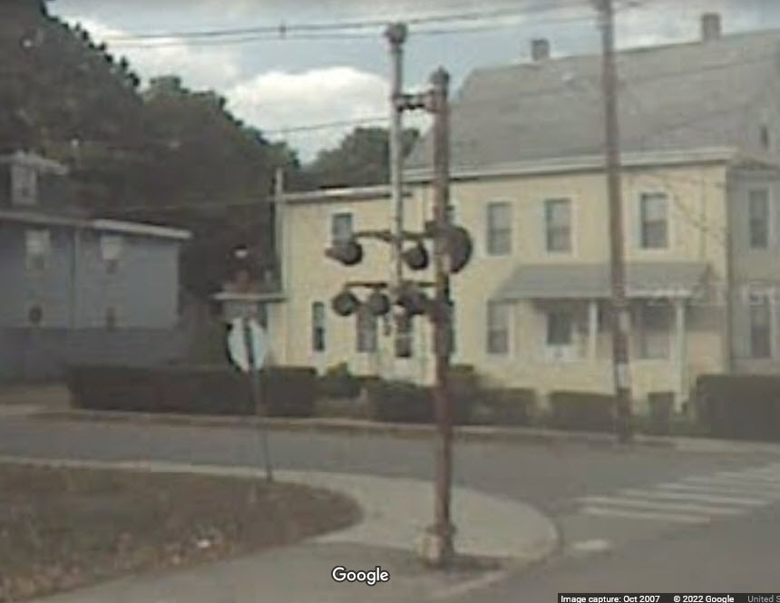
This was here when I came thru in 2001, and it looks like it was still there in 2007, but in the 2011 Streetview, it is gone. It was at the corner of Guinan and Bacon Streets. If I had driven here, instead of flying, I would have hunted down someone to ask if I could take the thing..... :-)
Over at the Porter Square Station
Porter Square is in towards the city. All of these photos are by Mike Brotzman
Porter Square station in background, from the Beacon St overpass.
Notice the green over green, not very common.

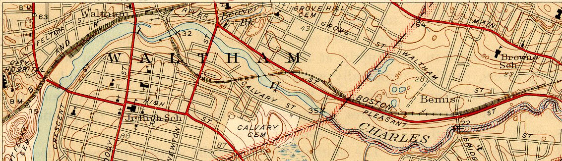
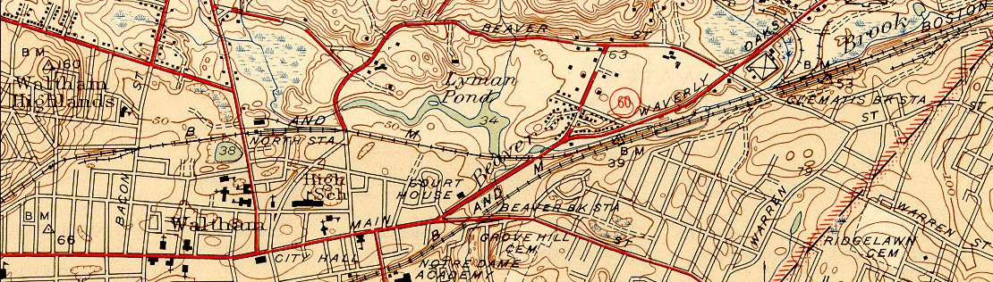
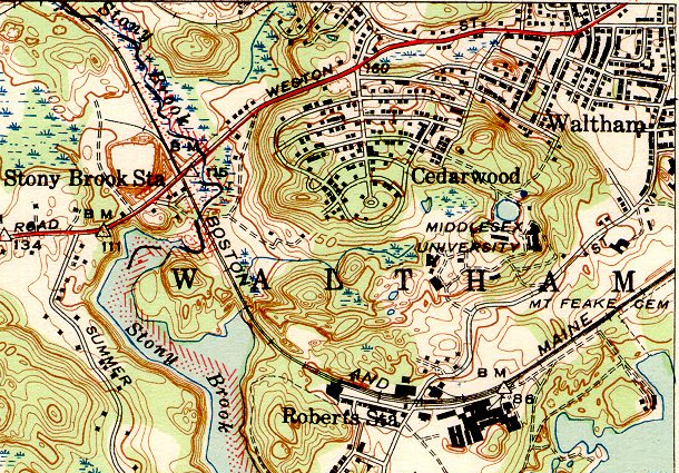
1940's Era USGS Topo Maps
The first one is a 15 minute projection, the other three are 7 1/2.
Disclaimers:
I love trains, and I love signals. I am not an expert. My webpages reflect what I find on the topic of the page. This is something I have fun with while trying to help others.
Please Note: Since the main focus of my two websites is railroad signals, the railfan guides are oriented towards the signal fan being able to locate them. For those of you into the modeling aspect of our hobby, my indexa page has a list of almost everything railroad oriented I can think of to provide you with at least a few pictures to help you detail your pike.
If this is a railfan page, every effort has been made to make sure that the information contained on this map and in this railfan guide is correct. Once in a while, an error may creep in :-)
My philosophy: Pictures and maps are worth a thousand words, especially for railfanning. Text descriptions only get you so far, especially if you get lost or disoriented. Take along good maps.... a GPS is OK to get somewhere, but maps are still better if you get lost! I belong to AAA, which allows you to get local maps for free when you visit the local branches. ADC puts out a nice series of county maps for the Washington DC area, but their state maps do not have the railroads on them. If you can find em, I like the National Geographic map book of the U.S..... good, clear, and concise graphics, and they do a really good job of showing you where tourist type attractions are, although they too lack the railroads. Other notes about specific areas will show up on that page if known.
Aerial shots were taken from either Google or Bing Maps as noted. Screen captures are made with Snagit, a Techsmith product... a great tool if you have never used it!
By the way, floobydust is a term I picked up 30-40 years ago from a National Semiconductor data book, and means miscellaneous and/or other stuff.
Pictures and additional information is always needed if anyone feels inclined to take 'em, send 'em, and share 'em, or if you have something to add or correct.... credit is always given! Please be NICE!!! Contact info is here
Beware: If used as a source, ANYTHING from Wikipedia must be treated as being possibly inaccurate, wrong, or not true.
RAILFAN GUIDES HOME
RAILROAD SIGNALS HOME
NEW 03/21/2012, AUG13/2013, OCT04/05/06/07/2022
Last Modified 07-Oct-2022