In General
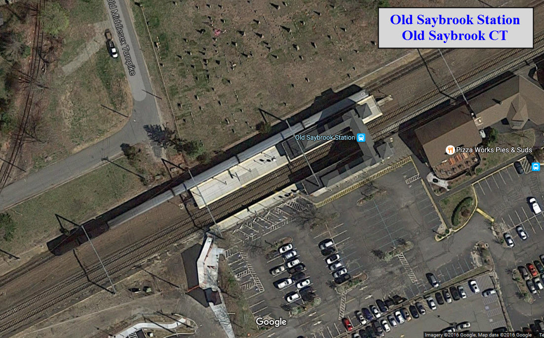
Getting Here
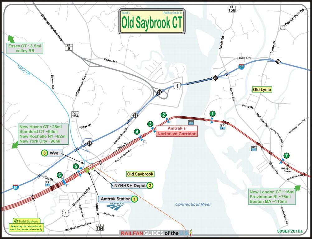
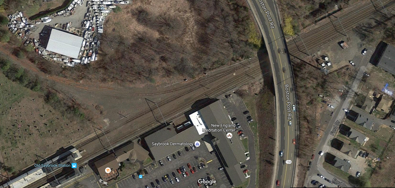
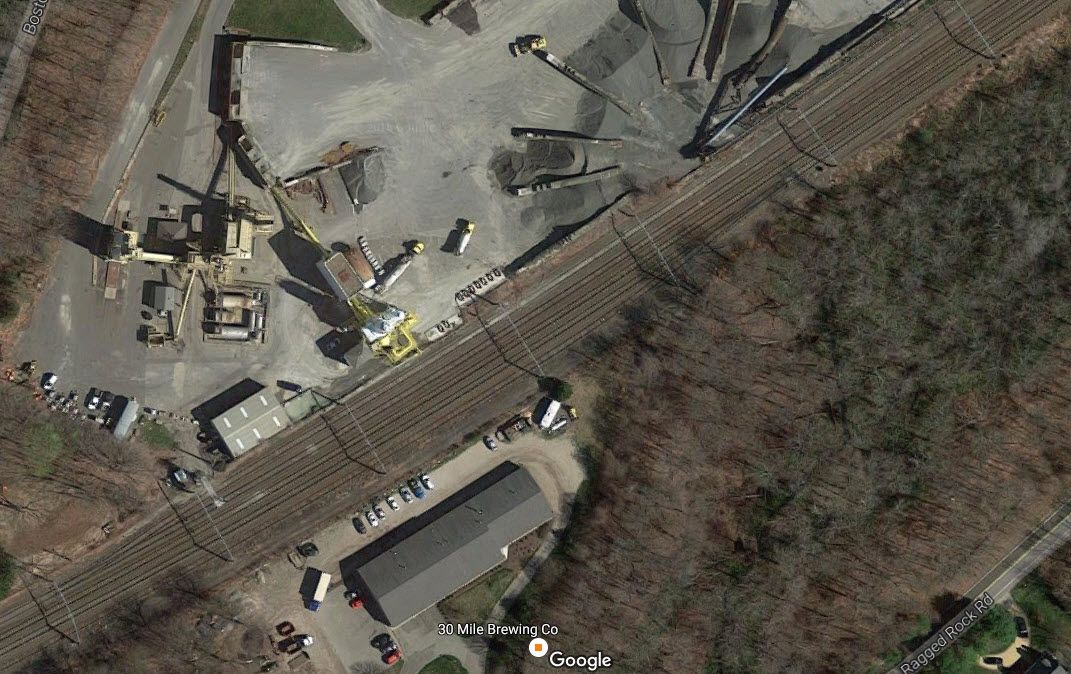
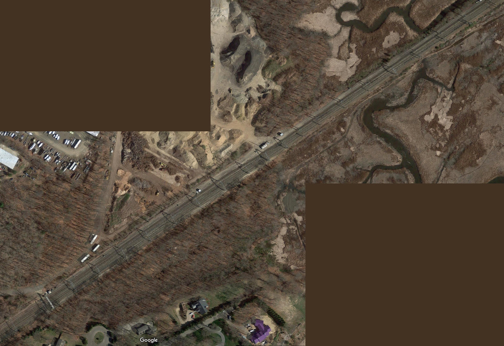
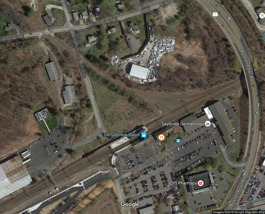
Map
Sights
Pictures
Signals
Floobydust
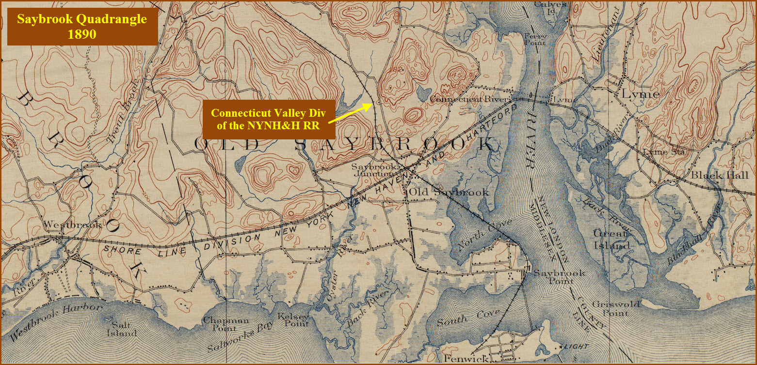
USGS Maps
RAILROAD SIGNALS HOME
Location / Name:
Old Saybrook CT, Middlesex County
What's Here:
Former New Haven Depot
Amtrak Station
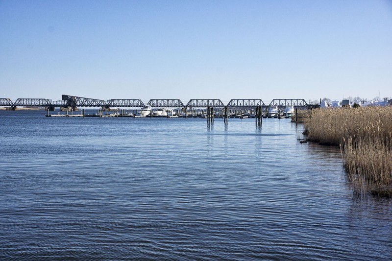
Saybrook Wye
Interchange with the Valley Railroad
Gauntlet Track
Data:
GPS Coordinates: 41.300489, -72.377054
Phone A/C: 860
ZIP: 06475
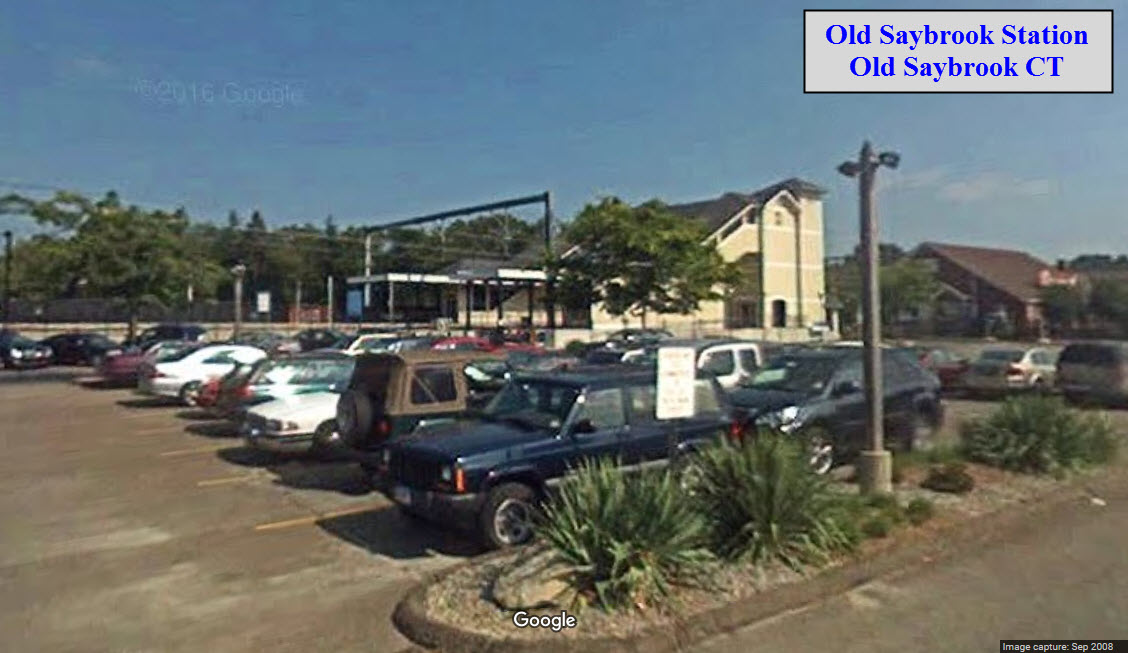
Access by train/transit:
Plenty by Amtrak Northeast Regional trains
Plenty by Shore Line East trains
Estuary Transit District buses
The Scoop:
Old Saybrook has always been a "sweet" New Haven spot for those of us who love Northeast railroading, for that is the heritage of Old Saybrook. It used to be the junction between the Connecticut Valley and Shore Line Divisions of the NYNH&H. Of course, that all changed in 1968 with the formation of the Penn Central.
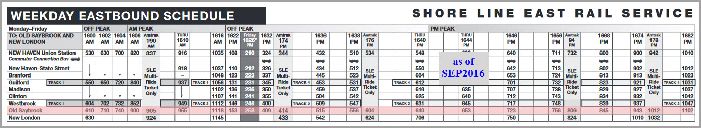
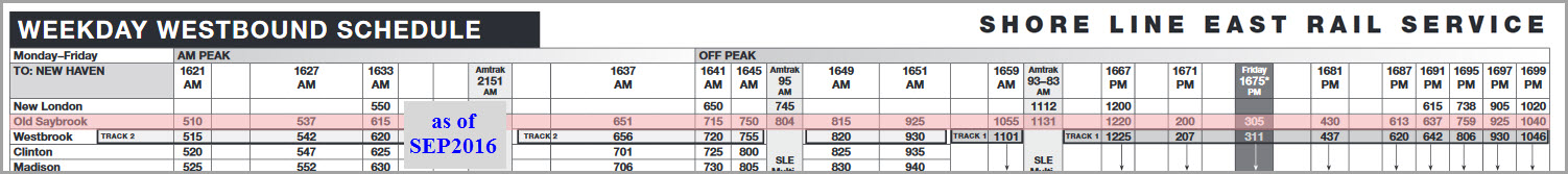
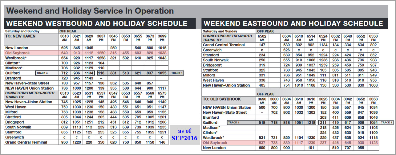
Old Saybrook is a busy place, with about 19 Amtrak trains coming through a day, about 34 Shore Line East trains, and a Providence & Worcester freight once in a while, but I understand most of them should be at night due to the passenger traffic volumes (how the heck did the NH ever run a railroad? :-) Acela trains do not stop here, and about half of the regular Amtrak trains do not stop in Old Saybrook (info from the Trains hot spot article).
This spot on the New Haven was also known as Saybrook Junction.
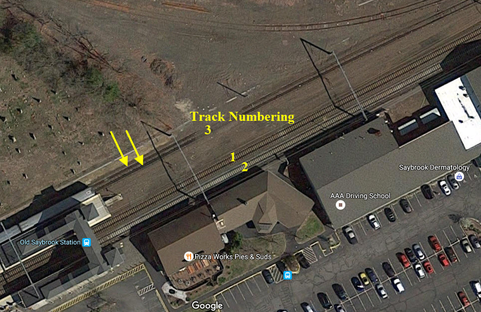
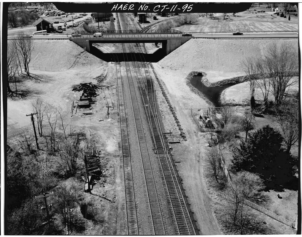
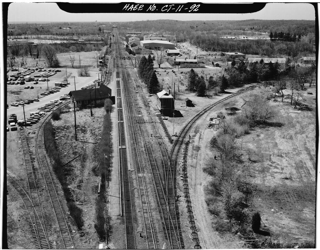
As far as track goes, we have some interesting interlocking going on. In addition, the track going thru the station is a gauntlet track. What is that? It is where there are two sets of tracks, only inches apart, so that the track (in this case) further from the station platform can accommodate wider loads on freight trains. One of the few other places I know of that has used gauntlet track, and coincidentally, also on the NEC, is the Capitol Beltway station back in the 80's. You can find those pictures here.
As we come up from the south, the line is two tracks until we get just north of School House Rd, where it turns into a four track railroad.
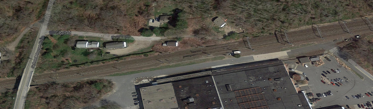
As we approach the wye, we have two short industrial sidings, one on both sides of the R-O-W, and we have another interlocking where we go down to three tracks for going thru the station.
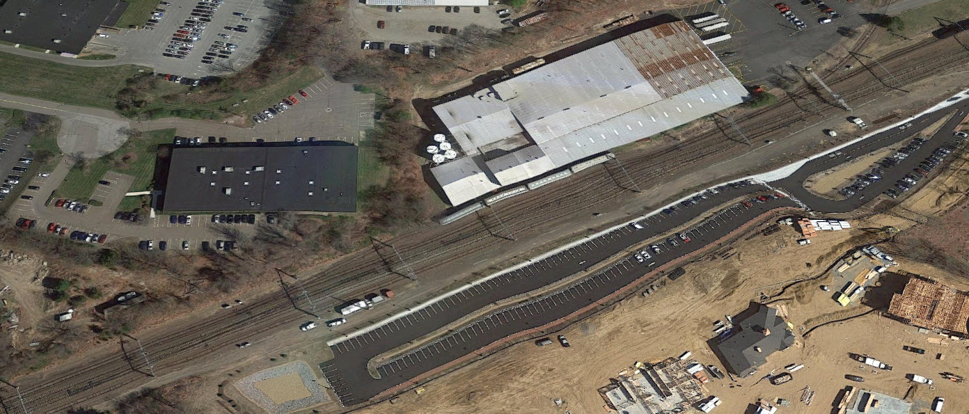
On the north side of the station and wye, we have another siding to serve a gravel company.
On the north end of the siding, we have a couple of crossovers (one in 2 track territory) and we lost the third track, going back to two for it's trek towards New London.
This location is featured in the September 2016 issue of Trains magazine as a hotspot.
Acknowledgements:
Denver Todd
William Nelson
Train man Paul
Chris
Pi
Google Maps
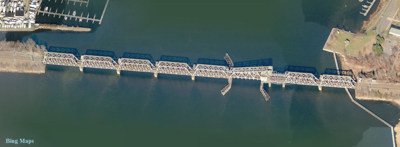
Bing Maps
Websites and other additional information sources of interest for the area:
https://en.wikipedia.org/wiki/Old_Saybrook_station
http://www.greatamericanstations.com/Stations/OSB
http://www.loc.gov/pictures/search/?q=Photograph:%20ct0338&fi=number&op=PHRASE&va=exact&co%20=hh&st=gallery&sg%20=%20true pictures of the NH
http://www.loc.gov/pictures/search/?q=Photograph:%20ct0646&fi=number&op=PHRASE&va=exact&co%20=hh&st=gallery&sg%20=%20true the tower, 3 pics
http://thenhrhtanewhavenrailroadforum.yuku.com/reply/62568/Re-Old-Saybrook-Signal-Tower-Color#.V-8CTMkazkE pictures of the tower
http://www.shorelinetimes.com/articles/2014/09/21/opinion/doc539b06cb61cda158458400.txt
https://en.wikipedia.org/wiki/Shore_Line_East
https://en.wikipedia.org/wiki/Gauntlet_track
http://www.eesi.org/files/Paul_Haven_-_Toward_A_Sustainable_Transportation_Network_in_the_Northeast-_2016_04_28_v2.pdf
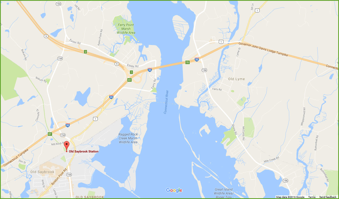
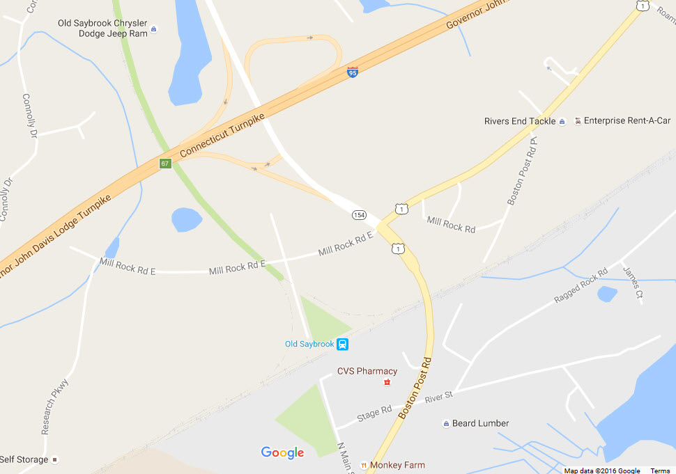
If you're coming from the south on I-95, take exit 67,
and stay to the right getting on US1, the Boston Post Road, southbound.
Go over the tracks, and take a right onto Stage Road to get to the Amtrak
station. If you want to get into the middle of the wye, take a right
turn immediately after getting off the exit ramp onto Mill Rock Road, then
take a left at Old Middlesex Turnpike before crossing the Valley RR tracks.
NEW 09/30/2016,
OCT05/2016, AUG24/2017, MAR23/2024
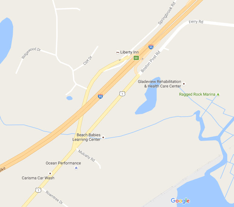
If you're southbound on I-95, take exit 68 onto US1, and take it a half mile or so till you hit the Boston Post Rd, and hang a left to the station.
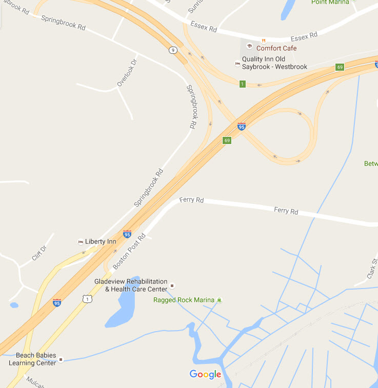
If you're coming from the Hartford area, or north (like the Connecticut Trolley Museum in East Windsor/Warehouse Point), use I-91 to get to CT9 (exit 22), and travel
south about 28 miles to I-95. Take the I-95 south exit, then, immediately take exit 68 to get on US1.
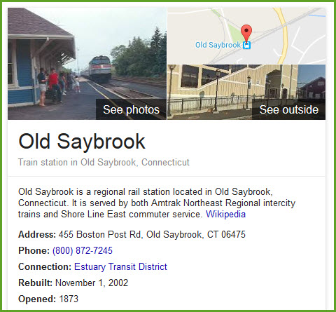
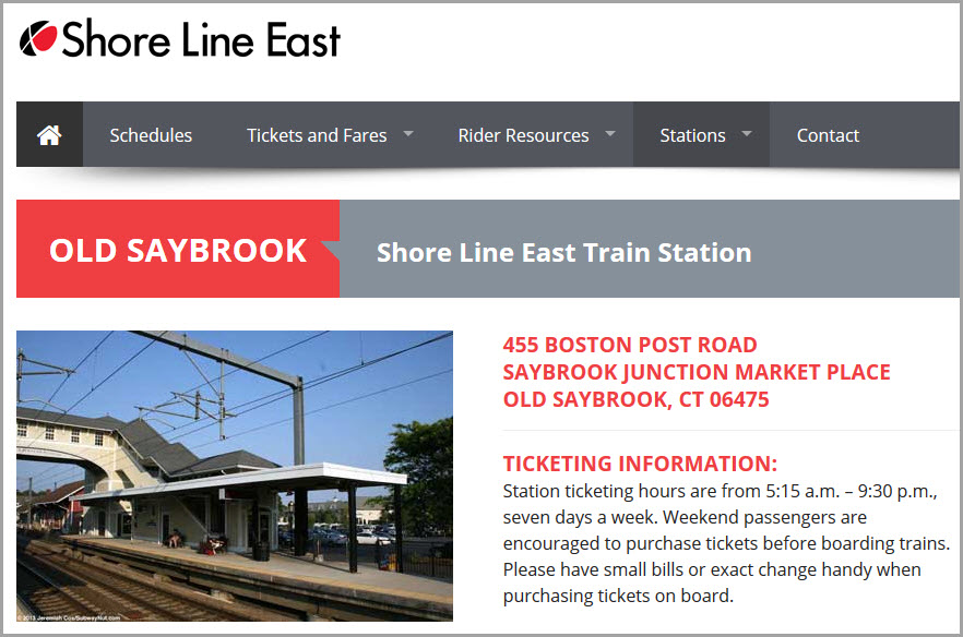
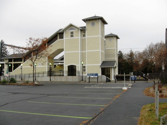
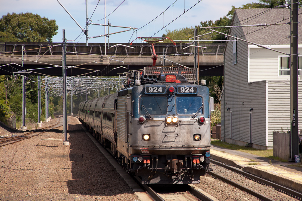
![]() the Amtrak / Shore Line East Station
the Amtrak / Shore Line East Station
Station Code: OSB
GPS Coordinates: 41.300489, -72.377054
455 Boston Post Rd, Old Saybrook, CT 06475
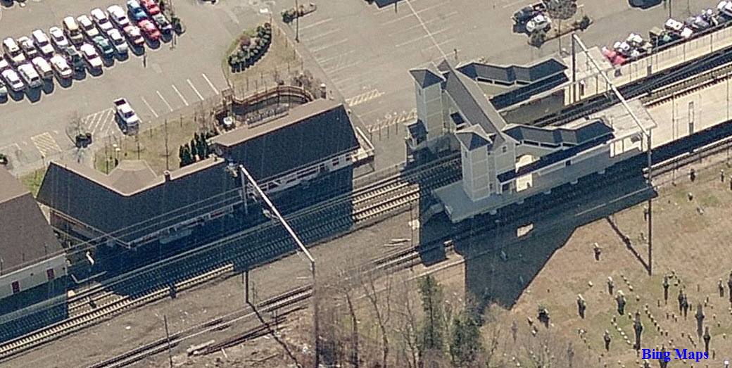
Interesting note, the rails on track 3 are gauntlet, meaning there are two sets
of rails, one for the passenger trains to get them close to the platform, and
one for the freight trains, which places the trains a little further away for
safety and clearance reasons. The only other station I of know of in
recent memory to have gauntlet tracks was the
Capitol
Beltway station in Maryland back in the 80's.
You can just make out the double set of rails in the picture below.......
![]() the former NYNH&H Depot
the former NYNH&H Depot
GPS Coordinates: 41.300501, -72.377005
The Amtrak ticket office is in this building, which is the old New Haven depot built in
1873. In case you are wondering about the odd layout of the building, the
depot was built to accommodate both branches of the New Haven, when the
Connecticut Valley division crossed here. This is shown in the one aerial
view below with the dotted yellow line.
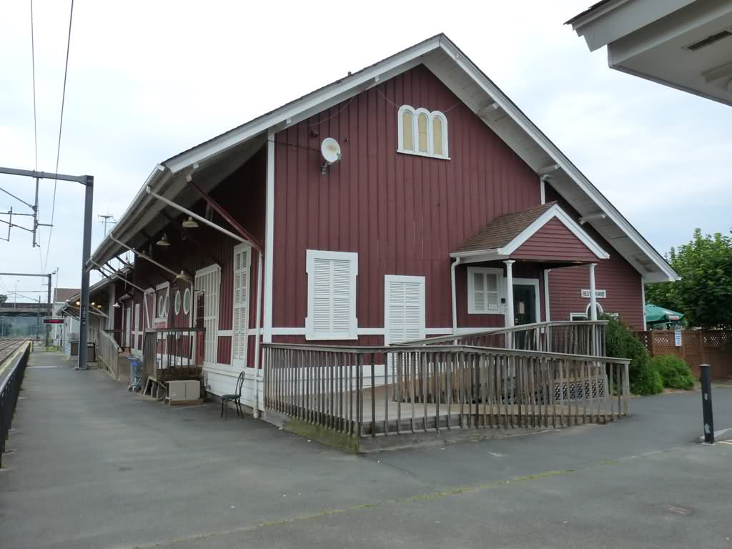
Photo by TMP, Train Man Paul, 2011
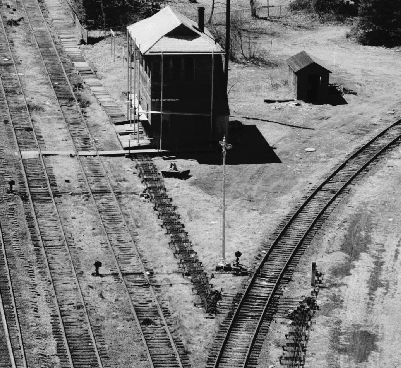
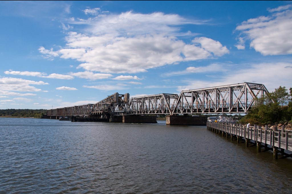
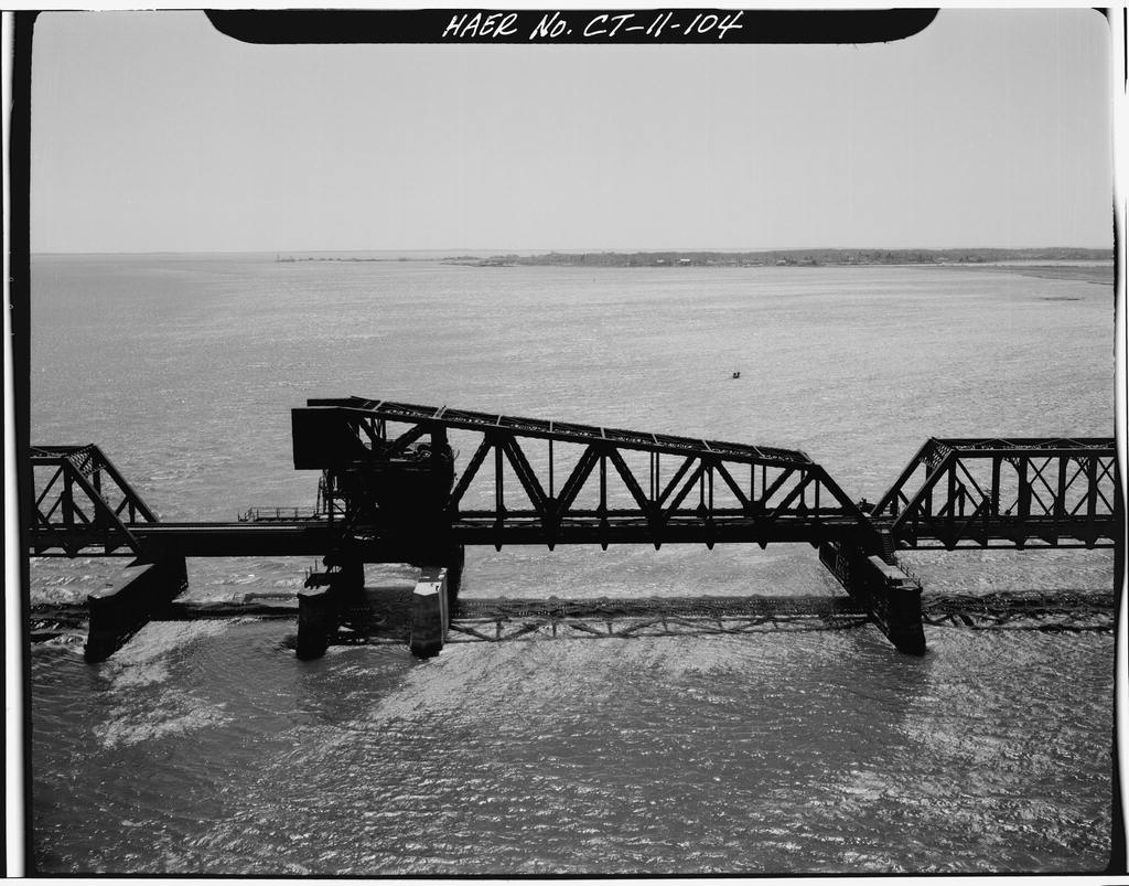
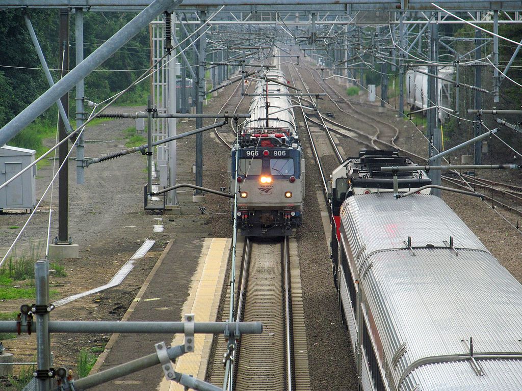
![]() the Old Saybrook Wye
the Old Saybrook Wye
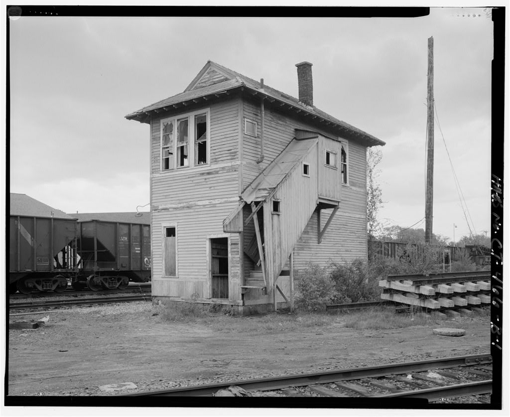
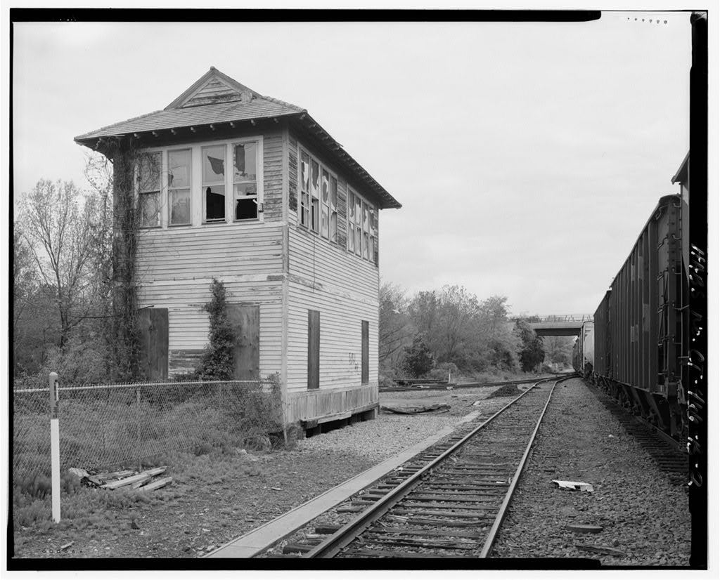
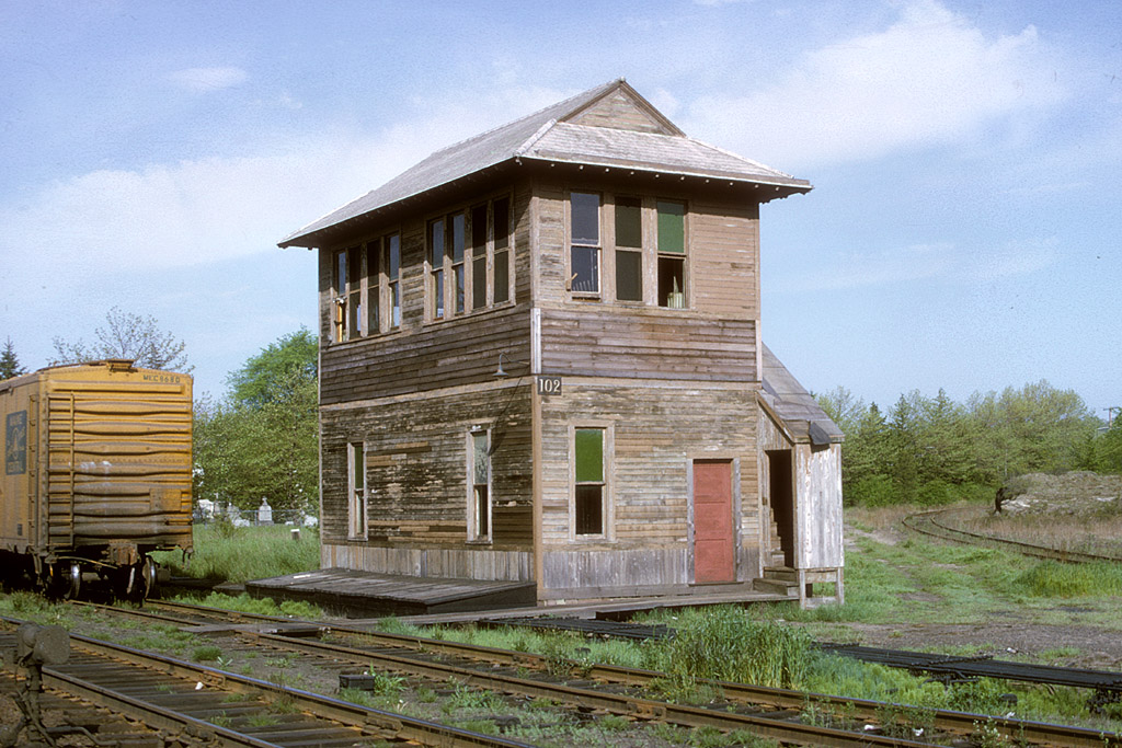
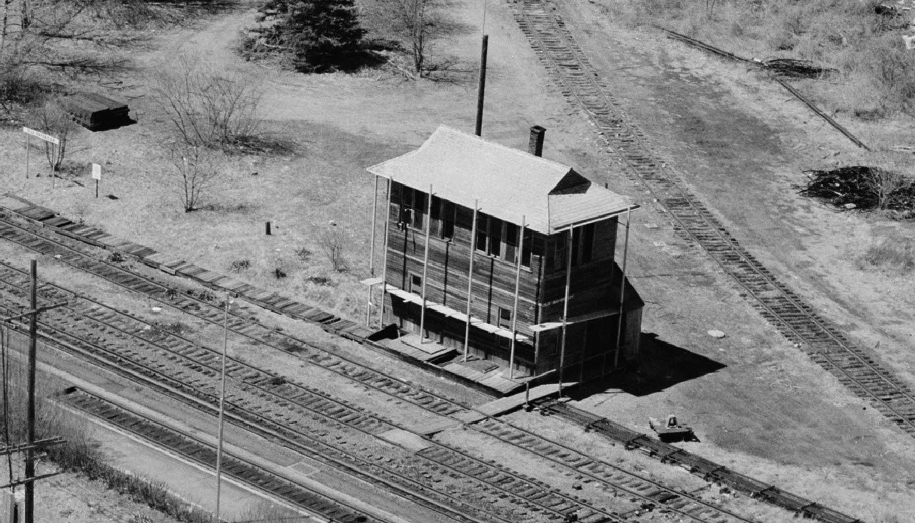
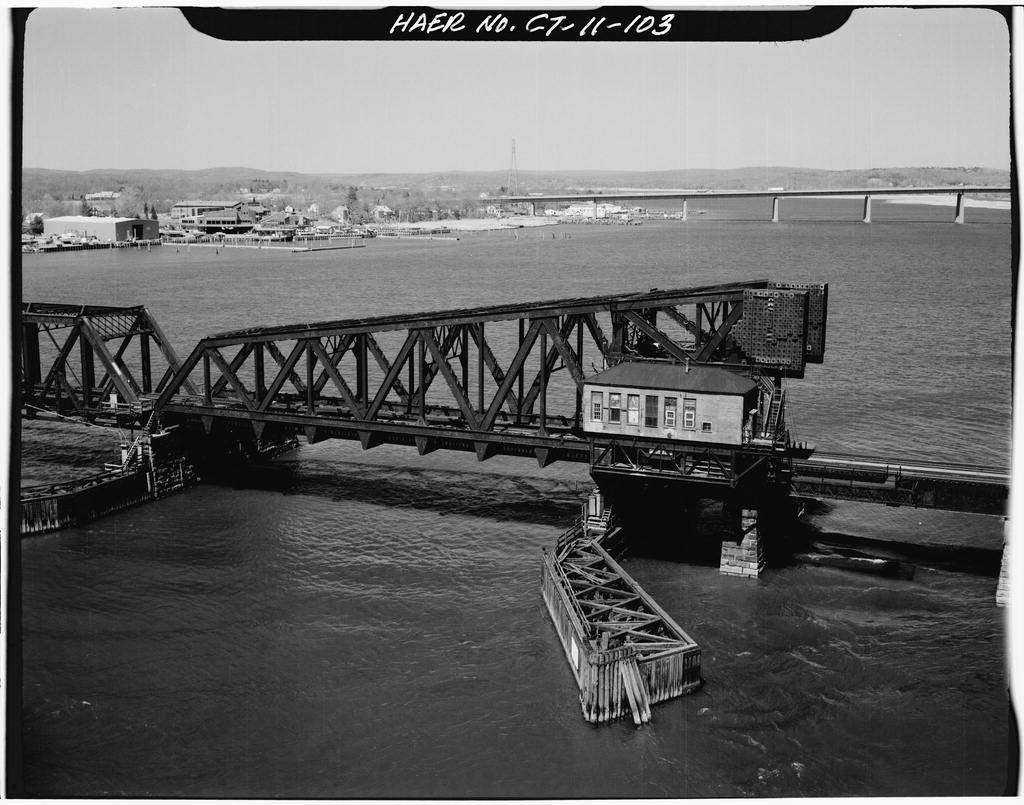
![]() Old Saybrook Tower
Old Saybrook Tower
I can find lots of pictures, but not so much on the history........ What follows is from the history section below...
The original tower was built around 1890 to keep the New Haven and Valley lines on separate tracks. However, the old tower was destroyed when a “runaway” box car
crashed into the structure and killed the operator in 1912.
A new tower was built and remained until 1985 when switching was done from Boston. Set in a “V” between the tracks of the two rail lines, the blue-gray
building became home to vagrants and pigeons and was offered free to anyone who would move it. The State Historic Preservation Office offered to help, but
Amtrak management got wind of the relocation effort, and moved up the
demolition of the tower.
Notice in the pictures below, that even as old as the B&W pictures are, the crossing line is not there.....
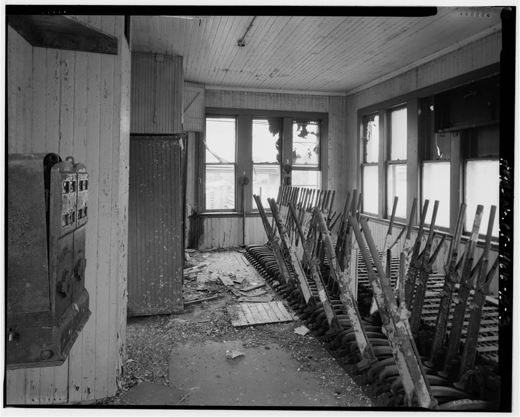
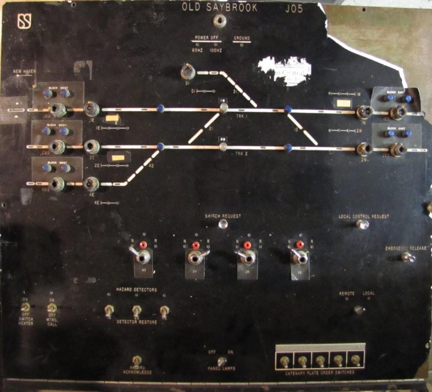
Here is the US&S console from the tower, which I acquired about 10 years ago at the Gaithersburg MD train show
(which usually happens on the weekend of the first Sunday of November).
If anyone is interested in it, it's up for sale at $400, NO shipping (it is too heavy), but I will drive it for you to pick as far
Hagerstown (west), Richmond VA (south), or Harrisburg/Philadelphia (north). I have some of the broken overlay, which was damaged when I bought it, a smaller
portion of it was already missing, darn. Contact info is below.

 By Chris, see below for source
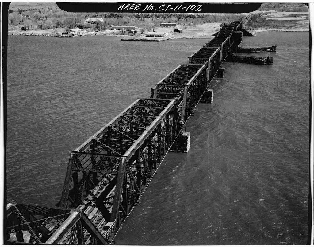
![]() X
X
Pictures needed.
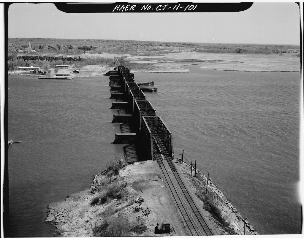
![]() X
X
Pictures needed.
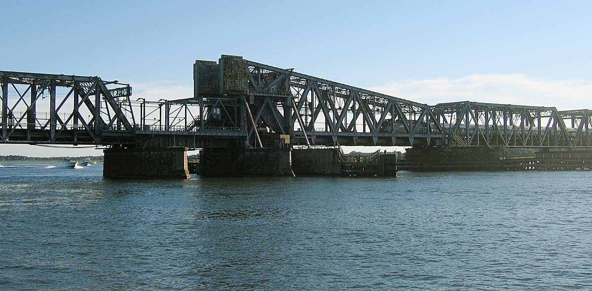
![]() X
X
Pictures needed.
![]() X
X
Pictures needed.
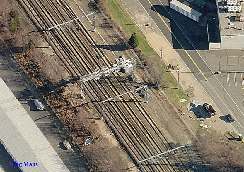
![]() SB Signals on the West Side of the Wye
SB Signals on the West Side of the Wye
Here we have the signals for tracks 1 and 2 on a signal bridge. The track 3 signal, and the signal for the wye leg are mast mounted.
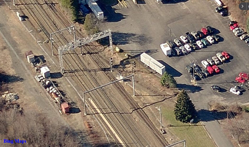
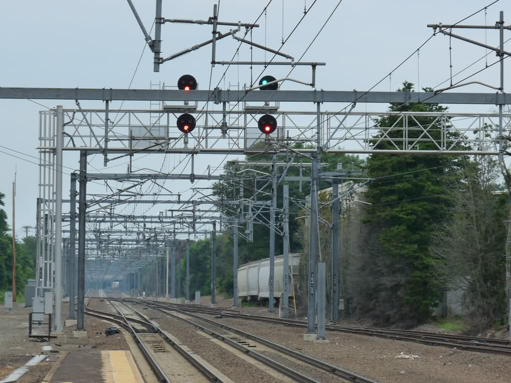
Photo by TMP, Train Man Paul, 2011
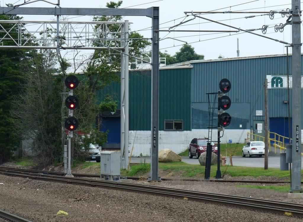
Photo by TMP, Train Man Paul, 2011
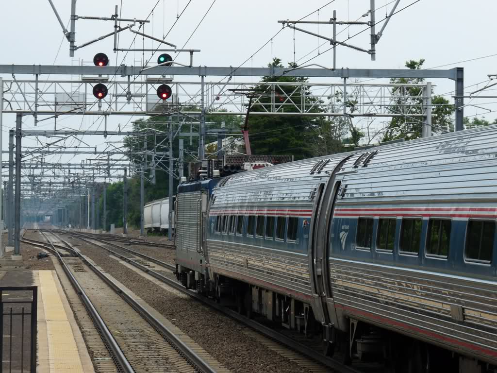
Photo by TMP, Train Man Paul, 2011
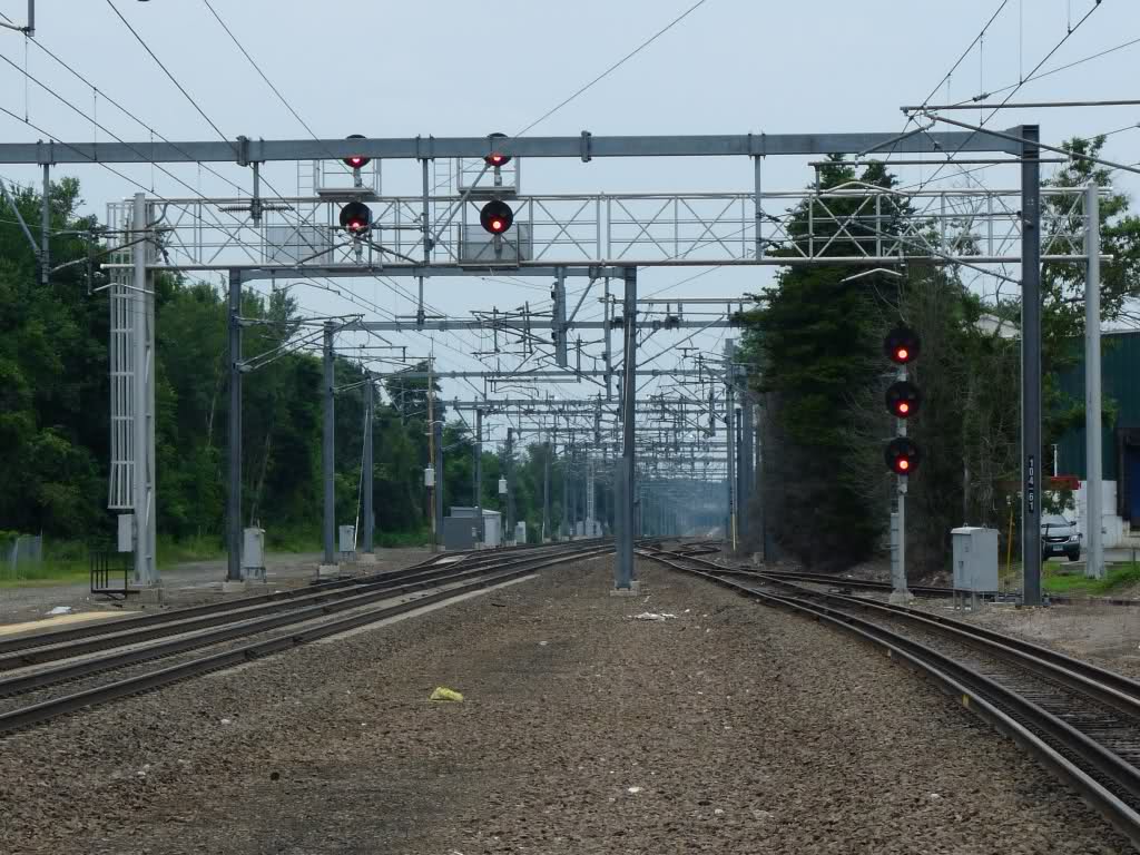
Photo by TMP, Train Man Paul, 2011
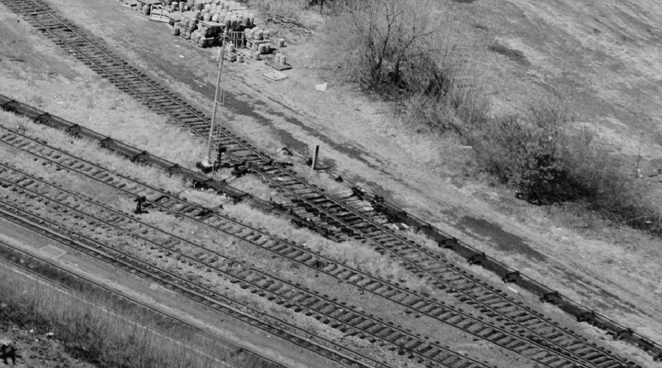
![]() NB Signal Bridge
NB Signal Bridge
This signal bridge spans all four tracks
 By Chris, from here
 Picture by Pi.1415926535
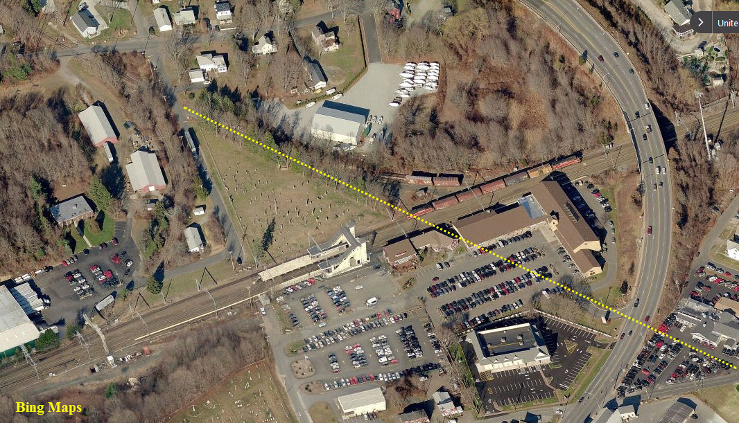
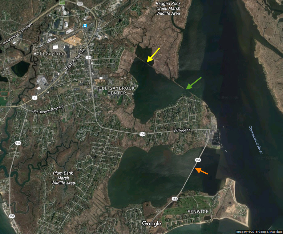
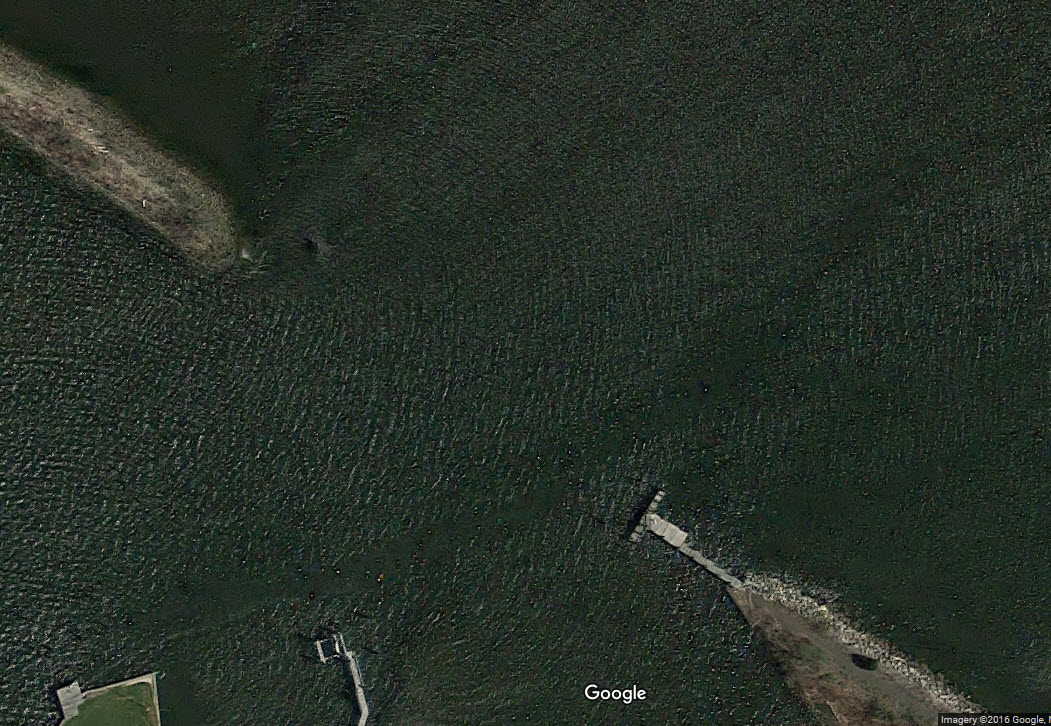
The remainder of the Connecticut Valley division right-of-way is unused, except for the bridge that connected the Fenwick to the peninsula above it (and is currently used by 154)(orange
arrow). The
gap (green arrow) in the one section may have been where a bridge was located, to let boat traffic into the inlet
(second aerial shot). The old R-O-W may be an interesting place to hunt
for railroadiana with a metal detector!
I found this here history here :-)
As an architectural masterpiece, the Saybrook railroad station doesn’t quite
match the beauty and grandeur of New York’s Grand Central or Washington, DC’s
Union Station. But, since it was constructed, which was just after the last
spike was driven for the transcontinental railroad (1869), it has adapted to change and served its modest purpose.
It was not long after George Stephenson built a locomotive capable of doing 30
mph, and thereby ending the commonly held belief that people would die of
asphyxiation at those speeds, that early railroad passenger service began on May
22, 1830 at the Mount Clare station of the Baltimore and Ohio Railroad, the same
site as the first telegraph message sent years later in 1844 by Samuel F.B. Morse, a sometime resident of Saybrook.
In Connecticut, after four years of laying track over marshes and streams, the
first Shoreline train (departed New Haven on July 1, 1852 with stops at Fair
Haven, Branford, Stony Creek, Guilford, Madison, Clinton and Westbrook before arriving at Saybrook.
In less than a month, there were two and soon three daily round trips between
New Haven and New London at the impressive time of less than three hours. It
crossed Connecticut River on the ferry “Shampishue,” until wooden bridge was
built in 1870 which was replaced by an iron bridge circa 1907 that remains today.
The railroad also brought manufacturing to Saybrook. In 1854, a joint stock
company of residents was formed to manufacture skates, and a building was put up
near the depot. However, after a few years they went out of business and the
building was sold. It stood idle for several years until it was bought and
refurbished to serve as the St. John Roman Catholic Church until a new church
was constructed on Main Street in the 1930s. A cemetery was established alongside the church.
There were many lines in those early days of railroading: The New Haven &
Hartford joined with the New York & New Haven to form the New York, New Haven &
Hartford in 1871. The company adopted an aggressive merger policy which
eventually included over 25 lines including the Shore Line Railroad, the New
Haven & Northampton and the New York & Boston Air Line.
Among the new lines that became part of the New Haven was the Connecticut Valley
Railroad, which had its first run in 1871 from Hartford to Saybrook, and then on
to Saybrook Point and Fenwick.
With two routes coming together at what was now called Saybrook Junction, a
station was angled to serve both lines. Part of the building faced the east-west
tracks of the New Haven line and part faced the north-south track of the Valley
Railroad. The Valley line tracks ran at street level across today’s parking lot,
passed Beard Lumber and then on spits of land connected by small trestles around North Cove to Saybrook Point.
The New Haven line crossed Middlesex Turnpike which was an extension of North
Main Street where a flagman controlled road traffic. Many years later, in 1966,
Saybrook officials attempted to get the State Highway Department to construct a
bridge over the tracks as a way to ease traffic jams that were occurring where
Route 1 and Route 9 met. The idea was rejected and the traffic jams remain today.
A newspaper report dated Sept. 2, 1874 noted that “the new Union depot at
Saybrook Junction, and the two large freight depots, are fine buildings and much
admired….”“The little octagonal brick building where the engines go “to take a
drink,” they reported, “cost, with the well and fixtures, more than all the
other buildings combined. In the top of this building is a huge water tank, with
a capacity of 23,230 gallons and weighing when filled about 100 tons…”
“A large locomotive drinks 1,800 gallons of water at a time, and about twenty of
them are watered here every day,” the report noted. “A curious little engine is
stationed in the building, and it is kept very busy in drawing the water from
the well nearby carrying it up to the tank.”
As trains driven by steam engines increased, a reservoir was dug and water piped
from high on the hills overlooking the Connecticut River to the tank at the
junction. The reservoir remains, but water for steam power was replaced about
1950 by diesel power.
One of the reservoirs was the Obed reservoir. The "res" was a dammed up stream (in 1880) and near the dam was what we called "the well" as it was in 15 feet of water was
square, made of stones (like a stone wall would be) and about 30 feet from the dam and 50 feet from the south western edge of the "res'. The stream was actually spring fed
and so clear that one could see 15-20 into the water. The "res" is a good 50-60 feet higher than the rail lines, so the water did not need to be pumped to the holding tank.
The steam trains used that water from the 1880's until the tenders capacity was increased and the trains would fill up in either New Haven or New London so the company "The
Saybrook Water Company" went out of business a few years later. (courtesy W. Nelson, who grew up here in Old Saybrook!)
Passenger service between Hartford and Saybrook ended in 1933 and freight service from Middletown to Saybrook was abandoned in 1967. Track from Saybrook to Haddam was leased by
rail road hobbyists who added vintage steam engines, cars and equipment and opened in 1971, 100 years after the opening of the Valley Railroad, as the popular tourist attraction
known as the Essex Steam Train and River Boat.
A switch tower was built about 1890 to keep the New Haven and Valley lines on separate tracks. However, the old tower was destroyed when a “runaway” box car crashed into the
structure and killed the operator in 1912.
A new tower was built and remained until 1985 when switching was done from Boston. Set in a “V” between the tracks of the two rail lines, the blue-gray building became home
to vagrants and pigeons and was offered free to anyone who would move it. The State Historic Preservation Office offered to help, but there were no takers and it was demolished.
During World War II, the station was very active with long freight trains passing through with tanks, trucks, and guns pulled by multiple steam engines. When Pratt Read was
ordered to stop producing piano parts “for the duration” they made gliders, which were then packed in large wooden crates and shipped by train to Boston for transfer to Europe.
Not much care was taken with the passenger station and over the years it deteriorated. In 1973 it was offered to the town but the offer was not accepted. With the scruffy
station and growing criticism of the rail line, a group of commuters and concerned residents led by Dr. Wayne Southwick, a professor of orthopedic surgery at Yale and a
resident of Old Lyme, organized the Shoreline
Trains Association.
First Selectwoman Barbara J. Maynard formed an ad hoc committee to restore the station. Volunteers painted its exterior, an Explorer Scout group cleaned the inside, the
Shoreline Junior Women gave $2,000, and even Amtrak contributed funds toward its improvement.
In 1984, Amtrak purchased 1.2 acres that they combined with the existing 4.6 acres and accepted bids to turn the area into an upscale village of stores and offices. They hoped
to attract a drive-in bank and planned to establish a railroad museum.
The new commercial area was designed by Halcyon Architects and constructed by Associated Development Corporation of Hartford, both from Hartford.
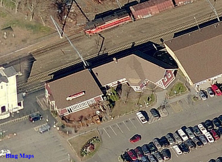
The old freight building was moved in 1986 to the west side of the station and became a restaurant called O’Brannigan’s. Today it is Pizzaworks. Amtrak maintains an office
and supply room between the restaurant and the station.
With uncertain schedules, poor service and run down trains, the New Haven went bankrupt in 1961 and after struggling for several years was absorbed by the Penn Central in
1969 and then it, too, was absorbed (the passenger service was - Todd) into the national railway service created in 1971 called Amtrak.
Other than installing a new floor and at one time fresh, but now fading paint, little has been done in the station in the last 30 years. However, in 2006 Amtrak established
the Great American Stations Project to help communities redevelop their train stations but, lately, they have had more pressing concerns
An 1849 manual of regulations for railroad engineers states that “one stroke of the Bell signifies go ahead. Two strokes of the Bell signify stop. Three strokes of the Bell
signify back.” For the rail system today, it’s not always clear how many strokes of the bell.
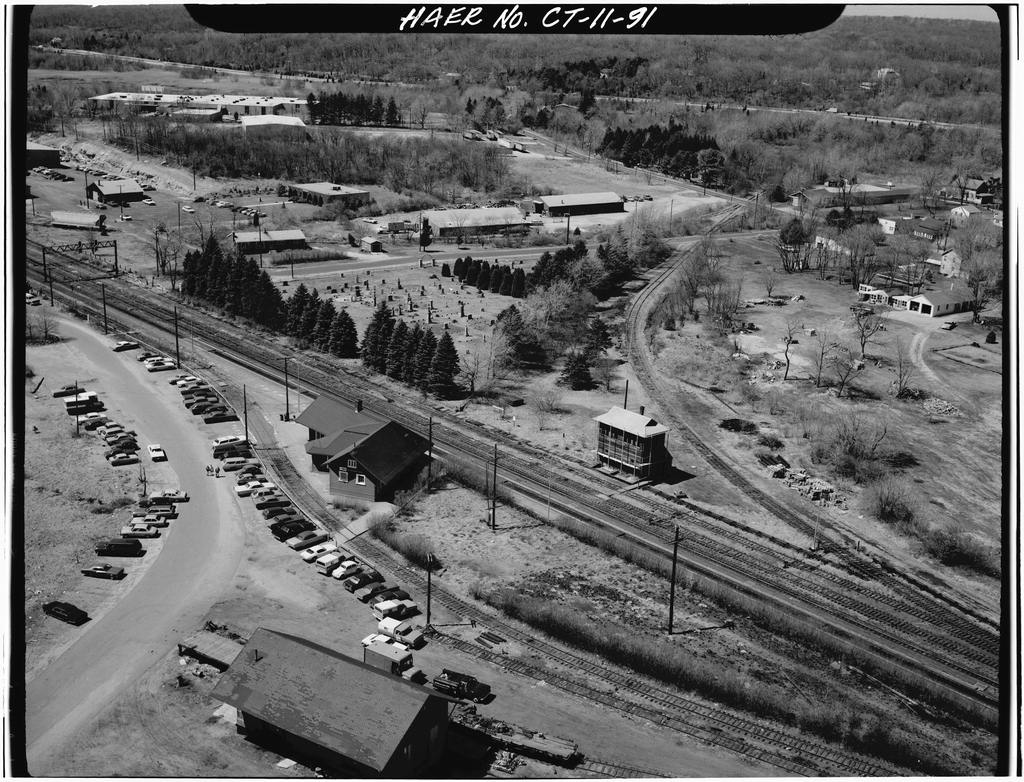
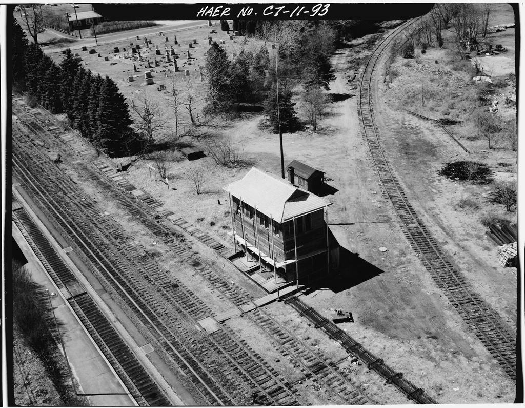
Courtesy of the University of Texas Library, click here for their index page.
Disclaimers:
New format 10/26/23: Please check out my disclaimer page for my standard dribble and contact info
here
RAILFAN GUIDES HOME
RAILROAD SIGNALS HOME
Last Modified
23-Mar-2024