
In General
Getting Here
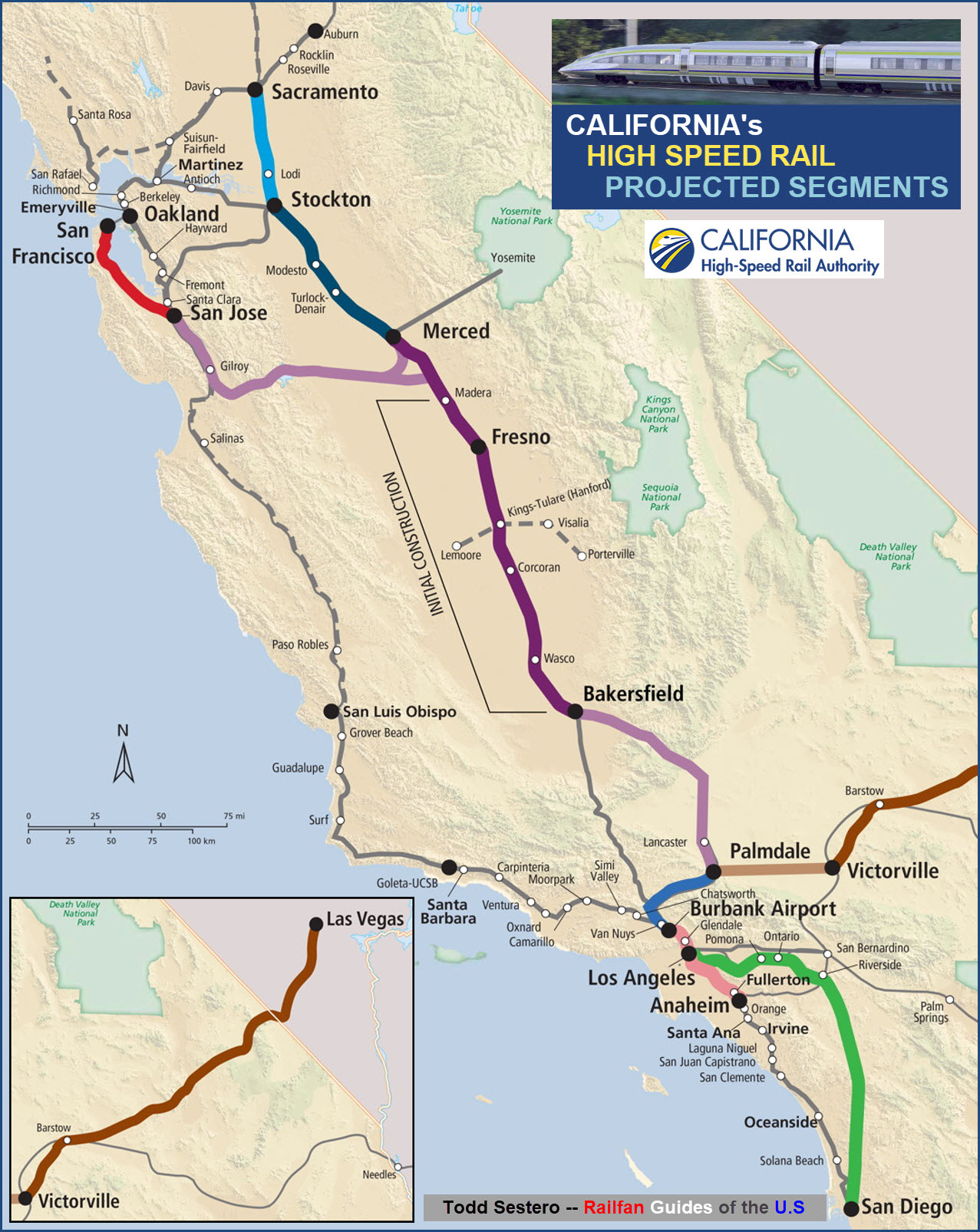
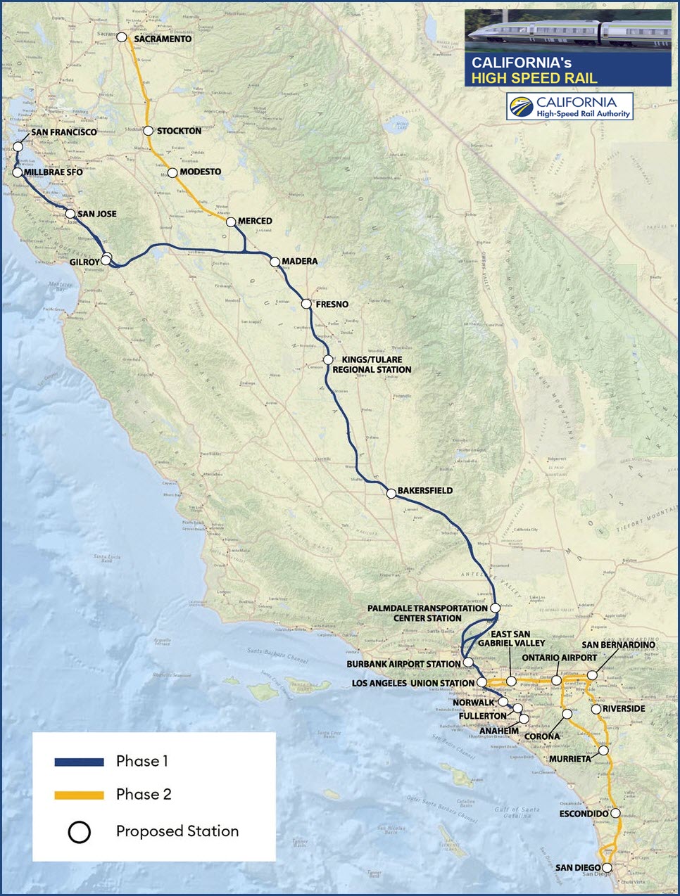
Map
Station by Station
Pictures
Bridges
Floobydust
RAILFAN GUIDES HOME
RAILROAD SIGNALS HOME
Location / Name:
Los Angeles to San Francisco CA
What's Here:
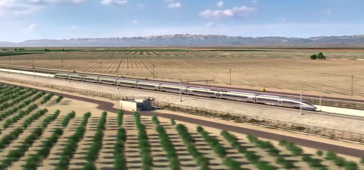
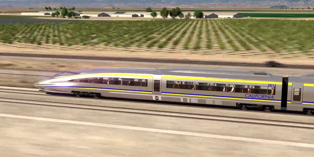
America's First High Speed Rail Project
Data:
GPS Coordinates: as needed
Phone A/C: n/a
ZIP: n/a
Access by train/transit:
San Francisco: Caltrain, Muni
Millbrae-SFO: Caltrain, BART, samTrans
San Jose: Amtrak, Caltrain, ACE, BART, VTA
Merced: Amtrak, Valley Rail, CatTracks, bus (YARTS, Greyhound, Merced County Transit)
Gilroy: Caltrain, VTA, bus (Greyhound)
Fresno: bus (FAX, YARTS, Greyhound)
Kings/Tulare: bus (Kings Area Rapid Transit, Visalia Transit, Tulare County Area Transit, Greyhound), Amtrak (~17 miles SW in Corcoran)
Bakersfield: bus (GET, Kern Transit, Greyhound)
Palmdale: Metrolink, bus (Amtrak Thruway Bus, Antelope Valley Transit Authority, Greyhound), and the future? Brightline West
Burbank: Amtrak, Metrolink, Metro, Hollywood Burbank Airport, bus (BurbankBus)
Los Angeles: Amtrak, Metrolink, Light Rail, bus (LAX Flyway, LADOT local DASH, Greyhound)
Anaheim: Amtrak, Metrolink, bus (Anaheim Resort Transportation, Orange County TA)
The Scoop:
This page covers America's first high speed rail project, maybe. I consider the Pennsylvania Railroad's building of what eventually became the North East Corridor to be the first, considering it was done 100 years earlier.
When originally conceived, it was going to be a (mostly) brand new railroad between San Francisco and Los Angeles, cutting down transit time from 10+ hours to approximately 2 hours and 40 minutes, less time if you wanted (to say) do LA-San Jose, further enhancing the attractiveness of taking the train versus flying.
When California voters first approved a bond issue for the project in 2008, the rail line was to be completed by 2020, and its cost seemed astronomical at the time — $33 billion. In 2022, 14 years later, construction is underway on part of a 171-mile “starter” line connecting a few cities in the middle of California, which has been 'promised for 2030'. When the California High-Speed Rail Authority issued its new 2022 draft business plan in February, it estimated an ultimate cost as high as $105 billion. Less than three months later, the “final plan” raised the estimate to $113 billion. The rail authority said it has accelerated the pace of construction on the starter system, but at the current spending rate of $1.8 million a day, the system could not be completed in this century.
Ballooning costs and funding snafus aside, monumental engineering challenges also loom. These include tunneling through the San Gabriel and Tehachapi mountain ranges in the south and Pacheco Pass in the north. The system also has to be built to withstand the state’s infamous earthquakes. [Forbes]
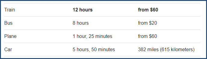
Currently, with Amtrak's regular service, there are 16 daily trains between Los Angeles and San Francisco. Traveling between the two by train usually takes around 10 hours and 19 minutes, but the fastest of the trains can make the trip in 9 hours and 30 minutes. The trip is 347 miles (559 km) long.
Here is a comparison of travel times between the Los Angeles and San Francisco:
I know I shouldn't interject my personal opinion, but here goes anyways: I can't help but to wonder how much this project could have cost if we didn't have the politicians (who all want something in return for giving them their blessings) and all of the various government agencies (federal, state, and local) to deal with. Things were much simpler 100 years ago except for the human element, that will ALWAYS be a constant. I know I should stay away from making politically oriented comments, but since my tax dollars are going into this..... When I visited France in 2002, they were in the process of building a new high speed rail line to Marseilles, much of it elevated such as this project, and I wonder if they had to jump thru all of the hoops and pay off people like we do here? Because of how this project became so out of control, it will probably kill any further high speed projects in America.... and if the Maglev advocates on the east coast from DC to -wherever- think their project would go any smoother, without graft, corruption, incompetence, stupid decisions, stupid designers, stupid and corrupt politicians, and mismanagement, they are living in a dream world. Although the Brightline project in Florida has been plagued with -some- problems, it shows you what can be done if a project is done as a profit making business.
Acknowledgements:
Ryan Christopher Jones/The New York Times
Google Maps
Bing Maps
Open Railway Map
Wikipedia
Websites and other additional information sources of interest for the area:
https://railfanguides.us/dc/DCstreetcar/index.htm read about another (2 mile long!) rail project that got entangled in incompetence and government meddling....
https://news.yahoo.com/californias-bullet-train-went-off-182254798.html
https://www.wanderu.com/en-us/train/us-ca/los-angeles/us-ca/san-francisco/
https://www.forbes.com/sites/alanohnsman/2022/07/16/california-bullet-train-gets-42-billion-green-light-for-first-phase-while-bigger-challenges-loom/?sh=24ece46525b1
Please consult your GPS, the covered area is too large to go into detail.
San Francisco
GPS Coordinates:
The
Milbrae-SFO
GPS Coordinates:
The
San Jose
GPS Coordinates:
The
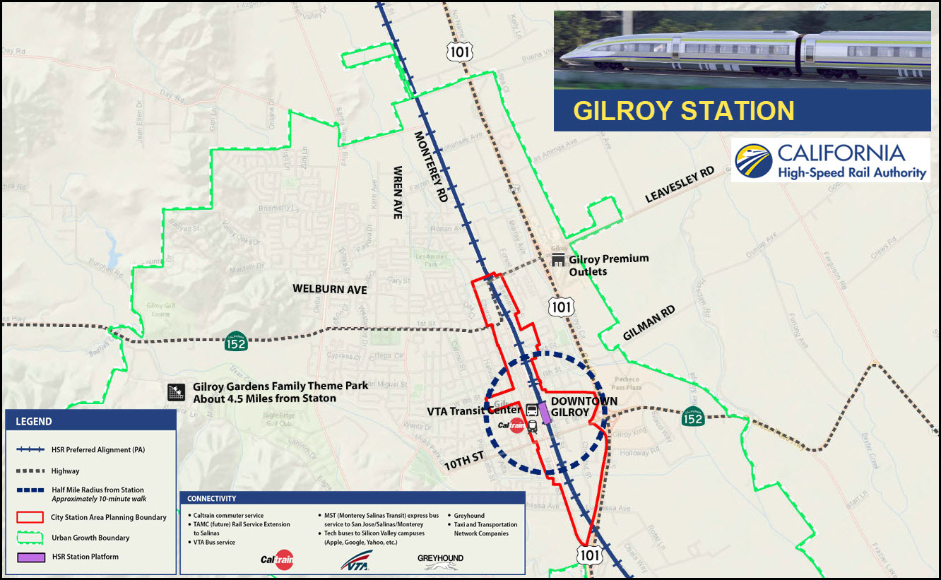
Gilroy
GPS Coordinates:
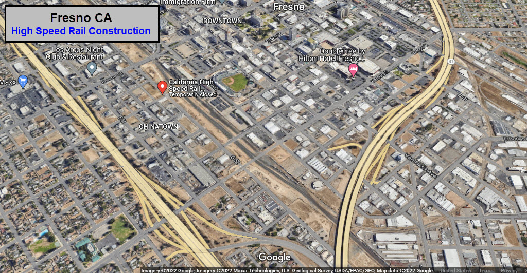
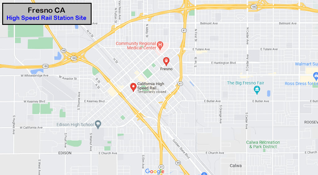
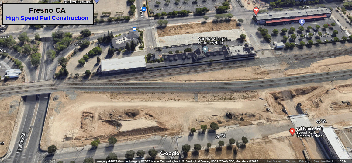
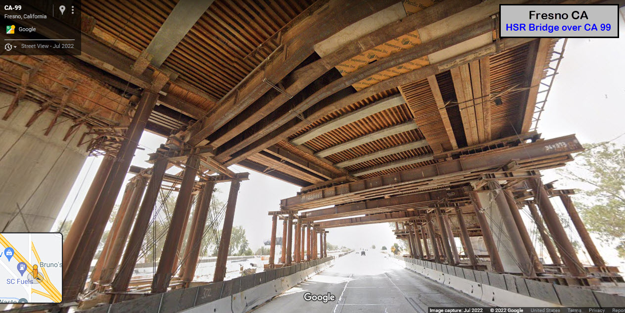
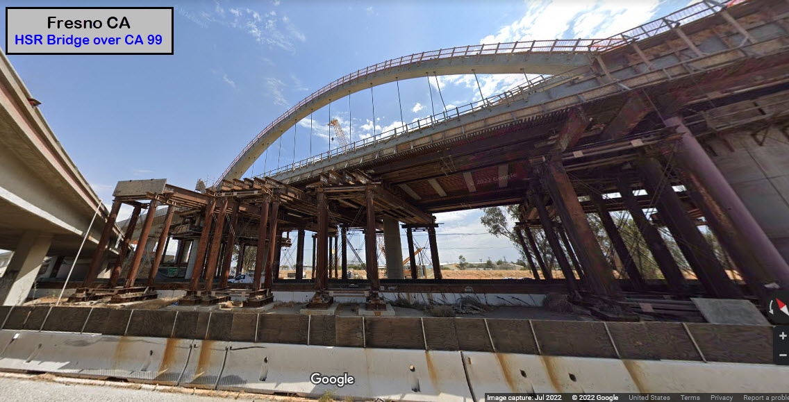
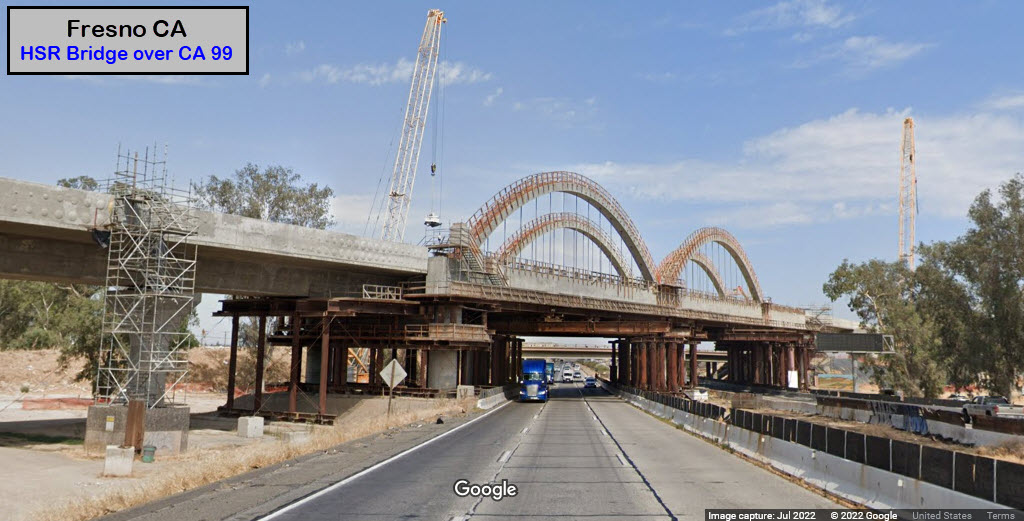
Fresno
GPS Coordinates: ~36.73135, -119.79328
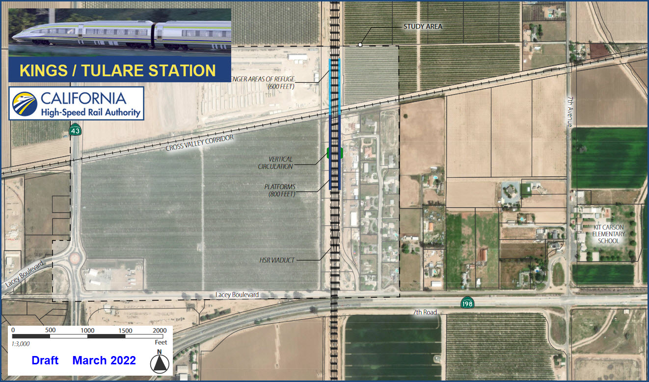
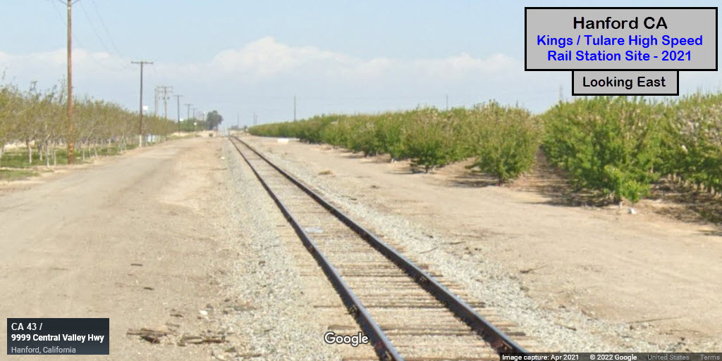
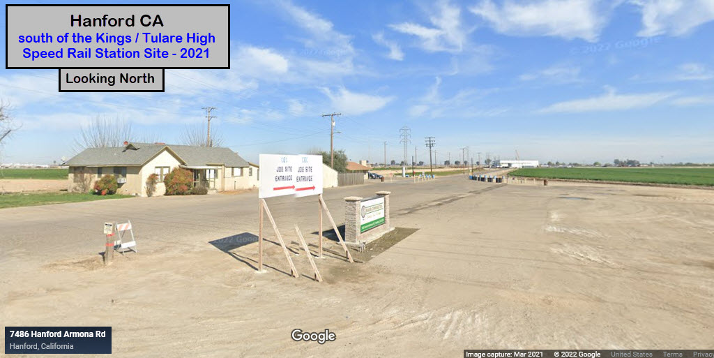
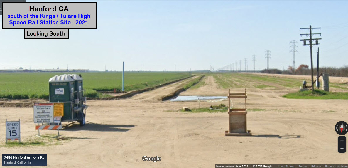
Kings / Tulaire
GPS Coordinates:
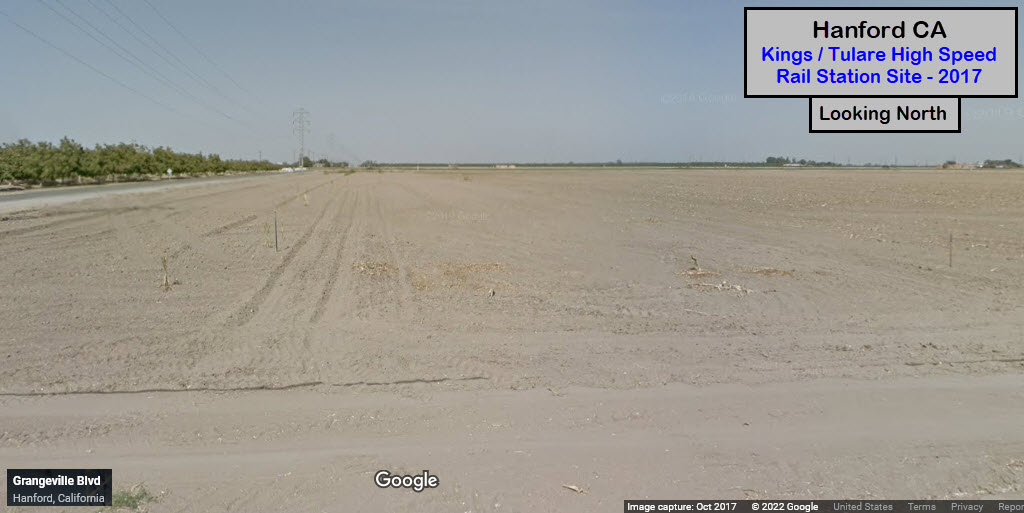
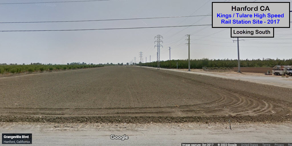
Grangeville Blvd is to the north of the station location, and Lacey Ave/CA 198 is to the south. As of October 2022, we don't have any newer Streetview visits on Grangeville than 2017.
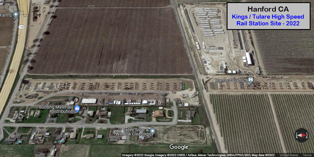
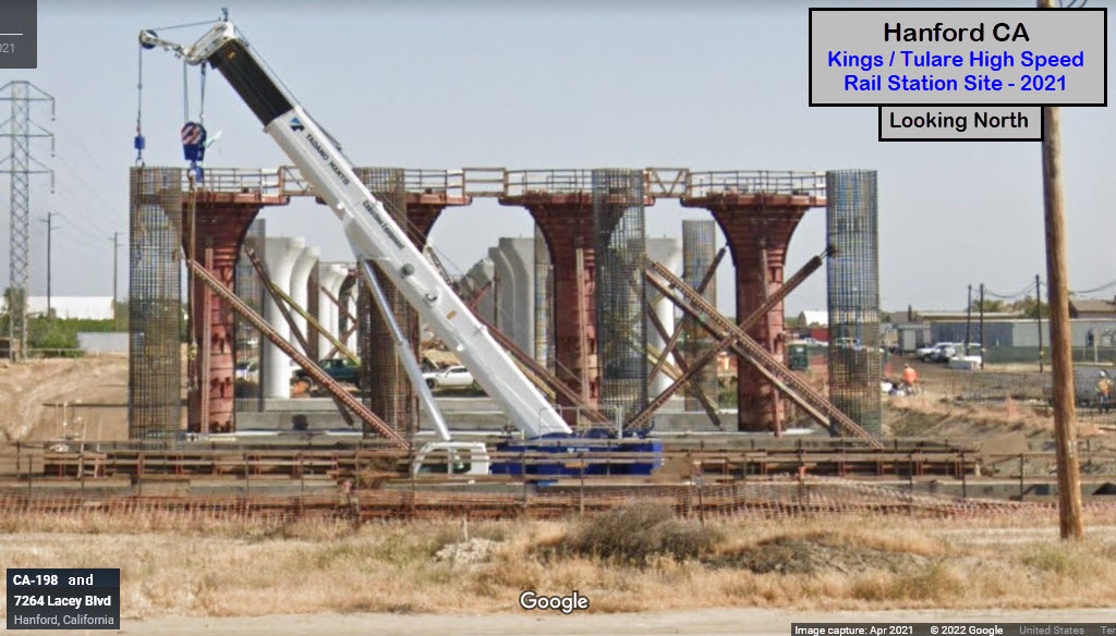
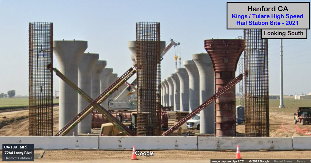
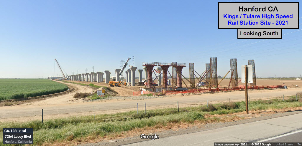
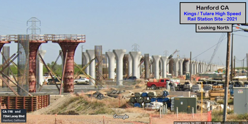
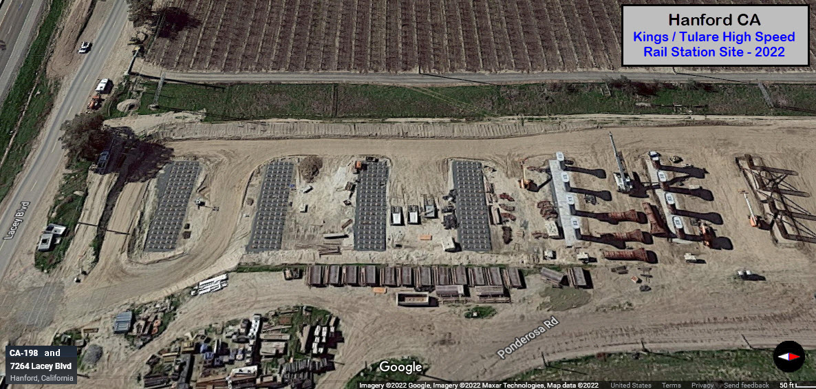
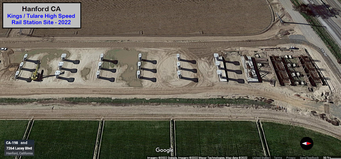
Going south to the next east/west road crossing the HSR right-of-way, Hanford Armona Rd, come the next two pictures from 2021. I wonder where visitors sign in at, the porta-pottie? :-) :-)
I wonder who paid off the designers so the building owners could get a new building out of the project? They couldn't have moved it over by 100 feet?

Bakersfield
GPS Coordinates: 35.39121, -119.02326
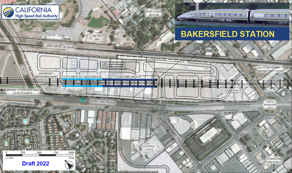
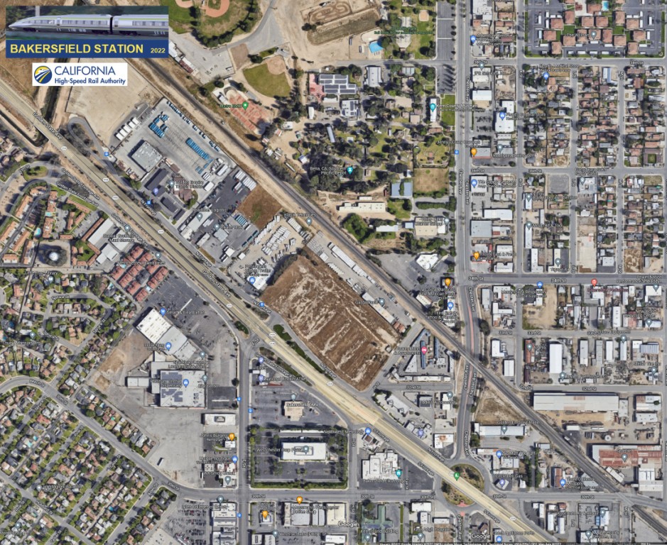
Google Maps Aerial View
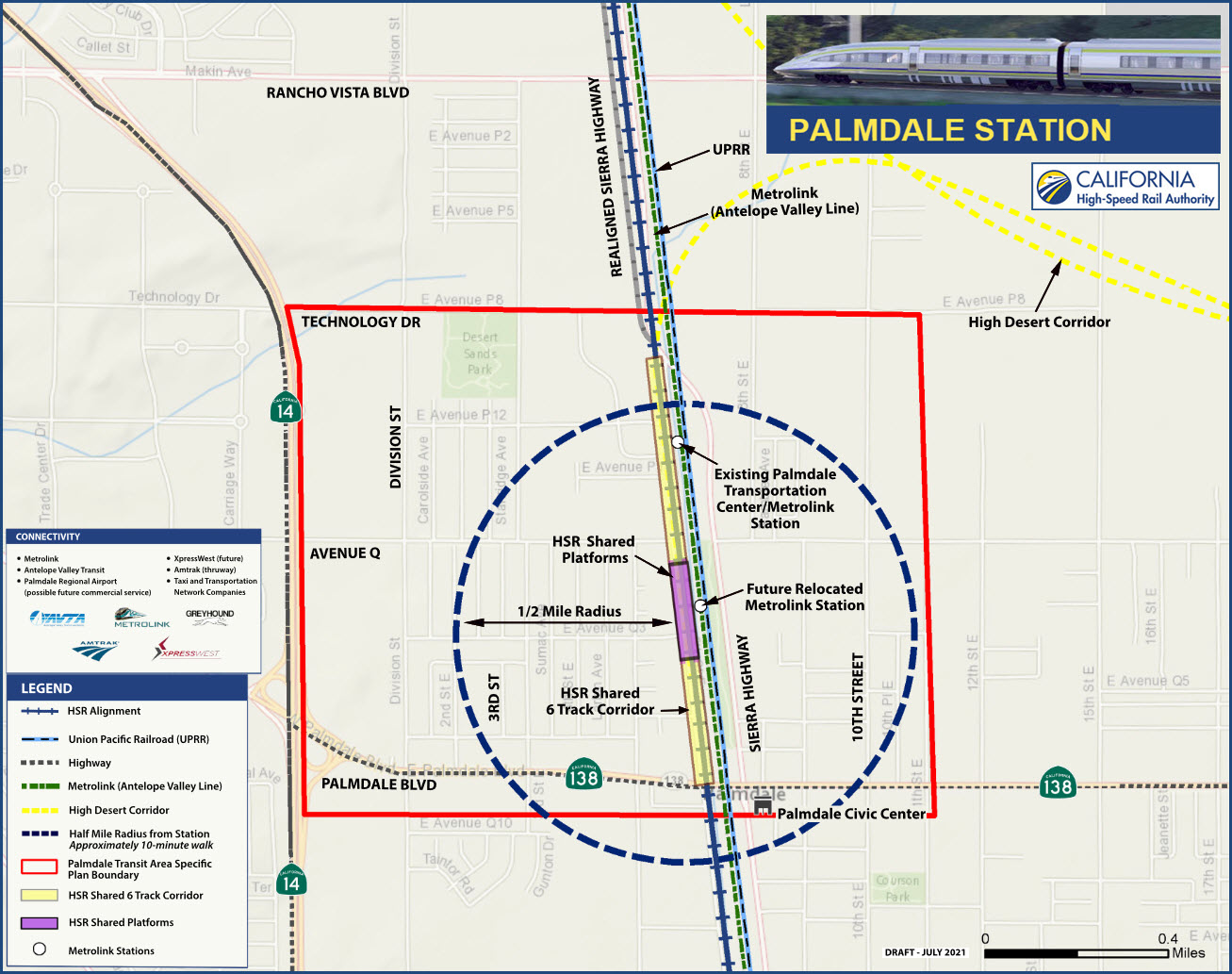
Palmdale
GPS Coordinates:
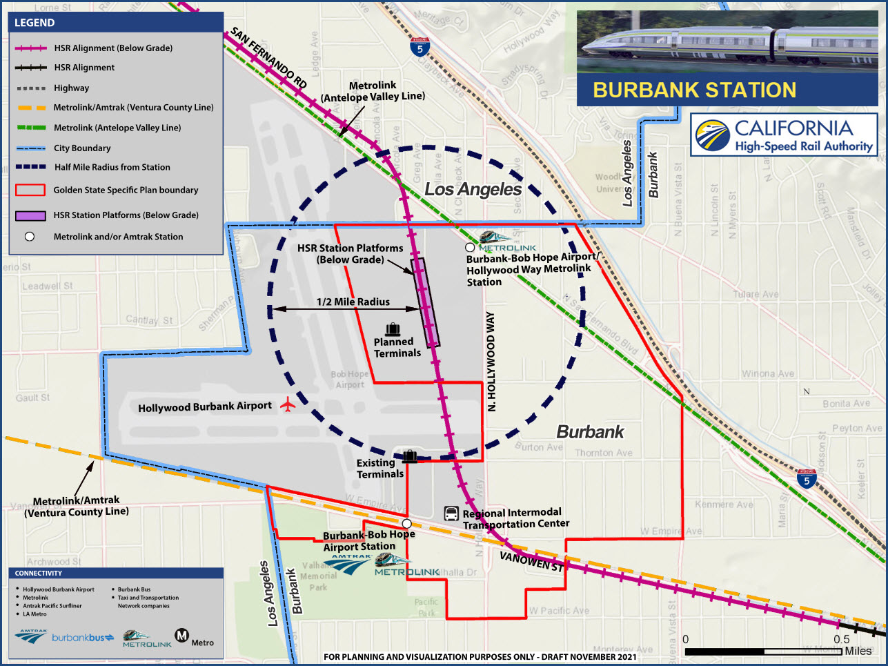
Burbank
GPS Coordinates:
Los Angeles
GPS Coordinates:
The
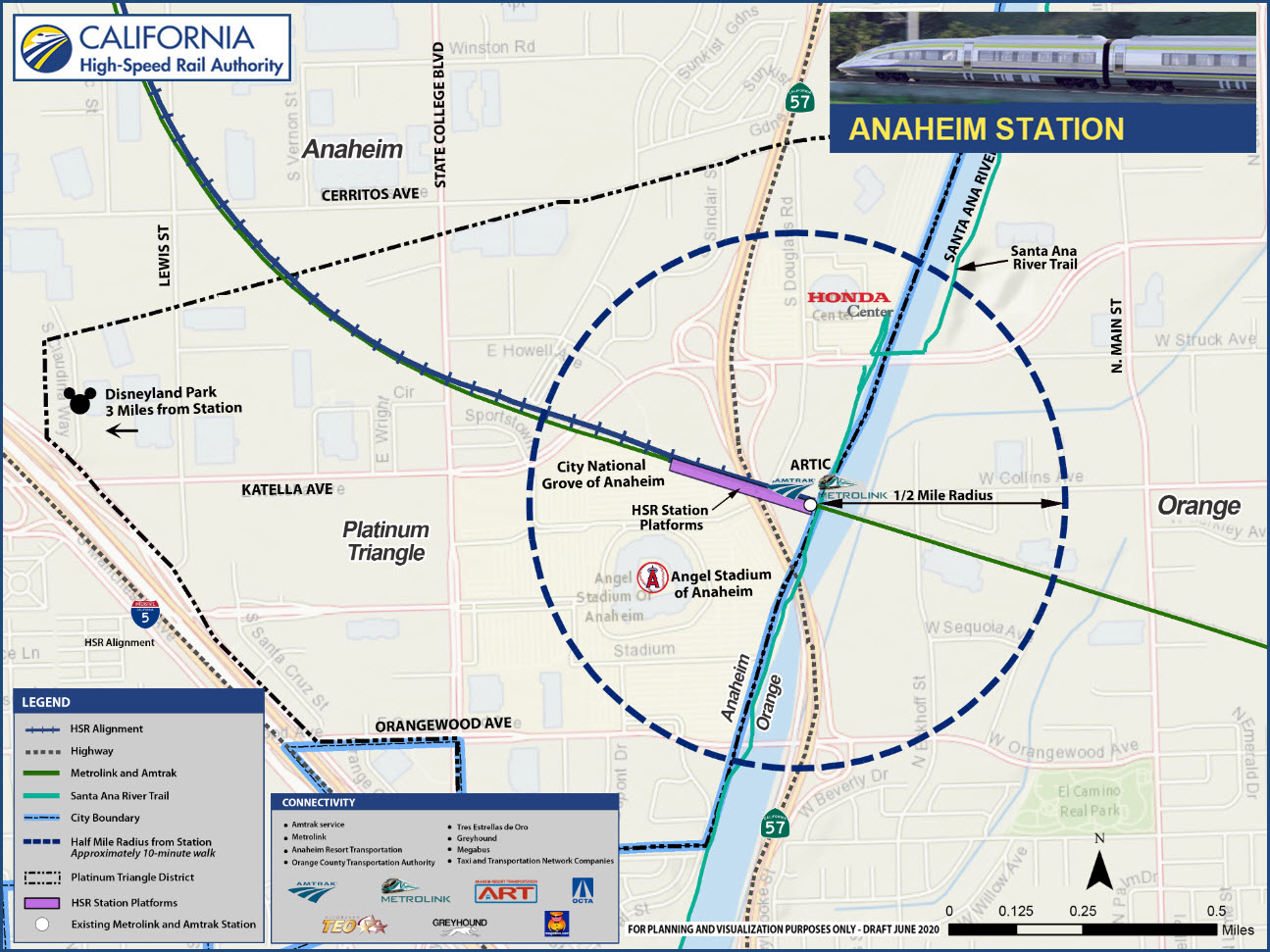
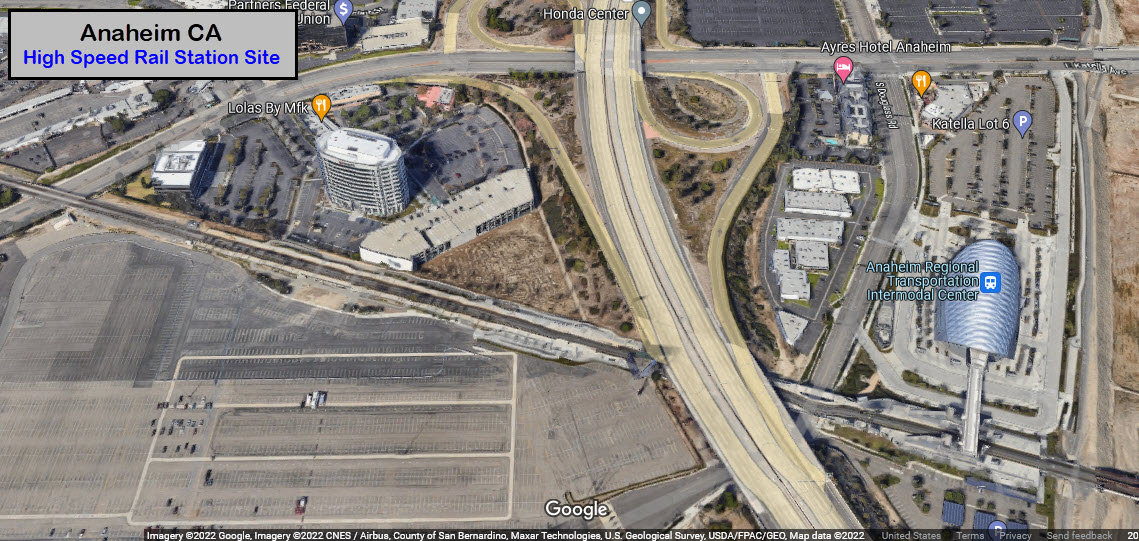
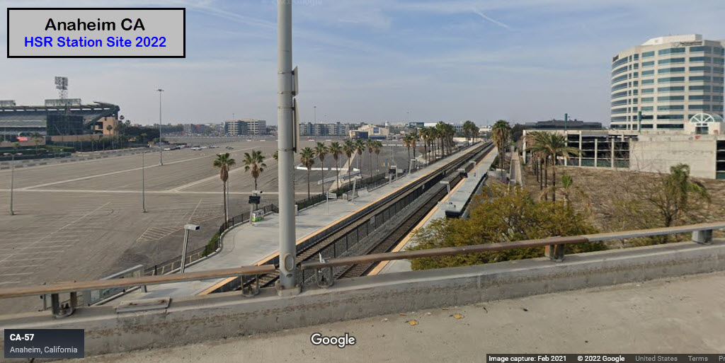
Anaheim
GPS Coordinates: 33.80290, -117.87953
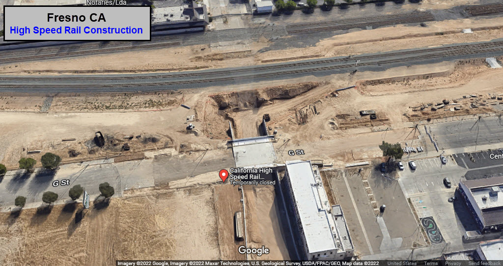
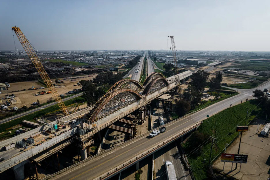
A construction site in Fresno for California's high-speed rail line on Jan. 25, 2022. (Ryan Christopher Jones/The New York Times)
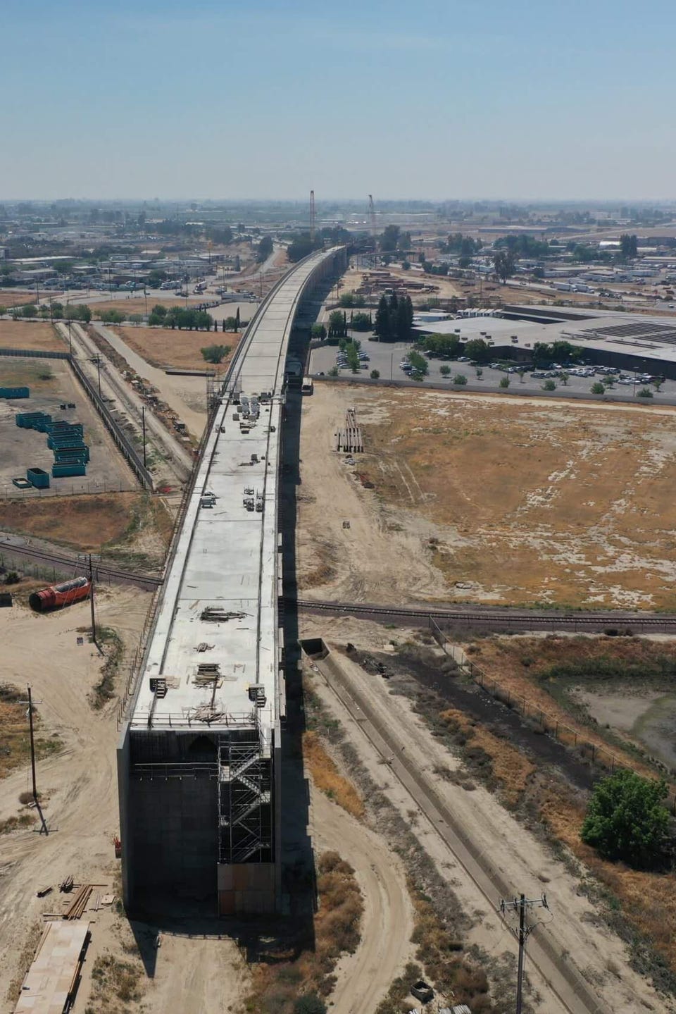
Cedar Viaduct, Fresno CA 2021. California High Speed Rail Authority
Did U Know?
None for now......
Disclaimers:
I love trains, and I love signals. I am not an expert. My webpages reflect what I find on the topic of the page. This is something I have fun with while trying to help others.
Please Note: Since the main focus of my two websites is railroad signals, the railfan guides are oriented towards the signal fan being able to locate them. For those of you into the modeling aspect of our hobby, my indexa page has a list of almost everything railroad oriented I can think of to provide you with at least a few pictures to help you detail your pike.
If this is a railfan page, every effort has been made to make sure that the information contained on this map and in this railfan guide is correct. Once in a while, an error may creep in :-)
My philosophy: Pictures and maps are worth a thousand words, especially for railfanning. Text descriptions only get you so far, especially if you get lost or disoriented. Take along good maps.... a GPS is OK to get somewhere, but maps are still better if you get lost! I belong to AAA, which allows you to get local maps for free when you visit the local branches. ADC puts out a nice series of county maps for the Washington DC area, but their state maps do not have the railroads on them. If you can find em, I like the National Geographic map book of the U.S..... good, clear, and concise graphics, and they do a really good job of showing you where tourist type attractions are, although they too lack the railroads. Other notes about specific areas will show up on that page if known.
Aerial shots were taken from either Google or Bing Maps as noted. Screen captures are made with Snagit, a Techsmith product... a great tool if you have never used it!
By the way, floobydust is a term I picked up 30-40 years ago from a National Semiconductor data book, and means miscellaneous and/or other stuff.
Pictures and additional information is always needed if anyone feels inclined to take 'em, send 'em, and share 'em, or if you have something to add or correct.... credit is always given! Please be NICE!!! Contact info is here
Beware: If used as a source, ANYTHING from Wikipedia must be treated as being possibly inaccurate, wrong, or not true.
RAILFAN GUIDES HOME
RAILROAD SIGNALS HOME
NEW 10/12/2022, OCT13/14/2022
Last Modified 14-Oct-2022