
In General
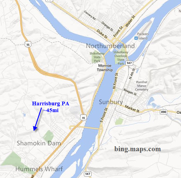
Getting Here
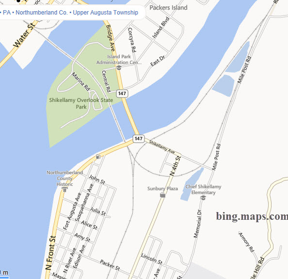
Map
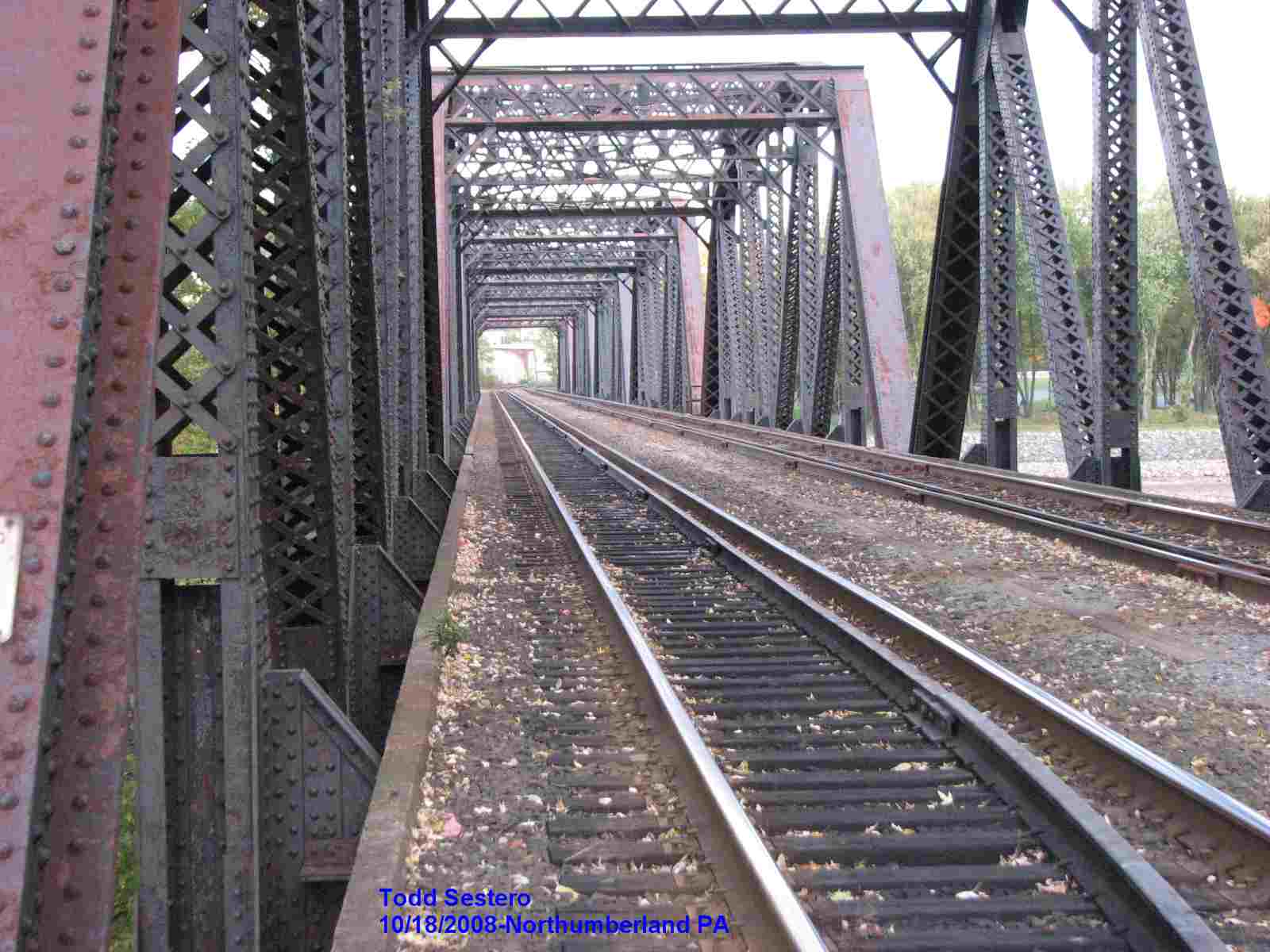
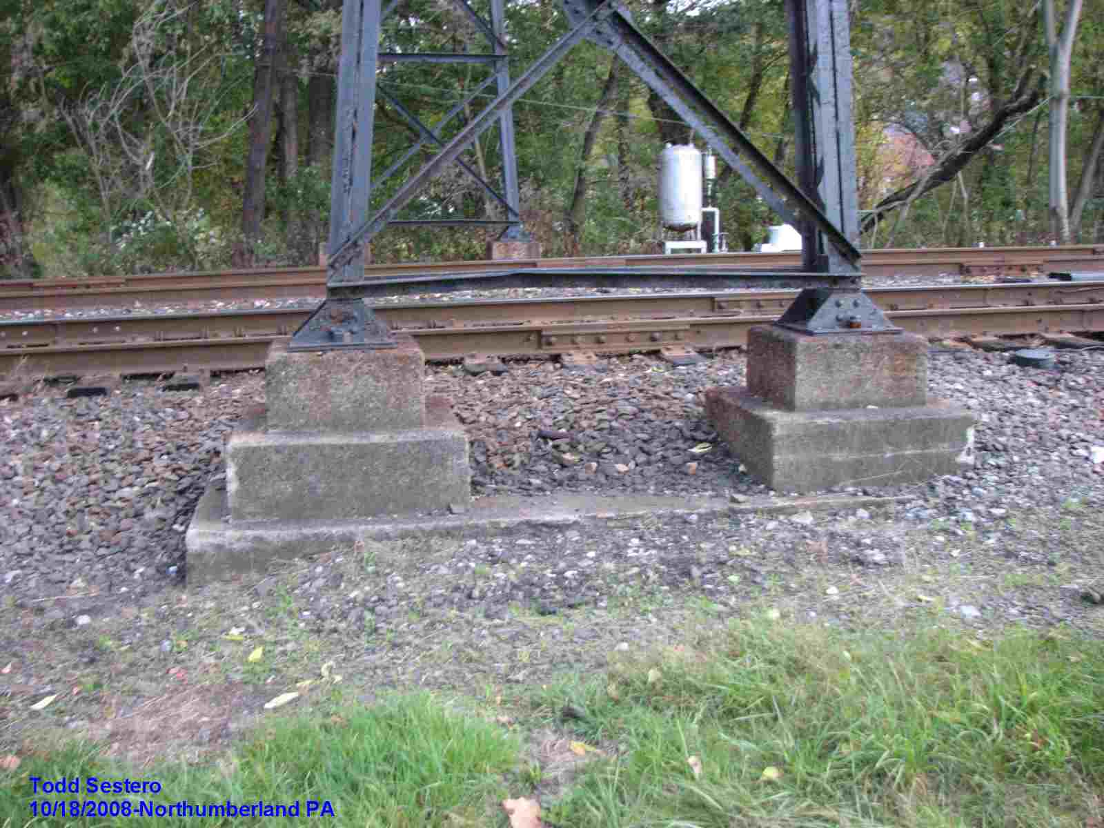
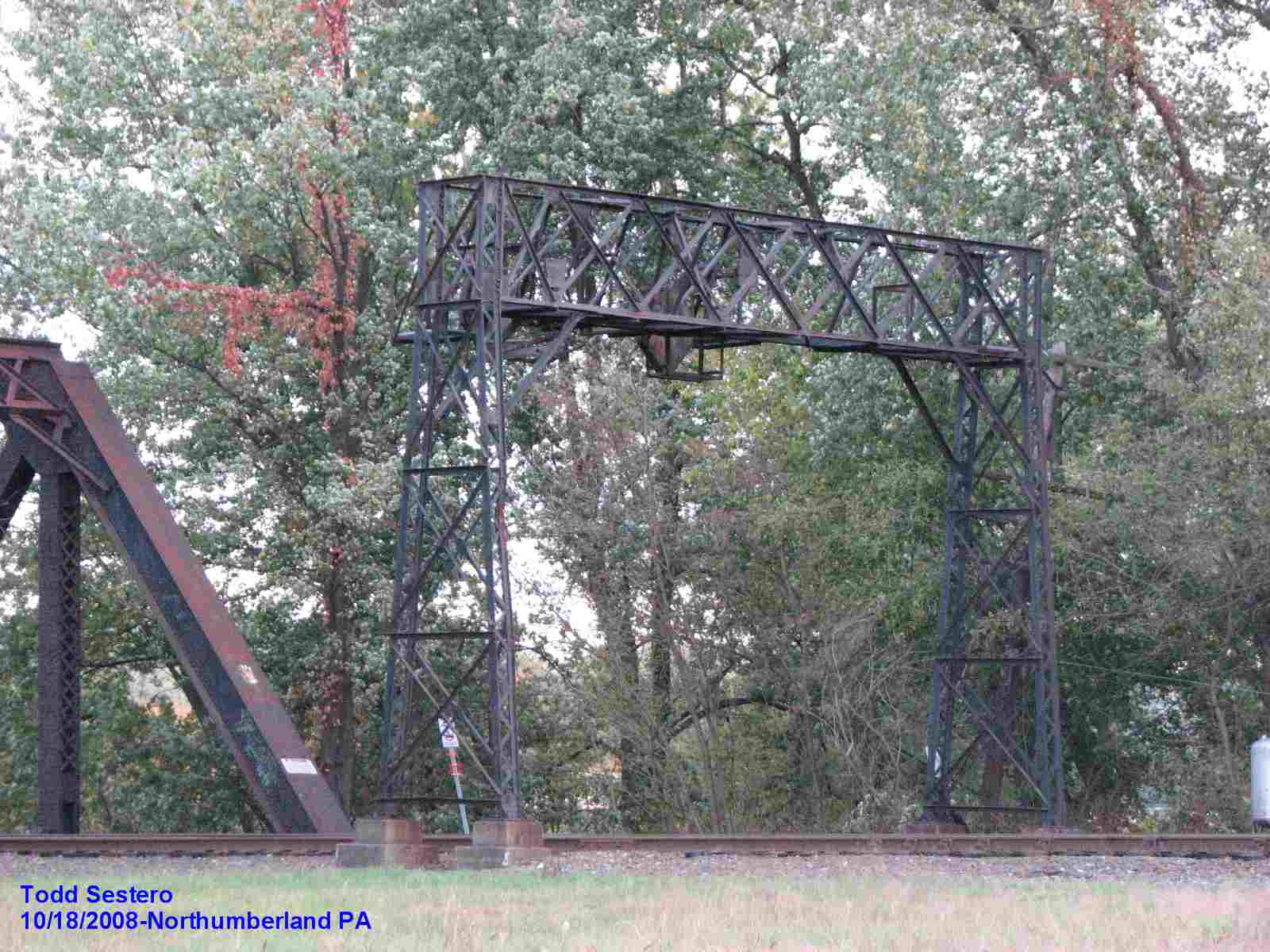
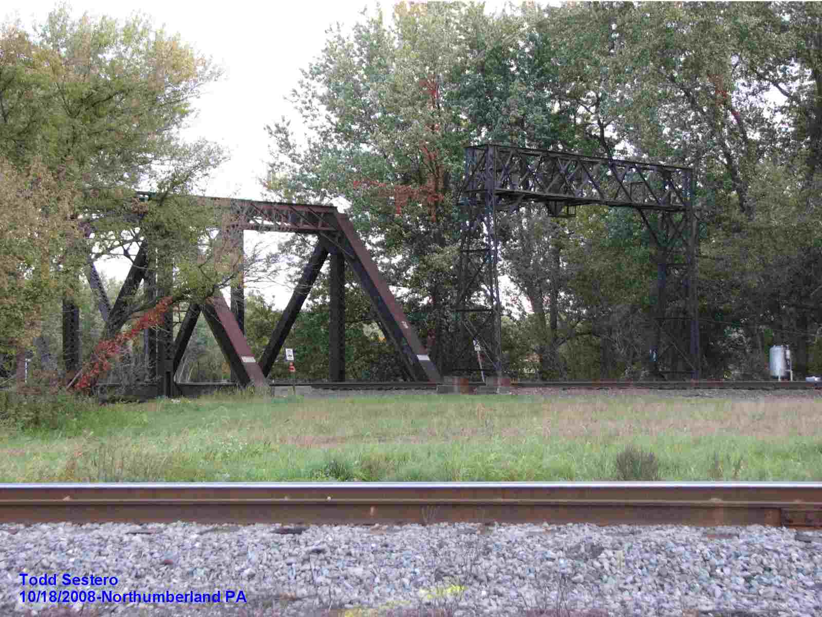
Sights
Signals
Floobydust
Historical USGS Map
Northumberland & Sunbury History
RAILROAD SIGNALS HOME
Location / Name:
Northumberland PA, Northumberland County
What's Here:
(formerly) the most unique PL/Position Light Signals in the United States
Data:
GPS Coordinates: as needed
ZIP: 17857
Phone A/C: 570
Access by train/transit:
None
The Scoop:
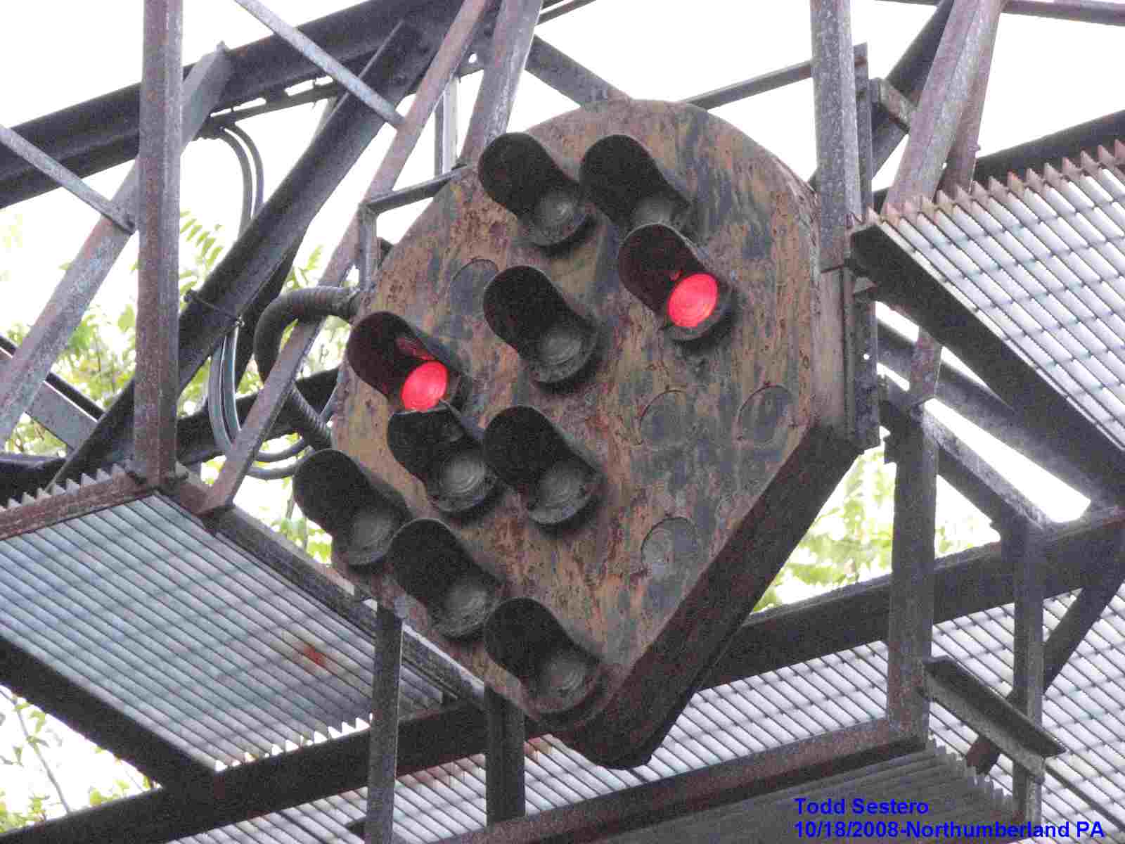
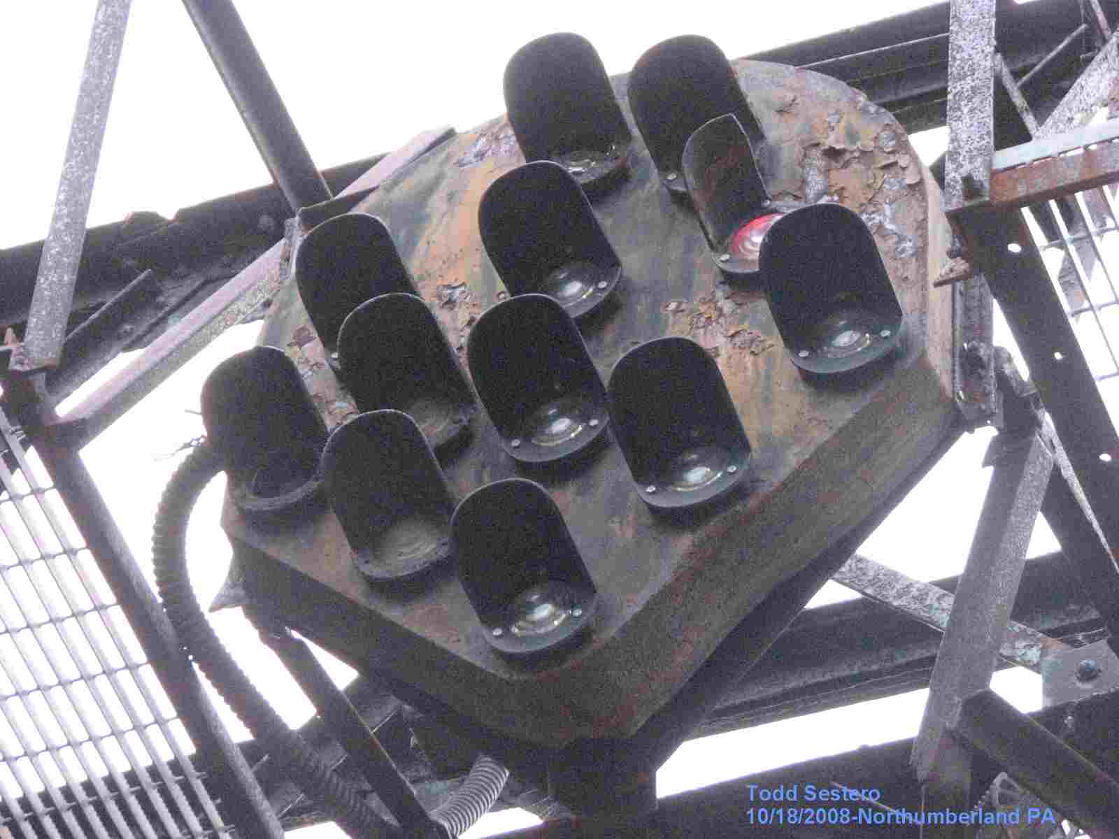
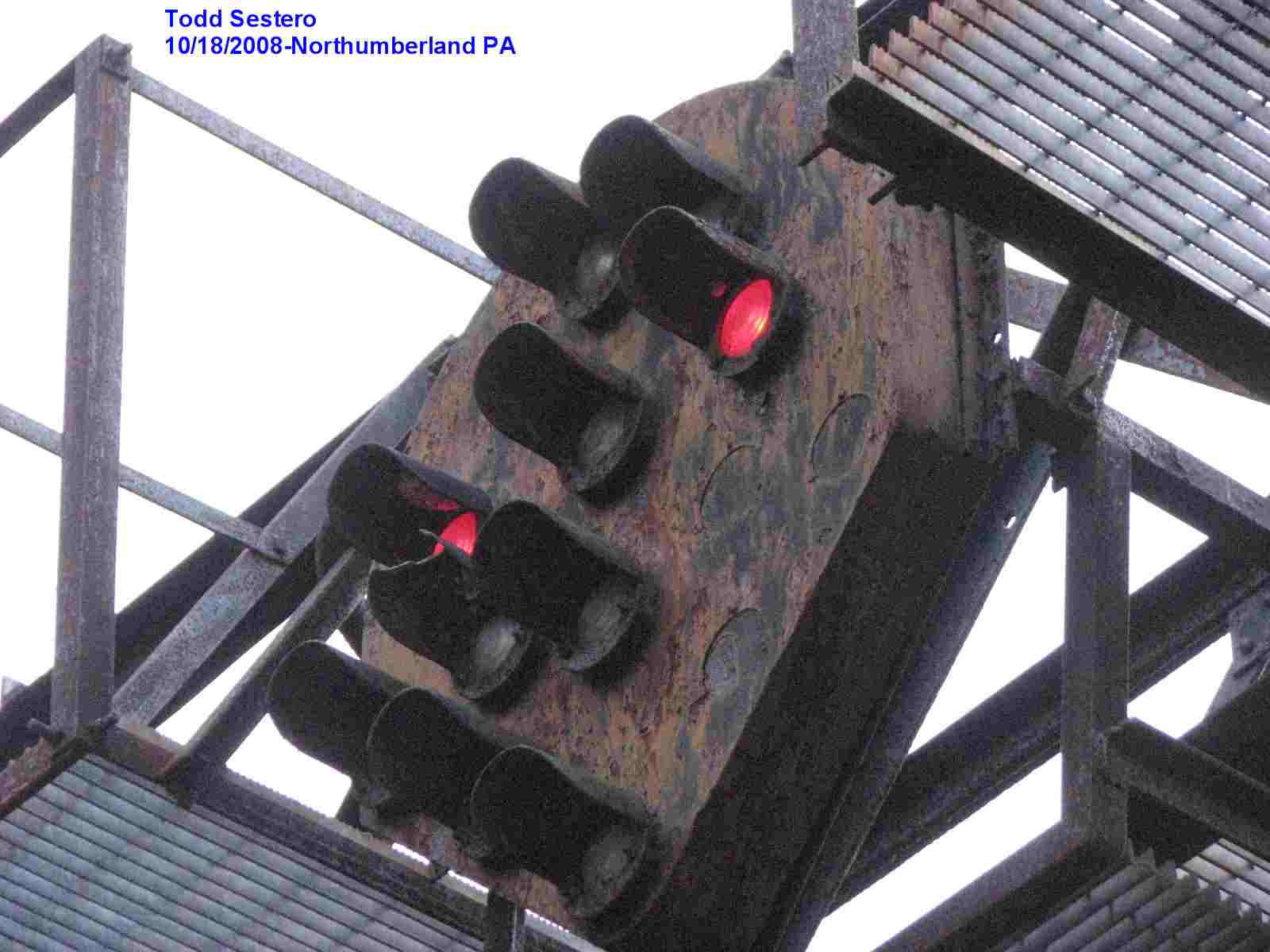
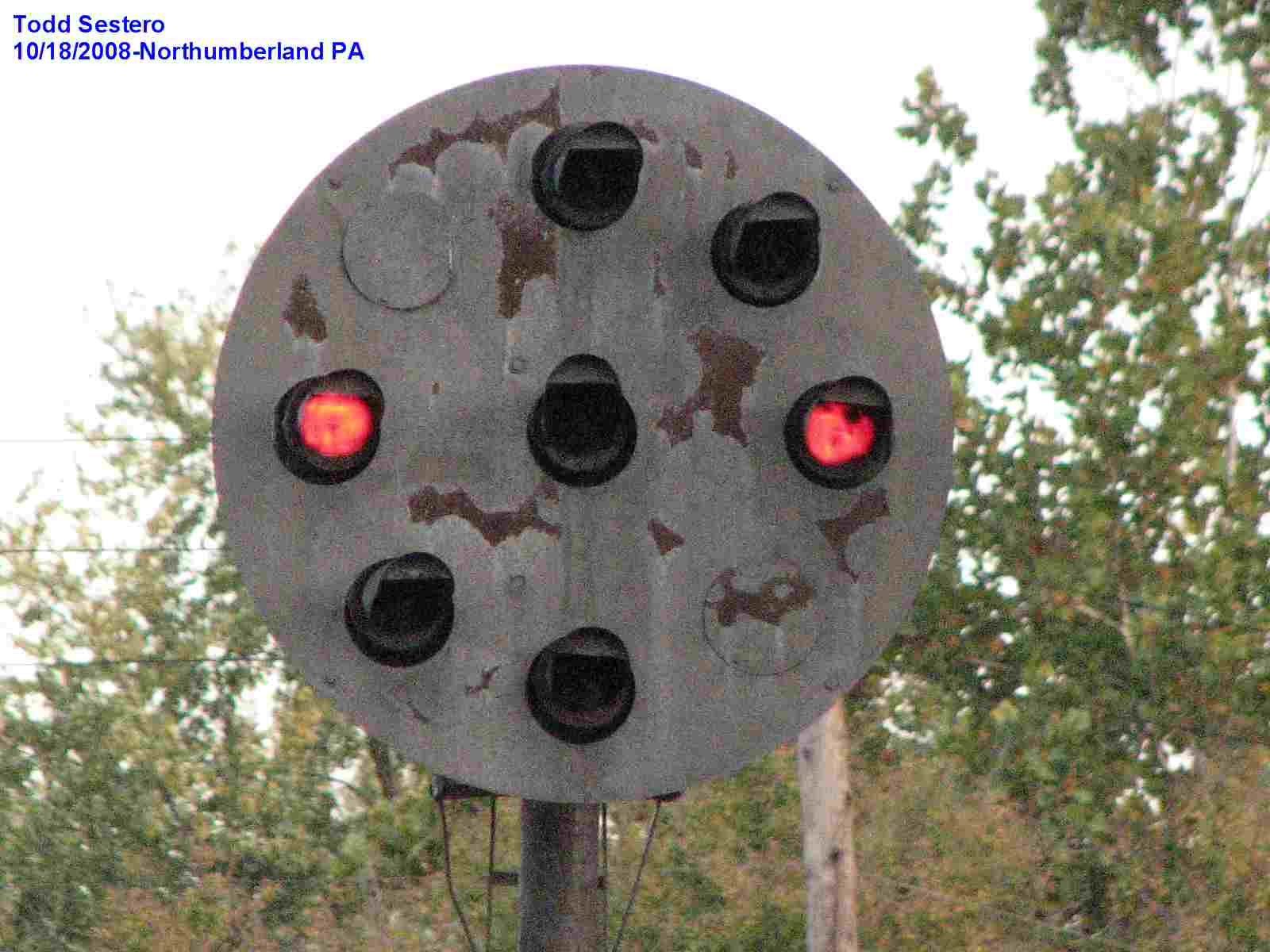
Northumberland WAS home to perhaps the most unique set of Pennsy Position Light (PL) signals in existence.
In addition to the signals, Northumberland offers the railfan several railroad stations, a fair size yard, and the North Shore RR.
Northumberland used to be in the middle of hardcore "Snake Eyes', or "Red Eye" territory. These signals have had the RED aspect replaced with red lenses, leaving the center lamp "out" when displaying STOP. One theory was to make the signals more readable through the fog laden valleys along the Susquehanna River, which goes against everything I have read about the Pennsy going to extremes to research the yellow used in the PL lamps to pierce fog and rain, making them more readable.... ?
I went looking on/in Google images to see if anyone has posted pictures of the new signals yet, anything that could be easily found, and nothing popped up, guess I need to visit again and have a great lunch in the process. I did 'discover' that I should probably do a page for Northumberland in the United Kingdom, seems there is a lot of history there.
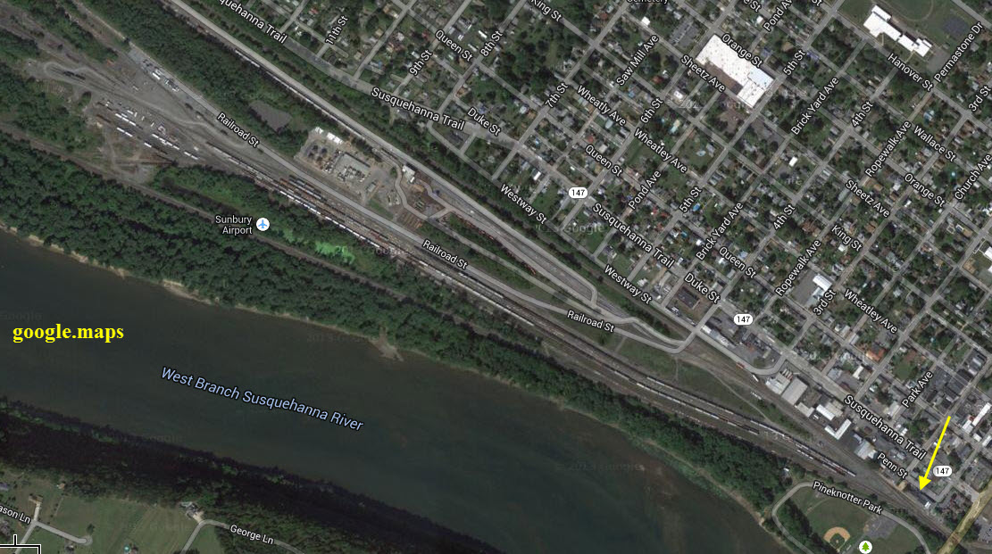
Across the Susquehanna River from Northumberland is Sunbury. It is one of two ways to get to Northumberland, and there is a lot of stuff there to see!!!
Acknowledgements:
Rob Blackford
west2k.com
trainweb.org
Google Maps
Websites and other additional information sources of interest for the area:
I came across some old B&W pictures here
From Harrisburg, head straight up US 11/15 about 45 miles. To make things a little quicker, you can take US 22 north from I-81 (which is on the east side of the Susquehanna River) until you cross the river, then hop off at US 15 to finish the journey north.
It is about 35 miles south of Williamsport PA, via I-190 and PA 147.
If you're coming in from the west (Cleveland/Youngstown) or east (New York City for instance), I-80 brings you about 10 miles to the north, via exit 212.
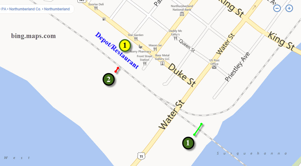
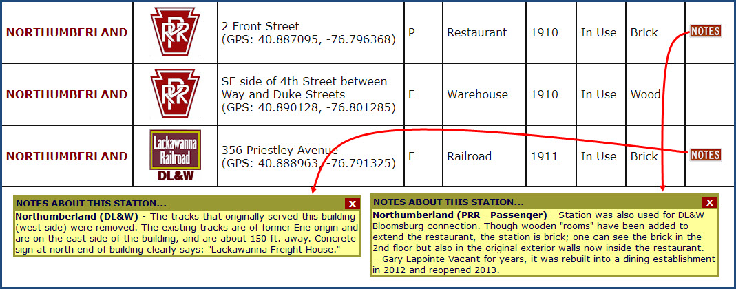
Apparently, there are still three extant depots in Northumberland, the date column indicates when the depot was built. Found here.
I did not have the time to go search them all out the last time I was here..... :-(
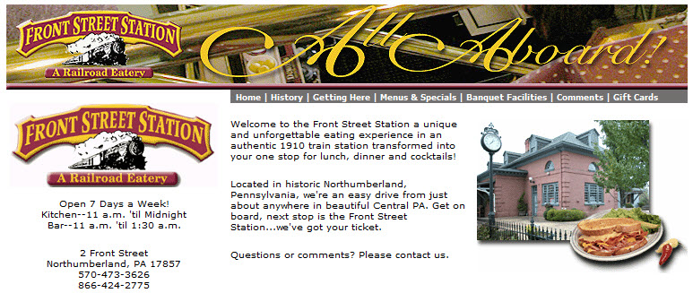
GPS coordinates: 40.88709, -76.79634
2 Front St, Northumberland PA 17857
570-473-3626
http://www.frontstreetstation.com/
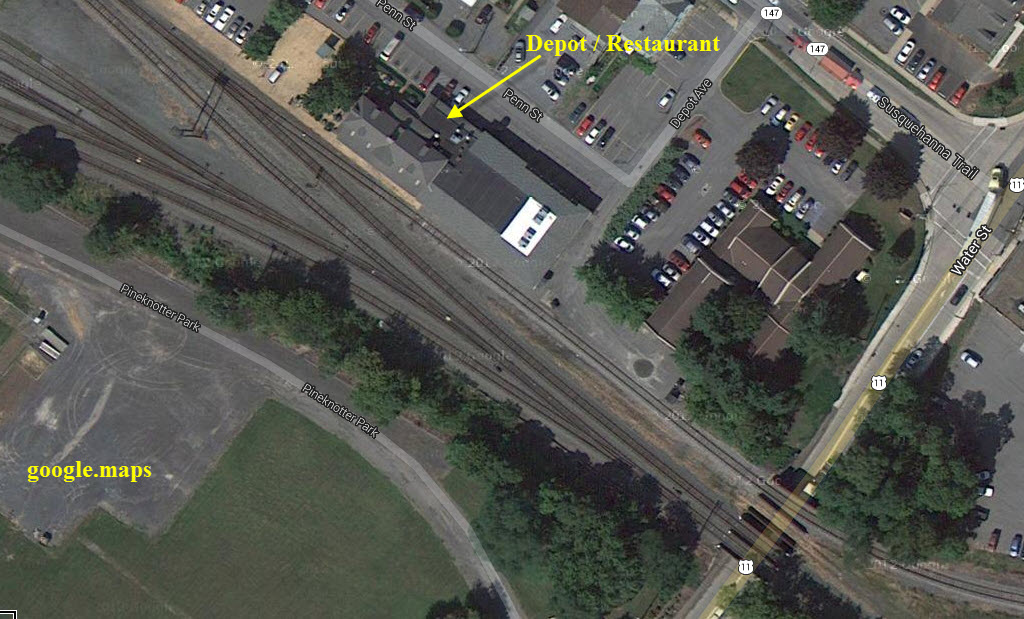
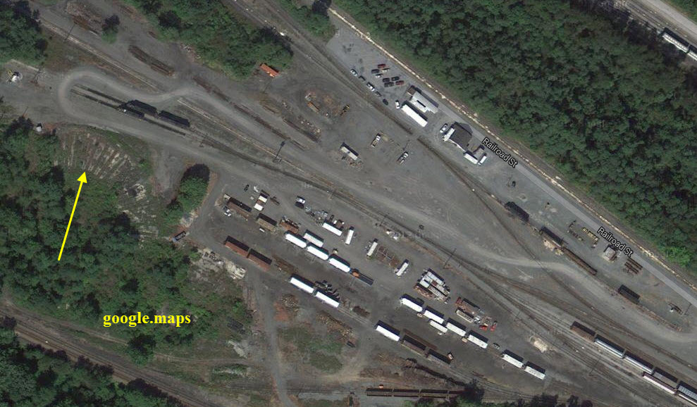
The arrow is pointing at the remains of the turntable.
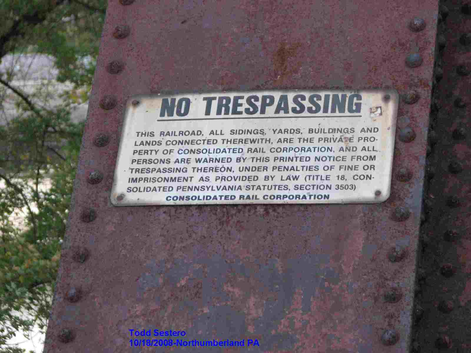
I've been to Northumberland twice, 2008 and 2018, and it was impossible to catch pictures of the engines without trespassing, altho I have to admit, I was here on a Sunday with my daughter Jennifer both times which makes it difficult because she is in a wheelchair and I can't leave her in the car for long.
The North Shore Railroad (reporting mark NSHR) is a short line railroad that operates 44 miles (71 km) of track in Northumberland, Montour, Columbia, and Luzerne counties in Pennsylvania in the United States. The line runs generally northeast between Northumberland (in Northumberland County) and the unincorporated village of Beach Haven in Salem Township (in Luzerne County).
Other communities served include Danville (in Montour County), Bloomsburg, and Berwick (both in Columbia County).
The system has trackage rights via the Norfolk Southern line. These allow the North Shore Railroad to connect to the south with the Shamokin Valley Railroad (at Sunbury), and to the north and west with the Union County Industrial Railroad (at Milton), the Lycoming Valley Railroad (at Muncy and at Linden) and the Nittany and Bald Eagle Railroad (at Lock Haven).
The rail line runs generally northeast along the north shore of the North Branch of the Susquehanna River, roughly following U.S. Route 11. There are 10 miles (16 km) of SEDA-COG Joint Rail Authority track in Northumberland County, 12 miles (19 km) in Montour County, and 15 in Columbia County. Beach Haven is just east of Berwick and the Columbia County - Luzerne County line.
The corporate offices are located in Northumberland, where there is a connection to the Norfolk Southern Railway line (as well as an indirect connection to Canadian Pacific Railway service).
Quick RR History:
The North Shore Railroad's line first was built in 1852 as part of the Lackawanna and Bloomsburg Railroad. This was in turn acquired by the Delaware, Lackawanna and Western Railroad in 1873. The DL&W merged with the Erie Railroad in 1960, forming the Erie Lackawanna Railroad, and was absorbed into Conrail in 1976.
SEDA-COG JRA was formed in July, 1983 to continue to provide rail service to communities whose rail lines Conrail had decided to abandon. In 1984 the JRA took over the line along the north shore of the Susquehanna River from Northumberland to Beach Haven and renamed it the "North Shore Railroad".
The railroad's Facebook page is here
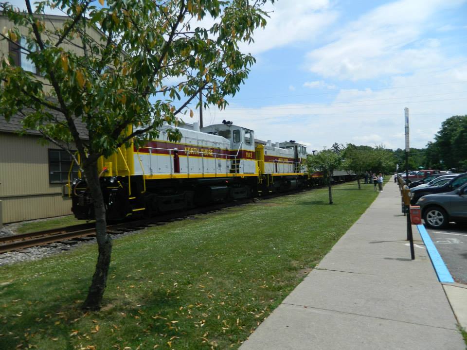
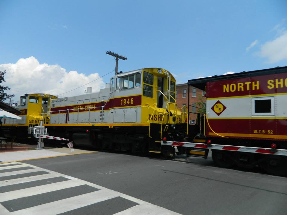
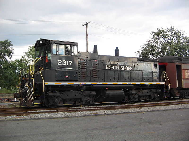 Photo from Wikipedia, taken by Ruhrfisch
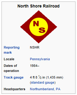
GPS Coordinates: 40.88487, -76.79293 (center)
GPS Coordinates: 40.88565, -76.79441
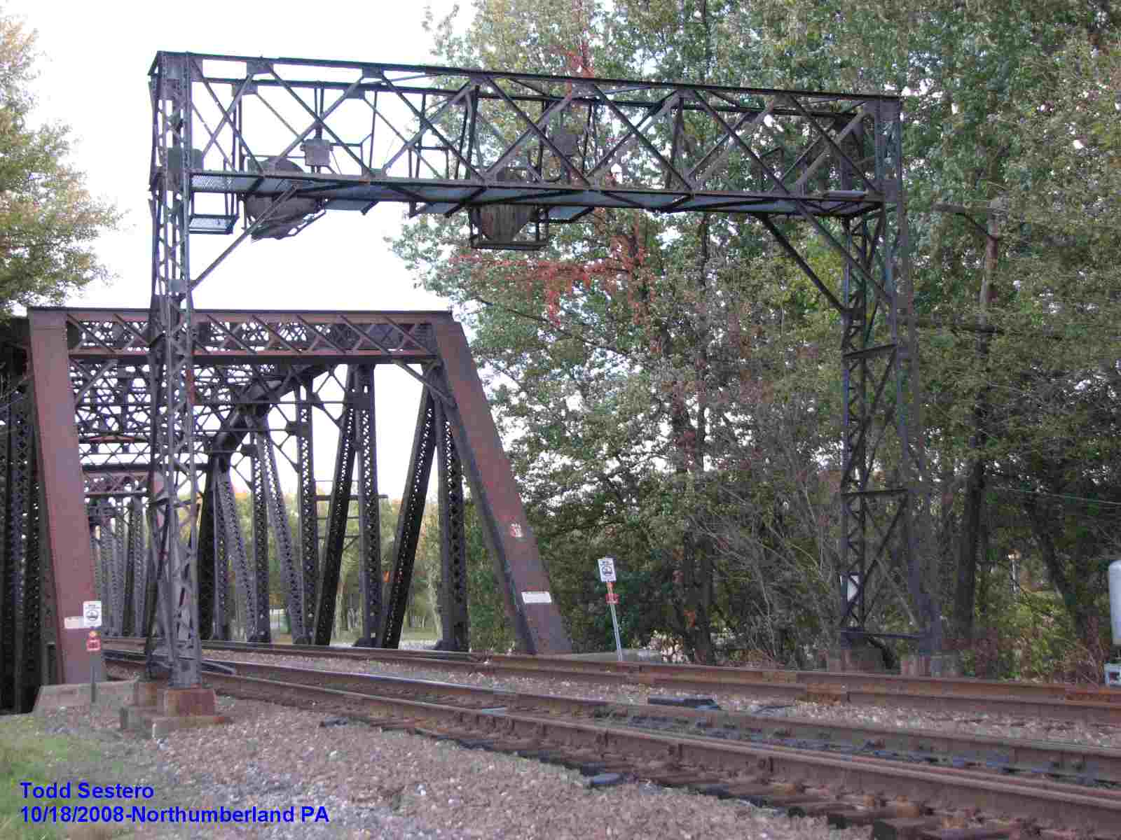
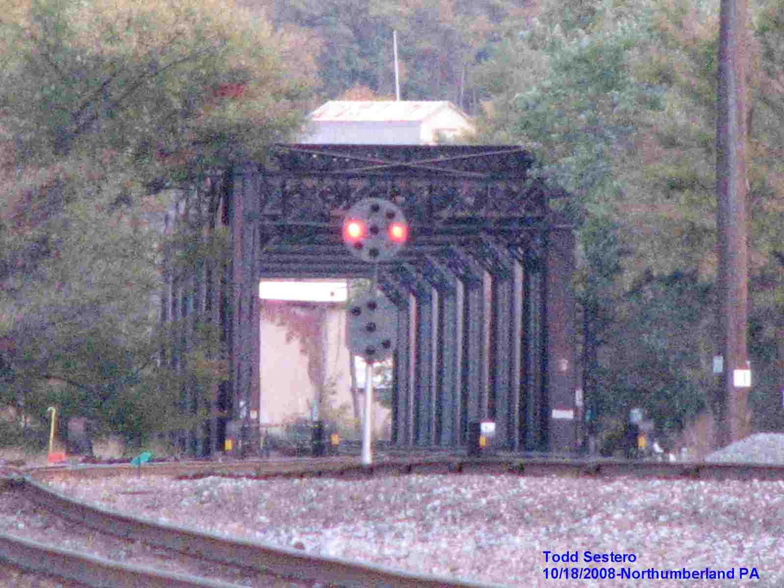
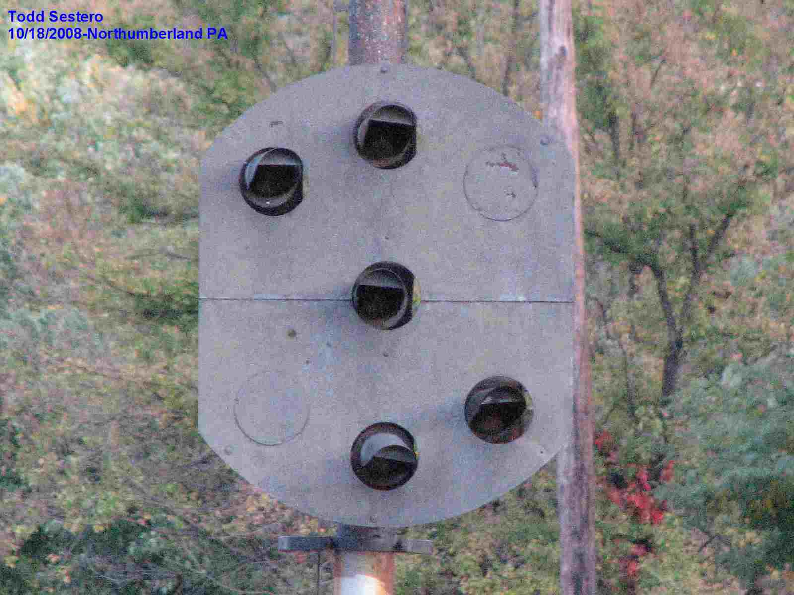
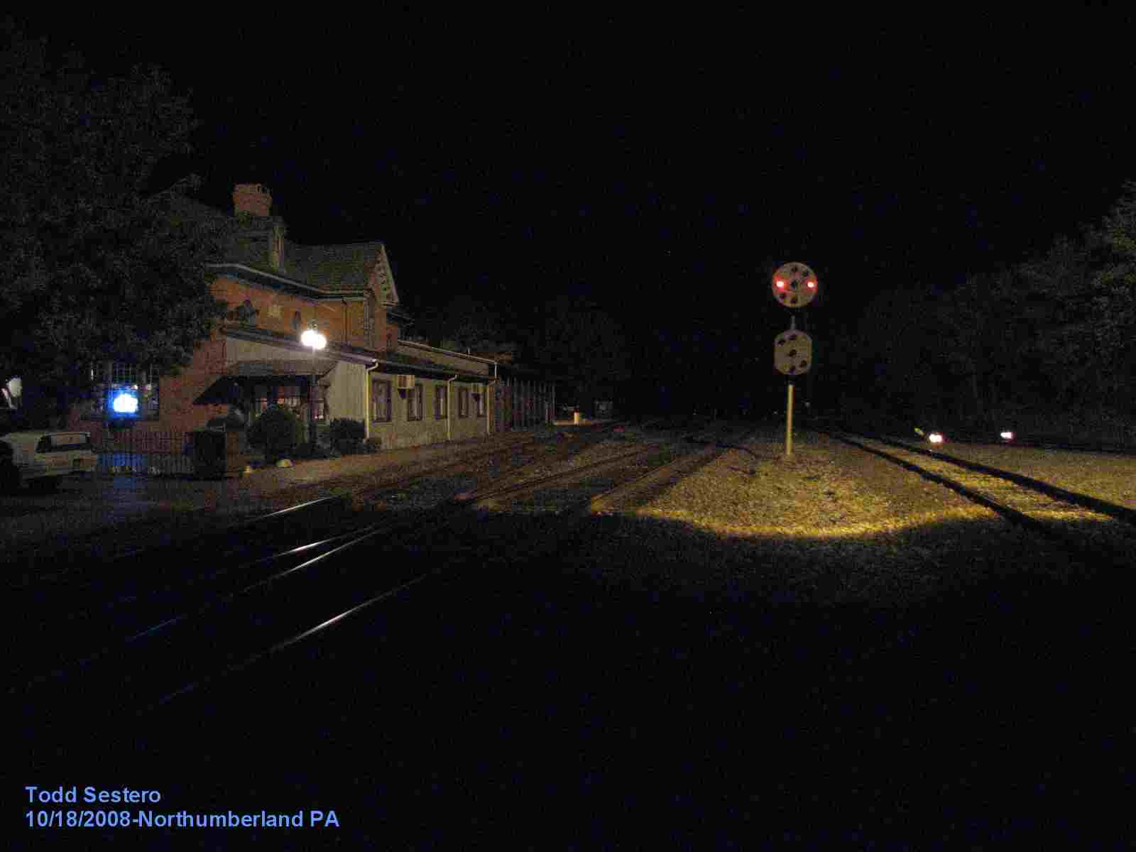
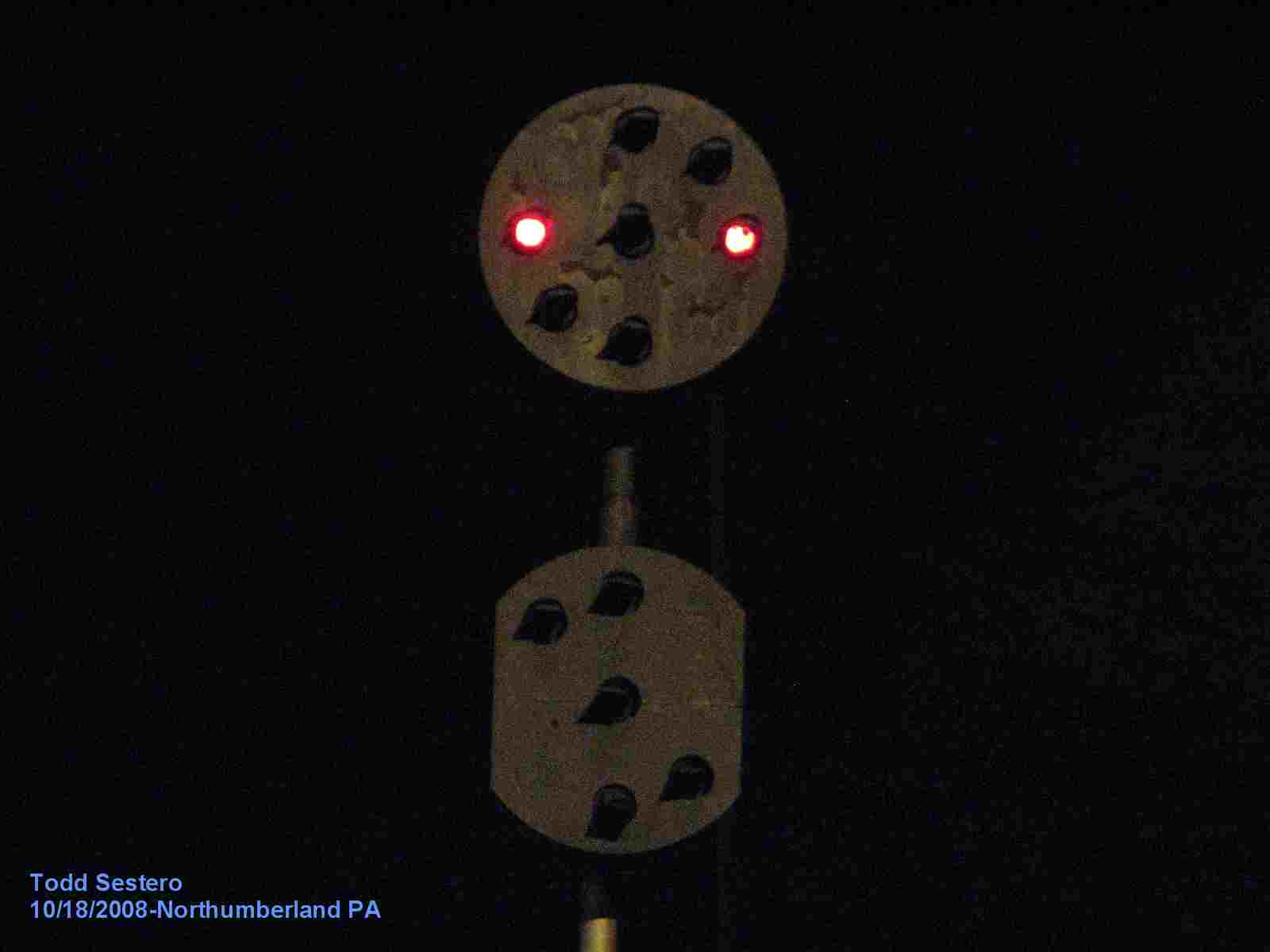
These two signals are perhaps the most unique Pennsylvania Railroad type Position Light (PL) signals to be found anywhere, bar none. The Domino type signals used at the Chicago Union Station approach are similar, but were a standardized design so they appeared in the catalog.
No-one I am aware of knows anything about their history. Our best guess is that they were custom made by the Pennsy.
They were replaced around 2018, and supposedly, after asking around, the signals went to a private individual, with the reason given that they would take care of them better than any museum. Before they were replaced, I had made a call to the railroad museum in Strasburg, and the one official I spoke with there said they weren't going after them because they had NO ROOM for them. Really lame excuse. While it may be "a nice thing" that this individual has these signals, what happened when he dies? Where do the signals wind up then? Unless he has made prior plans to have them donated somewhere. I'm divided on whether or not being in the hands of an individual is for the better. IMHO.
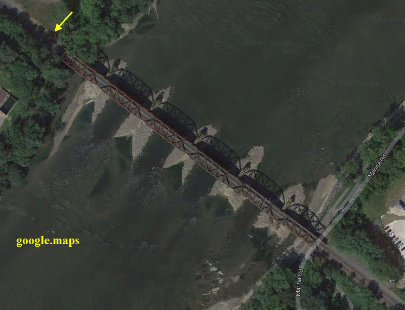
The reasoning for these signals is the close clearance on the bridge coming over from the Sunbury side. If full size PL signals were used, they could not be seen by an approaching train.
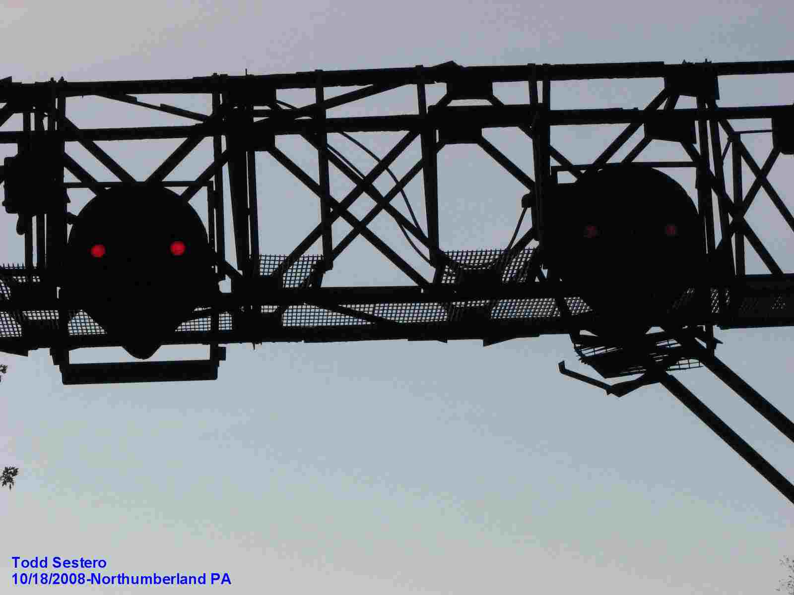


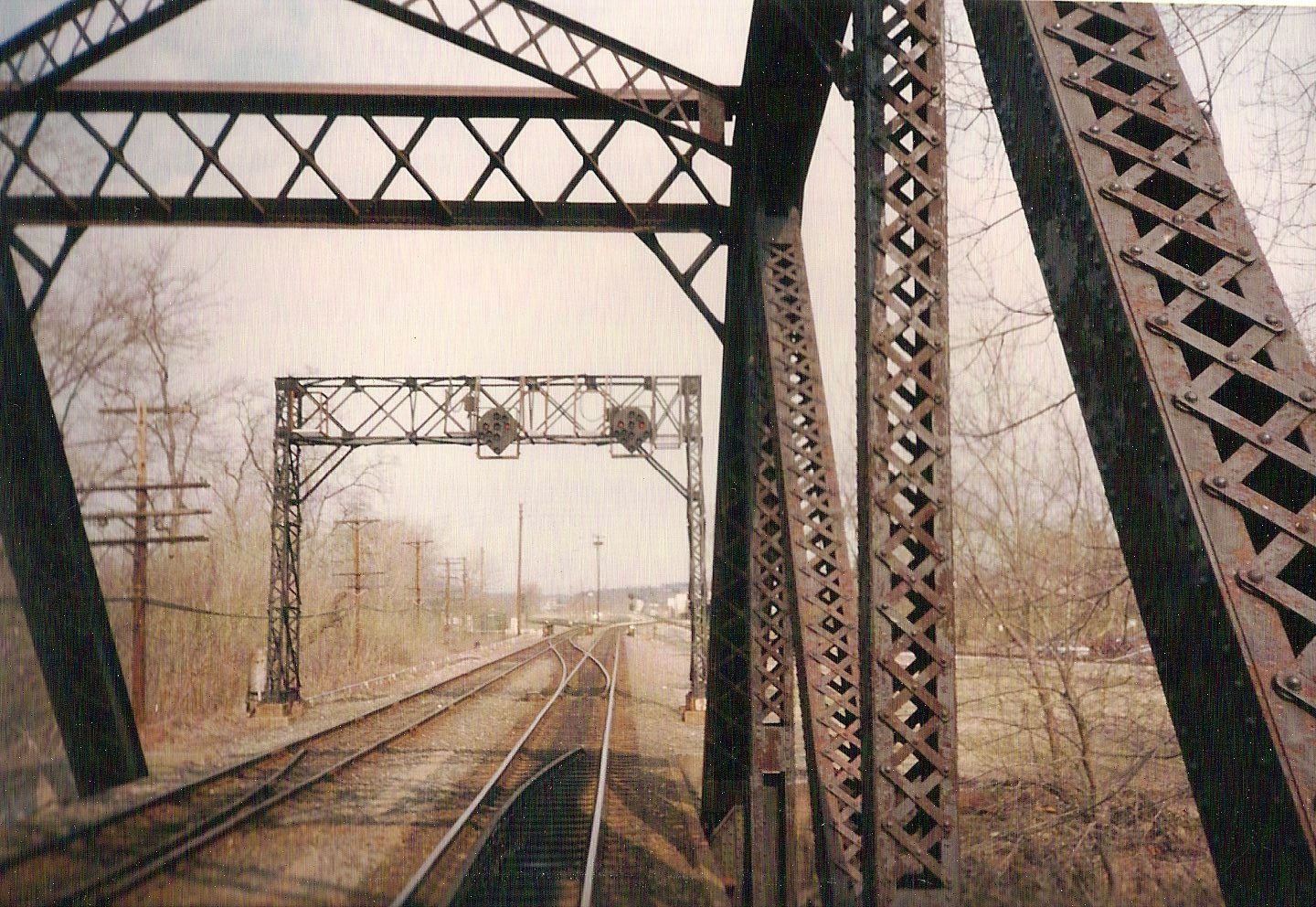 Here is yet another view of the signals from the engineers viewpoint -
Thanks to Rob Blackford, who was riding up the Buffalo Line in a Sperry Car.
Here is yet another view of the signals from the engineers viewpoint -
Thanks to Rob Blackford, who was riding up the Buffalo Line in a Sperry Car.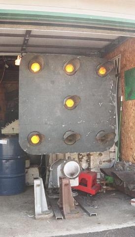 A Domino signal for comparison purposes.
GPS coordinates: around 40.88699, -76.79657
Signals for eastbound traffic headed to Sunbury.

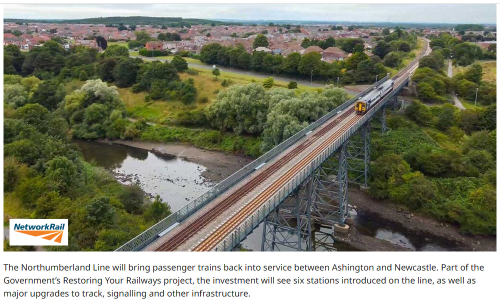
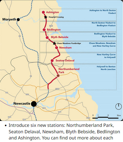
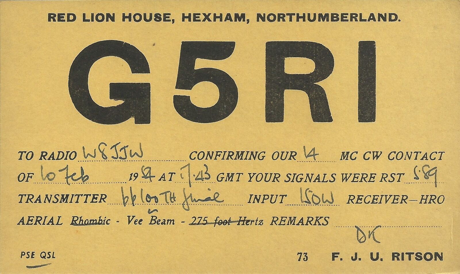
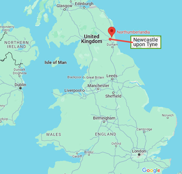
Northumberland, in the UK
As I was doing my update in April of 2024, and trolling the internet to see if anyone has posted pictures of the new signals, I "found out" that there is a Northumberland in the UK, and I'm going to take a wild guess that the one here in Pennsylvania was named after the one in England. Looks like I May have to do a guide for the one in England, as it seems to have a lot of cool railroad stuff, and also sports a Northumberland Line running thru town. Here are just a few things I came across.....
Now this station makes a really cool home!..... only thing missing is a piece of track with a passenger car or two on it as a model train room and guest room!
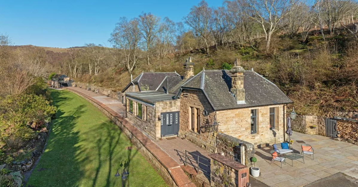
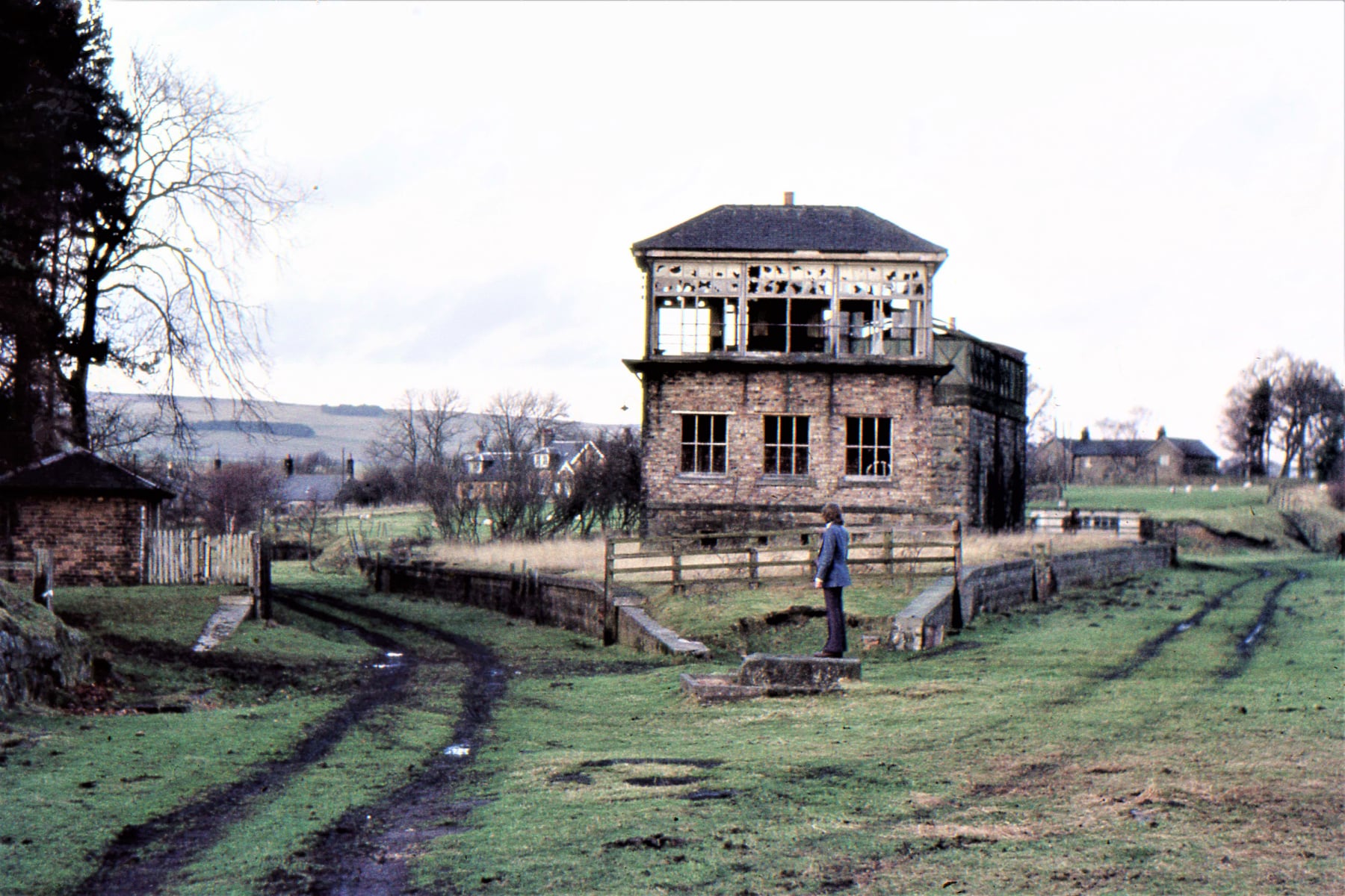
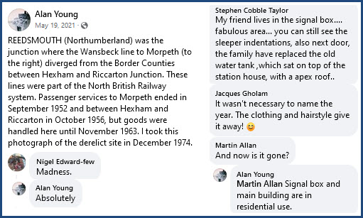 For the picture below, picture posted by Alan Young.
https://www.facebook.com/photo/?fbid=317832596530049&set=gm.6178466485500657
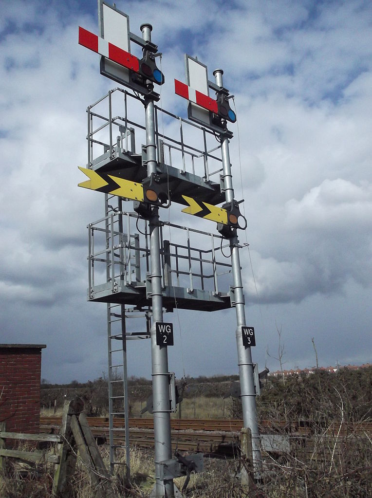
A close-up of the semaphore signals, which are apparently "new", having been erected in 2010 -- From Wikipedia: New semaphore signals installed since 2010 on the Blyth and Tyne network at Winning Signalbox. Forming a "splitting distant" controlling access to a tri-angle. Photo by Robertforsythe, via Wikipedia UK.
The Northumberland Line Project:
https://www.networkrail.co.uk/running-the-railway/our-routes/north-and-east/the-northumberland-line-project/
Also came across the Ham Radio QSL Card from the UK. QSL Cards are postcards hams trade to prove that they talked or communicated with another station, and many of us fill the walls of our radio rooms with these things :-) This one went to a fellow on the west coast of the US, indicated by the "W8" in his call sign.:
Where is Northumberland U.K.?
USGS Quadrangle Map From 1891
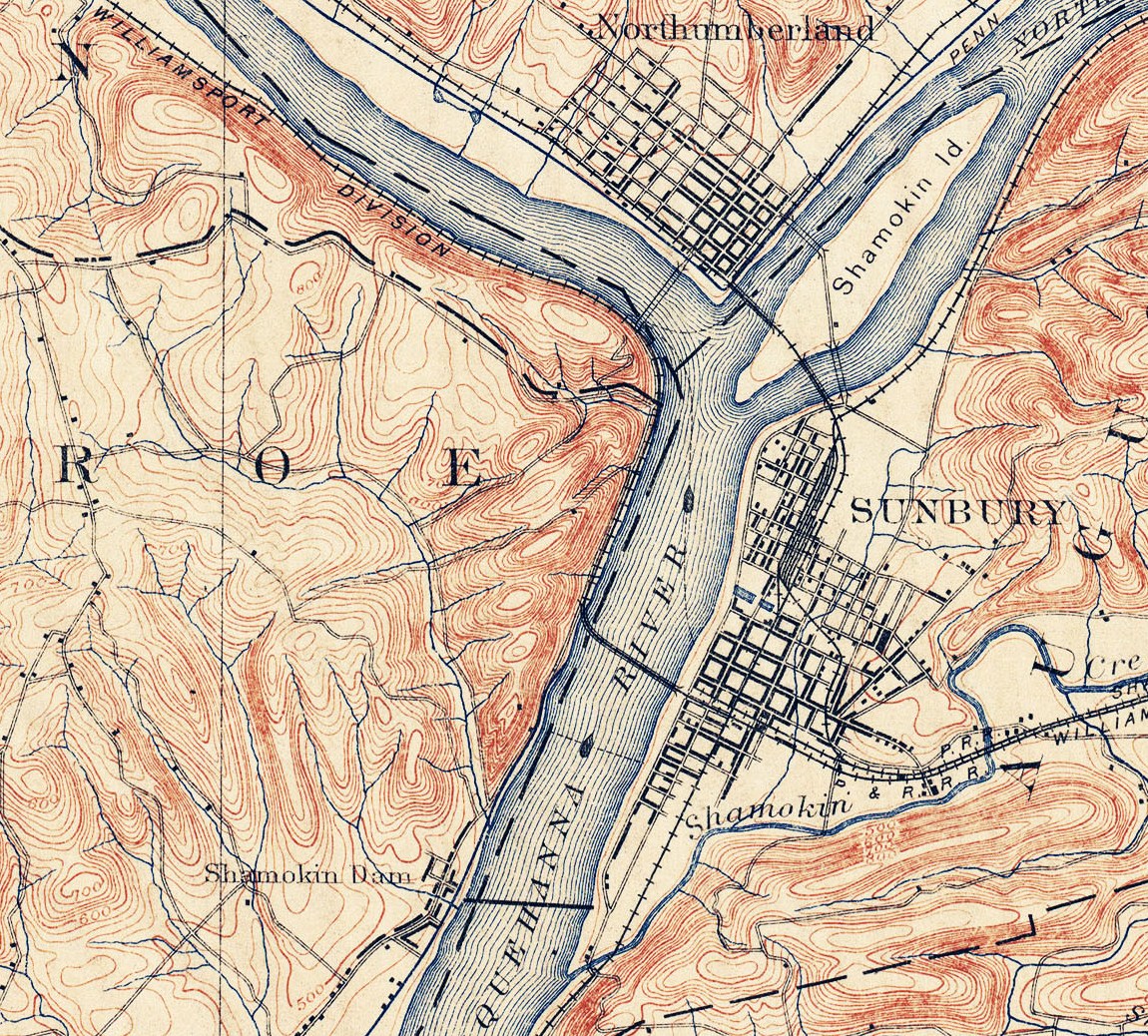
Northumberland / Sunbury History
Sunbury, originally the Indian town of Shamokin, was laid out as the county seat in 1772. Because of Sunbury’s location at the forks of the Susquehanna River, by the beginning of the nineteenth century it was the hub of Northumberland County. The seven original townships in Northumberland County, also created in 1772, included Bald Eagle, Buffalo, Penn’s, Turbot, Augusta, Wyoming, and Muncy. The seven townships were divided and subdivided into new townships and counties as areas grew in population and the need for local government increased. Sunbury remains the county seat in Northumberland County. Of the seven original townships, only Turbot and Augusta were located in what is now Northumberland County. As these large sections of land began to develop and more settlers moved into the region, pressure for localized government was exerted until new communities were formed.
The line was originally chartered on April 8, 1826 as the Danville and Pottsville Railroad, making it the third oldest line in the United States. It was to run from the Ferry House opposite Danville, Pa. to the Schuylkill Canal at Pottsville, Pa. Before construction began, the terminus was changed from Danville to Sunbury.
Construction began in July 1834 on the 20 mile section between Sunbury and Shamokin and was completed in the summer of 1835. The line was soon extended to Mt. Carmel, Pa.
The transportation of Anthracite Coal was the principal business of the rail road. Coal was brought from the mines in two ton dump cars pulled by horses or mules. The road entered Sunbury through Raspberry Alley, out to the river front to wharves, where the coal was dumped into canal boats to be taken across the river to the canal and then to market. However, with the collapse of the Canal System, the line was never extended to Pottsville!
The railroads of the day were very different from what we usually think. The rails were wooden stringers topped with flat iron bars, and the motive power was horses and mules! The first passenger cars were the "Shamokin" and the "Mahonoy" and were each pulled by two horses. In 1837, 3 small steam engines, the "North Star", "the Mountaineer", and the "Pioneer", were purchased and put to work on the road. In 1839, the road went back to using 'Horse Power" because the weight of the steam engines proved to be too heavy for the track. In 1852 the line became the first rail line in the world to use iron T rails made by the nearby Danville Iron Company, and the line secured six more steam engines. It was over these tracks, that in 1861, the first troops from this area left for service in the Civil War. The Line went through several name changes before becoming the Shamokin Valley Branch of the Pennsylvania Railroad. Passenger service on this line continued until 1938.
The Shamokin, Sunbury, and Lewisburg Railroad was chartered in 1882, and was absorbed by the Philadelphia and Reading Railroad in 1883. This line was built on the opposite shore of the Susquehanna River and followed the route of the old canal system to Sunbury. It then crossed over the River and paralleled the Shamokin Valley Branch through our area. In Shamokin, the two Railroad Stations were only one block apart and the tracks were within several yards of each Passenger service on this line continued until Friday, June 28, 1963, when No. 863, the "King Coal" made the final run of her daily passenger service between Shamokin and Philadelphia.
Completed on August 6, 1911, the Northumberland Classification Yard contained an area of 700 acres and 70 miles of track, round house, and shops. During it's 1950's, over 1500 railroad cars passed through the yard each day for receiving, dispatching, or reclassifying!
Before the opening of the Saint Lawrence Sea Way, the Shamokin Valley Branch was used to haul iron ore from the docks on Lake Erie to the Lehigh Valley Railroad interchange at Mt. Carmel on its way to the Bethlehem Steel Mills. During the 1950's the Shamokin Valley Branch was one of the last to give up her Steam engines. The Pennsylvania Railroad used four I1's to pull and push 100 ore cars over the 2% grades of the line between Northumberland and Mt. Carmel. Due to the weight of the iron ore, it could only be loaded directly over the trucks to prevent buckling of the hoppers. At the Lehigh Valley interchange, the train was broken into three sections and the Lehigh Valley used four "modern diesel engines" to haul each section! Twelve "modern diesels" to do what four of the mighty PRR I1 steam engines could do!
The above describes the railroads of the area needed to build a model RR layout: The Lower Anthracite Model Railroad Club is located on the second floor of the American Legion Building (above the Public Library) at 210 East Independence Street, Shamokin PA. Our Club has built and operates: The Shamokin Lines which is a 3,000 square foot HO scale model railroad. The area being modeled is Northumberland County, Pennsylvania. We begin at the Pennsylvania Railroad yards in Northumberland, Pa, through the City of Sunbury, and then follow the 27 mile long Shamokin Valley Branch of the Pennsylvania Railroad, the lines of the Reading Railroad that paralleled it, (sometimes within a few yards), and the interchange with the Lehigh Valley Railroad in Mt. Carmel.
Above found here
The settlement of Northumberland County is related to the development of the transportation system throughout the County. Many of the routes in Northumberland County were established by the original Native American inhabitants, who had an elaborate system of trade routes that connected much of Northumberland County. Generally the trade routes followed the natural contour of the land, covering natural stream beds, flat lands, and gently sloping grade levels over mountains. As the white settlers moved into Northumberland County, the Indian trails were replaced by bridle paths supporting travel on horseback. The bridle paths gave way to the roads and highways that supported travel by wagons and the movement of herds of animals. By 1885 canals and railroads had been constructed, often paralleling the Centre Turnpike (present day Route 61), thereby removing much of the heavy, bulky freight that had the potential to generate the greatest revenue for the road.
The construction of the Pennsylvania Canal was envisioned as part of the longest chain of canal navigation in the world supporting an unbroken line of internal navigation uniting the Chesapeake Bay with Lake Erie, Lake Ontario, Lake Champlain, and the Hudson River. The idea to connect these interior waterways with the sea had been visualized by William Penn in 1690. The need for a means of transportation in order to establish an economic base for the previously separated counties, which had only primitive means of distributing their products, led to the establishment of six divisions of the Pennsylvania canal. The Susquehanna Division was formed in Northumberland County. The Susquehanna Division stretched 39 miles along the west side of the river to the end of the bridge at Northumberland. In the Susquehanna Division, two branches existed: a) the North Branch connecting Northumberland with Naticoke; and b) the West Branch connecting Northumberland with Muncy.
By 1838, only ten years after its inception, the canal system had been rendered useless. The advent of the railroads, coupled with the cost of the canal system in Pennsylvania, led to its failure. The Northern Central Railroad was building along the east shore of the Susquehanna River, reaching Sunbury in 1858. By 1858 the railroads completely swallowed the canal system in Northumberland County. For years, the railroad was the major employer in the Sunbury area. The history of the railroads in Northumberland County is bound to the history of coal. It was the demand for anthracite that was the direct cause of the construction of nearly every rail line in Northumberland County. When the demand for coal dropped off, the railroads went into a decline with the result that every rail line in Northumberland County went bankrupt. In Northumberland County there was not enough industry replacing coal to keep up the demand for rail service and what industry that did appear was generally not rail-oriented. Encouraged in the 19th Century by the need for an economical fuel located near metropolitan centers, anthracite prospered until the beginning of the 20th Century when, plagued by work strikes and environmental legislation, new energy sources appeared and anthracite began a rapid decline.
Above found here
Disclaimers:
New format 10/26/23: Please check out my disclaimer page for my standard dribble and contact info here
RAILFAN GUIDES HOME
RAILROAD SIGNALS HOME
NEW 10/01/2012, APR25/2024
Last Modified 27-Apr-2024