
In General
Getting Here
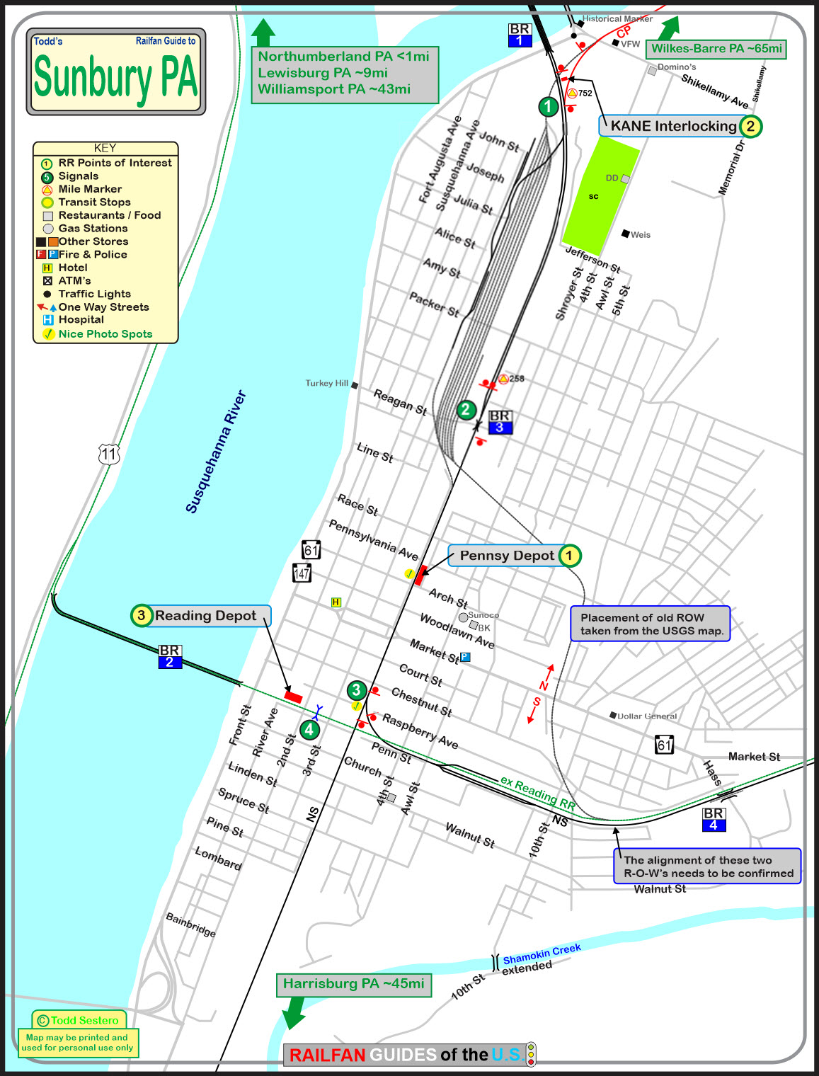
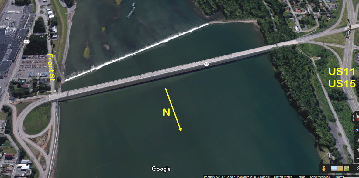
Map
Sights
Signals
Bridges
Pictures
Fire & Police
Floobydust
USGS Maps
RAILFAN GUIDES HOME
RAILROAD SIGNALS HOME
Location / Name:
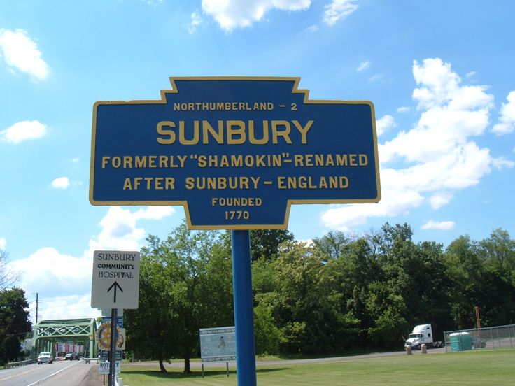
Sunbury PA, Northumberland County
What's Here:
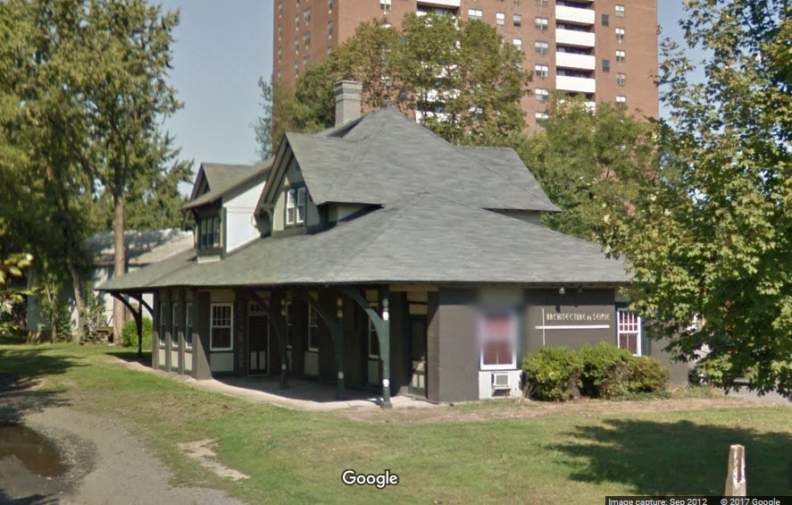
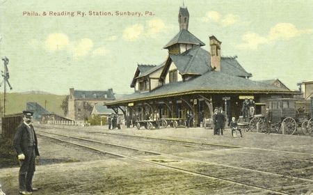
former PRR Depot
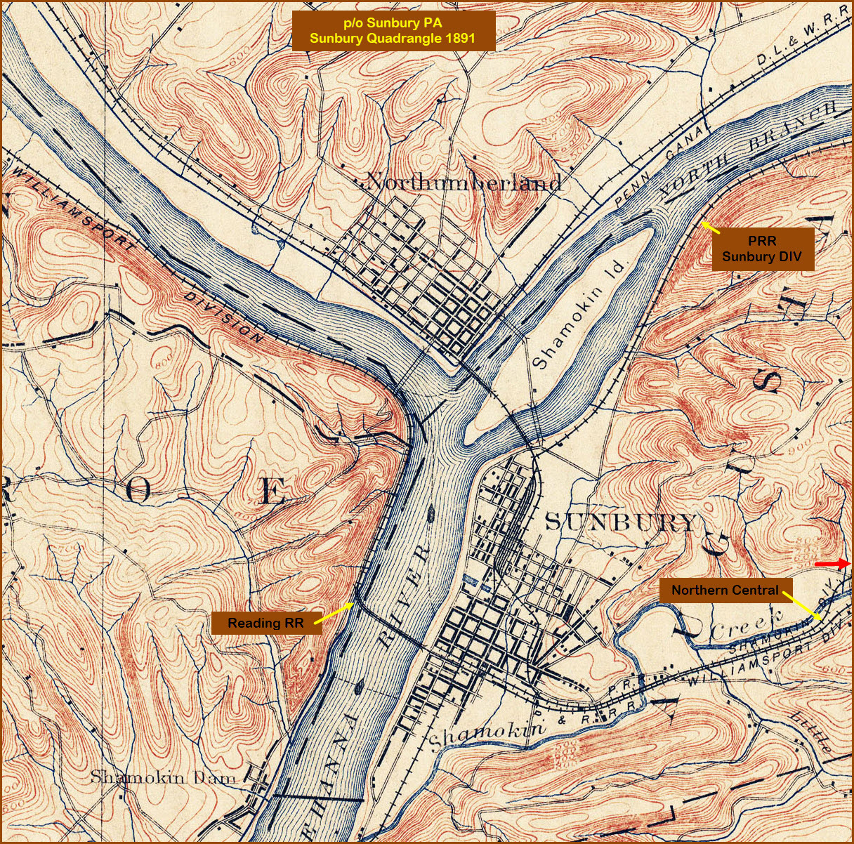
former junction between the PRR and RDG
former junction between Conrail and the D&H
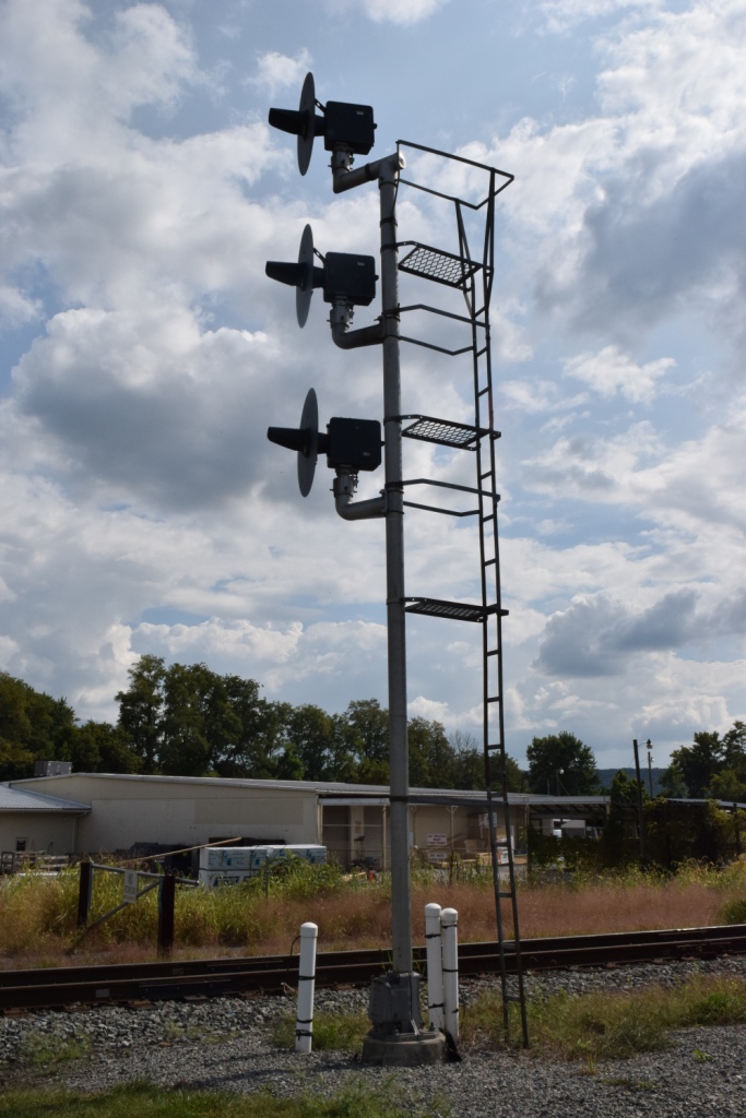
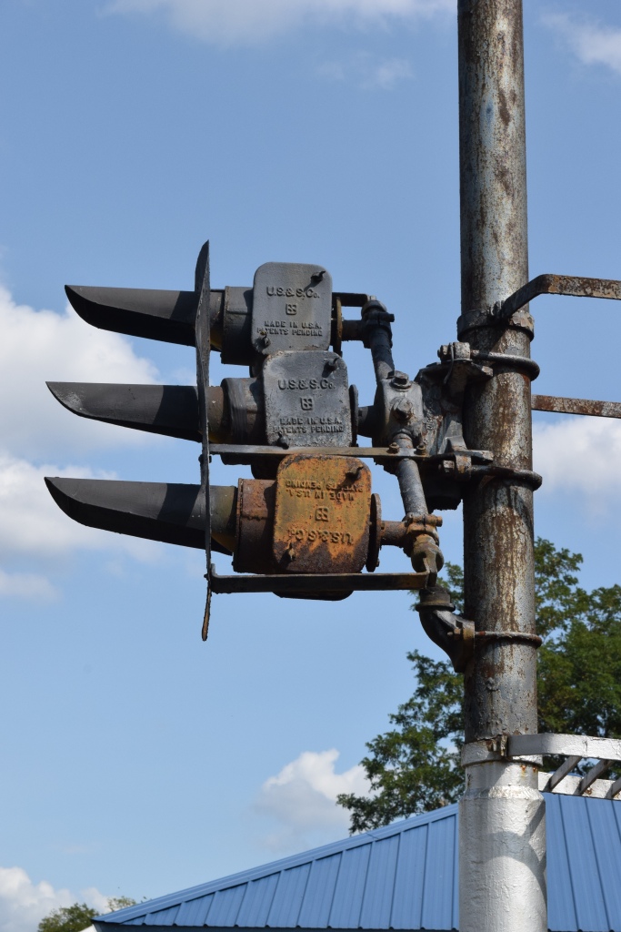
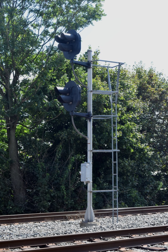
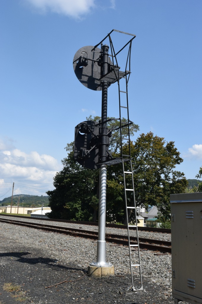
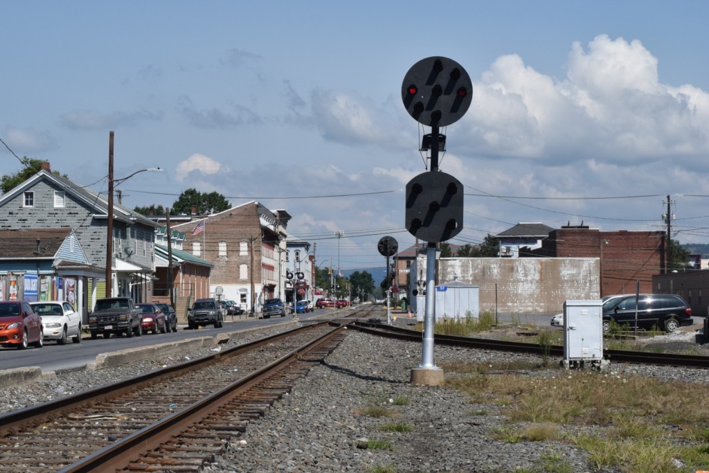
Pleasant mixture of "red eye" PRR PL signals, a lone trilight signal, and a lone Unilens signal (for now, as of SEP2017)
Data:
GPS Coordinates: 40.863366, -76.791827 (at the PRR Depot)
Phone A/C: 570
ZIP: 17801
Access by train/transit:
None
The Scoop:
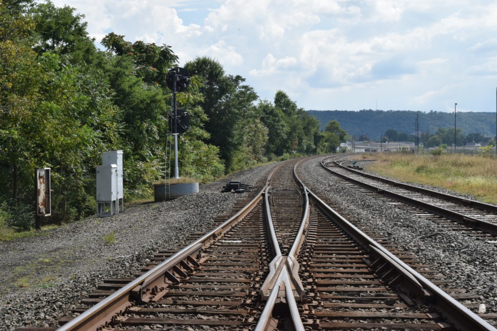
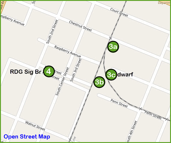
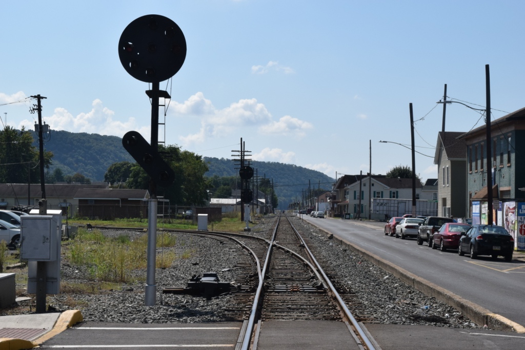
You come to Sunbury for the signals, at least for now while they still have the heritage signals up. There is a mixture of Pennsy PL signals with the "red eye" modification done to them, a lone set of Conrail era "tri-light" signals, and over on the CP line to Wilkes-Barre is a Unilens signals for SB trains.
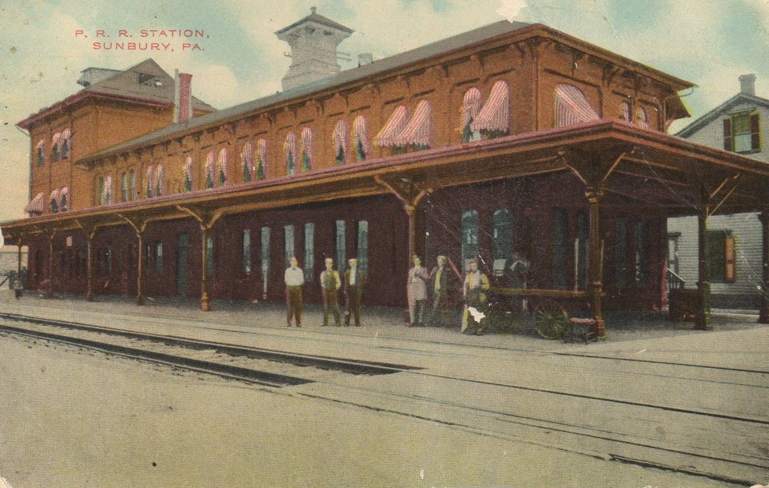
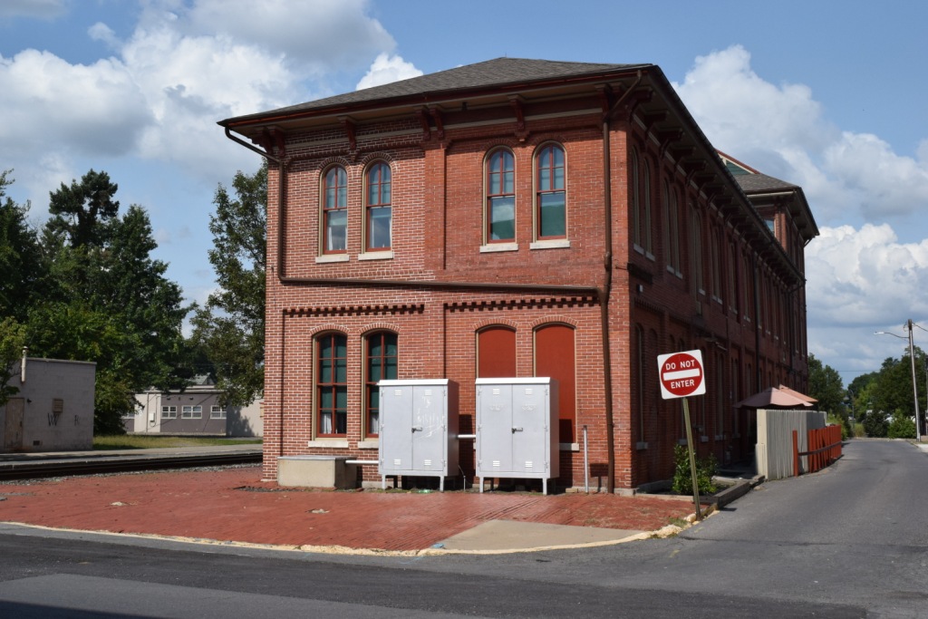
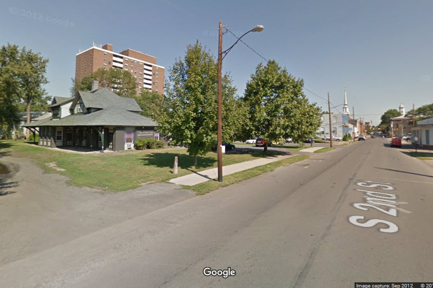
Not far from CP HORN is the former Pennsy depot, in good shape and used by several commercial establishments.
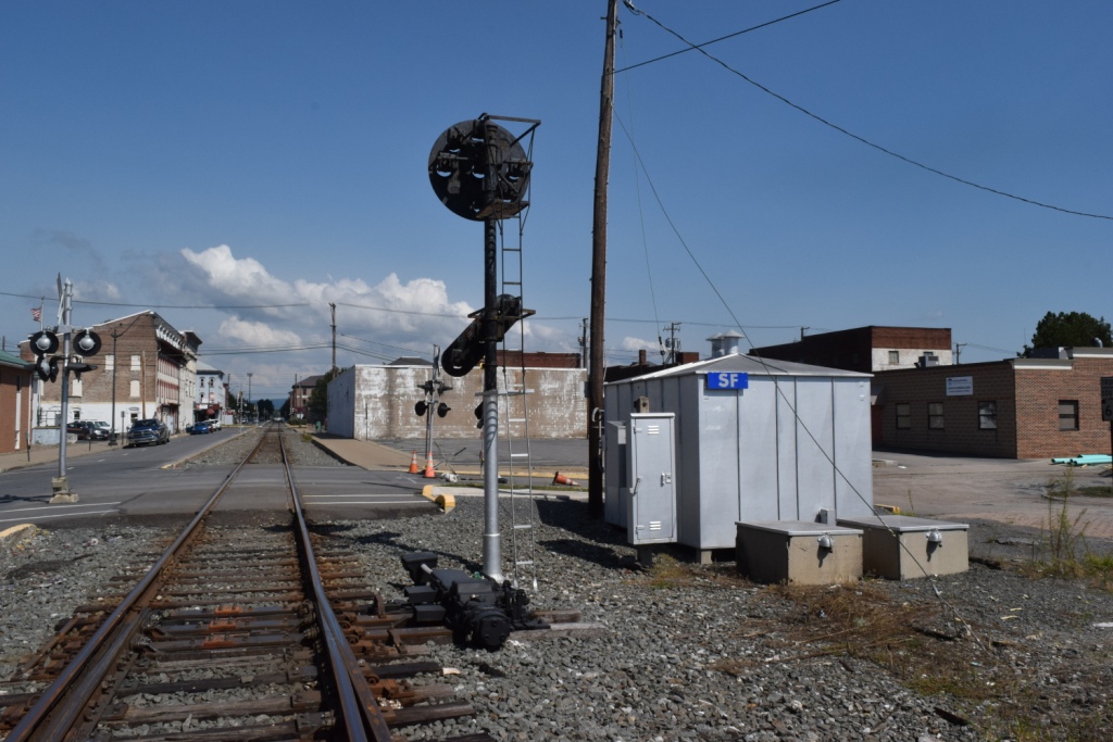
Also downtown, there is a former Reading RR signal bridge still standing, but it has no lights on it. It is on Penn St, two short blocks from CP HORN .
And speaking of the Reading, their former depot is located a block west of the Reading signal bridge, kind of hidden by a large row of pine trees where the right of way used to be.
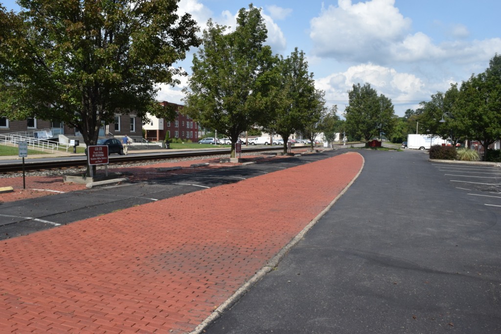
Another noteworthy feature of Sunbury is the track running right along 3rd St. If you catch a train, because the track is so straight, and crosses a bucket full of streets, the scene is unique with all of the crossing gates down and lights-a-flashing for almost as far as the eye can see. Many people will call this street running, but technically, it is not -- it has the appearance of street running, as it does in Ashland VA, where the tracks are in the middle of two streets, conveniently located right next to the tracks.
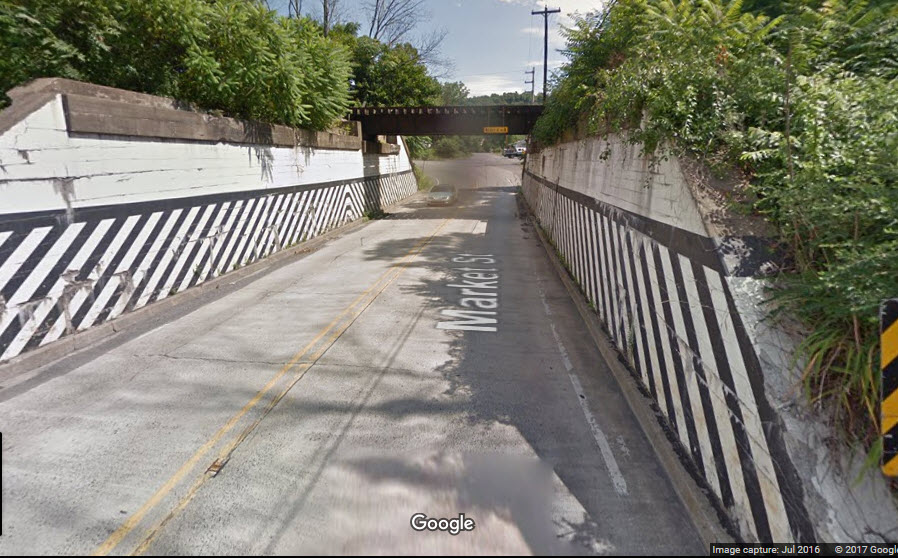
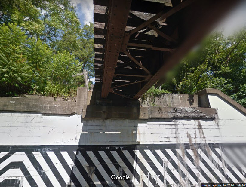
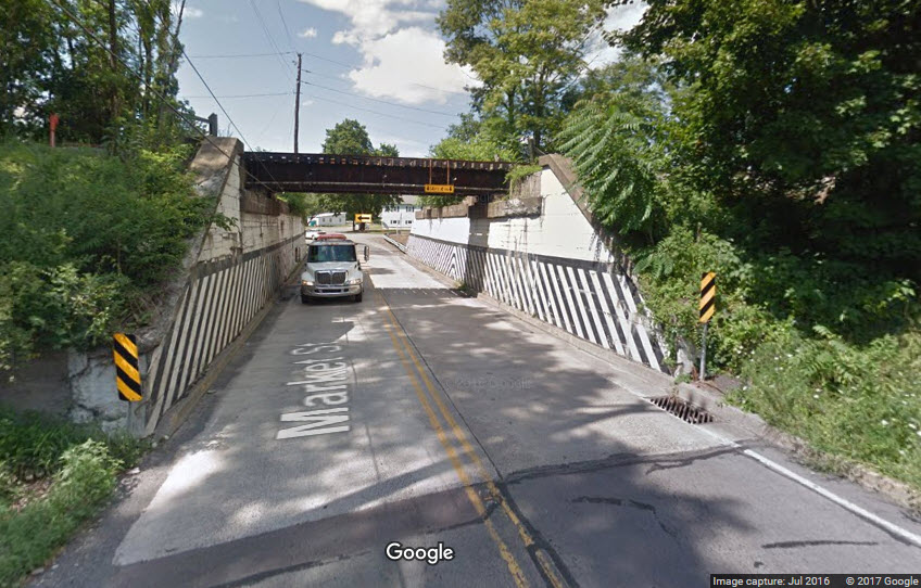
BTW, Market St is the north-south divider, everything north of there is "north".
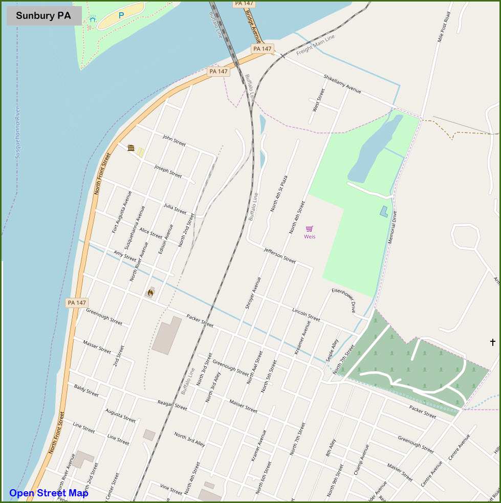
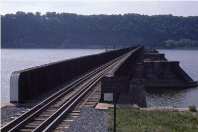
The Buffalo line continues west/north by crossing the Susquehanna on a double track bridge, and upon reaching the far side going into Northumberland, goes under perhaps the most unique set of signals (bar none) existing in the U.S. today. See below.

Acknowledgements:
Denver Todd
Barry Wills (bridge photo)
Bob Jaegers
Jersey Mike
John Dziobko
Alexander D. Mitchell IV
Alexander D. Mitchell IV and Art Suckewer for pictures of the Reading Bridge
Websites and other additional information sources of interest for the area:
http://berwickrailfan.webs.com/brwkrfsunburynorry.htm Nice page but pictures are teeny :-)
http://railfansisuslibrary.tripod.com/Collections/LibraryPage1.html
http://michaelfroio.com/blog/
http://www.sunburyfloodcontrol.com/flood-history.html
https://bridgehunter.com/pa/northumberland/bh71280/
https://bridgehunter.com/pa/northumberland/bh58972/
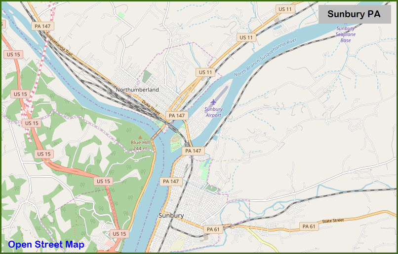
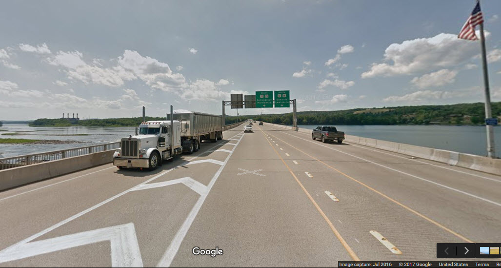
Sunbury is about 52 miles north of Harrisburg via US15. Take the PA61 exit a few miles before getting to Northumberland - this will take you across the Susquehanna, and put you in south Sunbury.
From I-80, which is north of Sunbury and Northumberland, take exit exit 212, which will dump you onto PA147. It is a 15 miles trek into Sunbury.
From the west or east, I would use I-80.
If you are coming from the Lewistown or Mt Union (think EBT) PA area, use US522 north.
Maps
The PDF version of the above map is
here
From the mid 1800's (because it says NC instead of the B&S RR):
GPS Coordinates: 40.863366, -76.791827
100 N. 3rd St, Sunbury PA, 17801
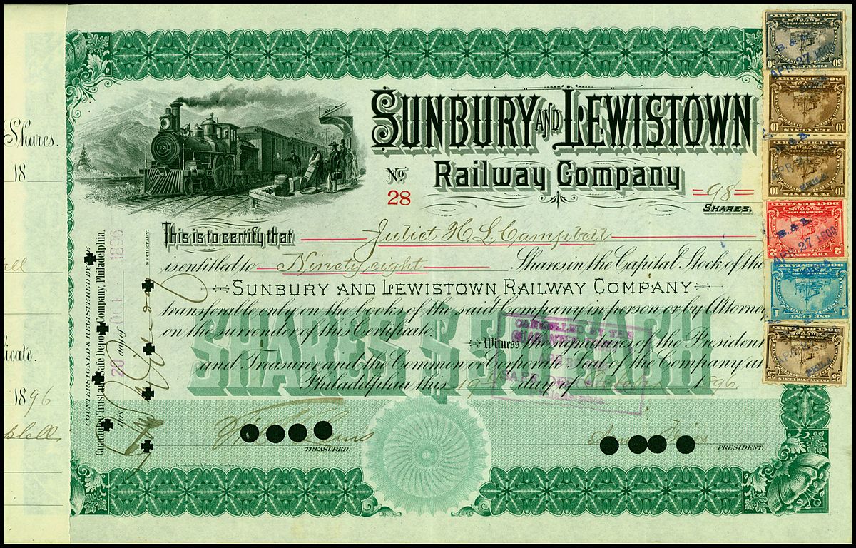
 EBay: from njrtsr
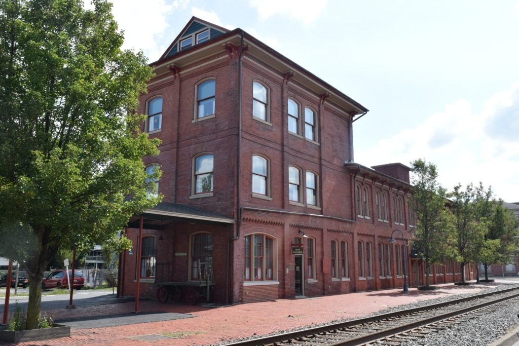

GPS Coordinates: 40.877174, -76.786189
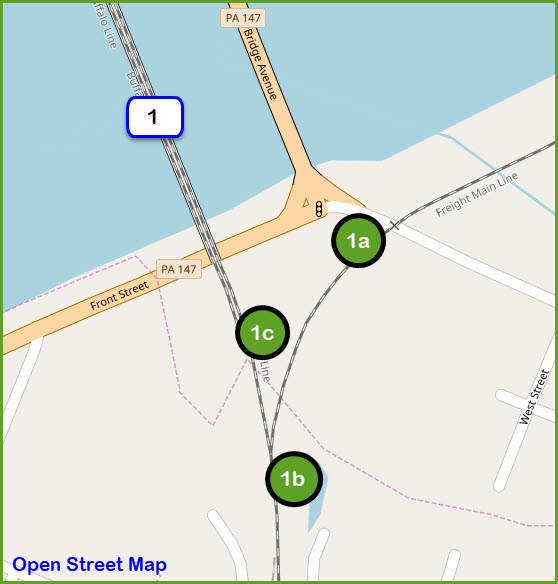
Over the years, it appears that there were at least three buildings at this location. Also, from the one picture, it looks like the tower was in the middle of a wye. The current building here is a simple cinder block type building, sitting off to the side of the tracks, instead of being in the middle of where the wye used to be. Another interesting fact, if we look at the bridge picture below, it appears that the Wilkes-Barre line did not wye into the Pennsy main line in the beginning (as indicated by the dashed line). I'm still looking for a 30's-40's vintage map of Sunbury to confirm this, and to also get a better picture of what was here then.
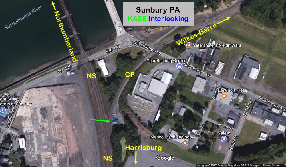
 Today
Today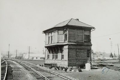 Pennsy KASE Tower
 PRR KASE Tower prior to the one above
GPS Coordinates: 40.859786, -76.796608
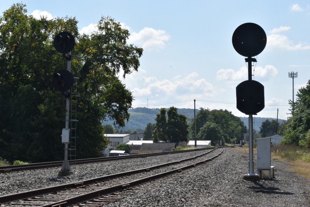
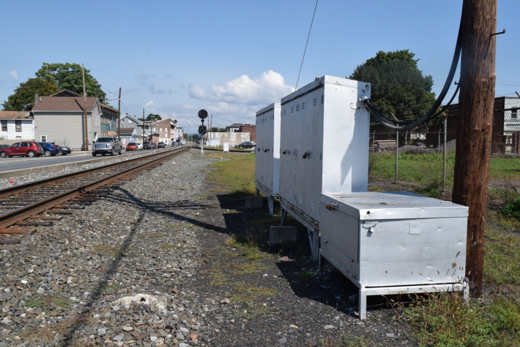
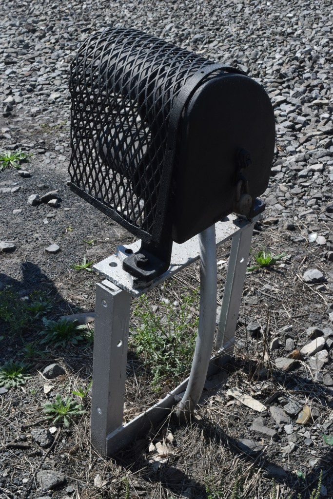
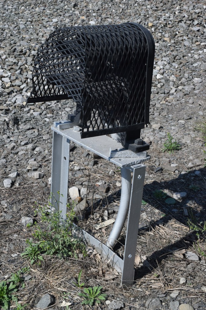
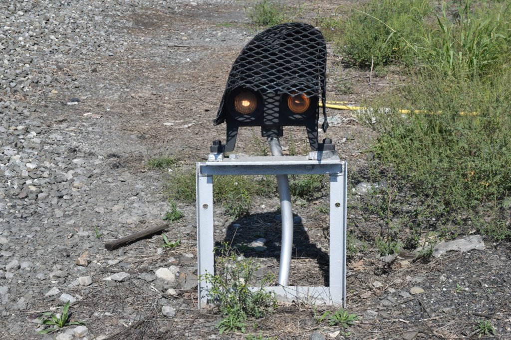
This is where the Canadian Pacific line up to Wilkes-Barre ties into the NS (Pennsy) line between Northumberland and Harrisburg. Interesting note about this location is: since the line to Wilkes-Barre is owned by the Canadian Pacific, they have installed Unilens type searchlight signals, which appear on many of their U.S. lines.
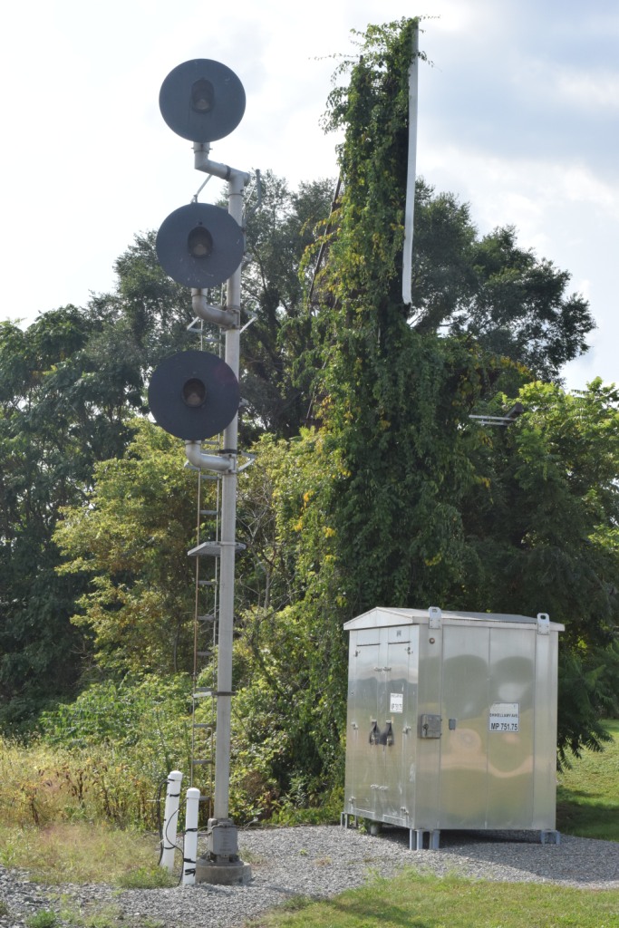
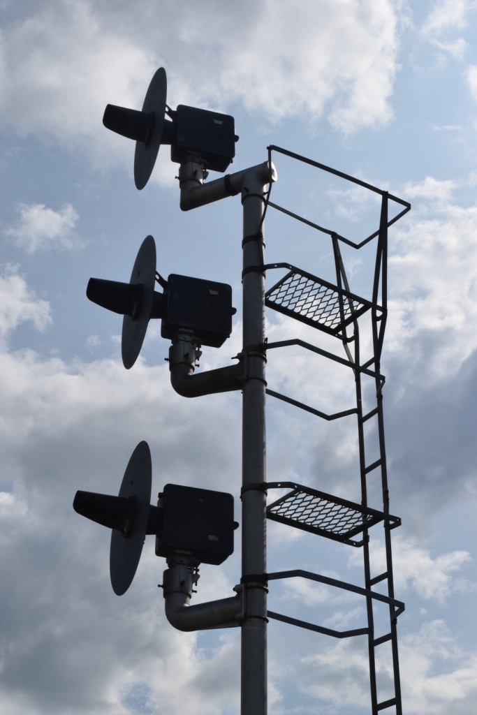

 1a
1a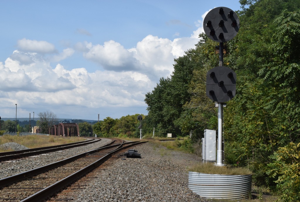

 1b
1b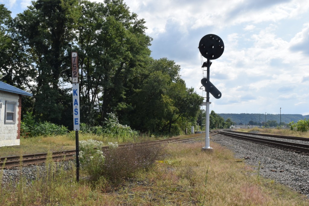
 1c
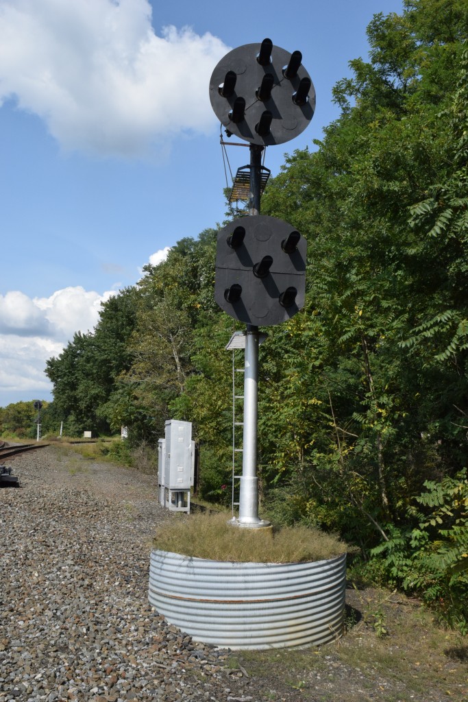
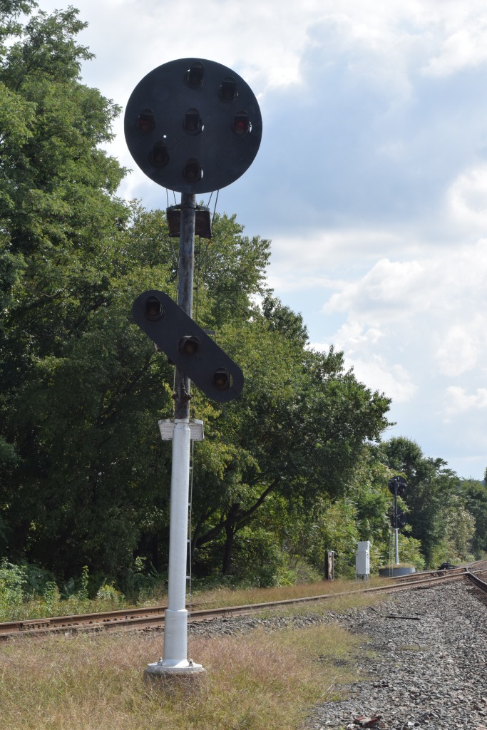
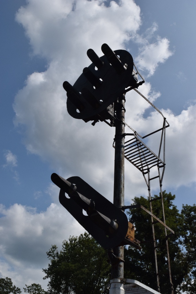
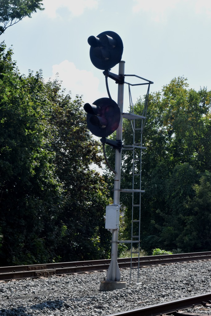
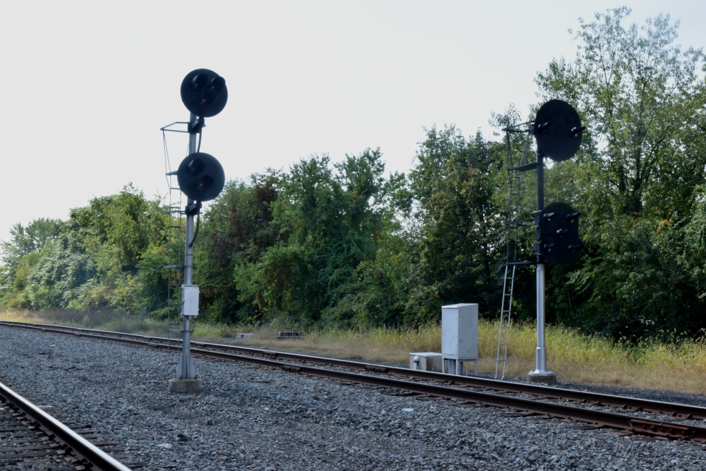
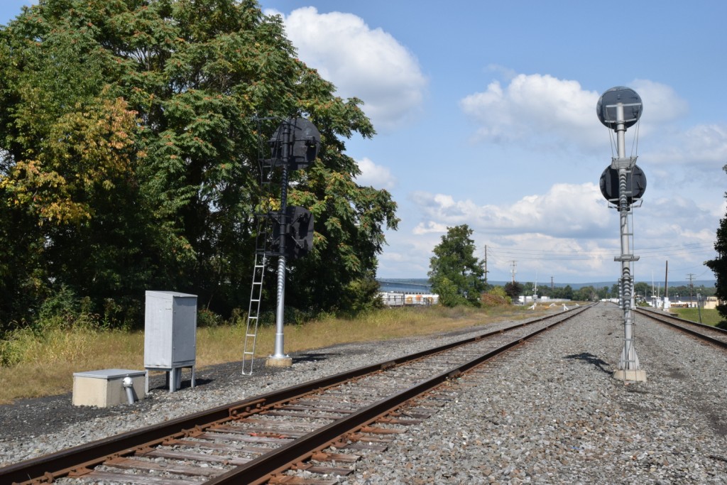
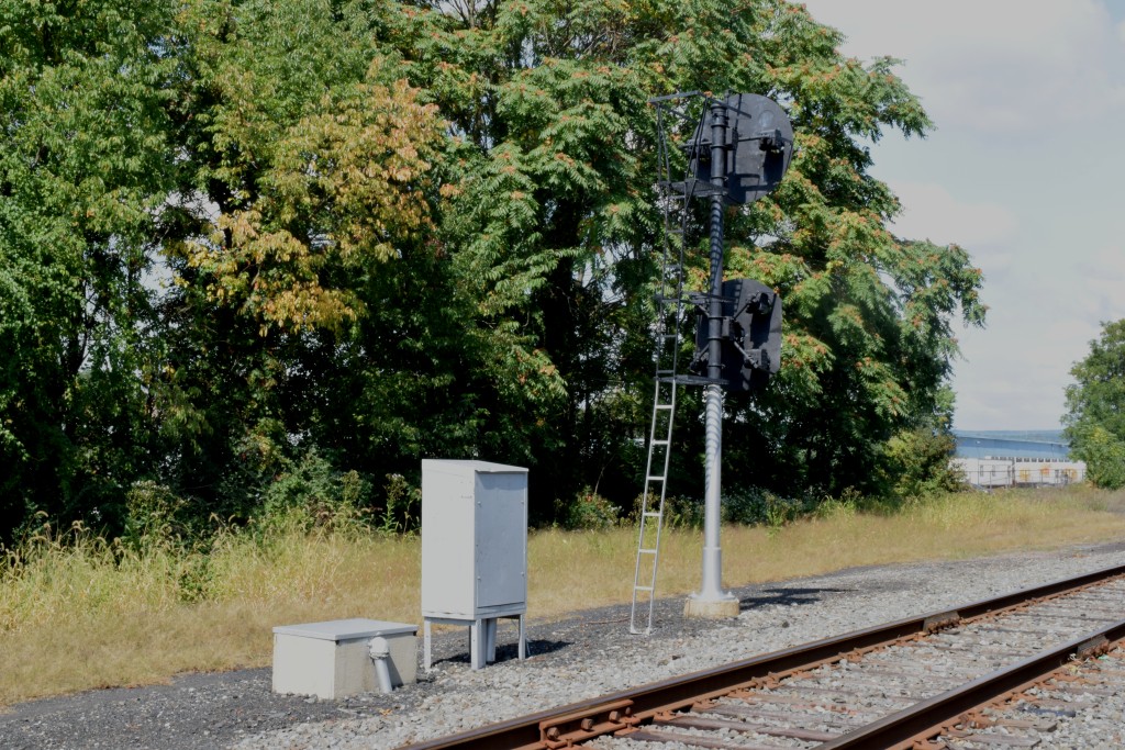
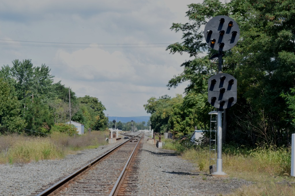
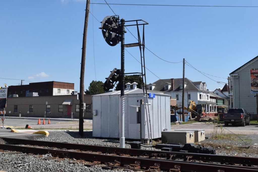
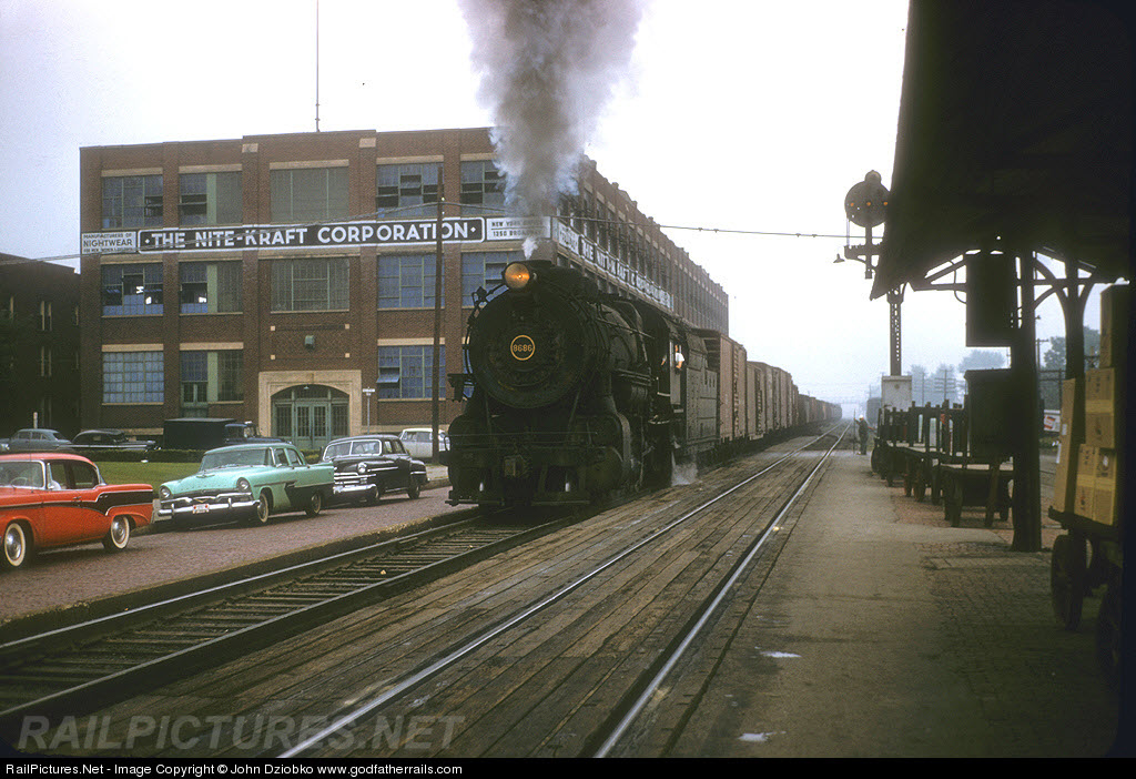
1cAt this interlocking, we will find a mixture of Pennsy "Red Eye" PL and Conrail Era "Tri-light" Signals. Also here, we go from one track, to two, for it's continuation north/west into Northumberland. The Buffalo line is a single track railroad, with sidings about every 10 miles.
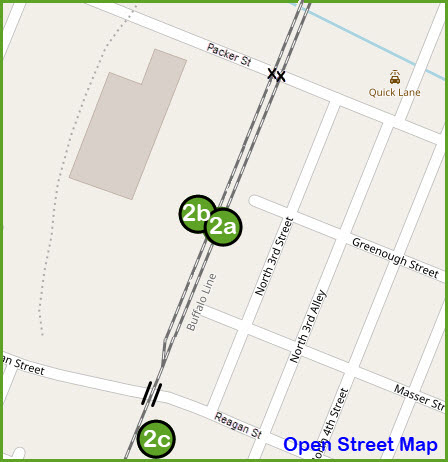

 2a
2a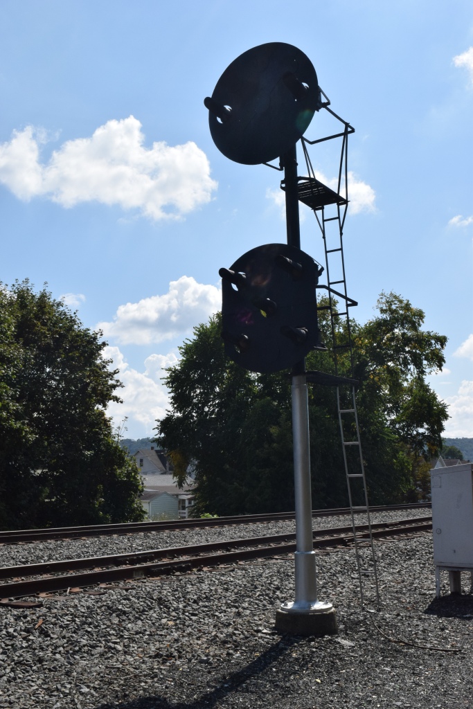
 2b
2b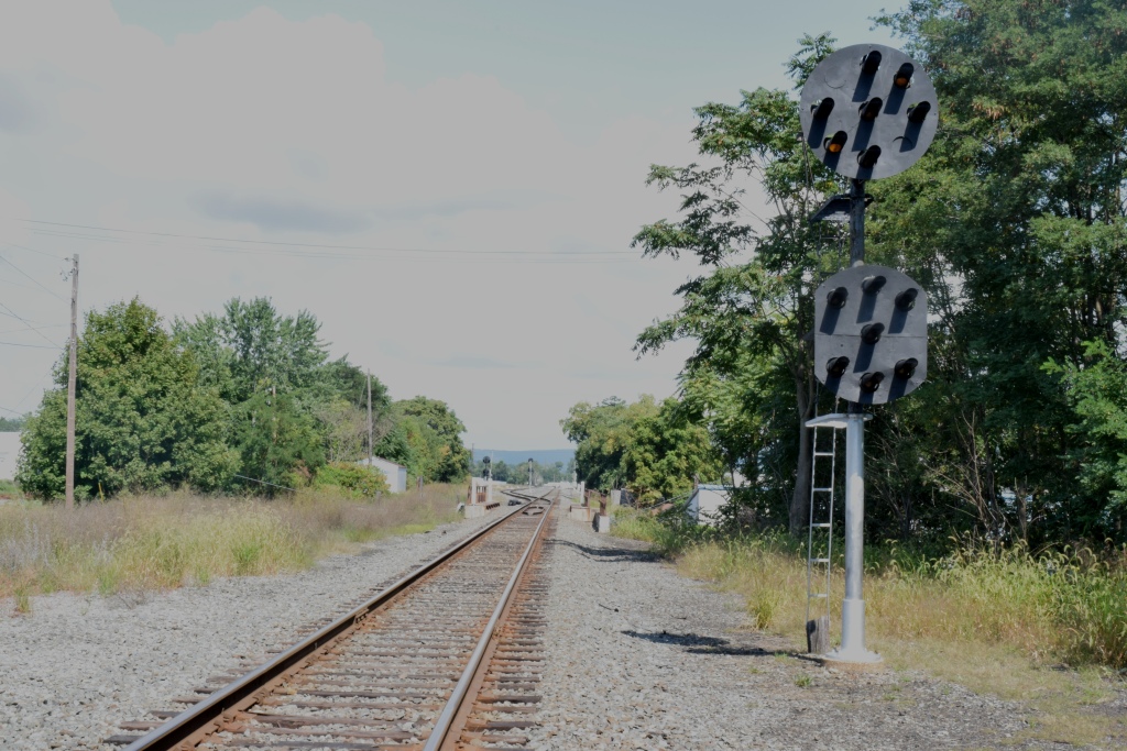
 2c
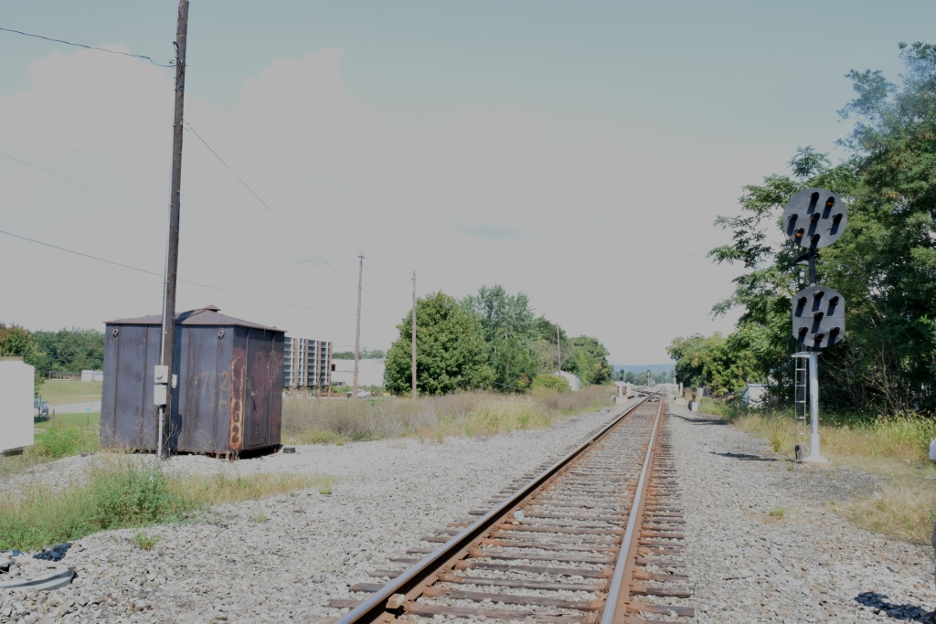
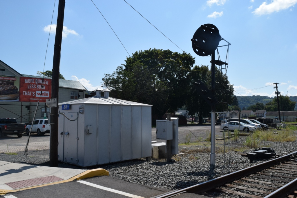
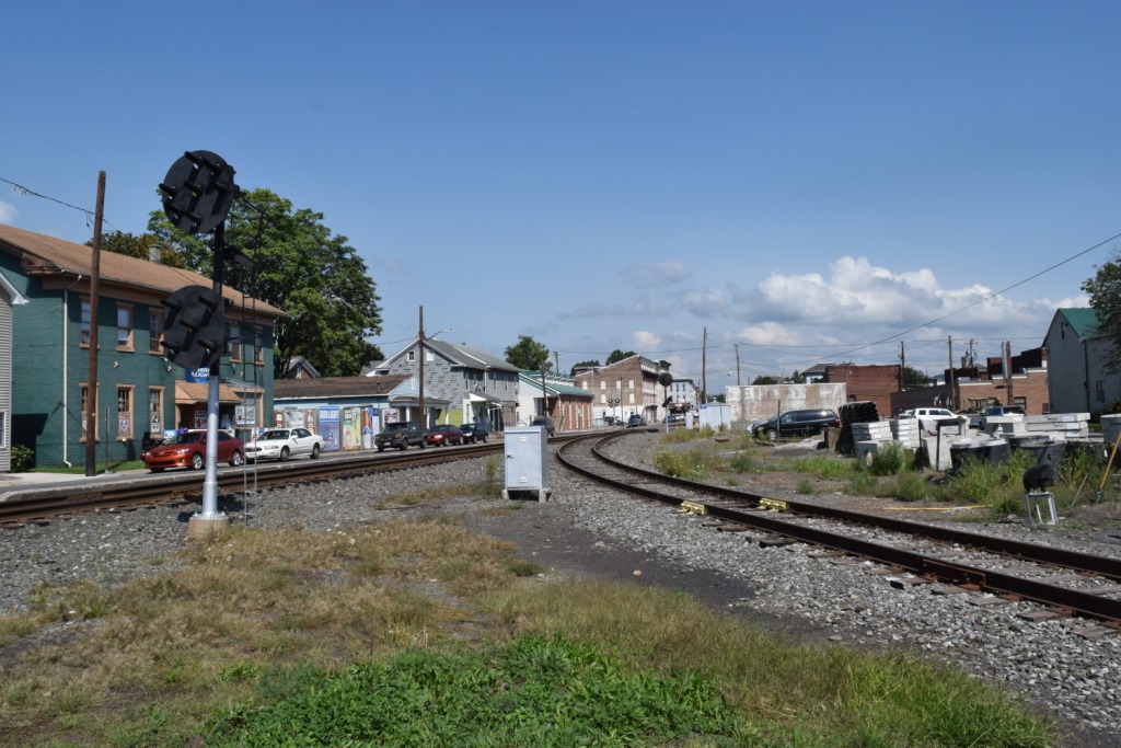
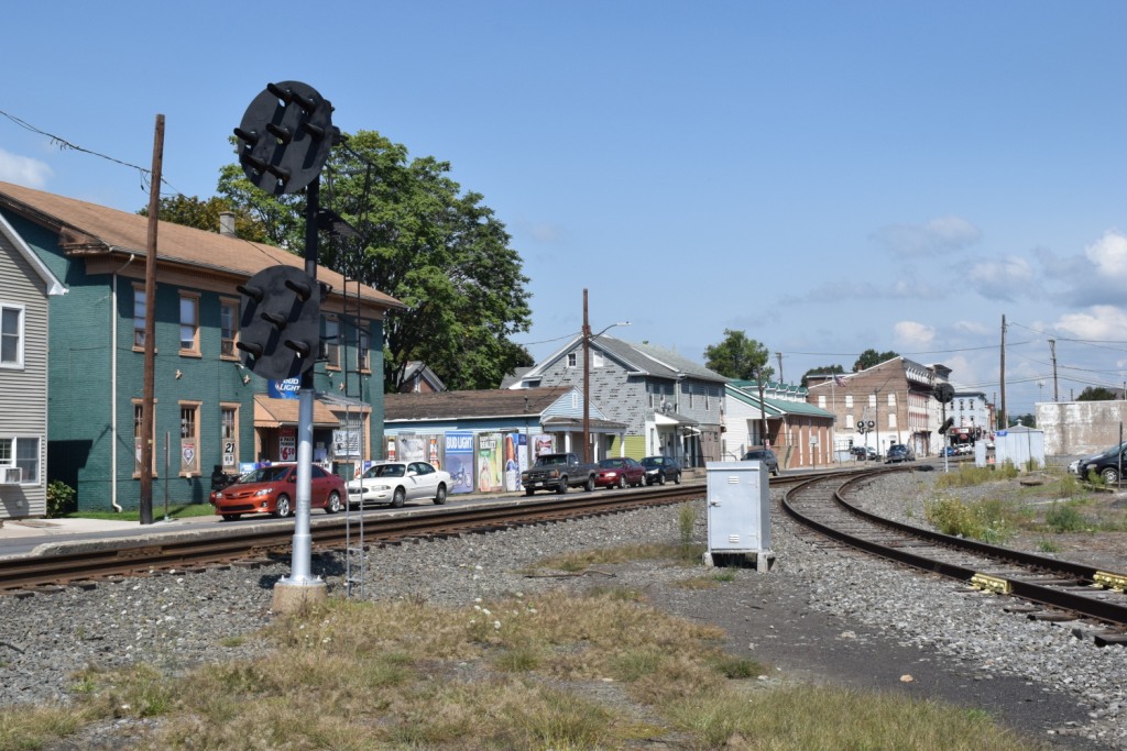
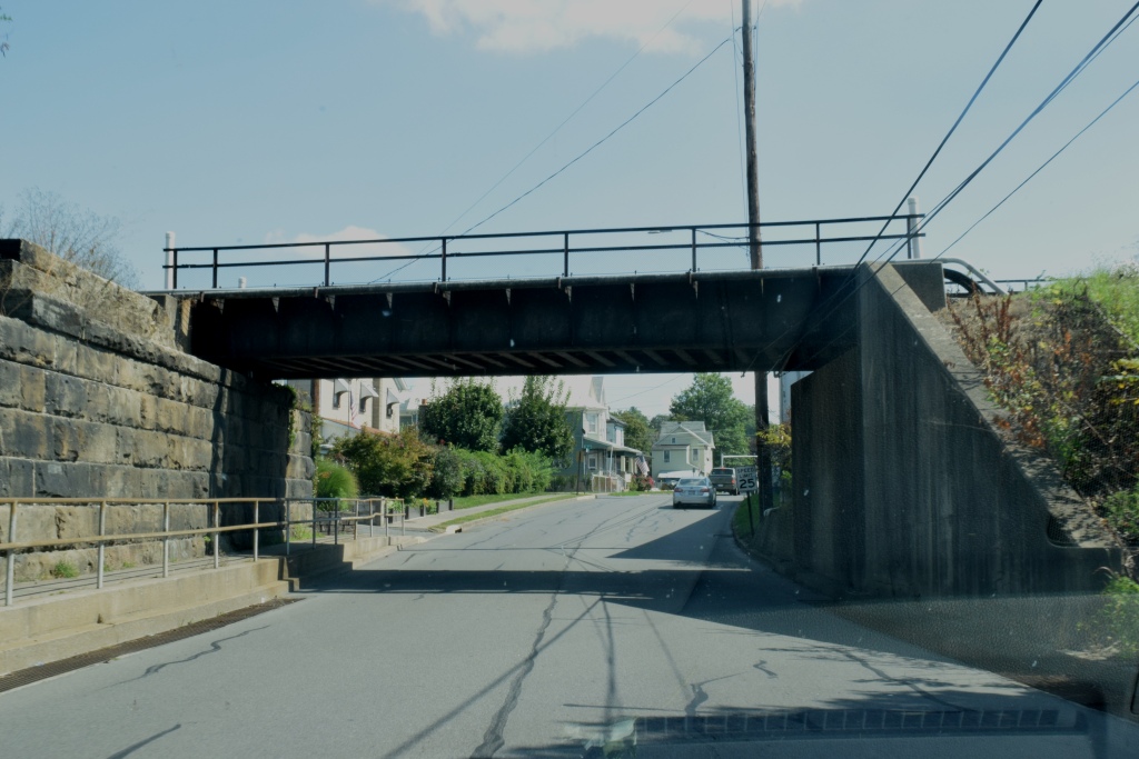
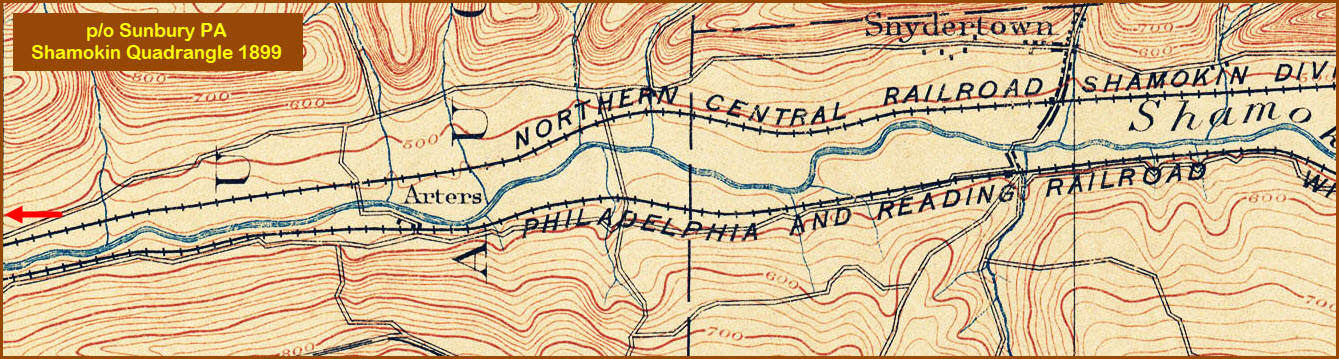
2cThis is an interchange to what, at one time, was the Northern Central's track going further north. Later on, it was the PRR Shamokin Division. It is all PL, and the full size signals are of the "red eye" style. A couple of small blocks west is the only remaining artifact from the old Reading days - a signal bridge with no signals.

 3a
3a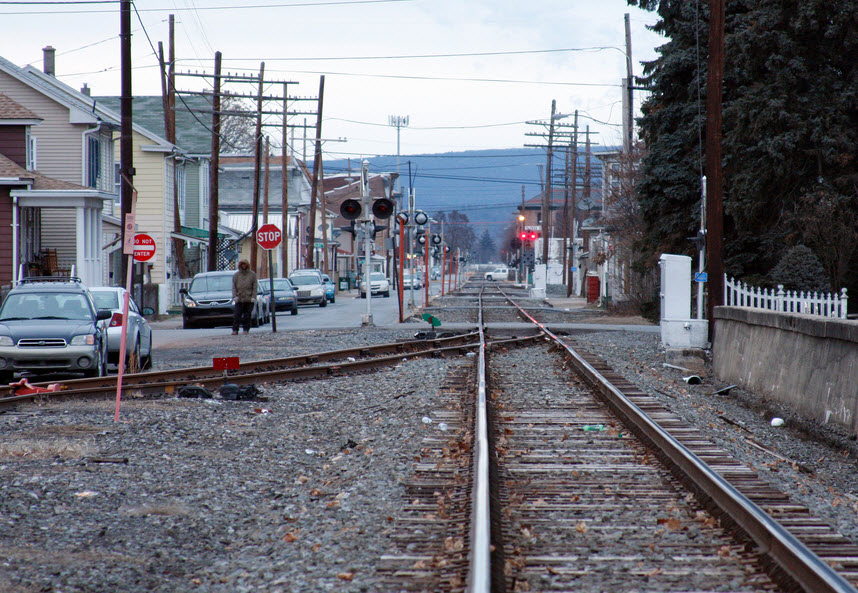 3b
3b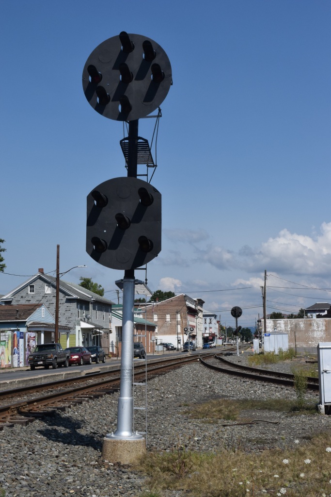
 3b
3b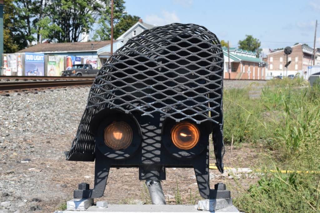
 3c
3cGPS Coordinates: 40.859373, -76.795622
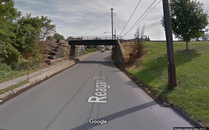
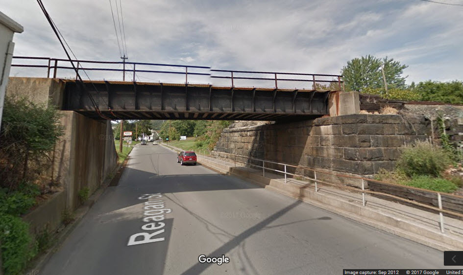
The last surviving piece of Reading signal equipment is this lone signal bridge adjacent to Penn St.
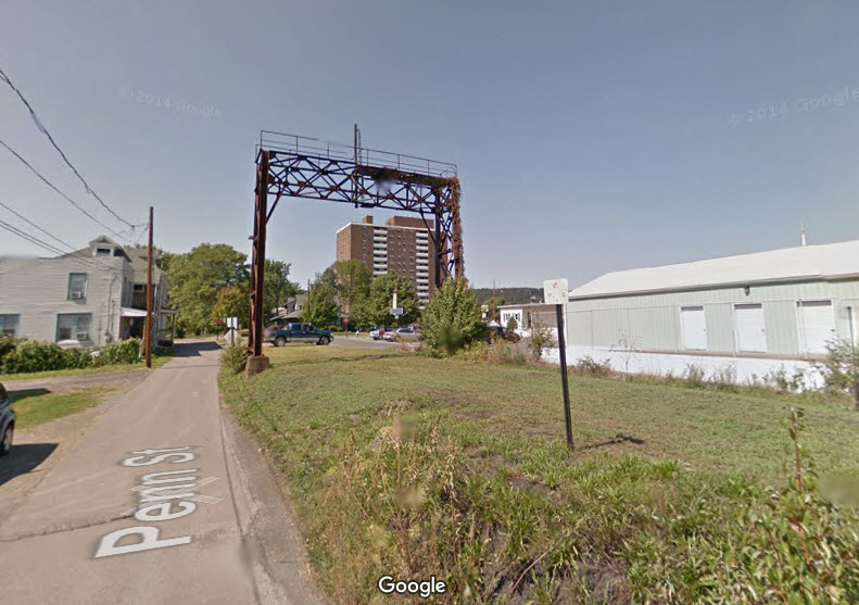
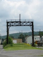
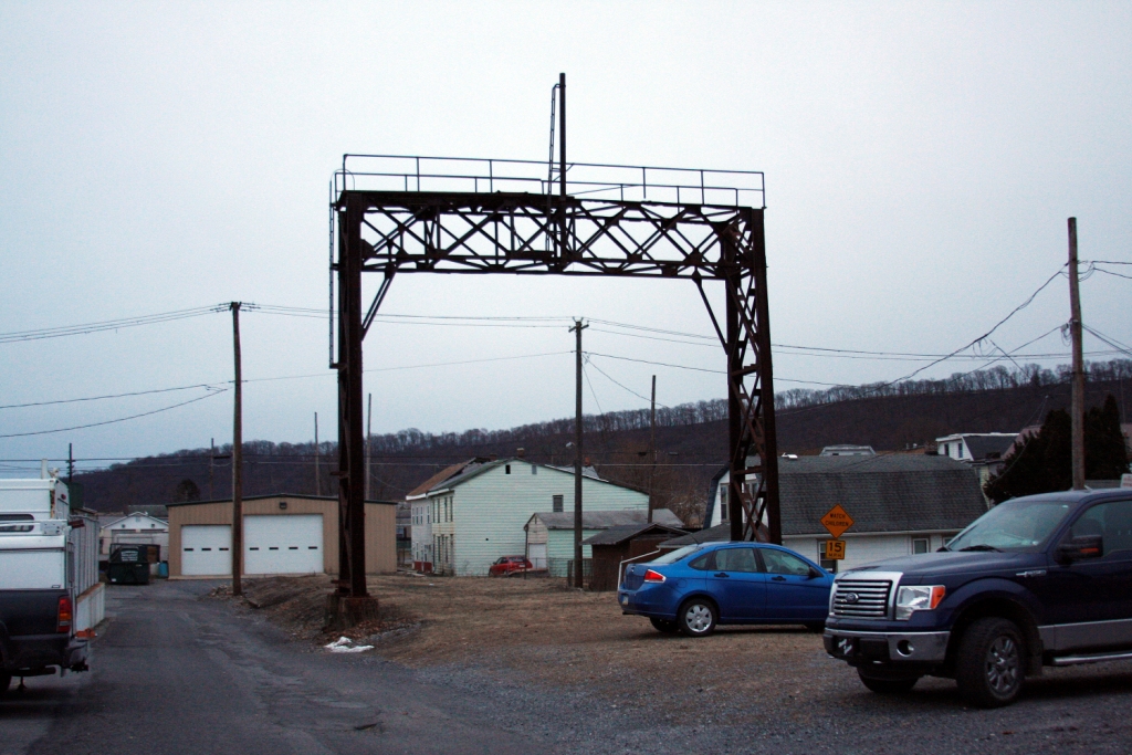 Picture by Jersey Mike
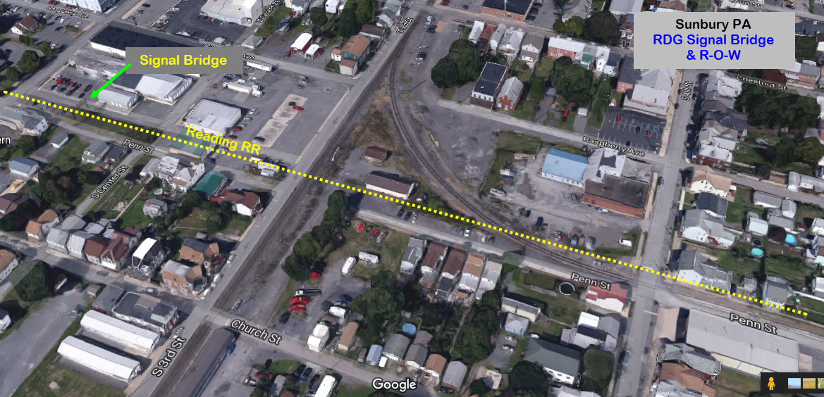
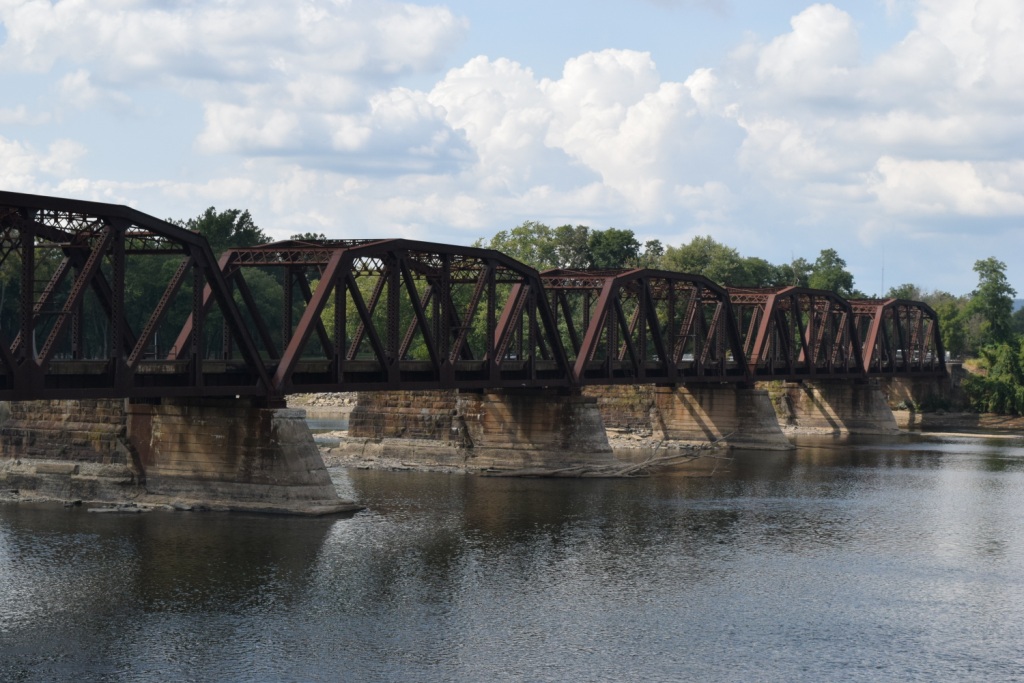
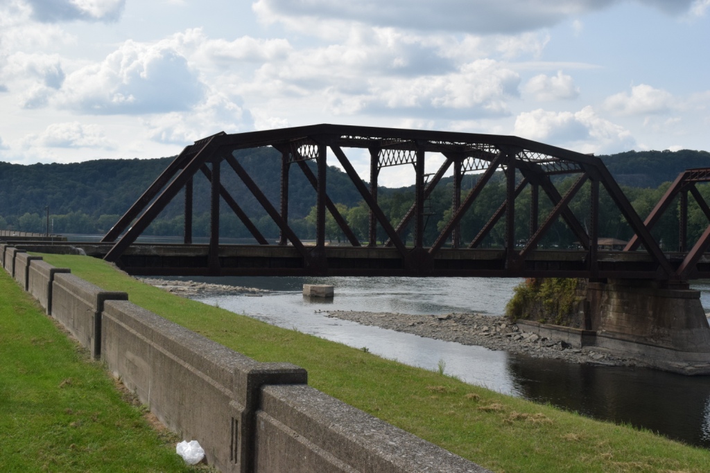
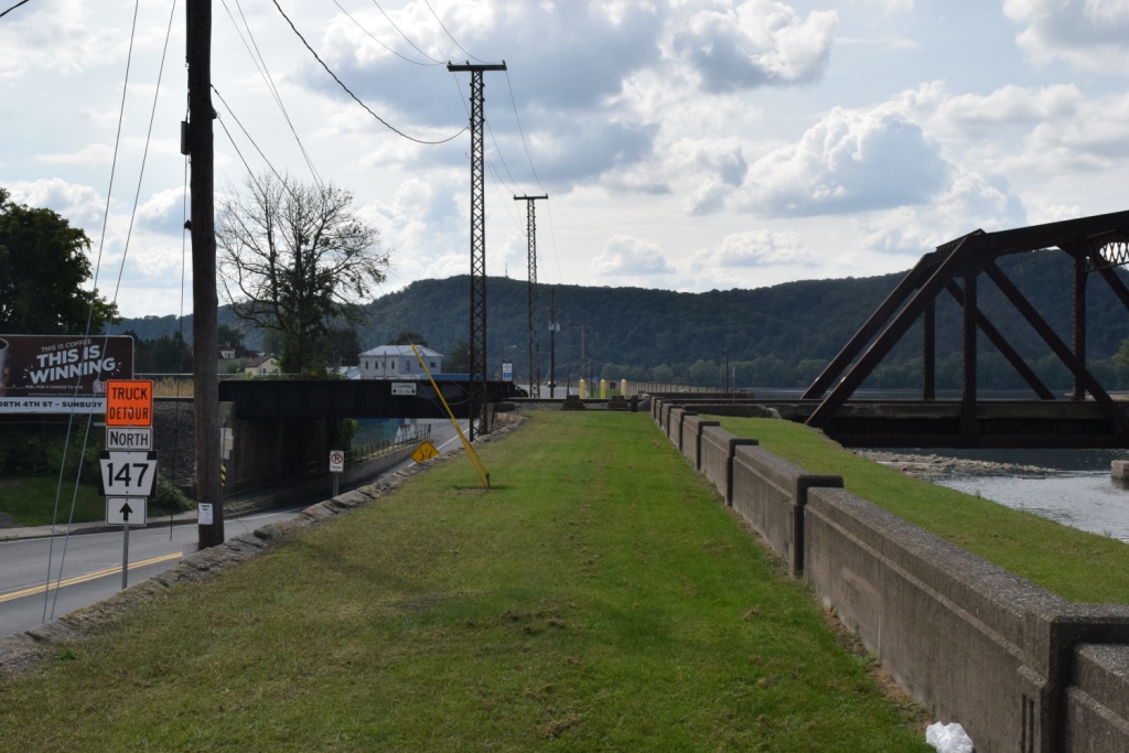
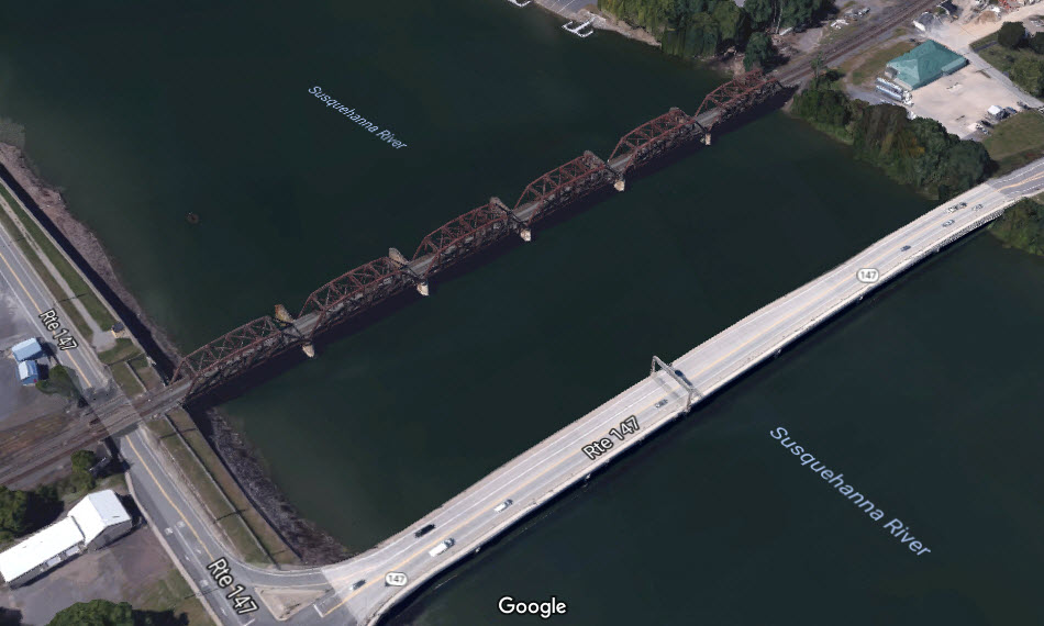
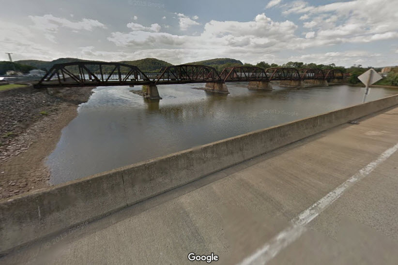
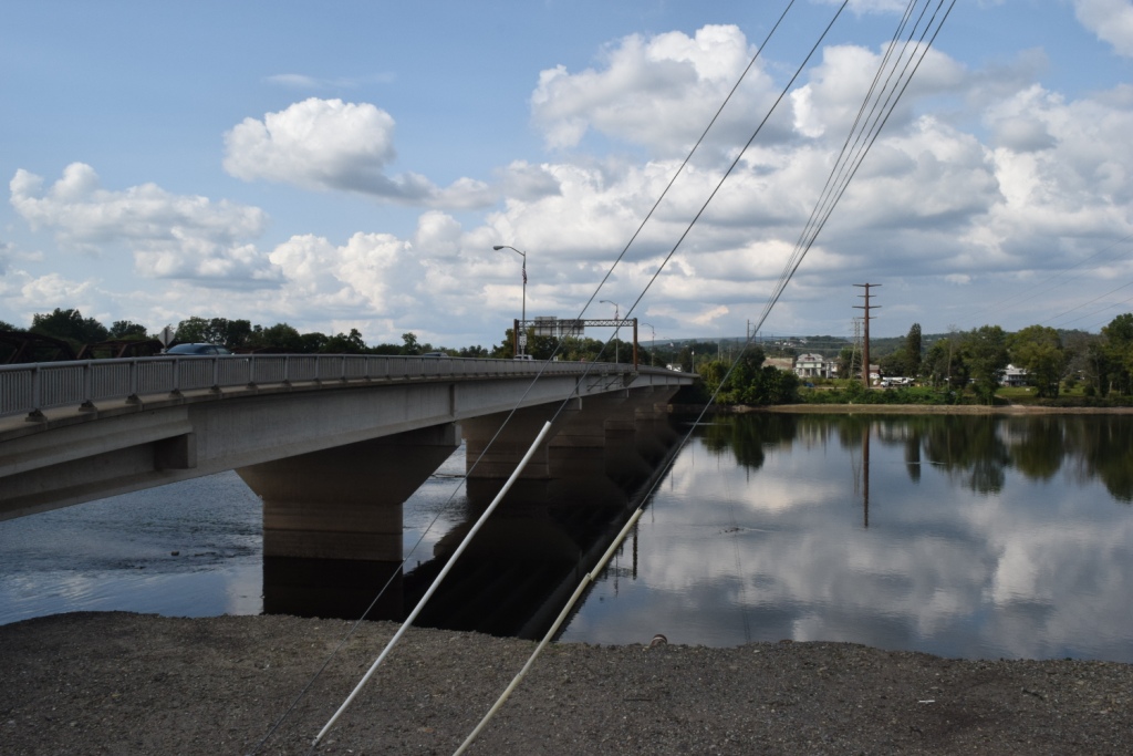
Sunbury, being situated on two rivers, has it's fair share of bridges, both over the water, and in town, here are some of them.
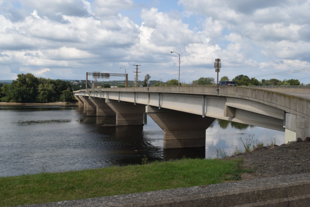
GPS Coordinates: 40.879862, -76.787777 (center of the bridge)
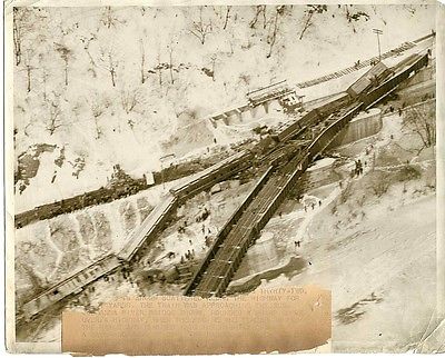
Here is an excellent picture of the two Pennsy bridges, while they both existed, during a flood. Notice that the older bridge had a signal bridge at the east end, while the new bridge has a single signal at the east end. I believe this photo is from the flood that occurred on March 19th, 1936. Because of the detail, I left this picture in it's original form at 1.6meg.
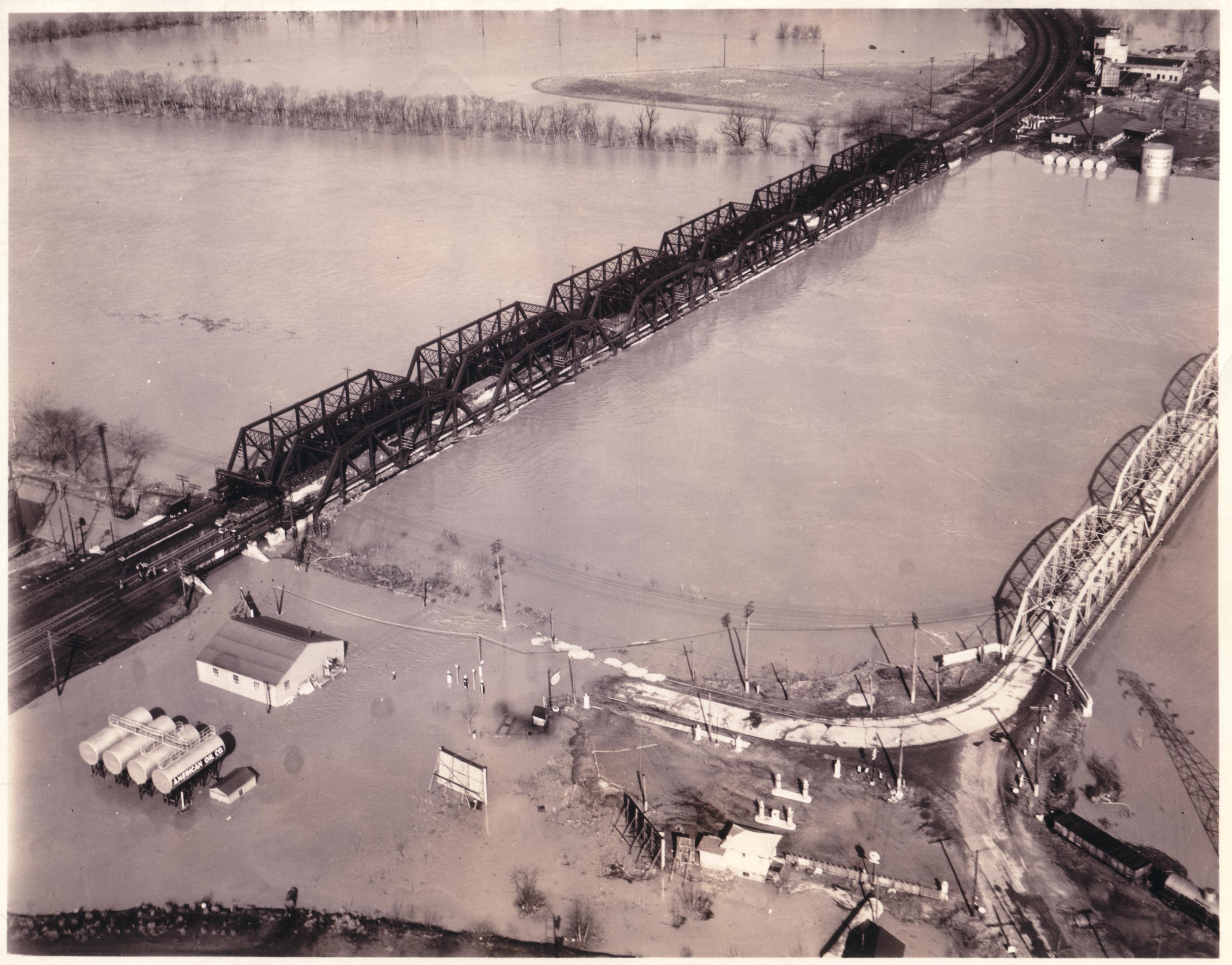
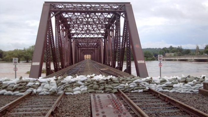 Waiting for the flood.....
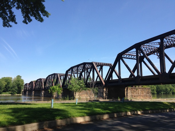
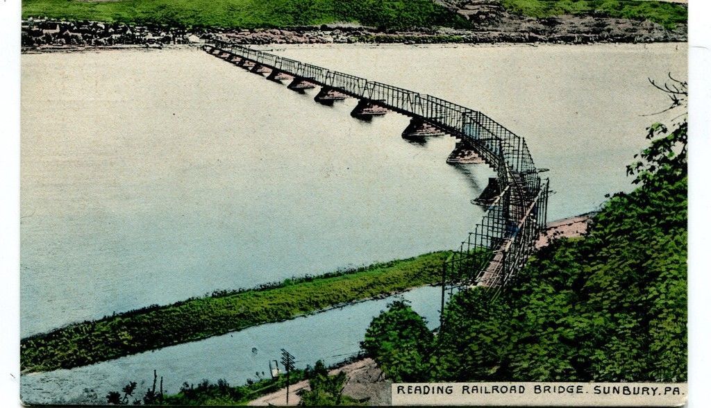
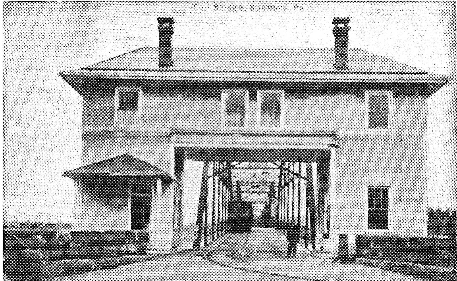
This was a single track bridge which curved at the west bank. Built in 1885, this structure was replaced by plate girder bridge in 1917. Design: 4 Vertical endpost Whipple through trusses 3 skewed 1 straight) and 10 inclined endpost whipple through trusses. All with Phoenix columns. Alexander remembers that the two spans over US 11 were removed in 1987-88 or so and the rest of the bridge about 1992. There is no evidence remaining that this bridge ever existed.
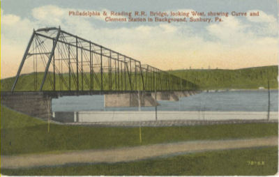
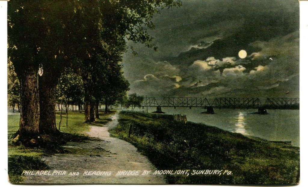
This is a description of the girder bridge: Bridge curved to north on west side of river. Carried main line of Reading Railroad (previously Philadelphia & Reading) between Shamokin/Sunbury & West Milton/Williamsport. Abandoned 1976 shortly after merger of Reading RR into Conrail. Bridge remained standing until demolished to clear river's recreational-lake reservoir. Was proposed for emergency-vehicle bypass bridge in 1970s and 1980s as traffic jams increased on nearby Bainbridge Street Bridge and White Bridge upstream was replaced in 1976-78. Highway dip under bridge was flood-prone and the location of the western abutment (railroad name Clement Station) was removed for highway fill for nearby highway projects, so no trace of the western end remains.
 < 1974 view
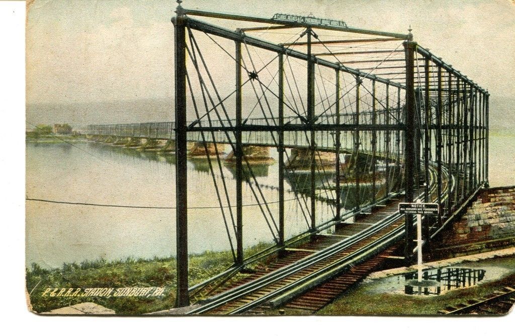 Wrong caption on the postcard :-)
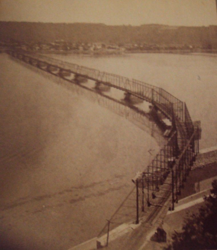
 Unknown wreck on the west side of the Susquehanna
GPS Coordinates: 40.867657, -76.789678
GPS Coordinates: 40.859050, -76.772854
The caption for this picture said Sunbury in 1920, but I'm not sure which bridge it is?
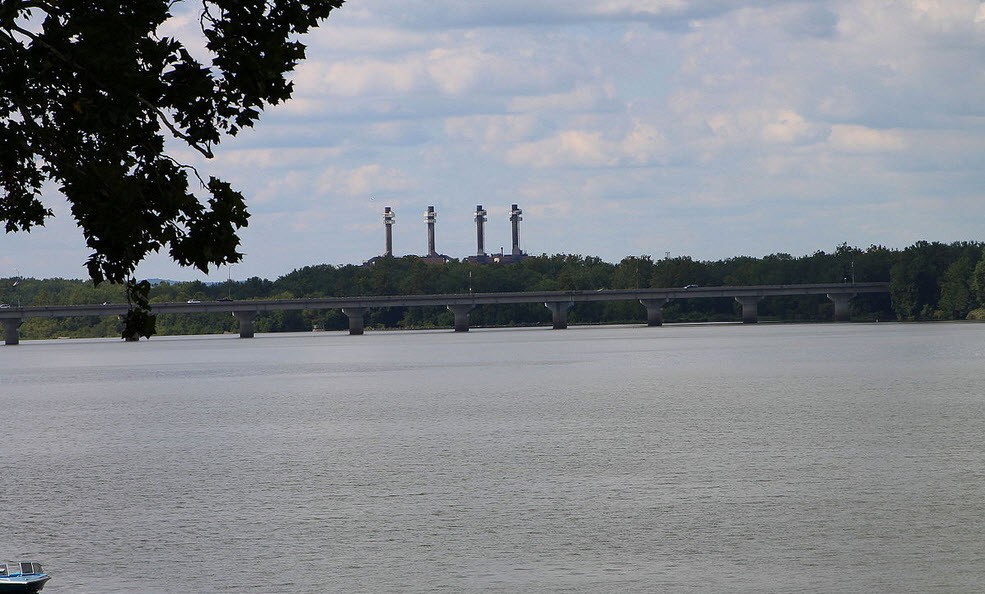
Bob Jaegers, who grew up in Sunbury, wrote me and said this bridge was at Bainbridge Street. It was replaced with a girder bridge that carried the streetcars on tracks on the north side of the structural girders on that side. It was a two lane bridge and they still collected tolls until the late 1950s. The toll house was on the Sunbury end of the bridge. Streetcars went from Market Street to Rolling Green Park in Hummel’s Wharf. The Reading Railroad girder overpass was over the road and streetcar tracks just west of the west end of the bridge after the spur line was built to the 4-stack PP&L power plant built around 1947. It was coal fired and Porter steam locomotives without fireboxes were used to move stored coal around the coalyard after delivery by Reading and PRR. The power plant was removed completely by 2020.
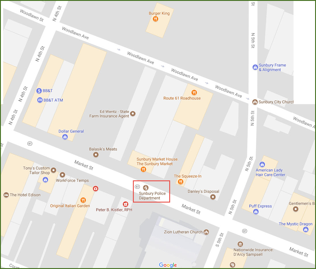
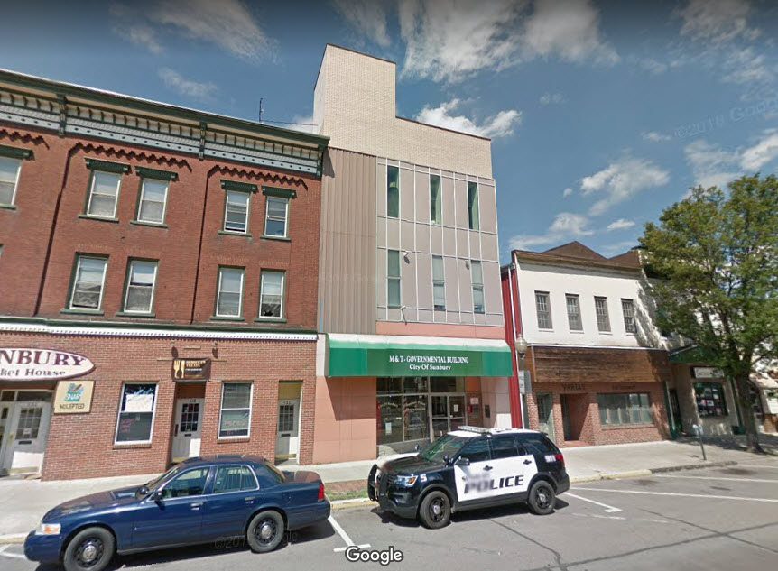
Sunbury Police
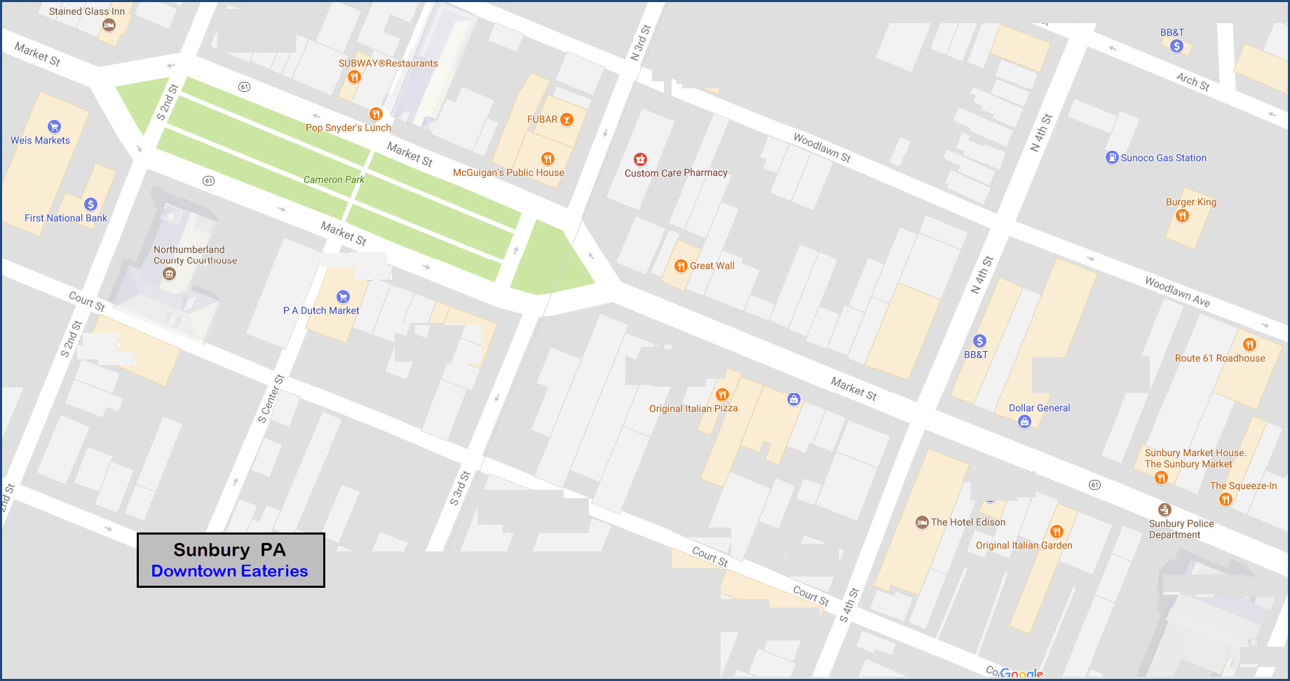
Looking for a place to eat... most of the places are local as opposed to chain.....
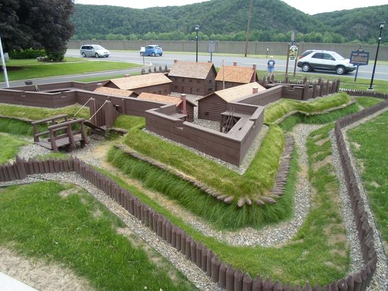
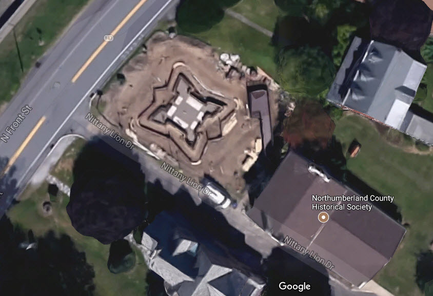
Someone took the time to build scale model of Fort Augusta.... it is at the Northumberland Historical Society along N. Front St.
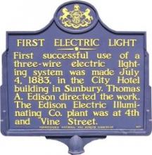
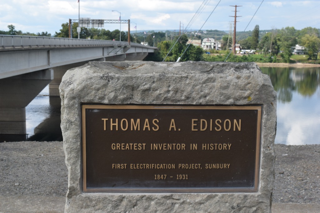
Thomas A. Edison and his first successful use of a light bulb, the stone is at the end of the 147 bridge
Courtesy of the University of Texas Library, click here for their index page.
Disclaimers:
I love trains, and I love signals. I am not an expert. My webpages reflect what I find on the topic of the page. This is something I have fun with while trying to help others.
Please Note: Since the main focus of my two websites is railroad signals, the railfan guides are oriented towards the signal fan being able to locate them. For those of you into the modeling aspect of our hobby, my indexa page has a list of almost everything railroad oriented I can think of to provide you with at least a few pictures to help you detail your pike.
If this is a railfan page, every effort has been made to make sure that the information contained on this map and in this railfan guide is correct. Once in a while, an error may creep in :-)
My philosophy: Pictures and maps are worth a thousand words, especially for railfanning. Text descriptions only get you so far, especially if you get lost or disoriented. Take along good maps.... a GPS is OK to get somewhere, but maps are still better if you get lost! I belong to AAA, which allows you to get local maps for free when you visit the local branches. ADC puts out a nice series of county maps for the Washington DC area, but their state maps do not have the railroads on them. If you can find em, I like the National Geographic map book of the U.S..... good, clear, and concise graphics, and they do a really good job of showing you where tourist type attractions are, although they too lack the railroads. Other notes about specific areas will show up on that page if known.
Aerial shots were taken from either Google Maps or www.bing.com/maps as noted. Screen captures are made with Snagit, a Techsmith product... a great tool if you have never used it!
By the way, floobydust is a term I picked up 30-40 years ago from a National Semiconductor data book, and means miscellaneous and/or other stuff.
Pictures and additional information is always needed if anyone feels inclined to take 'em, send 'em, and share 'em, or if you have something to add or correct.... credit is always given! Please be NICE!!! Contact info is here
Beware: If used as a source, ANYTHING from Wikipedia must be treated as being possibly being inaccurate, wrong, or not true.
RAILFAN GUIDES HOME
RAILROAD SIGNALS HOME
NEW SEP18/2017, SEP25/2017, JAN22/2021
Last Modified 22-Jan-2021