RAILFAN GUIDES of the U.S.
Todd's Railfan Guide to
MILWAUKEE WI
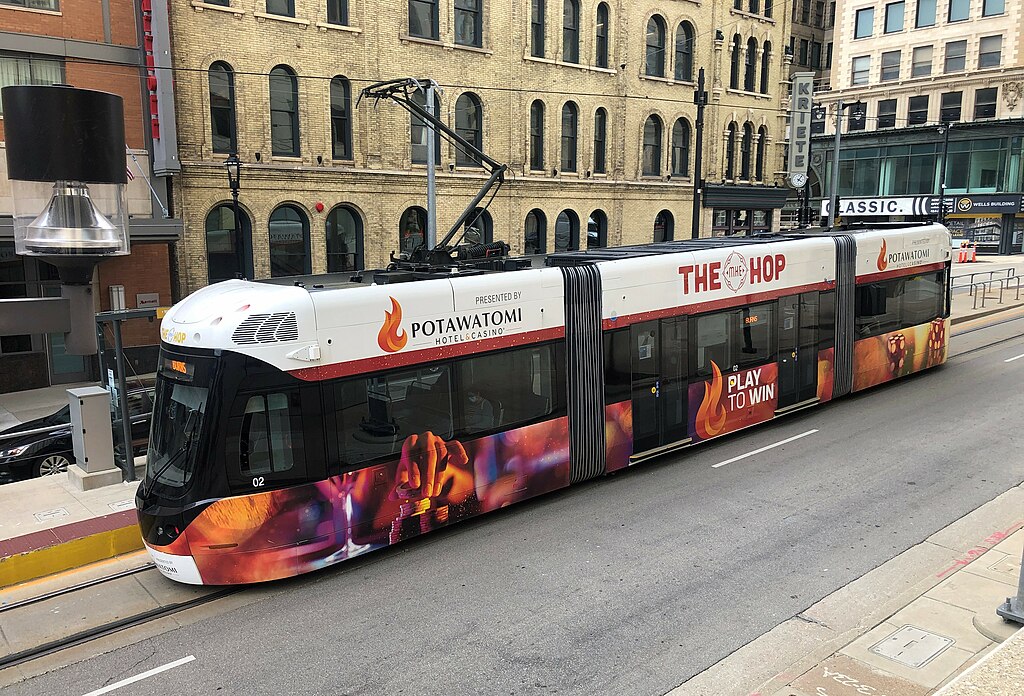
THE HOP Streetcar System

In General
Getting Here
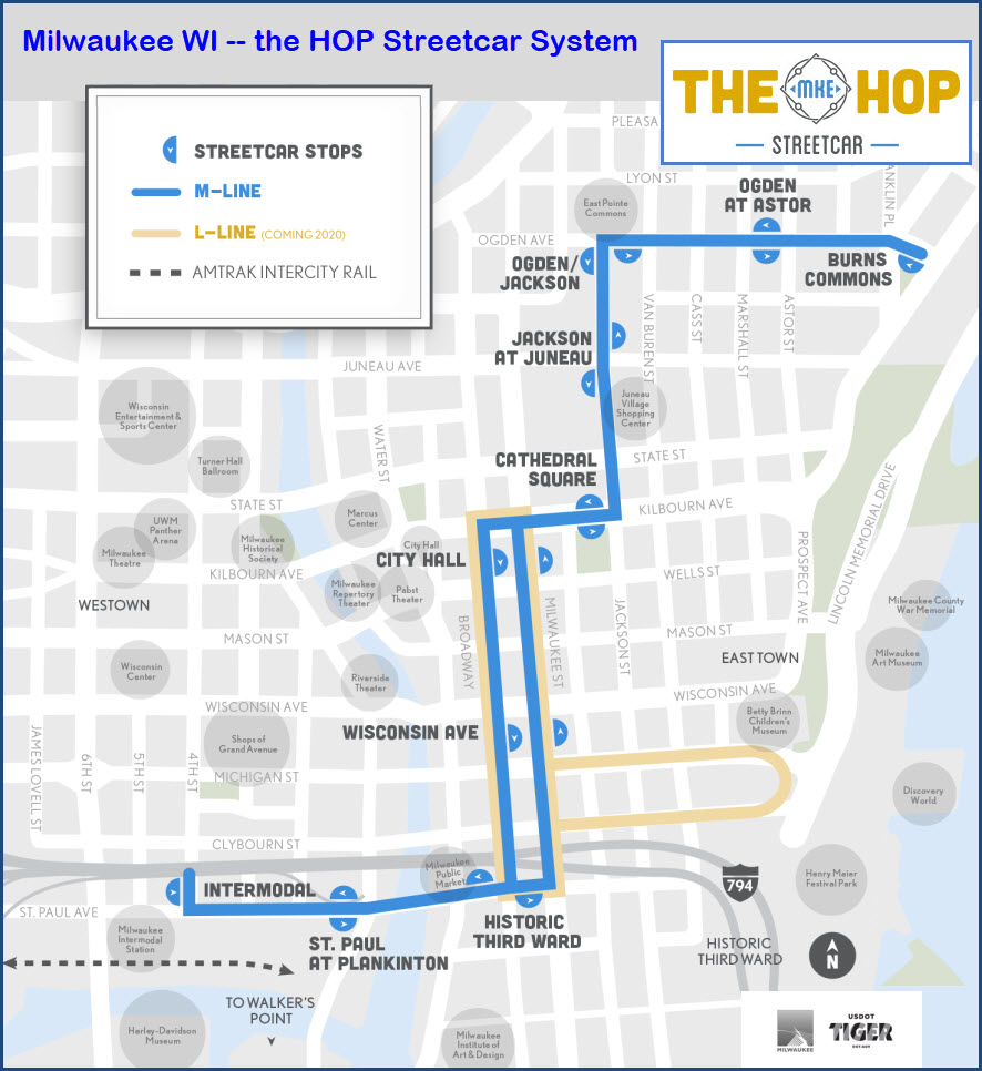
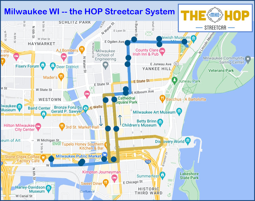
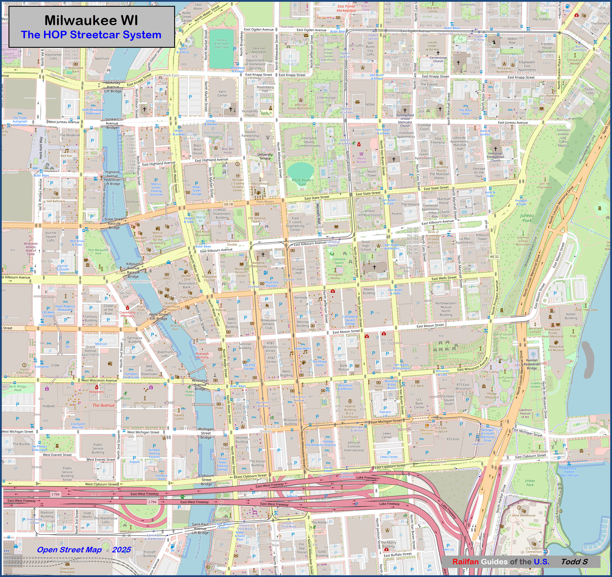
Map
Station by Station
Pictures
Bridges
Signals
Floobydust
RAILROAD SIGNALS HOME
Location / Name:
Milwaukee WI, Milwaukee County
What's Here:
the HOP Streetcar System
Amtrak
Data:
GPS Coordinates: as needed
Phone A/C: 414
ZIP:
Most populous city Wisconsin
Home to the Miller, Pabst, and Schlitz breweries
Access by train/transit:
Amtrak
Geography:
Fairly Flat
The Scoop:
From Wikipedia: The Hop, also known as the Milwaukee Streetcar, is a modern streetcar system in Milwaukee WI.
The system's 2.1-mile (3.4 km) original M-Line connects the Milwaukee Intermodal Station and Downtown to the Lower East Side and Historic Third Ward neighborhoods. The first test trip covering the entire line under power was made on the night of June 18/19, 2018.
The L-Line opened to the public on October 29, 2023, in a reduced form that only ran on Sundays and bypassed the lakefront. Full daily service, including to the Couture, began on April 11, 2024.
Additional extensions for new lines are currently in the planning stage.
The system is owned by the city and operated by Transdev.
Construction of the system began in late 2016 and was completed in summer 2018. Service to the public began on November 2, 2018.
Please note: Many of you will have to bear with me as I include a lot of "non-train" stuff like pictures of what we call "the physical plant" - stuff that supports the operation of the LRV's, without which, the trains could not run. Not only am I a "techie", but I used to work for the Baltimore Light Rail System and acquired an appreciation for all things light rail :-).
Acknowledgements:
Google Maps
Bing Maps
Open Street Map
Wikipedia
Wikipedia: David Wilson
Wikipedia: Aaron Volkening
Wikipedia: Milwaukee 148
Wikipedia: SecretName101
WISN 12
Websites and other additional information sources of interest for the area:
https://en.wikipedia.org/wiki/The_Hop_(streetcar)
https://www.wisn.com/article/st-paul-avenue-bridge-reopens/5949165
https://en.wikipedia.org/wiki/Milwaukee
Getting to G

If you want a higher resolution version of the above map,
click here , it's a 1.9Mb JPG
Burns Common
GPS Coordinates:
Ogden at Astor
GPS Coordinates:
Ogden / Jackson
GPS Coordinates:
Jackson at Jeanau
GPS Coordinates:
Cathedral Square
GPS Coordinates:
City Hall (SB - N Broadway)
GPS Coordinates:
City Hall (NB - N Milwaukee St)
GPS Coordinates:
Wisconsin Ave (SB - N Broadway)
GPS Coordinates:
Wisconsin Ave (NB - N Milwaukee St)
GPS Coordinates:
 Aaron Volkening, 17MAY2022
Historic Third Ward (WB - St Paul Ave)
GPS Coordinates:
Historic Third Ward (EB - St Paul Ave)
GPS Coordinates:
St Paul at Plankinton
GPS Coordinates:
 David Wilson of Oak Park Il, 2NOV2018
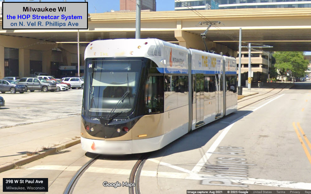
Intermodal Station
GPS Coordinates:
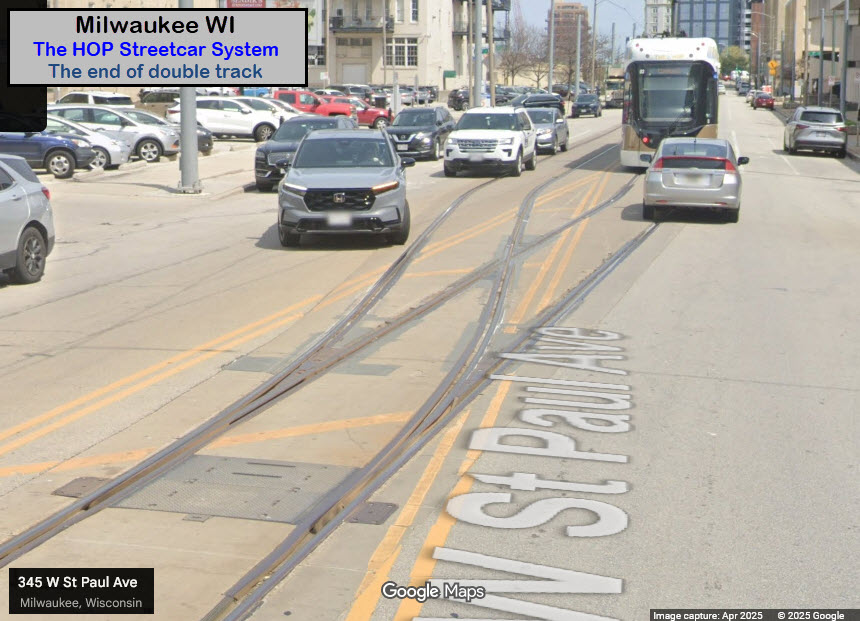
Two Tracks Into One
GPS Coordinates:
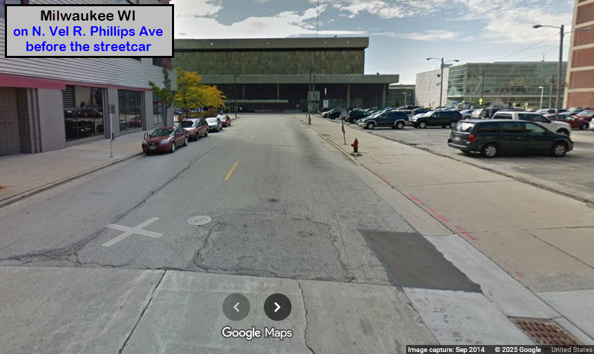
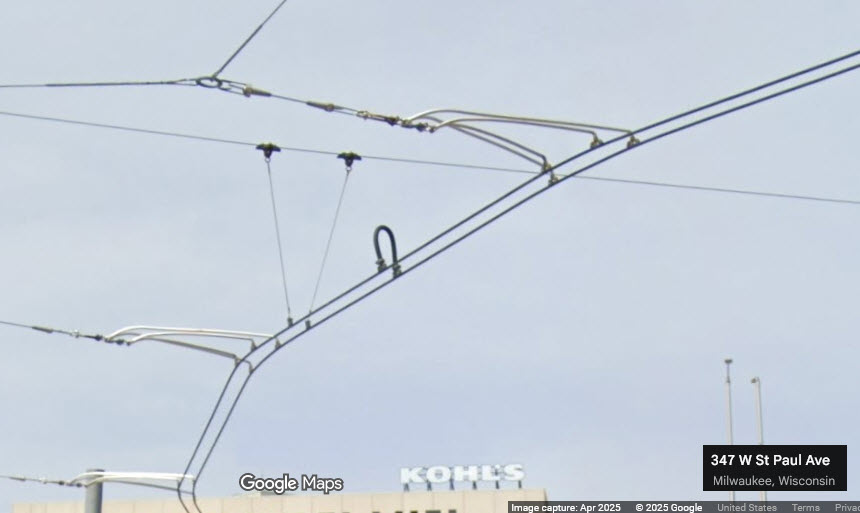
There is a single track coming out of the maintenance building, which hits the first station on N Vel R Phillips Ave - Intermodal Station. The track takes a left onto W St Paul Ave, where, before coming to the next station - St Paul at Plankinton, the tracks split into the outbound and inbound "sides".

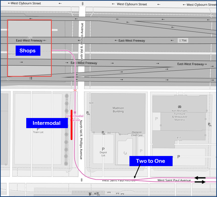
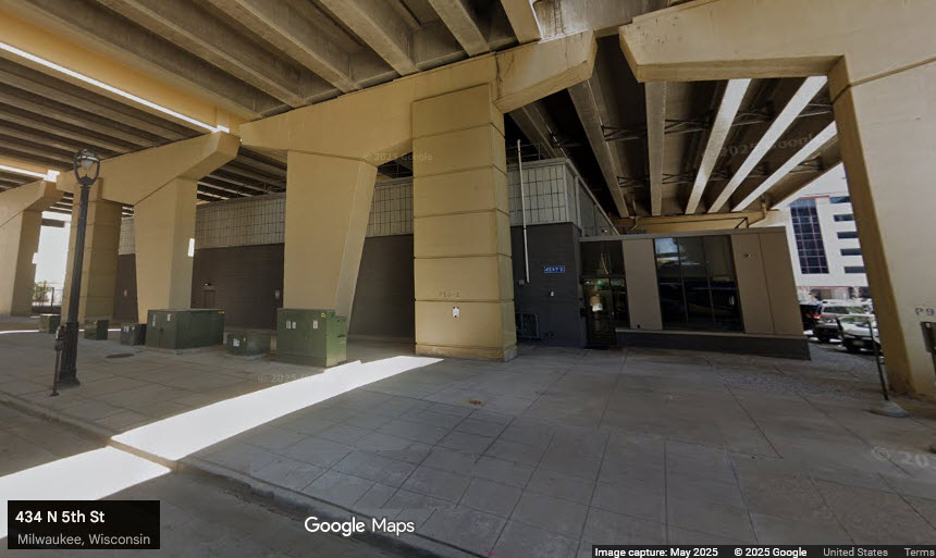
the Shops
GPS Coordinates: 43.03564, -87.91669
The shops and maintenance facility is nicely tucked away under I-94 between N 5th Street and N Vel R Phillips Ave.

Car #01 after delivery. Photo by Milwaukee 148 in March 2018.
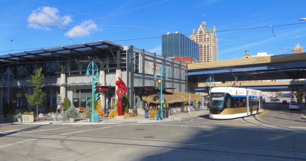
Turning onto St Paul Ave from Broadway, passing the Milwaukee Public Market. photo by David Wilson, 3NOV2018.
GPS Coordinates: 43.03483, -87.91013
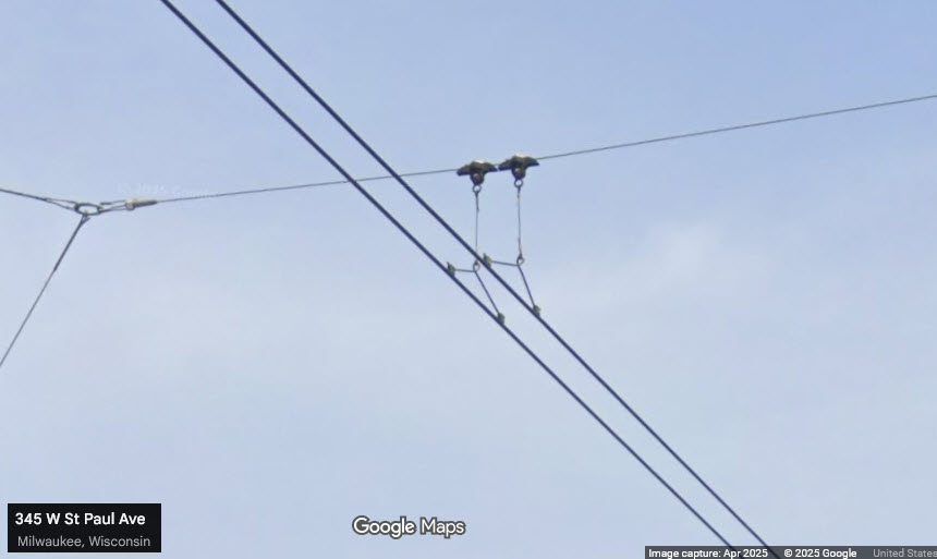
The bridge was built in 1966, and is a table lift bridge. When it raises, the overhead wires of the streetcar line do not move.
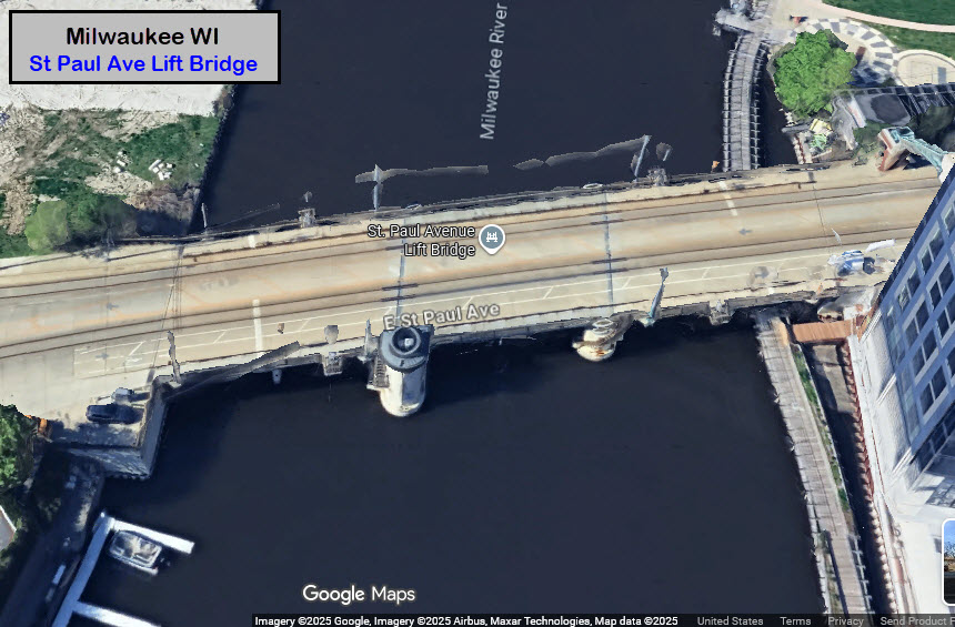
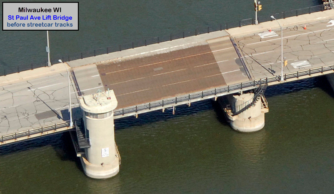
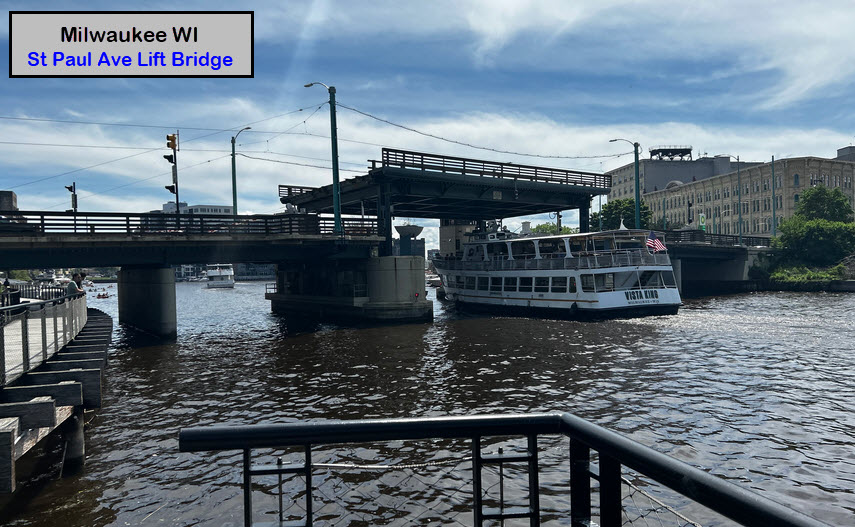
photo by SecretName101, 2JUN2024

Hop streetcar westbound on the St. Paul Avenue Bridge, over the Milwaukee River, on Nov. 3, 2018 - the second day of service on the then-new streetcar system. Photo by David Wilson, 3NOV2018.
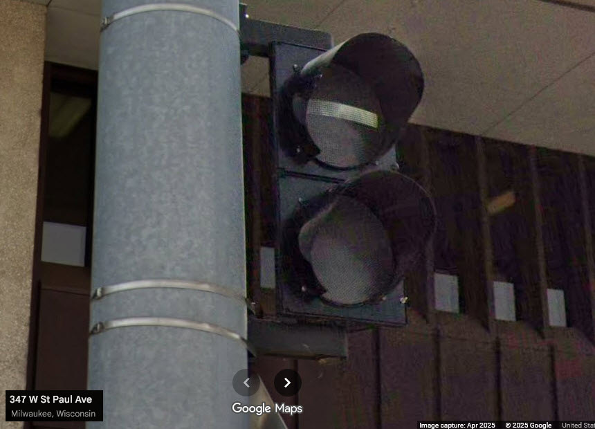
Typical streetcar bar signal.
![]() Xxx
Xxx
The
Did U Know?
None for now......
Disclaimers:
New format 10/26/23: Please check out my disclaimer page for my standard dribble and contact info here
RAILFAN GUIDES HOME
RAILROAD SIGNALS HOME
NEW 11/13/2025, NOV14/2025
Last Modified 14-Nov-2025