
In General
Getting Here
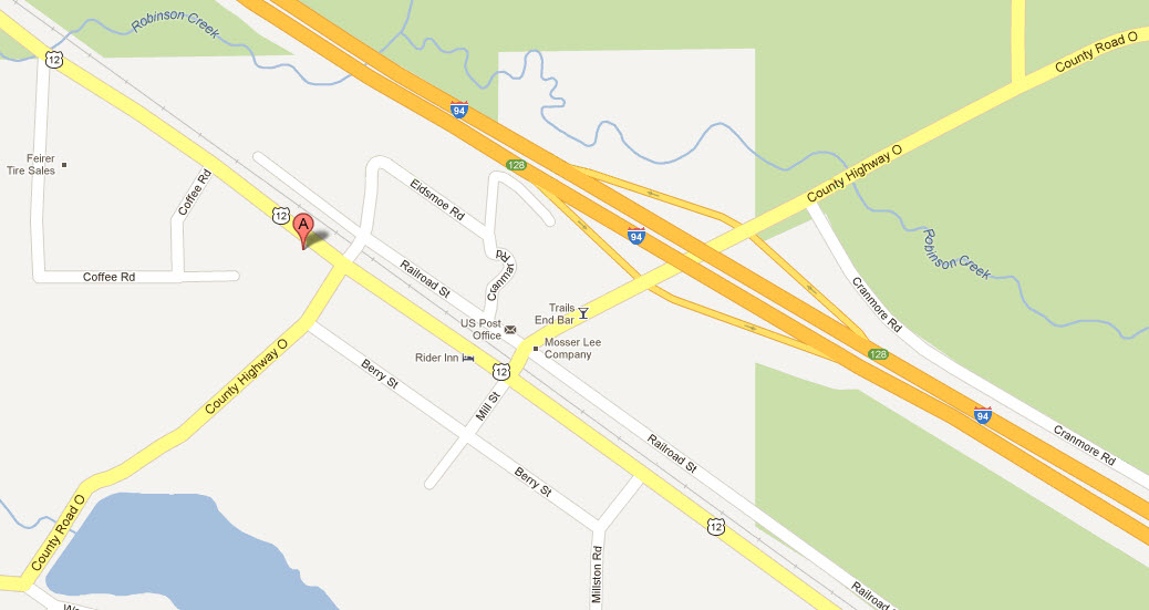
Map
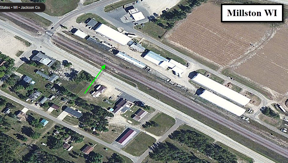
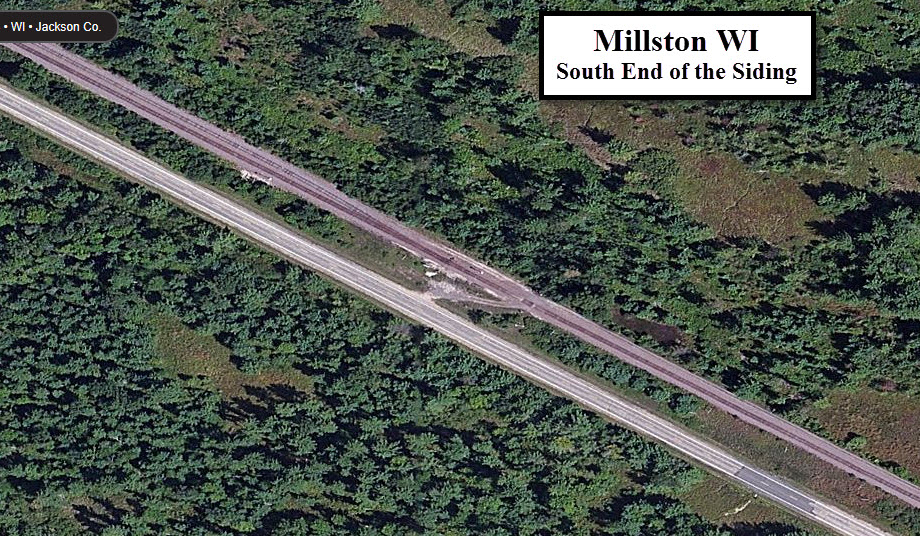
Pictures
RAILFAN GUIDES HOME
RAILROAD SIGNALS HOME
Location / Name:
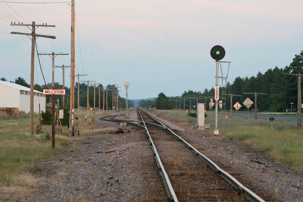
Millston WI, Jackson County
What's Here:
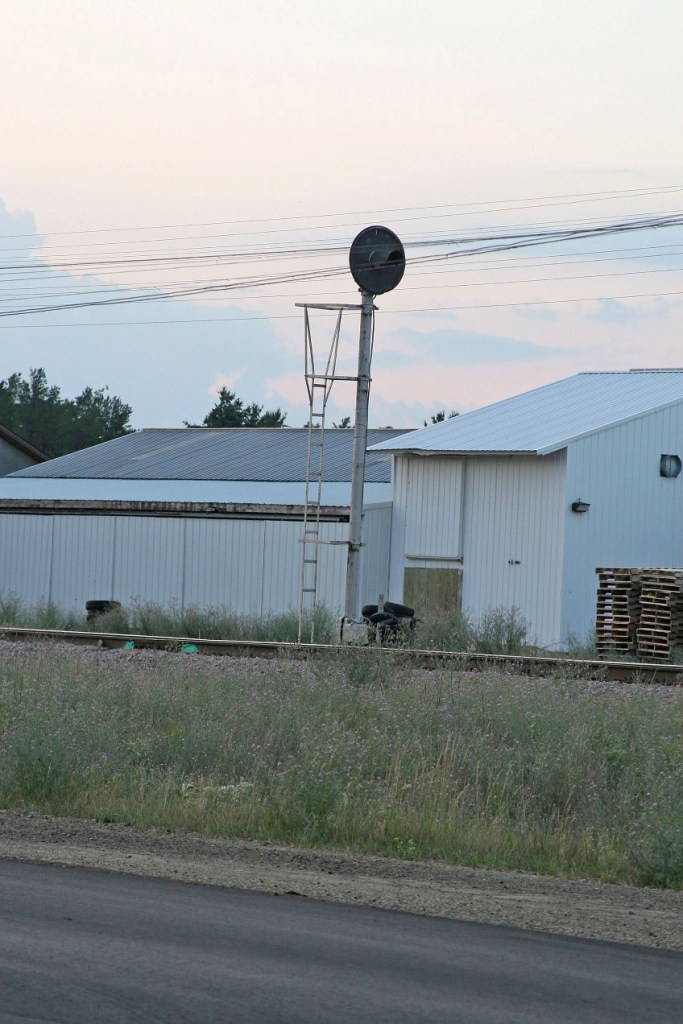
Siding
Signals
Spring Switch
Data:
GPS Coordinates: as needed
Phone A/C: 715
ZIP: 54643
Access by train/transit:
None
The Scoop:
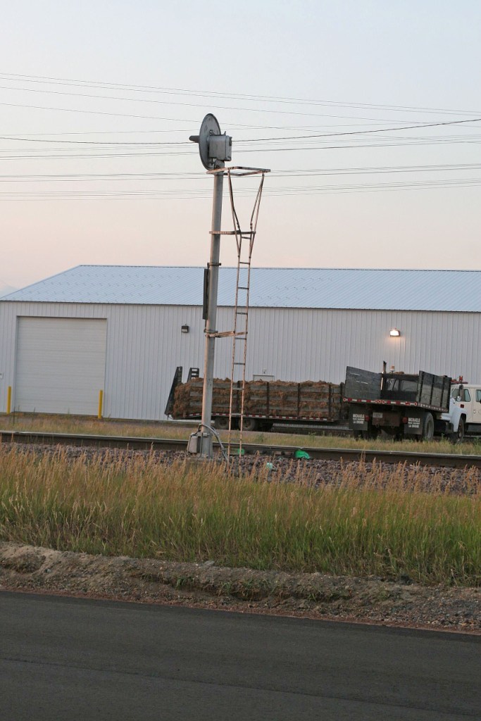
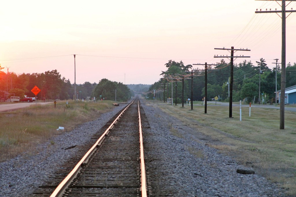
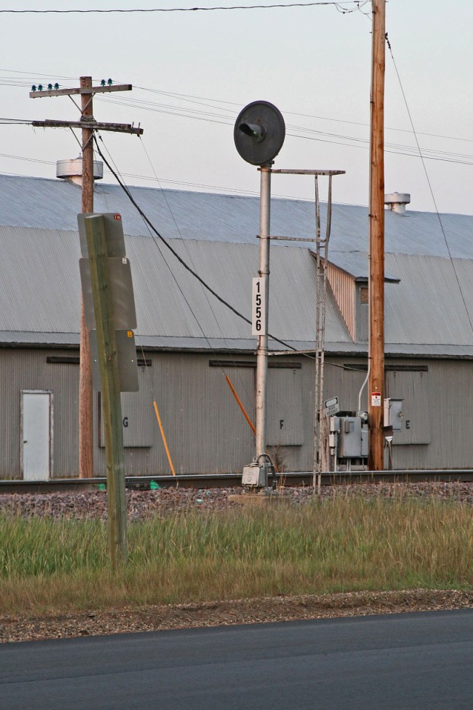
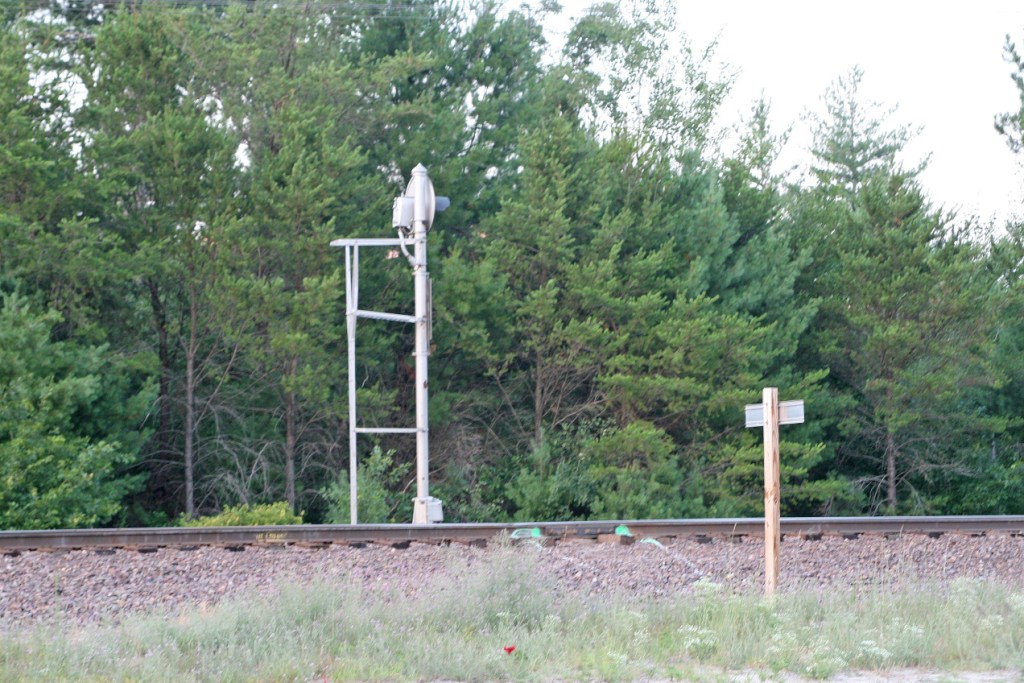
Not much here 'cept for the north end of a siding, but it's kinda unique since it uses a spring switch. Alto it is hard to see, there is a dwarf searchlight signal controlling the siding for movements onto the mainline. Looking at the map, the siding looks to be about 9,000 feet long.
I would like to give a big thanks to Jim Mihalek and his brother for the pictures. Every year, they go out and document signals from the Minneapolis area (where Jim lives) down into Michigan and Ohio. They do a great job and should be commended for their efforts!
Acknowledgements:
Jim Mihalek
Google Maps
Websites and other additional information sources of interest for the area:
None for now.....
Take exit 128 off of I-94..... head SW into town on County Highway O, which turns into Mill Street. After crossing the tracks, you hit US12, which parallels the track. The towns population is 136 according to the 2000 census!
Millston is about 60 miles southeast of Eau Clare WI, and about 13 miles southeast of Black River Falls WI.
Millston is about 175 miles NW of Milwaukee via I-90 and I-94.
Disclaimers:
I love trains, and I love signals. I am not an expert. My webpages reflect what I find on the topic of the page. This is something I have fun with while trying to help others.
Please Note: Since the main focus of my two websites is railroad signals, the railfan guides are oriented towards the signal fan being able to locate them. For those of you into the modeling aspect of our hobby, my indexa page has a list of almost everything railroad oriented I can think of to provide you with at least a few pictures to help you detail your pike.
If this is a railfan page, every effort has been made to make sure that the information contained on this map and in this railfan guide is correct. Once in a while, an error may creep in :-)
My philosophy: Pictures and maps are worth a thousand words, especially for railfanning. Text descriptions only get you so far, especially if you get lost or disoriented. Take along good maps.... a GPS is OK to get somewhere, but maps are still better if you get lost! I belong to AAA, which allows you to get local maps for free when you visit the local branches. ADC puts out a nice series of county maps for the Washington DC area, but their state maps do not have the railroads on them. If you can find em, I like the National Geographic map book of the U.S..... good, clear, and concise graphics, and they do a really good job of showing you where tourist type attractions are, although they too lack the railroads. Other notes about specific areas will show up on that page if known.
Aerial shots were taken from either Google or Bing Maps as noted. Screen captures are made with Snagit, a Techsmith product... a great tool if you have never used it!
By the way, floobydust is a term I picked up 30-40 years ago from a National Semiconductor data book, and means miscellaneous and/or other stuff.
Pictures and additional information is always needed if anyone feels inclined to take 'em, send 'em, and share 'em, or if you have something to add or correct.... credit is always given! Please be NICE!!! Contact info is here
Beware: If used as a source, ANYTHING from Wikipedia must be treated as being possibly inaccurate, wrong, or not true.
RAILFAN GUIDES HOME
RAILROAD SIGNALS HOME
NEW 11/22/2012, AUG29/2016, OCT28/2020
Last Modified 28-Oct-2020