In General
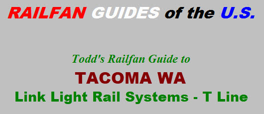
Map
Station by Station
Floobydust
RAILFAN GUIDES HOME
RAILROAD SIGNALS HOME
Location / Name:
Tacoma WA, Pierce County (county seat)
What's Here:
Light Rail/Streetcar system operated by Sound Transit, one of the area's mass transportation operator.
Data:
GPS Coordinates: as needed
Phone A/C: 253
ZIP: 98421 (at the Tacoma Dome station)
Access by train/transit:
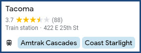
Amtrak Cascades and Coast Starlight at the Tacoma Dome station
Sounder S Line trains at the Tacoma Dome station
The Scoop:
From Wikipedia: The T Line, formerly known as Tacoma Link, is a light rail line in Tacoma WA, part of the Link light rail system operated by Sound Transit. It travels 4.0 miles (6.4 km) and serves 12 stations between Tacoma Dome Station, Downtown Tacoma, and Hilltop. Tacoma Link runs for 9 to 18 hours a day, with intervals of 12 to 20 minutes.
Tacoma Link was approved in a regional transit ballot measure passed in 1996 and began construction in 2000. It was the first modern light rail system to be constructed in Washington state and succeeded a former streetcar system that ceased operations in 1938. Service on Tacoma Link began on August 22, 2003, at five stations, replacing a downtown shuttle bus. A sixth station, Commerce Street/South 11th Street, was opened in 2011. It was designated as the Orange Line in 2019 and renamed to the T Line in 2020.
Sound Transit extended the T Line by 2.4 miles (3.9 km) to the Stadium District and the Hilltop area west of Downtown Tacoma on September 16, 2023. A longer western extension to the Tacoma Community College campus via South 19th Street is planned to open by 2041. end wiki
Acknowledgements:
Sound Transit, various pages
Wikipedia
Google Maps
Bing Maps
Websites and other additional information sources of interest for the area:
https://en.wikipedia.org/wiki/Link_light_rail
https://en.wikipedia.org/wiki/T_Line_(Sound_Transit)
https://ontheworldmap.com/usa/city/seattle/seattle-light-rail-map.html
https://www.soundtransit.org/system-expansion/everett-link-extension (good as of 5/2024)
https://en.wikipedia.org/wiki/Union_Station_(Tacoma,_Washington)
I-90 brings you in from the east, I-5 brings you up from the south and from Vancouver ON (about 130mi) to the north.

Station by Station
All stations on the T Line are at street/ground level.
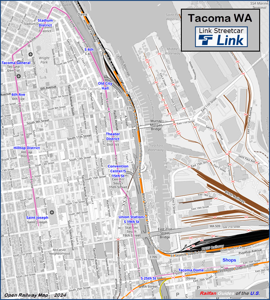
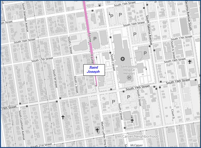
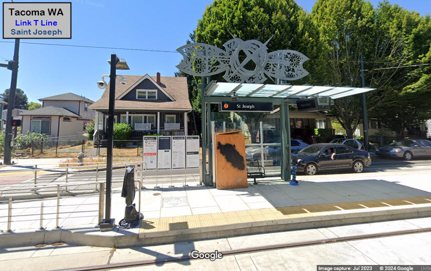
Saint Joseph
GPS Coordinates: 47.24507, -122.45015
MLK Jr Way, between South 17th and 19th Streets
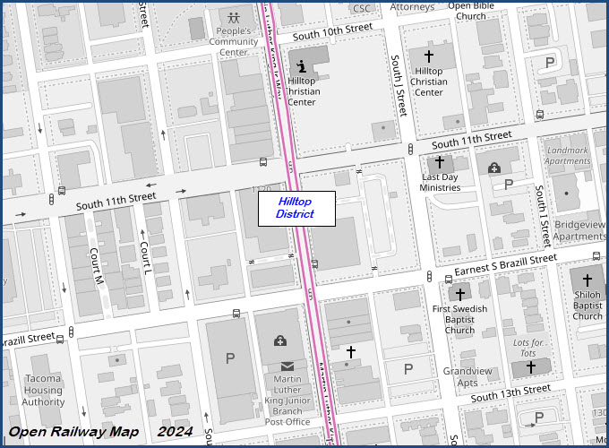
Hilltop District
GPS Coordinates: 47.25178, -122.45169
MLK Jr Way and South 11th St
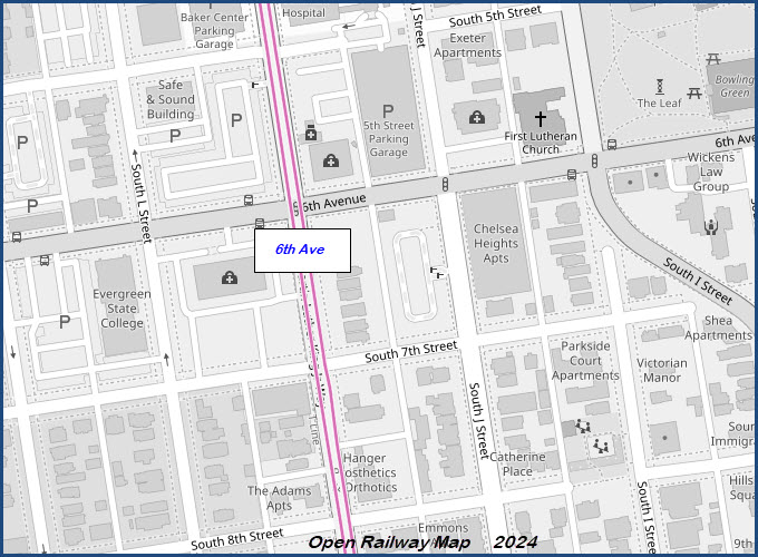
6th Ave
GPS Coordinates: 47.25687, -122.45287
MLK Jr Way and South 6th Ave
Tacoma General
GPS Coordinates: 47.26000, -122.45353
MLK Jr Way and South 3rd St

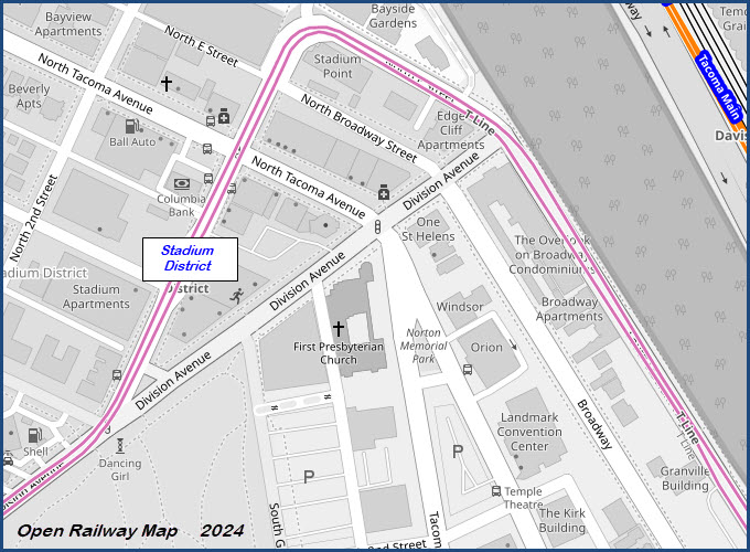
Stadium District
GPS Coordinates: 47.26388, -122.44900
North 1st St near North Tacoma Ave
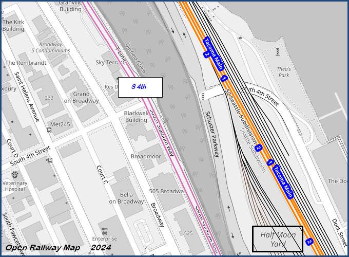
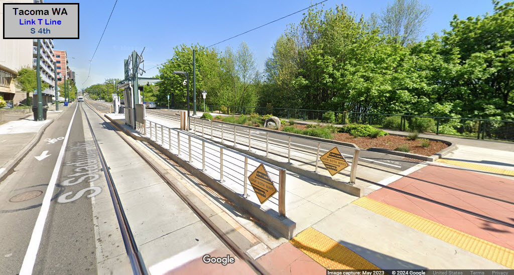
S 4th
GPS Coordinates: 47.26134, -122.44276
South Stadium Way and South 4th St
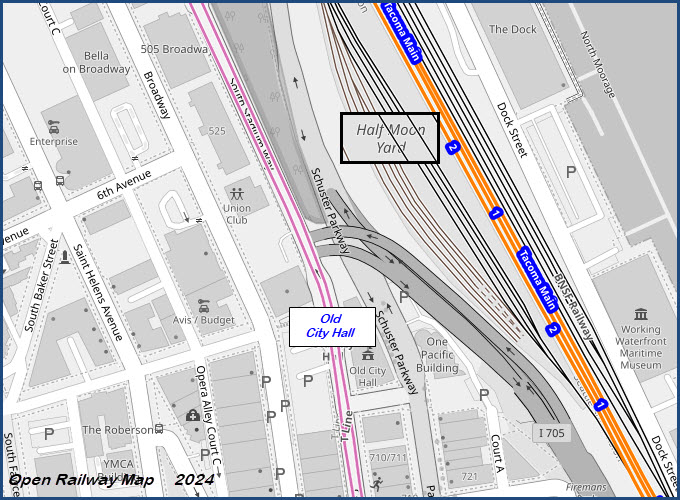
Old City Hall
GPS Coordinates: 47.25770, -122.44037
Commerce St and South 7th St

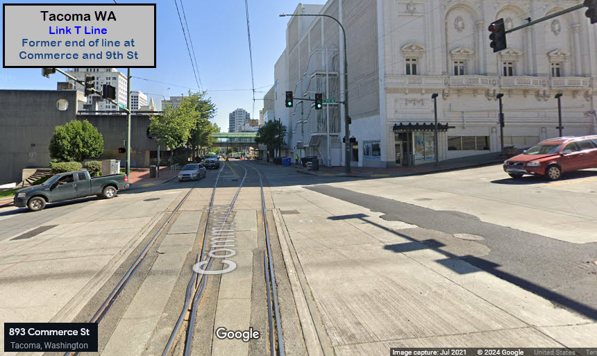
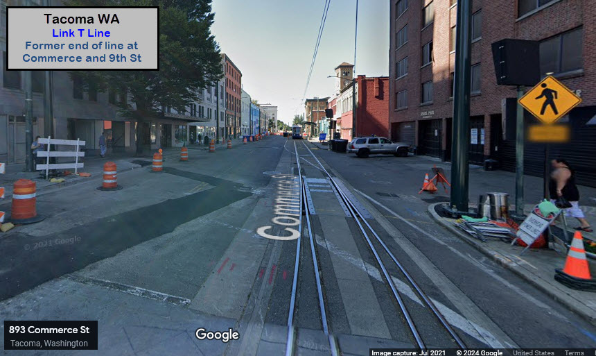
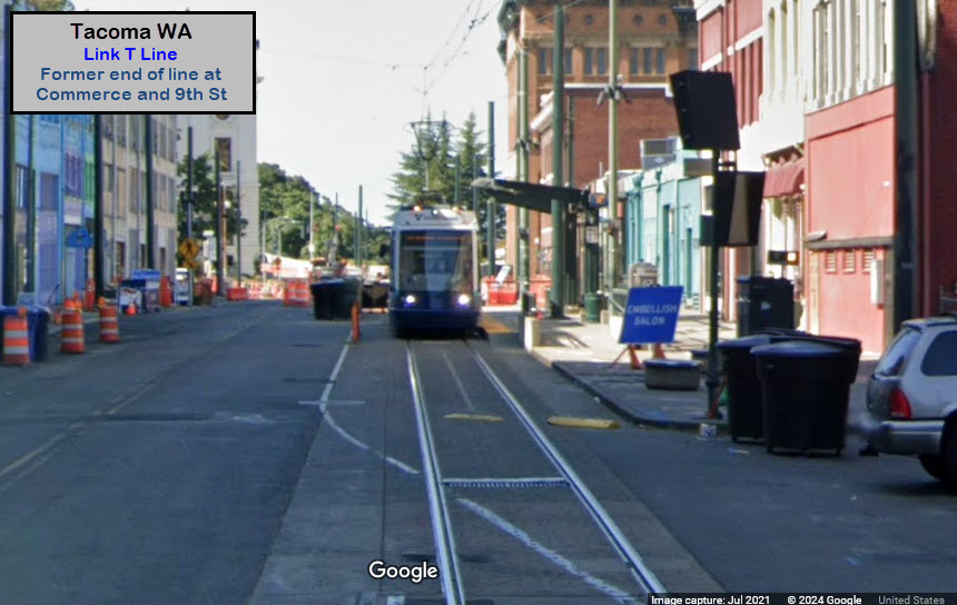
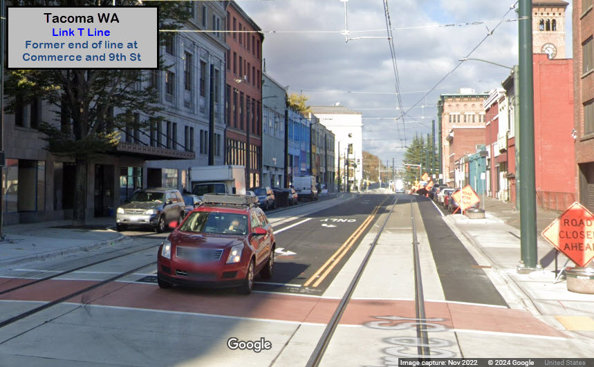
Former End of the Line at Commerce and 9th Street
GPS Coordinates: 47.25562, -122.43991
Commerce St and South 9th St
Thanks to a Google Map's "brain fart", pictures of the spot just north of S 9th Street are shown from July 2021 when the line still ended here. By the time Google's cameras came thru again in November 2022, the NB track had been extended and the second track was installed. The extension was opened on 16SEP2023.
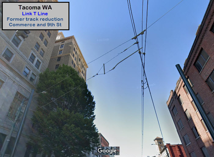 Looking up at the catenary
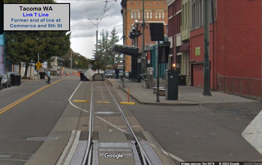
 after
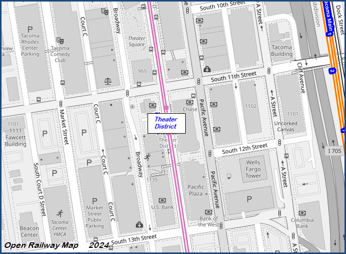
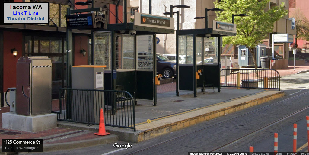
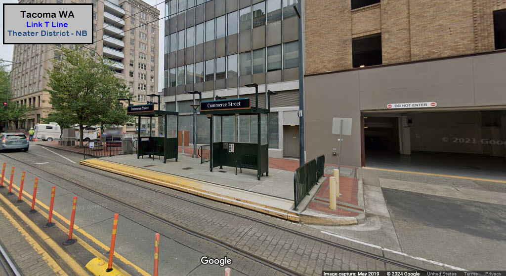
afterTheater District
GPS Coordinates: 47.25233, -122.43919
Commerce St and South 12th St
Convention Center
GPS Coordinates: 47.24955, -122.43848
Commerce St and South 15th St
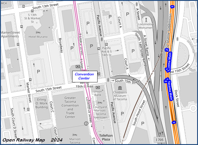


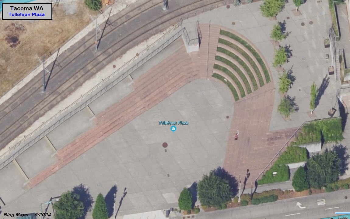
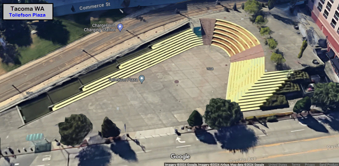
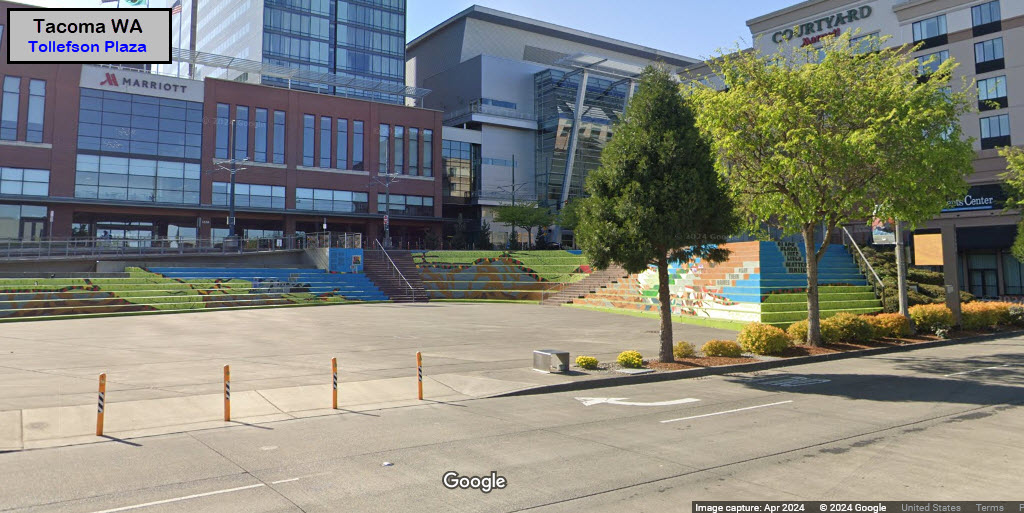
Tollefson Plaza
GPS Coordinates: 47.24793, -122.43778
Commerce St/Pacific Ave and South 17th St
Nestled between the Convention Center and Union Station stops is this interesting open air amphitheater.
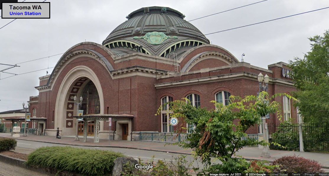
Union Station / South 19th St
GPS Coordinates: 47.24481, -122.43662
Pacific Ave (and South 19th St)
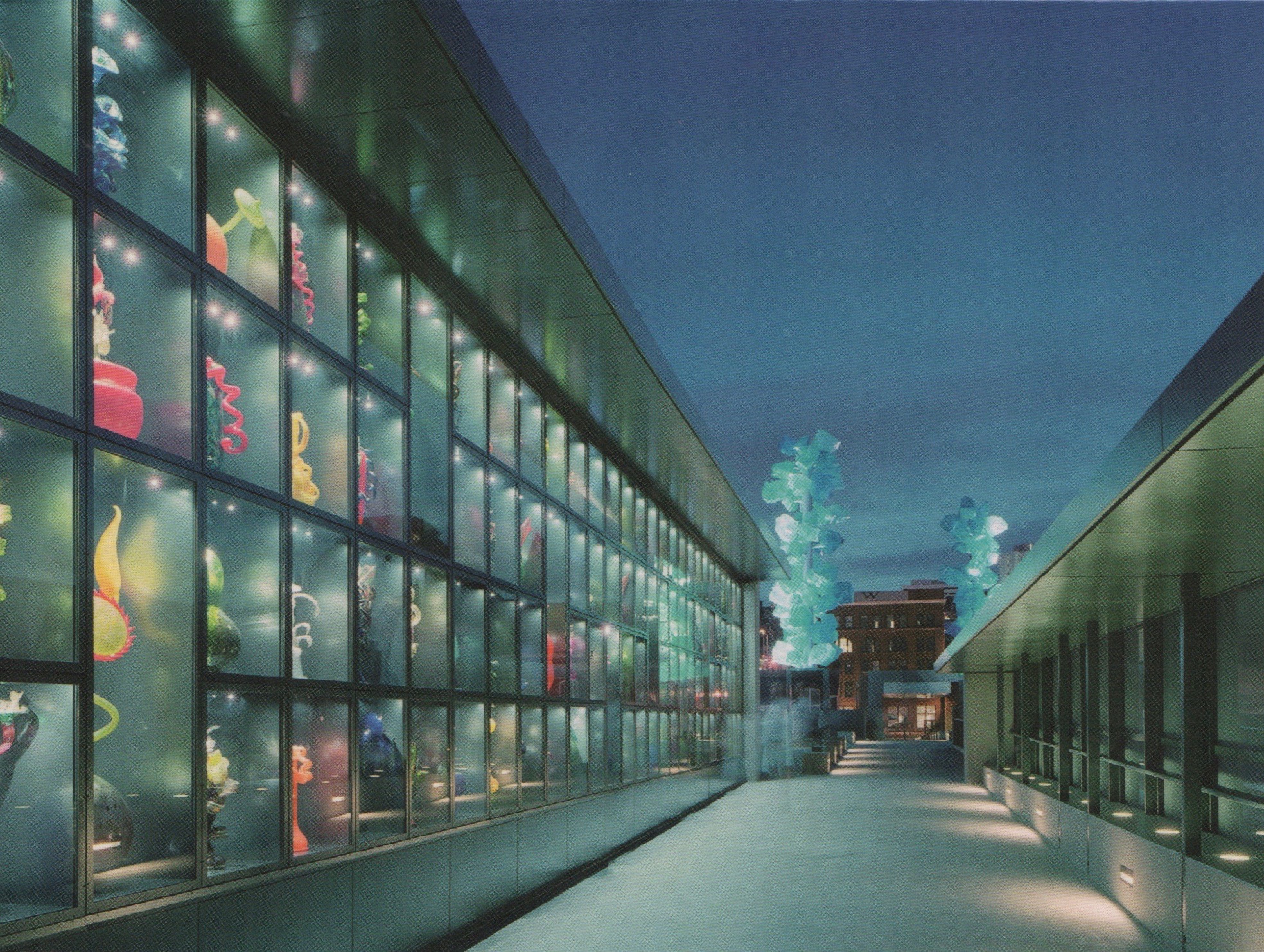
Between the former NP station, and the Chihuly Bridge, there is plenty here to see to plan a layover for an hour or so......
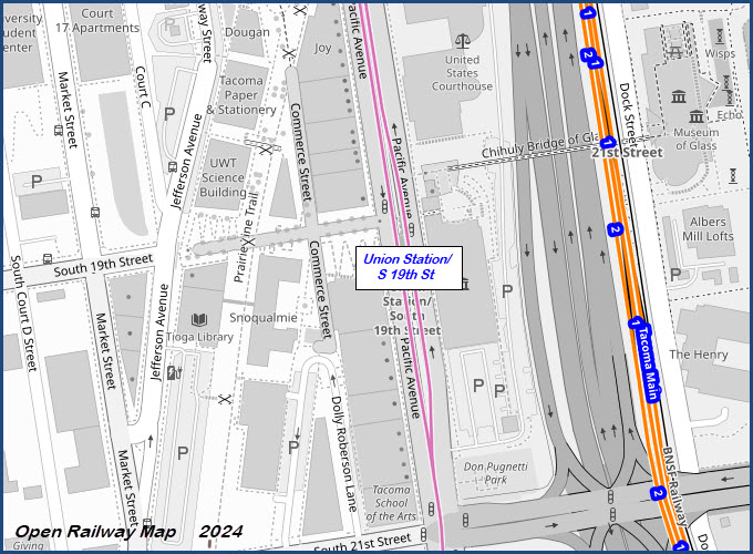

The Union Station station is named for the former Northern Pacific railroad station that is adjacent to the streetcar's tracks. It is now a courthouse and public venue for having weddings and the like. It opened on 1MAY1911, and Amtrak closed it as a train station in 1984. An addition "in like" was added 1990-1992. This building replaces an earlier depot that was built in 1883.
Off to the right of Union Station is a pedestrian bridge going over I-705, the Chihuly Bridge of Glass.


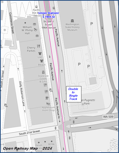
The double track line becomes a single track "south" of Union Station station
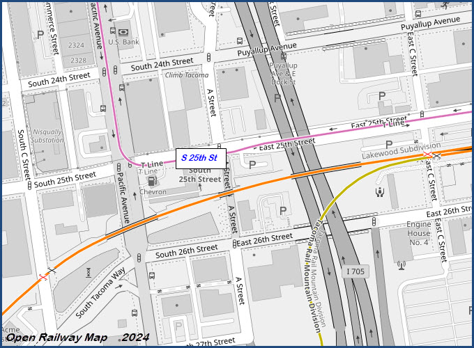
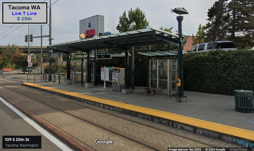
S 25th St
GPS Coordinates: 47.23908, -122.43415
South 25th St and A St
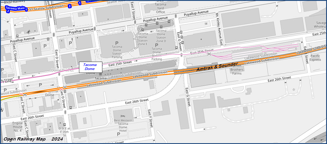
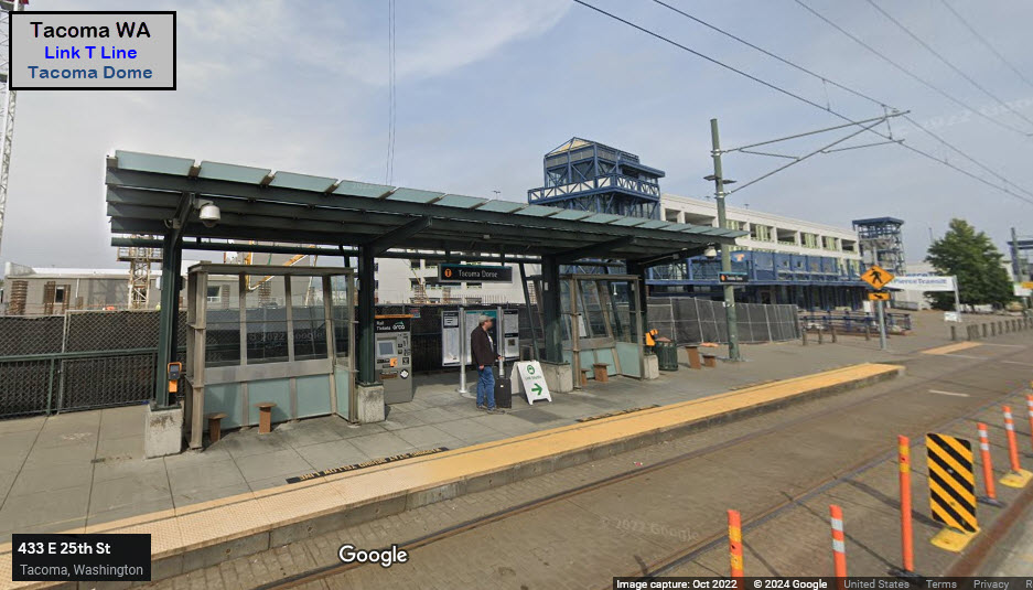
Tacoma Dome
GPS Coordinates: 47.23984, -122.42808
East 25th St near East D St
Connect with Amtrak and Sounder
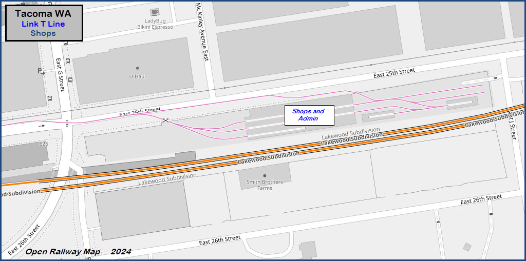
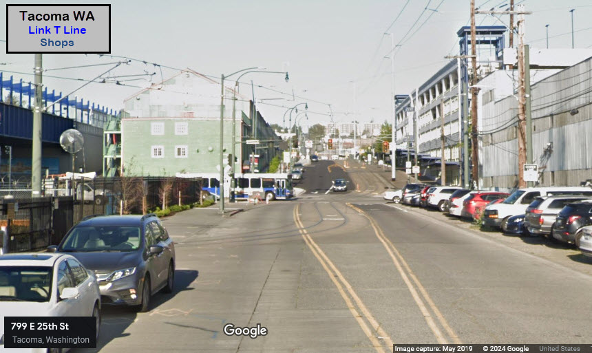
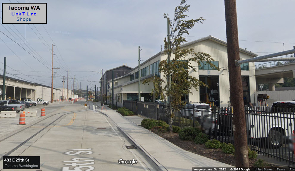
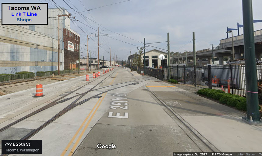
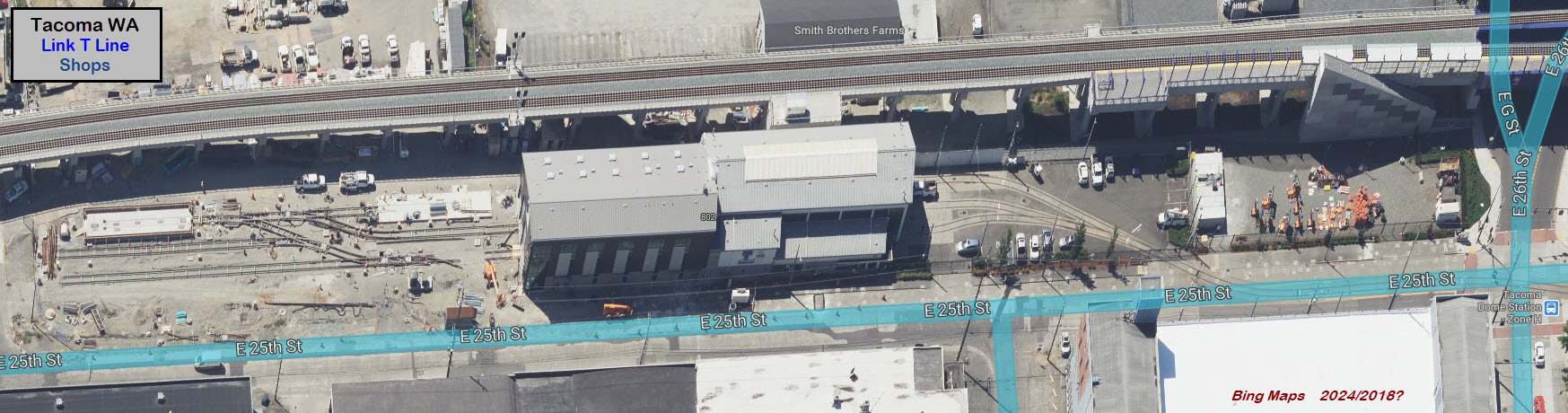
Shops and the End of the Line
GPS Coordinates: 47.24014, -122.42255
East 25th St near McKinley Ave E
At some point after 2019, we can see they added a short bypass track along 25th Street to gain entrance to the far side of the yard without having to go thru the building. We can also see from Bing's "Birds Eye View" that additional yard trackage was added on the "far side" of the maintenance building, but Bing does not annotate the dates on their pictures.


None for now
Disclaimers:
New format 10/26/23: Please check out my disclaimer page for my standard dribble and contact info here
RAILFAN GUIDES HOME
RAILROAD SIGNALS HOME
NEW 05-20-2024, MAY26/27/2024
Last Modified 28-May-2024