
In General
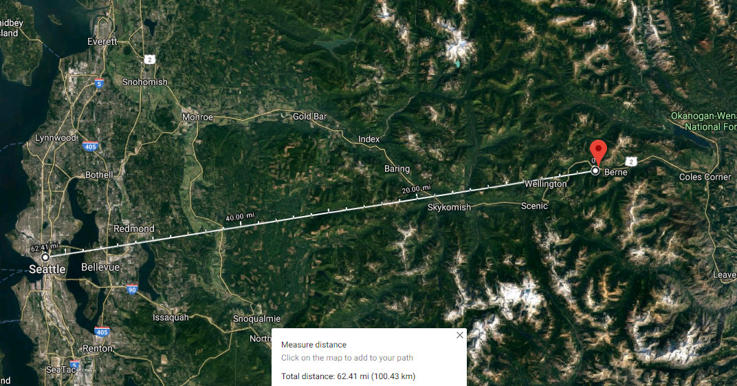
Getting Here
Map
Pictures
Signals
Historical USGS Maps
RAILFAN GUIDES HOME
RAILROAD SIGNALS HOME
Location / Name:
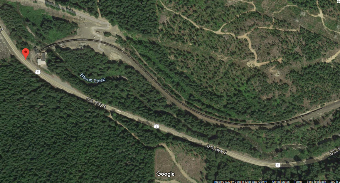
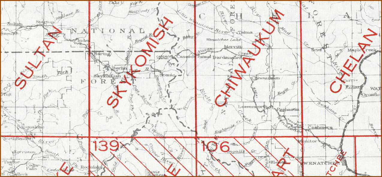
Berne WA, Chelan County, East Portal
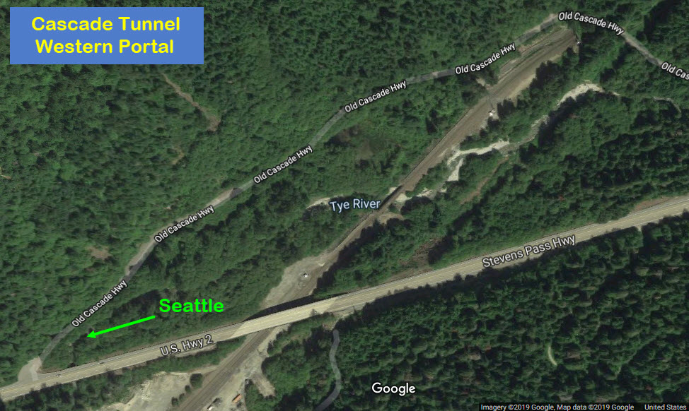
Hot Springs/Leavenworth WA, King County, West Portal
The tunnel crosses the Cascade Range near Stevens Pass
Data:
GPS Coordinates: 47.769861, -120.999413 East Portal
GPS Coordinates: 47.715344, -121.145315 West Portal
Phone A/C: 206
ZIP: 98826
Access by train/transit:
None
The Scoop:
Both Cascade Tunnels were built by the Great Northern Railway. The BNSF now operates the tunnel.
From Wikipedia: The Cascade Tunnel refers to two railroad tunnels (original and its replacement) in the northwest United States, east of the Seattle metropolitan area in the Cascade Range of Washington, at Stevens Pass. It is approximately 65 miles (105 km) east of Everett, with both portals adjacent to U.S. Route 2. Both single-track tunnels were constructed by the Great Northern Railway.
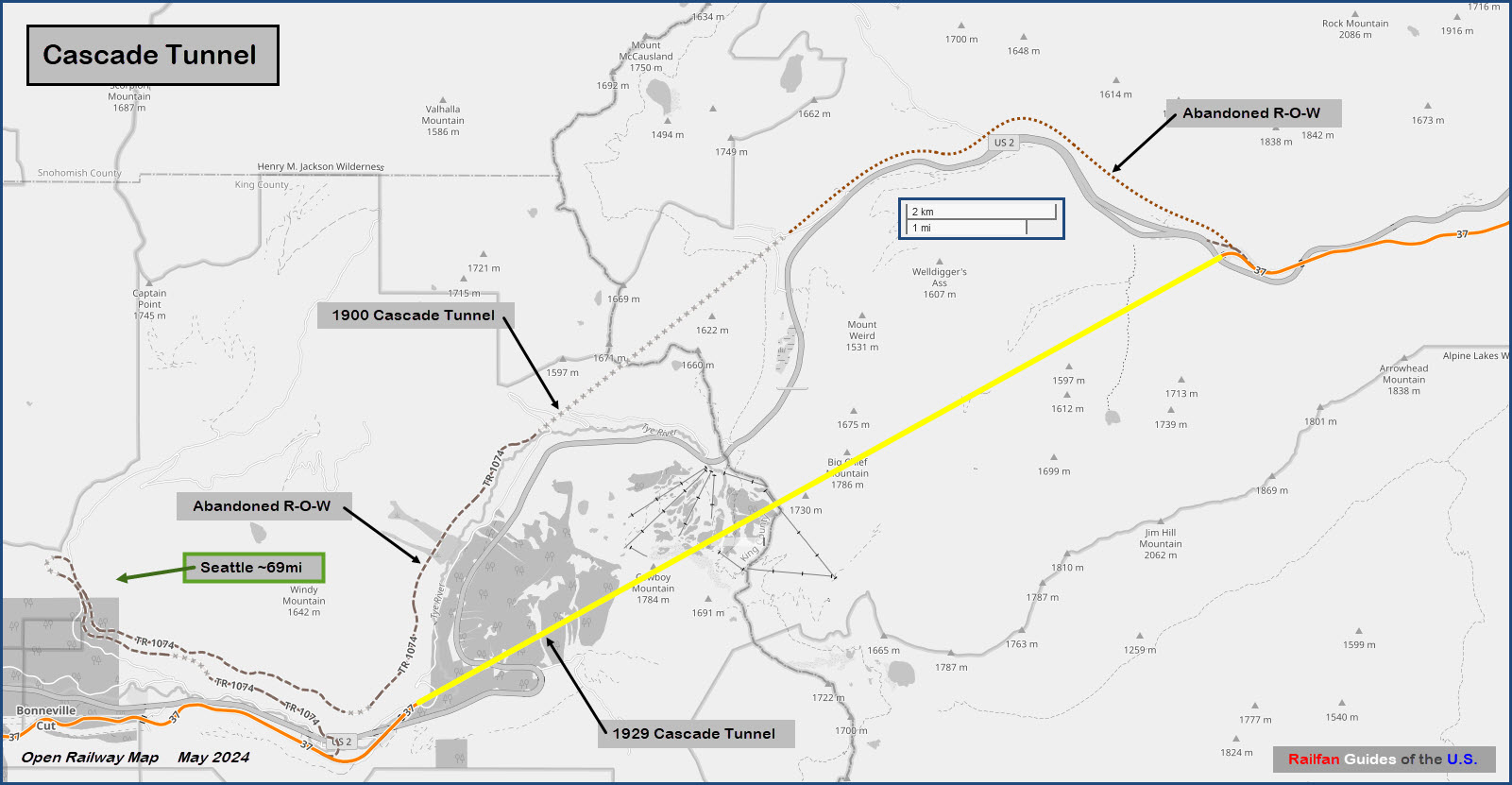
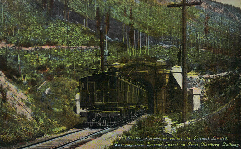
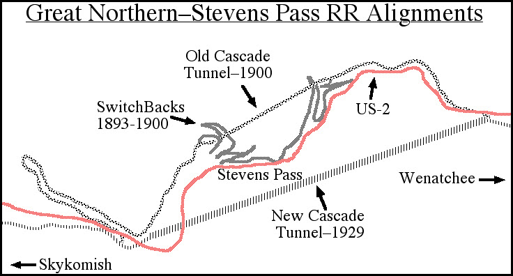
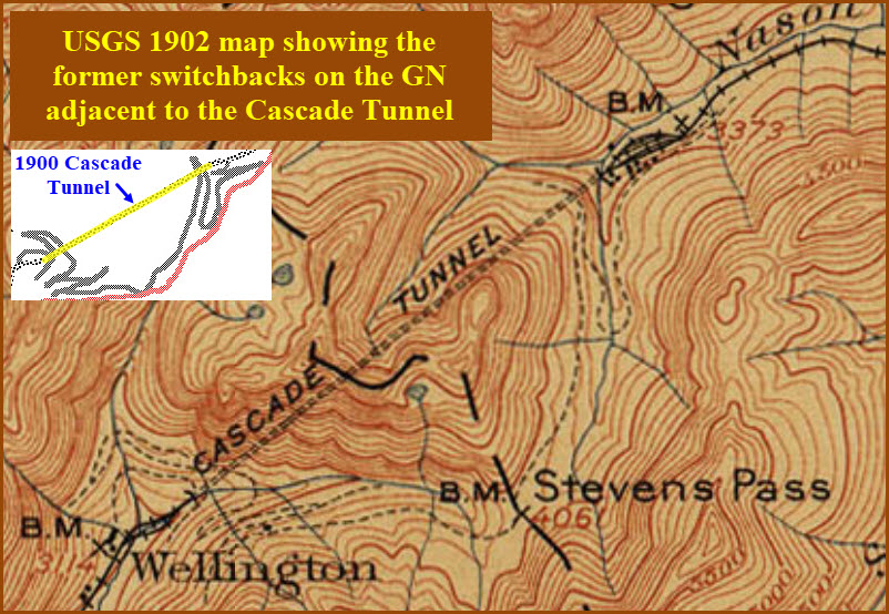
The first Cascade Tunnel was 2.63 miles (4.23 km) in length and opened in 1900 to avoid problems caused by heavy winter snowfalls on the original line that had eight zig zags (switchbacks).
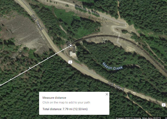
The current tunnel is 7.8 miles (12.6 km) in length and entered service in early 1929, approximately 1.5 miles (2.4 km) south of and 500 feet (150 m) lower in elevation than the original. The present east portal is nearly four miles (6.5 km) east of the original's and is at 2,881 feet (878 m) above sea level, 1,180 feet (360 m) below the pass. The tunnel connects Berne in Chelan County on its east with Scenic Hot Springs in King County on its west and is the longest railroad tunnel in the United States.
The current Cascade Tunnel is in full operation and receives regular maintenance from BNSF Railway. The new alignment is a straight-line tunnel running between Berne and Scenic Hot Springs. It is currently part of the BNSF Scenic Subdivision between Seattle and Wenatchee, and Amtrak's Empire Builder runs through it. Because of safety and ventilation issues, this tunnel is a limiting factor on how many trains the railroad can operate over this route from Seattle to Spokane. The current limit is 28 trains per day. Speed through the tunnel is 30 mph for passenger trains, 25 mph (40 km/h) for freight.
The gradient in this tunnel is 1.565% (1:64), with the rise from west to east. The gradient is 2.2% on the west side from the town of Skykomish.
Ventilation operations (also from Wikipedia): Because of the length of the tunnel, an unusual system is used to ensure that the air inside remains breathable and reduce problems with excess fumes. For example, as a train enters the west portal of the tunnel, doors close on the east portal and huge fans blow in cool air through a second portal to help the diesel engines. As long as the train is within the tunnel, the fans work with reduced power to avoid pressure problems.
After the train has left the tunnel, the red-and-white-checked door closes and the fans operate for 20 to 30 minutes with maximum power to clear the tunnel of exhaust before the next train passes through. In the opposite direction, the door opens when the train is within 0.6 miles (1 km). The fans are powered by two 800-horsepower electric motors, clearing the air through the seven miles (11 km) of tunnel within 20 minutes. Present-day train crews carry portable respirators for use in the event of a fan failure or a train stalling inside the tunnel. In addition, there are emergency/safety stations spaced 1,500–2,500 feet (460–760 m) apart, depending on the location within the tunnel, that provide additional air tanks and equipment to be used in the event of a ventilation/other failure.
The tunnel door is protected by an absolute signal near the east portal. On the west side, another signal with dual flashing lunar aspects indicates to eastbound trains that the tunnel fans are operating.
I know I'm not supposed to make personal comments, but if you read down the list of comments about Steve's video, I can't believe someone from Europe made a wisecrack about how short the tunnel is compared to the newly opened 35 mile tunnel thru the Alps, and how it was done by a TBM. Is this guy really that stupid to NOT know that TBM's didn't exist in 1928-1929, and this was all dug pretty much by hand, with little aid from machines? Geez.
Acknowledgements:
Denver Todd
Steve Larson
Jersey Mike
Google Maps
Websites and other additional information sources of interest for the area:
https://www.youtube.com/watch?v=rc7zRVtx1Bk Steve Larson's really nice YouTube video on the tunnel
https://en.wikipedia.org/wiki/Cascade_Tunnel
Both portals of the Cascade Tunnel are "easy" to find off US highway 2.
Getting here and back from Seattle is an all day adventure if you are going to do any sort of railfanning at both ends of the tunnel.
Beware that even out here, the BNSF trolls are around, so they may catch you and ask you to leave the property. Go with three people, and use one as a lookout! :-)
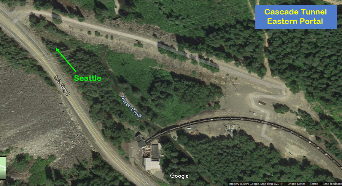

The East Portal
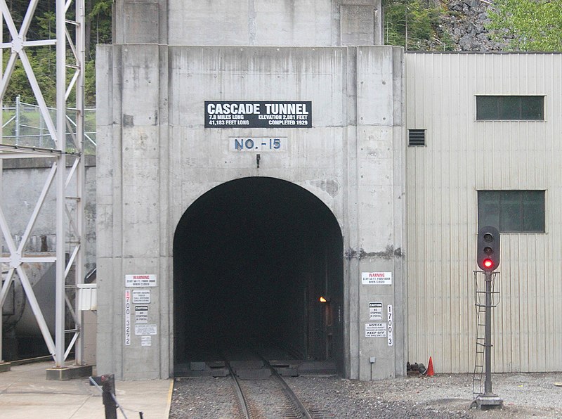 Picture by Sturmovik/Jersey Mike
 Photo/video by Steve Larson
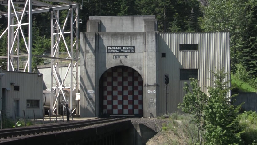
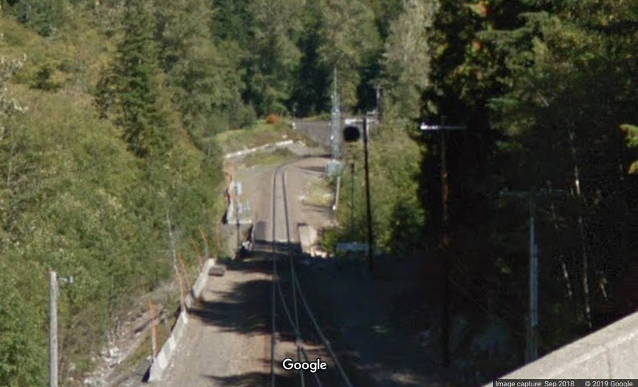
The West Portal

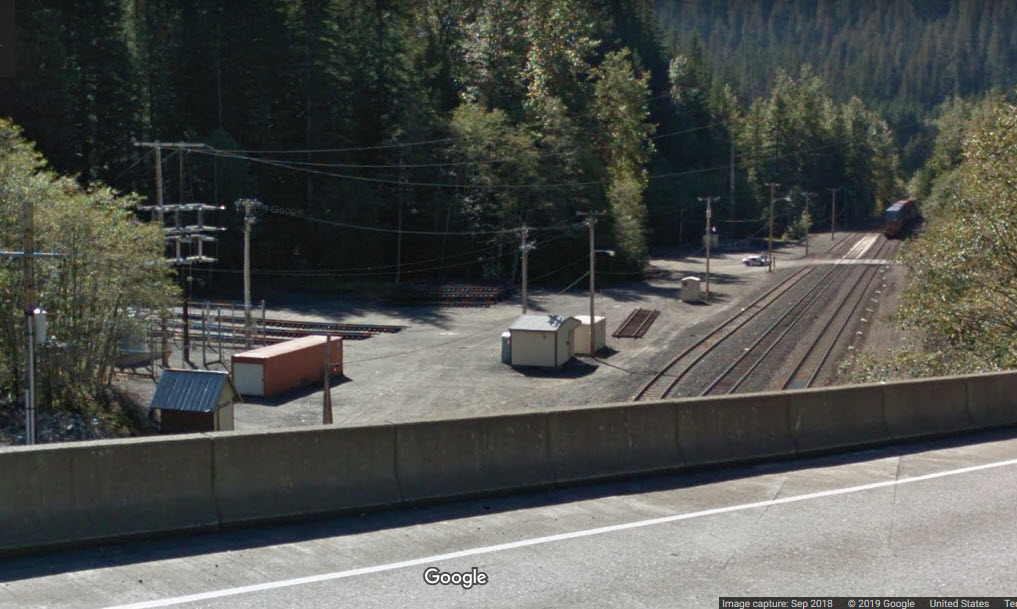
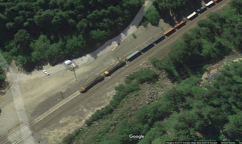
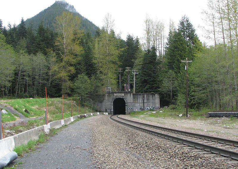
The tunnel itself is a single track tunnel. On either side of the tunnel, the mainline is double tracked, with a siding at the east end. Both of the interlockings are fully signaled. There is also a signal right at the east portal entrance, probably due to the tunnel door.
At The East Portal
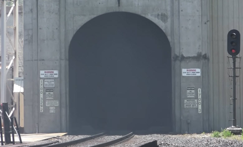 Photo/video by Steve Larson
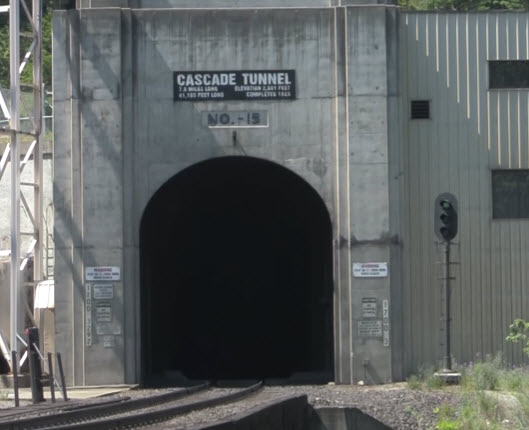 Photo/video by Steve Larson
At The West Portal
Courtesy of the University of Texas Library, click here for their index page.
This copy of the Skykomish quadrangle was published in 1902, two years after the first Cascade Tunnel was opened.
The map enlargement shows the switchbacks, since (I guess) the tracks were still in place, but not in service.

Disclaimers:
New format 10/26/23: Please check out my disclaimer page for my standard dribble and contact info here
RAILFAN GUIDES HOME
RAILROAD SIGNALS HOME
NEW 07/01/2019, APR11/2021, MAY17/2024
Last Modified 17-May-2024