Location / Name:
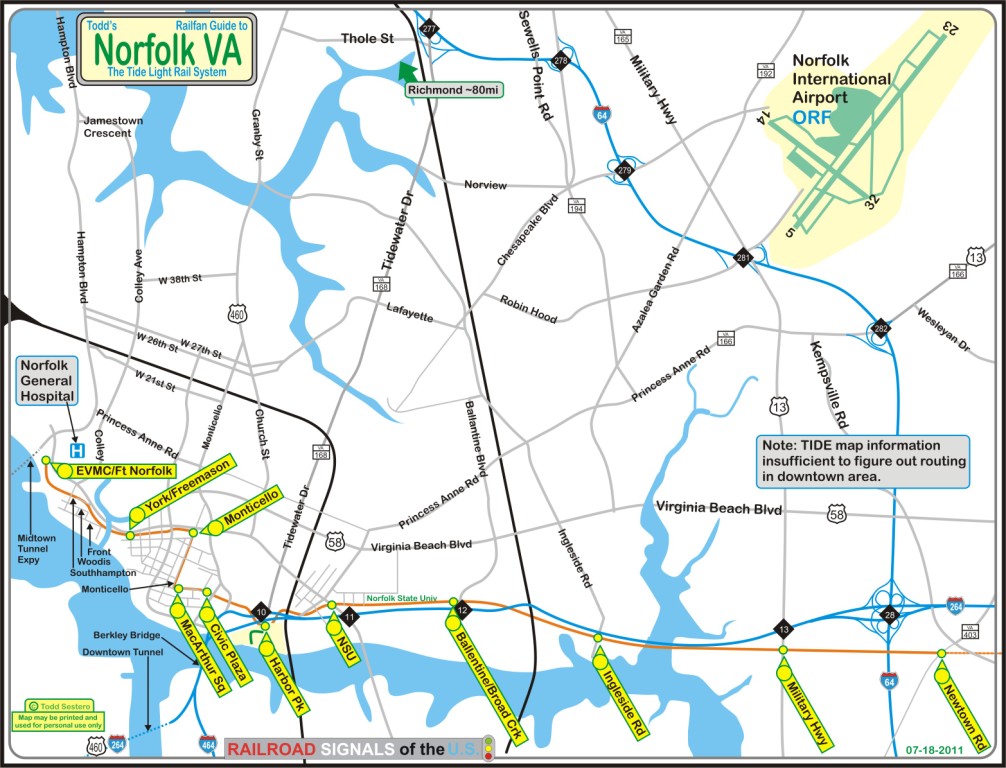
Norfolk VA, Norfolk is not part of a surrounding county
What's Here:
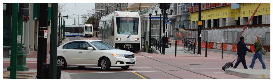
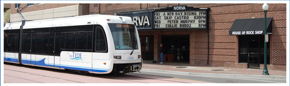
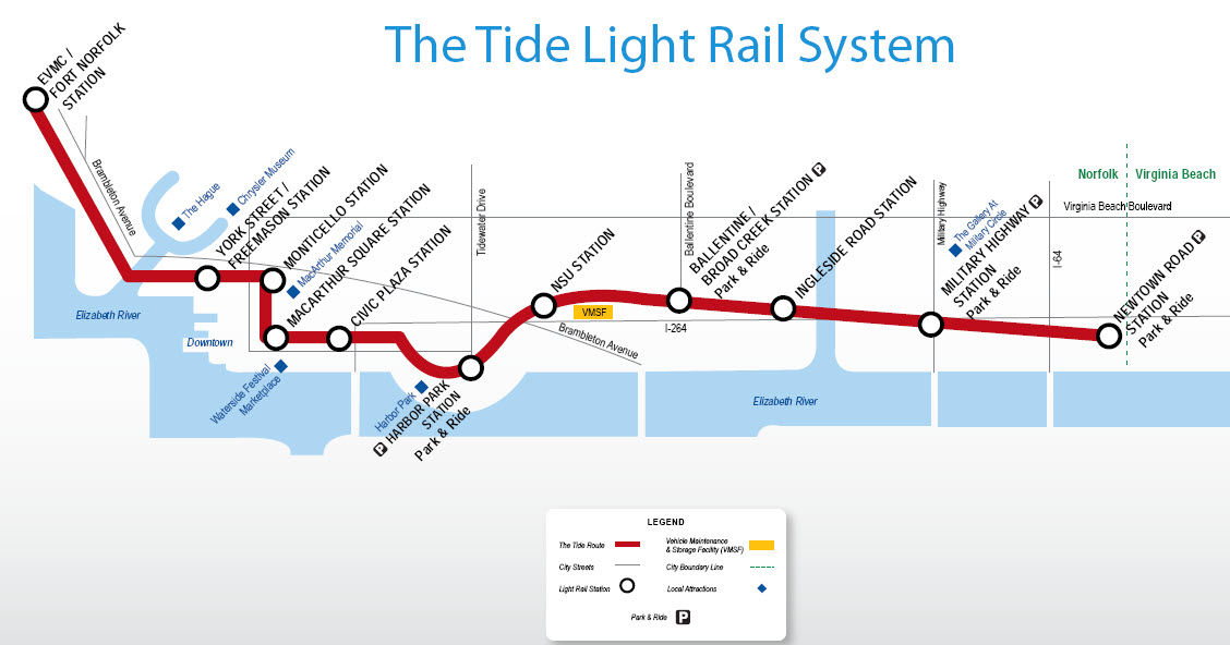
Tide Light Rail System
Data:
GPS Coordinates: as needed
Phone A/C: 757
ZIP: 23504
Population: 238,005 (2020), 3rd most populous city in VA
Access by train/transit:
Amtrak (see additional info below)
Geography:
Flat
The Scoop:
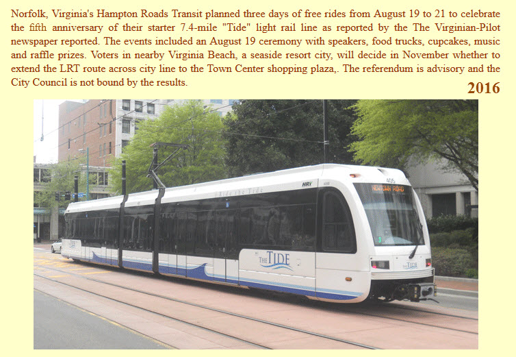
The Tide Light Rail System opened on August
19th, 2011, with a week+ of free traveling to celebrate. Regular
revenue service was supposed to start on Monday the 22nd, but because the
response was so great, they put it off until August 29th!
The Tide is operated by
Hampton Roads Transit.
It is the first light rail system to be opened in the state of Virginia (yeah, I
know everyone else calls it the Commonwealth of Virginia :-)
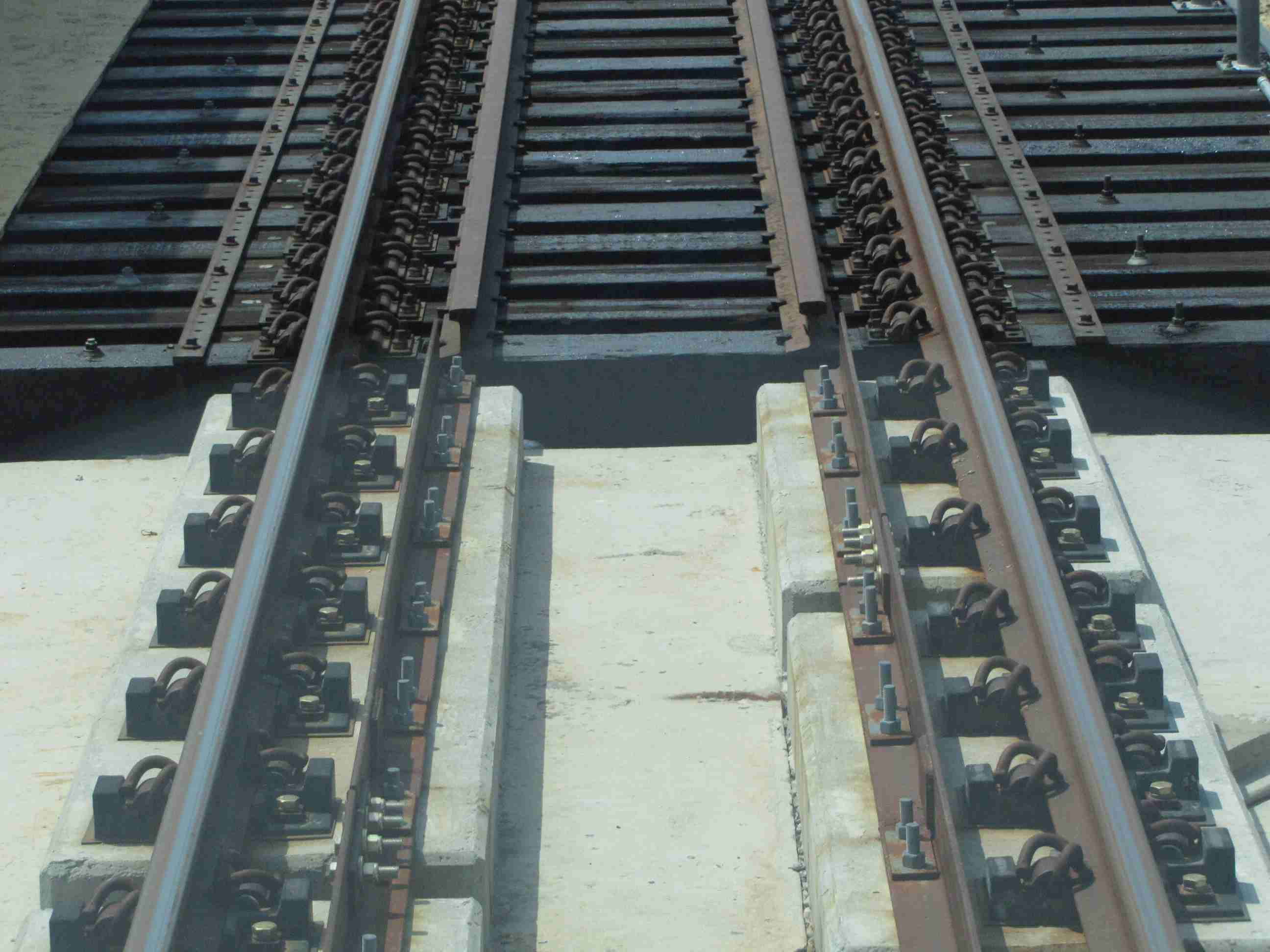
The line is 7.4 miles (11.9 km) long, has 11 stations, four of which are park
and ride stations. Travel time is about 25 minutes. There are 9
formal grade crossings, none are downtown though. The system is all at grade.
Ridership during the first year is expected to
be 2900 a day, increasing to 7000 by 2030.
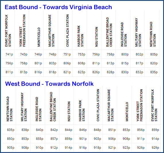
The line travels east-west, and ends on the
east side to the city line with Virginia Beach, which originally did not want
anything to do with the system when it came up for a vote in 1999 - they even
made a resolution that the subject could not be presented for another 10 years.
Pressure from high gas prices and new construction has made Virginia Beach to
reconsider. Since then, Virginia Beach has agreed to purchase the former
Norfolk Southern right-of-way that goes almost all the way to the waterfront.
As of the creation of this page, there are not any pictures on Bing Maps, Google
Maps, etc showing the completed system, for it is too recent. However, in
some places, there are some pretty neat shots of the construction in progress,
which will eventually go away.
The trains may or may not operate during inclement weather, call customer service for info.
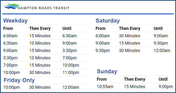
Hours of Operation and Riding Times
It looks like it's taking about 24 minutes to go from end to end of the system.
Notice on Fridays, train frequency is only every 30 minutes and doesn't start
till 10am! These screen grabs are from the Hampton Roads Website, but
have been edited to make them easier to read.
Acknowledgements:
Denver Todd
Ben Schumin
Google Maps
Amtrak
HRT
Bing Maps
Open Railway Map
Wikipedia
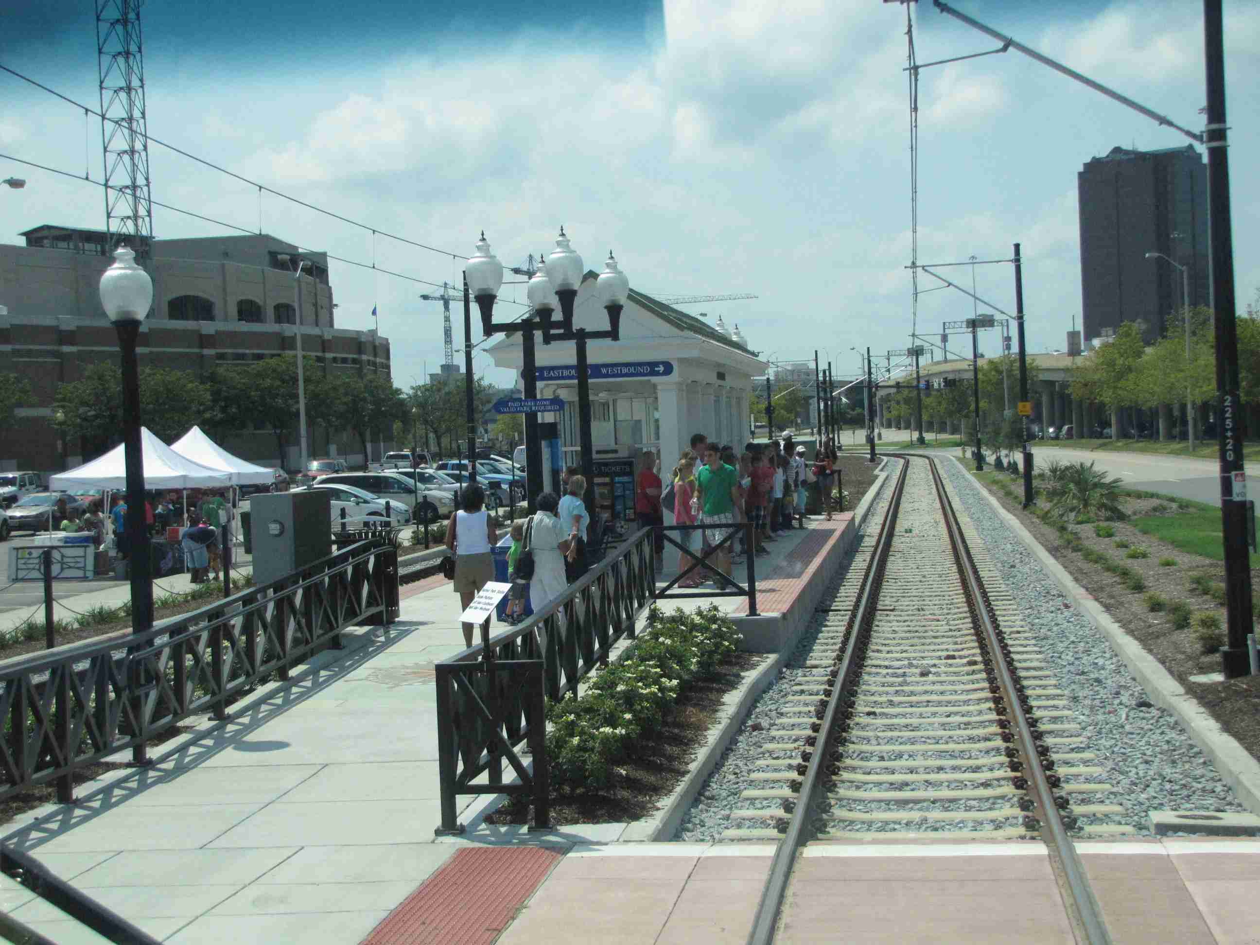
For the opening weekend, HRT "hired" a large team of volunteers,
all of whom seemed to be enjoying themselves as "transit ambassadors".
Crowds and long lines were to be found at
almost every stop Saturday, for people waiting to ride the Tide. I luckily
found a place to park in the Ballentine "park n ride" lot. There was no
waiting at this stop, don't know why.
HRT was handing out giveaways, and they seemed
to have different stuff at many of the stations. One station was handing
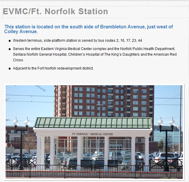
out safety posters (at the EVMC station), and HRT zipper pouches were being
given away at the Ingleside station. Most of the stations that I could see
were giving away small HRT bags with a system map and a special version of the
tickets that could be used as a discount in many of the retailers along the system.
Operators: I spoke with several of the
operators, all of whom seemed to be very nice. I asked them how they came
to be a light rail operator. In Baltimore, as with many "older" systems
that have expanded beyond bus service only, operators have to "pick" into the
light rail system, on a seniority basis. The operators with the lowest
badge number get to pick which service and position within the service they
want. The good assignments (ie: the most desired) go first. In
Baltimore, the heavy rail jobs get filled first, then the light rail. The
bus driver positions go last. Apparently, HRT first tried to offer the
light rail operator positions to those that had the best operating records
(like, who had the least number of accidents) and other things like having the
fewest sick days. But when they didn't get enough qualified operators,
they opened it up to everyone. Other systems, like San Diego, opened up
their light rail system as a separate entity, so they could hire people right
off the street, so one of the trains I was on had a 20 year old operator.
The light rail cars had an impressive rate of acceleration considering
the loads were near what they call a "crush load" (all seats full,
and the aisles filled with standing people so there is little wiggle room).
The Baltimore light rail cars have a 3mph/sec acceleration rate, and during
brake rate tests, they didn't feel as quick as the Norfolk cars!
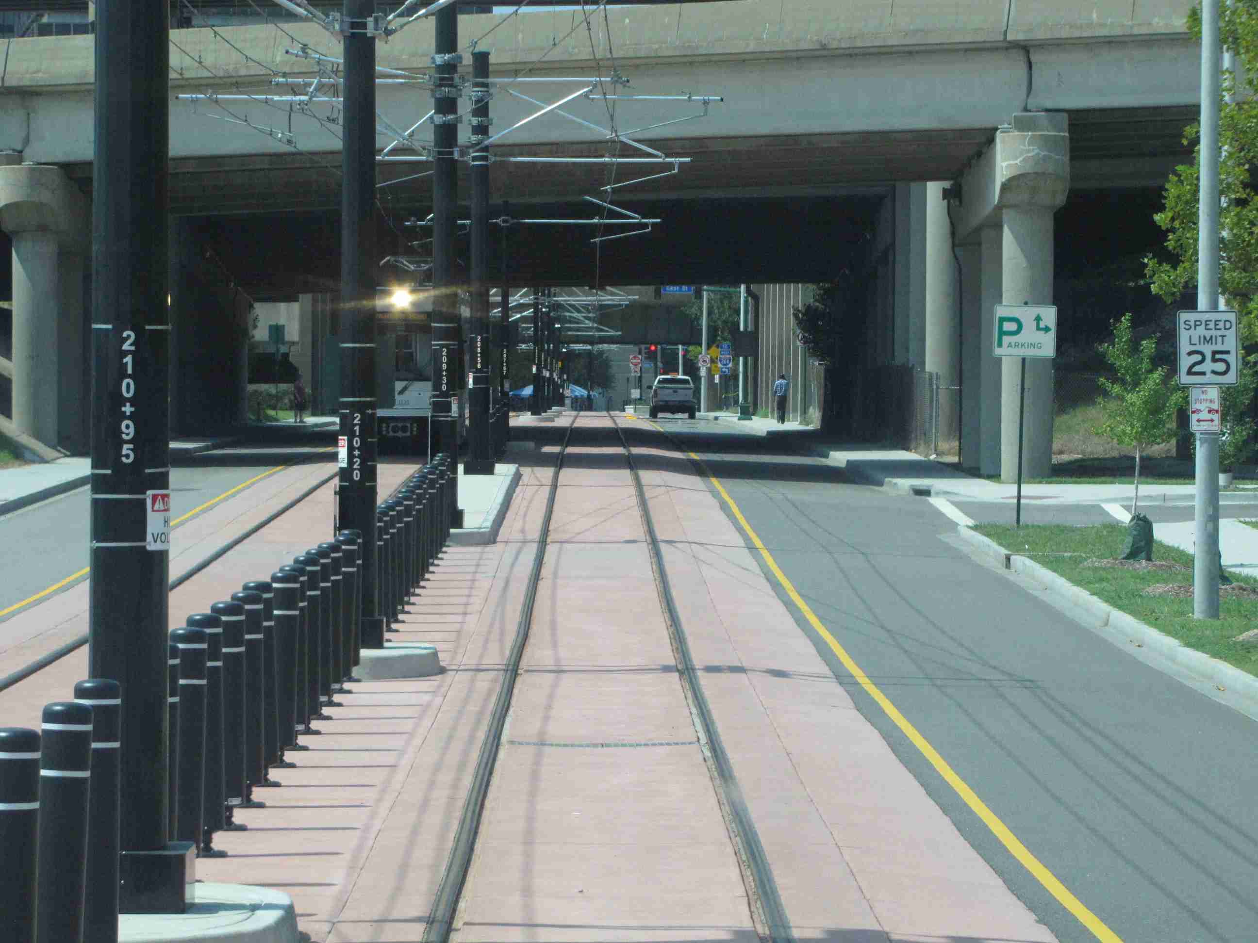
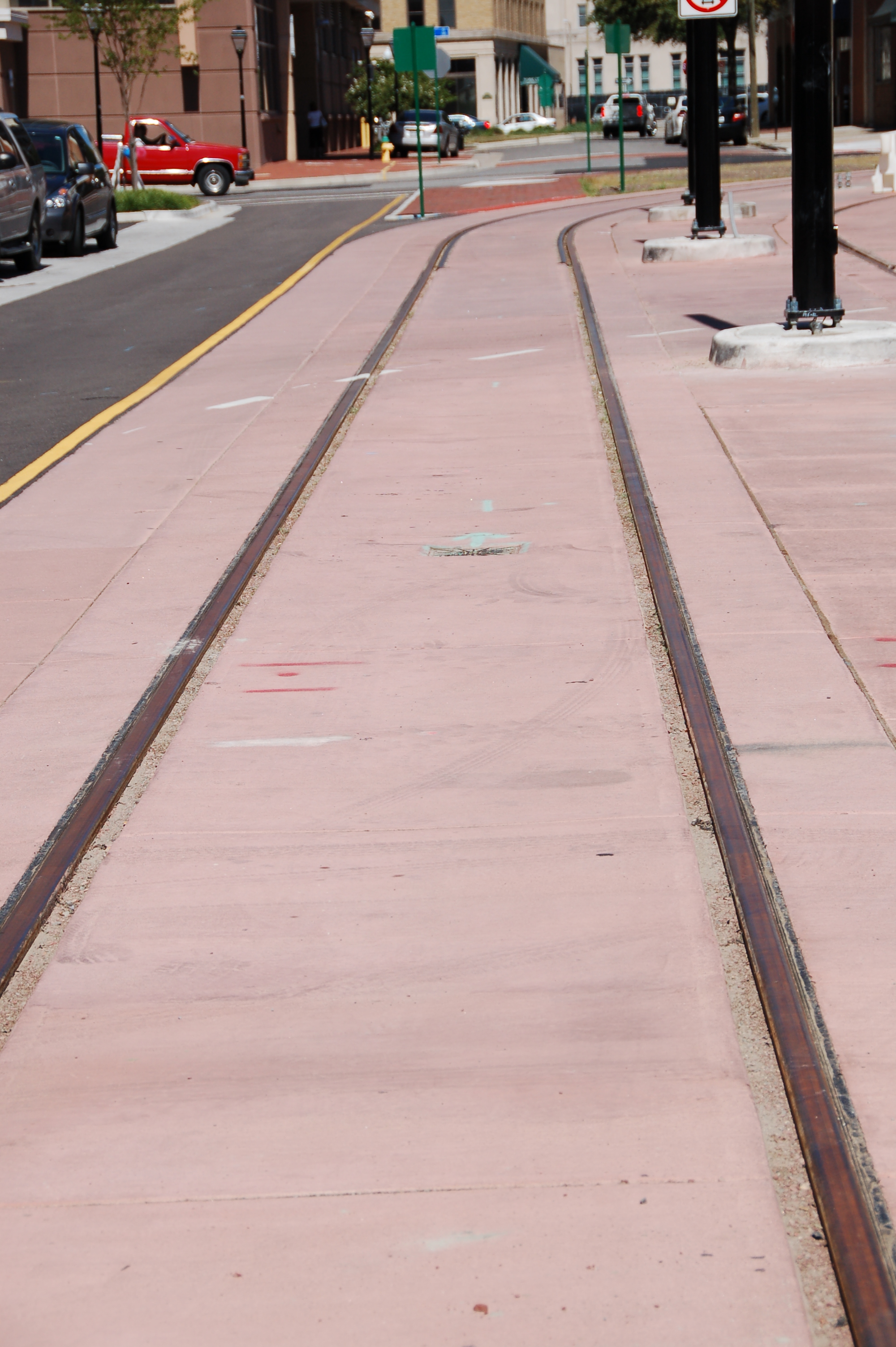
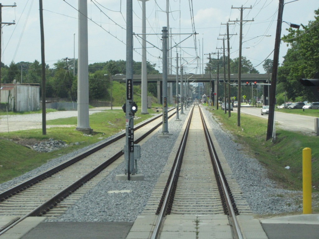
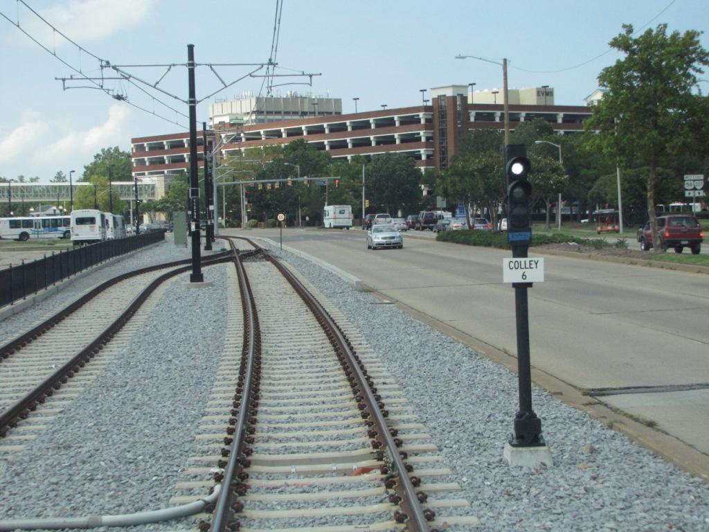
Most of the system has fairly low speed limits
imposed, with only one section I saw that had a posted limit of 55. When
going by the shops, I don't know why, but they have limited the speed to around
25. Speed on the west end of the system to Harbor Park are generally slow
because most of the trip is on the streets and/or combines with vehicular
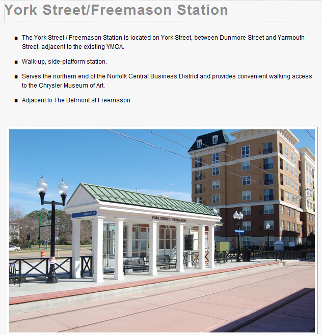
traffic, the one exception is the stretch between York/Freemason and EVMC/Ft
Norfolk because it is once again on private R-O-W.
It's too bad, for the TVM machines were not active over the weekend --
I'm sure they would have sold a bunch to the railfan community as souvenirs!
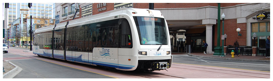
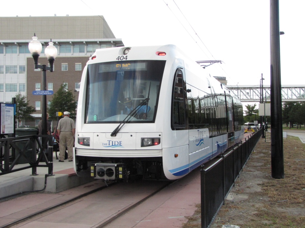
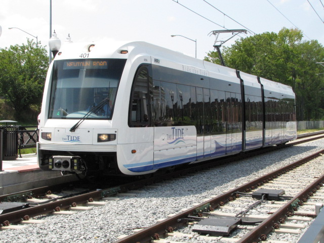
They have 9 LRV's made by Siemens, and are
model S70. Like many other systems, the cars are bi-directional, have
three trucks, and are fully low-floor cars. The cars have an operational
speed of 55MPH, and a maximum speed of 66MPH.
The LRV's can seat 68 people, with a total
capacity of between 160 to 180 people. There are 4 handicapped seats, and
4 bike racks. The cars have a total of 8 doors, four on each side.
The cars run off of 750VDC, which is pretty much a world-wide standard
in today's light rail systems.
The cars are 93.6 feet long (I'm guessing over coupler faces), 8.7 feet
with lowered pantographs, and can wide, 12.7 feet high reach up to 23
feet with the pantographs extended. The cars weigh 96,800 lbs empty
(again, I'm guessing the quoted weight is empty, the website doesn't say).
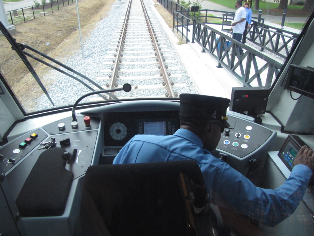
The cars are manually operated, controlling
the speed, braking, and audible warning systems. Announcements are done
automatically. The cars have a total of 10 cameras inside and out.
The website says each train is equipped with
an automatic block signal system, but my guess is that they are referring to the
wayside signals, with ATC- automatic train control on the cars.
Most of the pictures below are from HRT's
website. I don't know why, but they load exceedingly slow from their site,
even with a high speed connection. They load a lot more quickly from
mine... enjoy them until they tell me to take them off.
I find the last part following statement on their website very amusing,
unless they use a trolley-bus type catenary (which they are not):
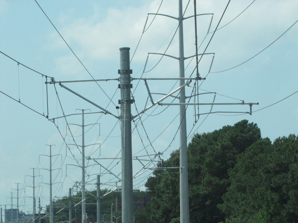
Q - How is the light rail system powered? A - The Tide is
powered by an Overhead Catenary System, or OCS. This means electricity flows
from overhead wires, through a device called a pantograph, to the train.
There is no electricity flowing through light rail
tracks that would endanger pedestrians or motorists. The reason
I find this amusing, is that every light rail system I know of, uses the rails
as the return for the overhead power, but it is at ground potential, and that
is what makes it essentially safe.
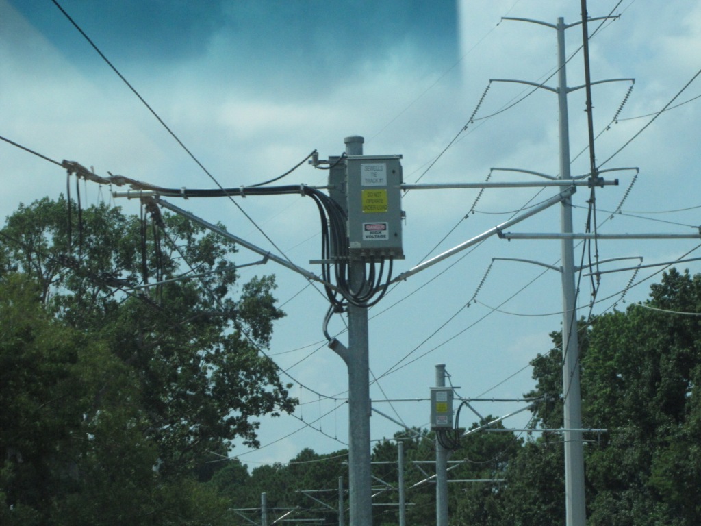
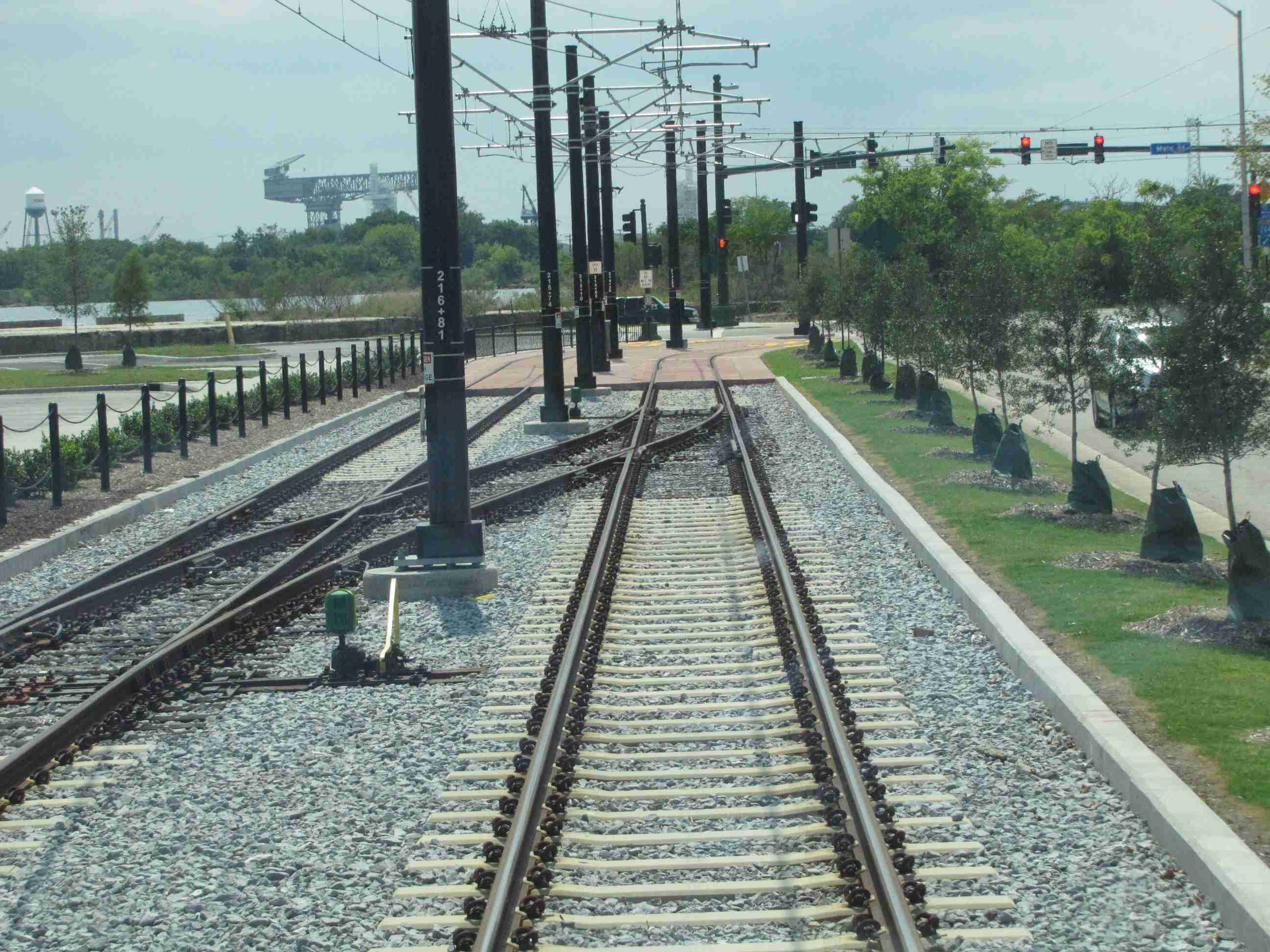
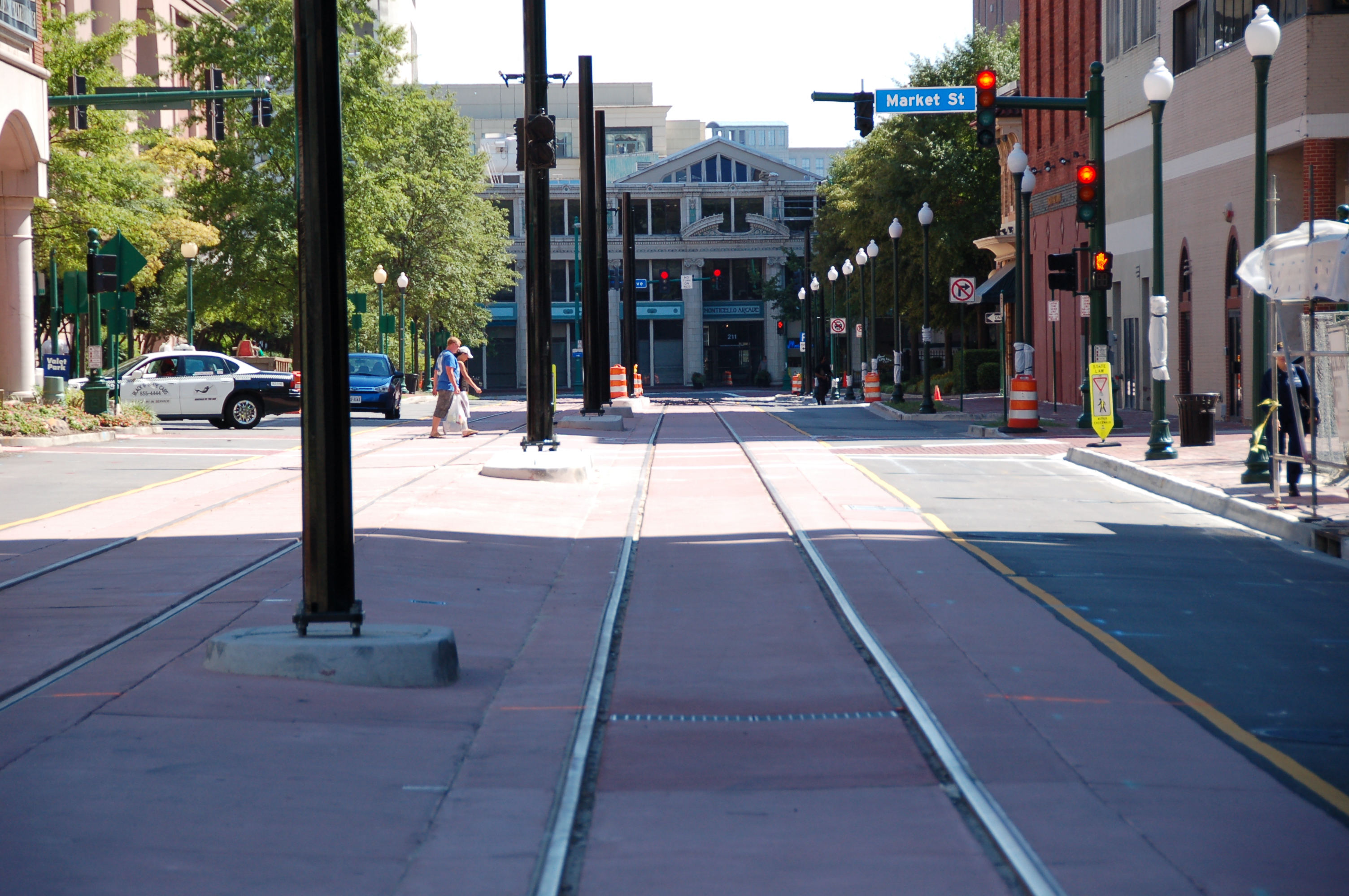
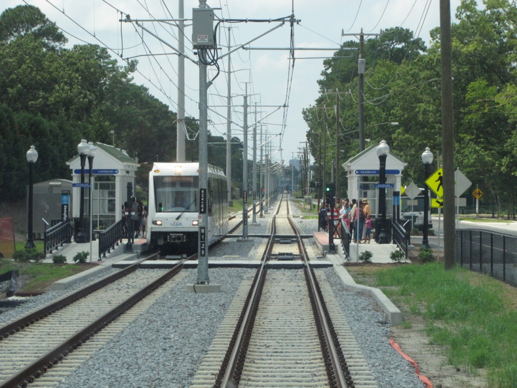
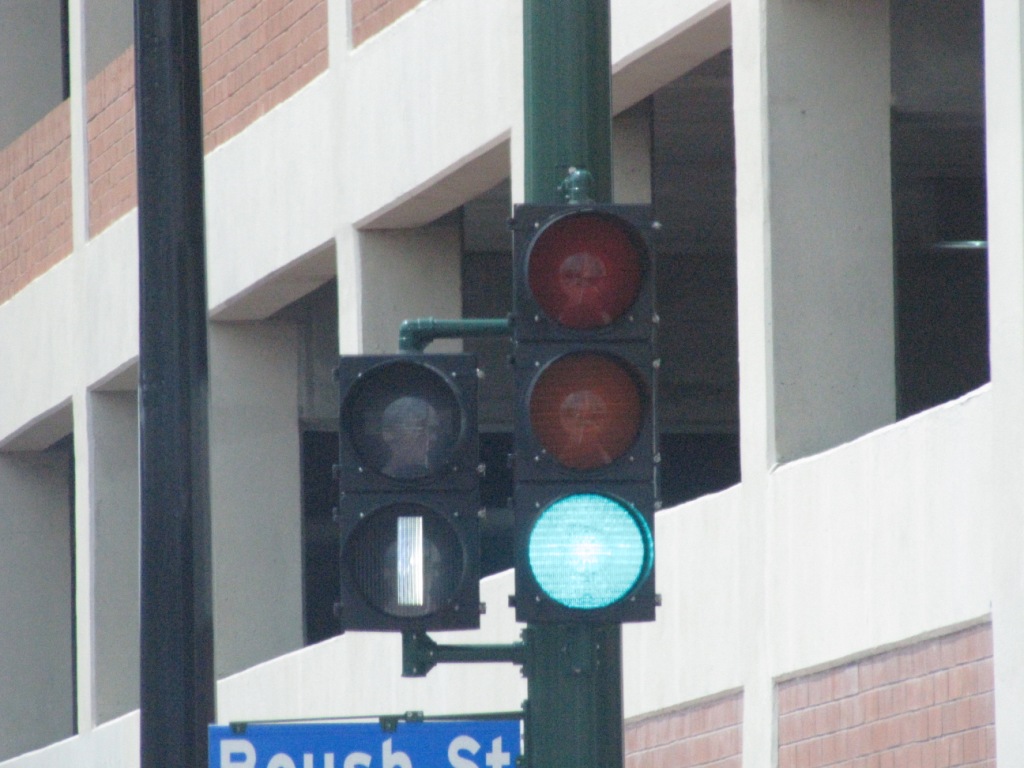
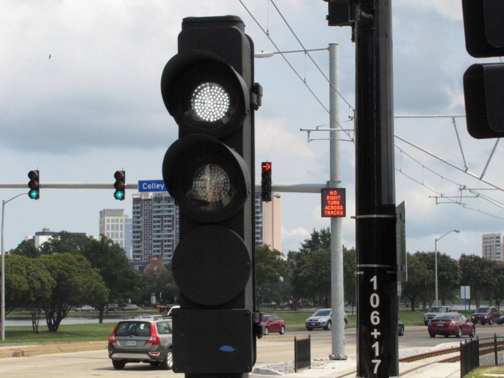
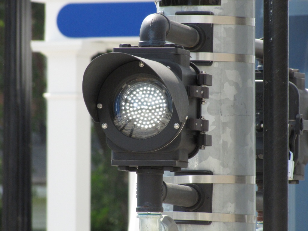
The Tide uses two types of signals, bar signals and
green/yellow/red/lunar color light signals. The mainline
tracks are fully signaled for operation in either direction.
The bar signals they use are
two aspect, single head, two segment traffic light signals.
I didn't snap off a picture of the housings, so I'm not sure if
they are Eagle's or not, however, they are the same exact style
and make as the Norfolk traffic lights as you can see from the
photos. They are used everywhere the trains run mixed in
with vehicular traffic, west of the private R-O-W of the west
end, to Harbor Park. Train movement is usually independent
of the traffic light cycles except for a couple of key
intersections. The two photos on the right happen to be
one intersection where the train signals echo the indication of
the traffic lights. I didn't catch a photo of it, but when
the traffic light signal goes yellow, there is NO bar signal lit.
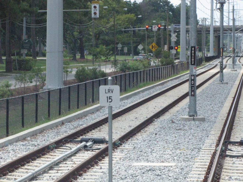
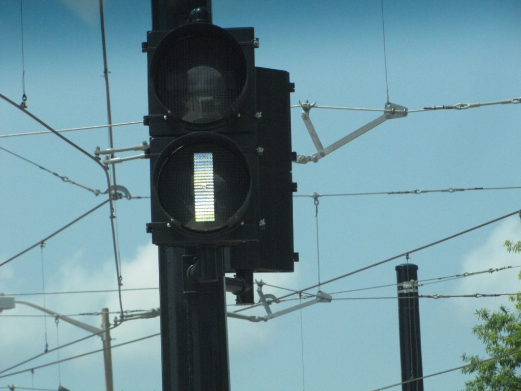
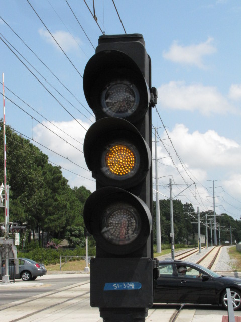
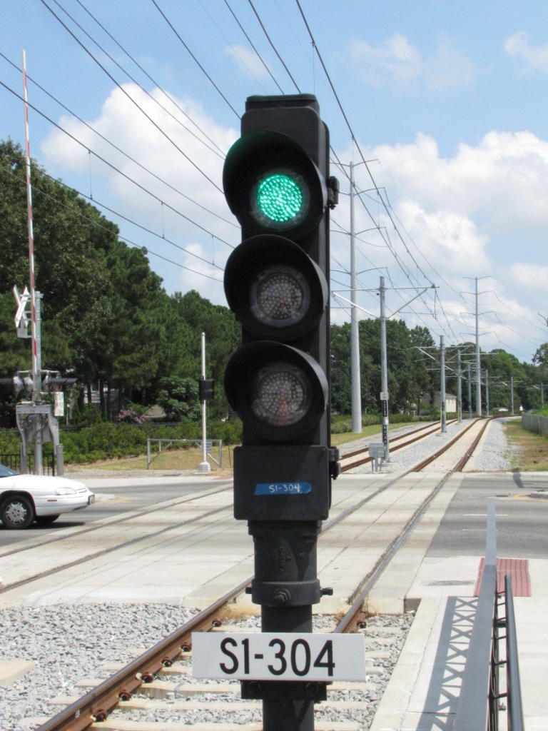
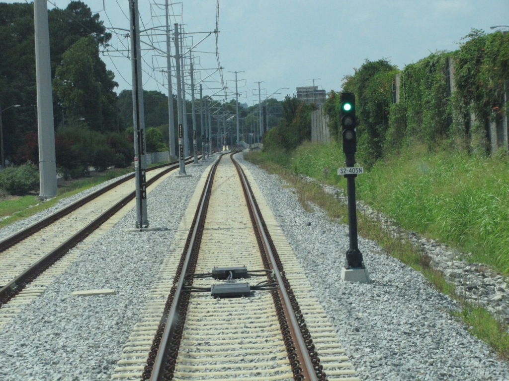
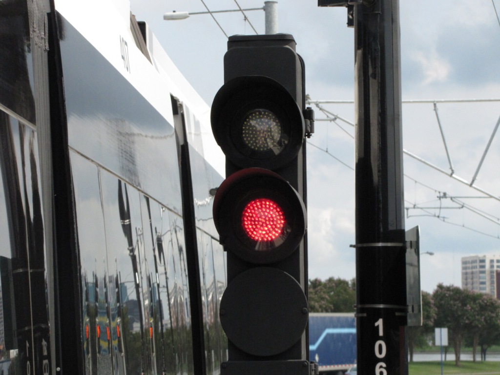
All mainline signals are three
aspect color light transit style signals except as noted below.
The signals follow standard railroad practice with red on the
bottom. Color light signals are used from Harbor Park east
to the end of the line, and the short section of the very west
end where it is separated from street traffic. These
signals are made by US&S.
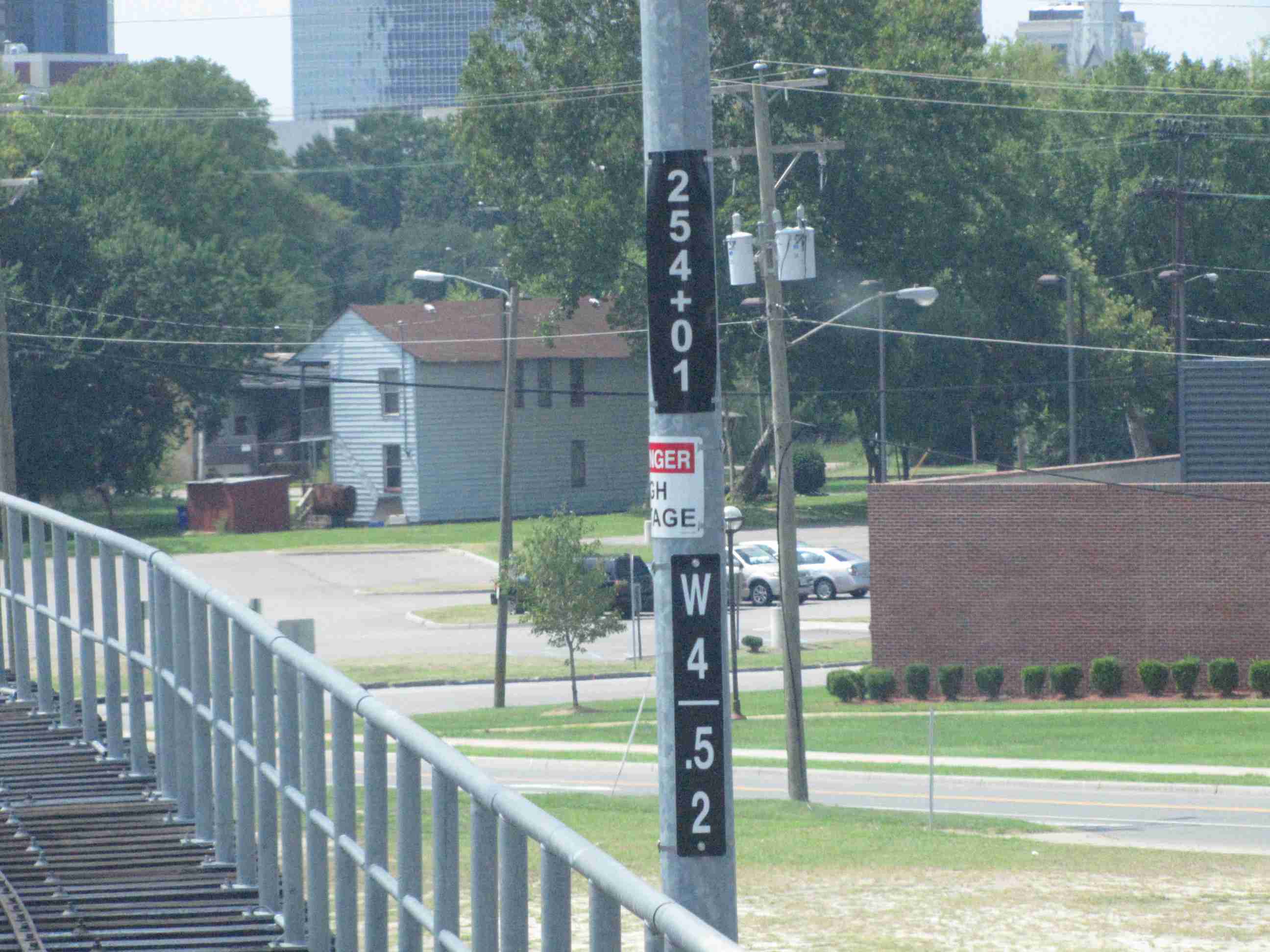
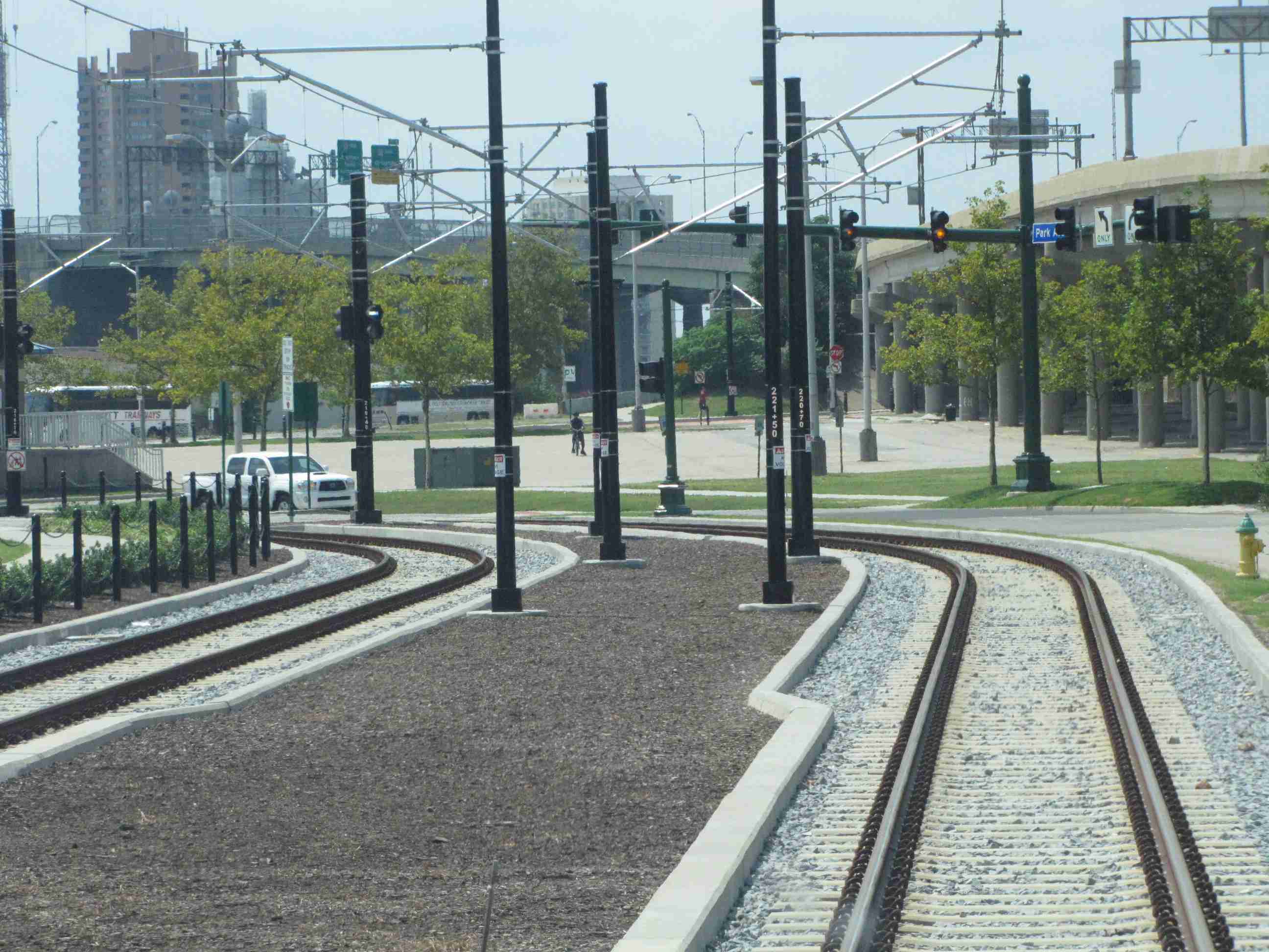
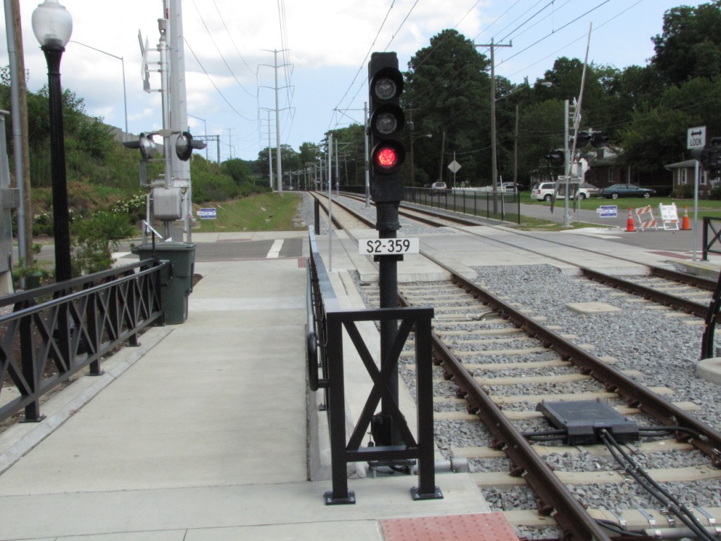
Standard intermediate signal between Broad Creek and Military Highway.
The R/Y/G color light exceptions are two aspect signals at the ends where the tails
are single tracks, and they use lunar/red signals to indicate
occupancy of the tail track. The only other place I saw a
two color L/R signal on the mainline was on the WB track before
a crossover adjacent to the shops, presumably for the same
reason as they are used at the ends (probably used when trains
exit the yard onto mainline - although I don't know why a
regular 3 aspect signal could not have been used). They
are used both on the mainline to control movements into the
tail, and in the station to control train movements out of the
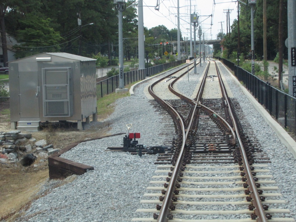
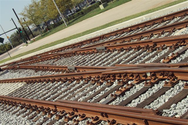
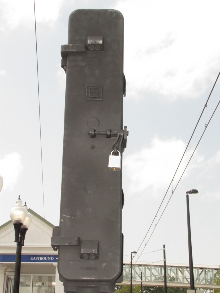
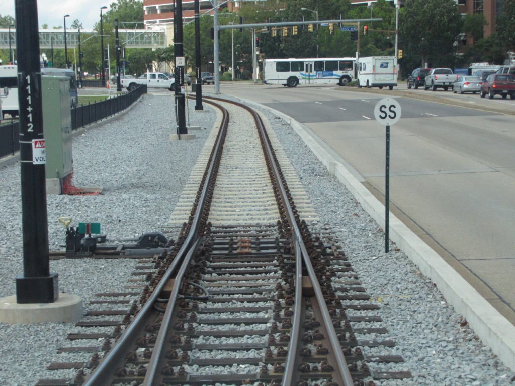
tails. Interesting note, the two switches used at either
end are spring switches. The spring can be clearly seen in
the photo below, as well as the "SS" sign. The spring
switches can be manually thrown so they can run "on the left
side".
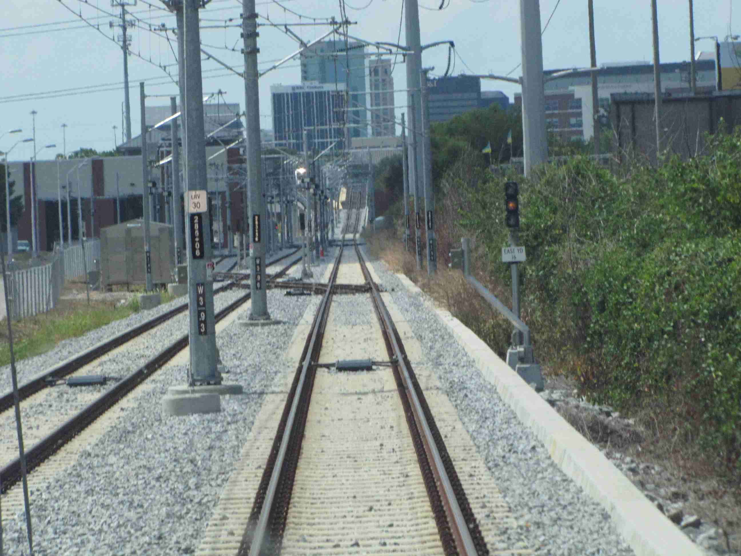
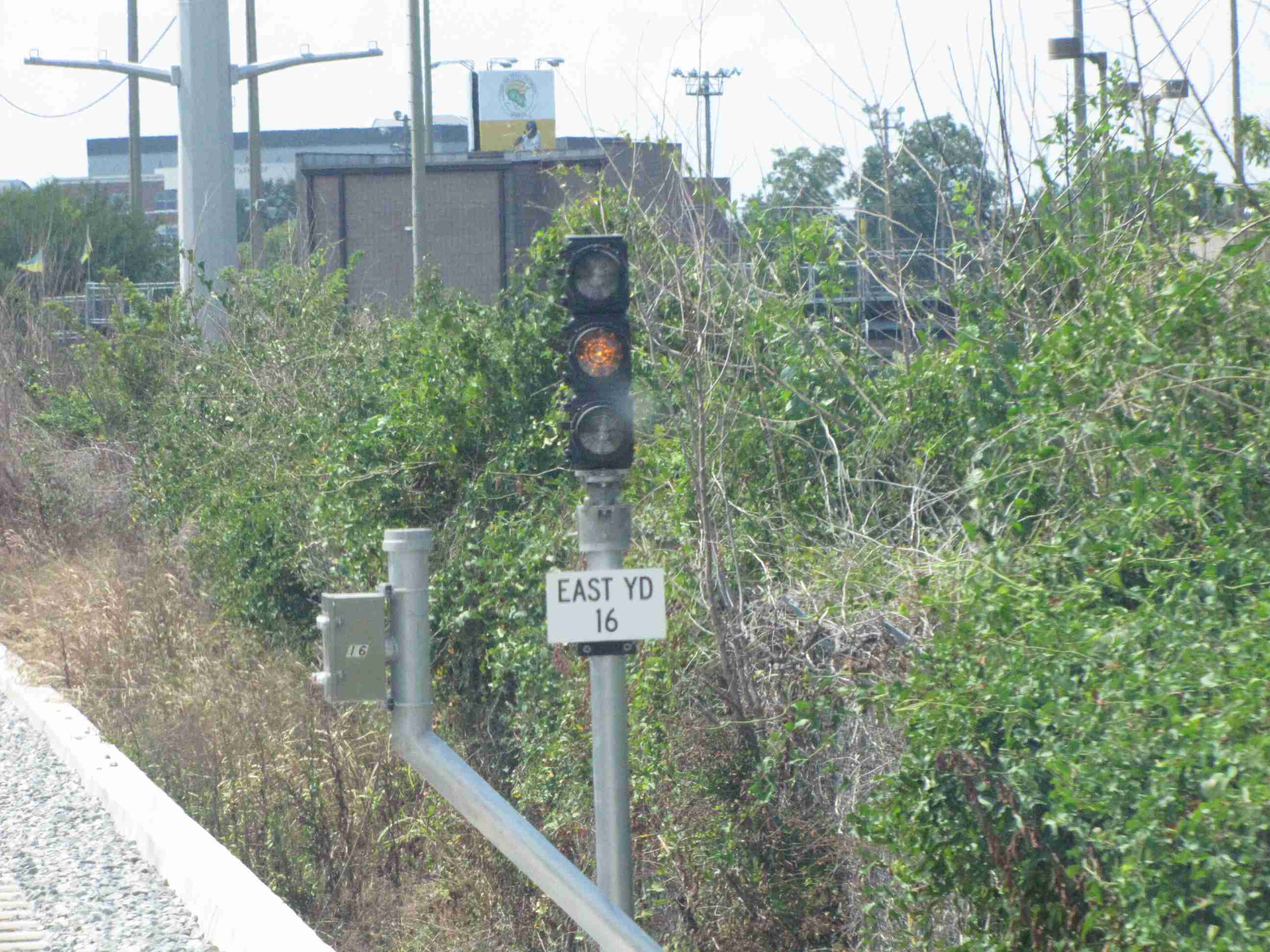
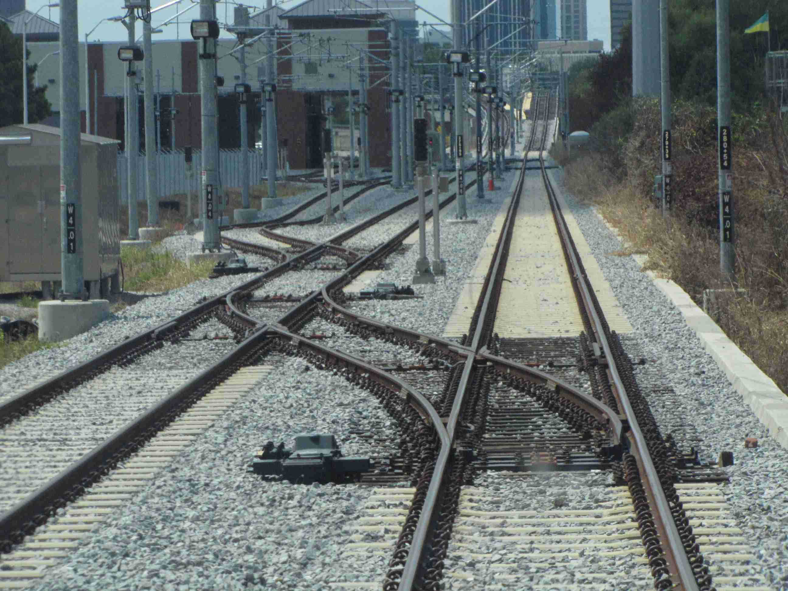
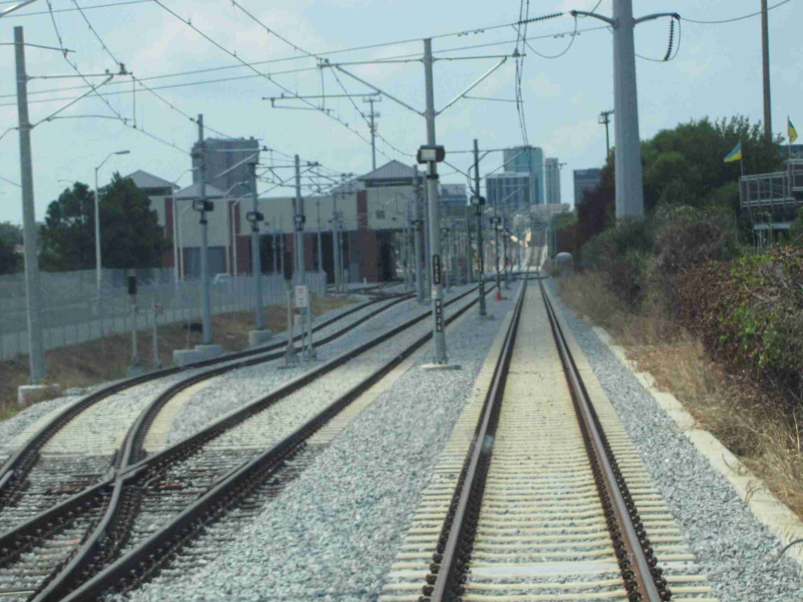
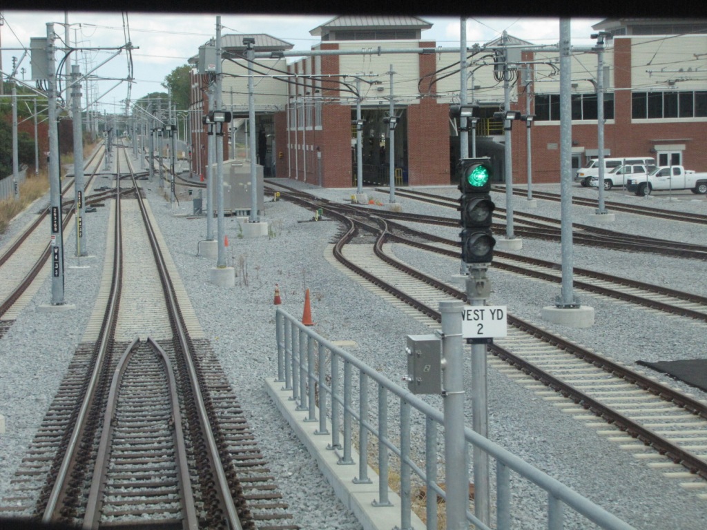
The few tracks in the yard
that are signaled use two aspect signals, and they are segmented
heads in contrast to the unibody styles used on the mainline.
They were all red when I went by, so I do not know what color
the non-red aspect is.... judging from the one on the mainline
tho, it is probably lunar. The pictures below are all in
the yard/shop area.
EB signal adjacent to the shops/yard
WB signals
At every grade crossing where there are crossing gates, the
operators also have a gate status indicator. These lunar
lights flash as the gates are going down, and go steady once
the gate is in the full down position.
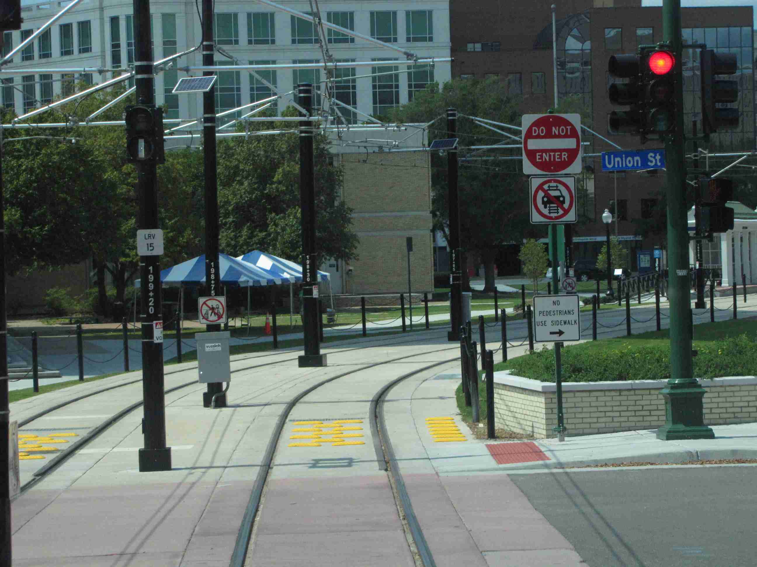
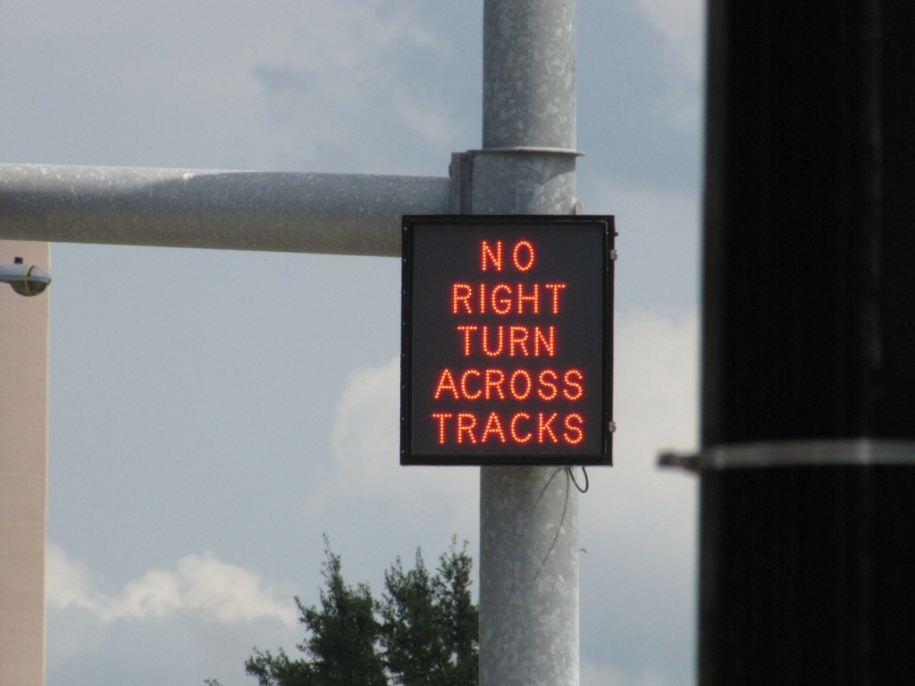
Where the trains mix with
cars, and the city does not want you to cross the tracks because
a train is coming, they use the following no turn signs.
Most are no left turn signs, with no right turn signs being used
at SB Ballentine Rd and at the EVMC station so EB Brambleton
traffic can't cross the tracks while turning onto Colley.
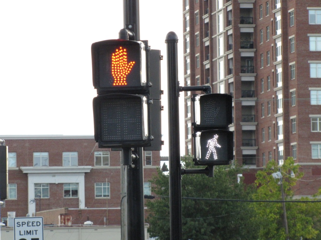
In a few places, HRT uses a
standard hand-man signal to instruct pedestrians as to whether
it is safe or not to cross the tracks. The picture below
shows one such a signal at EVMC, looking from Brambleton across
the tracks. The "hand" signal is for people crossing
Brambleton, and the "man" signal is telling people it is OK to
cross the tracks.
The Tide Hours of Operation:
-- 6am - 11pm (Mondays thru Thursdays)
-- 6am - 12 midnight (Fridays and Saturdays)
-- 11am - 9pm (Sundays and Holidays)
Service Frequency:
-- Every 10 minutes during rush hour
-- Every 15 minutes during non-rush hours
-- Every 30 minutes early morning and late at night
-- No hours are given on the website when the changes take place, or if the frequency is the same on the weekends.
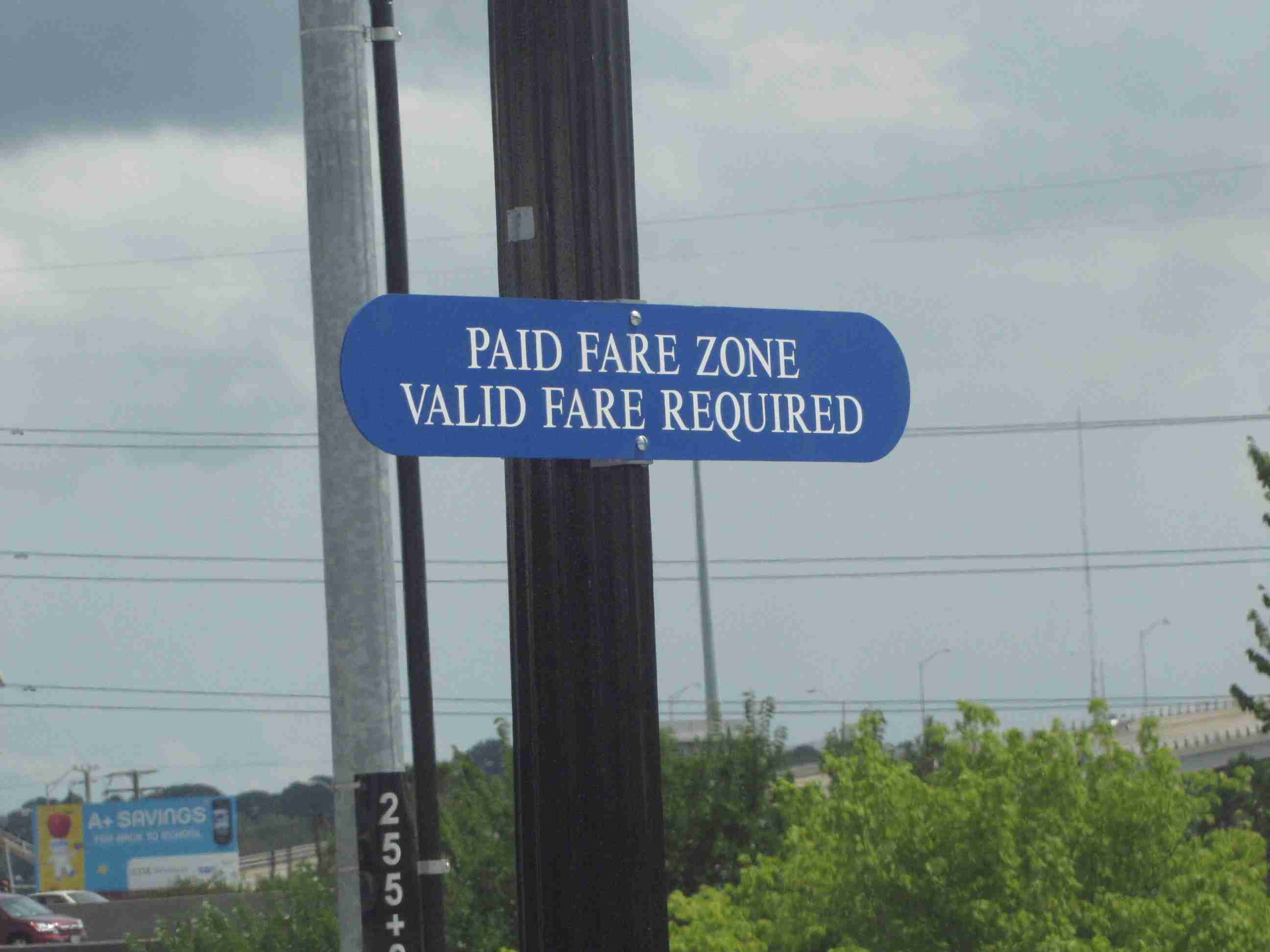
Fares:
-- $1.50 - One way, $1.00/under 18, $0.75/seniors/disabled
-- $3.50 - All day till 2am, unlimited rides, $1.75/seniors +
-- $17.00 - 7 day pass
-- $50.00 - 30 day pass, $35.00/seniors +
-- Tickets are good on both light rail and busses
-- Bundled and 7/30 day tickets can be purchased at HRT transfer centers and selected retailers
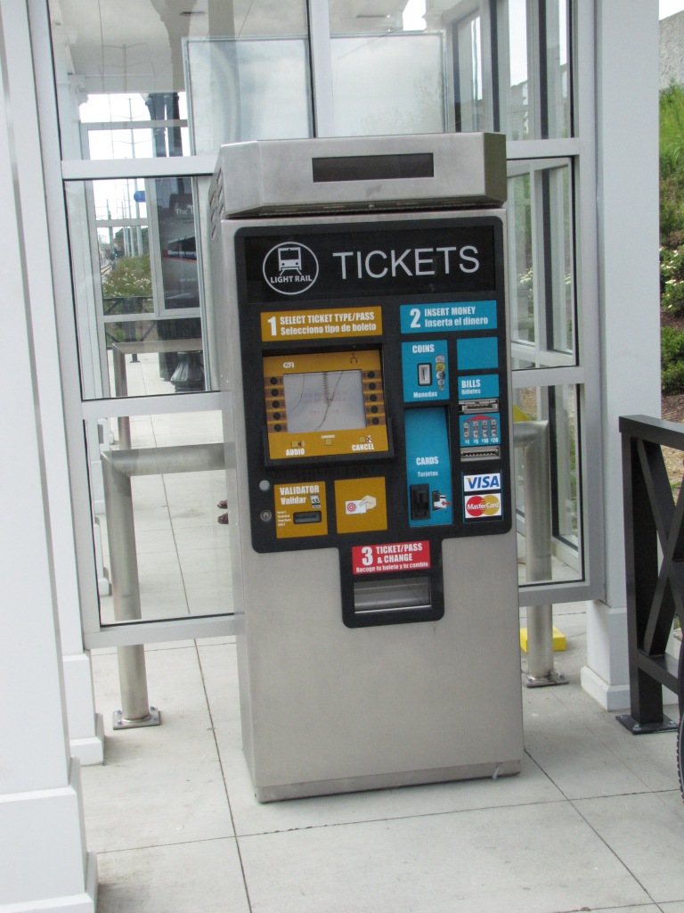
A TVM - Ticket Vending Machine
Costs:
-- $338 million/construction cost
-- $201 million came from the Federal Transit Administration
-- $71 million came from the State
-- $66 million came from the city of Norfolk
-- $6.2 million expected costs per year
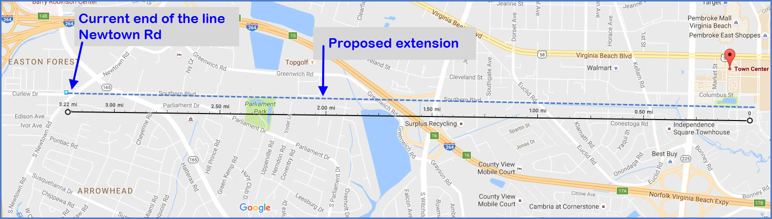
-- $800 million, projected cost to expand to Virginia Beach (Why so much???)
Notes:
-- Tramsworld.com states the expansion to VB would be feasible if it attracts enough customers, but no L/R
system in America yet pays their way :-)
-- The Richmond Times-Dispatch has comments on one of their
blogs to the effect that at 3000 riders a day, they would have
to charge $18 per ride just to pay for the interest on the
money, and another $7 per ride to pay for the annual costs.
It is also stated, that to pay back the Chinese" (for example)
who are buying the federal 20 year bonds to pay for the
construction at 4.26% interest, the interest alone on that money
will cost $14M, or $55,000 a day.
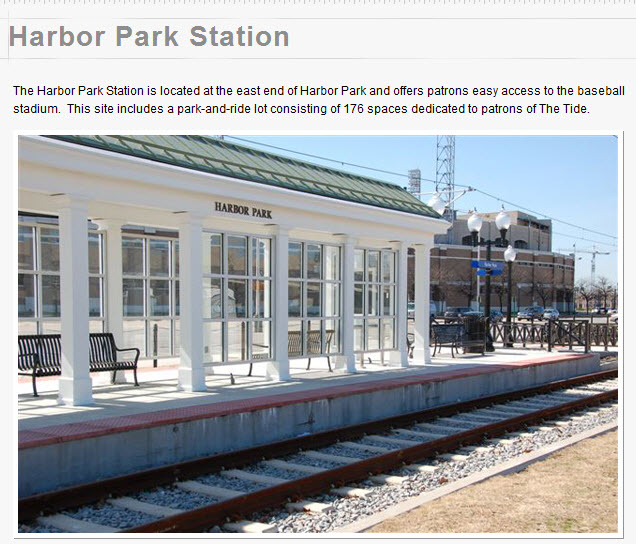
A good size crowd, but then, they have 176 parking spots here.....
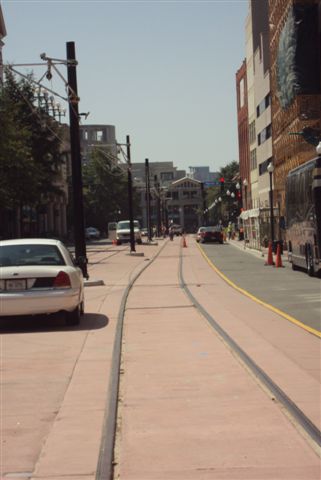
West of here, you start getting a lot of the brick inlaid
medians strips, and BAR signals start.
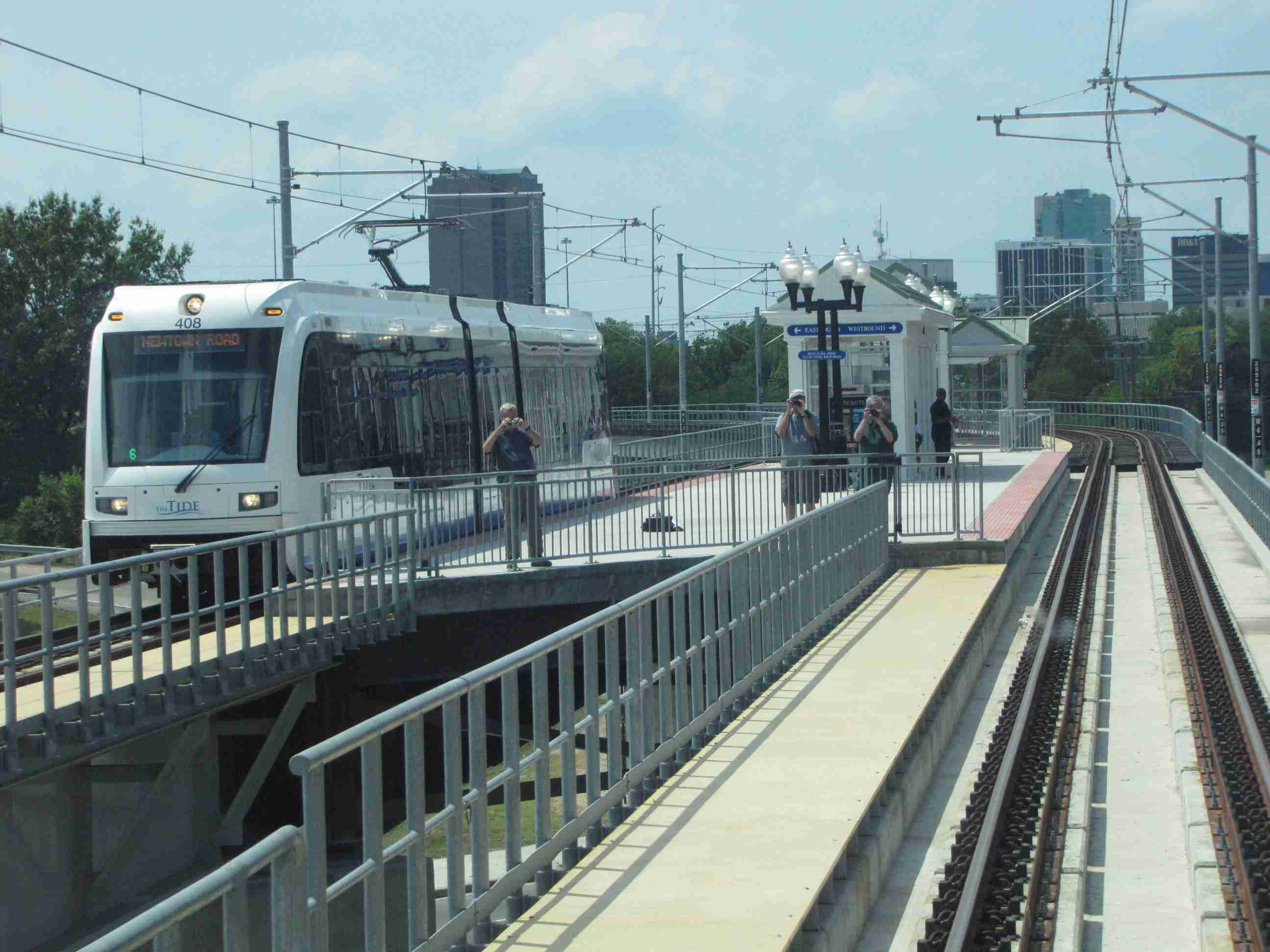
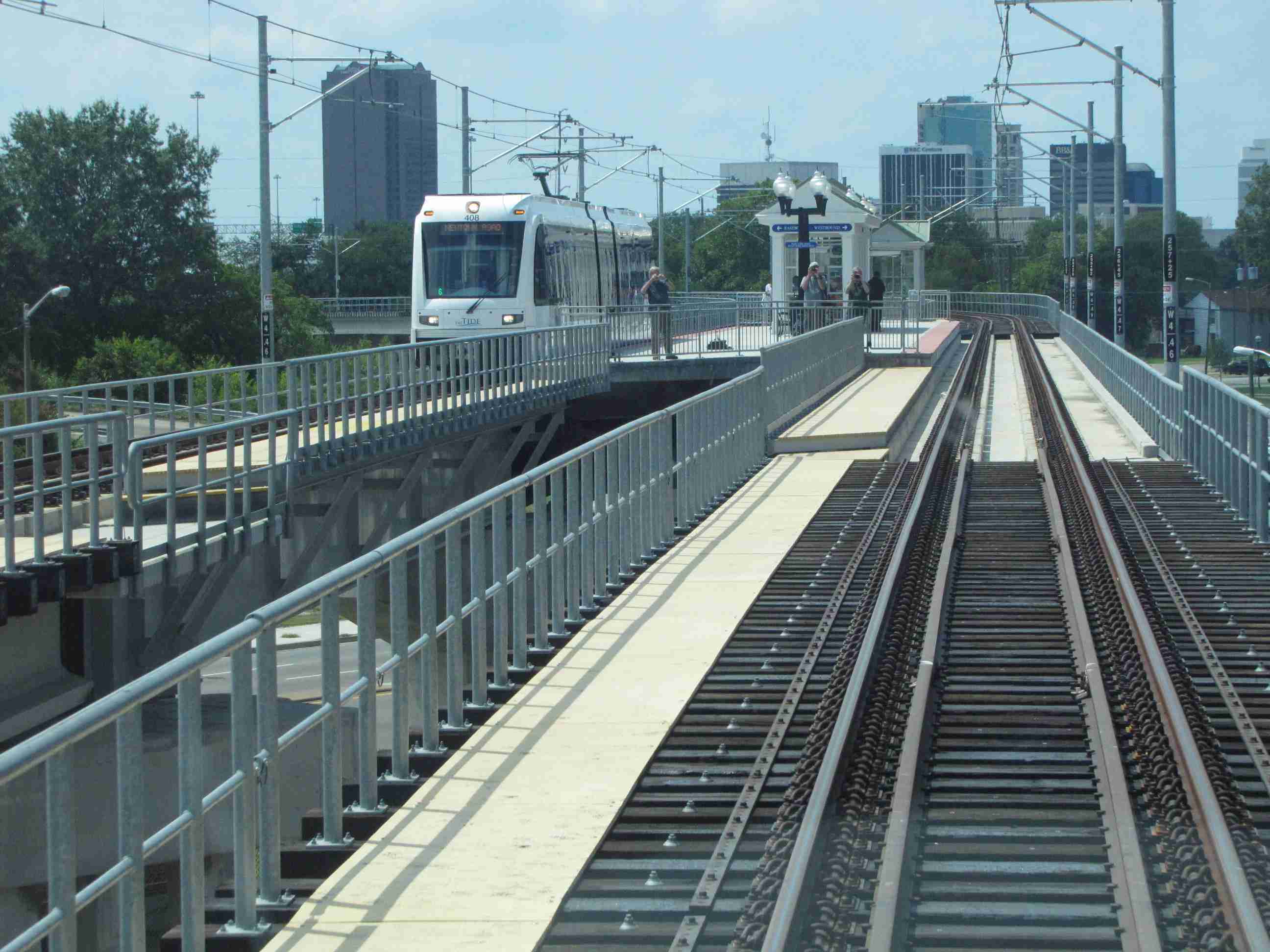
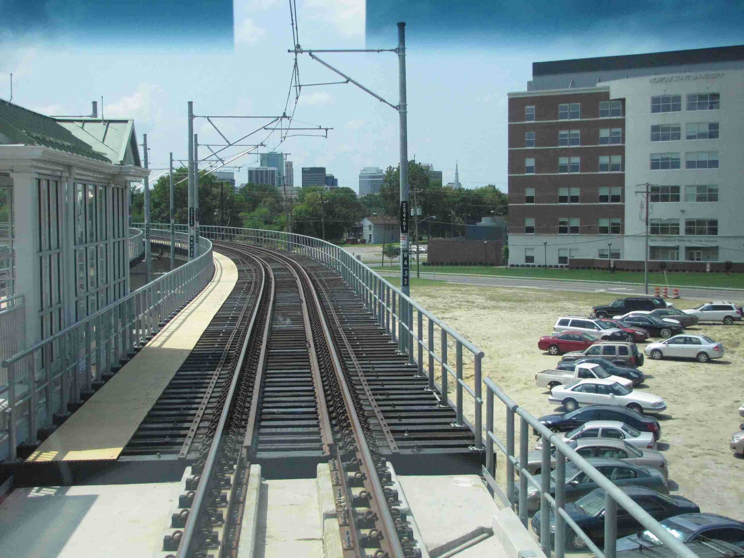
NSU
Looks like the NSU station was popular with the railfans... of which, BTW, I didn't really see many of!
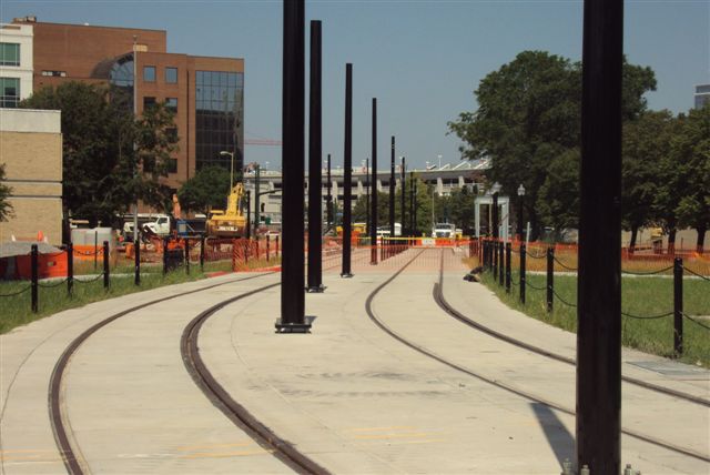
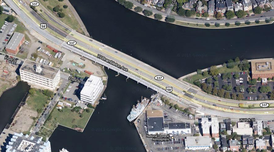
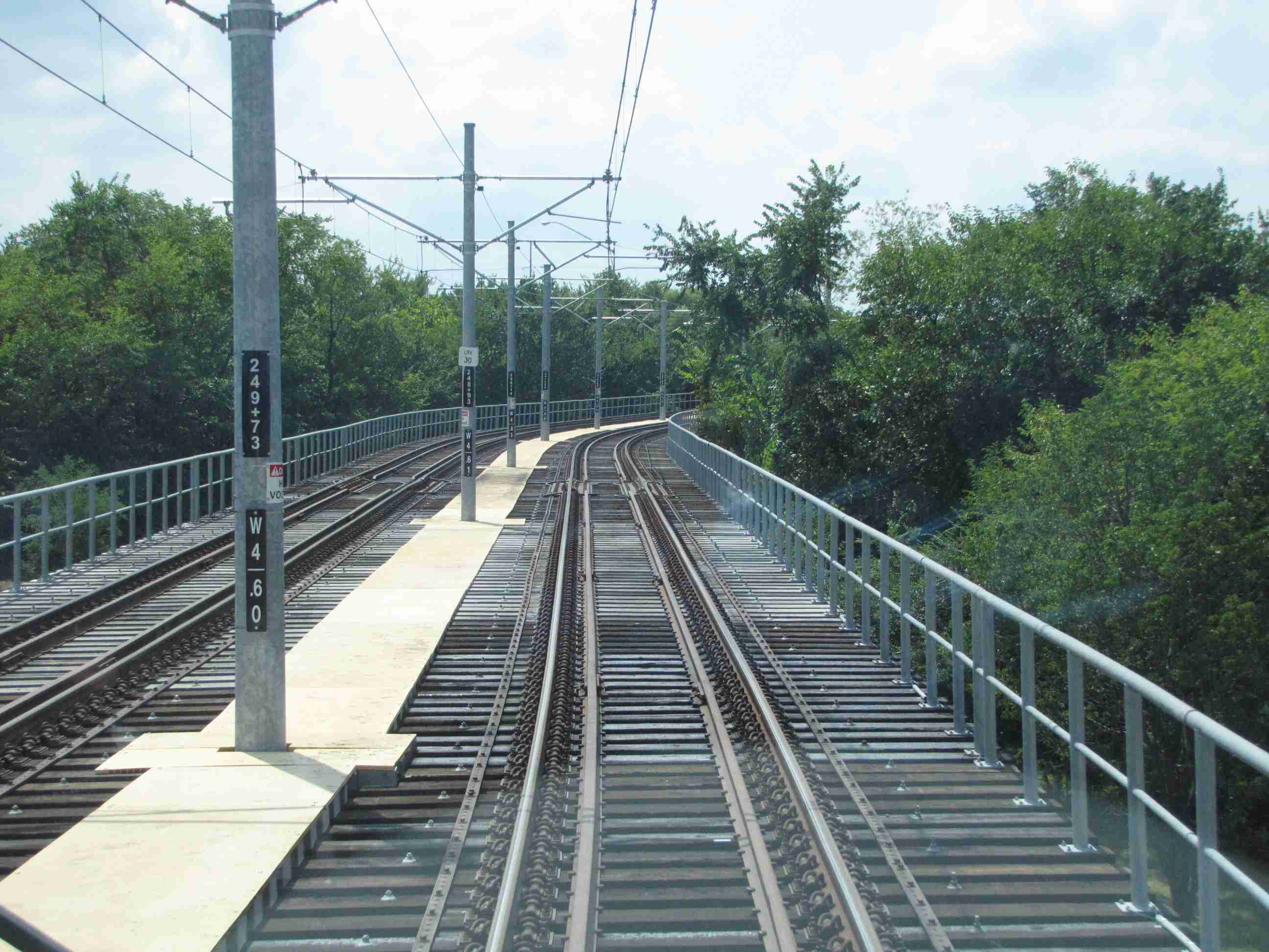
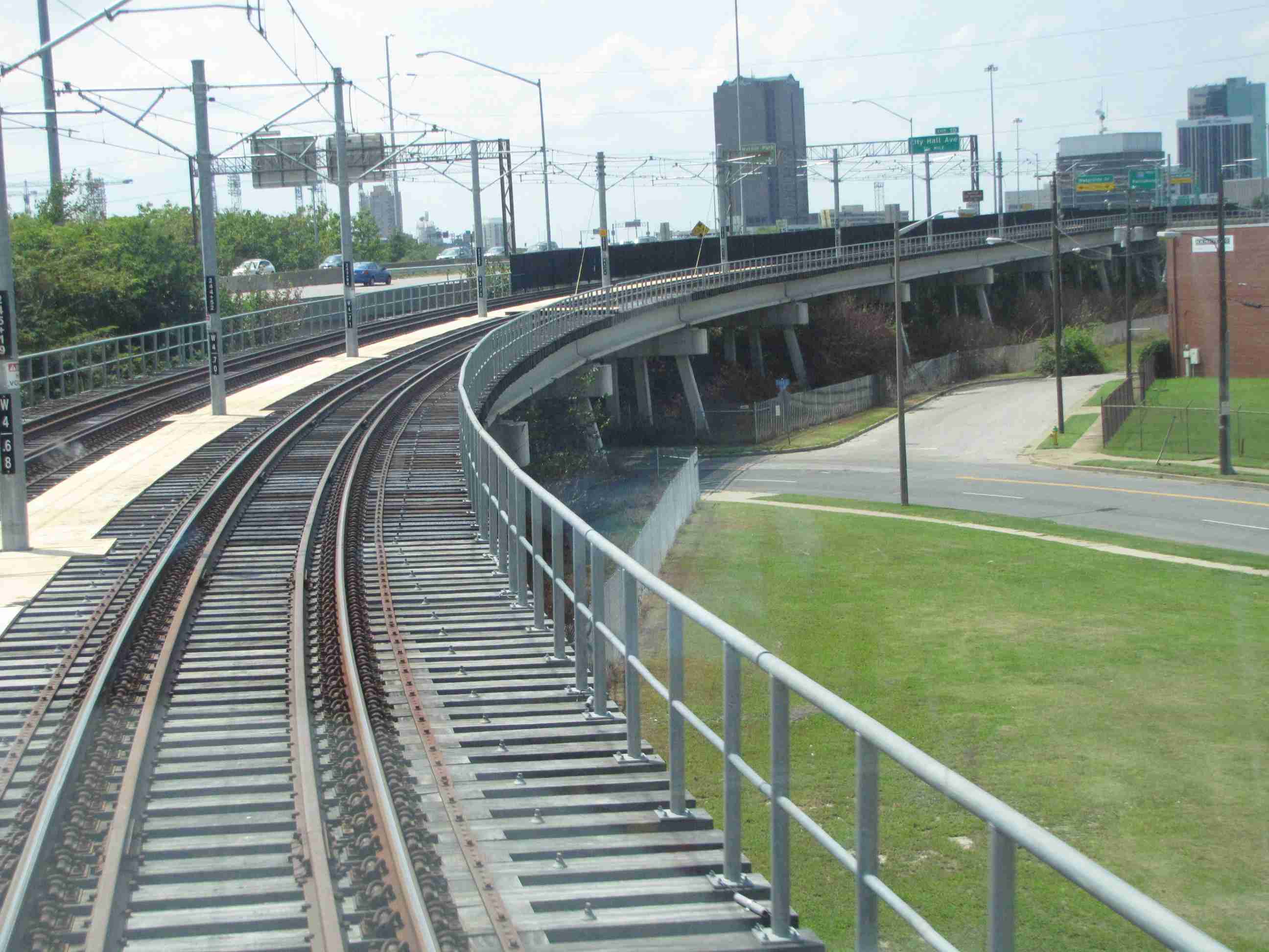
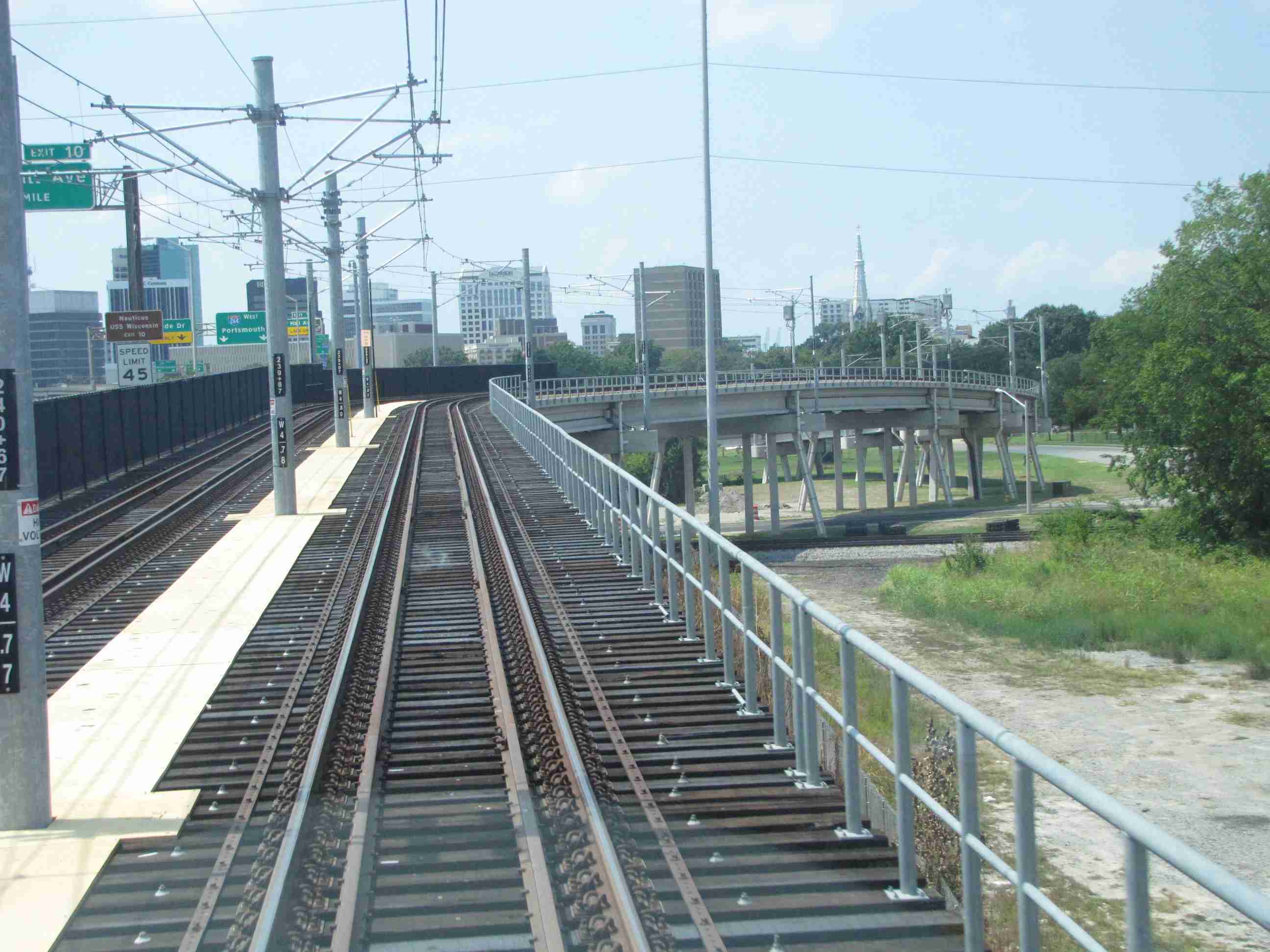
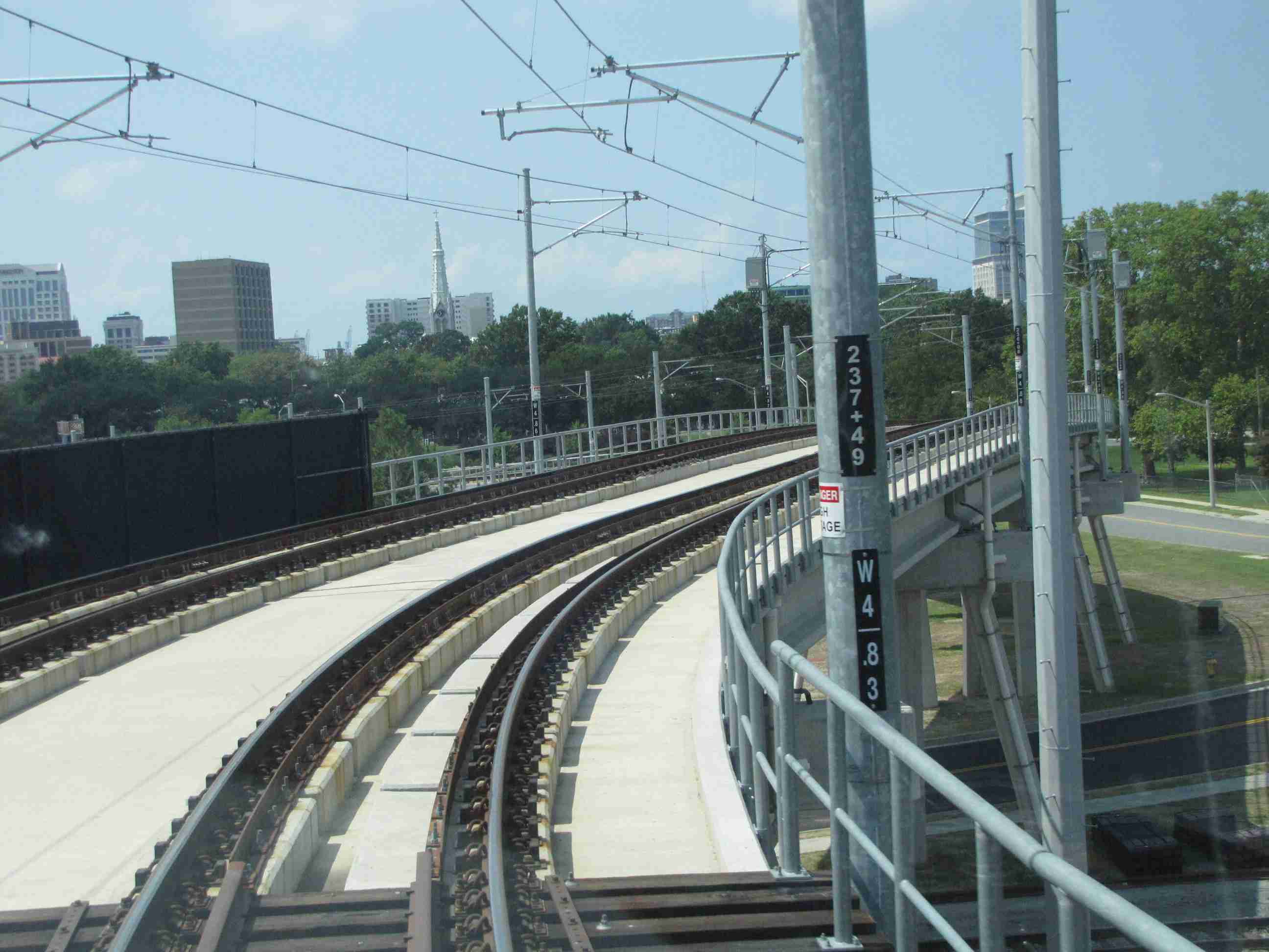
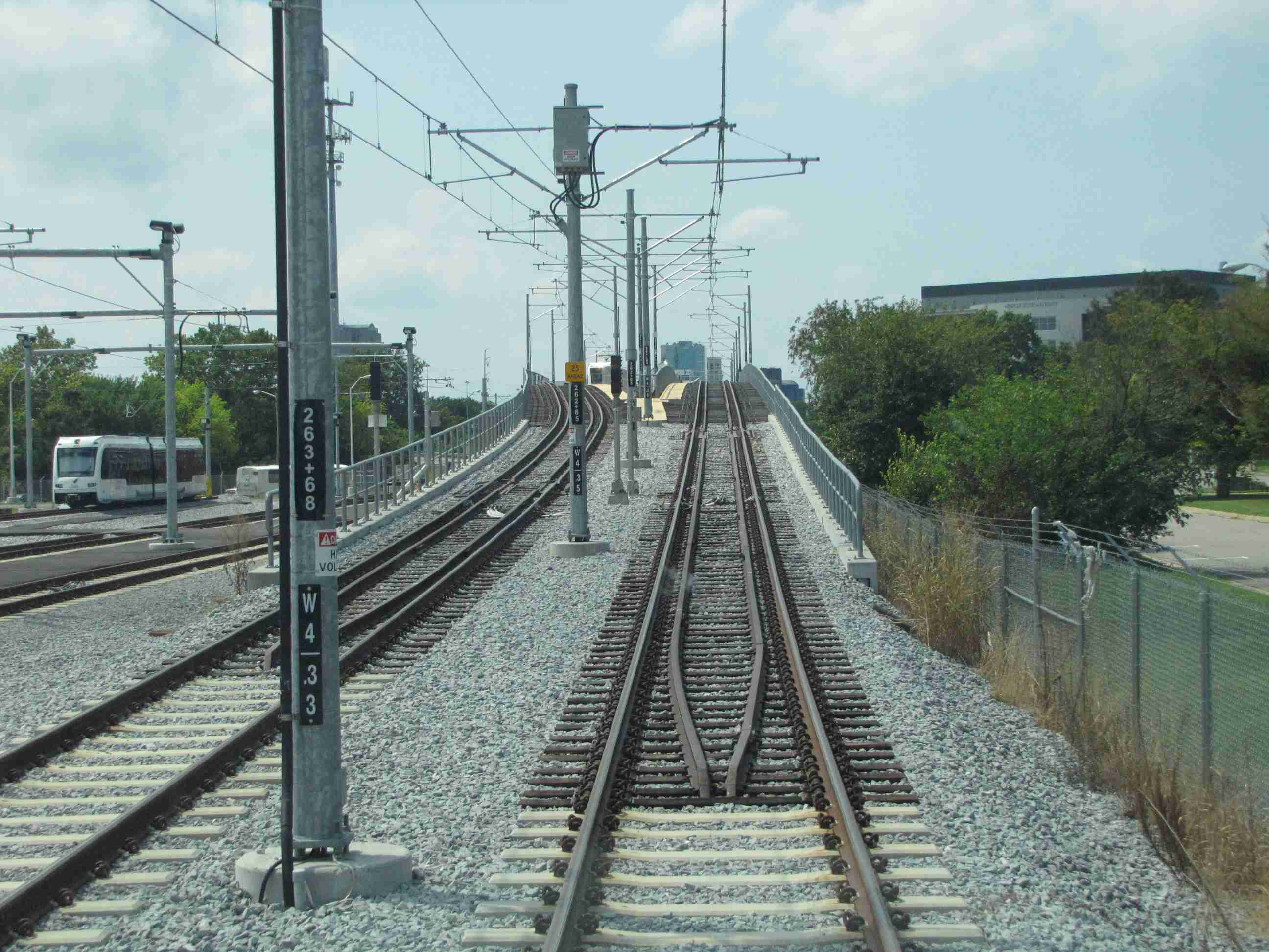
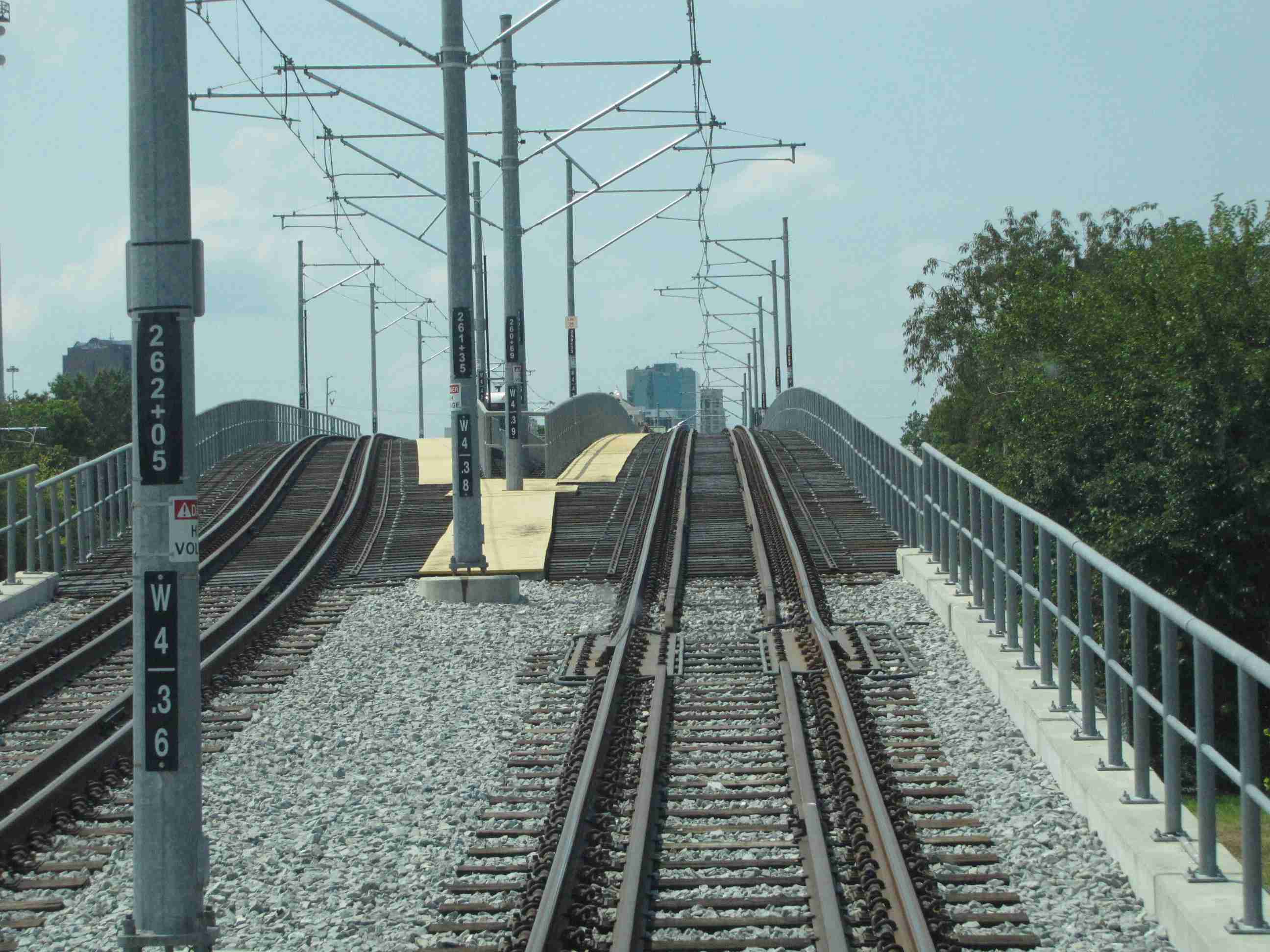
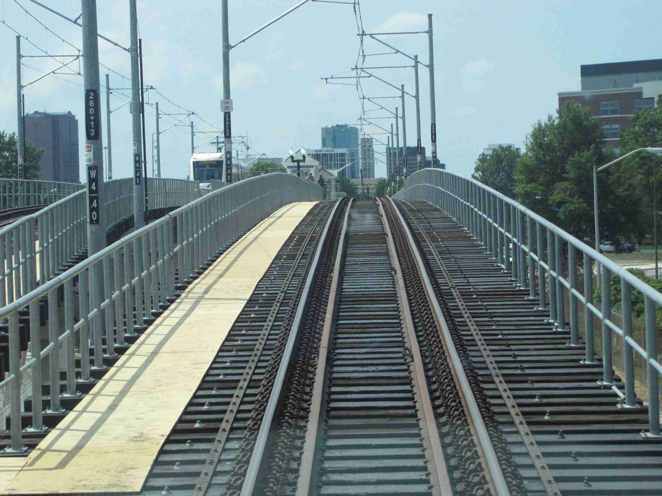
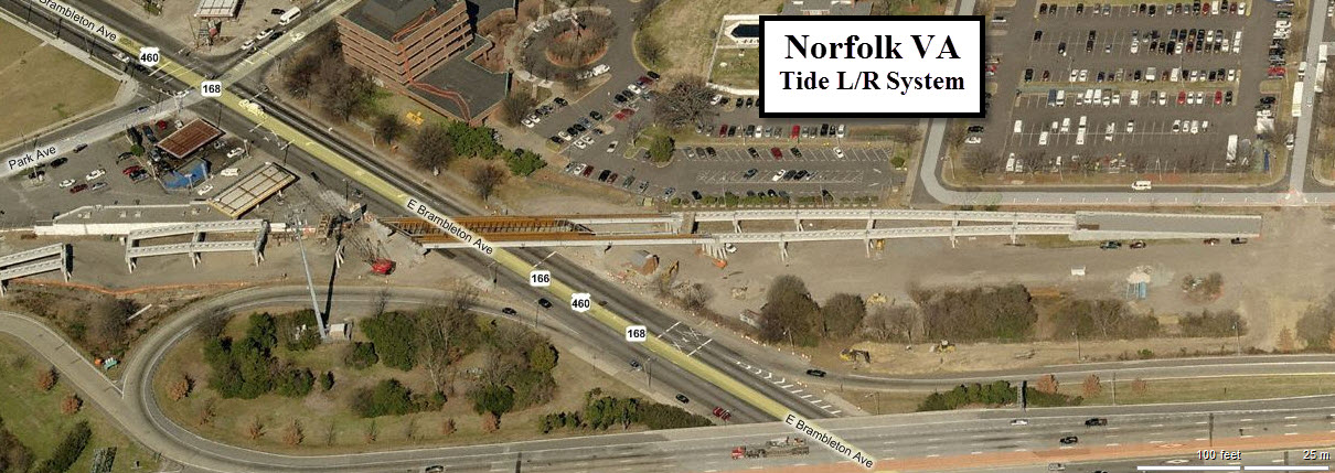
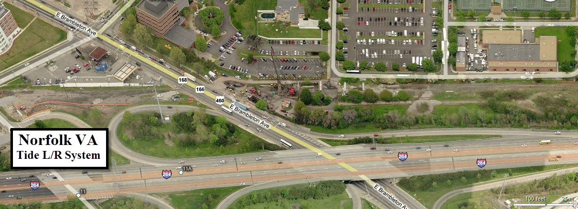
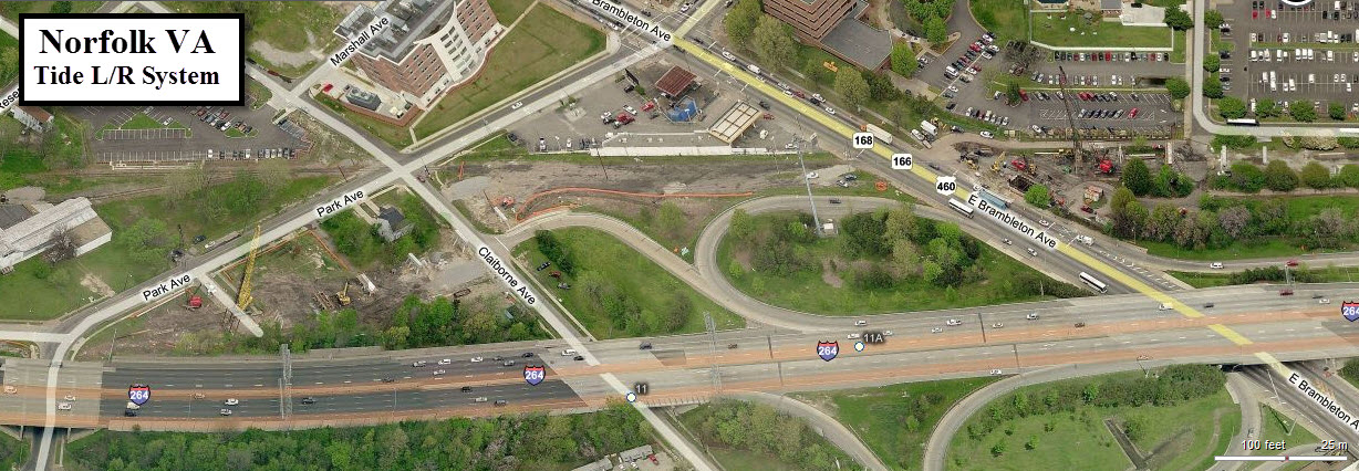
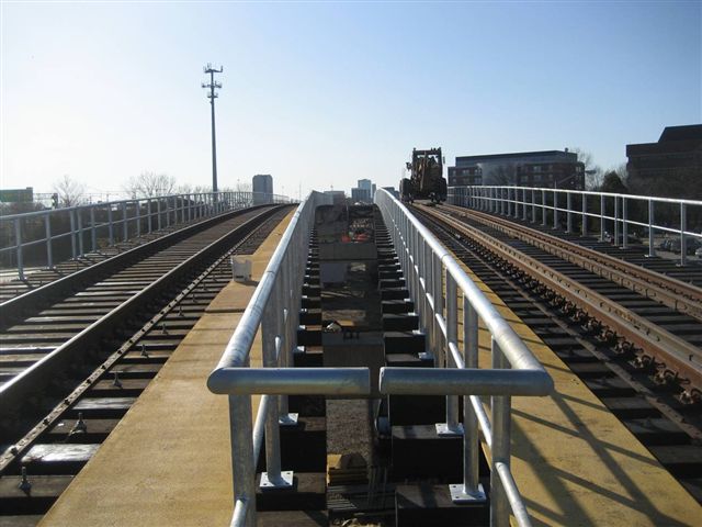
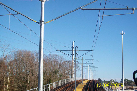
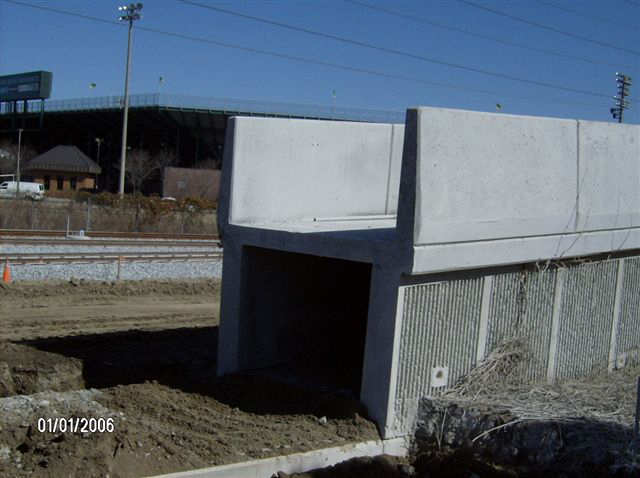
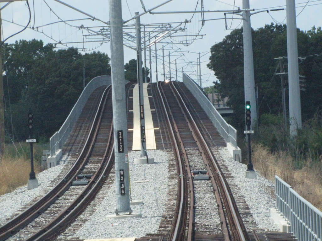
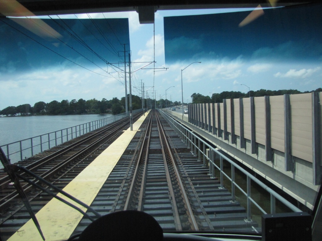
the Viaduct
Across the viaduct and "down" on the western side, going WB from left to right.
Pictures of the viaduct, again, a westbound progression of pictures, going "up" and to the NSU station.
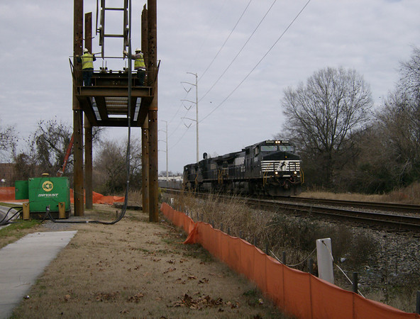
Going across the viaduct also takes us across another set of Norfolk Southern tracks.
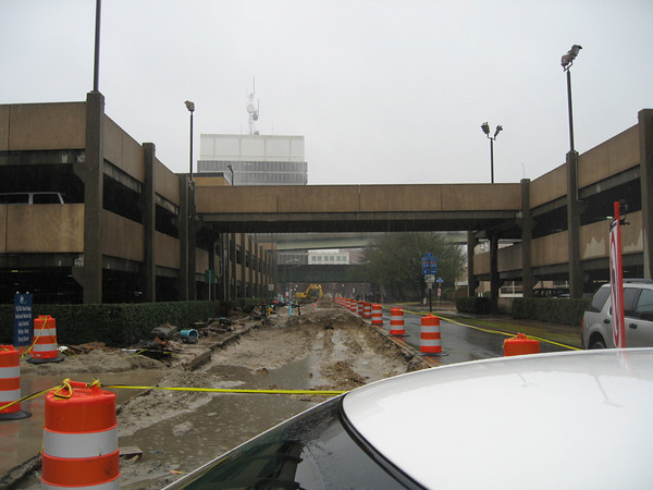
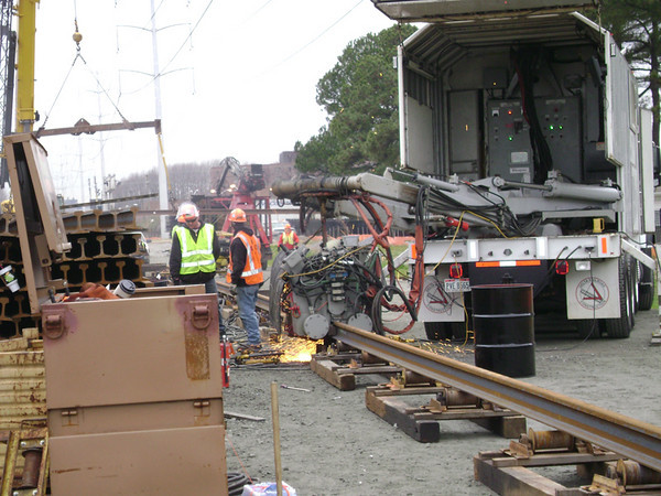
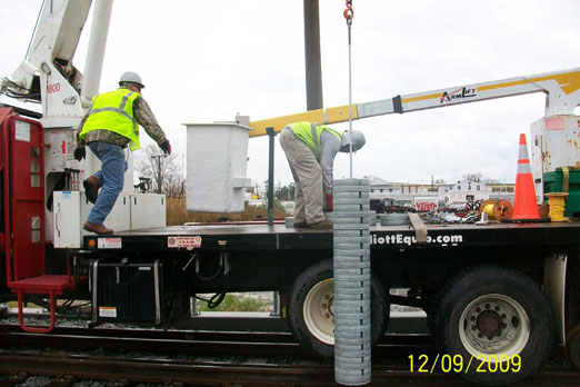
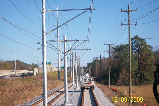
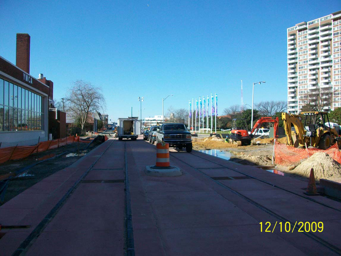
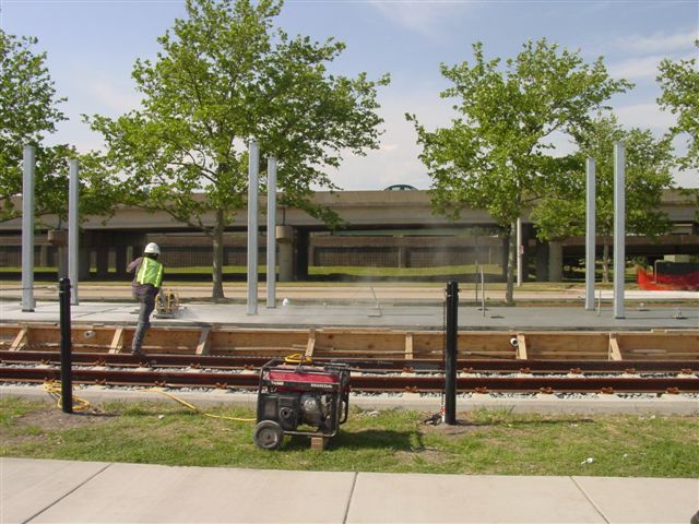
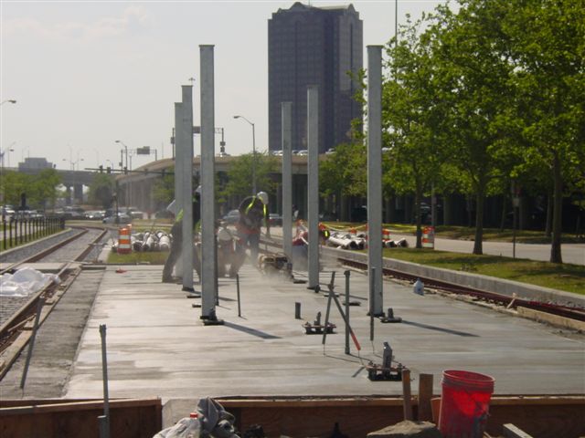
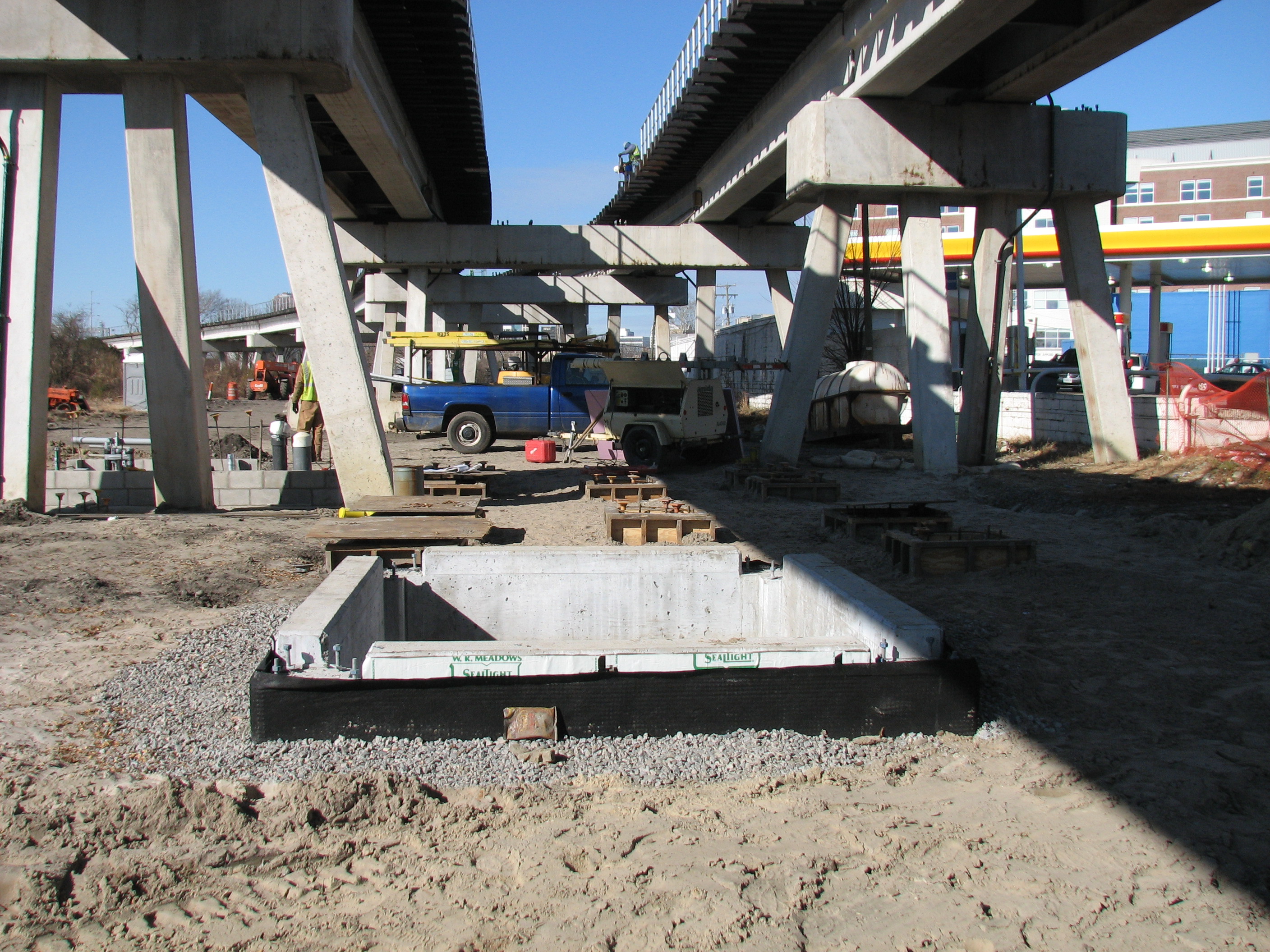
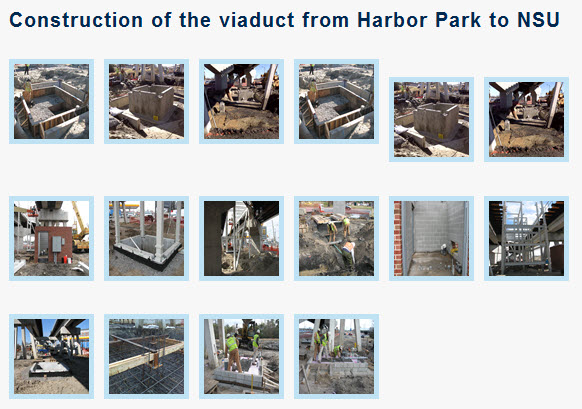
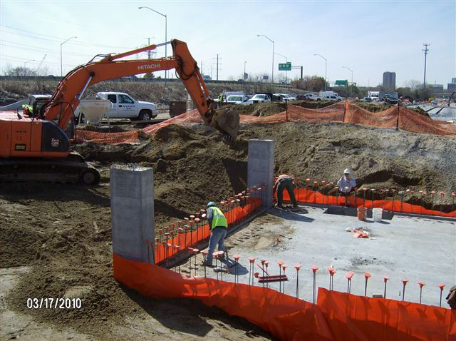
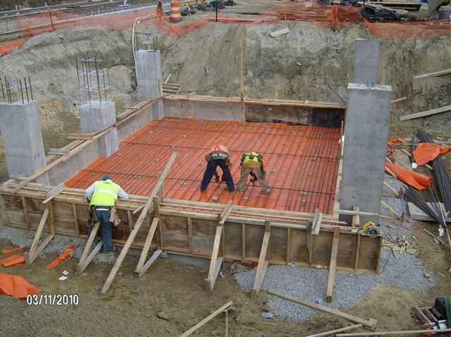
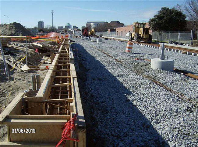
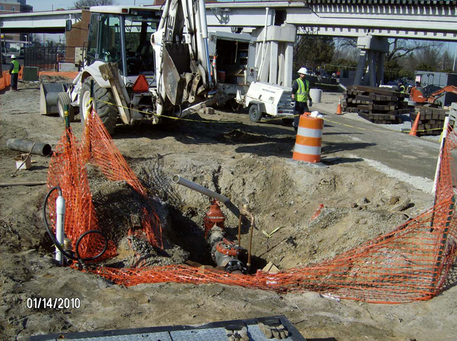
Aerial shots of the viaduct construction from www.bing.com/maps.
Additional HRT pictures of the construction.
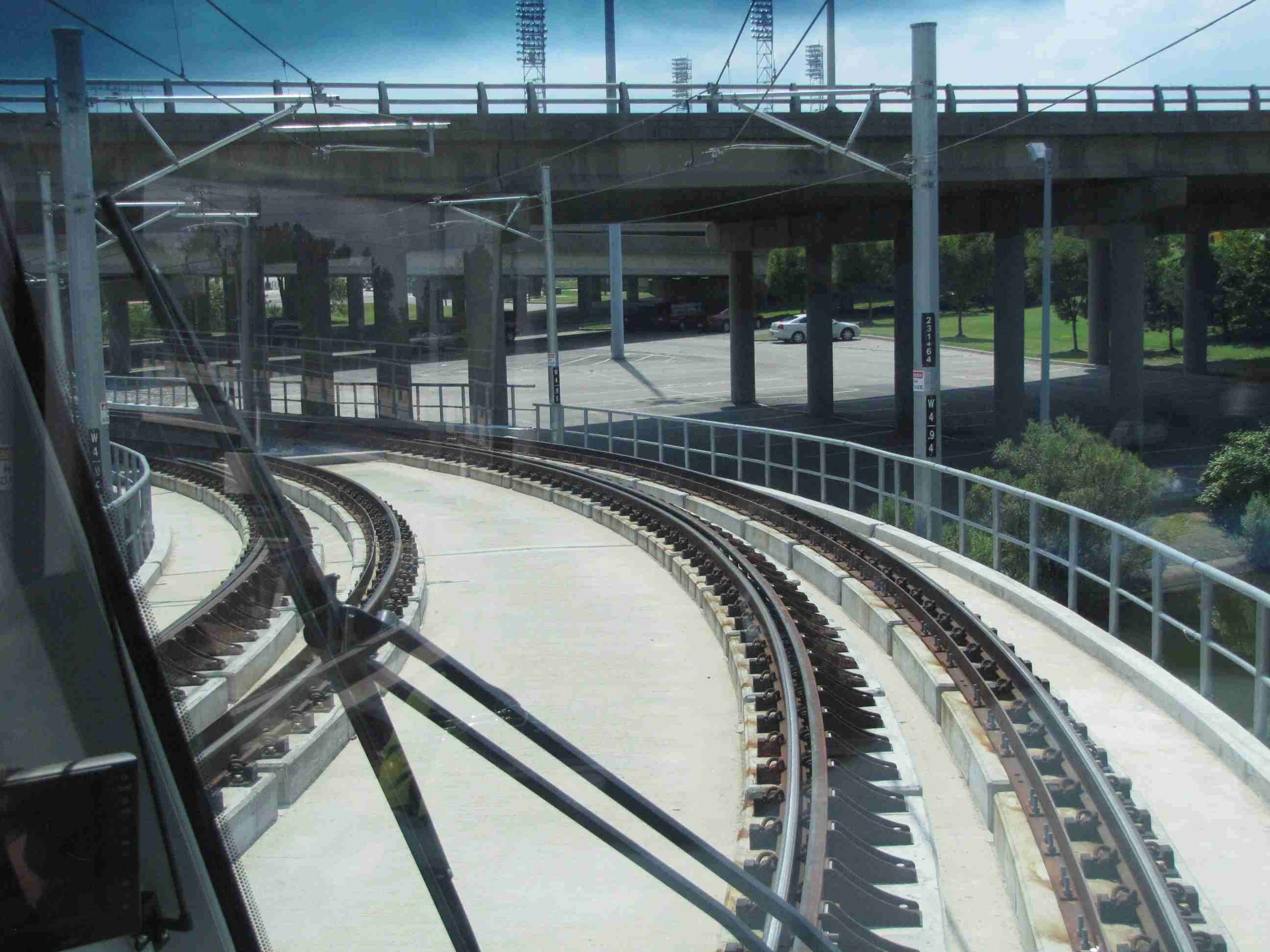
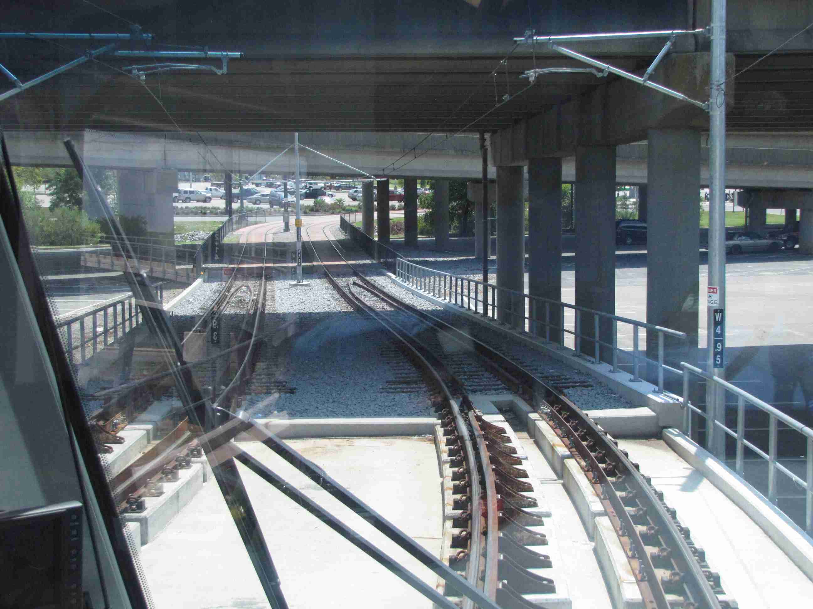
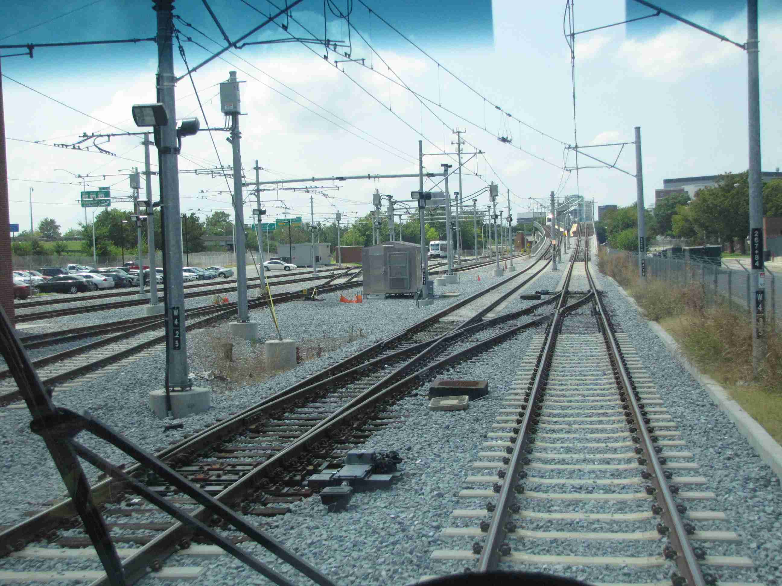
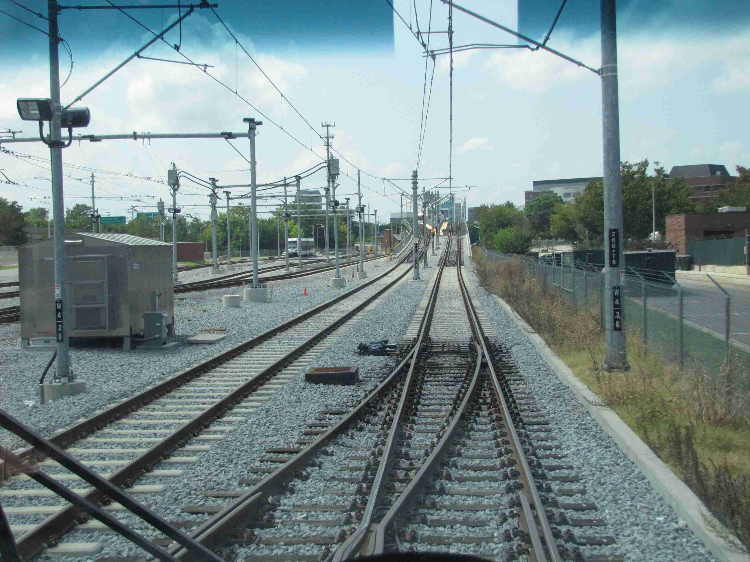
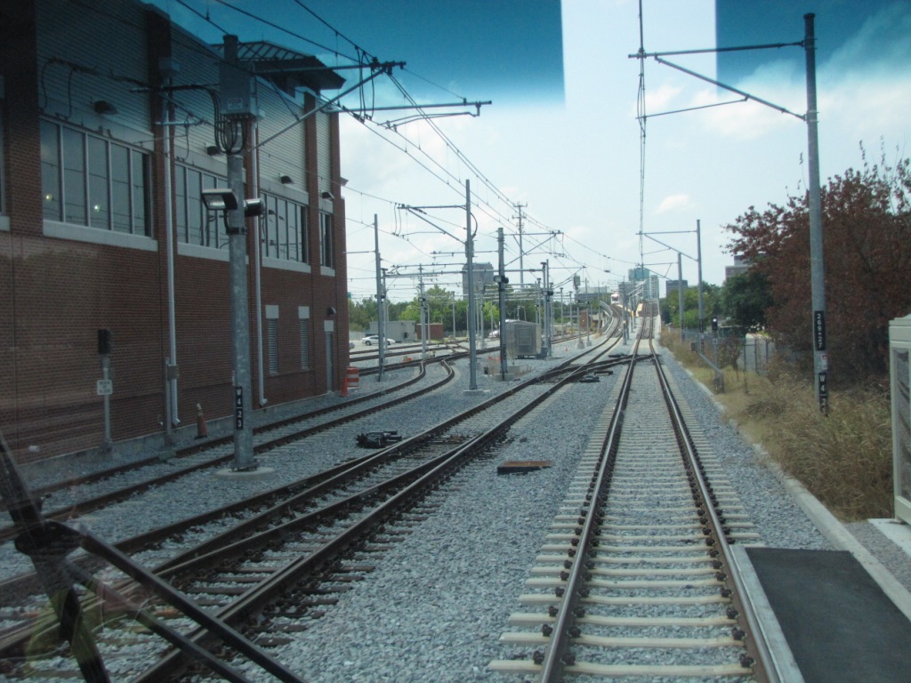
At the Shops
A westbound "drive-by" of the shops, left to right.
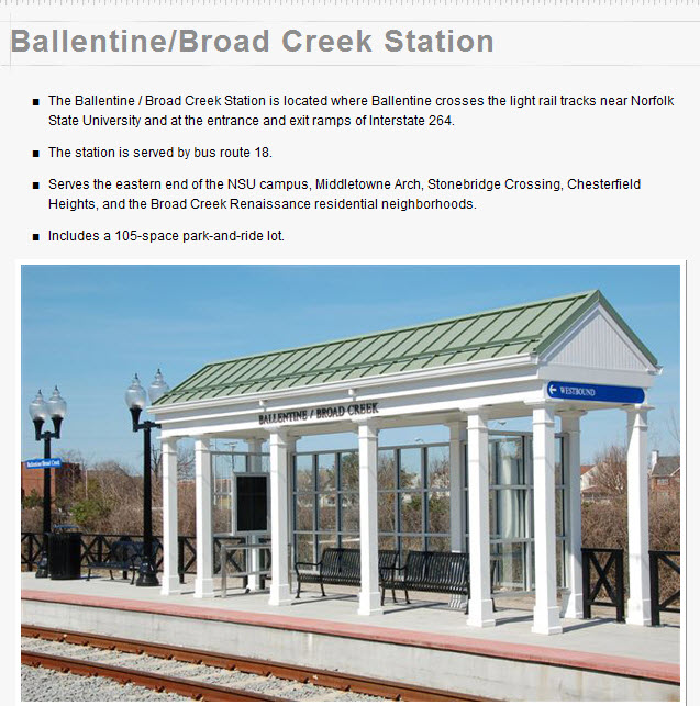
Ballentine / Broad Creek
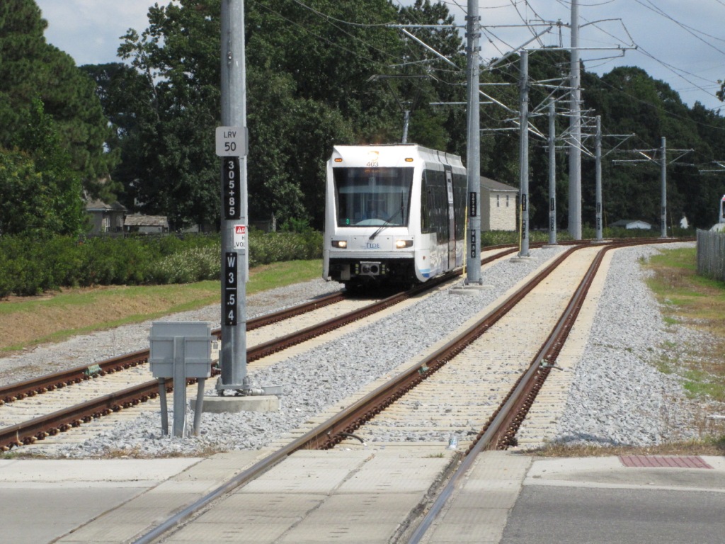
NB #403 coming into the Ballentine Station.
Over the Norfolk Southern
On the western side of the overpass is an interchange track with the NS, as seen in the right photo.
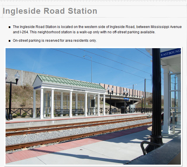
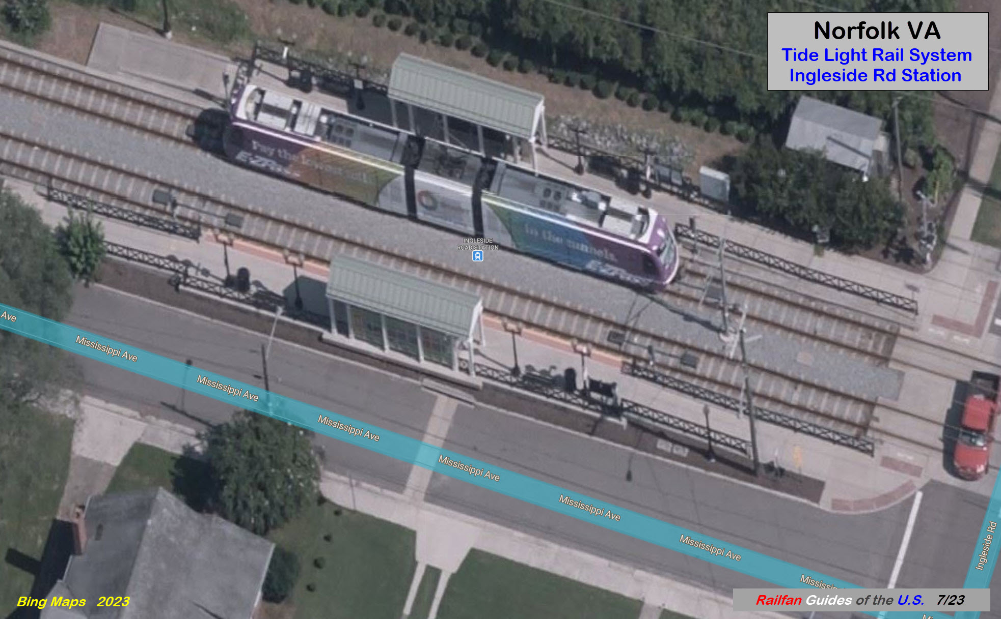
Ingleside Road
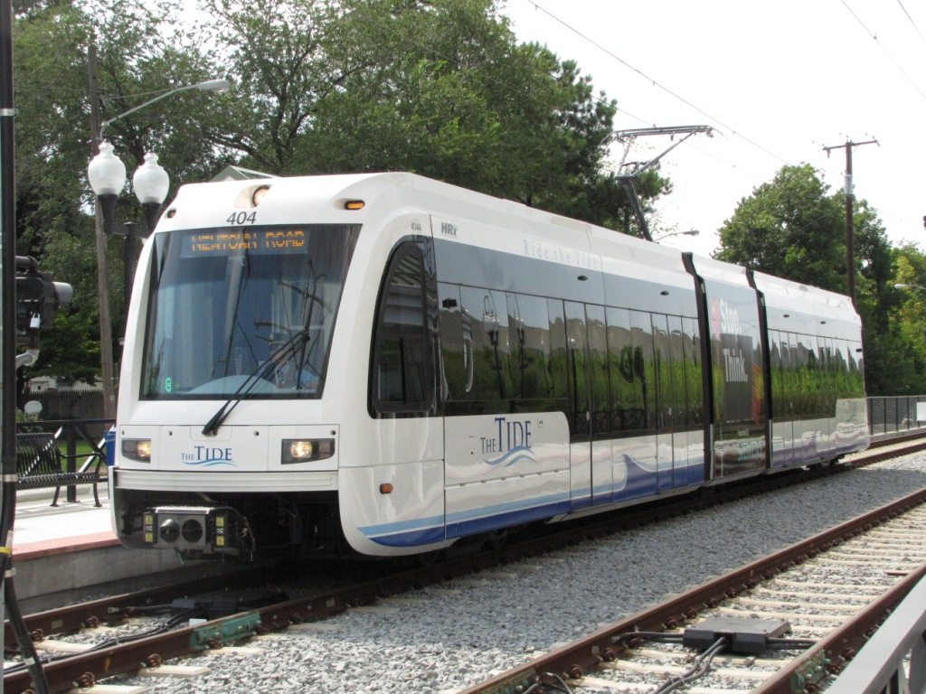
EB #404 at Ingleside, articulated section has
a "stop and think" safety message.
EB #401 at Ingleside, blank articulated section.
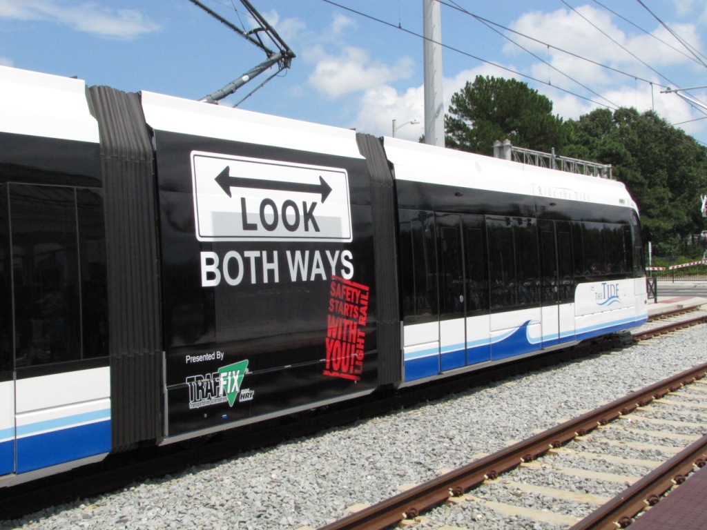
Articulated section with a "look both ways" safety message.
Across Broad Creek
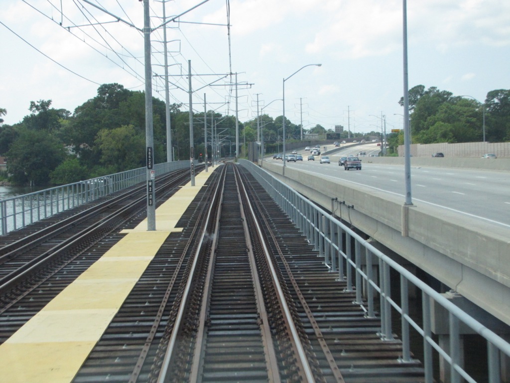
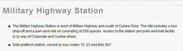
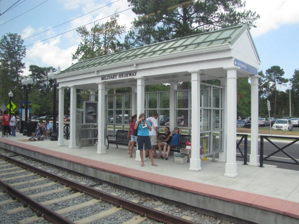
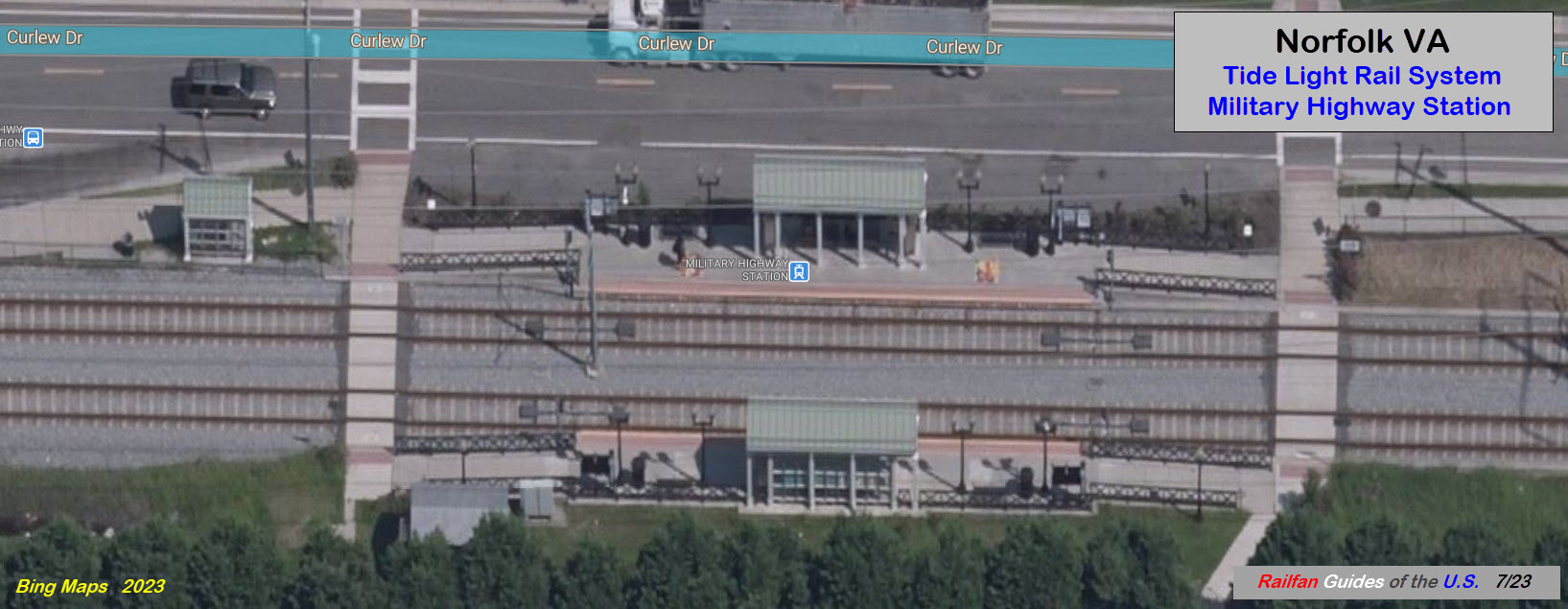
Military Highway
Approaching the Military Highway station, the grade crossing lights are very visible!
Upon leaving Military Highway, the distant LED signals are
easily discernable even on this bright sunny day.
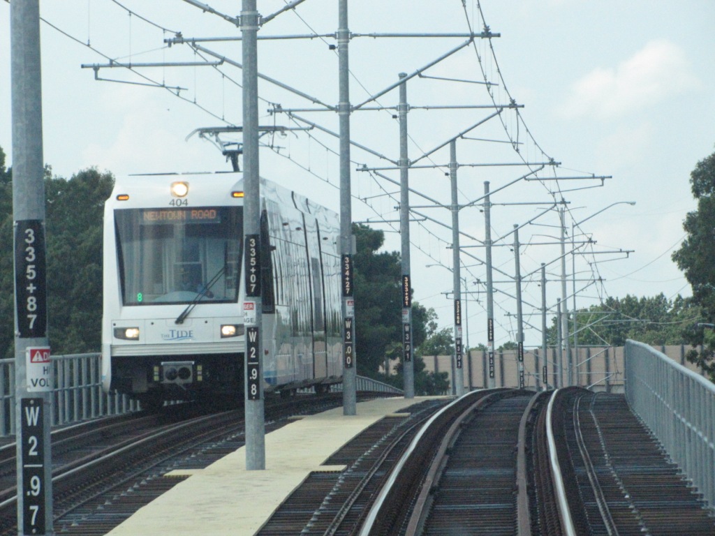
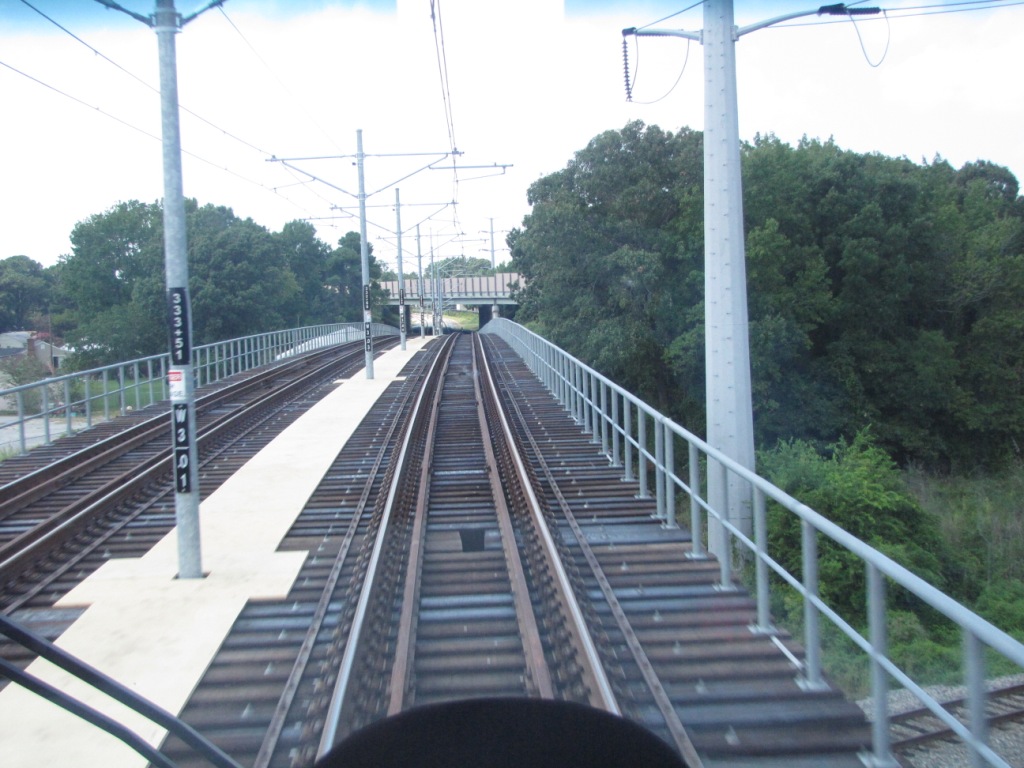
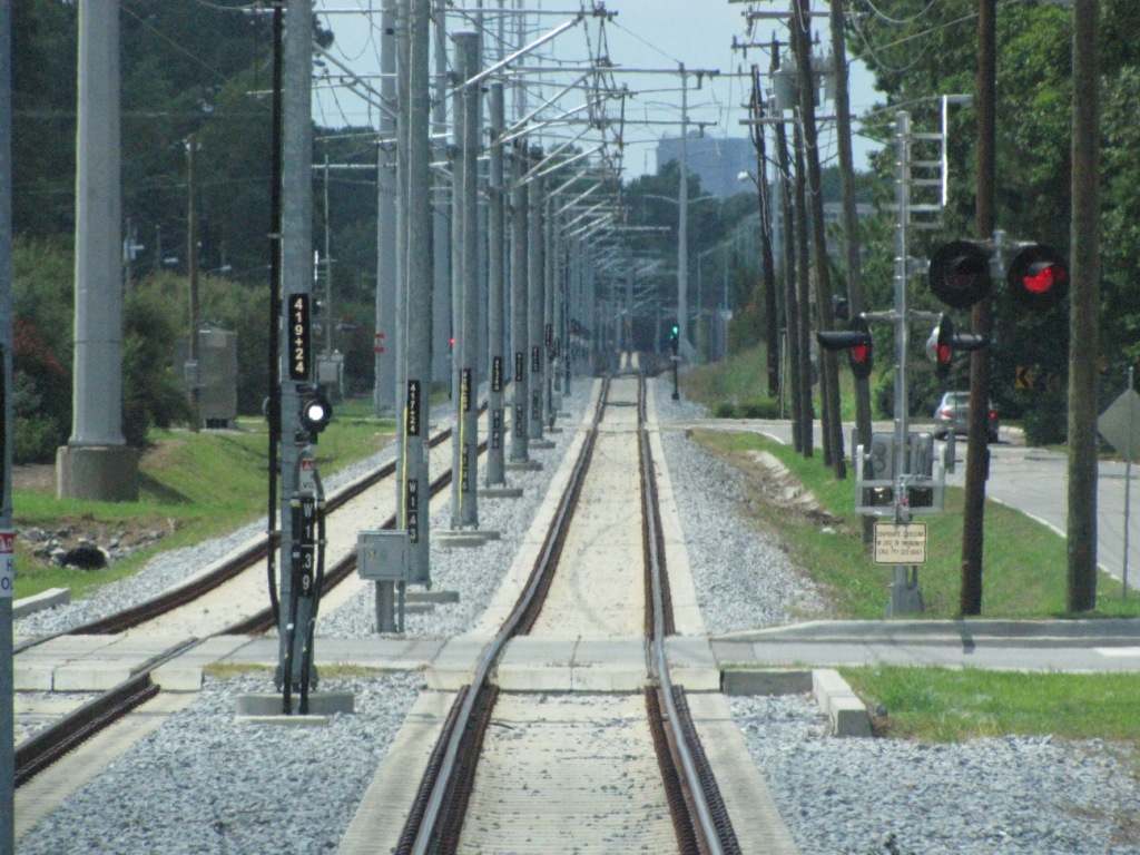
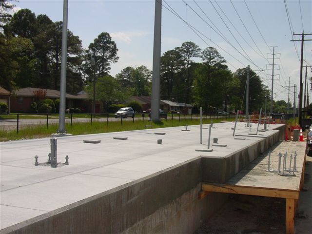
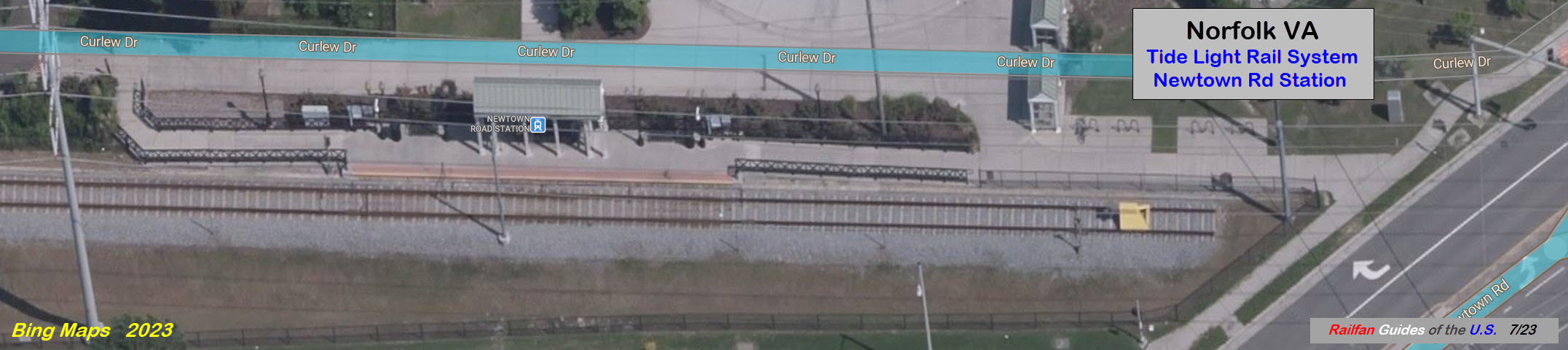
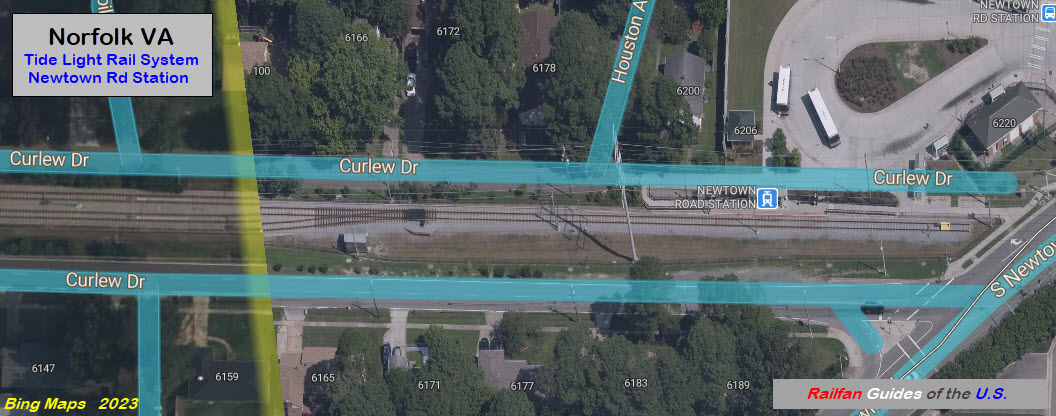
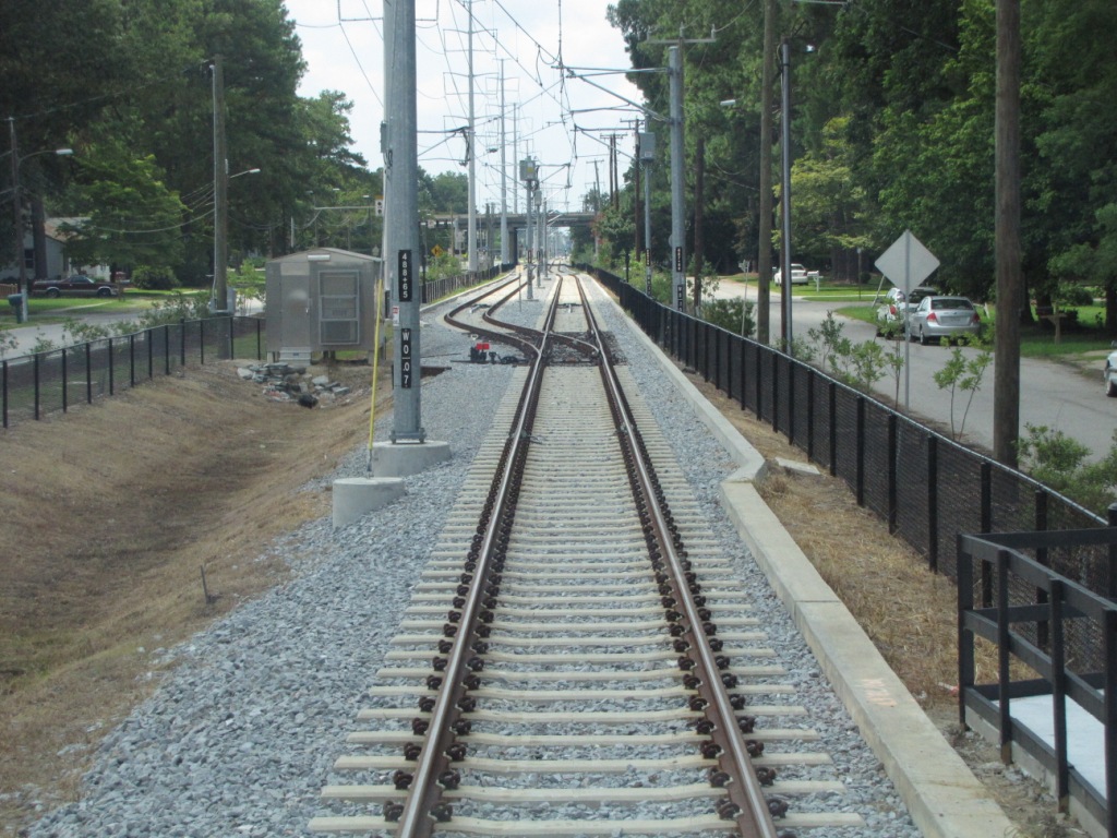
Newtown Road
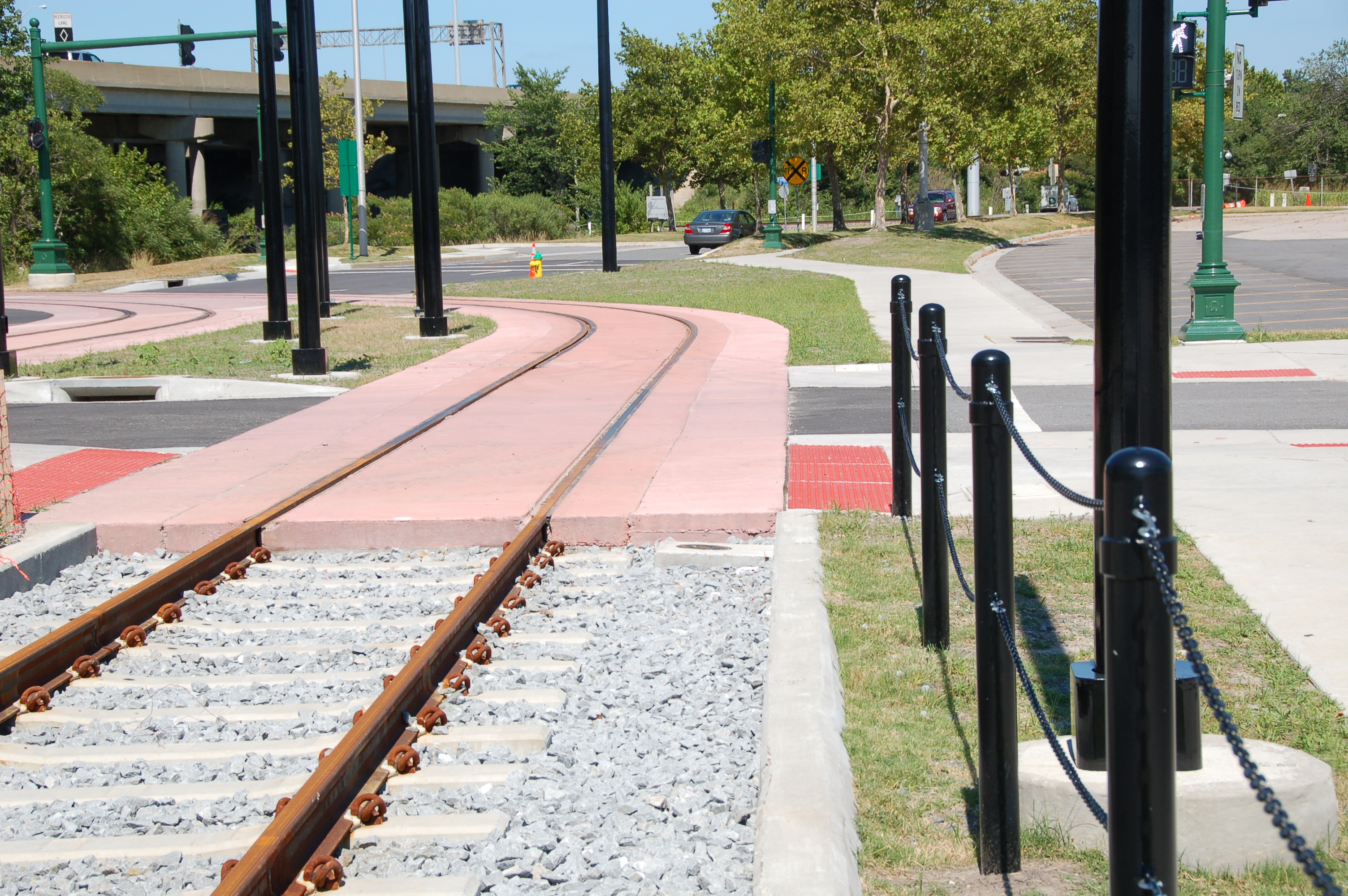
Shot looking out the cab window of the tail track at
Newtown Road... at least when they build an extension, they don't have to
"re-do" the catenary poles like Baltimore did!
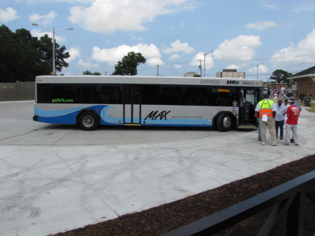
Bus #3002 at Newtown Road.
Not wanting to stray too far from the LRV, and having to
get in and go thru the huge line at Newtown Rd, I wasn't able to get a
picture of the station :-(
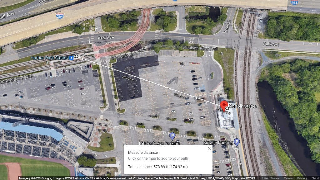
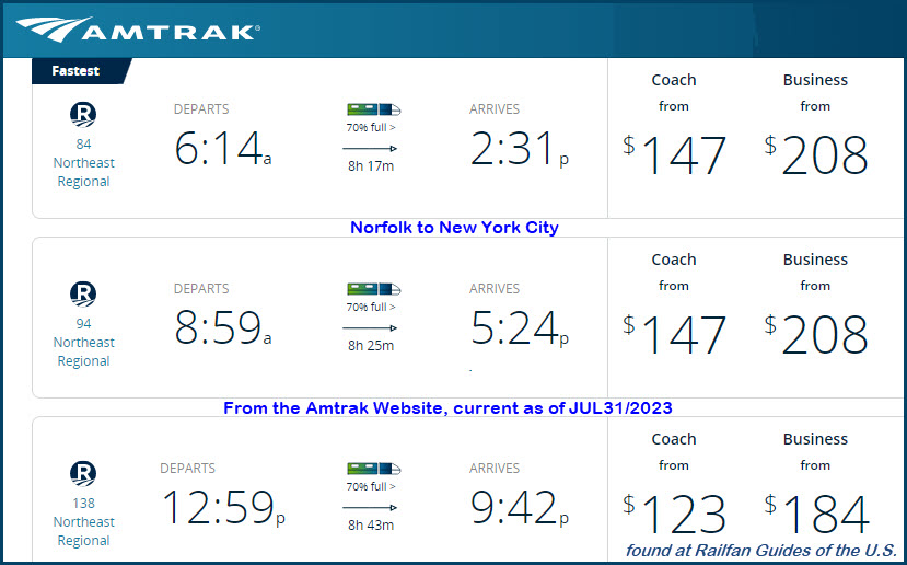
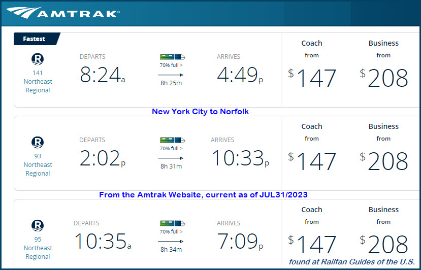
The Amtrak station (NFK) is a 600 foot walk from the Harbor Park Station.
Harbor Park, lot D, 280 Park Avenue, Norfolk VA 23510
Here are the Northeast Regional trains that come into Norfolk.... 8-9 hours
is a long ride! If you live closer to
Richmond,
leave from there, they have a few more choices.
Additional Info
Here is a letter I sent it to the Pilot on 11/14/2016:
Disclaimers:
New format 10/26/23: Please check out my disclaimer page for my standard
dribble and contact info here


 EB signal adjacent to the shops/yard
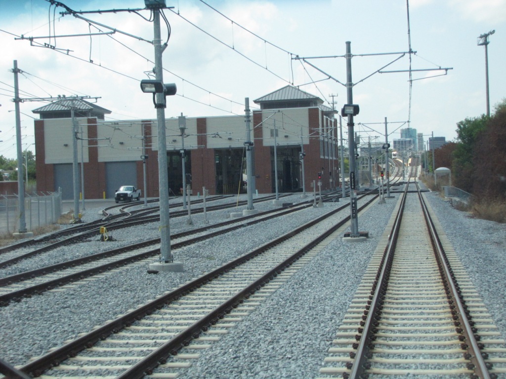

 WB signals
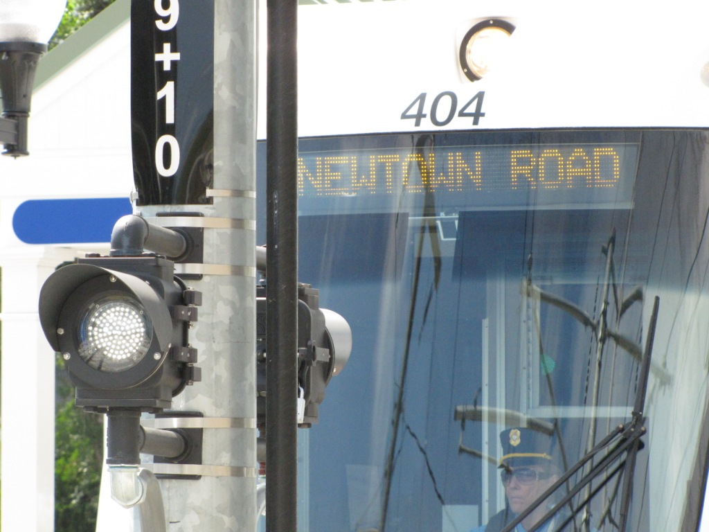

 A TVM - Ticket Vending Machine