
In General
Getting Here
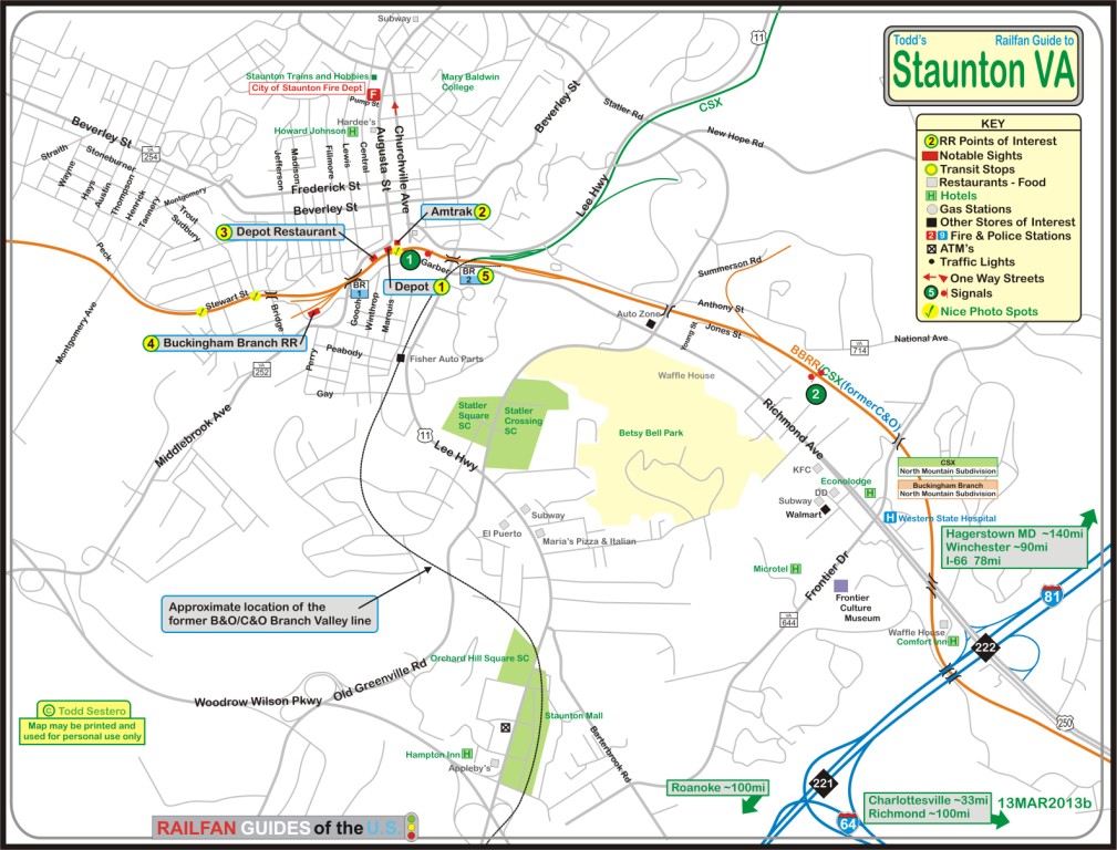
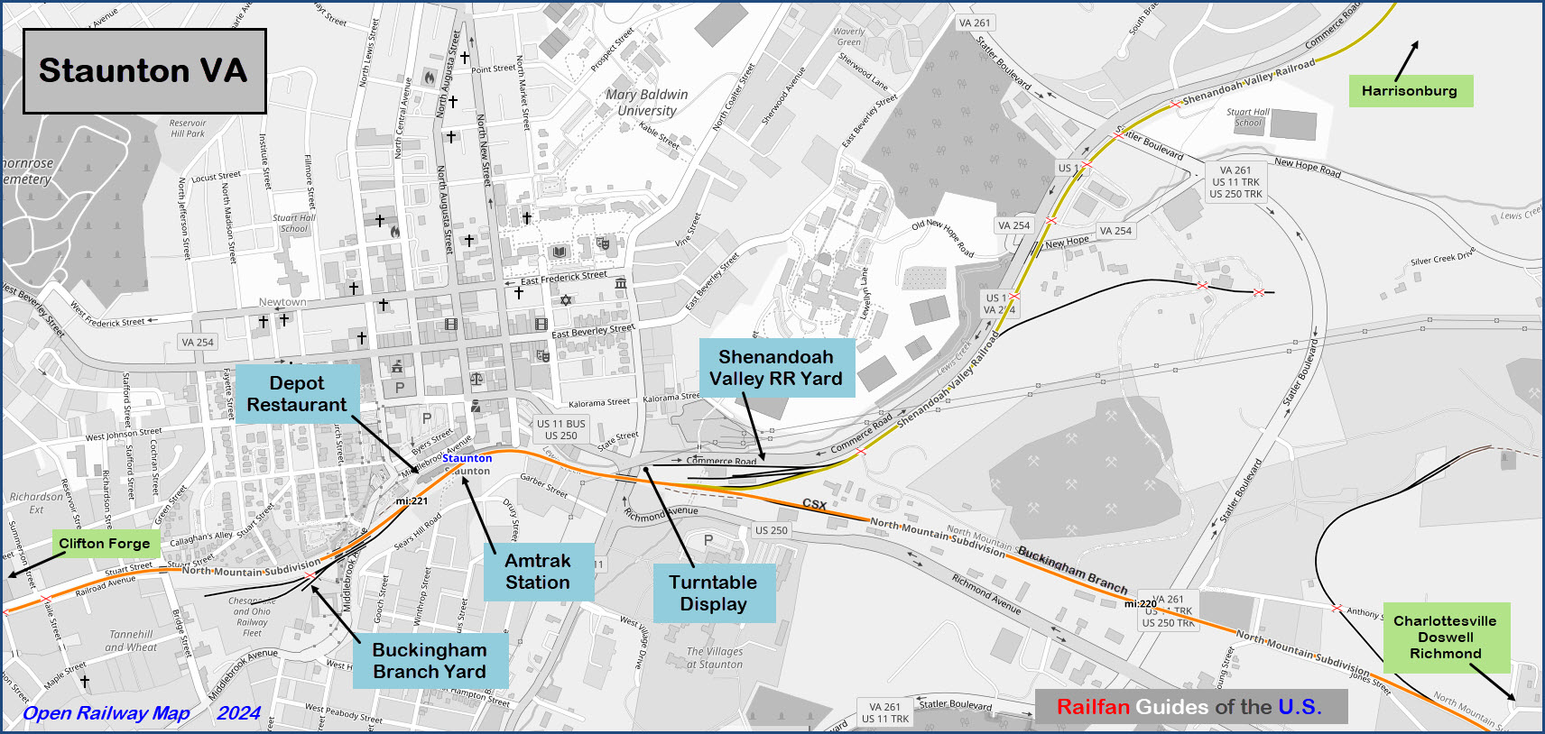
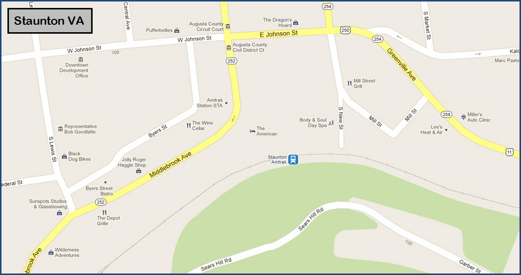
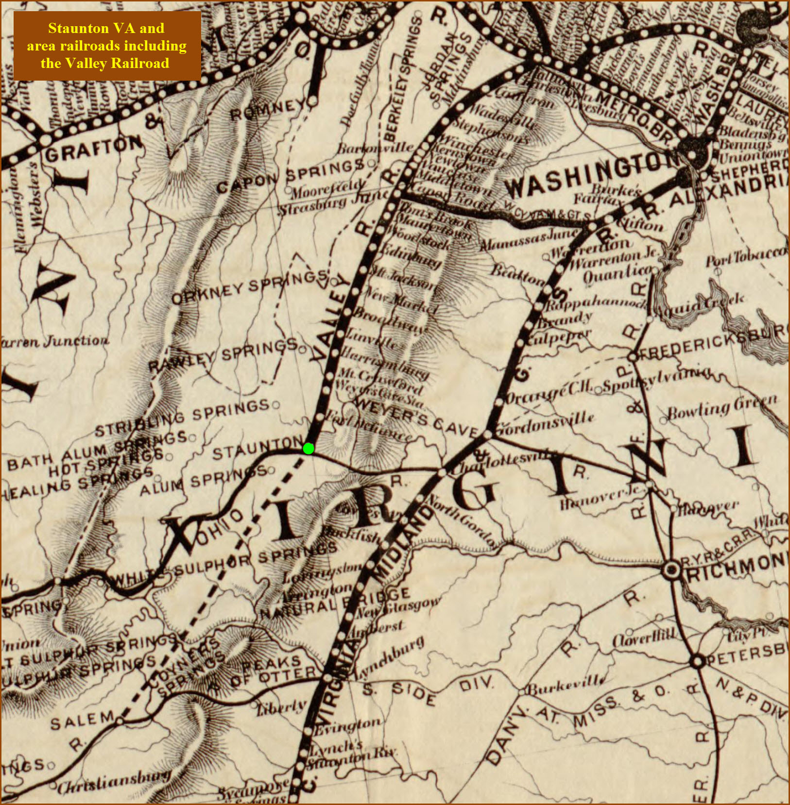
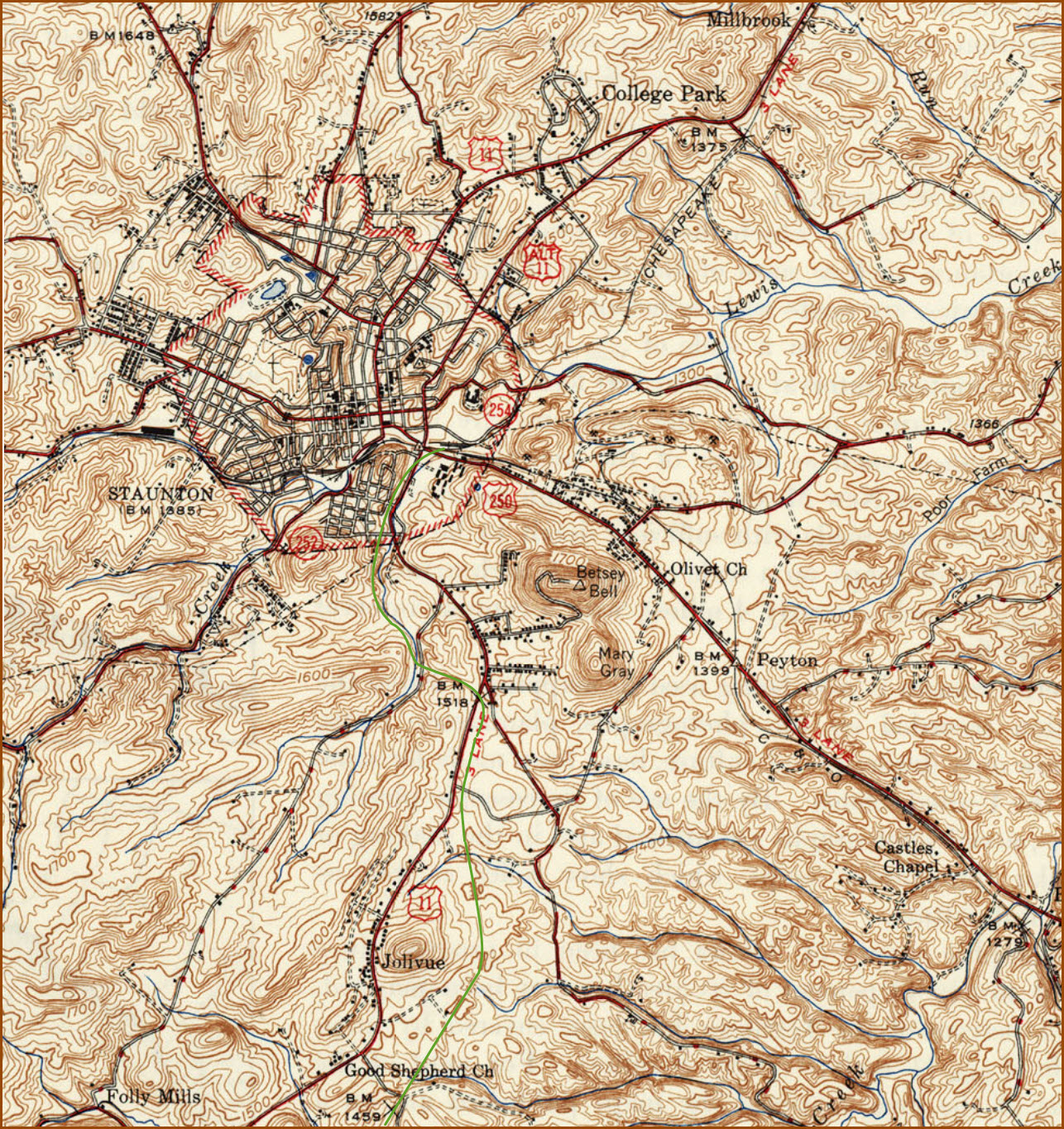
Maps
Sights
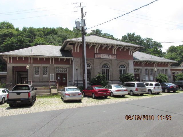
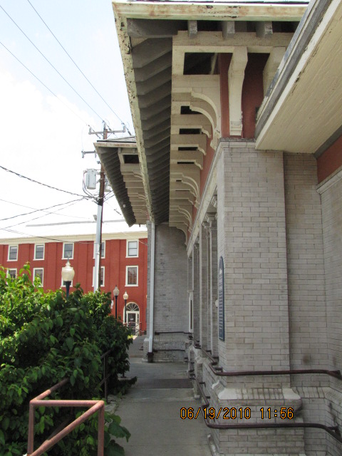
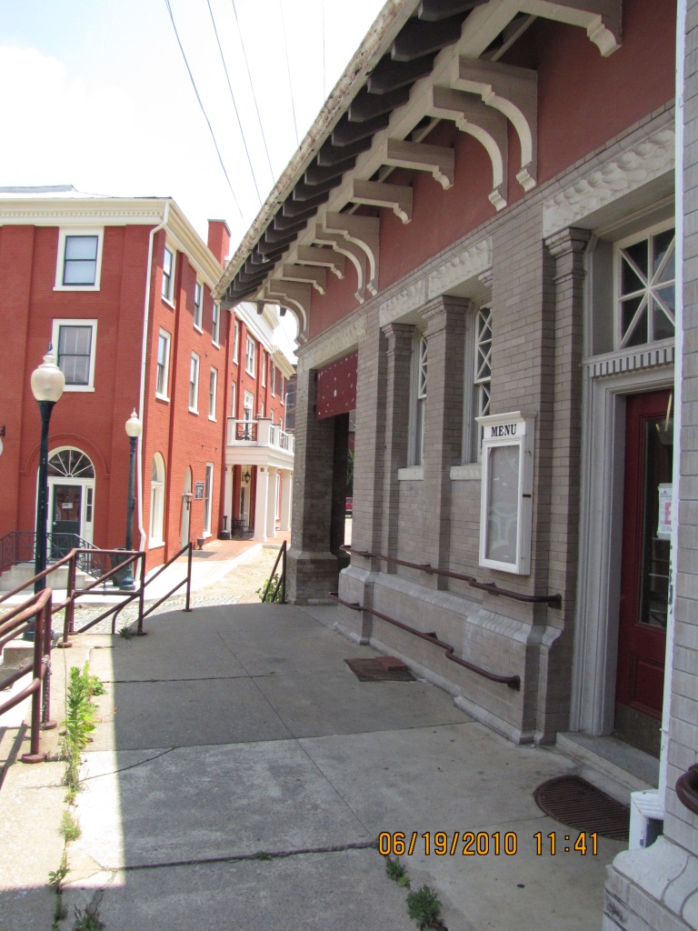
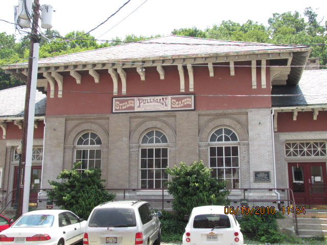
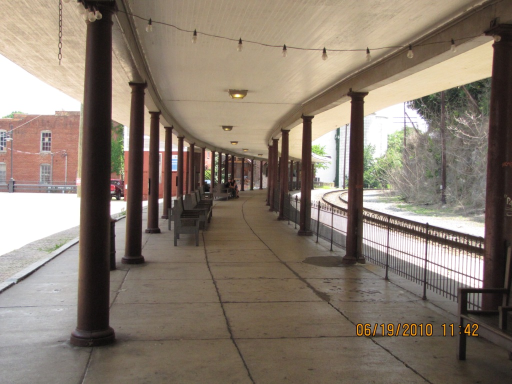
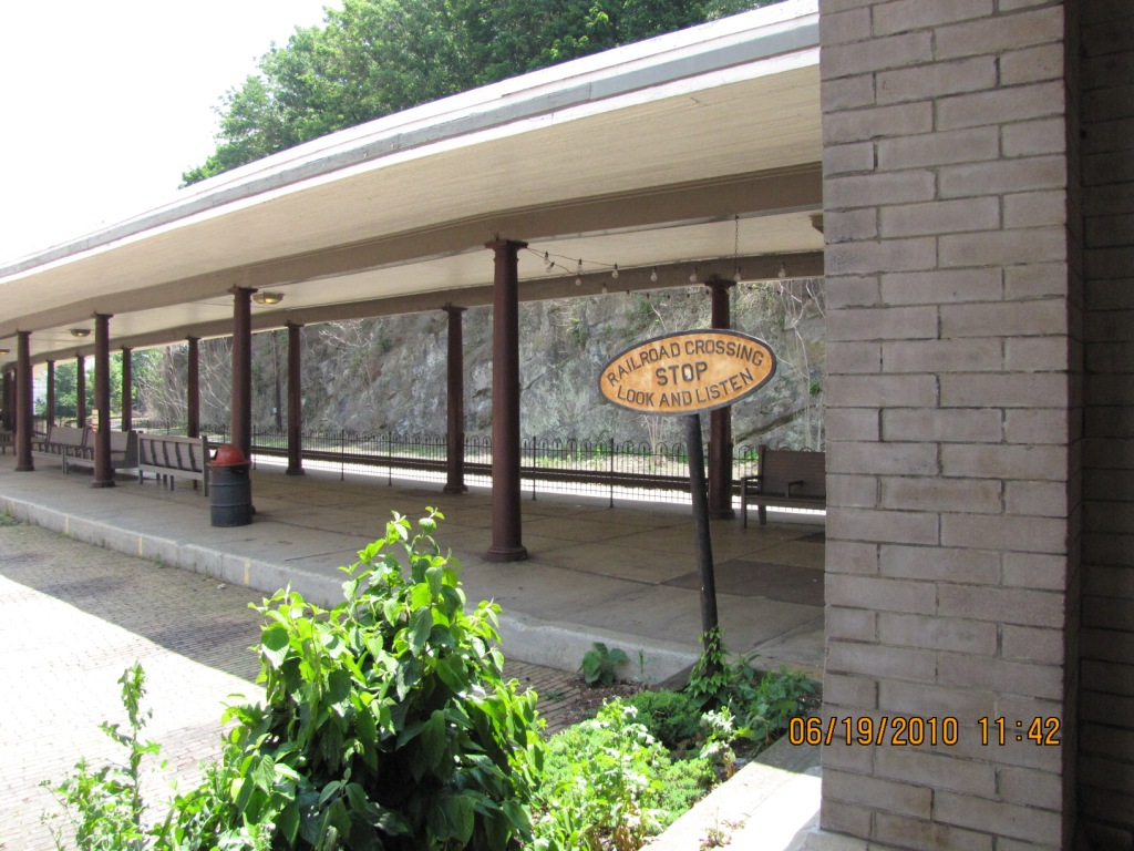
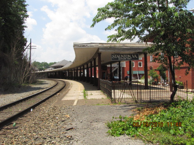
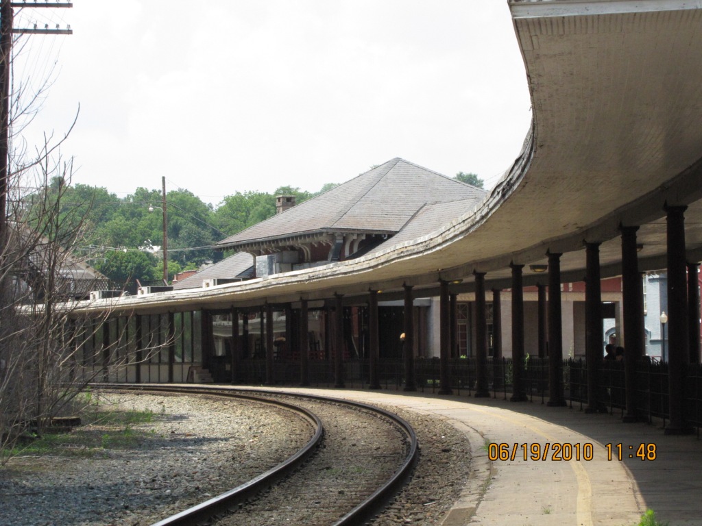
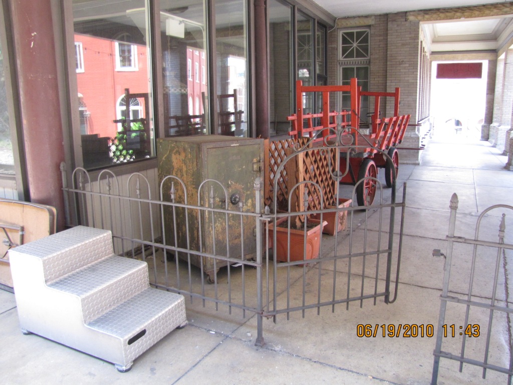
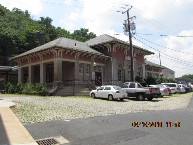
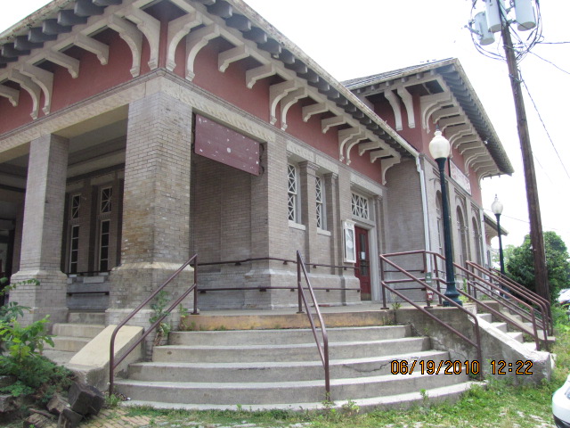
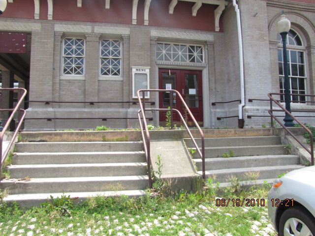
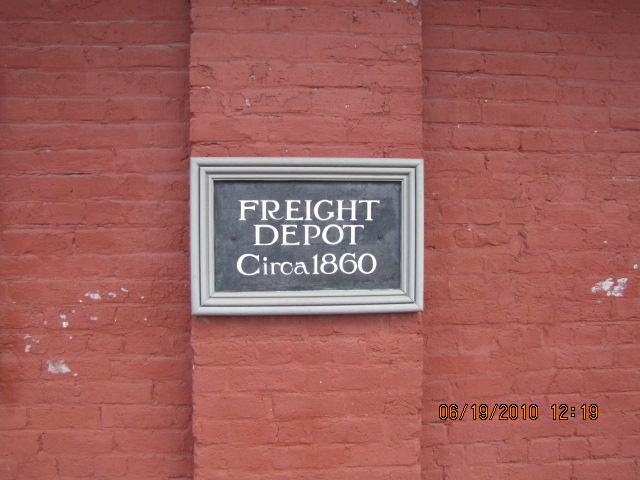
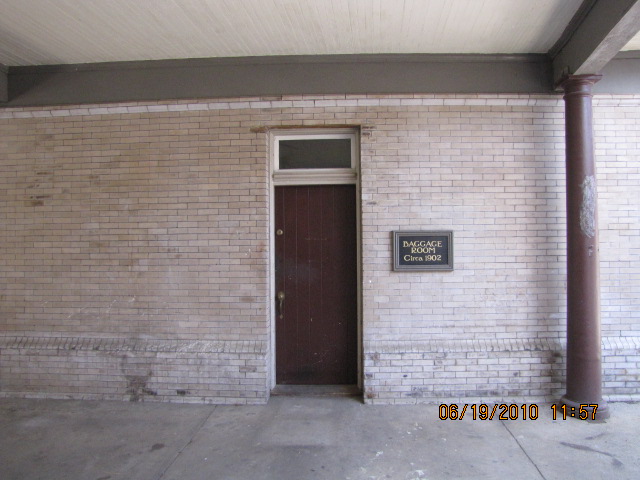
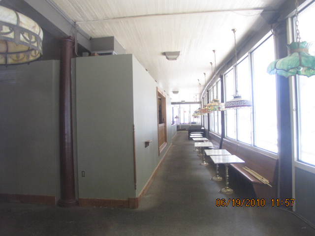
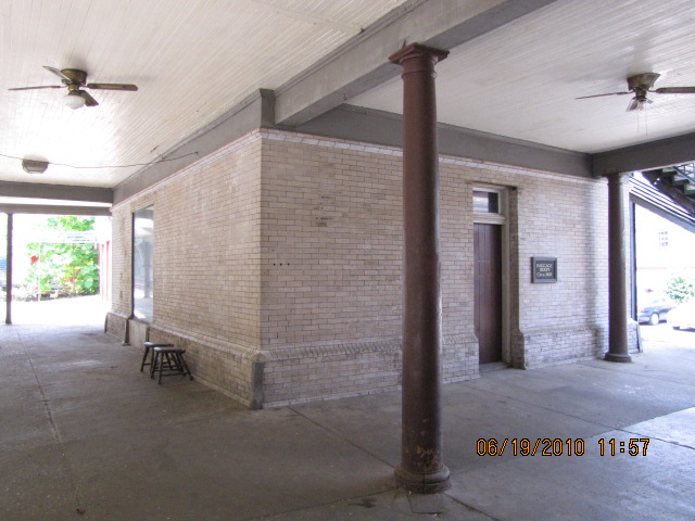
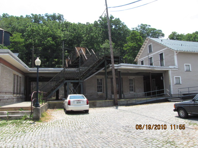
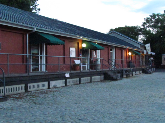
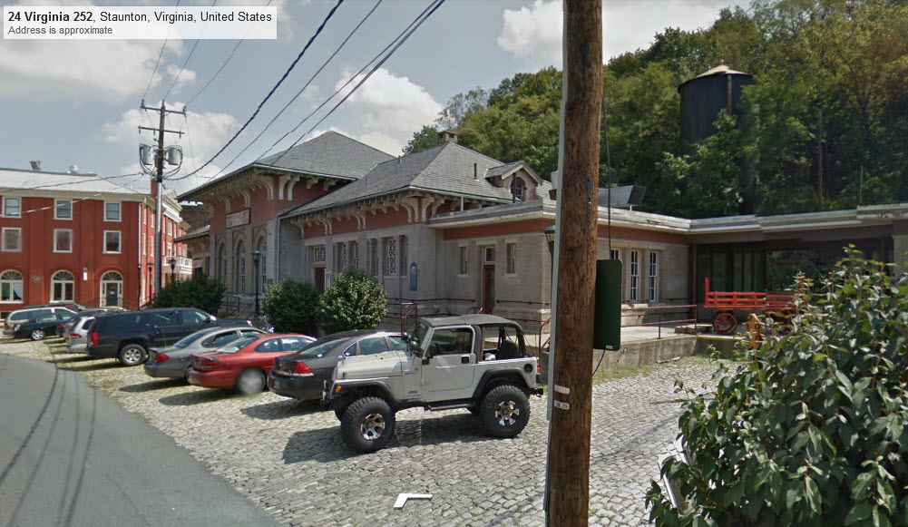
C&O Depot
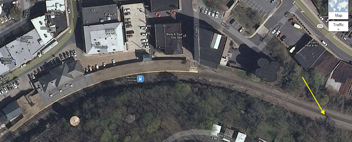
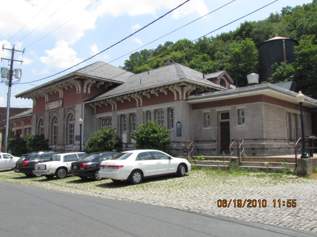
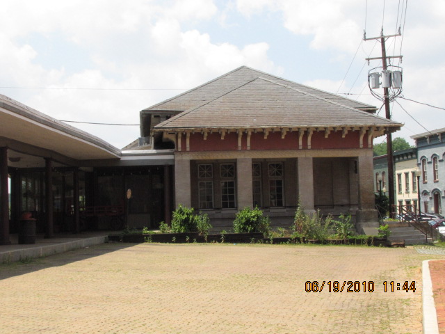
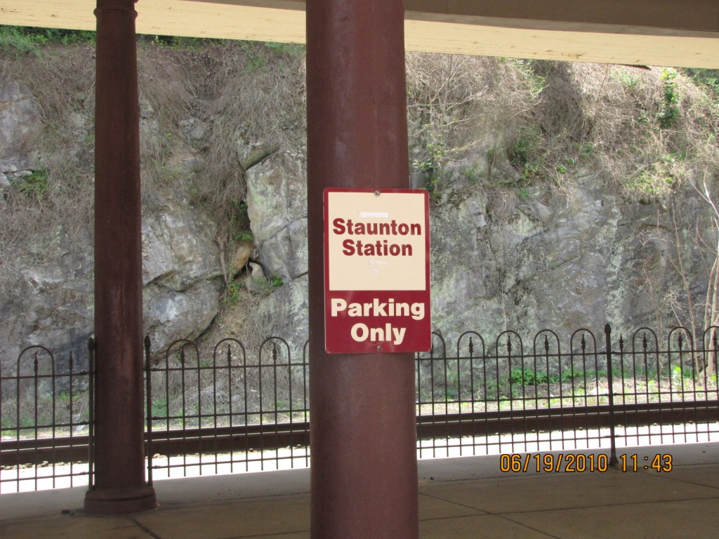
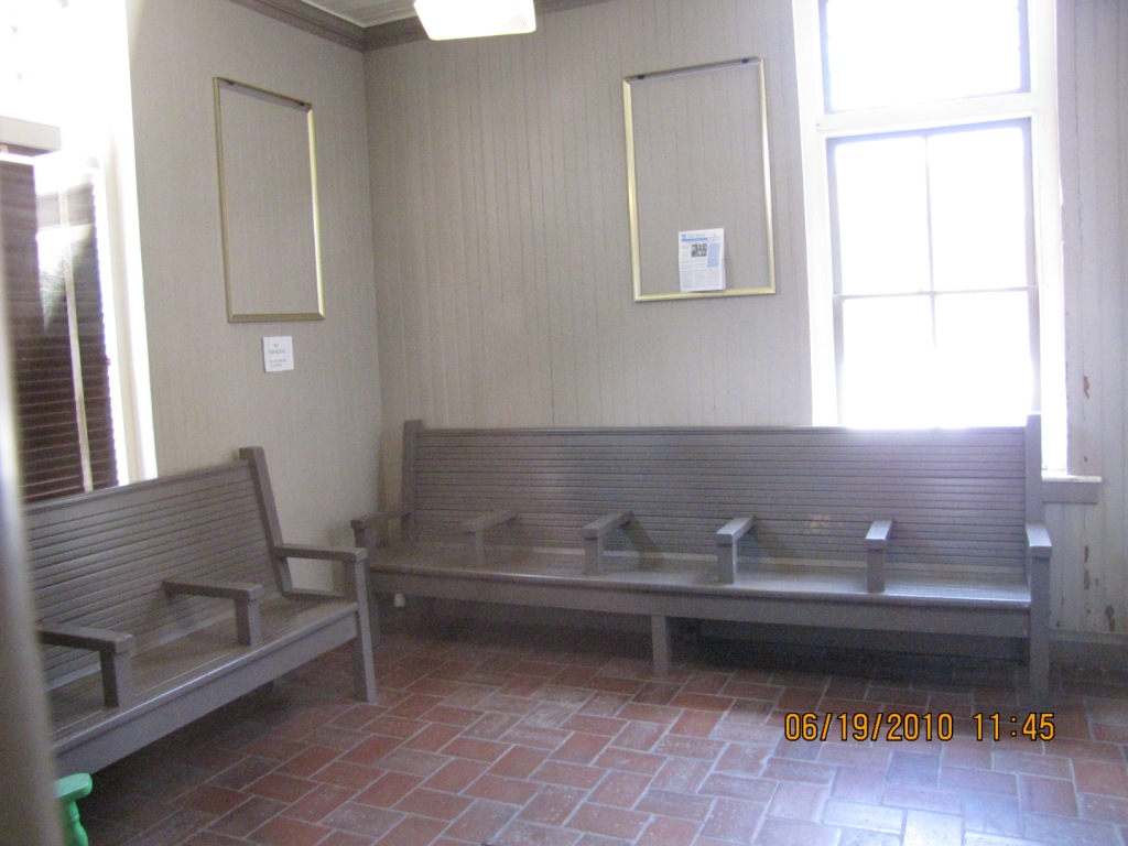
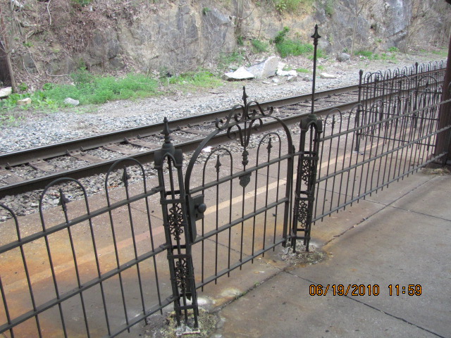
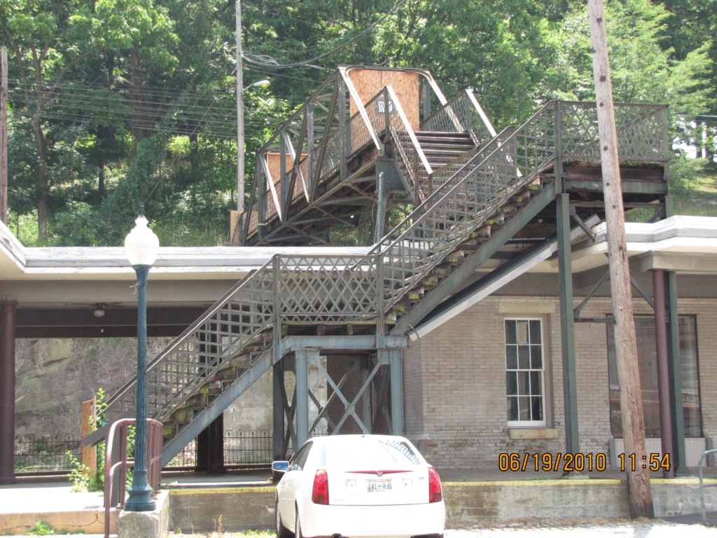
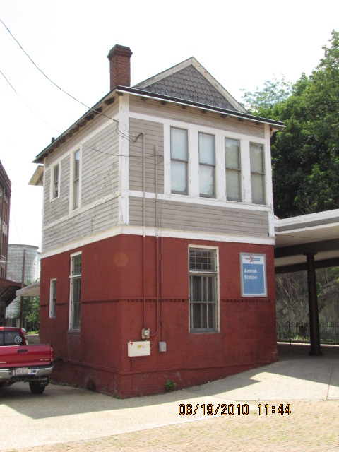
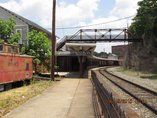
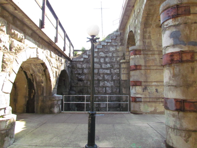
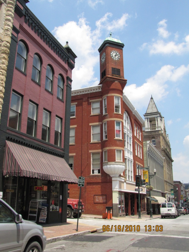
Tower and Amtrak Station
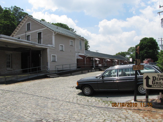
The Depot Grill
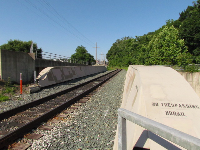
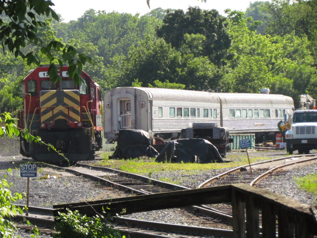
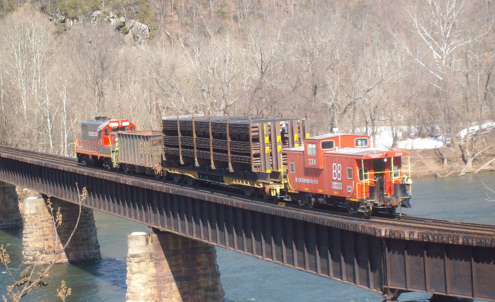
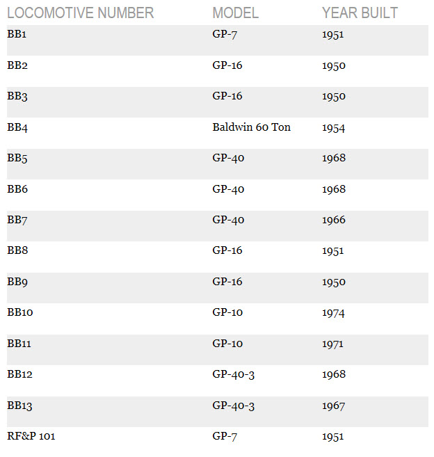
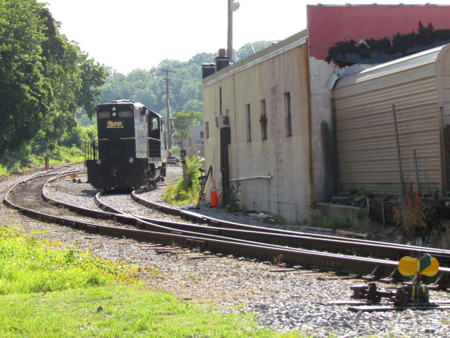
The Buckingham Branch RR
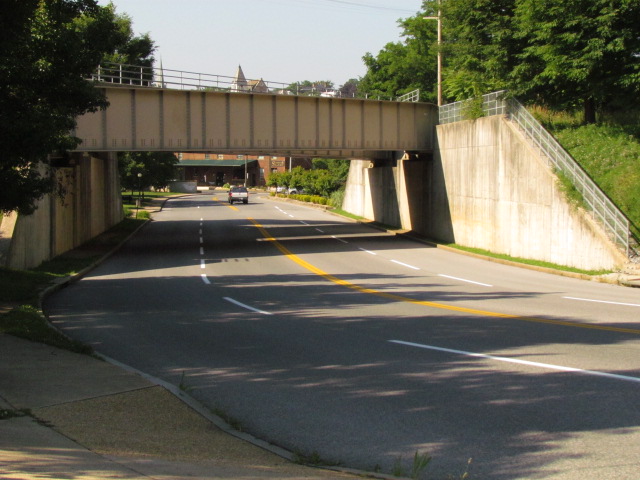
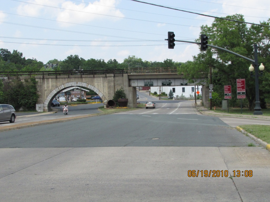
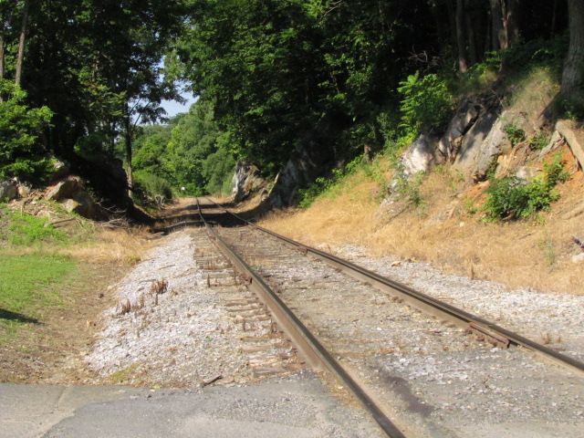
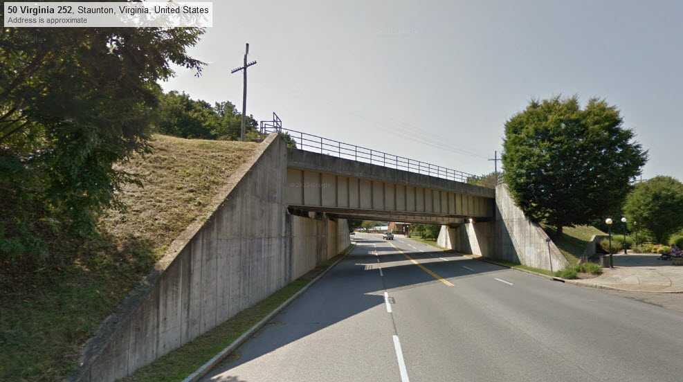
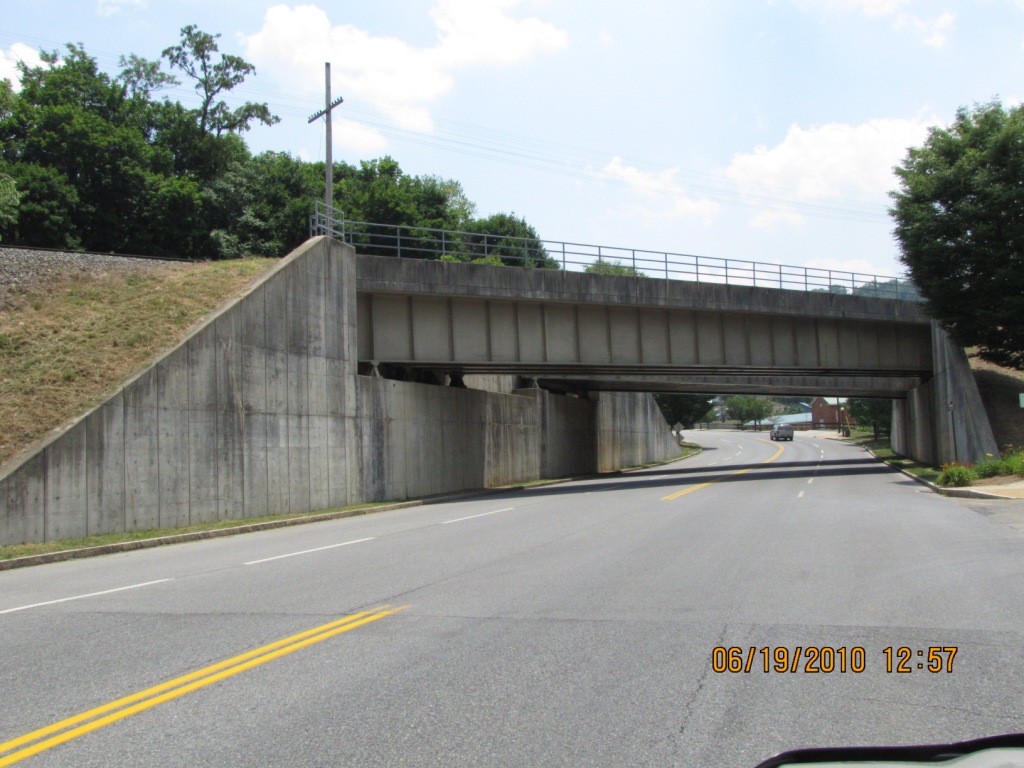
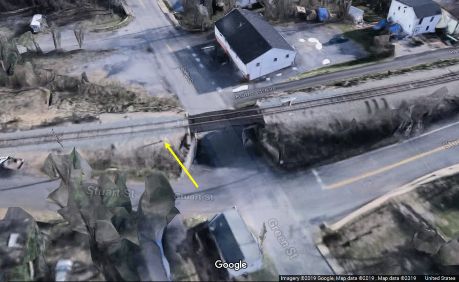
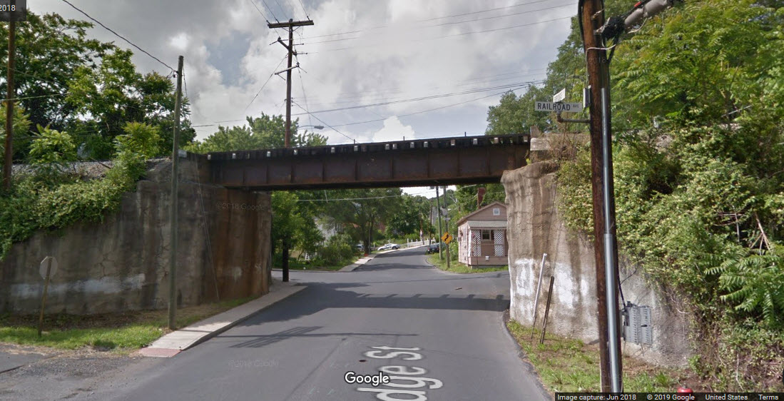
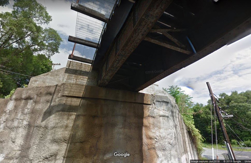
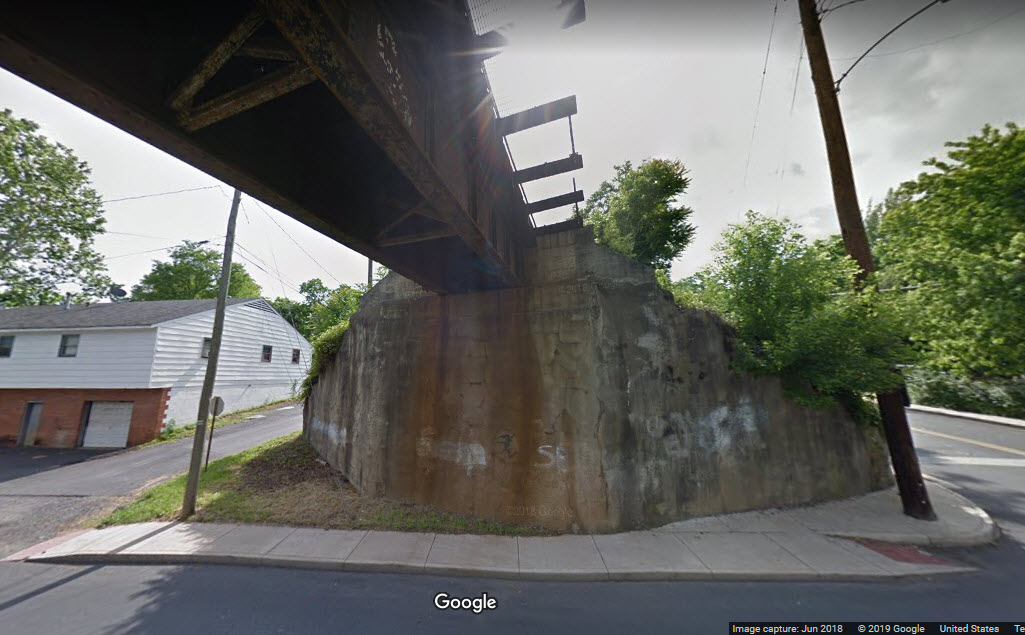
C&O Bridge over US 11
Coal Tipple
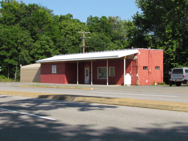
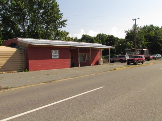
Shenandoah Valley RR
C&O Water Tower
Turntable Display
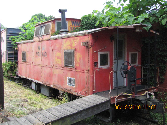
B&O Depot
Foley Mills Creek Viaduct
Gypsy Express Mini-Train
Pictures
Signals
Bridges
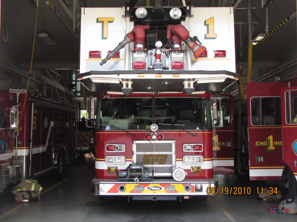
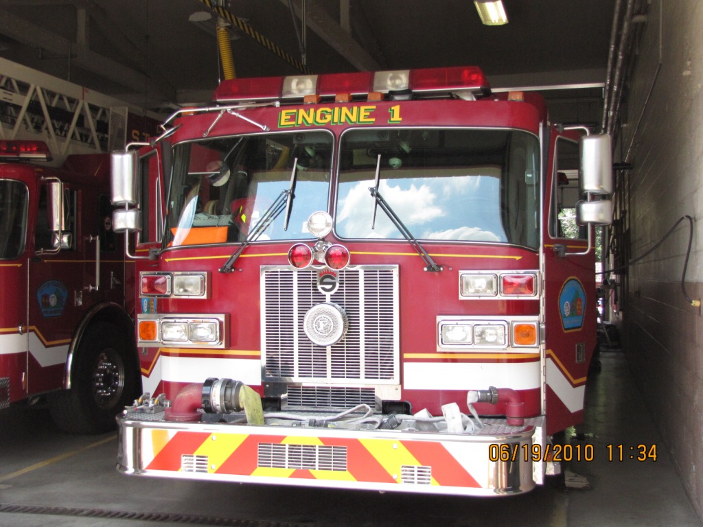
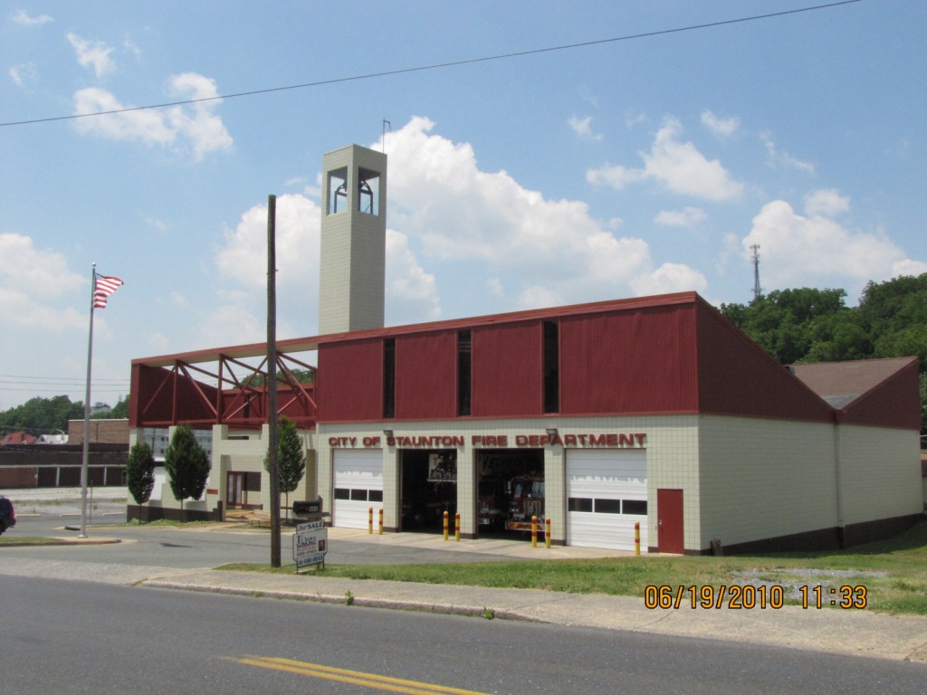
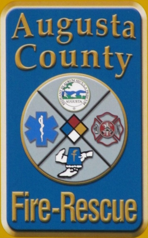
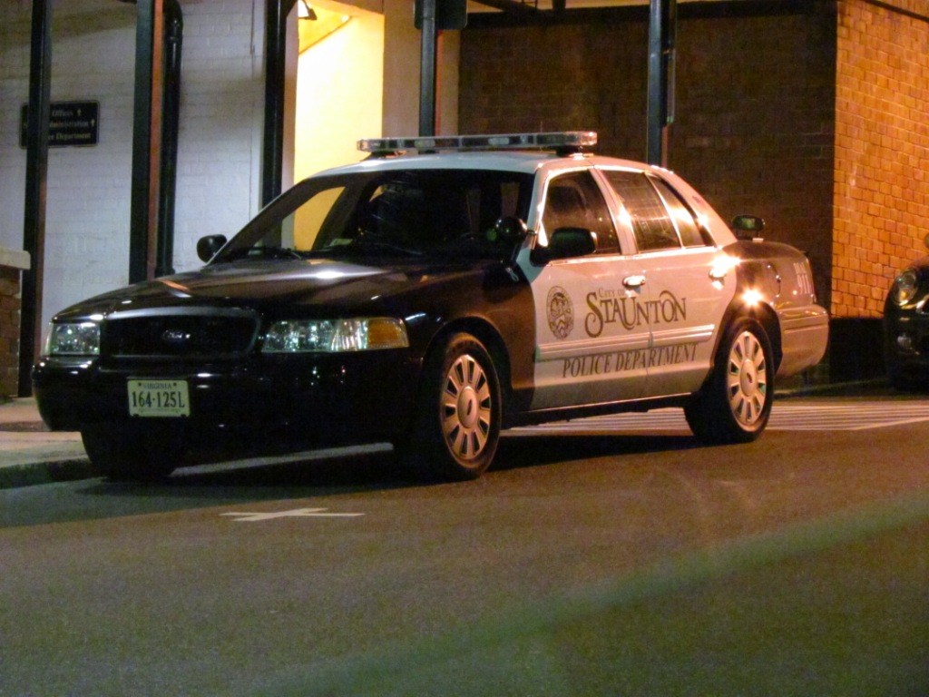
Fire & Police
Amtrak Info
Railroad History
Floobydust
USGS Maps
RAILFAN GUIDES HOME
RAILROAD SIGNALS HOME
Location / Name:
Staunton VA, No County (Staunton is an independent city in the Commonwealth of Virginia!)
What's Here:
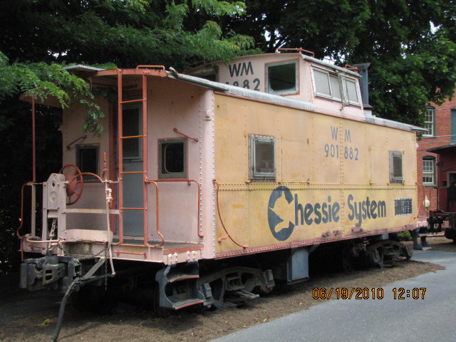
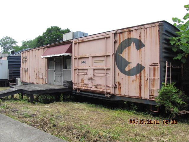
Former C&O Depot
The Buckingham Branch RR
Amtrak
The Shenandoah Valley RR
C&O Water Tower
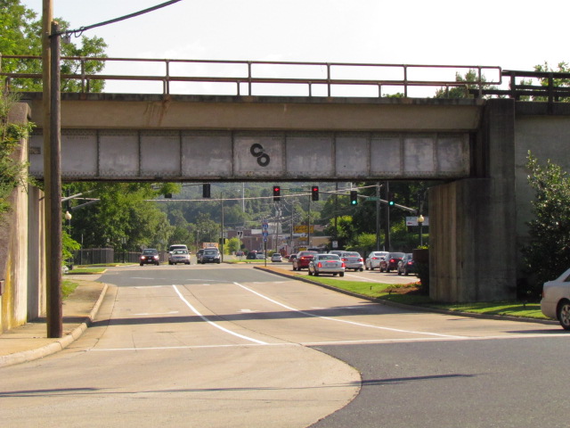
C&O Markings on RR Overpass
Turntable Display
Data:
GPS Coordinates: as needed
Phone A/C: 540
ZIP: 24401
Access by train/transit:
Amtrak trains #50 and #51
The Scoop:
Staunton VA is a quiet little town on the western side of mid Virginia. Thanks to my son-in-law Rob, and his folks Terry and Vicki who live in Staunton for helping me find my way around town! It's beautiful here - if you come, you won't wanna leave :-)
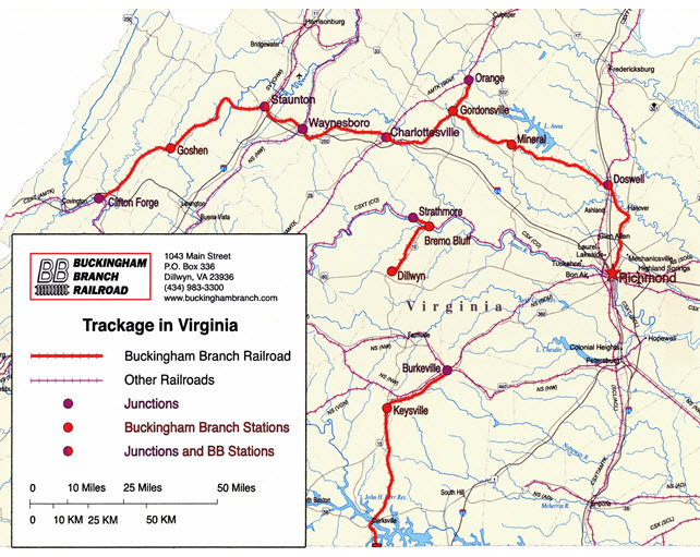
CSX owns the tracks that come thru town. The Buckingham Branch RR has trackage rights from Doswell to Clifton Forge, with a division point at Charlottesville.
CSX no longer deals with anything local in Staunton, it is now handled by the Buckingham Branch.
The Shenandoah Valley RR handles local traffic from their yard along Lee Highway, northward to just south of Harrisonburg, where they also interchange with the Norfolk Southern. When they head out depends on when the Buckingham Branch brings them cars from their interchange with the CSX in Clifton Forge.
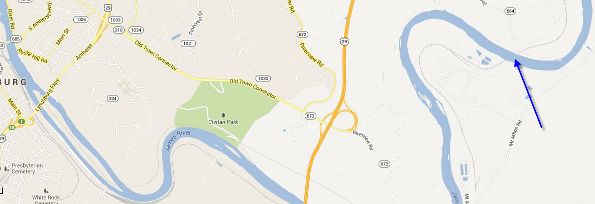
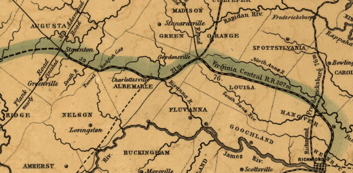
Clifton Forge is also the division point for CSX, where the loaded coal drags head east via the more level route following the James River into Richmond via Lynchburg. The lighter empty trains can handle the steeper grades on the WB route going thru Charlottesville and Staunton. There are 5 or 6 trains each way every day. In looking at a map, you can see where the CSX goes from being on the south side of the James River to the north shore, just slightly east of Lynchburg - the maplet below.
A couple more tidbits of info. On the one map where you see the B&O heading south out of town, they were trying to reach Roanoke before the N&W. Once the N&W got there first, for some reason, the B&O decided to quit building southward. If you drive along I-81, just south of the interchange with I-64, you should be able to see where they built a bridge and did grading for the right-of-way, but neither ever saw any track. There are other various places where the B&O did grading and put in abutments that can still be seen if you know where to look (I don't).
Ross Roland's ex N&W #614 is stored down in Clifton Forge. Nothing on its location is evident from looking at Google maps, although there are still two turntables and an impressive bridge structure holding up the southern end of the yard!
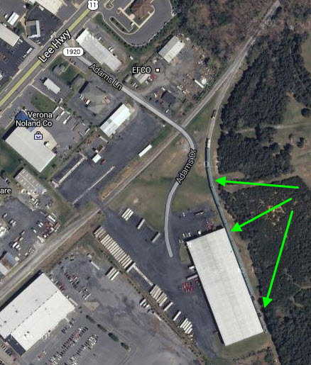
There used to be an excursion operation that used to run out of Staunton, maybe 10 years ago. After CSX kept raising the requirements, forcing them to buy more and more insurance, they finally called it quits after about three years of operation. Some of the equipment was sold off, what remains sits behind an industrial building on a siding in Verona (off Adams Dr). The engines may still be there. The building is supposed to be vacant.
I would like to thank Mike, a local railfan whom you can find at the station on most days, for the detailed information here and elsewhere on this page.
Located a few blocks from the Staunton Train Station is the Woodrow Wilson Birthplace Memorial and the Woodrow Wilson Presidential Library, as well as the Woodrow Wilson Museum.
If you have never been here before, and pronounce the name of the town with the "U" in it, everyone will know you are not from the area, as the name is pronounced "STAN-ton", more is from here: Staunton (pronounced STAN-ton) was named for Lady Rebecca Staunton, wife of the Colonial Governor of Virginia William Gooch. No one really knows why Staunton is pronounced the way that it is. Some believe that the pronunciation is because "that is the way that the family pronounced the name (although Staunton descendants pronounce the "u".) It has also been suggested that since most area settlers were Scots-Irish and Germans and not English like the Staunton name that when Staunton was pronounced by those with Irish and/or German accents, it sounded like it did not contain a "u". It is anyone's guess!
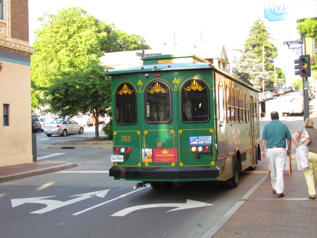
From Wikipedia: As far as bus transportation goes, Staunton has the Staunton Trolley, which provides fixed-route bus service throughout Staunton. It includes three routes - the Red Route, the Green Route and the Silver Route. The Green Route connects to the City's Amtrak station. The Coordinated Area Transportation Services (CATS) operates a demand-response service throughout the Staunton area, as well as a fixed shuttle service between the downtown areas of Staunton and Waynesboro. Pictures below in the Floobydust section.
Acknowledgements:
Steven Smith
Denver Todd
Mike
Paul North Jr.
Library of Congress
Google Maps
Open Railway Map
Newspaper.com
Wikipedia
Websites and other additional information sources of interest for the area:
https://en.wikipedia.org/wiki/Staunton_station
https://www.greatamericanstations.com/stations/staunton-va-sta/
https://www.historicstaunton.org/b-o-valley-railroad-line/
https://railfan.com/shenandoah-valley-railroad/
https://en.wikipedia.org/wiki/Virginia_Central_Railroad
https://en.wikipedia.org/wiki/Buckingham_Branch_Railroad
https://en.wikipedia.org/wiki/Shenandoah_Valley_Railroad_(1867%E2%80%931890)
https://en.wikipedia.org/wiki/Shenandoah_Valley_Railroad_(short-line)
https://www.abandonedrails.com/
https://www.abandonedrails.com/valley-railroad
http://buckinghambranch.com/history/
http://www.rypn.org/forums/viewtopic.php?f=1&t=22919 on the stone arch at MP 219 - from 2007, but still relevant
https://www.loc.gov/resource/g3884sm.g3884sm_g090771904/?sp=3&st=image 1904 Sanborn map of Staunton
newspapers.com
If you're coming in from the south, such as southwestern Virginia (Salem, Roanoke), or Tennessee via I-81, get off at exit 222 just after passing I-64, heading into town on Richmond Ave.
Coming down from the north via I-81, take the same exit.
If you're coming over from Charlottesville or Richmond via I-64, bear to the right onto I-81 and take the very first exit, which is #222.
Coming in from the west via I-64 from, say, Charleston WV, head south out of Charleston on I-77/64, and then head east at Beckley to I-81 at Lexington, then go north to exit 222.

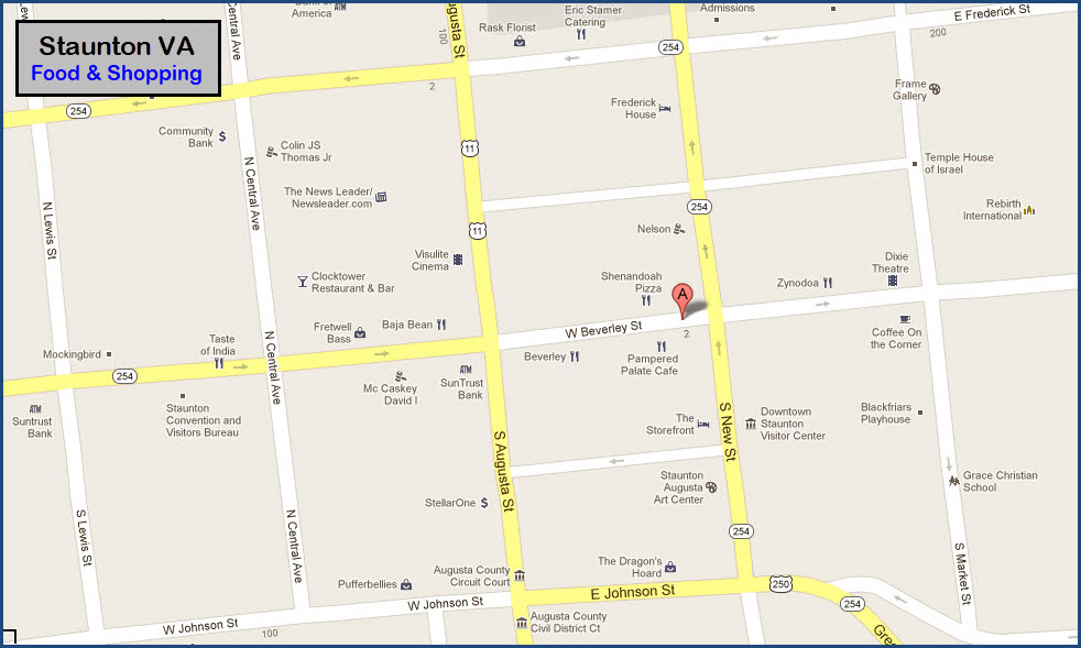
GPS Coordinates: 38.147469, -79.072550
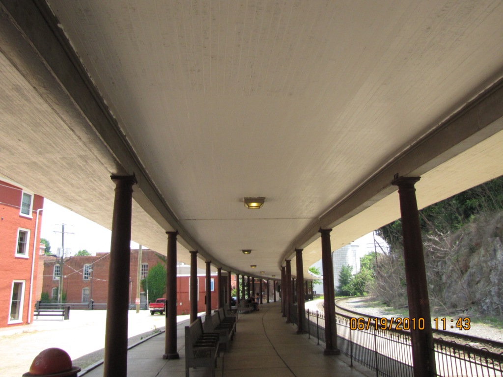
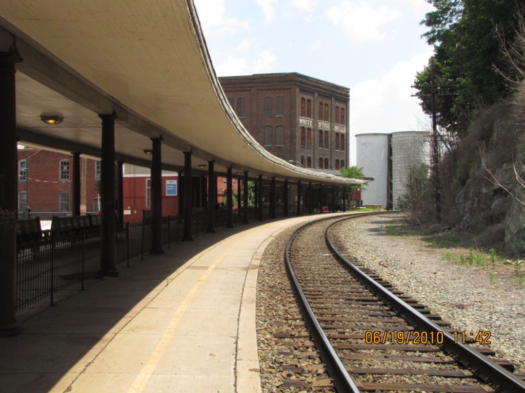
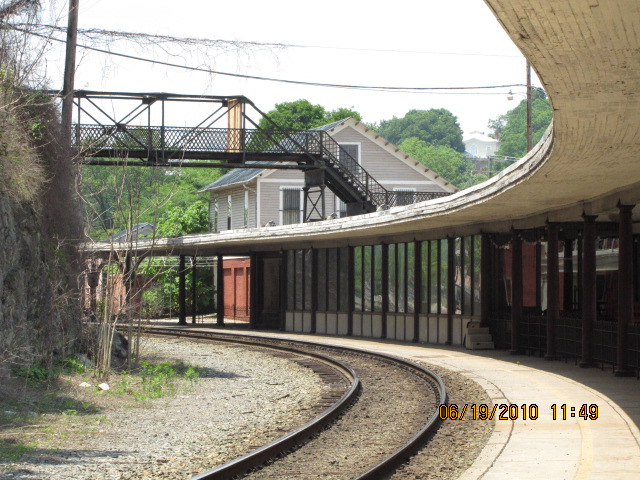
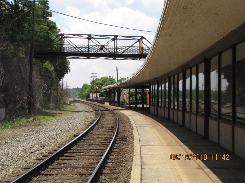
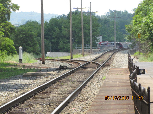
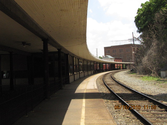
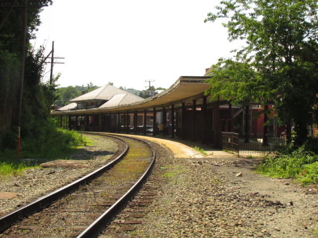
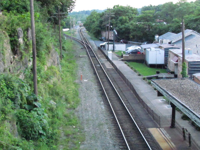
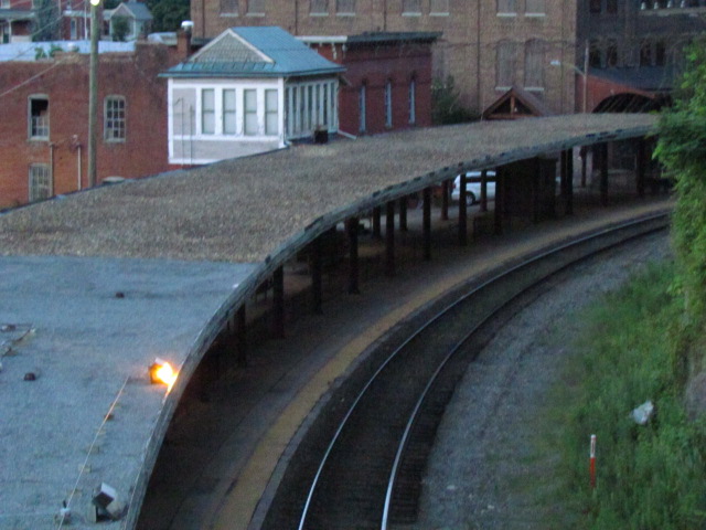
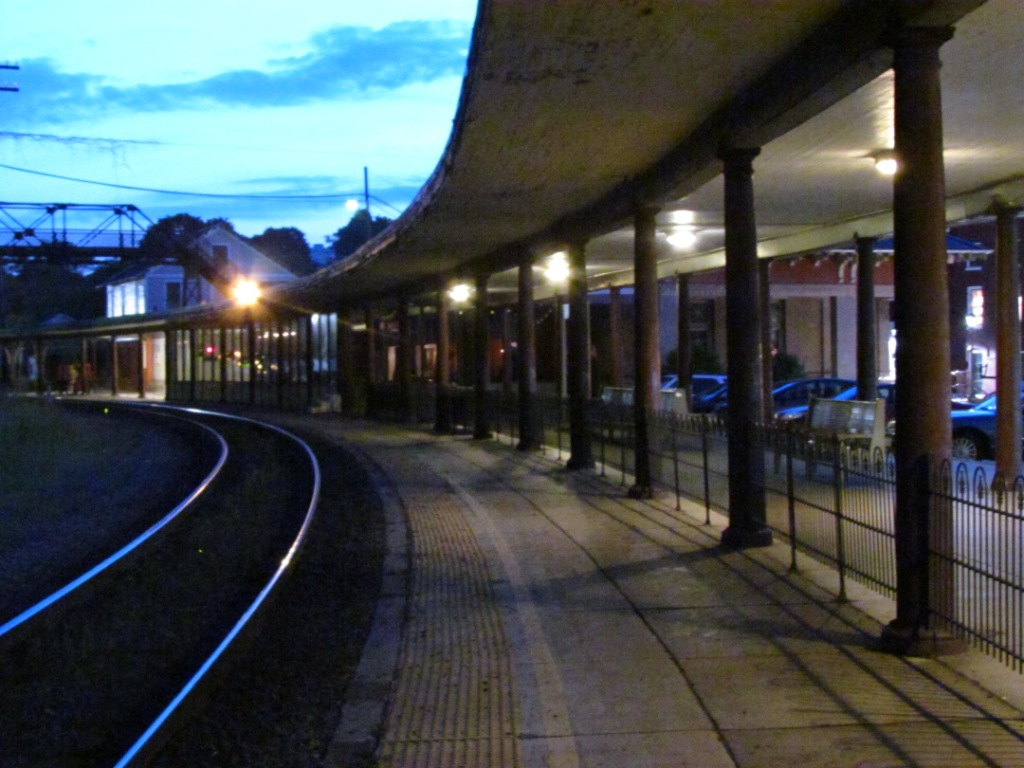
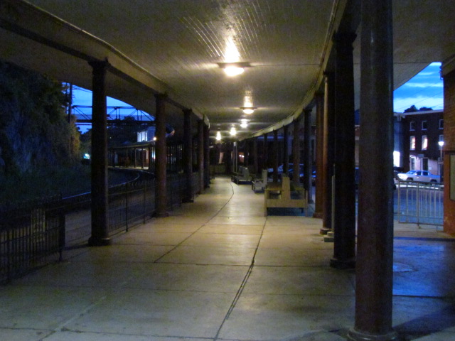
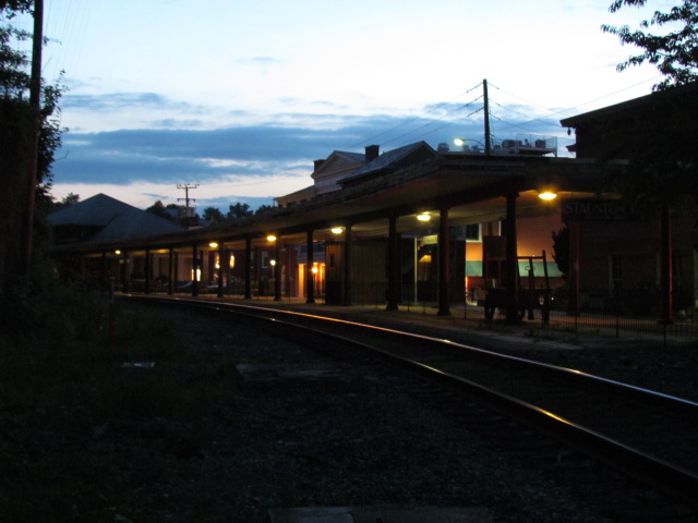
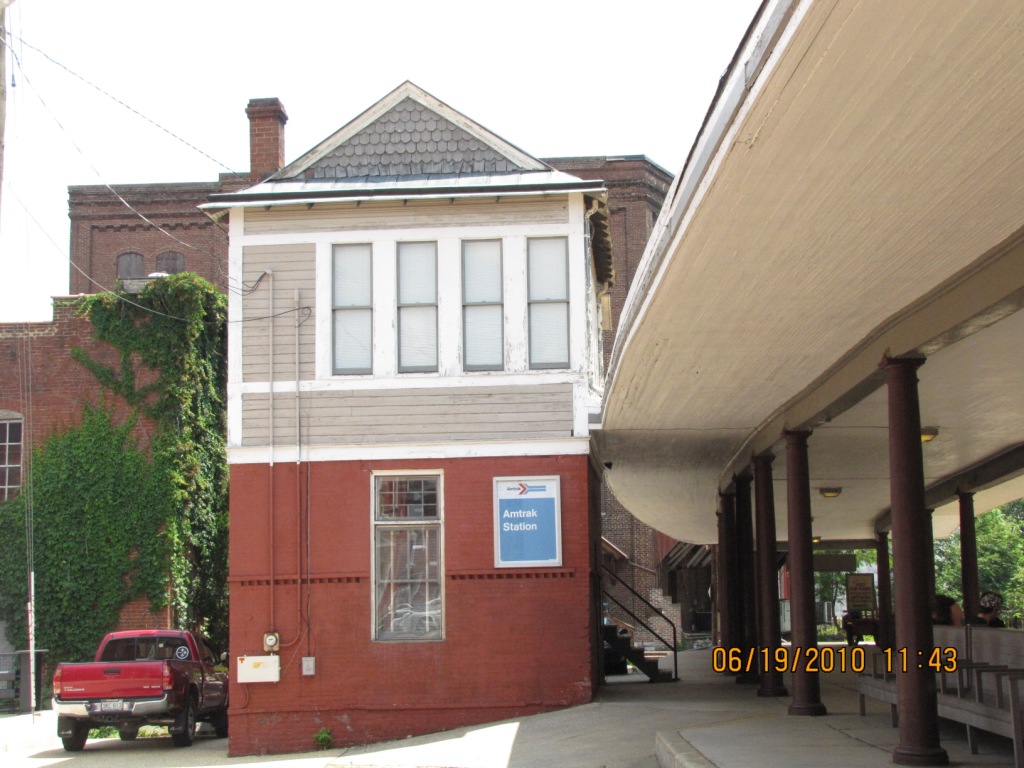
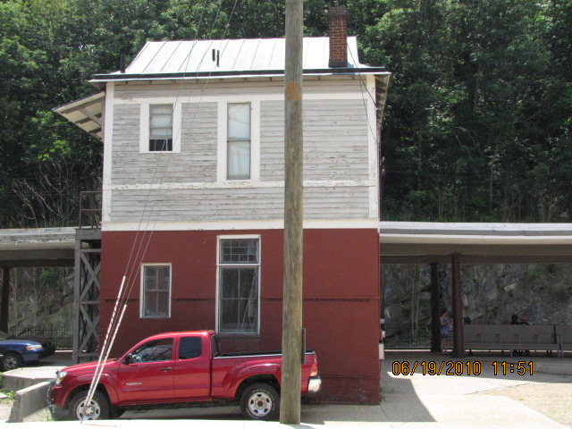
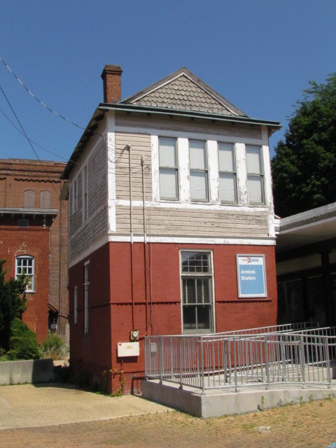
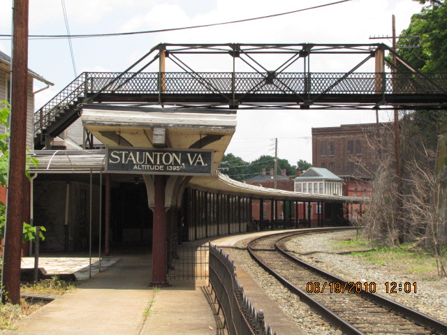
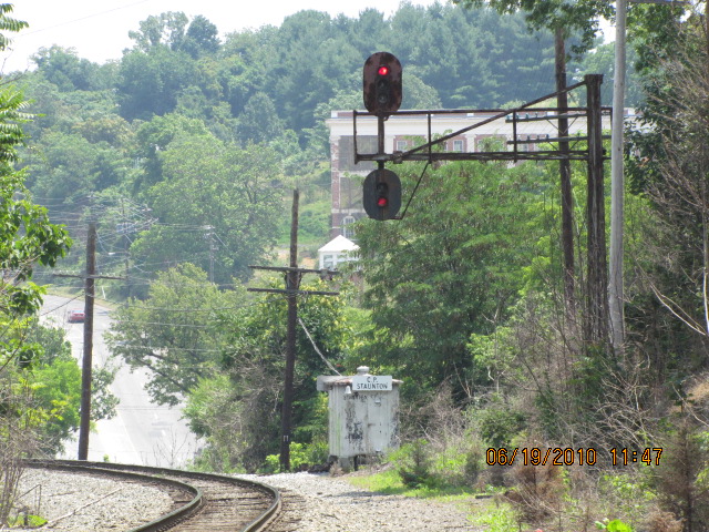
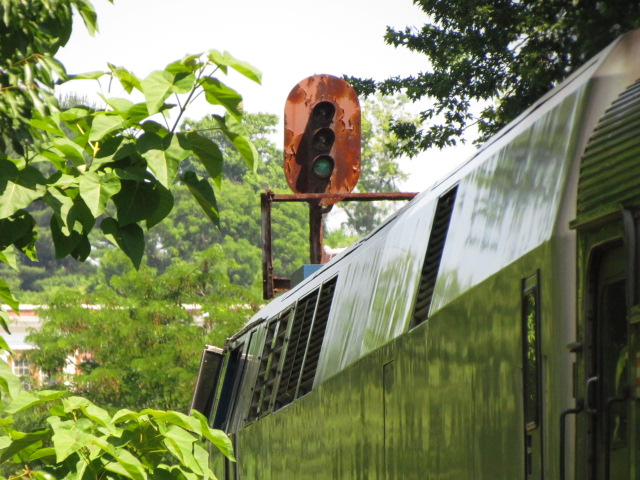
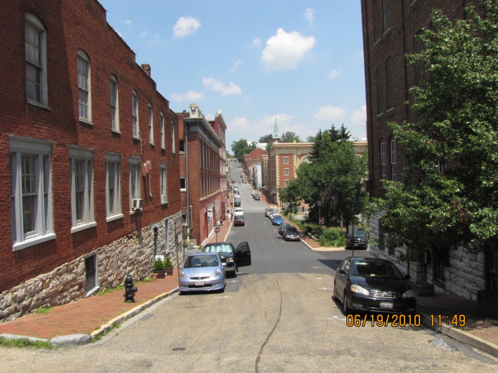
The station is on the left with the curved canopy. The signal pictured below is on the right pointed to by the yellow arrow.


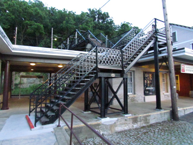

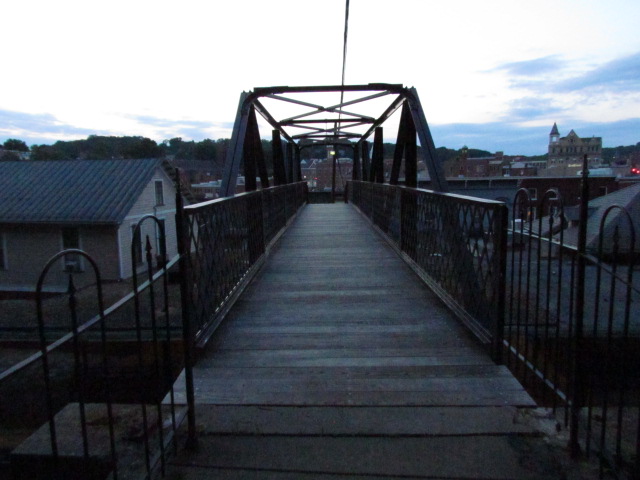
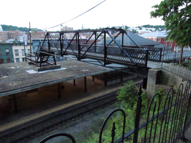
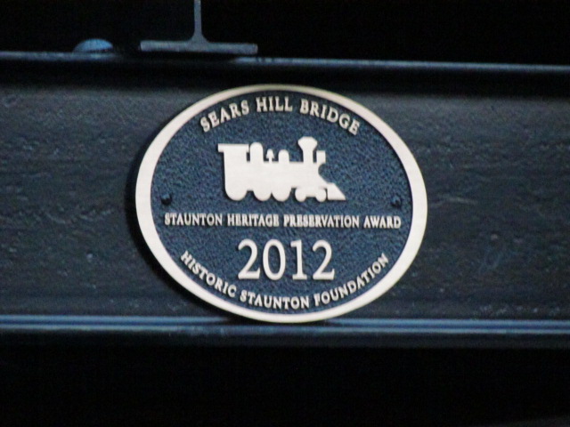
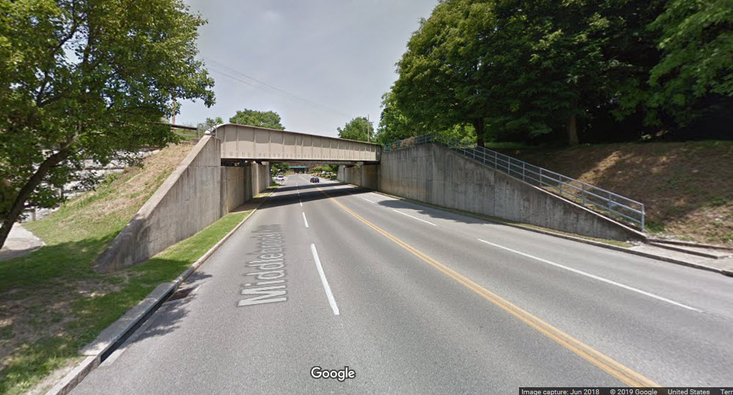
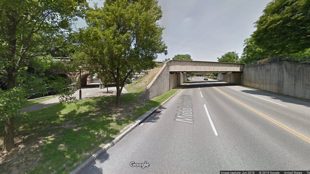
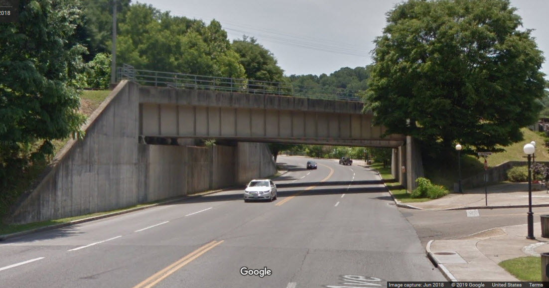
The bridge was rebuilt as new 2011-2012, and they did a wonderful job!
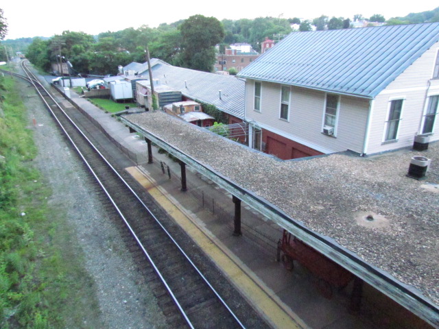

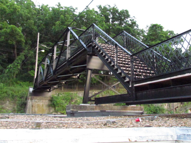
Views from the bridge.
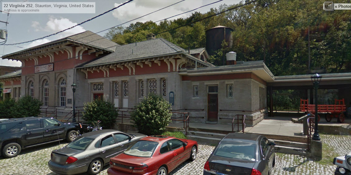
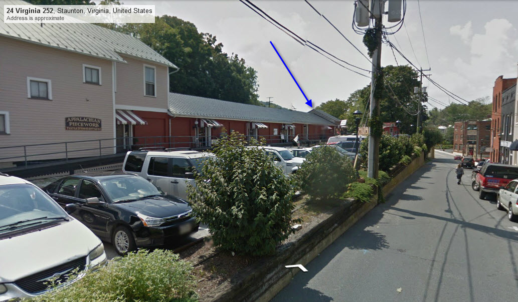
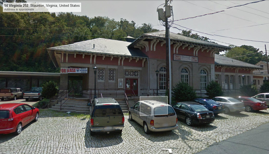
These 4 pictures are from Google's street view, actually very clear for a change!

GPS Coordinates: 38.147623, -79.071731
https://www.greatamericanstations.com/stations/staunton-va-sta/
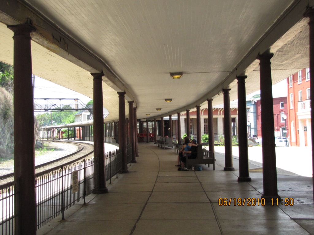
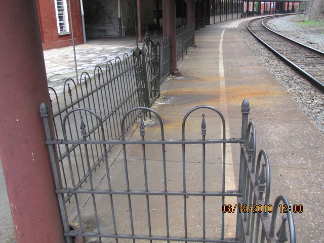
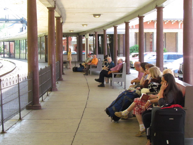
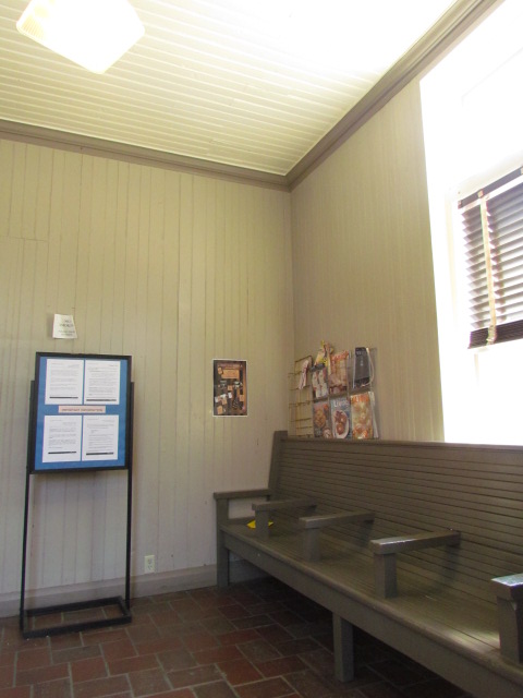
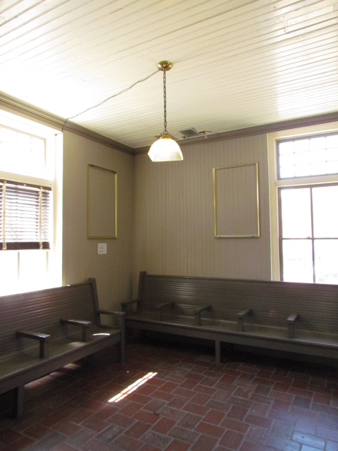
It must have been difficult to see trains from here with the platform canopy in the way.
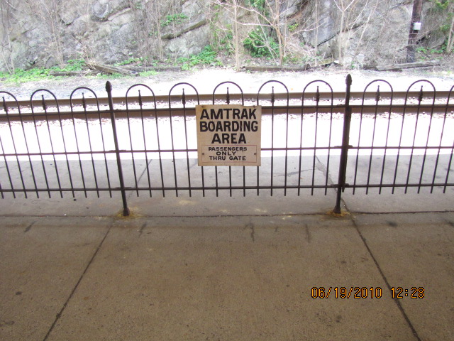
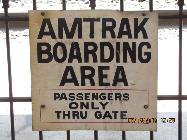
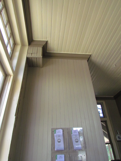
Amtrak also uses the bottom floor for their station and is open about an hour before trains arrive.
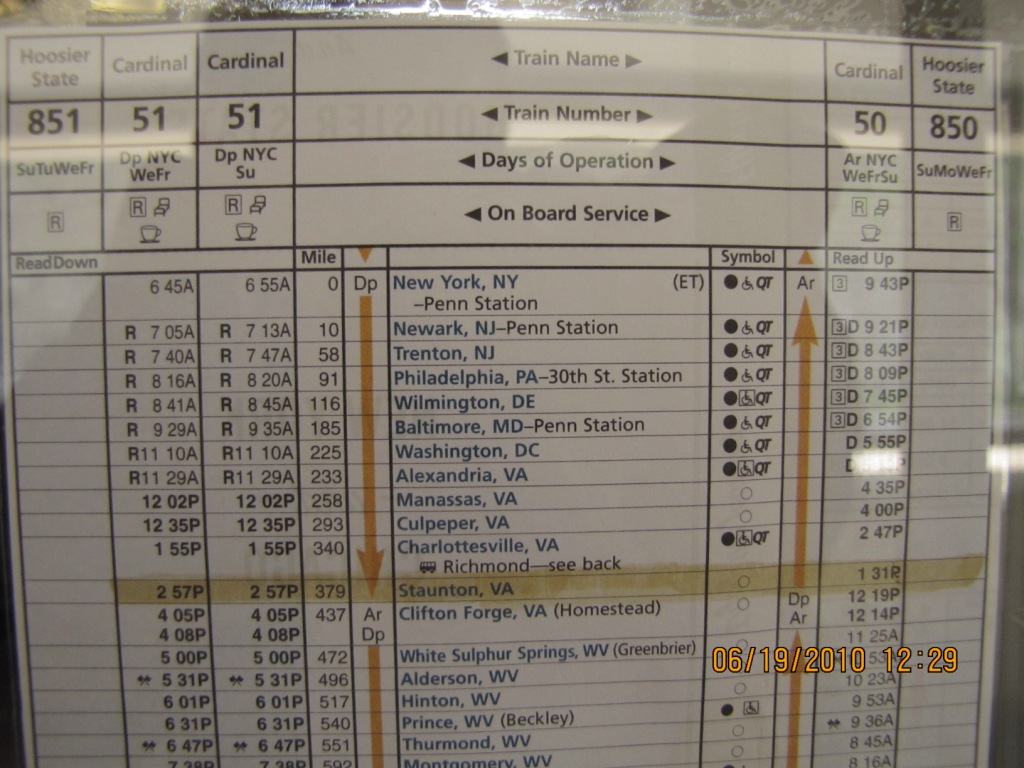
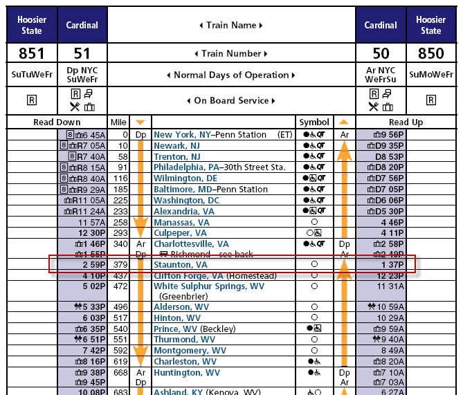
Staunton is serviced 3 times a week by the Cardinal, Amtrak trains #50 and #51.
The Cardinal provides service between NYC, DC, and Chicago via a "southernly" route.
Travel time by train from Charlottesville is about 1:12hrs and costs $11.
A trip to Richmond will cost around $20, but goes by bus between Charlottesville and Richmond.
To/from Washington DC, it's a 4:29 ride and will set you back $64.
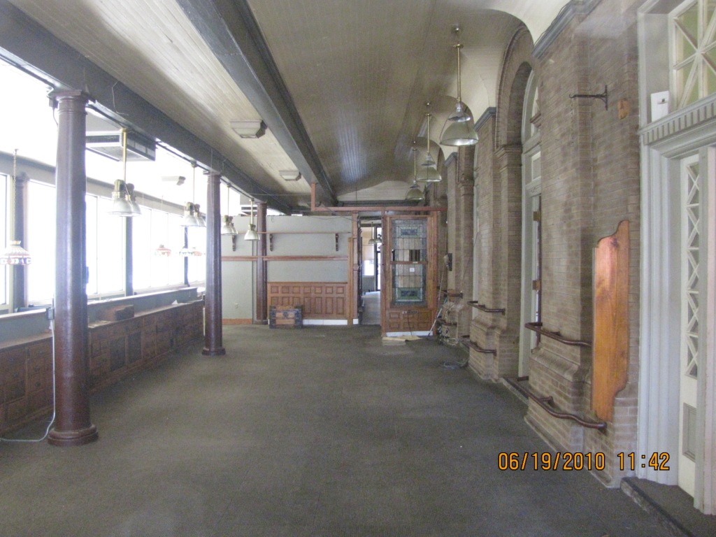
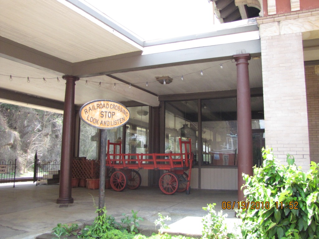
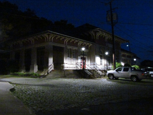
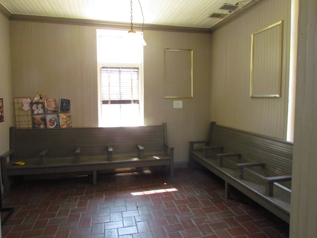
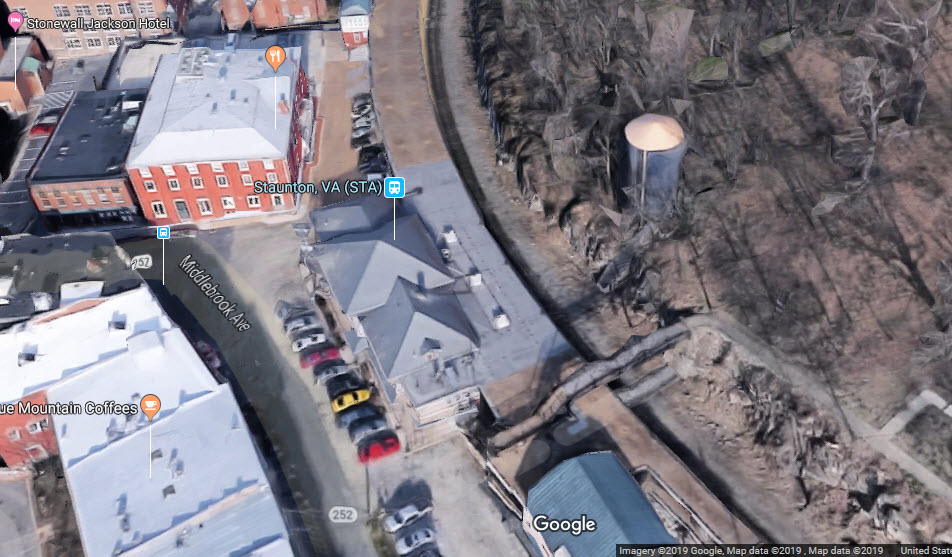
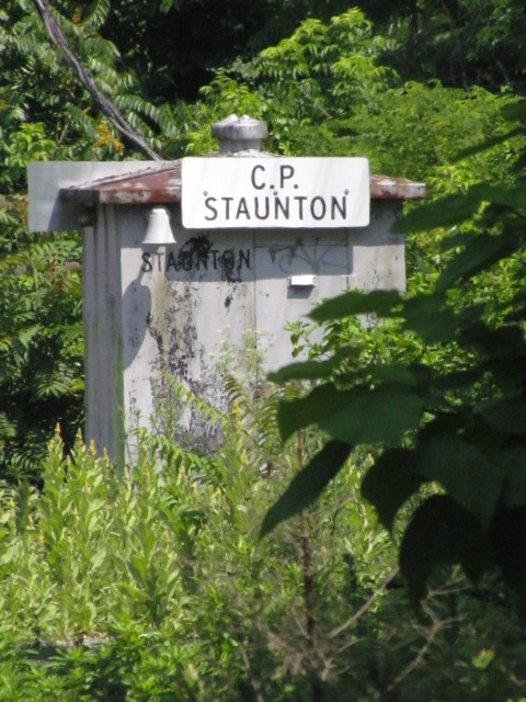
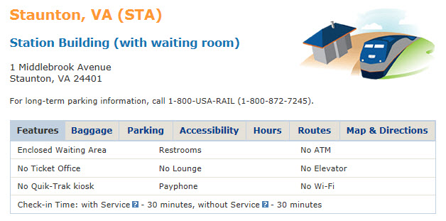
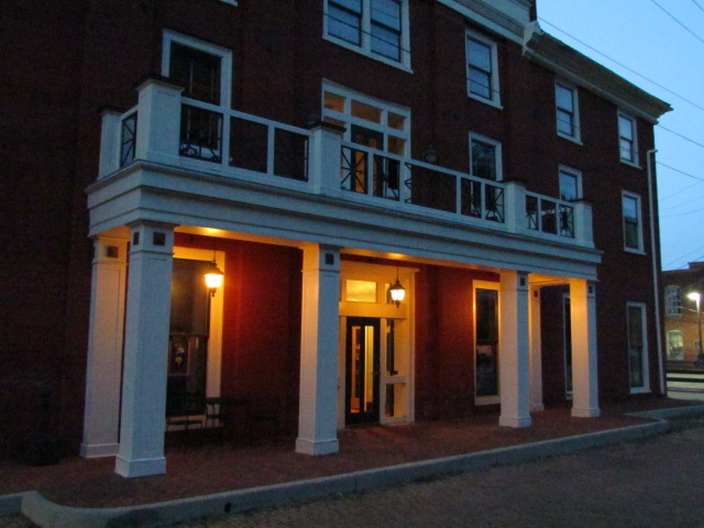
From the Great American Stations page: Customers at Staunton use a small unstaffed waiting room located in the former signal house (The C&O called them CABINS - Todd) built for the Chesapeake & Ohio Railway (C&O) circa 1886. Since the mid-19th century, three depots have served rail passengers at this site, located on a bend at the foot of Wilson Park and beside the now-underground Lewis Creek.
More info below.


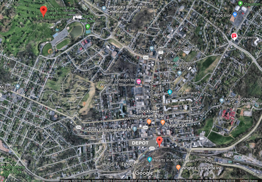
GPS Coordinates: 38.147092, -79.073316
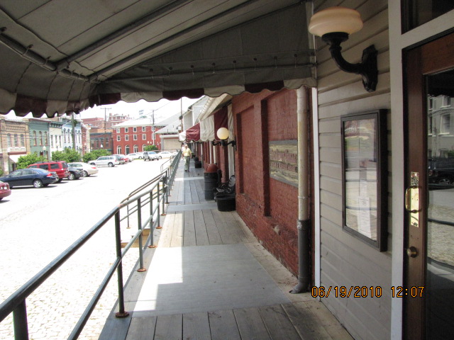
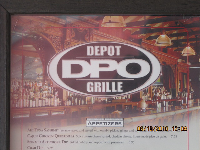
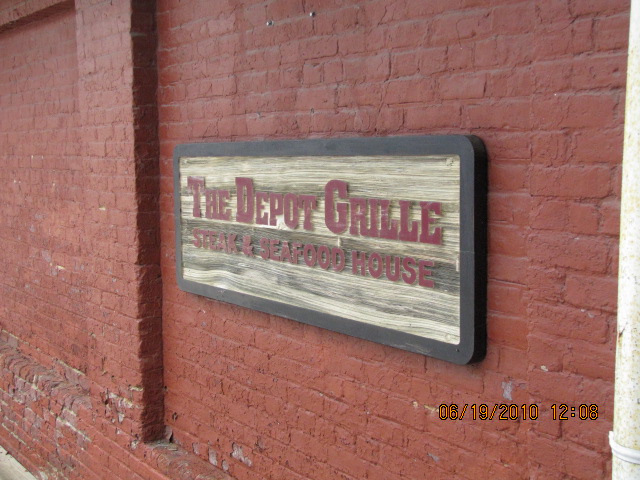
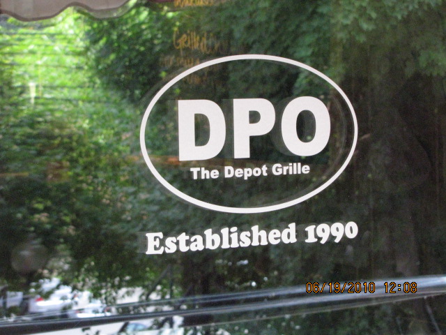
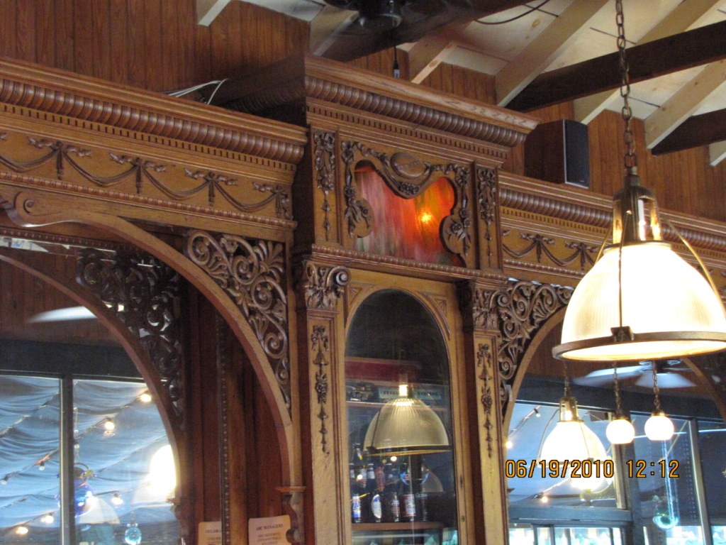
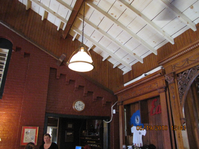
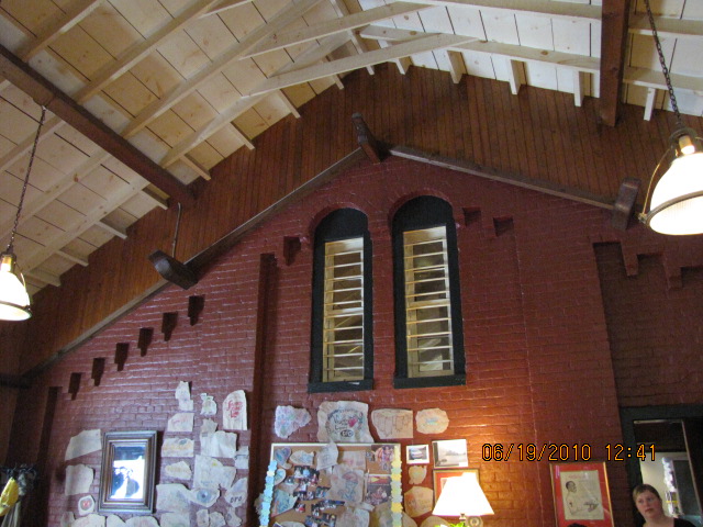
Probably built in a former freight warehouse.... Very worthy for stopping in at and having lunch or dinner, prices AND food are great! The Depot Grill is the "best" place in town to eat, well, it's the only place I did eat at.... so......


GPS Coordinates: 38.145099, -79.076211
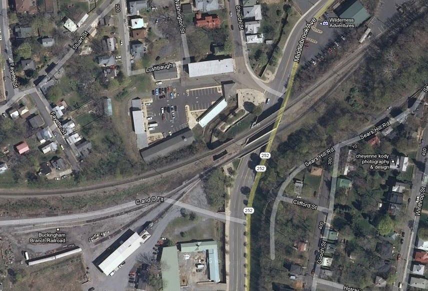
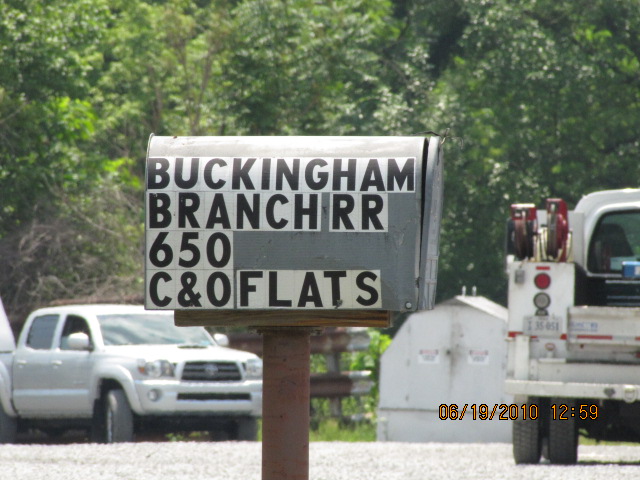
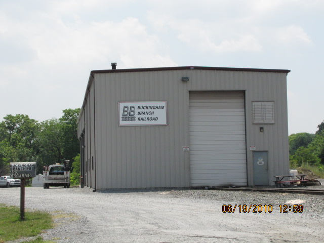
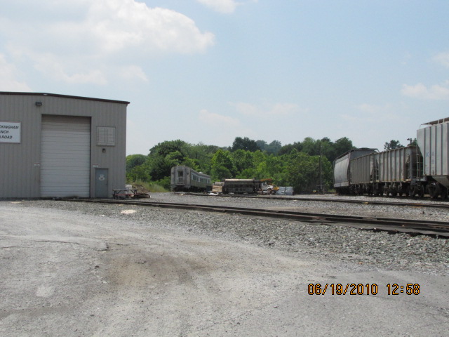
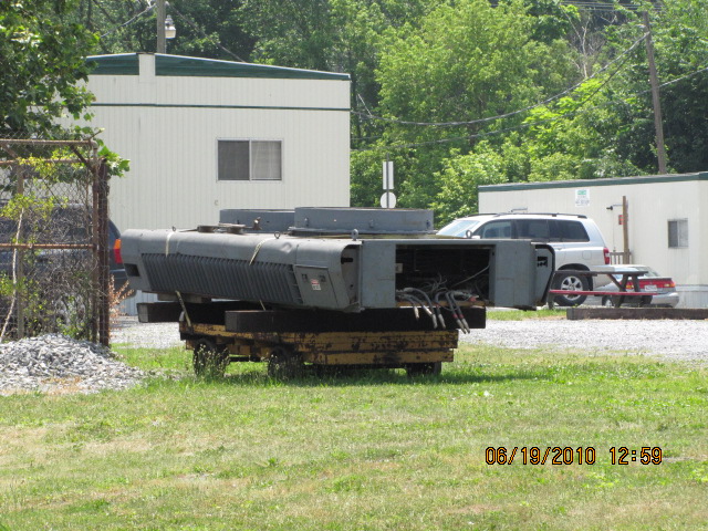
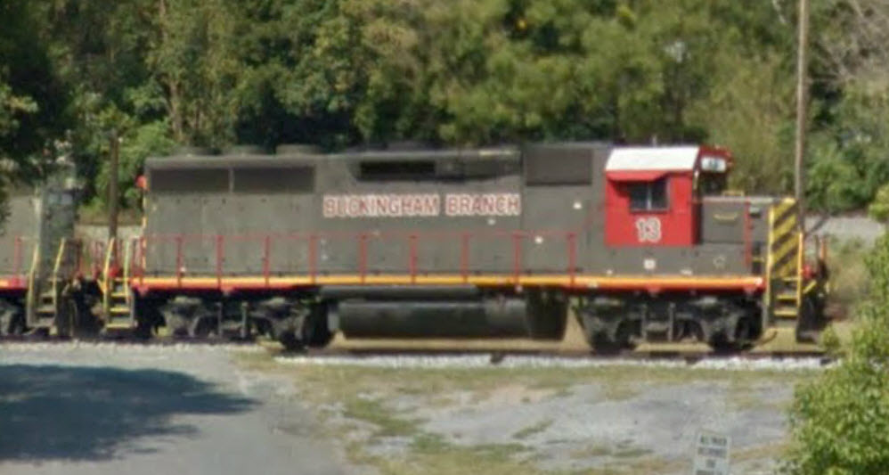
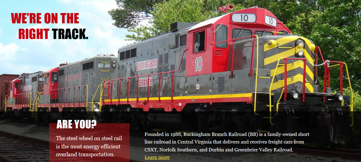
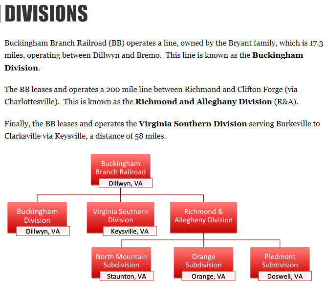
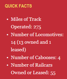
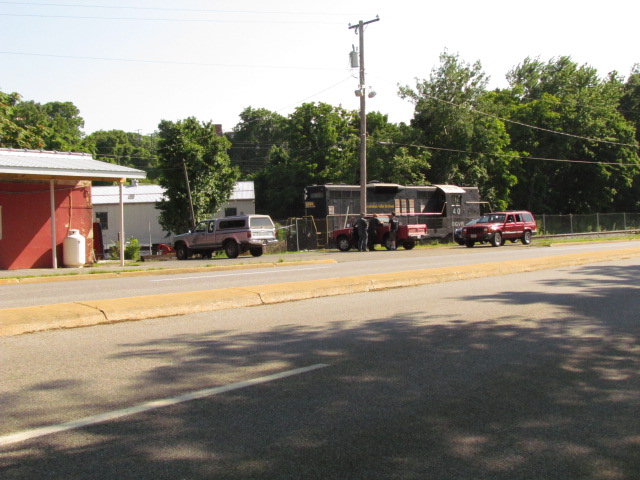
The Buckingham Branch RR is the largest shortline in Virginia. They are railfan friendly, and a stop at either Doswell or Dilwyn will prove. To boot, the owner's daughter used to live across the light rail tracks from where I live in Thorton.
Their website is here, and has a fair bit of railfan oriented stuff on it.
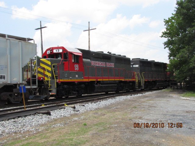
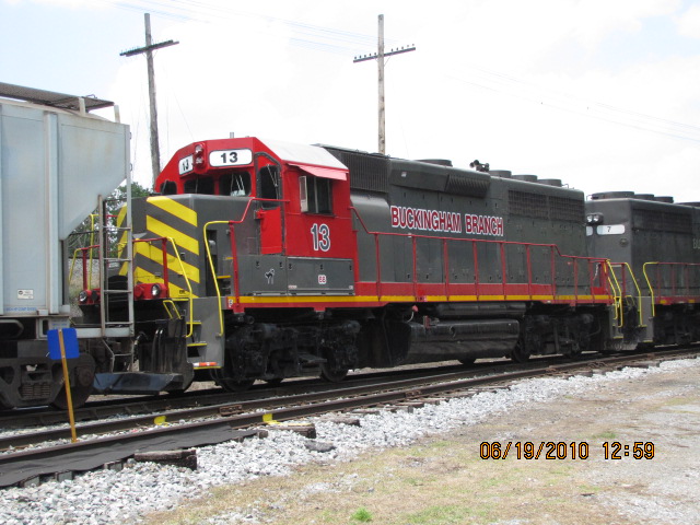
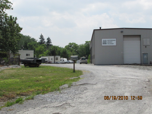

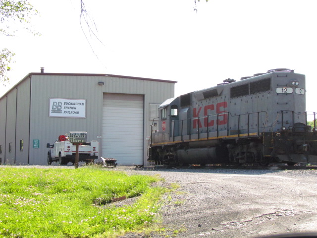
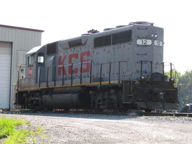 From Friday June 21st, 2013
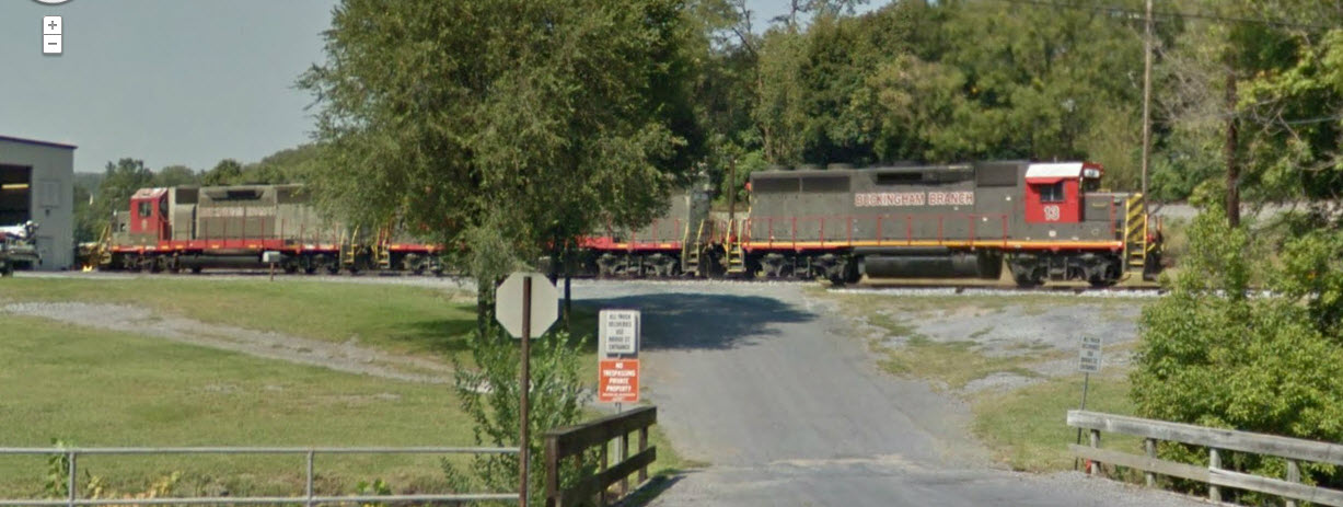
Again, these 3 pictures are from Google's street view.
Below is some stuff from their website.
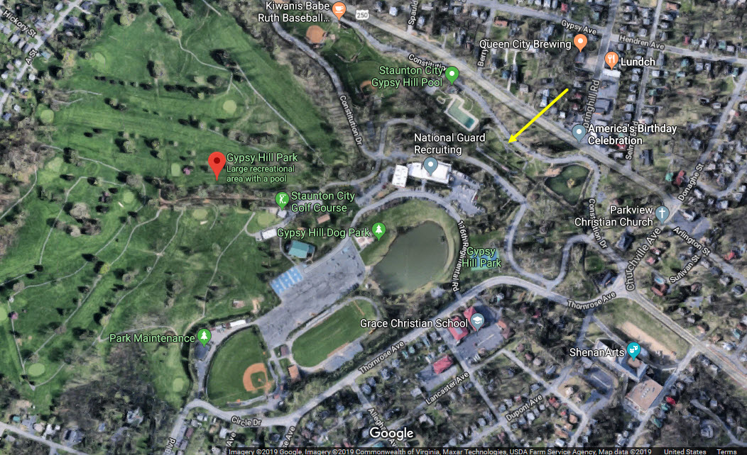
GPS Coordinates: 38.147072, -79.068652
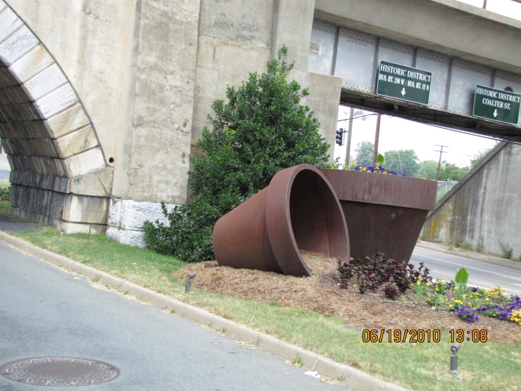
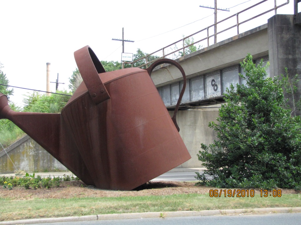
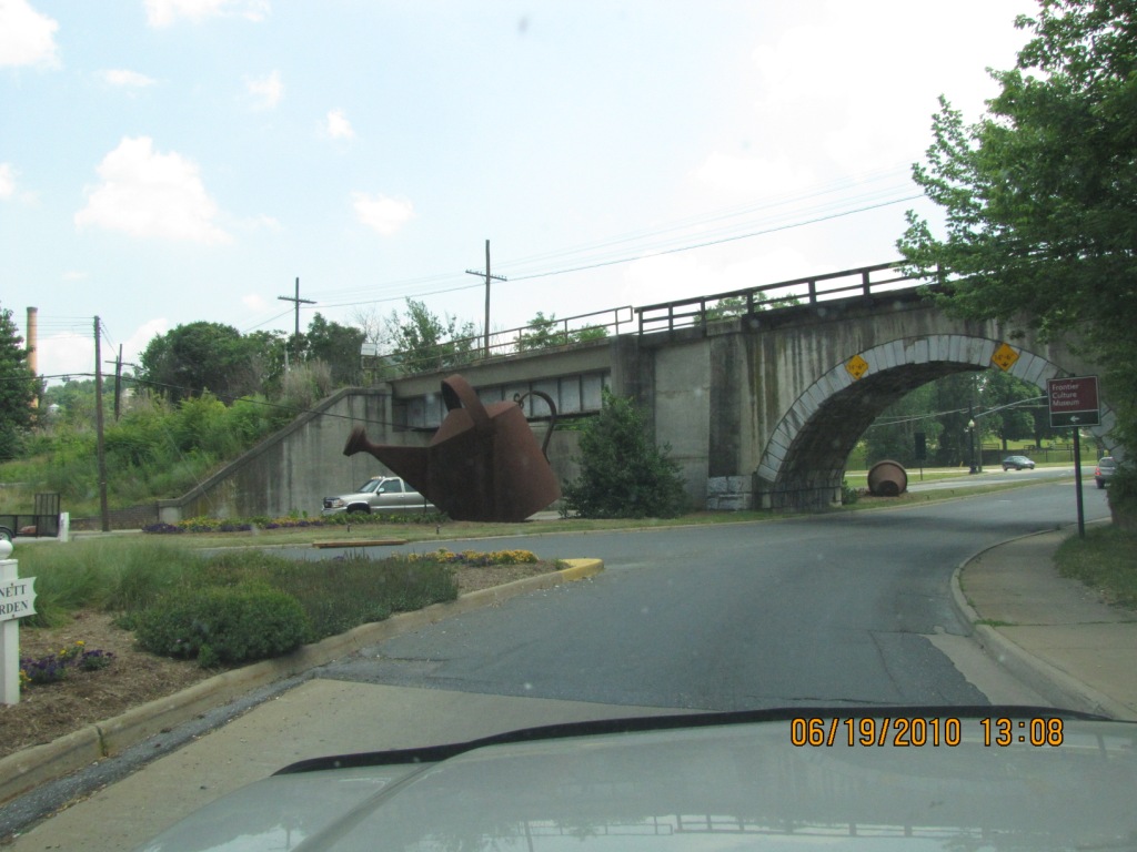
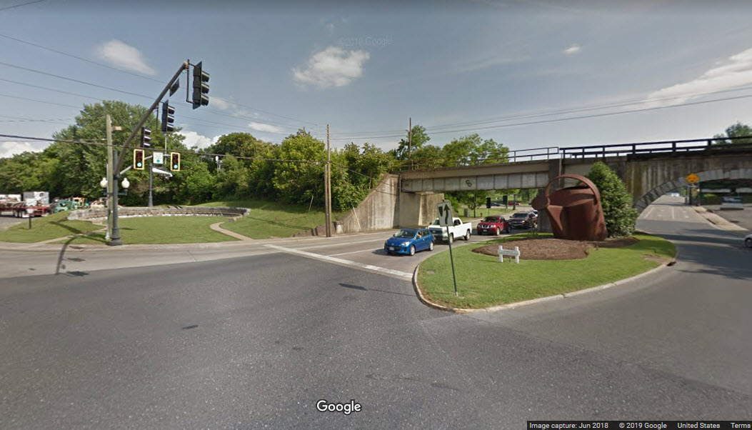
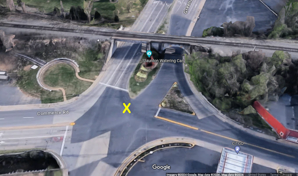
Interesting watering can and flower pot where Greenville Ave goes under the tracks on a still labeled C&O bridge.
GPS Coordinates: 38.146671, -79.066719
Along Richmond Ave, just off US 11.
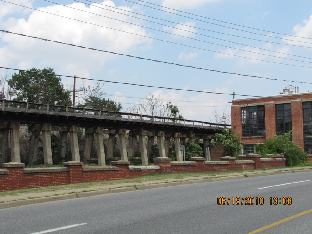


GPS Coordinates: 38.146989, -79.065896
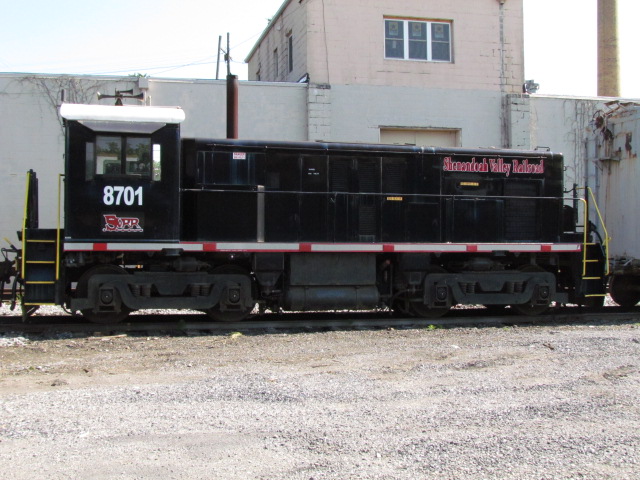
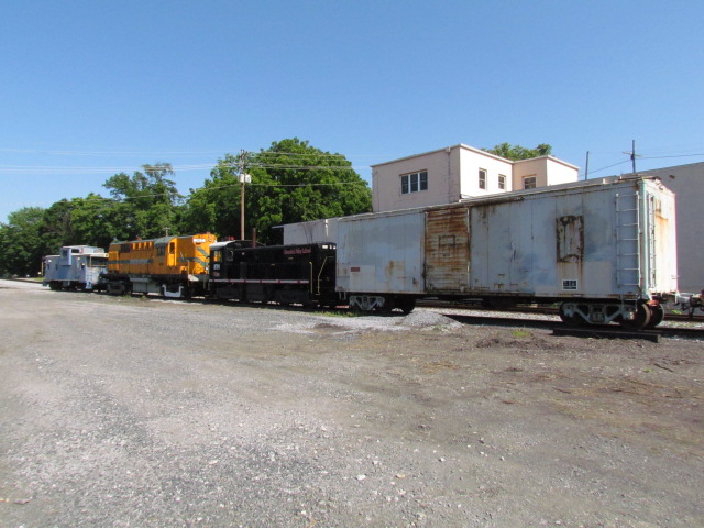
Located off Lee Highway, near the watering can. The Shenandoah Valley Railroad came about in 1993, when it bought 20.2 miles (32.5km) of track from the Norfolk Southern between Staunton and Pleasant Valley (Harrisonburg). It is currently operated by the Durbin and Greenbrier Valley Railroad. The SV interchanges with CSX and Buckingham Branch in Staunton and Norfolk Southern in Pleasant Valley. I do not know when their trains run.


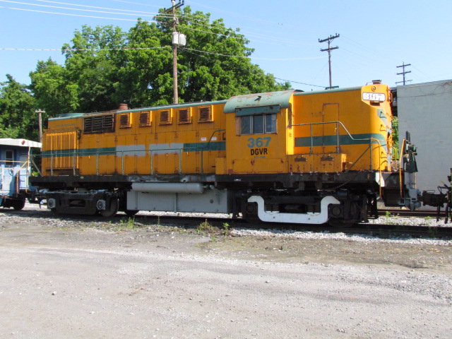
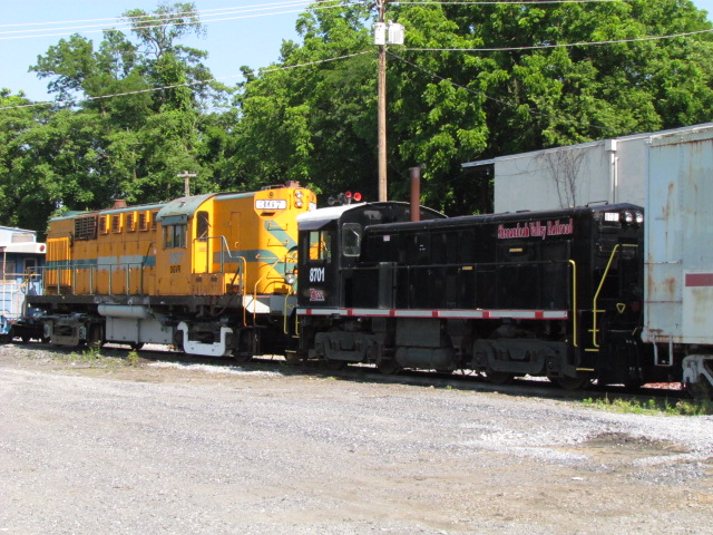
The RS-11 (367) doesn't run :-(
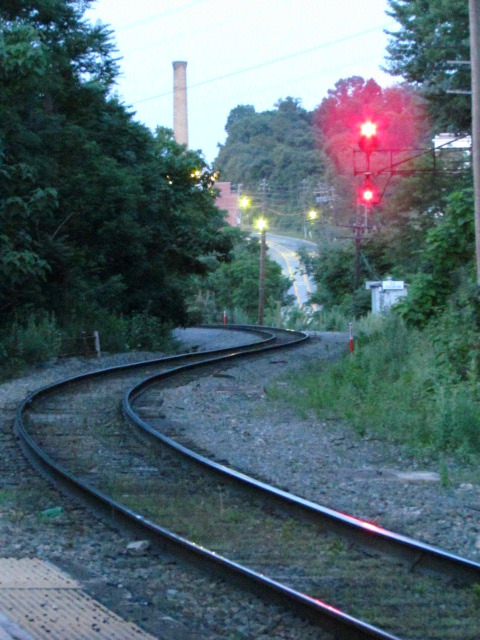
 Looking west (L) and then east (R) from the crossing adjacent to the office.
GPS Coordinates: 38.147172, -79.072389
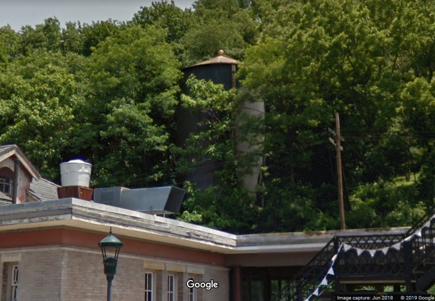
Nestled quietly above the depot is a C&O water tower that has never been removed. During the summer, it is difficult to see. Thanks to Paul for bringing this to my attention, and to Jonathan for taking the picture.
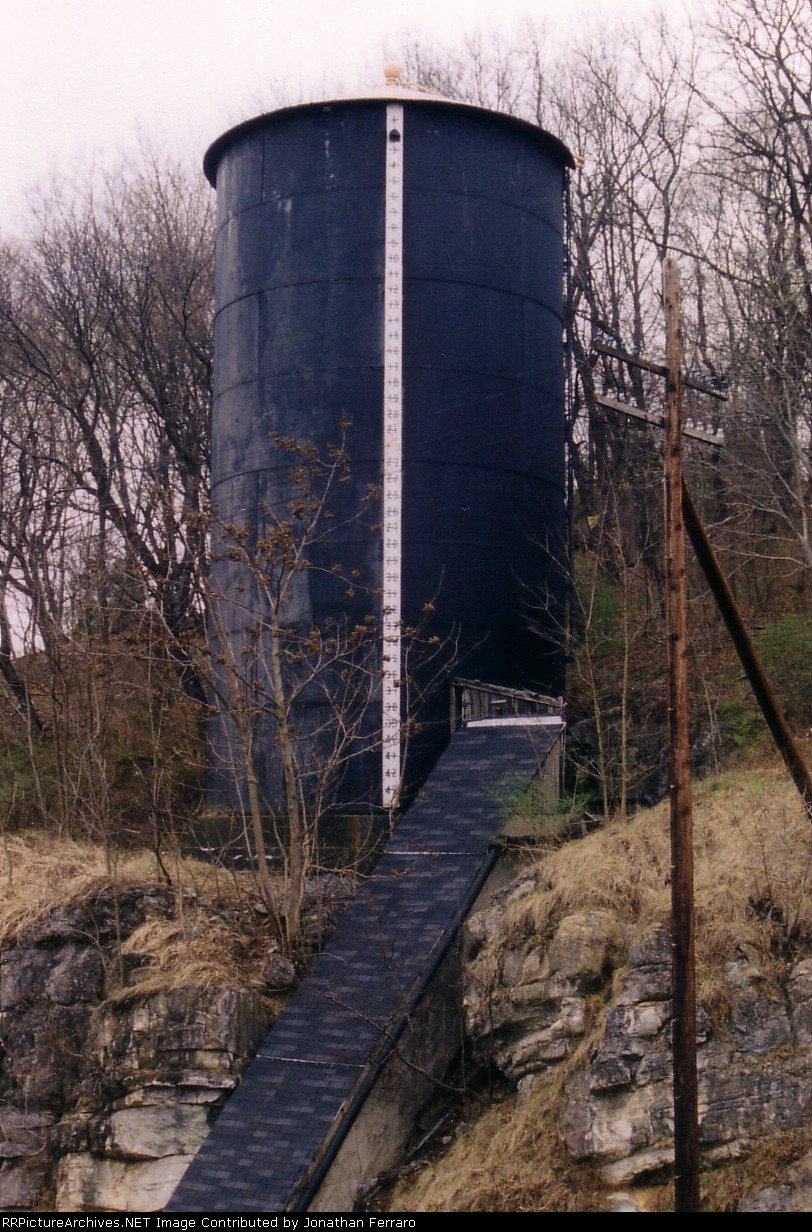
http://www.rrpicturearchives.net/showPicture.aspx?id=281675
GPS Coordinates: 38.147137, -79.068229
Adjacent to the Water Can pictured at the US 11 Overpass is a "new" attraction for Staunton. This display was designed to recreate a turntable that used to be here. They did a nice job with a section of dual gauge track going into the stonework. Also here is a whistle post and a steam tender water standpipe. Thanks to Paul for bringing this to my attention too!
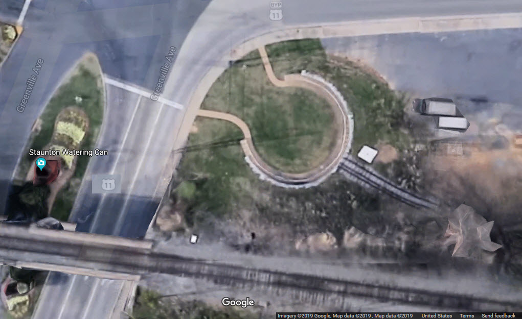

GPS Coordinates: about 38.14719, -79.06856
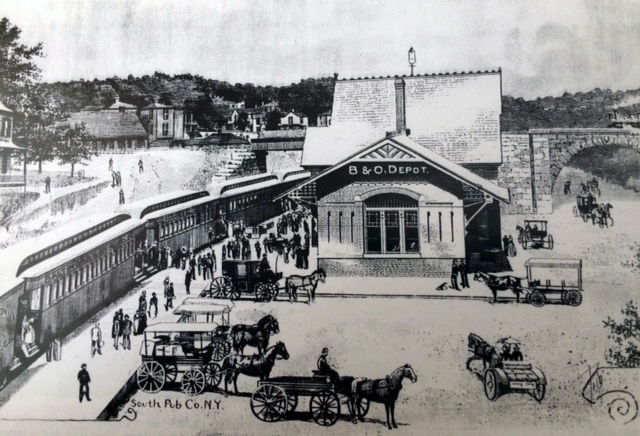
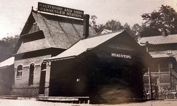
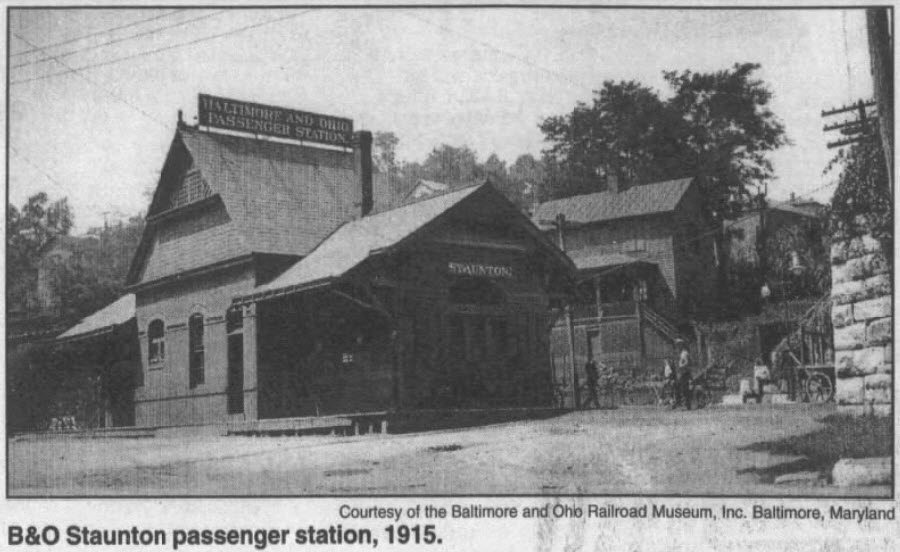
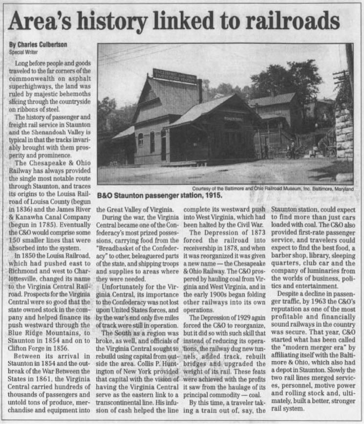
Information on the ole B&O Depot is hard to come by. The first two of the pictures and info block below come from the Historic Staunton Foundation website, but I'm not sure they are the source of the photo. The third picture comes from the "newspapers.com" website, and is a picture contained in an article back in 2002 about the railroads of Staunton, but not mentioning the B&O except for the photo of the depot.
I have not come across a date as to when the depot was torn down.
I finally located a Sanborn map of Staunton from 1904 which shows the location of the depot, see below. Thank you Library of Congress!

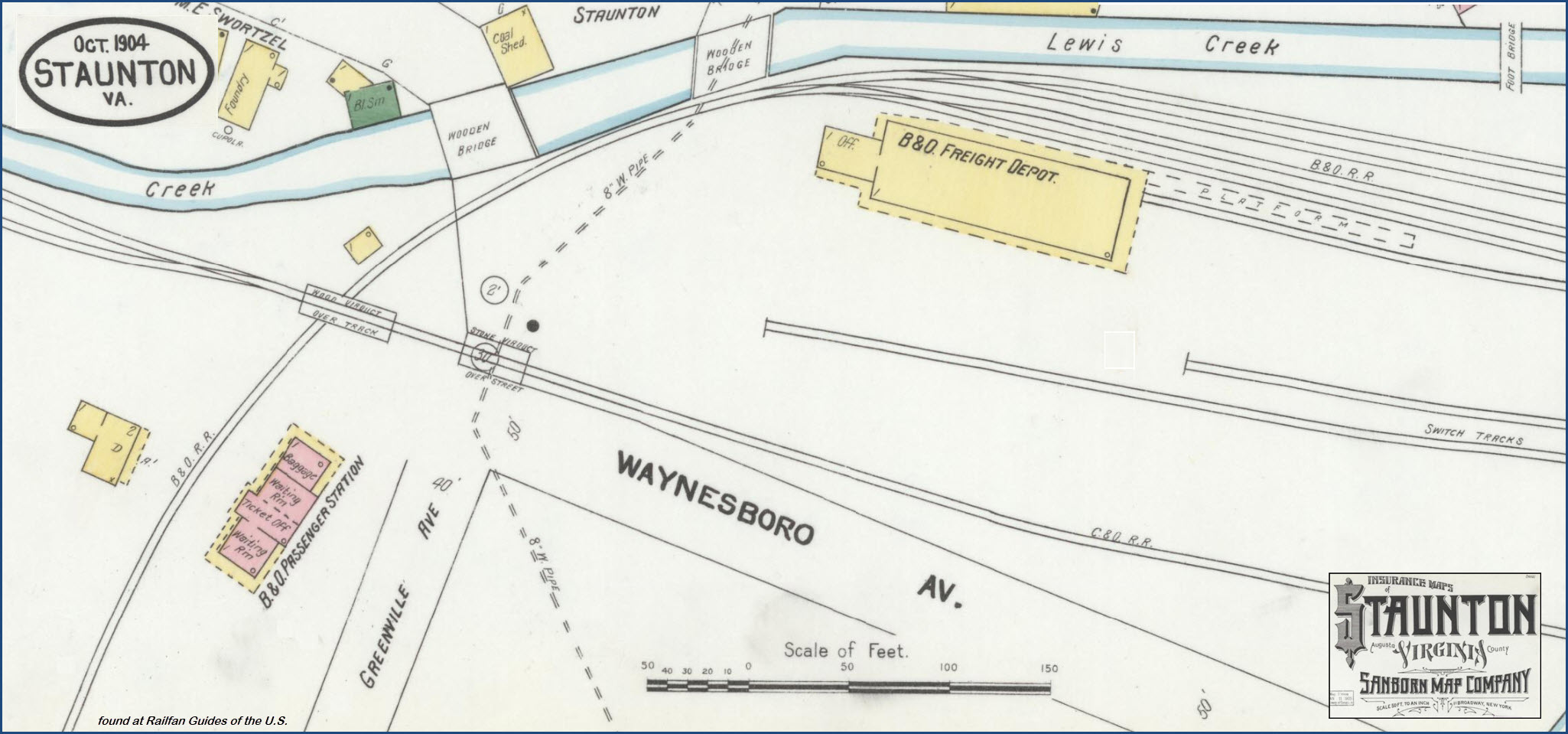
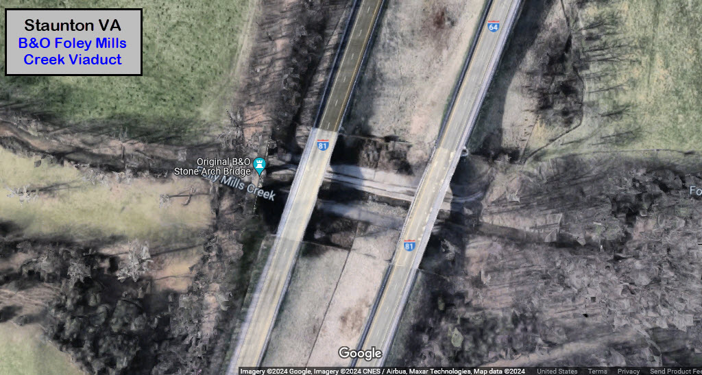
GPS Coordinates: 38.08955, -79.07762
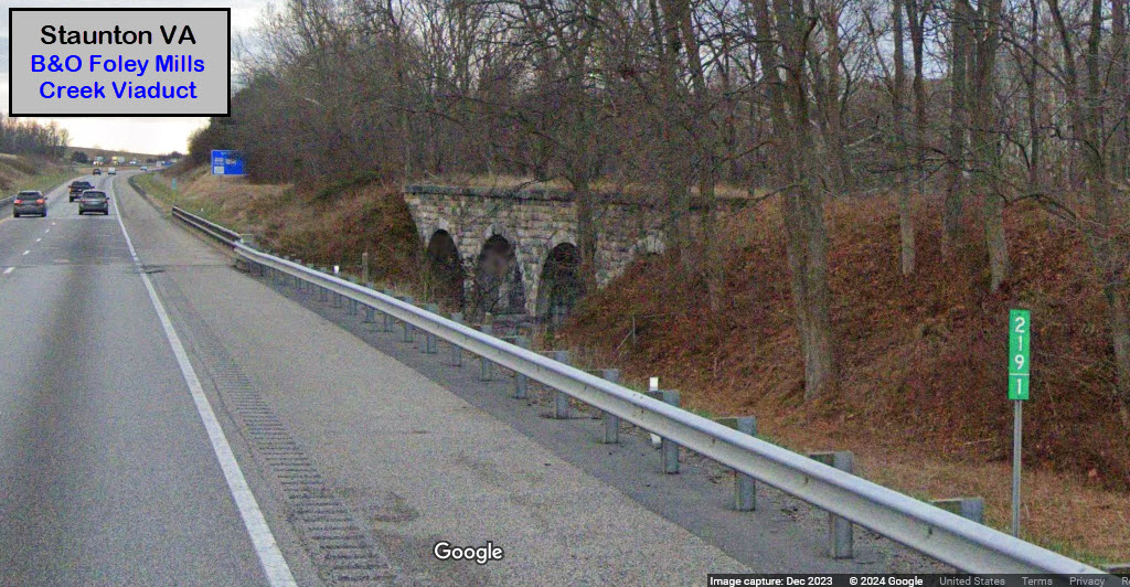
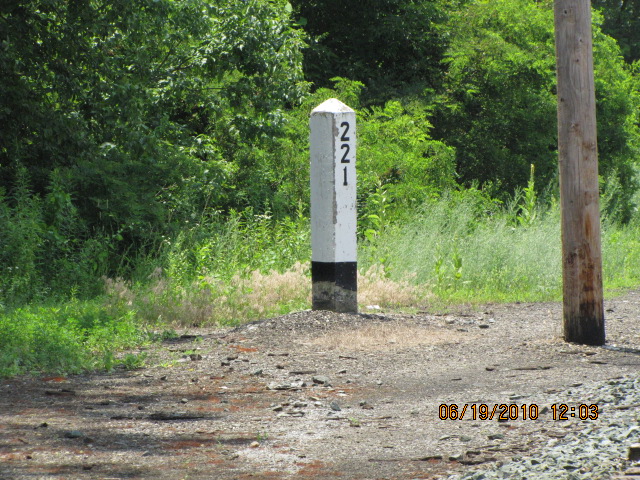
Valley Railroad/B&O's extension to Lexington required crossing Folly Mills Creek south of Staunton. The bridge across Folly Mills Creek in Augusta County was completed in 1874. The four-arch limestone bridge was no longer needed after the railroad ceased operations to Lexington in 1942 - the bridge has remained in good condition since. It was acquired by the Virginia Department of Transportation (VDOT) when I-81 was constructed, using part of the railroad's route across the divide separating the Shenandoah and James Rivers. It can be easily seen from I-81 for drivers in the southbound lanes at milepost 219.1. The is no public access to see the bridge other than from I-81. The historic structure is maintained by the VDOT. History of the unfinished line to Salem VA can be found in the references above.
Interesting note: I don't think I can say I have ever noticed this bridge before, and I have traveled up and down the I-81 corridor countless times since 1980... how the heck did that happen???? :-) :-)


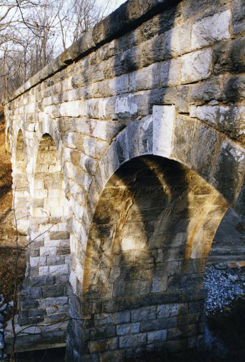
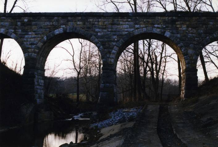
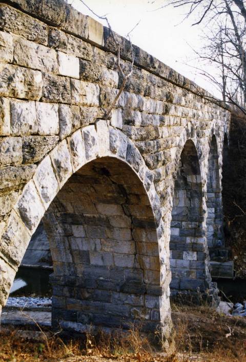

these four pictures by Steven Smith
GPS Coordinates: 38.160197, -79.080421
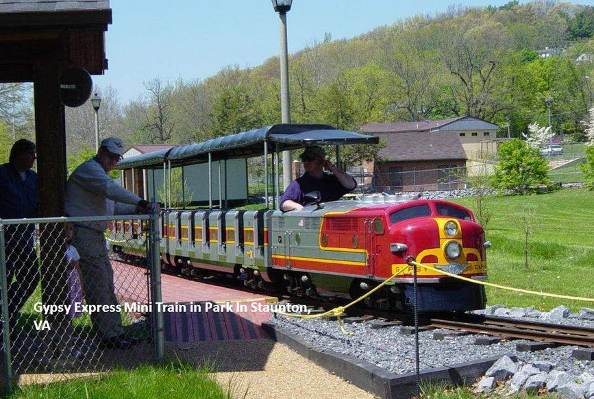
Just under a mile away from the depot, in Gypsy Hill Park, is a park size mini-train that has been around since 1958. It is off my map to the NW.
https://www.ci.staunton.va.us/departments/parks-recreation-/parks-/gypsy-hill-park/gypsy-express-mini-train
Hours: 1 to 5 p.m., Saturdays and Sundays, May through October. The Gypsy Express does not run in the rain.
Tickets: $1 per person. All rides are free on July 4 and Labor Day.
The Gypsy Express is a short, fun ride around a scenic area of Staunton’s Gypsy Hill Park. Today's riders are frequently the children and grandchildren of those who first rode the mini train more than a half-century ago. The Gypsy Express has been sharing fun and adventure with the young and young at heart for 60 years. Get in on the great Staunton train adventure!
History: In 1958, George and Linda Bartley brought a mini-train to Gypsy Hill Park. In a truly remarkable display of commitment, they operated the Gypsy Express until 1991, when they sold it to the City of Staunton. The City continued to operate the mini-train until 1998, when it was taken out of service for safety reasons. City leaders were considering whether the train could be safely operated or whether it should simply be removed from the park. A group of area residents refused to put their memories and fondness for the train aside and, in August 2000, held an open meeting at Montgomery Hall Park to discuss saving the train. About 50 local citizens attended, including George Bartley. As a result, the group formed a non-profit corporation and named it Gypsy Express, Incorporated (GX). GX contracted with the City to repair and bring the train back to safe service standards, and to provide volunteers to operate the train. The City provided some seed funding, but the bulk of the funding has been provided through private and corporate donations. Volunteers began the rebuilding process in the spring of 2001 by moving the station house to higher ground and refurbishing it. They then enlarged the track and replaced most of the roadbed, added drainage pipes, and added stone rip-rap to hold the roadbed in place.The old 8 lb. rail was replaced with new and heavier 12 lb. rail. GX borrowed a rail bender from Maine to bend the new rail. The old rail was sold to a private train operation in North Carolina. The volunteers also put in all new ties, tie plates and drove in all-new spikes, one at a time. They designed and built two new bridges, replaced the engine house, rebuilt the engine and refurbished the cars. The engine and cars were repainted in Santa Fe Railroad colors, and a newly designed Gypsy Express logo was added. Dedicated volunteers also landscaped the grounds, added a switch and siding, rebuilt the crossings and added a crossing signal. A flagpole, new fencing, and gates were also installed. The Gypsy Express again roared to life on August 5, 2001 in a drenching rainstorm, with Mrs. Linda Bartley and Staunton Mayor G. John Avoli in attendance. GX designed and built a third car that accommodates larger people and wheelchairs. It is the first of its kind in the US, and began operation in 2003. The upper bridge has been made into a covered bridge for storage of this new ‘handicapped’ car. The loading platform was extended to allow for easy loading of wheelchair riders, and paved walkways were built for easier access to the train.

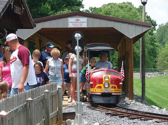
Friday, June 21st, 2013
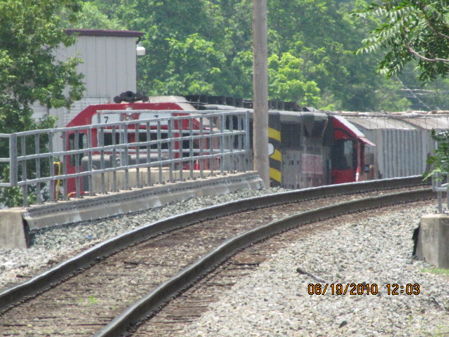
Staunton is served by two Amtrak trains, NB #50, and SB #51. #50 is scheduled to come thru at 1:37PM, train #51 2:59PM. On this day, Amtrak train #50, since it is coming from Chicago, was running about 90 minutes late. The SB train was only running about 15 minutes late. As chance would have it, they both got here at just about the same time. Train #50 came arrived first around 3:00, and immediately after they passed on the siding to the north of the station, #51 arrived.
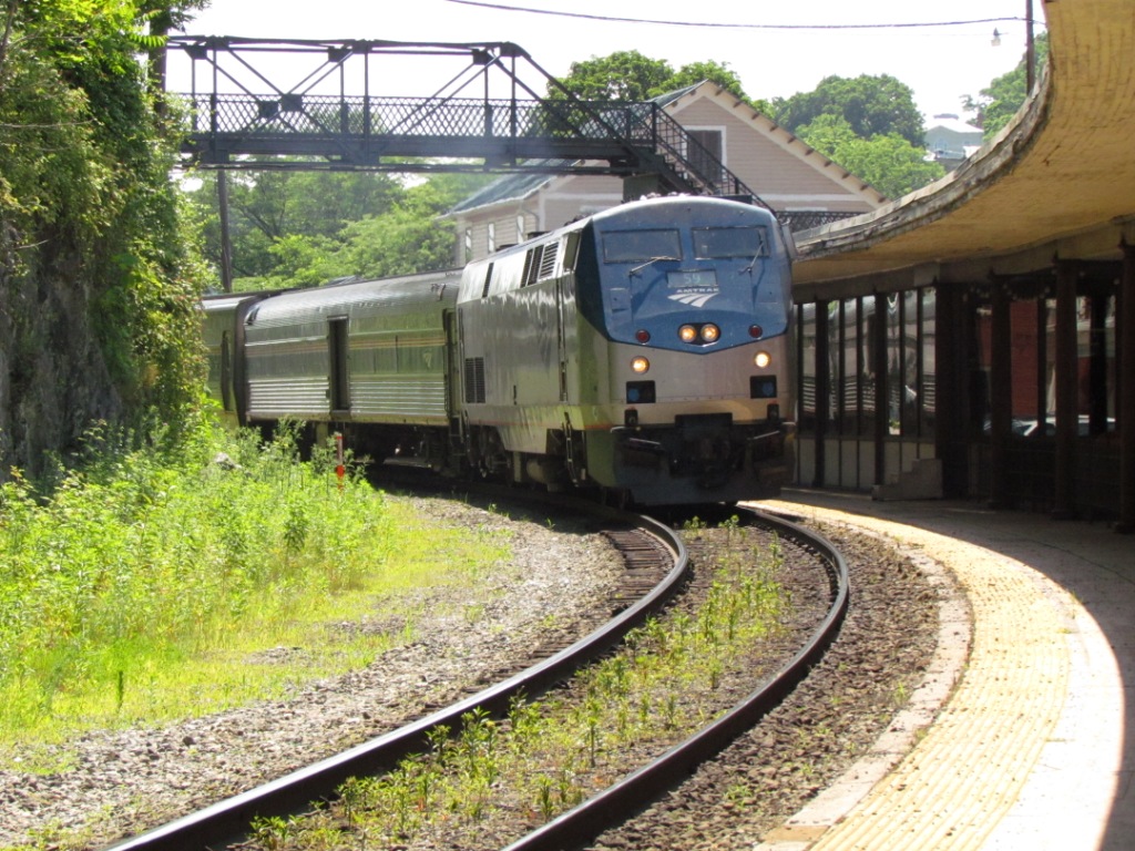
 Train #50
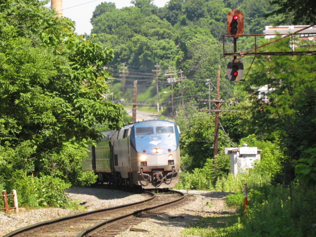
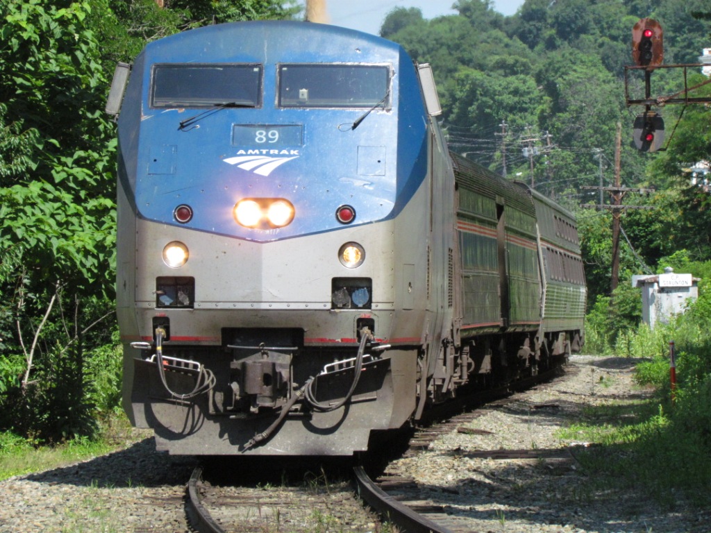 Train #51
Next to the Tracks

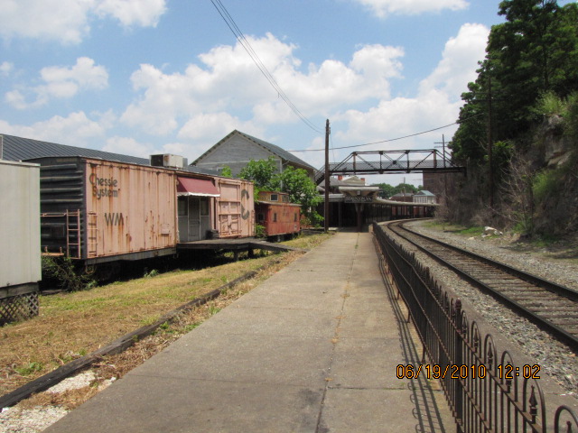


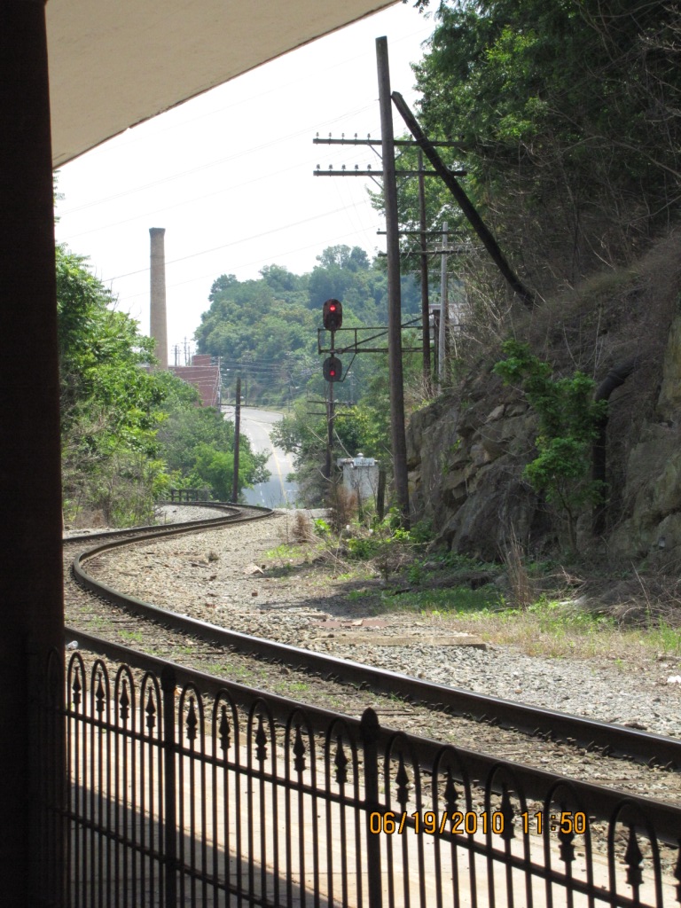
This is what you will see as you walk along the tracks on the platform.
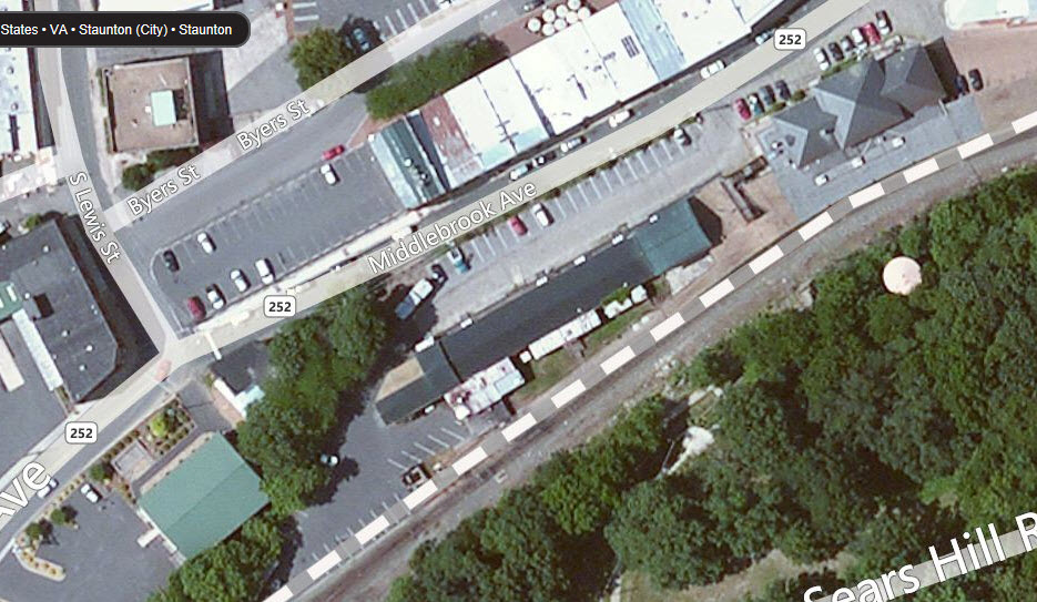
Around the corner from the station, as you go under the R-O-W on Middlebrook Ave towards the BBrr.
The left picture is from Google's street view, the right one is mine.
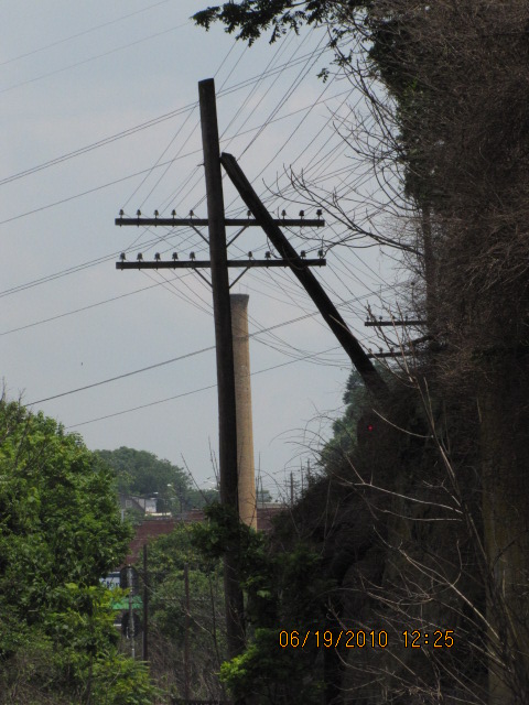
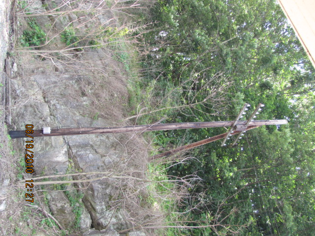
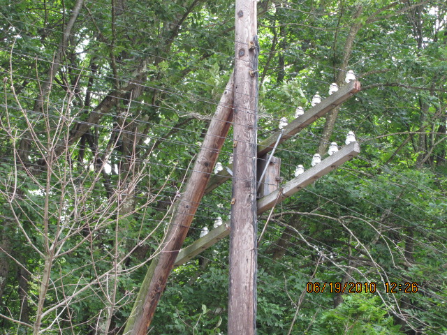
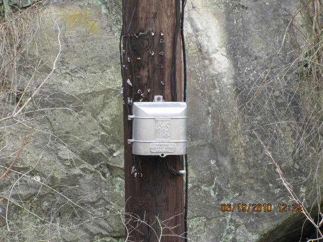
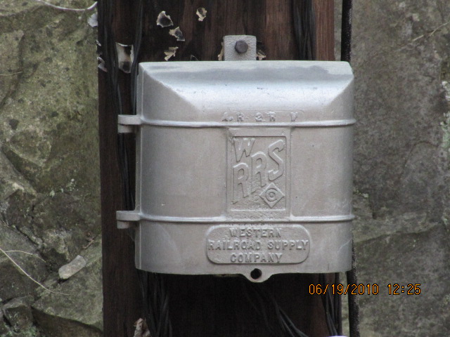

The pole line on the far side of the track is interesting, as it hugs a high wall of rock.
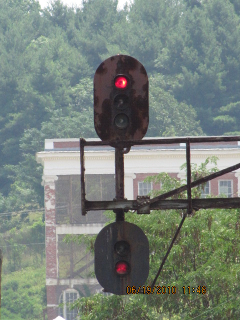
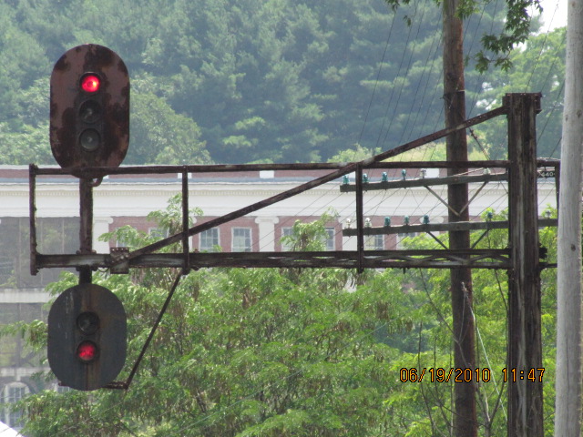
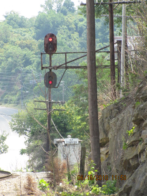
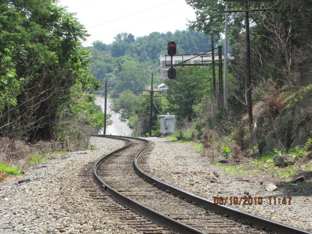
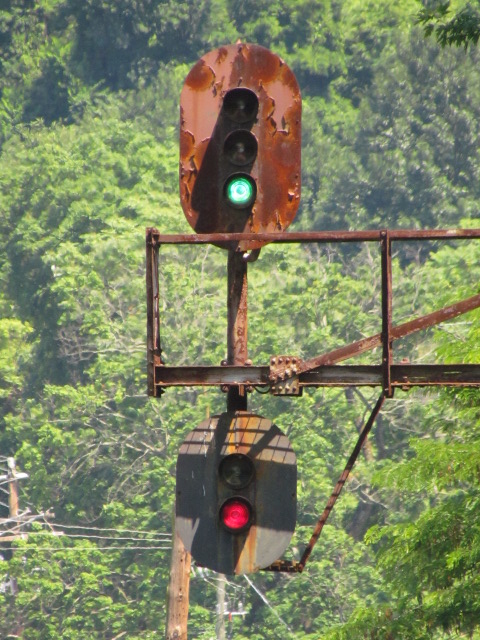
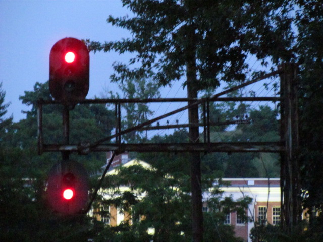
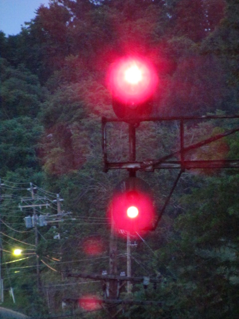
The only signal I came across in my short time going through town - they are just east of the station for EB traffic. Just around the bend are the WB signals, but there is no way to easily get pictures without walking down the tracks. Definitely C&O styling if you are at all familiar with their equipment, with red on the top of the upper head. According to one railfan I met at the station, the C&O signals are soon to be replaced by newer "darth vader" color lights.


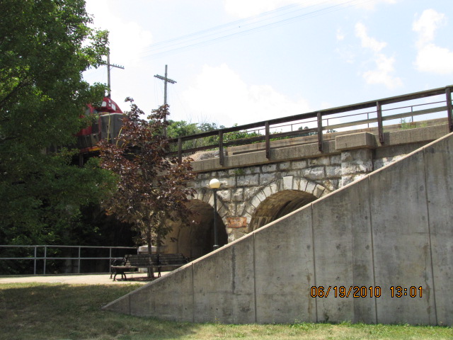
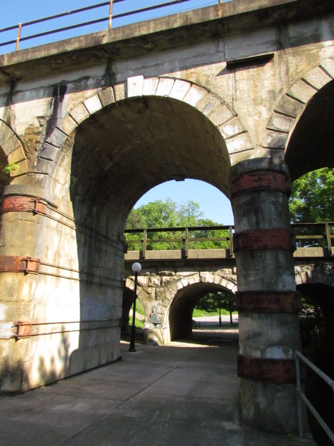
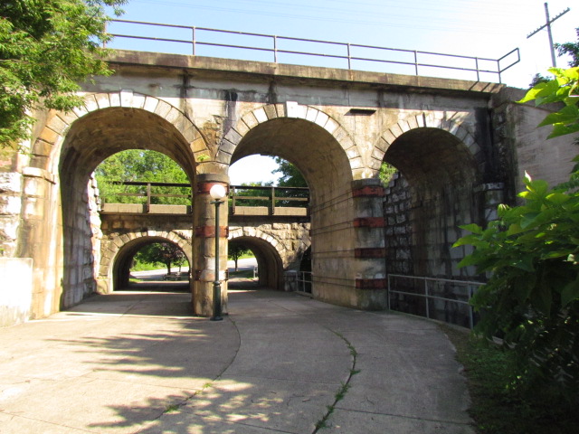
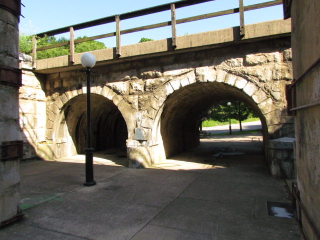
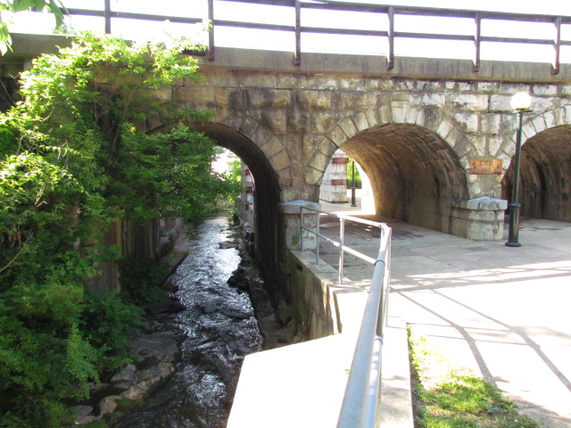
Railroad Bridges and Overpasses
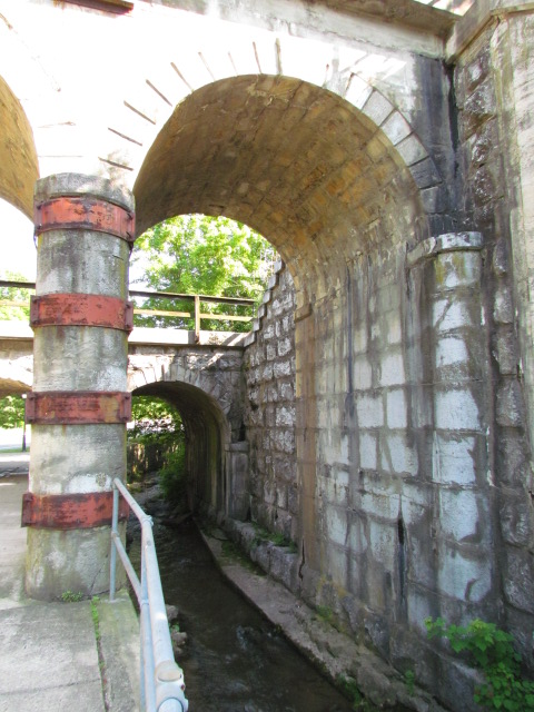
The span going over Middlebrook Avenue is a steel girder, and the track going over the creek and walkway is on a couple of small but well decorated stone arches.
You can find a convenient place to park off Church St and Middlebrook.
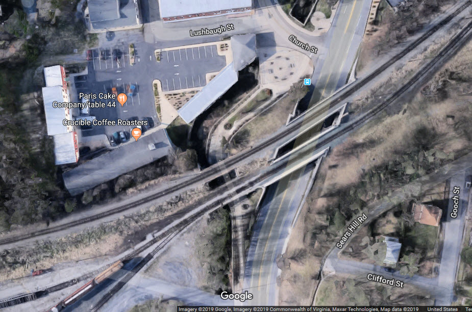
These overpasses are now part of Landis Park, a nice break from everything else.
See above, sight #5.
A narrow street spanned by a steel girder bridge.


Staunton supposedly had the very first volunteer fire company in the state.
At some point in time, the city decided to make the all volunteer station part paid, and part volunteer... then, to the dismay of those that were volunteers, they made it all paid. Many cities, especially in Florida, are finding out that it is very expensive to pay for the retirement of all of those former employees. We'll see how Staunton fares, maybe they will invite the volunteers back. The West Friendship Volunteer Fire company in Howard County MD is a good example of what can be accomplished when people and the local government work together, as they have a mix of both paid and volunteer.
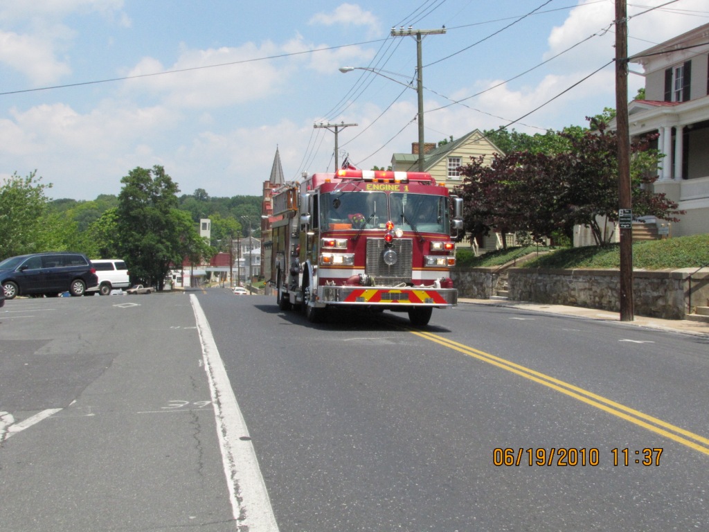
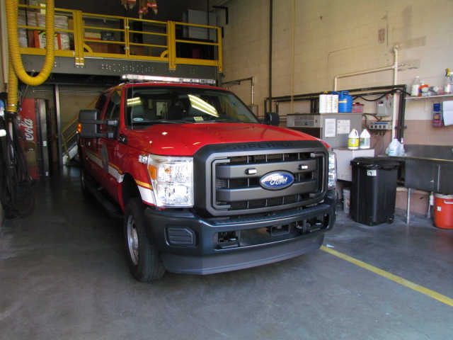
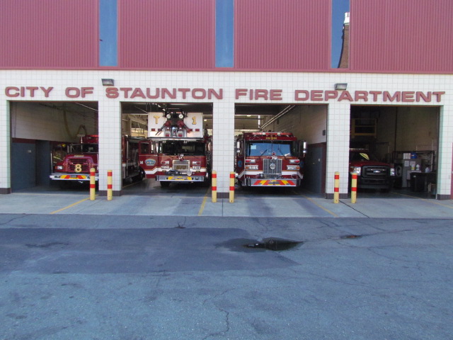
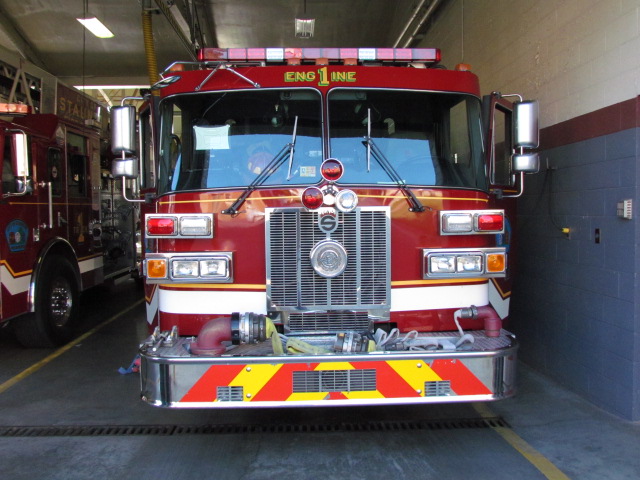
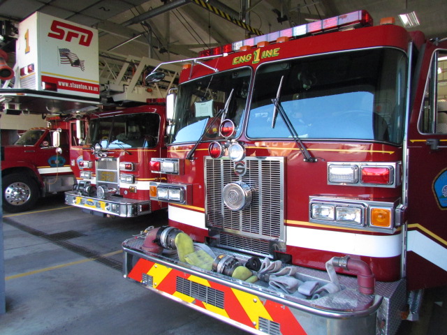
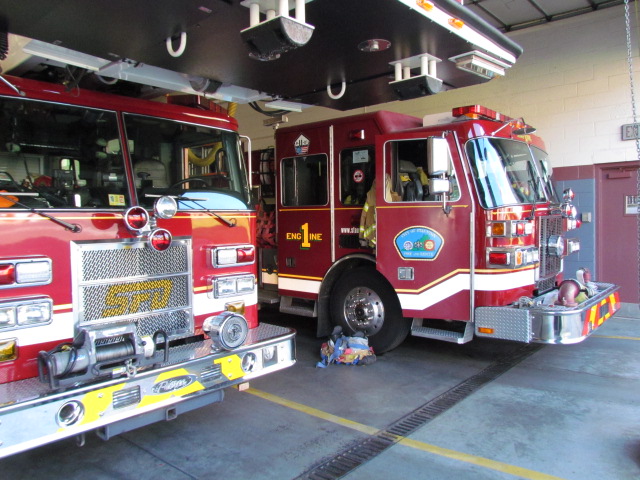
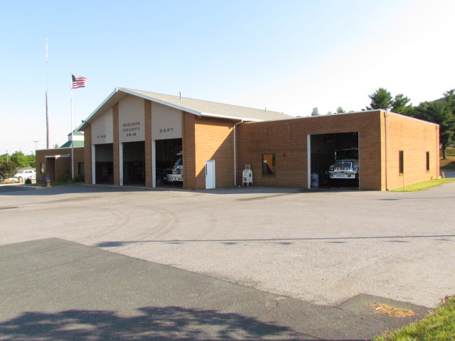
City of Staunton Fire Department Station #1
At the corner of N Augusta St and Pump St. More info from the historical page above: In 1911, the Staunton Fire Department purchased the first motorized fire apparatus in the state. Named "JUMBO" by its manufacturer, the fully restored Robinson Pumper Fire Engine is on view daily at the Staunton Fire Department. Since the fire engine is located at the Fire Department. It is essentially open 24 hours a day!


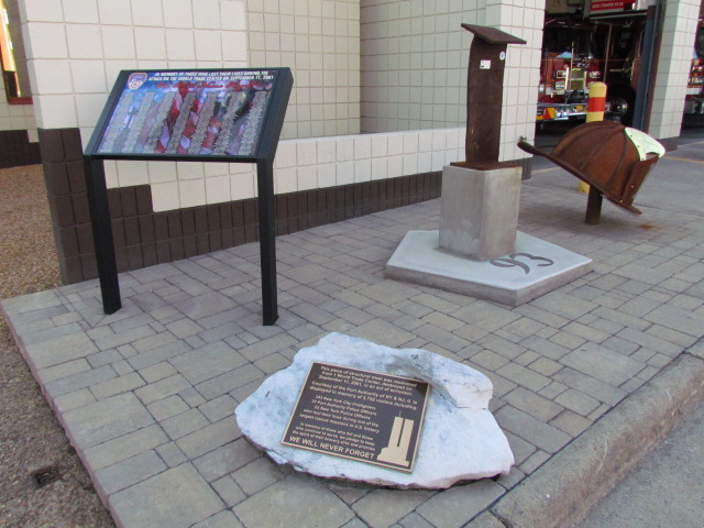 Their 9/11 memorial
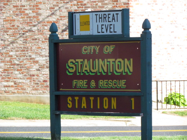

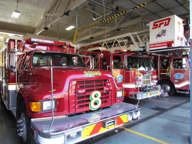

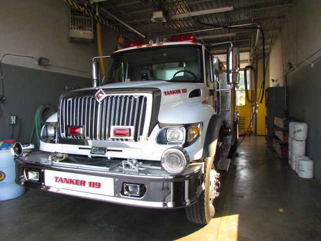
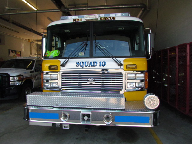
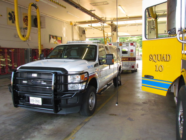
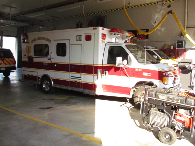
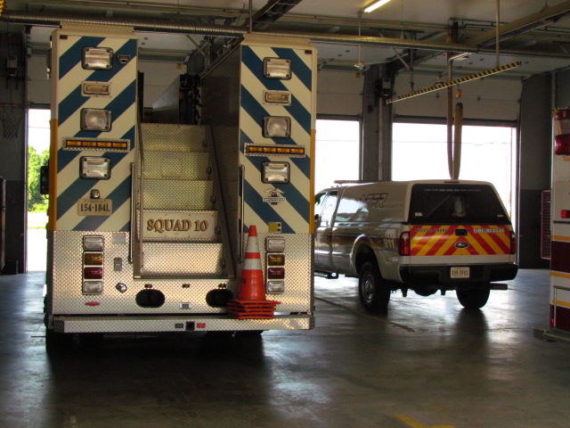
Augusta County Fire Company #10
Along Richmond Ave near the Walmart.


On the C&O Side:
The origins of rail service to Staunton begins with the Louisa Railroad, which was formed in 1836. The Lousia started in Doswell at a junction with the RF&P - the Richmond, Fredericksburg & Potomac. From there, it went east to Richmond (and eventually Newport News), and west to Charlottesville.
In 1850, the railroad became the Virginia Central RR. It was the first railroad to make it's way into Staunton in 1854, and on to Clifton Forge in 1856. The Civil War was really bad for the Virginia Central, because at the end of the war, the railroad had only five miles of operating track!
The C&O Railroad was formed in 1868 with the merger of the Virginia Central and the Covington & Ohio RR. The railroad was later changed to the C&O Railway in 1878 after Collis P. Huntington was recruited for money, and expanded the railroad east into Newport News in the 1880's. A hundred years later, the railroad officially became the CSX, after a long association with the B&O and then the Chessie System 1972-1987. I have a merger chart here.
On the B&O Side:
The B&O in the meantime, wanted to head south out of Hagerstown MD, to reach the the Atlantic Mississippi & Ohio Railroad (AM&O) in Big Lick (which was later renamed Roanoke). The construction of this railroad, the Valley RR, was financed by the B&O - it was to come down via the west side of the Massanutten Mountain. The charter for the Valley RR was issued on February 23, 1866. Over on the eastern side of the mountain, the Pennsy backed Shenandoah Valley RR was heading south at the same time, also trying to connect to the AM&O. The SVRR got there first, and the B&O decided to stop building south of Lexington.
They were able to reach Staunton with relative ease, and I say that, because there was a shortline in northern Virginia that had to be dealt with, that was "in their way". The Valley Railroad/B&O reached Staunton about 1880.
And the rest of the story:
As most of you probably know, the Southern Railroad (SR) and the Norfolk and Western Railway (N&W) merged in 1990 to become the Norfolk Southern (NS), using the name of a railroad that had been absorbed into the Southern back in the early 70's. In 1972, the Chesapeake and Ohio (C&O) and the Baltimore and Ohio (B&O) merged to become the Chessie System (along with the WM and B&OCT) And then in 1987, Chessie system merged with the Seaboard System (SBD) to become CSX. Just to round it out, the Clinchfield joined the Chessie System in 1983, and the Richmond, Fredericksburg & Potomac (RF&P) went into the CSX family in 1991.
As mentioned above, The Shenandoah Valley Railroad came about in 1993, when it bought 20.2 miles (32.5km) of track from the Norfolk Southern between Staunton and Pleasant Valley (Harrisonburg).
In 2004, the Buckingham Branch started leasing 199 miles of the R&A Division (Richmond & Atlantic) from CSX, going from Doswell to Clifton Forge. This stretch of track also hosts WB CSX freights and the Amtrak Cardinal trains.
Amtrak, thru all of this, has maintained their once daily Cardinal service to and from Chicago. Both trains are scheduled for daylight hours, so catching photos should not normally be a problem. If you're really lucky like I was on the one day I was railfanning, they both arrived in Staunton at the same time, and one had to wait for the other to clear the single track!
According to the Buckingham Branch history page, the BB has assumed responsibility for dispatching BB, CSX and Amtrak trains on the R&A, and created a rail traffic control department.
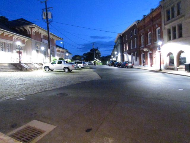
More historical trivia: The area of Staunton surrounding the railroad station is known as The Wharf, a curious name for a neighborhood that is nowhere near a wharf! In fact, the name is an historical one dating to the 19th century. The warehouses in this neighborhood reminded people of buildings that you might see along a wharf. In Staunton's case, the railroad acts in same manner as a wharf, and in fact, the neighborhood's old warehouses really do look like those that one might see along the waterfront of a port city.
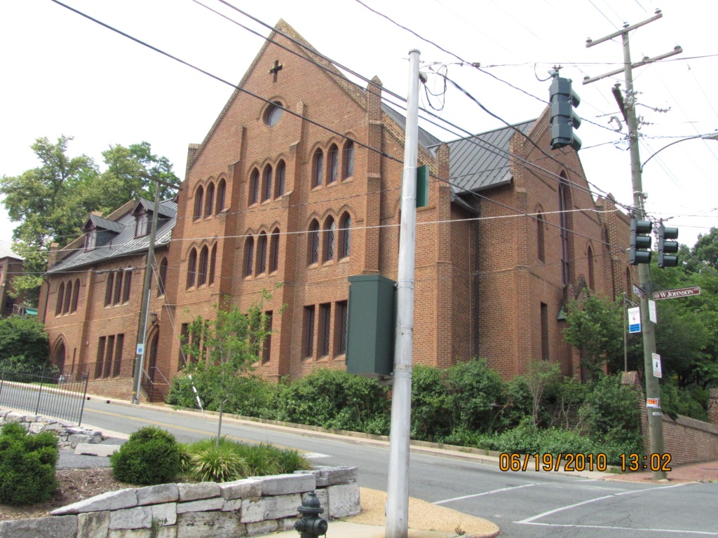
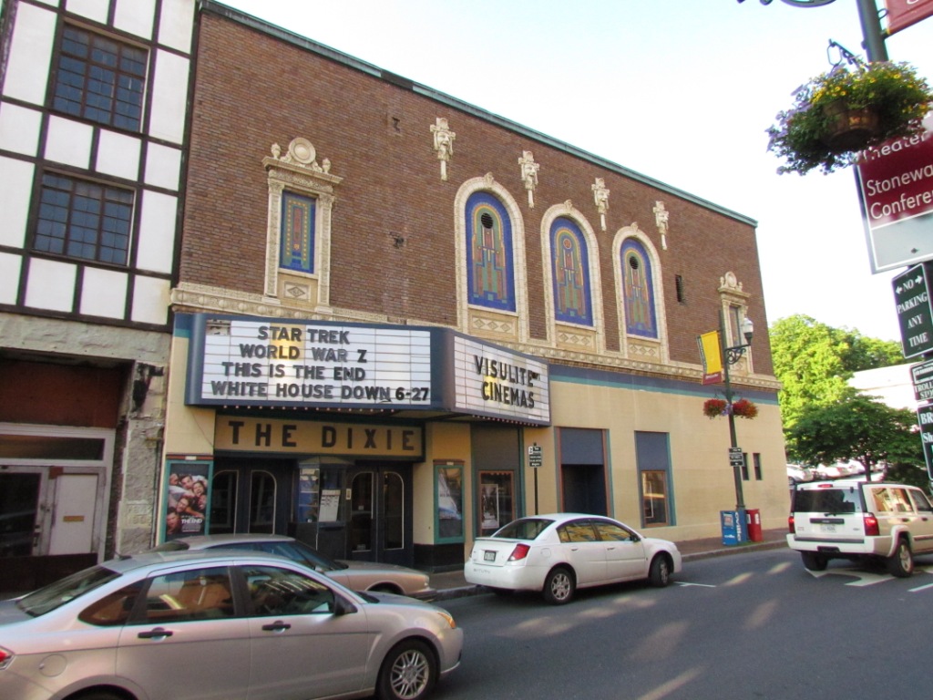
Staunton has a whole lot of stuff to visit and see, if they interest you. The station area is littered with bunches of antique and specialty stores. Staunton also has a lot of very cool looking churches, none of the modern stuff that you find in newer areas like the burbs around established cities. Enjoy your visit.

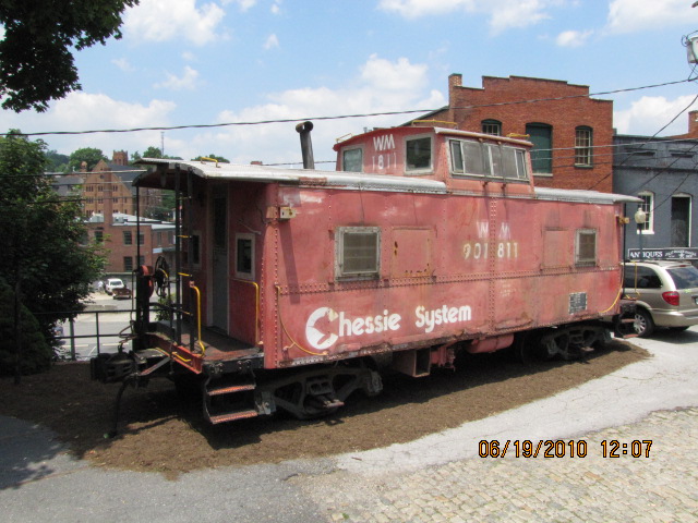
Seen around town.
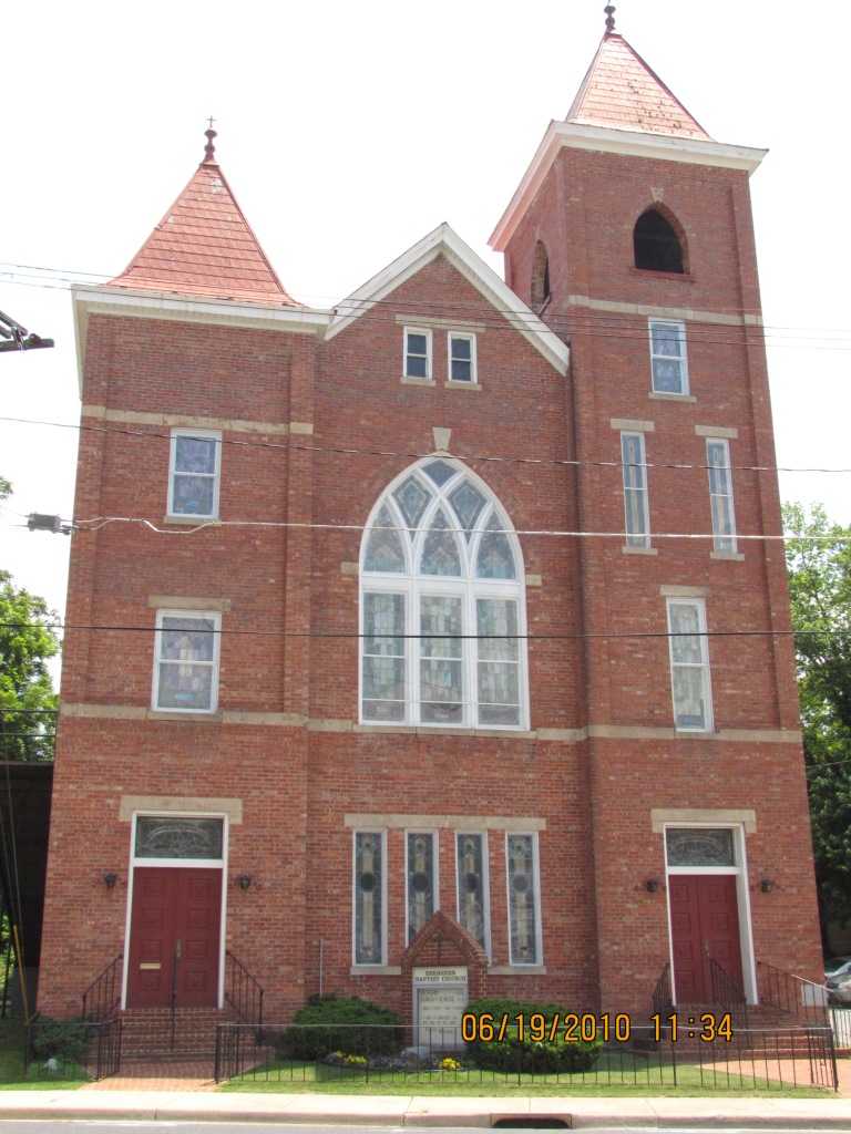
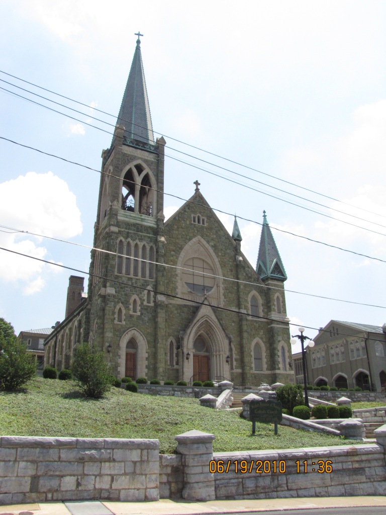
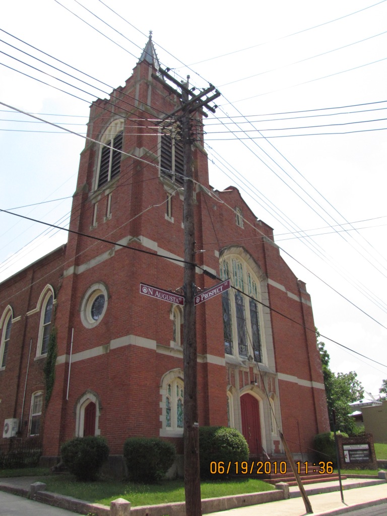

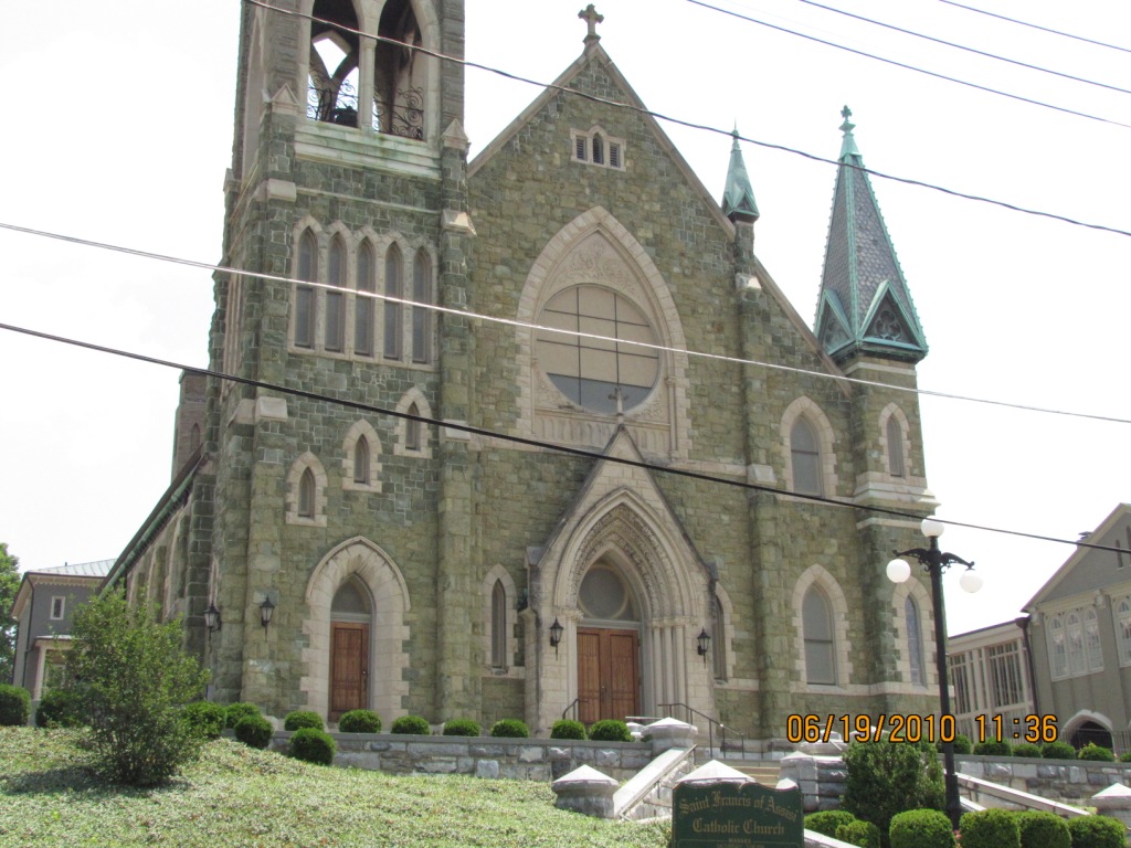
A small sampling of some of the churches, I believe these are all along Augusta St.

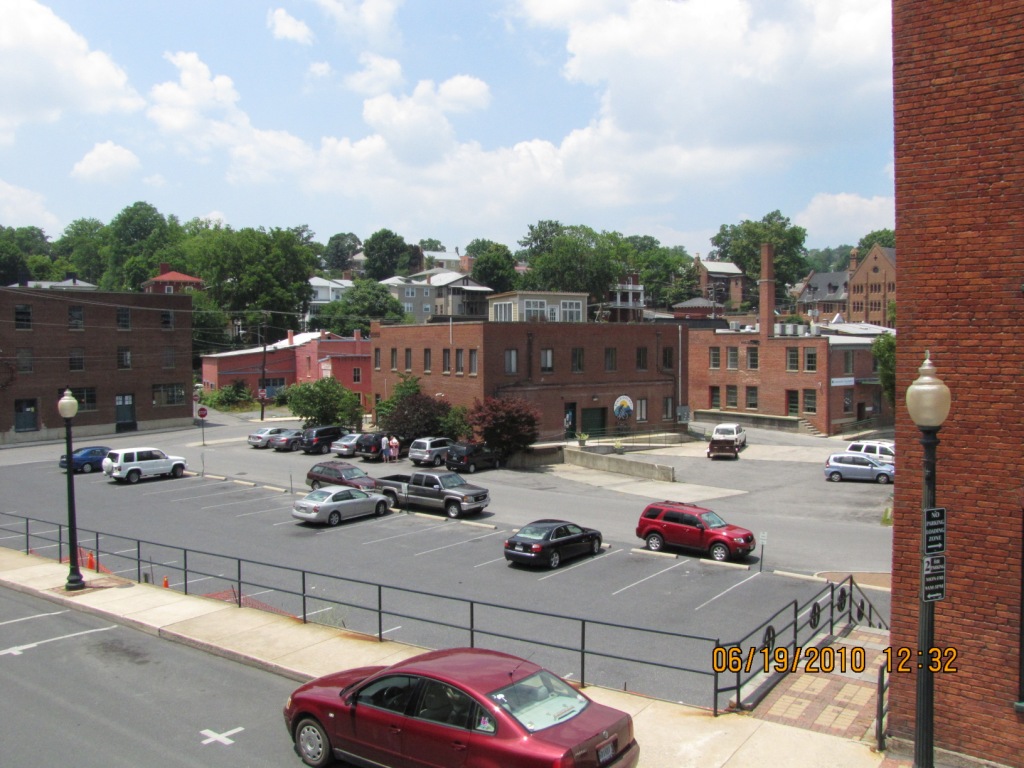
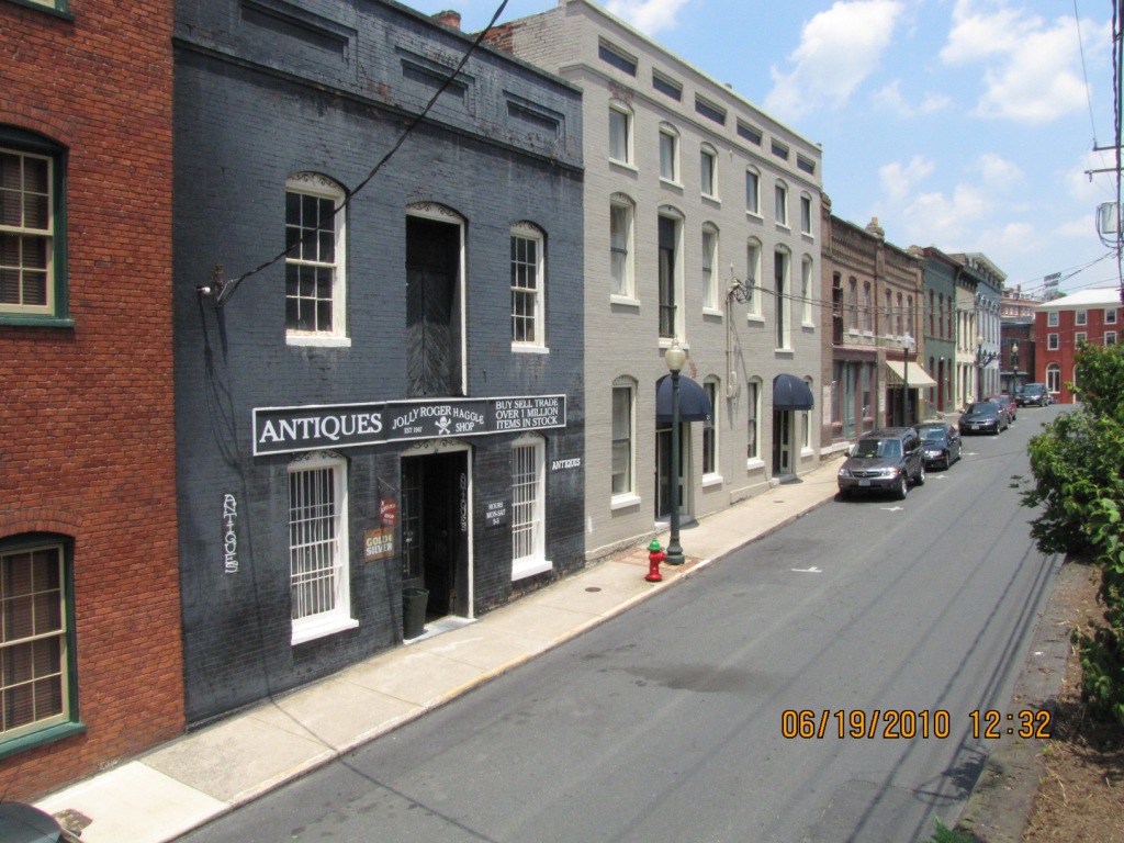
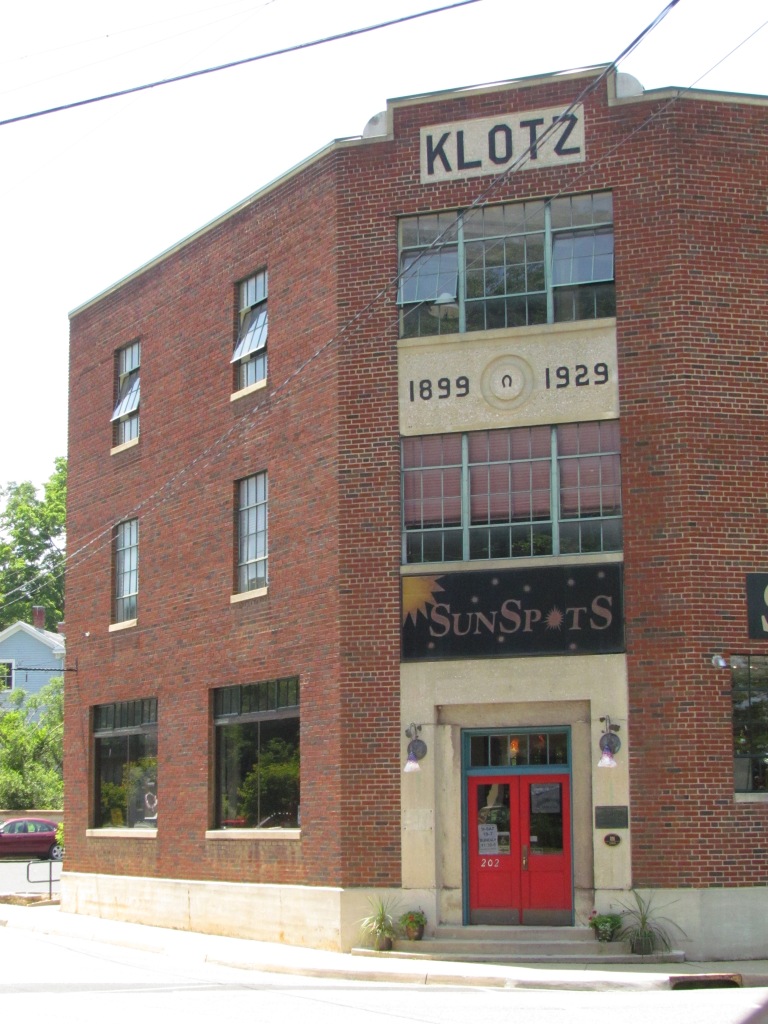
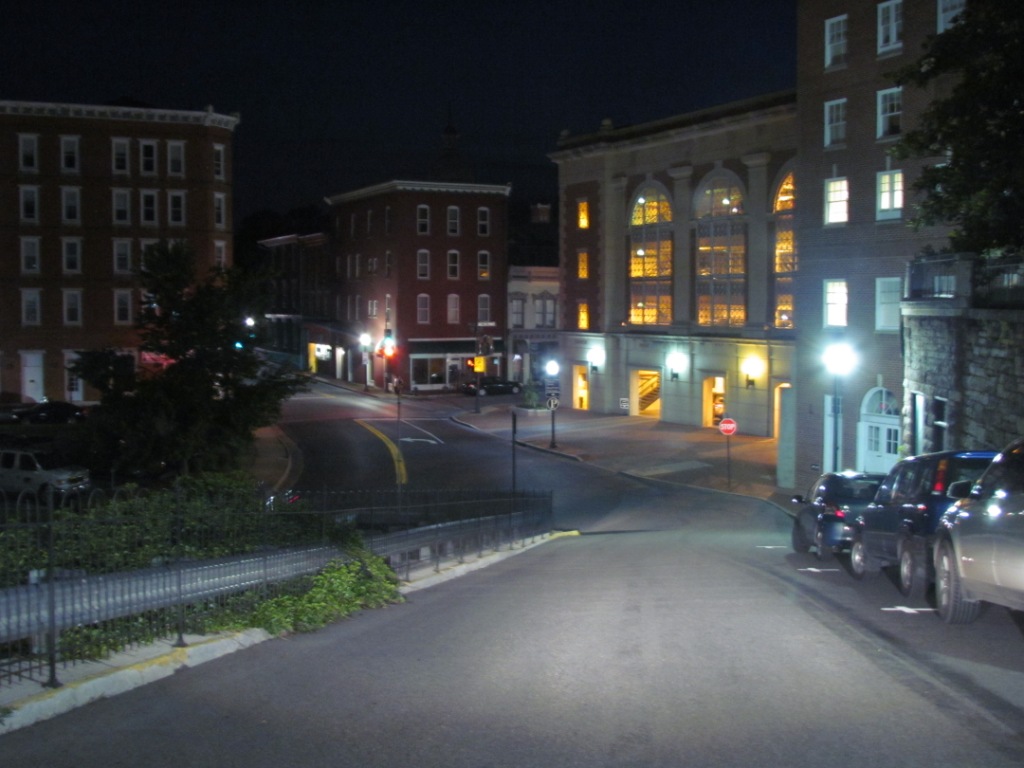


Other views in the downtown area.
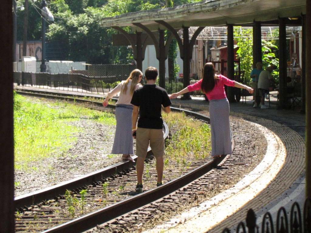
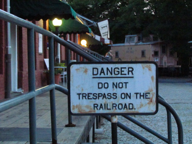
How to get killed on the railroad tracks.

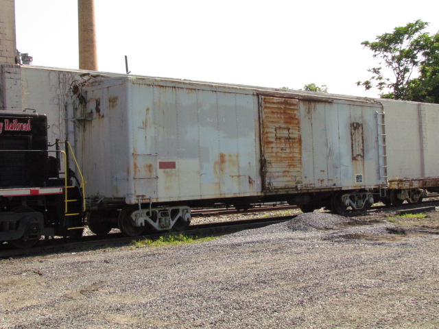
Stuff seen on the way out of town. The remains of the coal tipple is across from the Buckingham Branch yard.
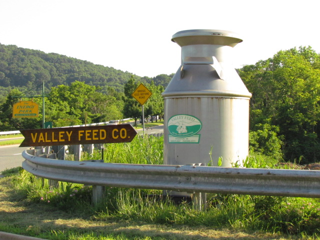
Largest milk can I've ever seen, off Statler Blvd near the tracks.

Courtesy the University of Texas Library and the USGS, click here for their index page.
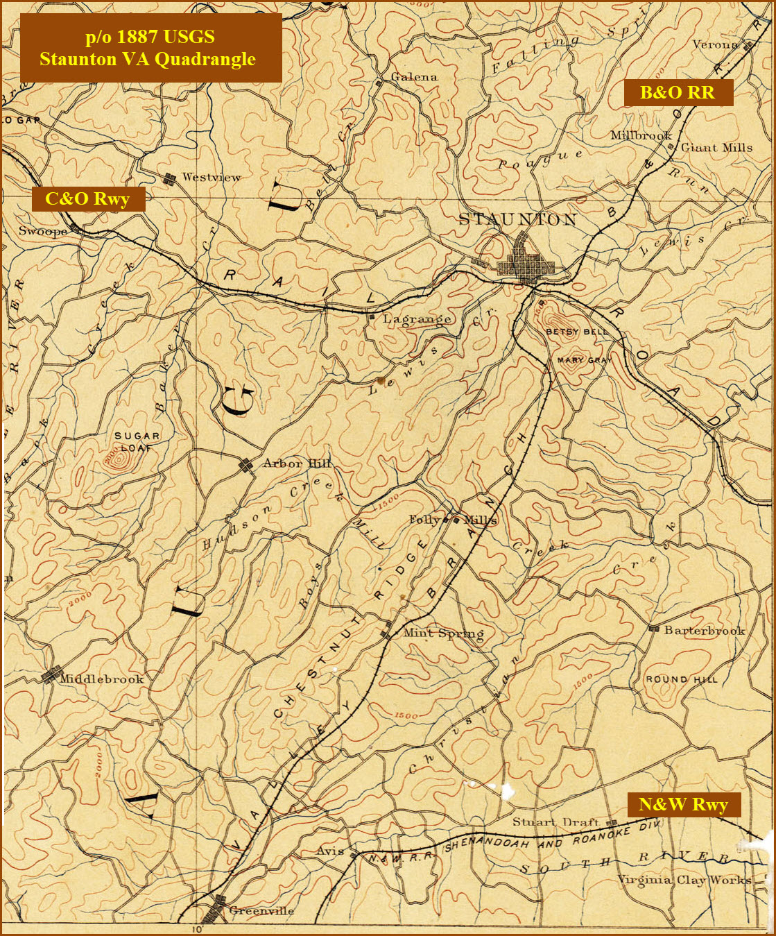
In the map below, we can see that the B&O trackage south of Staunton has been abandoned and removed.
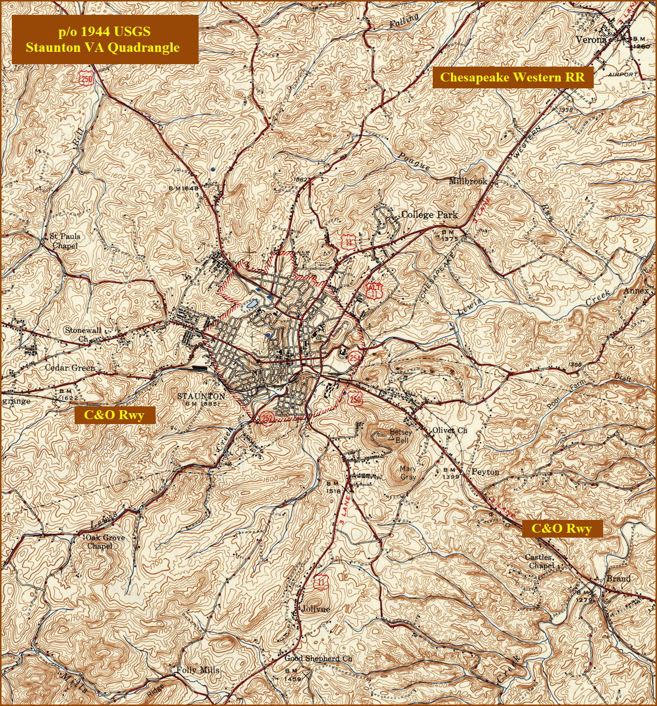
Below are enlargements of the central Staunton areas for comparison....
I have overlaid where I believe the R-O-W used to be, from comparing the two maps, and looking for clues with the contour lines.

Disclaimers:
New format 10/26/23: Please check out my disclaimer page for my standard dribble and contact info here
RAILFAN GUIDES HOME
RAILROAD SIGNALS HOME
NEW MAR03/2013, JUN13/2016, JUN06/2020, MAY10/11/15/17/2024
Last Modified 17-May-2024