In General
Getting Here
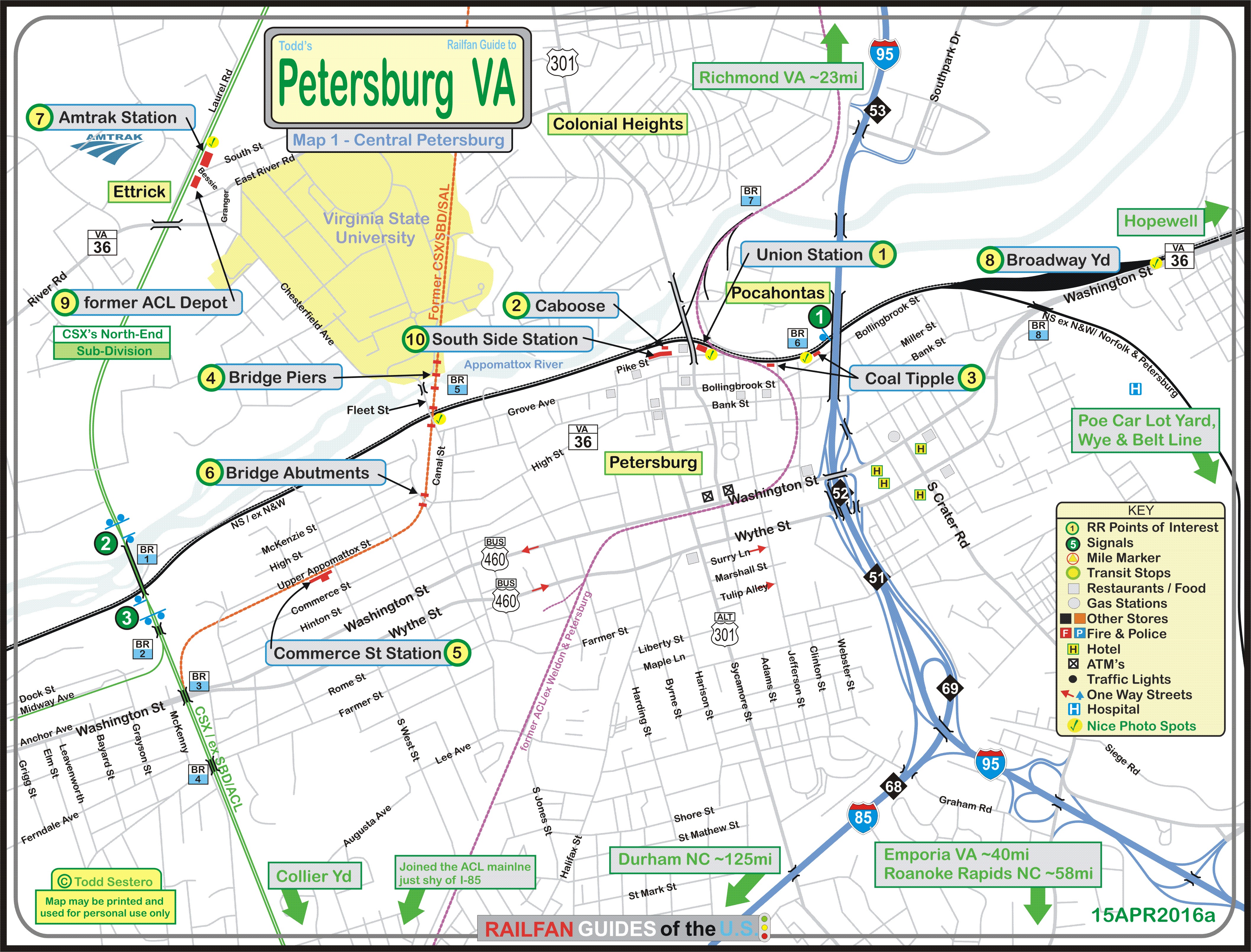
Map
Sights
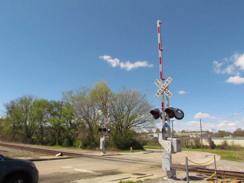
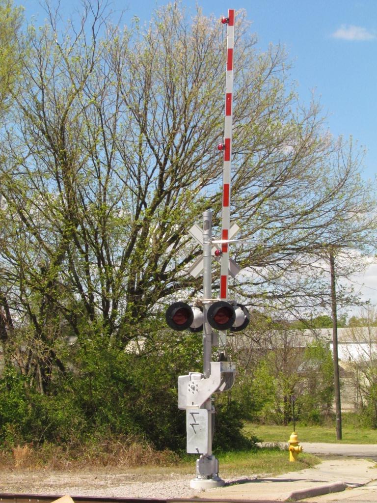
Signals
Bridges
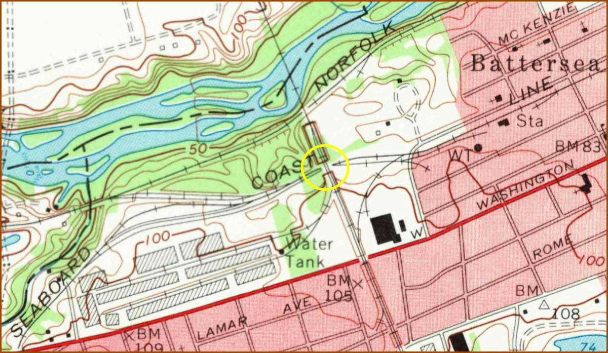
USGS Maps
Floobydust
Worlds Largest Arby's
Postcards
RAILFAN GUIDES HOME
RAILROAD SIGNALS HOME
Location / Name:
Petersburg VA; administratively independent of, but located in, Dinwiddie and Prince George counties
What's Here:
The Amtrak station in Ettrick
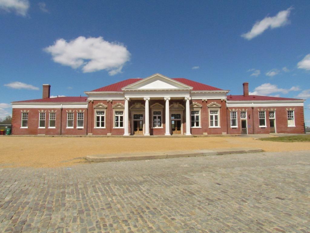
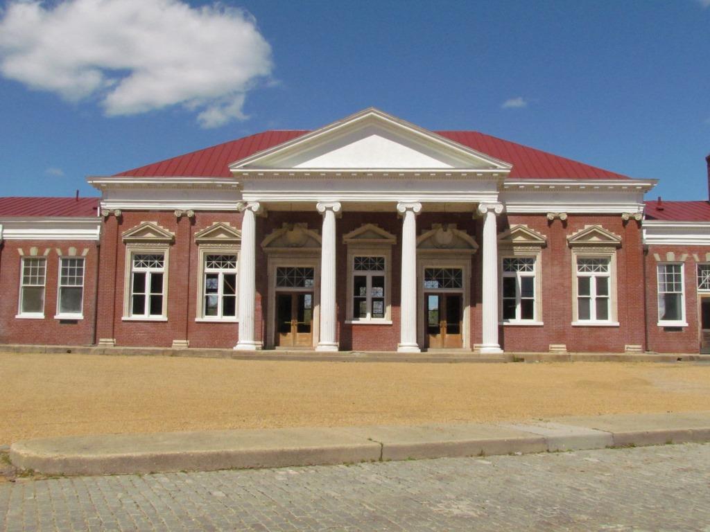
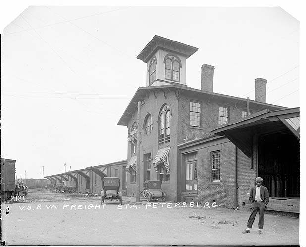
The ex N&W Union Station depot in downtown
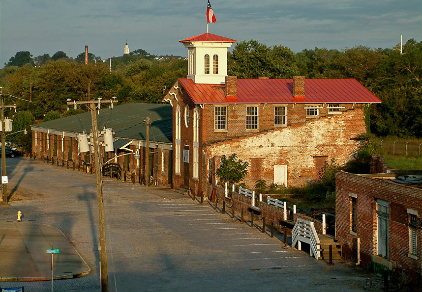
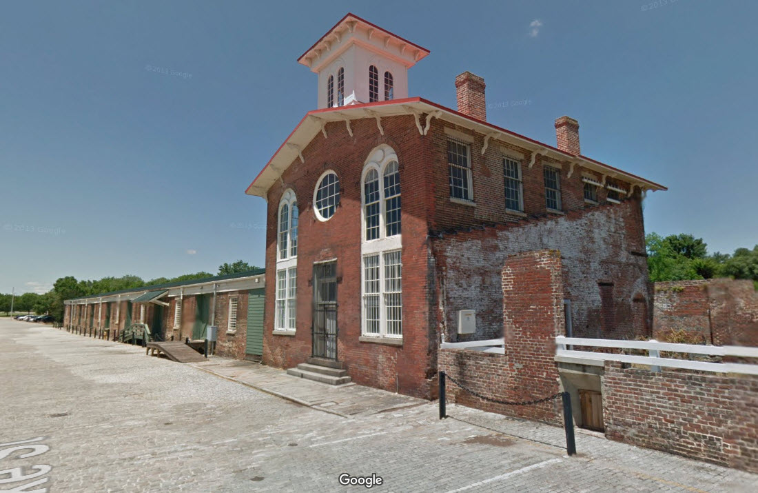
The South Side Station in downtown - oldest station in VA
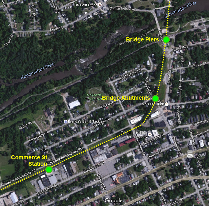
Bridge piers from the old SAL bridge crossing the Appomattox
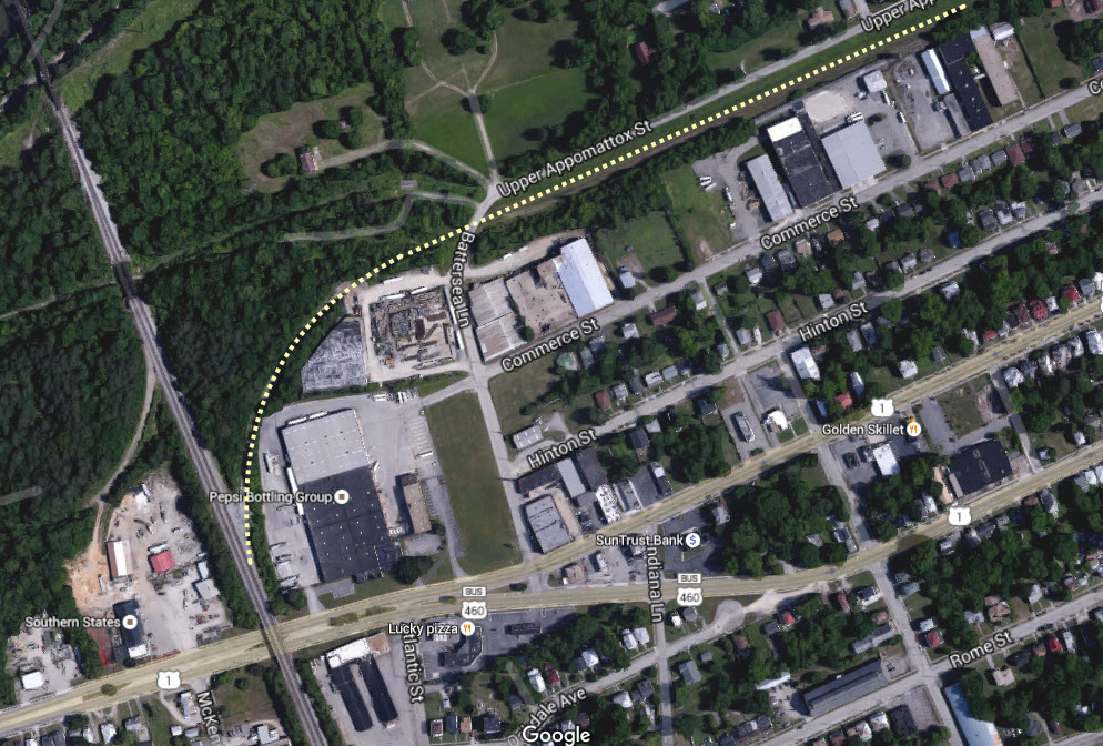
SAL bridge abutments off Upper Appomattox St
The platform from the SAL Commerce Street Station
CSX's Collier Yard
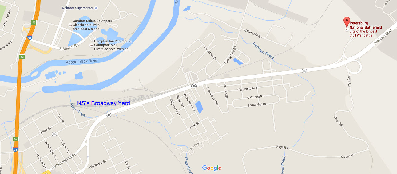
NS's Broadway Yard
NS's Petersburg Yard (Poe Car Lot Yard)
AND, the world's largest Arby's
Non Train Stuff to See and Visit
the Petersburg National Battlefield (just east of Broadway Yard off Washington St)
Historic Downtown Petersburg
Data:
GPS Coordinates: as needed
ZIP: 23803
Area code: 804
Access by train/transit:
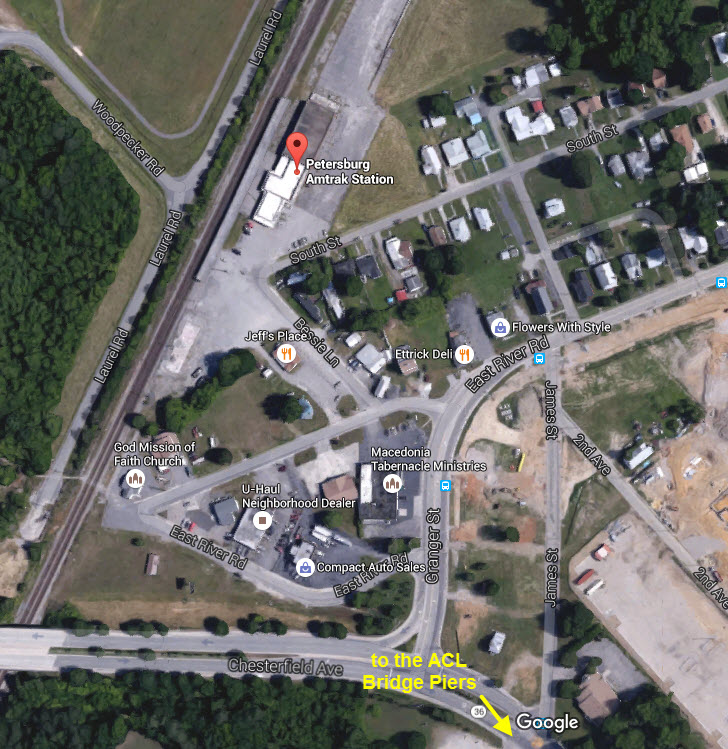
The "Petersburg" Amtrak station is in neighboring Ettrick.
The Scoop:
There is a lot to see in Petersburg, however, most of it is historic in value, for a good portion of it is on no longer existing right-of-ways. But don't let that discourage you, because there is plenty of action on the CSX and NS mainlines, especially with Amtrak coming through on CSX.
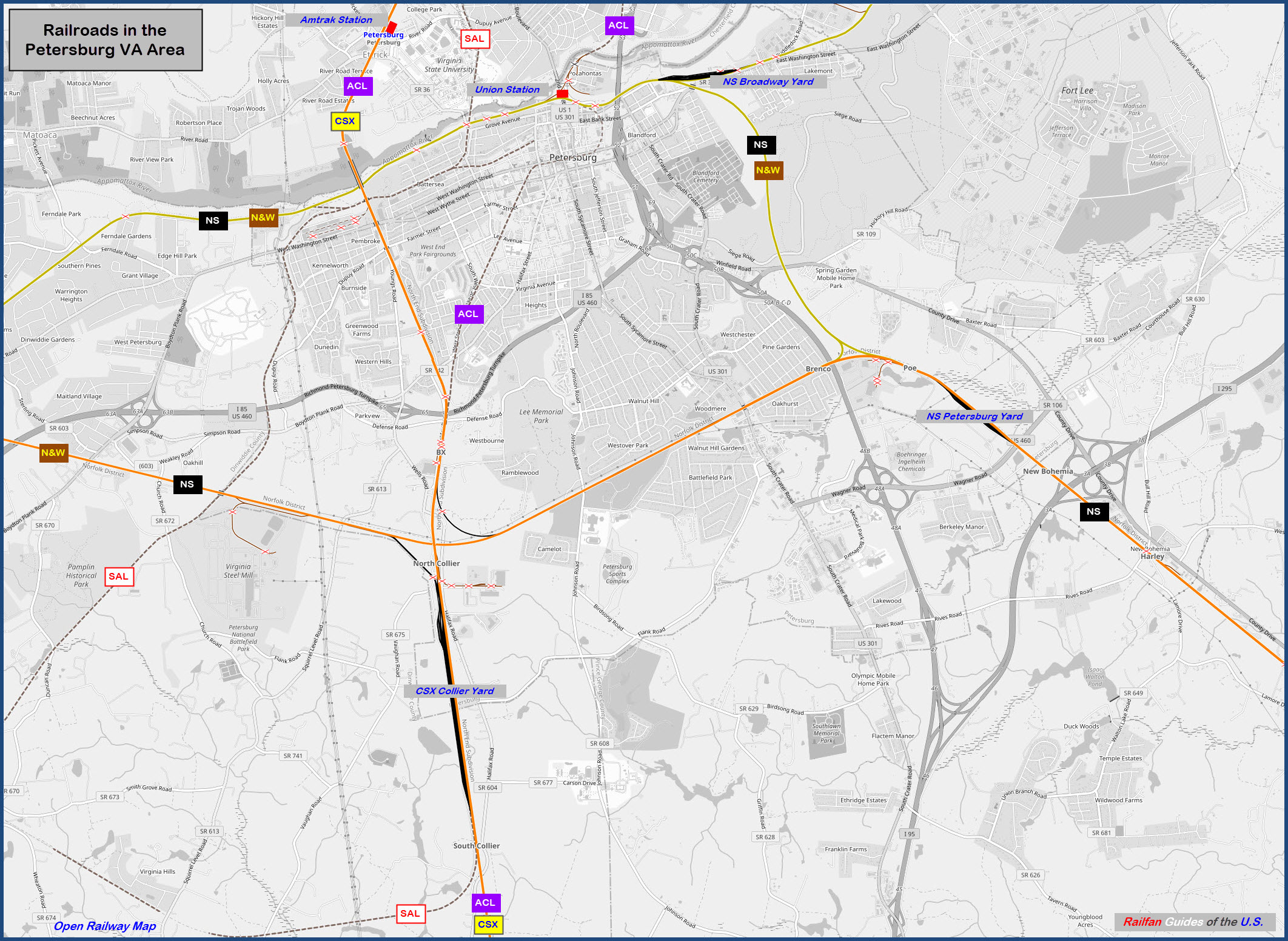
Back in the 50's and 60's, Petersburg was serviced by the Norfolk & Western, the Seaboard Air Line, and the Atlantic Coast Line. In 1967, the SAL and ACL merged, becoming the Seaboard Coast Line, and then there were two. The SCL became the Seaboard (SBD) in 1983 when it merged with the likes of the L&N. In 1987, the SBD became CSX with the merger with the Chessie System. The NS story is a little simpler, with the merger of the Southern Rwy and the N&W in 1990. I have a bunch of merger maps here, including Norfolk Southern (the original one) and the N&W.
Today, CSX has the north-south traffic, and NS has the east-west traffic going over to neighboring Hopewell.
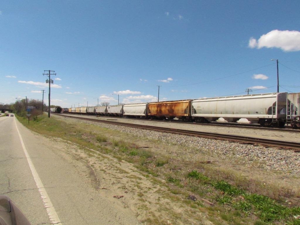
CSX has one local yard just south of Petersburg, Collier, which is pretty considerable in size considering Acca is just 23 miles to the north.
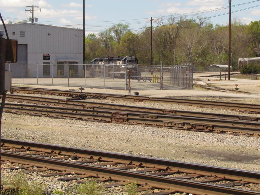
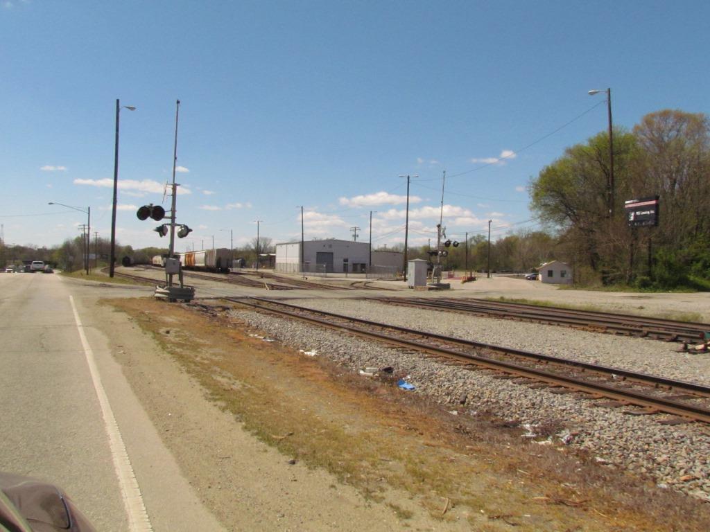
Norfolk Southern has two yards, Broadway in town, and the Poe Car Lot just to the southeast.
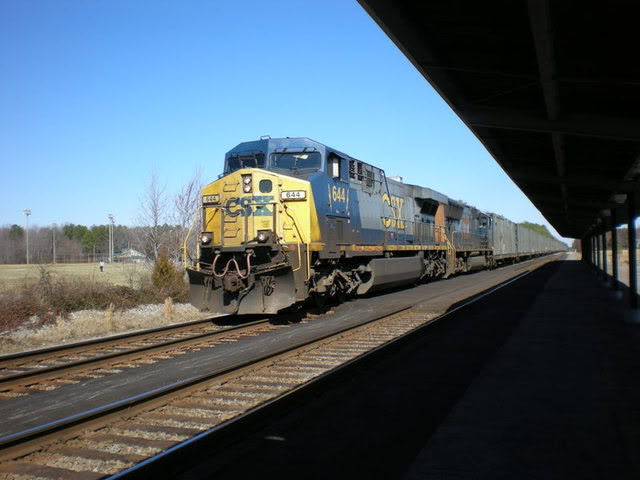
Amtrak travels on CSX, and has their Petersburg station in Ettrick.
There used to be an old ACL depot there too, but it was torn down prior to 2012 looking at the Bing birds-eye view.
As soon as I figure out the A and S-Lines, I will do a general map for the Richmond-Petersburg area showing them.
Safety:
Petersburg is a depressed area. Outside of the historic downtown area, it is wise to NOT railfan by yourself, and always be careful of your surroundings.
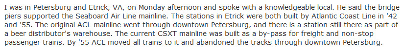
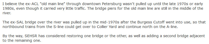
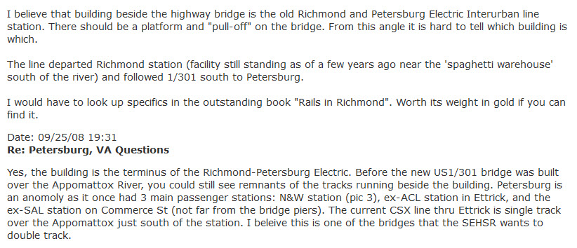
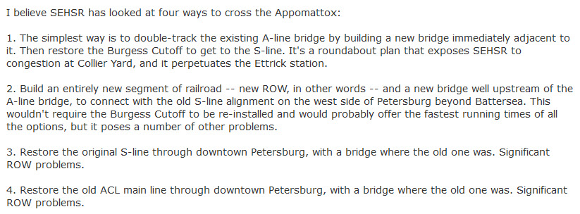
Here are a few excerpts from a Train Orders post back in 2008:
hhttp://www.trainorders.com/discussion/read.php?11,1769064
FYI: in one of the messages, there is a reference to the "Burgess Cutoff" -- those who worked on it refer to it as the "Burgess Connection". Take your pick! :-)
Petersburg at one time boosted seven stations as seen below. Since the chart was compiled, we lost the older ACL depot.
The chart was found here: http://www.rrshs.org/Virginia/petersburg.htm

Acknowledgements:
-- A real big thanks to Bill Ogburn for help with the two Petersburg guides. Bill spent a whole day driving me around and showing me all of these cool things. He grew up in Colonial Heights, and remembers seeing trains cross the old SAL trestle!
-- Otis Little for help and history of the area, I ran into him at Collier Yard
-- Jonathan - additional information and the 1969 USGS Petersburg Quadrangle map
-- Bob Krone - Commerce St Station picture
-- J. Parker Lamb, the two shots of trains on the SAL bridge
-- Brad Bennett, current picture of the caboose
Websites and other additional information sources of interest for the area:
http://www.railsinvirginia.com/abandoned/acl/signals.html A pictorial record of many of the ACL searchlight signals that CSX replaced over the years
http://www.rrshs.org/Virginia/petersburg.htm
https://www.facebook.com/pages/Union-Station-Petersburg/132437720127844
https://en.wikipedia.org/wiki/Union_Station_%28Petersburg%29
http://www.greatamericanstations.com/Stations/PTB
http://www.trainweb.org/usarail/petersburg.htm
http://www.railpictures.net/photo/393761/
https://railphoto-art.org/collections/lamb/group-three/ source of the J. Parker Lamb photos (and MUCH more!)
Exit 52 from I-95 takes you right into the downtown
area of Petersburg, or exit 9 from I-295.
Exit 65 from I-85 is the easiest way to get to CSX's Collier Yard.
Exit 48 off of I-95 for NS's Poe Car Lot Yard.
Exit 9 from I-295 is also a good way to get to neighboring Hopewell.
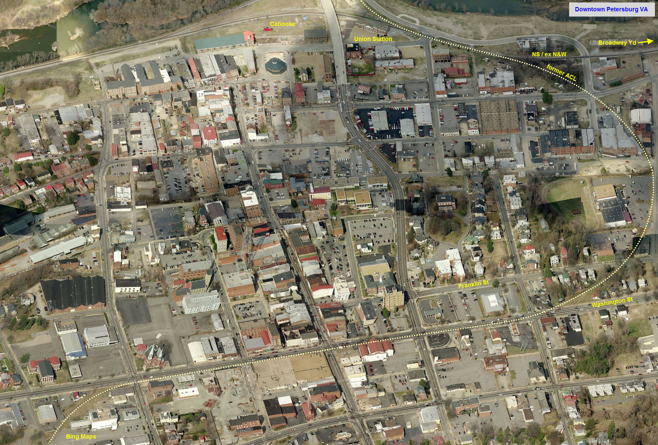
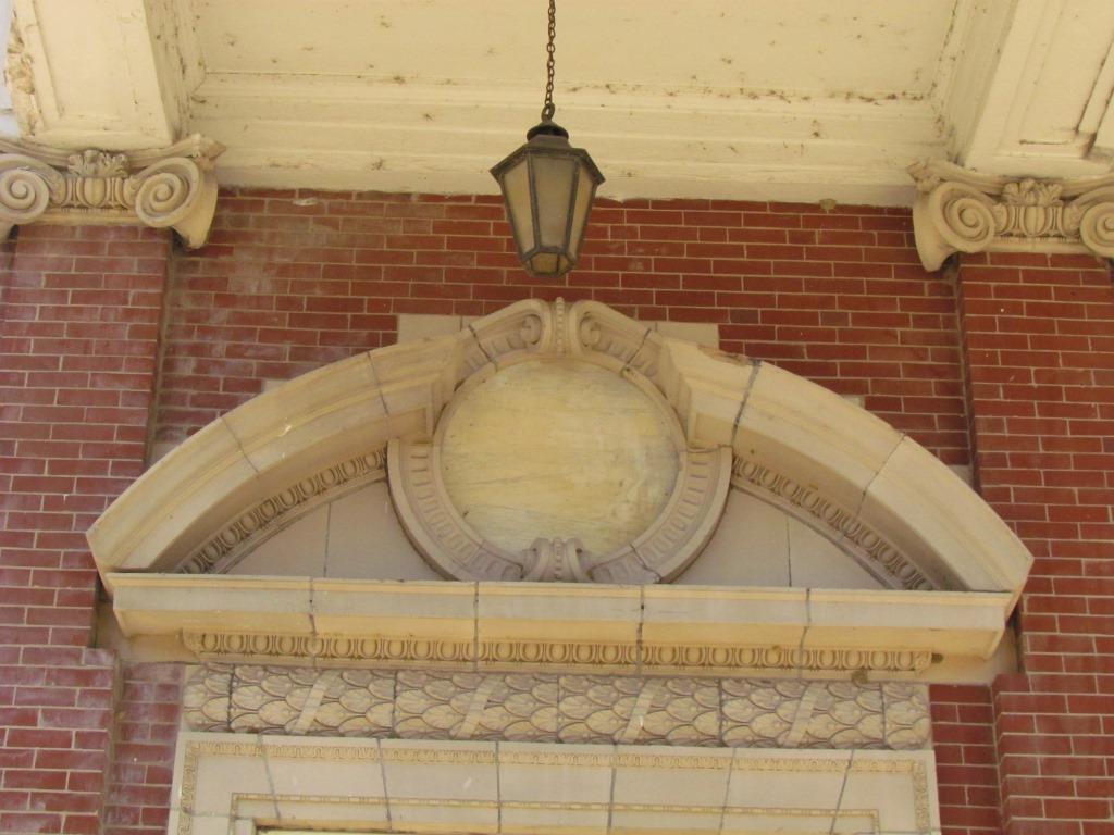
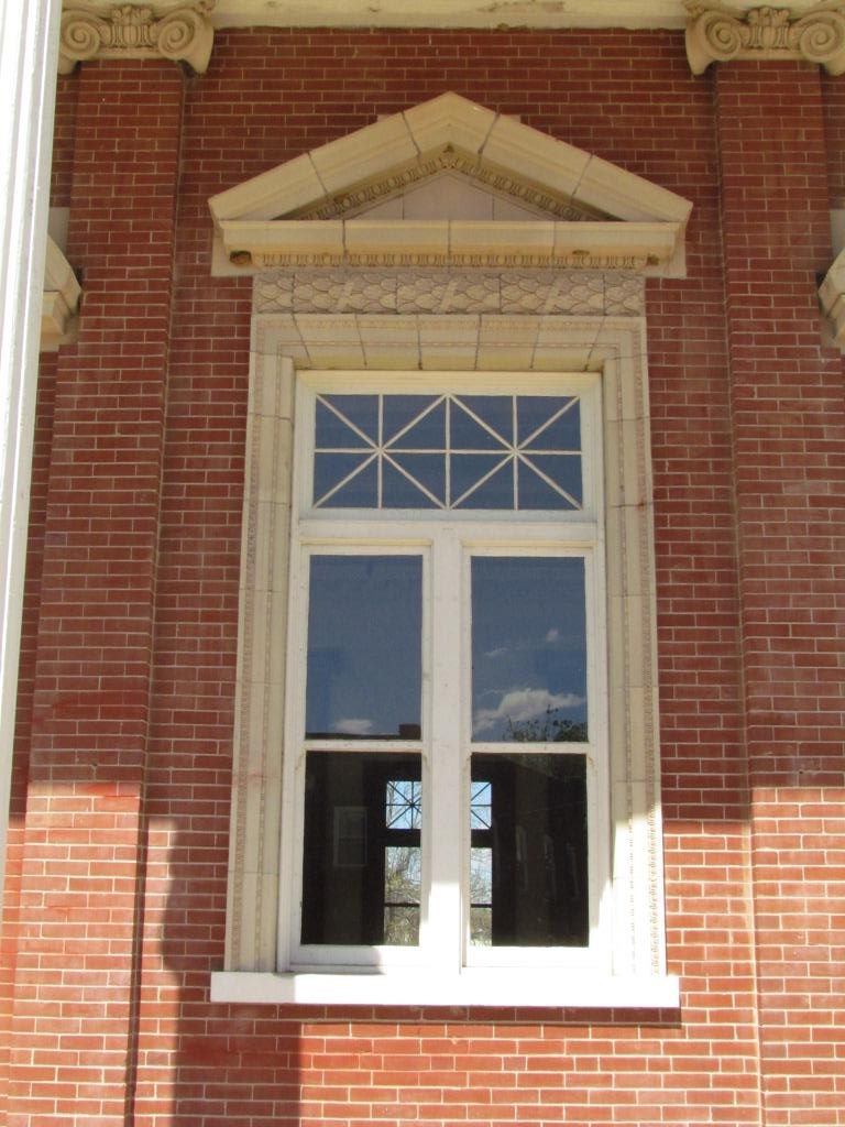
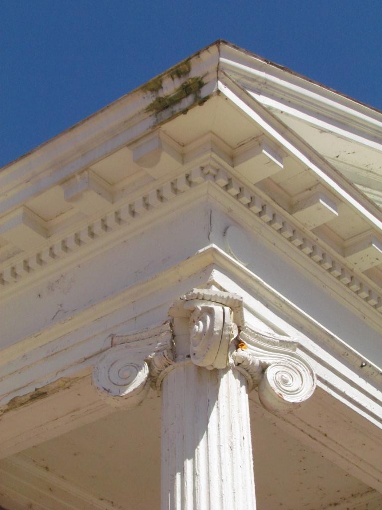
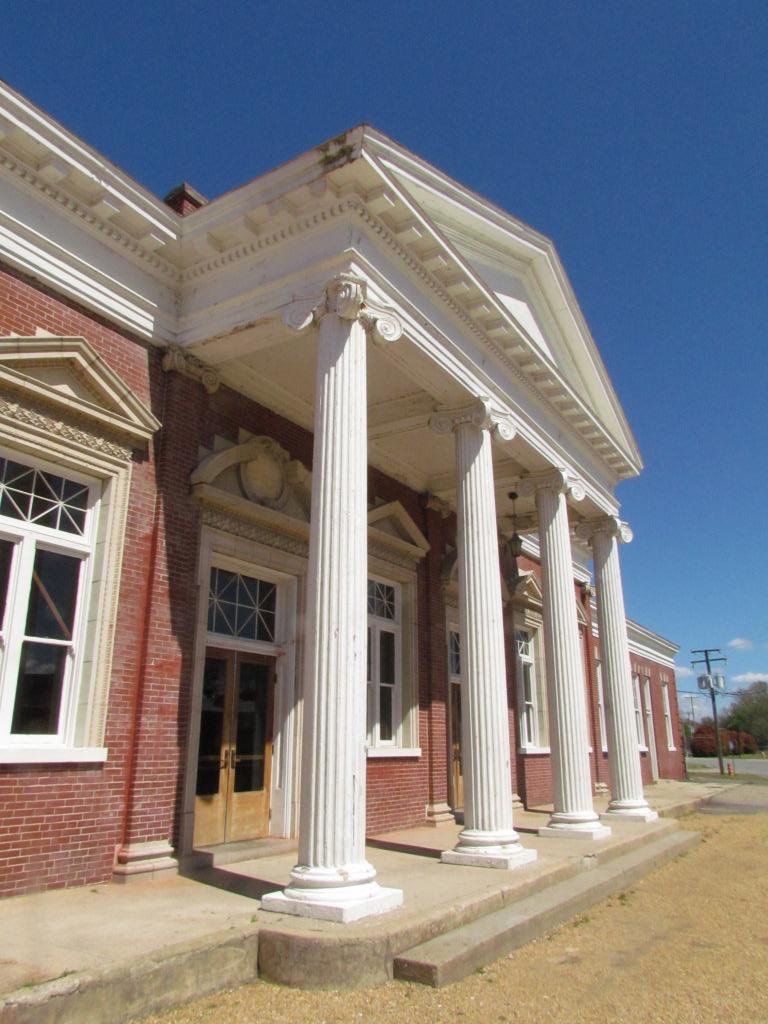
![]() Union Station - Former Norfolk and Western Rwy Depot
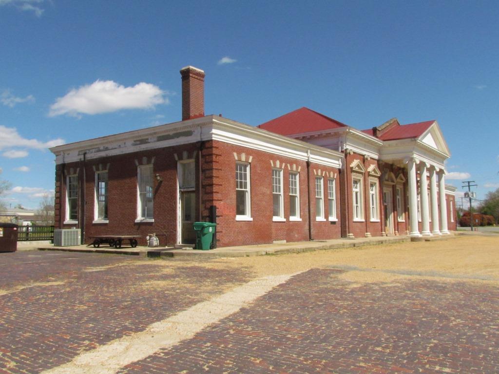
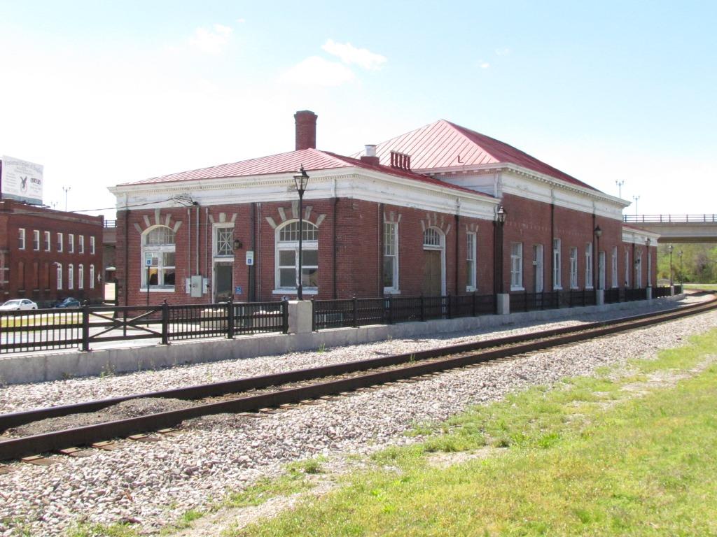
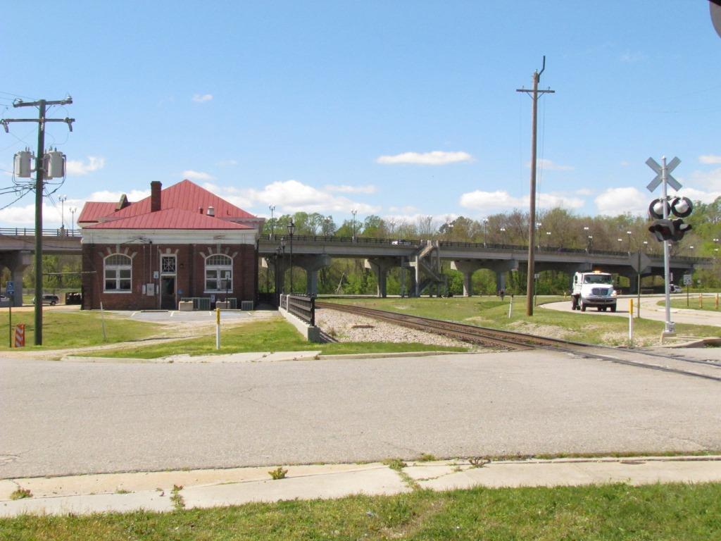
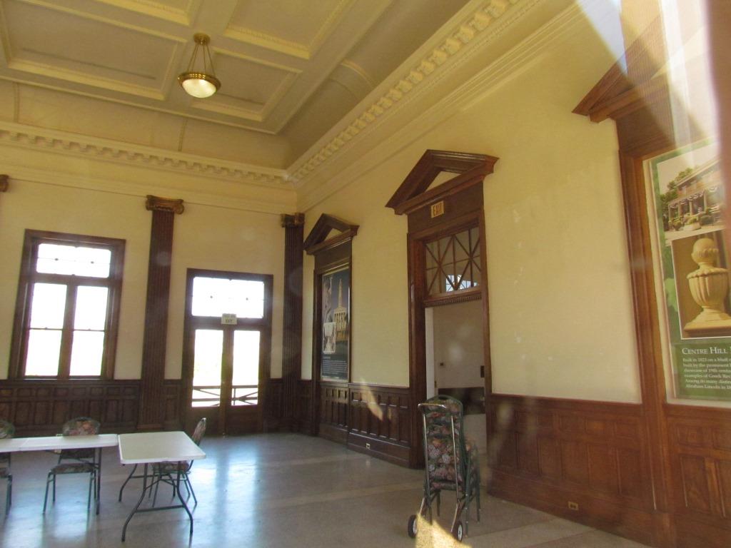
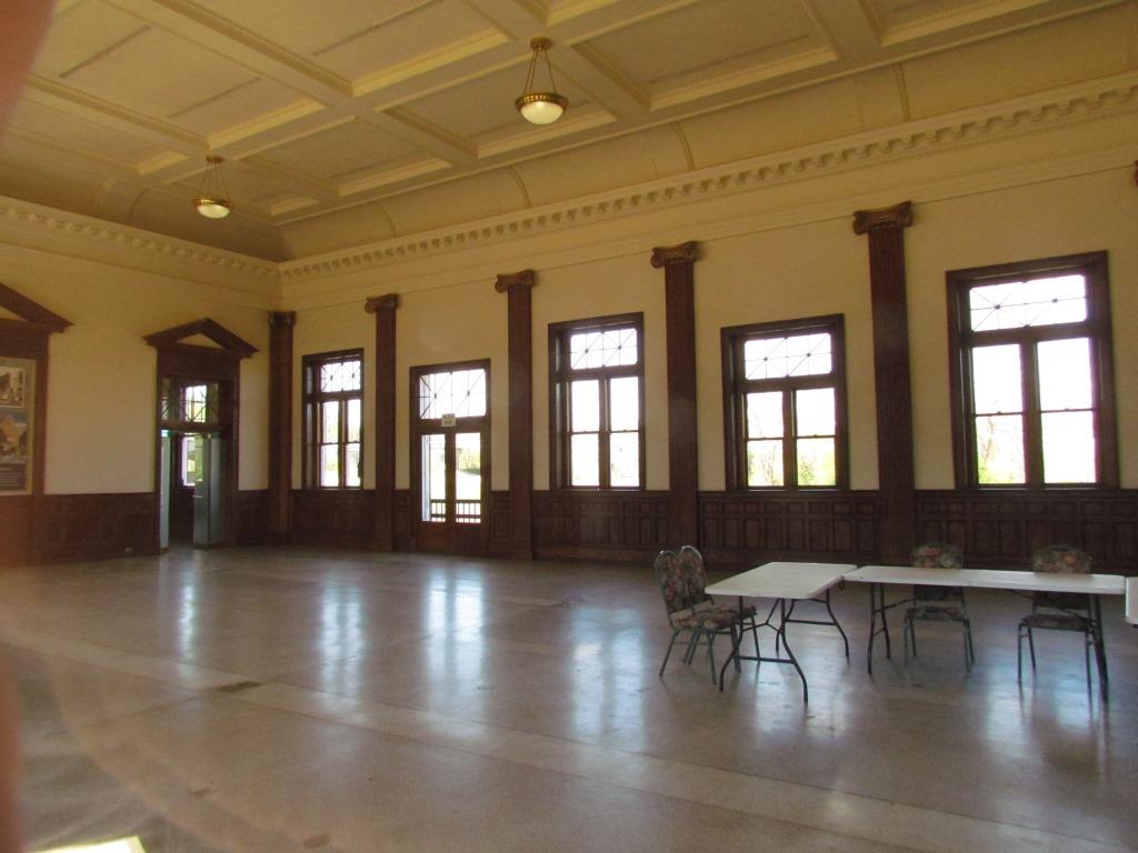
Union Station - Former Norfolk and Western Rwy Depot
GPS Coordinates: 37.234292, -77.402548
103 River Street, Petersburg, VA 23803
https://www.facebook.com/pages/Union-Station-Petersburg/132437720127844
https://en.wikipedia.org/wiki/Union_Station_%28Petersburg%29
http://www.petersburgva.gov/facilities/facility/details/Union-Train-Station-21
From Wikipedia: Petersburg Union Station is an unused train station in Petersburg, Virginia. It was originally built in 1909–1910 for the Norfolk and Western
Railway, replacing an earlier structure damaged by a flood. The station remained in use until the formation of Amtrak in
1971, when passenger service on the Norfolk and Western's tracks ended. It saw a brief revival in 1975–1977, when Amtrak operated the Mountaineer between
Norfolk and Cincinnati, Ohio. Union Station is located along the northeastern edge of the Petersburg Old Town Historic District.
The Atlantic Coast Line Railroad also used Union Station for a time - the ACL's line went north from the station while the Norfolk and Western's line ran
east–west. The Atlantic Coast Line used a new station from 1955 on.
The Seaboard Air Line Railroad, the third railroad to serve Petersburg, had two stations (Market Street and Donlap Street) near downtown. (This is one
of those instances where Wikipedia is wrong, as the SAL had a Commerce St station as seen below. I don't know (yet) if they had a second station
in town or not).
The station is owned by the city of Petersburg, and can be rented for just about any function.
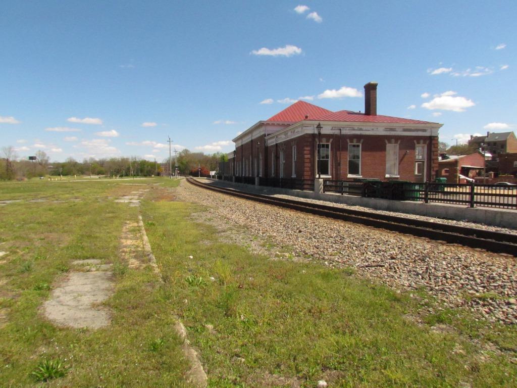


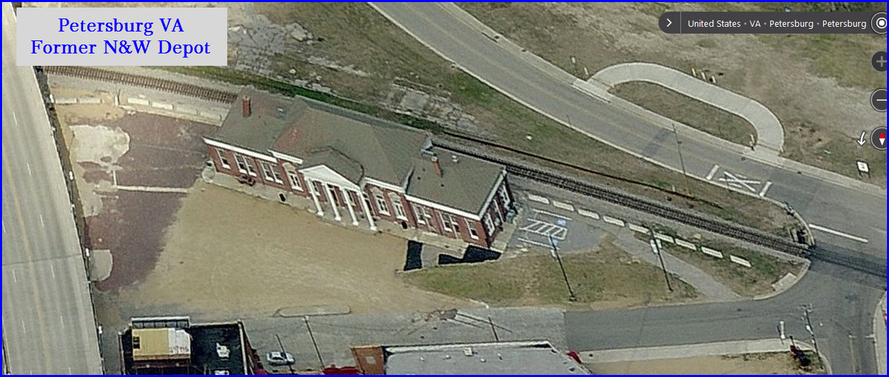
 There used to be a nice sized yard adjacent to the station.
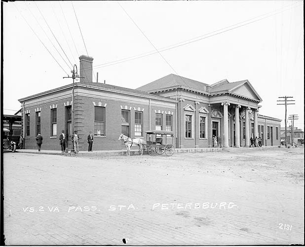
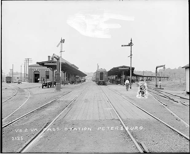
From the VT Library
In the picture below, which I had earlier as "location unknown", reader Jonathan was sharp eyed enough to notice that it is Union Station, and we are looking at it from the opposite direction as the
right picture above from the VT library. We also notice it is a little more recent, I'm guessing maybe early 1960's, and the semaphores are long gone - having been replaced by the N&W CPL
signals. In the VT photo you can see the ACL line veering off to the right - in the newer photo, you can just catch a glimpse of it between the platform roof on
the left. Notice the ACL used color light signals.
![]() Caboose
Caboose
GPS Coordinates: 37.234236, -77.404378
Can't tell you anything about it, but Brad reports it may be a C&O caboose.
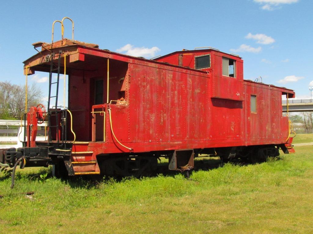
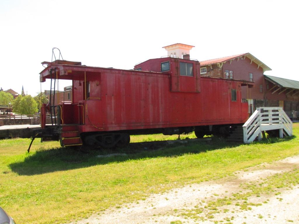
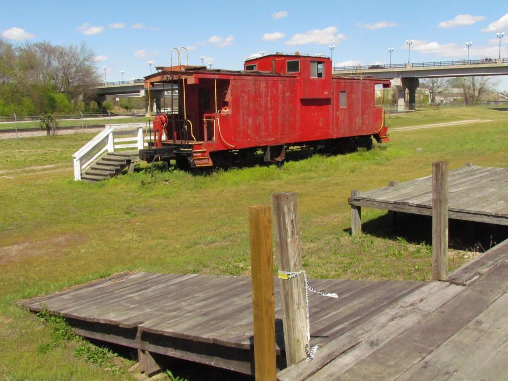
Looks like they need to come along and do some "yardwork" :-) :-)
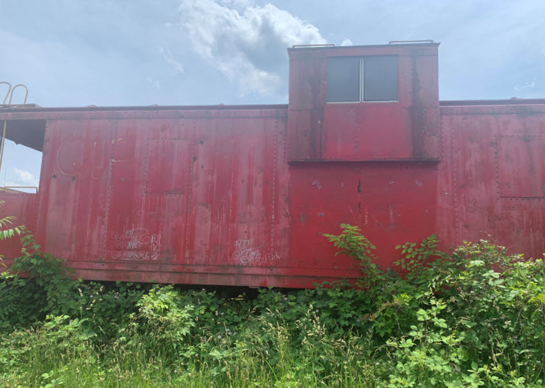 Photo by Brad Bennett, May 2022
![]()
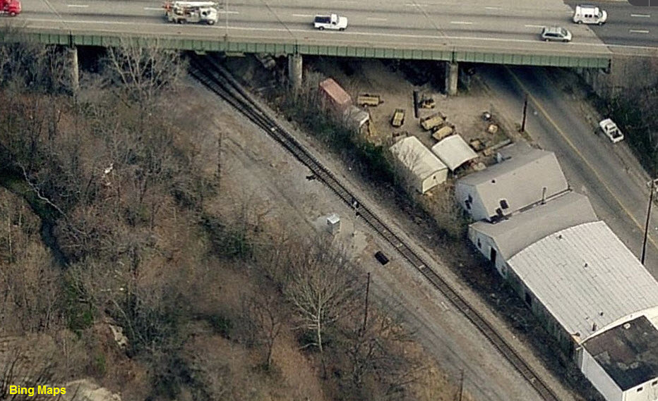
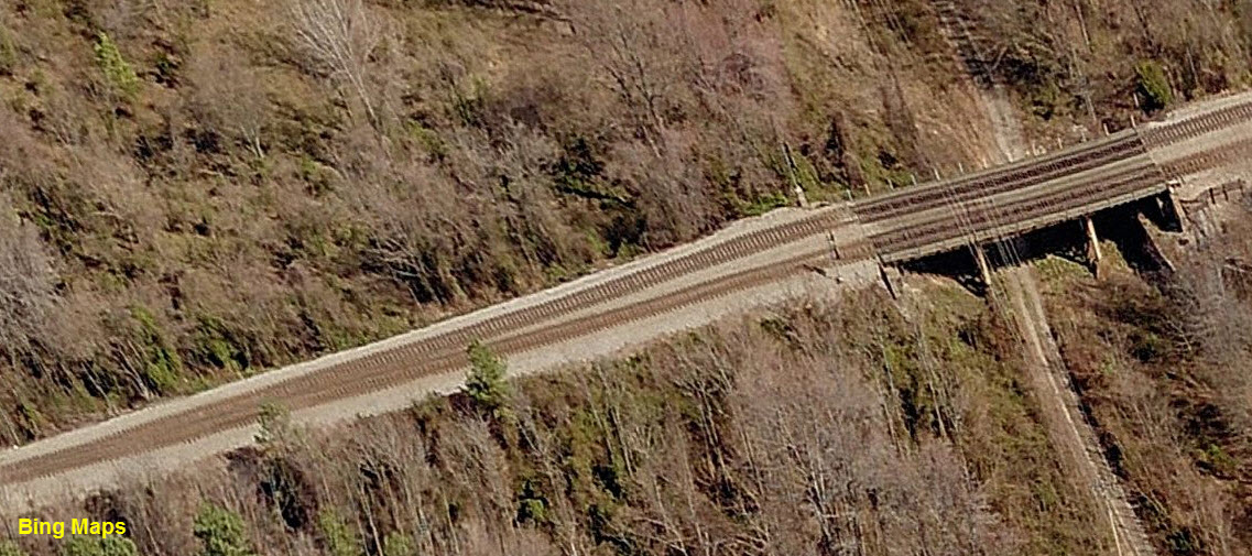
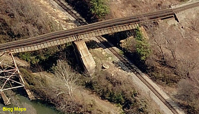
![]() Bridge and Coal Tipple
Bridge and Coal Tipple
GPS Coordinates: 37.234062, -77.396782
The remains of a short wooden bridge is still around - it was for a siding that led to a small coal tipple.
The wooden roadbed for the coal tipple is no longer there as of APR2016.
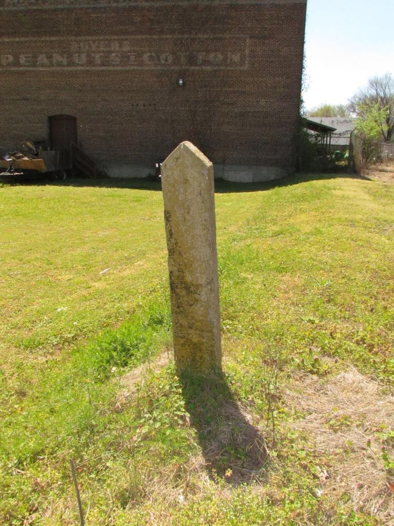
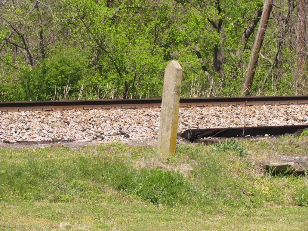
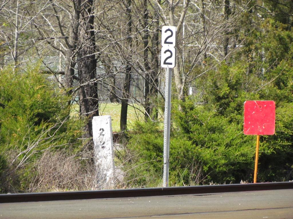
A concrete post stands adjacent to the bridge, there are no markings on it.
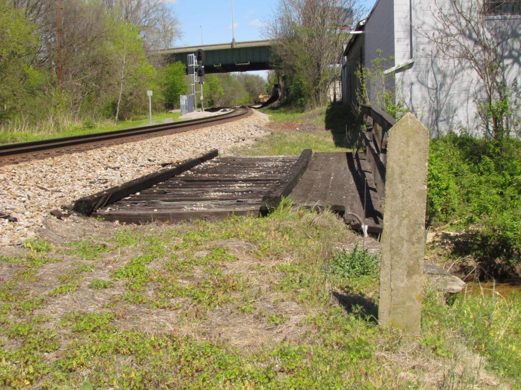

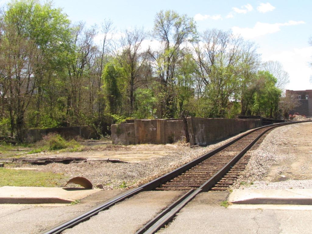
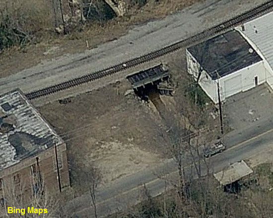
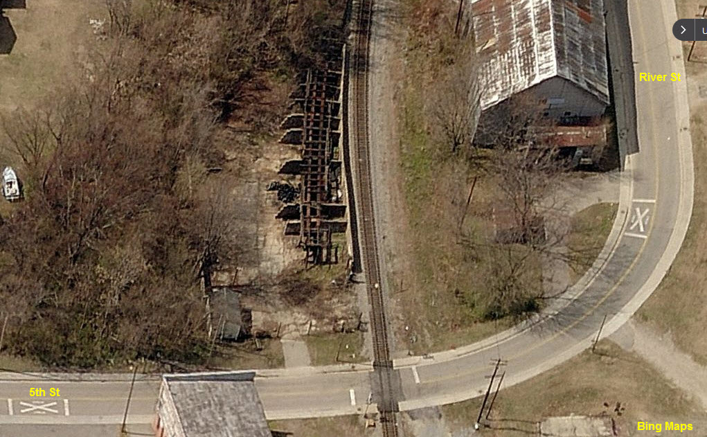
the 5th Street Crossing

![]()
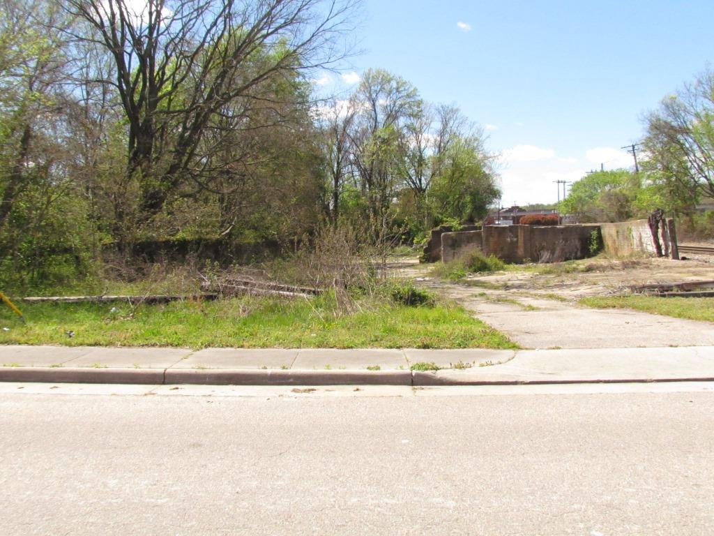
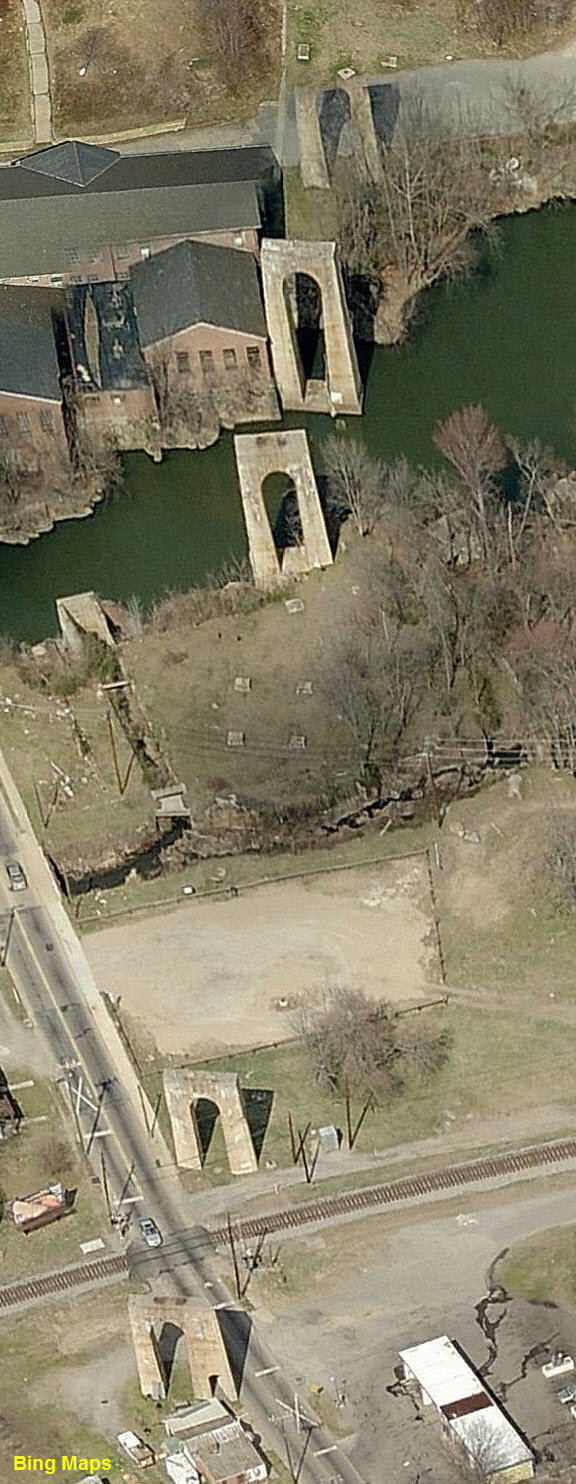
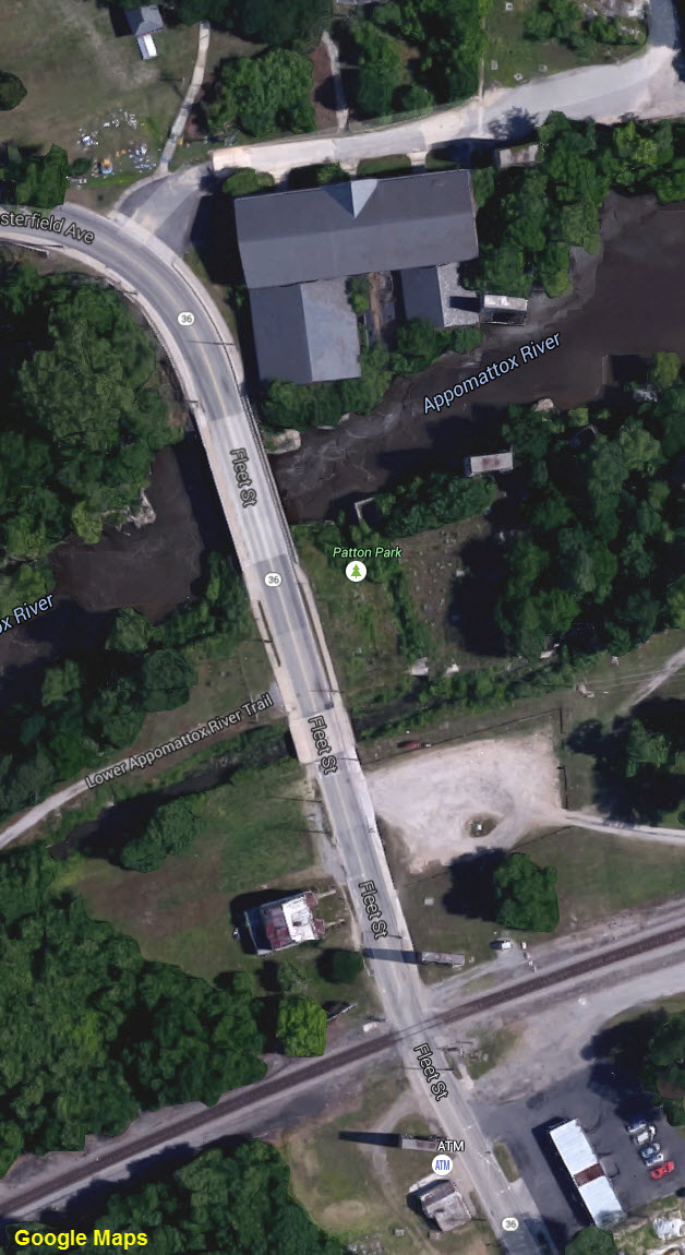
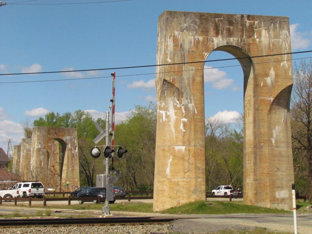
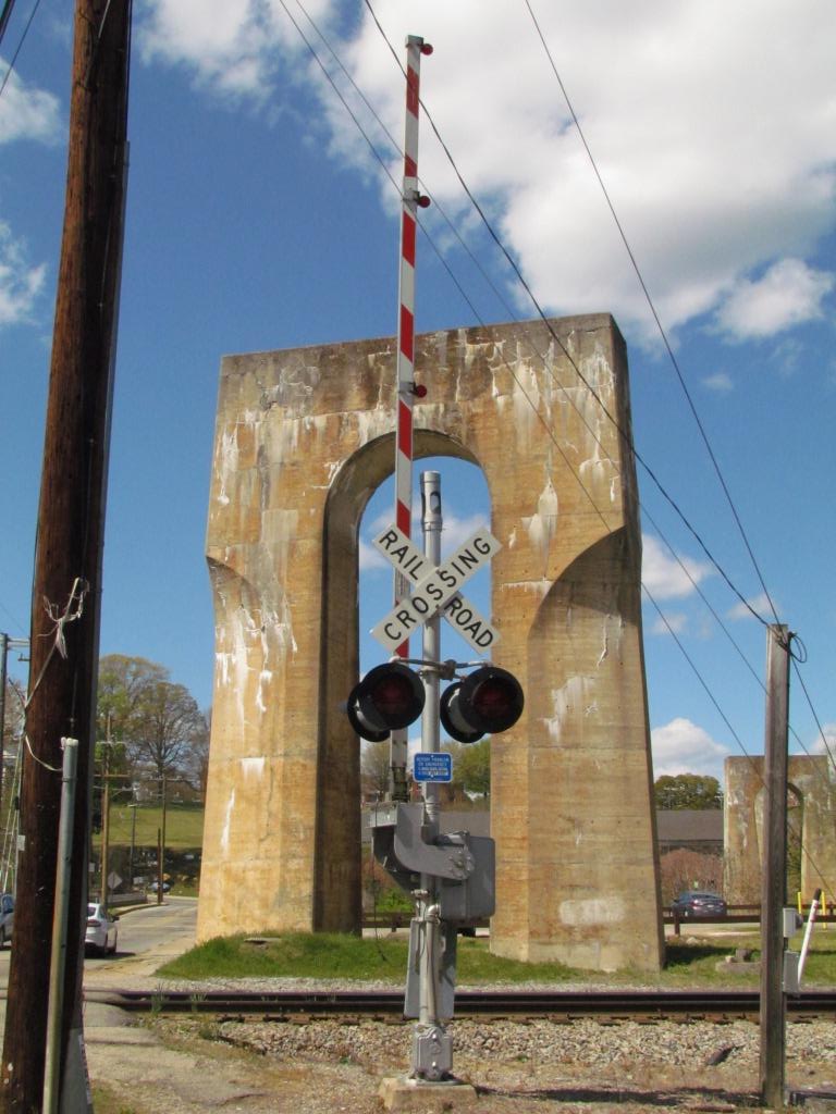
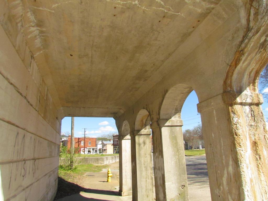
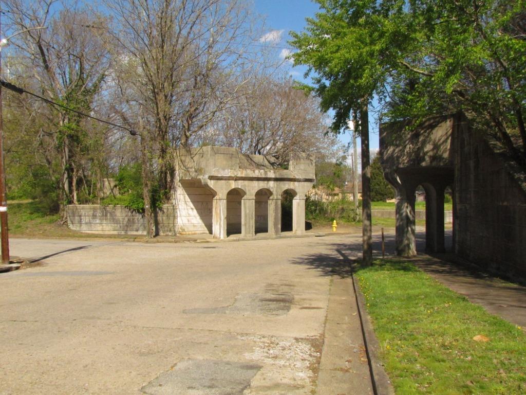
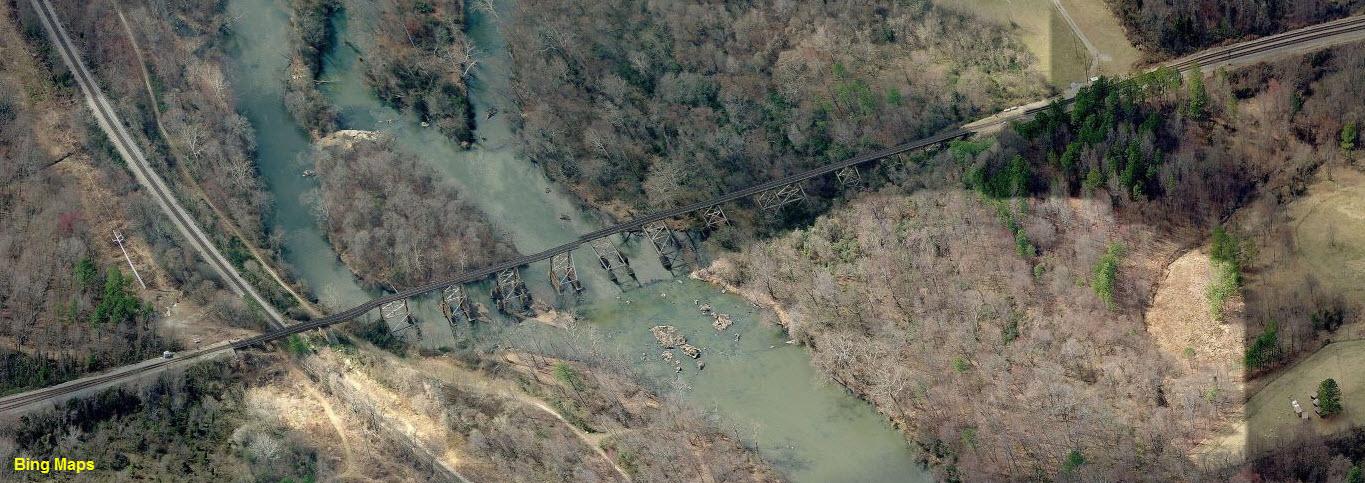
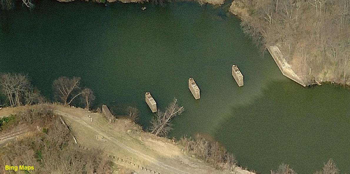
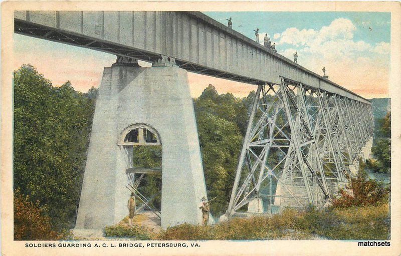
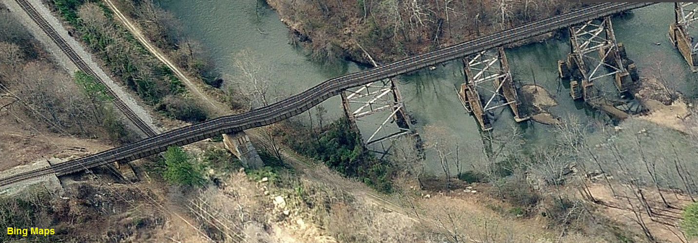
![]() Old SAL Bridge Piers
Old SAL Bridge Piers
GPS Coordinates: 37.231577, -77.417033
Interesting that after 33 years, the piers are still here. I guess it
would cost too much to take them down.
It's one of the coolest bridges I never got to see, and
it's a shame, for back in 1975-76, I use to
drive by here all the time going to Havelock NC!
The one with the pedestrian walkthru is interesting, as is the one with the chamfered sides.
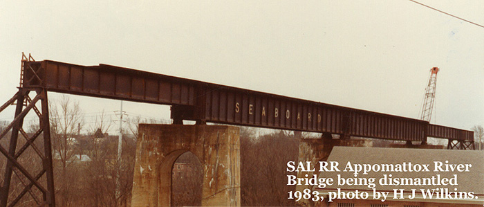
CSX removed the bridge structure in 1983. The remainder of the line
went dead in 1987.
The pictures at the bottom of this
section are the only ones I have come across, copyright the individuals named.
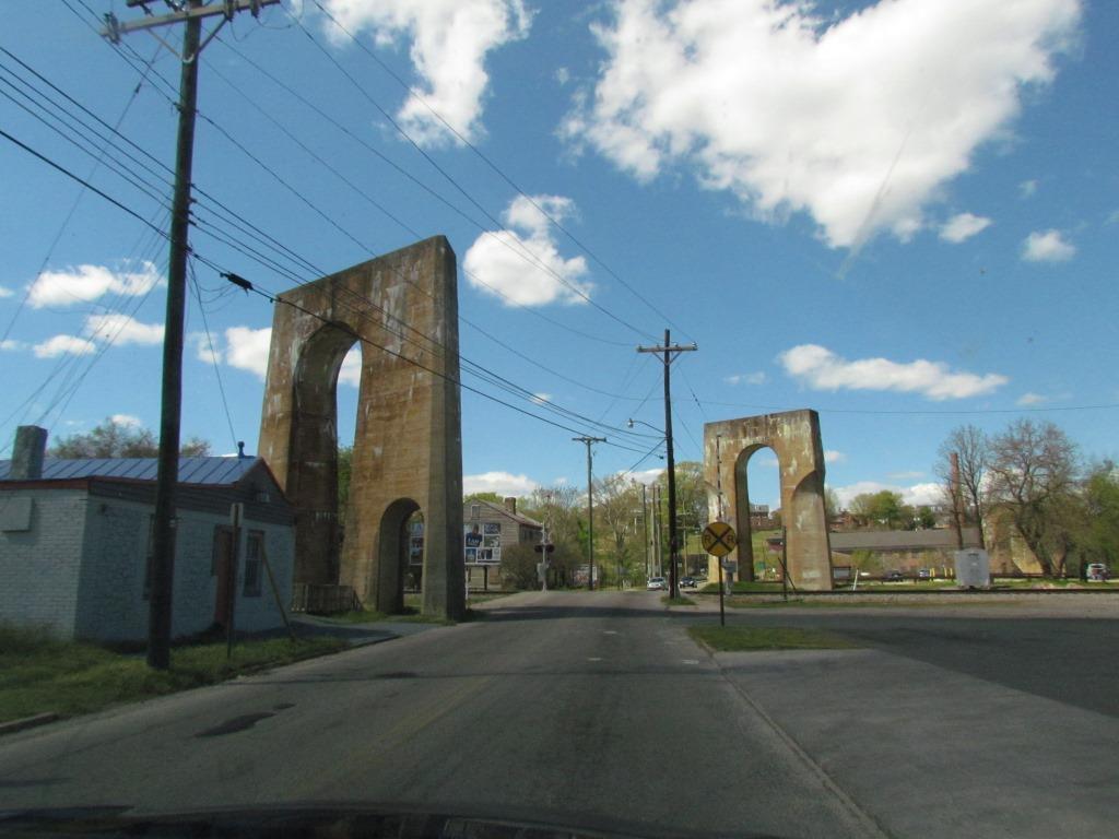
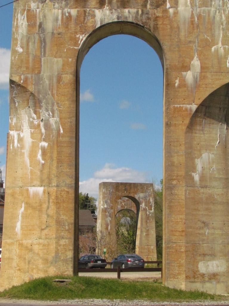
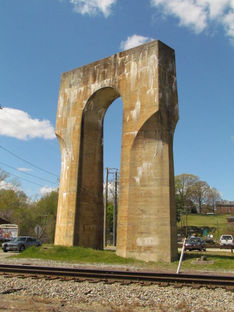
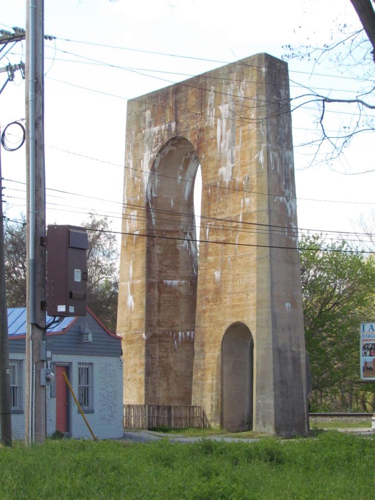
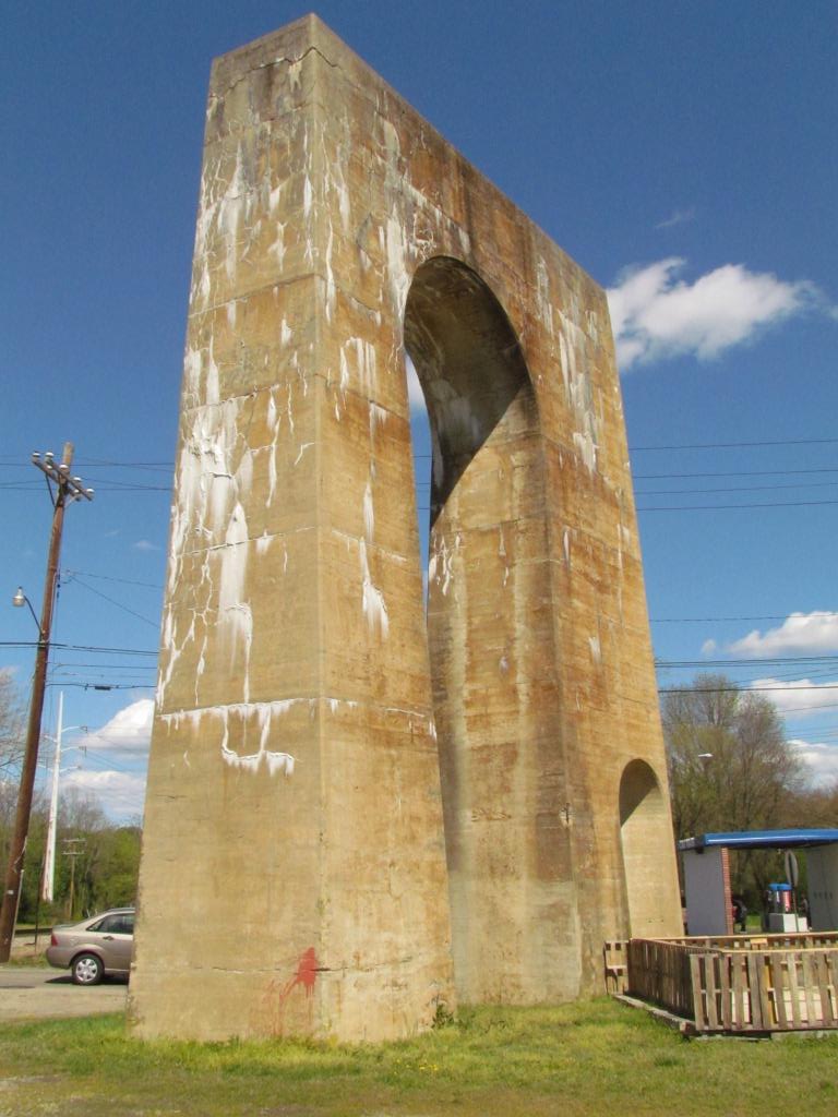
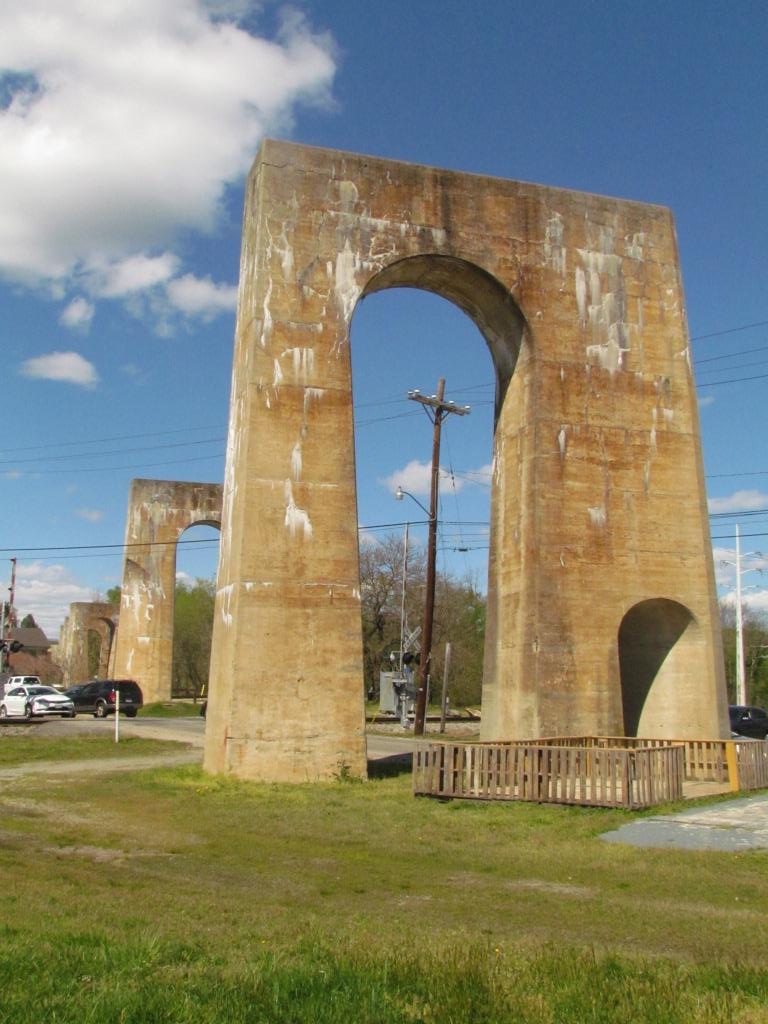
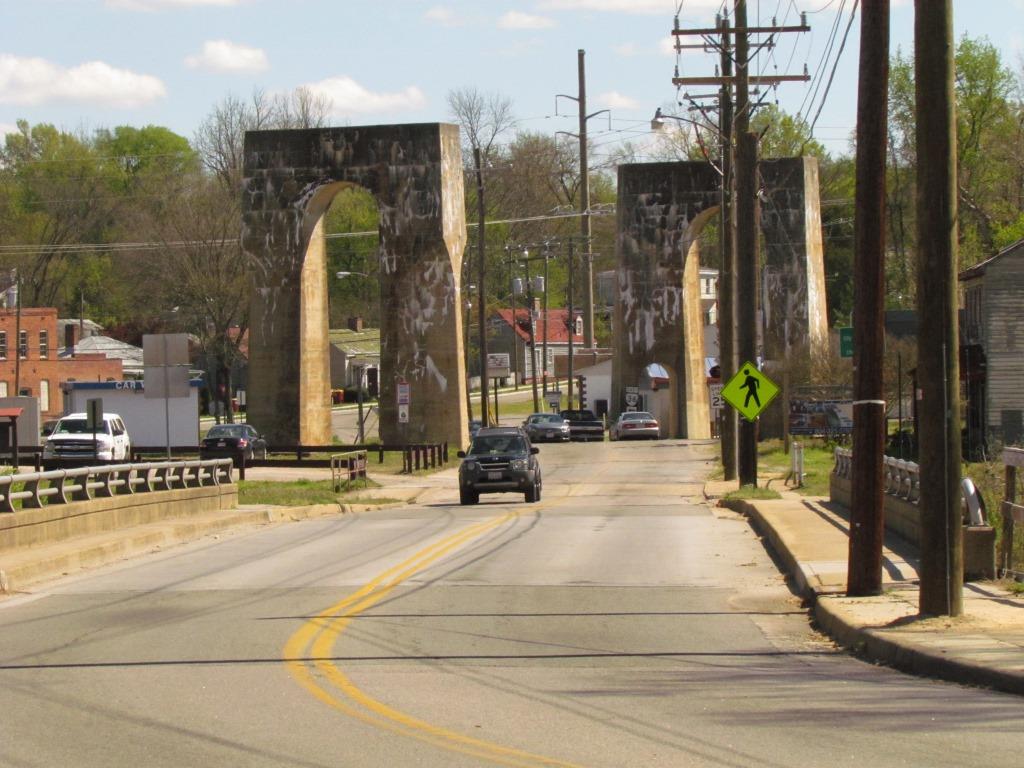
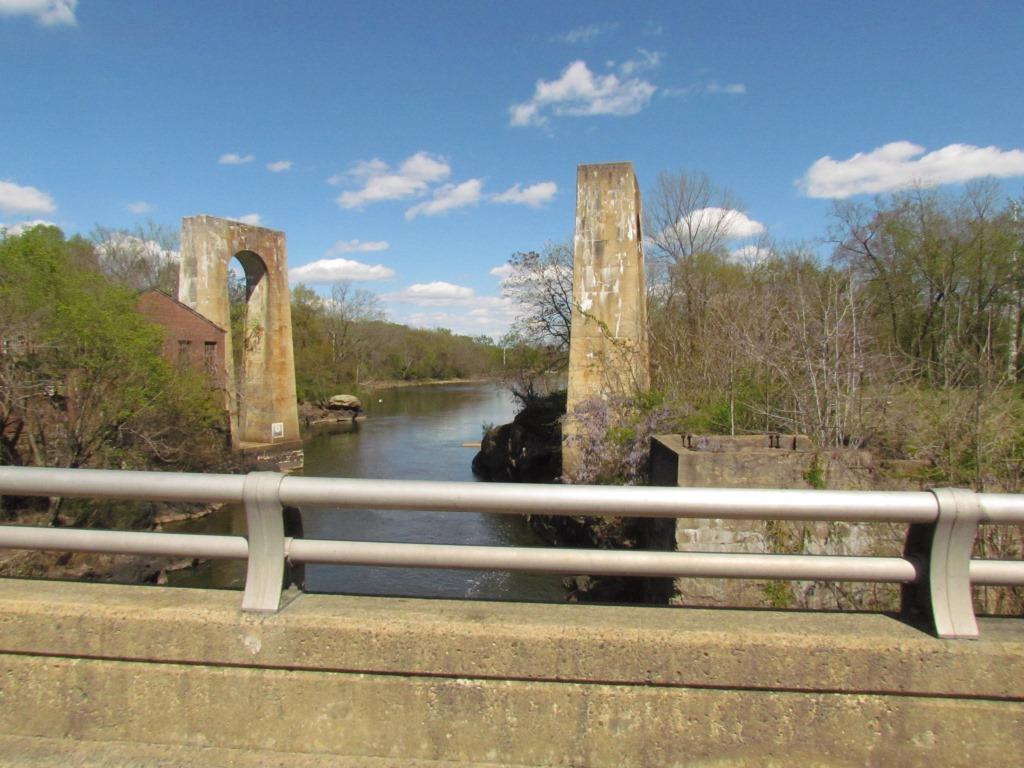
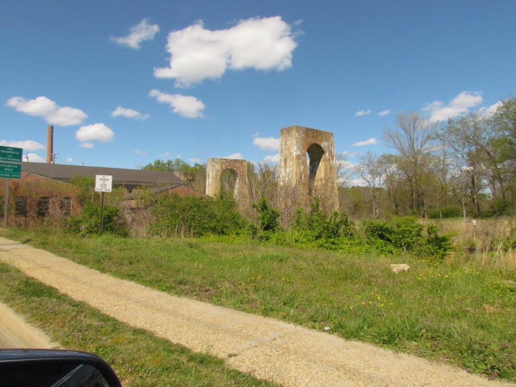
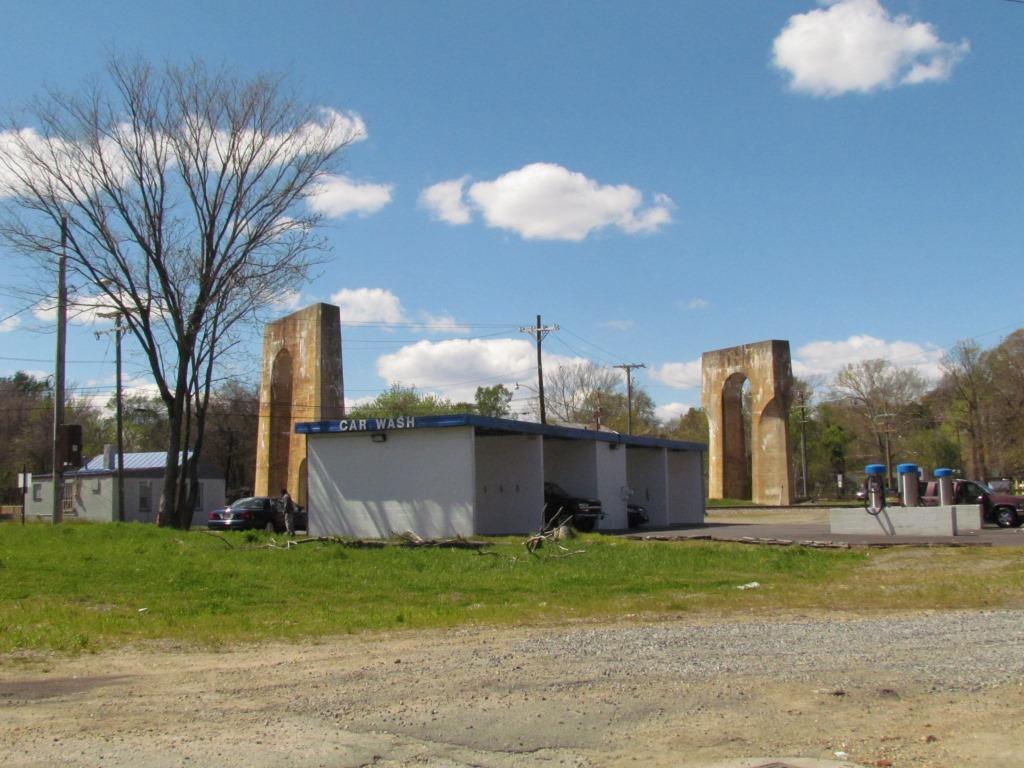

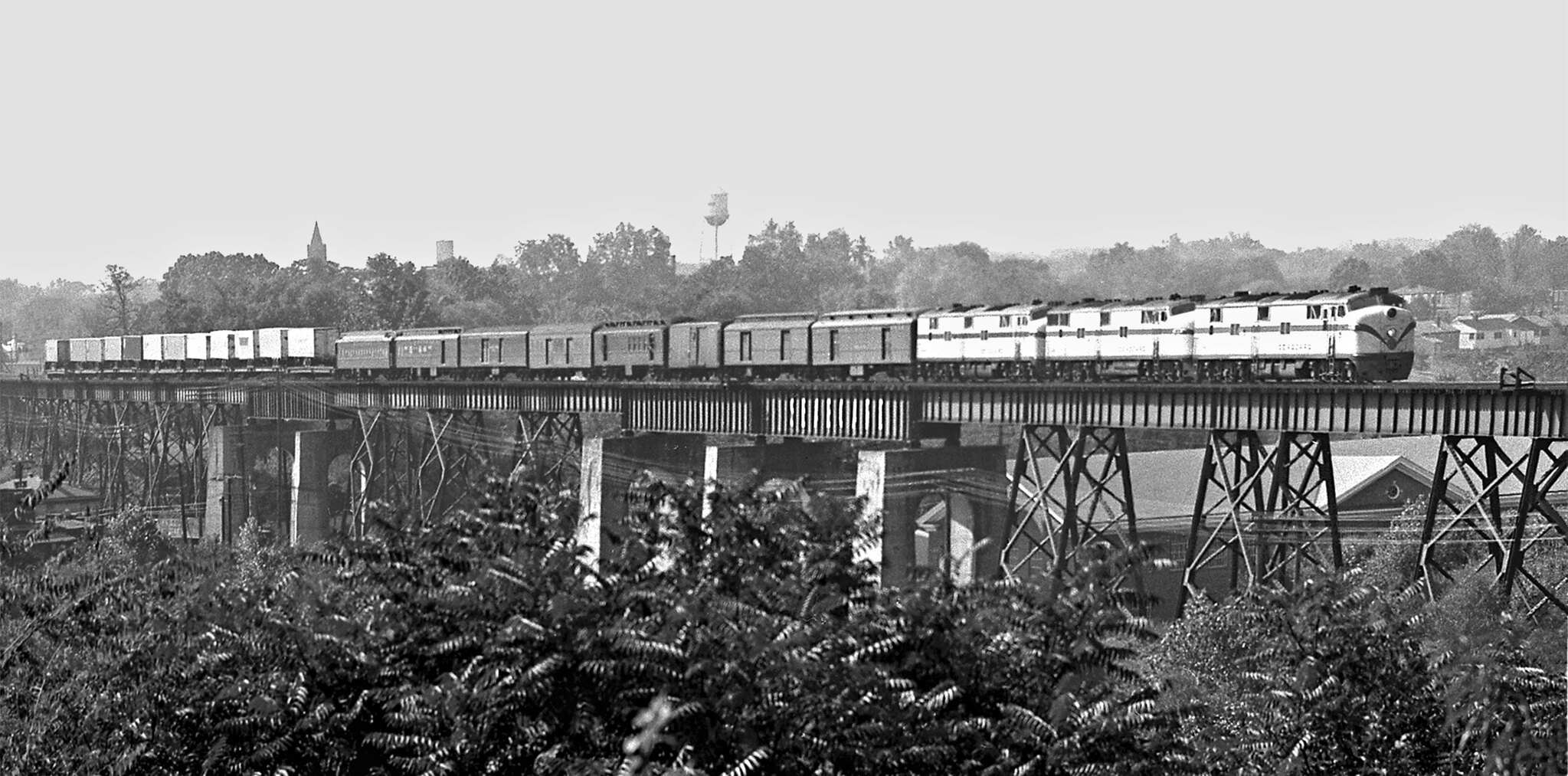 photo by J. Parker Lamb, 1962
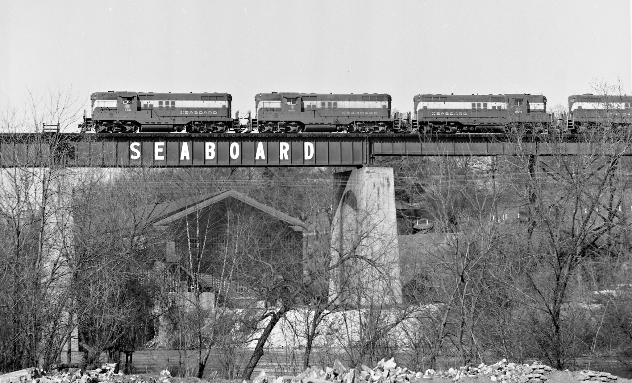 photo by J. Parker Lamb, 1962
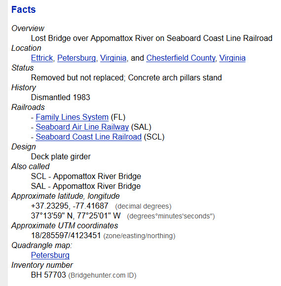 Stats from Bridgehunter.com.
the Fleet Street Crossing
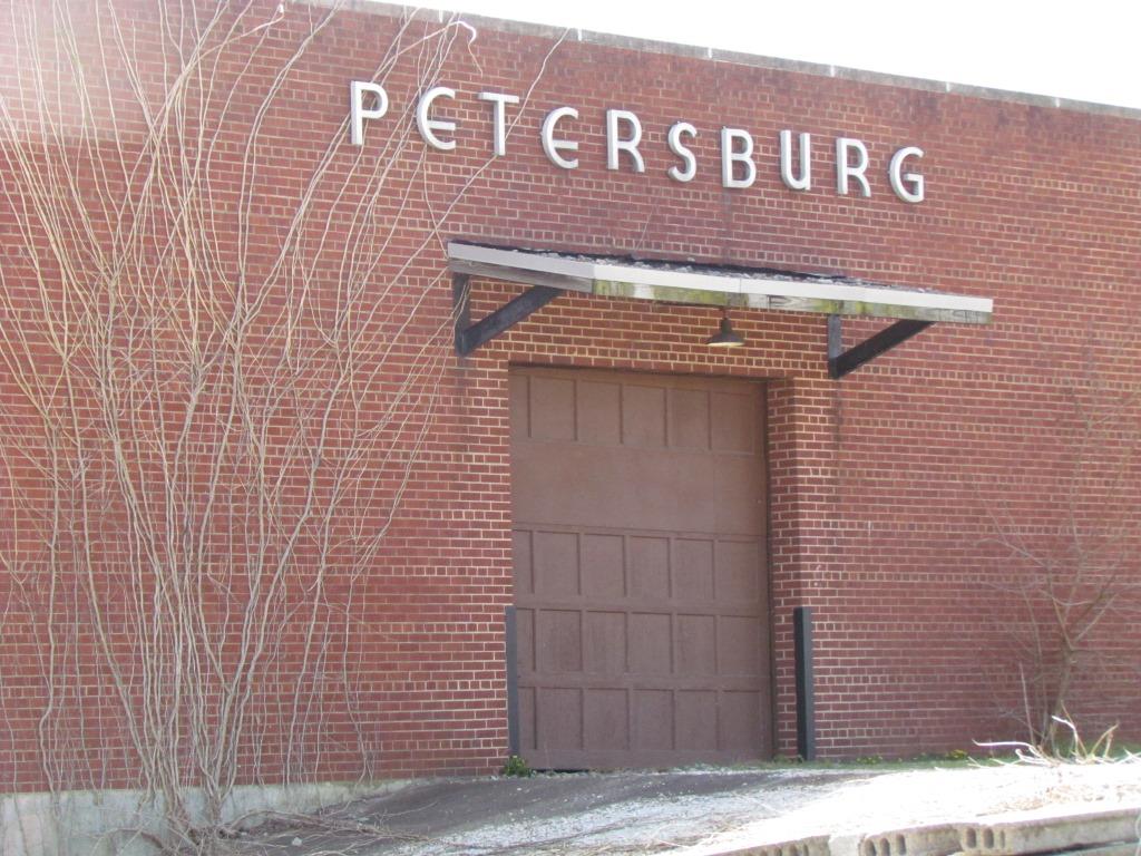
![]() Old
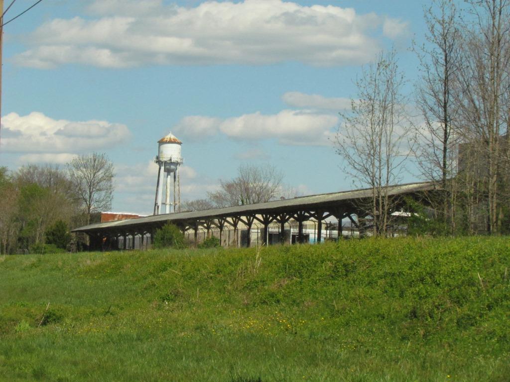
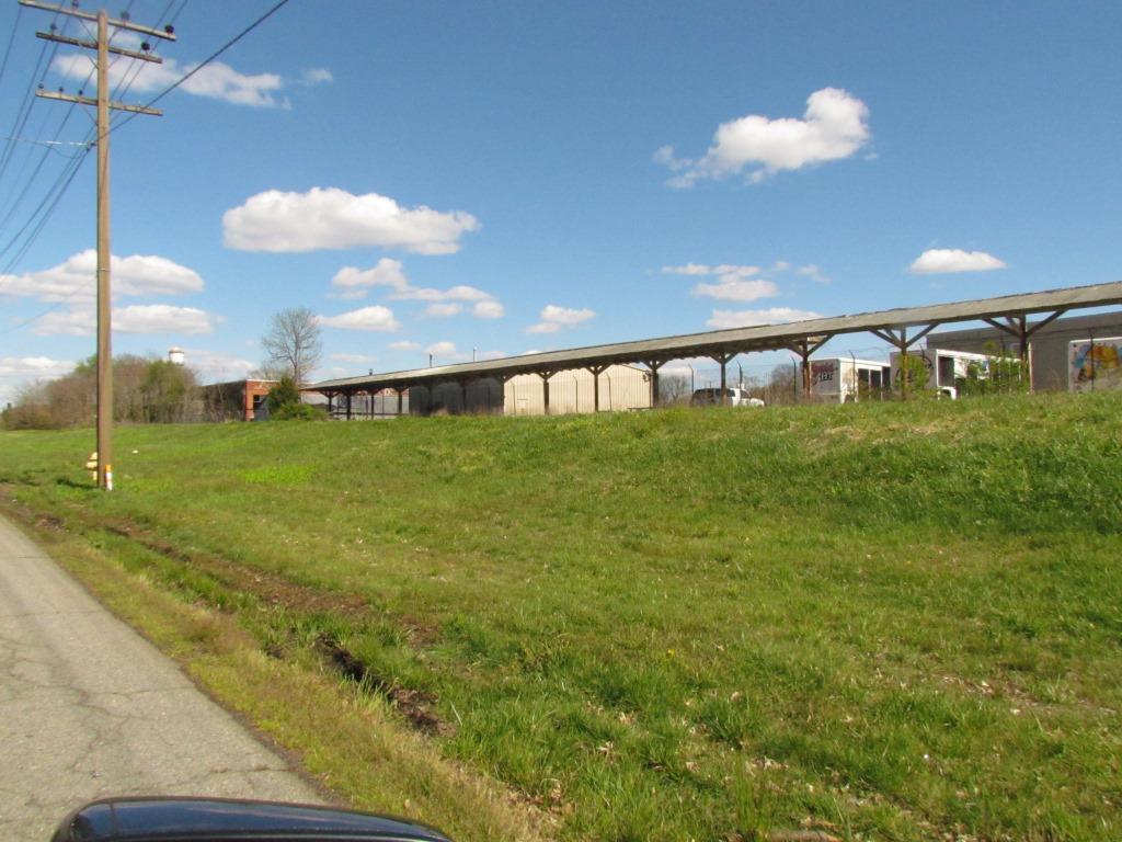
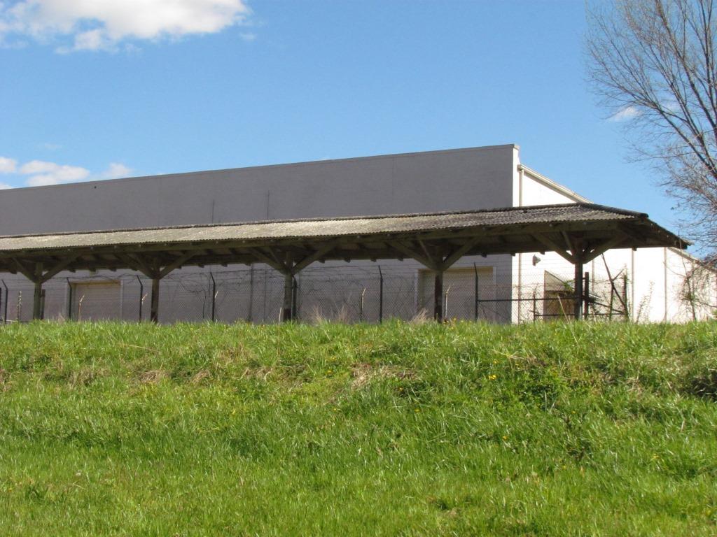
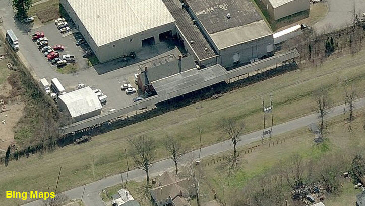
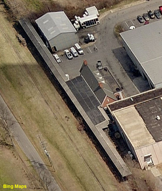
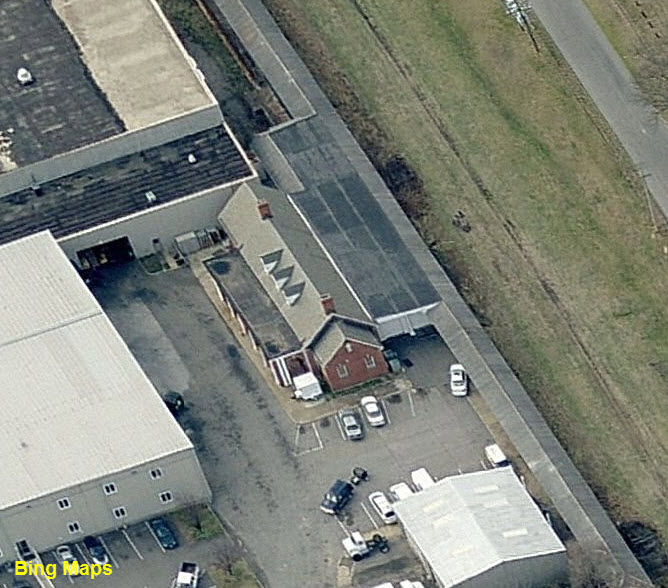
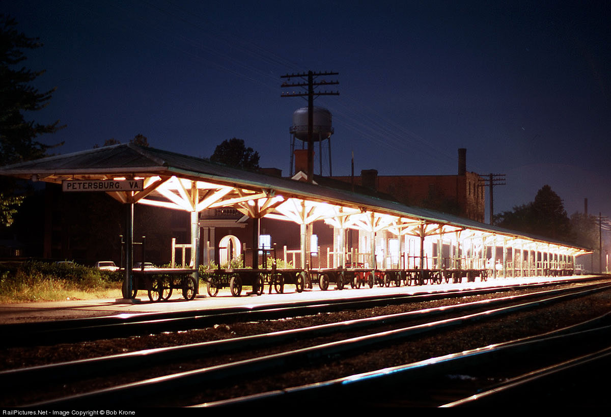
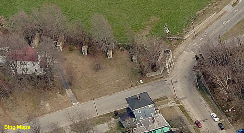
SAL Commerce St Station and Passenger Platform
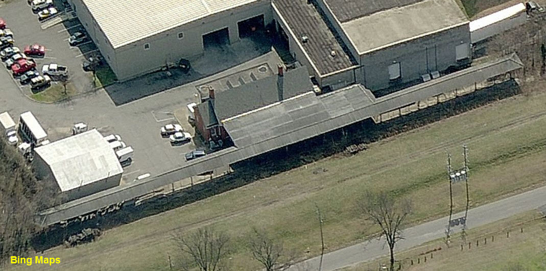
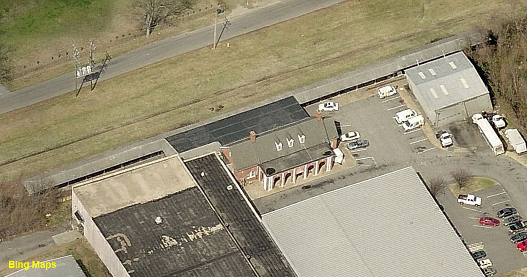
Old
SAL Commerce St Station and Passenger Platform
GPS Coordinates: 37.224573, -77.424646
You can catch of glimpse of this structure from along Upper Appomattox St.
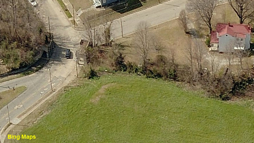
The station was fairly recently torn down. It was closed in 1970 after the ACL-SAL merger. Service was moved to the station in Ettrick.
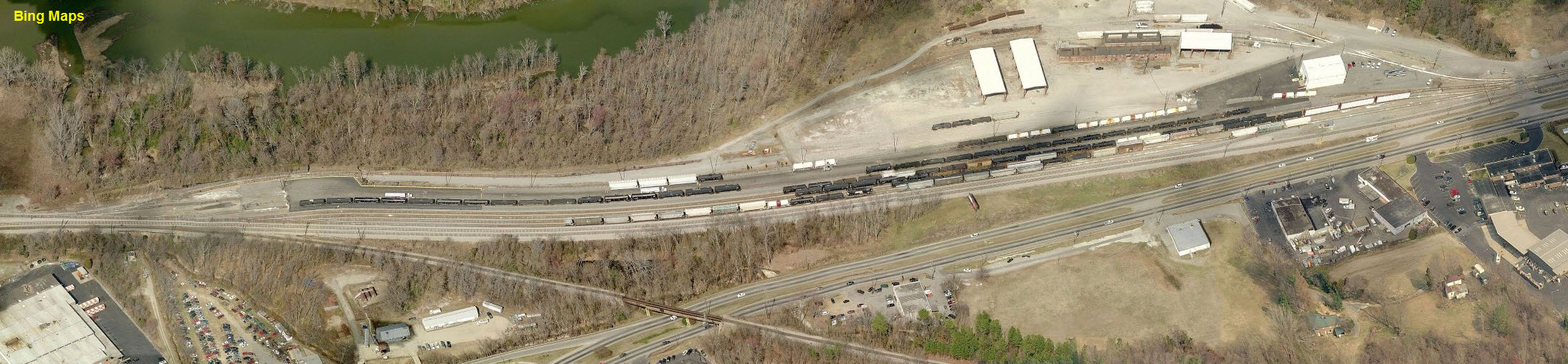
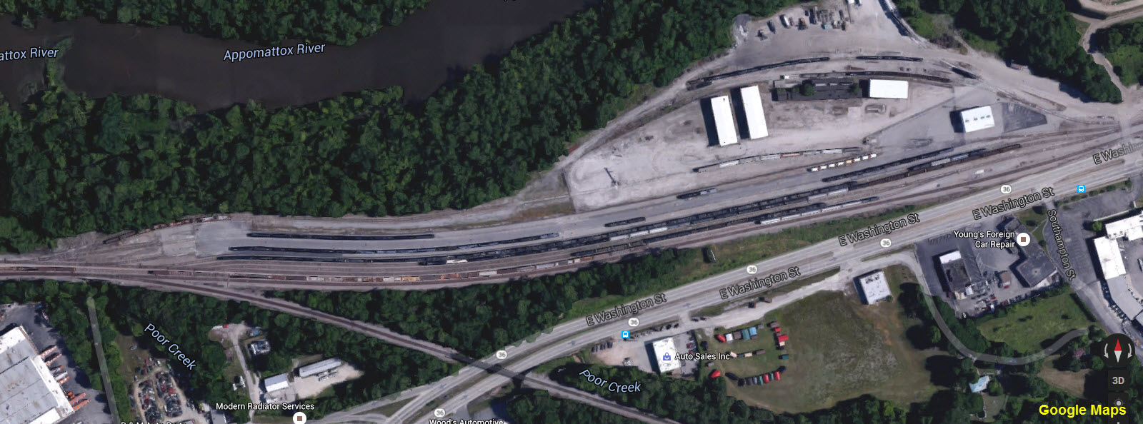
In the Bing birds-eye view, you can see the station, in the Google image, it is gone.
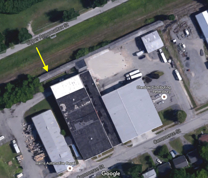
The Station
We can thank Bing for not updating their aerial views so quickly! :-)
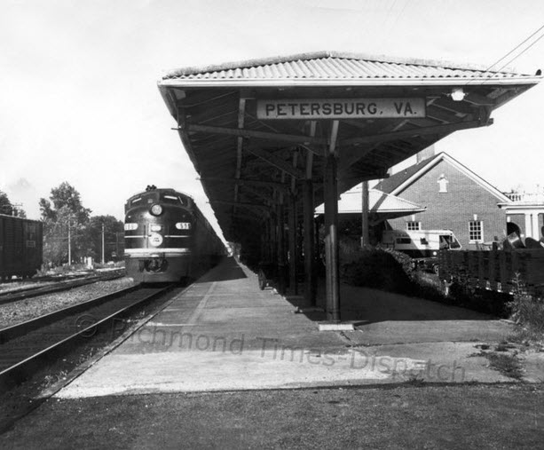
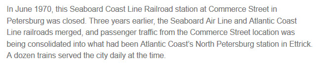
From a Richmond Times-Dispatch article found
here
Below is a night shot of the Commerce Street Station in October 1968. Photo by Bob Krone.
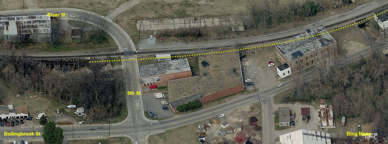
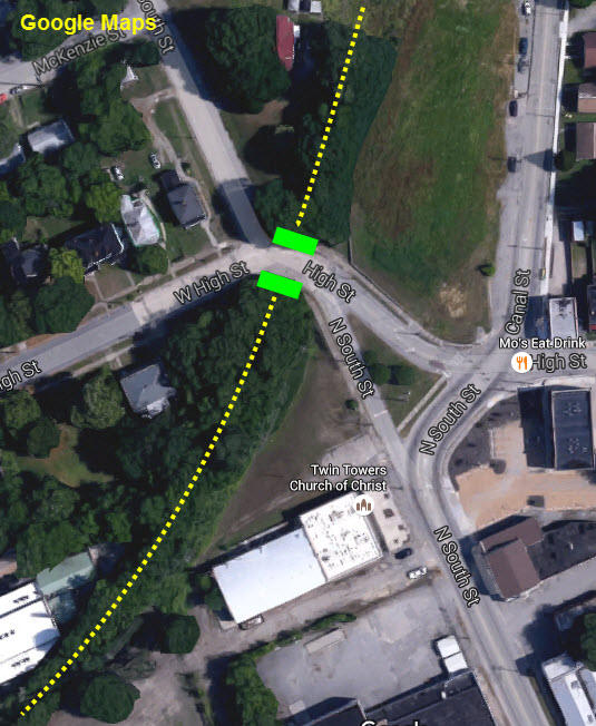
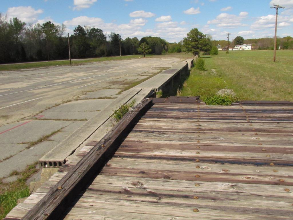
Where the Seaboard Air Line (SAL) Sights Are In Relation to Each Other
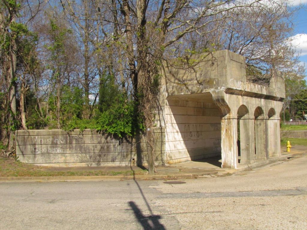
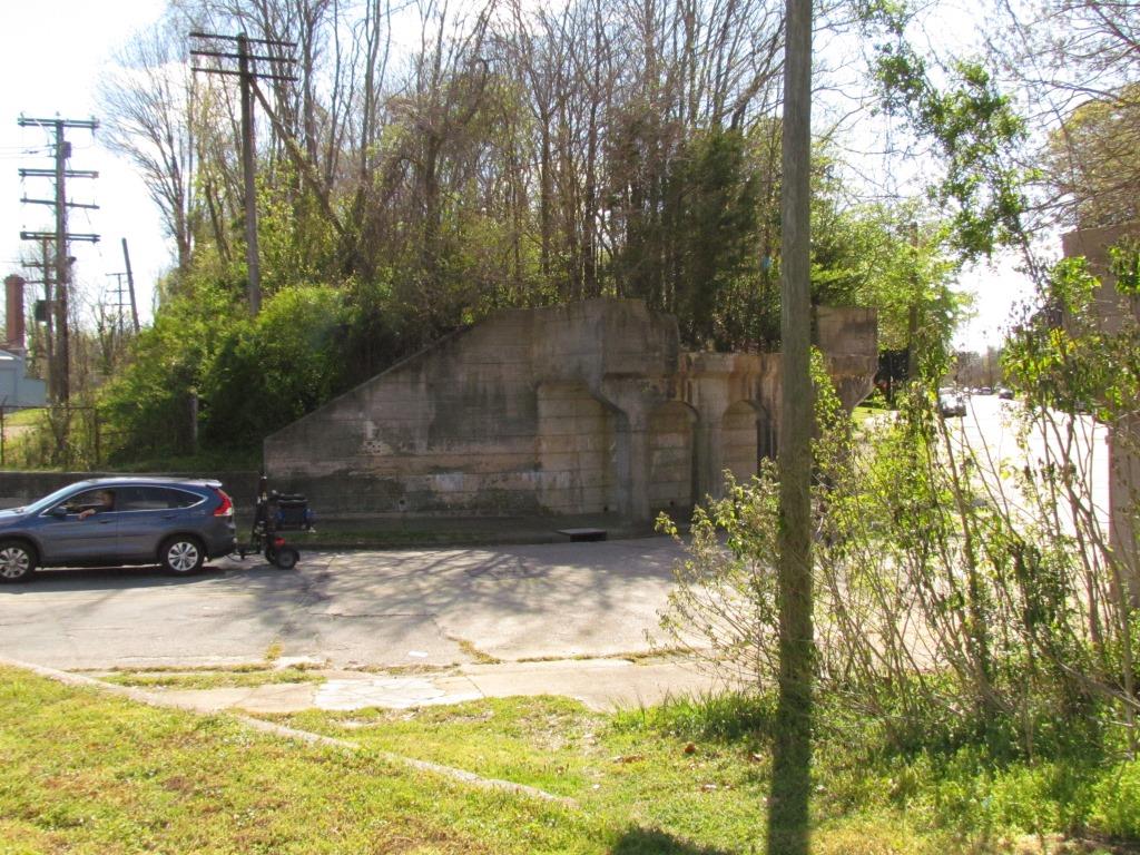
GPS Coordinates: 37.228410, -77.417571
Very nice period concrete work - still in remarkably good condition! You have to at least drive by and take a look. These would be a nice addition to any model layout!


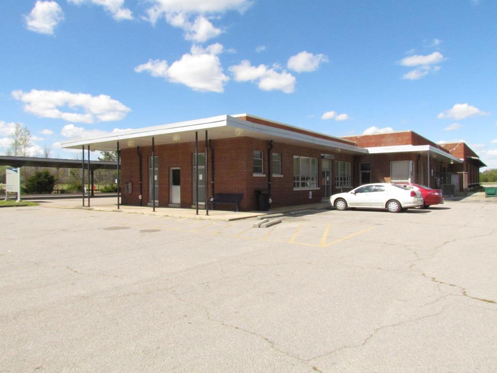
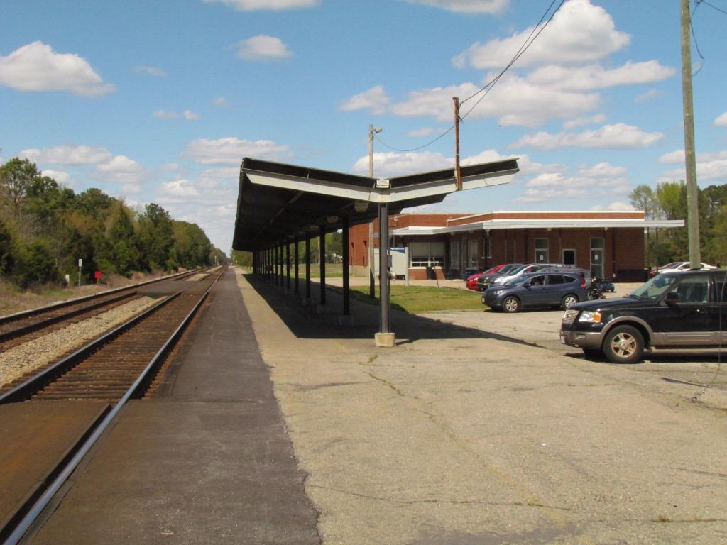
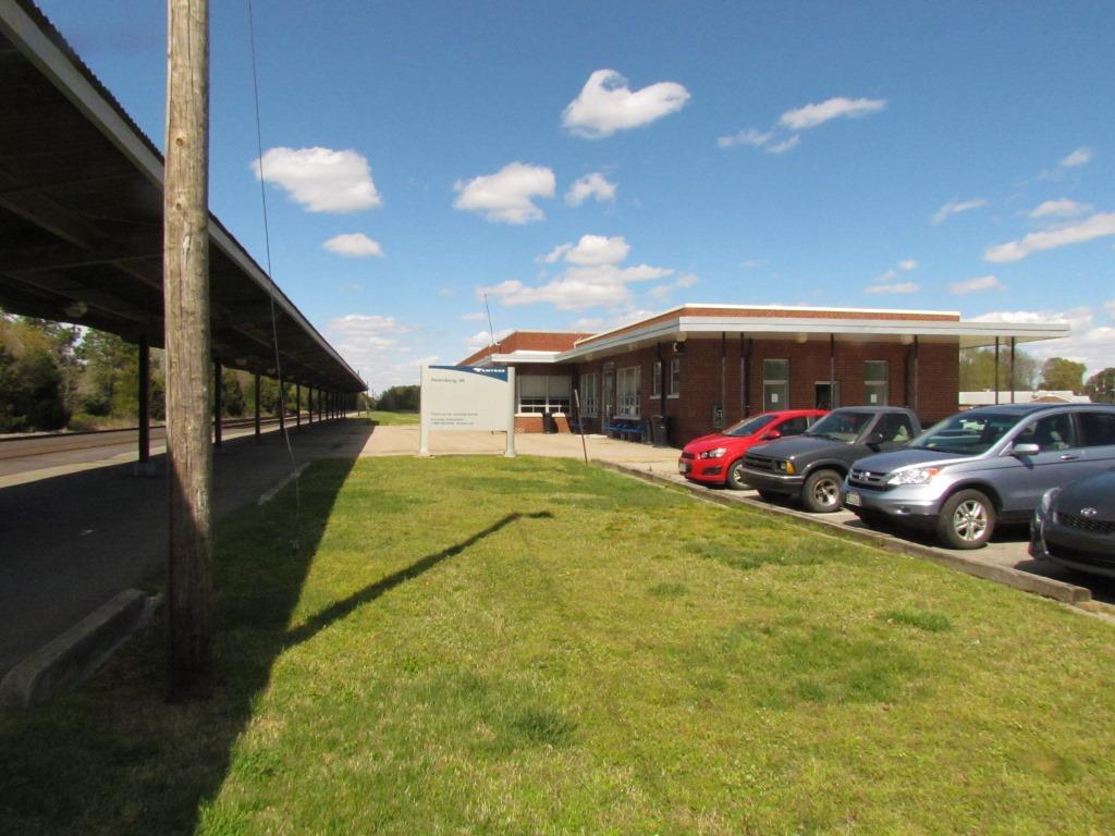
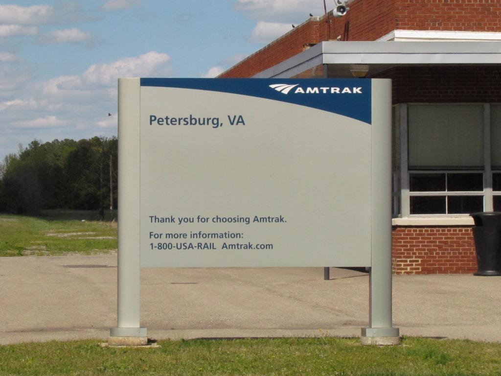
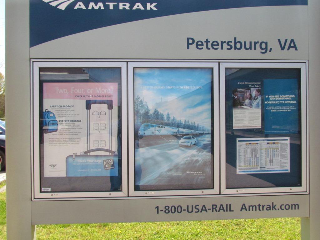
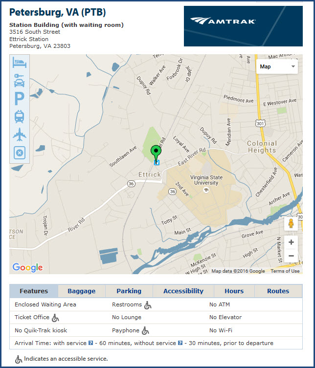
GPS Coordinates: 37.241893, -77.428695
Station Code: PTB
3516 South Street, Ettrick Station, Petersburg, VA 23803
Elevation: 105ft / 32m
https://www.amtrak.com/servlet/ContentServer?pagename=am/am2Station/Station_Page&code=PTB
According to one source, this station was built in 1955. Anyone know for sure?
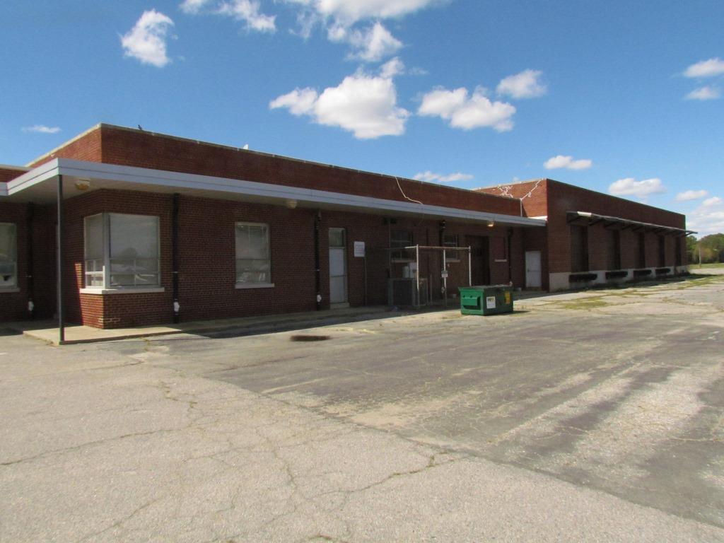
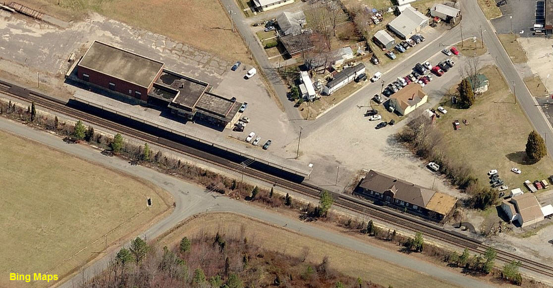
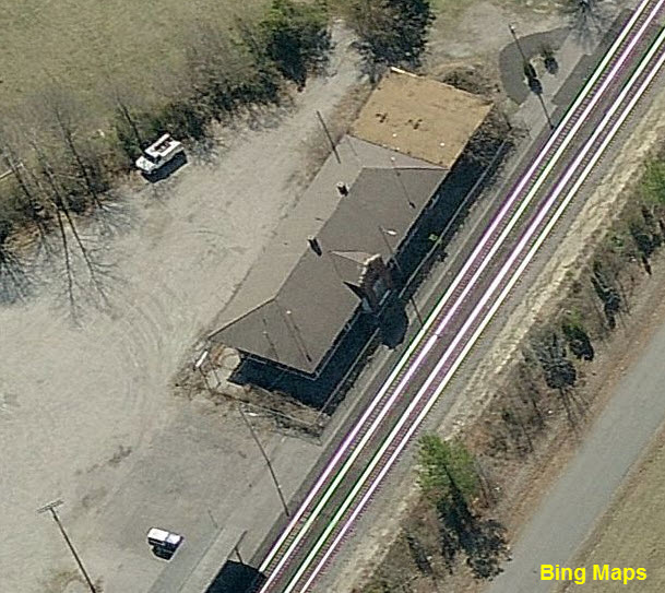
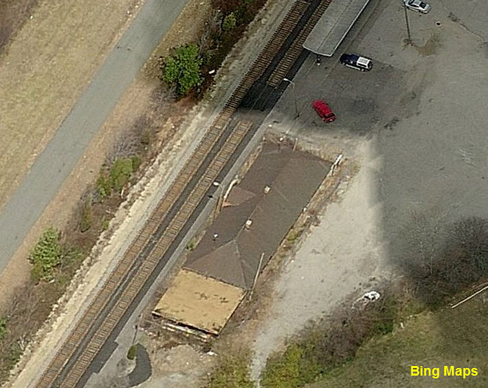
In the Bing Birds Eye views, you can still see the old Seaboard/ACL Depot standing just south of the Amtrak station.


 Foundation for the old depot.
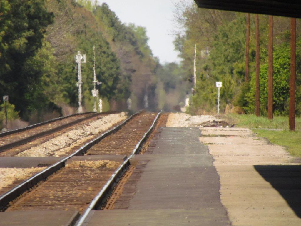 Looking north.
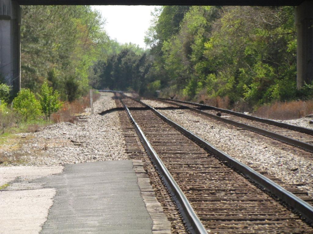 Looking South.
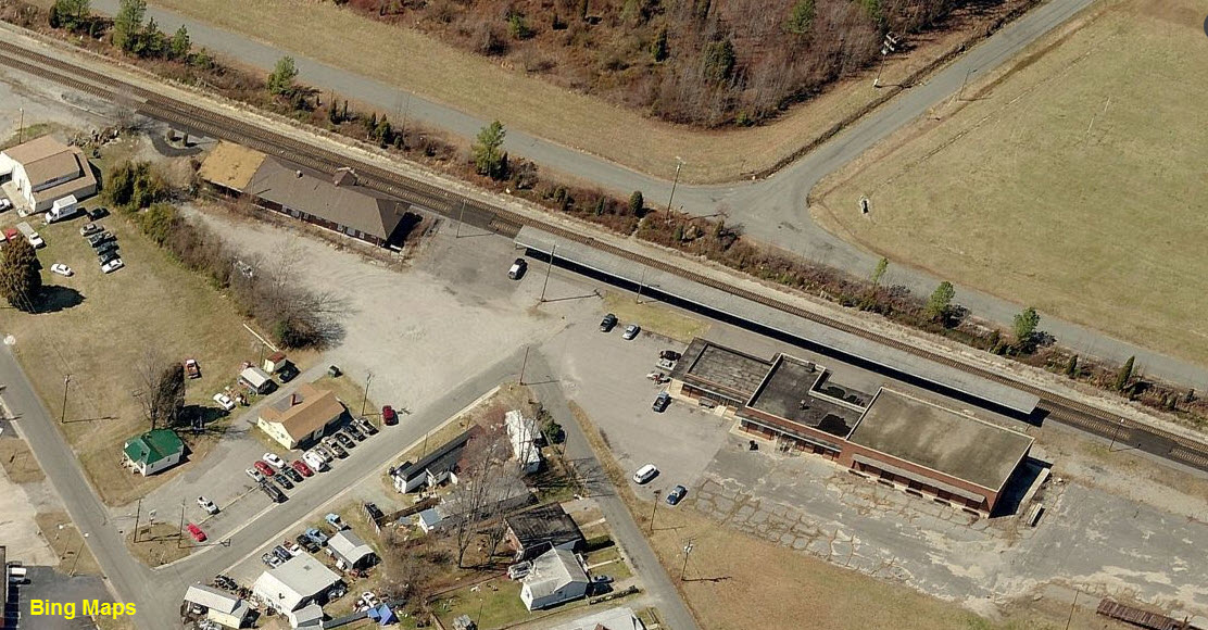
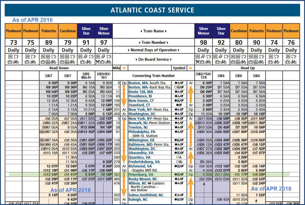
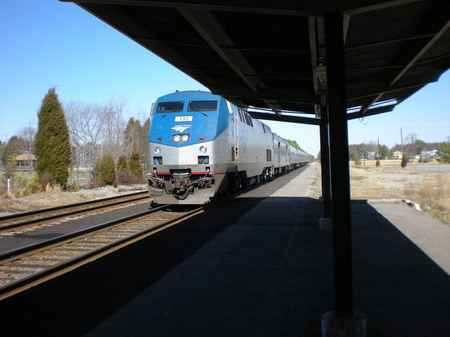 #132 with Train 89 - The Palmetto...... these 3 pictures by Major Ursa, 3/2008.
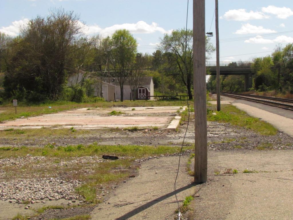
GPS Coordinates: 37.241893, -77.428695
GPS Coordinates: 37.240890, -77.429502
The station was torn down sometime in the 2011-2012 timeframe, only the concrete pad remains.
 Picture by Earl Leatherberry - Feb 13th, 2011
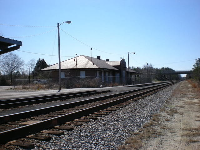 Picture by Major Ursa, 3/2008.
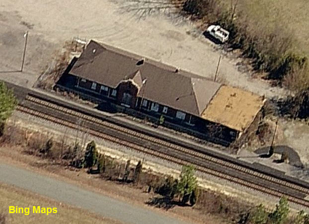

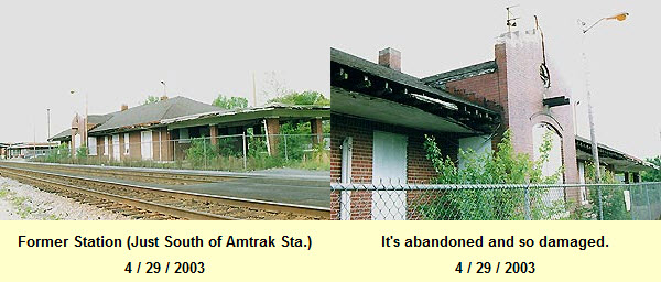
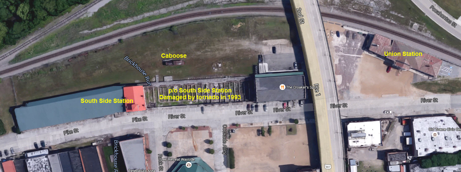
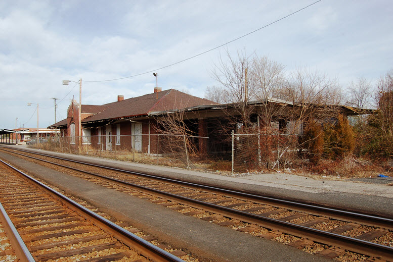
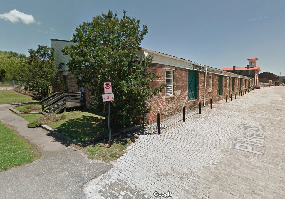
GPS Coordinates: 37.234006, -77.404699
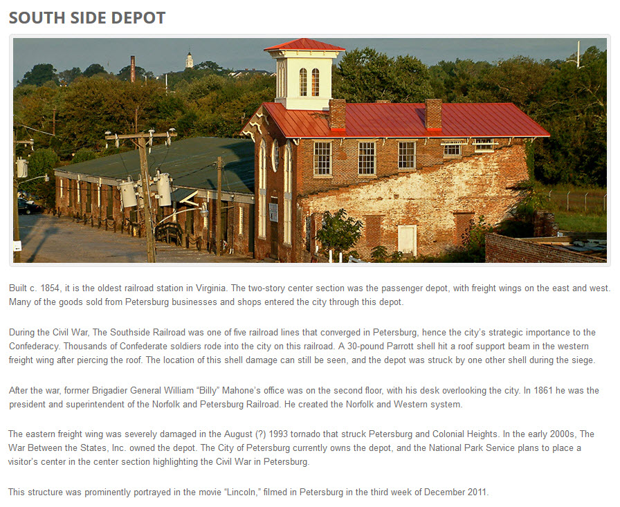
http://www.preservationpetersburg.org/explore_southside_depot.html
The station is Virginia's oldest, it was built in 1853/1854. A tornado came through in 1993 and took away the eastern freight warehouse section.
The info and picture below came from the website mentioned above. Information on this station is hard to find.
 From the VT Library.
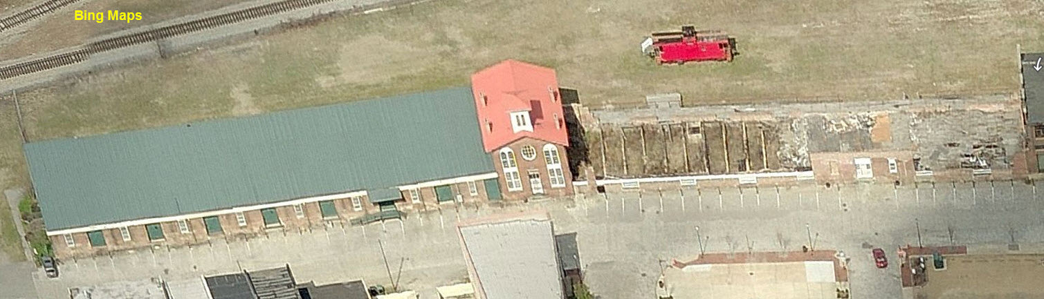

GPS Coordinates: 37.234476, -77.396099
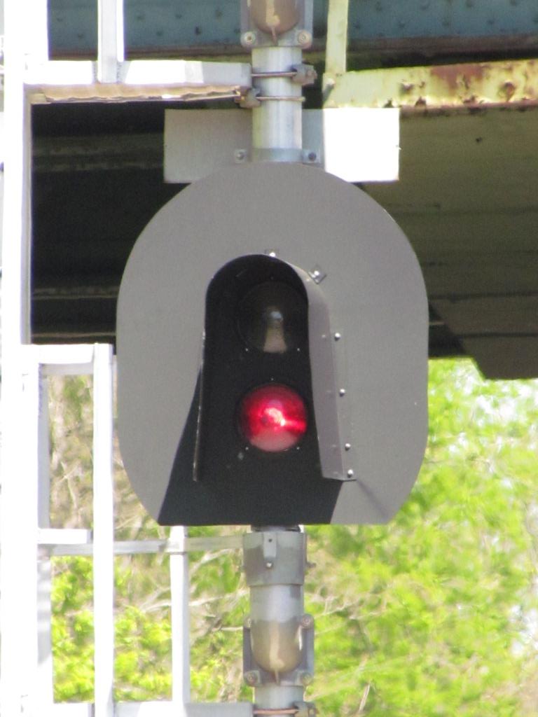
![]() Northside Interlocking Signals on the CSX Appomattox River Bridge
Northside Interlocking Signals on the CSX Appomattox River Bridge
GPS Coordinates: 37.228040, -77.433911
No pictures yet
![]() Southside Interlocking Signals on the CSX Appomattox River Bridge
Southside Interlocking Signals on the CSX Appomattox River Bridge
GPS Coordinates: 37.223782, -77.431593
No pictures yet
Bridges and bridge remains other than those shown above.
![]() CSX Bridge over the Appomattox River
CSX Bridge over the Appomattox River
A single track trestle on an otherwise double-tracked mainline handling CSX's main north-south corridor on the east coast.
This bridge is part of the former ACL's A-Line.
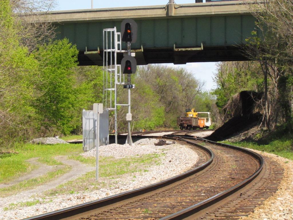
![]() CSX Bridge
the former ACL (Atlantic Coast Line) tracks
CSX Bridge
the former ACL (Atlantic Coast Line) tracks
A short double tracked trestle at the southern
interlocking for the Appomattox River bridge. The NB signals are just off
to the left of the bridge in the picture below. View from the west, so it
appears "upside down" when comparing it to the map. This bridge
is also part of the former SCL's A-Line.
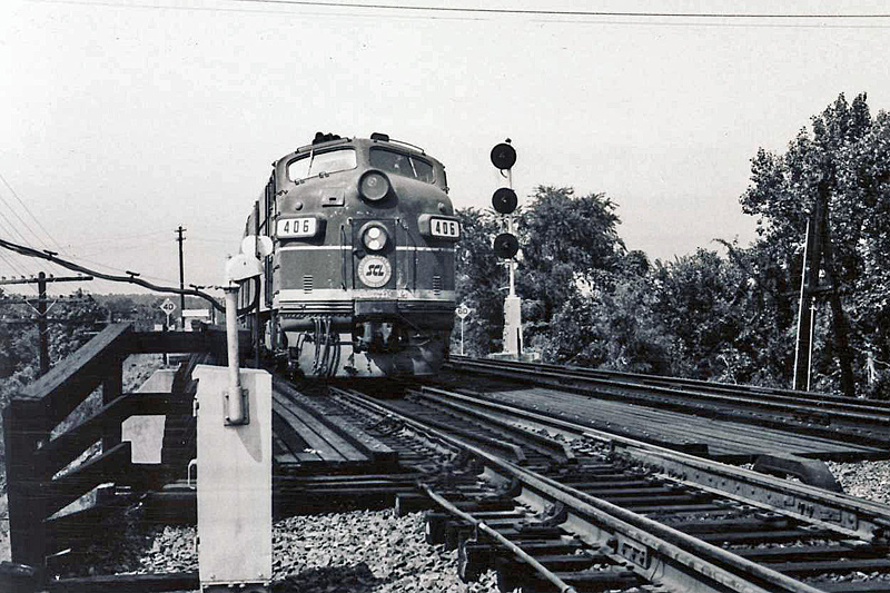
A southbound freight getting ready to come off the bridge in 1969. From the Rails in Virginia page.
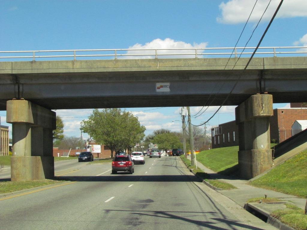
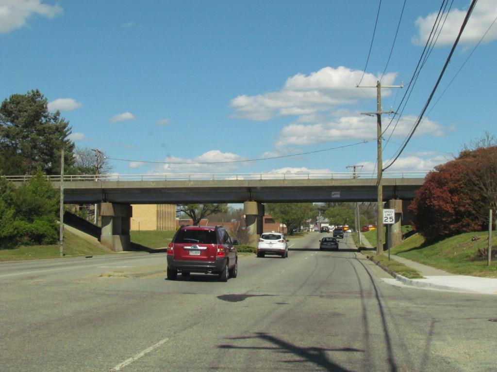
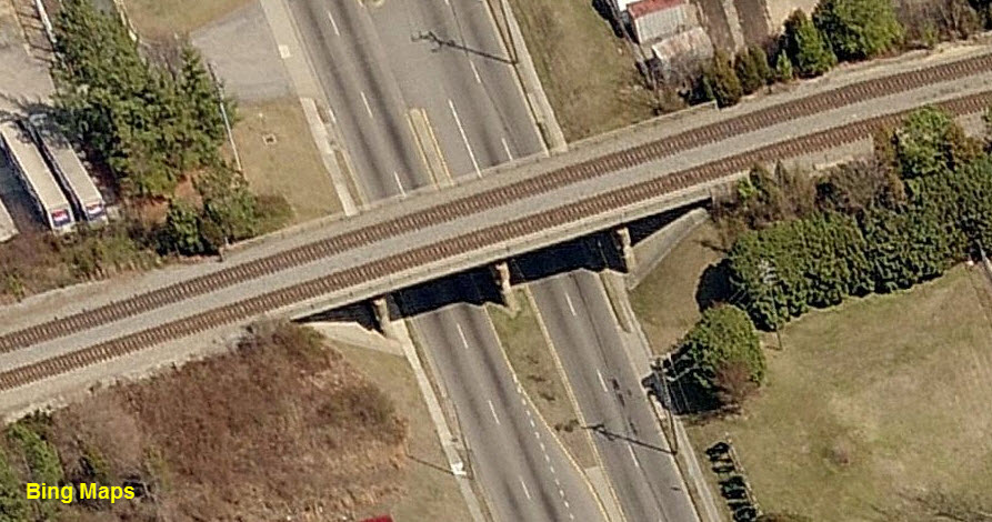
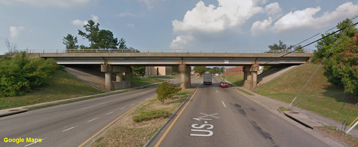
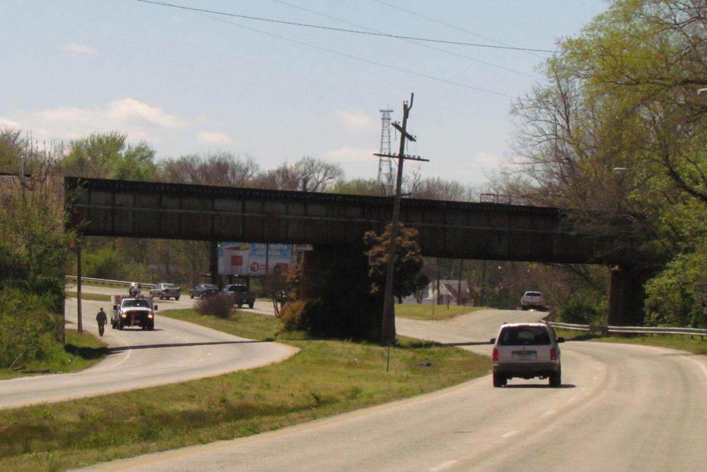
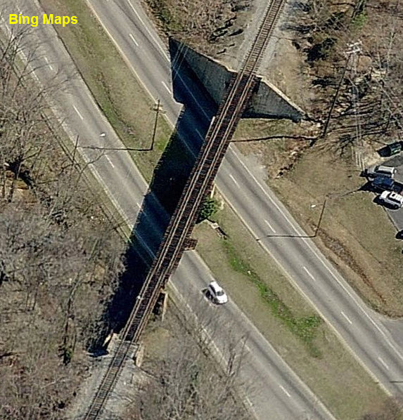
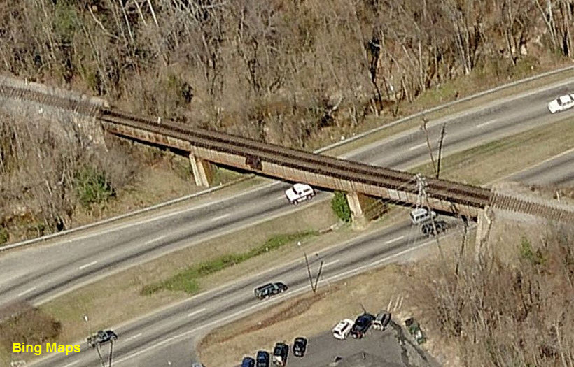
![]() CSX Bridge over West Washington St - US-1 and Business 460
CSX Bridge over West Washington St - US-1 and Business 460
A well kept concrete/steel double-tracked bridge. Notice the bridge still has the Seaboard logo on it.
![]() CSX Bridge over Farmer St
CSX Bridge over Farmer St
A short double-tracked girder bridge.
![]() Piers and Abutments for former ACL Bridge crossing the Appomattox River
Piers and Abutments for former ACL Bridge crossing the Appomattox River
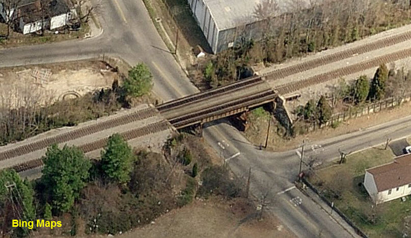
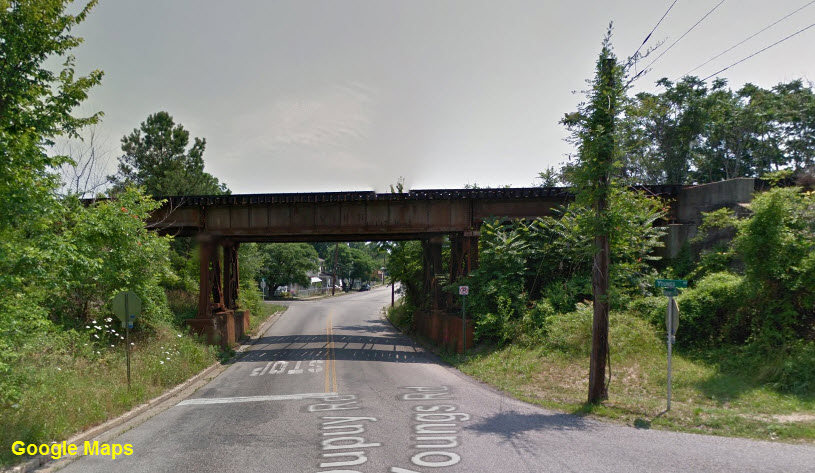
![]() NS Girder Bridge over East Washington St
NS Girder Bridge over East Washington St
This track was formerly the N&W, and before that, the Norfolk & Petersburg.
The track heads SE to a wye, the Belt Line, and the "Poe Yard".
 Looking west
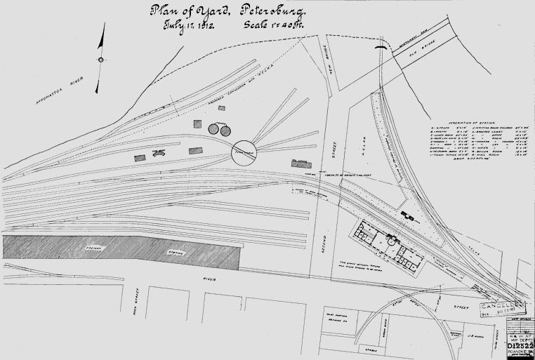
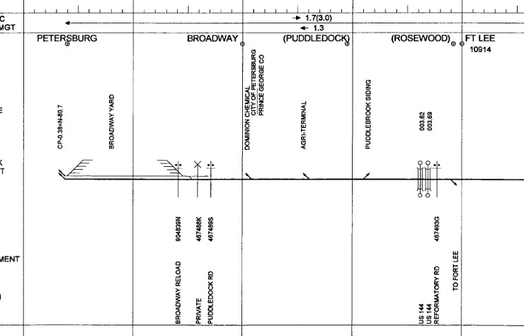
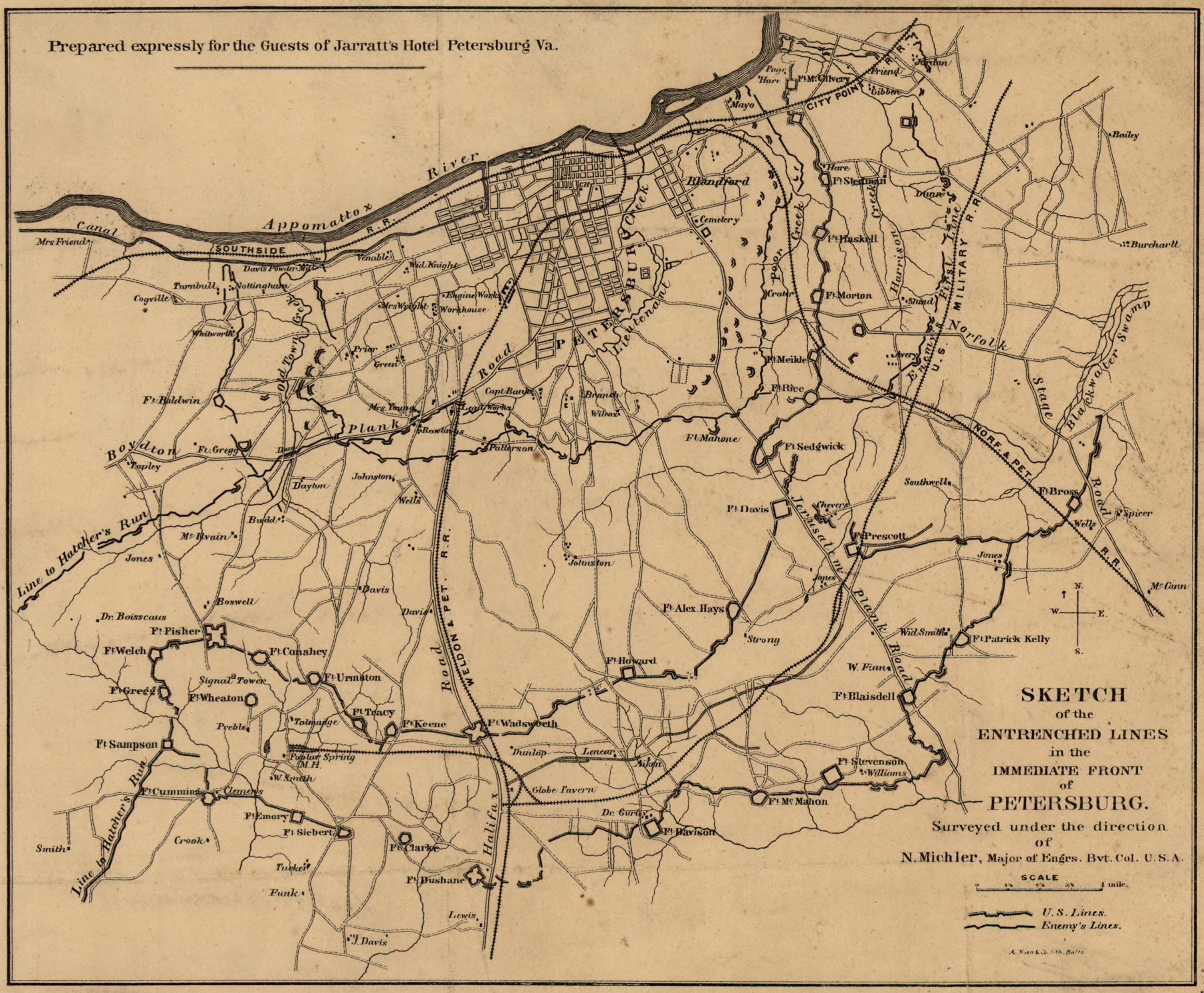
Top map courtesy of the University of Texas Library, click
here for their index page.
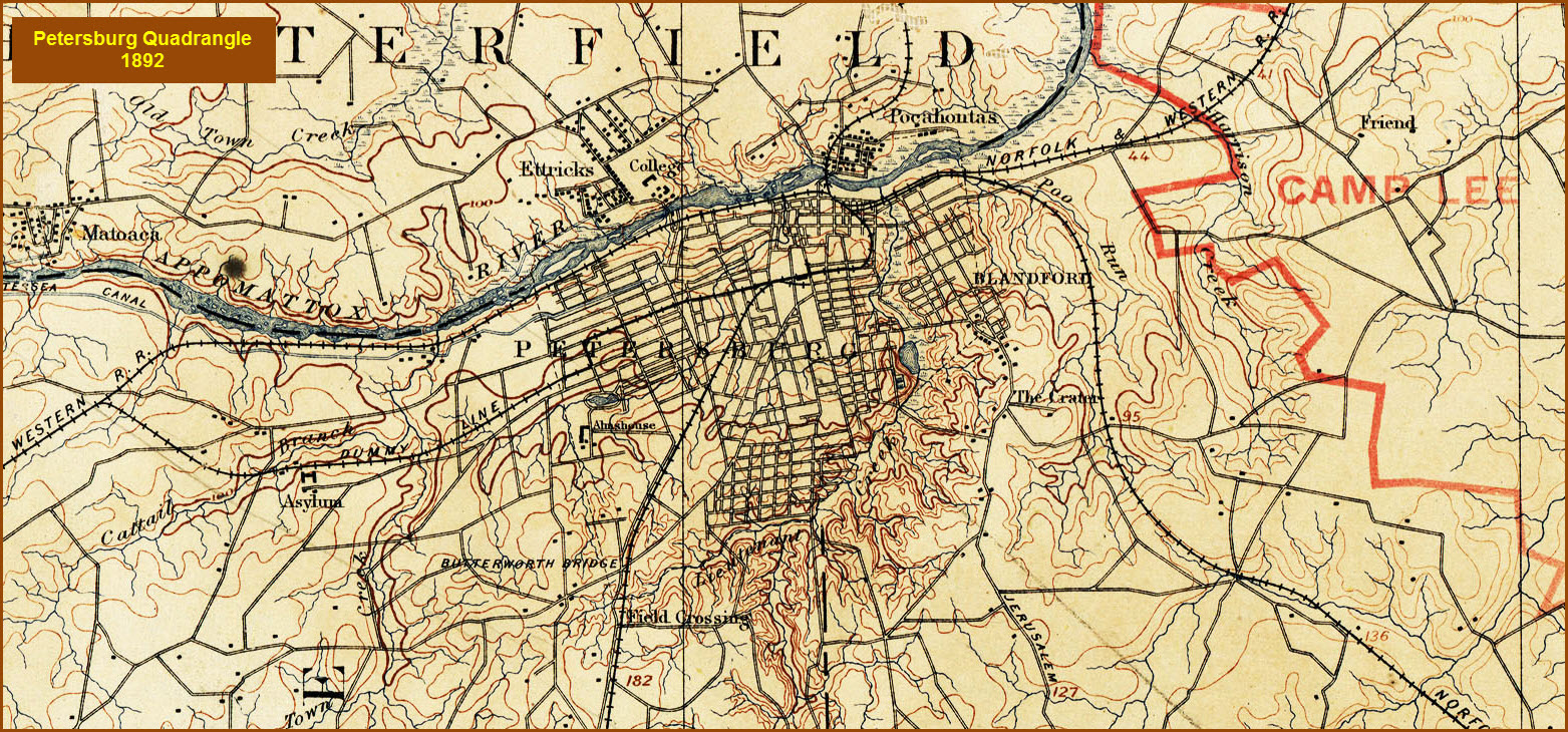
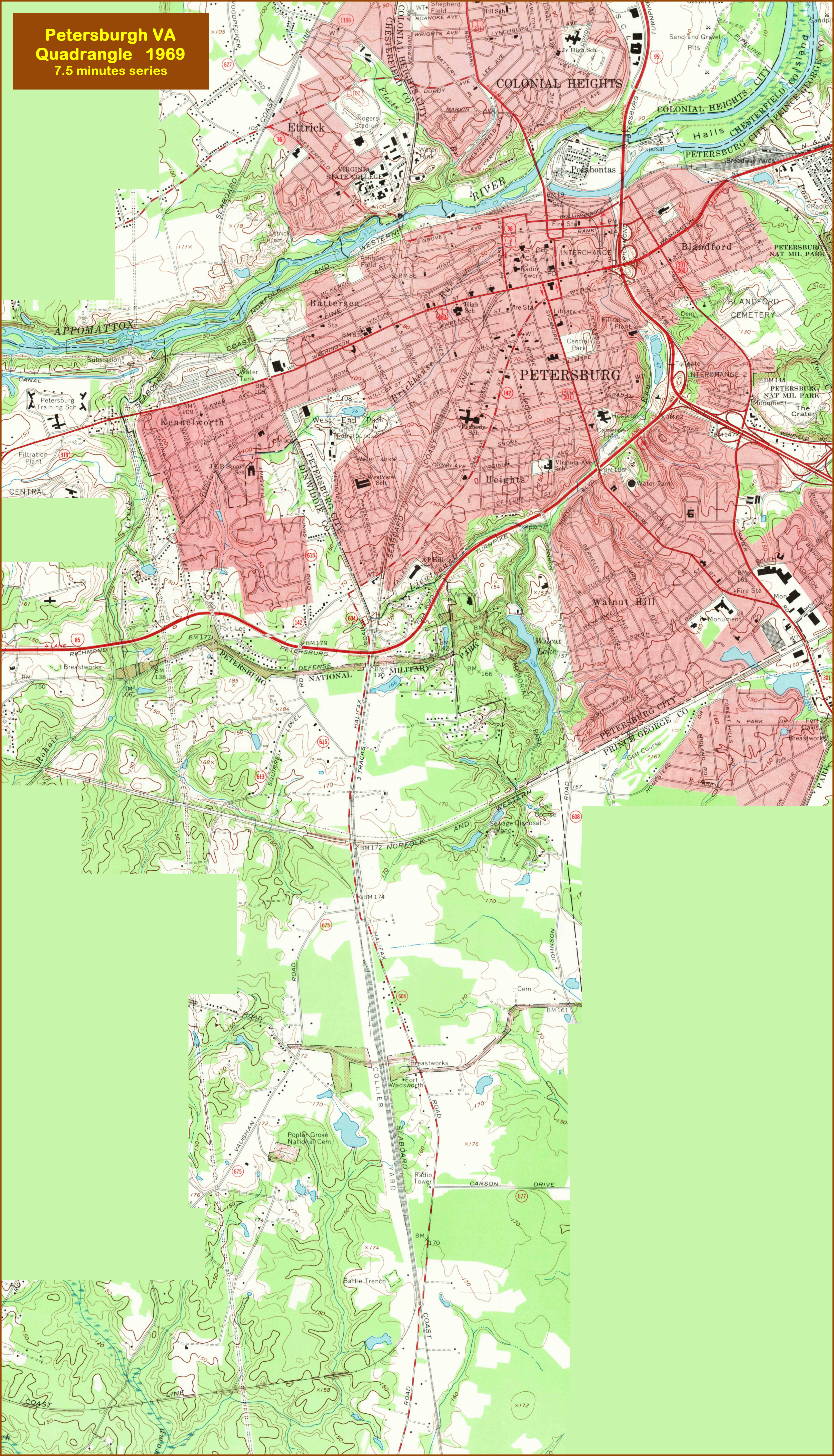 This is a 4meg JPEG, so I made it a thumbnail.
The PDF version of it is here
This is a 4meg JPEG, so I made it a thumbnail.
The PDF version of it is here
Petersburg National Battlefield
GPS Coordinates: 37.241156, -77.357271 (Main entrance off Washington St)
5001 Siege Rd, Petersburg, VA 23803
804-732-3531
More Info:
https://www.nps.gov/pete/index.htm
http://www.virginia.org/Listings/HistoricSites/PetersburgNationalBattlefield/
https://en.wikipedia.org/wiki/Petersburg_National_Battlefield
Petersburg National Battlefield Park, located approximately 25 miles south of Richmond, encompasses a large area with battlefield sites and visitor centers.
In June 1864, Ulysses S. Grant realized that the key to conquering Richmond was to bring down the remaining major supply source, Petersburg. Three days
after an unsuccessful attack, Grant decided to surround the city and wear down the supply desperate Confederate soldiers. The Confederates, under General
Robert E. Lee, managed to hold off the Northern troops for 9-1/2 months. However, by early April the Confederates could protect Petersburg no longer and evacuated
the damaged city. Both armies began their trek toward Appomattox, leaving behind 70,000 casualties in what was the longest siege in American warfare. Lee's
surrender at Appomattox Courthouse would occur one week later.
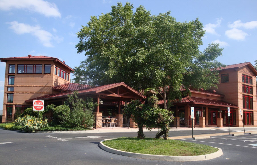
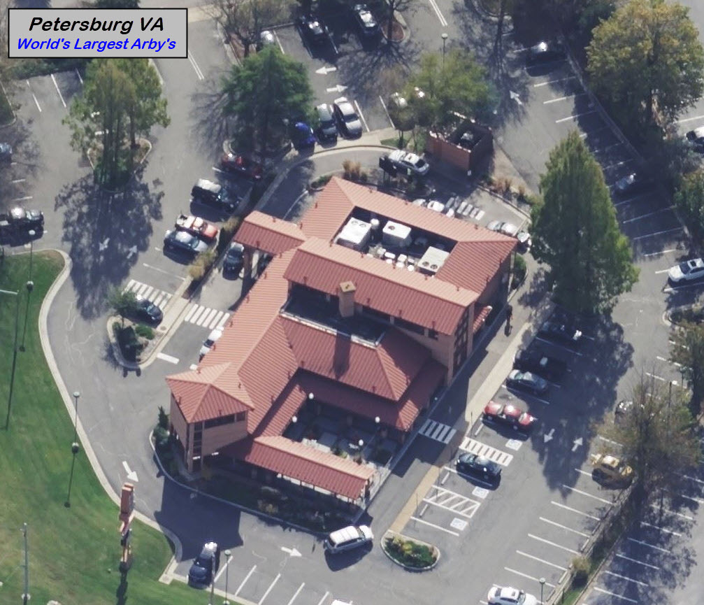
the World's Largest Arby's
GPS Coordinates: 37.253489, -77.385128
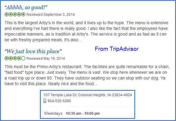
107 Temple Lake Dr, Colonial Heights VA 23834-4924
804-520-5280
https://arbysrva.com/
I don't usually push restaurants unless they are either railroad related or
offer something special. This Arby's offers the latter. If you
are in the area, this restaurant is just north of Petersburg by a mile or
so, closer to downtown than Collier Yard is.
If you know about Arby's, they are known for their
roast beef sandwiches. But the Richmond/Petersburg area Arby's go WAY beyond
that and offer just about anything you can think of, including a full offering Mexican bar
at this location. Although their prices are a little higher
in relation to a BK or McDs, they are in line with Chick-Fil-A.
Excellent roast chicken, shakes and Zucchini bread!
The Arby's restaurants in the Richmond / Petersburg area are owned by "The
Restaurant Company", and there are 16 of them.
The restaurant is pretty convenient to I-95 exit 54, Temple Ave. It is just
under a mile east of the interstate. My daughter lives about 30 minutes
away in Midlothian, and they are just about as big "there".
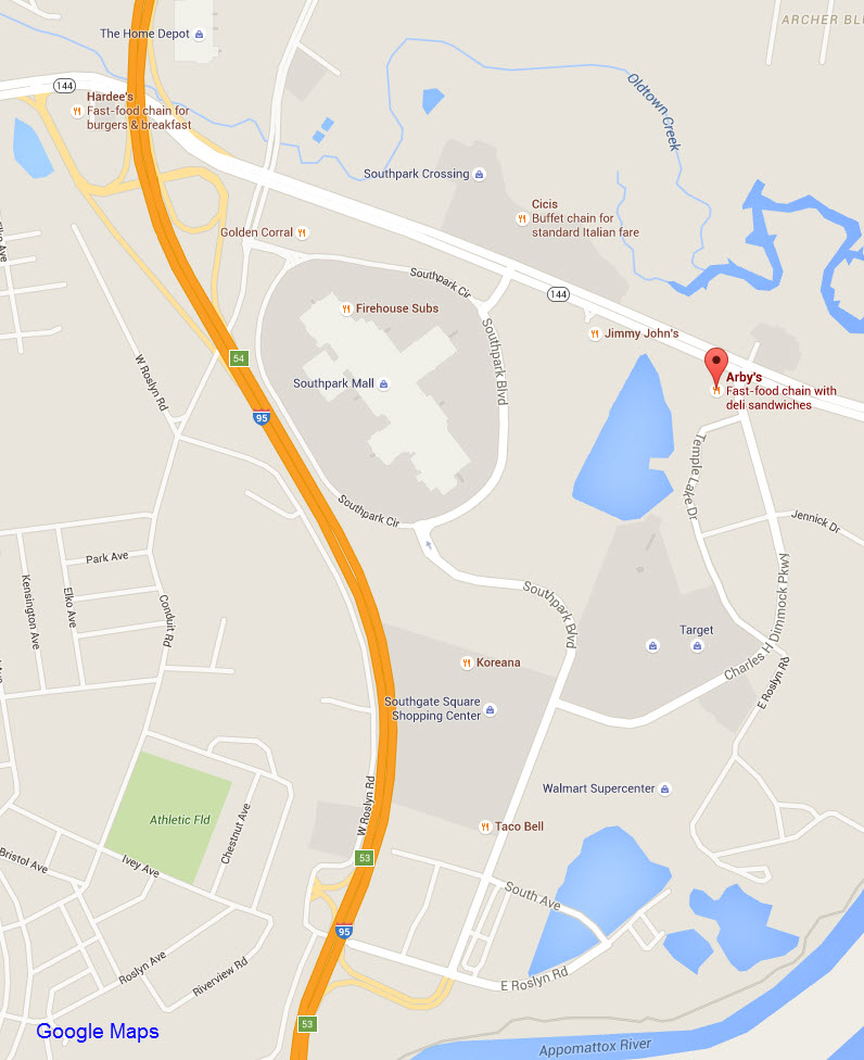
On my map above, if you are in Petersburg and can make your way to I-95, get
off at exit 53 and take Southpark Rd north till you hit Charles H Dimmock
Pkwy, the little tail at the very top of the map, and that will take you to Arby's.
For lots of pictures:
http://junioryoshitaka.blogspot.com/2009/06/worlds-largest-arbys.html , the
picture below is one of his
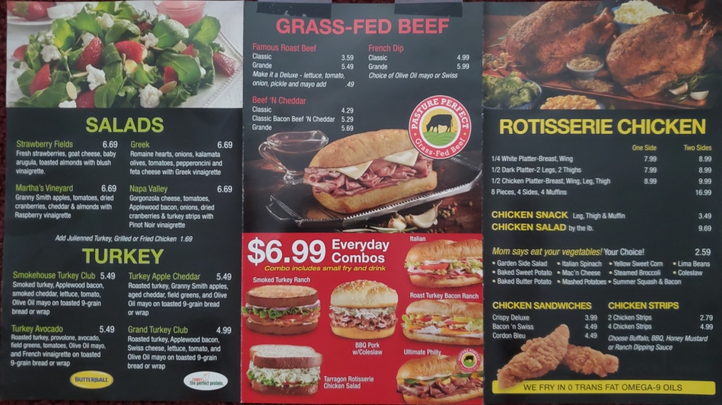
Here is their menu from about 2021, they no longer print up really nice ones like this anymore.....


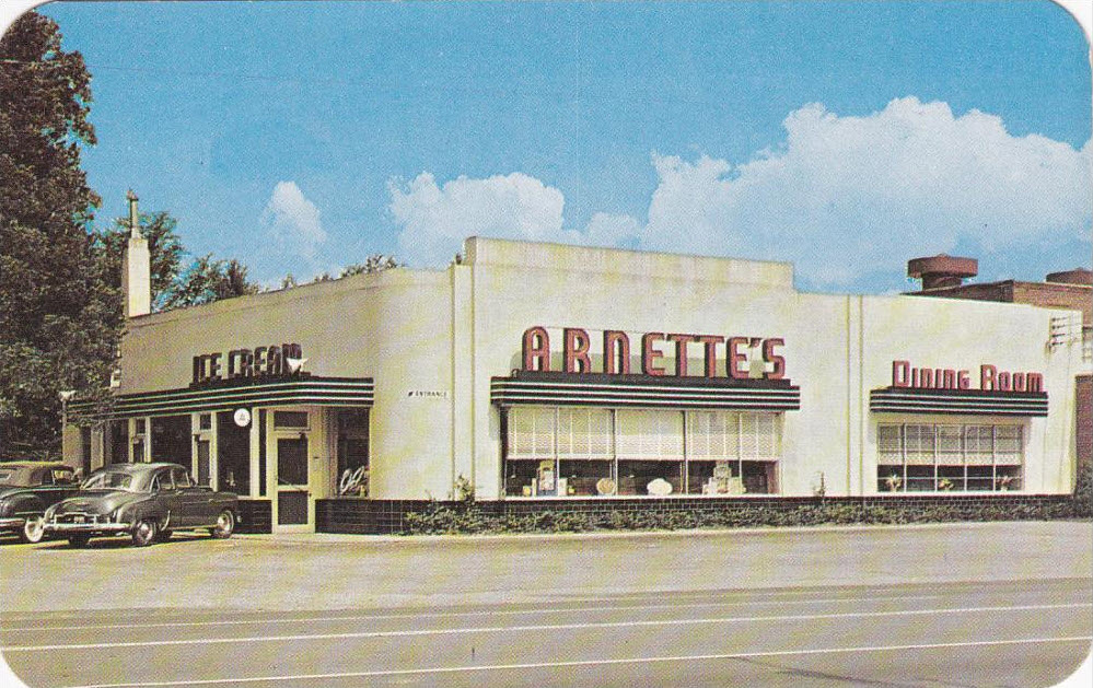
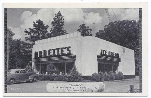
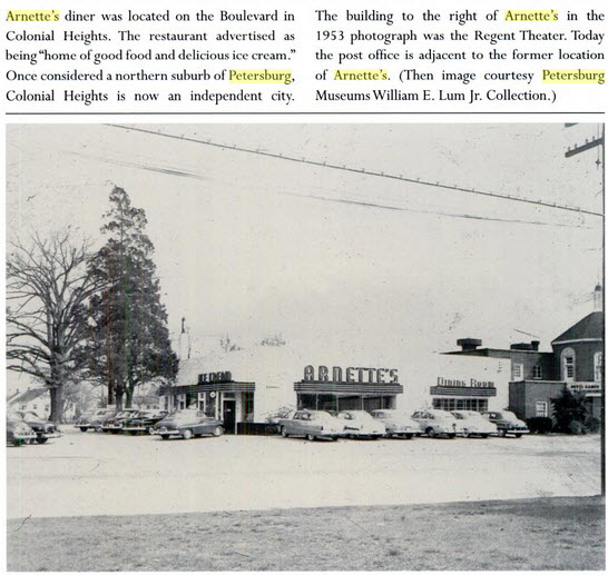
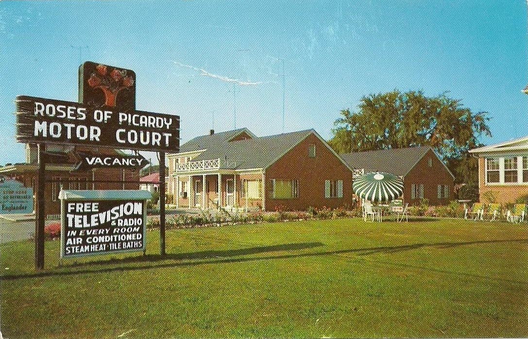
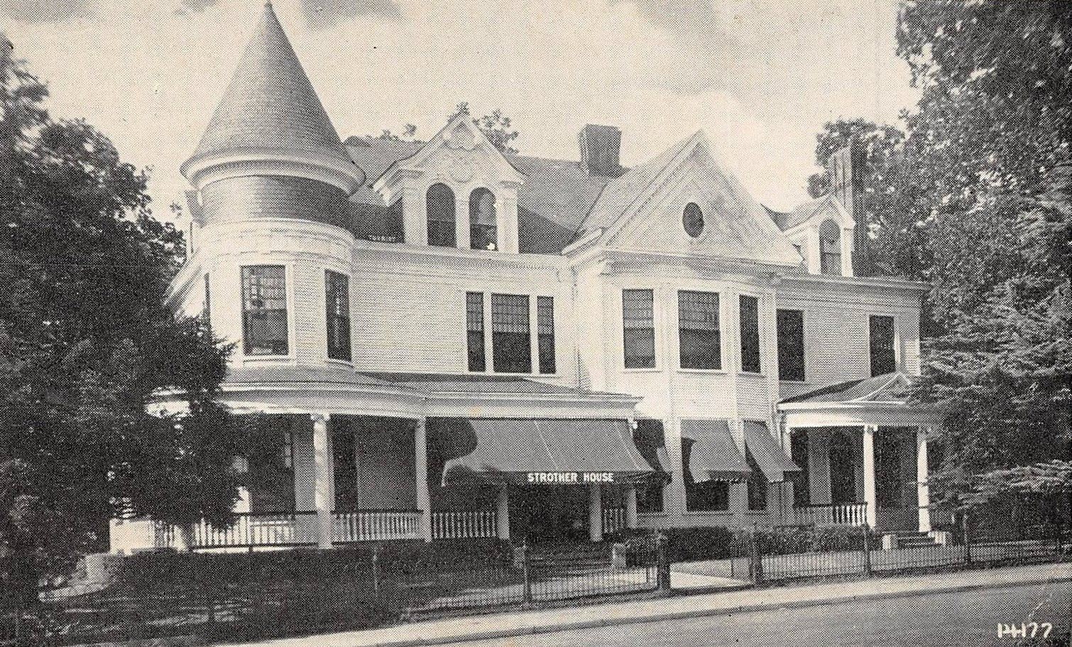
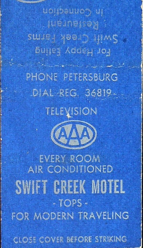
Historic Downtown Petersburg Eating
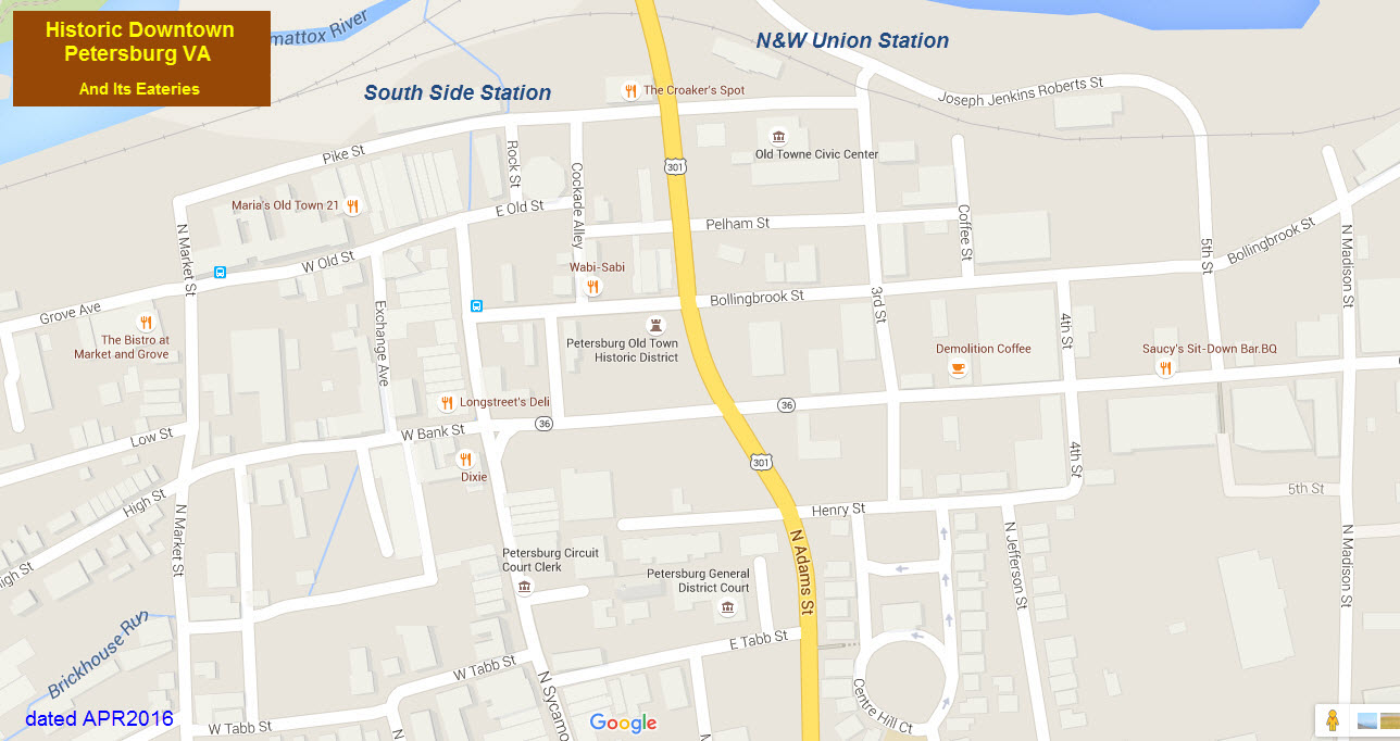
This is one of my favorite sections.
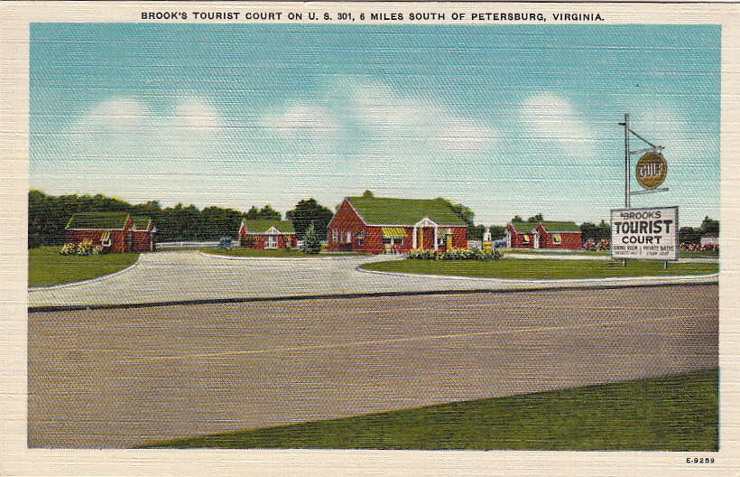
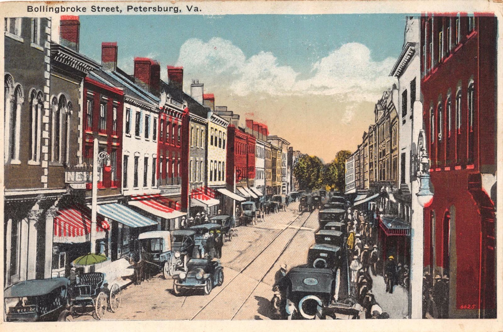
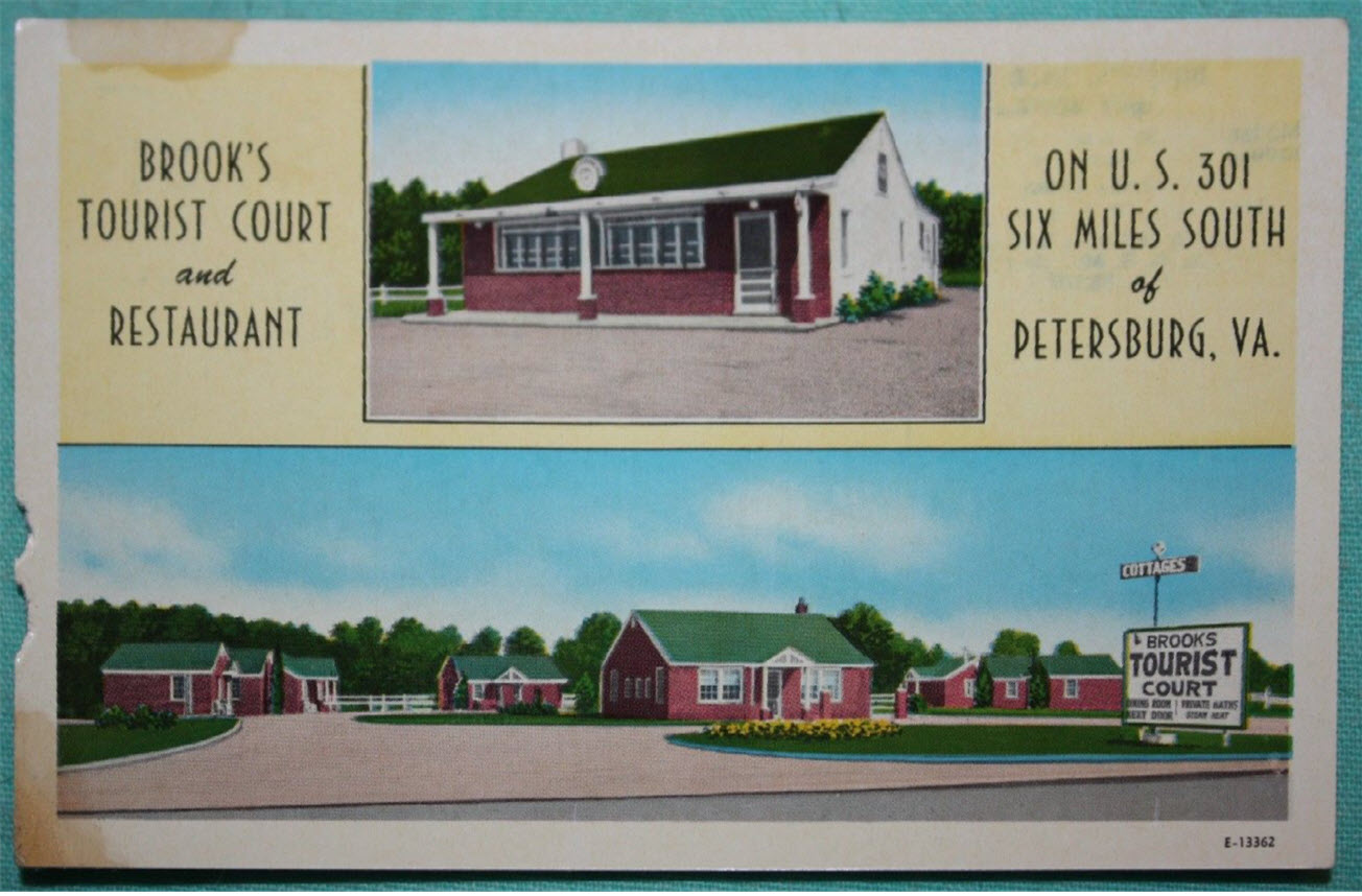
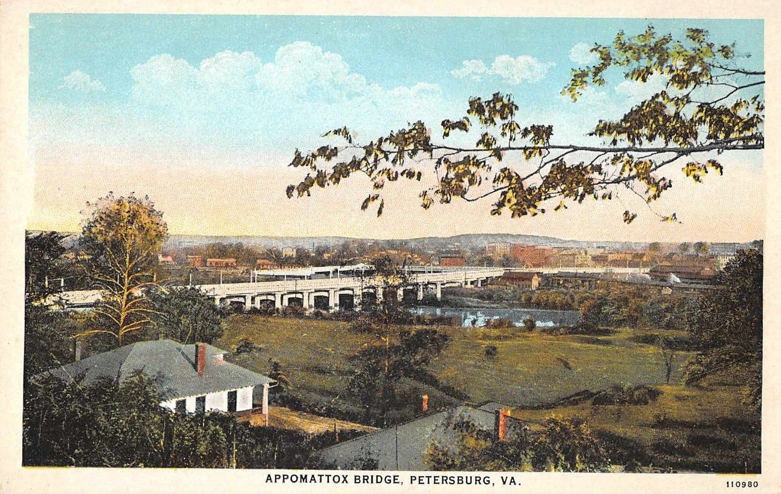
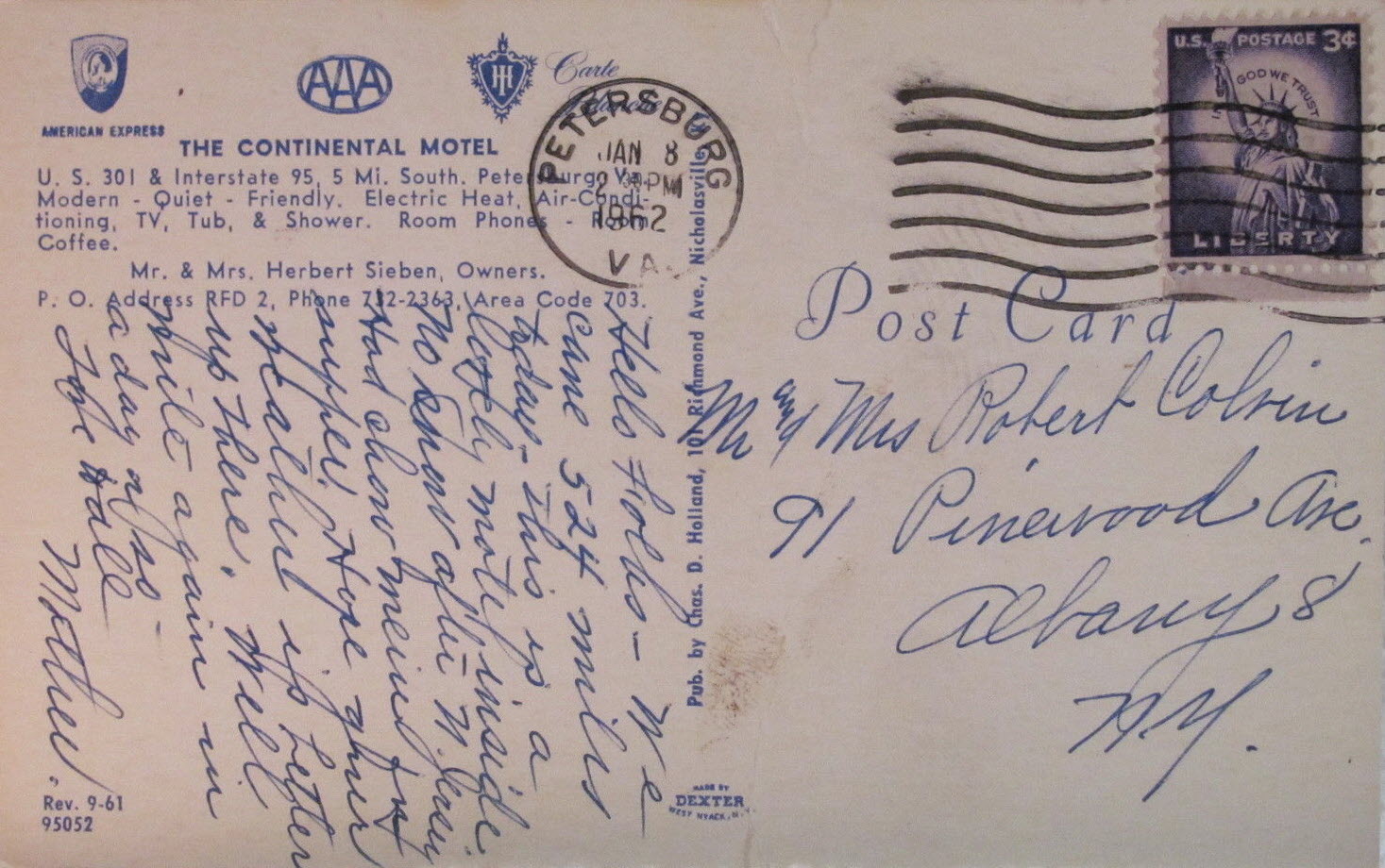
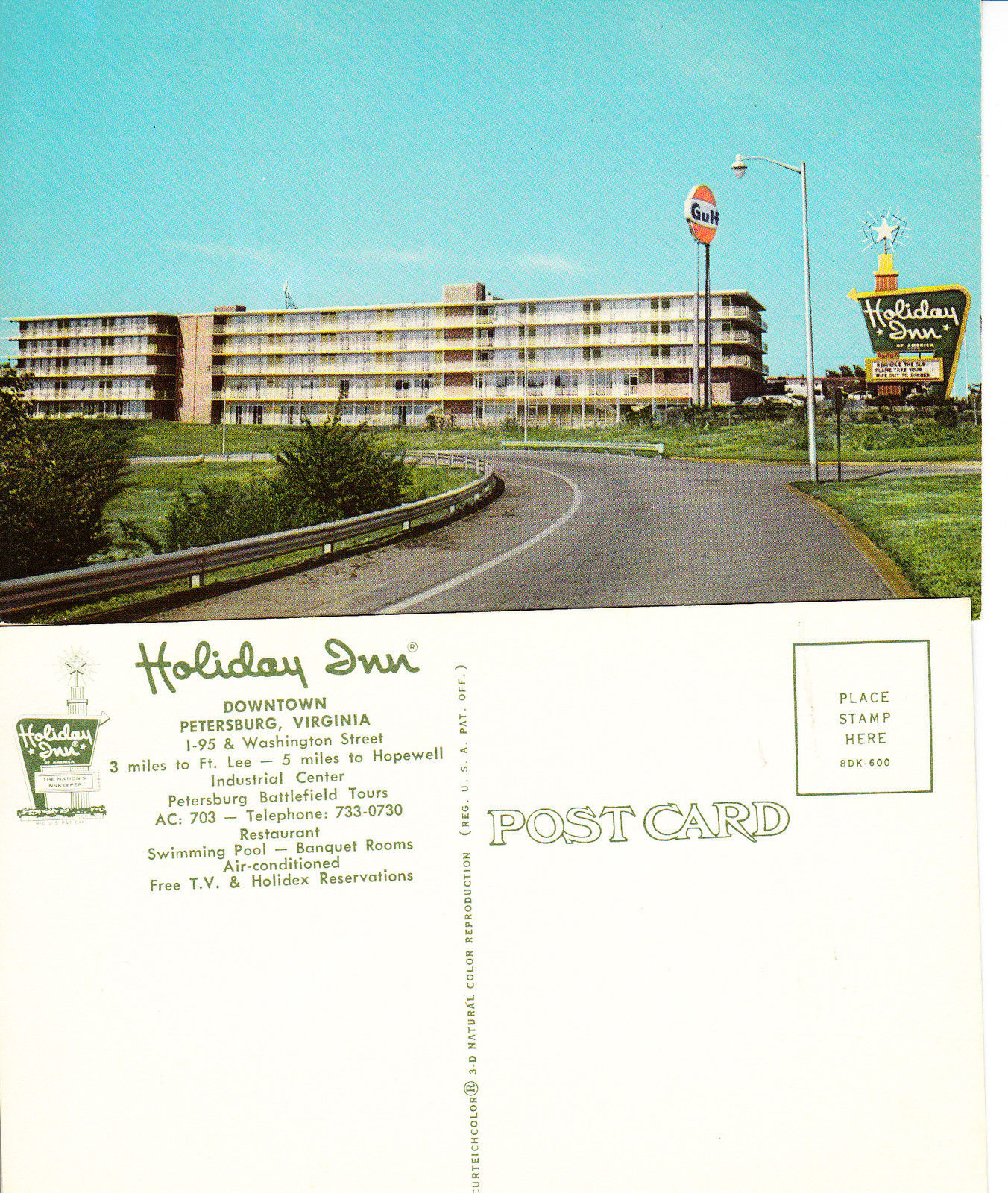
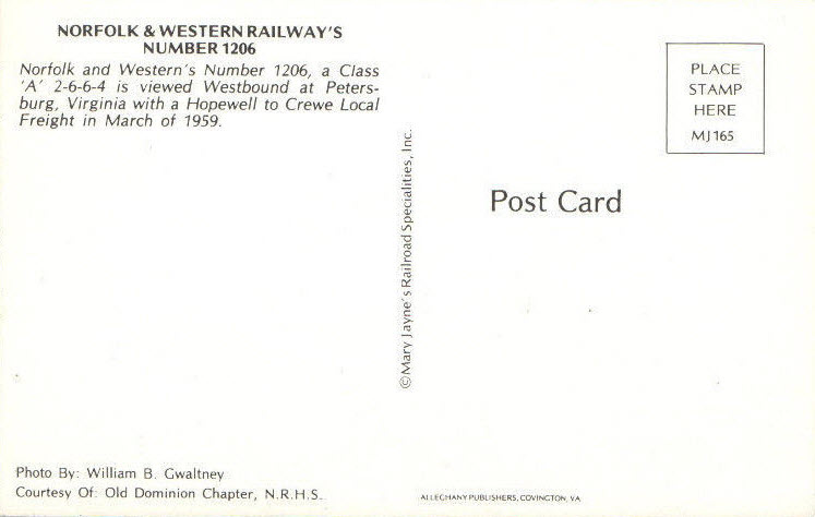
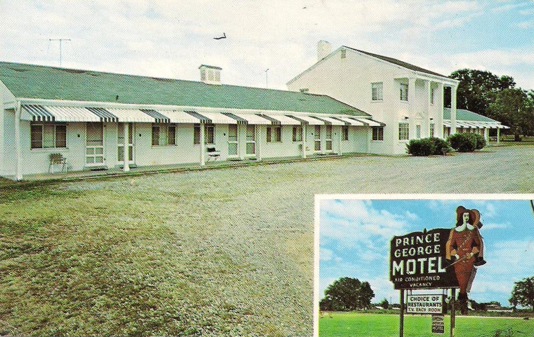
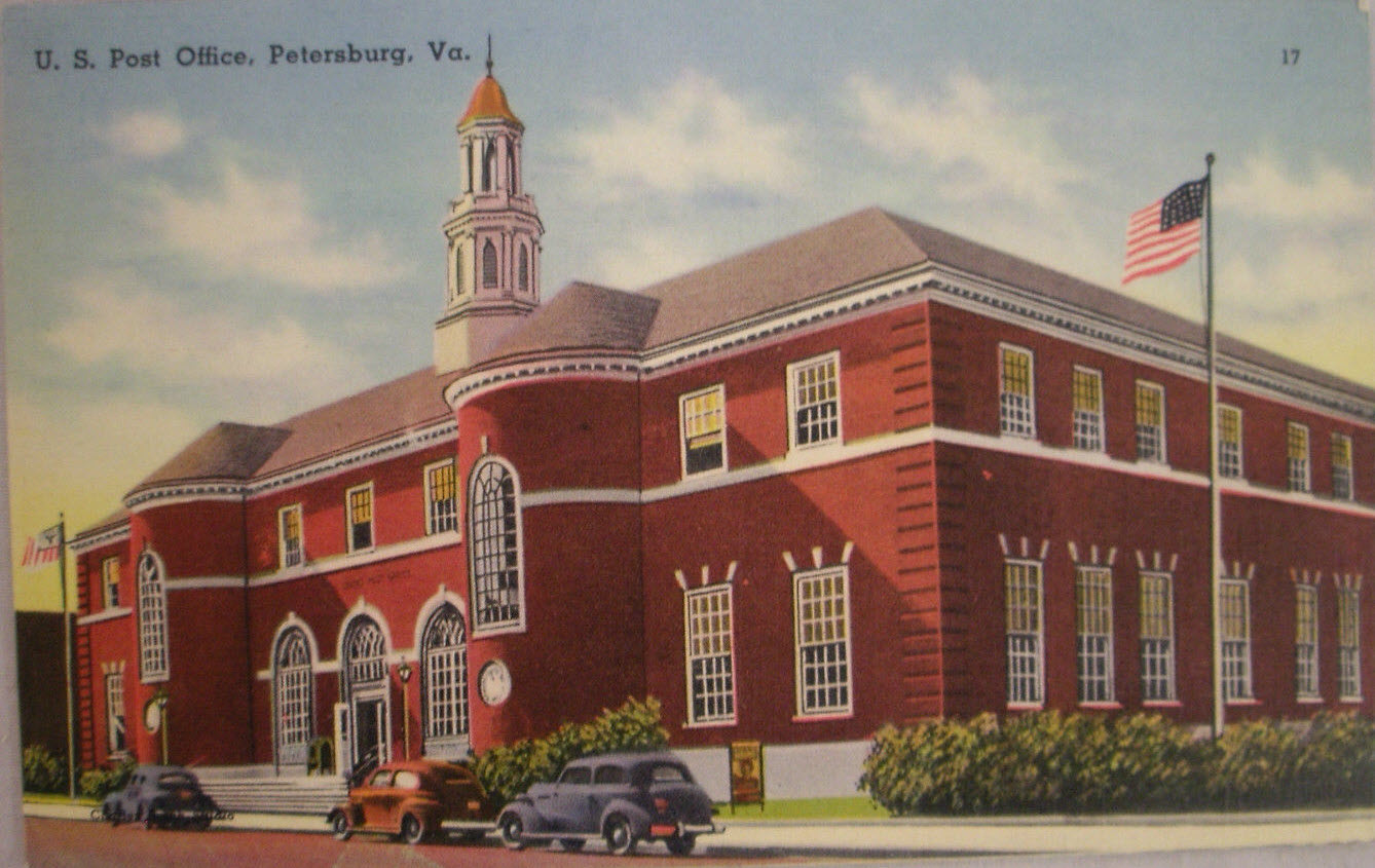
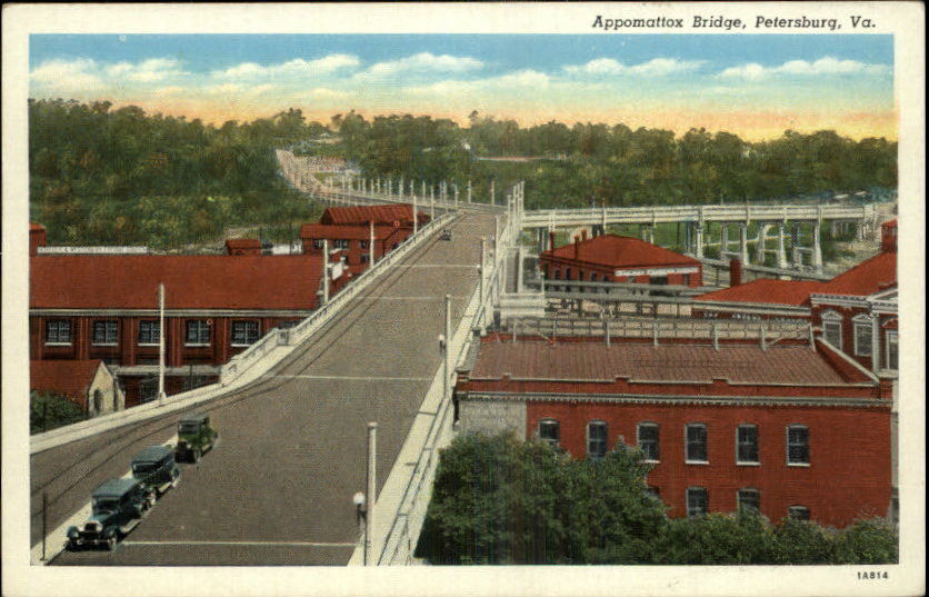
Old postcards are one of the few ways you can catch a glimpse of what used to be, for many of us aren't old enough to remember these things.
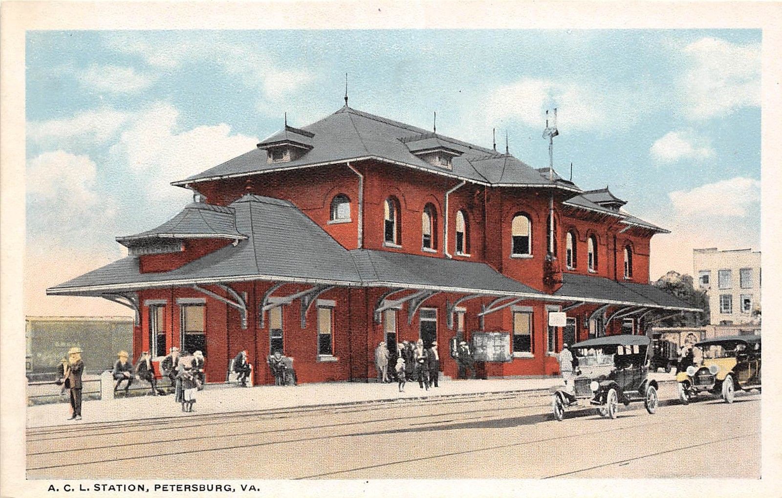
A most puzzling picture, for the concrete pier does not match what is there today. The postcard is from 1917-1918.
At this time, nothing is known about this depot.
Is it an older station that was replaced by a newer one?
Was it somewhere else than Ettrick? Don't know, because the building behind it is not in Ettrick (at least not now).
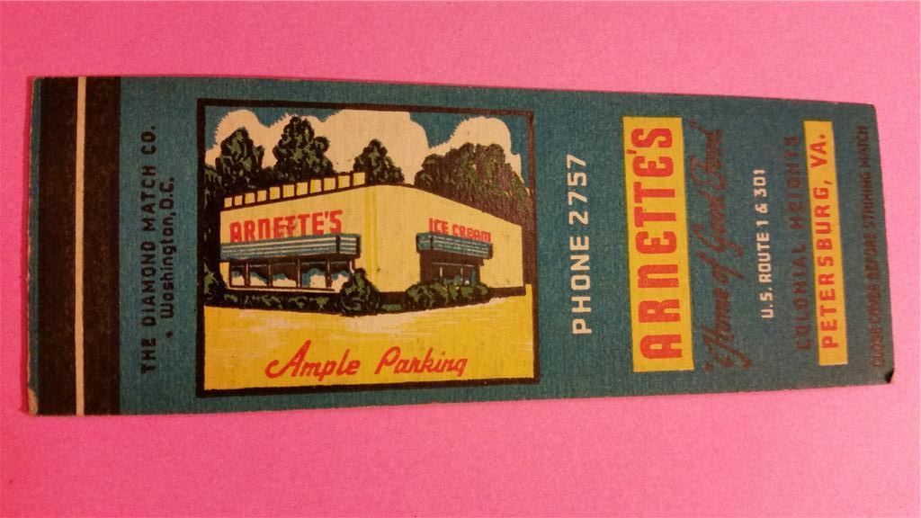
It looks like Arnette's expanded since the picture in the small B&W picture was taken.
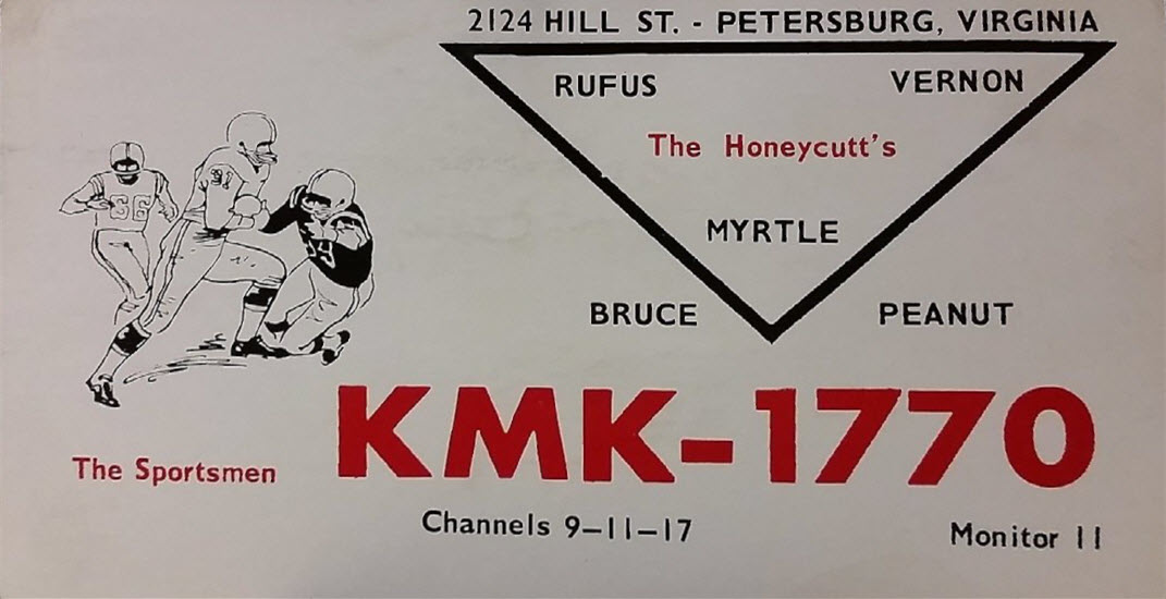 Remember CB QSL cards?
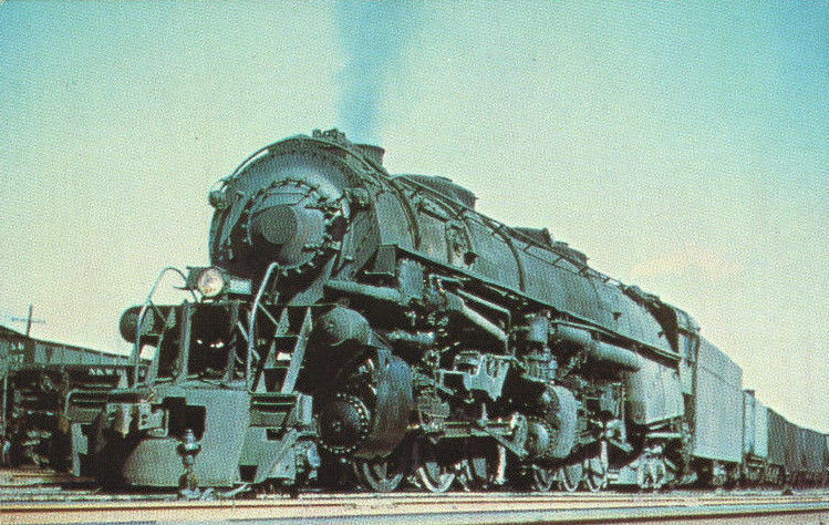
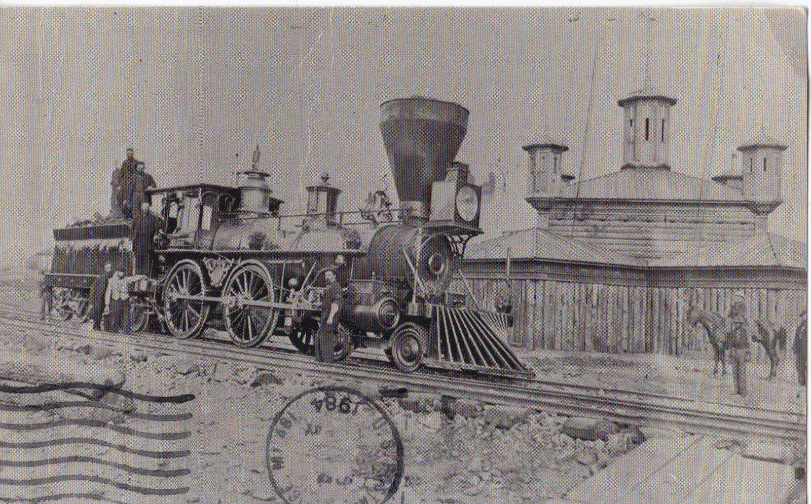 Grant's Railroad
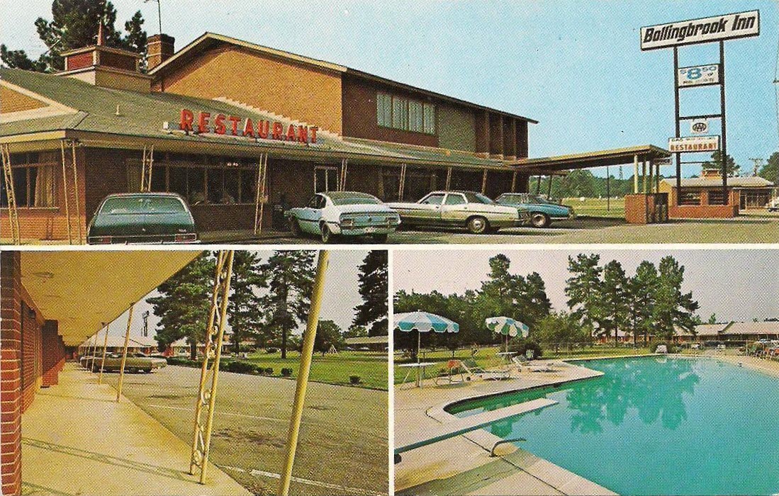
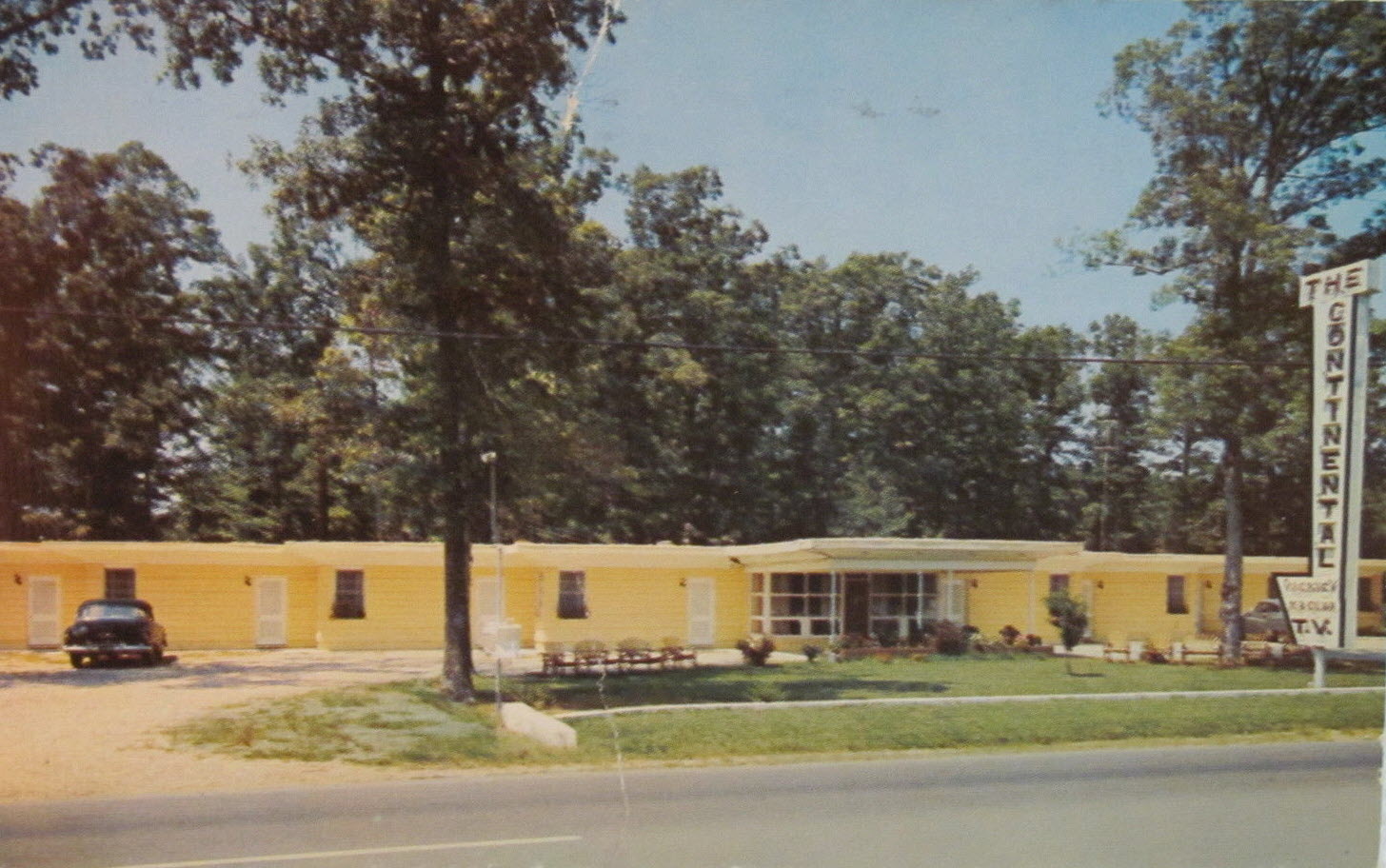
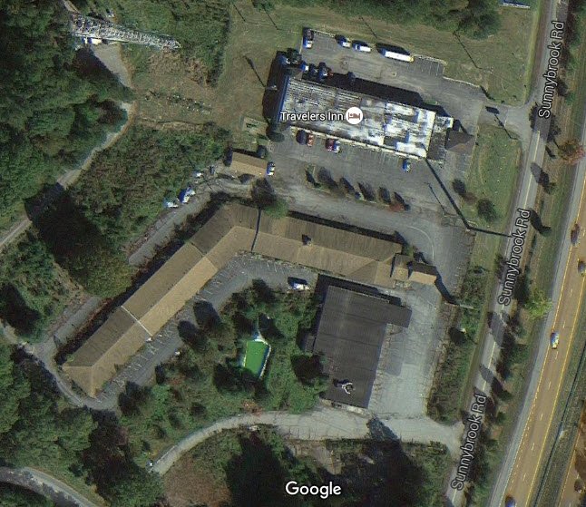
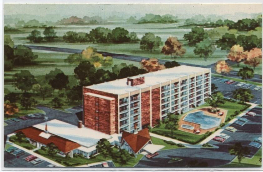
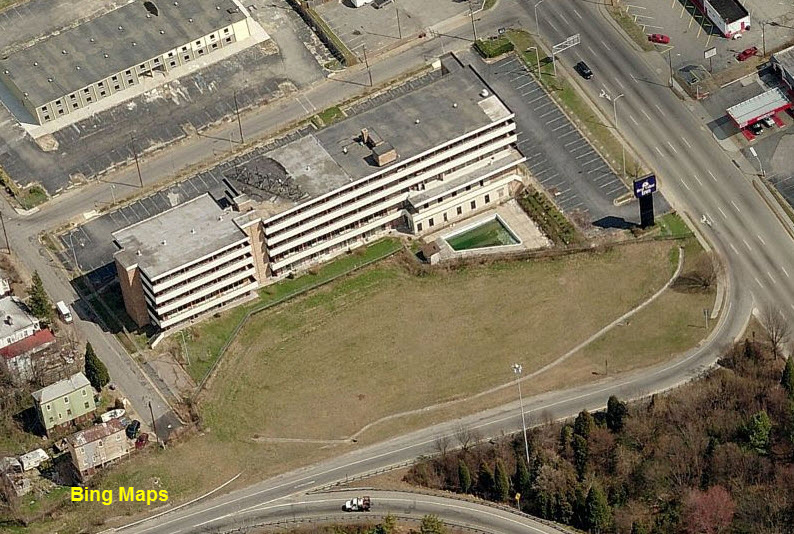
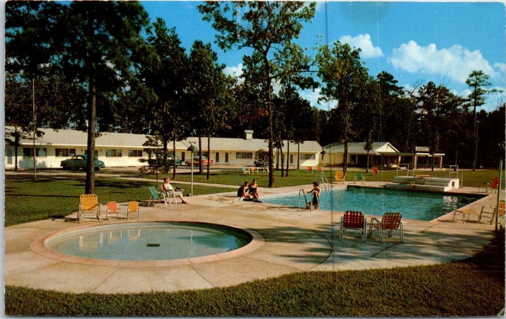 Ellwyn Motel
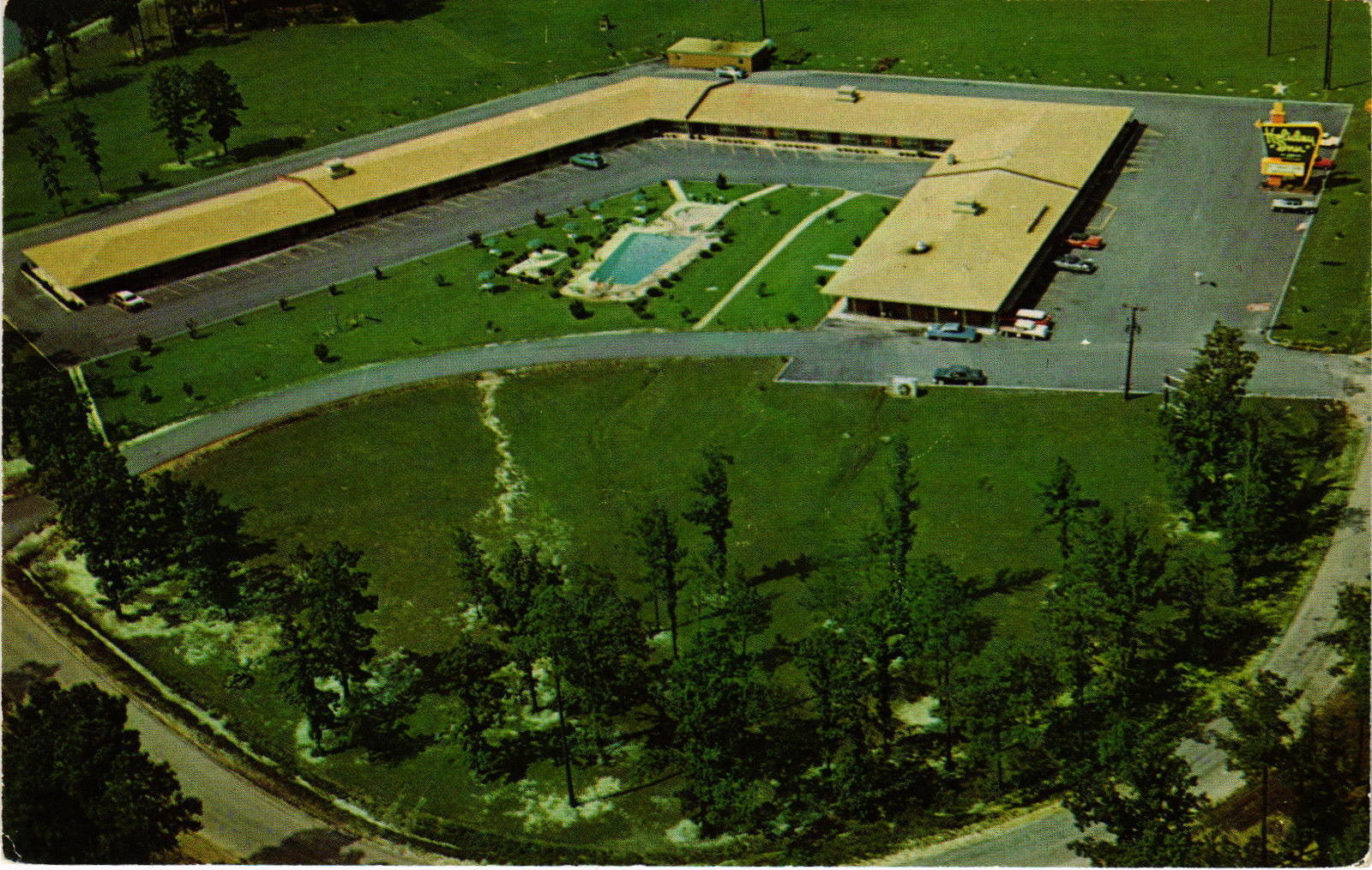
At exit 41 - Templeton, part of it remains today although the pool doesn't look like its been used for a while :-).....
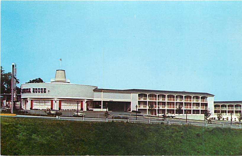
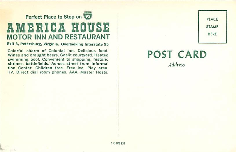
 Howard Johnson's Hotel
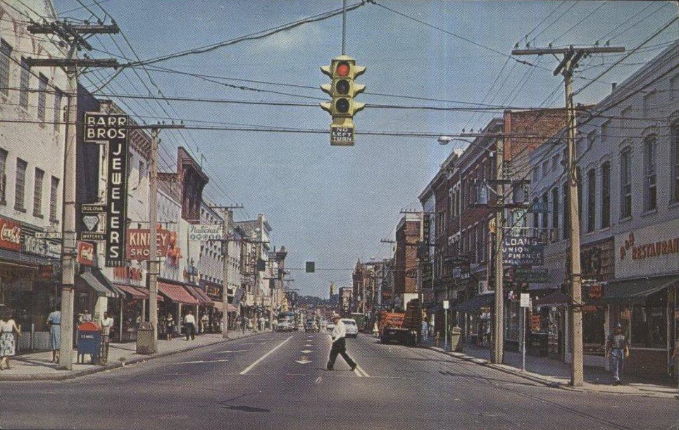
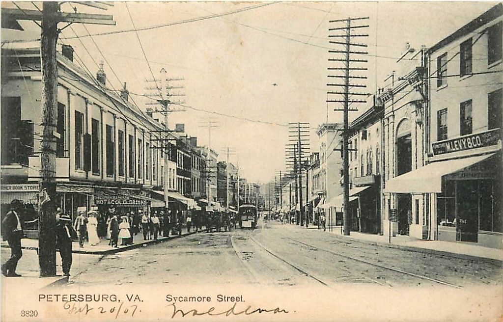
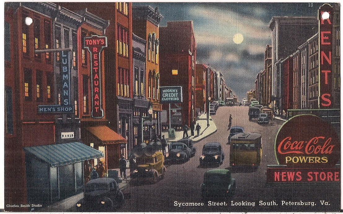
A few streetcar postcards......
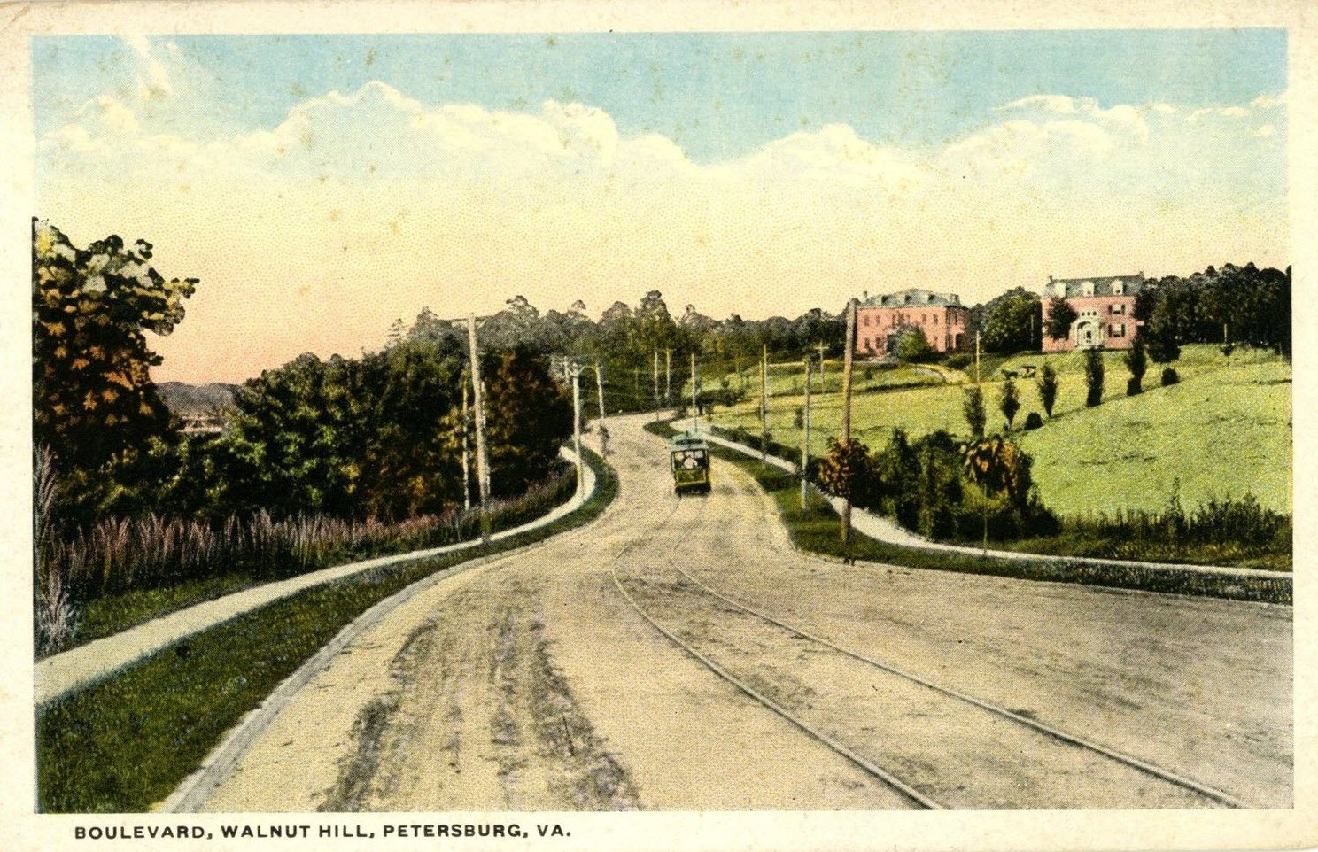
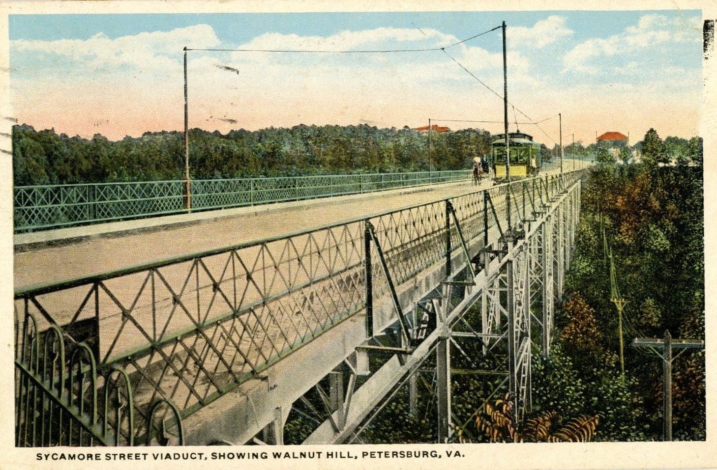
Sycamore Street had more postcards than any other street, at least that what I found from the offerings on EBay....
Disclaimers:
New format 10/26/23: Please check out my disclaimer page for my standard
dribble and contact info here
RAILFAN GUIDES HOME
RAILROAD SIGNALS HOME
NEW 04/10/2016, APR02/2017, OCT03/2020, AUG11/2021,
MAY31/2022, MAY09/2024
Last Modified
09-May-2024