In General
Getting Here
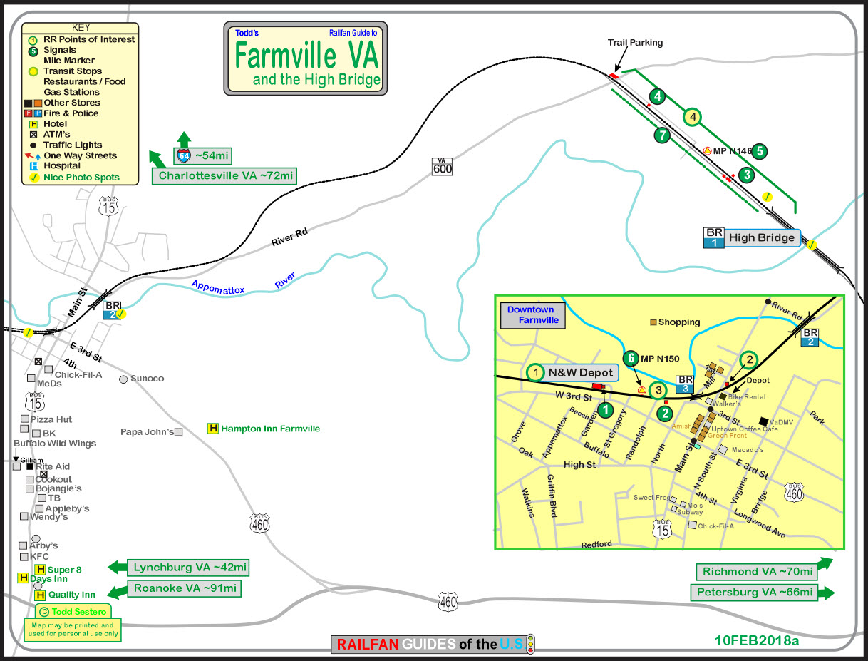
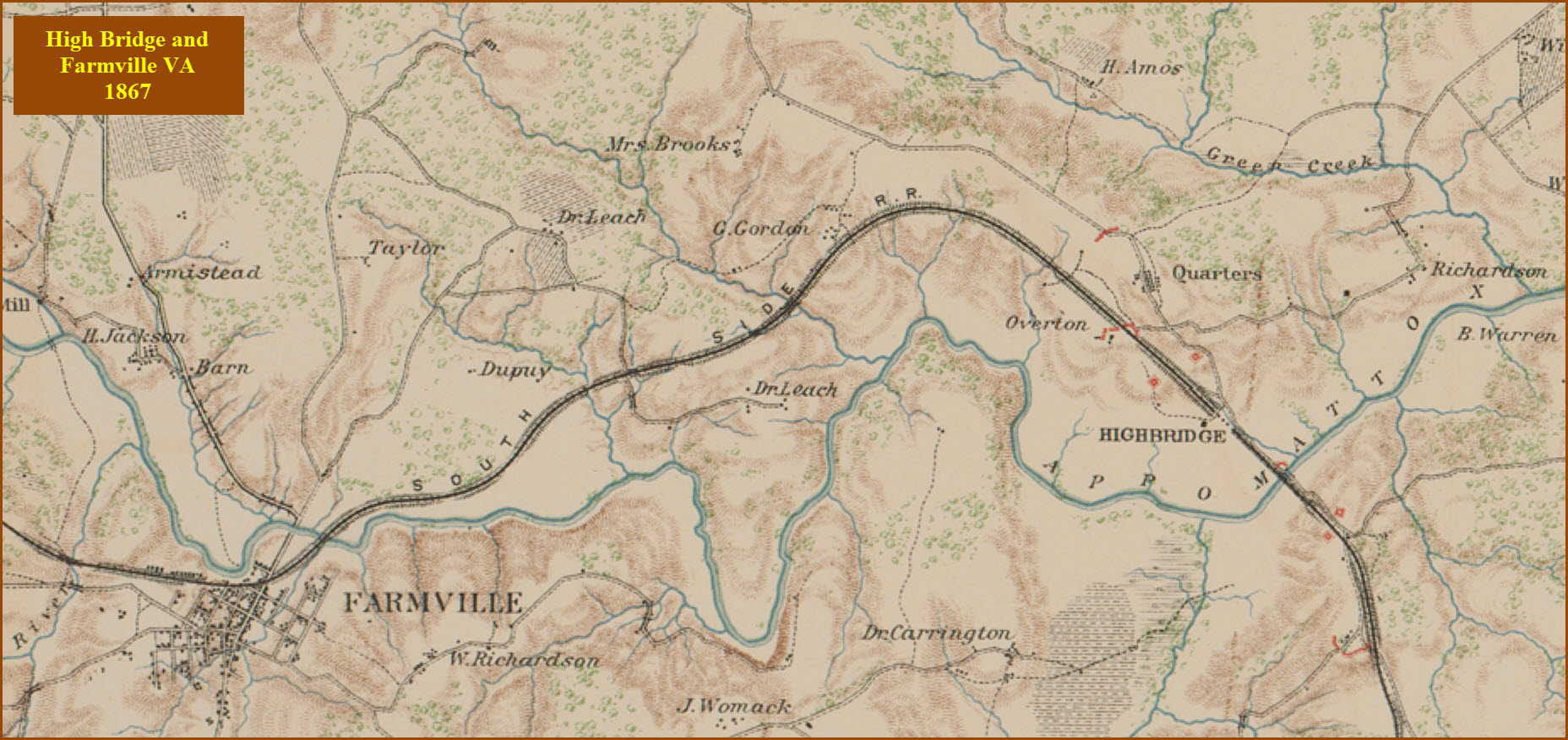
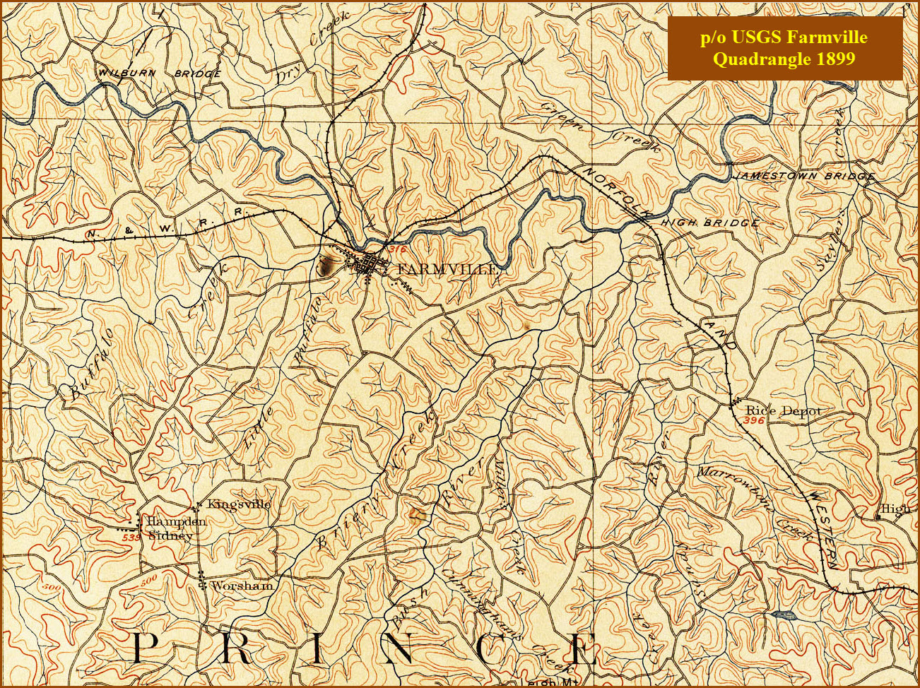
Map
Sights
Pictures
Bridges
Signals
Floobydust
USGS Maps
RAILROAD SIGNALS HOME
Location / Name:
Farmville VA, Prince Edward & Cumberland Counties
What's Here:
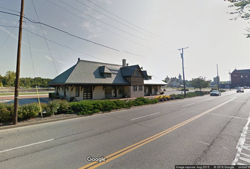
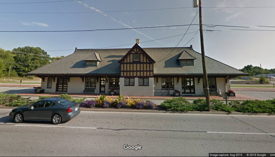
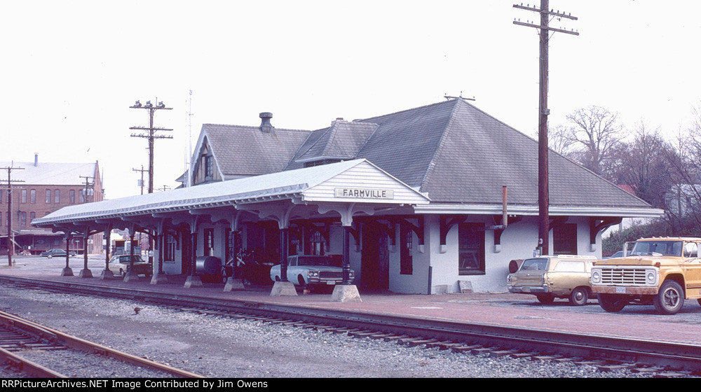
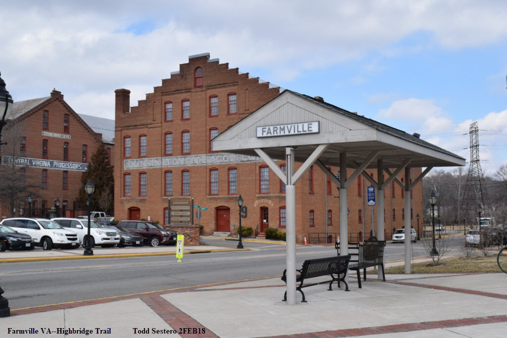
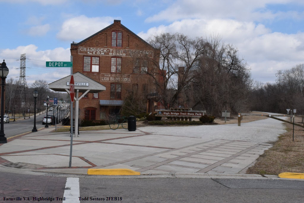
Former N&W Depot
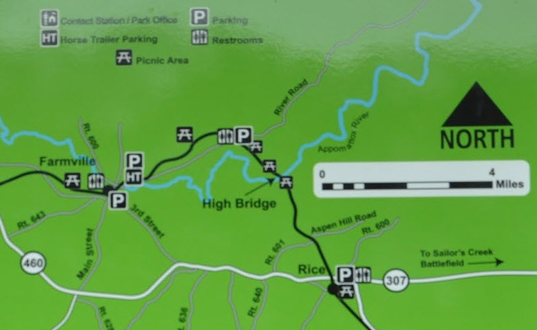
High Bridge, 4mi out of town
Data:
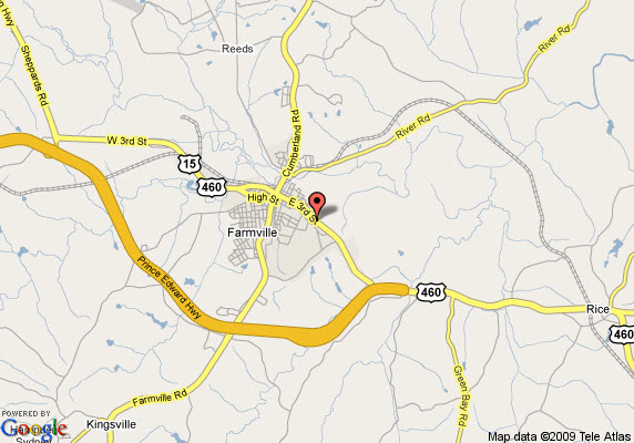
GPS Coordinates: 37.304397, -78.396985 (depot)
Phone A/C: 434
ZIP: 23901, 23909, 23943
Access by train/transit:
None
The Scoop:
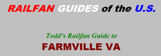
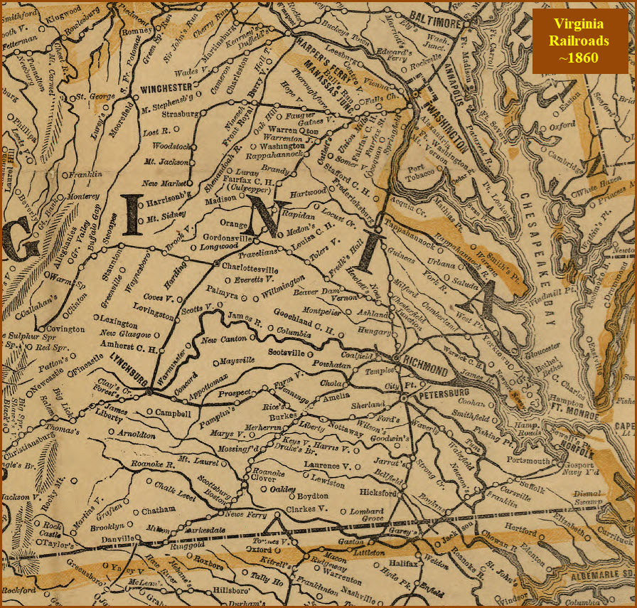
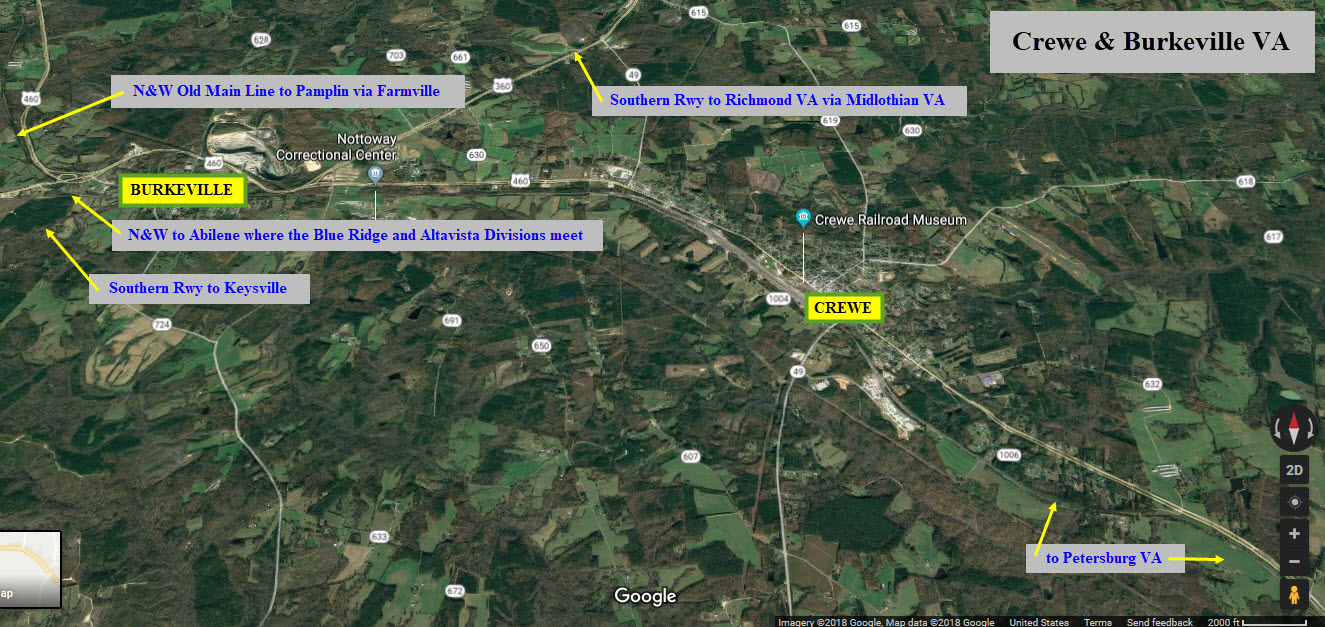
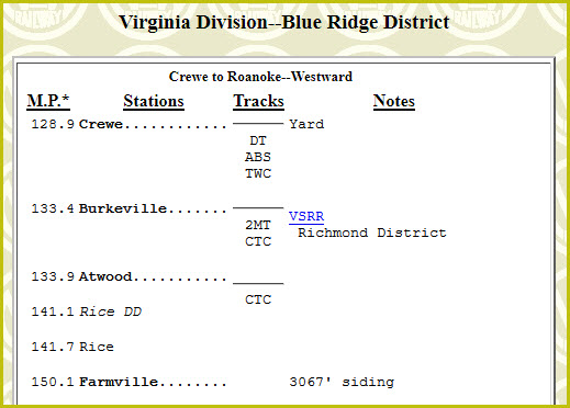
This line, the northern route in the map below, was formerly part of Norfolk Southern's Virginia Division, Blue Ridge District between Crewe (to the east) and Pamplin (on the west), and is also known as the Farmville Belt Line, or the Old Main Line. Descriptions of the two district's I have come across are vague, so I have had to piece this together. It also enjoyed the reputation as being a 30 mile long passing siding! :-) When it was around, the Farmville line usually had WB trains running on it. NS took up the tracks in 2006.
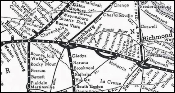
The northern route running thru Lynchburg, Pamplin, and Farmville is an N&W route, while the southern route thru Altavista and Abilene is a former Virginian line.
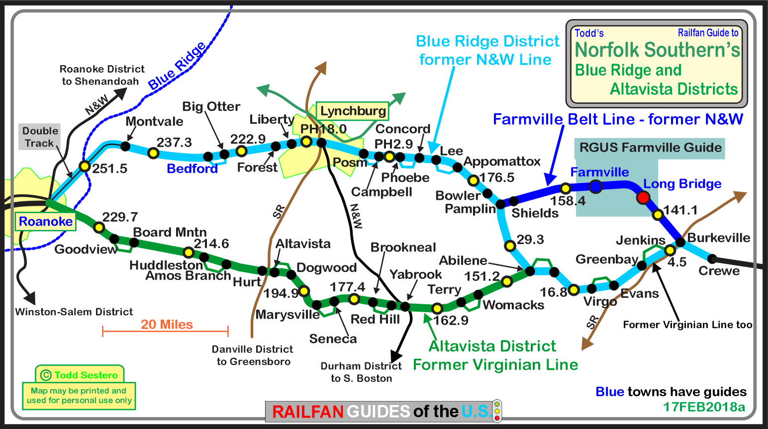
 The N&W lines in this area
 The Virginian lines in this area
History of the High Bridge is below.
In addition to Farmville, stations still stand in Appomattox, Pamplin, and Burkeville.
Short history from Abandoned Rails: This abandoned railway line was initially constructed by the South Side Railroad in the early 1850s. Final completion of the line came in 1854. The line was originally intended to bypass Farmville VA, for a more favorable low-profile grade route - however, Farmville, seeking the additional commerce a railroad can provide, partially subsidized the South Side Railroad to build through its town, which required a high-level crossing of the Appomattox River. (The originally-planned "low-grade" line was eventually built in 1916, and ultimately led to the abandonment of this route.)
In 1870, the South Side Railroad merged with other local railroads to form the Atlantic, Mississippi and Ohio RR, which continued operating the line. Shortly thereafter in the 1880s, the AM&O fell into bankruptcy and emerged as a new railroad entity known as the well-known Norfolk & Western Railroad (sic). The N&W became the Norfolk Southern in 1982, with the merger with the Southern Rwy. In 2004 (on the line's 150th anniversary) the line was abandoned due to (mainly) the high cost of maintaining the "High Bridge" over the Appomattox. All service, eastbound and westbound, then used the newer "low-grade" line which offered easier (and thus cheaper) grades.
More from the Abandoned Rails Farmville Branch page: Even into the final years, a number of businesses along the line continued to utilize rail service, however High Bridge was beginning to become a maintenance concern due to it's age. That coupled with the fact that traffic volume, especially coal, had decreased a considerable amount meant that the future of the old mainline was in a precarious position.
The beginning of the end came in 2003 when Norfolk Southern discontinued through traffic over the old mainline with a local out of Crewe continuing to serve customers. Finally in March 2004 the dreaded announcement was made by Norfolk Southern. It was going to formally abandon the old mainline. A brief reprieve came during the spring and early summer months of 2004 as local railfans reported many trains, including the circus train, operating over the old mainline. Through trains continued to use the old mainline sporadically until October 2004.
The last revenue movement took place on Friday, July 15, 2005. NS GP38-2 No. 5098 left Crewe Yard and traversed the line to Farmville to retrieve the last few cars. There were scores of people on hand to witness the event including a number of local media outlets. Removal of the track and signals began in late July and was completed by early 2006.
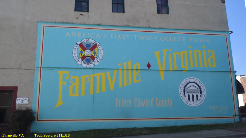
Farmville also lays claim to being the first town in the United States that hosted TWO colleges: Longwood University and
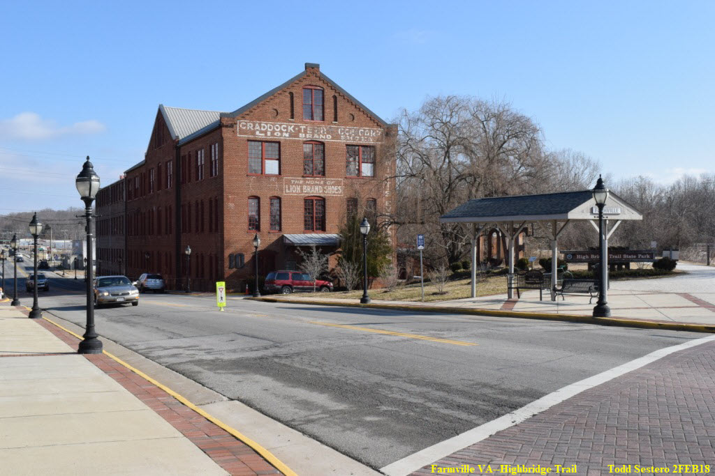
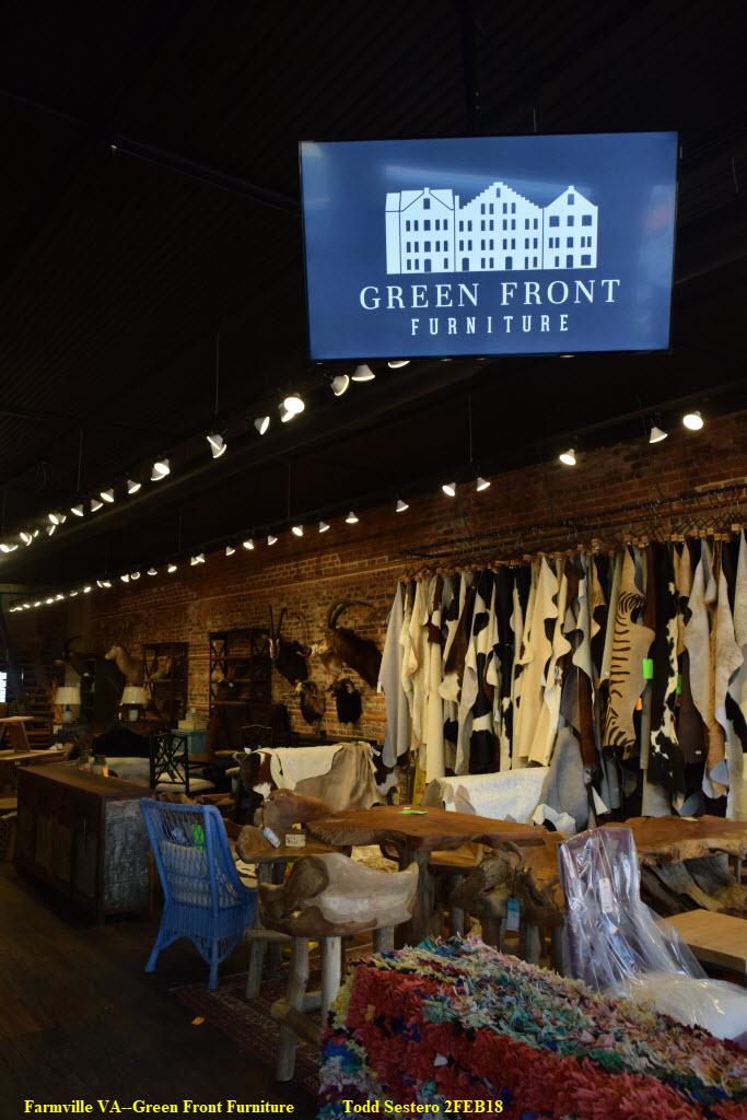
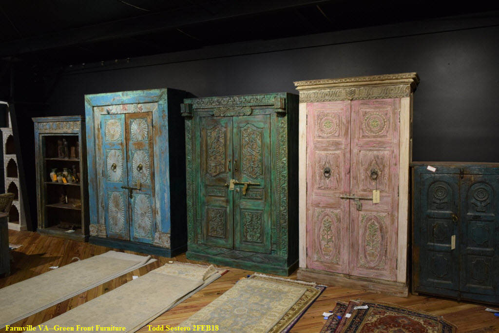
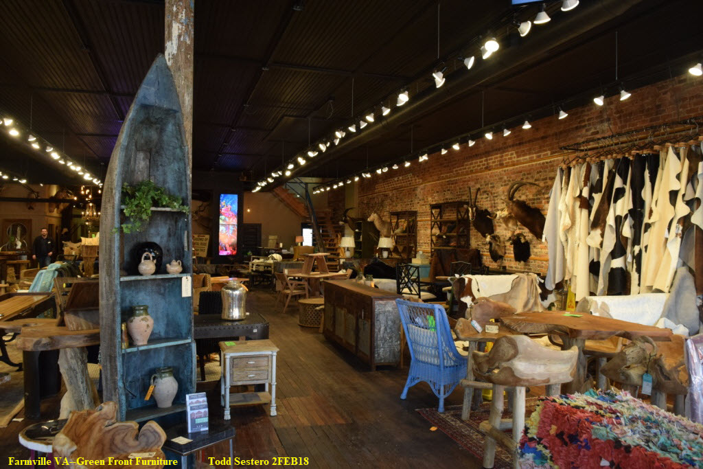
Now. In a departure from my usual policies, I am going to push something for Farmville, which is the reason I came here in the first place. The shopping. If you or your wife/girlfriend have even a remote hankering for shopping, you must come to Farmville. The town is a Mecca for furniture, oriental rugs, and antiques. Many years ago, a fellow started buying up property, some of which are the old warehouses near where the right-of-way crosses Main St (that he bought for $2 a square foot), and remodeled them to sell furniture. It will take you a whole day, maybe more, to visit everything Farmville has to offer if you take in not only Green Front Furniture, but the other numerous stores lining Main St.
Radio Freqs
Not sure how current these are:
CHAN 72 - 161.190 - Road & Dispatcher
CHAN 67 - 161.115 - EOT Devices
CHAN 27 - 160.515 - ARN (PBX Crewe)
CHAN 76 - 160.250 - Roanoke Terminal DS/Yard
Acknowledgements:
Denver Todd
Jeff Hawkins
Bill Gordon
Jim Owens
Bob Flippen
Doug Lilly
Sneakin Deacon
TrainWeb
Google and Google Maps
Sources/links as listed below in the additional info section
Websites and other additional information sources of interest for the area:
http://www.trainweb.org/varail/nsnw.html Info on the Alta Vista and Blue Ridge Districts
http://www.railsinvirginia.com/abandoned/nw/farmville.html
https://en.wikipedia.org/wiki/High_Bridge_(Appomattox_River)
http://www.abandonedrails.com/Pamplin_to_Burkeville
http://www.onlyinyourstate.com/virginia/bridge-hike-in-farmville-va/
http://visitfarmville.com/
http://www.railsinvirginia.com/abandoned/nw/farmville.html
http://www.dcr.virginia.gov/state-parks/high-bridge-trail#general_information
http://www.richmond.com/news/photo-gallery-high-bridge/collection_5d5bcc5a-fc8a-59c7-84aa-9c44b85f4ef6.html
http://members.trainorders.com/varailfan/abandoned/winston_salem_district_signals.html
http://www.fpehs.org/depot.html
https://en.wikipedia.org/wiki/List_of_Norfolk_Southern_Railway_lines#Defunct_Norfolk_Southern_lines_or_lines_that_don't_have_their_own_employee_timetable[84][85][86][87][88][89]
http://www.railsinvirginia.com/guides/altavista_district.pdf
http://www.blet375.com/html/ns_resources.html
http://www.waymarking.com/waymarks/WM2X87_High_Bridge
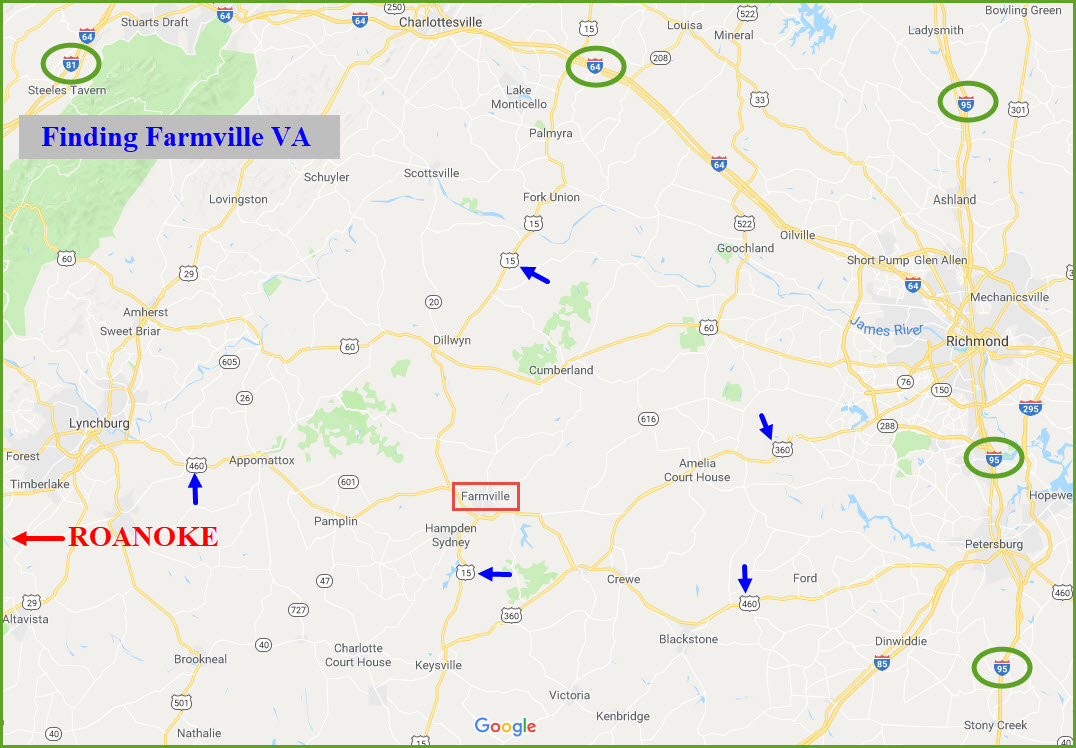
Farmville is about:
45 miles east of Lynchburg VA via US460.
65 miles southwest of Richmond VA via US360 and US460.
63 miles west of Petersburg VA via US460.
58 miles south of I-64 exit 136 via US15.
The last leg of the journey is via US 15 Business from the west, and US 460 Business from the east..... keep your eyes open for the signs!
From north or south along the east coast, via I-95, look for US460 and head west.
From Tennessee or other points near or west, best to go thru Roanoke VA and head east on US460.
From points to the north and west, come down I-81 to I-64, head east to exit 136 and then take US15 south.
From the mid sections of NC and VA, its US15 north.
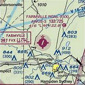 If you want to fly in, there is the Farmville Regional Airport about 5 miles to the northwest.
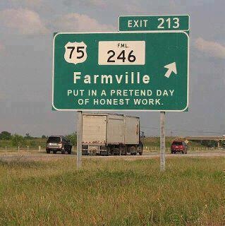
Sometimes the "older" and more simple graphics were better......
GPS Coordinates: 37.304397, -78.396985
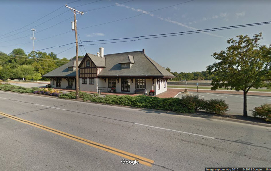
In Farmville, Virginia, the old N&W passenger station is a structure that has been identified with this community for nearly a century. It came about in January 1899 when Mr. W.P. Venable circulated a petition among the businessmen in town asking the N&W authorities to erect a new passenger station. The original station had become inadequate and Main Street was blocked for extended periods of time as passengers and freight were loading. By August 14, 1902, the new station became a reality as contractor J.P. Pettyjohn, of Lynchburg broke ground for construction. The site was known as the Davis lot, located opposite Scott's crossing and four blocks from the intersection of Main and Third Streets. The structure was completed and opened for service on April 29, 1903. Over the years this passenger station has served the citizens of Farmville. Circus trains parked on adjacent sidings with exotic animals to entertain the citizens. After World War I, the Carter Glass Trophy Train visited and exhibited captured weapons at the station. In 1979 a Pepsi-Cola commercial was filmed there where it captured the essence of heartland America. Long after passenger service stopped, the station remained a symbol of our community. When Norfolk-Southern announced plans to demolish the station, the citizens of Farmville united under the leadership of Amy Castleberry and Beverly Anne Snoddy to save the building. It was subsequently deeded to the town and has been remodeled and continues to serve the people of Farmville...... Bob Flippen
For detailed drawings of the station from the N&W Historical Society: https://www.nwhs.org/archivesdb/selectdocs.php?index=c&id=99
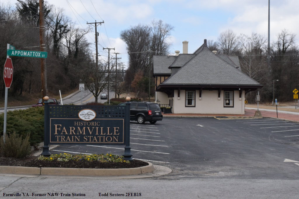
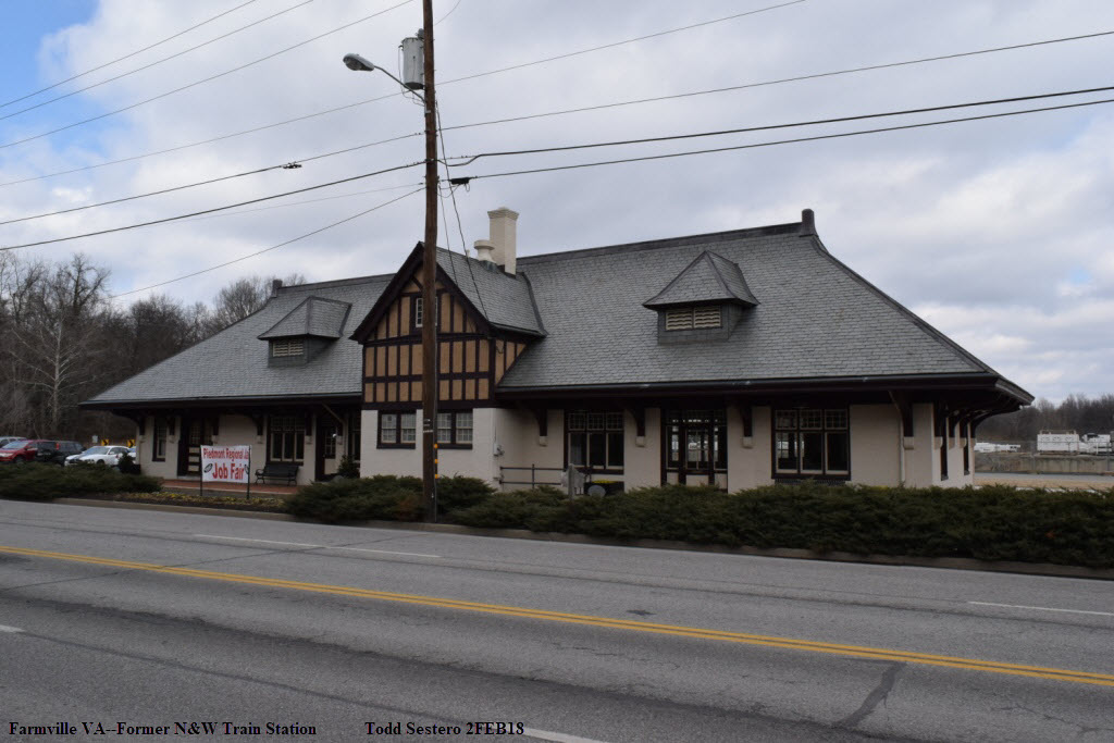
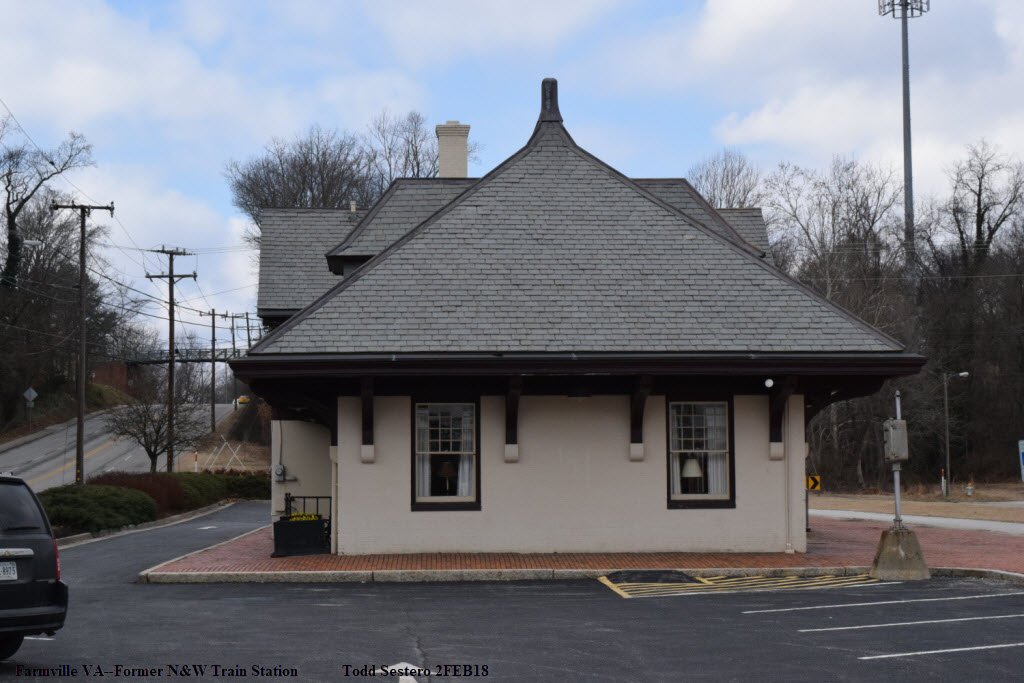
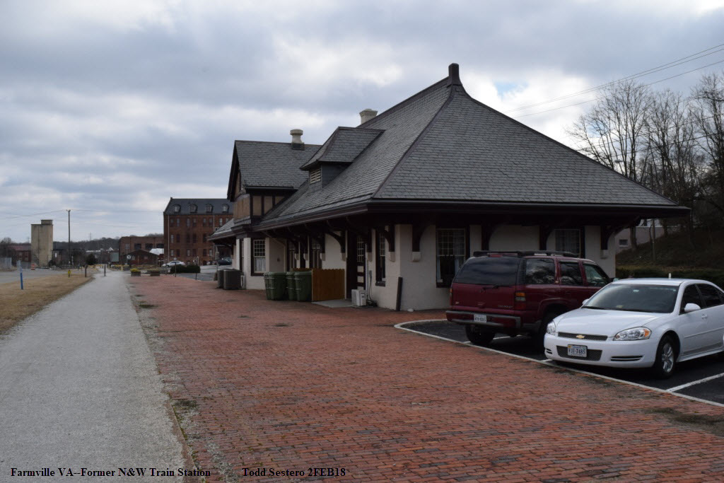
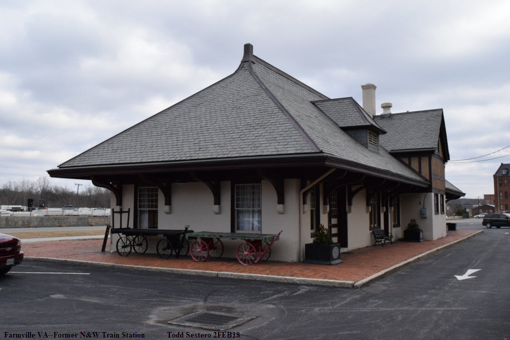
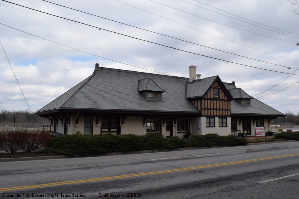


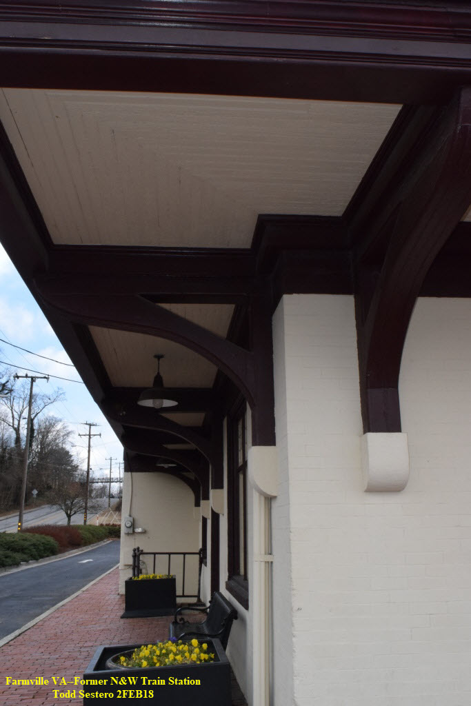

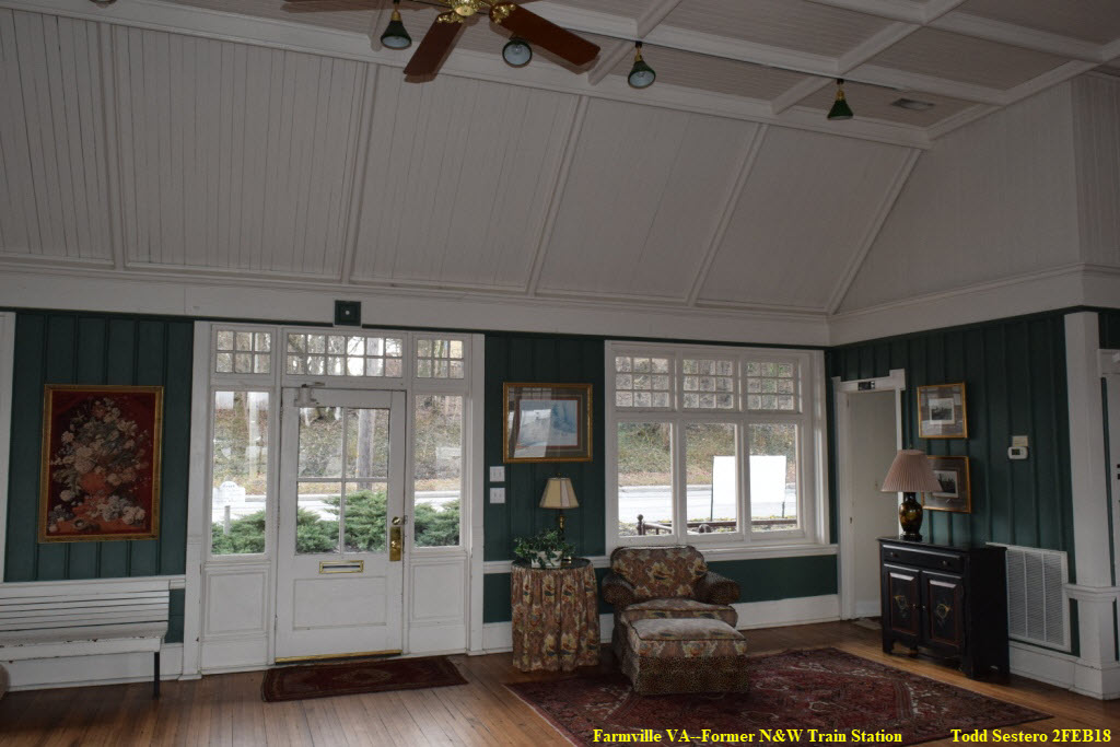
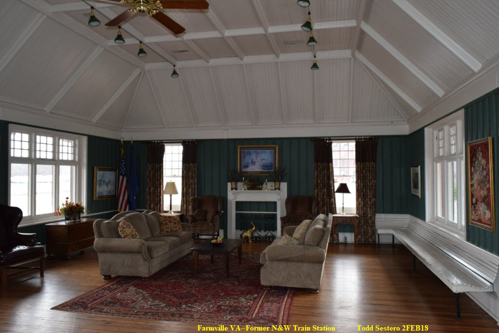
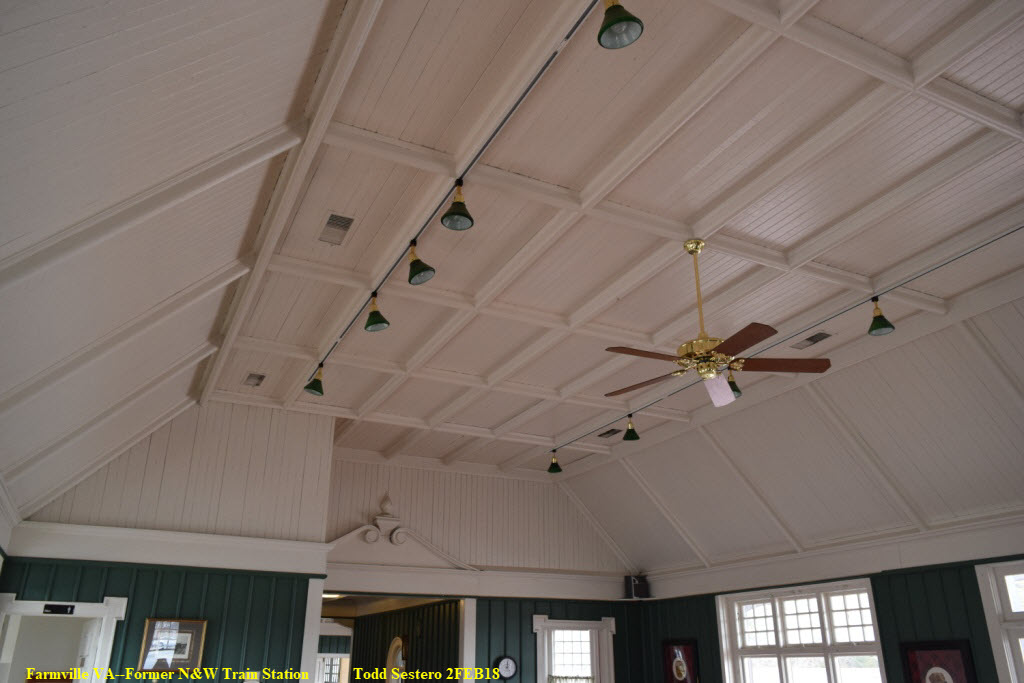
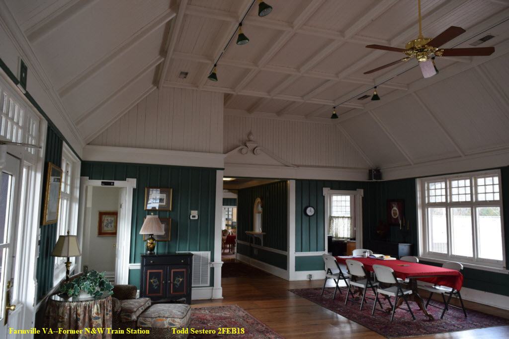
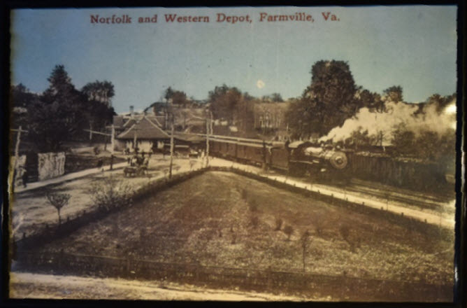 Photo on display at one of the restaurants in town
 1982
1982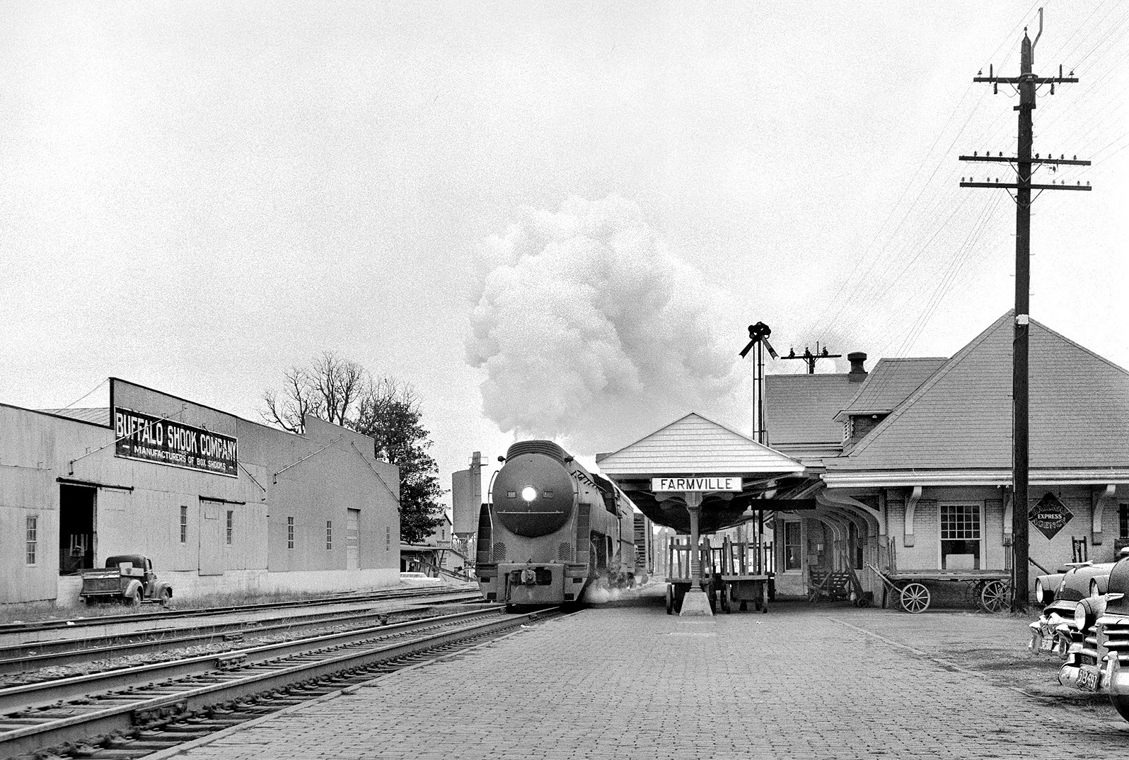
N&W 132 working out of Crewe; November 28, 1958, photo by Bill Gordon
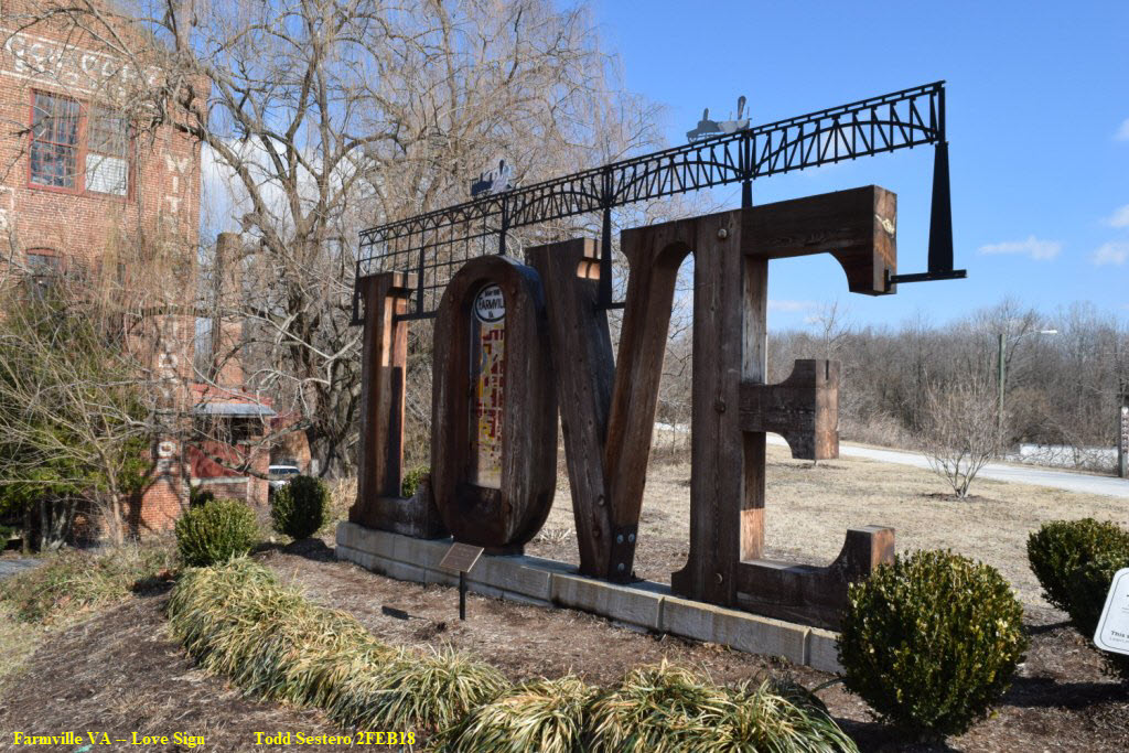
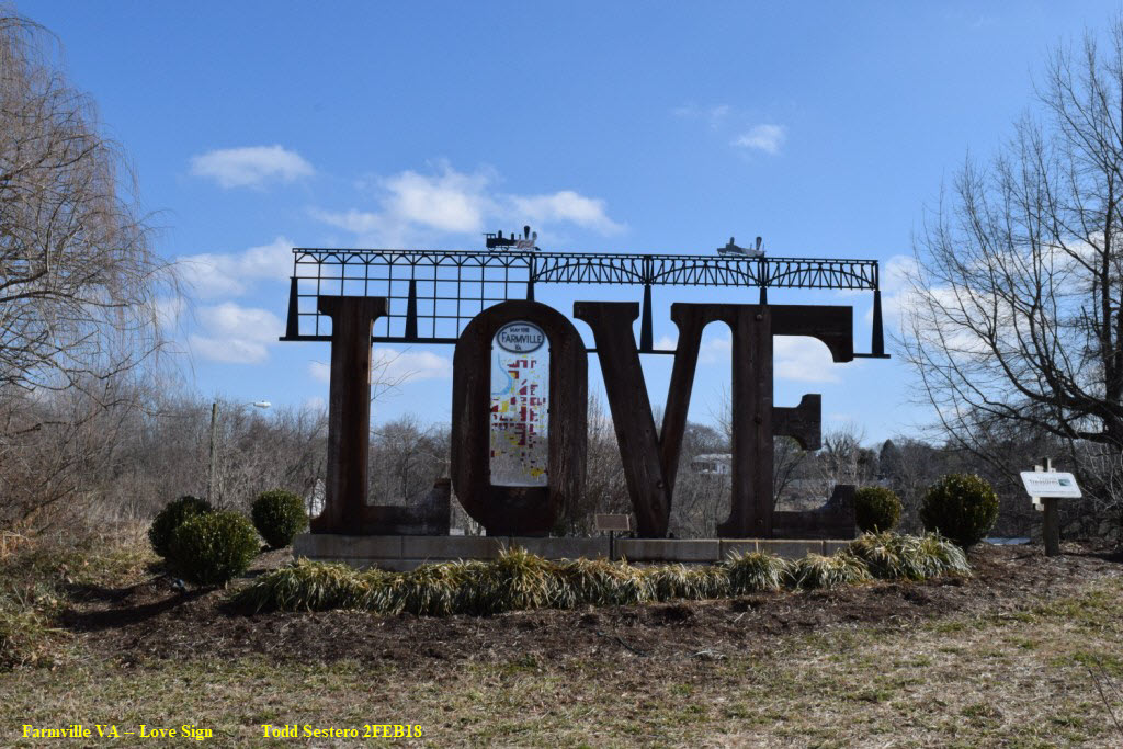
Part of a continuing series across Virginia, remember, "Virginia is for Lovers". Next to the Highbridge Trail at Main St.
It is the only railroad themed one I am aware of :-)
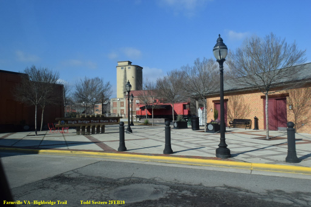
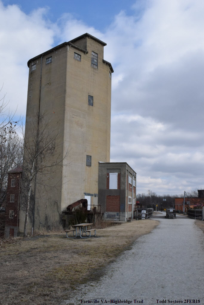
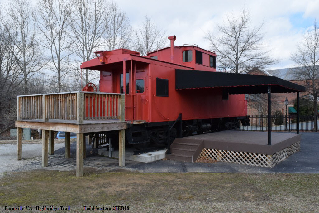
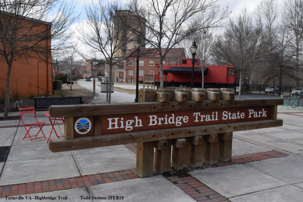
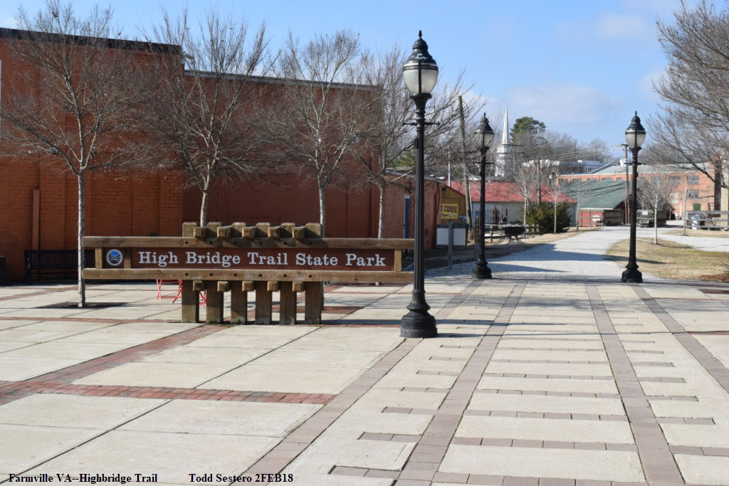
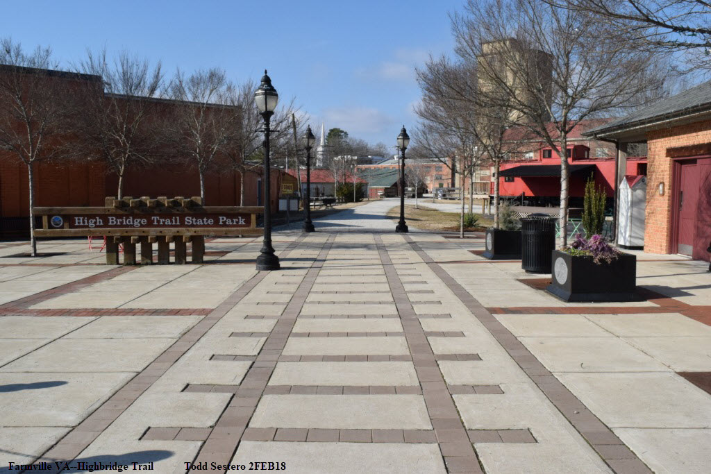
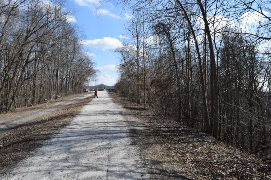
Various and assorted shots walking from Main St to the Station.
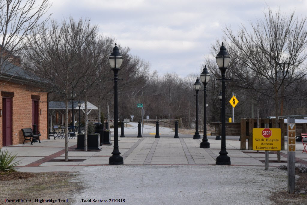
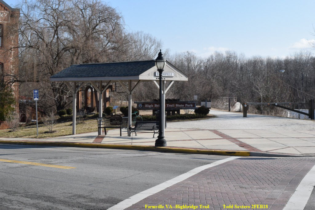
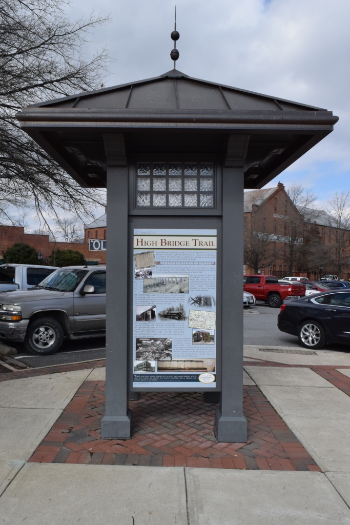 Information kiosk in town
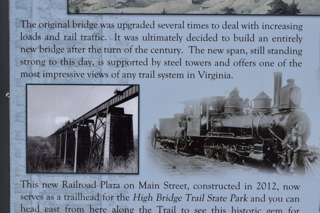 From the kiosk
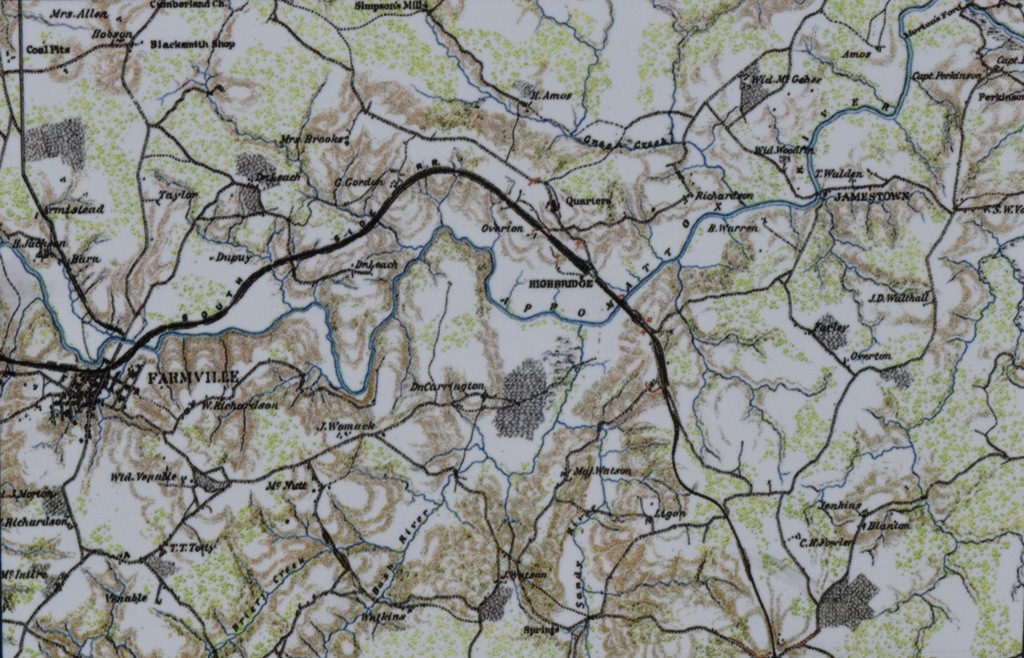 From the kiosk
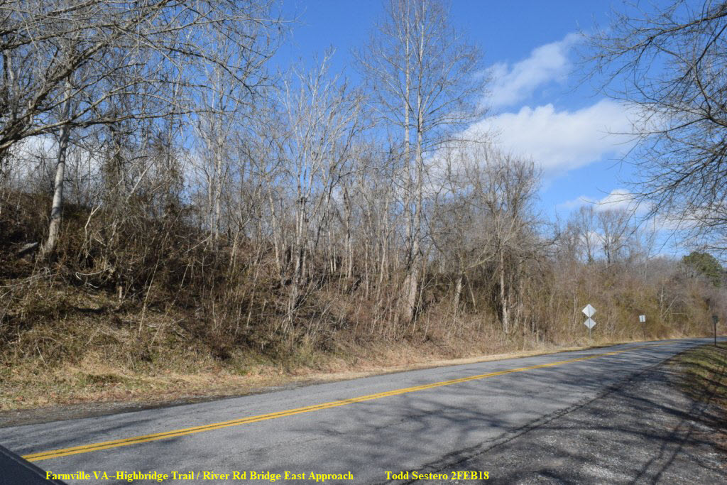
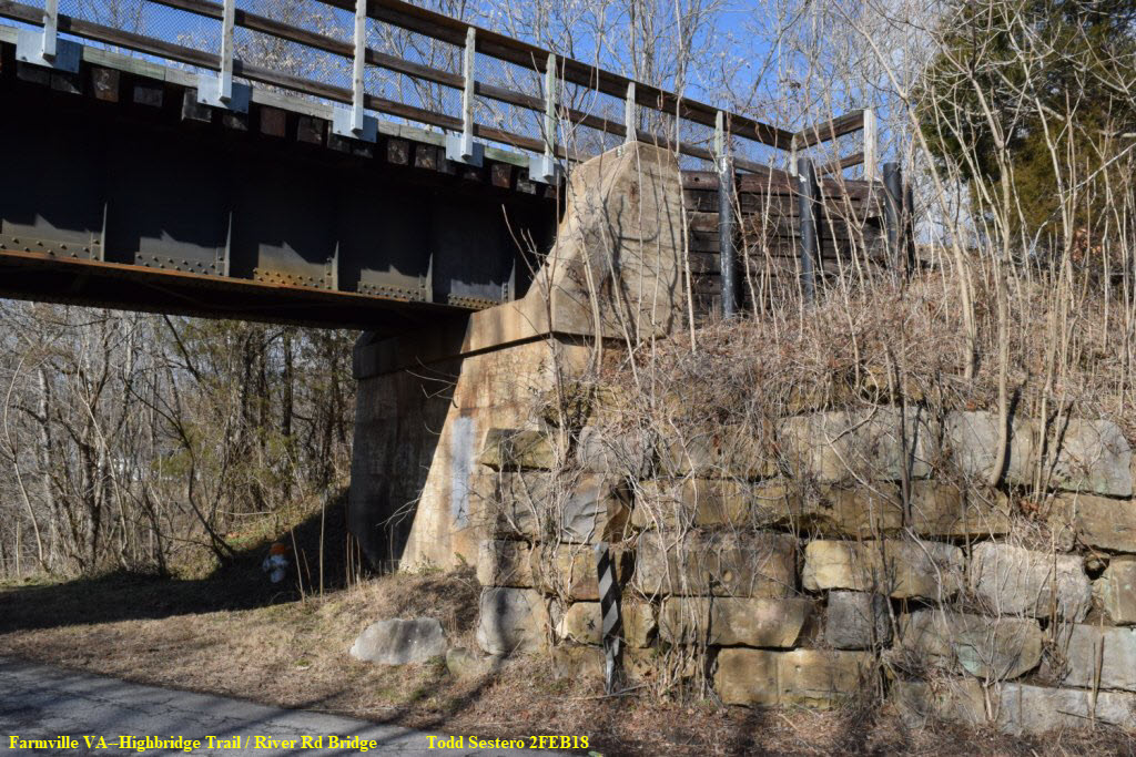
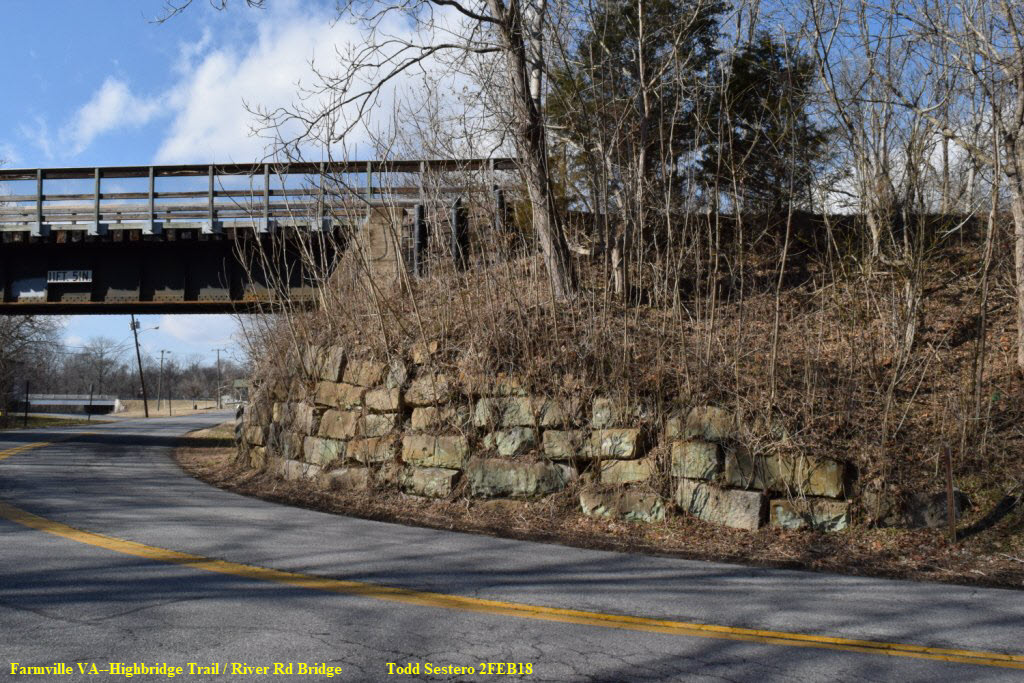
Various and assorted shots walking from the trail parking lot at River Rd to the bridge.
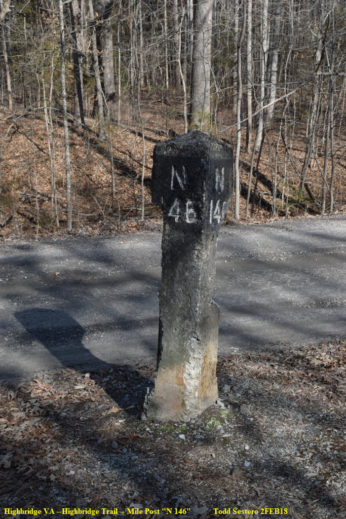
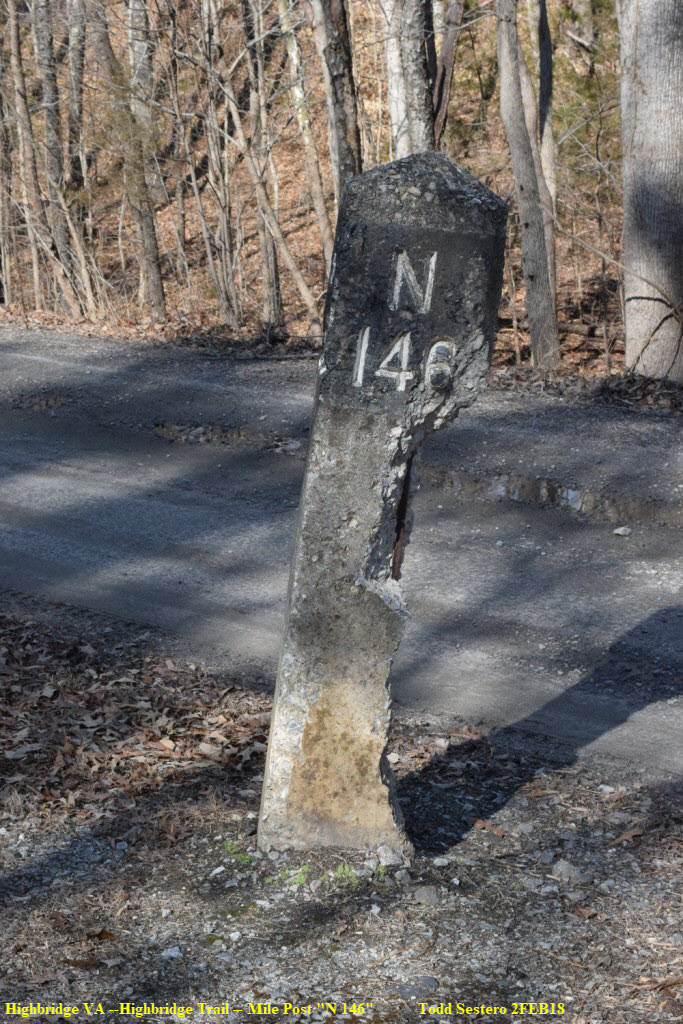
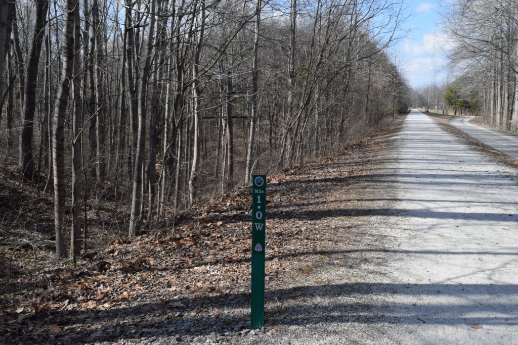 One of the trail's mile markers
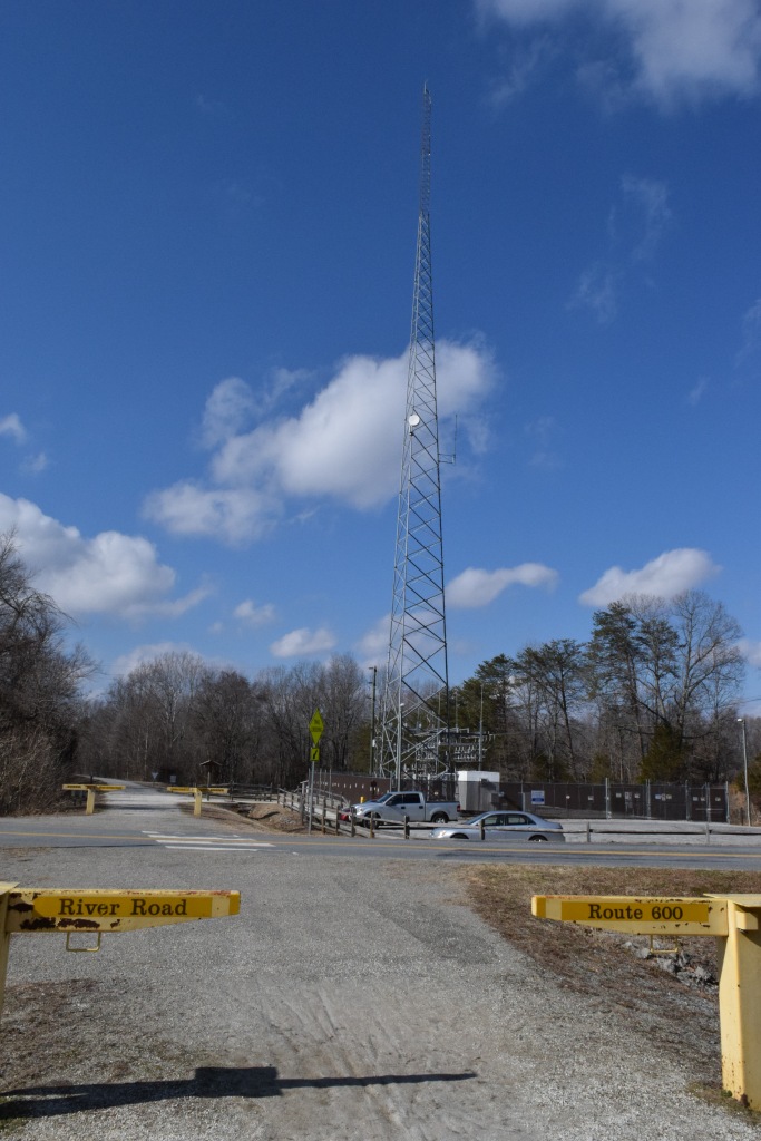 The trail parking lot at River Rd
A few teasers to get you interested......
 Tons of cowhides for $150 up
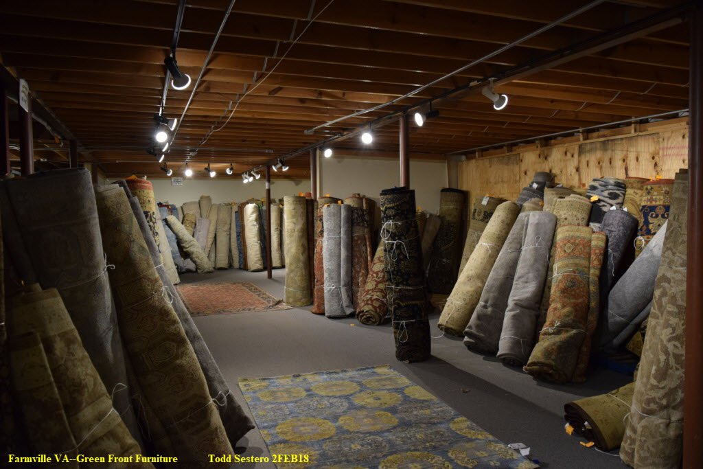
 Some armoires, probably from the late 1800's?
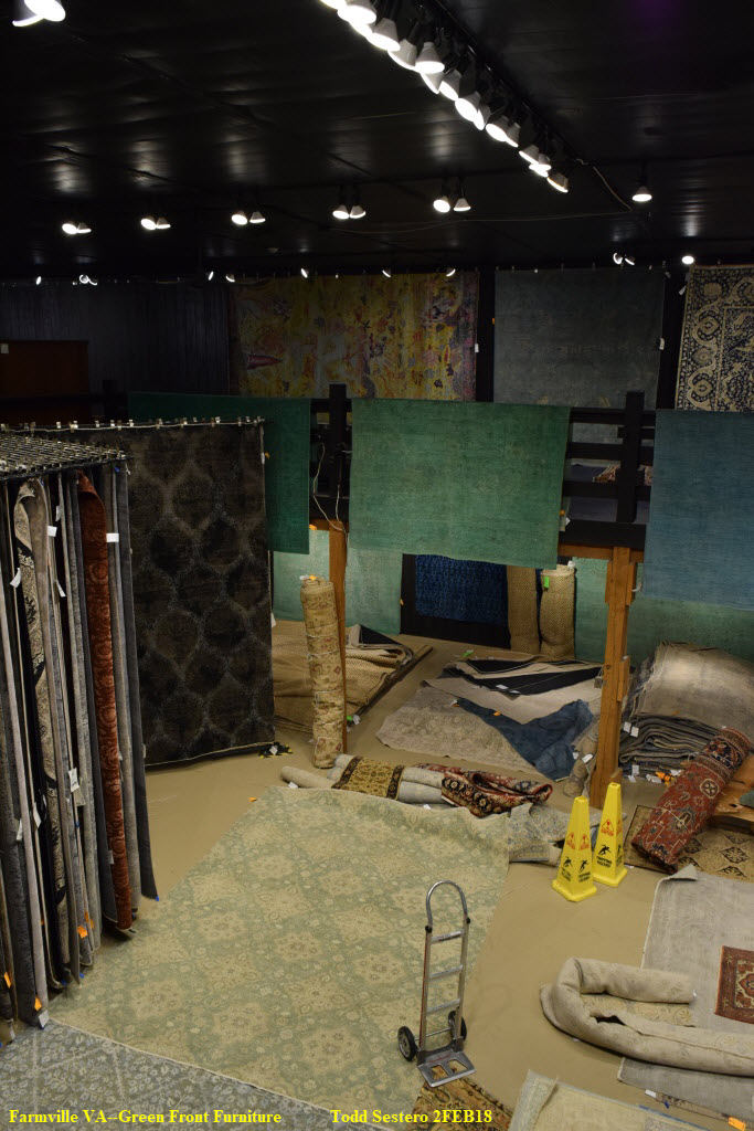
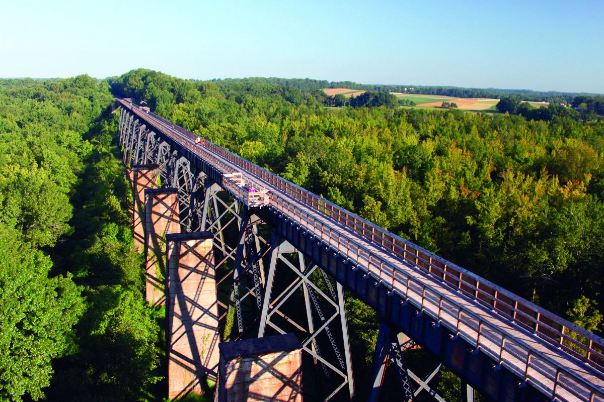
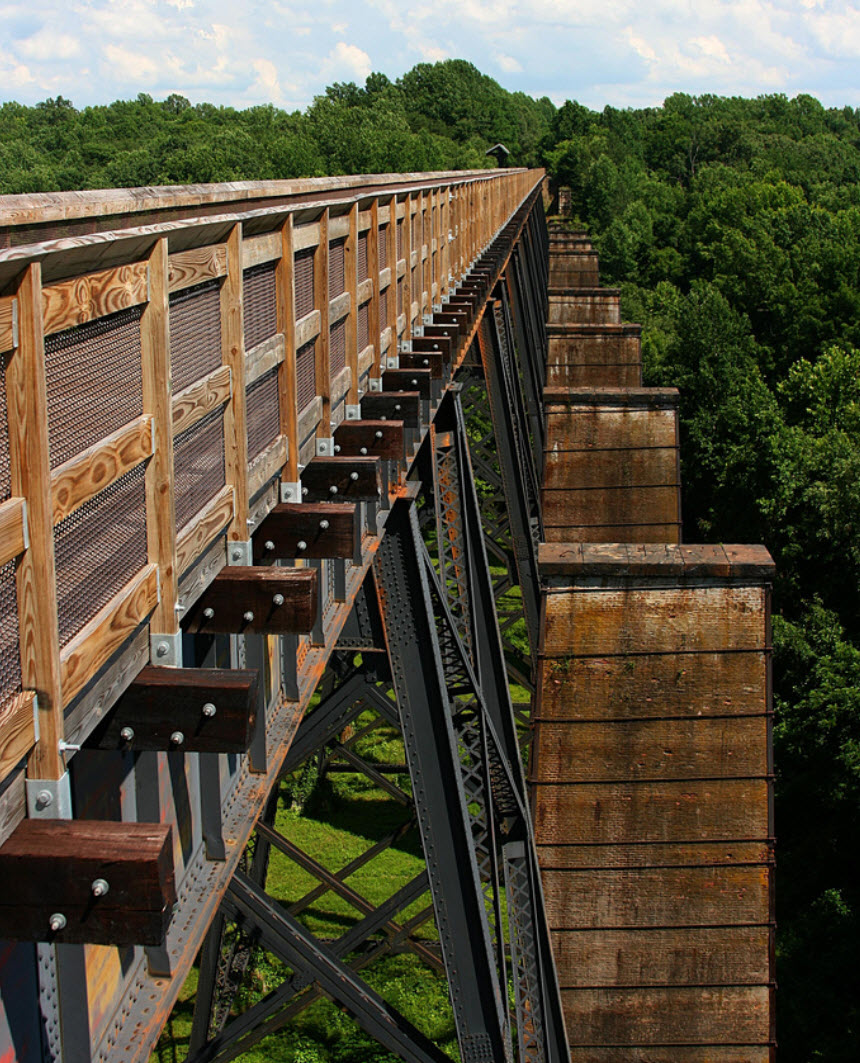
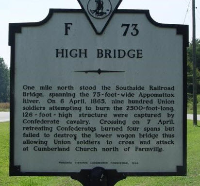
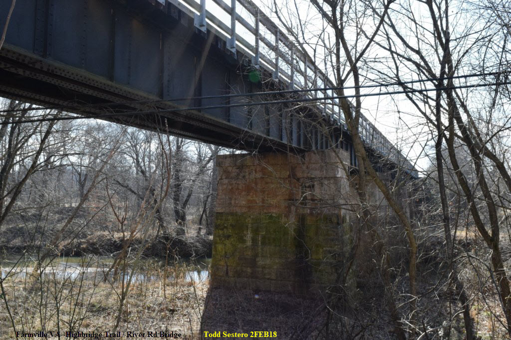
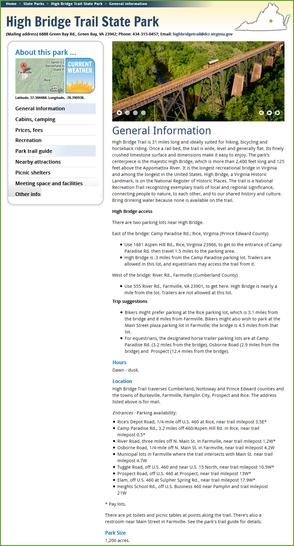
The most notable feature of this line is the High Bridge crossing the Appomattox River. When construction was completed in October, 1853, it was considered "not the longest bridge in the world nor the highest, but the largest" at the time. The bridge played a strategic role during the U.S. Civil War, and was even the site of the Battle of High Bridge. The bridge was partially destroyed by fire during this engagement, and was rebuilt after the Civil War to its present length of 2400 feet, at a height 120 feet above the valley it crosses.
Partially due to the high cost of maintaining the High Bridge over the Appomattox River valley, Norfolk Southern downgraded and eventually abandoned the line through Farmville in favor of the "Low-grade Line" between Burkeville and Pamplin. The low-grade line, completed in 1916, contained more favorable grades for westbound trains. The Southside Railroad had originally envisioned using the low-grade route until persuaded by the citizens of Farmville to bring the line through their town.
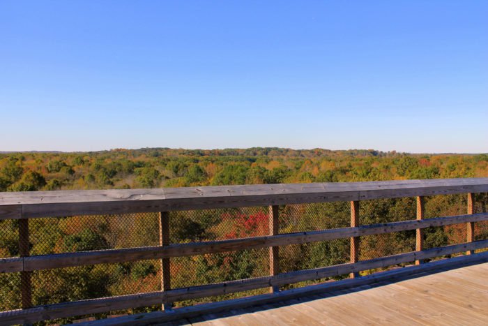
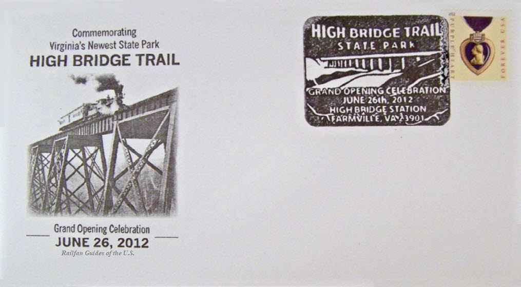
Trains used the High Bridge until October of 2004. The bridge and ROW was donated to the Virginia Department of Conservation and Recreation. Today, the bridge is a significant attraction and namesake of the High Bridge Trail State Park, which follows the abandoned Pamplin to Burkeville route through Farmville. High Bridge opened to the public on April 6, 2012, the 147th anniversary of the Battle of High Bridge.
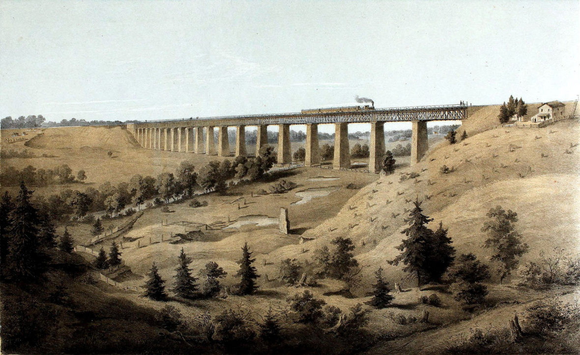
Next three paragraphs from Wikipedia: The first Long Bridge was completed in 1852 and the full line was completed in 1854. The High Bridge's twenty piers contained almost four million bricks, and supported a wooden superstructure with a pedestrian walkway beside the rail line – along with an adjacent wagon bridge (known also as the lower wagon bridge).
The Southside Railroad was heavily damaged during the American Civil War. The High Bridge played a key role during Confederate General Robert E. Lee's final retreat from Petersburg in the last days of the War. The Battle of High Bridge took place there on April 6–7, 1865. Fleeing the Union troops, the Confederates set the bridge afire after crossing it, but failed to destroy it. Union troops were able to use it and continued the chase, which ended several days later at Appomattox Courthouse, where Lee's surrender to Union General Ulysses S. Grant took place on April 9, 1865.
After the Civil War, Robert E. Lee directed the Confederate engineers who had attempted to destroy the bridge to rebuild it. Under the leadership of former Confederate General William "Billy" Mahone, the bridge was rebuilt, including 21 new Fink deck truss spans on the High Bridge erected in 1869. In 1870, the Southside Railroad was combined with the Norfolk and Petersburg Railroad and the Virginia and Tennessee Railroad to form Mahone's Atlantic, Mississippi and Ohio Railroad (AM&O), which stretched 400 miles across the southern tier of Virginia from Norfolk on Hampton Roads to Bristol. After the Financial Panic of 1873, the AM&O fell into default on its debt, and was purchased in the early 1880s by new owners who renamed it the Norfolk and Western (N&W). N&W replaced the High Bridge's Fink truss spans in 1886 with minimal interruption of rail traffic, one span at a time, first suspending a new Pratt deck truss from traveling wooden falsework and then removing the old trusses.
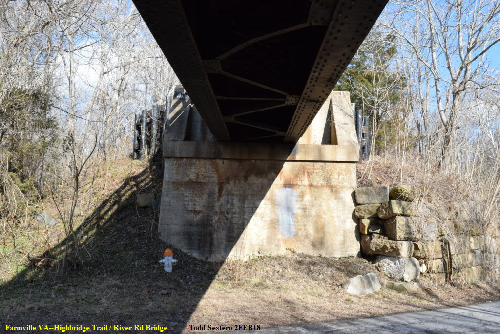
The original bridge was built on concrete piers, which still stand today alongside the steel piers. High Bridge was constructed in 1854 as a railway to span the Appomattox River and connect the cities of Petersburg and Lynchburg. Building this structure was no easy feat. Originally made of wood, the bridge stood on 20 brick piers and spanned 2,400 feet. When you look out over the valley today, it is hard to imagine that at one time the fields were almost bare, and that there was a lone standing fireplace from a house long gone!!!!
 from Wikipedia
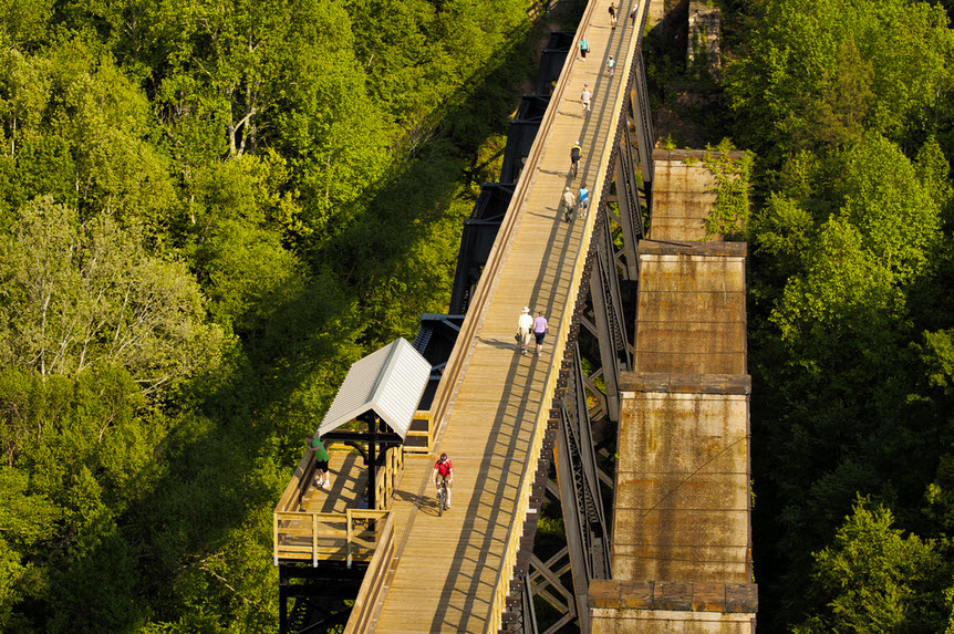
A couple of good aerial shots, above and below, showing the adjacent piers
 4.5mi east of Farmville on US 460, N 37° 16.520 W 078° 19.400, picture by Sneakin Deacon
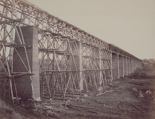

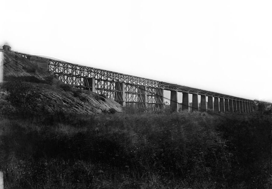
Dismantling the original bridge after the new one went into service in 1914. Picture via the Richmond Times page.
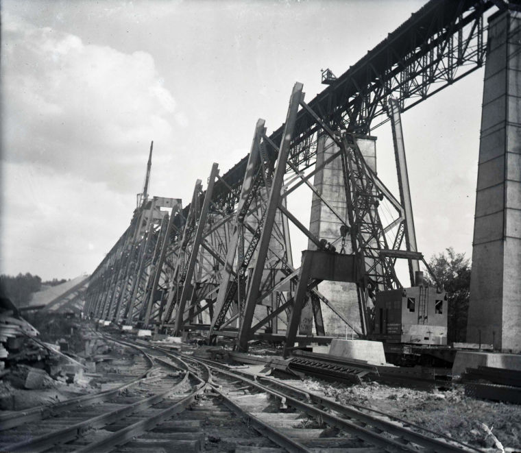
Construction of the new steel bridge in 1913, notice the dual gauge track on the ground! Picture via the Richmond Times page.
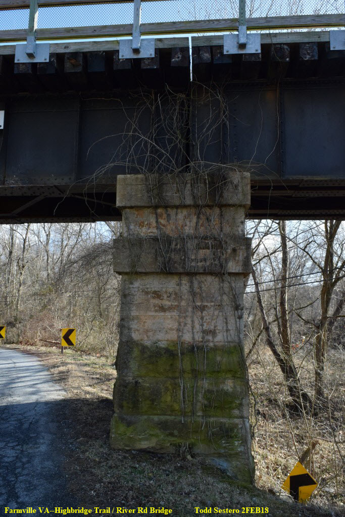
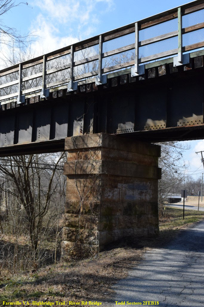
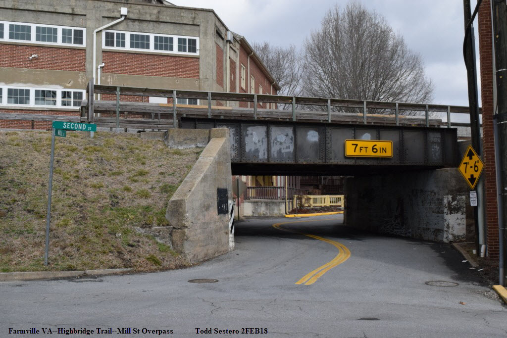
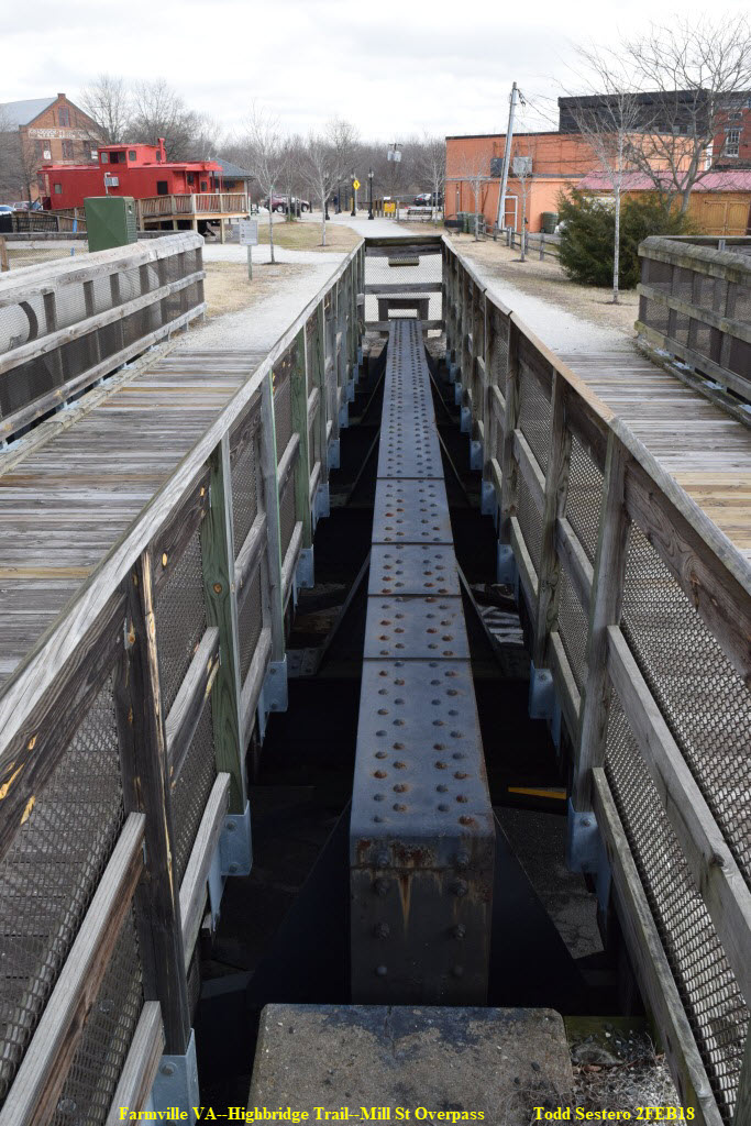
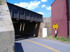
A single track bridge going over both River Road and the Appomattox.
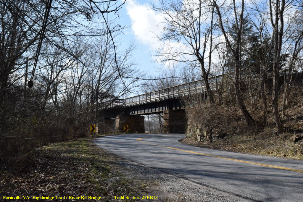

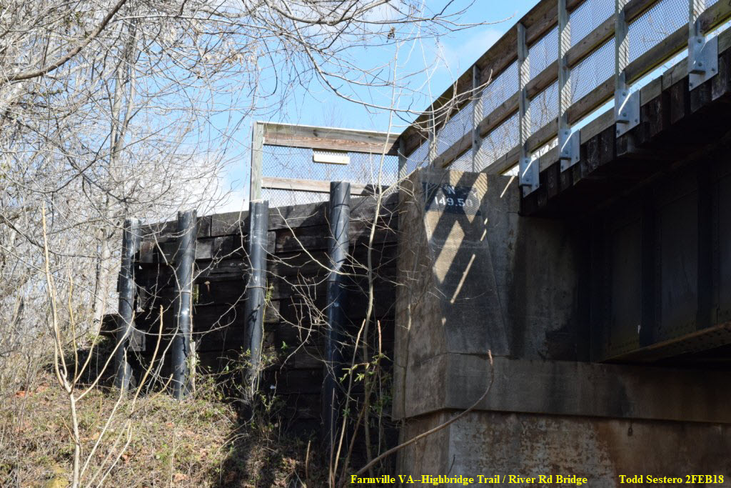

A two track bridge supporting both the main line and the Farmville Siding.
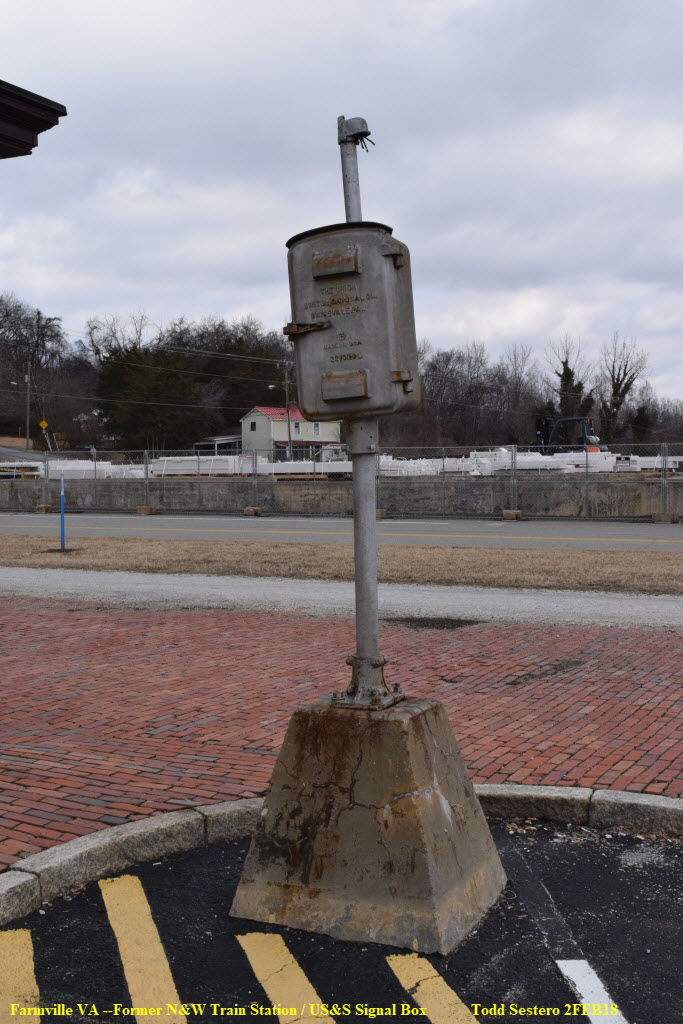
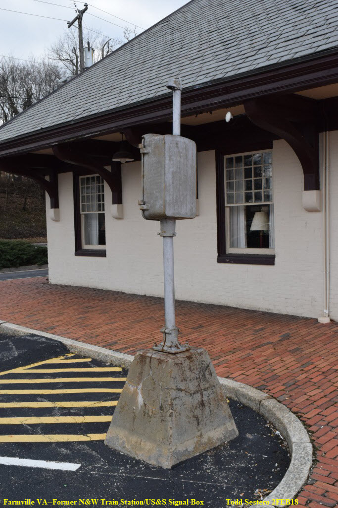
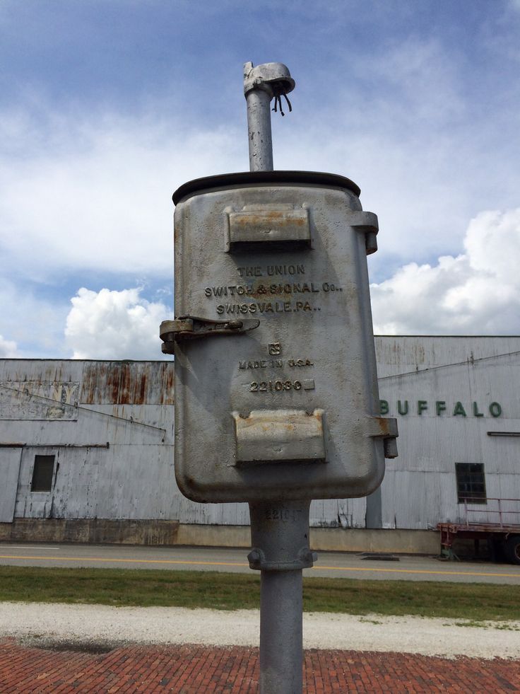
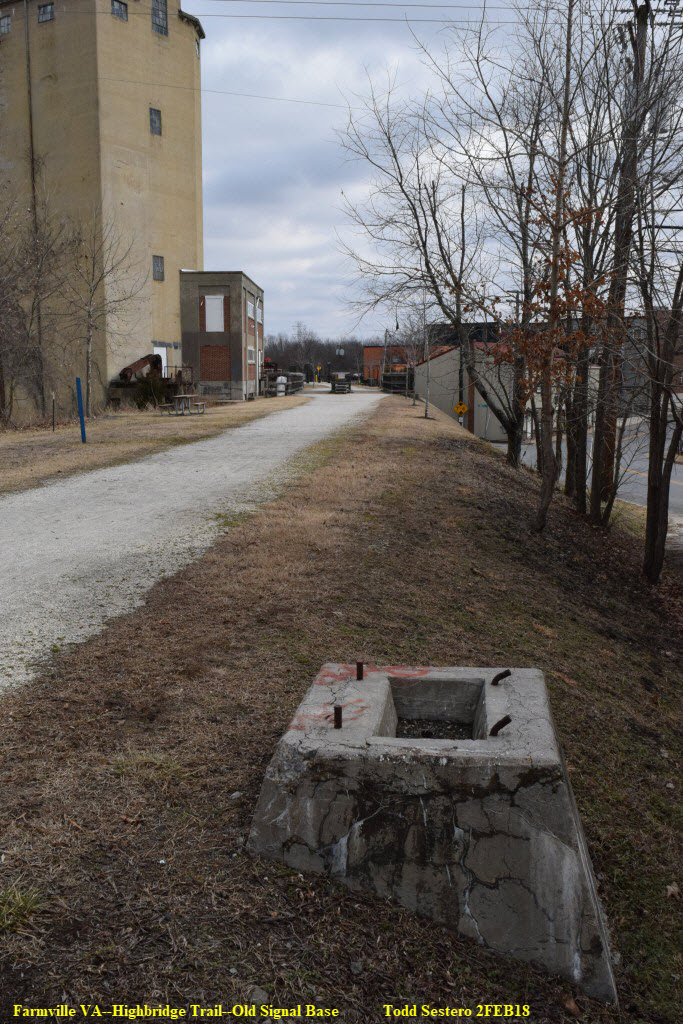
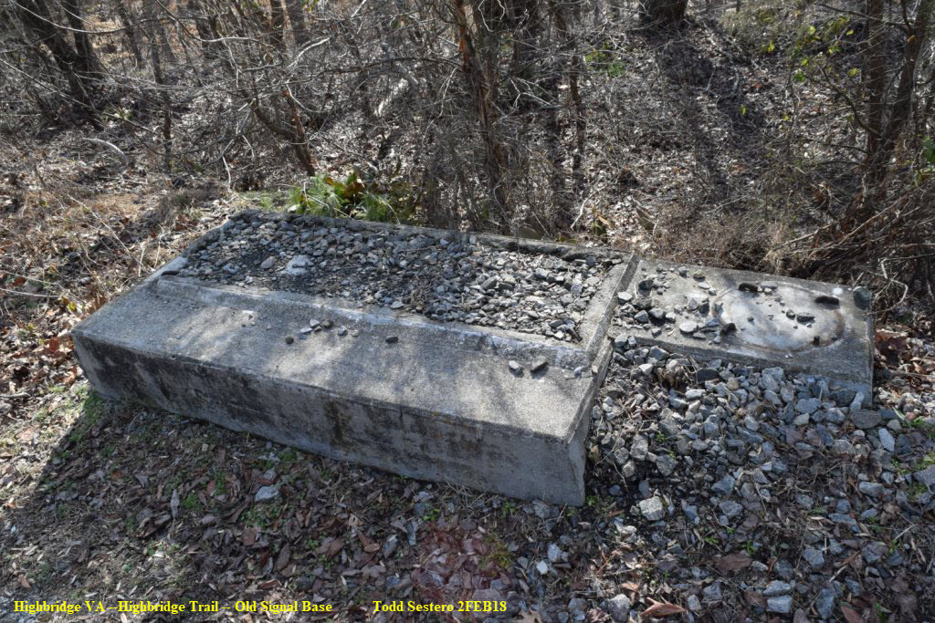
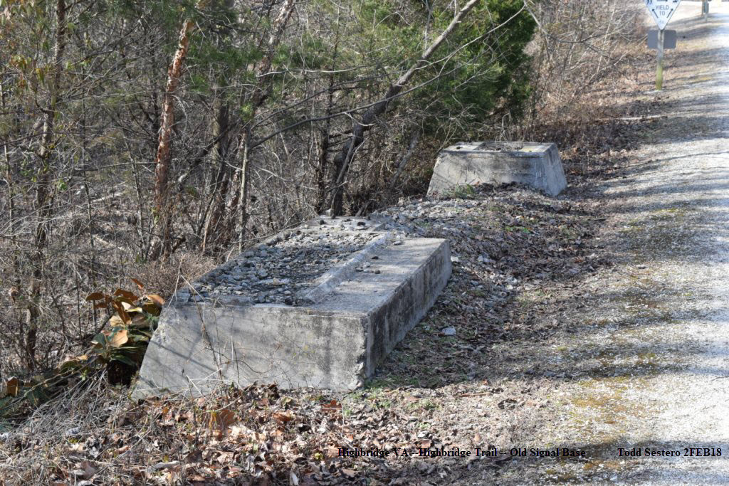
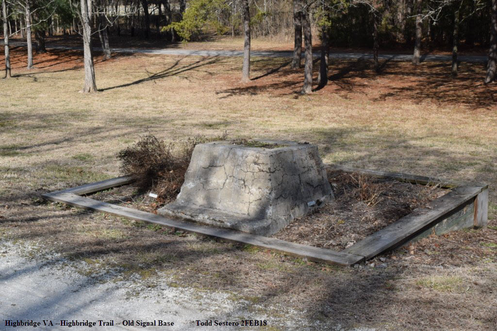
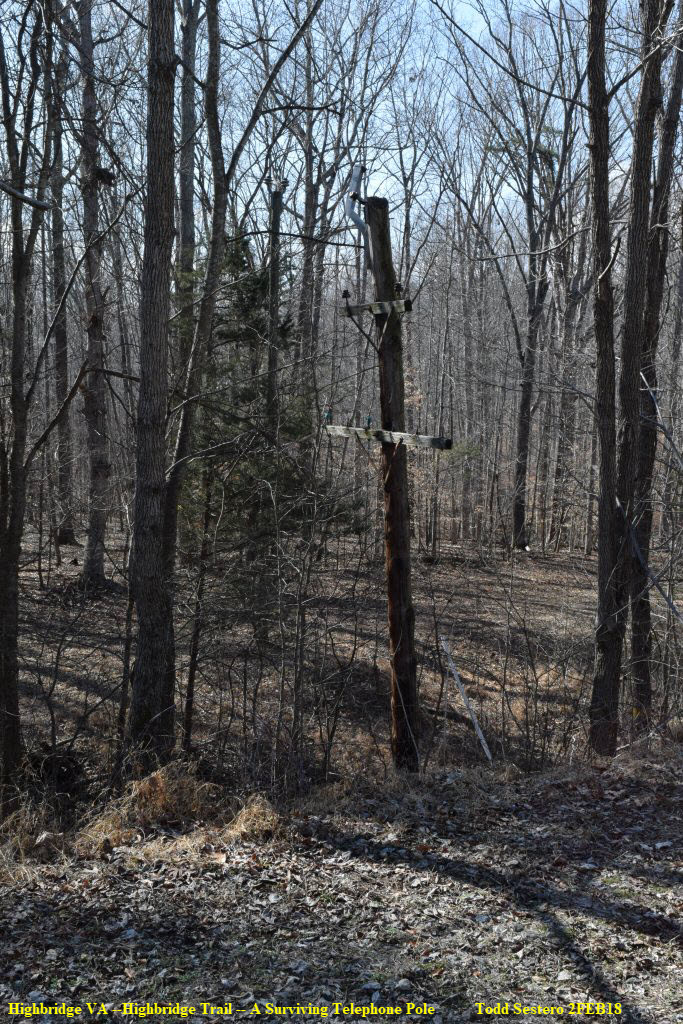
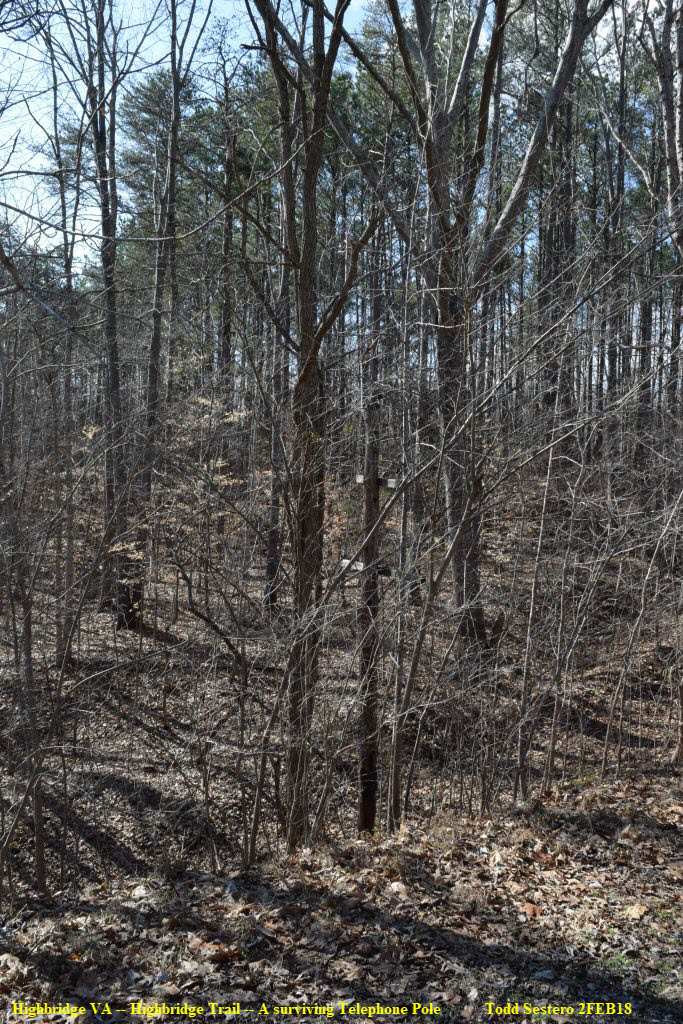
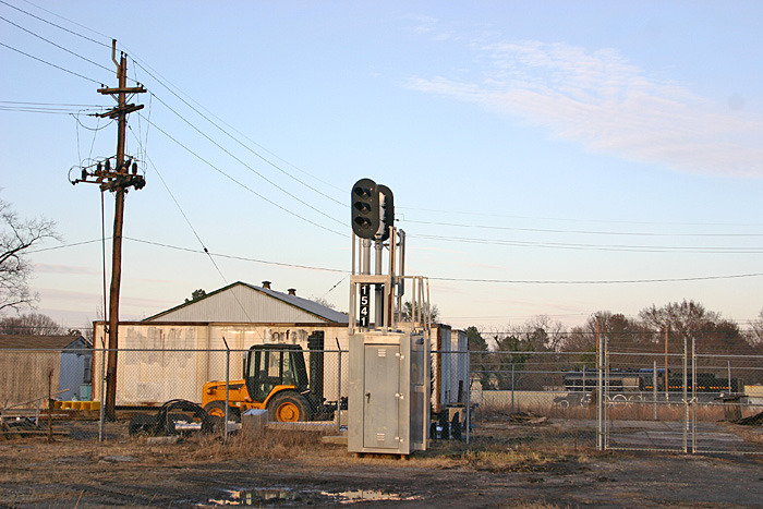
Being that the line has been abandoned since around 2010, there are no signals remaining. However, they didn't remove most of the concrete bases for them. However, a US&S box remains at the station, and other miscellaneous forms of signaling have survived.
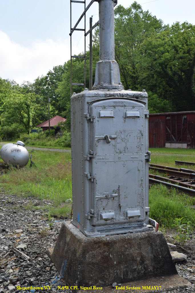
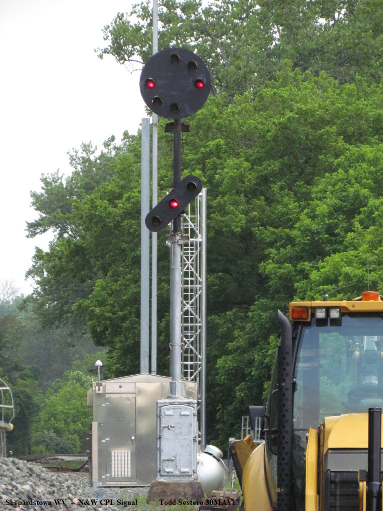
Signals were originally N&W CPL's, and replaced by Safetran color light signals in the 1996 timeframe. Obviously, before the CPL's went in, they were semaphores.
From the Rails in Virginia website: Owing to the Pennsylvania Railroad's ownership in the N&W, the company began utilizing position light signals in the 1920's. The first position light signals were installed on the Shenandoah Division between Hagerstown and Shenandoah in February 1924. In December 1926 the remaining segment of the line to Roanoke was activated. In the early 1960's the N&W removed the center light and changed the lights around the outer perimeter to color bulbs, hence the term color position light signal. Unfortunately the curtain fell on the Punkin Vine CPL signals in 2010 and they are now just a memory.
What is the enclosure for?: Unknown. Maybe a phone???
The signal bases along the Highbridge Trail supported Norfolk and Western CPL (Color Position Light) signals, which are of Pennsy heritage because of their partial ownership of the N&W. The signal lenses were originally all yellow, and colorized in the mid 60's. For more info, visit my page on N&W CPL signals here, and Pennsy PL signals here. The pictures below are from one of the last standing CPL signals left standing (in Shepardstown WV) over the summer of 2017, before they were replaced around October.
Below: Signals at Starkey VA, at MP R12.5, looking south along Merriman Road with the R12 milepost visible in the foreground.
Typical of the signals you would have seen where the trail is between River road and the High Bridge, including the pole line.
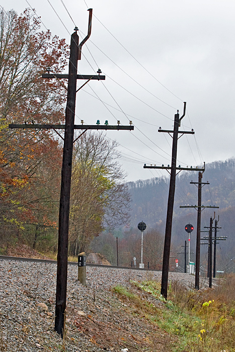 Photo by Jeff Hawkins (November 12, 2009)
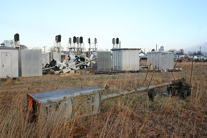 Photo by Jeff Hawkins, February 18, 2006
Signals in Crewe VA in 1996, with one of the old CPL's on the ground.
 The former N154.1 signal, Photo by Jeff Hawkins, February 18, 2006
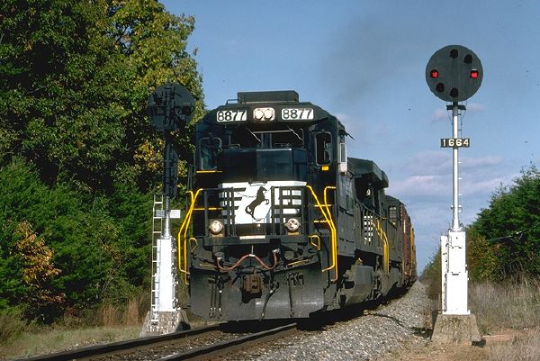 West of Pamplin City, on the N&W Old Main Line. 11/1996
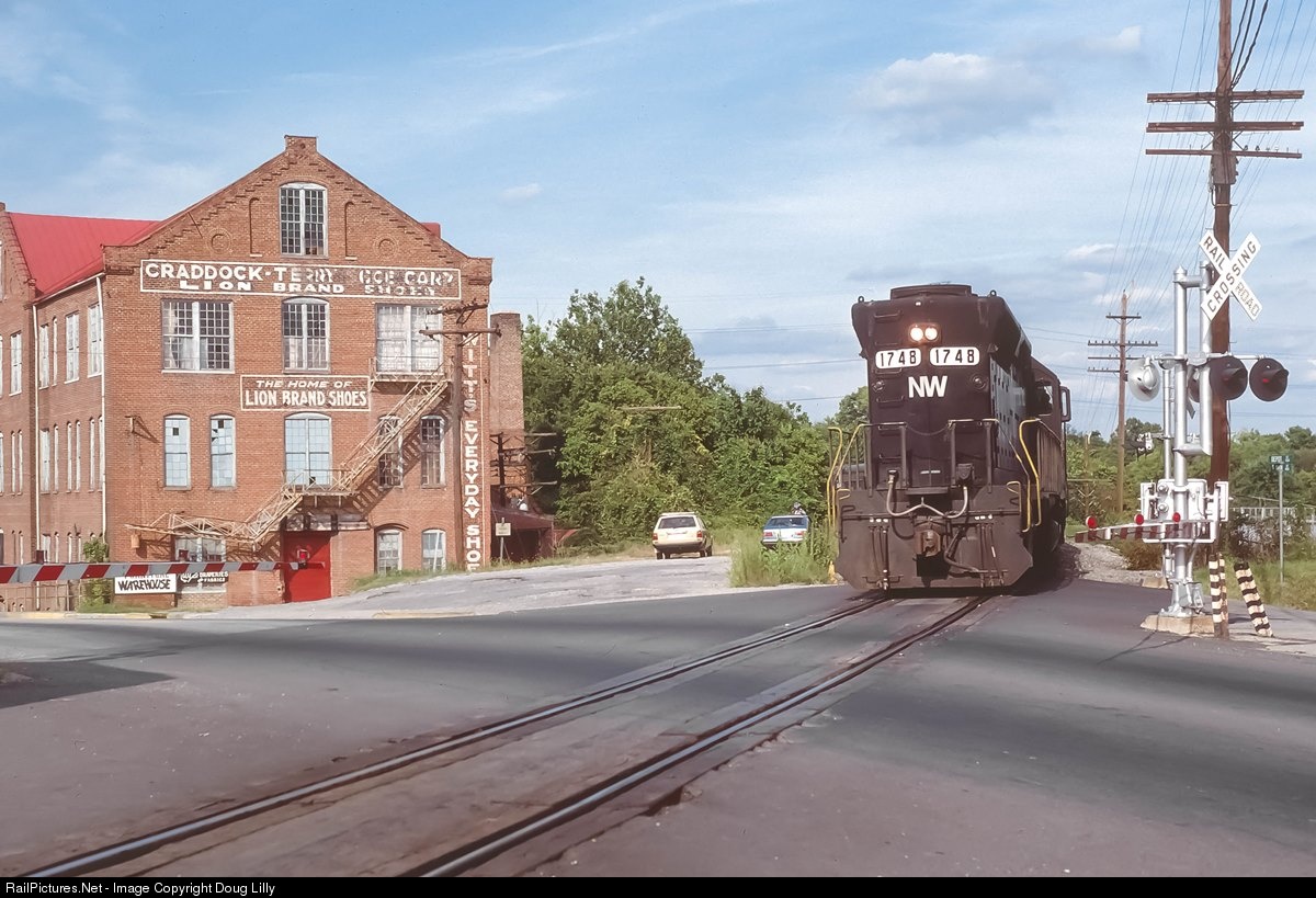 September 4th, 1982
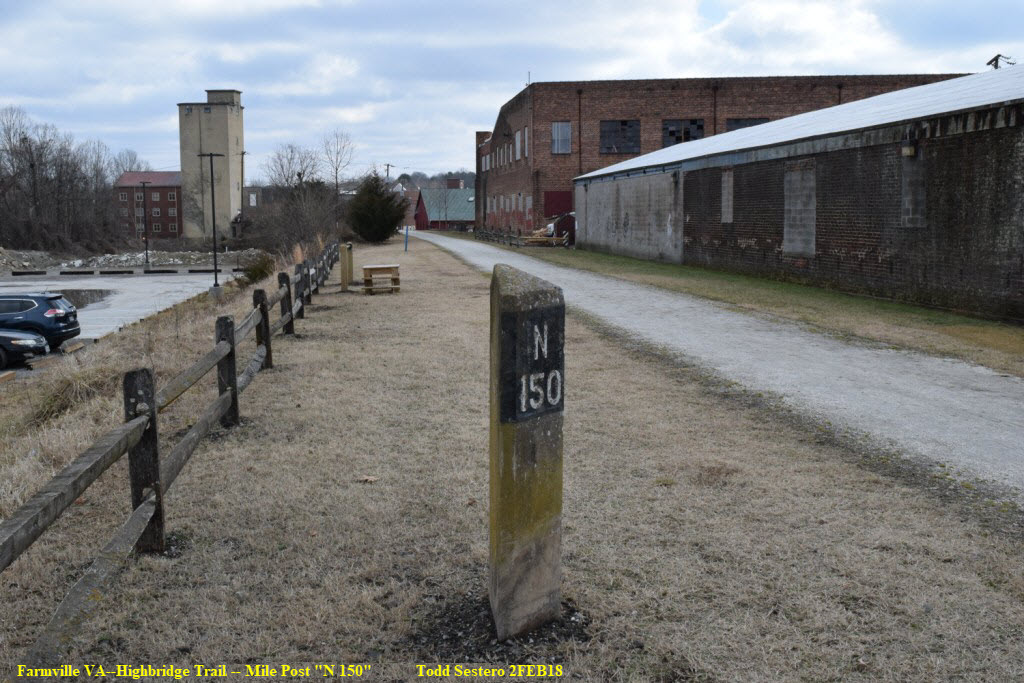
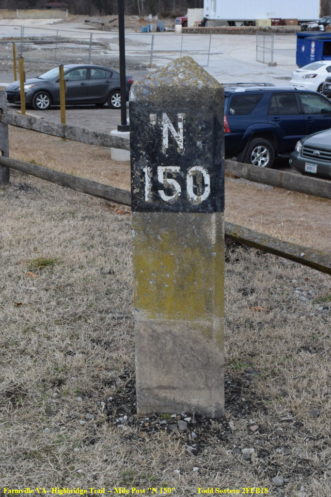
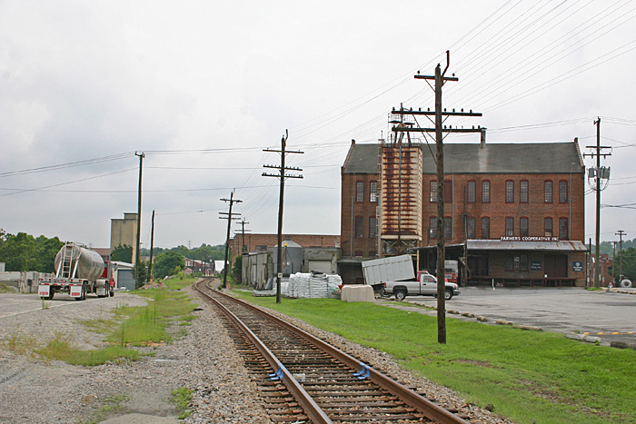 MP 150.1 in Farmville, photo by Jeff Hawkins
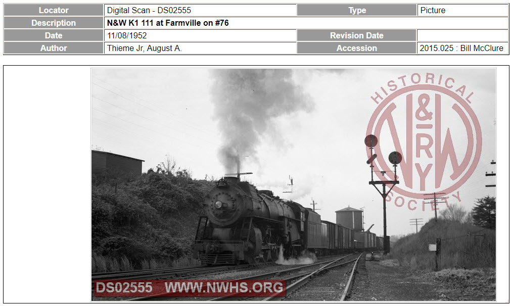
A few miles to the east in Burkeville, is where the Old Main Line coming thru Farmville originated.
the Farmville Siding
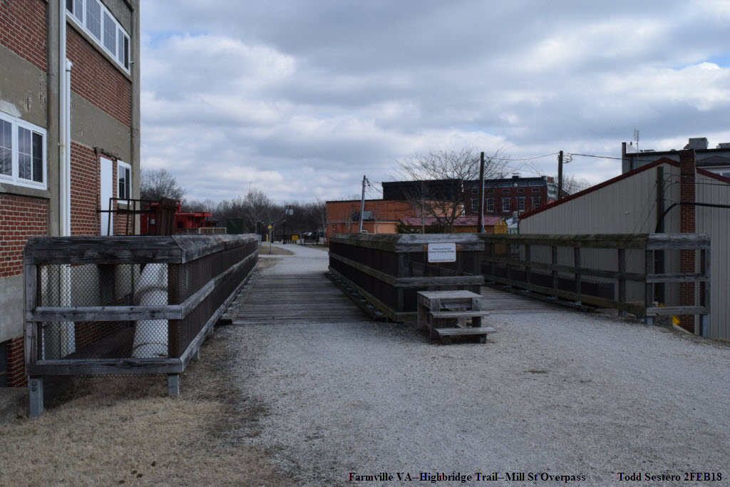
The only reason I know there was a siding here is because it was listed on Train Web's page for this district. Not sure of it's exact location however, the bridge over Mill Street had room for two tracks. In the photo above by Jeff, it looks like the sidings have been long gone..... Above that, in the picture by Doug at Main St, it is also single track there, so maybe (just maybe) the switch for the siding was between there and the Mill St overpass.
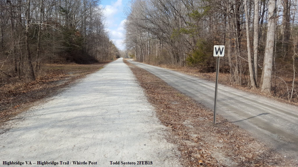
Trail Info
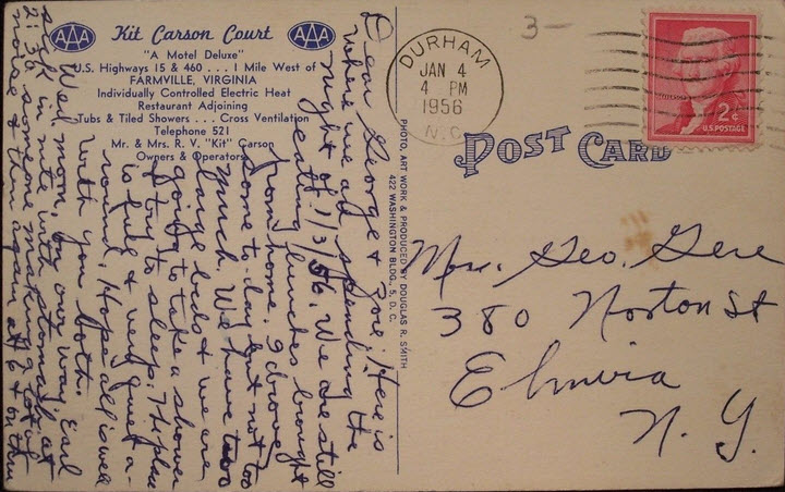
Other Other Stuff
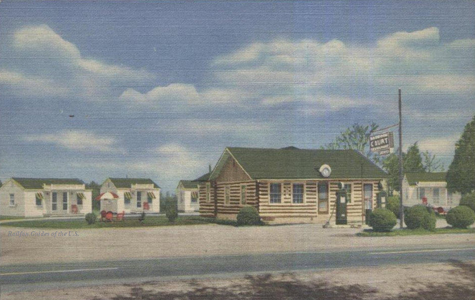
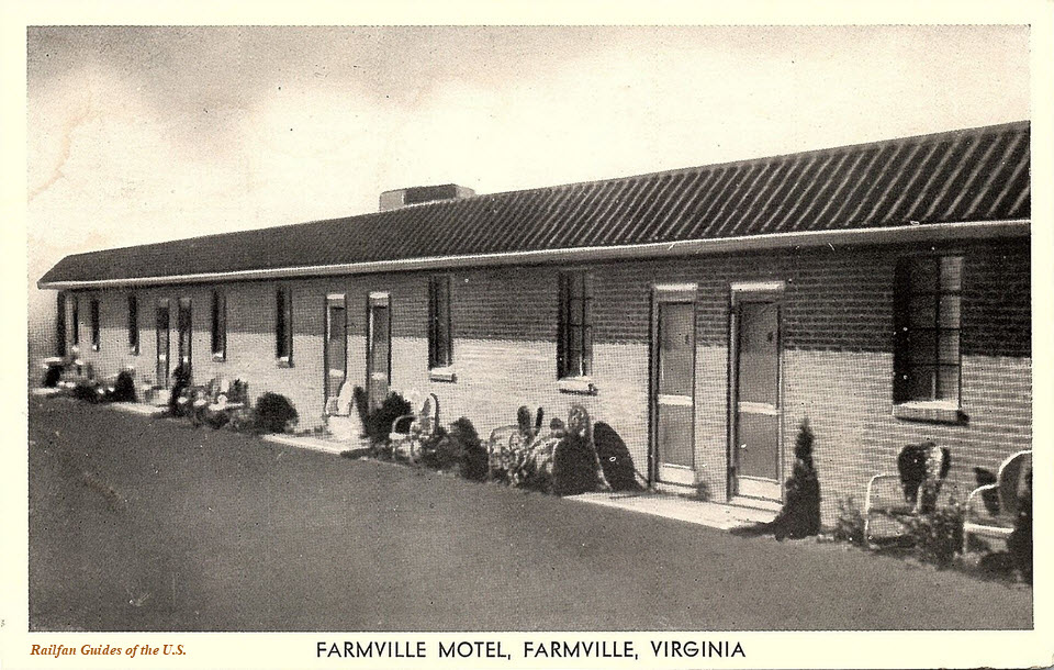
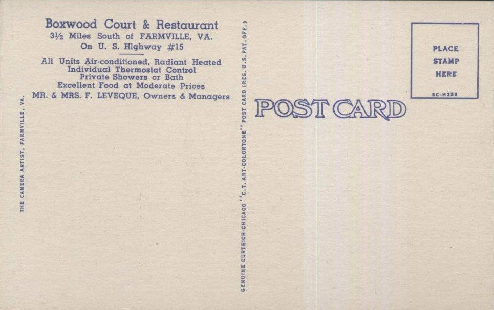 Boxwood Motor Court ~1930
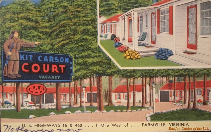

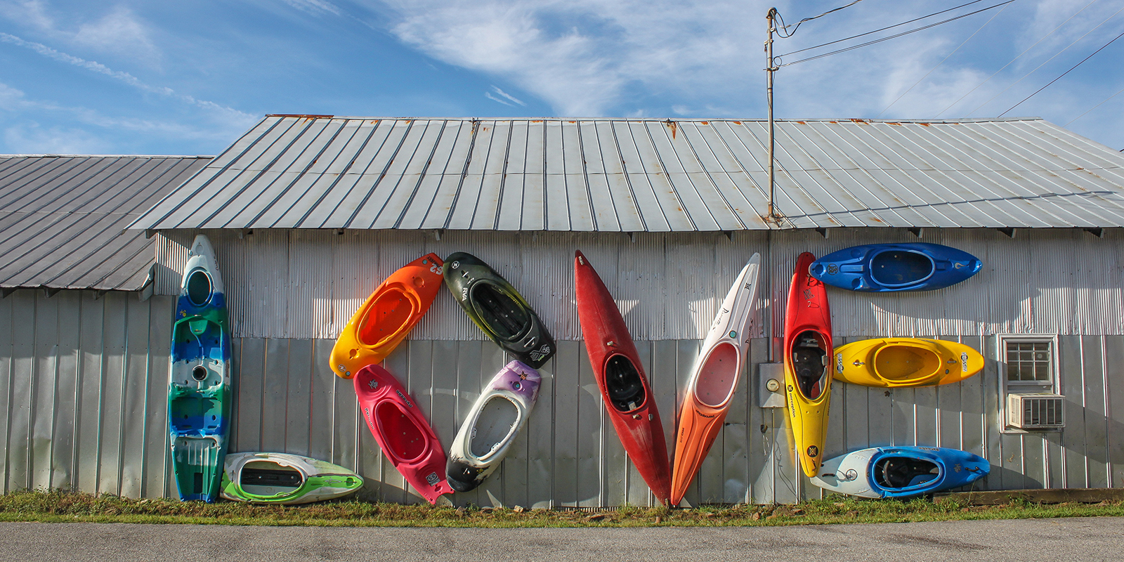 "Kayak Love"
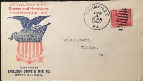
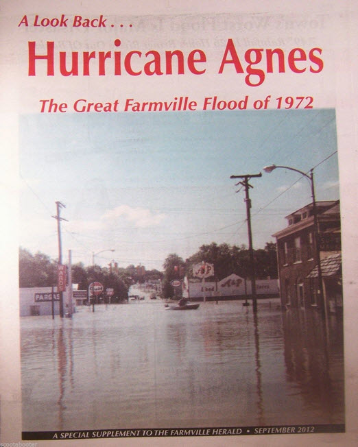 Hurricane Agnes is what killed the "Northern Central" in Maryland.... :-(
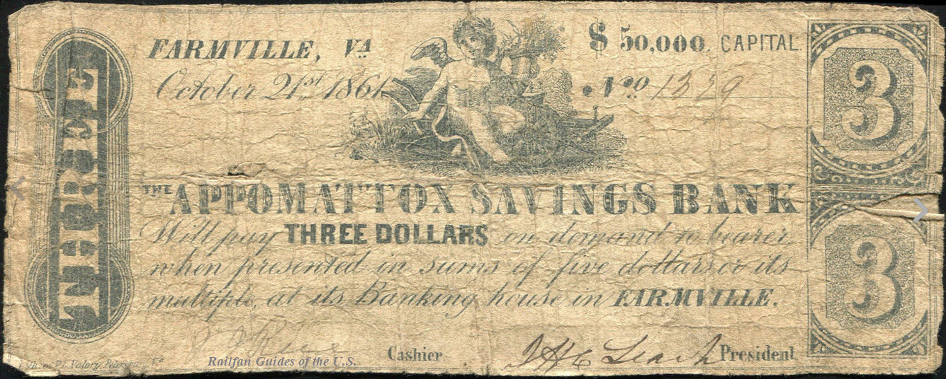
 Next to the train station
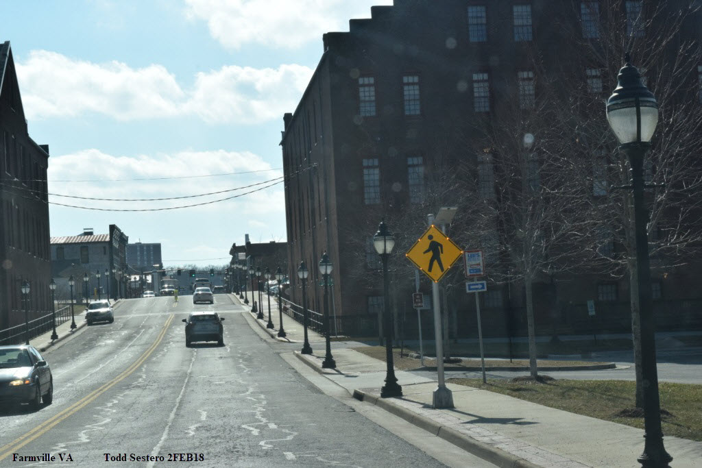 LED equipped pedestrian signs
Courtesy of the University of Texas Library, click here for their index page.
Disclaimers:
I love trains, and I love signals. I am not an expert. My webpages reflect what I find on the topic of the page. This is something I have fun with while trying to help others.
Please Note: Since the main focus of my two websites is railroad signals, the railfan guides are oriented towards the signal fan being able to locate them. For those of you into the modeling aspect of our hobby, my indexa page has a list of almost everything railroad oriented I can think of to provide you with at least a few pictures to help you detail your pike.
If this is a railfan page, every effort has been made to make sure that the information contained on this map and in this railfan guide is correct. Once in a while, an error may creep in :-)
My philosophy: Pictures and maps are worth a thousand words, especially for railfanning. Text descriptions only get you so far, especially if you get lost or disoriented. Take along good maps.... a GPS is OK to get somewhere, but maps are still better if you get lost! I belong to AAA, which allows you to get local maps for free when you visit the local branches. ADC puts out a nice series of county maps for the Washington DC area, but their state maps do not have the railroads on them. If you can find em, I like the National Geographic map book of the U.S..... good, clear, and concise graphics, and they do a really good job of showing you where tourist type attractions are, although they too lack the railroads. Other notes about specific areas will show up on that page if known.
Aerial shots were taken from either Google Maps or Bing Maps as noted. Screen captures are made with Snagit, a Techsmith product... a great tool if you have never used it! HOWEVER, as of the end of 2017, the Bing Maps birds-eye view which we have all come to love, has been totally destroyed by Bing - dunno what they did, but it now sucks the big-one!!! So their usefulness has come to an end!
By the way, floobydust is a term I picked up 30-40 years ago from a National Semiconductor data book, and means miscellaneous and/or other stuff.
Pictures and additional information is always needed if anyone feels inclined to take 'em, send 'em, and share 'em, or if you have something to add or correct.... credit is always given! Please be NICE!!! Contact info is here
Beware: If used as a source, ANYTHING from Wikipedia must be treated as being possibly being inaccurate, wrong, or not true.
SEPTA HOMEPAGE
RAILFAN GUIDES HOME
RAILROAD SIGNALS HOME
NEW 02/10/2018
Last Modified
18-Feb-2018