"We" moved to Tyler in 1959 when I was
8. We lived near Hogg Junior High School, but attended Gary Elementary
School until we were old enough to go to the junior high. Back in the
mid 70's, I worked with a fellow, Jan Smith, who had attended Gary Elementary a
generation earlier (in the 30's) and said all of the streets that are bricked
paved in the area, were dirt roads back then. It was interesting to talk
to Jan and I considered myself lucky for knowing him, even if it was for such a
short spell. In later years, I met this fellow Marvin Mervis when I worked for
Westinghouse in Hunt Valley. I found out that his dad owned a shoe store
in downtown Tyler on the square, around the same time we lived there.... how
about that for being a small world?
So, Tyler is where I saw my first
GP-30's, and fell in love with them... Hence, the GP30 part of my email address.
Back then, and up into the mid 80's,
Tyler was serviced by two railroads as noted above. The Mopac came the
closest to where we lived on Victory Drive, being a short walk through the
woods, and where it came thru that part of Tyler, it was up on a high fill.
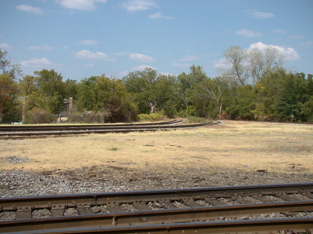
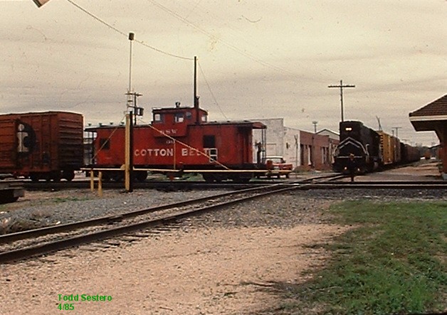
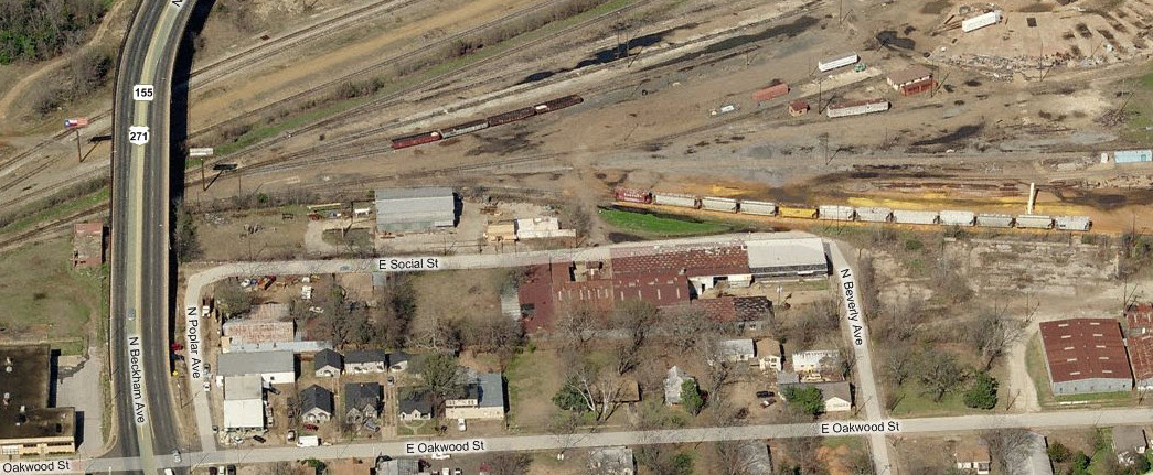
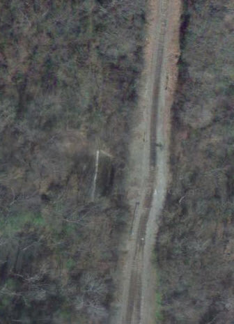
The Cotton Belt tracks run east-west, and the Mopac line ran north-south.
When I lived there, I used to go down the
the Cotton Belt yard a lot, and would get rides on the engines... how cool is
that for a budding railfan!? You could also ride all around the
yard on your bike - if you can imagine a world when no-one chased you off! I don't
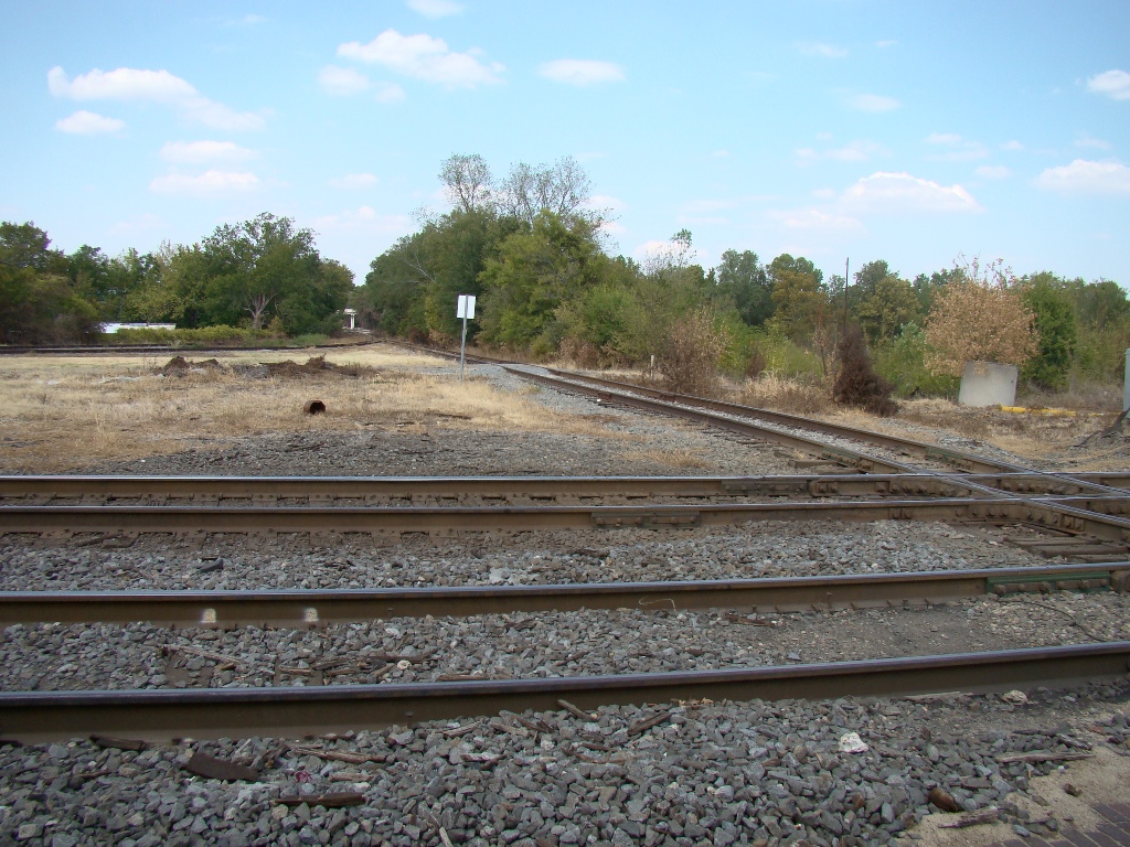
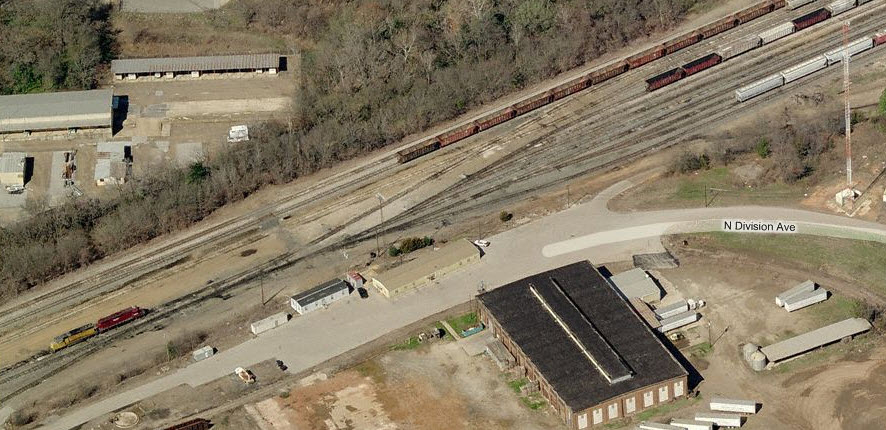
remember if there was a hump in the yard, but they did do switching... there was
also a turntable and roundhouse. On one trip to the yard, there was
a burnt-up F unit sitting in front of the roundhouse!
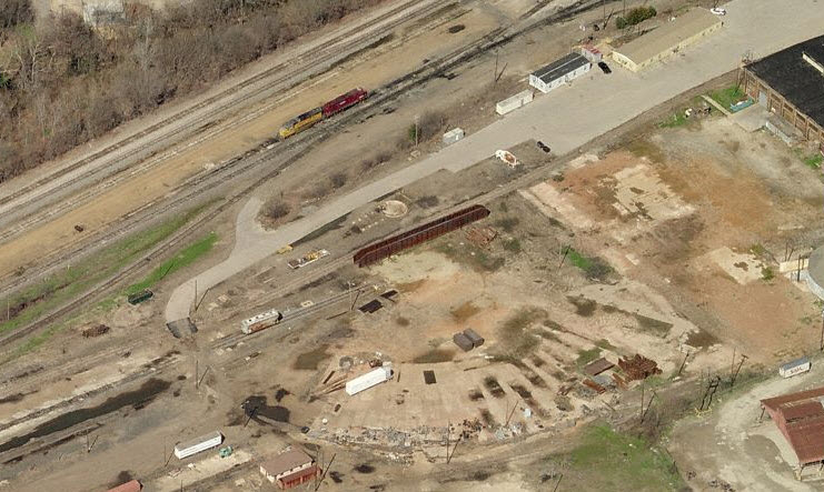
The last time I was there, the turntable was gone, and it didn't look like much was going on in
the yard. Being only a hundred miles from the yards in Dallas, they
probably do most of the switching there. The
yard still has 13 tracks in it, tapering off to 5 on the east end. Because
of my last job I had as a field engineer, I was able to visit Tyler on two occasions,
once in 1985, and again in 1999.
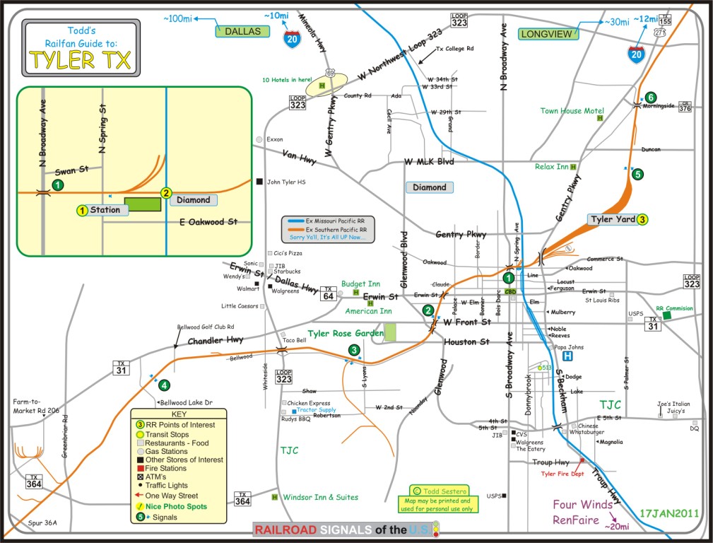
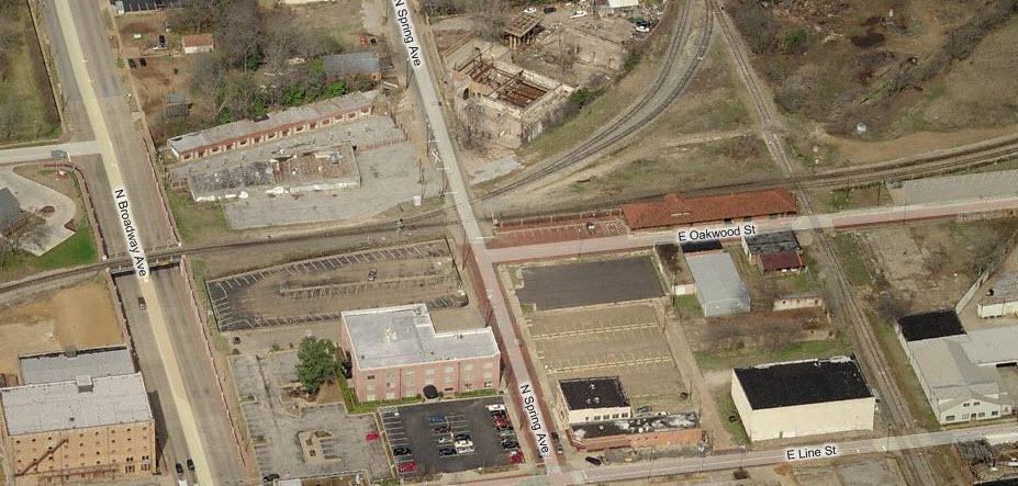
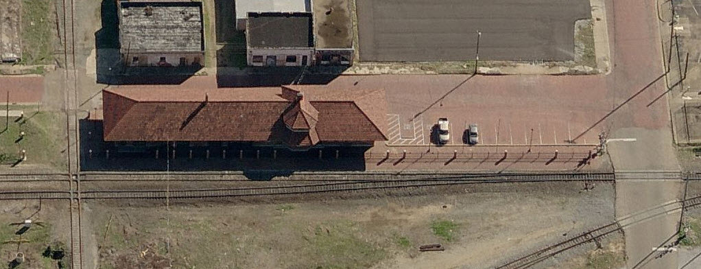
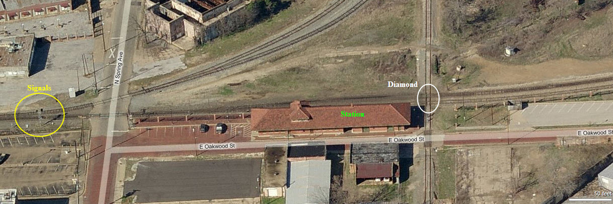
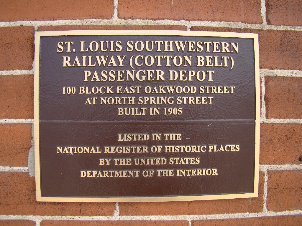
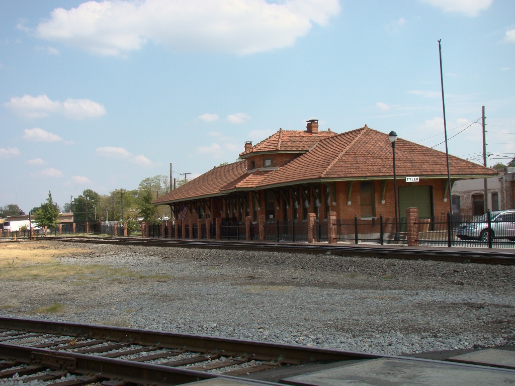
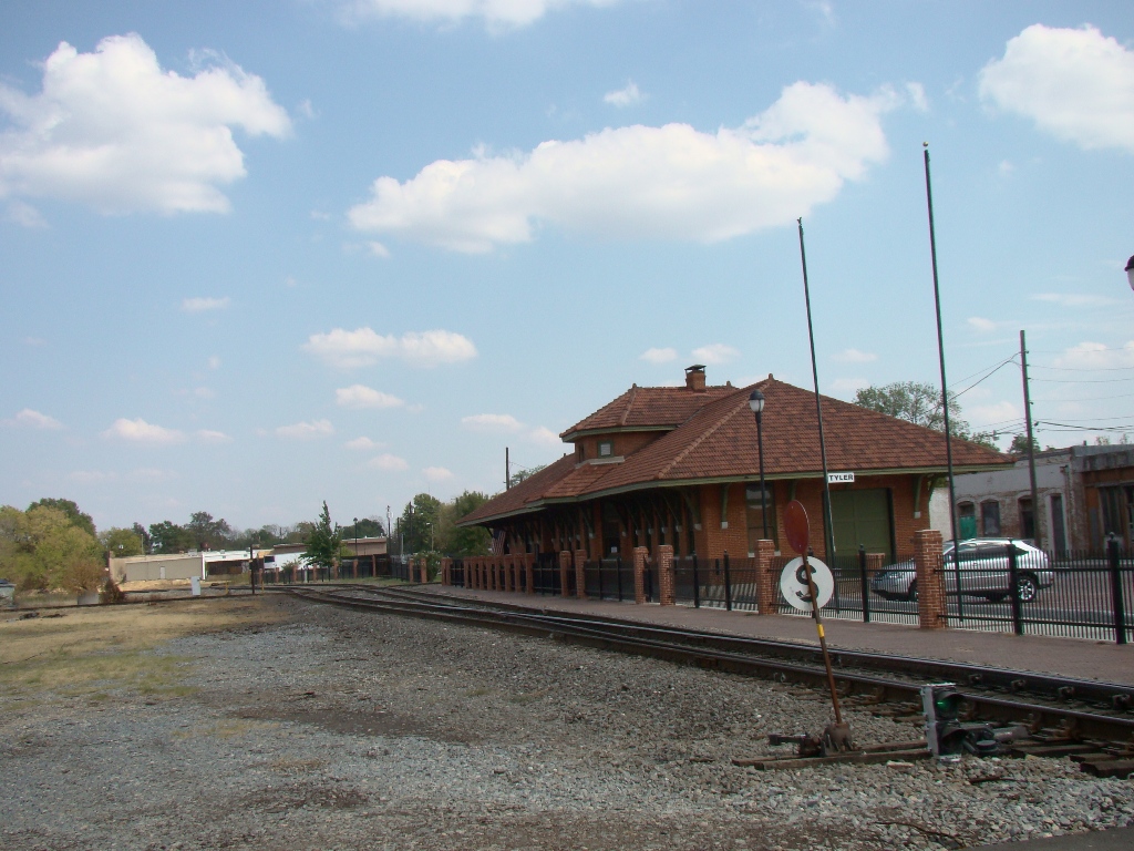
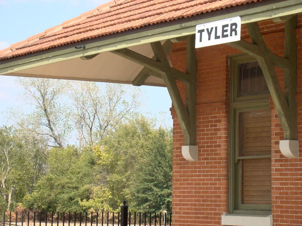
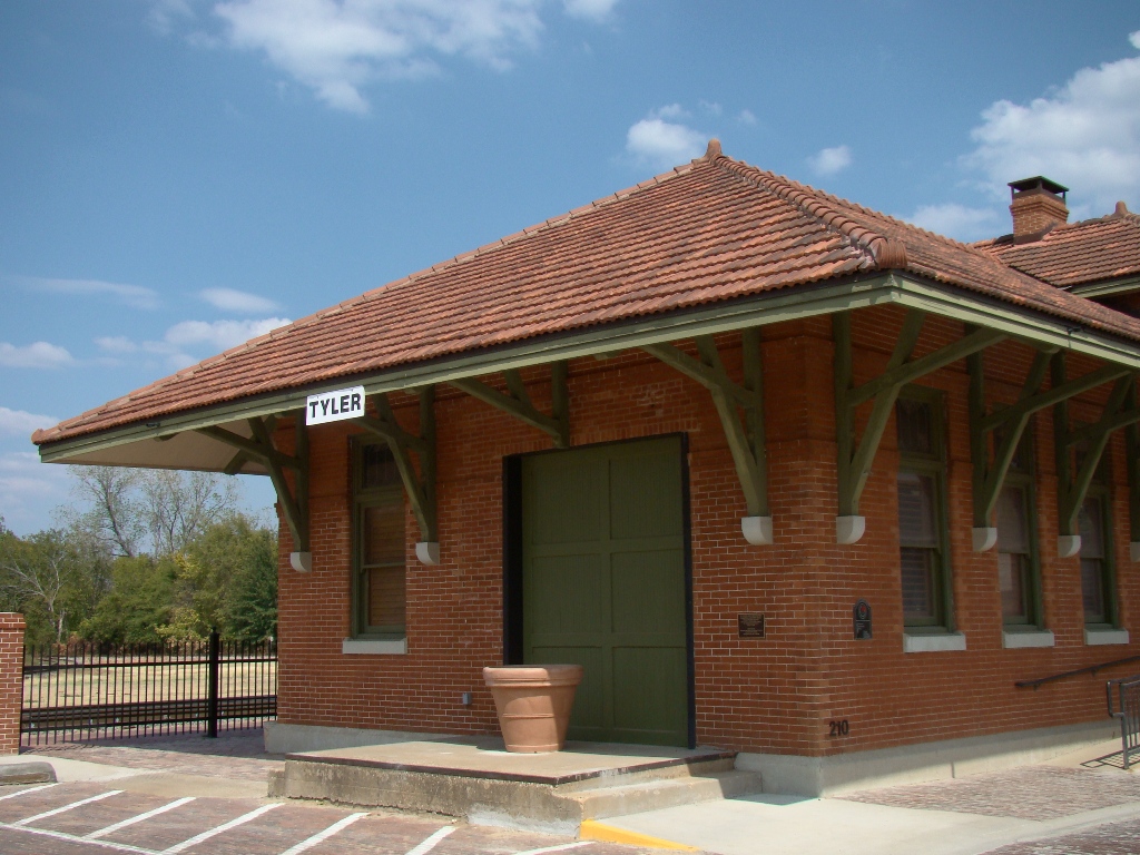
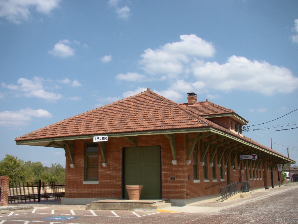
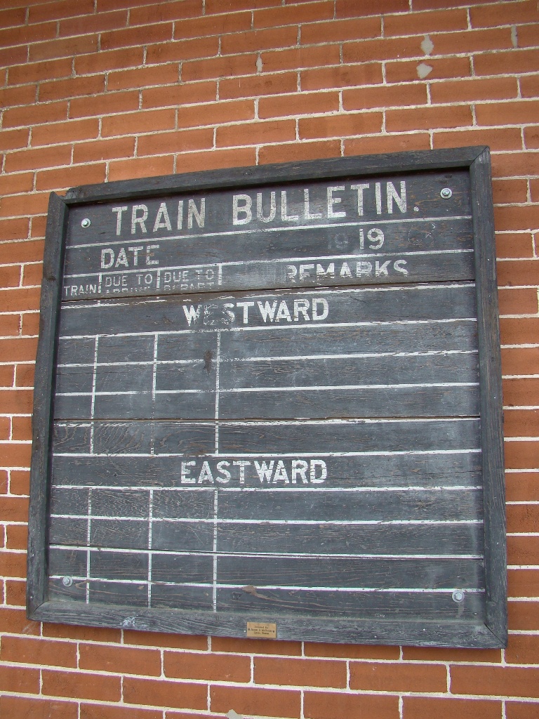
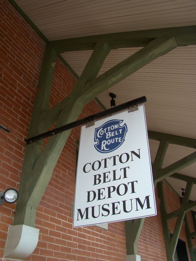
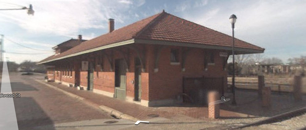
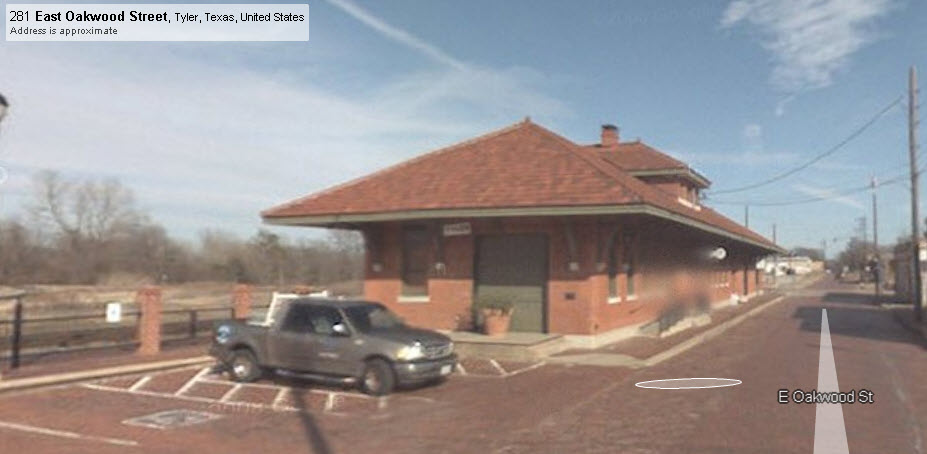
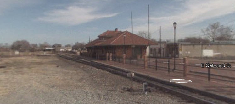
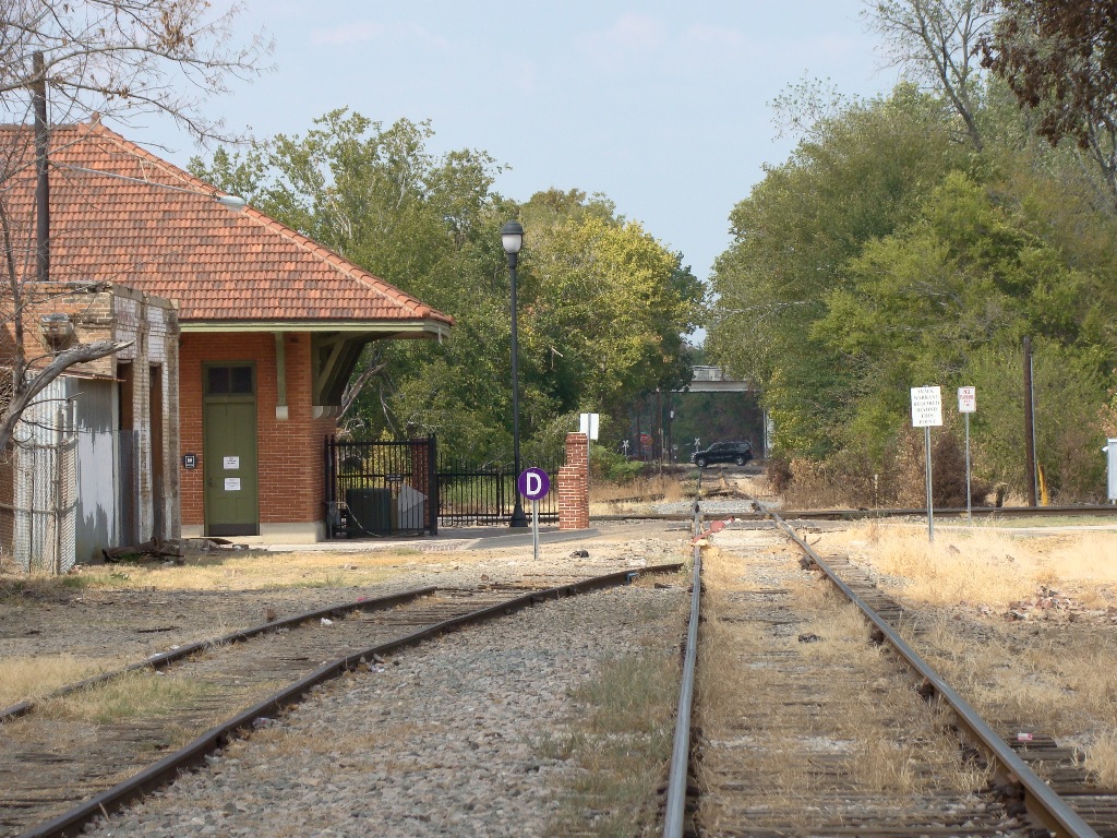
Tyler has a station still standing - the former Cotton Belt depot,
and it is home to a railroad museum: The Cotton Belt
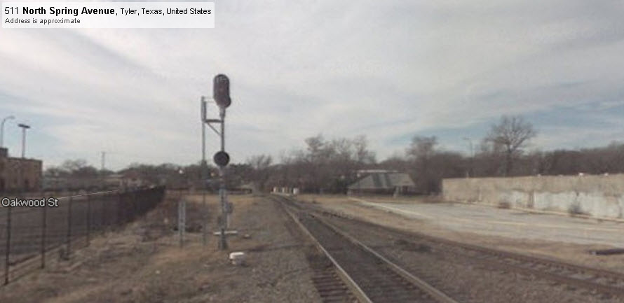
Depot Museum. The depot is located off of E.
Oakwood St, two blocks off of N. Broadway Ave, but you need to take E. Line St.
off of Broadway, and then north on E. Spring Ave.
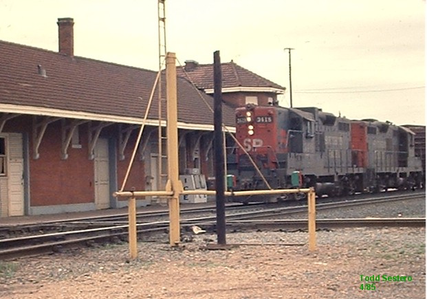
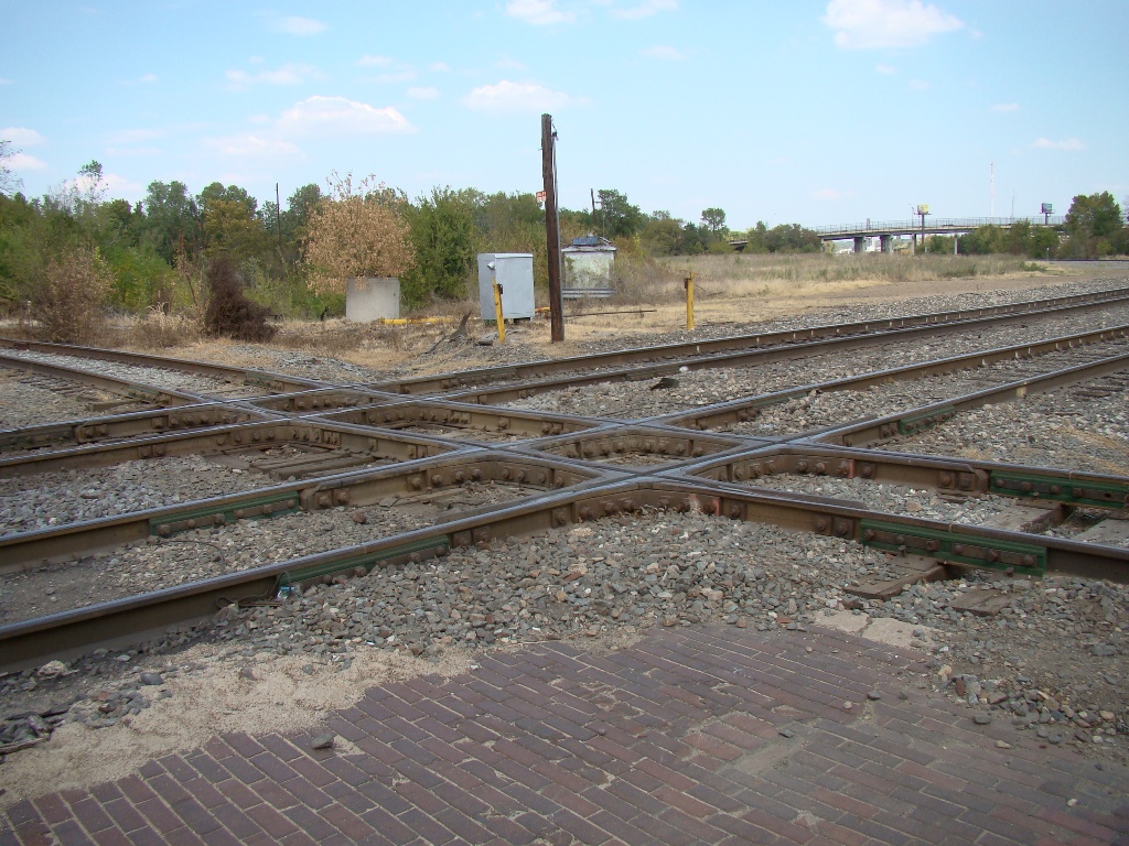
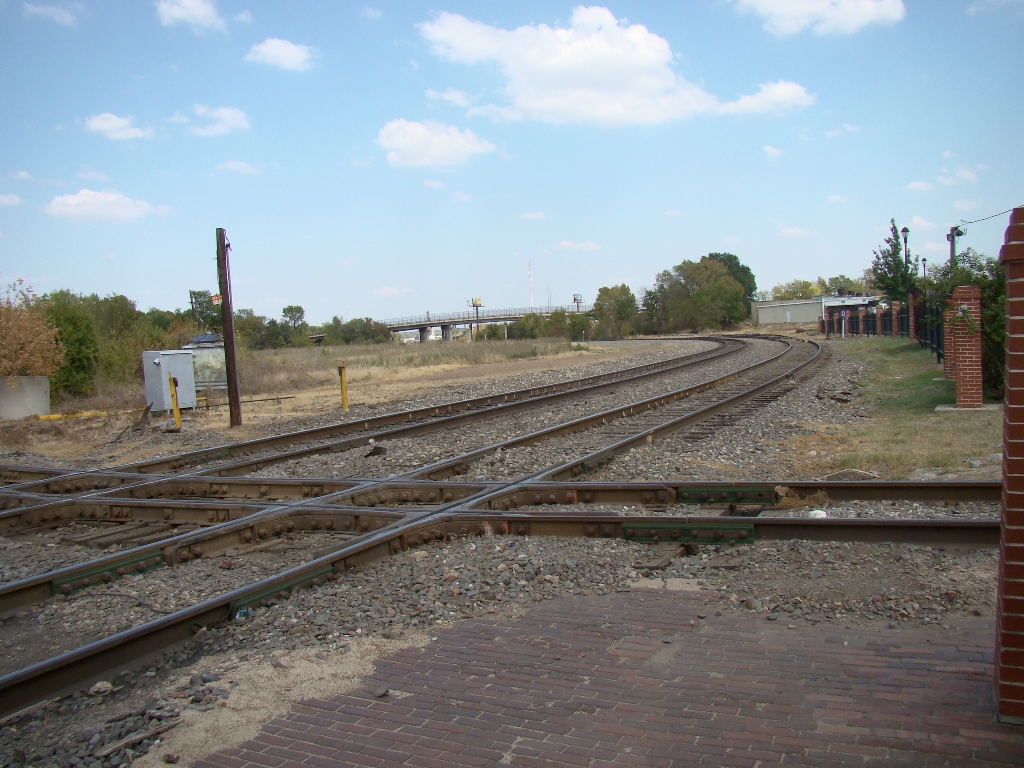
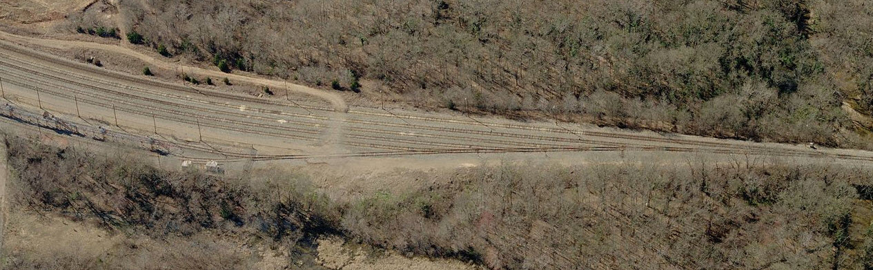
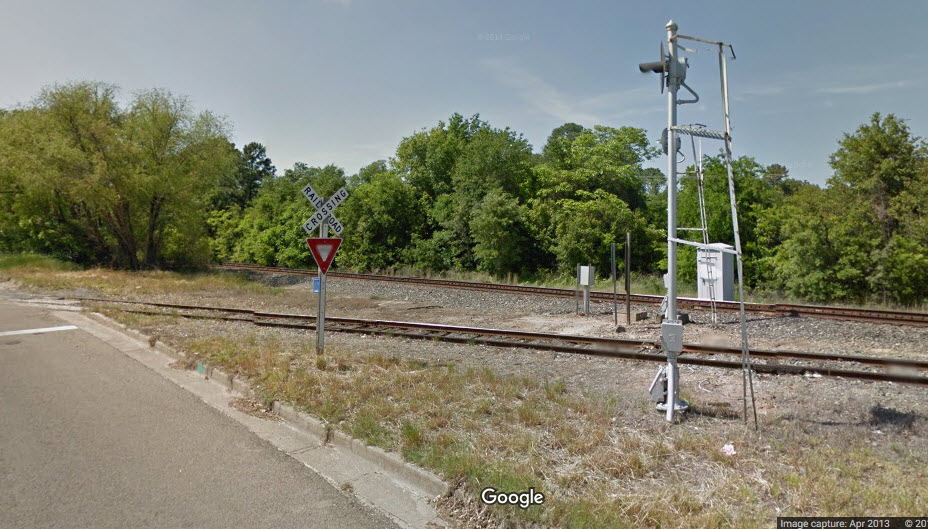
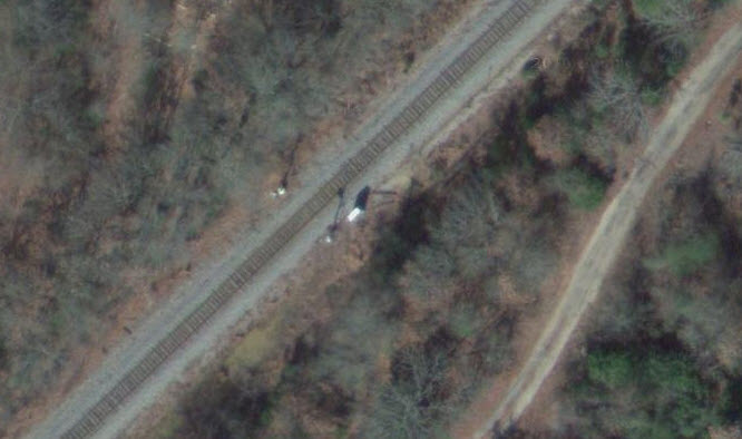
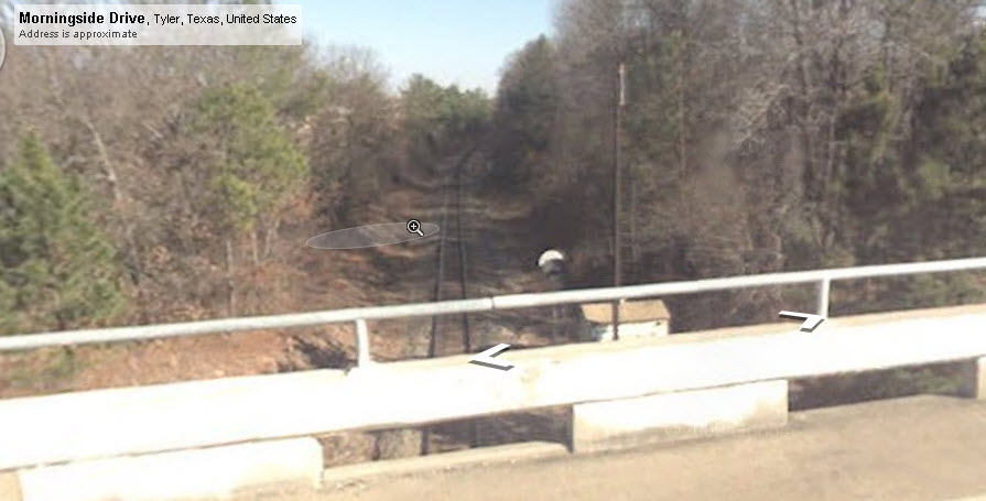
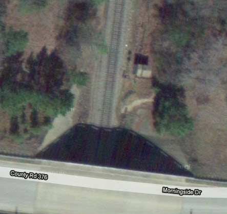
Adjacent to the depot is the former
CB-MP diamond, also known as Tower 183. This diamond
is was protected
by a simple swing gate. The Cotton Belt has the majority of traffic coming thru
here - even back in the 60's I only remember seeing only one train a day on the Mopac......
too bad, but I never paid it much mind.
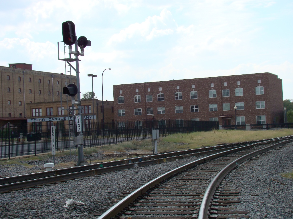
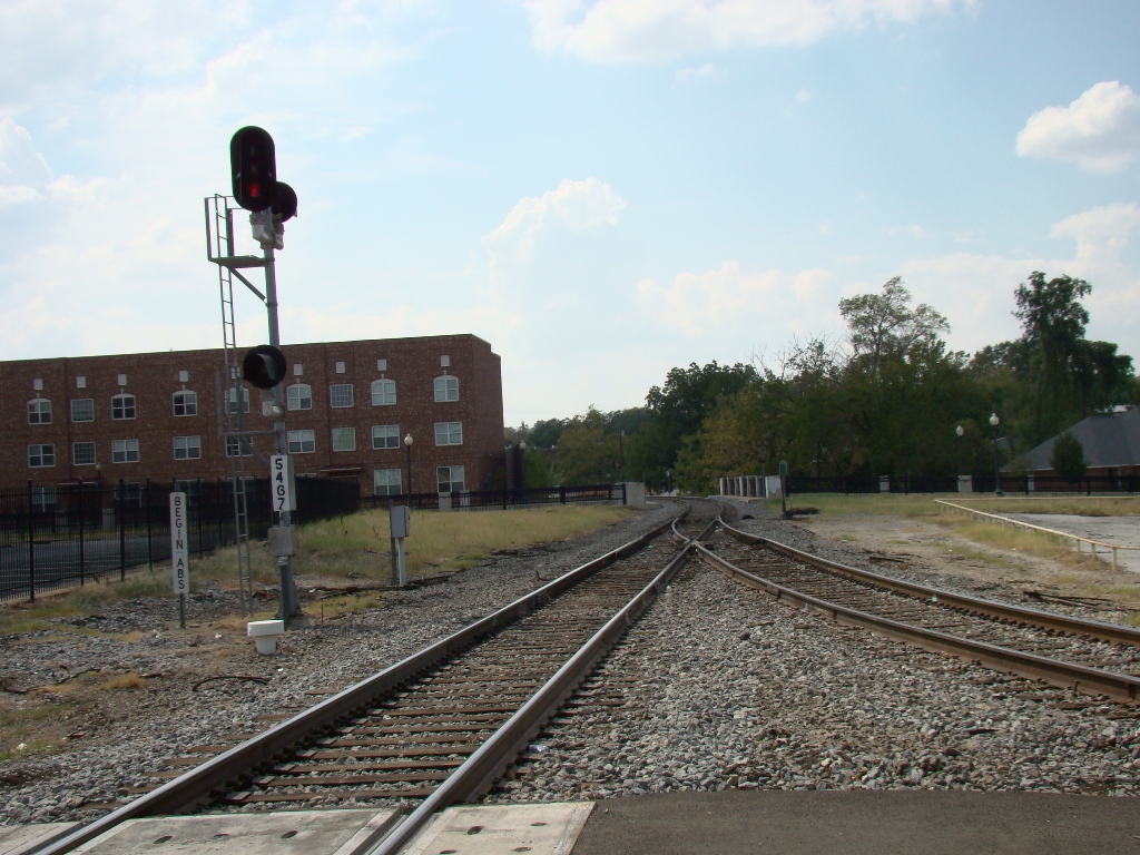
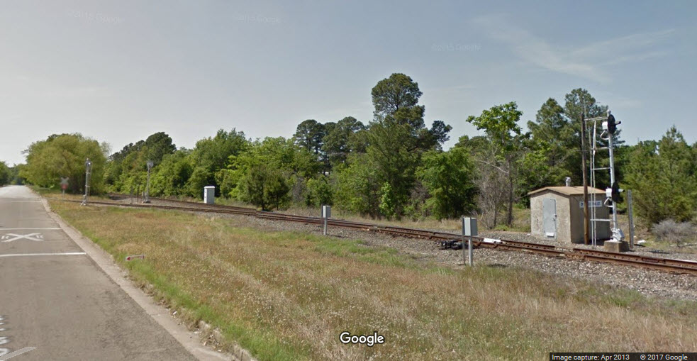
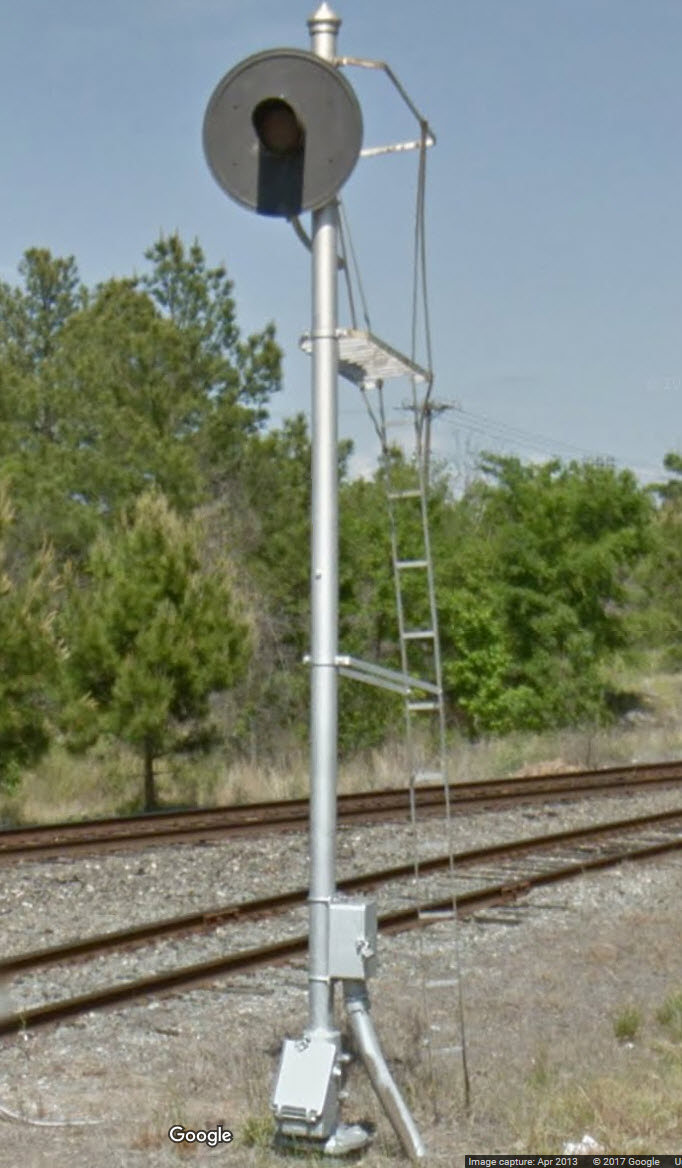
As far as signals go, there are
signals just off to the west side of the diamond, station, and Spring Ave.
They are also spaced at regular intervals, and I could use pictures of them if
anyone feels like going out and getting them for my page.
For additional information on
railfanning in Tyler, visit Ken Freeman's site.
There you will learn about the history of Tyler railroading all the way from the
"Tyler Tap" up to the current day.
One last note, if you are into
renaissance faires, one of the largest ones going was held south of Tyler every
spring, the Four Winds Renaissance
Faire, it has apparently "gone with the wind".
They also have/had a few special events in the fall such as a
Celtic Festival and a Steampunk get-together.
Pictures in and around the Tyler depot are courtesy Ken Freeman,
I've been looking for good ones for a long time. Thanks Ken!
An interesting side note: when we moved here in 1959, our phone number was
LY3-7074, the LY being for "Lyric". If you notice, several
of the phone numbers below on the matchbook covers, you will notice the
phone numbers are only four digits. If
you called within the LY3 area, you could get away dialing just four digits -
outside of LY3, you needed to dial five digits :-). I'm going to make an
assumption with my next statement: Prior to 1959 at some point, I'm sure there
were way less than 10,000 phones in Tyler, and all you had to do was dial four
numbers to dial anywhere in the city. Once they went over 10,000, they had
to add another relay in the central office to handle the extra digit, and they
added the LY1, 2, and 3. As I said, just guessing, but that would be a
logical assumption knowing how phones work.
I can always use additional pictures of Tyler..... if you have something to contribute, my email is below
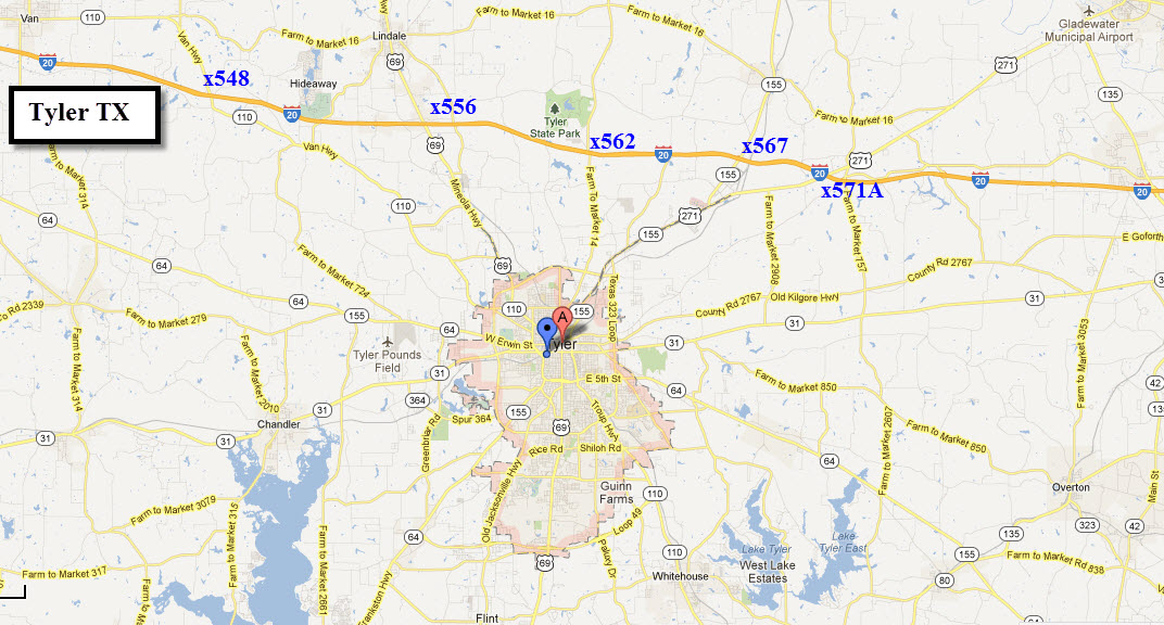
If you are coming from Dallas via I-20 exit 556,
downtown is about 9 miles off the interstate.
From the east via I-20, take exit 571A and come into Tyler via US271.
From the south, such as Houston, I would jump off I-45 at
exit xx and take US79 to Palestine, then head north to Tyler via 155.
If you're coming down from the north-east via I-30, through
Little Rock, I would probably opt for getting off at Mt Pleasant at exit 162A
and come into town via US271, never tried it, so I can't vouch for the routing.
Getting off at exit 162A vs exit 162 takes you by the small yard in Mt Pleasant.
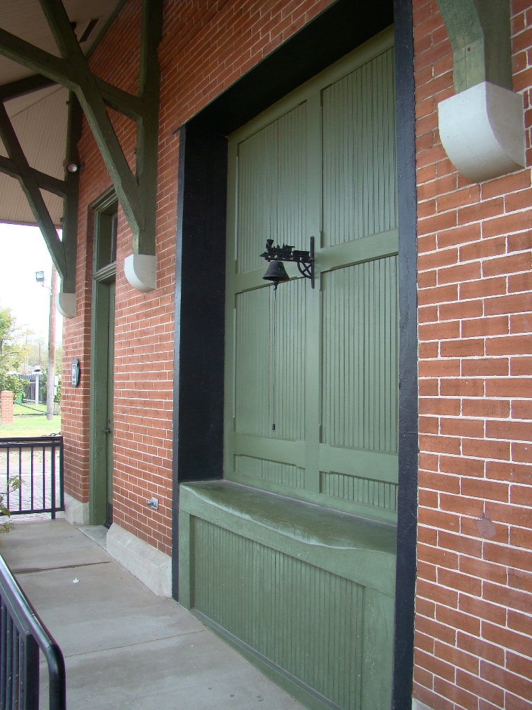
The depot is a former Cotton Belt station, and now houses
a museum. There's a lot more info on Ken's site!
The Cotton Belt Depot was opened to the public in 1905 and continued service
until the last passenger train, #8, departed in April 1956. In 1988 the
Southern Pacific deeded the depot to the City of Tyler. The City restored
the depot to her original beauty in 2003.
Photos by Ken Freeman.
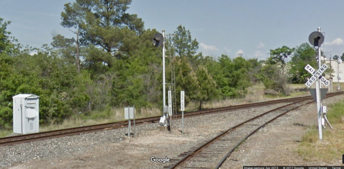
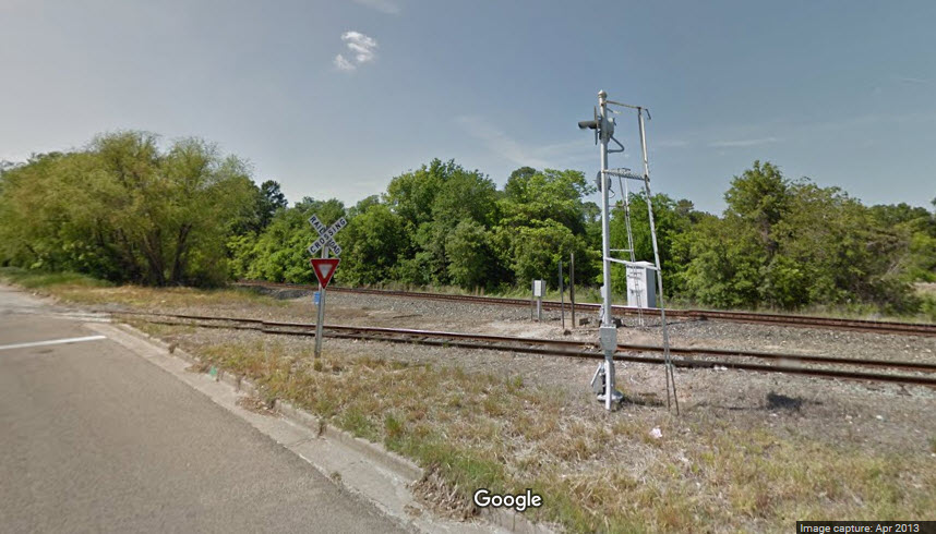
A few pictures of the depot from Google Street View:
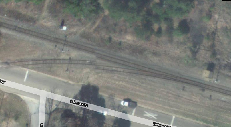
The Diamond / Tower 183
GPS Coordinates: 32.354844, -95.298460
The diamond is referred to as Tower
183. Almost all junctions and diamonds in Texas are numbered, something
set up by the state in the early days of railroading. It's kind of lucky
for us, for no matter where in the state towers were built, we have an orderly
record of them... it's too bad other states didn't do the same thing!
After leaving Tyler in 1964, I returned in 85 and 99, and the pictures below are
from then. Luck was with me for catching both a Mopac and Cotton Belt
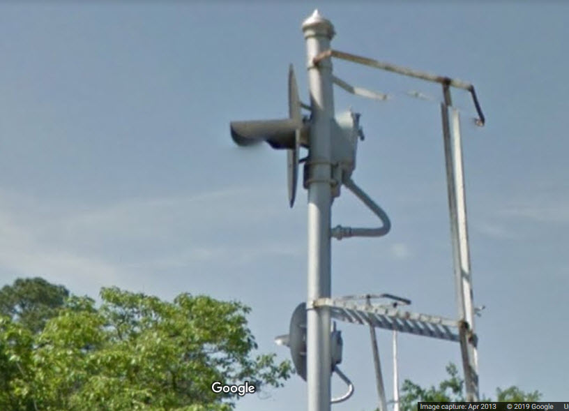
freight at the gate in 85. It appears that the red/green reflectors on
the arm disappeared over the years.
You will notice, in the pictures from Ken, that the gate has been taken down completely :-(
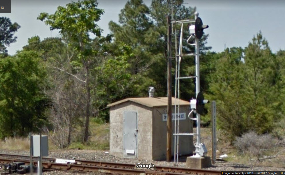
I wonder if the UP has replaced these signals with standard Darth Vader type colorlight signals yet?
Looking at this screenshot, it appears that the signal closest to us is a GRS
searchlight, while the one farther away from us, is a US&S searchlight,
if not, they mixed up the hoods! :-).
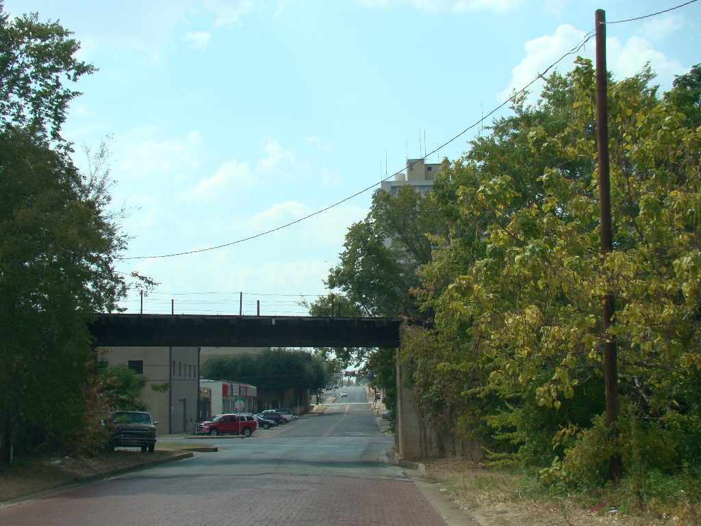
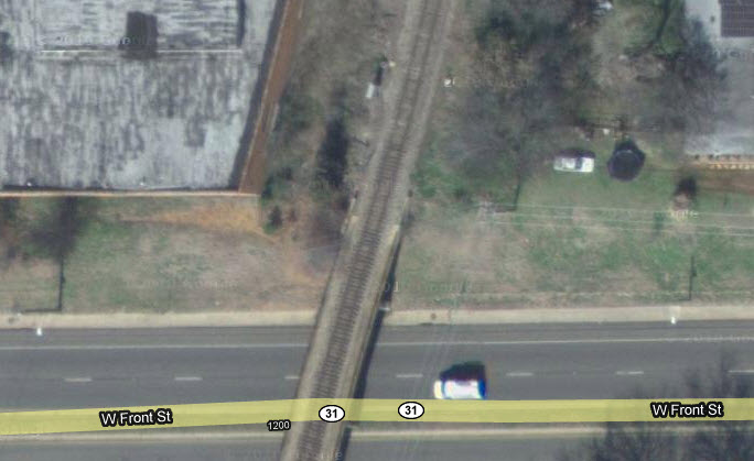
Overpass at Front St with Cotton Belt still on it, photo by Ken Freeman.
Both sides of the overpass, from Bing Maps, 2024 streetview, but taken in 2019.
Google does not have any streetviews, at least on Front St, and Bing has very
limited and old views.
The former headquarters of the Cotton Belt in Tyler at 1517 West Front Street - photo by Ken Freeman.
OK, time for a little time traveling.....
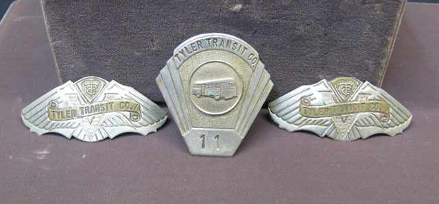
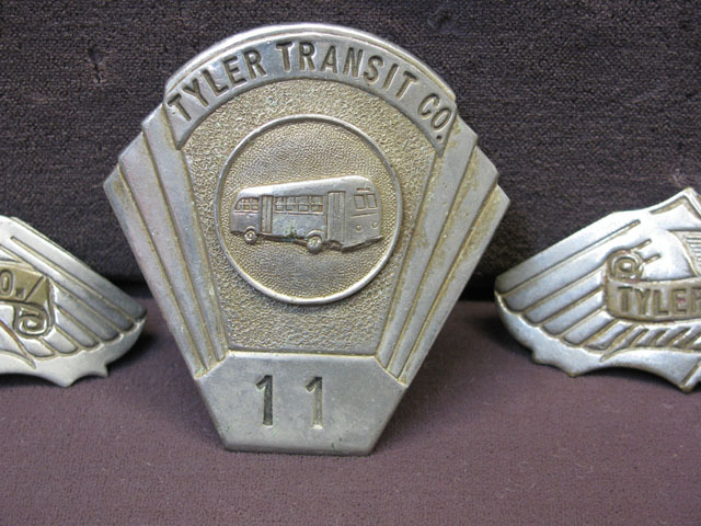
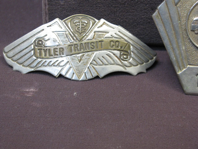
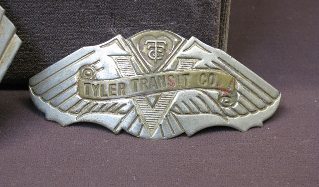
Some of the items below are from my own collection of "stuff" :-)
It's rare to find something like this on EBay, especially something train
oriented, so I had to buy the darn thing LOL.
Envelopes commemorating flights out of Pounds Field:
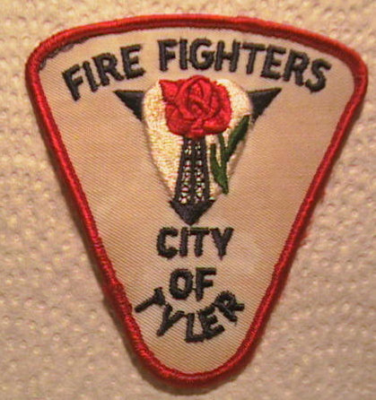
The left patch I traded for on my 1985 trip....
These things were all over the place when we moved here in 1959!!!
1909
1930's
1922
1800's
1937
1912
1945
Very early Rose Gardens/1948
These showed up on EBay a couple of years ago.... nice....
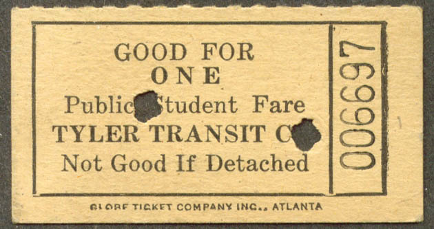
TTC tokens from the 1930's.
A couple of ham radio and CB QSL cards.....
Disclaimers:
New format 10/26/23: Please check out my disclaimer page for my standard
dribble and contact info here


 Photos by Ken Freeman.
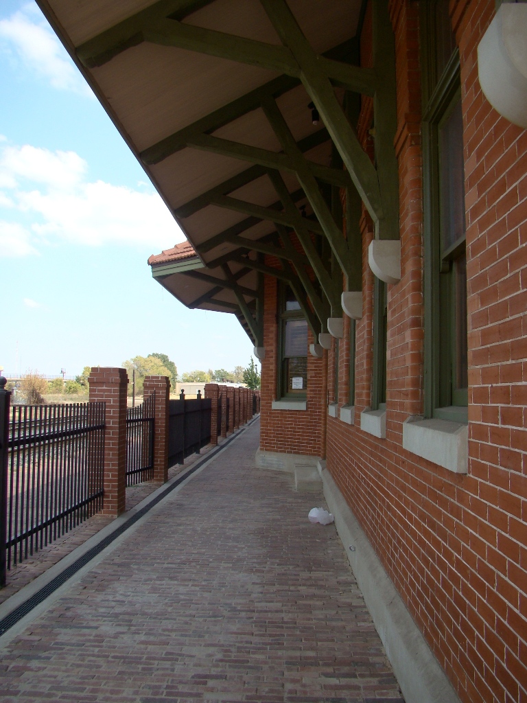


 Looking north across the diamond.
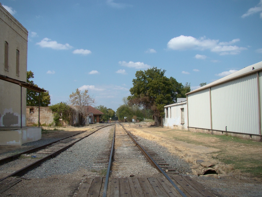 Photos by Ken Freeman.
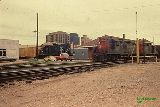


1909
1930's
1922
1800's

1937

1912

1945

Very early Rose Gardens/1948