
In General
Getting Here
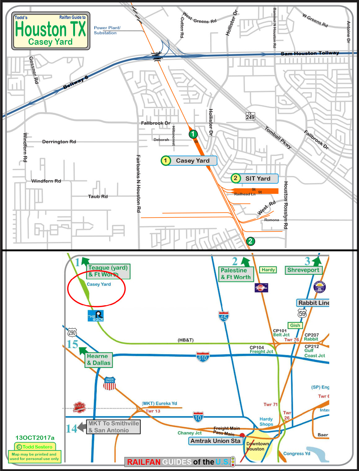
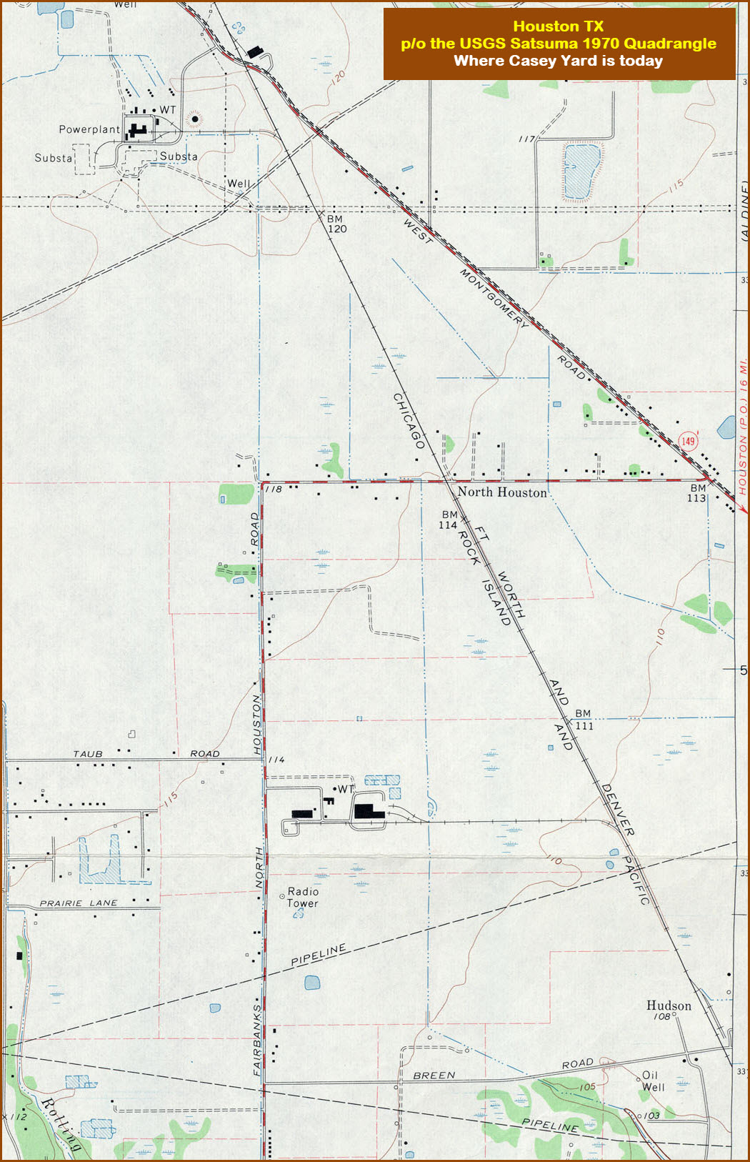
Map
Pictures
Signals
Floobydust
USGS Maps
RAILFAN GUIDES HOME
RAILROAD SIGNALS HOME
Location / Name:
NW Houston TX, Harris County
What's Here:
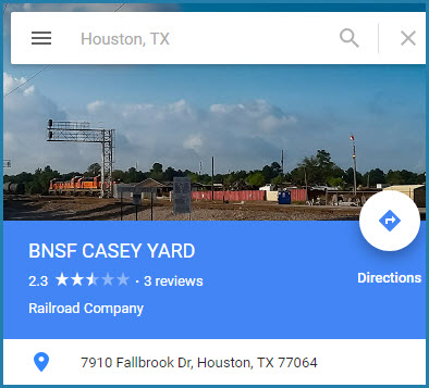
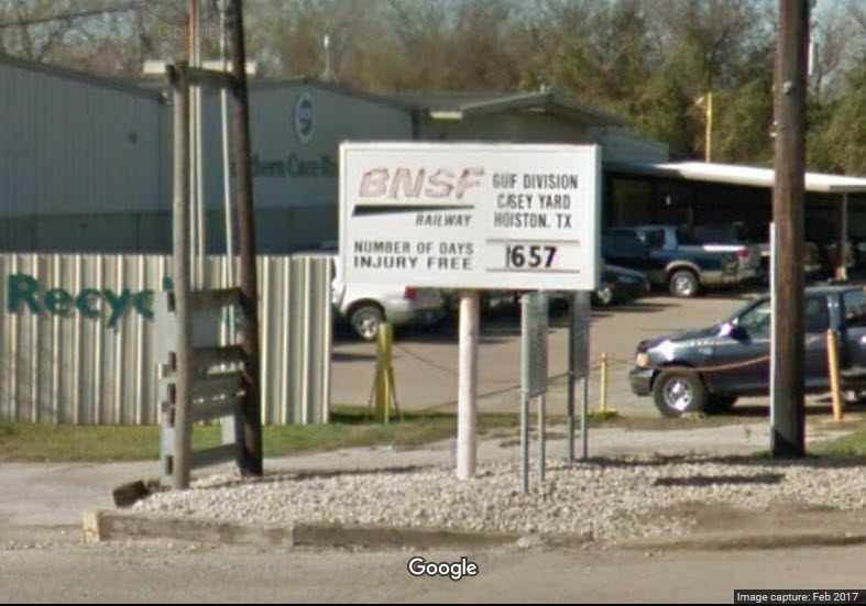
Casey Yard
18 Track SIT Yard
Note: The SIT yard is inside the city limits, Casey yard is not
Data:
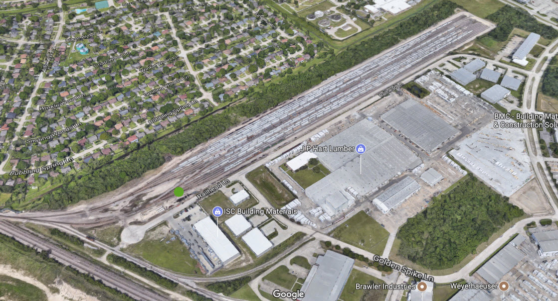
GPS Coordinates: 29.921464, -95.513276 (center of Casey)
Phone A/C: 281
ZIP: 77086
Access by train/transit:
None
The Scoop:
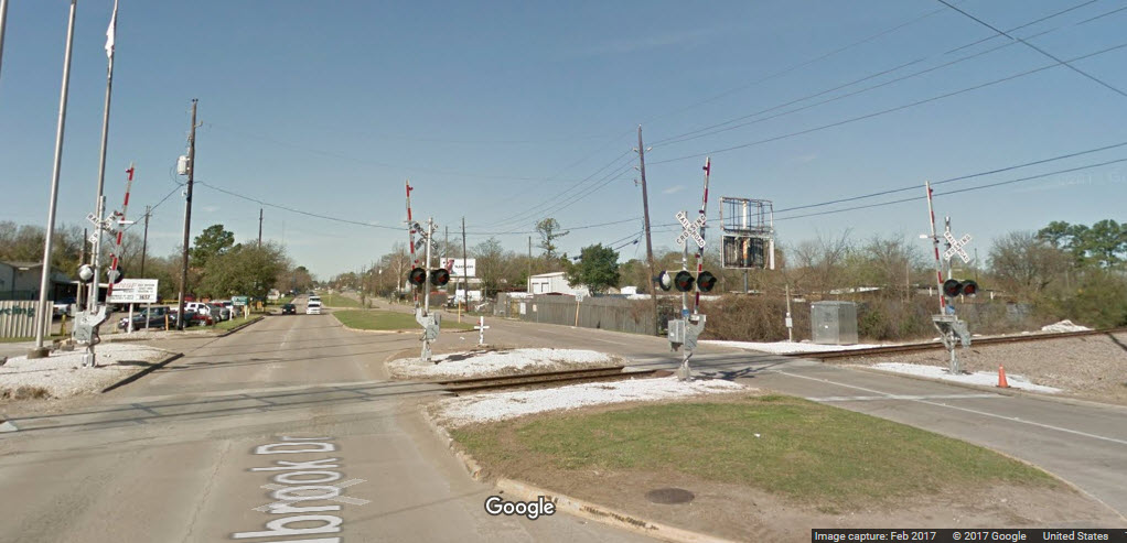
Casey Yard is a small 6 track yard on the former Rock Island line which ran from Galveston to Teague and Ft Worth and beyond. It is now BNSF. The north end of the yard from Fallbrook is your only real safe vantage point, as there are no other roads that cross the yard. You can try going down Hiltoncrest and then across on Deborah St to see if you have a better vantage point if engines are around, but they often have equipment parked that gets in your way.
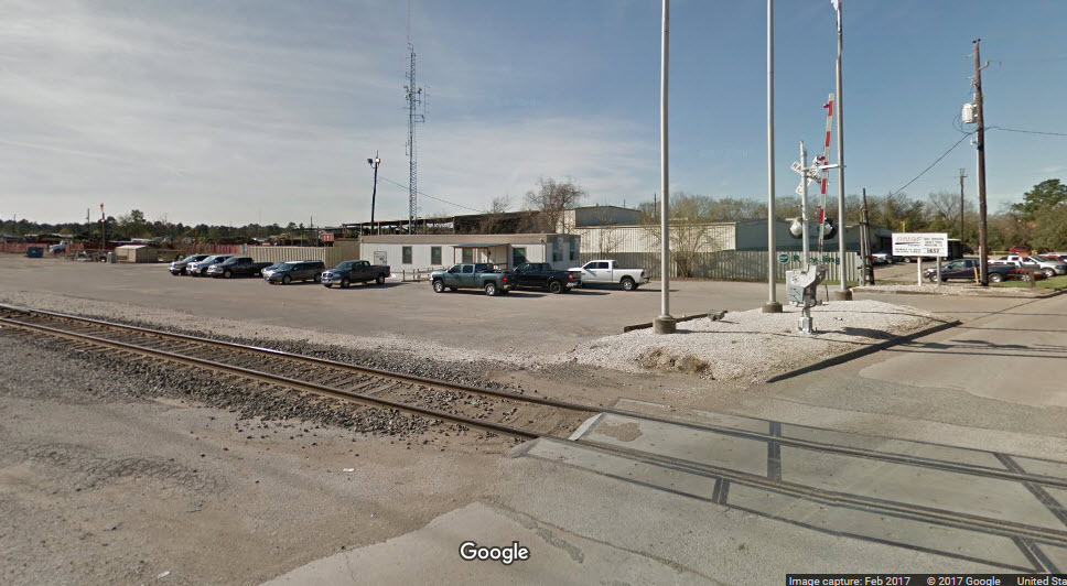
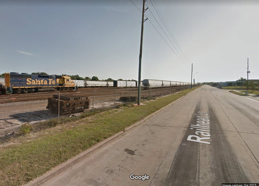
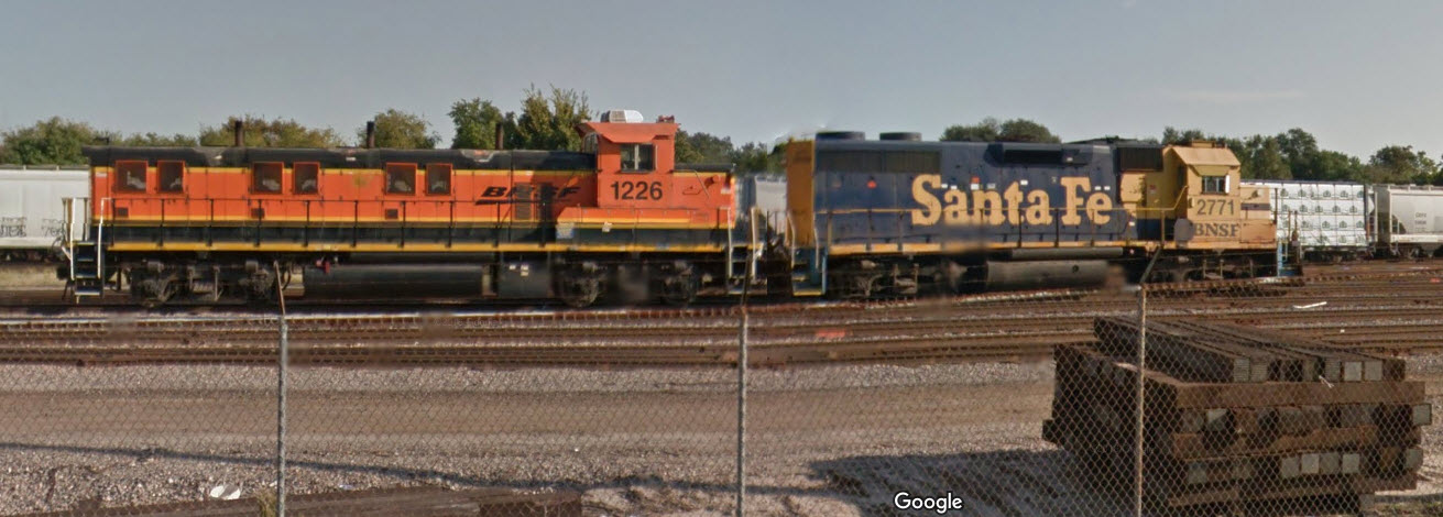
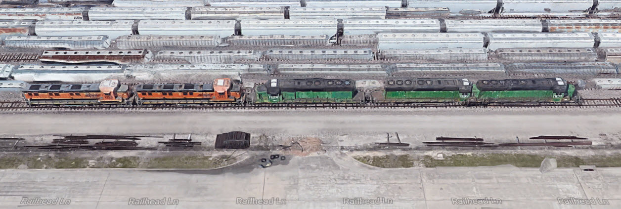
The SIT yard is easy to access from Railhead Lane, which comes off West Rd via North Houston Rosslyn Rd. Engines are at the west end of the yard, on the track closest to Railhead if around.
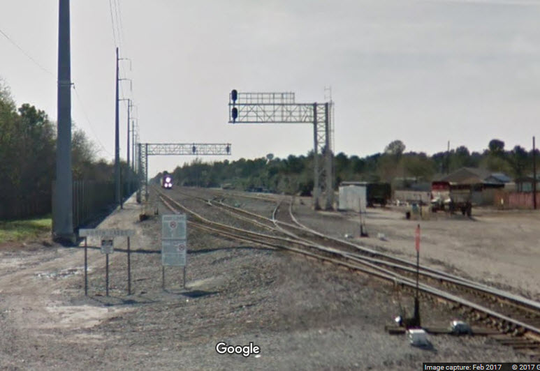
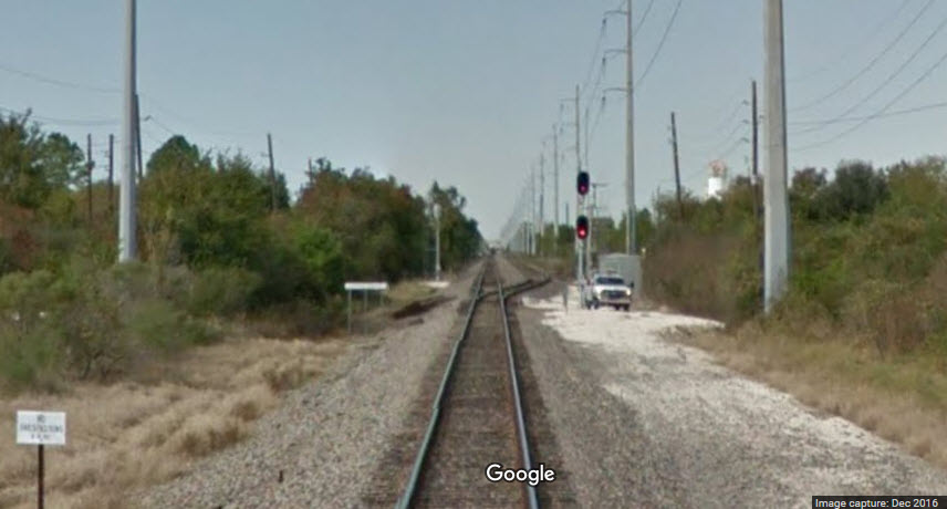
Not much in the way of signaling that I can see that you safely have access to, except for the two signal bridges at the north end of Casey Yard, and an interlocking north of Breen Dr.

Acknowledgements:
Steve Sandifer
Websites and other additional information sources of interest for the area:
https://railfanguides.us/system/rockisland/index.htm
You can take the Sam Houston Tollway, Hwy 8, to Tomball Pkwy (249), and head south 1-1/4 miles to Fallbrook Dr. Take a right onto Fallbrook, and you will come to the north end of the yard in slightly less than a mile. An alternative to get away from the tolls is to take I-45 out of Houston, and then hopping on 249 to Fallbrook.
To get to the SIT yard, go down Tomball from the Sam Houston 1-3/4 of a mile, and hang a right onto N Houston Rosslyn Rd. then about 2/3 of a mile to West Rd, take another right, and then almost immediately, take a right onto Railhead Ln. This curves around and parallels the yard. Engines, if there, will be at the far end of the yard.

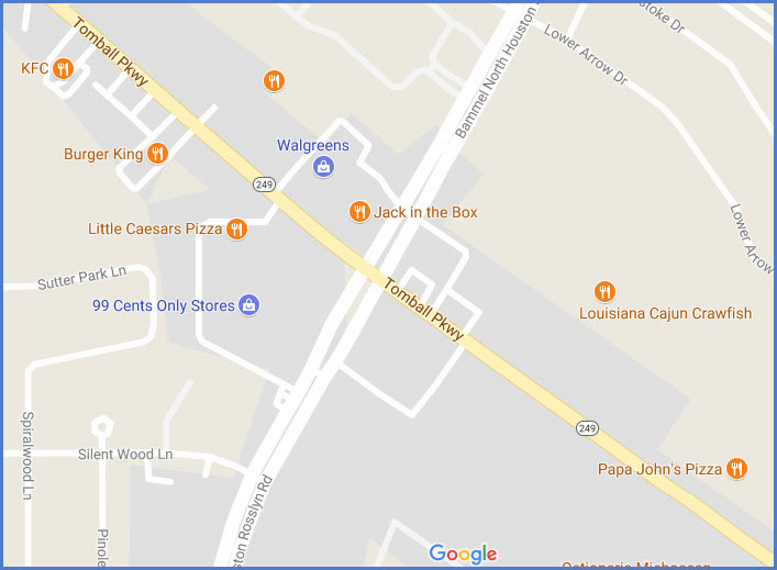
If you're looking for some quick eats while in the vicinity of the SIT Yard, there are quite a few choices around Tomball and Houston-Rosslyn.
The above map in PDF format is
here
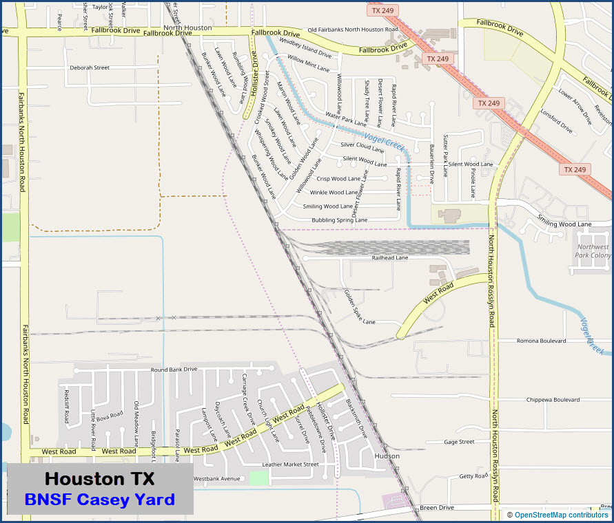
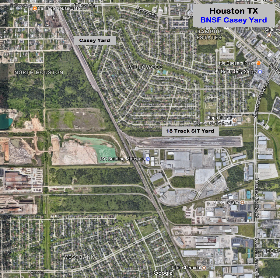


If you love gray colored centerflows, you're going to love it here! :-) If engines are around, and idle, they will usually be found at the west end of the yard along Railhead Ln, where the green dot is. It looks like this yard was probably built in the late 1980's, for it is not on the 1982 map, but IS on the 1995 map.


These signals are at the north end of the yard..... Looking south from Fallbrook Dr.
North of Breen Dr.
None so far
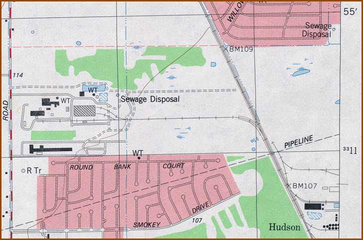
The power plant at the top of my map, is now an abandoned siding, not connected to the main line anymore.


Courtesy of the University of Texas Library, click here for their index page.
Disclaimers:
I love trains, and I love signals. I am not an expert. My webpages reflect what I find on the topic of the page. This is something I have fun with while trying to help others.
Please Note: Since the main focus of my two websites is railroad signals, the railfan guides are oriented towards the signal fan being able to locate them. For those of you into the modeling aspect of our hobby, my indexa page has a list of almost everything railroad oriented I can think of to provide you with at least a few pictures to help you detail your pike.
If this is a railfan page, every effort has been made to make sure that the information contained on this map and in this railfan guide is correct. Once in a while, an error may creep in :-)
My philosophy: Pictures and maps are worth a thousand words, especially for railfanning. Text descriptions only get you so far, especially if you get lost or disoriented. Take along good maps.... a GPS is OK to get somewhere, but maps are still better if you get lost! I belong to AAA, which allows you to get local maps for free when you visit the local branches. ADC puts out a nice series of county maps for the Washington DC area, but their state maps do not have the railroads on them. If you can find em, I like the National Geographic map book of the U.S..... good, clear, and concise graphics, and they do a really good job of showing you where tourist type attractions are, although they too lack the railroads. Other notes about specific areas will show up on that page if known.
Aerial shots were taken from either Google Maps or www.bing.com/maps as noted. Screen captures are made with Snagit, a Techsmith product... a great tool if you have never used it!
By the way, floobydust is a term I picked up 30-40 years ago from a National Semiconductor data book, and means miscellaneous and/or other stuff.
Pictures and additional information is always needed if anyone feels inclined to take 'em, send 'em, and share 'em, or if you have something to add or correct.... credit is always given! Please be NICE!!! Contact info is here
Beware: If used as a source, ANYTHING from Wikipedia must be treated as being possibly being inaccurate, wrong, or not true.
RAILFAN GUIDES HOME
RAILROAD SIGNALS HOME
NEW
10/09/2017
Last Modified
15-Oct-2017