RAILFAN GUIDES of the U.S.
Todd's Railfan Guide to
FT WORTH
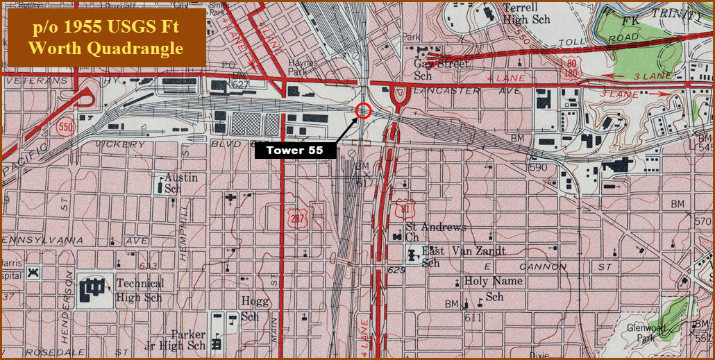
Tower 55
In General
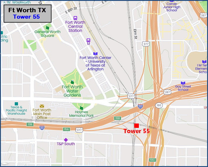
Getting Here
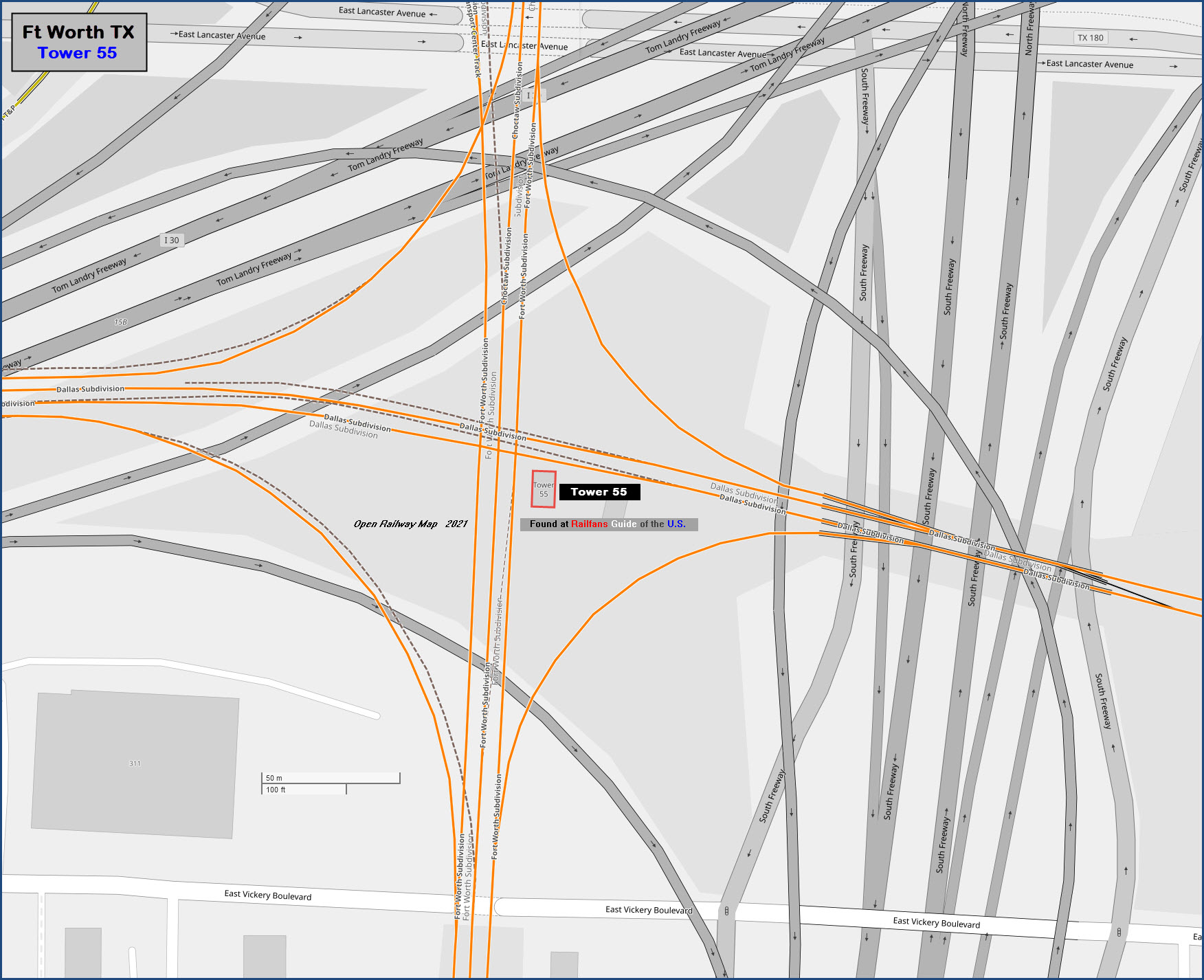
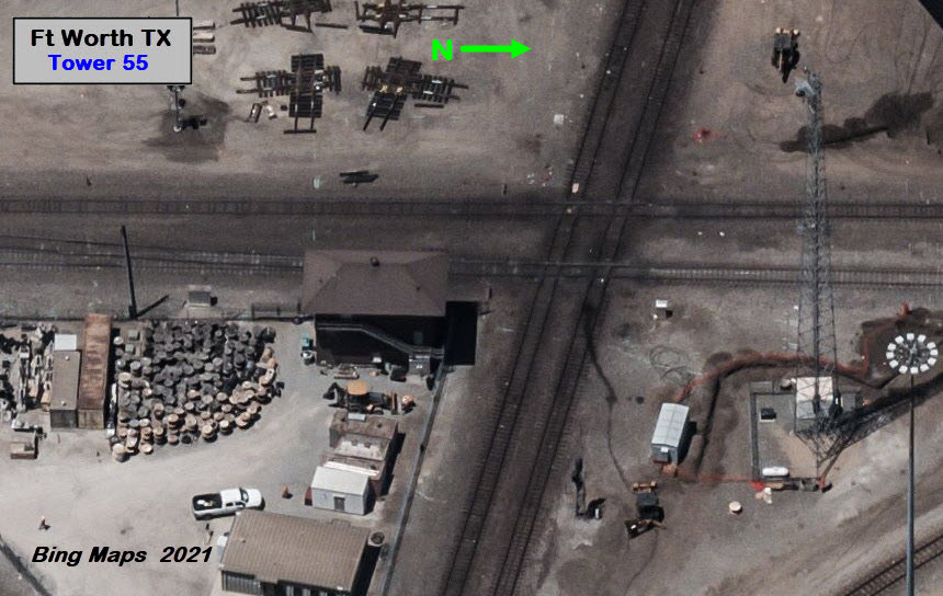
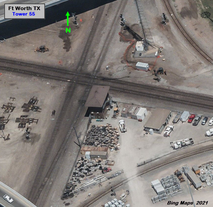
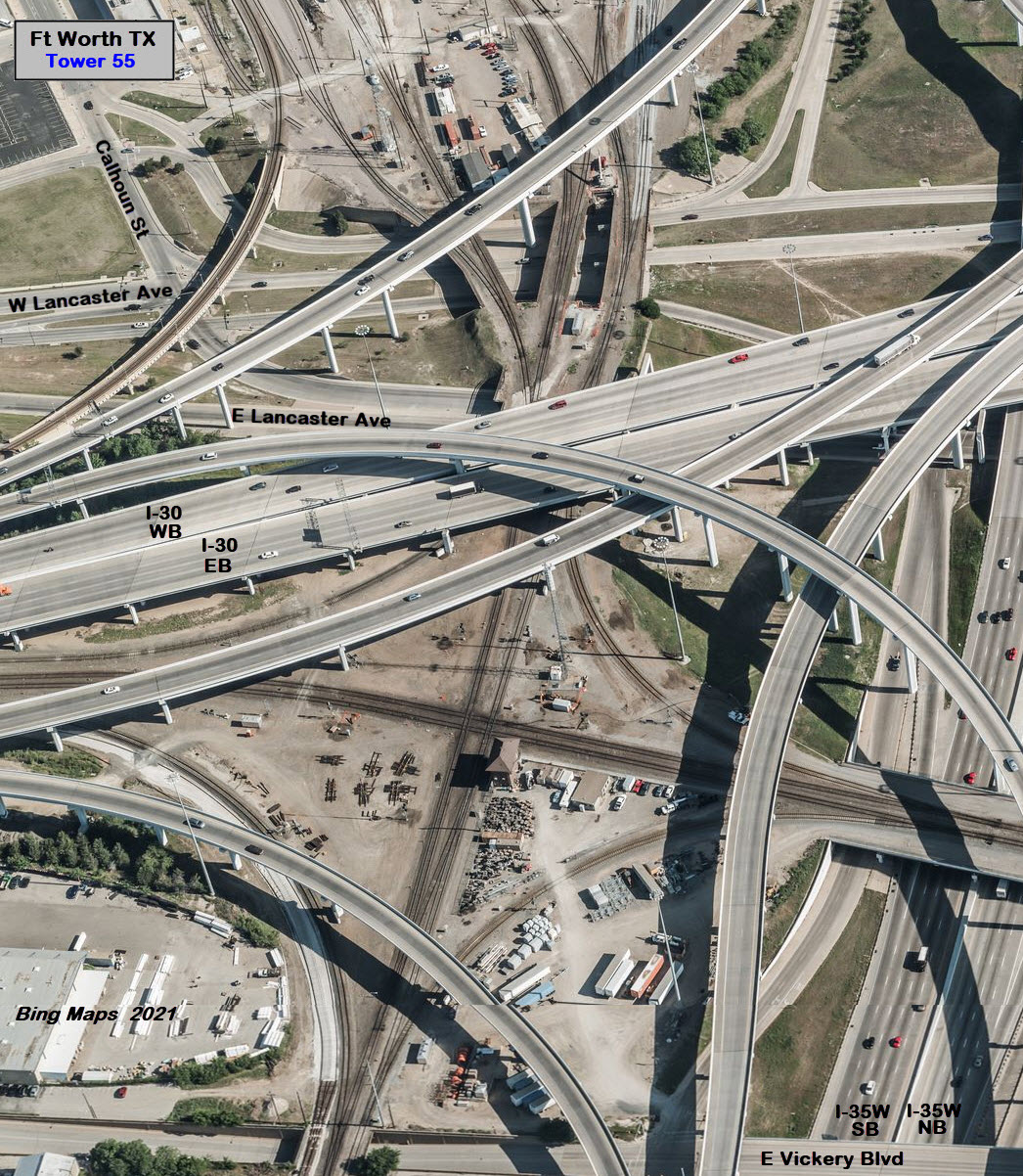
Map
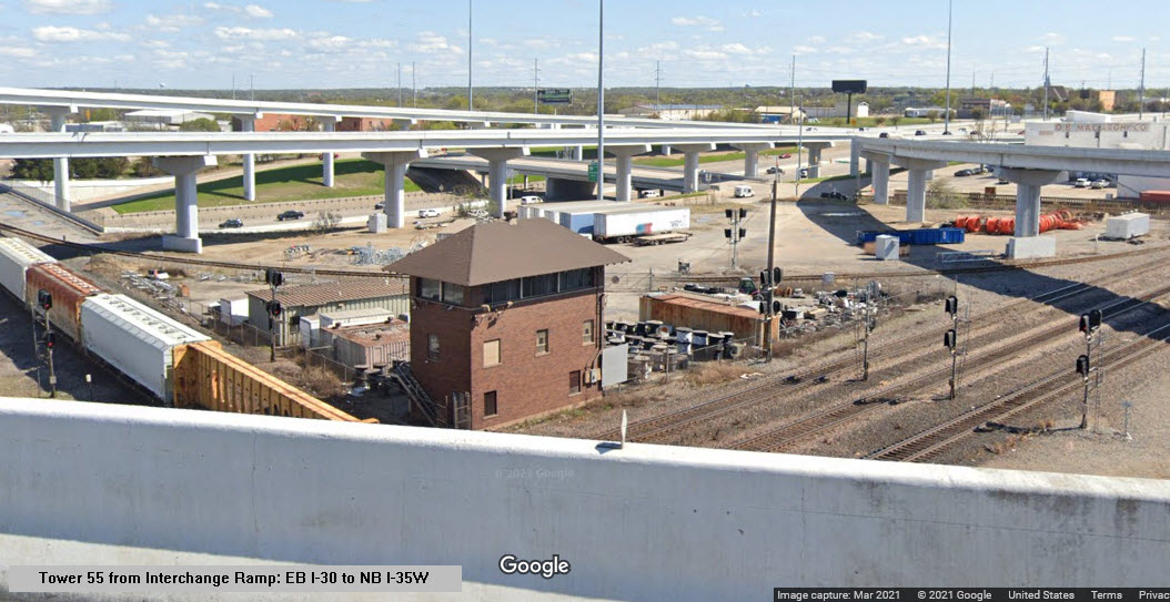
Pictures
Bridges
Signals
The Upgrade
Some History
Floobydust
USGS Maps
RAILROAD SIGNALS HOME
Location / Name:
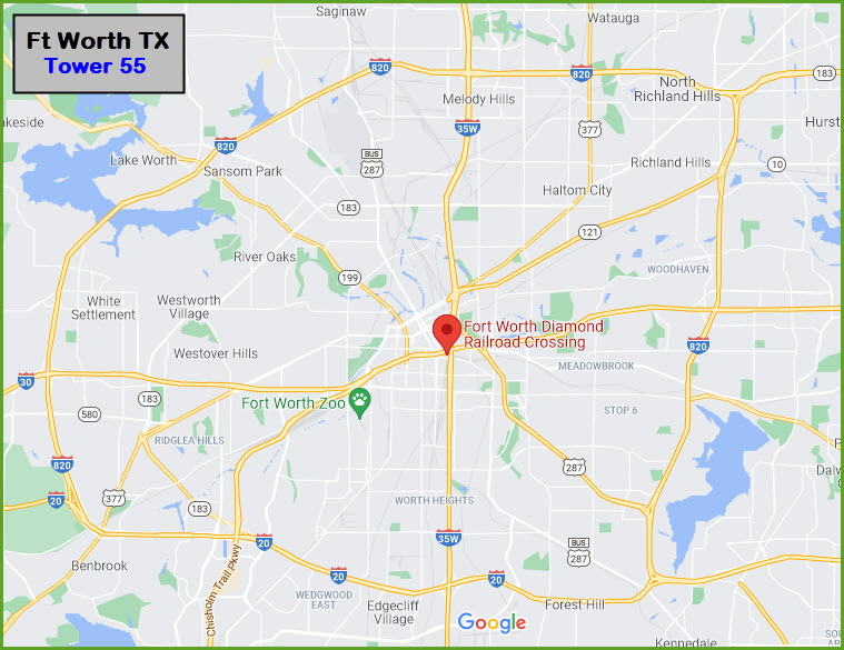
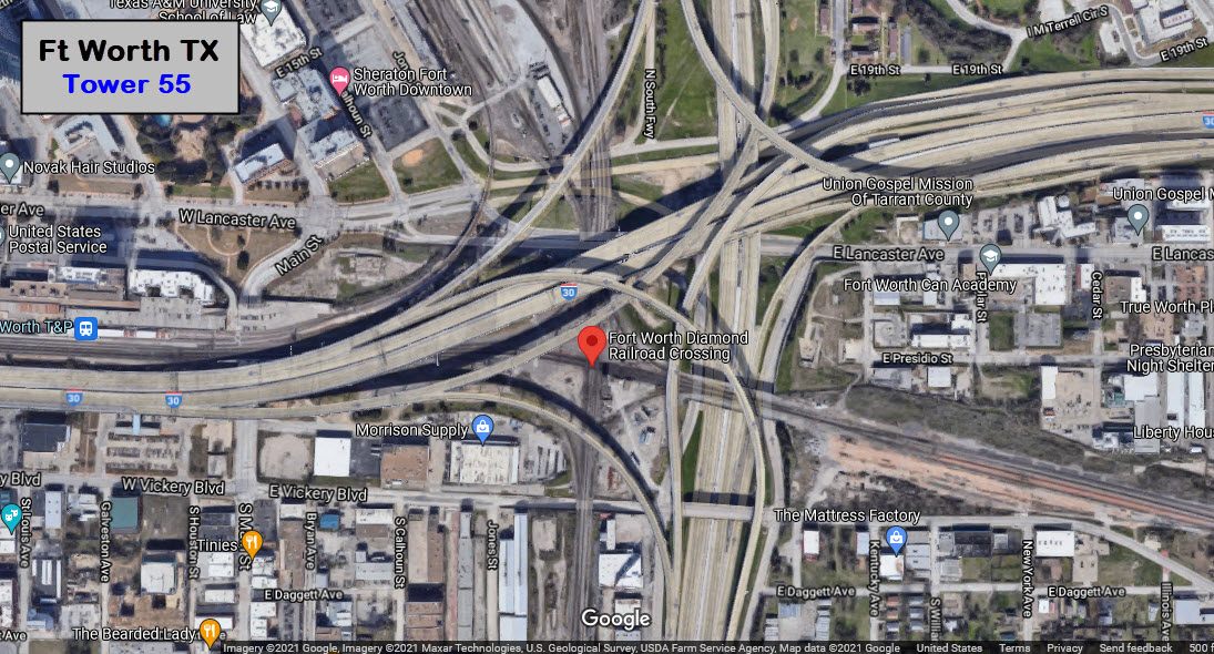
Ft Worth TX, Tarrant County
What's Here:
Tower 55
Diamond
Data:
GPS Coordinates: as 32.74496, -97.32142
Phone A/C: 817
ZIP: 76102
Access by train/transit:
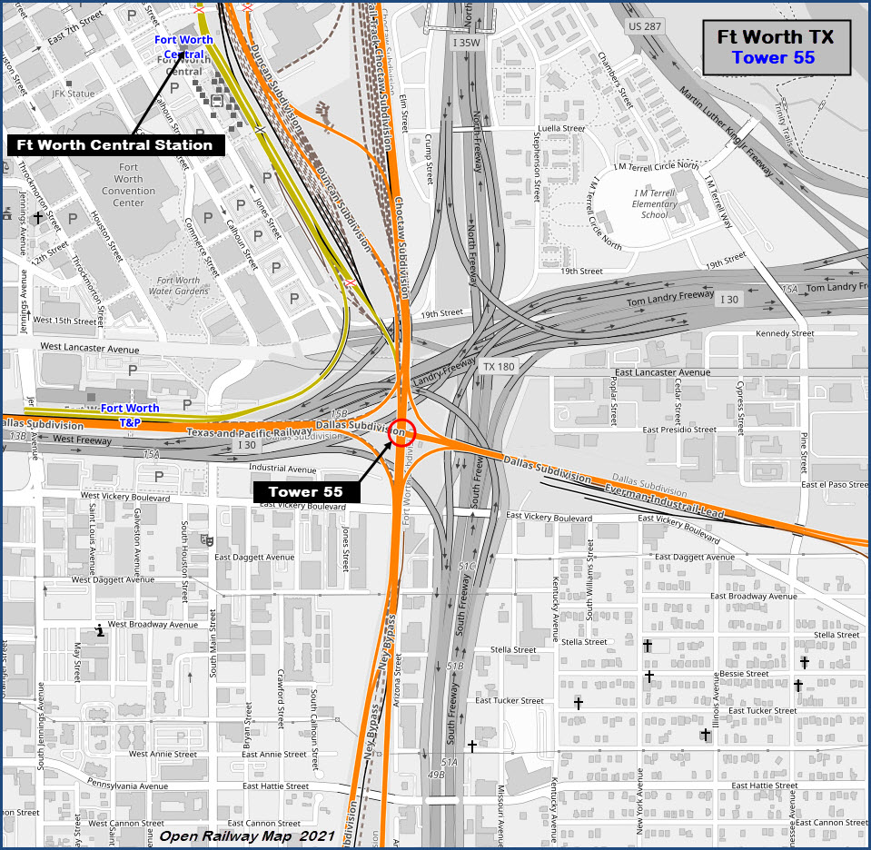
the Ft Worth Central Station is a few blocks (~ half mile) to the north, here you have:
Amtrak
TexRail
TRE (Trinity Rail Express)
The Scoop:
Tower 55 in Ft Worth is one of the busiest diamonds/interlockings outside of Chicago. There is something going on almost every minute of the day. It is a grade-level crossing of the double-track east/west Union Pacific line (ex-Texas & Pacific) and (the now) triple-track north/south BNSF main line (ex-AT&SF).
Trains came to Ft Worth in 1876, and Tower 55 became part of the landscape in 1904 - It was commissioned by the Railroad Commission of Texas (RCT) on September 26, 1904.
When I visited the Dallas/Ft Worth area in 1985, I remember the area being more open - I have to find my slides :-)
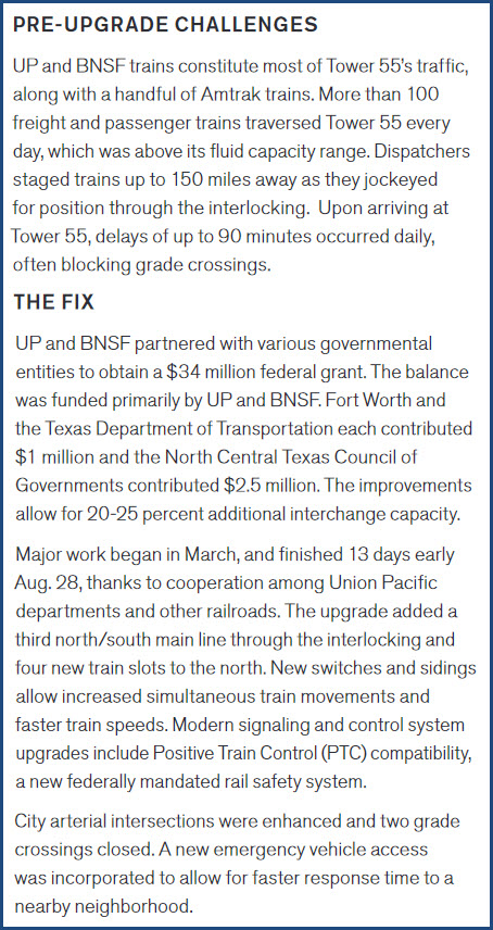
From UP PDF Flyer: Tower 55 is one of the nation’s busiest and most congested rail intersections. Located just south of downtown Fort Worth, Texas, Tower 55 holds vital national and international significance, connecting freight and passenger travel between the West Coast, Southeast, Midwest, Gulf Coast, Mexico and Canada. To alleviate congestion and enhance the flow of freight through Tower 55, Union Pacific, BNSF Railway, and city and regional governments developed plans to strategically link Texas’ major economic centers with key domestic and international markets.
Traffic Volume from Flyer #2:
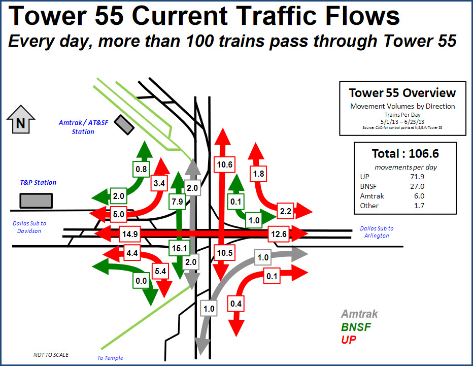
Approximate Train Volume:
BNSF: 30 freights
UP: 50 freights
TRE: 30 trains on weekdays, 18 on Saturday
Amtrak: 4 trains
Train Freqs / Listening In:
BNSF: 160.695 (road), 160.920 (road), 160.935 (yard)
UP: 160.410 (road), 160.470 (road), 160.515 (road), 161.550 (road), 161.280 (terminal), 160.395 (yard), 161.115 (yard), 161.250 (yard)
Amtrak: 160.440 (crew), 160.500 (crew)
TRE: 161.355 (dispatcher)
Nearby Points of Interest
The T&P Passenger Terminal and Fort Worth ITC are within a half mile of Tower 55. UP’s Centennial Yard is located less than 3 miles southwest, near I-30 and University Drive.
Saginaw TX is about 9 miles north of downtown - it is the northern rail funnel where BNSF’s and UP’s lines cross as they come into Fort Worth. A few miles farther north is the Alliance Intermodal Terminal and BNSF’s Alliance Yard where the action is constant.
Safety:
Railfanning with a buddy or two is recommended, especially as it gets dark - the area borders some less-than-desirable neighborhoods.
Acknowledgements:
Tim Vermande
Open Railway Map
Google Maps
Bing Maps
Union Pacific RR
Trains Magazine
Websites and other additional information sources of interest for the area:
http://kd5urs.rrpicturearchives.net/
https://hometownbyhandlebar.com/?p=5789 Great History of Tower 55!
http://txrrhistory.com/towers/055/055.htm
https://www.up.com/cs/groups/public/@uprr/@customers/documents/up_pdf_nativedocs/pdf_up_media_55history.pdf Flyer 1
https://www.up.com/cs/groups/public/@uprr/@customers/documents/up_pdf_nativedocs/pdf_up_media_55facts.pdf Flyer 2
https://www.up.com/media/tower-55/index.htm
https://www.trains.com/trn/railroads/hotspots/fort-worth-texas-tower-55/
https://www.hdrinc.com/portfolio/tower-55-surface-improvements
https://ftp.dot.state.tx.us/pub/txdot-info/rail/grant_funded/tower_55.pdf
https://virtualrailfan.com/fort-worth/ Membership required!
http://www.thedieselshop.us/Tower55.HTML lots of good photos from the 60's and 80's!
Getting to G
The
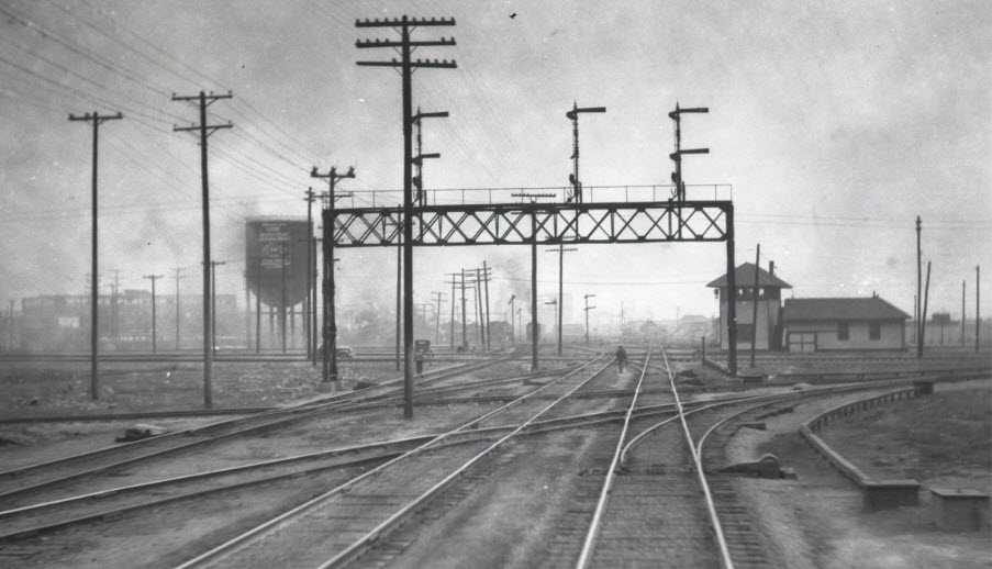 In the 20's, from UP flyer
The following Bing aerial views are before the BNSF tracks were upgraded to three.....
The
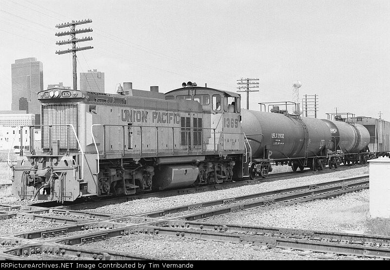 courtesy Tim Vermande, 1985
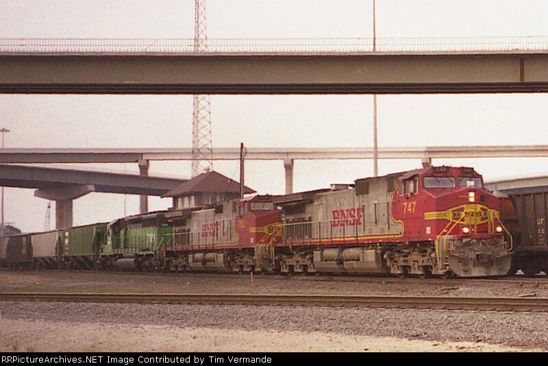 courtesy Tim Vermande, 1997
 photo by John Shine, 1985, via the dieselshop
The
The
Without a recent onsite visit, I won't be able to do any justice to the plethora of signals used in the Tower 55 interlocking.....
The
The
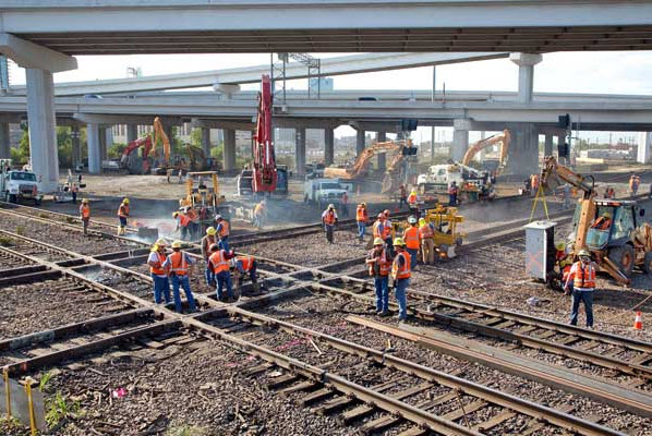
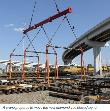
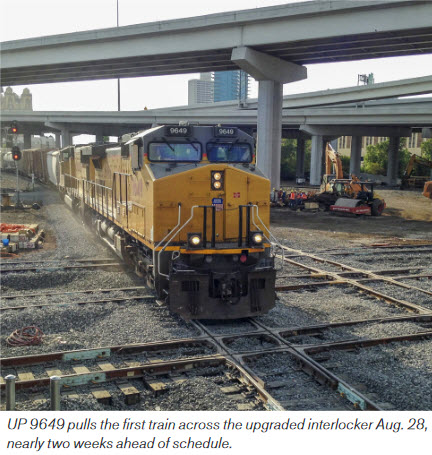
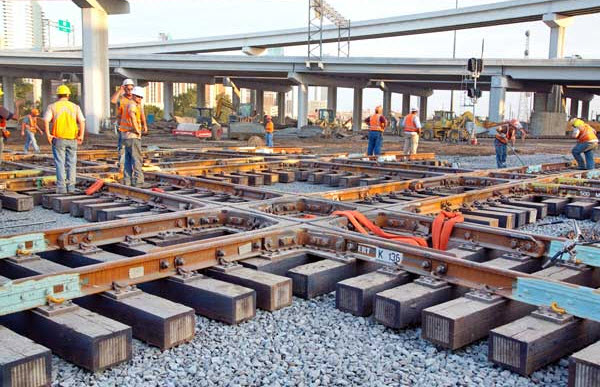
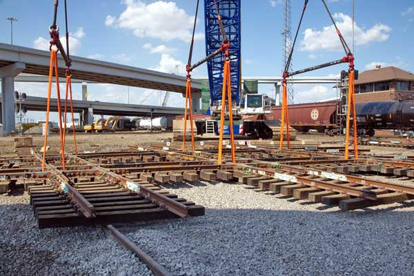
The Upgrade - Rebuilding the Tower 55 Diamond and Area
More coming.....
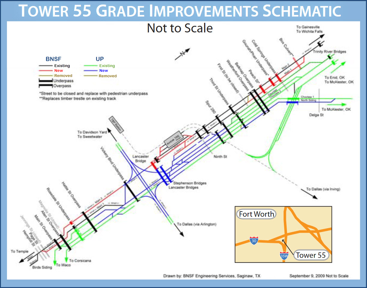
Info comes from a UP Flyer - Looks like the diamond and other work was done over the summer of 2014, altho the UP flyer only says 10/14......
More coming....
For a much more in depth look at Tower 55's history, visit: https://hometownbyhandlebar.com/?p=5789
 ~1899
~1899 ~1932
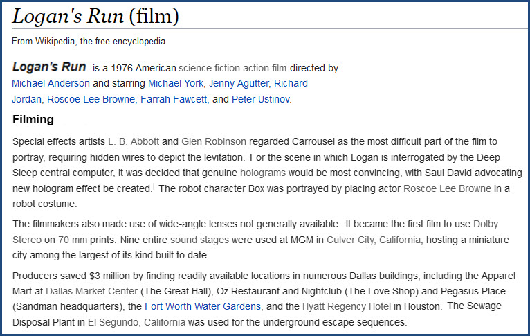
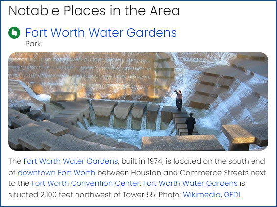
~1932the movie LOGAN'S RUN
This 1976 sci-fi movie had it's closing scene, where everybody came out of the underground living quarters, at a place which seemed really "out of this world" (if you saw the movie in the theaters at the time). It was filmed at the Fort Worth Water Gardens.
Courtesy of the University of Texas Library, click here for their index page.
Disclaimers:
I love trains, and I love signals. I am not an expert. My webpages reflect what I find on the topic of the page. This is something I have fun with while trying to help others.
Please Note: Since the main focus of my two websites is railroad signals, the railfan guides are oriented towards the signal fan being able to locate them. For those of you into the modeling aspect of our hobby, my indexa page has a list of almost everything railroad oriented I can think of to provide you with at least a few pictures to help you detail your pike.
If this is a railfan page, every effort has been made to make sure that the information contained on this map and in this railfan guide is correct. Once in a while, an error may creep in :-)
My philosophy: Pictures and maps are worth a thousand words, especially for railfanning. Text descriptions only get you so far, especially if you get lost or disoriented. Take along good maps.... a GPS is OK to get somewhere, but maps are still better if you get lost! I belong to AAA, which allows you to get local maps for free when you visit the local branches. ADC puts out a nice series of county maps for the Washington DC area, but their state maps do not have the railroads on them. If you can find em, I like the National Geographic map book of the U.S..... good, clear, and concise graphics, and they do a really good job of showing you where tourist type attractions are, although they too lack the railroads. Other notes about specific areas will show up on that page if known.
Aerial shots were taken from either Google or Bing Maps as noted. Screen captures are made with Snagit, a Techsmith product... a great tool if you have never used it!
By the way, floobydust is a term I picked up 30-40 years ago from a National Semiconductor data book, and means miscellaneous and/or other stuff.
Pictures and additional information is always needed if anyone feels inclined to take 'em, send 'em, and share 'em, or if you have something to add or correct.... credit is always given! Please be NICE!!! Contact info is here
Beware: If used as a source, ANYTHING from Wikipedia must be treated as being possibly inaccurate, wrong, or not true.
RAILFAN GUIDES HOME
RAILROAD SIGNALS HOME
NEW SEP25/2021, SEP26/27/28/2021
Last Modified 29-Sep-2021