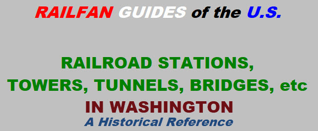
Aberdeen
Bellingham
Cascade Tunnel
Cedar Falls
Centralia
Chehalis
Dayton
Delcamp
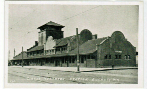
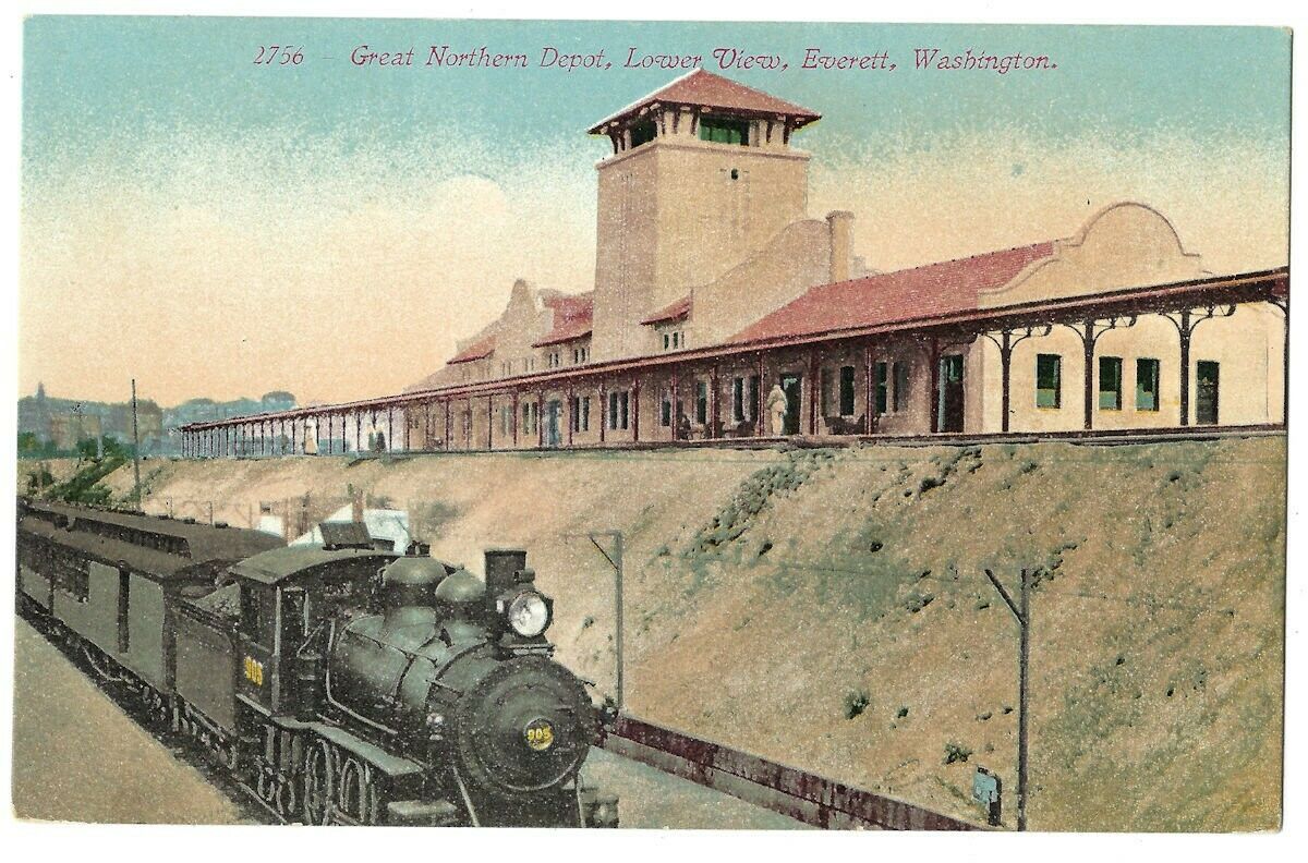
Everett
Joyce
Kelso
Lind
Long Beach
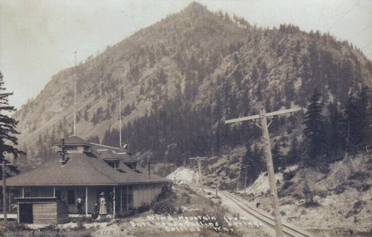
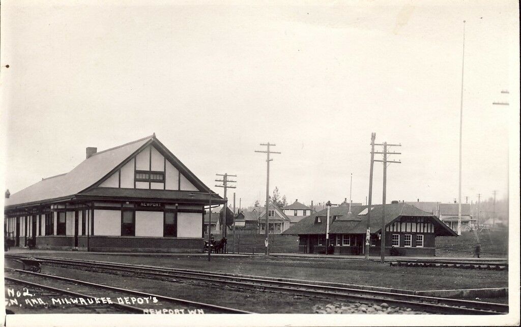
Newport
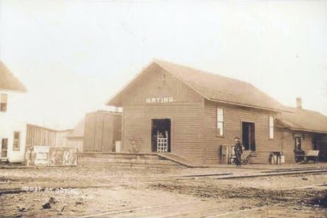
Orting
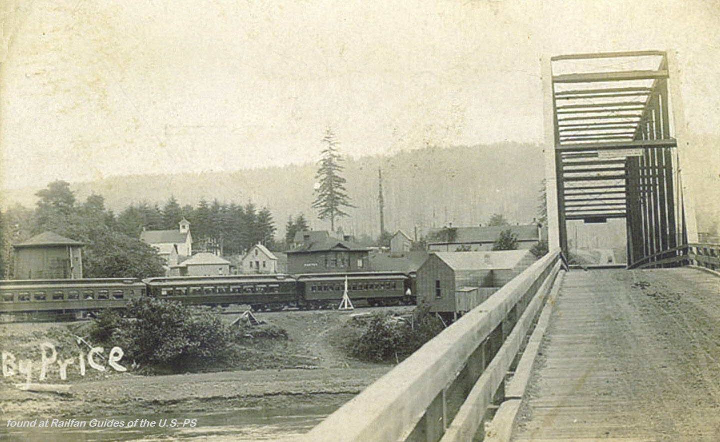
Porter
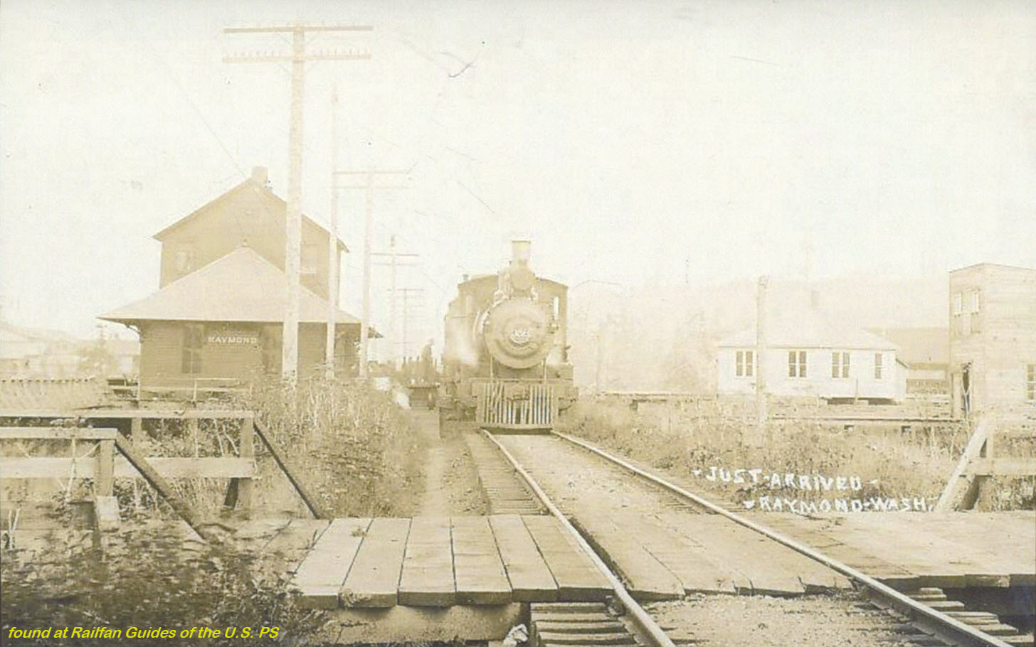
Raymond
Seattle
Seattle Union Station
Oregon-Washington Station
Spokane
Spokane NP Depot
Spokane Union Station
Tekoa
Tenino
Vancouver
Wenatchee
RAILROAD SIGNALS HOME
There are precious few good references for many of the railroad stations and depots that used to exist.
One of the better resources I have come across to this end is the plethora of old post cards still around depicting many of these structures, some better than others.
Most of the postcards were found on EBay unless noted, other pictures, mostly the more recent ones, come from Google and/or Bing images - credit given if the source is known.
Dates are in the picture name, x means the date is approximate. If they were available, and interesting, I included the back side of the postcards. 1901a and 1910b would be the same card, both sides.
If the picture was really, really bad, some of them have been cleaned up and/or repaired when I had the energy.
Since many of these stations are no longer around (railfans seem to prefer the term "extant", I'm not one of them! :-), this page is mostly for historical reference.
This page is mostly for historical reference, as MANY of these stations are not around anymore!
What's the difference between a station and a depot? Most people will say "nuttin", it's a matter of preference, although many will use depot for older buildings.
If you have a picture you would like to contribute, please see the bottom of the page for how to find me, credit is always given to contributing photographers.
Acknowledgements:
Denver Todd
Wikipedia
Sturmovik/Jersey Mike
Seattleretro
Various EBay postcard sellers as noted
Additional information resources:
http://www.wsrhs.org/old%20depot A great page of nothing but old depots in Washington
http://www.gngoat.org/depots_wa.htm more depots of Washington
Aberdeen
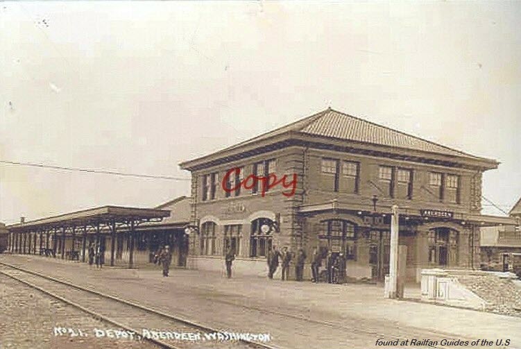
Bellingham
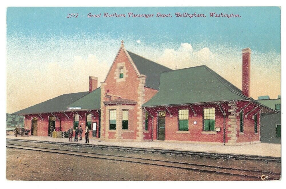 EBay seller: spocsa
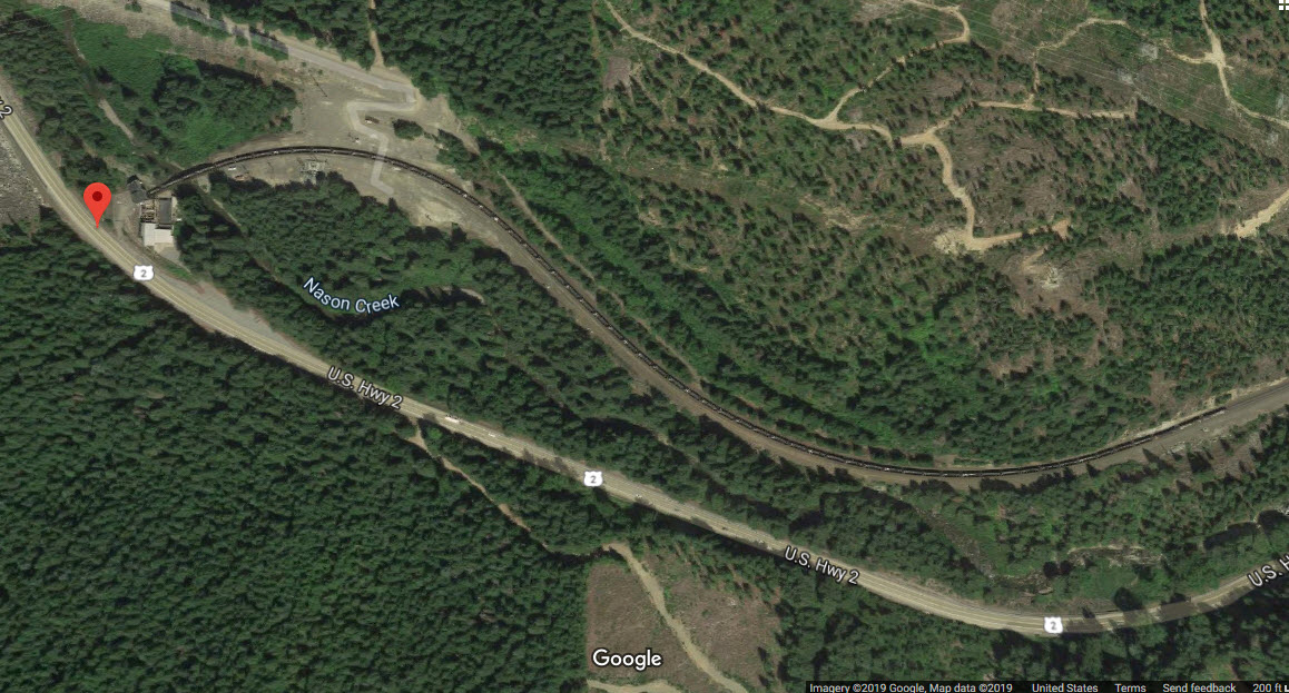
Cascade Tunnel
From Wikipedia: The Cascade Tunnel refers to two railroad tunnels (original and its replacement) in the northwest United States, east of the Seattle metropolitan area in the Cascade Range of Washington, at Stevens Pass. It is approximately 65 miles (105 km) east of Everett, with both portals adjacent to U.S. Route 2. Both single-track tunnels were constructed by the Great Northern Railway. The first was 2.63 miles (4.23 km) in length and opened in 1900 to avoid problems caused by heavy winter snowfalls on the original line that had eight zig zags (switchbacks). The current tunnel is 7.8 miles (12.6 km) in length and entered service in early 1929, approximately 1.5 miles (2.4 km) south of and 500 feet (150 m) lower in elevation than the original. The present east portal is nearly four miles (6.5 km) east of the original's and is at 2,881 feet (878 m) above sea level, 1,180 feet (360 m) below the pass. The tunnel connects Berne in Chelan County on its east with Scenic Hot Springs in King County on its west and is the longest railroad tunnel in the United States.
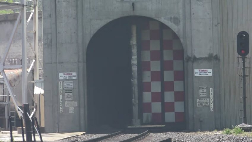
East Portal
GPS Coordinates: 47.769861, -120.999413
The following picture comes from Steve Larson's really nice YouTube video: https://www.youtube.com/watch?v=rc7zRVtx1Bk
West Portal
GPS Coordinates: 47.715344, -121.145315
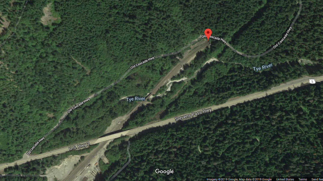
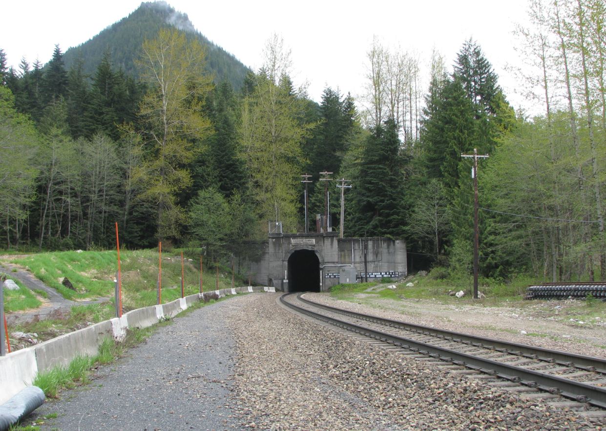 Photo by Seattleretro, via Wikipedia
Cedar Falls
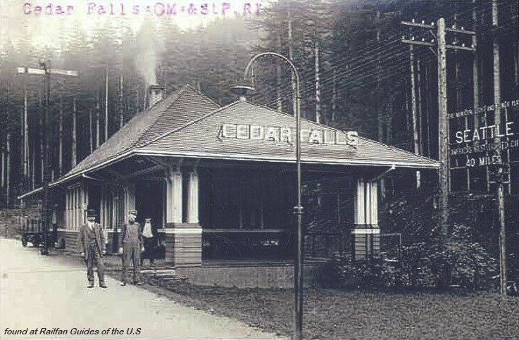 EBay seller: skurfanpostcards
Centralia
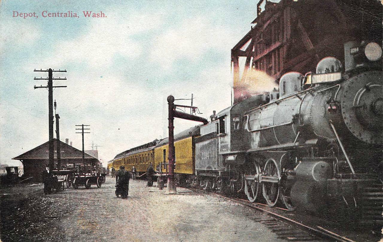 EBay seller: outwester
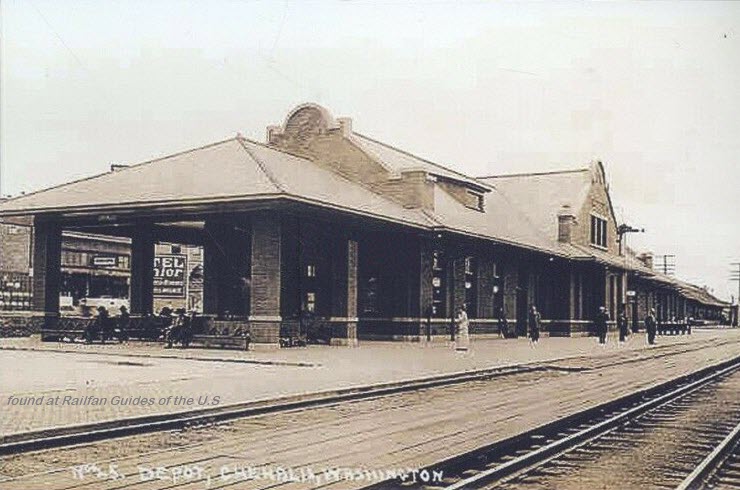 EBay seller: skurfanpostcards
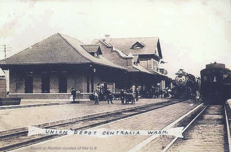 EBay seller: skurfanpostcards
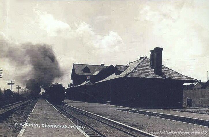 EBay seller: skurfanpostcards
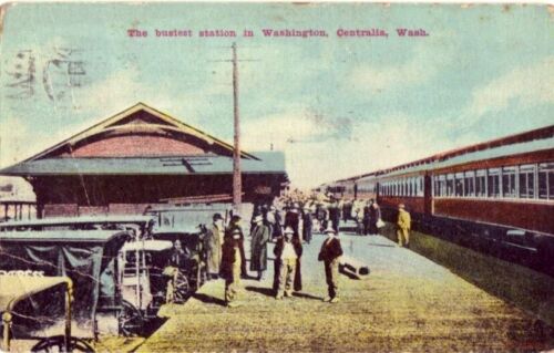
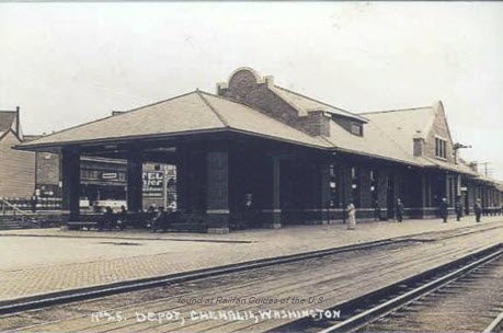
Chehalis
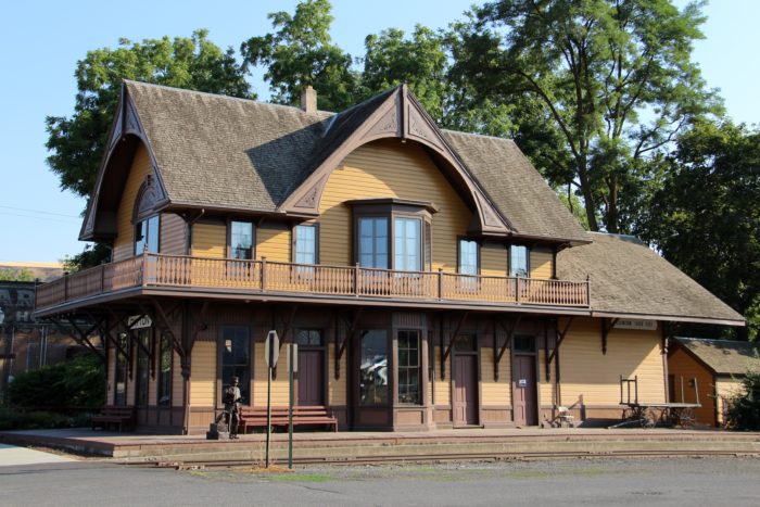
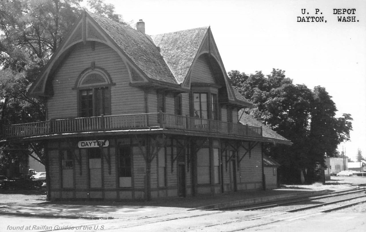
Dayton
GPS Coordinates: 46.320844, -117.980002
222 E. Commercial Ave
Dayton, WA 99328
509-382-2026
http://www.daytonhistoricdepot.org/museums/the-historic-depot-museum/
From the museums website: Established as an agricultural community in 1871, the community of Dayton grew rapidly. However, its residents struggled to get their products overland to market. For several years, there were rumors of railroads coming to Dayton, and finally in May 1800, Henry Villard, the president of Oregon Railway & Navigation (OR&N) promised Dayton a line. The following year, the spur line to Dayton was complete, as was the fashionably designed Stick/Eastlake style Depot. Originally the Depot and the entire rail yard were located at the base of Rock Hill on the southwest edge of Dayton, right beside the Touchet River. This location was chosen because the OR&N needed the logs that came down a flume along the river in order to build trestles into the Palouse. Competition between railroads was intense in the late 19th century and Columbia County farmers took advantage of this. Believing that a direct line to the Puget Sound would save them money, they negotiated with the Oregon & Washington Territory Railroad to bring a line into the center of Dayton, right up Commercial Street. This line was completed in 1889. Within just a few years, OR&N who by this time had become a subsidiary of Union Pacific, decided they needed to move their rail yard and depot in order to compete with the new line. In 1899, the OR&N Depot was jacked up and moved on roller logs pulled by horse and capstan to its present location on Commercial Street. Both Depots continued in business until the OR&N Depot closed at the end of 1971.
 EBay seller: outwester
Delcamp
 EBay seller: skurfanpostcards
Everett
 EBay seller: spocsa
Joyce
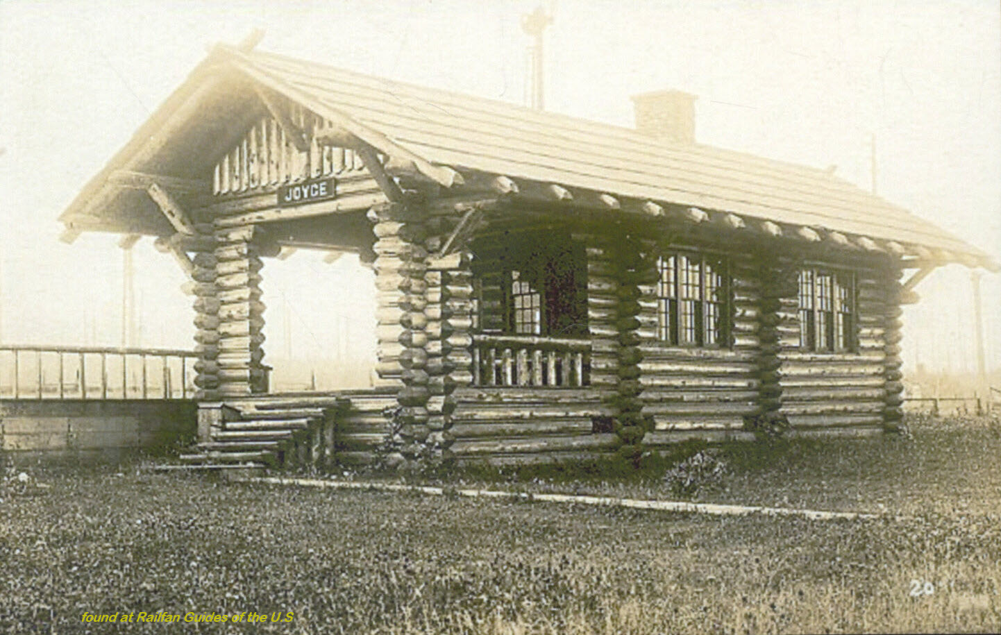 EBay seller: skurfanpostcards
Kelso
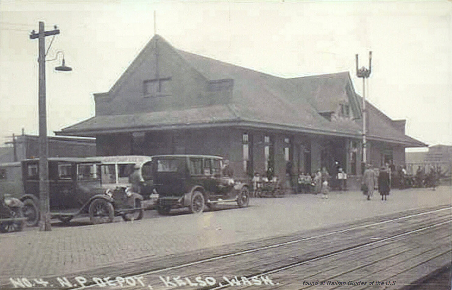 EBay seller: skurfanpostcards
Lind
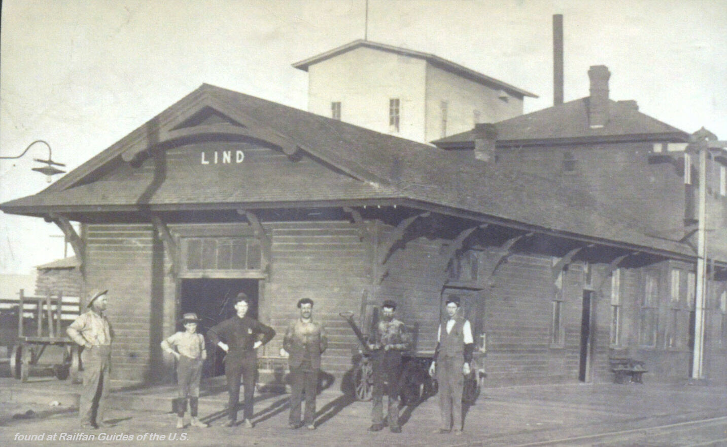 EBay seller: skurfanpostcards
Long Beach
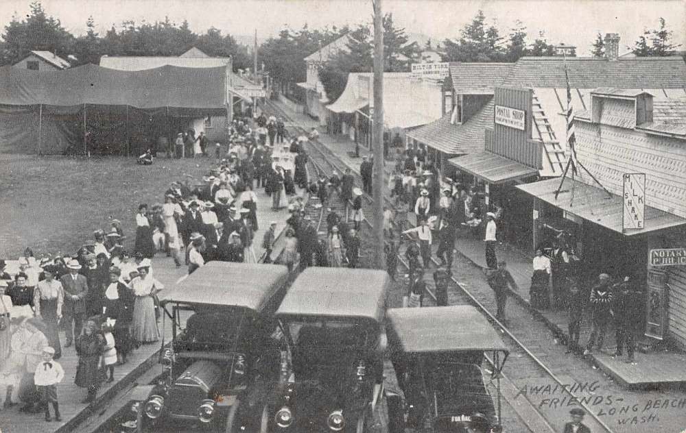 EBay seller: marymartinpostcards
Newport
Great Northern and Milwaukee Road Depots
 EBay seller: collectors_shelf
Orting
Porter
 EBay seller: skurfanpostcards
Raymond
 EBay seller: skurfanpostcards
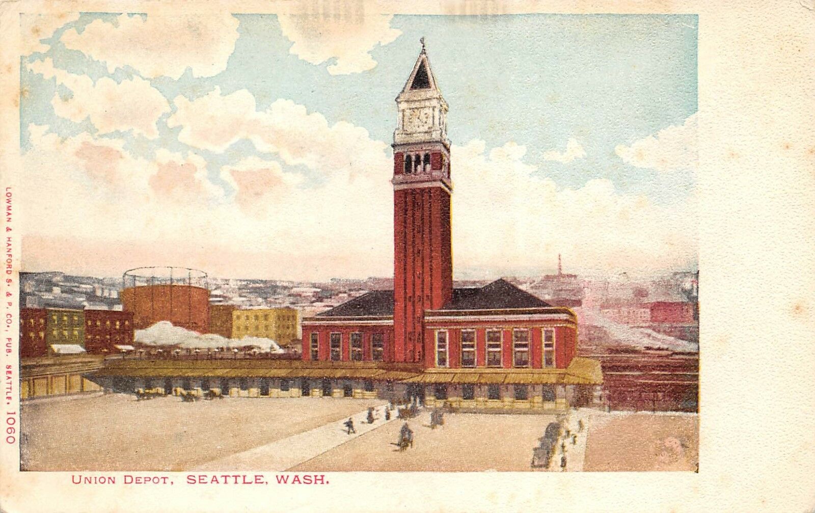
Seattle -- the King Street / Union Station
GPS Coordinates: 47.598384, -122.329836
Amtrak Station Code: SEA
303 South Jackson Street
Seattle WA 98104
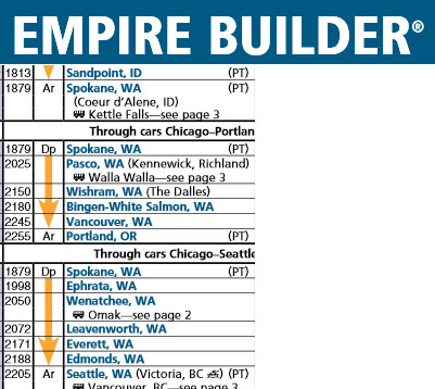
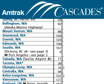
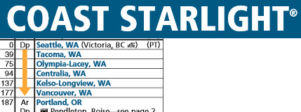
Here are the cities served in Washington state by the three Amtrak trains:
Built in 1906, it features a brick & granite facade, and a 12-story clock tower.
From Wikipedia: King Street Station is a train station in Seattle WA. Located between South King & South Jackson Streets and Second & Fourth Avenues South in the Pioneer Square neighborhood of Seattle, the station is just south of downtown. Built between 1904 and 1906, it served the Great Northern Railway and Northern Pacific Railway from its grand opening on May 10, 1906, until the creation and start of Amtrak on May 1, 1971. The station was designed by the St. Paul MN architectural firm of Charles A. Reed and Allen H. Stem, who were later associate designers for the New York Central Railroad's Grand Central Station/Terminal in New York City. King Street Station was Seattle's primary train terminal until the construction of the adjacent Oregon & Washington Depot, later named Union Depot (Station), in 1911. King Street Station was added to the National Register of Historic Places and the Washington Heritage Register in 1973. The station is served by Amtrak Cascades, Empire Builder, and Coast Starlight trains, and by Sound Transit's Sounder commuter trains. King St. Station is also the Seattle terminus for the Rocky Mountaineer's luxury excursion train, the Coastal Passage. In 2018, King Street was the third-busiest station in the Western United States (behind only Los Angeles and Sacramento) and the 15th-busiest overall.
 EBay seller: smithscastle
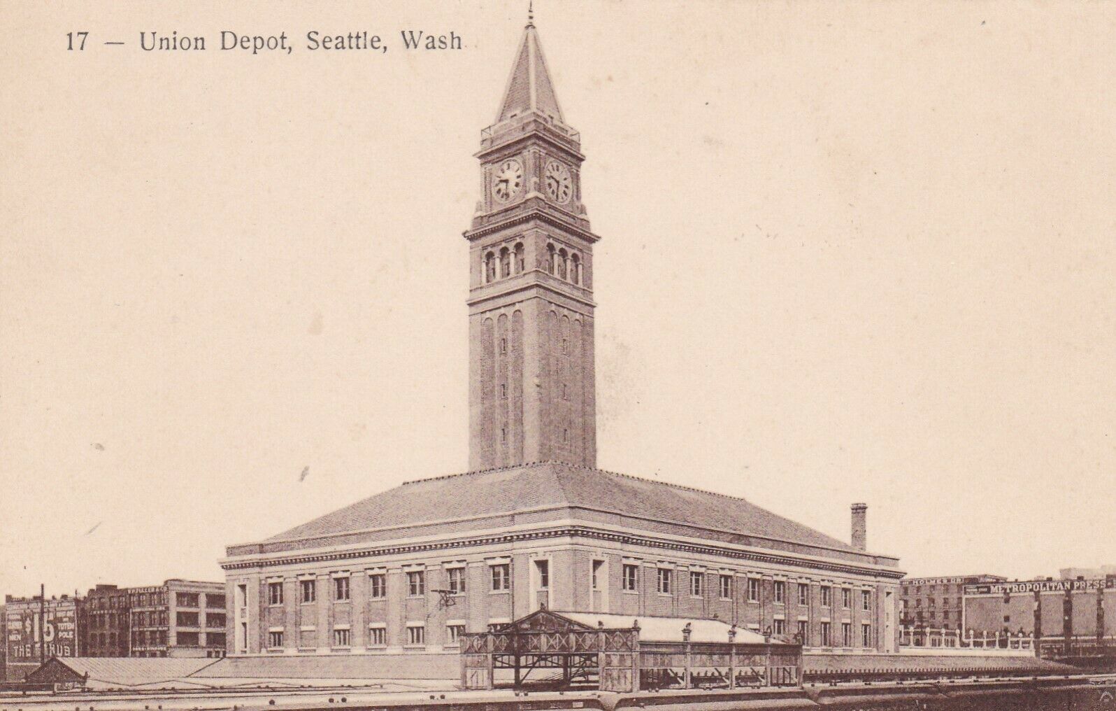 EBay seller: mikeg56
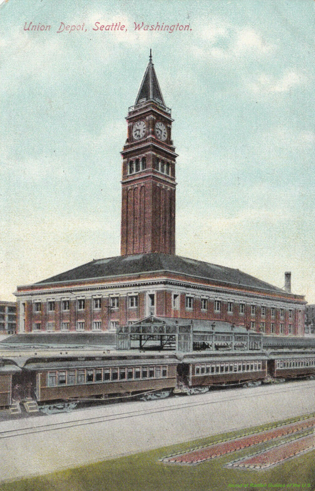 EBay seller: mikeg56
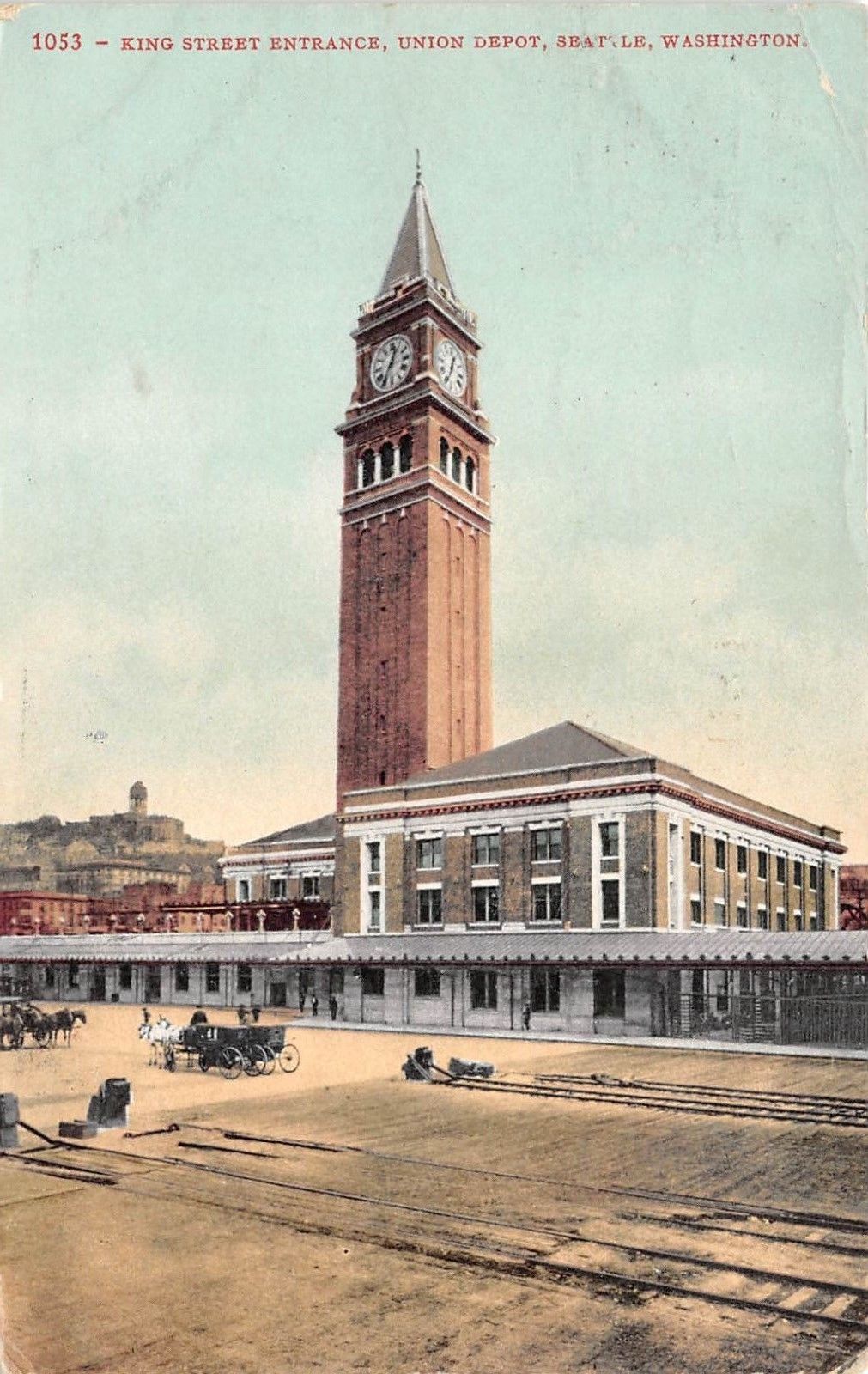 EBay seller: smithscastle
Seattle -- Oregon-Washington Station
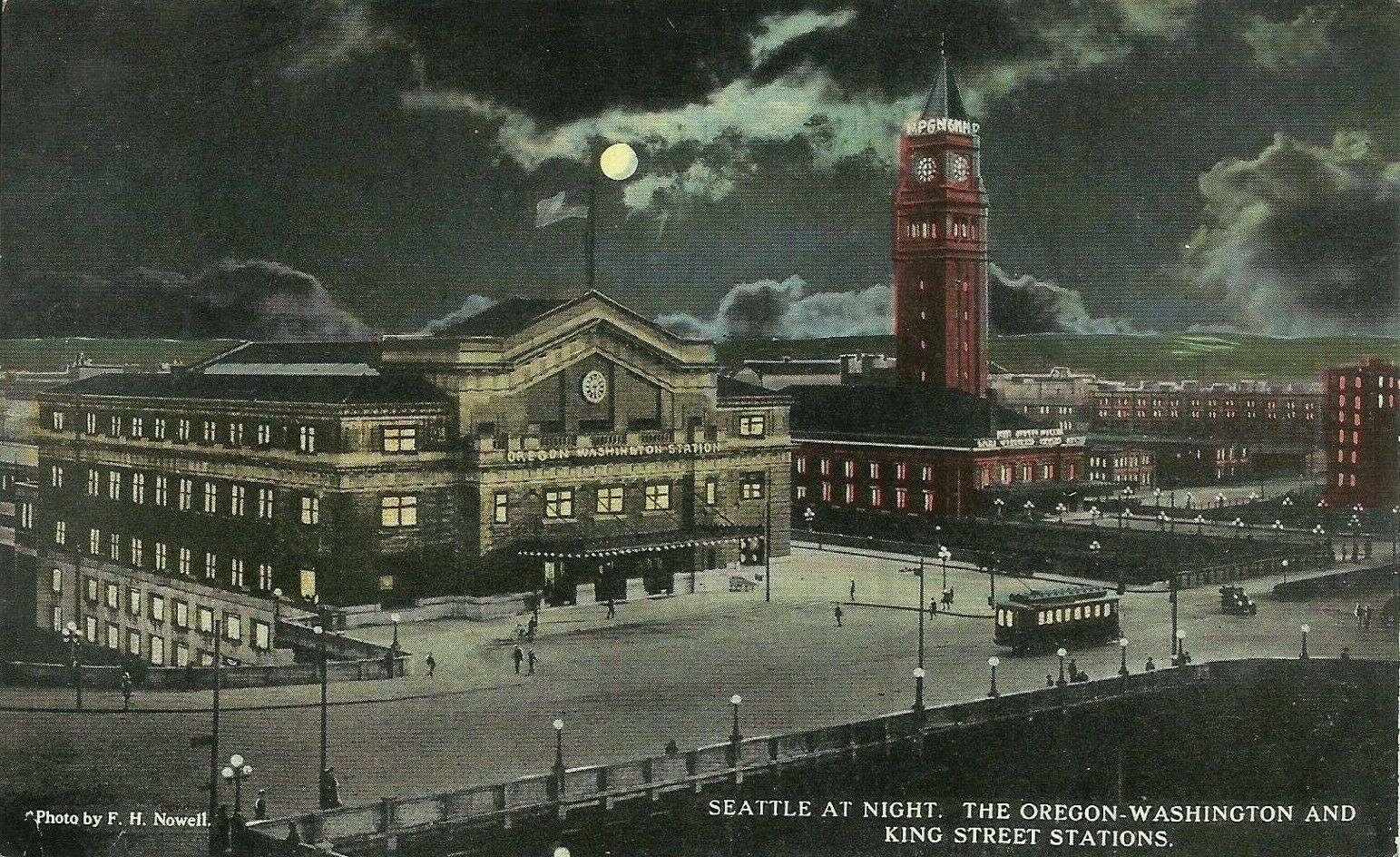 EBay seller: rarefindsfl
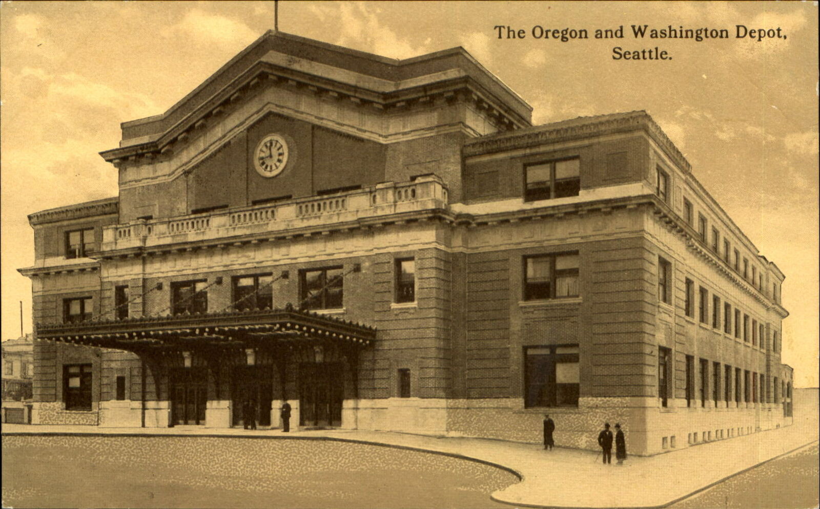 EBay seller: umpteen_postcards
Spokane - Great Northern Depot
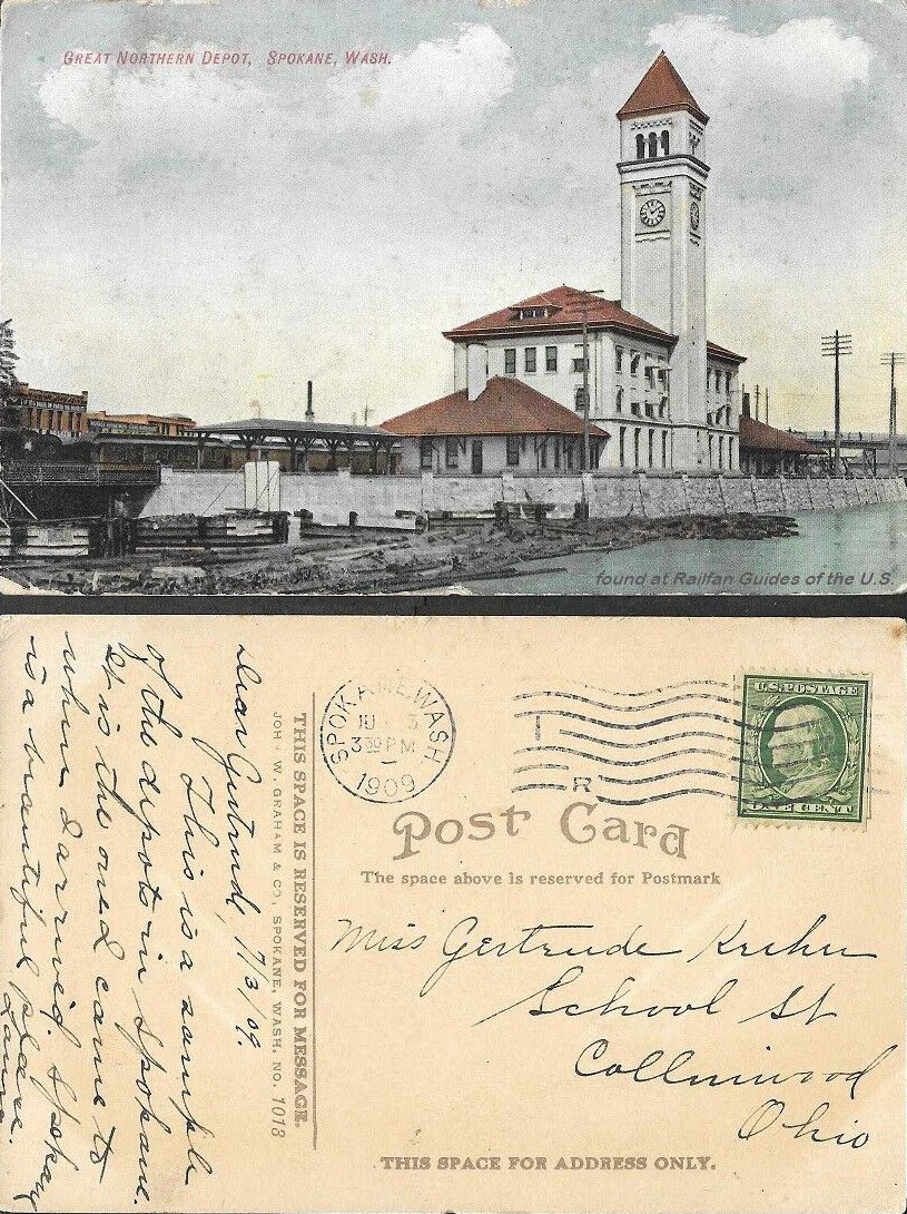 EBay seller: johnjazvac11
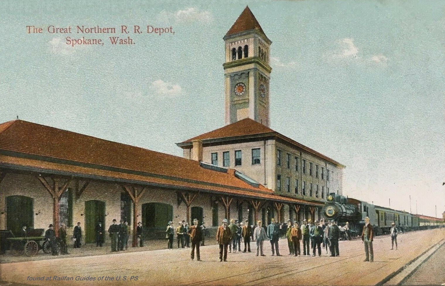 EBay seller: ats4824
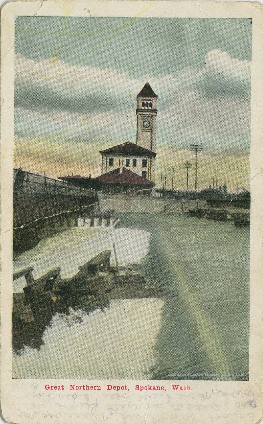 EBay seller: collectible_collectibles
Spokane - Union Station
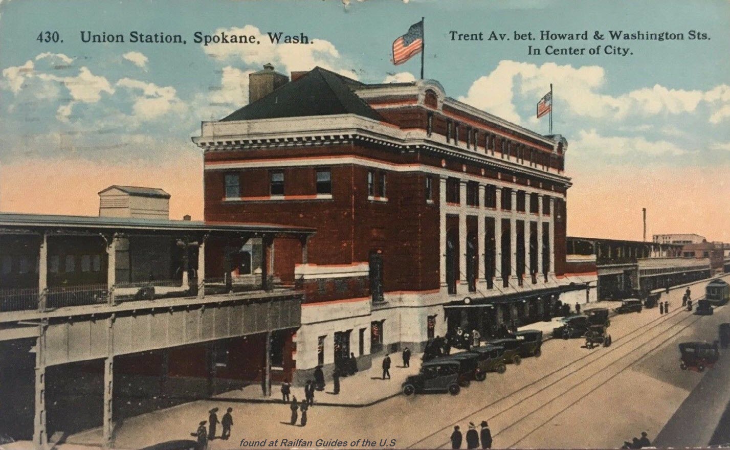
 EBay seller: ats4824
Tekoa
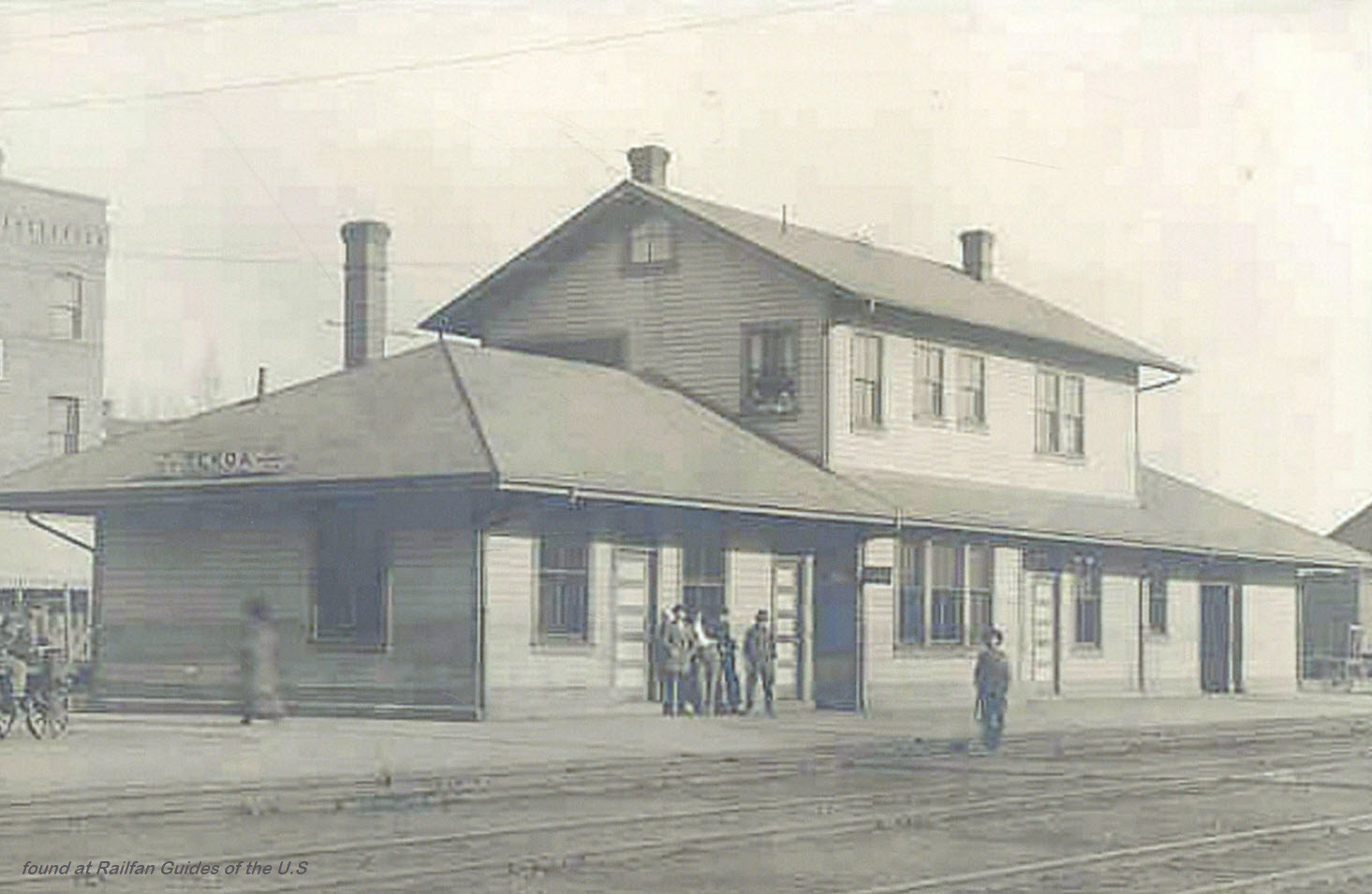 EBay seller: skurfanpostcards
Tenino
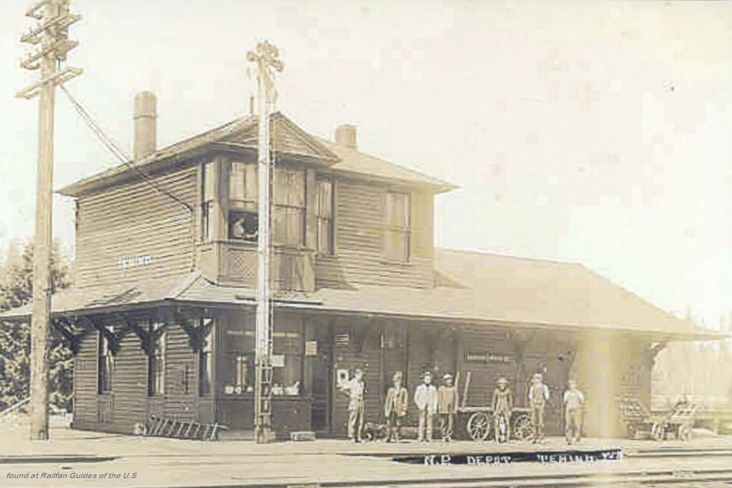 EBay seller: skurfanpostcards
Vancouver
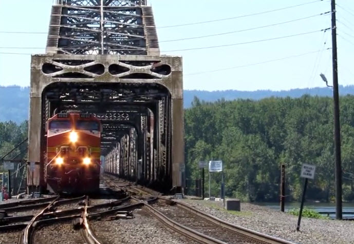
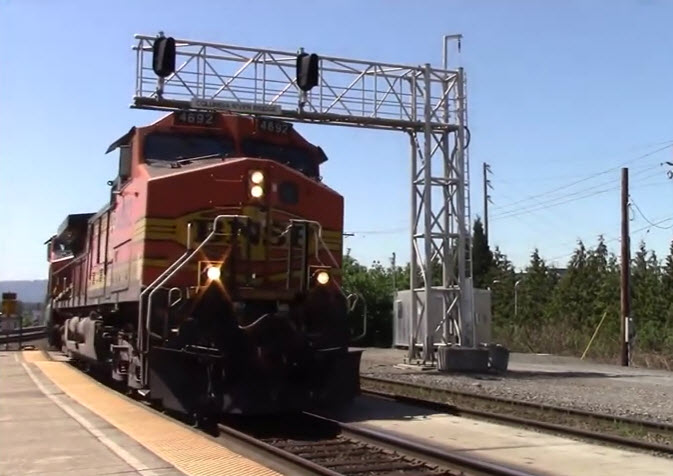
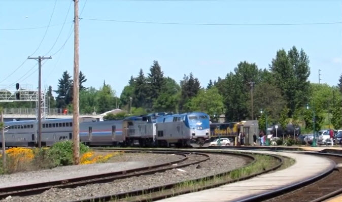
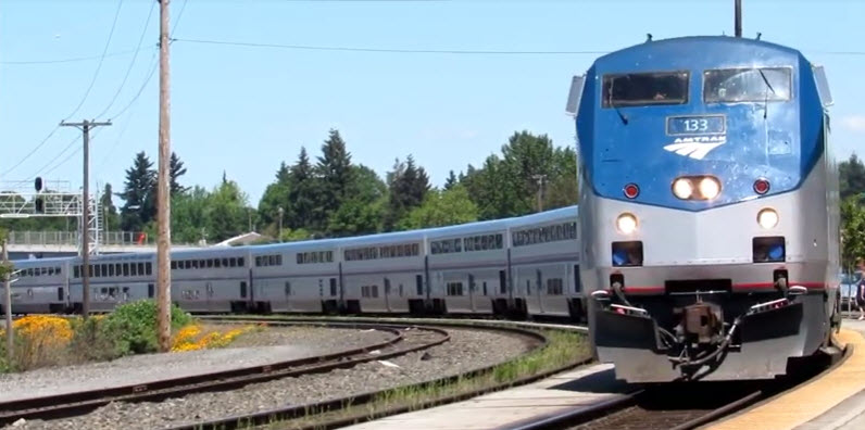
GPS Coordinates: 45.628738, -122.686622
Amtrak Station Code: VAN
1301 W. 11th Street
Vancouver, WA 98660
From Wikipedia: It is a unique, two-sided station situated in a "wye", where passengers board the Empire Builder on the southeast side of the station while the Amtrak Cascades and Coast Starlight are boarded on the northwest side of the station. The station building is now open after extensive interior renovations. Of the 19 Washington stations served by Amtrak, Vancouver was the third busiest in FY14.
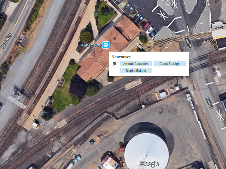
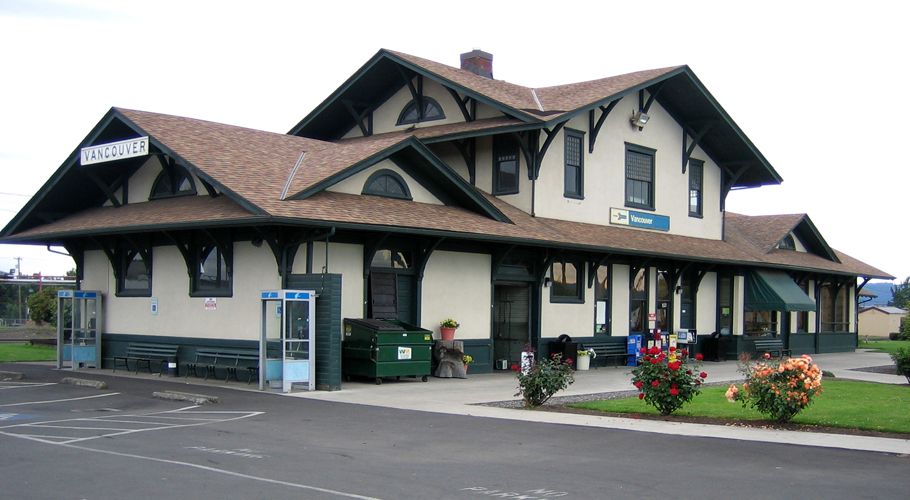 Photo by Jill/Jellidonut via Wikipedia
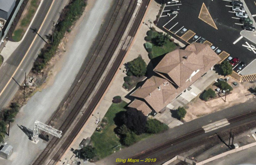
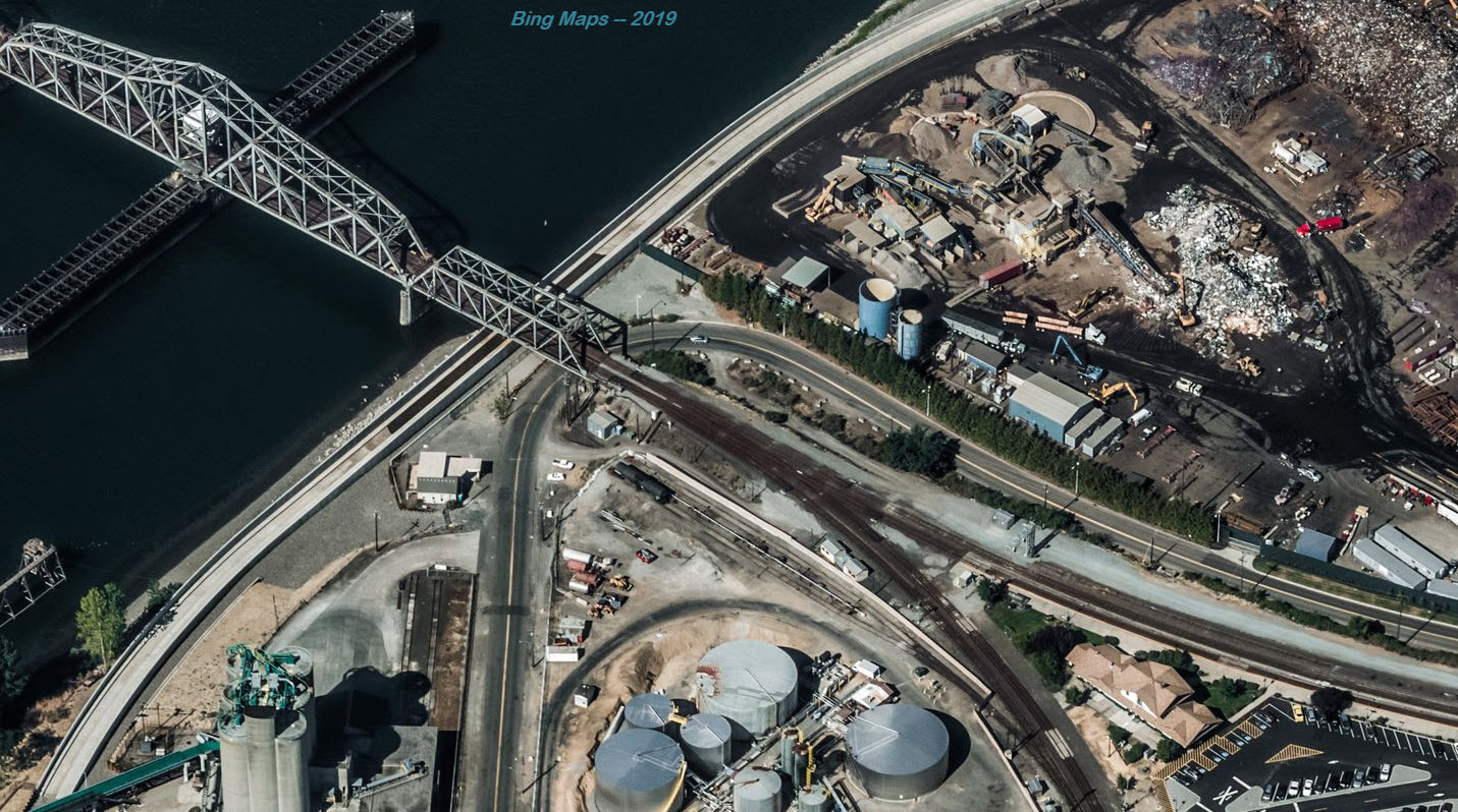
The following 4 pictures come from: https://www.youtube.com/watch?v=IcnK2PPVrU0
And are some of what you will see while standing on the platform
Wenatchee
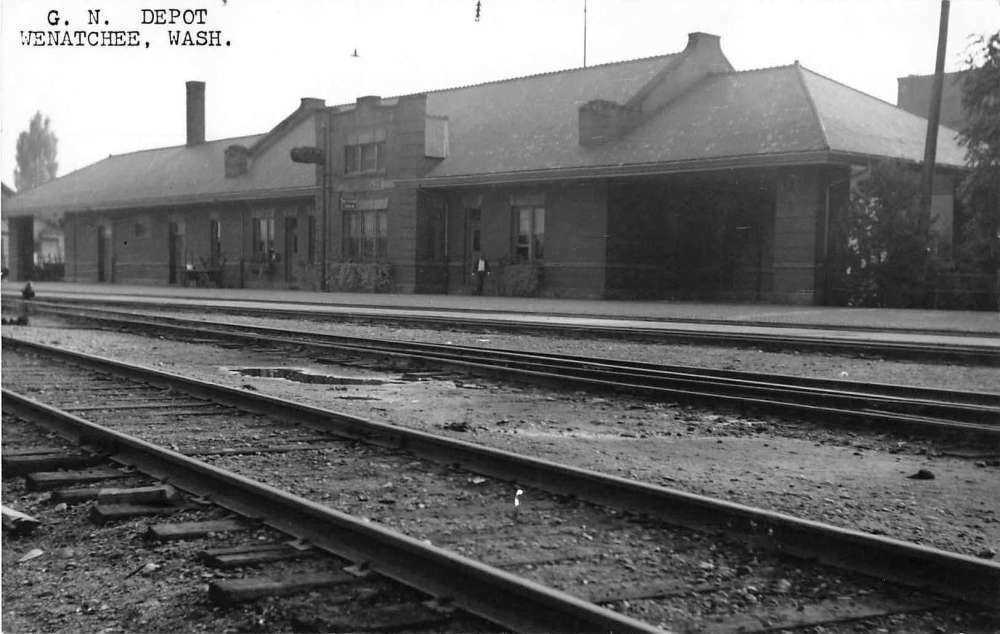 EBay seller: baysideantiques_02
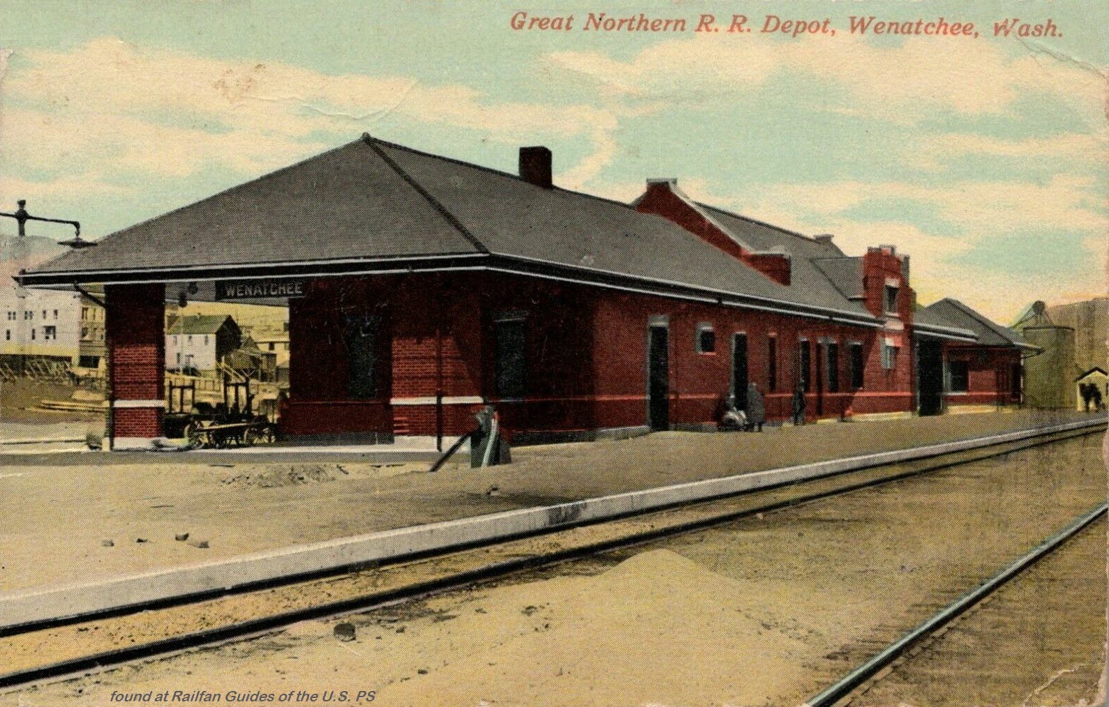
 EBay seller: refried.jeans
New 06/23/2019
Last Changed: 15-Nov-2021