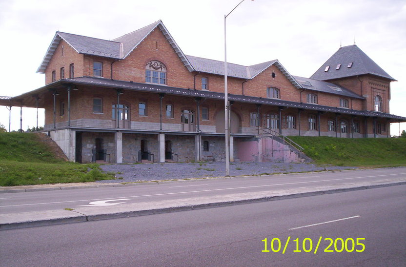
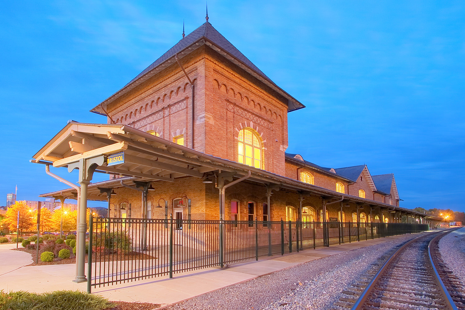
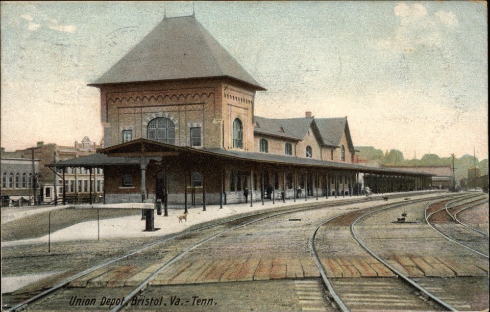
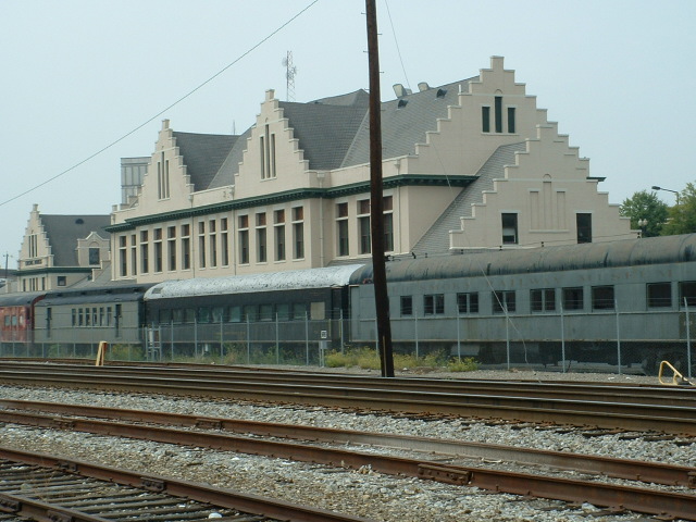
GPS Coordinates: 36.595584, -82.179901
101 Martin Luther King Jr. Blvd, Bristol, VA 24201
Phone: 276-644-1573
The station is technically in Virginia, and not Tennessee, but who is counting that few hundred feet! :-)
For more info: https://www.bristoltrainstation.org/
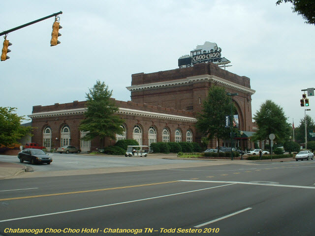
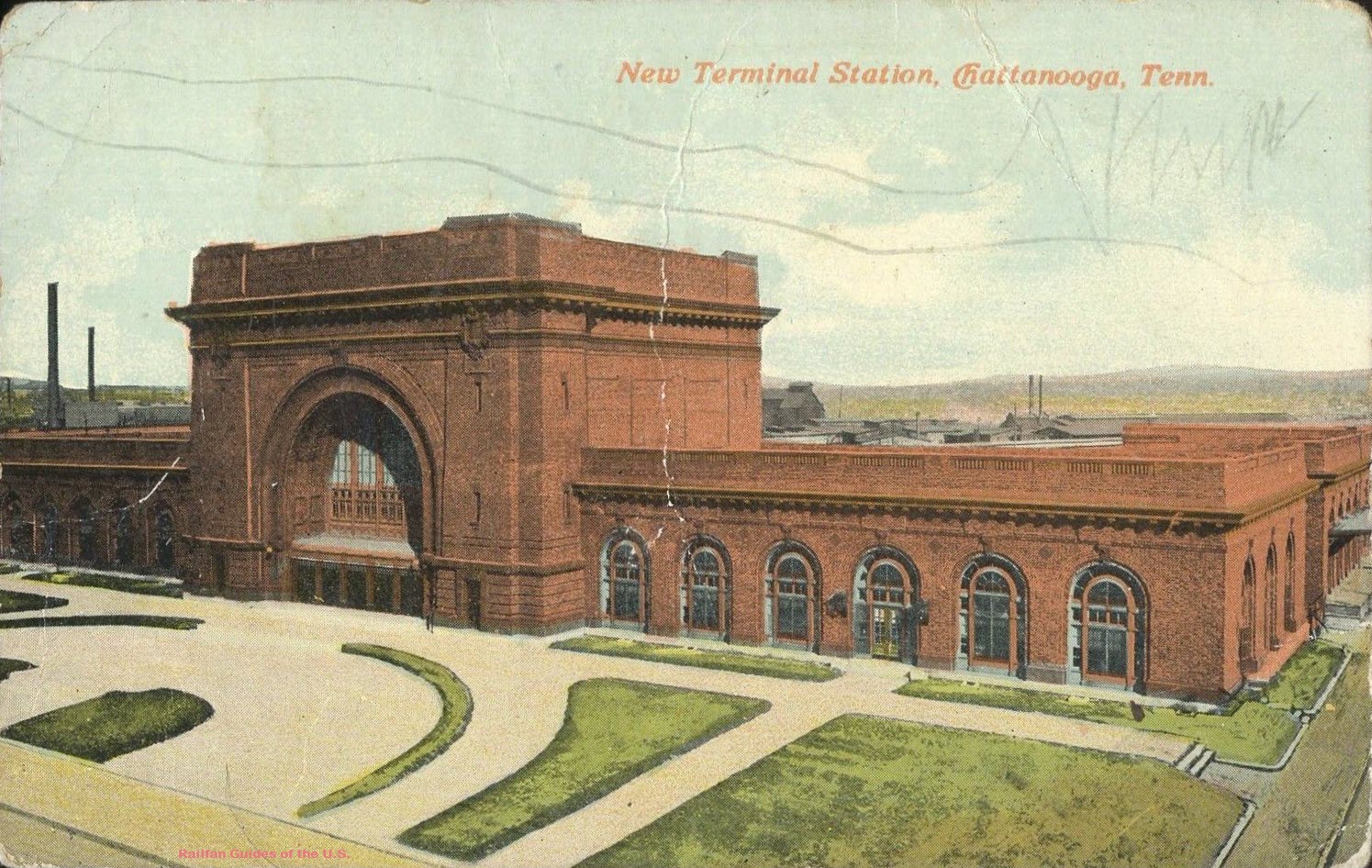
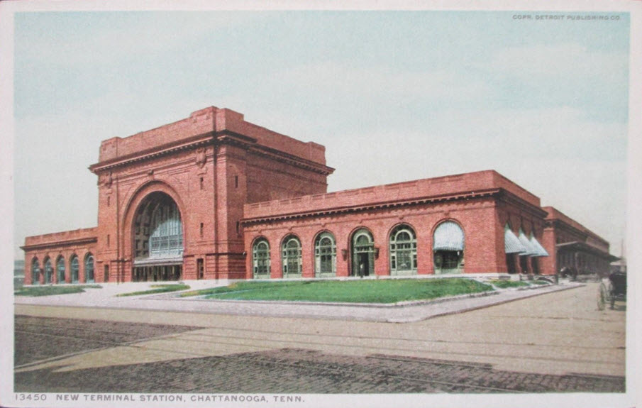
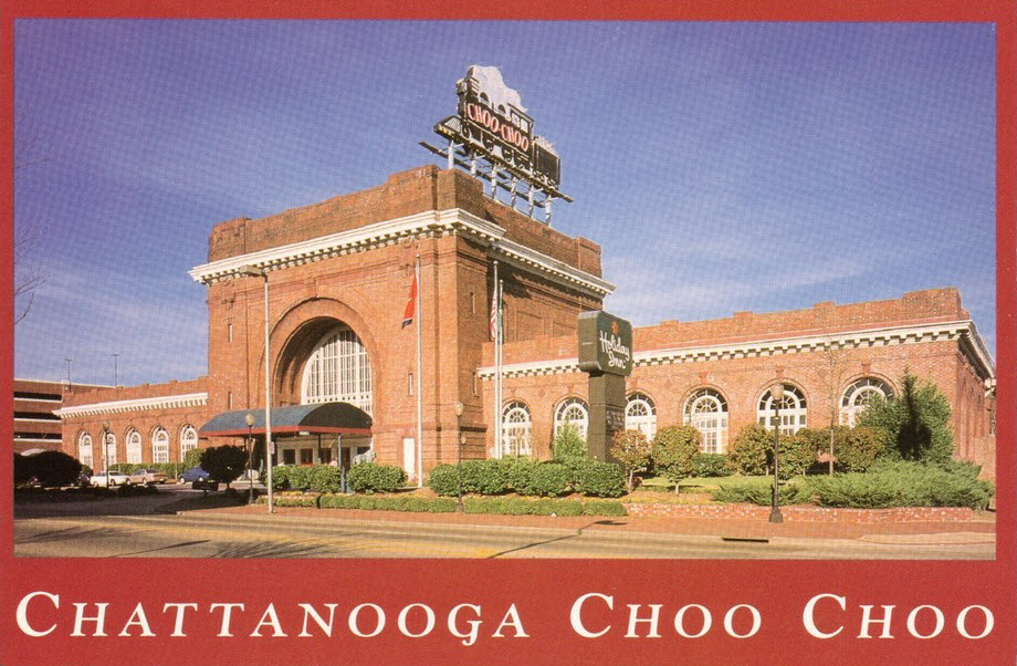
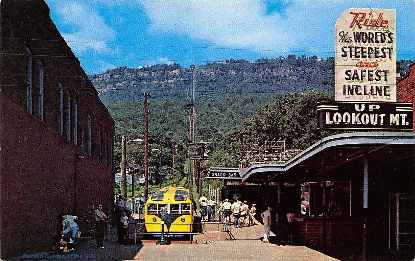
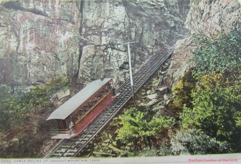
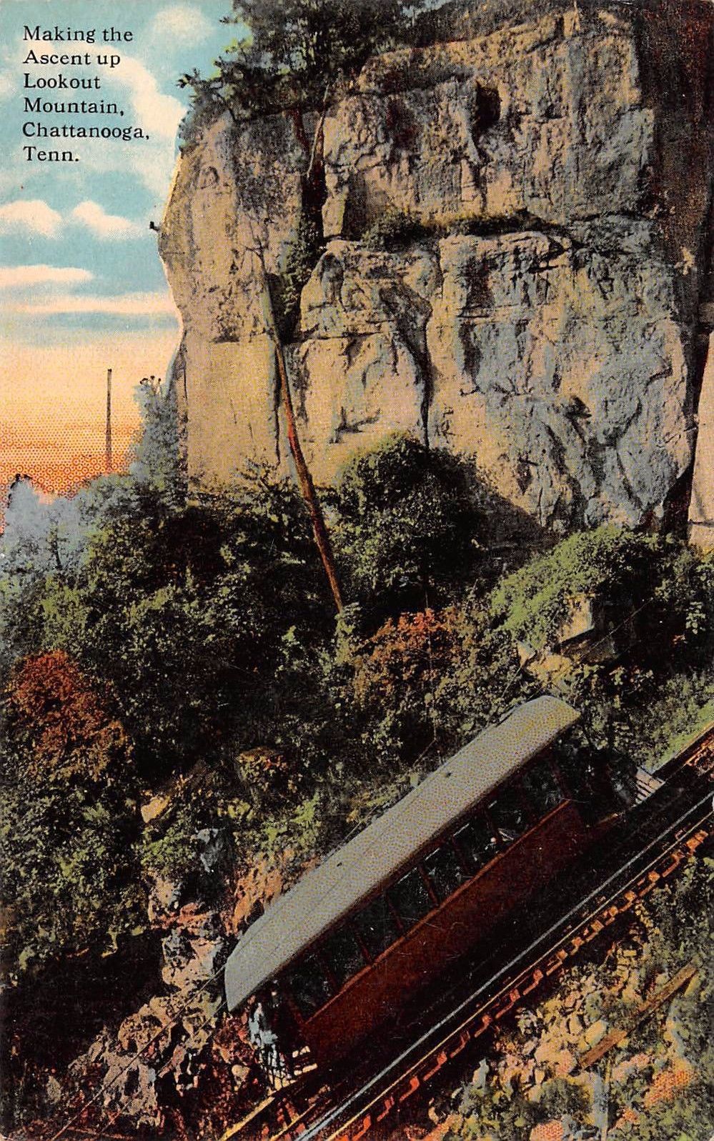
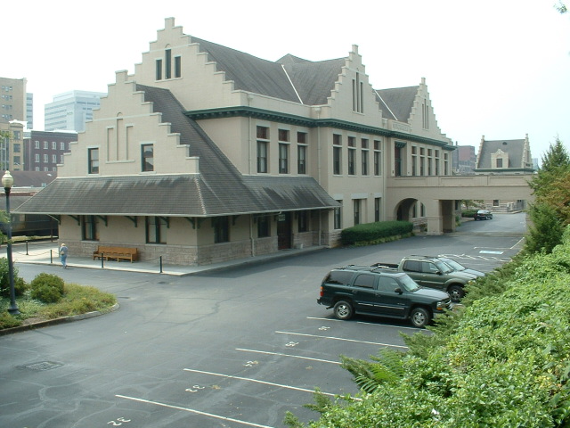
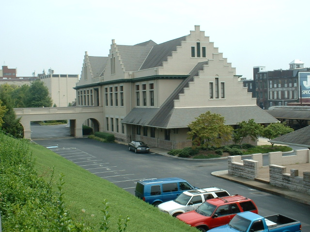
Home of the Chattanooga Choo Choo, it is now a fabulous hotel, and if you like, you can stay in Pullman cars set up as "rooms". They also have an operating
trolley, and numerous signals, including wig-wags. Click on the link to take you to my page for the
Chatanooga Choo-Choo
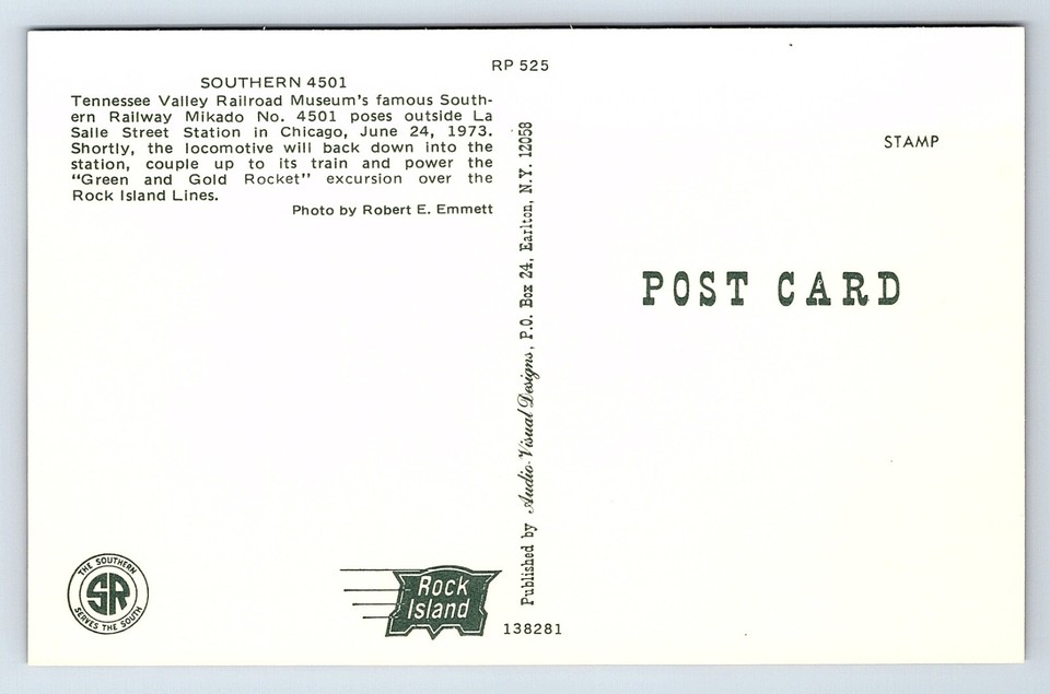
Back in the 70's and 80's, I used to catch 4501 running in NOVA during the
70's and thru Johnson
City TN in the 83 time frame, but did not know it made it out to Chicago!
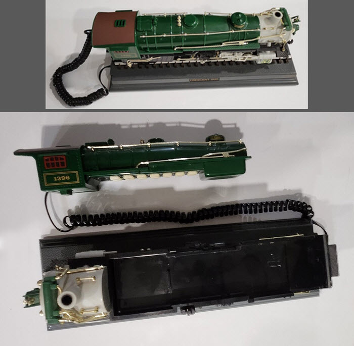
AND, did you know that in the late 70's, they came out with a corded phone that
looked like 4501, but it carried the number of 1396?.... Still got mine, somewhere :-)
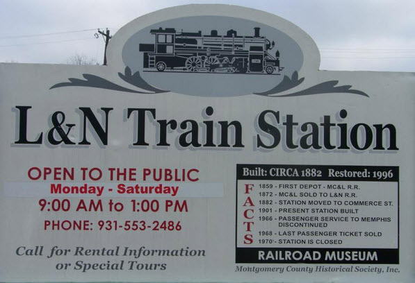
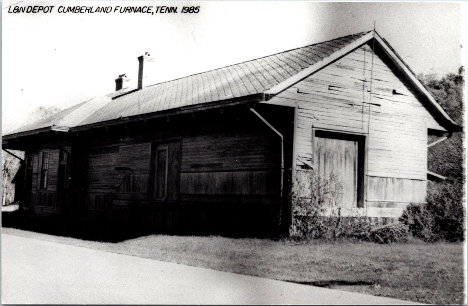
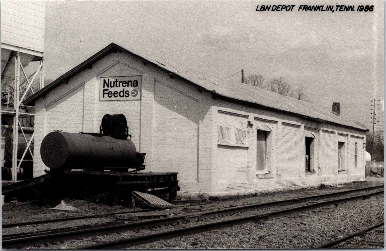
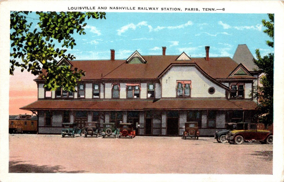
GPS Coordinates: 36.528509, -87.345544
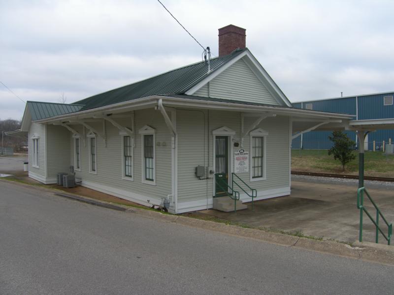
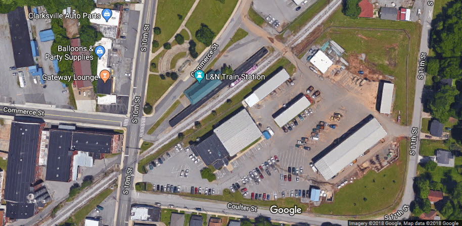
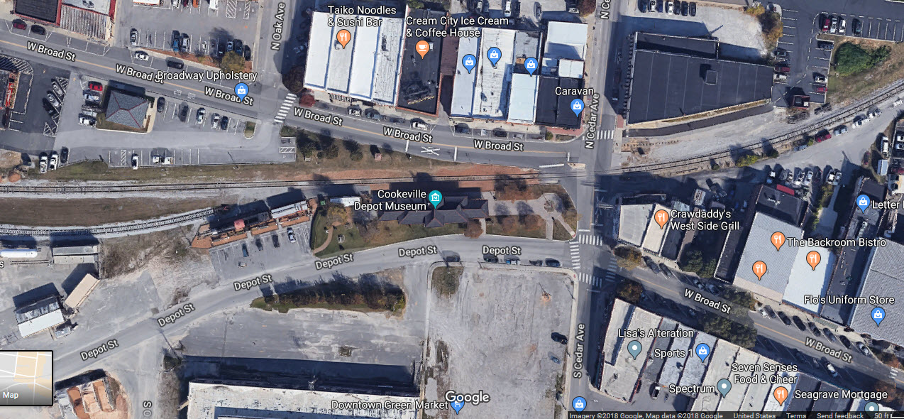
The L&N train station is located at Commerce and 10th Streets. Ground breaking for the current location took place in September of 1881. The first train rolled into
Clarksville from Bowling Green KY in 1860 when the Clarksville Depot was located on Depot Street, close to Cumberland Dr.
More info at: http://activerain.com/blogsview/1006528/the-last-train-to-clarksville---l---n-train-station
The Clarksville Depot is the home of the Montgomery County Historical Society
Open: Monday thru Saturday, 9am - 1pm
Phone: 931-553-2486
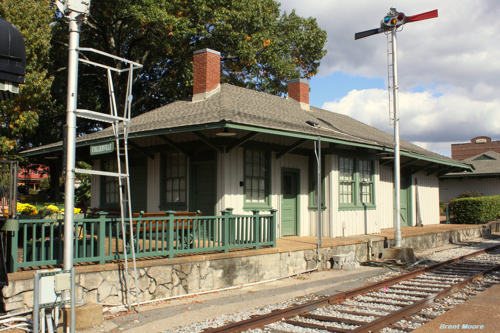
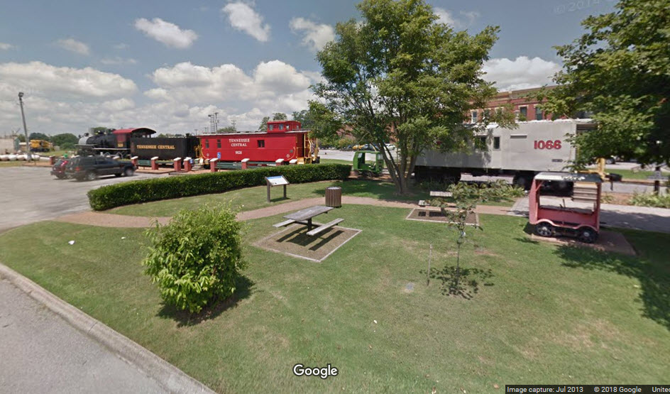
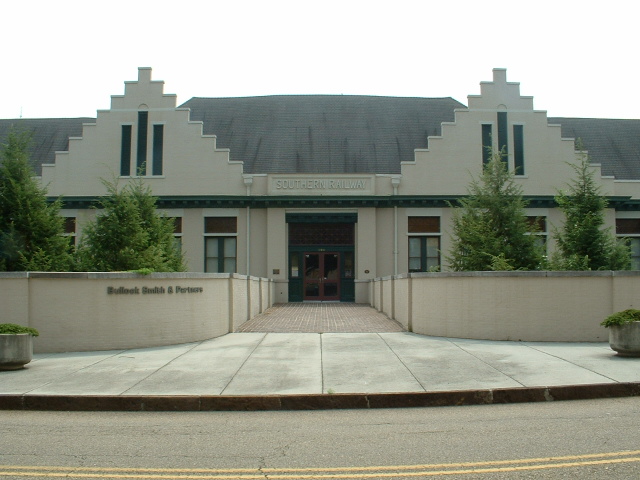
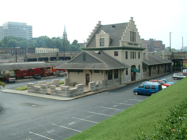
The train station in Collierville was originally built by Southern Railway for the town of LaGrange, TN. Then, in the 1940's it was moved to Collierville. In 1976,
the Southern realized there would be no more passenger service and the depot was given to the city and moved to its present location. Now it is on the town square and off
of the quite active NS main line. It is now open as a train museum, which is under the oversight of the Memphis Transportation Museum. There are still some tracks that
lead up to this station where the museum has some rolling stock on display.
GPS Coordinates: 35.608077, -87.037347
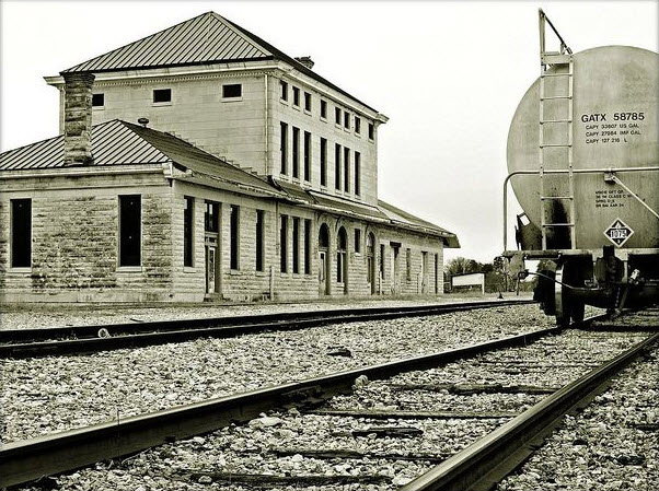
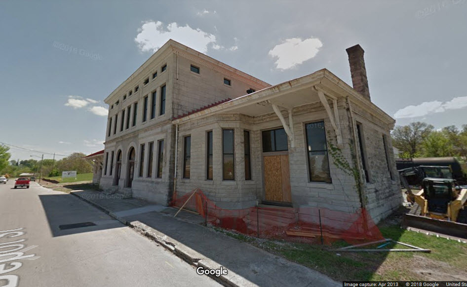
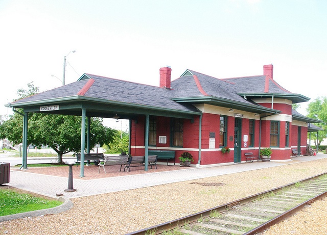
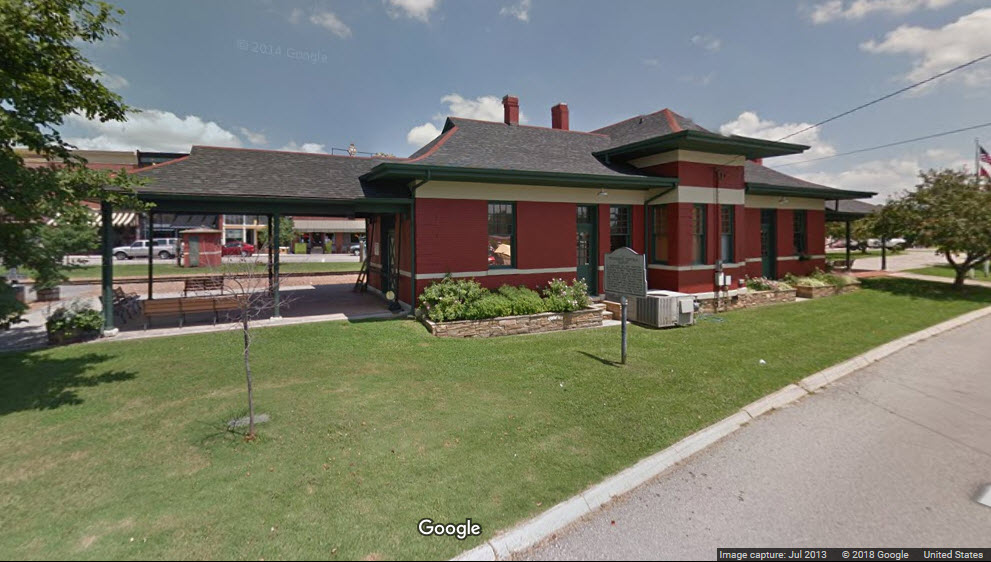
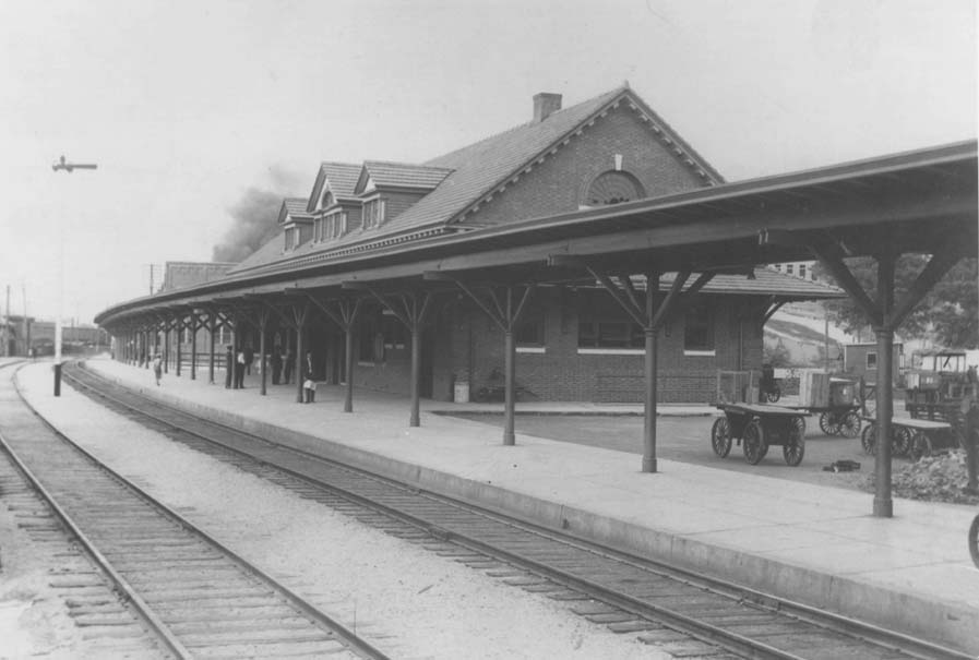
Columbia Train Depot - Union Station - Maury County TN
211 Depot St, Columbia TN 38401
The old Union Station in Columbia was built in 1905, replacing an older, long demolished building that had stood nearby. It served the community until the 1960s when
passenger service was discontinued, with freight and parcel service soon to follow.
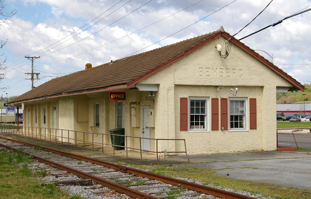
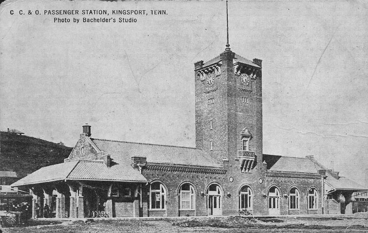
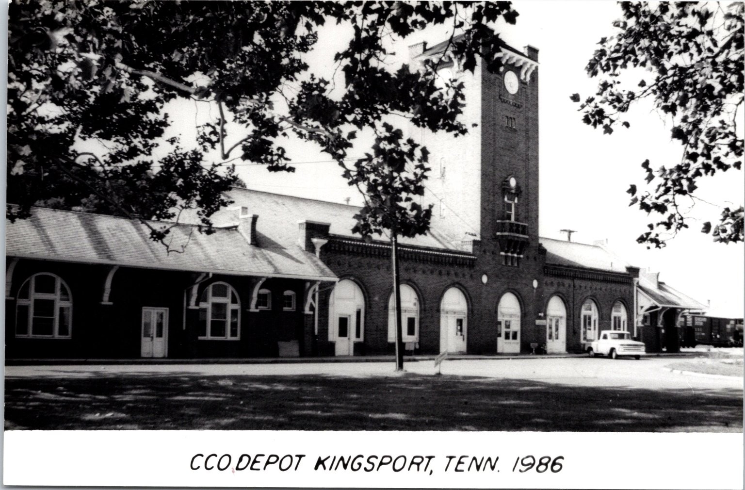
GPS Coordinates: 36.348103, -82.241868
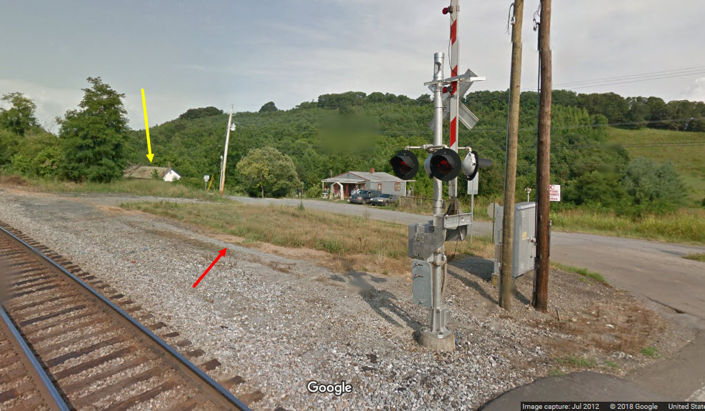
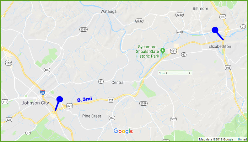
Located only 8 miles from Johnson City, the East Tennessee RR used to run freight into town back in early 80's.
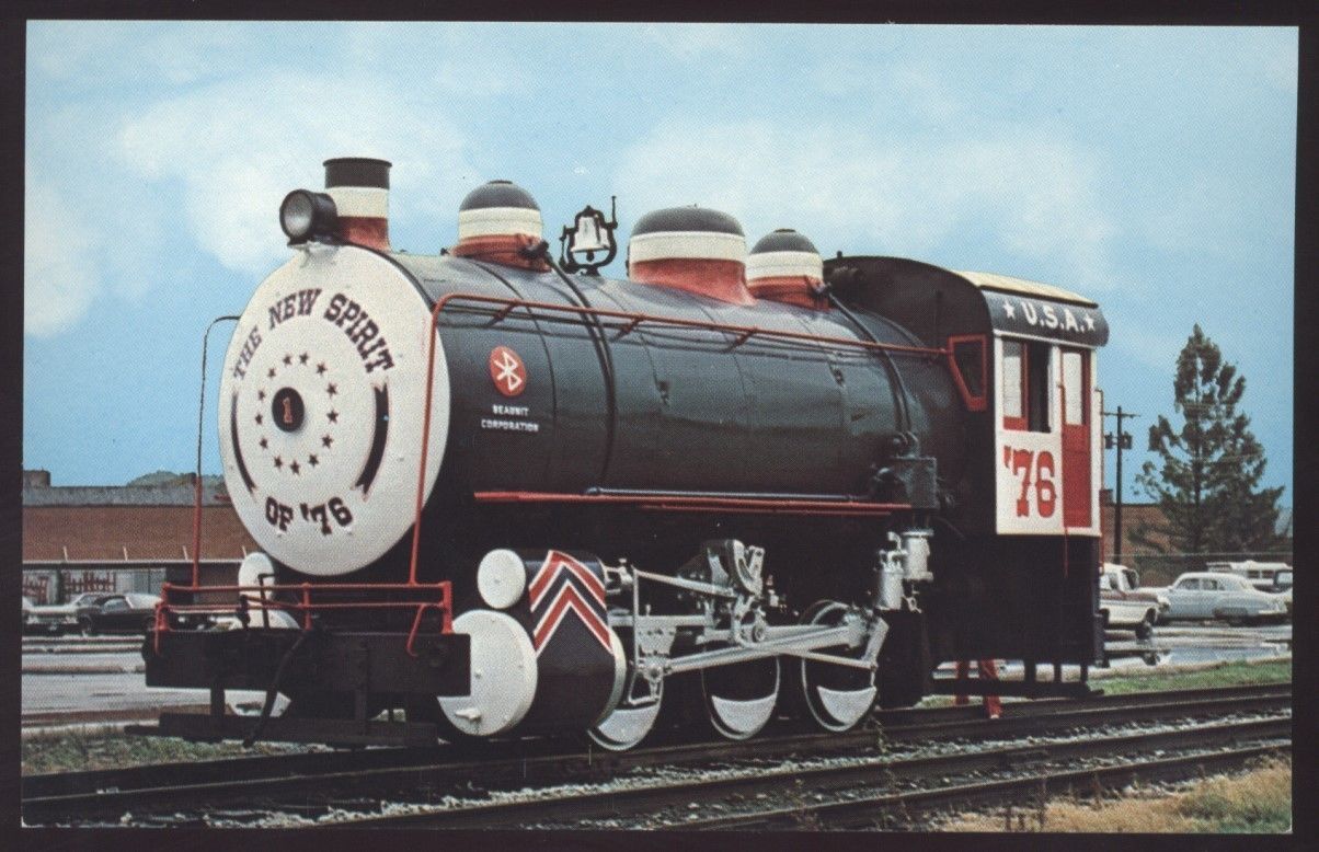
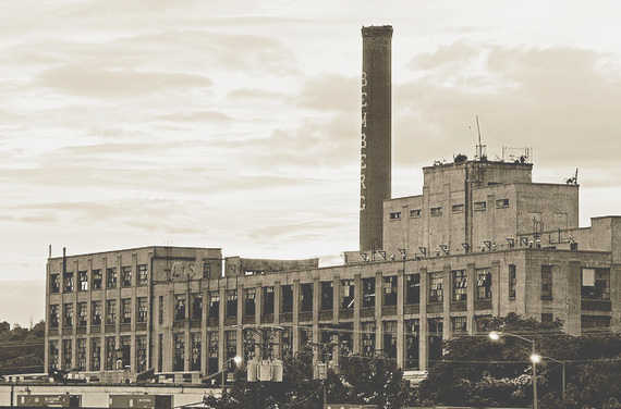
Elizabethton - the Fireless Steamer
A "fireless" steam engine at the Beaunit Corporation. Looks like the steam engine was an early user of Bluetooth technology :-)
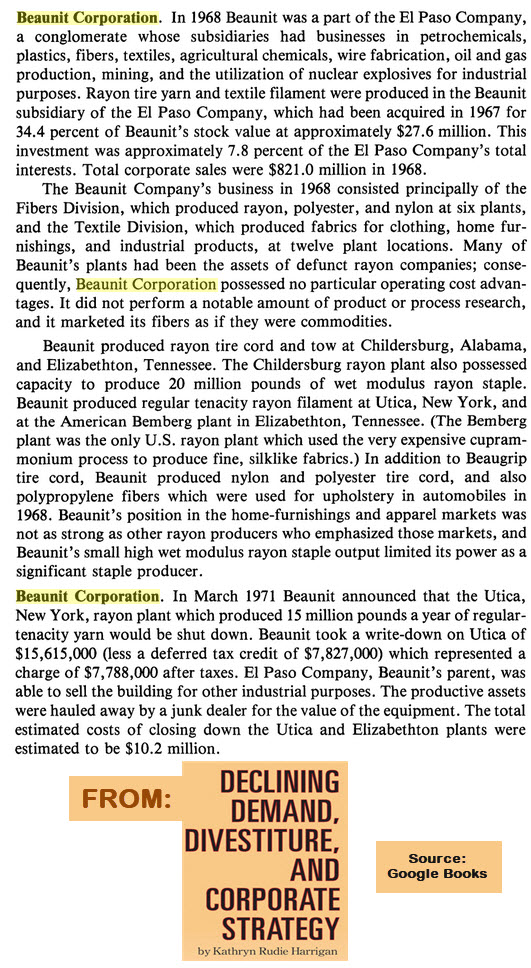
The plant produced RAYON, and had a difficult time come the 70's-90's.
In 1996 it laid off 70 people, and in 2000, the plant had a severe fire that took a week to put out. It was permanently closed then, and torn down in 2001.
For more reading: http://tennesseeencyclopedia.net/entry.php?rec=1005
the Beaunit plant area in 1953, both buildings are now gone
The yellow arrows point to the train station 2012, with Lowe's and Walmart now occupying the same sites
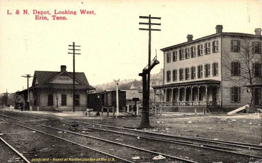
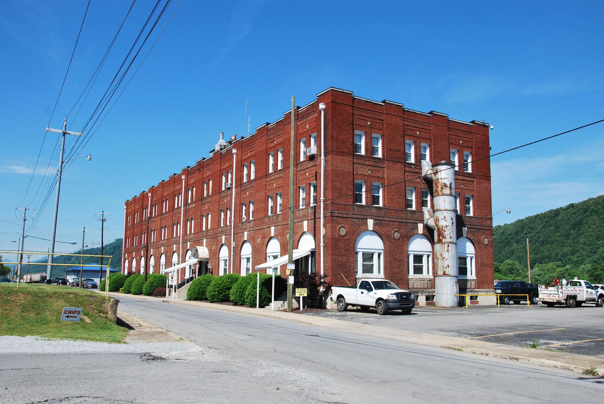
Former Clinchfield RR headquarters building in Erwin.
seller: walkerspostcards
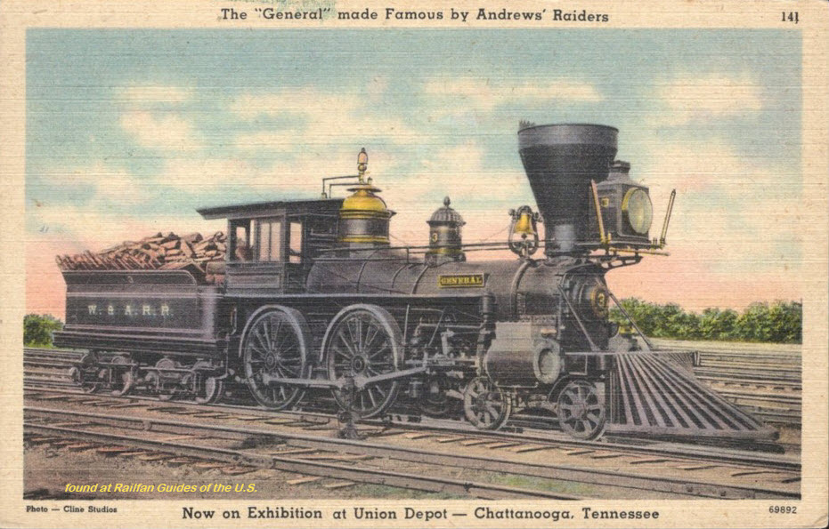
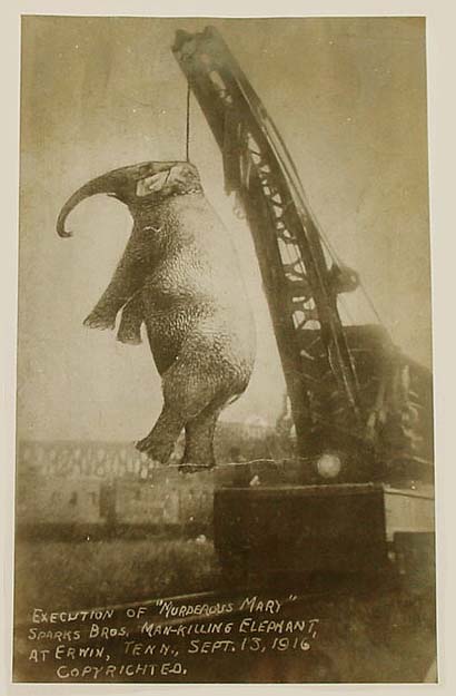
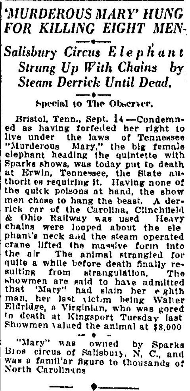
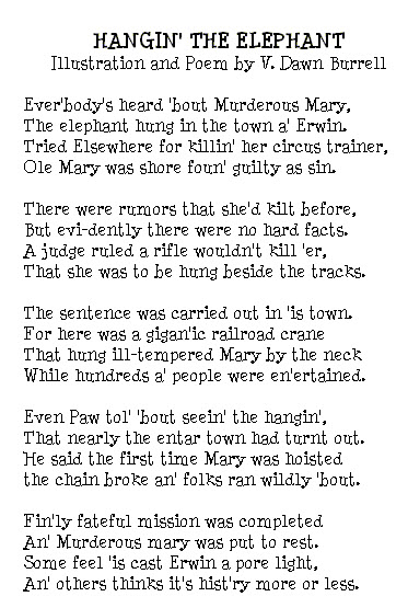
Back in the early 1900's when a circus came to Kingsport TN, an elephant went "crazy" and wound up killing its trainer. The punishment at the time was
hanging, so after a quick trial, the elephant was sentenced to death by hanging. The only problem was: there was no gallows strong enough to support the weight of
an elephant. So a decision was made to transport the elephant to Erwin, where the headquarters for the CC&O RR (the Clinchfield) was, and use one of there
railroad cranes to hang the elephant. Remember, this was America in 1916.
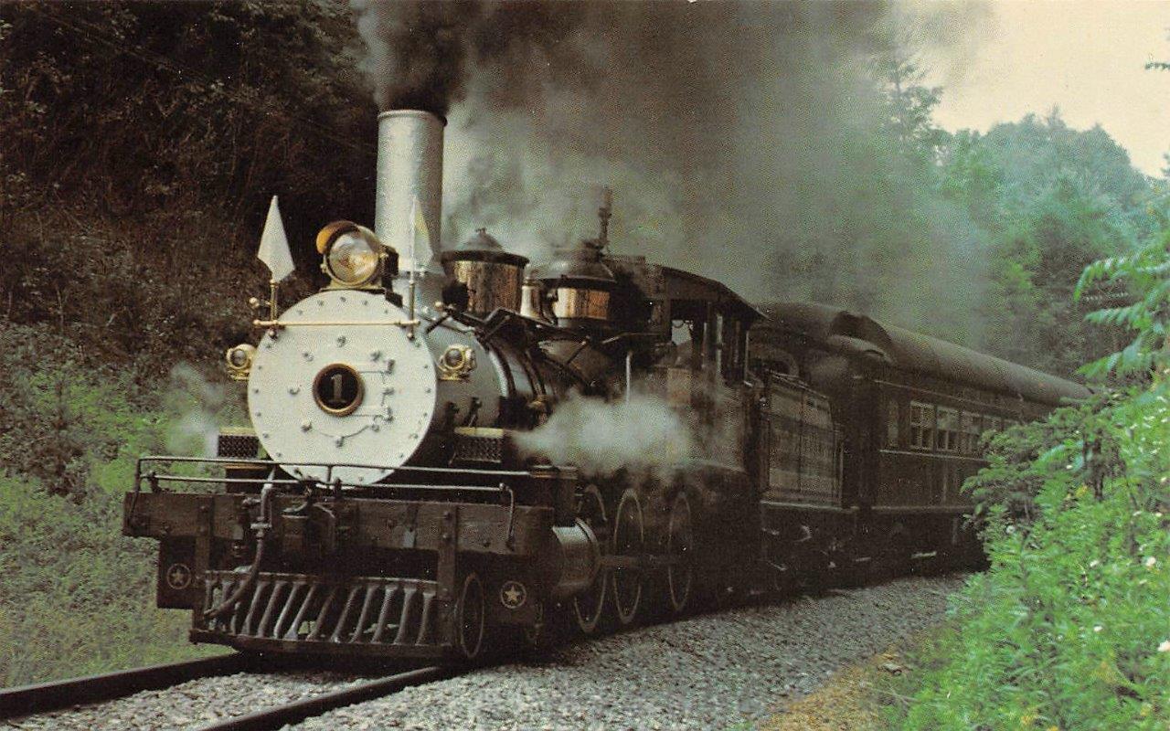
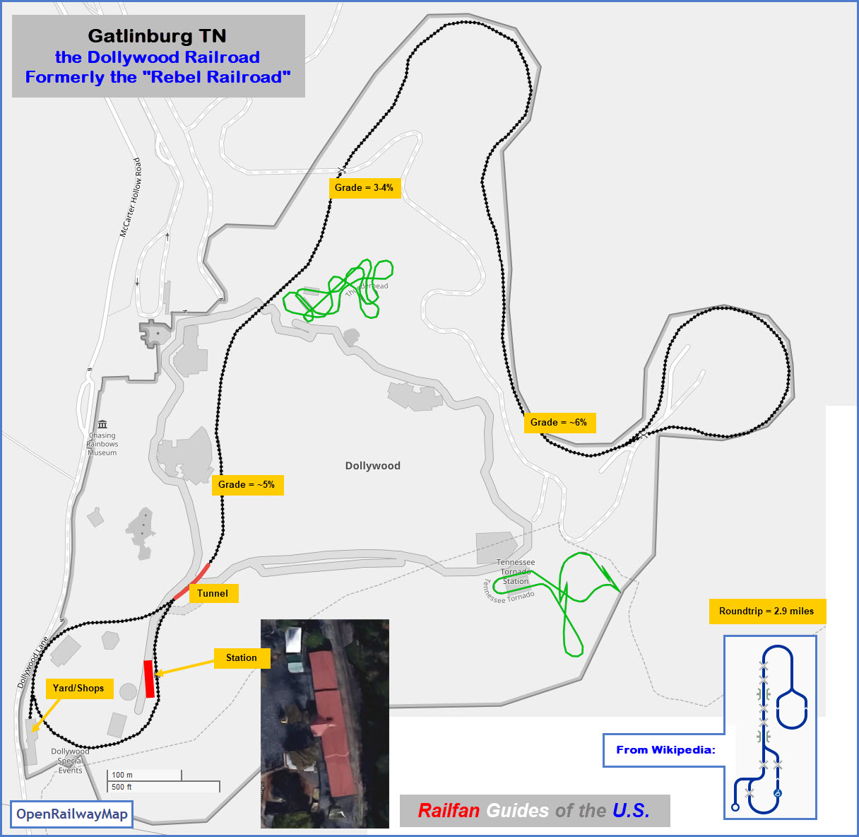
History: In 1957, North Carolina real-estate developer Grover Robbins opened a theme park between Boone and Blowing Rock called the Tweetsie Railroad
with ex-East Tennessee and Western North Carolina Railroad 4-6-0 #12. The park was an instant success. In 1961, he acquired two USATC S118 Class 2-8-2s from the
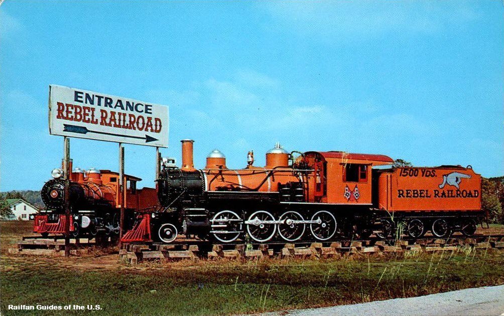
White Pass. The success of Tweetsie prompted him to send one of them, #192, to the Smoky Mountains of East Tennessee for a second theme park, called Rebel
Railroad. The other, #190, was sent to Tweetsie and still operates there.
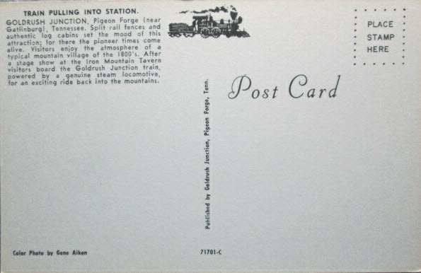
The Rebel Railroad, which opened in 1961, was designed as a tribute to the Smoky Mountain way of life. Besides the steam train named Klondike Katie, the
small park also featured a general store, a blacksmith, and a saloon. Although the park would soon change owners in 1970, the spirit of tradition would remain at
the Robbins’ park even into the present day.
In 1970, the Rebel Railroad was purchased by Art Modell, the owner of the NFL team, the Cleveland Browns. He renamed the park Goldrush Junction and
expanded it along the same Appalachia theme laid out by the Robbins Brothers. Now known as “Tennessee’s Million Dollar Fun Attraction,” the much
larger park featured new attractions such as a saw mill, an outdoor theater, log cabins, and a campground, as well as many children’s rides. Modell also
added a small chapel named after the Sevier County doctor who delivered Dolly Parton. This chapel was just one of the many connections to the park and county
that led Parton to eventually buy into it and give it her name.
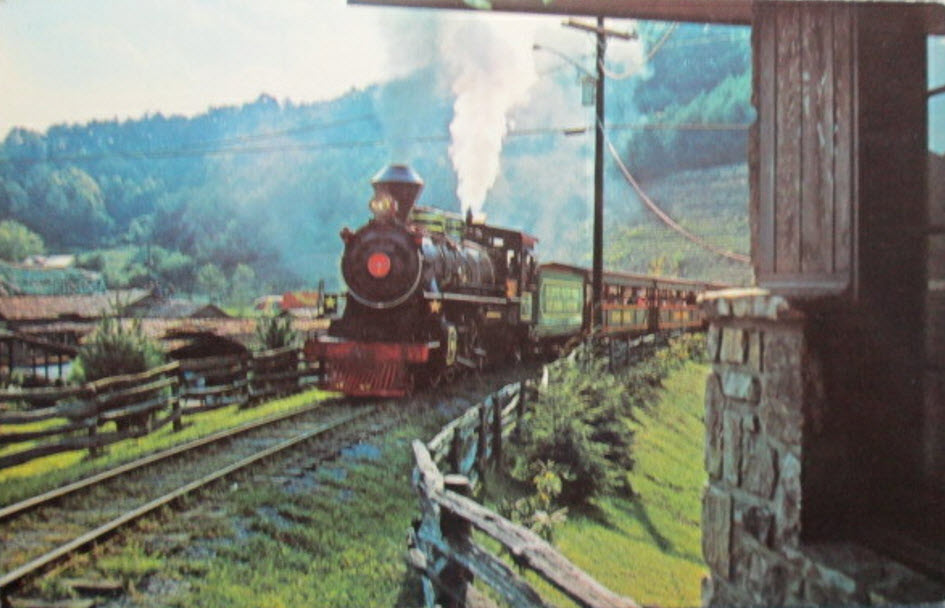
In 1977, Goldrush Junction was sold to Jack and Pete Herschend, of Herschend Enterprises, and renamed Silver Dollar City Tennessee. The Herschend brothers
were looking to build upon the success of their original Silver Dollar City in Branson MO. Just like the Tennessee park that they had just acquired, Silver Dollar
City in Branson paid homage to the unique history of the area, featuring frontier-style buildings and other period specific attractions. In 1983 Silver Dollar City opened
the first working grist mill Tennessee had seen in over 100 years.
In 1986, Dolly Parton partnered with the Herschends and together they reopened the park under the name, Dollywood.
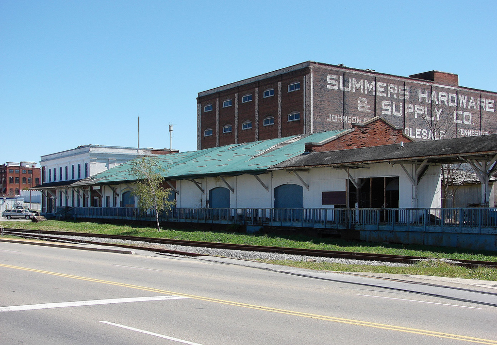
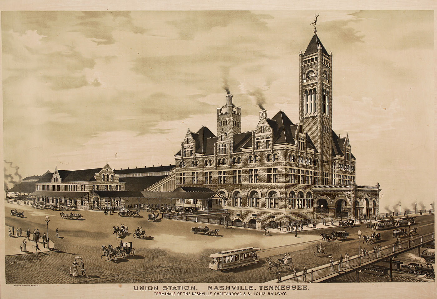
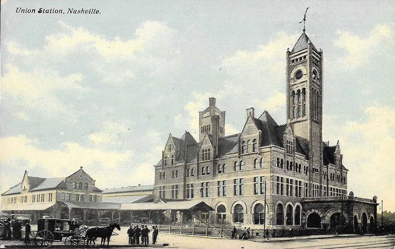
Johnson City was served by two railroads, the Clinchfield RR, and the Southern Rwy. They are now CSX and the Norfolk Southern. Just north of Johnson City is
a beautiful trestle on the Clinchfield, which provided many a good picture when I used to visit JC during the timeframe of 1980-1984.
During that time, the license plate on my car was "UP8444". One day I stopped by the Southern freight office, and that particular month, a picture on the
UPRR calendar hanging in his office was of, you guessed it, 8444. The station agent noticed my plate, and asked me how I was able to do that, and I told him Maryland
let you purchase vanity plates. He thought that was quite a hoot!.... AND quite a coincidence!
Believe it or not, 8 miles away in Elizabethton, there was an industry (the Beaunit Corp) operating a fireless steam engine to move its cars. This was the kind of
steam engine where the boiler was a storage tank, and the steamer would have to be hooked up to a boiler inside the factory for its steam.not a real boiler.
About 10 miles south was the Clinchfield's headquarters in Erwin TN. They were really pissed down there when CSX came in and moved Clinchfield #1 up to the B&O
RR Museum in Baltimore, believe me, I worked at Nuclear Fuels in Erwin, and never heard the end of it! :-)
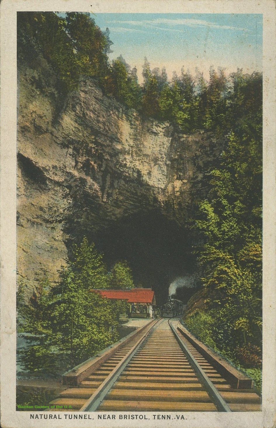
I've been here once in my life, way back in the early 80's when I had a job that took me to east Tennessee, and wouldn't you know it, there was a derailment somewhere
and trains weren't running. If it wasn't for bad luck..... It's off of I-81 near the TN-VA border, and the Natural Bridge (no trains) is up the road a ways also
off of I-81.
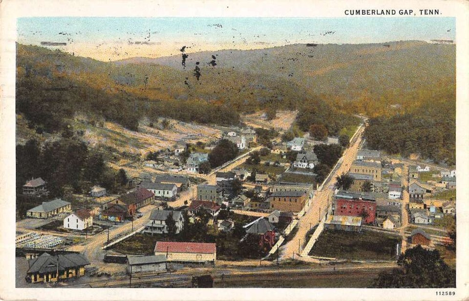
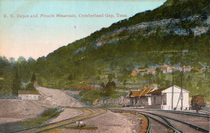
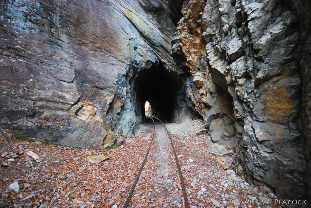
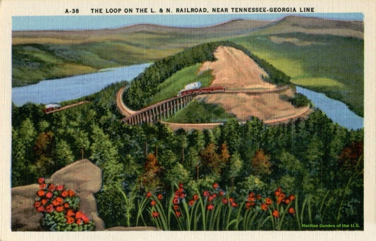
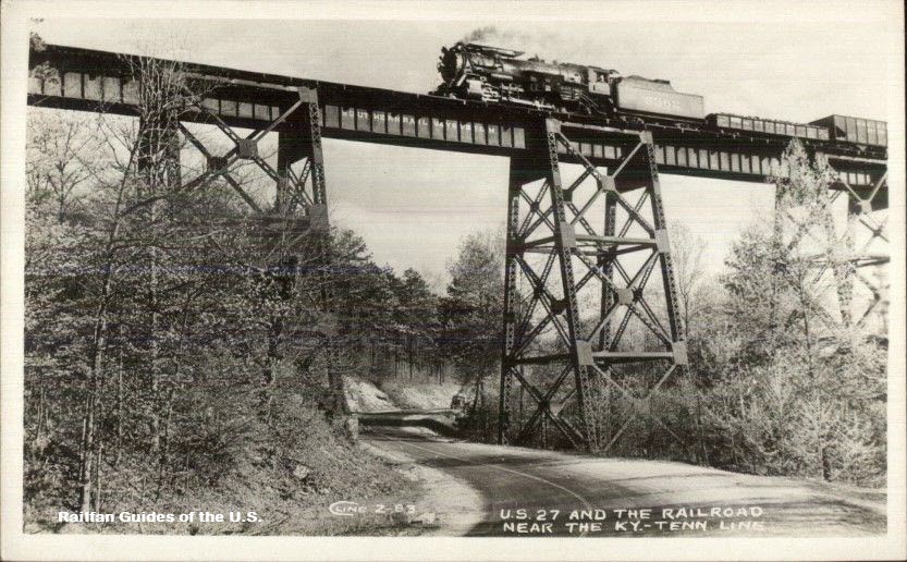
I tried to find where this trestle was/is, and couldn't, mainly because near the TN-KY border today, along US27, is a double-track Norfolk Southern mainline,
which in no way resembles what was around 100 years ago. So this is a guess...... It could be in Tennessee, or it could be in Kentucky.
seller: mikeingreensboro
seller: ohiopostcards
BTW, the recipient of the postcard lives in Suttons Bay MI, my guide for Suttons Bay is here
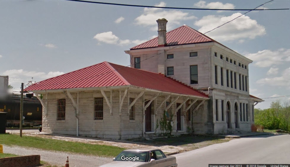
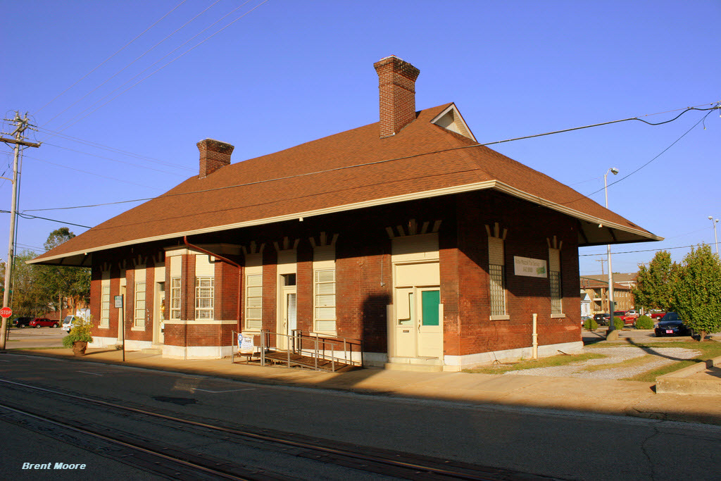
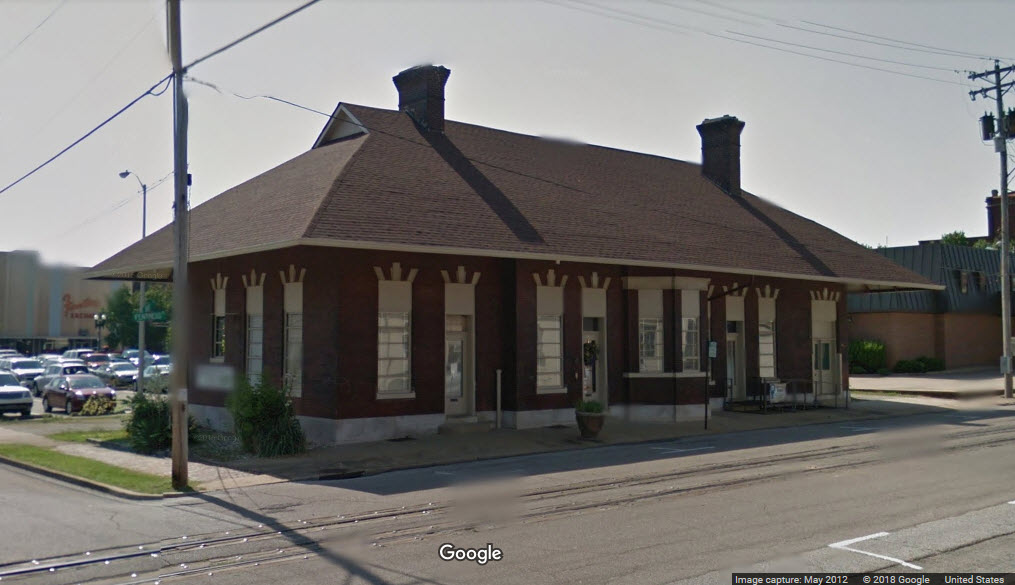
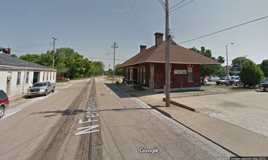
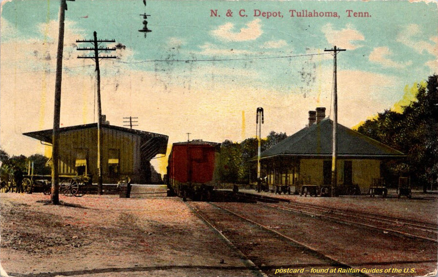
GPS Coordinates: 36.303413, -88.327263
This brick depot was originally built by NC&StL. The depot was built in 1896 and service ran until 1951. Today, the depot houses a tax business. The tracks run
down Fentress Ave. Those tracks still get some use by Kentucky & West Tennessee Railway, a short line that connects to CSX. Originally, they were laid by Paducah,
Tennessee & Alabama. When PT&A went bankrupt, the line was sold to L&N who leased it to NCStL.
More info at: https://www.flickr.com/photos/brent_nashville/6498467353
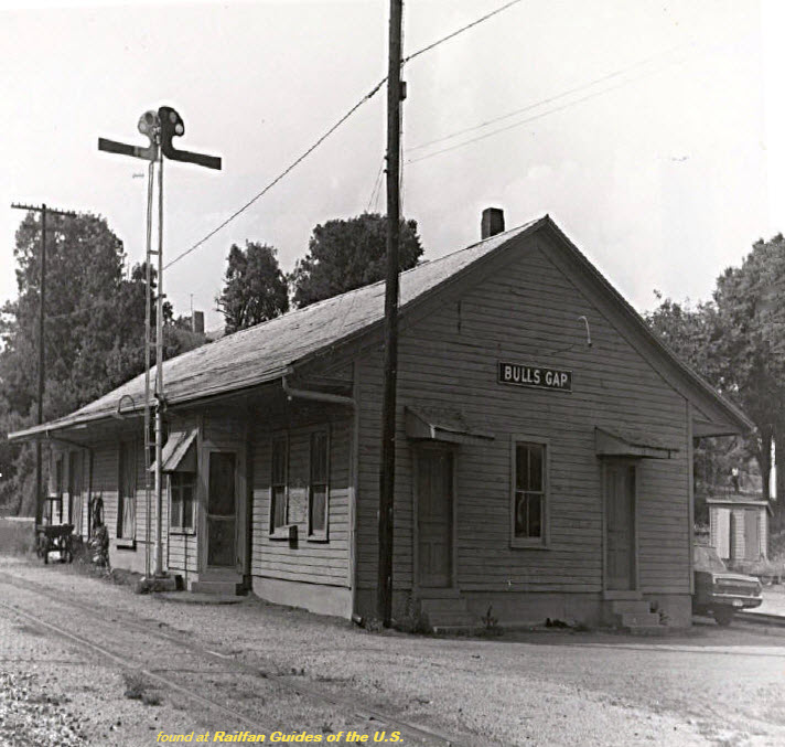
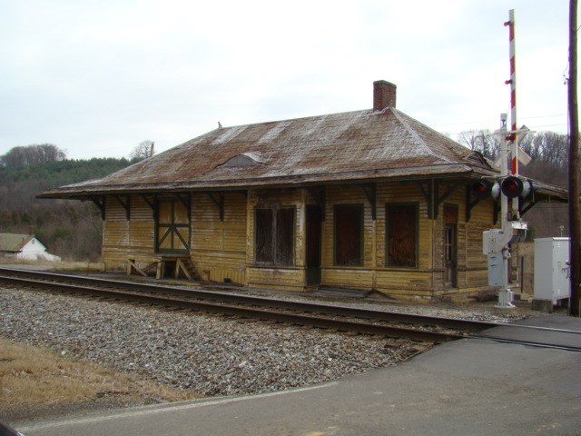
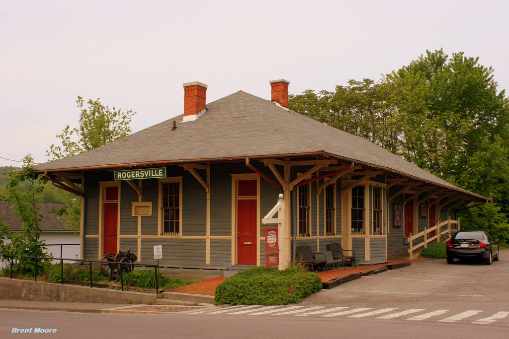
This train depot was built by Southern Rwy around 1890, and was the end of the line from
Bulls Gap. The tracks are long gone, but today the building holds the Rogersville
Heritage Association and the Tennessee Newspaper and Printing Museum.
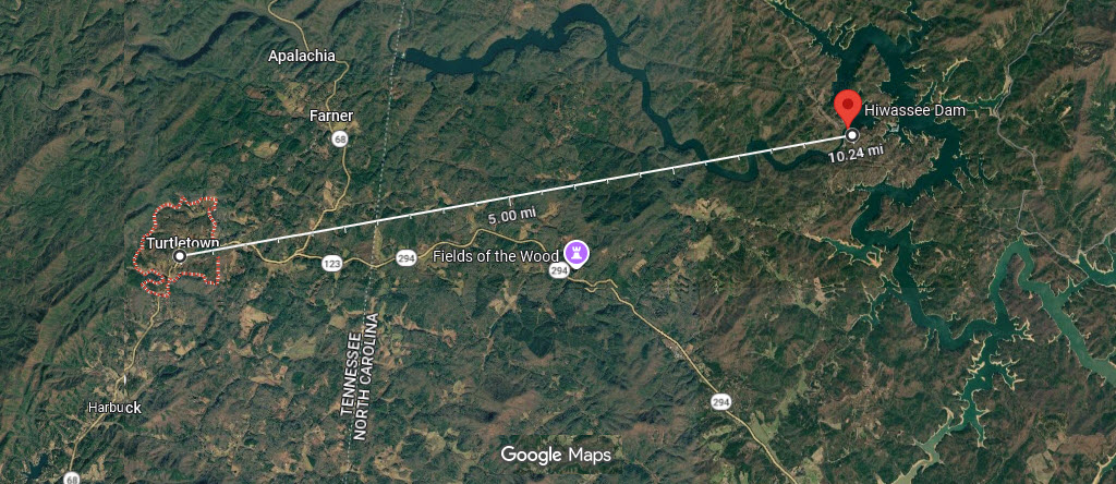
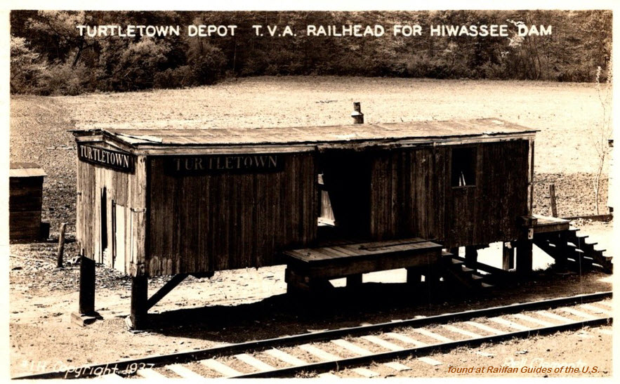
Not quite sure how a "depot" in Turtletown TN has much to do with the
Hiwassee Dam in North Carolina (10 miles away, as the crow flies).
Needs investigating, does anyone want to help solve the mystery?
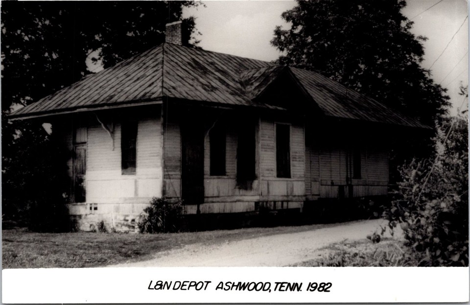


 seller: motka
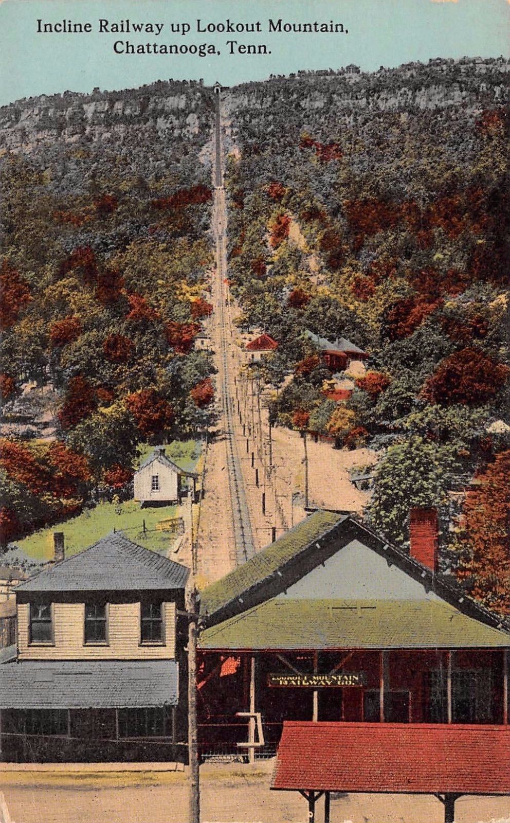
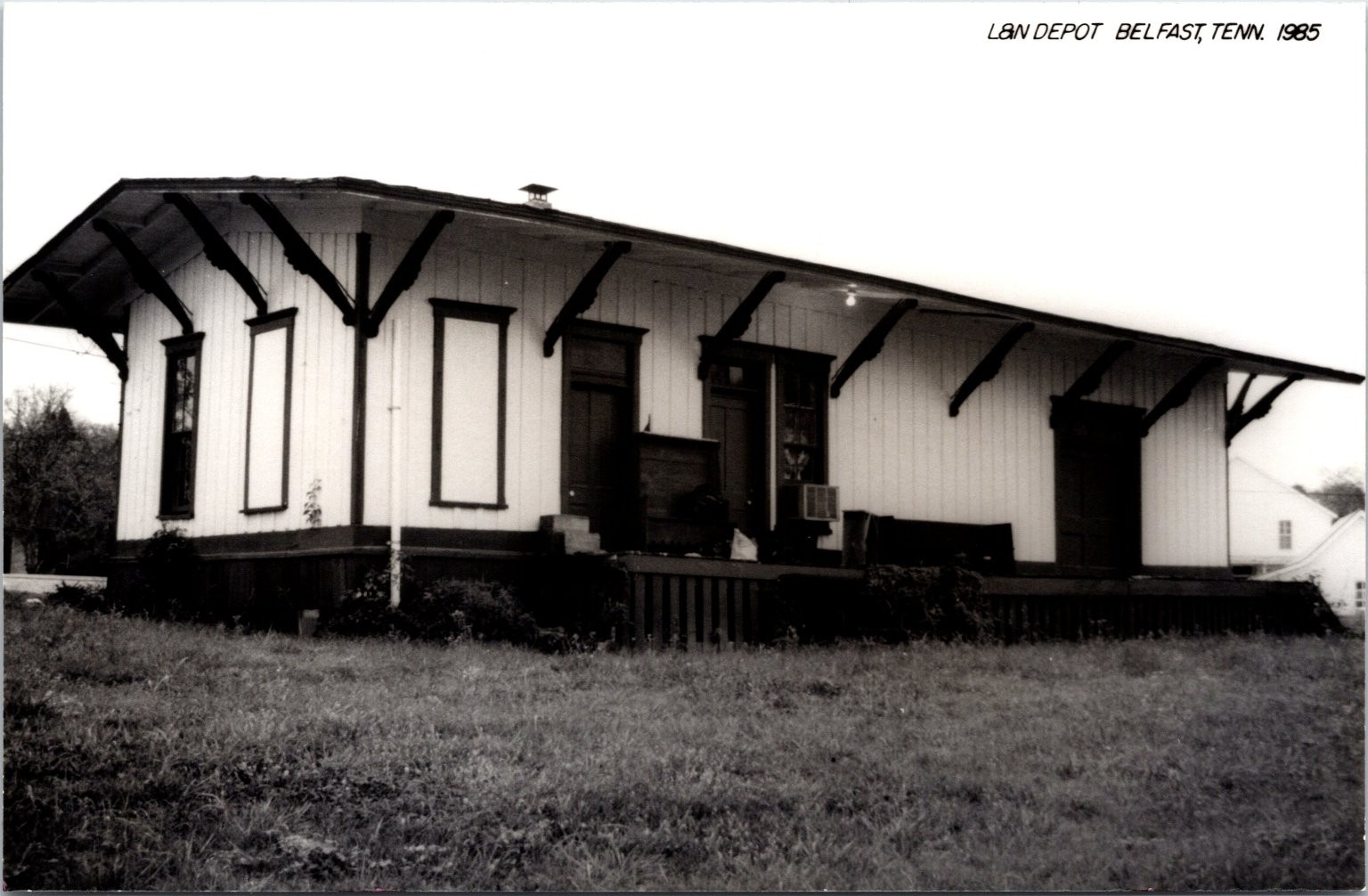
 seller: stampyboy
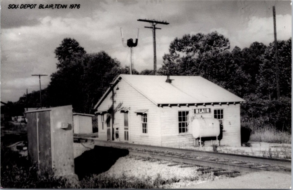
 seller: motka
 seller: jtaber
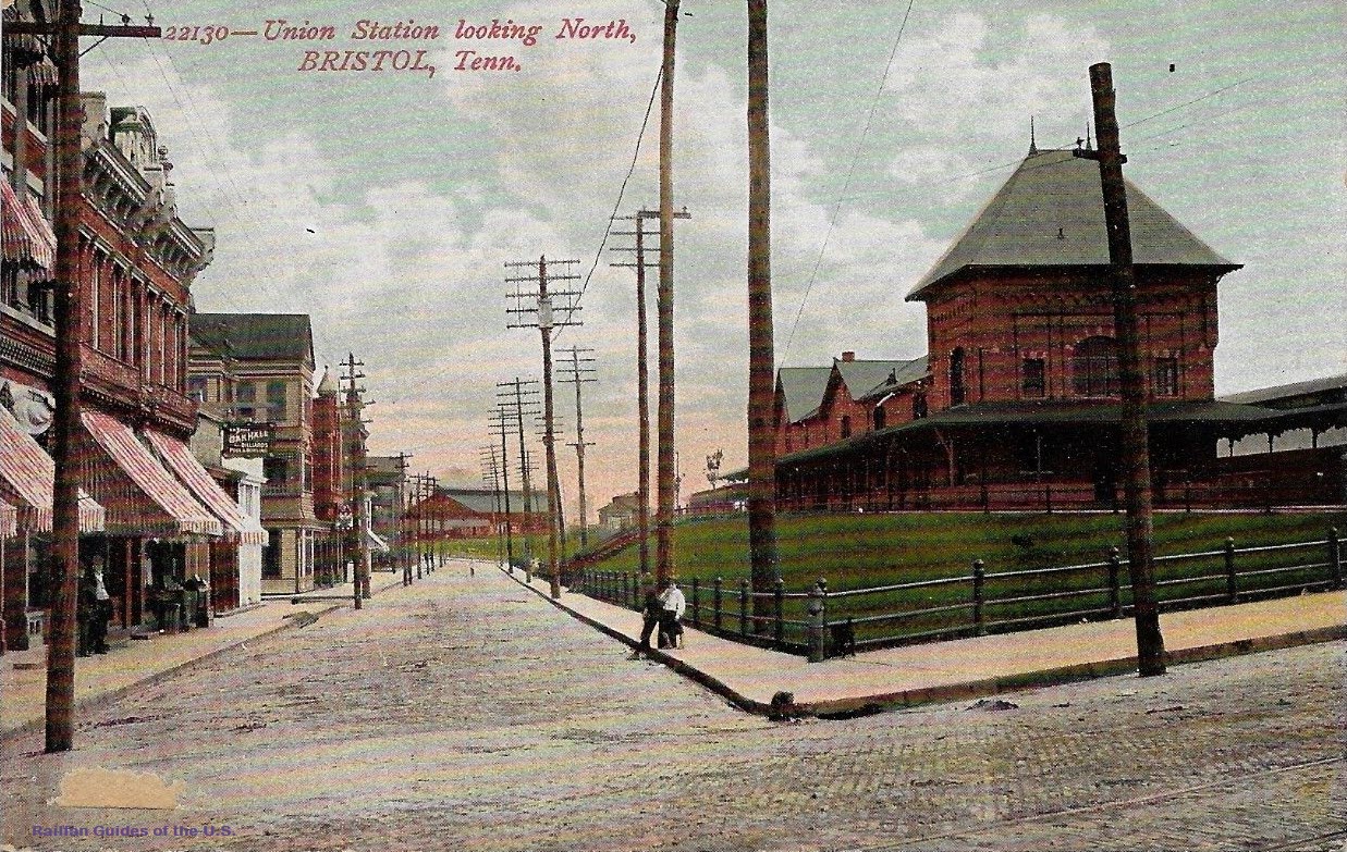
 from the Public Library/Hiener Collection
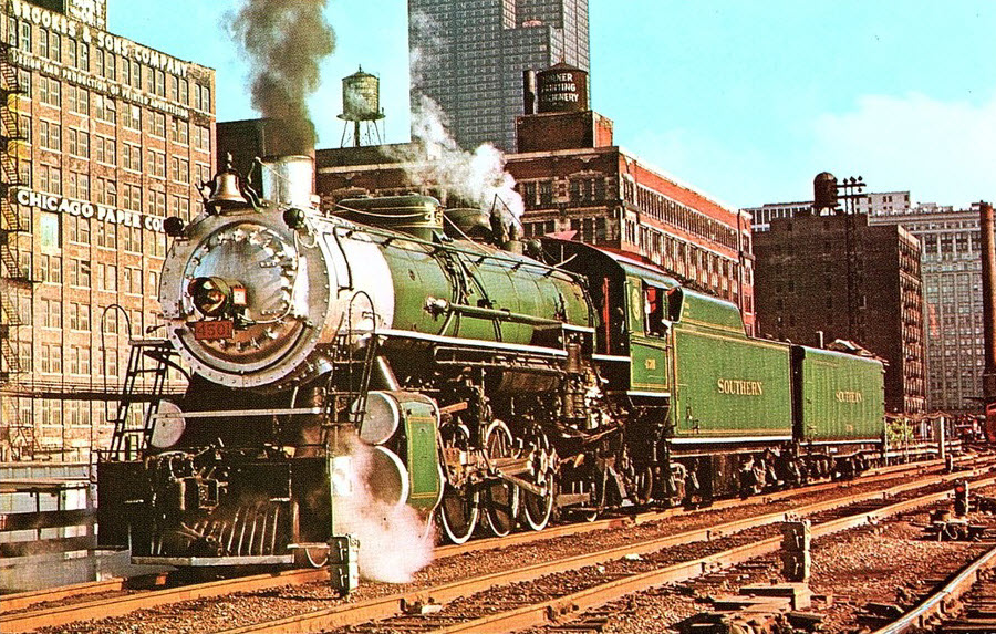
 Prior to 2012
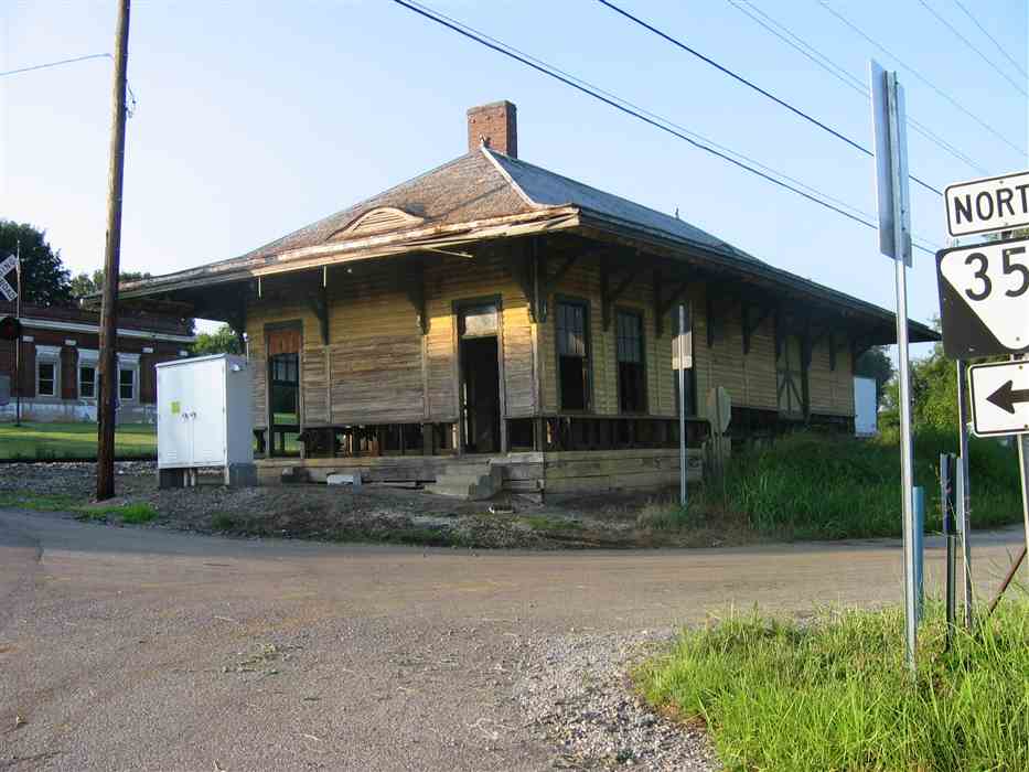
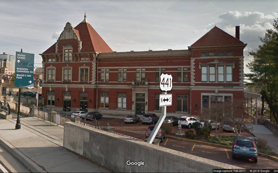
 as of 2012, from Google Streetview
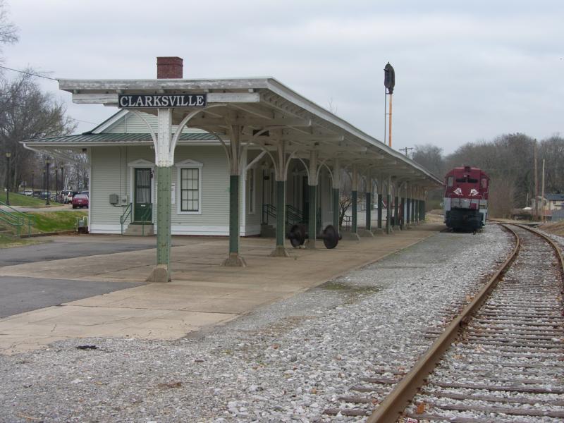


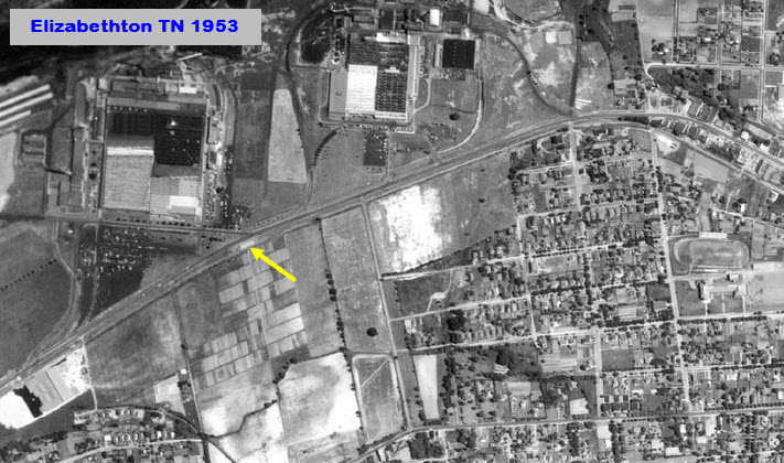 the Beaunit plant area in 1953, both buildings are now gone
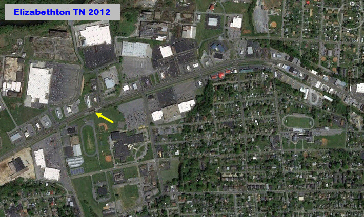 2012, with Lowe's and Walmart now occupying the same sites


 1950's, seller: crowspostcards
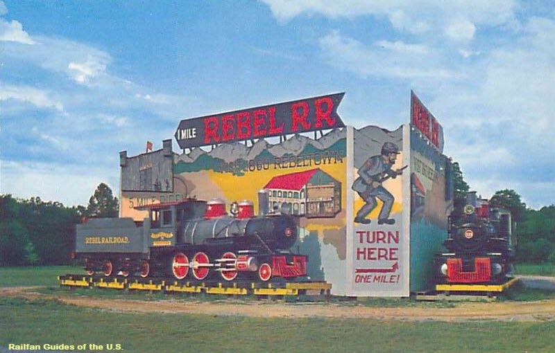

 seller: pottterycap
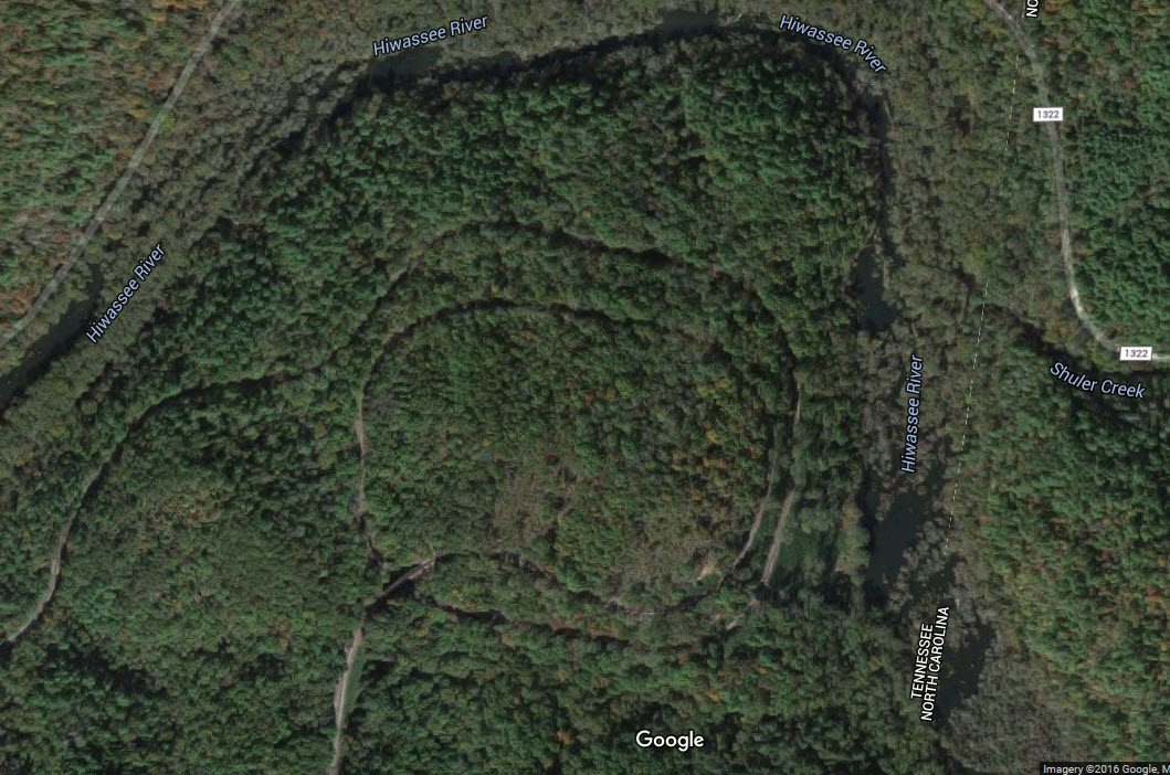
 .....postcard, cleaned up
 seller: lacumo
 seller: oldstuffisme
 .....postcard
 2007
2007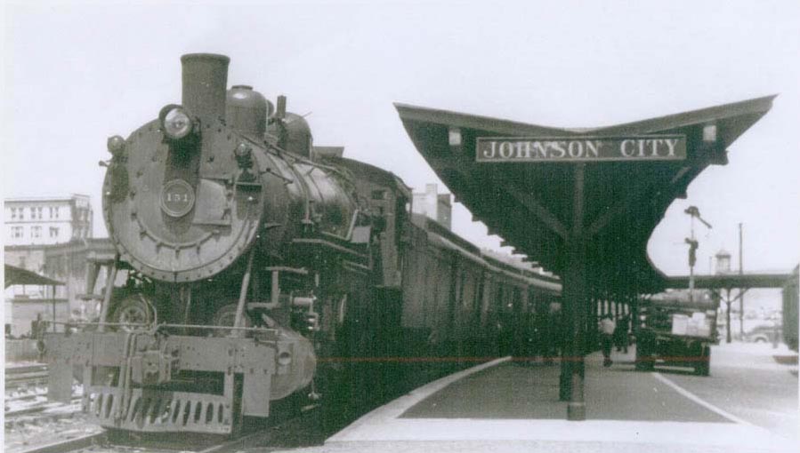

 seller: finscanes
 seller: crowspostcards
 seller: stampyboy
 seller: ourpastimes
 seller: baysideantiques_02
 seller: baysideantiques_02
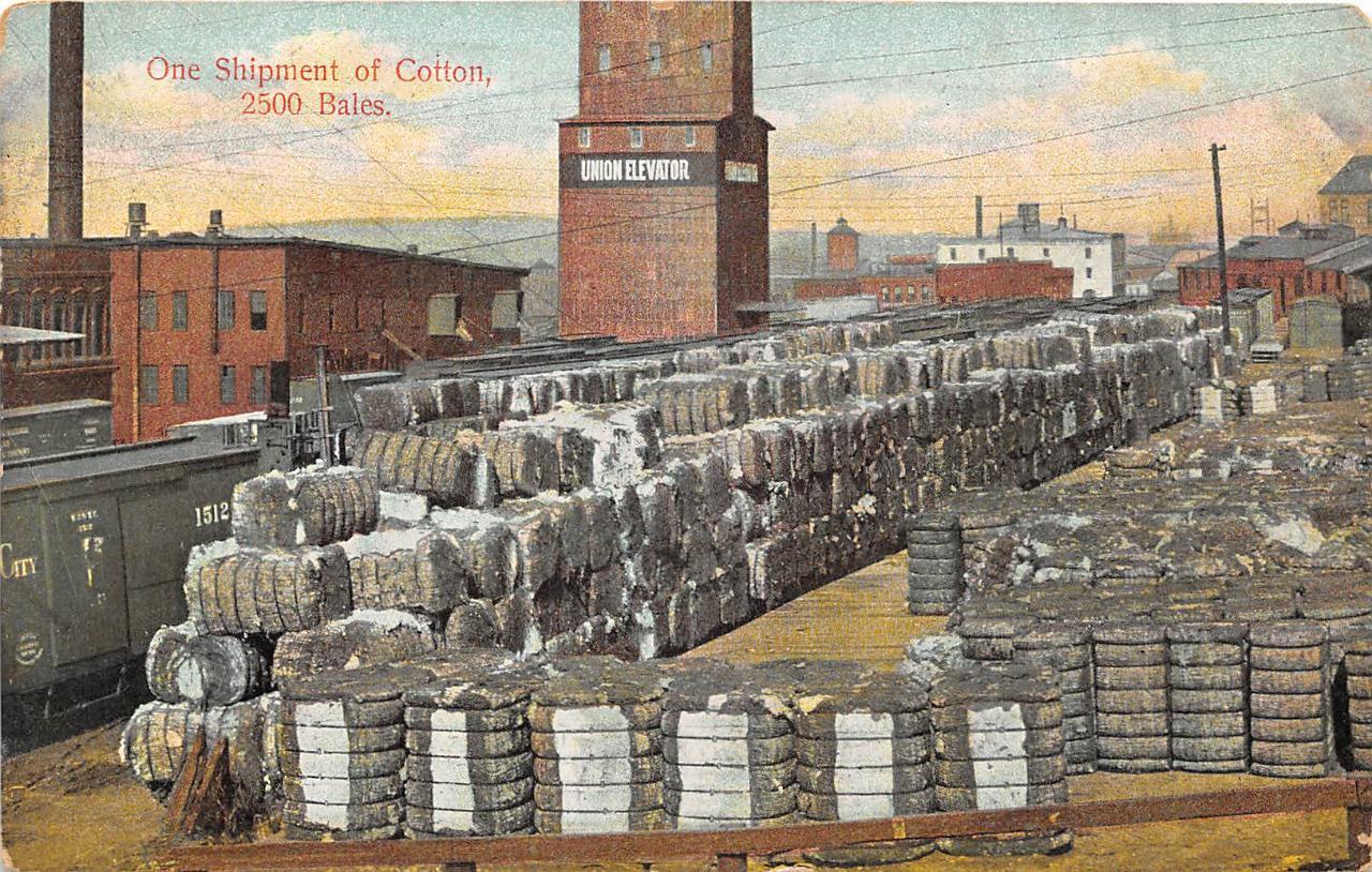
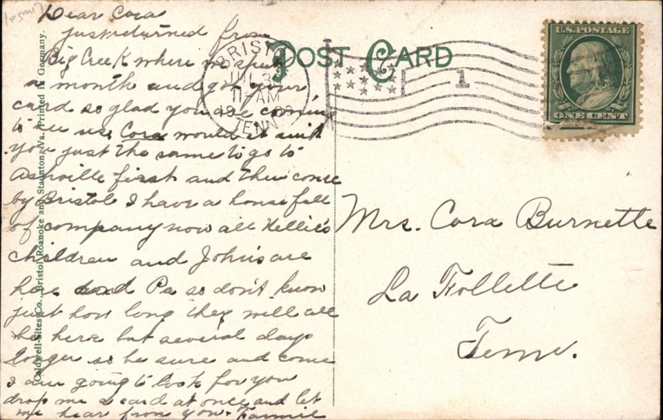
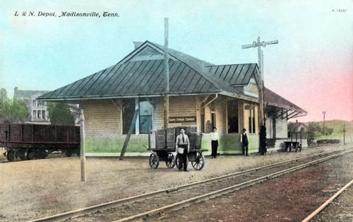
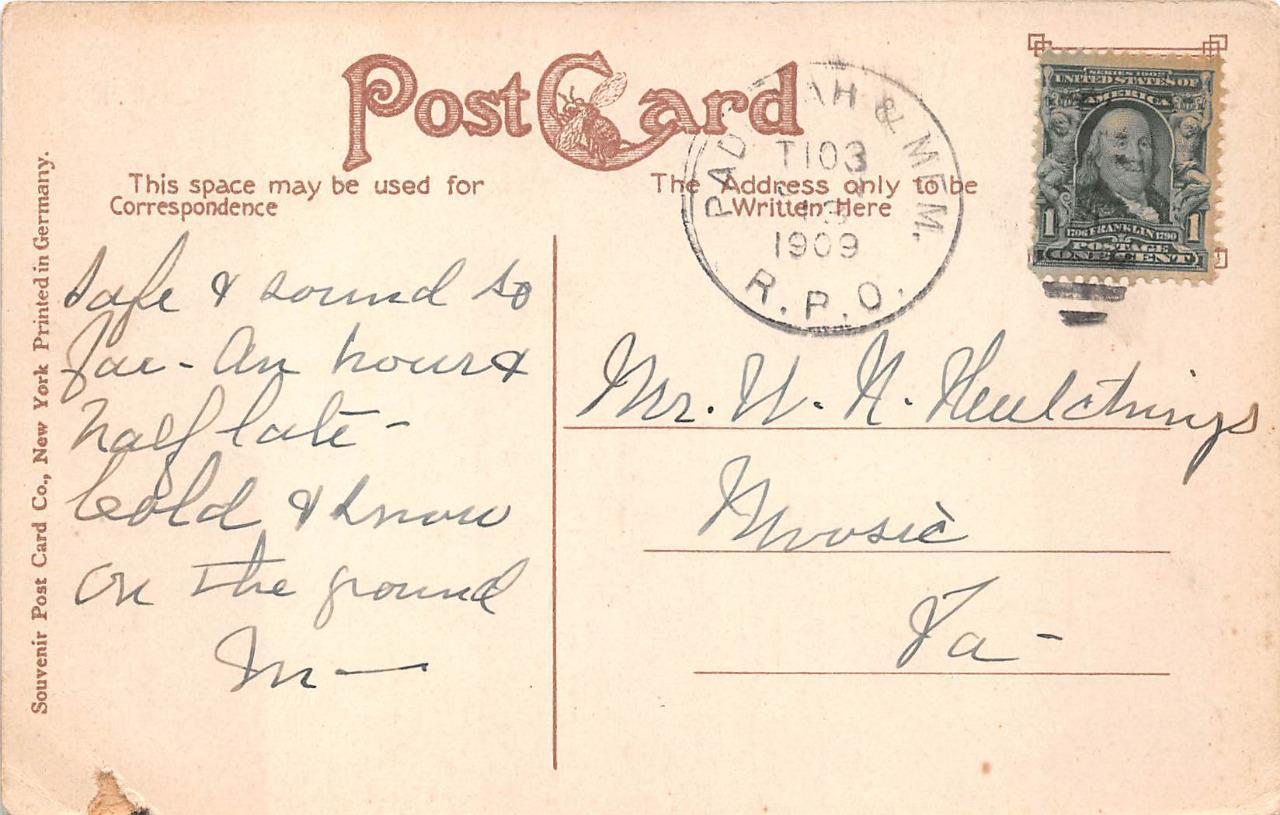
 RPO postmarked postcard
 seller: scruffy4159
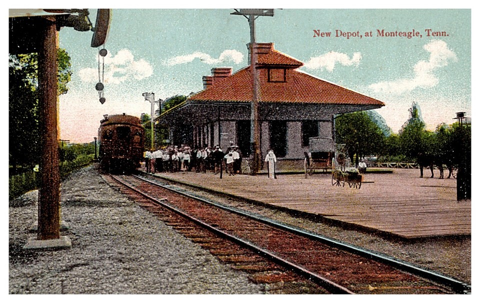

 seller: walkerspostcards
 seller: crowspostcards
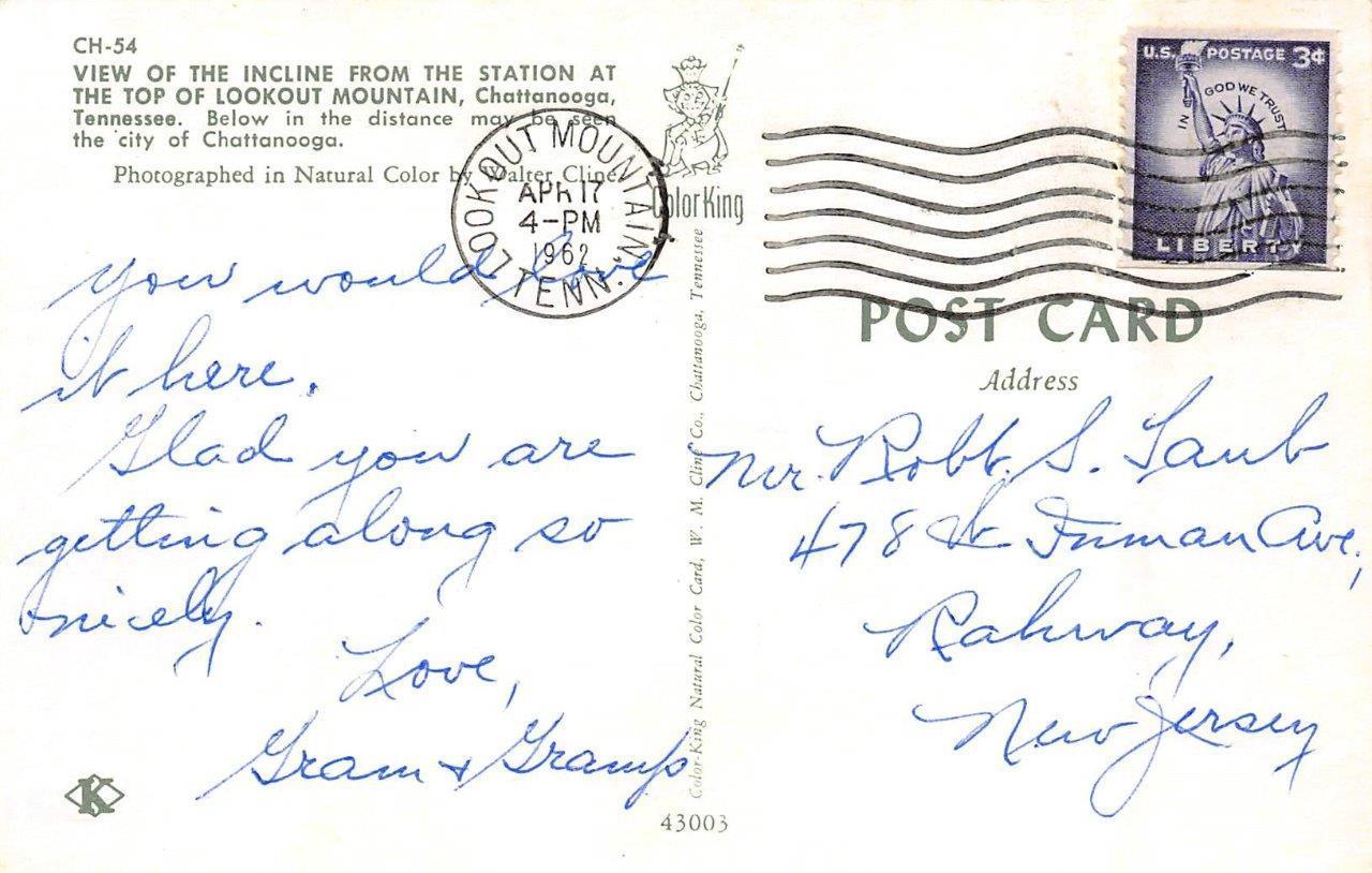
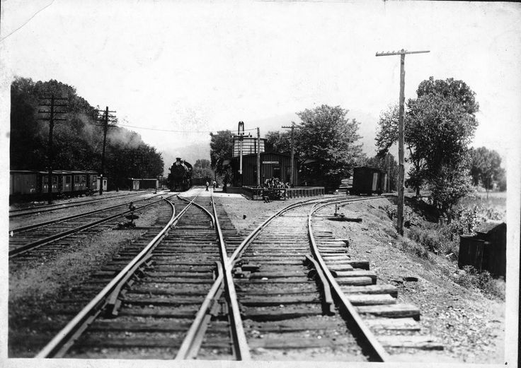 Unknown location near Nashville in 1918


 EBay seller Skurfan Postcards
 seller: mikeingreensboro
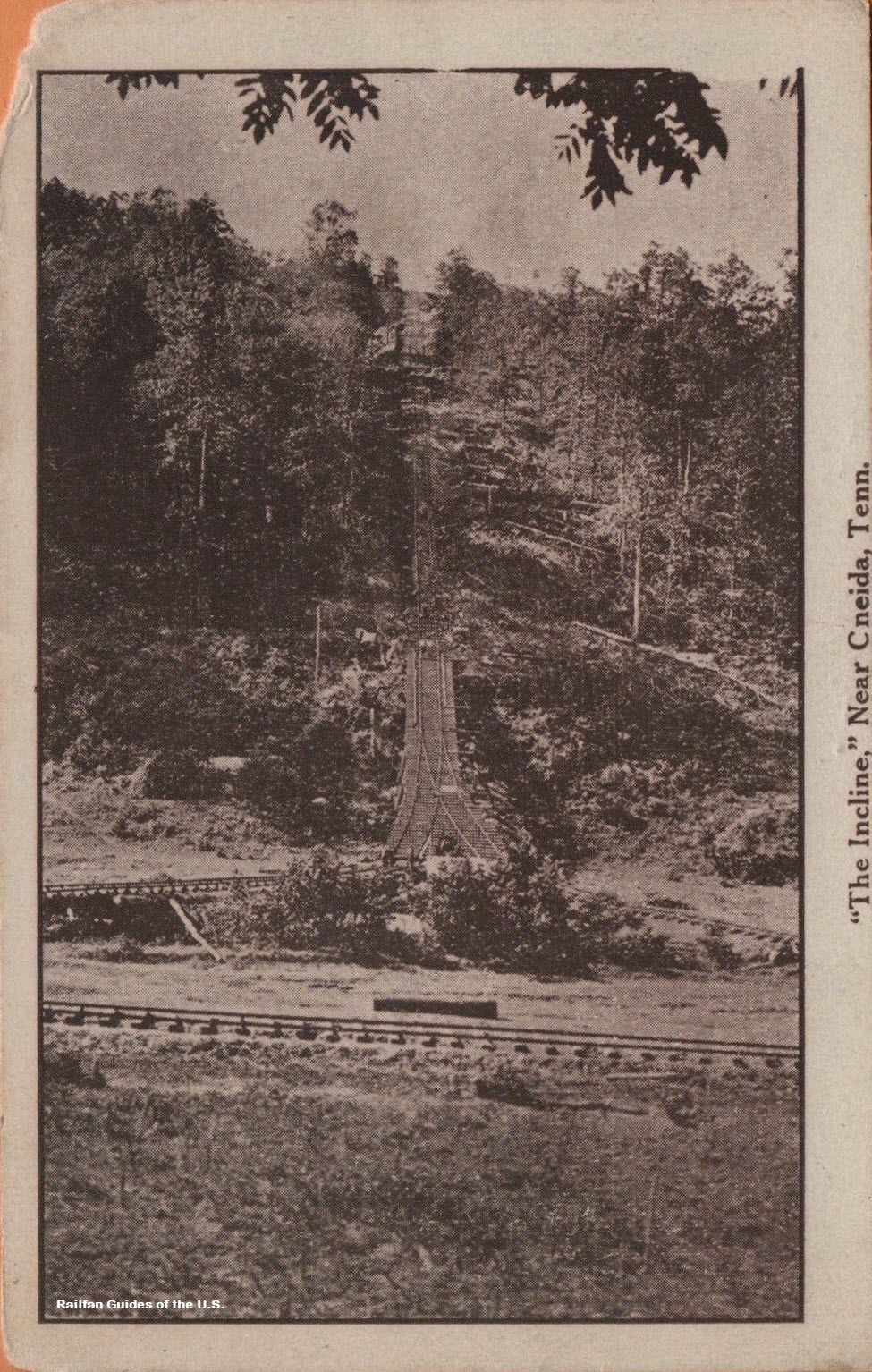

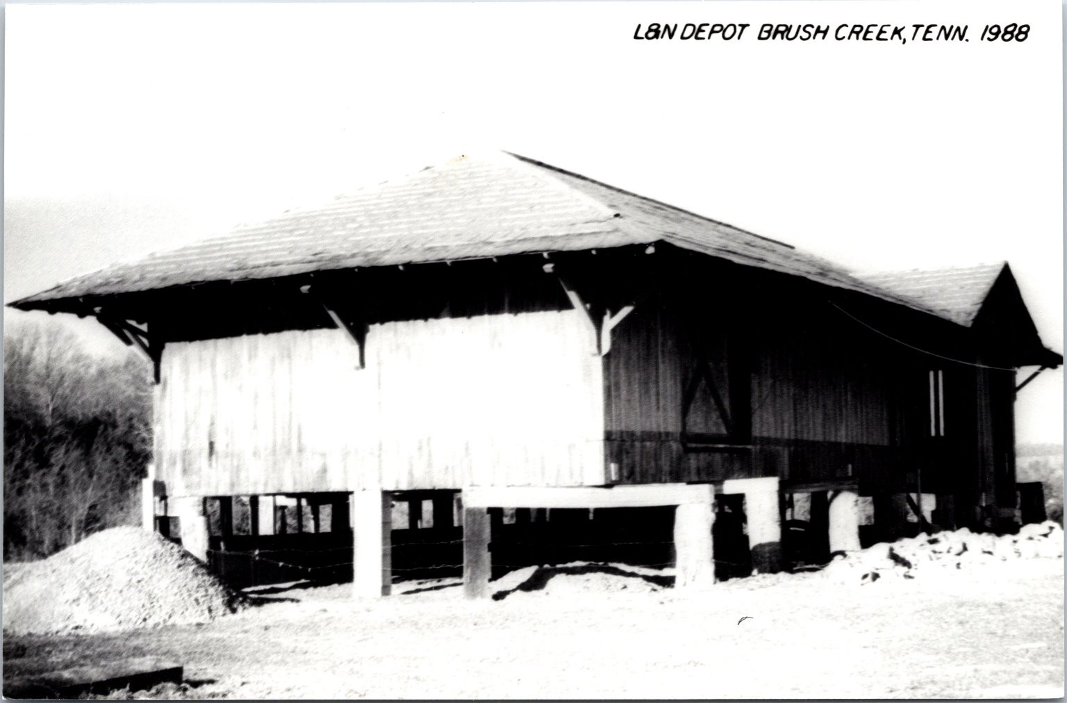
 Shed is more like it :-)
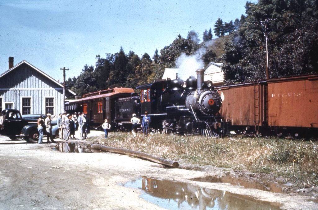
 2011
2011
 Ebay seller chiropractor13