RAILFAN GUIDES HOME RAILROAD SIGNALS HOME
Most of the postcards were found on EBay unless noted,
other pictures, mostly the more recent ones, come from Google and/or Bing images - credit given if the source is known.
Dates are in the picture name, x means the date is approximate. If they were available,
and interesting, I included the back side of the postcards. 1901a and 1910b would be the same card, both sides.
If the picture was really, really bad, some of them have been cleaned up and/or repaired when I had the energy.
This page is mostly for historical reference, as MANY of these stations are not around anymore!
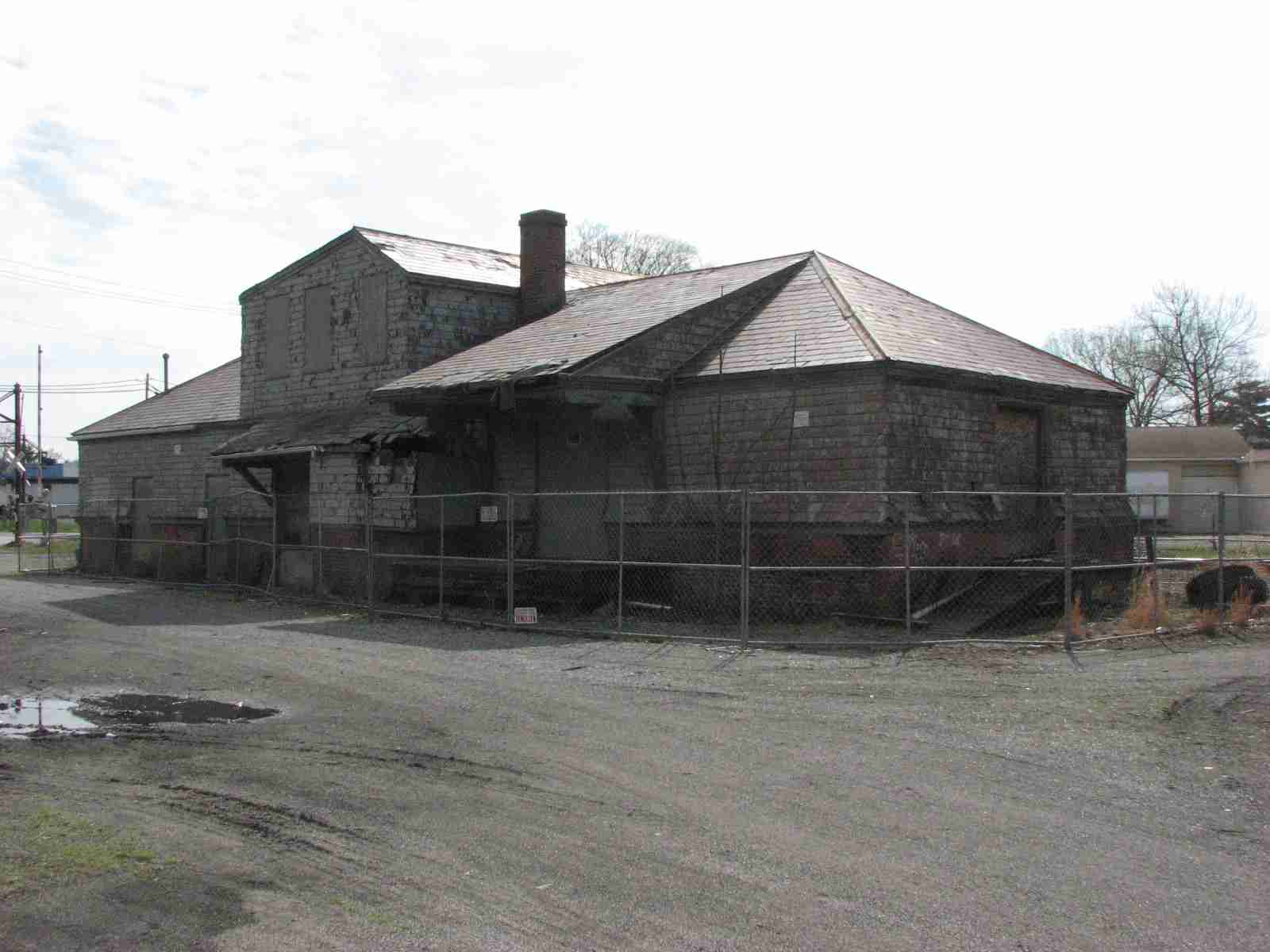
Ex B&O depot of Frank Furness design, as is the Riderwood NC Station. The picture
on the left is from 2004, way before the station was fenced off and moved.
The picture on the right is from 2015, and is courtesy Tony Kobilski.
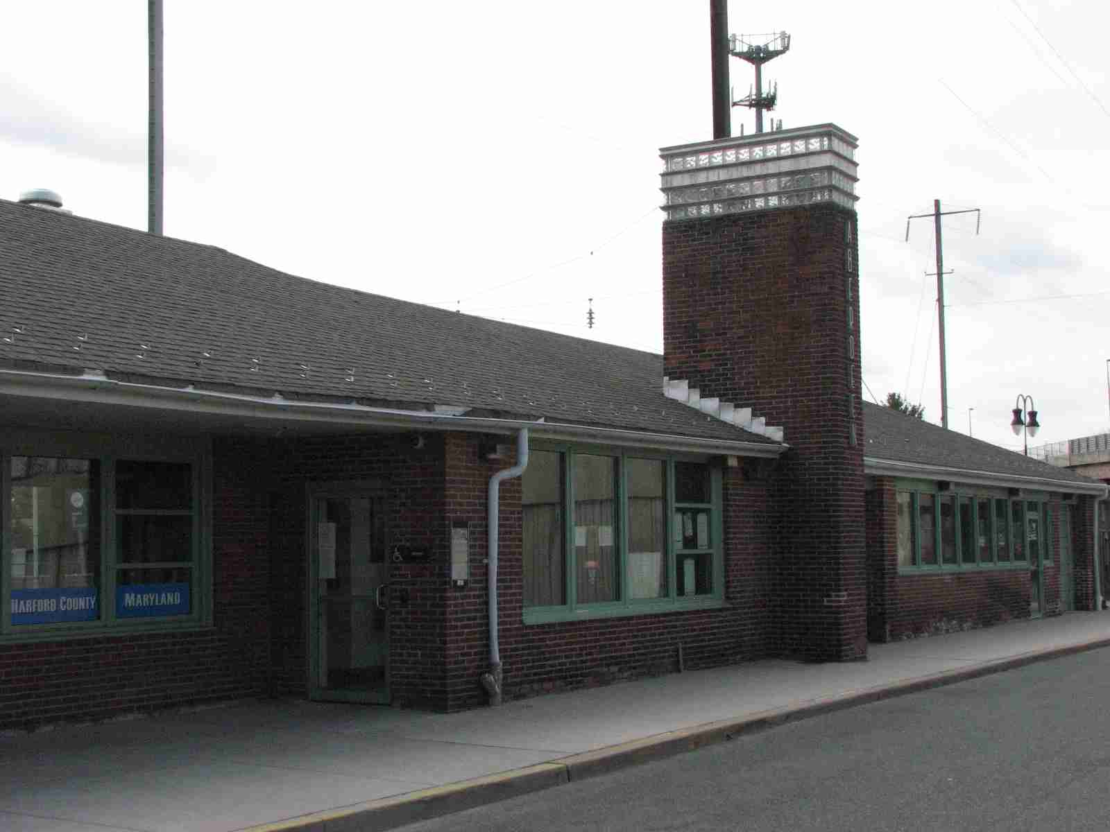
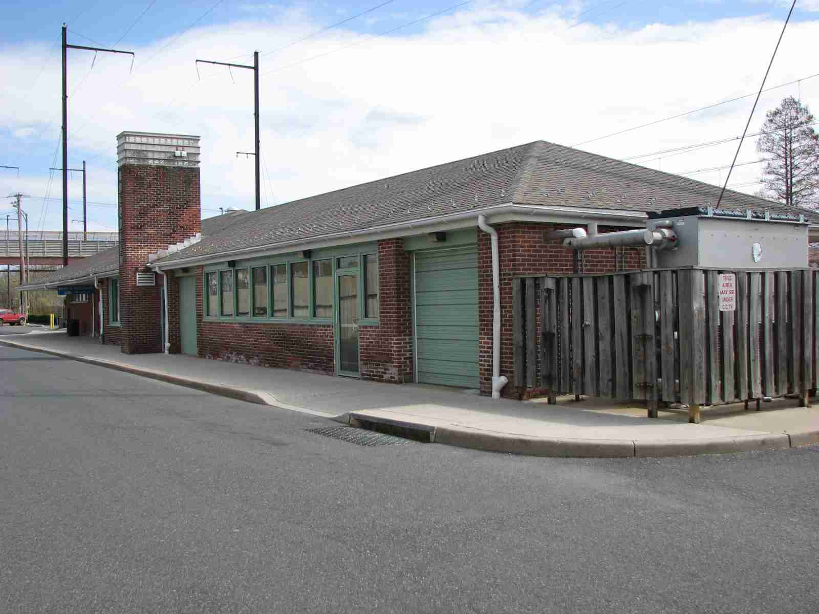
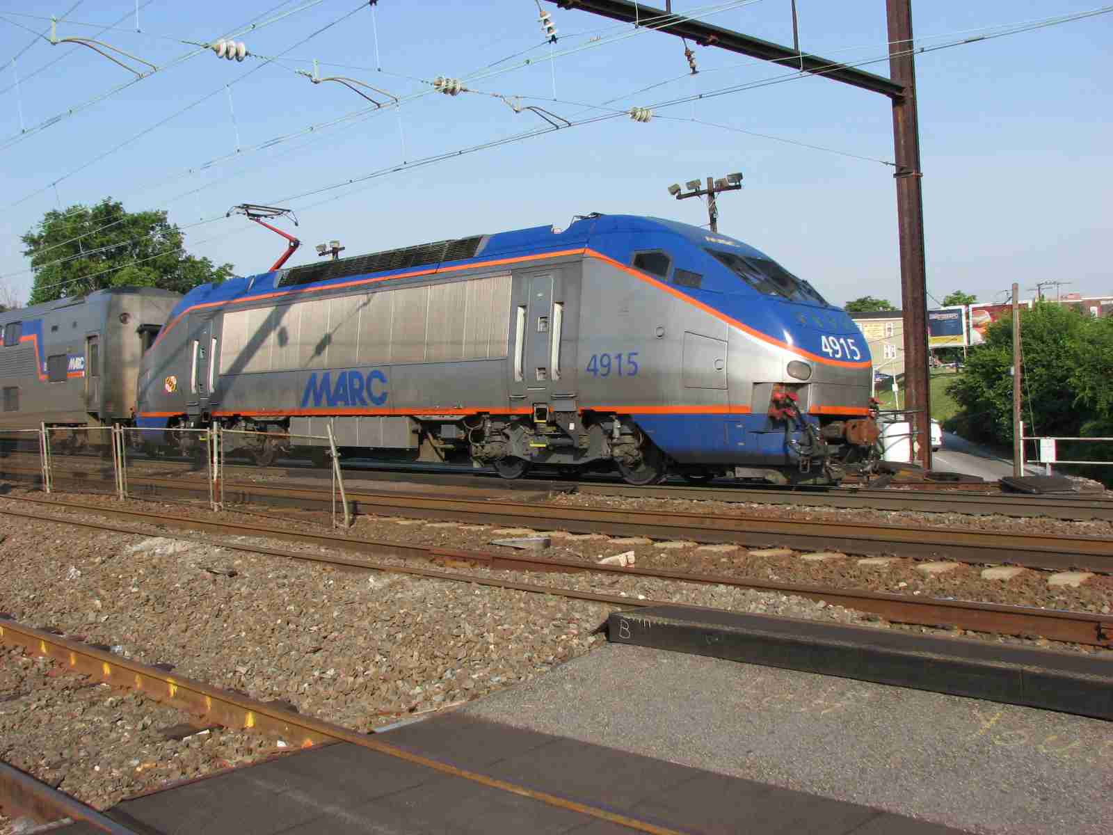
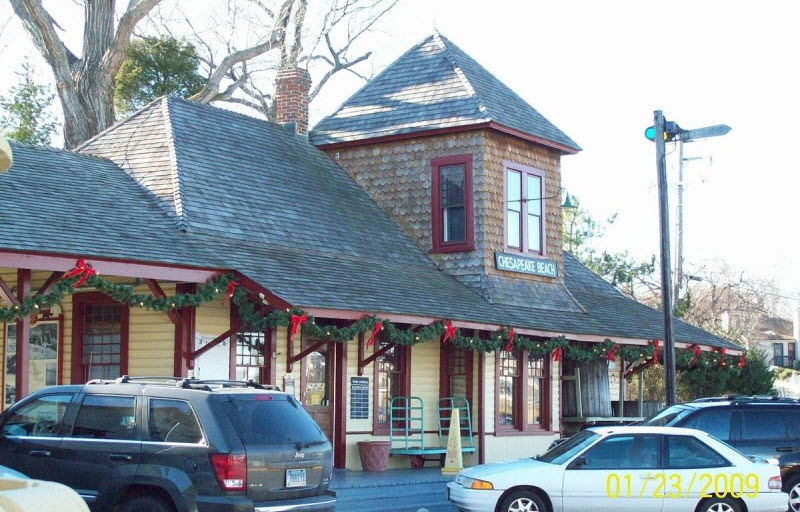
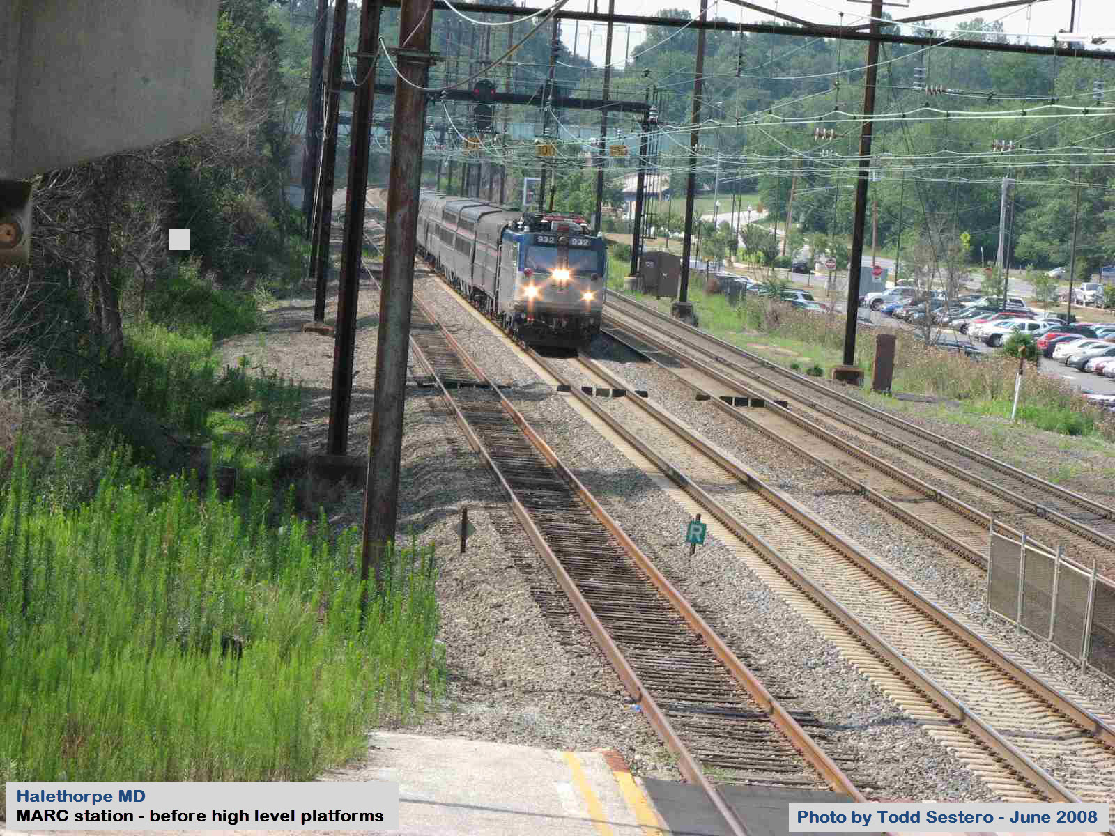
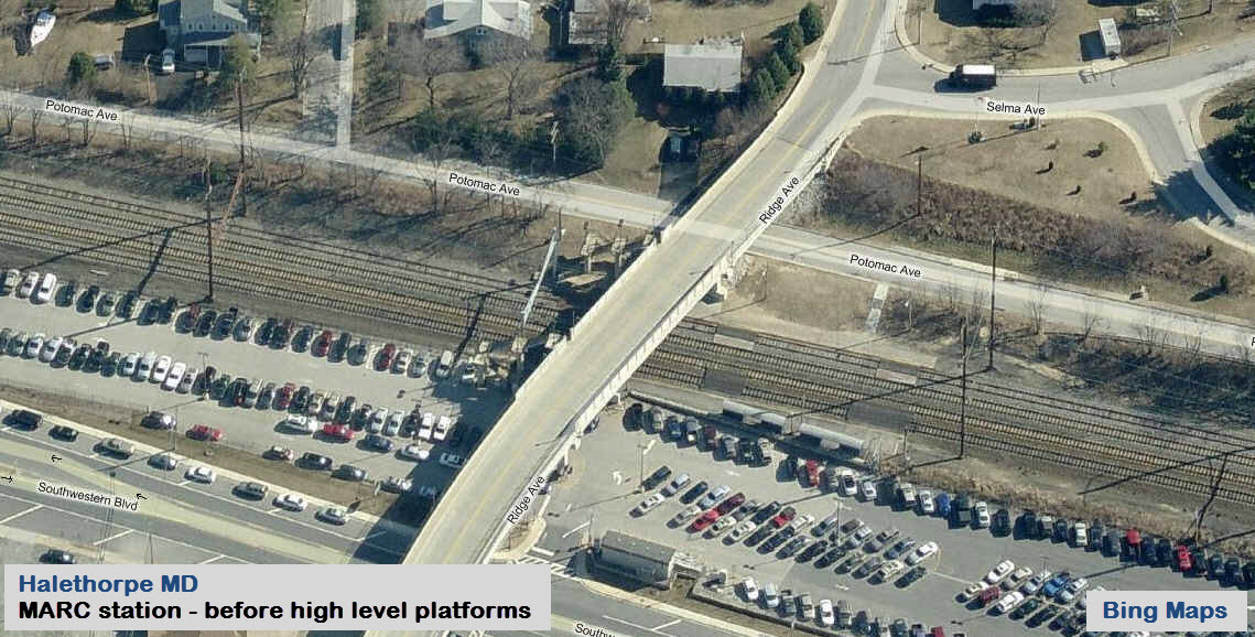
Aberdeen -- Amtrak/MARC station
Former Pennsy depot, looks like it's maybe from the 30's.... have to do some digging....
Additional pictures of stations in Baltimore can be found here
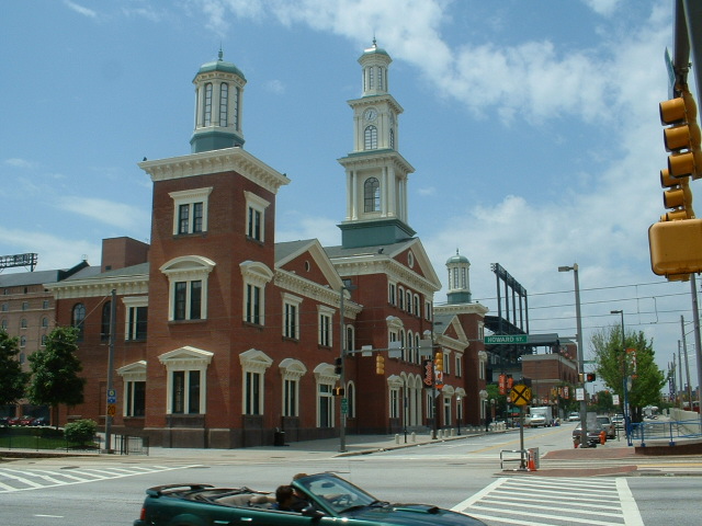
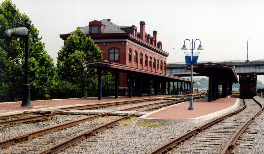
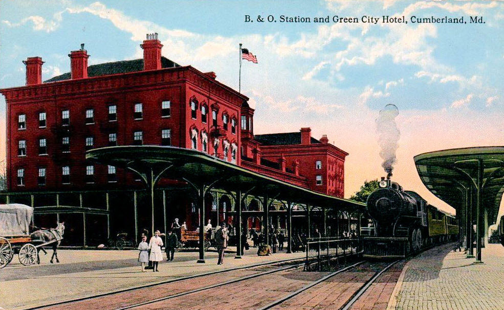
Baltimore -- Camden Station
B&O's great Camden station, on Howard St at the end of i395. The "new" station
adjacent to this great structure is used as the northern terminus for MARC on the (what else) Camden line.
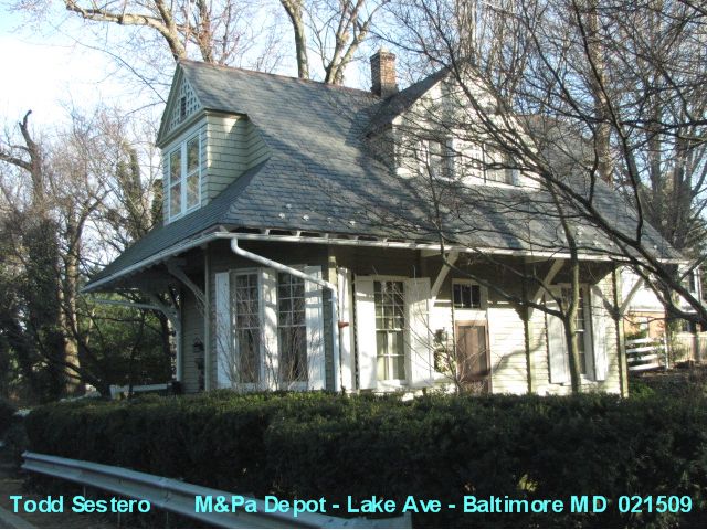
Baltimore -- Lake Ave
Former M&Pa station on Lake Ave, between Charles St and Falls Rd. Please don't go snooping around, as this is a private residence.
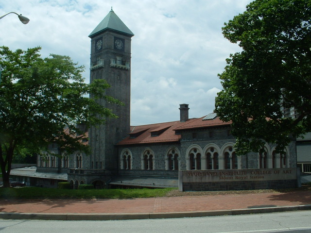
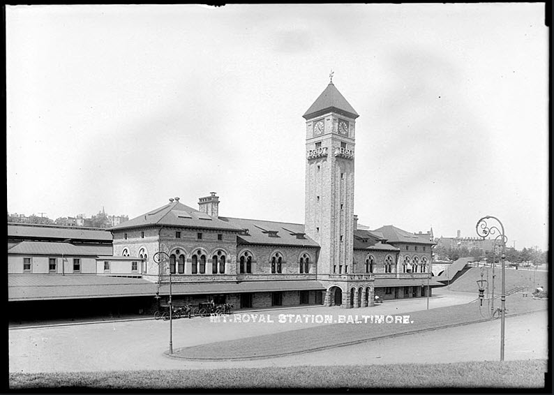
Baltimore -- Mt Royal Station
Ex B&O station, located on Mt. Royal Ave, and is easily accessible via the Mt. Royal Light Rail stop. It has been occupied by the Maryland Art Institute for just about ever.
1907.
Baltimore -- Penn Station
Baltimore's premier railroad station, with an extensive remodeling project finished around
2004 ago by Amtrak.
Originally used by the Pennsy, then Penn Central, it now services Amtrak, MARC
(Penn line), and the Light Rail.
Before they added the "art".
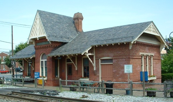
Baltimore -- President St Station
Former BP&W/NC depot at the end of President Street, just east of the downtown area, south of Pratt St. It now houses a Civil War Museum.
Baltimore -- West Baltimore
A MARC commuter stop on the Penn line to DC and a little variety of what you will see about every
five minutes during the rush hours, missing, some Amtrak stuff, I was a little too busy with two cameras.
The area of Baltimore, known as Highlandtown, is about 2 miles east of downtown.
Highlandtown, up until maybe 10 years ago, was the predominantly Polish area of town.
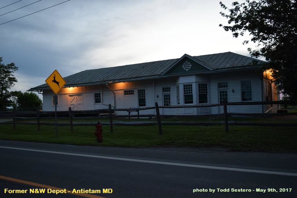
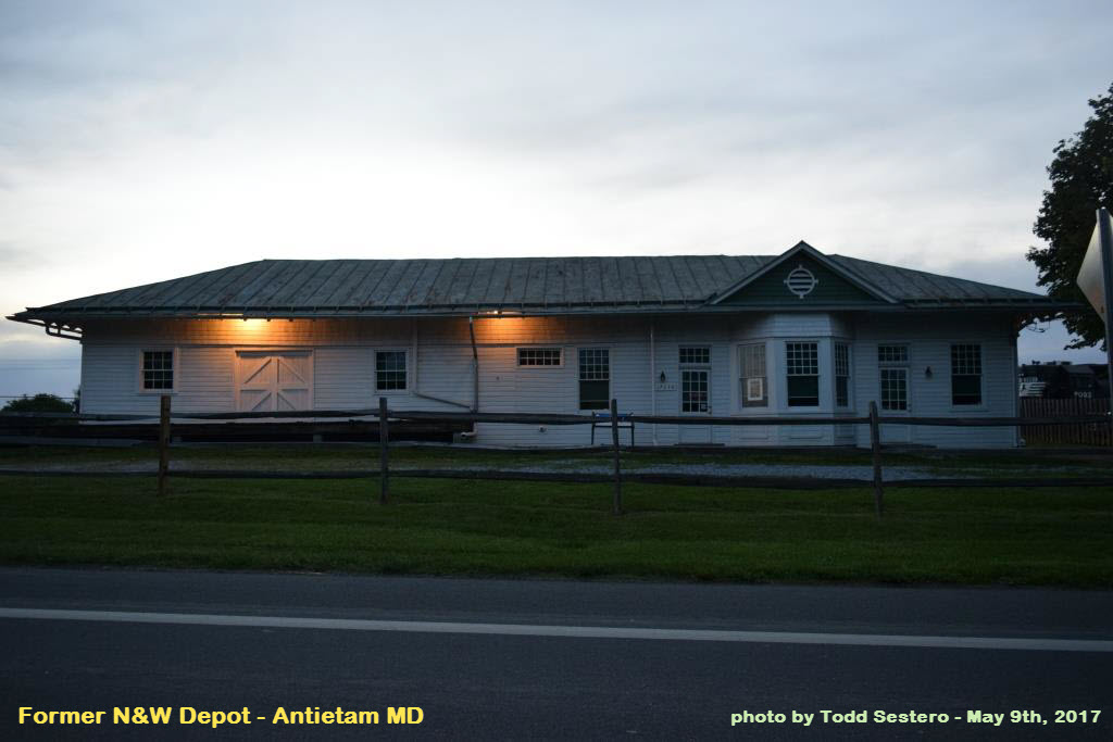
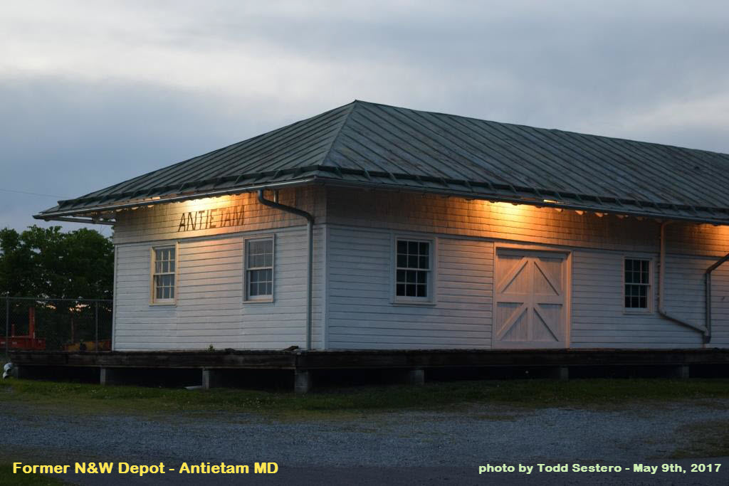
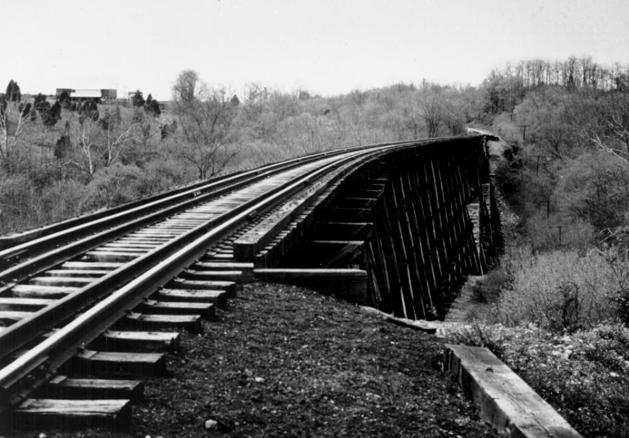
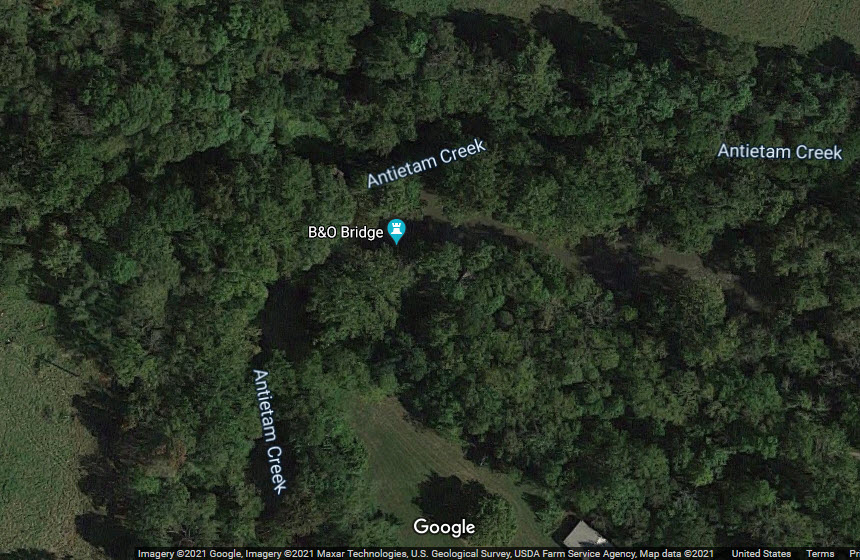
https://mht.maryland.gov/nr/NRDetail.aspx?NRID=442&COUNTY=Washington&FROM=NRCountyList.aspx
GPS Coordinates: 39.50439, -77.71347
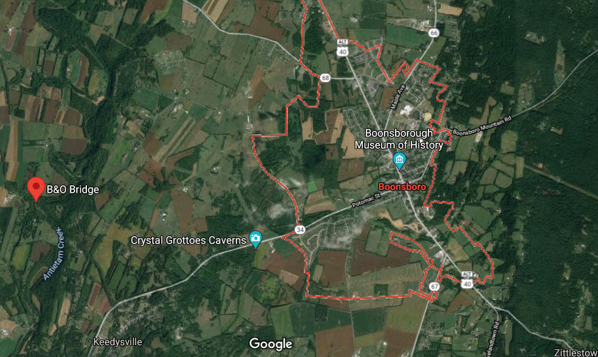
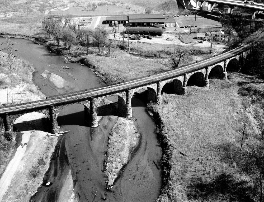
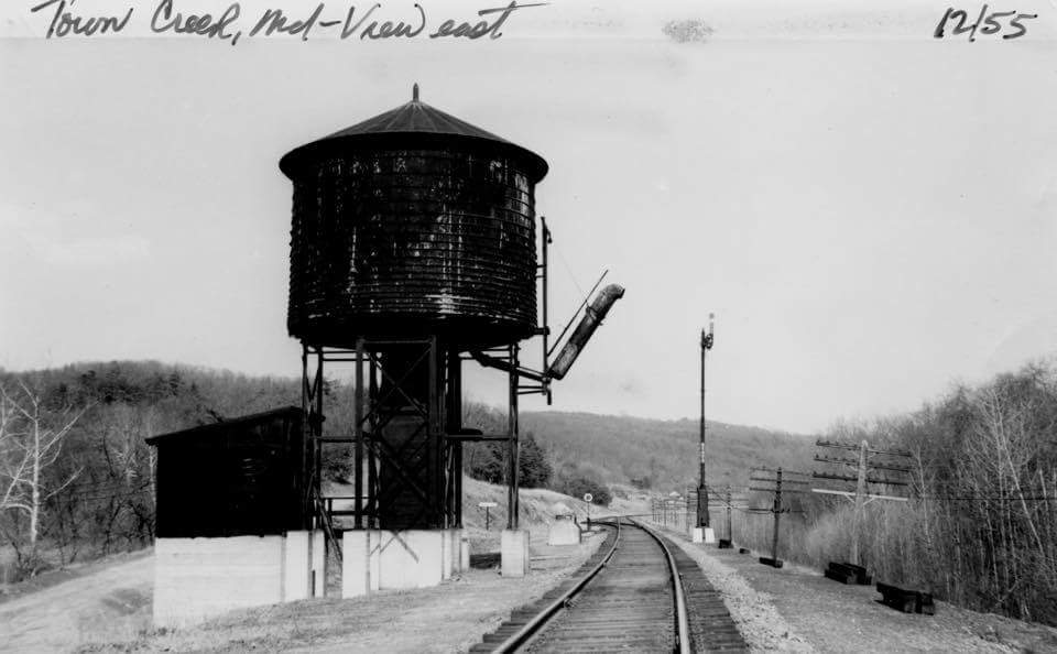
Built around 1867 by the B&O, it is one of the few surviving wood bridges in Maryland. This
timber trestle carries the Washington County branch of the Baltimore and Ohio
Railroad, now part of CSX, over the ravine formed by the Antietam Creek northwest of Keedysville.
The Washington County branch of the B&O is a spur which extends from Weverton at the
main line on the Potomac River for 24 miles to Hagerstown. Construction
of this section of railroad was completed in November of 1867. The wooden bridge,
approximately 400' in length, is supported by a series of timber bents resting on concrete sills.
Today because of the undergrowth, it is hard to find, this track into
Hagerstown MD was abandoned maybe sometime in the late 70's or early 80's.
An ex Northern Central and Pennsy depot, at Falls Rd and Hillside Rd (near where i83 ends
above the Beltway). It's now a private home, and WAS owned by the fellow who
owns the pub across the street. Sold in 2021.
More info and pictures on map 1 of the Baltimore guide
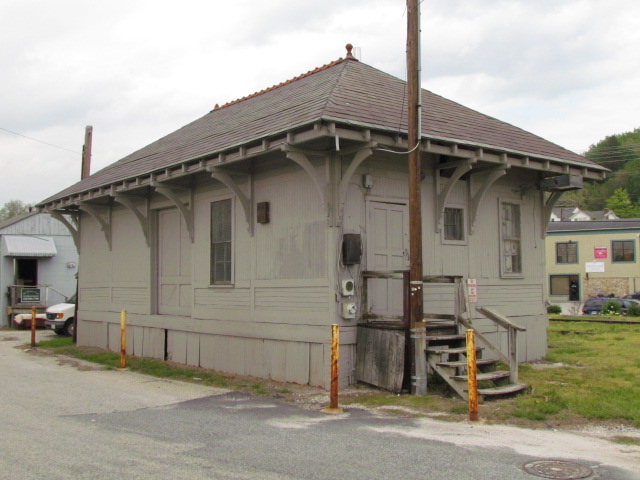
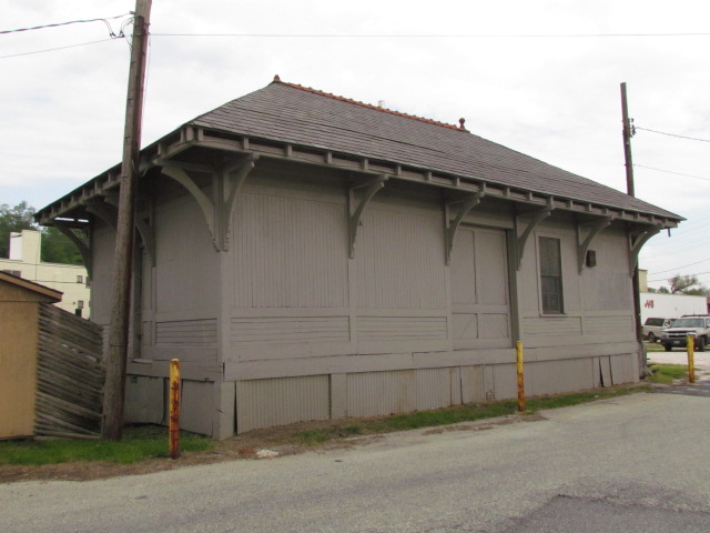
Just about the only thing left in Cockeysville to remind someone that there used
to be a railroad coming through is the old freight shed. At one time, maybe
10 years ago (2005 or so), the freight shed was used by the MTA on a regular
basis. The MTA also had a make-shift shed put together to house a speeder,
but it is gone now. A little bit of rail is still on the ground.
More pictures on my Cockeysville page here.
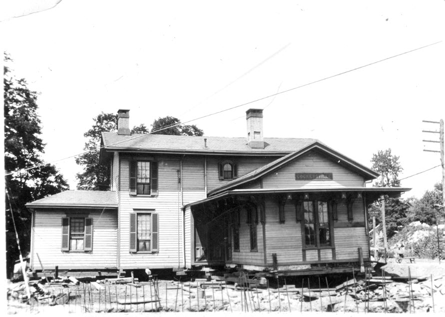
Cockeysville -- PRR Depot
I can't find a whole lot of information about the Cockeysville station. Not
even sure where I found this picture, and a search in February of 2017 did not
turn up anything on Google or Bing images, the Maryland Historical Society,
Shorpy, or the Library of Congress. The station was gone by the time I
started driving in 1969. The older pictures are from a time when York
Road was probably York Turnpike, and only a 2-lane dirt road. Interesting
octagon shaped building to the one side, wish we had a better picture of it!
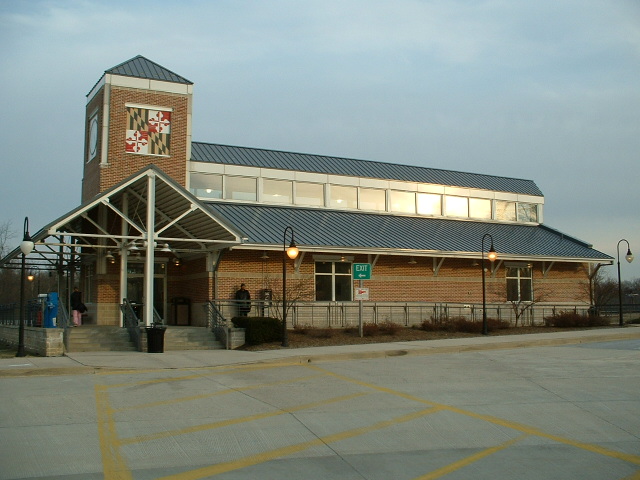
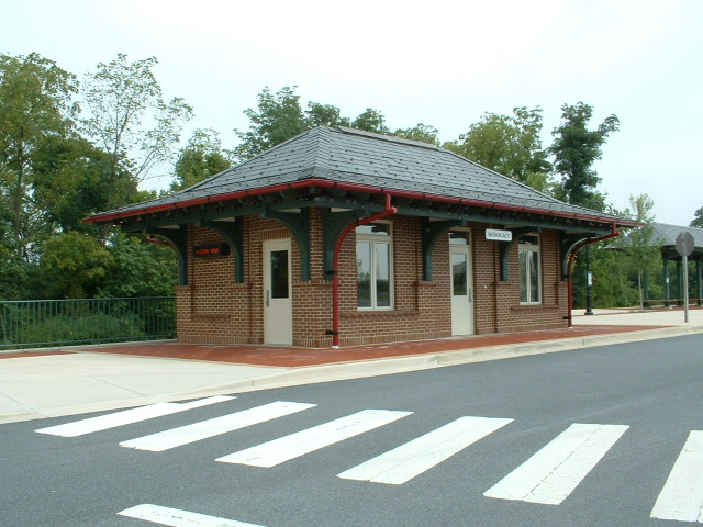
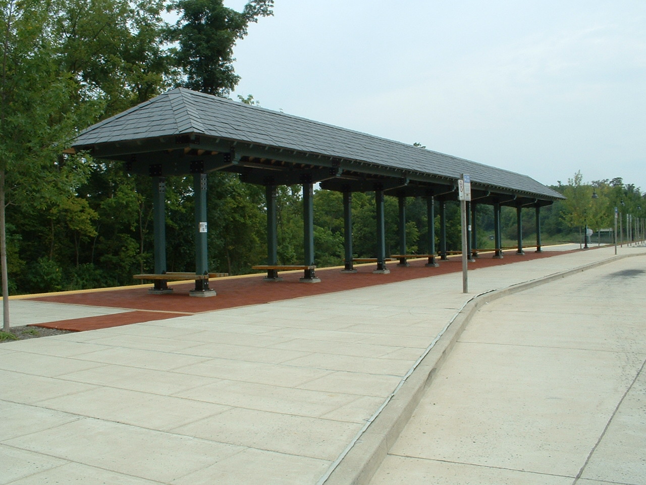
Brand new station built by Maryland for MARC commuter service (maybe 1998?).
Great view of northbound CPL's at the south end of the stations platforms - well,
not anymore, they got replaced in 2015 :-(
Conveniently located off MD Rt 100, between US 1 (and i95) and the Baltimore Washington Parkway with its own exit...
However, you can't access any of the local roads from the parking lot or exit.
My guide to the Dorsey area is here
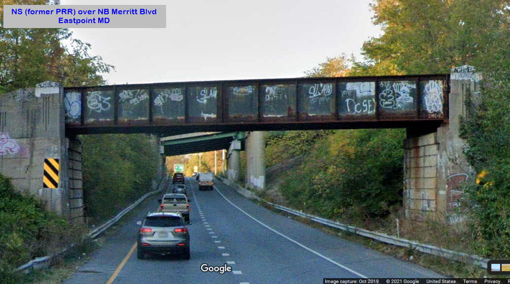
Another set of steel girder bridges used by the Pennsy, the Penn Central, Conrail, and Norfolk
Southern get into the old Patapsco & Back River RR Gray's yard. There
are two of them to get over the NB and the SB lanes of Merritt Blvd.
Notice that the north span had been built to accommodate two tracks, but a
second track was never installed!
NB Merritt looking north
NB Merritt looking south
SB Merritt looking south
SB Merritt looking north
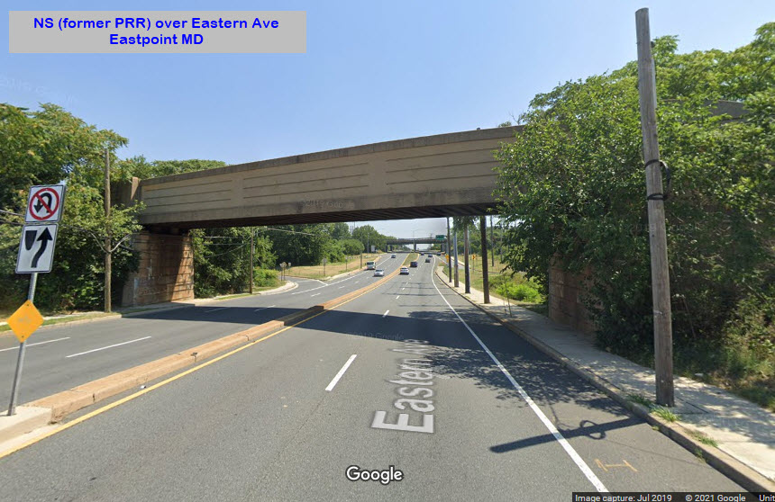
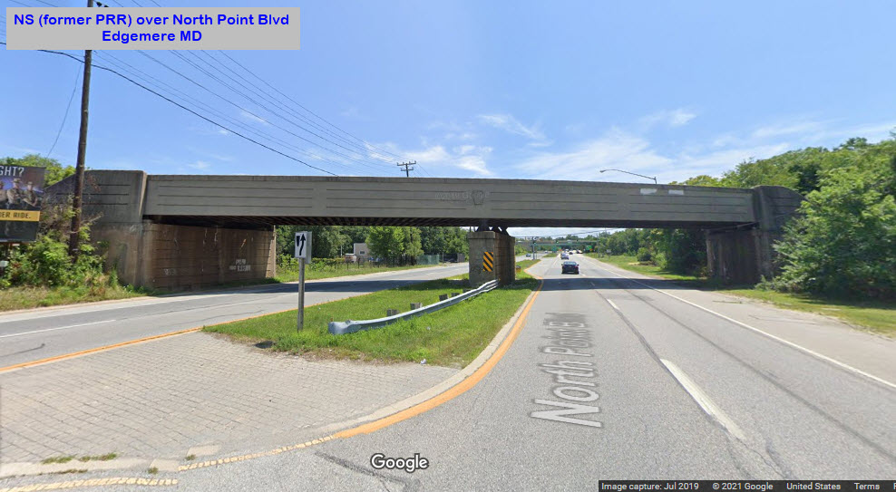
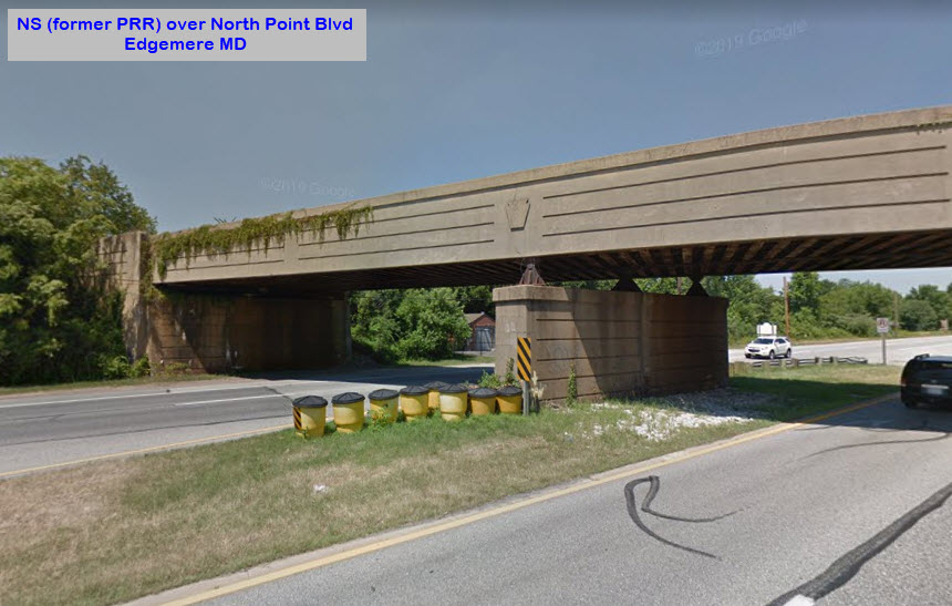
Eastpoint - NS over Eastern Ave
Another one of the four bridges on the NS/Pennsy line down into Sparrows Point.
This is how the Pennsy, the Penn Central, Conrail, and now Norfolk
Southern get into the old Patapsco & Back River RR Gray's yard, now Northern
Interchange Yard.
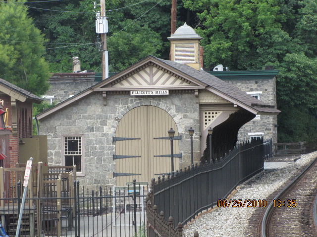
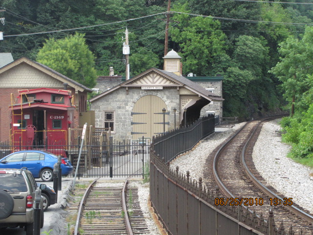
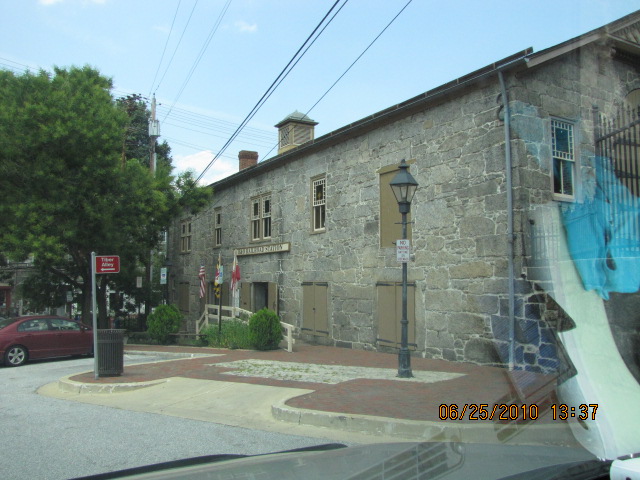
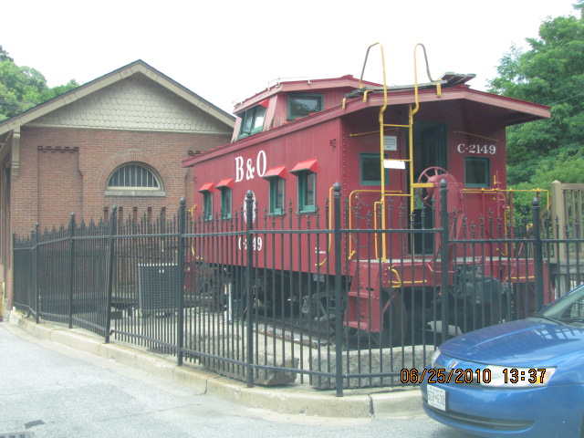
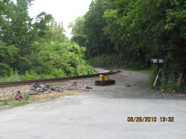
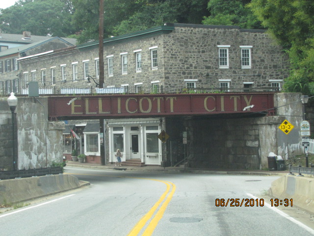
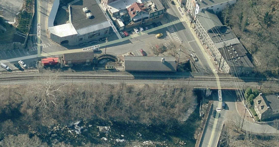
ex B&O depot now houses a museum that is part of the B&O Transportation
Museum. Just off Frederick Rd in Ellicott City where CSX goes over.
Ellicott City also appears on this map
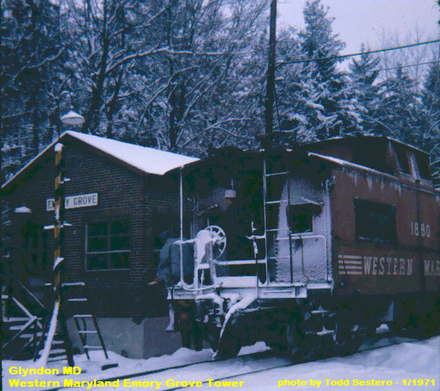
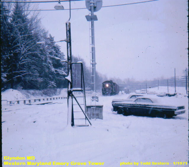
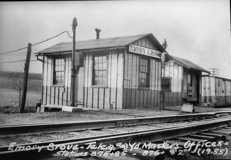
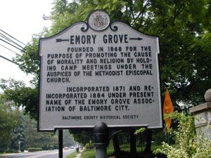
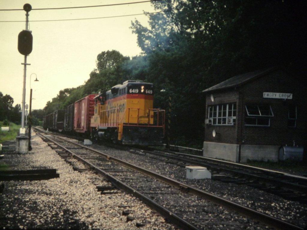
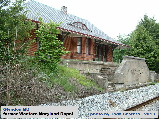
Emory Grove was a division point on the Western Maryland in the Baltimore County
"suburb" of Glyndon, about 25 miles due north of Baltimore. On the north
side of Butler Rd was the tower, and on the south side of Butler Rd was the
Glyndon station. Butler Road goes over the tracks, and in the Western
Maryland days, sported a set of signals.
It currently houses the Glyndon post office. Emory Grove tower was just north of here.
For pictures of the tower that used to be just north of here on the other side of Butler Road, click here.
More pictures and info here
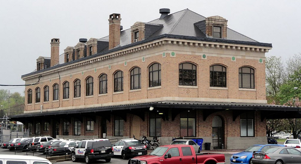
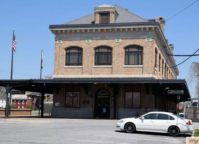
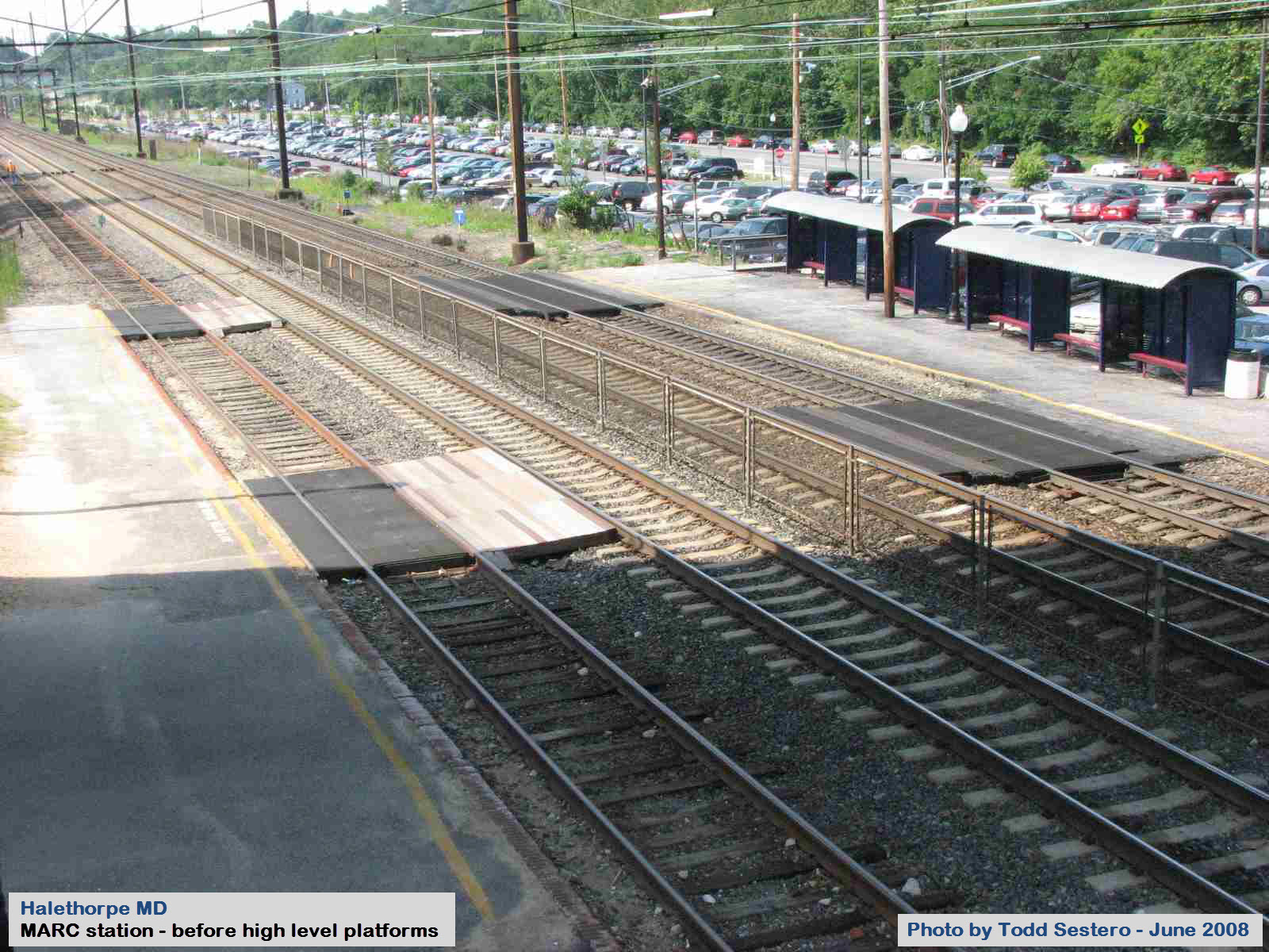
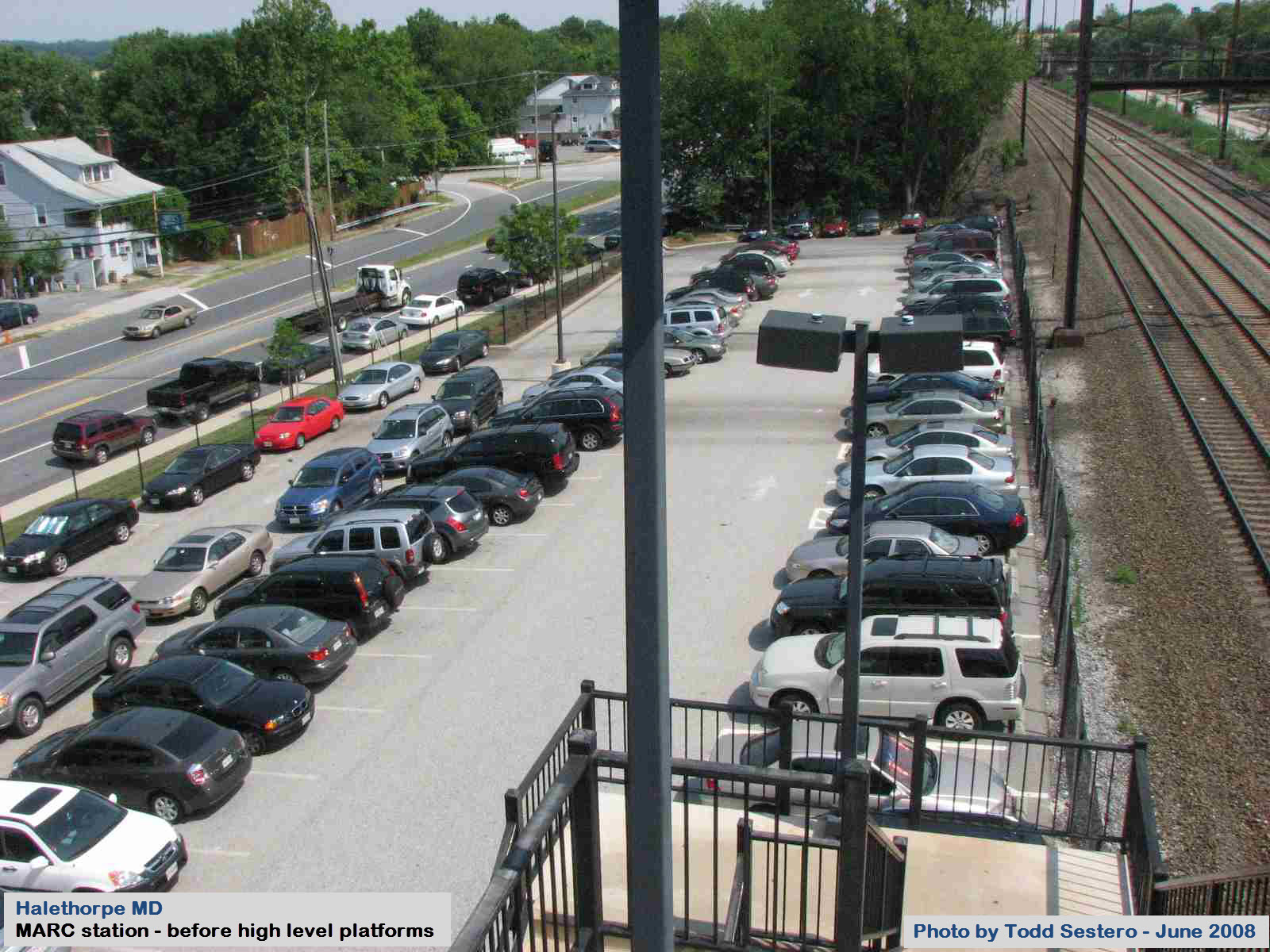
A "rebuilt" MARC commuter stop on the Penn line to DC in southwest
Baltimore. It has a nice passenger crossover where you can get some elevated shots from.
The station was given high level platforms sometime around 2010? More
info and pictures in my Baltimore railfan guide, map 6 here
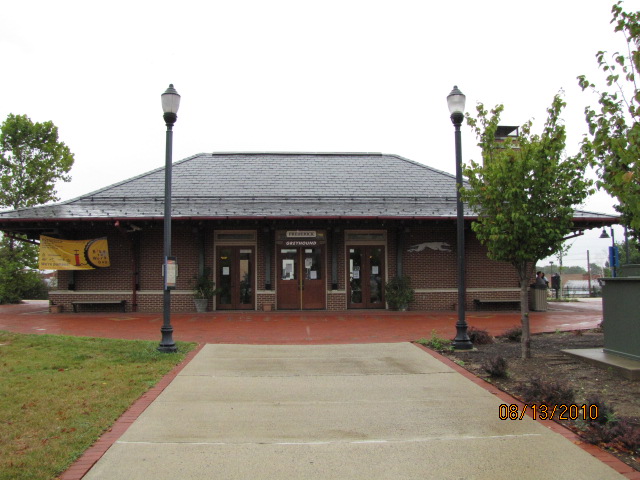
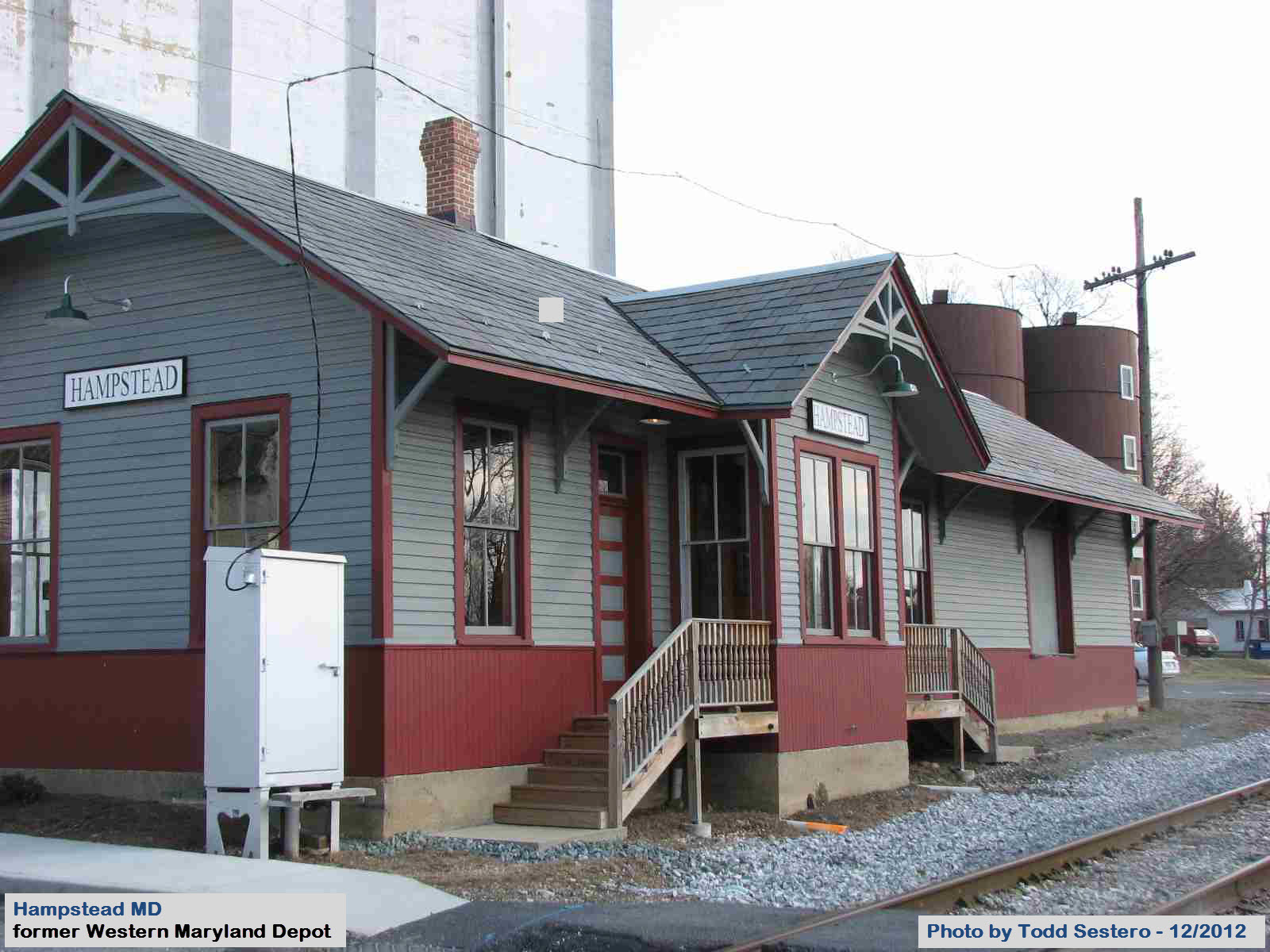
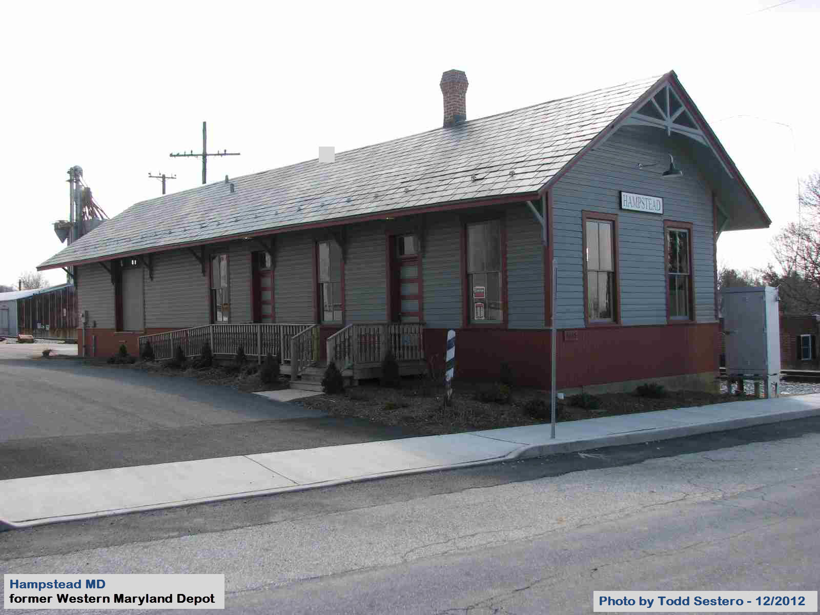
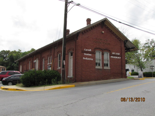
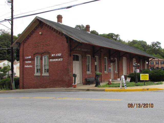
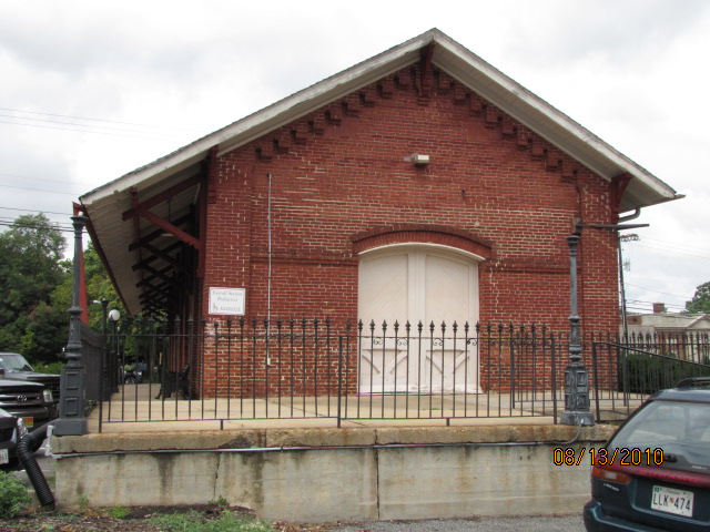
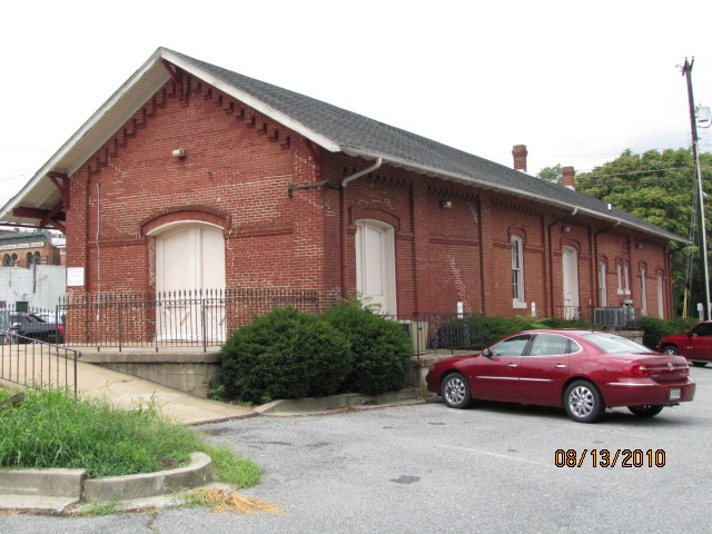
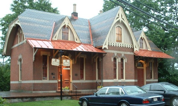
An ex Western Maryland depot in the town where DeWalt used to make it's tools,
remodeled around 2007 or so. Located off MD Rt 30, about 10 miles north of the end of i795 in Reisterstown.
Check out my railfan guide to Hampstead here
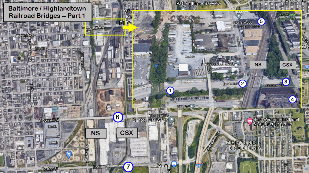
The area of Baltimore, known as Highlandtown, is about 2 miles east of downtown,
and until maybe 10-15 years ago, was the historically Polish area of town.
Highlandtown -- Steel Girder Bridge
One of three railroad bridges going over Eastern Ave in Highlandtown.
This one, on the eastern side, used to have a nice "Welcome to Highlandtown" mural on it!
This bridge has/had three Pennsy tracks on it, none of which have been used for at least 50 years.
looking west
looking east
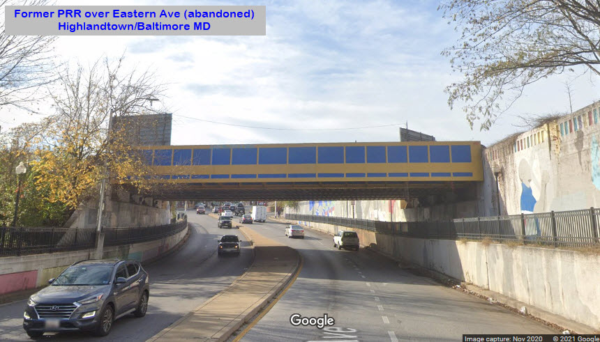
Highlandtown -- Steel Girder Bridge
Second of three railroad bridges going over Eastern Ave.
This one has three former Pennsy tracks on it, and is how NS gets into Canton.
There used to be four tracks on it.
looking east
looking west
Highlandtown -- Steel Girder Bridge
Third of three railroad bridges going over Eastern Ave. This one has
a single track on it, and is how CSX gets into Canton and Penn Mary Yard.
looking east
looking west
Highlandtown -- Steel Girder Bridge
Short and small girder bridges going over Eastern Ave extended. This one has
a single track on it, and is part of how CSX gets into Canton.
looking east
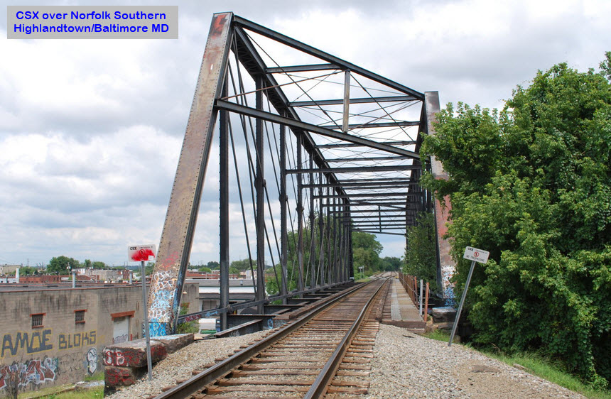
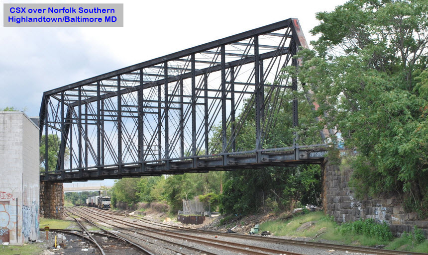
Highlandtown -- Steel Trestle
CSX going over the Norfolk Southern line into Canton.
According to
Bridgehunter.com, this is a Whipple through truss bridge.
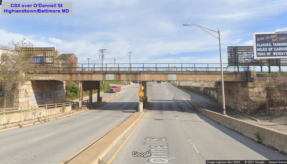
Highlandtown -- Steel Girder Bridge
CSX going over O'Donnell St on its way into Canton from Bayview Yard.
Notice in the Google aerial view, there appears to be a new siding!
looking east
looking west
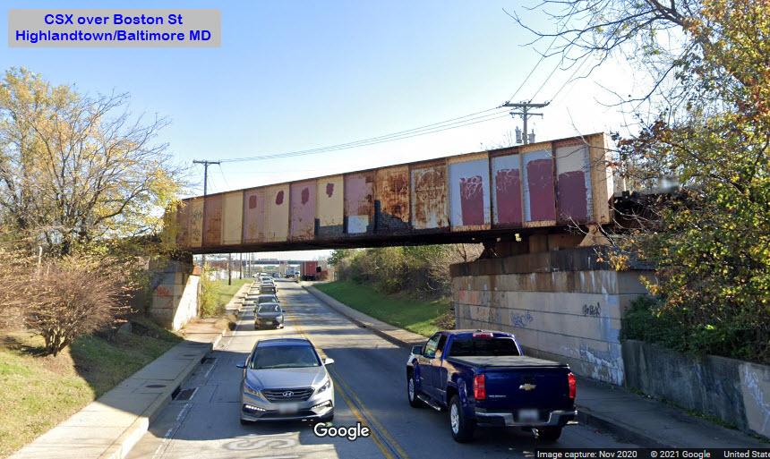
Highlandtown -- Steel Girder Bridge
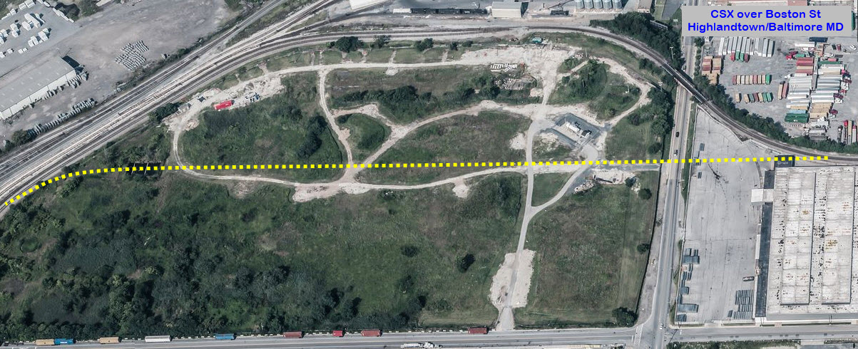
CSX going over Boston St on its way into Canton from Bayview Yard.
looking east
looking west
One of the reasons Boston St has probably NOT been widened is the B&O/CSX
bridge going over. If Baltimore and CSX wanted to do that, they should
take the opportunity of building a new bridge, and get rid of the huge curve
that used to go around a tank farm. :-) :-) This bridge is also
one of the most neglected in Baltimore, and until the city lowered Boston
St, used to be the scene of many a truck "crashes", almost as bad as the one
in Durham!
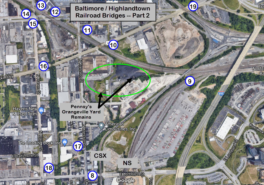
This section of Highlandtown contains 11 of the 18 bridges in the area.
Five of them are no longer in service (14-18), they were part of the Pennsy's track to get
from the EB corridor to Canton, without having to do a reverse move thru Bayview Yard.
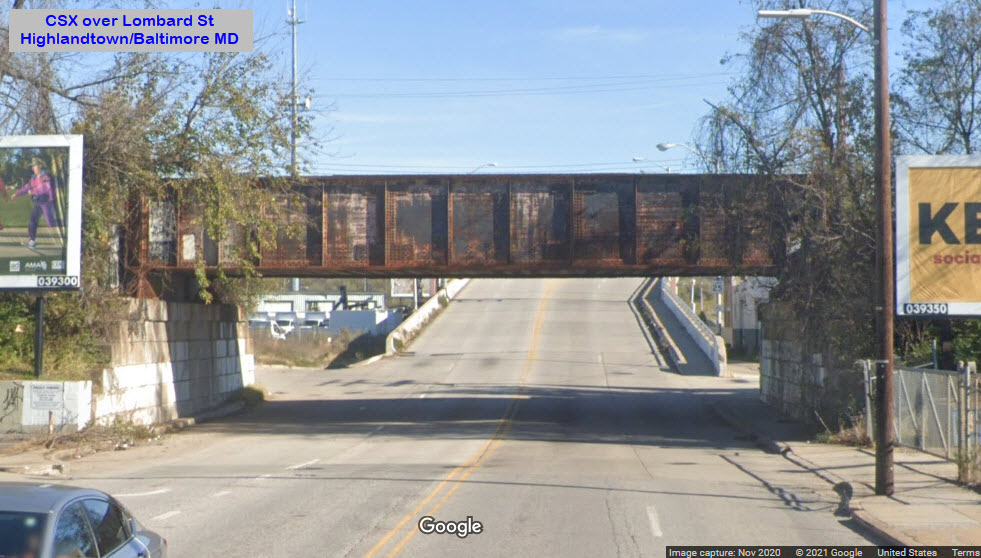
Highlandtown -- Steel Girder Bridge
CSX going over Lombard St on its way from Bayview Yard into Canton.
looking east
looking west
Highlandtown -- Steel Trestle
CSX going over the Northeast Corridor, just after leaving CSX's Bayview
Yard. It's confusing here, because both the B&O and the PRR used
Bayview for the names of their yards that are adjacent to one-in-other.
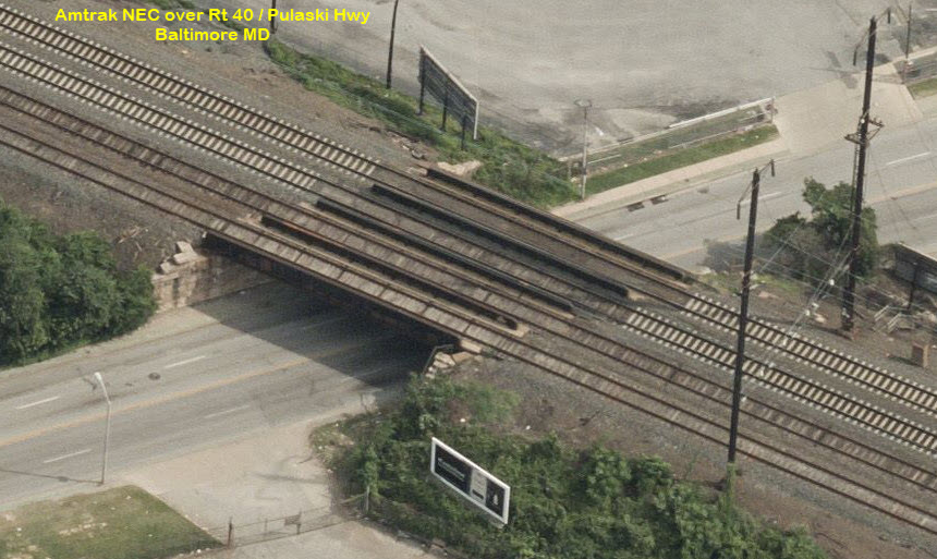
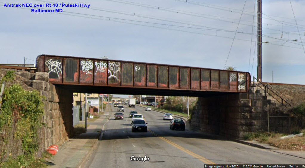
Highlandtown -- Steel Girder Bridge
Amtrak NEC going over Rt 40/Pulaski Highway.
looking east
looking west
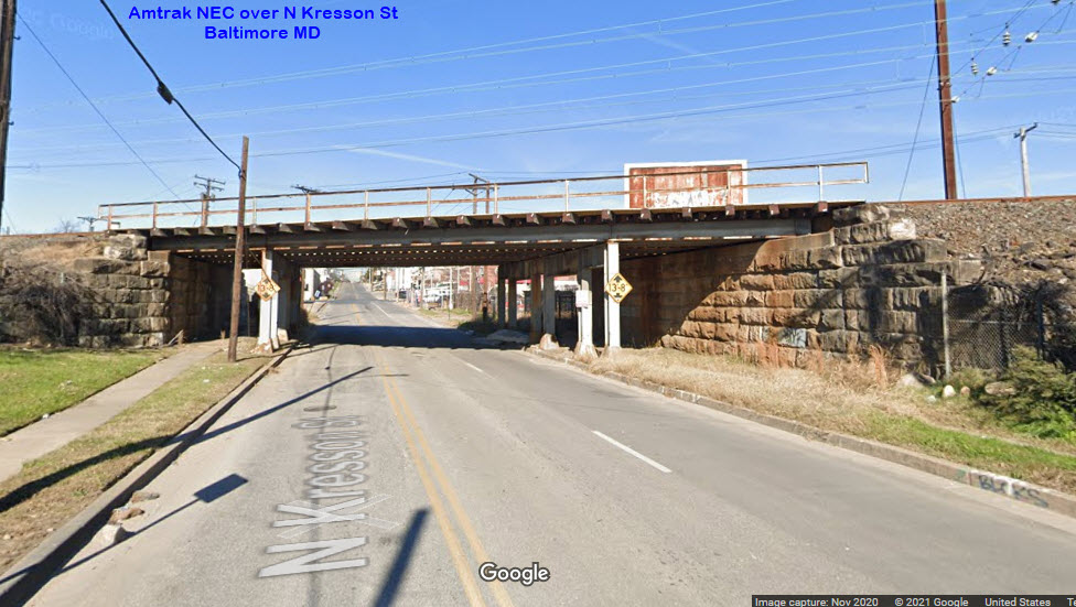
Highlandtown -- Steel Girder Bridge
Amtrak NEC/NS going over North Kresson St.
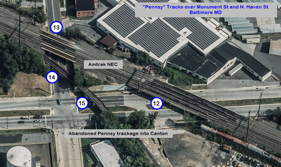
Here are the next four bridges, since they are all within the same confined area:
Highlandtown -- Steel Girder Bridge
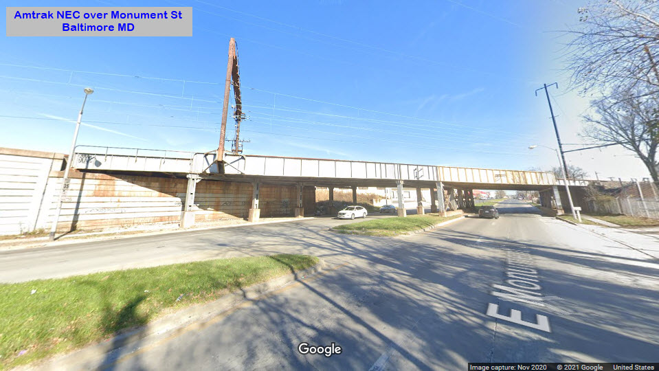
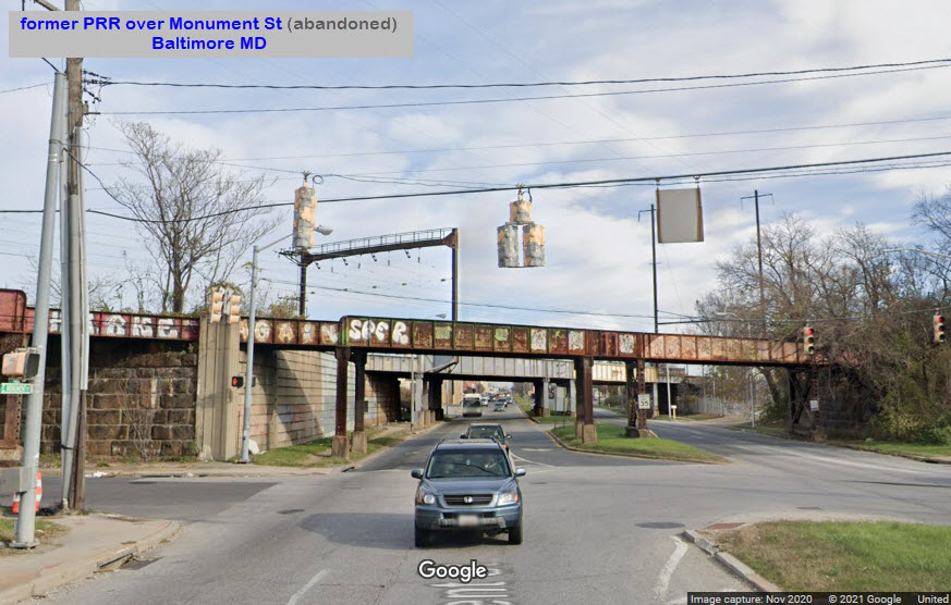
Amtrak NEC/NS going over Monument St. Difficult to get east looking
pictures because of the limited sight distance.
looking east
looking west
Highlandtown -- Steel Girder Bridge
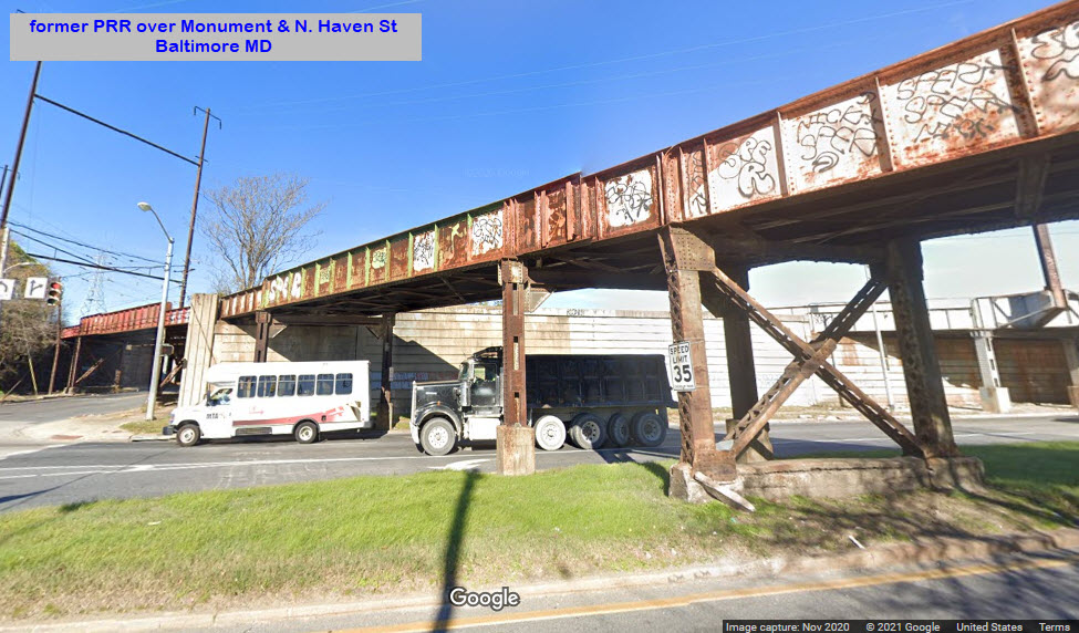
Amtrak NEC/NS going over North Haven St.
looking north
looking south
Highlandtown -- Steel Girder Bridge
Former PRR over North Haven St, going from the NEC into Canton, abandoned R-O-W.
Highlandtown -- Steel Girder Bridge
PRR going over East Monument St, abandoned R-O-W.
looking east
Highlandtown -- Steel Girder Bridge
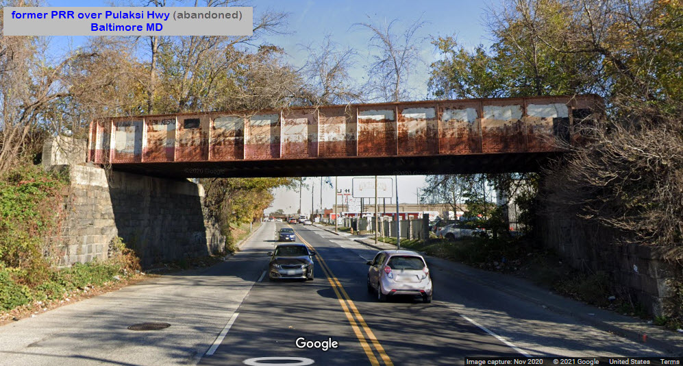
PRR going over RT 40/Pulaski Hwy, abandoned R-O-W.
looking east
looking west
Highlandtown -- Steel Girder Bridge
B&O going over North Kresson St. In the SB view, you can see the
right-of-way is no longer :-)
looking north
looking south
Both this bridge, and the next one, #18, were so the B&O could service the
(now gone) Esskay sausage and meat packing plant that used to be located
here in Highlandtown. If you were not aware of the fact that a
railroad siding came thru here, you would not know why the building with an
"X" in it was shaped like it is.
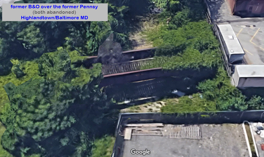
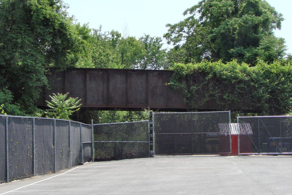
Highlandtown -- Steel Girder Bridge
B&O going over the Pennsy heading into Canton, both abandoned.
Need pictures.....
2023/photo courtesy Steve Okonski
A parking lot has been built adjacent to the abandoned B&O bridge that goes
over and abandoned PRR R-O-W - it's the only such site that Steve is aware of.
The Pennsy track used to connect the Canton Yard with the NEC at Haven St in
East Baltimore. The track paralleled Haven St.
The B&O bridge went over the Pennsy on its way to the Esskay Meat Processing
Plant in Highlandtown.
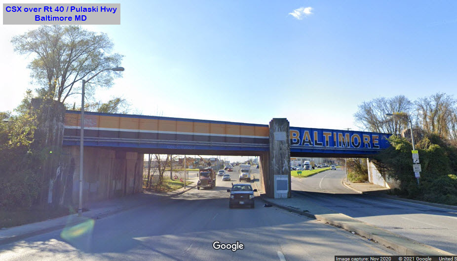
Highlandtown -- Steel Girder Bridge
CSX going over Rt 40/Pulaski Highway, the CSX sign on the right is their
entrance to Bayview Yard.
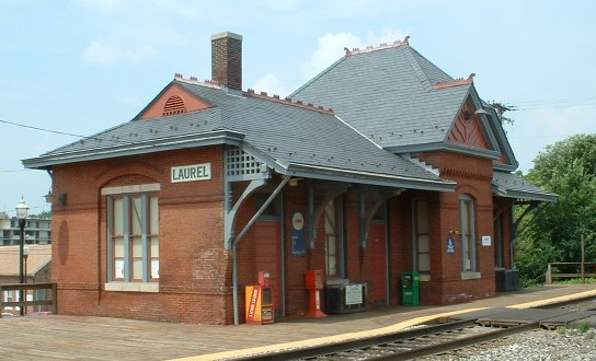
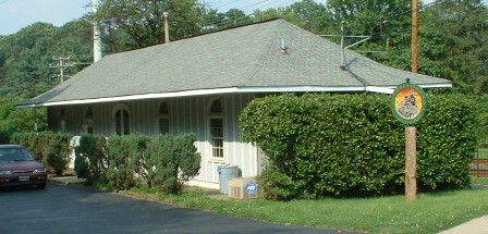
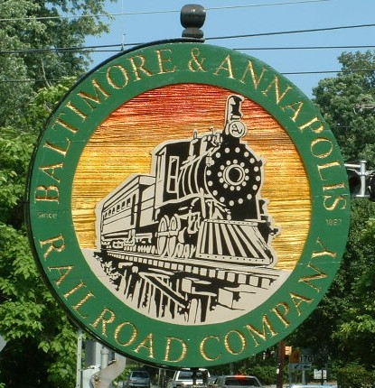
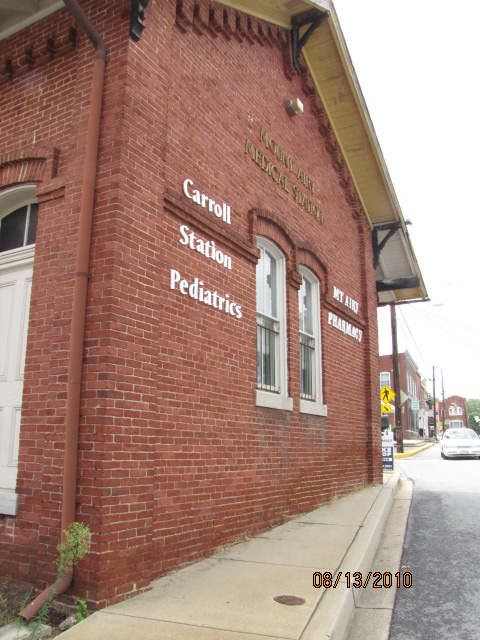
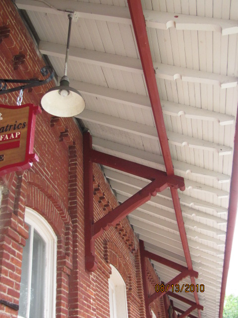
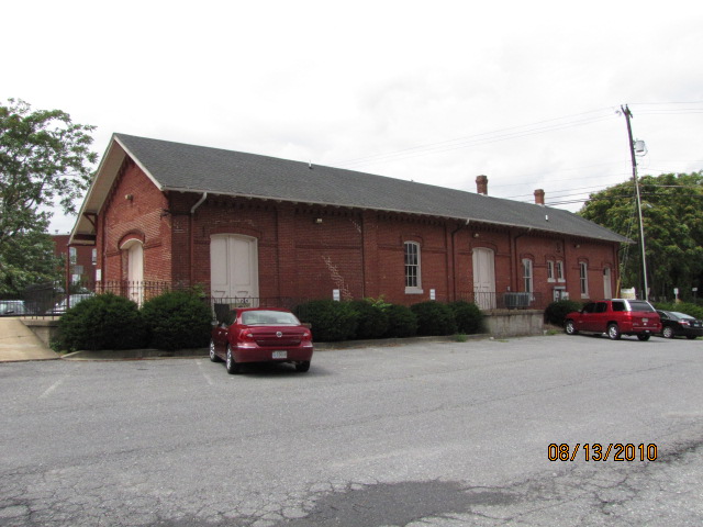
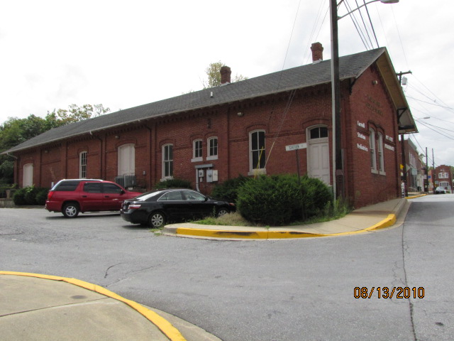
The Maple Road depot is a former Baltimore and Annapolis RR
station, and housed their offices up untill the time the MTA took over the rails and ended freight service.
The depot shows up on the Baltimore railfan guide here
An ex Pennsy station now a private home, located just off Seminary Ave adjacent to the Light Rail tracks.
More info and pictures on map 1 of the Baltimore guide
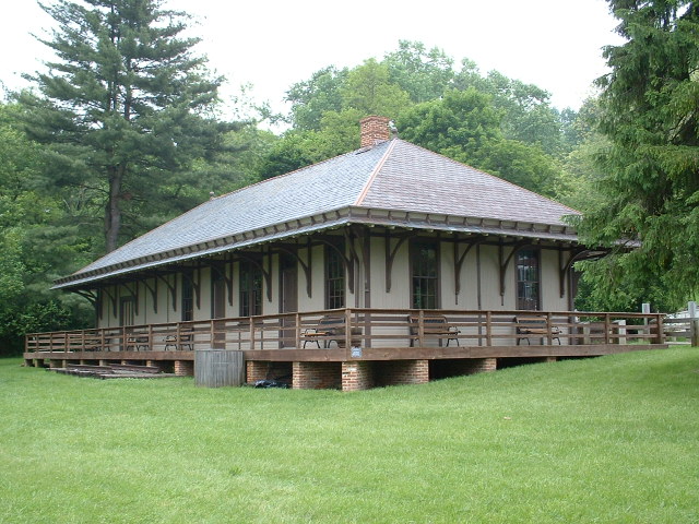
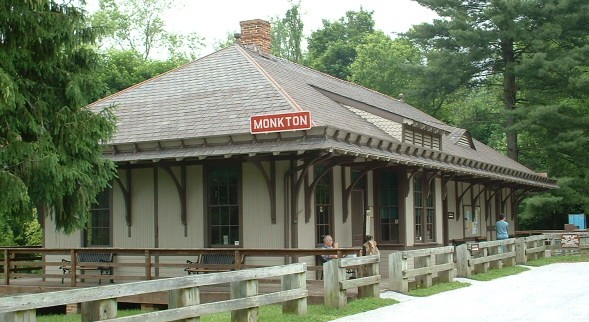
An ex Northern Central and PRR station.
One of five surviving Northern Central / PRR stations.
It has been very nicely remodeled and is used as the headquarters
(and rest stop) on the Northern Central hikey-bikey trail.
Monkton appears on map 1 of the Baltimore guide.
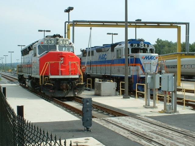
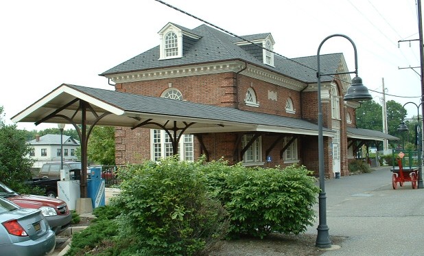
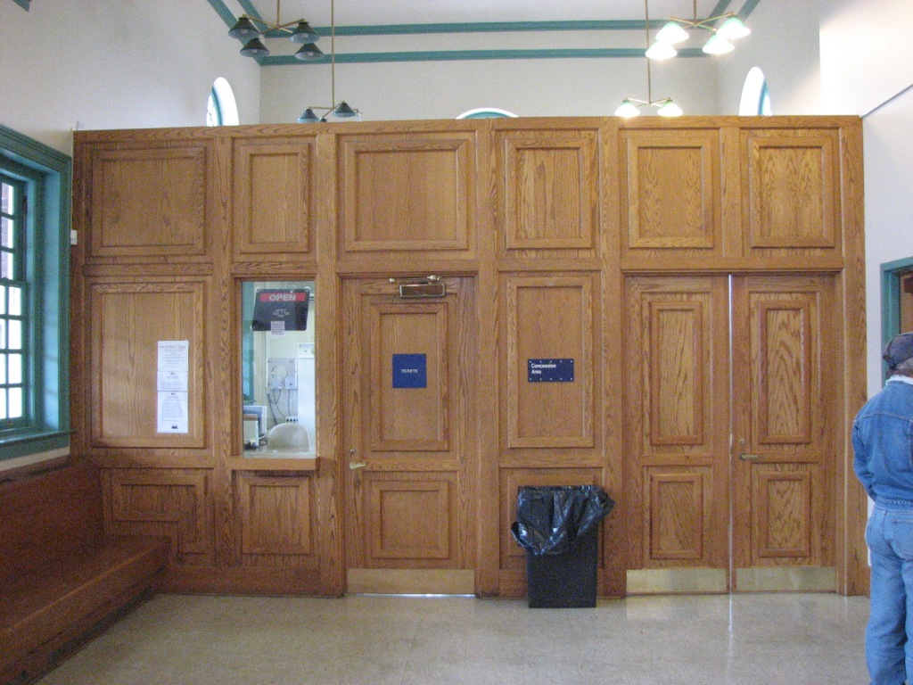
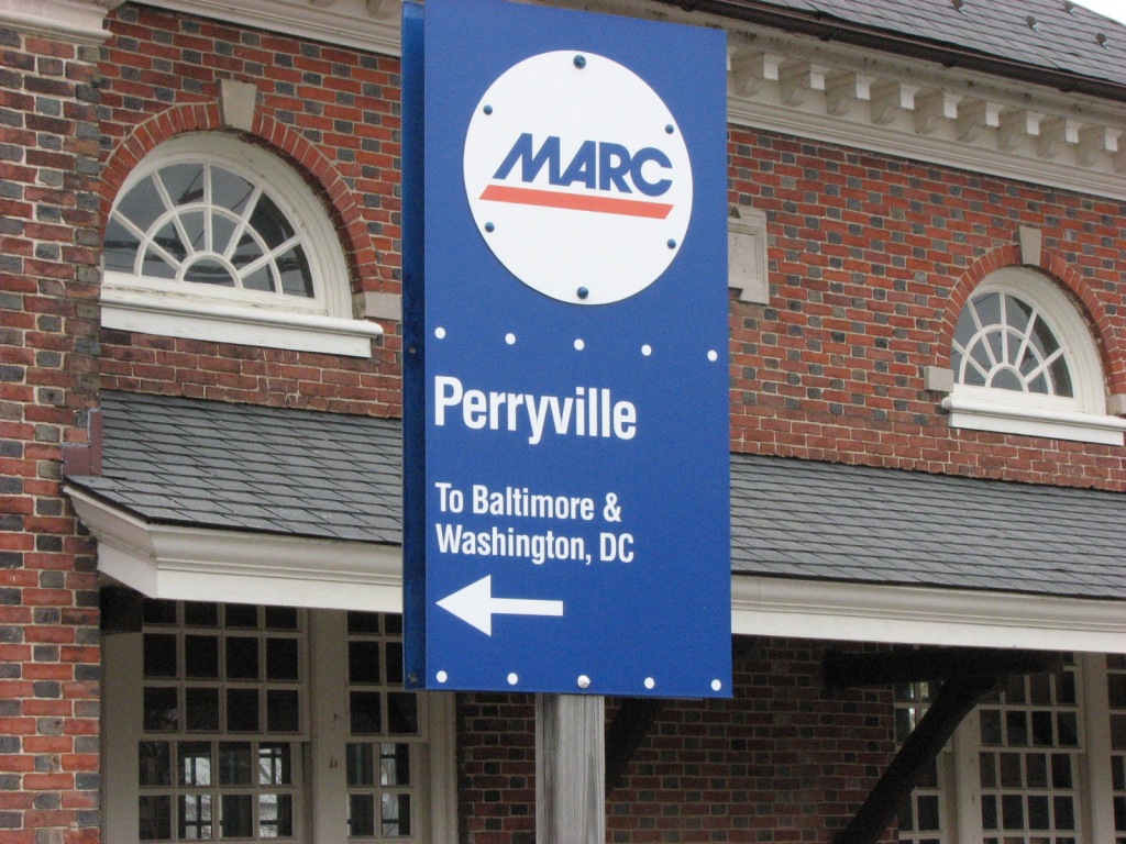
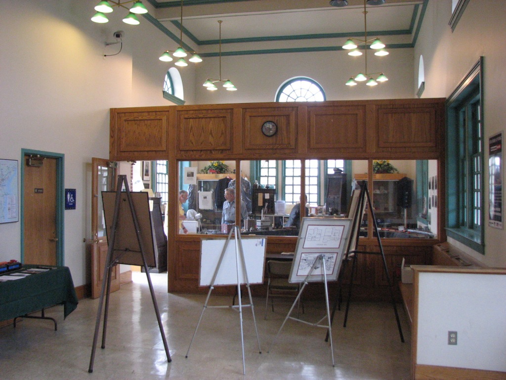
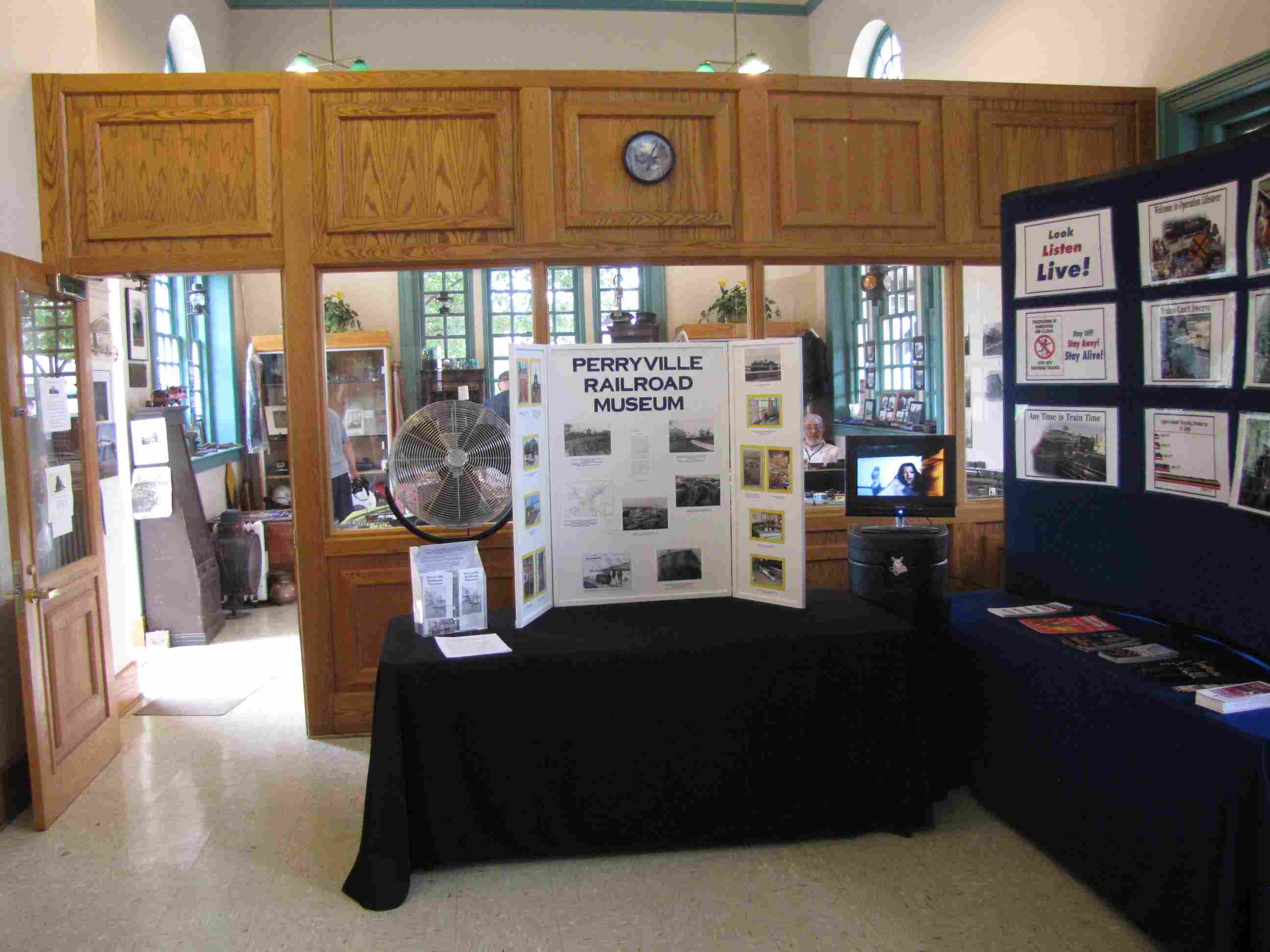
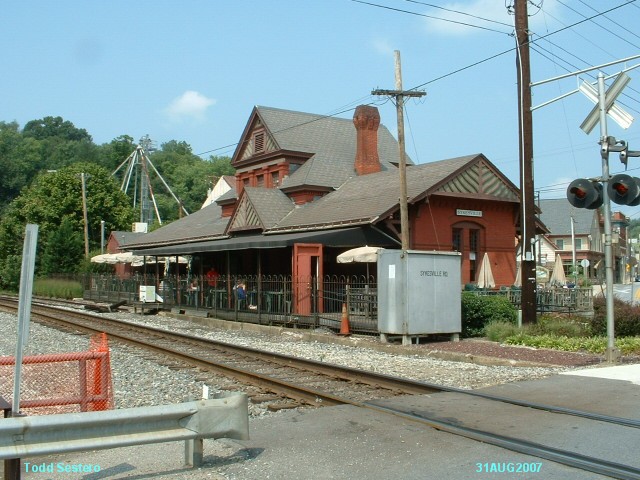
Ex Pennsy station. It now services MARC at it northern most point. MARC did a
very nice job "fixin the place up". It also houses a small NRHS museum and layout at the
far end, in addition to the ticket office. This is a great spot to watch and take
pictures of trains from, and a lot of railfans will come up here around 10pm to watch
the NS freights come off the Harrisburg line. MARC
is doing a feasibility study on extending service to Wilmington.
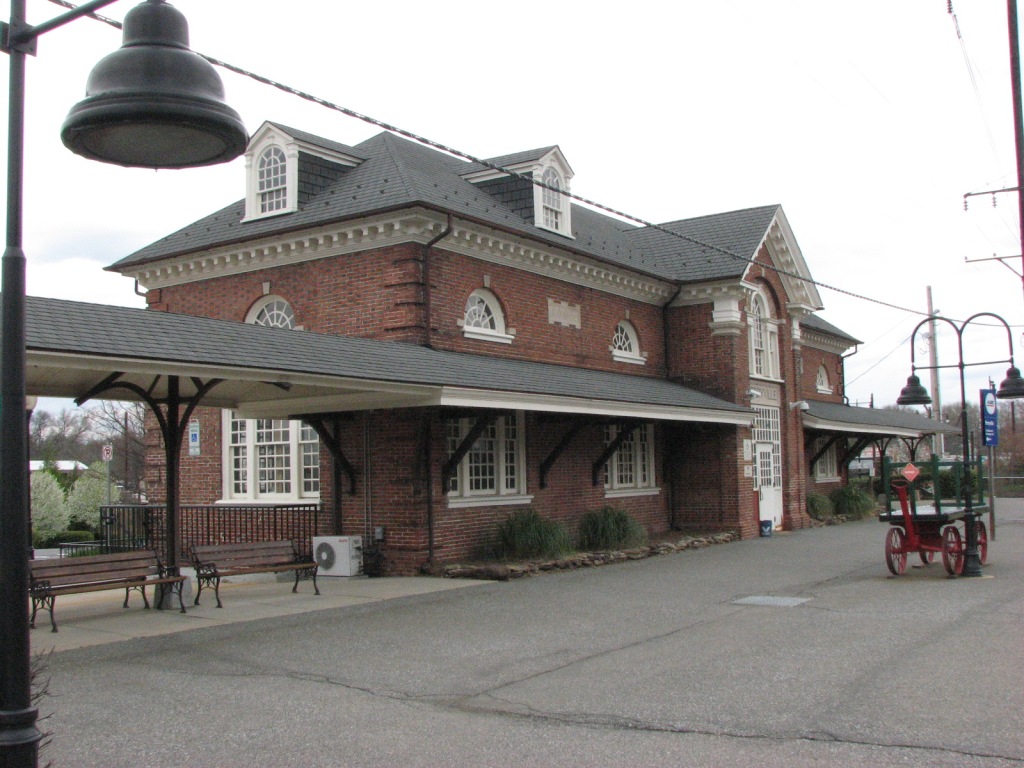
Check out the large Perryville page here
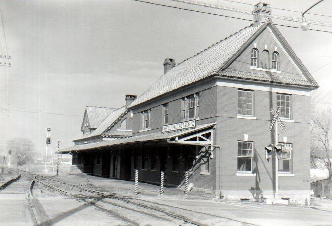
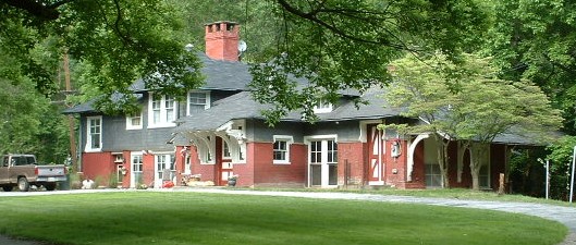
Another Frank Furness design, formerly used for the Northern Central and the Pennsy. Used till 1964 and then sold and became a private home for the station agent that used to work the station.
The widow sold it 2000, but not before I got it on the Baltimore County historical list, which pissed off the realtor, the owner, and the prospective developer who wanted tear it down and put five houses on
the acre and a half. She sold it for $250K, and it sold in mid 2008 for $650K.
Riderwood appears on map 1 of the Baltimore guide
Rockville
Ex B&O depot. Currently houses law offices. The current MARC station is about a quarter of a mile west (to the left) of here, along with a Metro station. On MARC's Brunswick line.
Located on the site of the old B&O commuter stop, the old station was torn down sometime in the late 70's (I think), I would come over here to study in between classes back in the late 60's, early
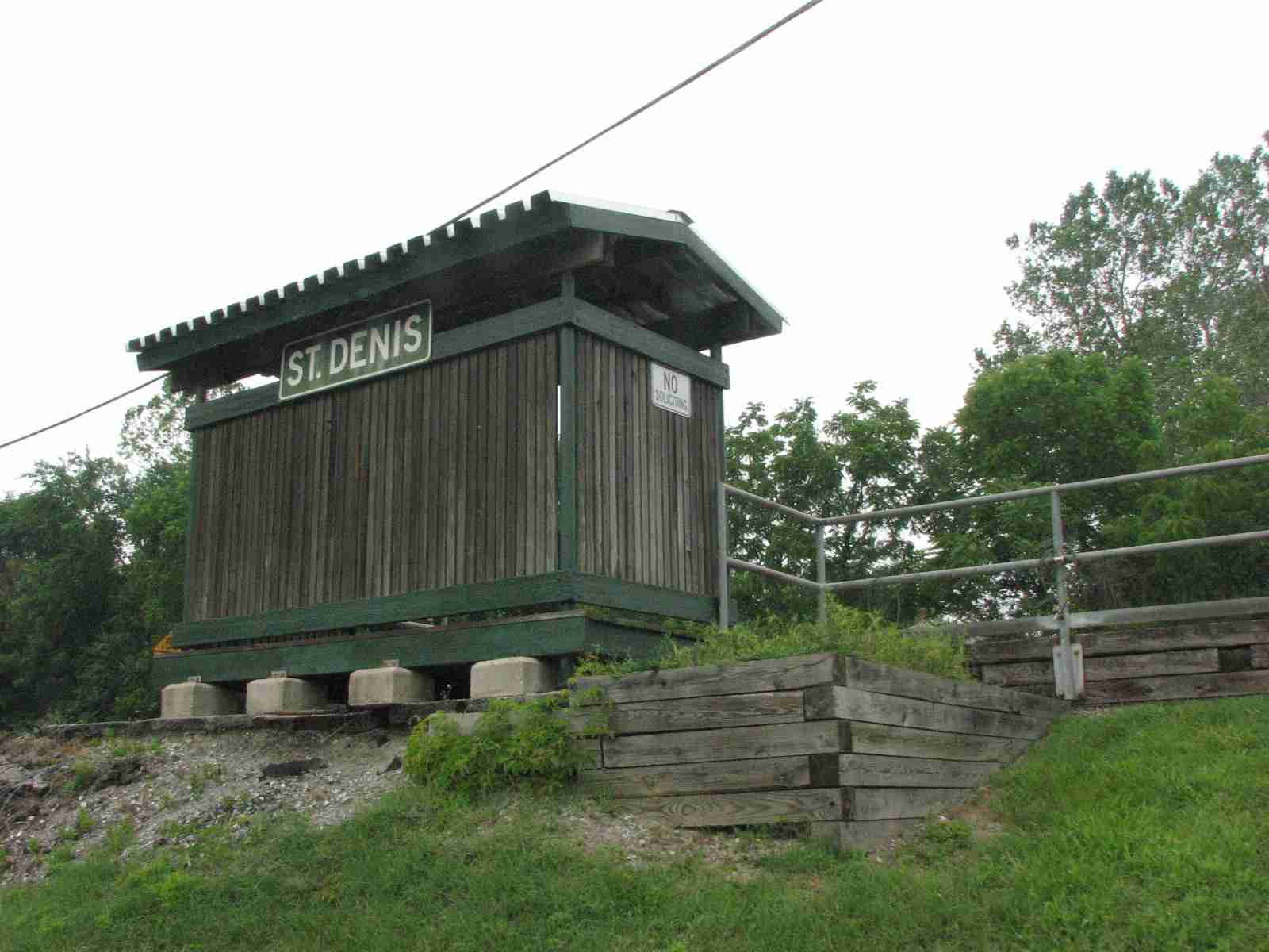
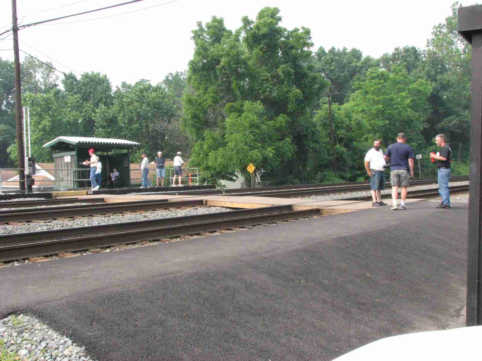
70's. Typical of MARC's plain stations. As can be seen, this is a popular spot with railfans on Saturday mornings. On MARC's Camden line to DC.
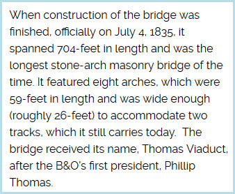
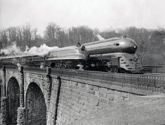
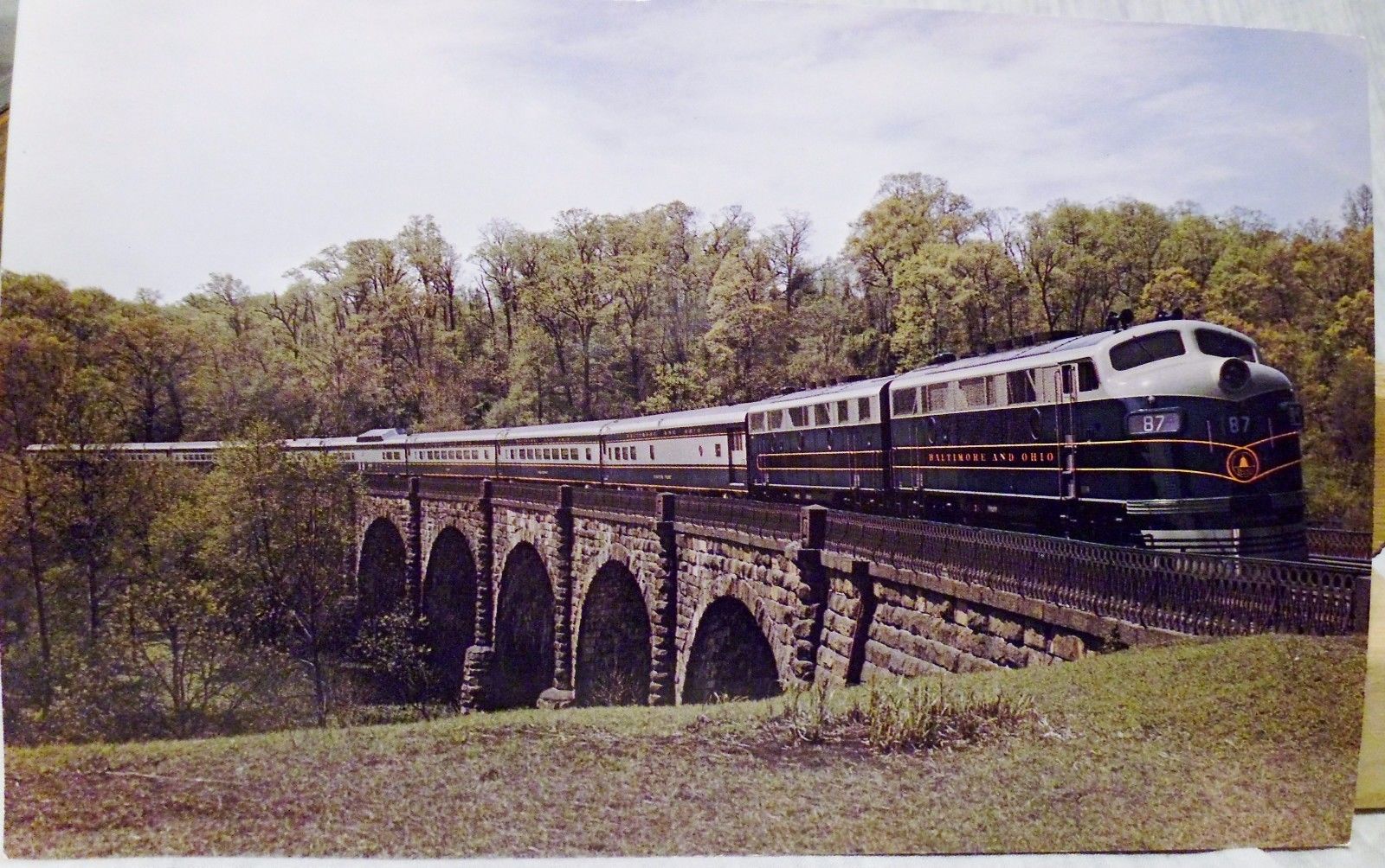
Lots more on the St Denis station and Thomas Viaduct here
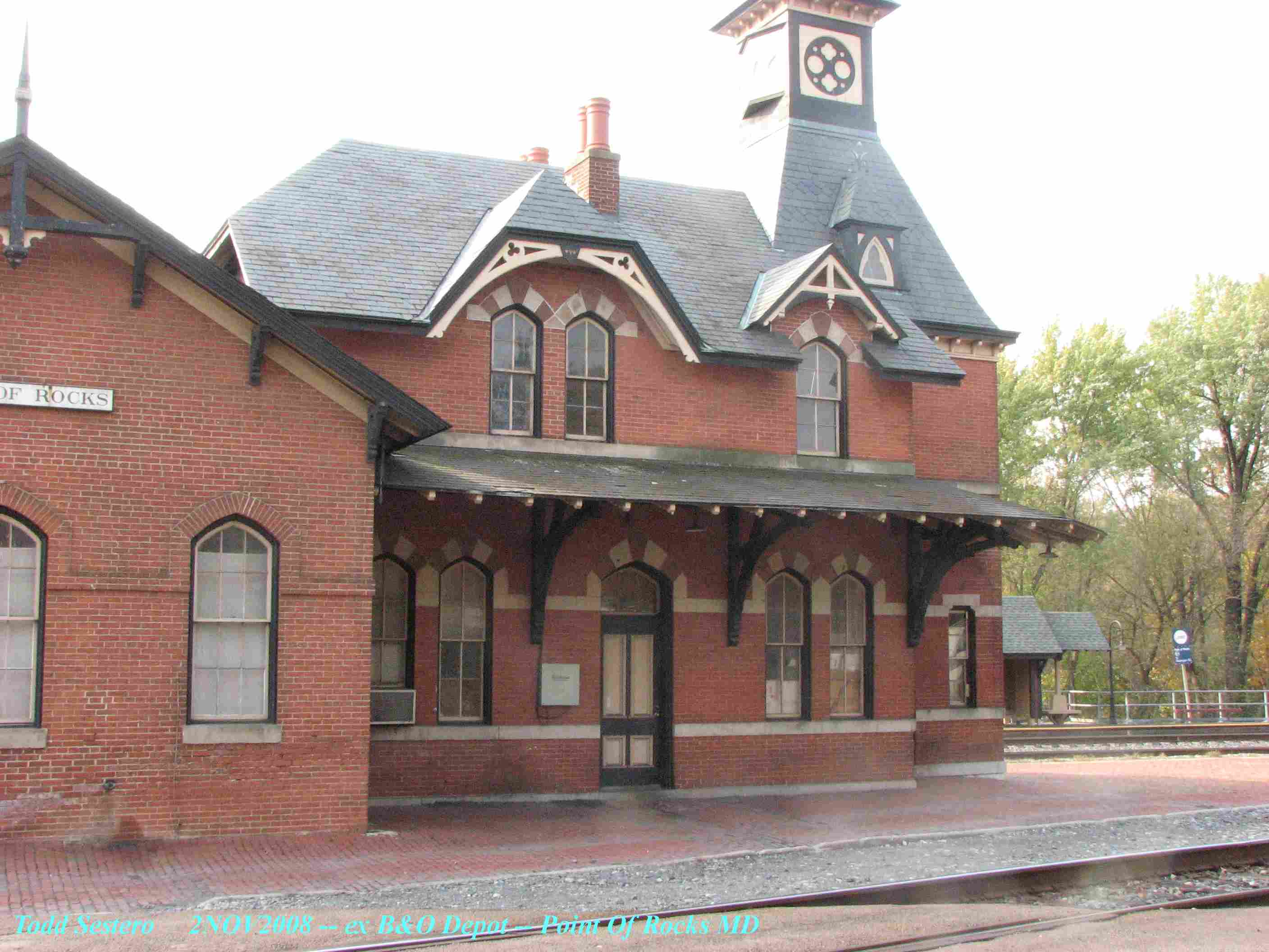
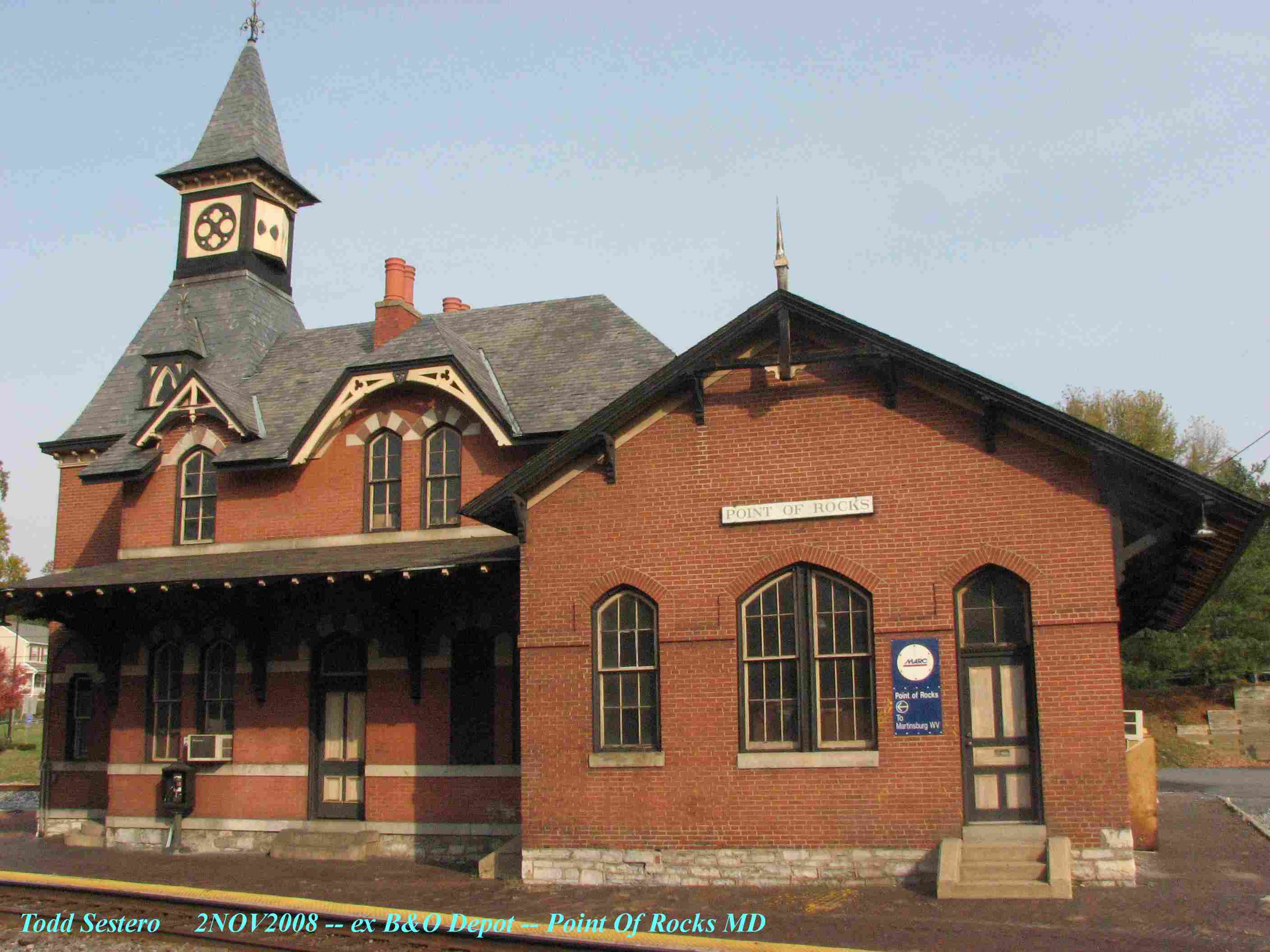
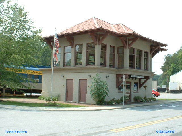
An ex B&O depot located in a very historic town. B&P tower also resides here after being "moved" from Penn Station and rebuilt here.
Check out the Sykesville railfan guide here - lotsa stuff!
An ex WM depot serves as home to the Western Maryland Historical Society. They have a fair number of signals for a small museum, and outside they have a WM semaphore on a full height mast.
The HQ for the Maryland Midland RR is across the street, as well as their yard.
Want to find out where the MMid goes, check here


 1907.
1907.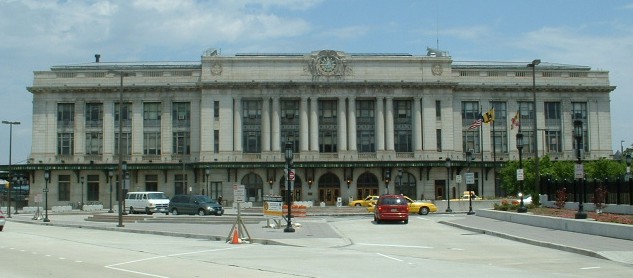 Before they added the "art".
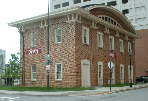


 courtesy Kilduffs
 NB Merritt looking north
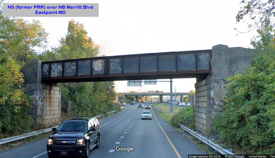 NB Merritt looking south
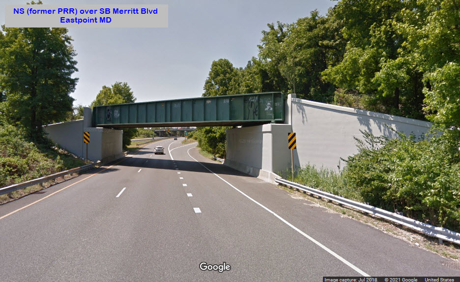 SB Merritt looking south
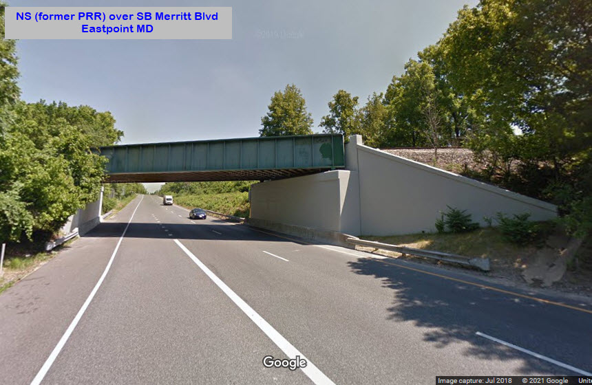 SB Merritt looking north
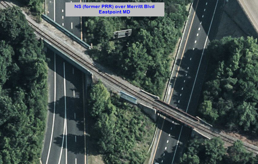
 looking east
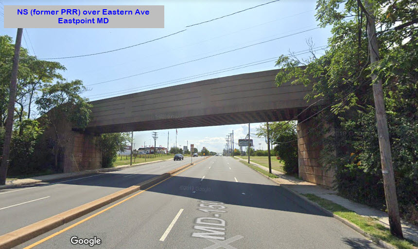 looking west
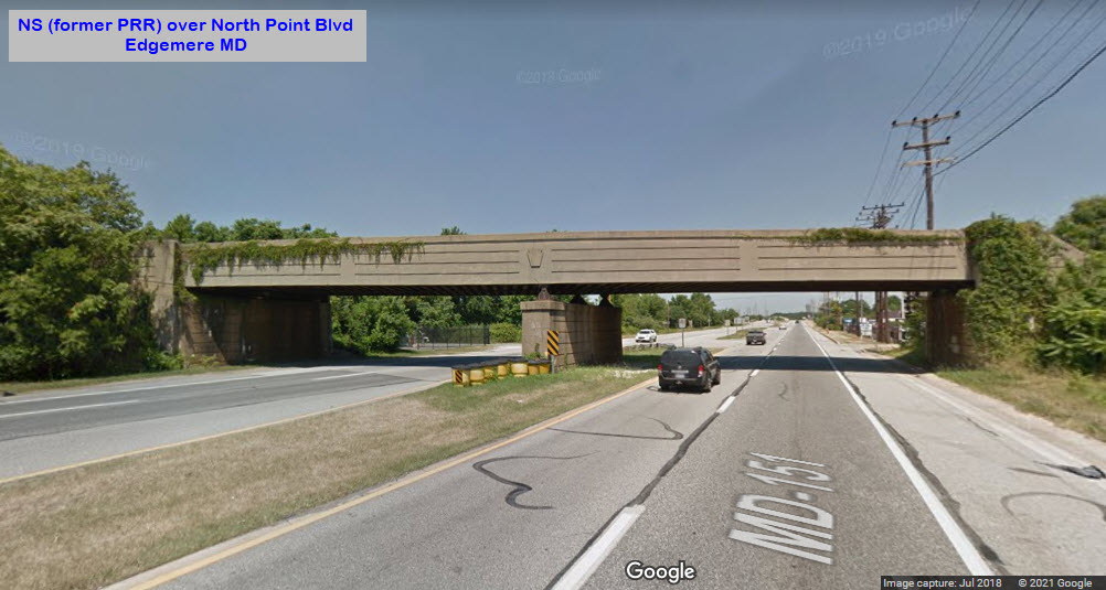


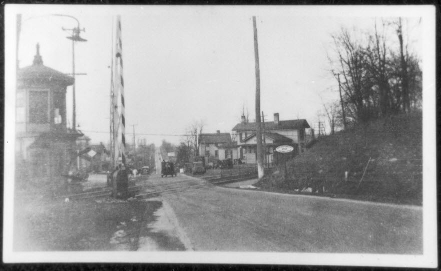
 ~1917
~1917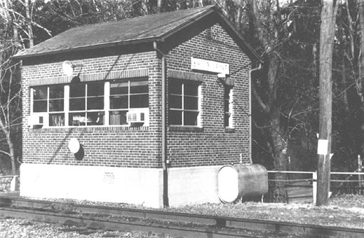 ~1977
~1977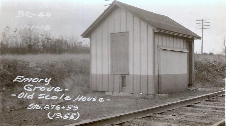 ~1917
~1917
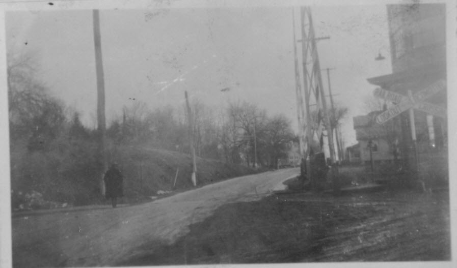
 ~1977
~1977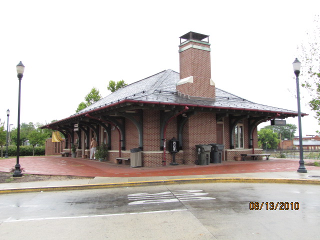


 Before
 Before
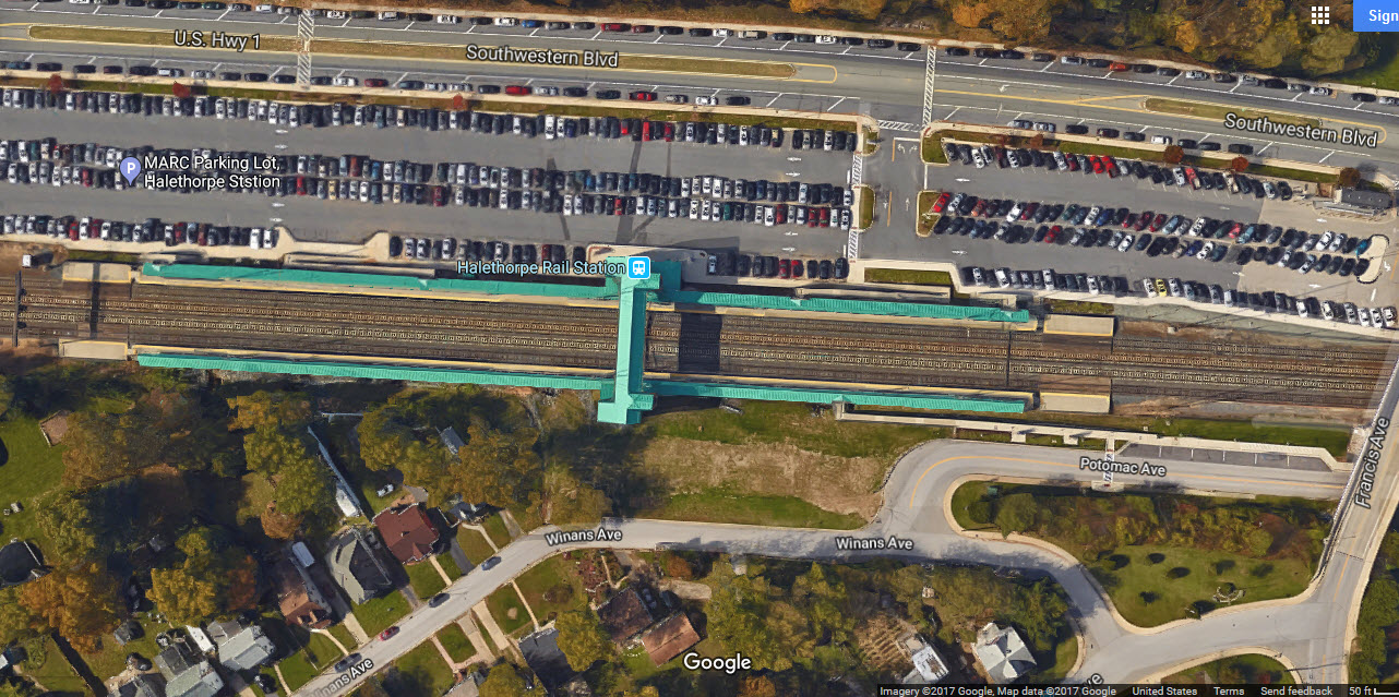 After
After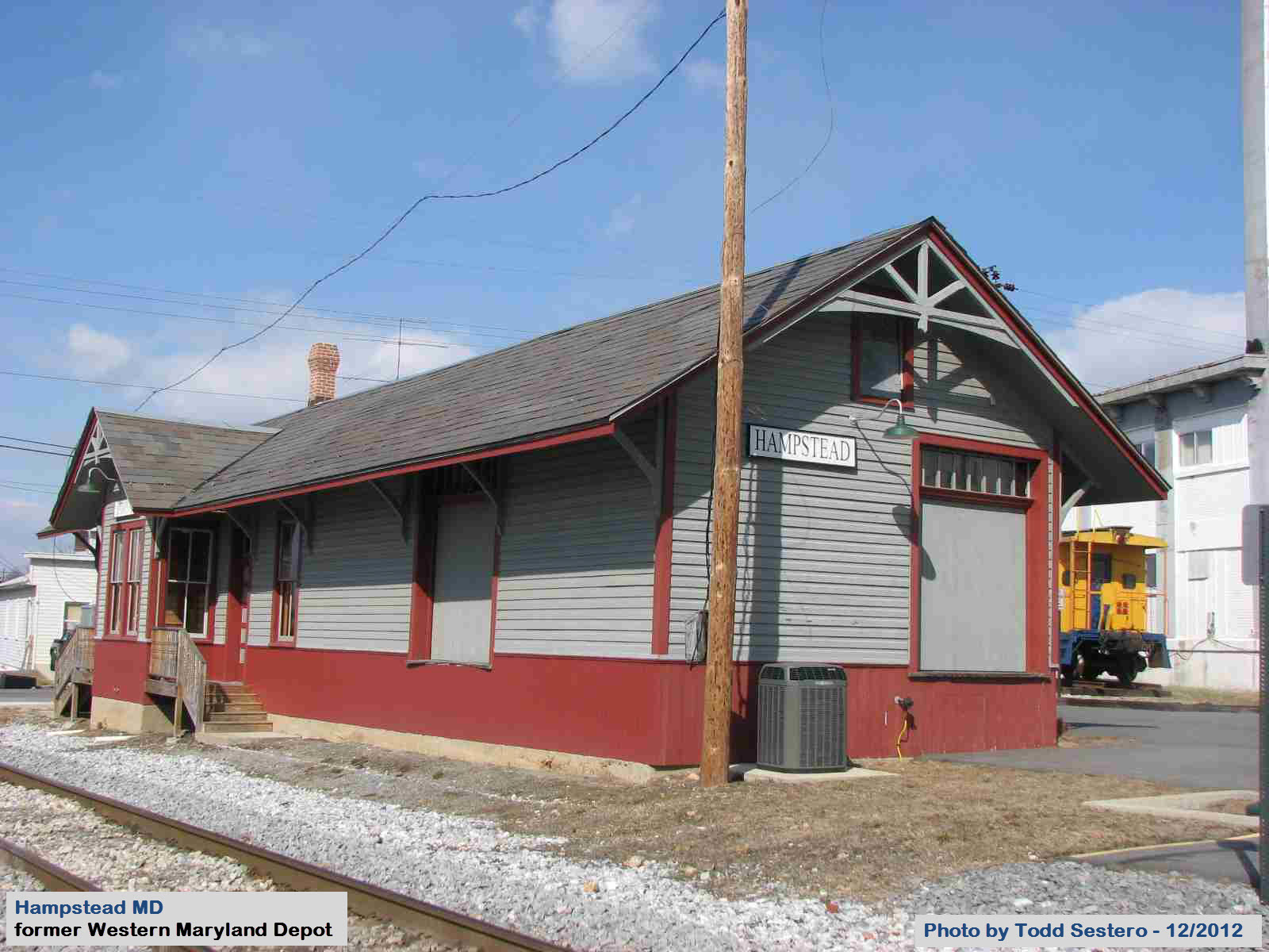
 looking west
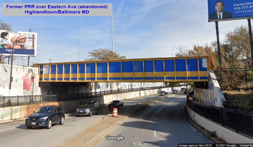 looking east
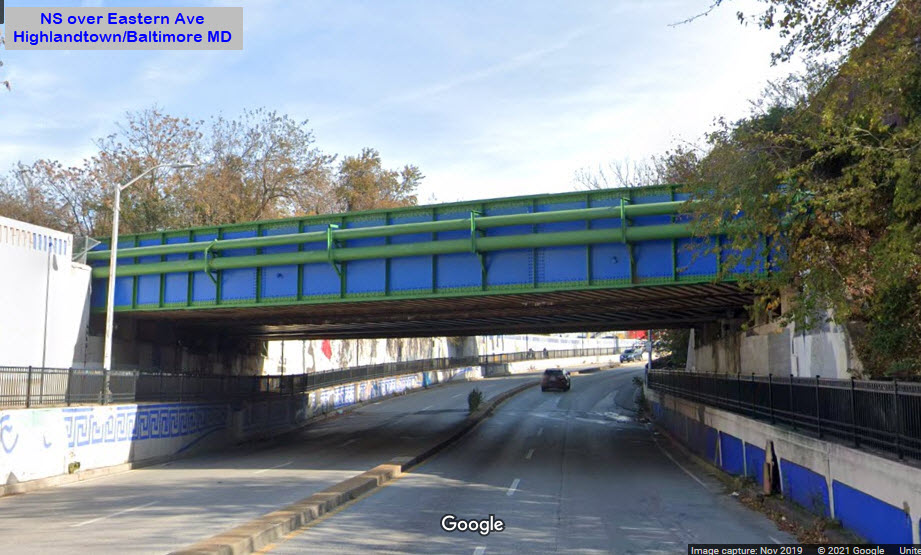 looking east
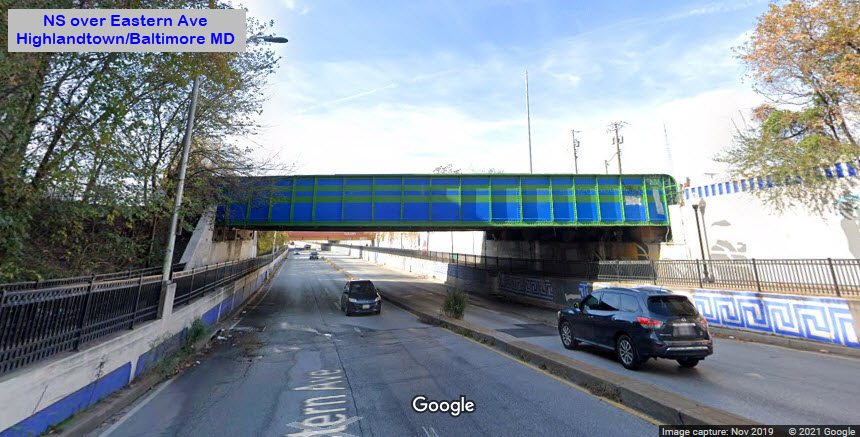 looking west
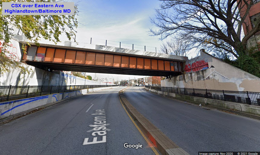 looking east
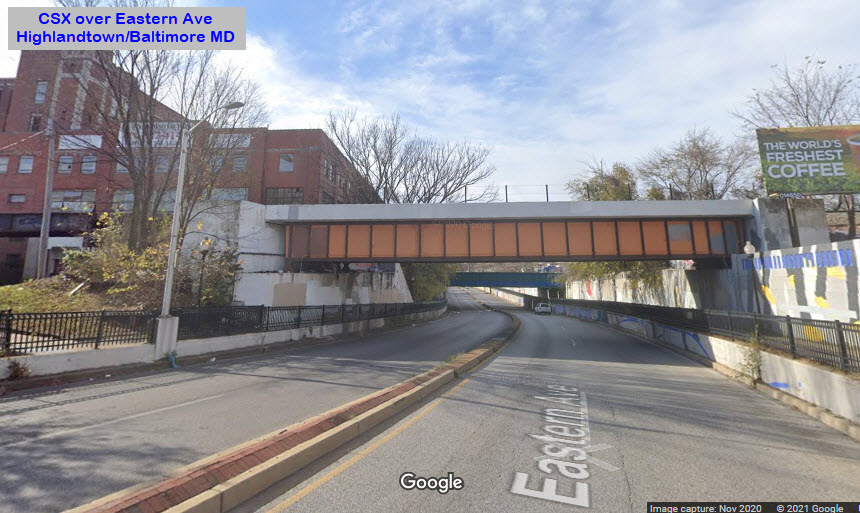 looking west
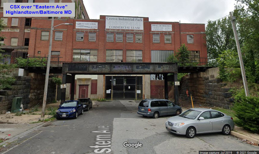 looking east
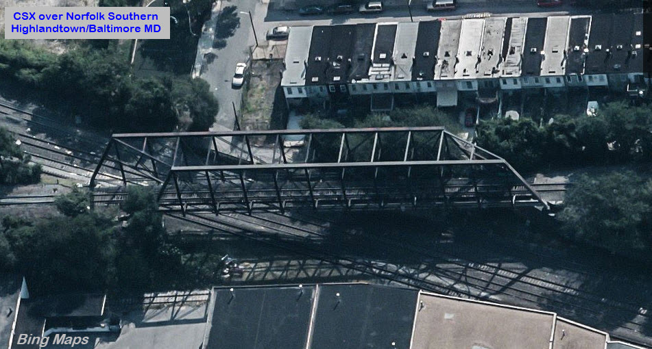
 looking east
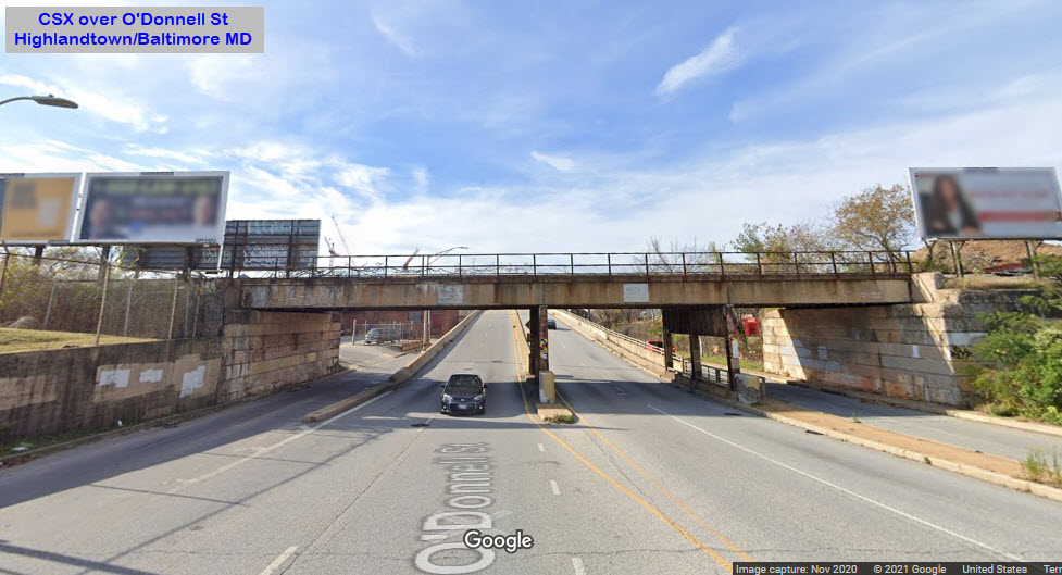 looking west
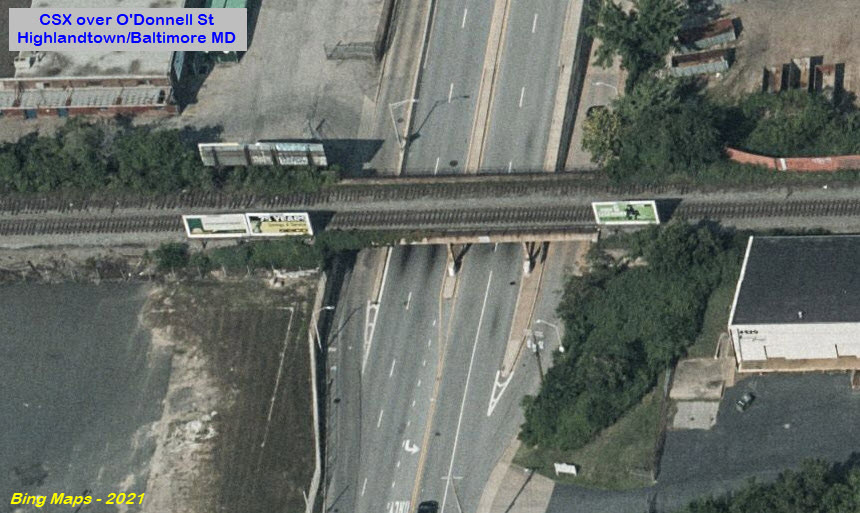

 looking east
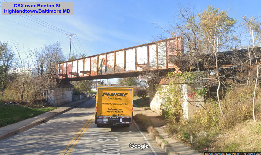 looking west
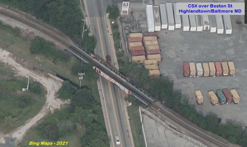
 looking east
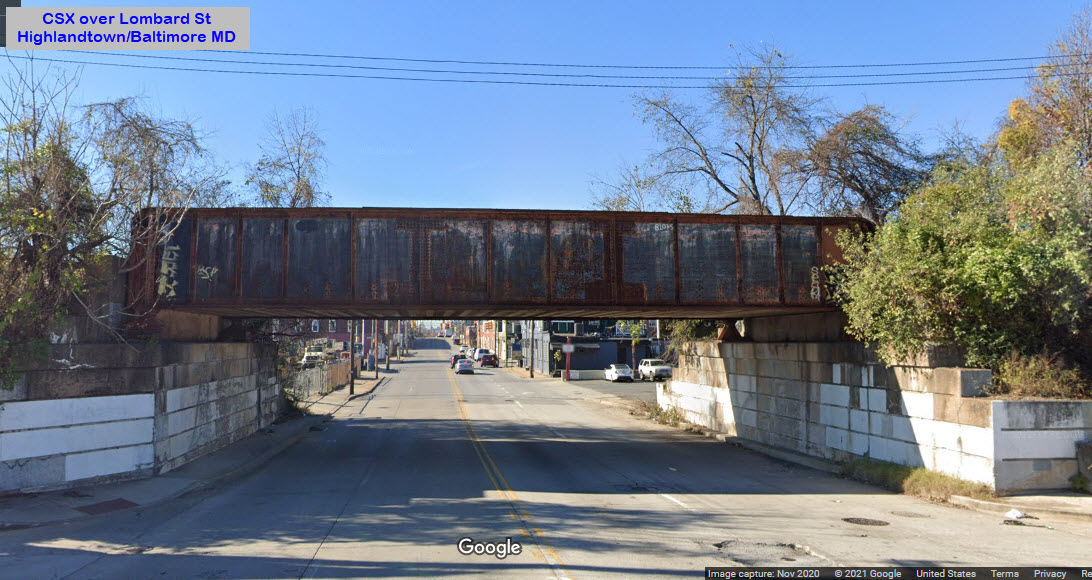 looking west
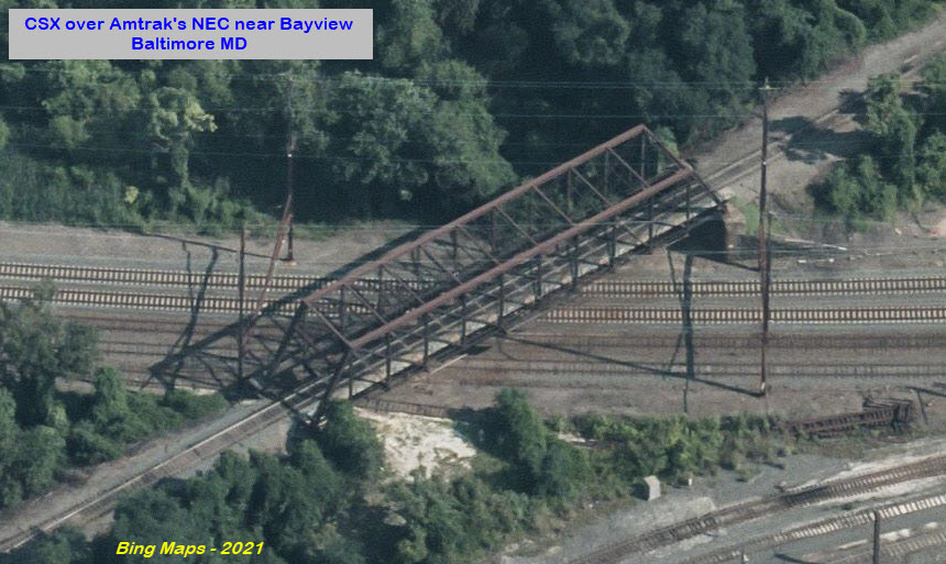
 looking east
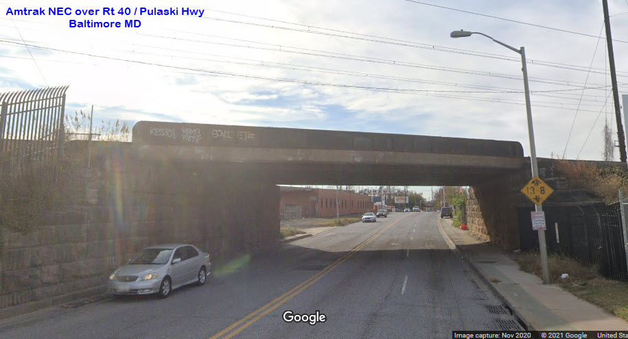 looking west
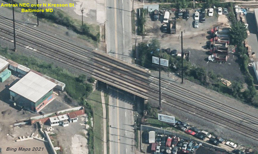
 looking east
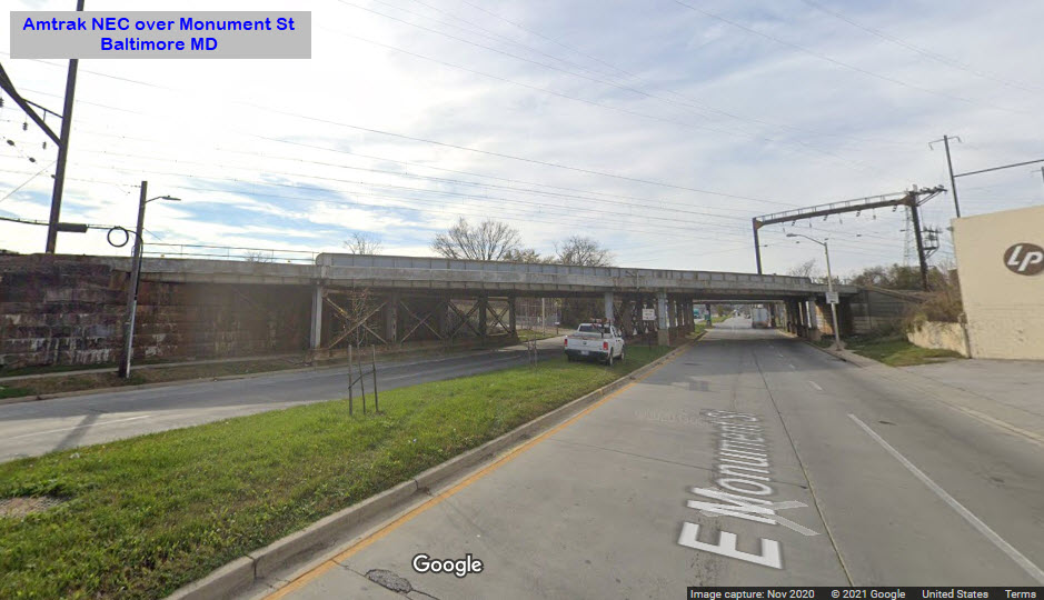 looking west
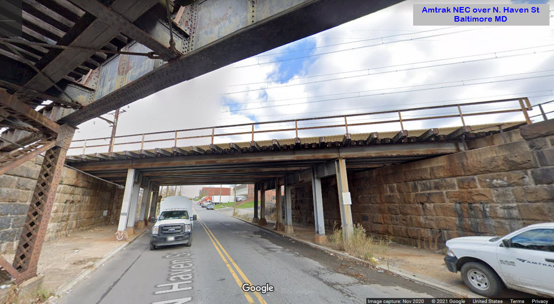 looking north
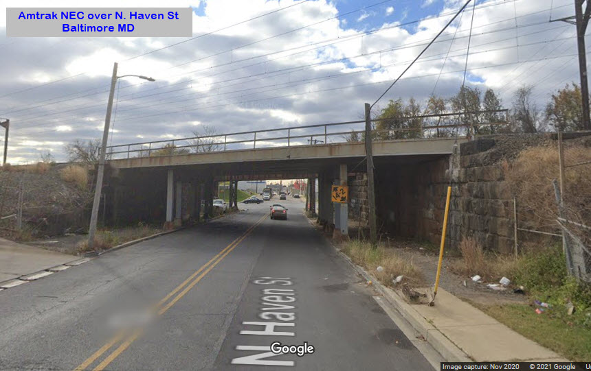 looking south
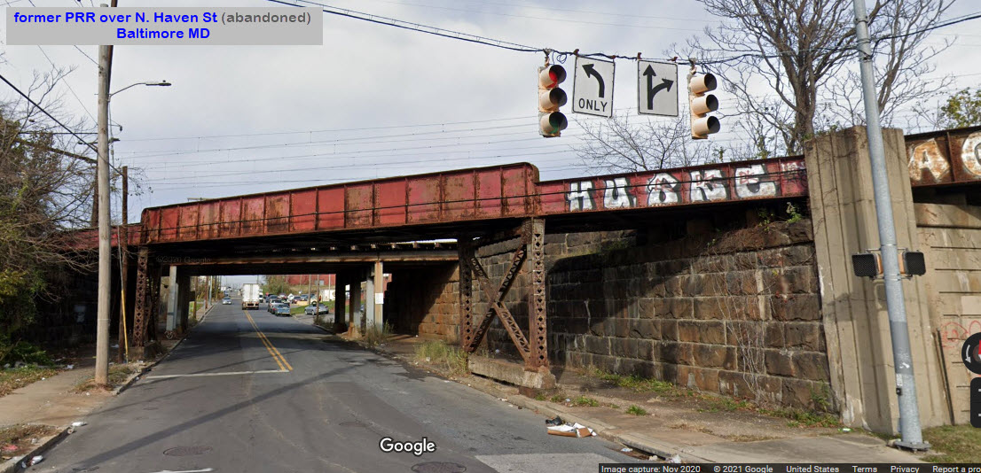
 looking east
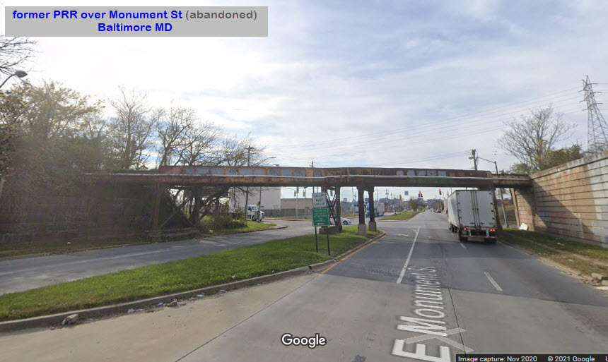
 looking east
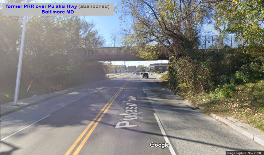 looking west
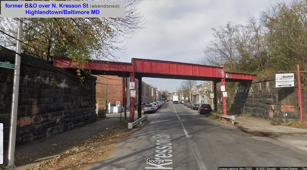 looking north
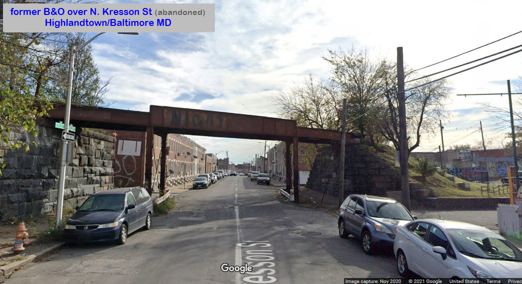 looking south
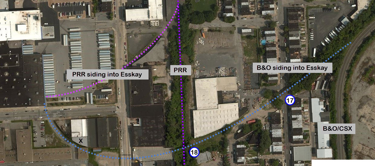
 2023/photo courtesy Steve Okonski
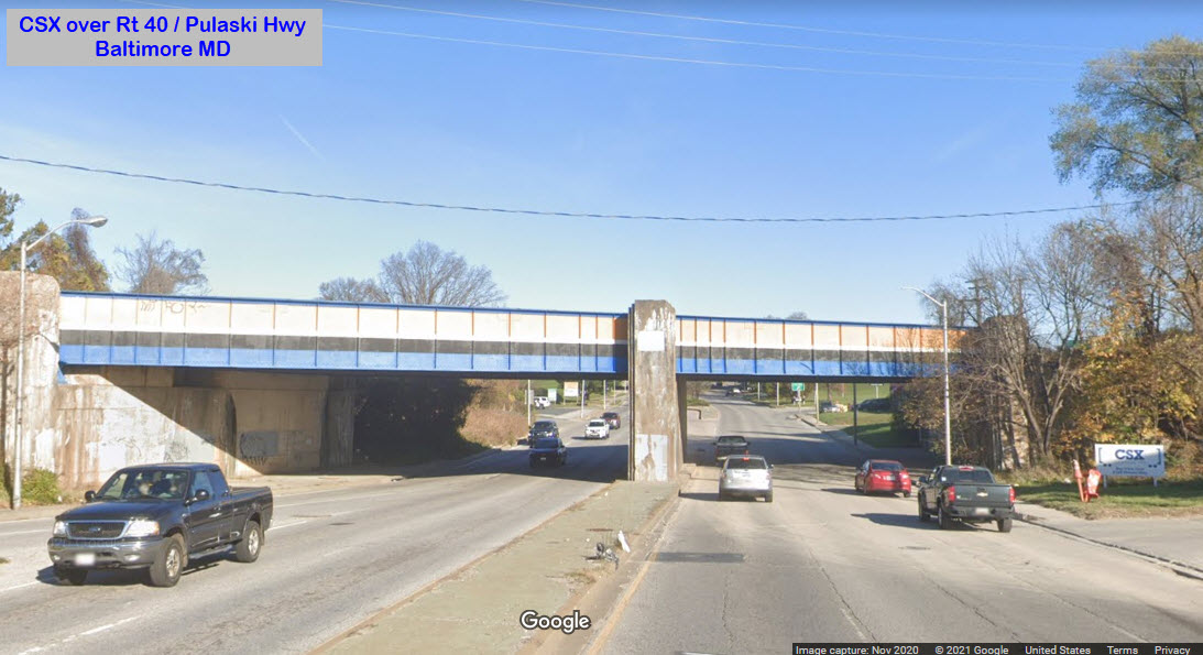


 picture by Charles T. Mahan