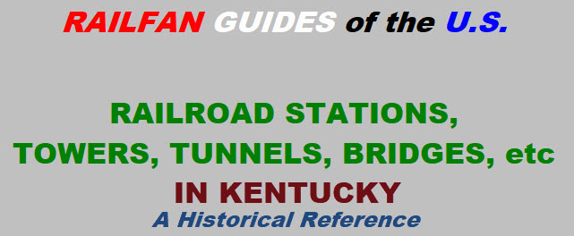
Allen
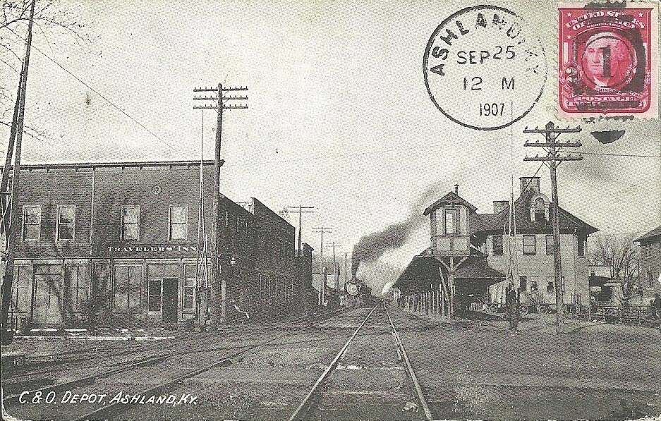
Ashland
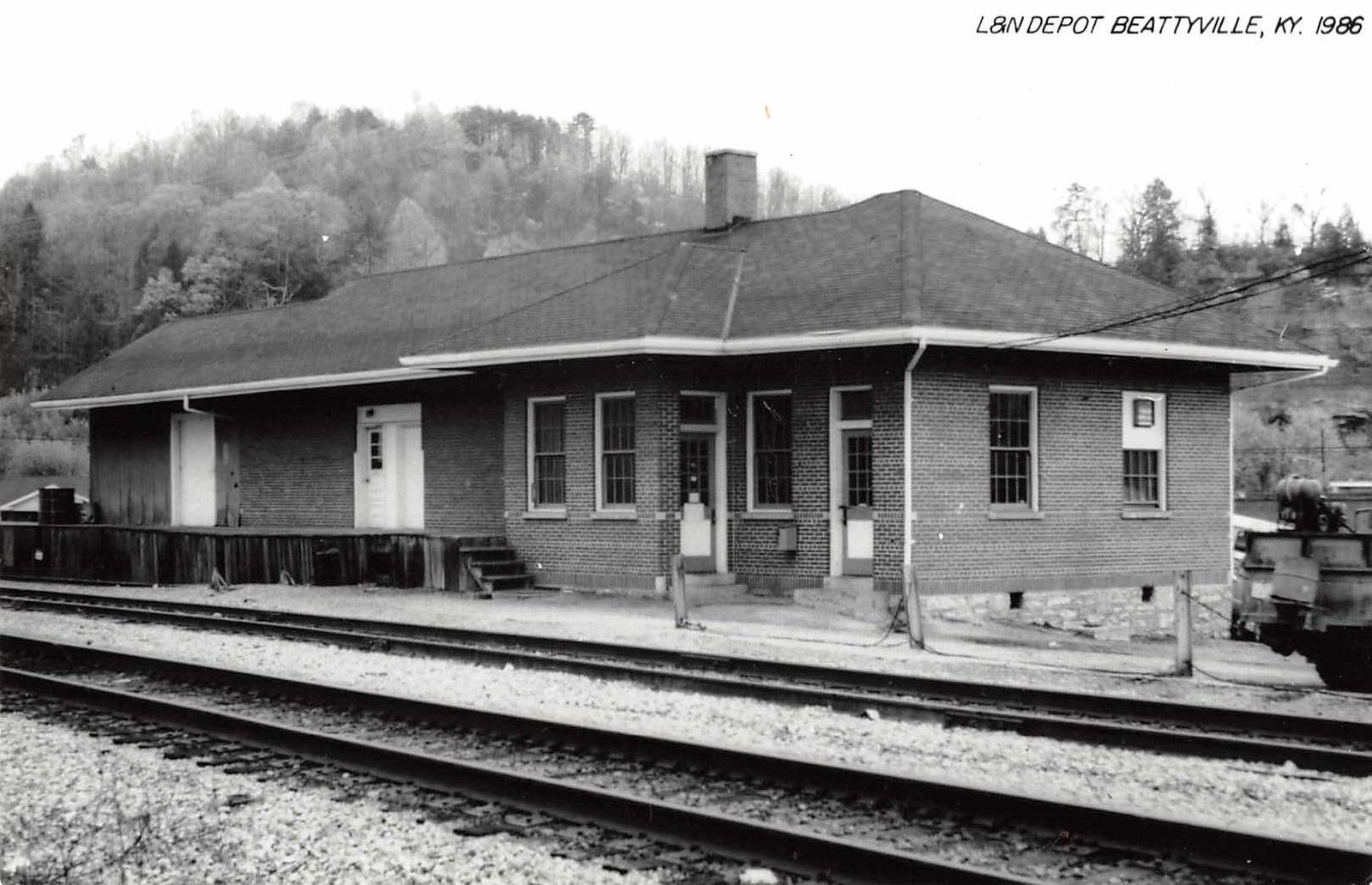
Beatyville
Berry
Bloomfield
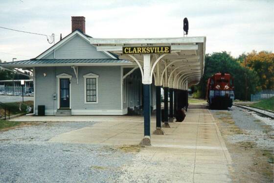
Clarksville
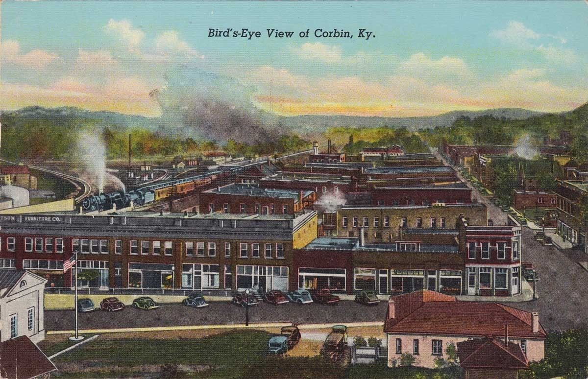
Corbin
Fulton
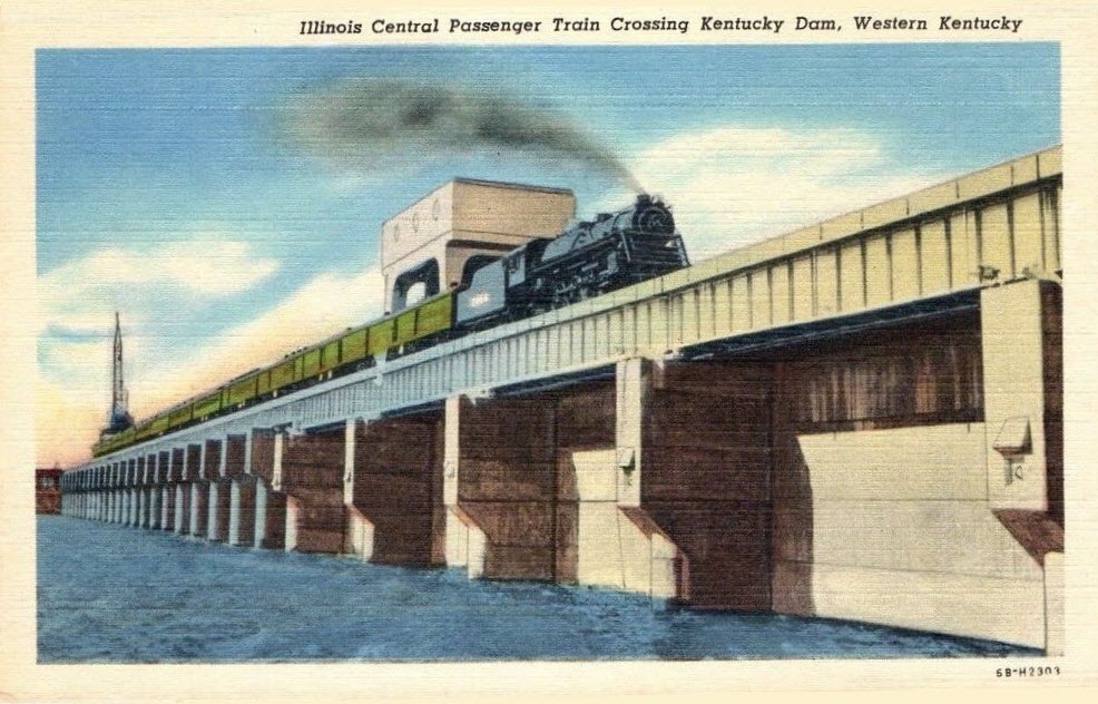
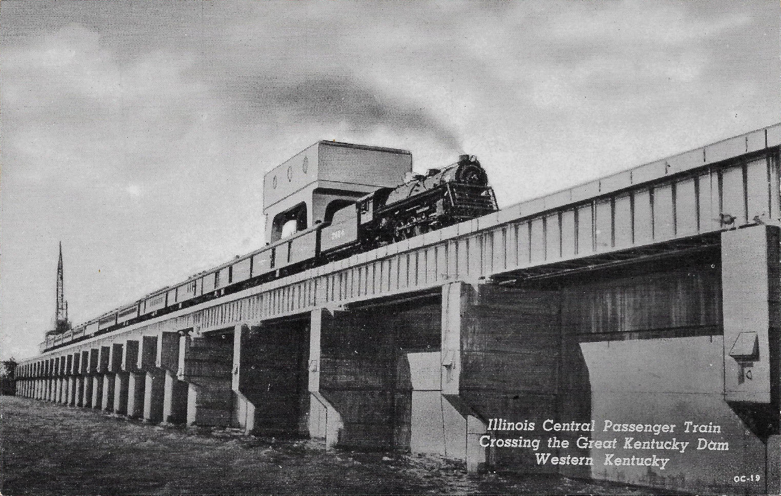
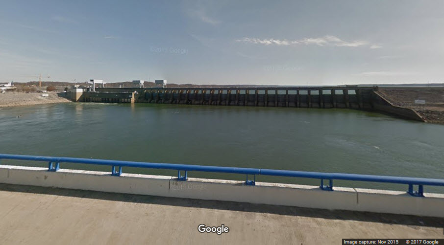
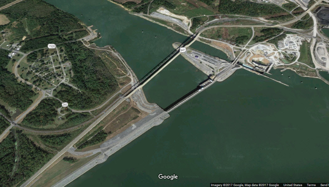
Great Kentucky Dam
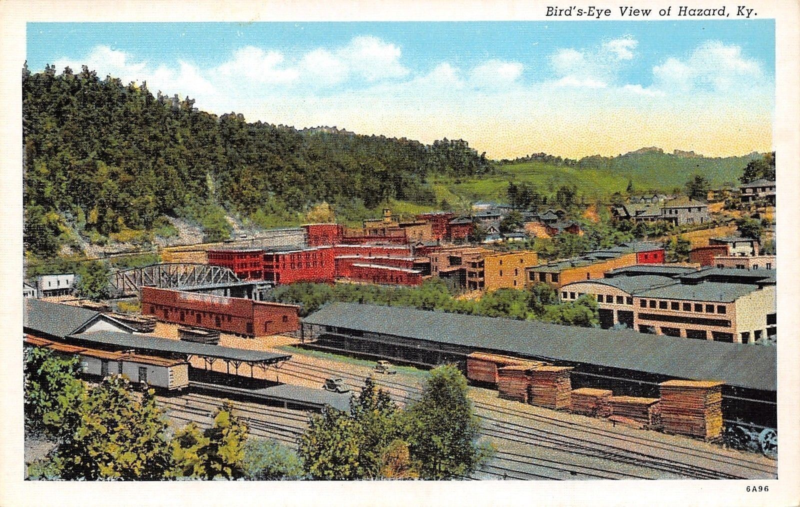
Hazard
High Bridge
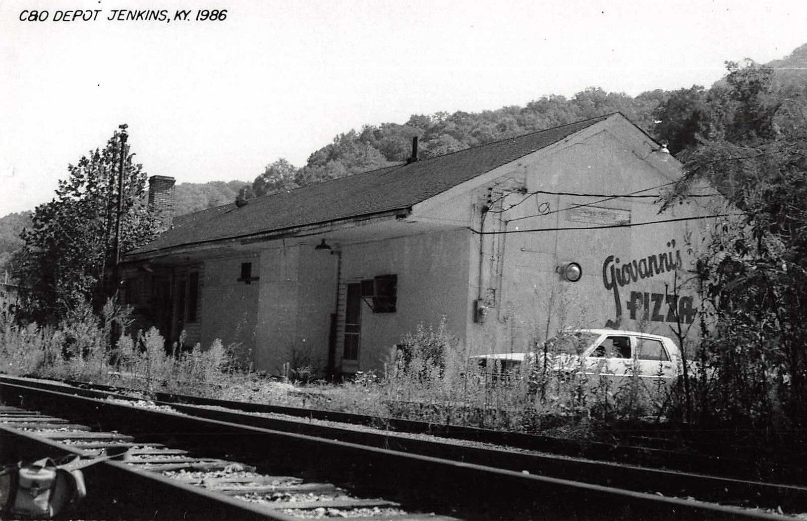
Jenkins
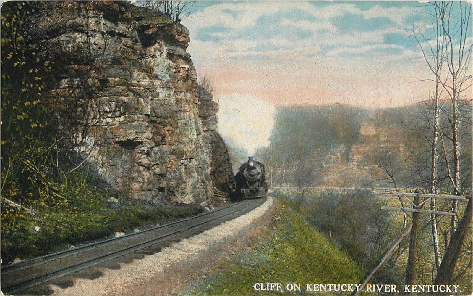
Kentucky River
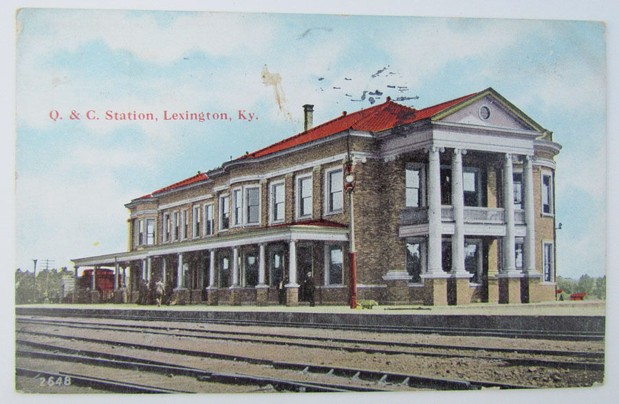
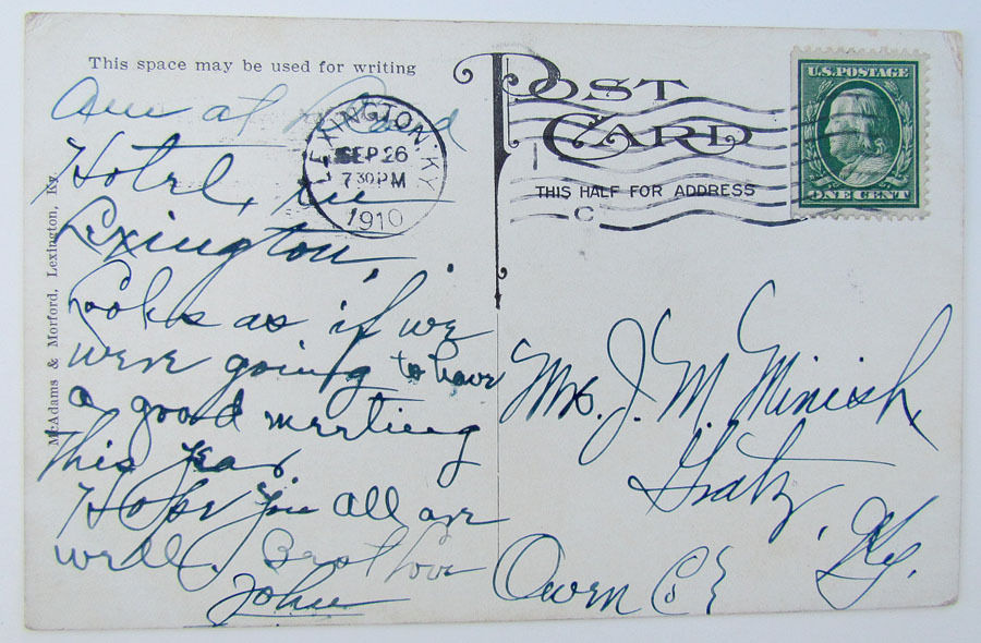
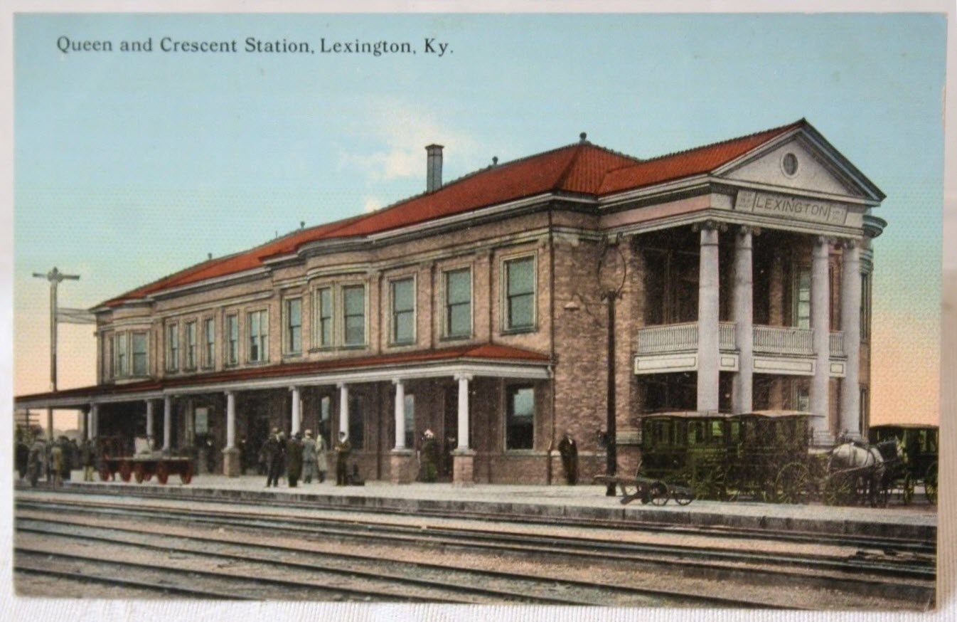
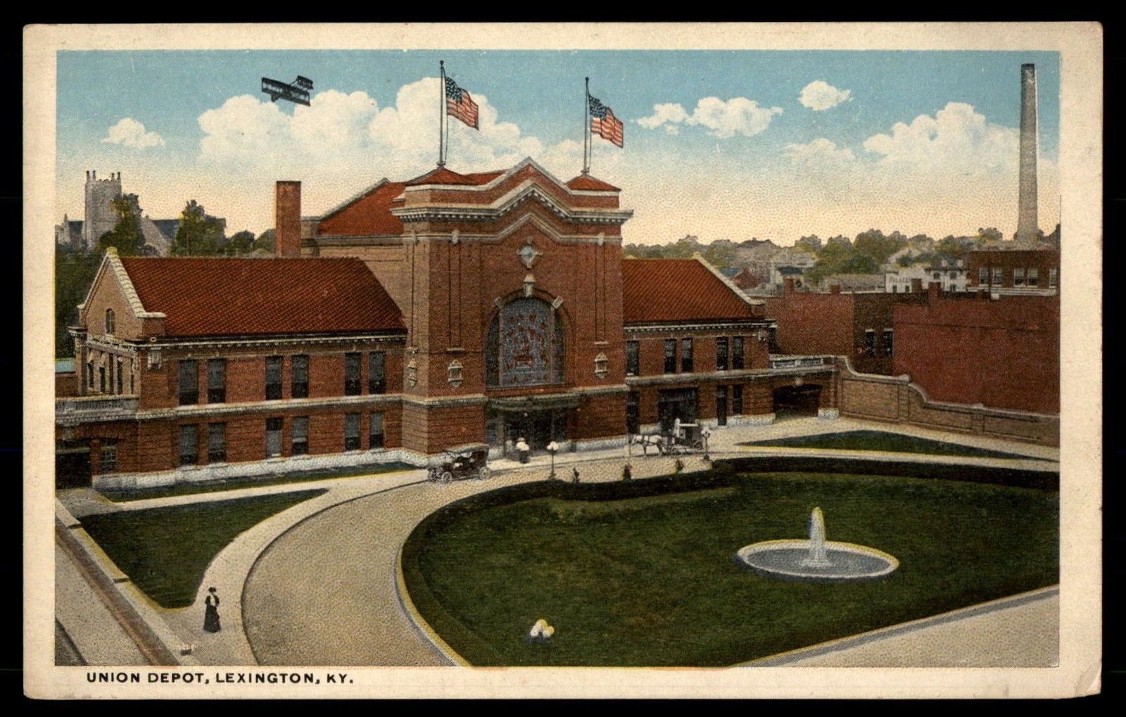
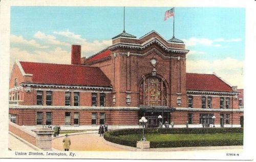
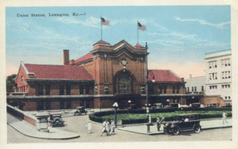
Lexington
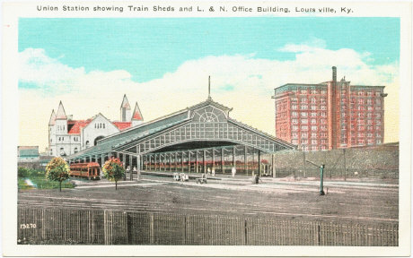
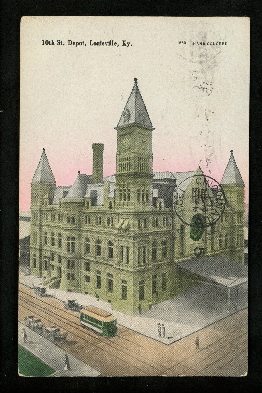
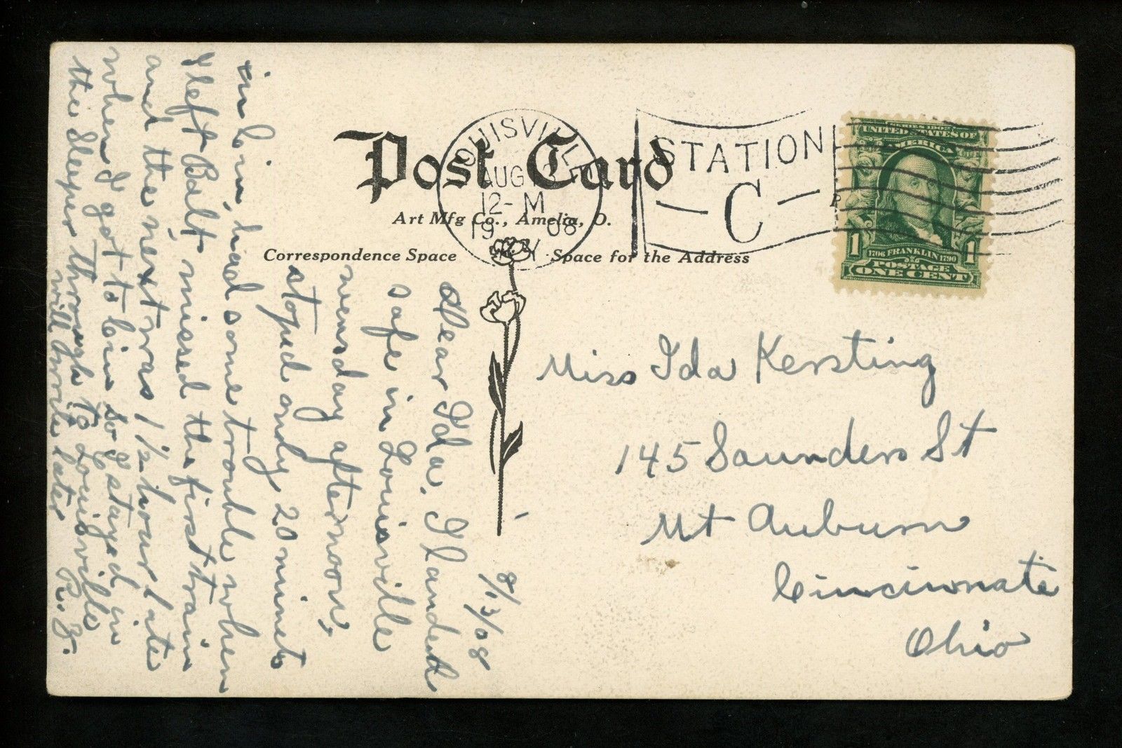
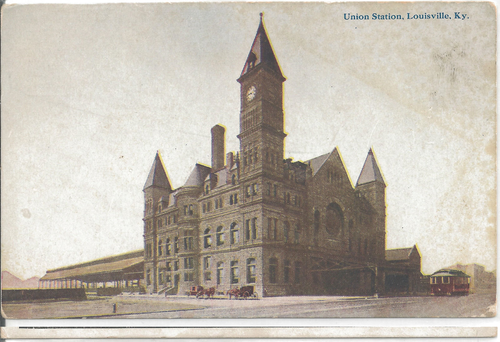
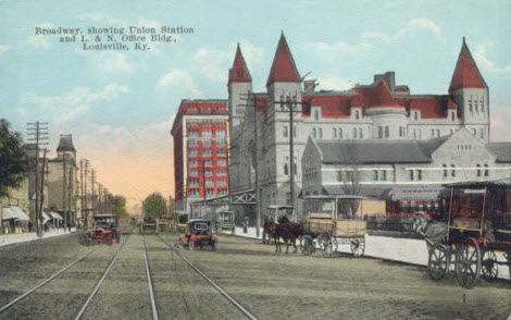
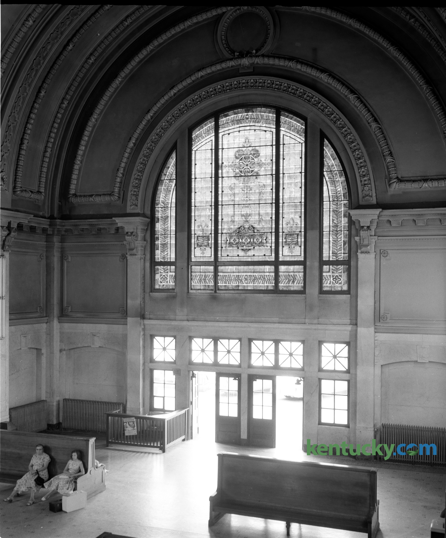
Louisville
Louisville Panhandle Bridge
Louisville Zoo
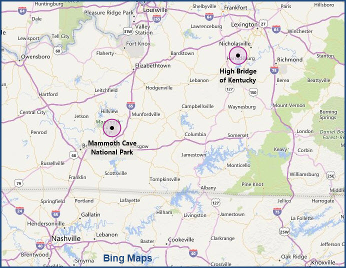
Mammoth Cave
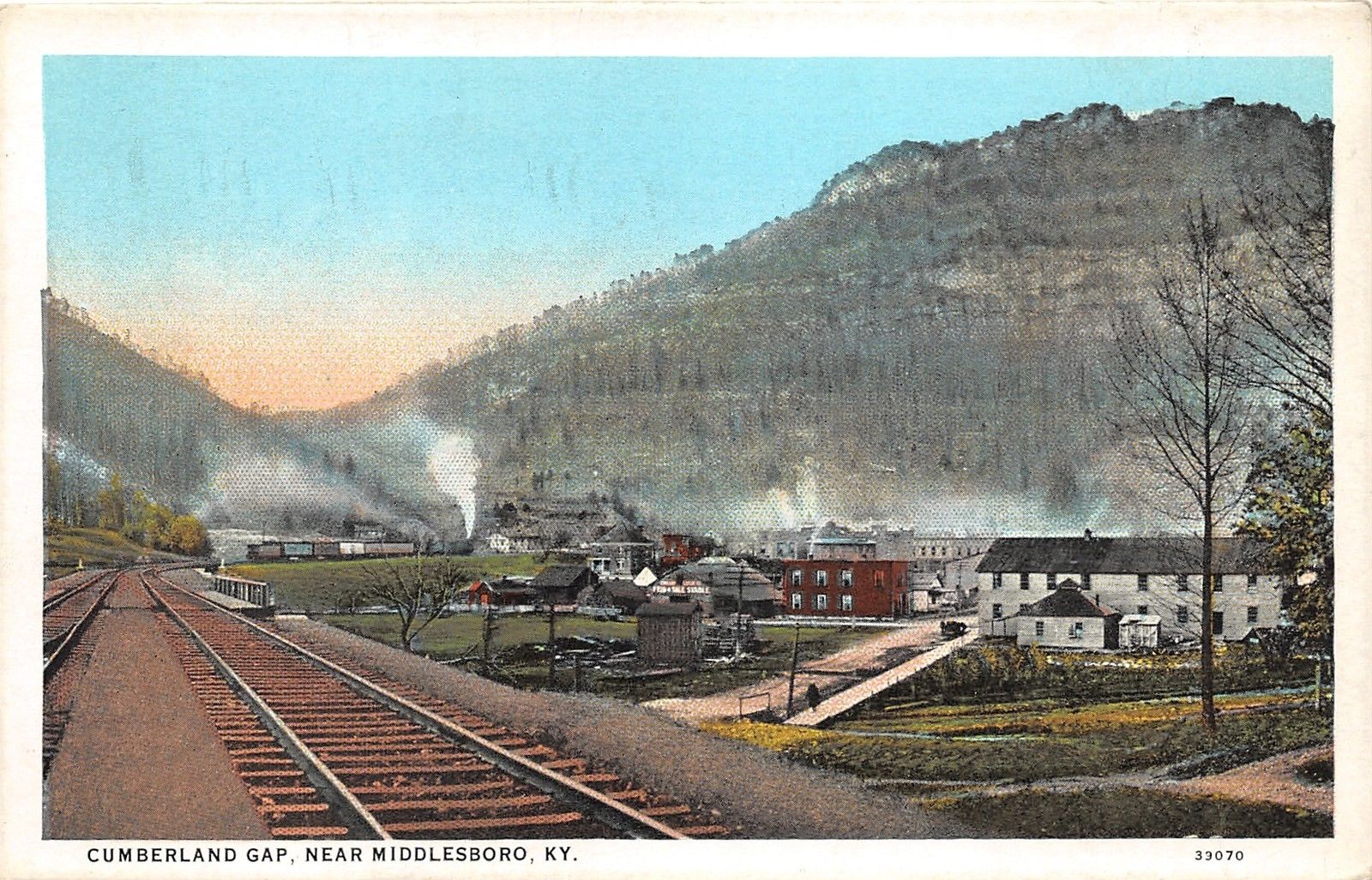
Middlesboro
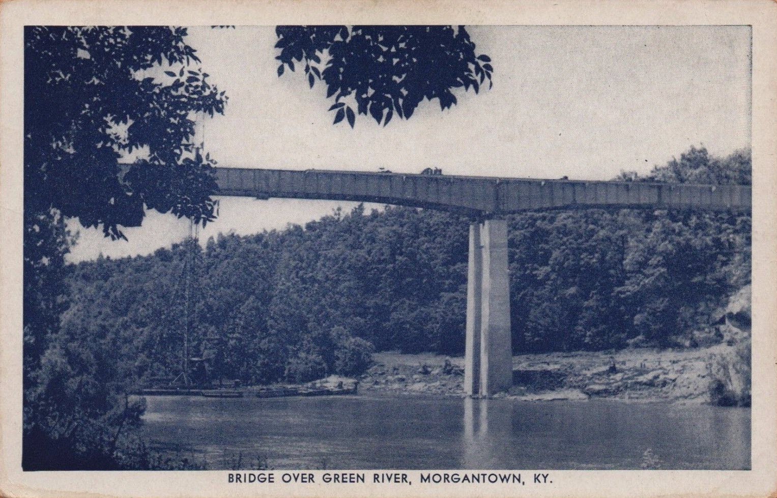
Morgantown
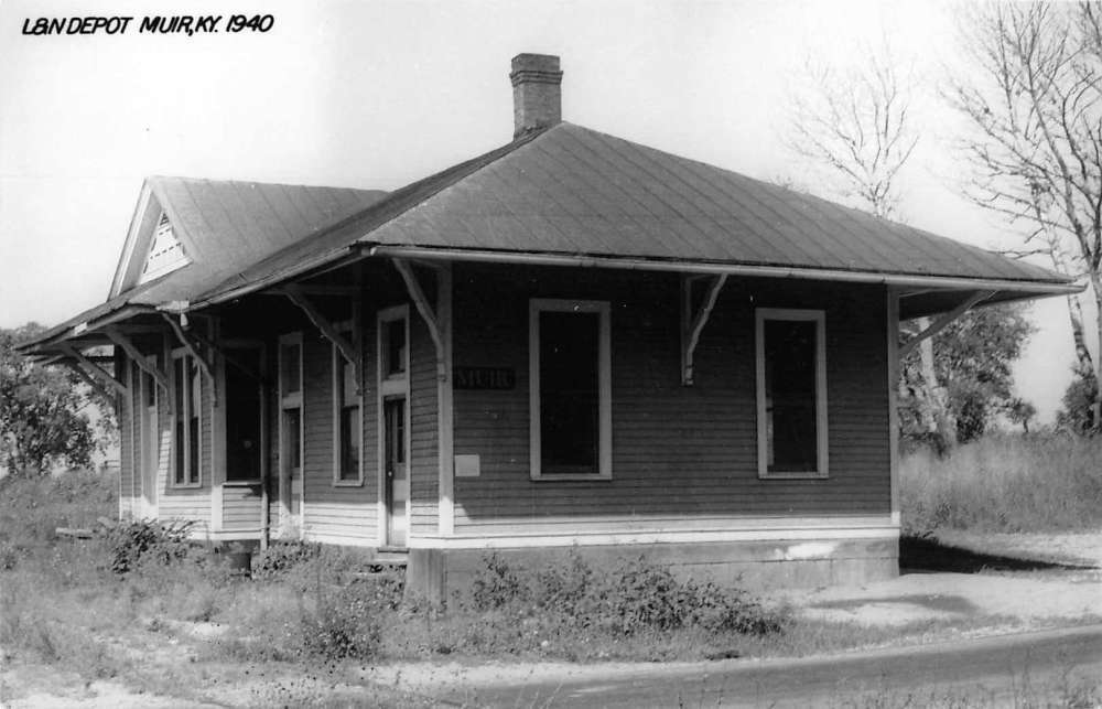
Muir
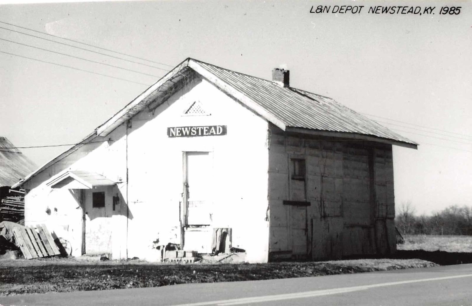
Newstead
Paducah
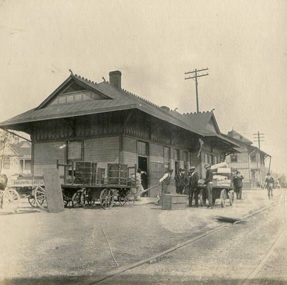
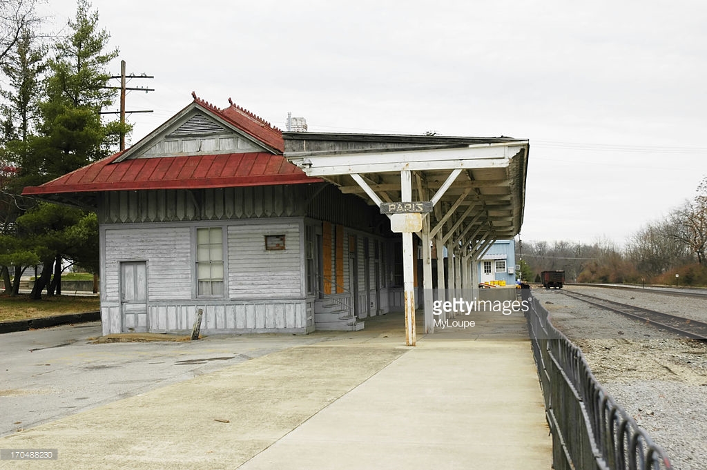
Paris
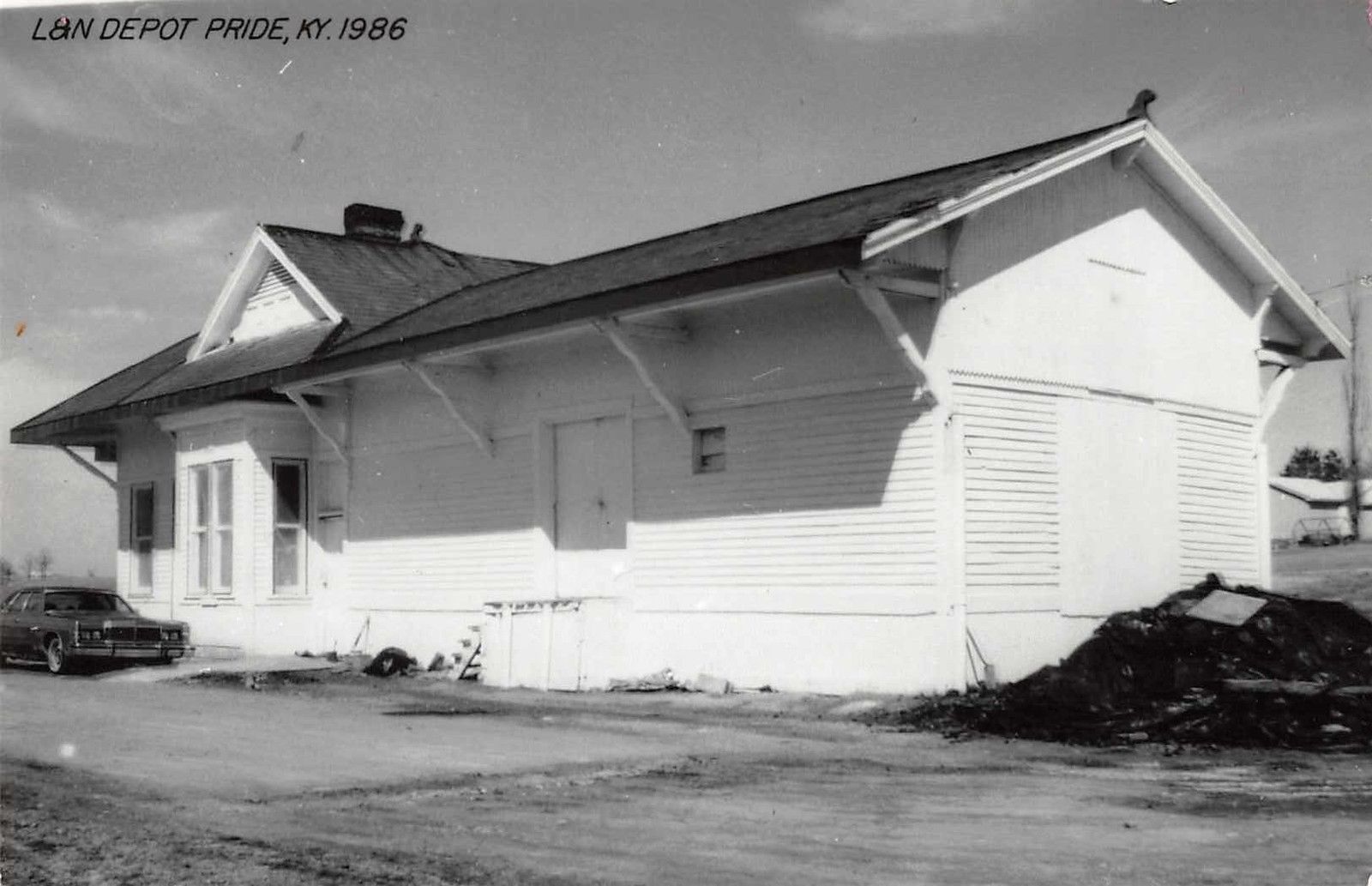
Pride
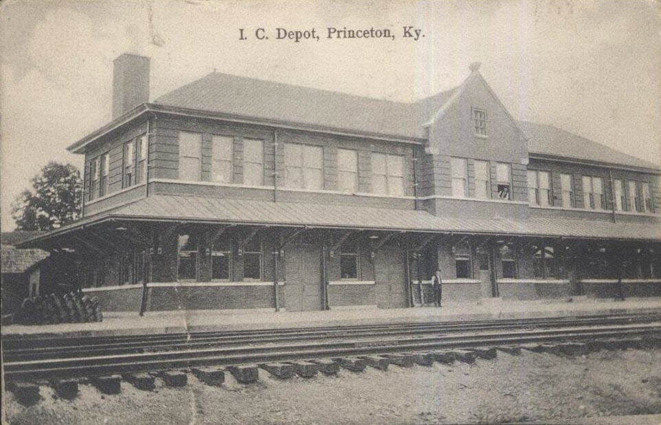
Princeton
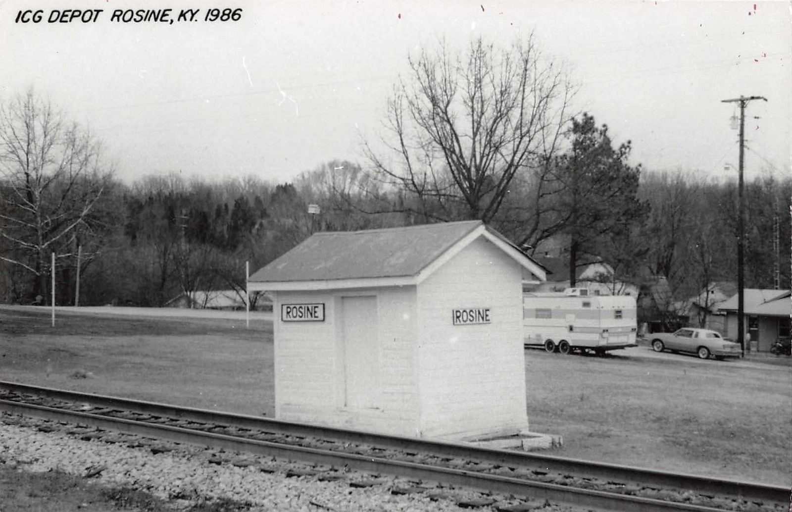
Rosine
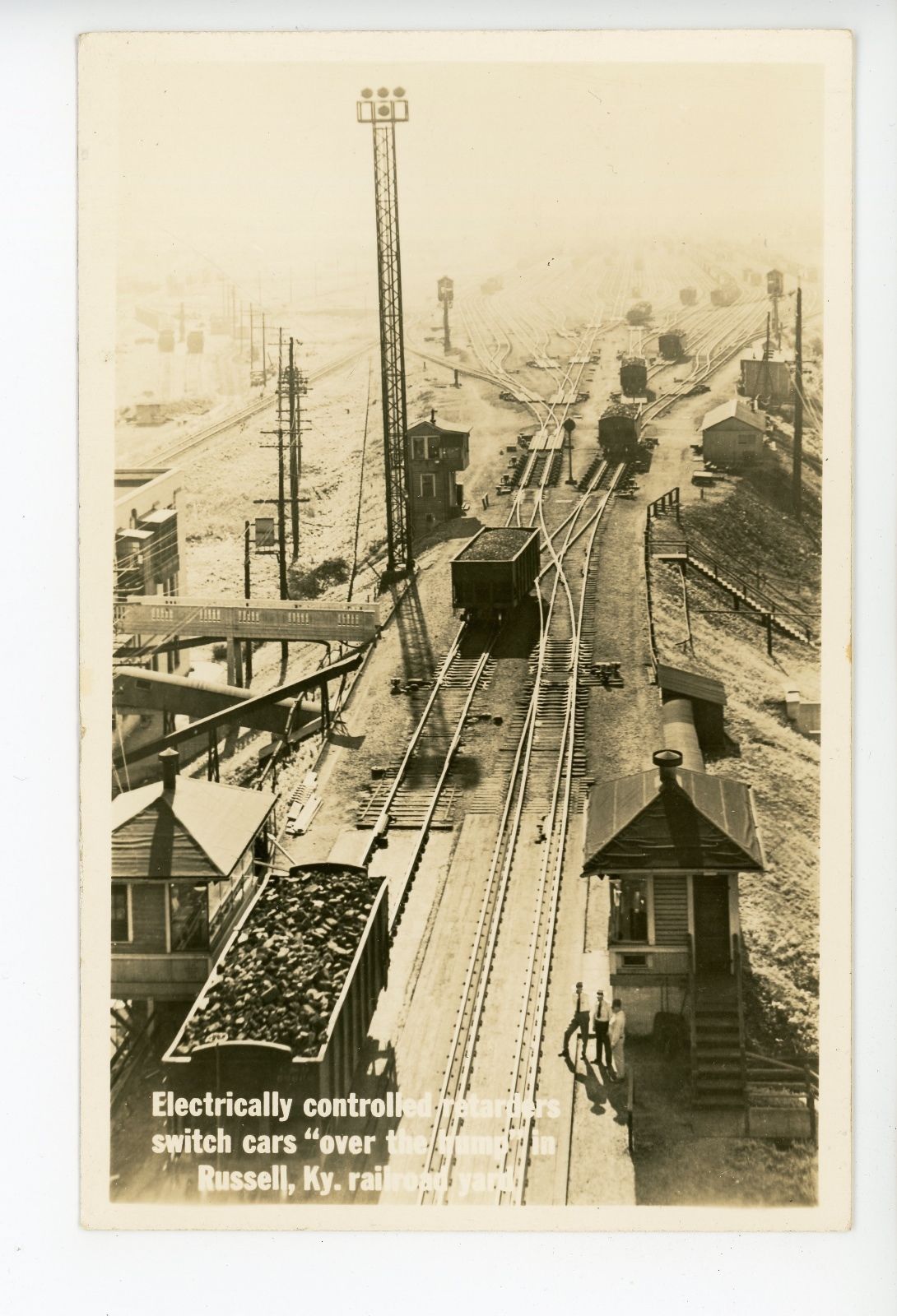
Russell
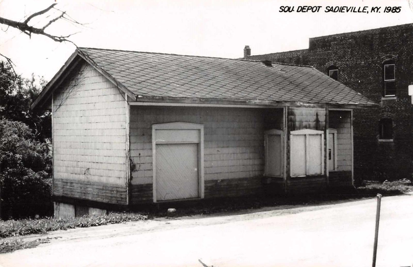
Sadieville
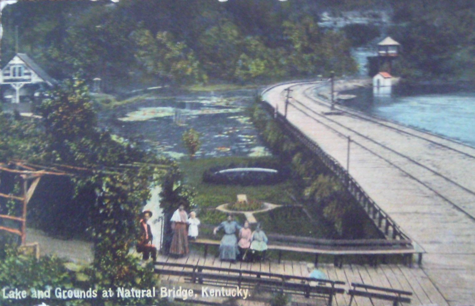
Torrent
Wickliffe
RAILROAD SIGNALS HOME
There are precious few good references for many of the railroad stations and depots that used to exist.
One of the better resources I have come across to this end is the plethora of old post cards still around depicting many of these structures, some better than others.
Most of the postcards were found on EBay unless noted, other pictures, mostly the more recent ones, come from Google and/or Bing images - credit given if the source is known. Compliments to (to name a few) skurfanpostcards, trentonstampandcoinco, and baysideantiques_02 for the many, many railroad depot pictures they all offer, without whom you wouldn't have as many pictures here to enjoy.... all of the pictures from these folks are for sale. Seller with the red word COPY on them is "skurfanpostcards".
Dates are in the picture name, x means the date is approximate. If they were available, and interesting, I included the back side of the postcards. 1910a and 1910b would be the same card, both sides.
If the picture was really, really bad, some of them have been cleaned up and/or repaired when I had the energy.
If you have the time, other good sources for pictures are: Shorpy, Google, and Bing images, and the Library of Congress (you have to be very patient to find things here :-)
Since many of these stations are no longer around (railfans seem to prefer the term "extant", I'm not one of them! :-), this page is mostly for historical reference.
This page is mostly for historical reference, as MANY of these stations are not around anymore!
What's the difference between a station and a depot? Most people will say "nuttin", it's a matter of preference, although many will use depot for older buildings.
If you have a picture you would like to contribute, please see the bottom of the page for how to find me, credit is always given to contributing photographers.
Allen
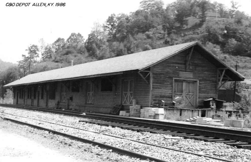
Ashland
Beattyville
Berry
Bloomfield
 Photo by Tom Dills
Clarksville
 Former L&N station
Corbin
Fulton
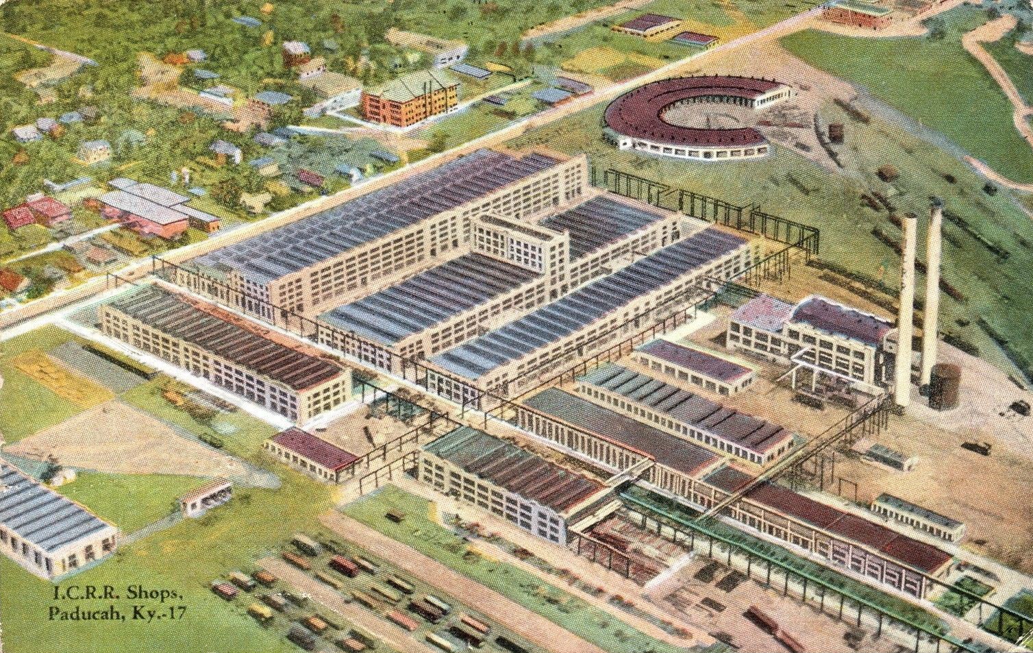
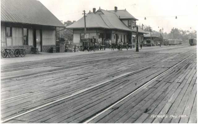 A former ICRR depot.
Great Kentucky Dam
GPS Coordinates: 37.013053, -88.269439
Construction was begun on July 1st, 1938, and is the longest dam on the Tennessee River. Construction was completed on August 30th, 1944. The dam originally had a road and a railroad on top of it, but in 2009, two new bridges, just slightly downstream opened, and the bridge sections of the dam were removed, so the remaining road on top only services maintenance and tourists.
From Bing Maps: Kentucky Dam is a hydroelectric dam on the Tennessee River on the county line between Livingston and Marshall counties in the U.S. state of Kentucky. The dam is the lowermost of nine dams on the river owned and operated by the Tennessee Valley Authority, which built the dam in the late 1930s and early 1940s to improve navigation on the lower part of the river and reduce flooding on the lower Ohio and Mississippi rivers. It was a major project initiated during the New Deal of President Franklin D. Roosevelt's administration, to invest in infrastructure to benefit the country. The dam impounds the Kentucky Lake of 160,000 acres, which is the largest of TVA's reservoirs and the largest artificial lake by area in the Eastern United States.
Hazard
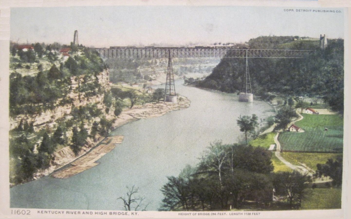
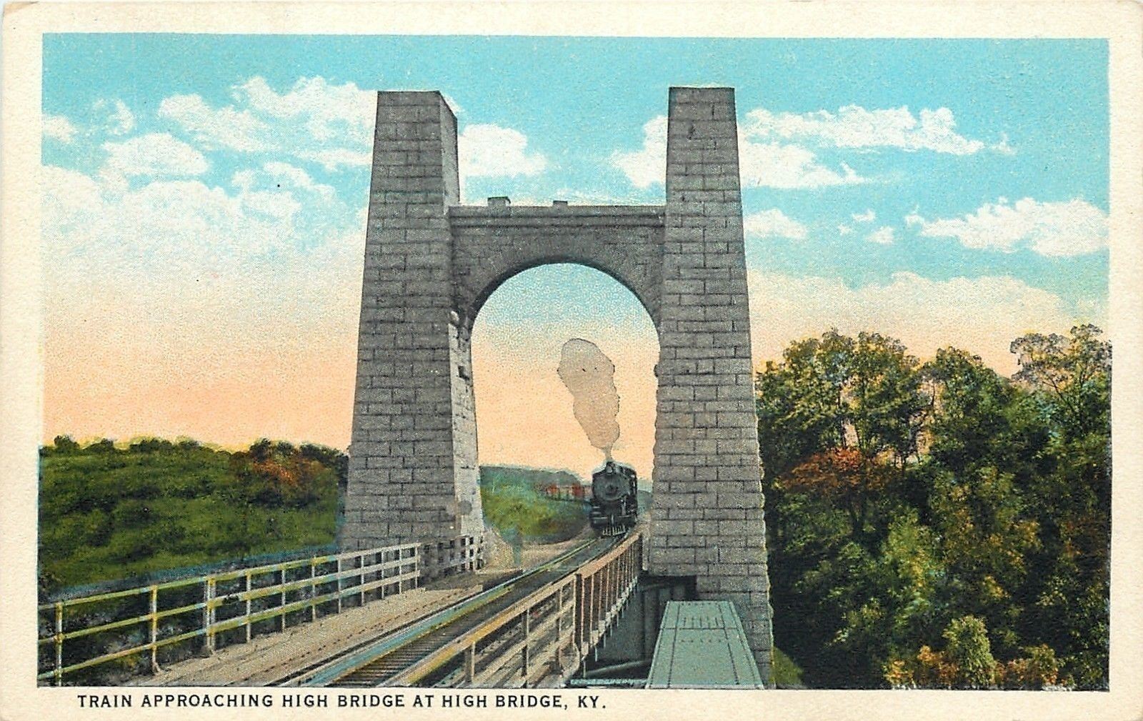
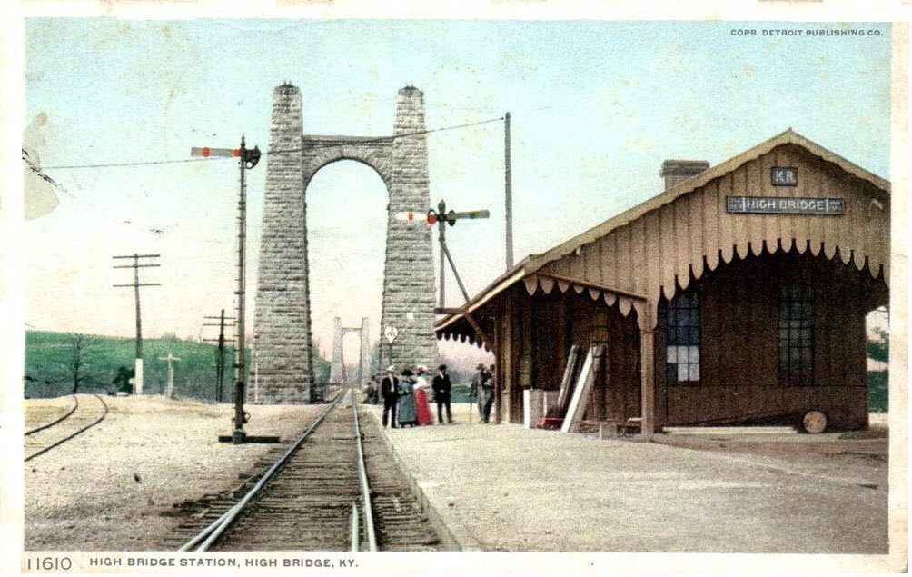
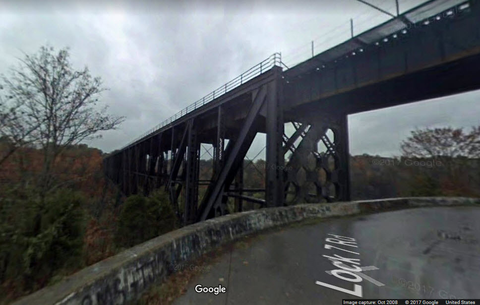
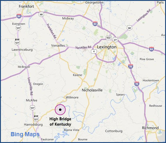
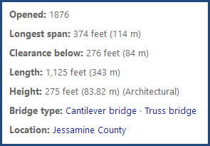
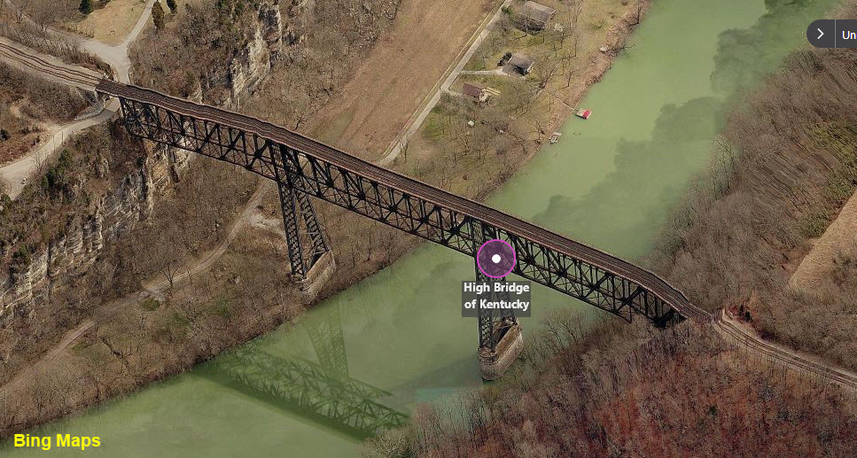
High Bridge
GPS Coordinates: 37.817107, -84.720117
From Bing Maps: High Bridge of Kentucky: High Bridge is a railroad bridge crossing the Kentucky River Palisades, connecting Jessamine and Mercer counties, Kentucky. Constructed in 1876, it is the first cantilever bridge in the United States. It has a three-span continuous under-deck truss, now used by Norfolk Southern Railway to carry trains between Lexington and Danville. It has been designated as a National Civil Engineering Landmark.
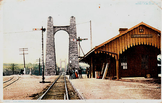 From about 1907, postcard found on EBay.
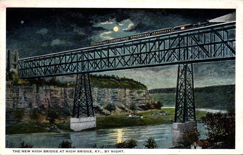
Jenkins
Kentucky River
Lexington
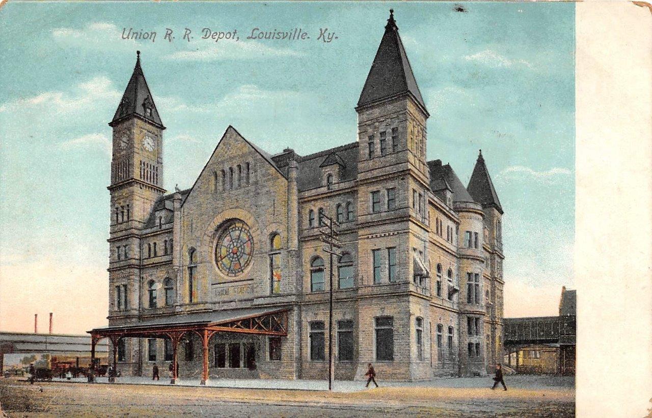
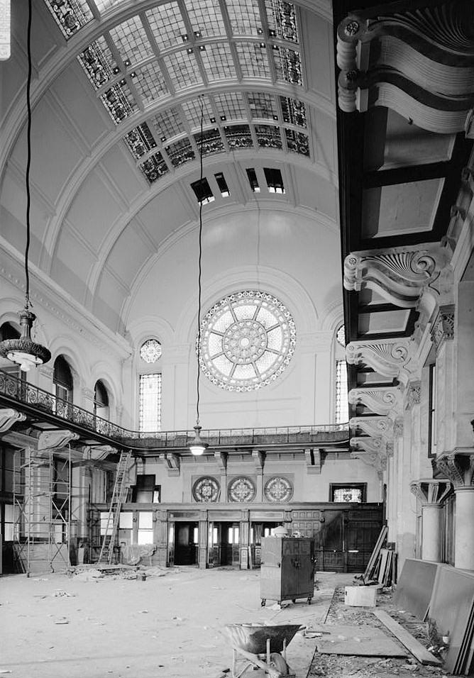
Lousiville - Louisville & Nashville Rwy Depot
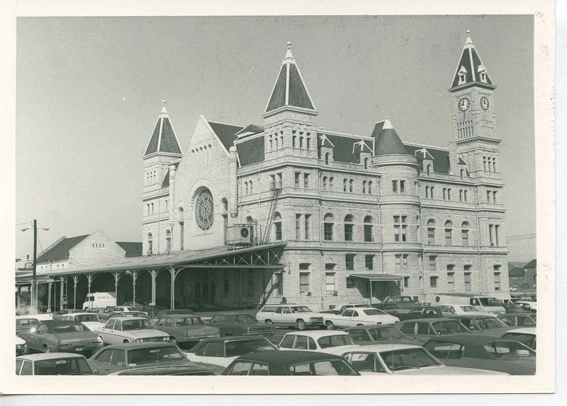 Opened on August 4th, 1907.
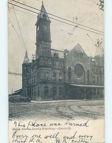
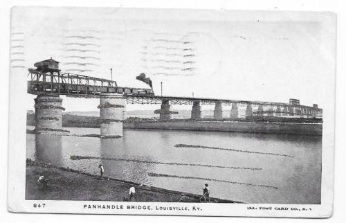
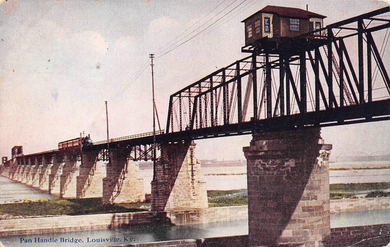
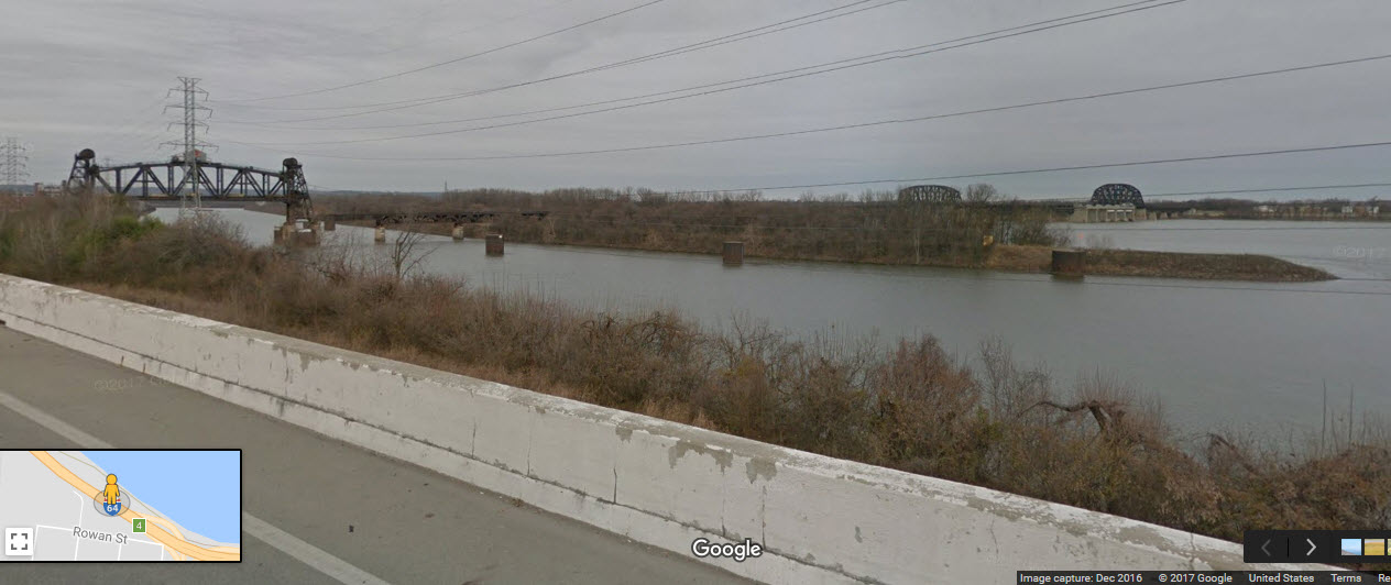
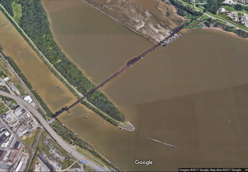
Louisville - PANHANDLE BRIDGE
GPS Coordinates: 38.268213, -85.766041
For more info and pictures: http://historiclouisville.weebly.com/the-three-rr-bridges.html
From the above source: The Fourteenth Street (iron) Bridge was completed in 1870. A stronger steel superstructure was built on the same piers in 1919.
The Fourteenth Street Bridge also known as The Pennsylvania Railroad Bridge marks the eastern boundary of The Falls of the Ohio State Park. It is at the head of the canal that leads to the McAlpine Locks and Dam.
By the 1860s, the Louisville and Nashville Railroad and the Jeffersonville and Indianapolis Railroad both desired a railroad bridge across the river. There were no bridges across the Ohio River at Cincinnati or any place west, including Louisville. The United States Congress approved the building of the bridge in February, 1865.
The L&N Railroad financed the Louisville Bridge Company to build the bridge and construction began on August 1, 1867. It was to become the longest iron bridge in the United States 27 spans covering a mile. The first train crossed the bridge on February 18, 1870.
The Pennsylvania Railroad purchased the L&N's 60% ownership of the bridge in the mid-1870s. By the 1900s the bridge was being used 300 times a day, putting more stress on the bridge. Between 1916 and 1919 a new single-track steel superstructure was placed on the old stone piers. A vertical-lift span replaced the swing span that was above the canal.
The bridge was operated for many years by the Pennsylvania Railroad. In 1968 the Pennsylvania Railroad and the New York Central Railroad merged to become Penn Central. Eight years later, it was placed under Conrail. The Louisville & Indiana Railroad purchased the Jeffersonville to Indianapolis line and bridge from Conrail in March 1994. The Louisville and Indiana Railroad is the current bridge owner.
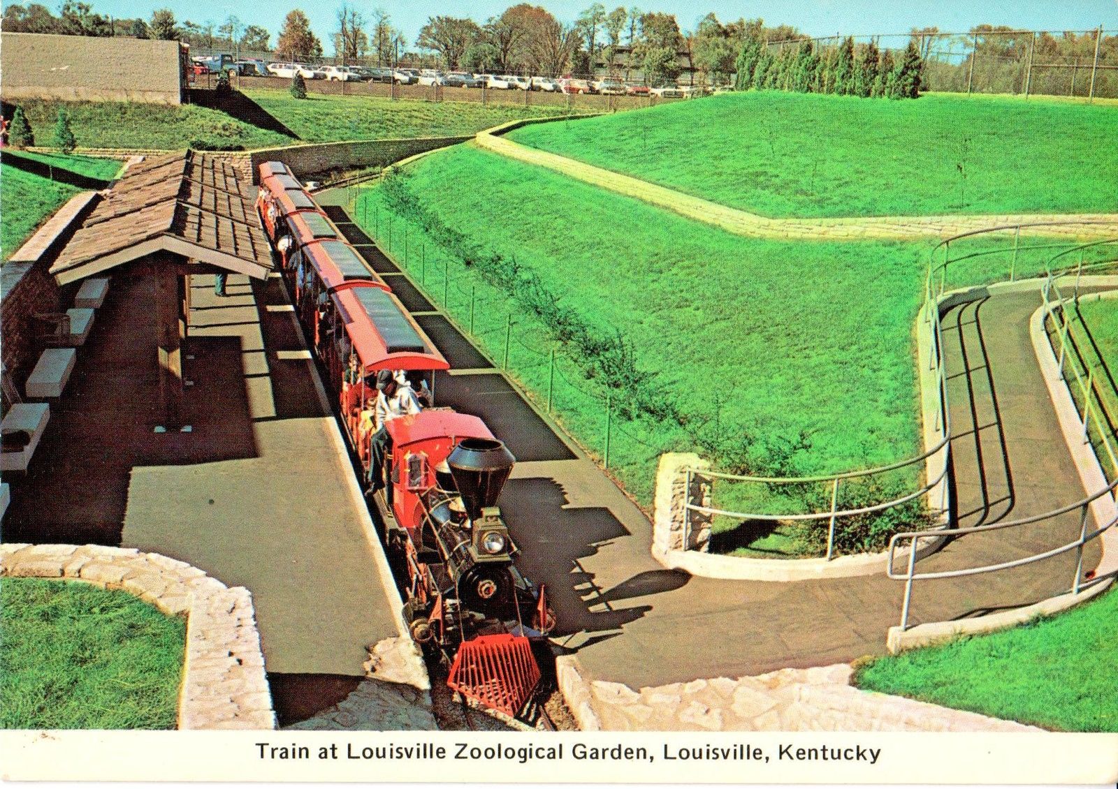
Louisville Zoo
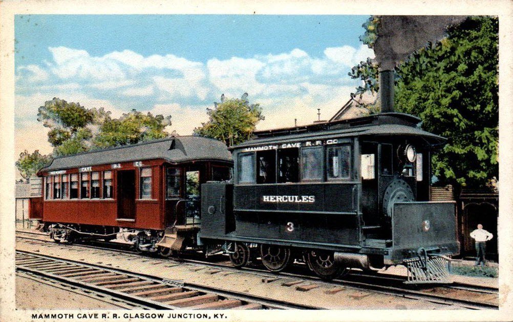
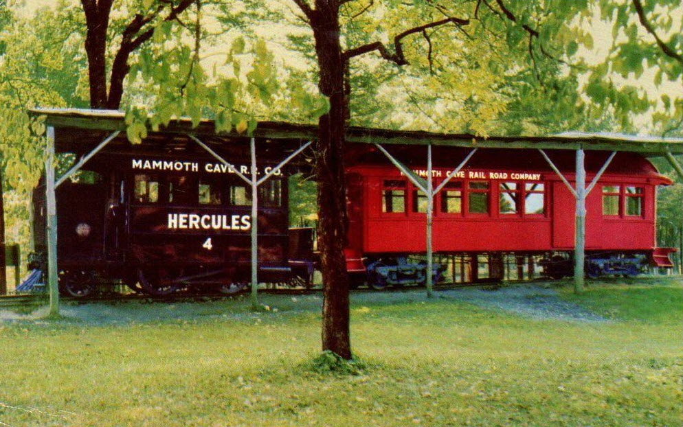
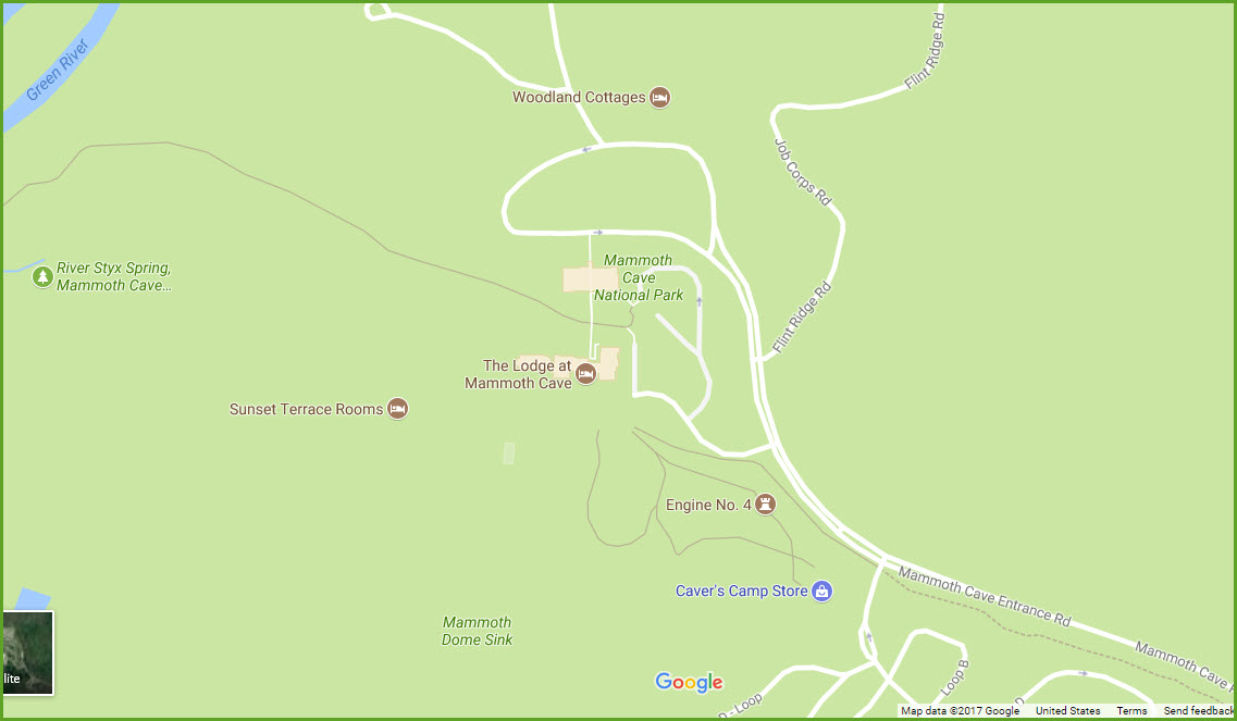
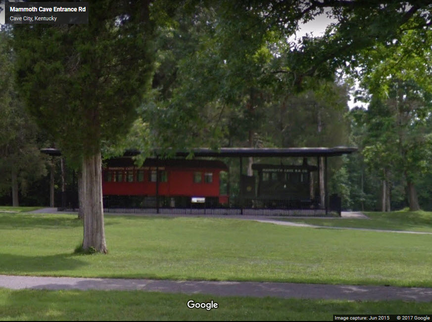
Mammoth Cave
GPS Coordinates: 37.186930, -86.100965
From Bing Maps: Mammoth Cave National Park is a U.S. national park in central Kentucky, encompassing portions of Mammoth Cave, the longest cave system known in the world. Since the 1972 unification of Mammoth Cave with the even-longer system under Flint Ridge to the north, the official name of the system has been the Mammoth-Flint Ridge Cave System. The park was established as a national park on July 1, 1941. It became a World Heritage Site on October 27, 1981, and an international Biosphere Reserve on September 26, 1990.
Middleboro
Morgantown
Muir
Newstead
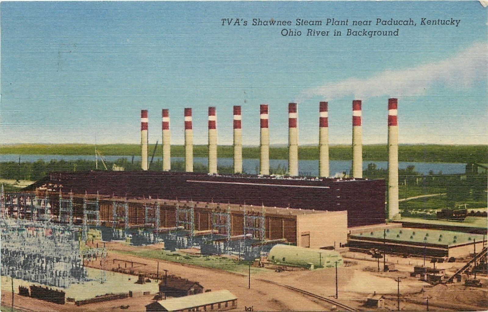
Paducah
Paris
Pride
Princeton
Rosine
Russell
Sadieville
Torrent
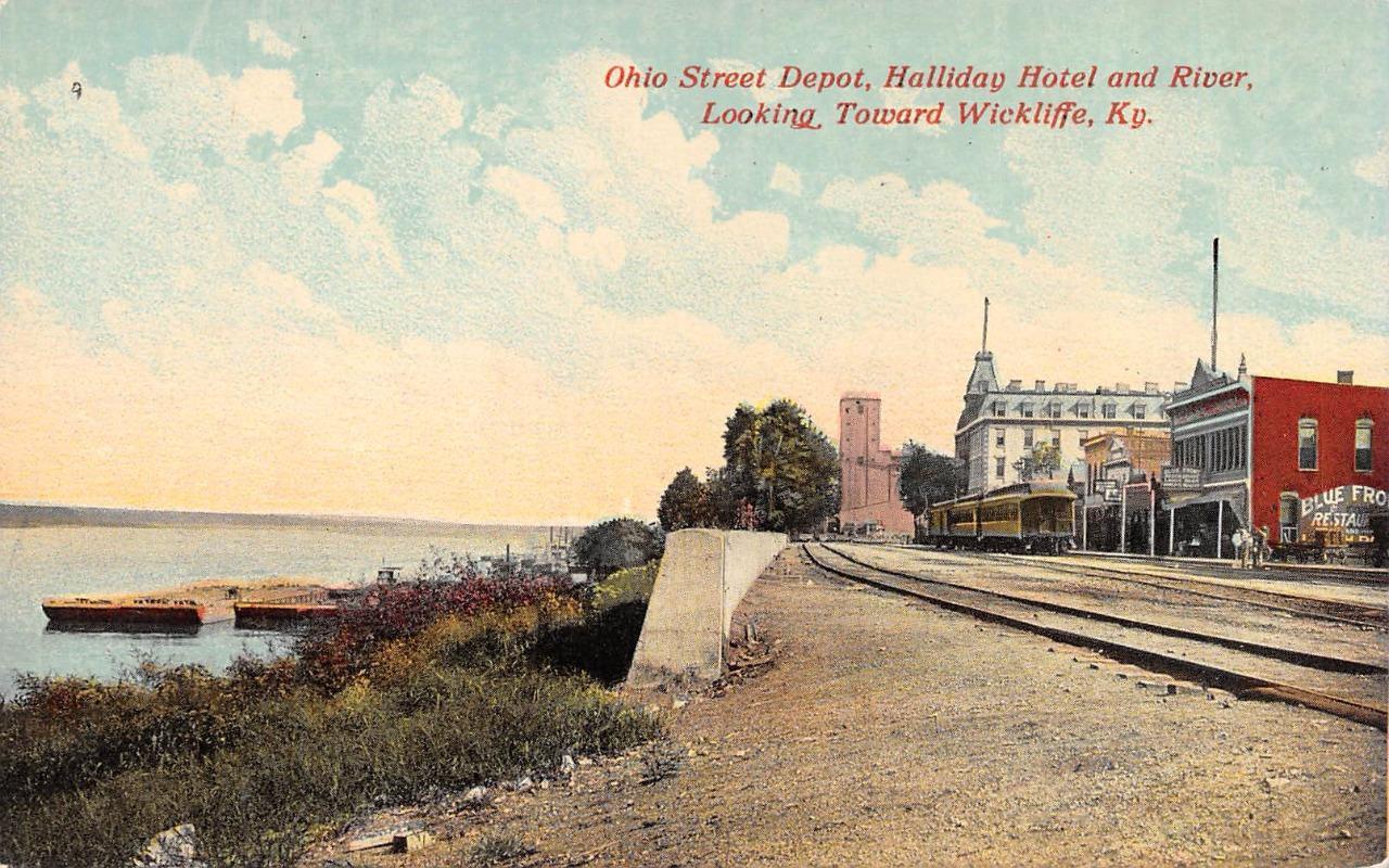
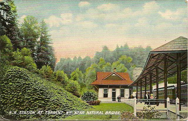 From approximately 1909, postcard found on EBay.
Wickliffe
Disclaimers:
I love trains, and I love signals. I am not an expert. My webpages reflect what I find on the topic of the page. This is something I have fun with while trying to help others.
Please Note: Since the main focus of my two websites is railroad signals, the railfan guides are oriented towards the signal fan being able to locate them. For those of you into the modeling aspect of our hobby, my indexa page has a list of almost everything railroad oriented I can think of to provide you with at least a few pictures to help you detail your pike.
If this is a railfan page, every effort has been made to make sure that the information contained on this map and in this railfan guide is correct. Once in a while, an error may creep in :-)
My philosophy: Pictures and maps are worth a thousand words, especially for railfanning. Text descriptions only get you so far, especially if you get lost or disoriented. Take along good maps.... a GPS is OK to get somewhere, but maps are still better if you get lost! I belong to AAA, which allows you to get local maps for free when you visit the local branches. ADC puts out a nice series of county maps for the Washington DC area, but their state maps do not have the railroads on them. If you can find em, I like the National Geographic map book of the U.S..... good, clear, and concise graphics, and they do a really good job of showing you where tourist type attractions are, although they too lack the railroads. Other notes about specific areas will show up on that page if known.
Aerial shots were taken from either Google or Bing Maps as noted. Screen captures are made with Snagit, a Techsmith product... a great tool if you have never used it!
By the way, floobydust is a term I picked up 30-40 years ago from a National Semiconductor data book, and means miscellaneous and/or other stuff.
Pictures and additional information is always needed if anyone feels inclined to take 'em, send 'em, and share 'em, or if you have something to add or correct.... credit is always given! Please be NICE!!! Contact info is here
Beware: If used as a source, ANYTHING from Wikipedia must be treated as being possibly being inaccurate, wrong, or not true.
RAILFAN GUIDES HOME
RAILROAD SIGNALS HOME
NEW 07/01/2017, SEP08/2017, NOV24/2021
Last Modified 24-Nov-2021