One of the better resources I have come across to this end is the plethora of
old post cards still around depicting many of these structures, some better than others.
Most of the postcards were found on EBay unless noted, other pictures, mostly
the more recent ones, come from Google and/or Bing images - credit given if the
source is known.
Dates are in the picture name, x means the date is approximate. If they were
available, and interesting, I included the back side of the postcards. 1910a
and 1910b would be the same card, both sides.
If the picture was really, really bad, some of them have been cleaned up and/or
repaired when I had the energy.
If you have the time, other good sources for pictures are:
Shorpy, Google,
and Bing images, and the Library
of Congress (you have to be very patient to find things here :-)
Since many of these stations are no longer around (railfans seem to prefer the
term "extant", I'm not one of them! :-), this page is mostly for historical
reference.
This page is mostly for historical reference, as MANY of these stations are not
around anymore!
What's the difference between a station and a depot? Most people will say
"nuttin", it's a matter of preference, although many will use depot for older
buildings.
If you have a picture you would like to contribute, please see the bottom of the
page for how to find me, credit is always given to contributing photographers.
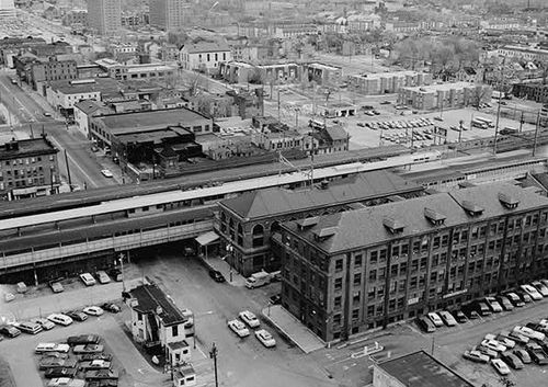
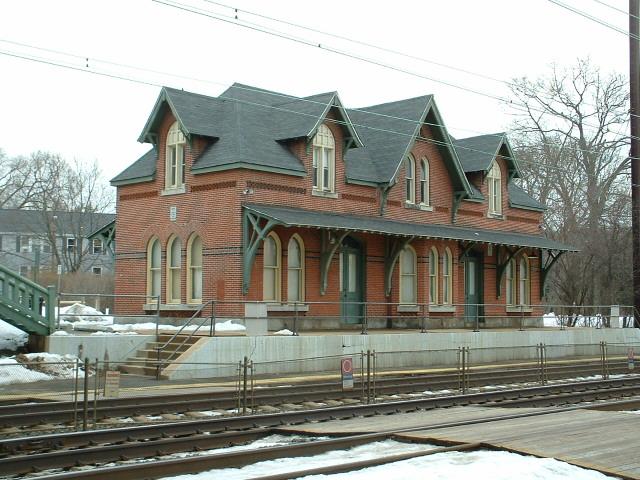
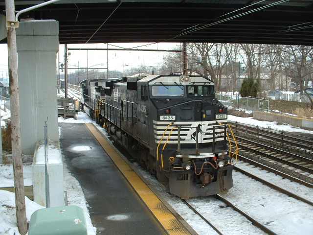
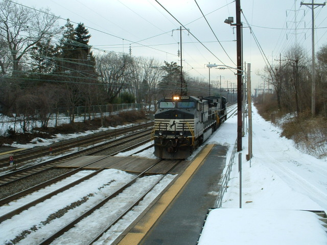
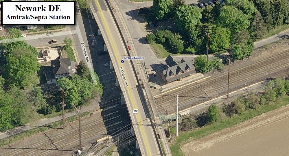
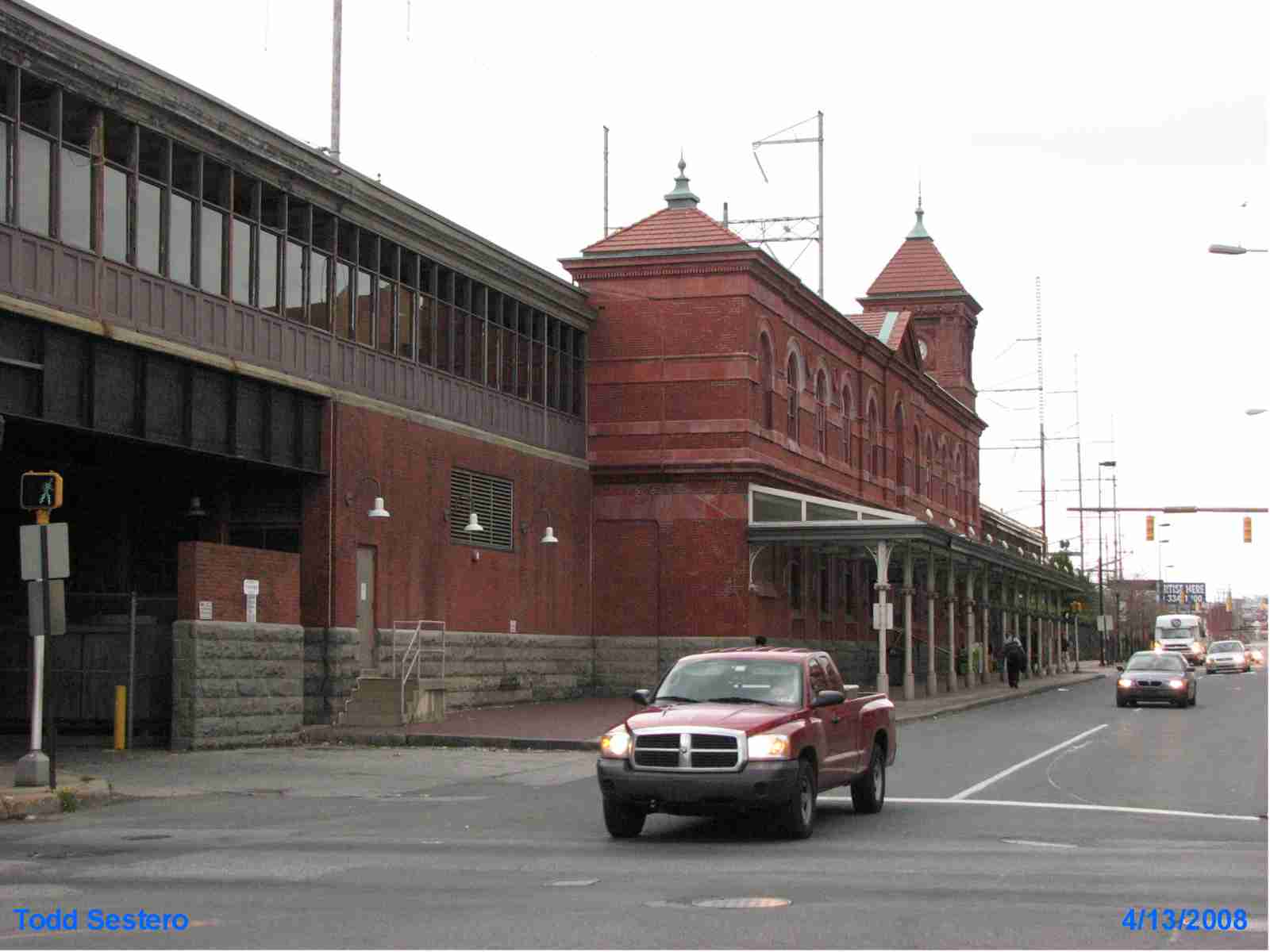
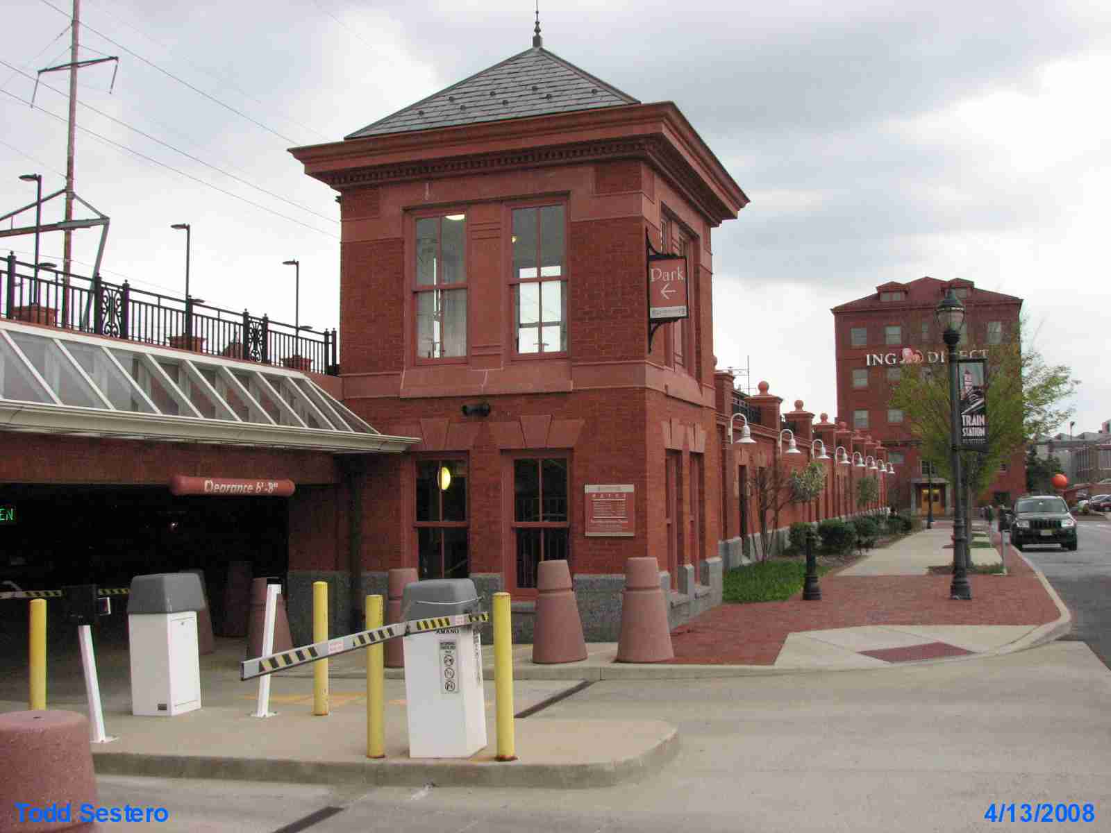
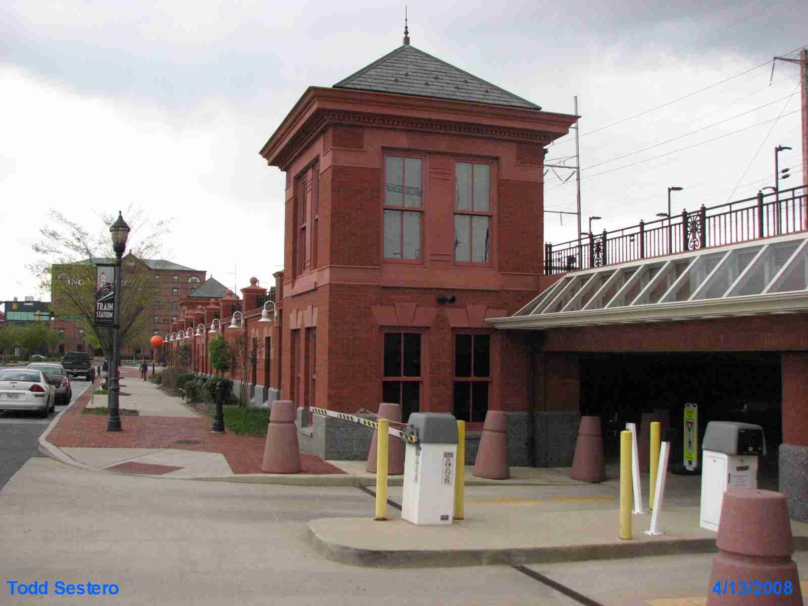
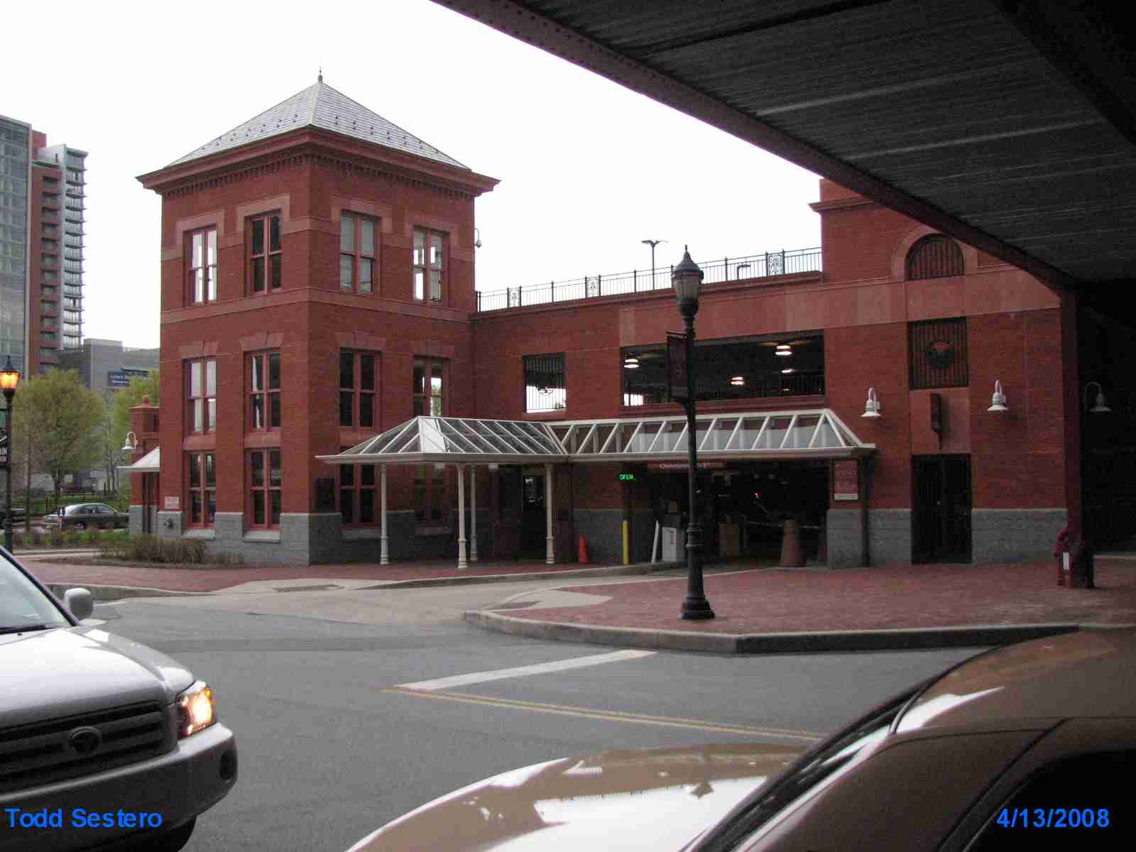
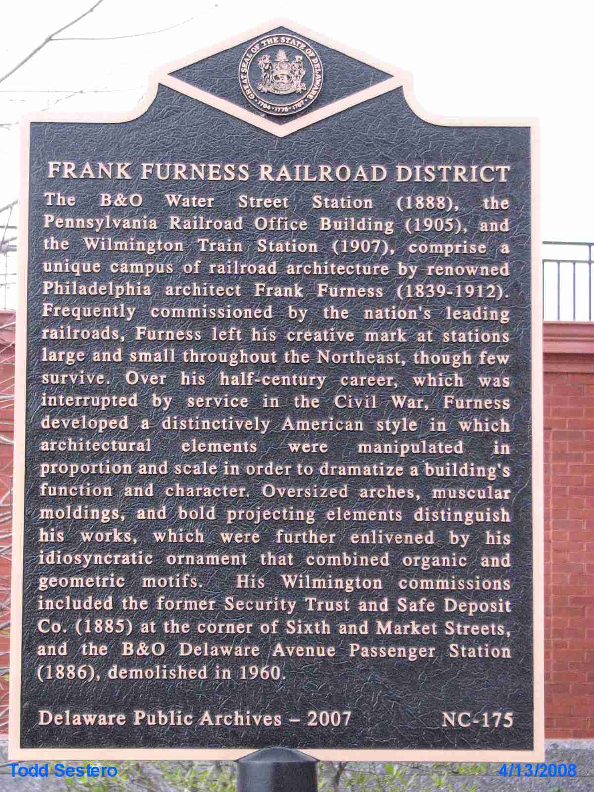
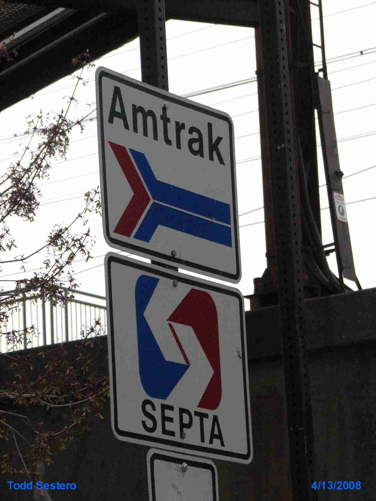
Currently an Amtrak Station on the North East Corridor (NEC), formerly a PRR Depot
Services Amtrak and SEPTA commuter trains.
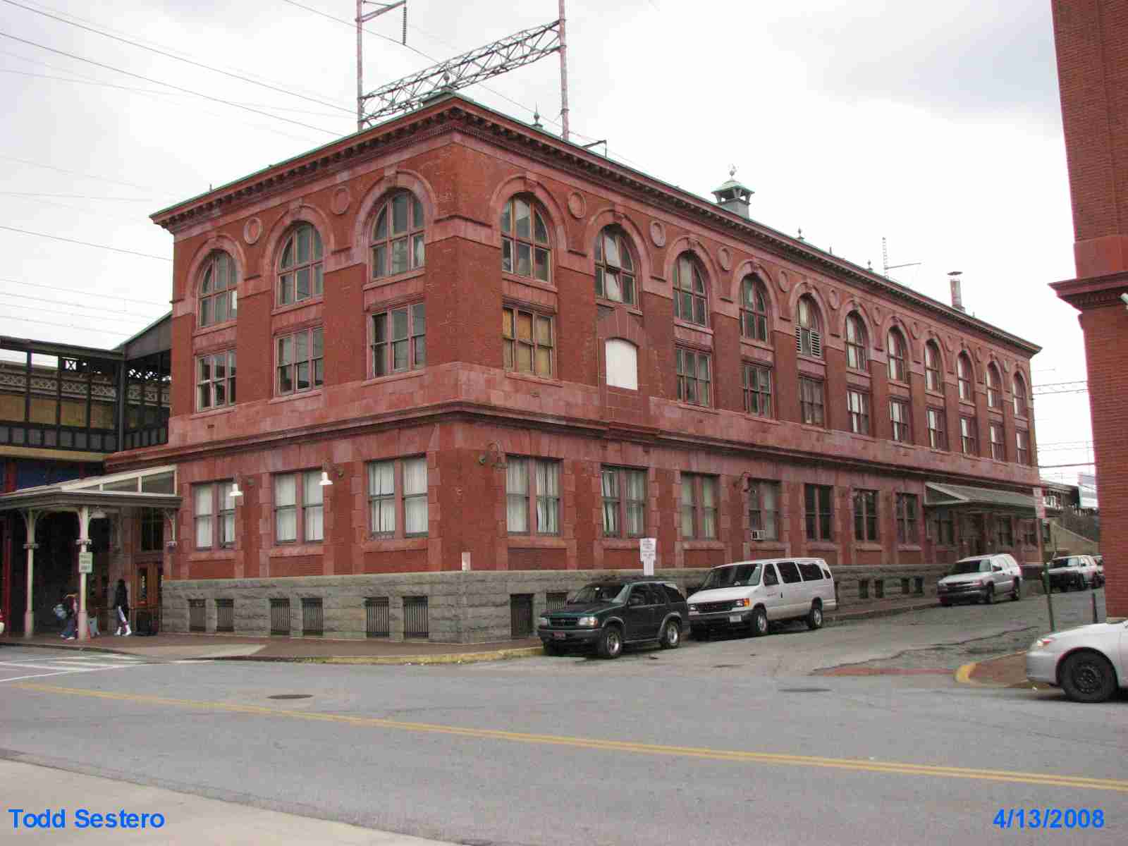
Another former Pennsy depot of class and greatness. This is supposedly
available as a model, but I will have to check with a friend of mine who
reviews model kits to confirm that. A couple of years ago I was taking
pictures of the station and was stopped by an Amtrak cop, who luckily, didn't
want my cameras, just asked me to stop and go away (taking pictures of "federal"
buildings is prohibited in the post 9/11 era - yes, even railroad stations!) --
update for 2013 -- Since the Amtrak anniversary train came through, Amtrak seems
less fearful of photography on the premises or from afar, as scores of railfans
took pictures here when the anniversary train came thru). This is one of
the great stations still around, like Philadelphia, Buffalo and Detroit (even
tho they are not used), Baltimore, Portland OR, and of course, Washington DC
(sorry if I left your favorite out).
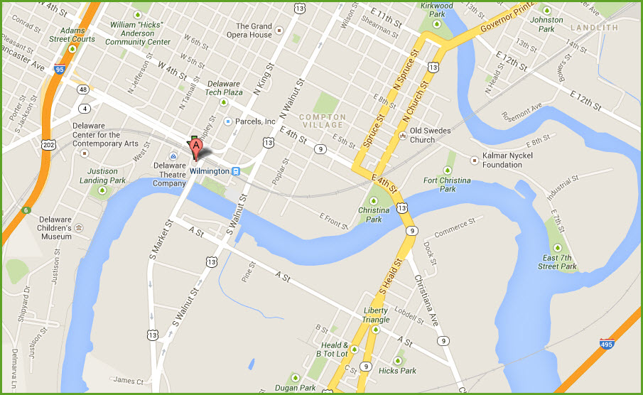
For a complete guide to downtown Wilmington, please click here
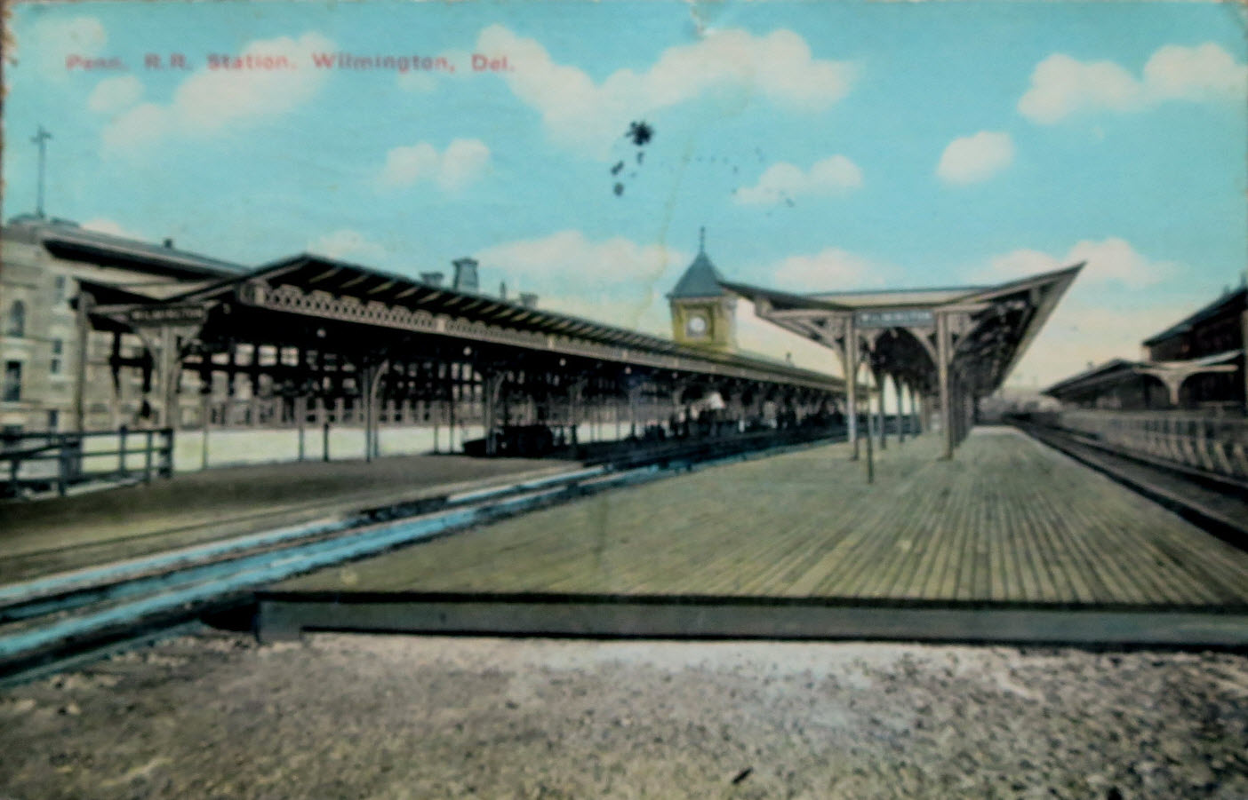
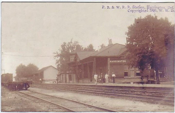
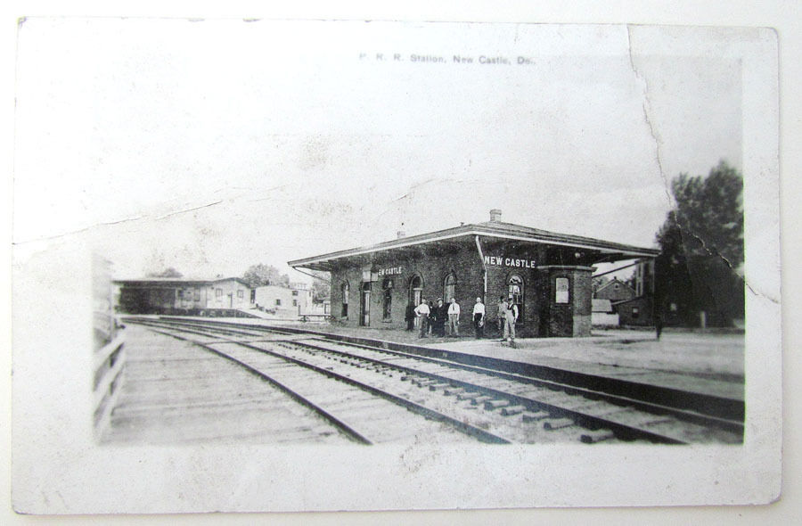
Postcard from about 1910.
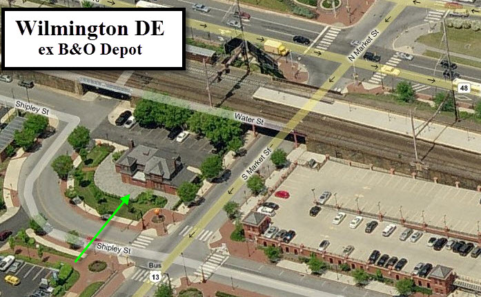
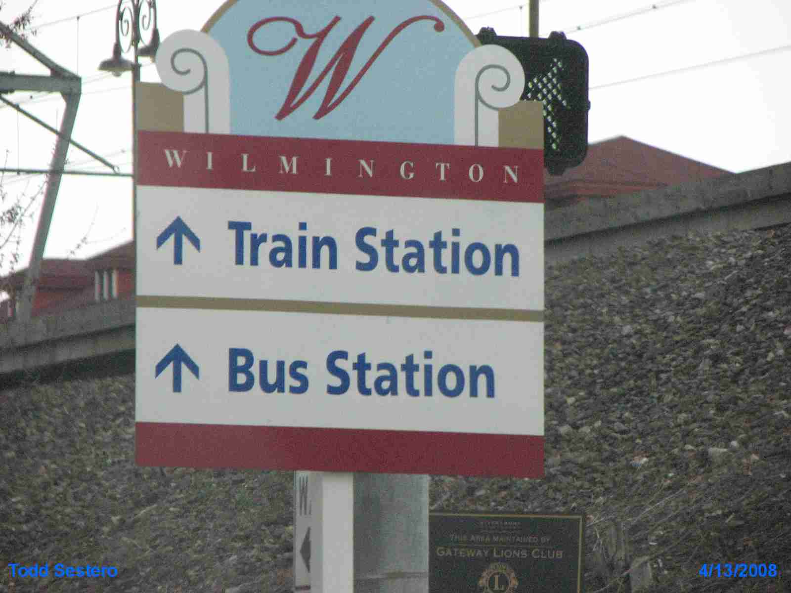
WILMINGTON
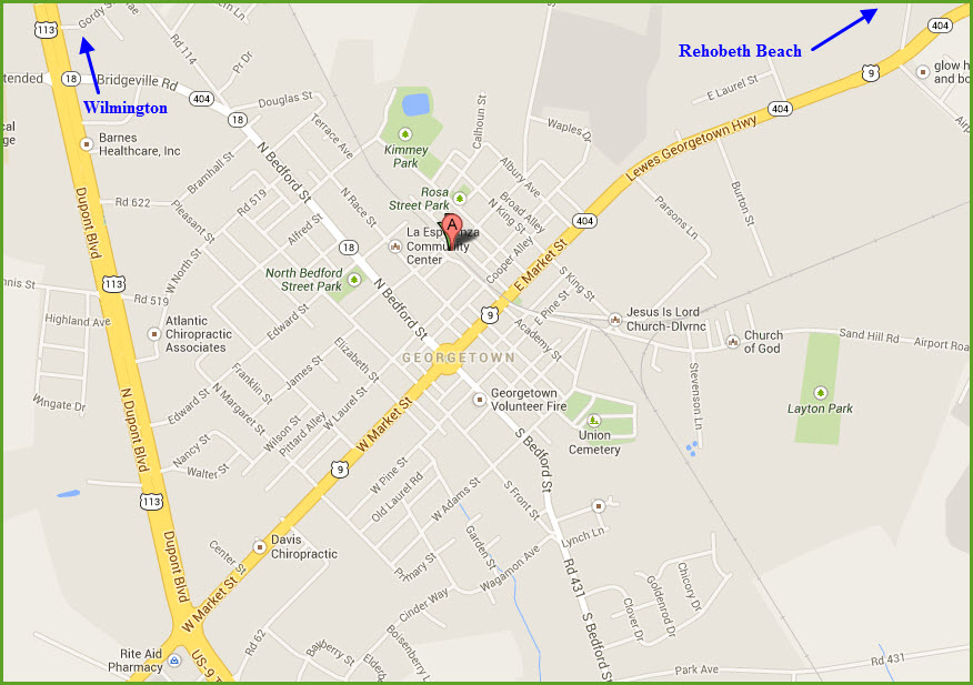
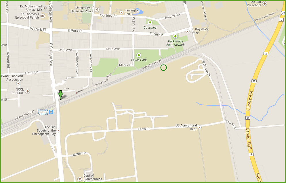
GPS Coordinates: 39.737752,-75.553622
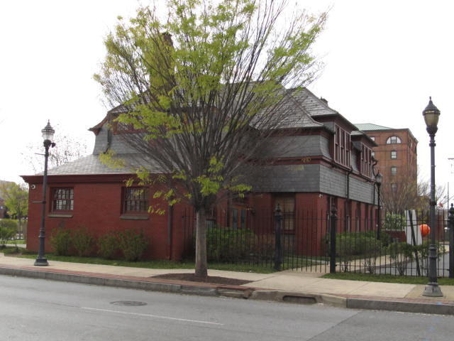
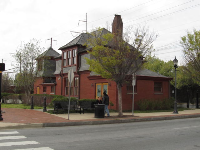
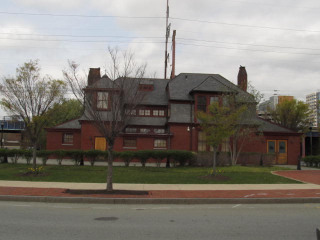
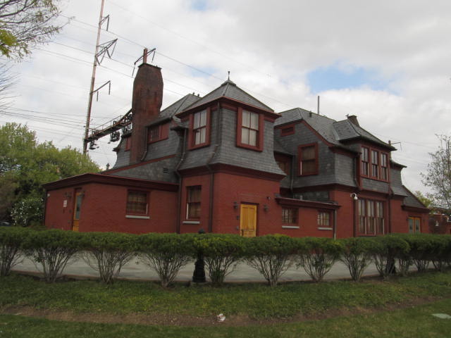
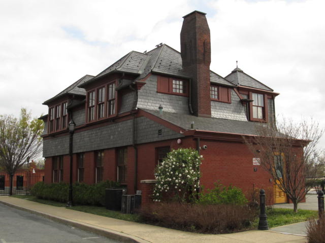
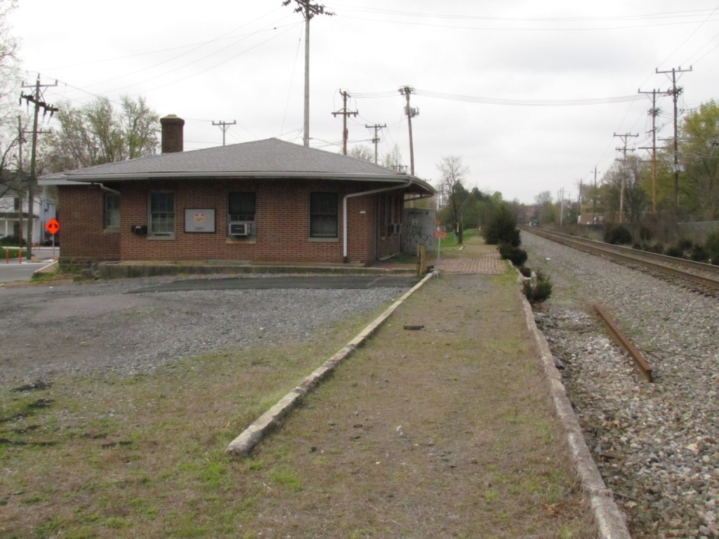
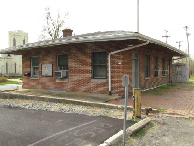
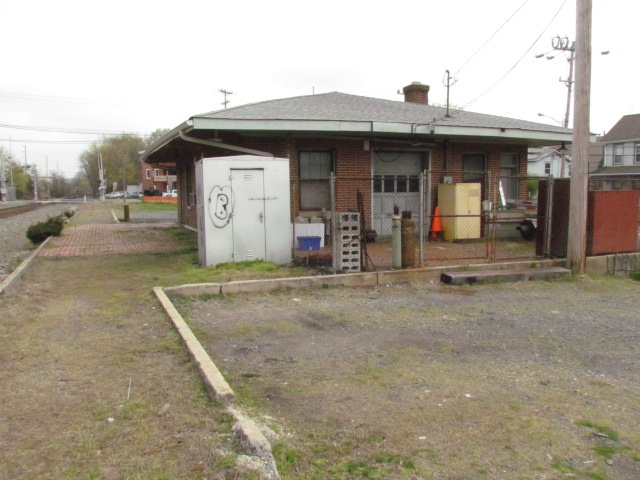
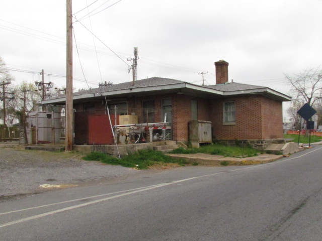
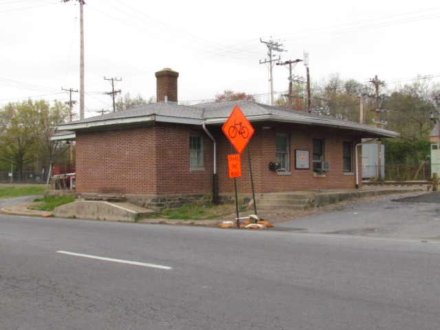
An ex B&O Depot.
In the shadow of the PRR's Wilmington Station was the B&O depot. It
was on a stub track, not a through track, which may explain why it
was never a success as the Pennsy's station was. How many of us
have been to downtown Wilmington and passed right by this beautiful
building without knowing it's heritage?
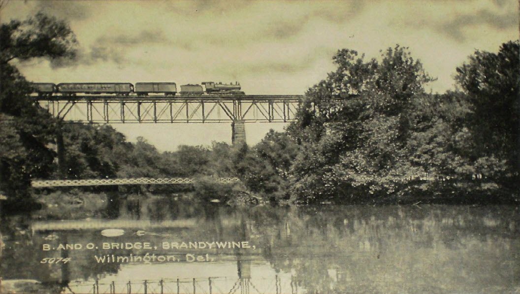
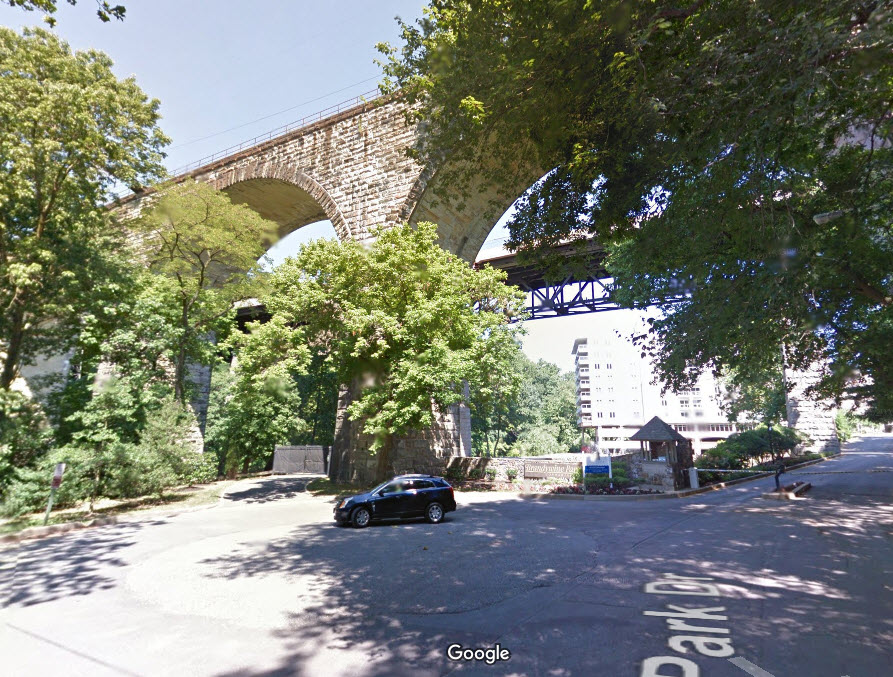
WILMINGTON
GPS Coordinates: 39.760580,-75.556840
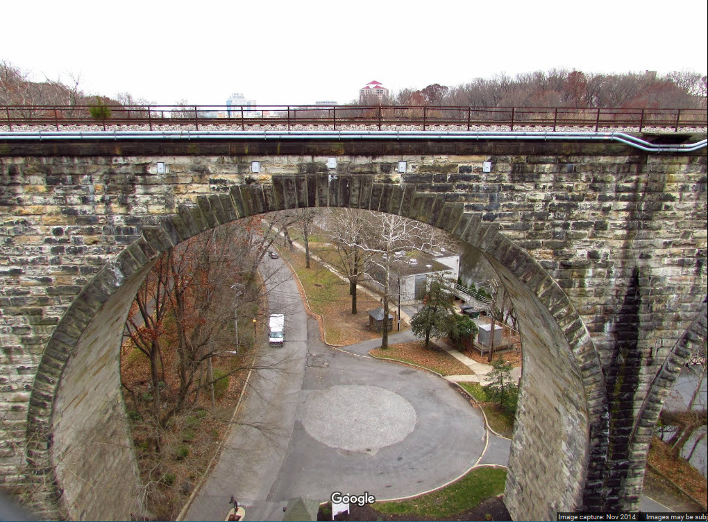
An former B&O bridge over the Brandywine Creek, on the north side of Wilmington.
The bridge was replaced by a stone viaduct structure.
So close, yet so far. All of the times I have been thru this
area over the past 50 years and never knew about this place until
I was searching for Delaware postcards on EBay!!!
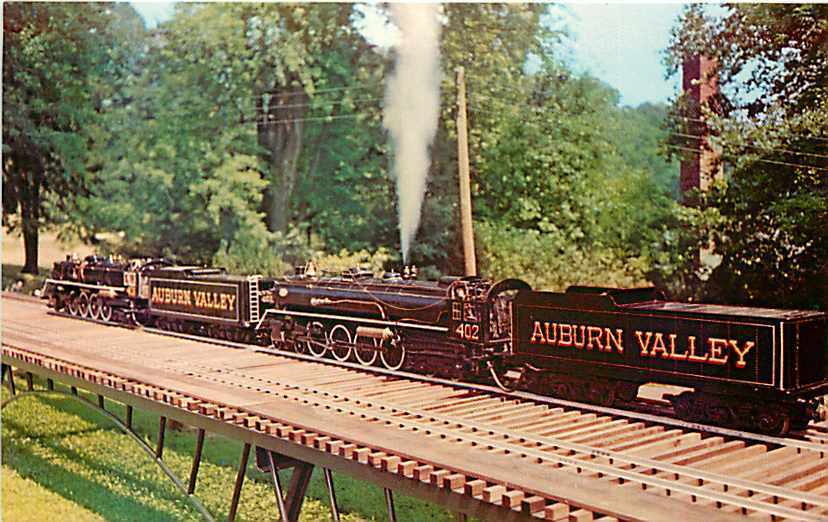
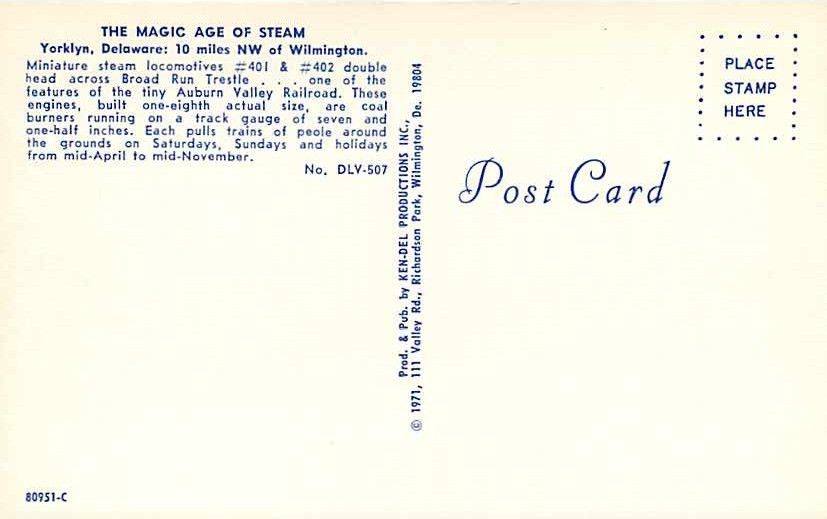
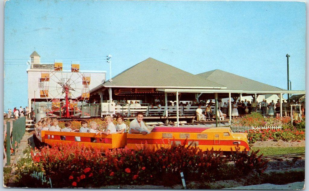
The Auburn Valley Railroad is part of the Marshall Steam Museum
in Yorklyn. It is a 1/8 scale, 7-1/2 inch wide gauge "live steam" railroad.
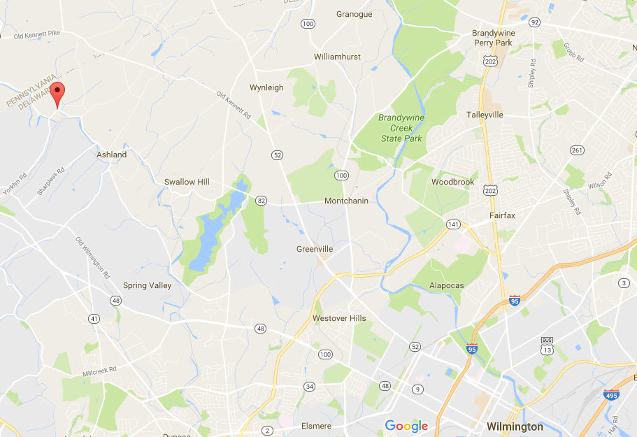
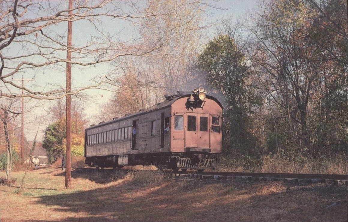
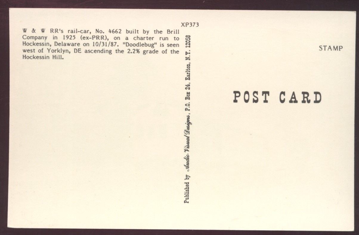
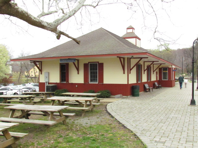
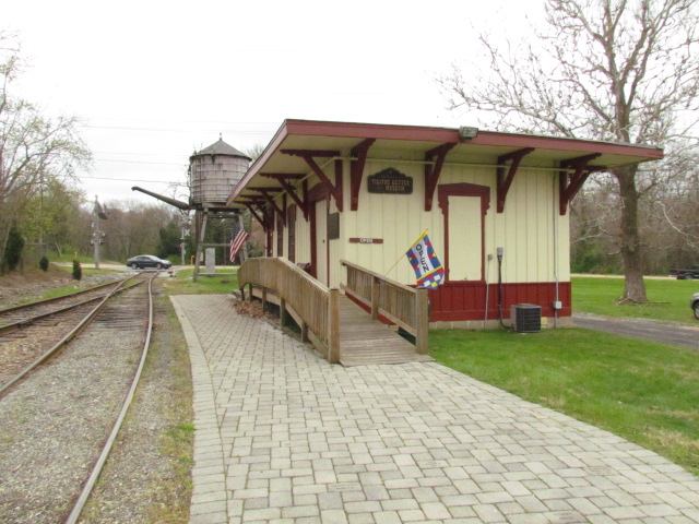
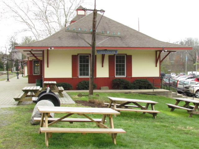
YORKLYN
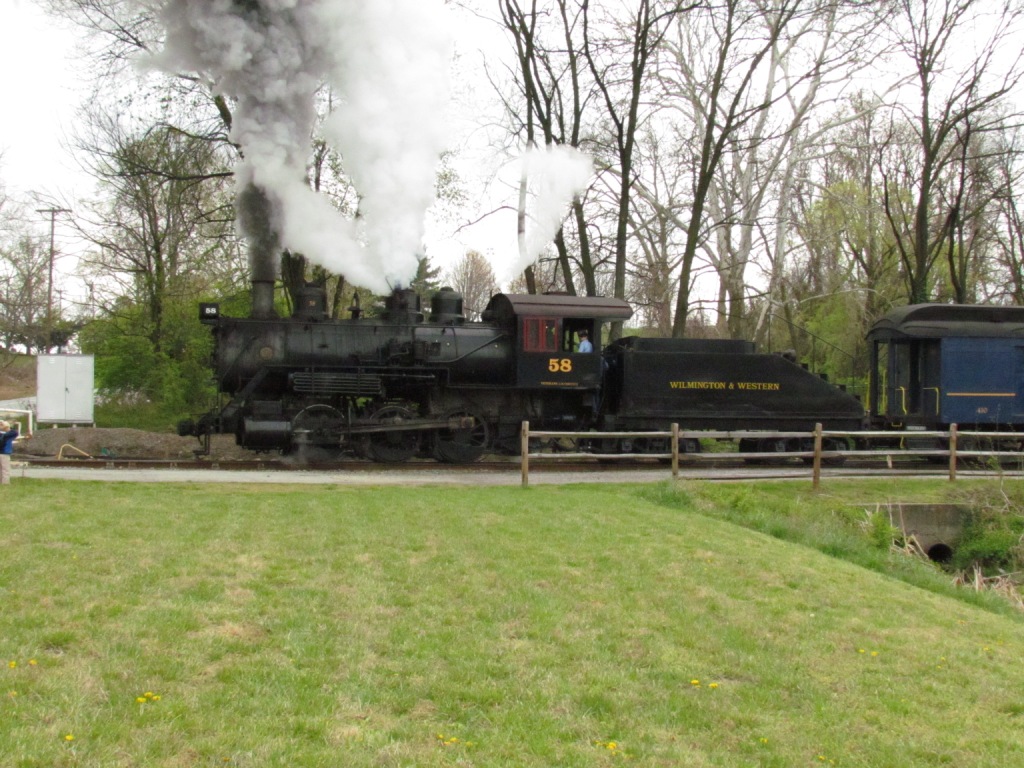
A shot of the Wilmington & Western doodlebug passing through Yorklyn.
Disclaimers:
I love trains, and I love signals. I am not an expert. My webpages reflect what I find on the topic of the page. This is something I have fun with while
trying to help others.
Please Note: Since the main focus of my two websites is railroad signals, the railfan guides are oriented towards the signal fan being able to locate them.
For those of you into the modeling aspect of our hobby, my indexa page has a list of almost everything railroad oriented
I can think of to provide you with at least a few pictures to help you detail your pike.
If this is a railfan page, every effort has been made to make sure that the information contained on this map and in this railfan guide is correct. Once in a while,
an error may creep in :-)
My philosophy: Pictures and maps are worth a thousand words, especially for railfanning. Text descriptions only get you so far, especially if you get lost or
disoriented. Take along good maps.... a GPS is OK to get somewhere, but maps are still better if you get lost! I belong to AAA, which allows you to get
local maps for free when you visit the local branches. ADC puts out a nice series of county maps for the Washington DC area, but their state maps do not have the
railroads on them. If you can find em, I like the National Geographic map book of the U.S..... good, clear, and concise graphics, and they do a really good job
of showing you where tourist type attractions are, although they too lack the railroads. Other notes about specific areas will show up on that page if known.
Aerial shots were taken from either Google or Bing Maps as noted.
Screen captures are made with Snagit,
a Techsmith product... a great tool if you have never used it!
By the way, floobydust is a term I picked
up 30-40 years ago from a National Semiconductor data book, and means
miscellaneous and/or other stuff.
Pictures and additional information is always needed if anyone feels inclined to take 'em, send 'em, and share 'em, or if you have something to add or correct.... credit
is always given! Please be NICE!!! Contact info is here
Beware: If used as a source, ANYTHING from Wikipedia must be treated as being possibly being inaccurate, wrong, or not true.
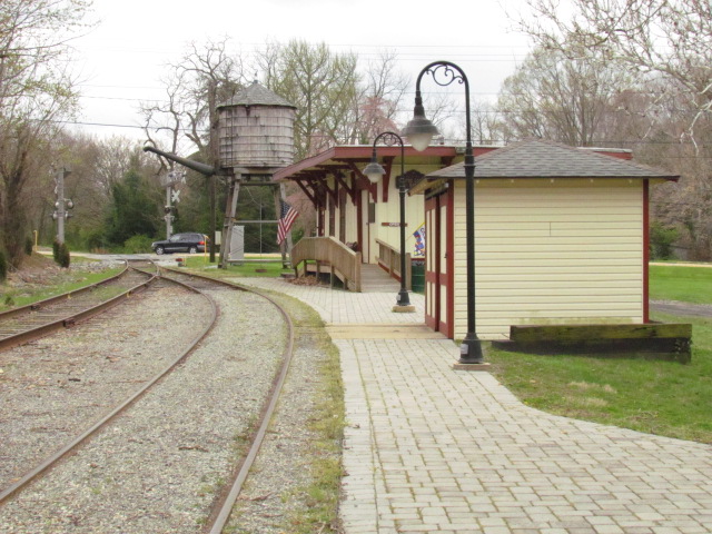

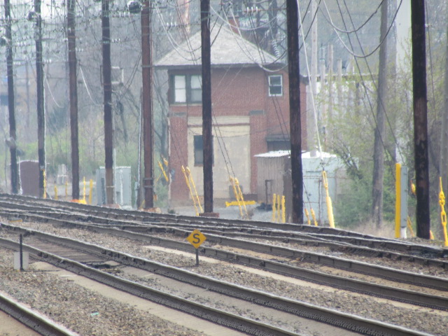
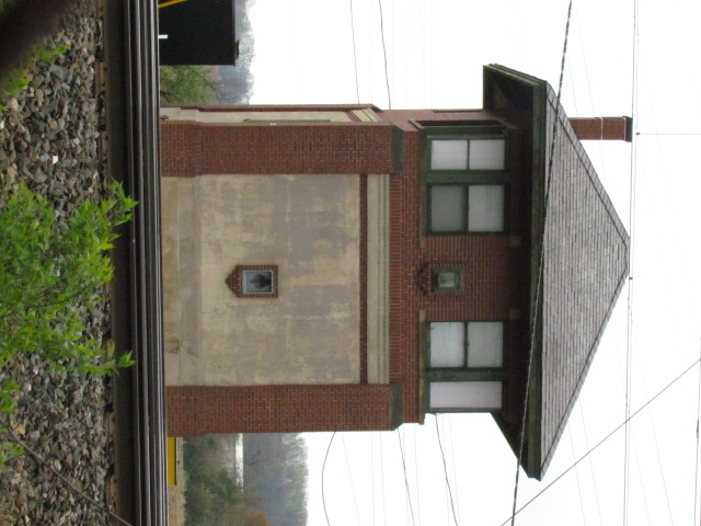 From the park walkway across the tracks from the tower.
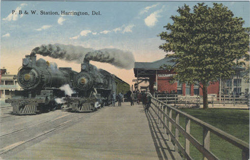
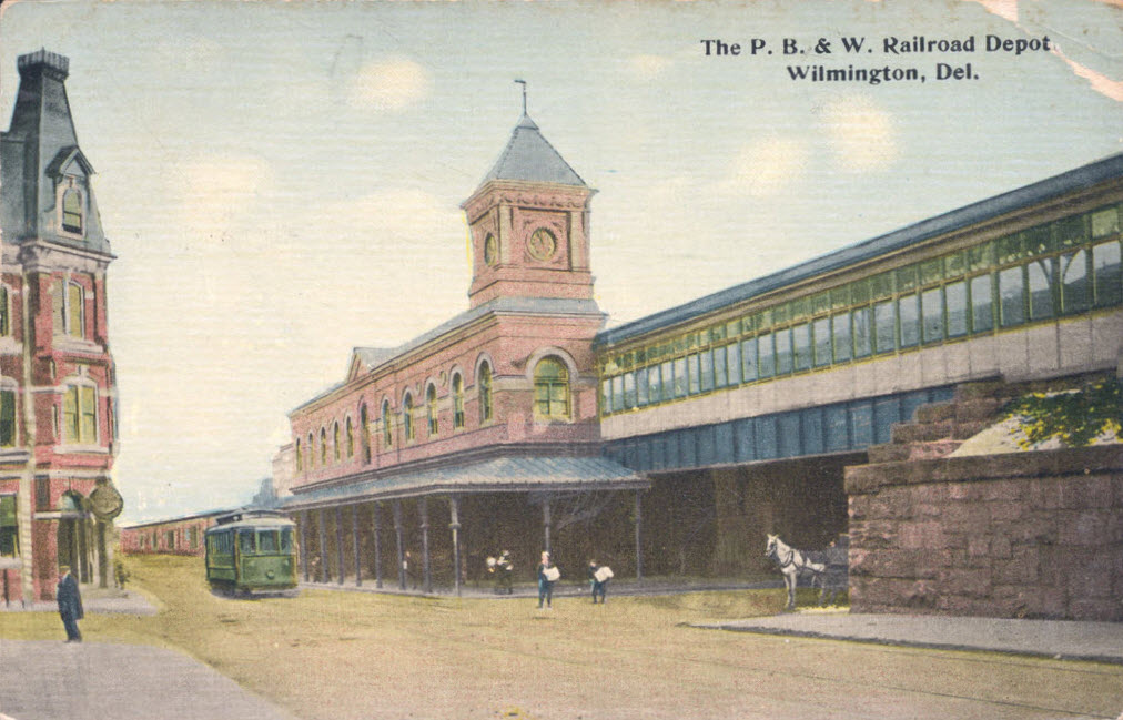 Postcard from about 1910.